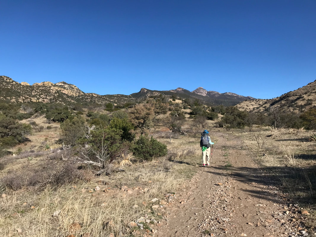
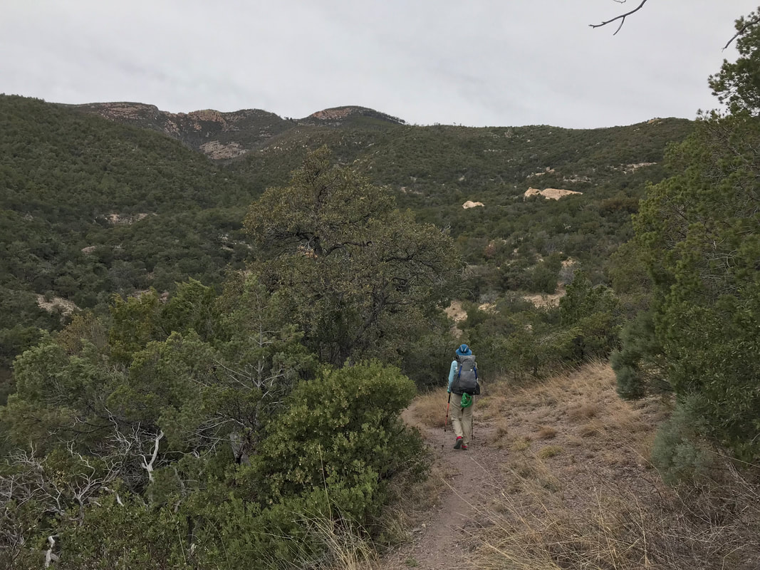
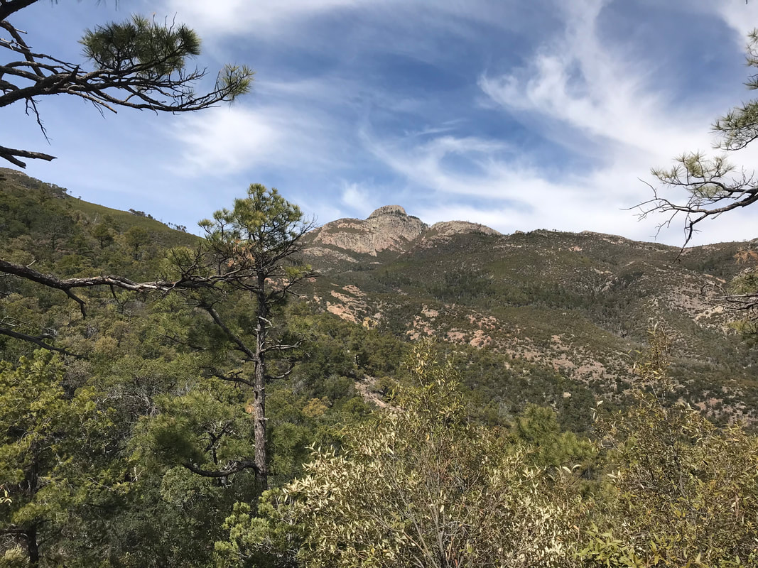
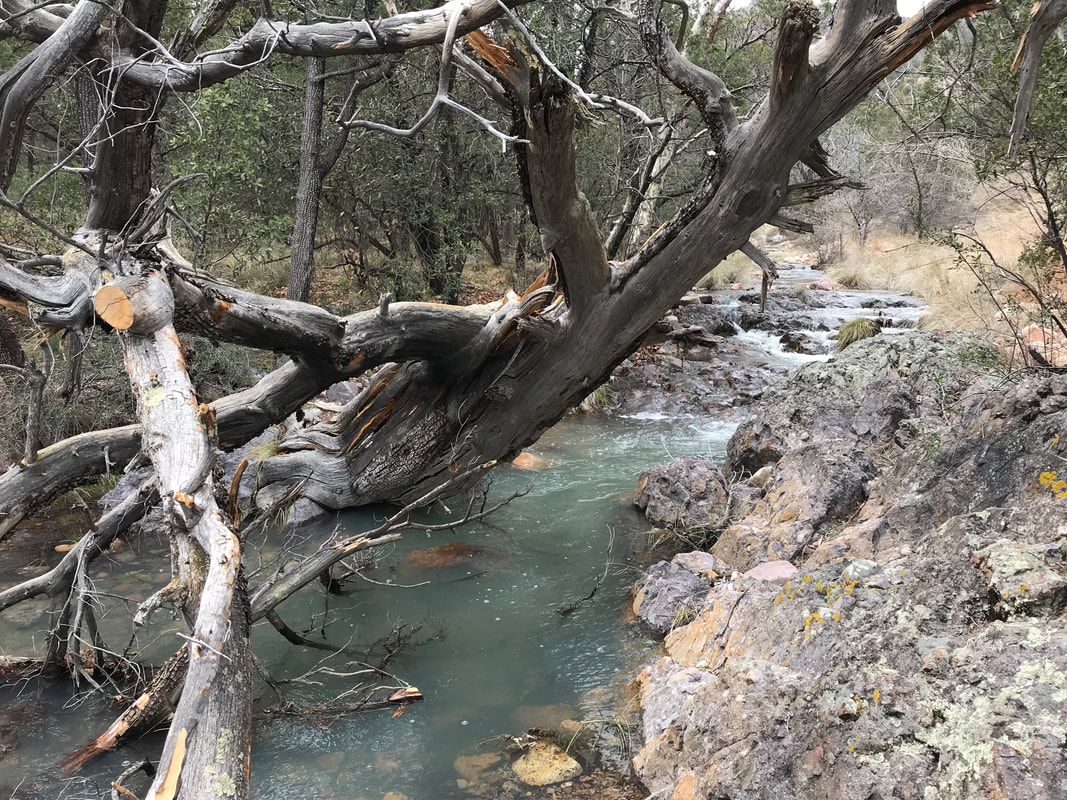
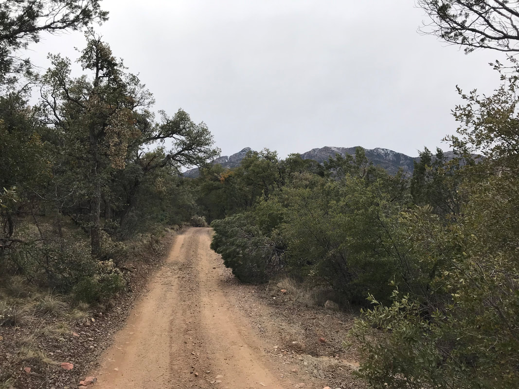
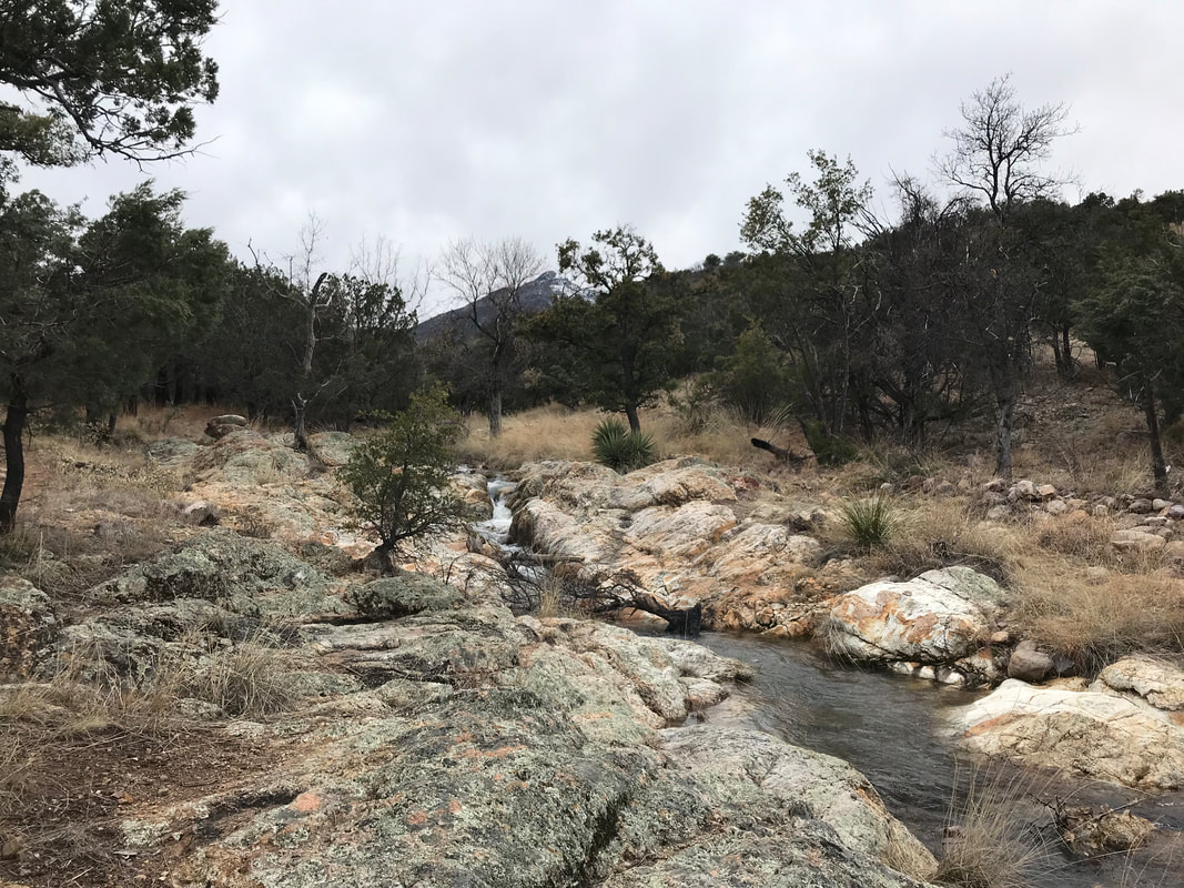
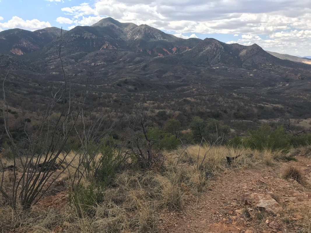
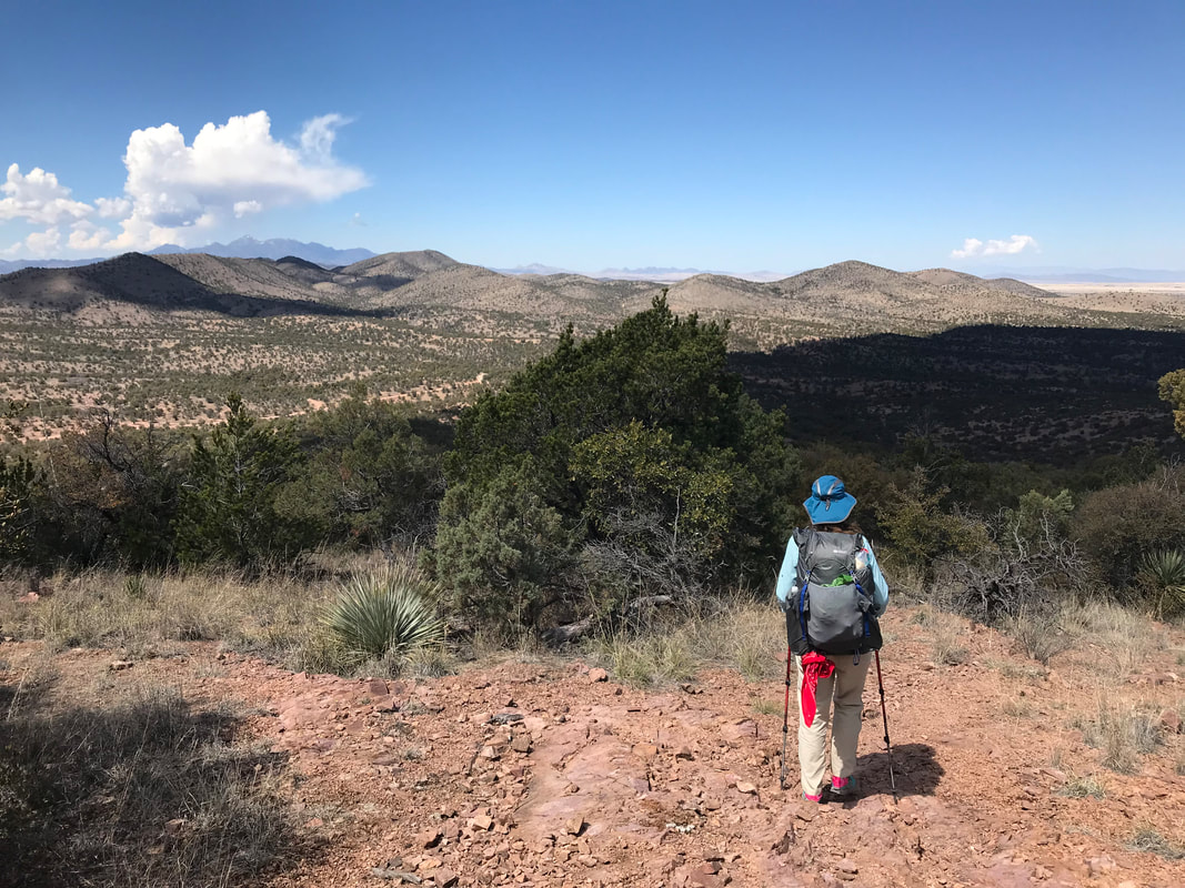
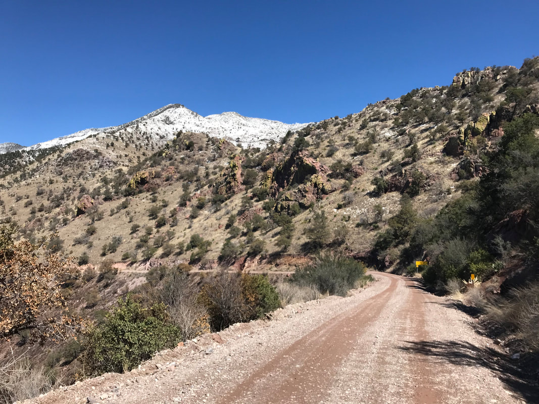
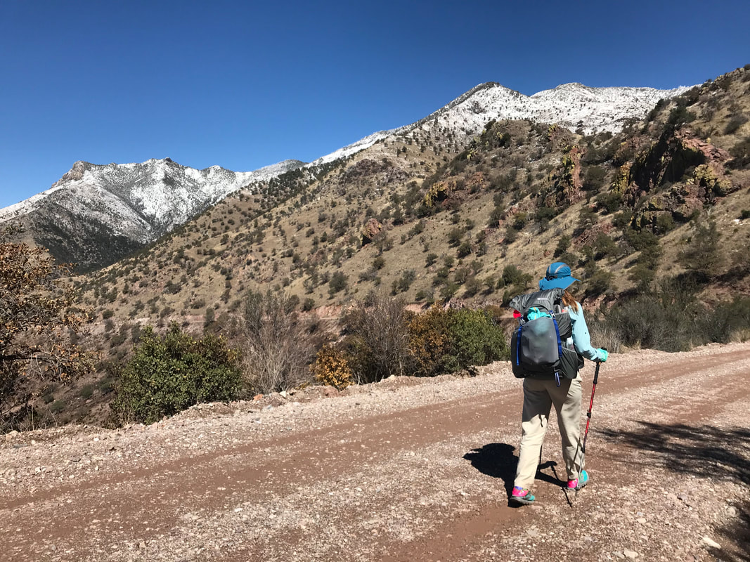
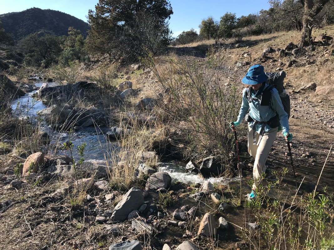
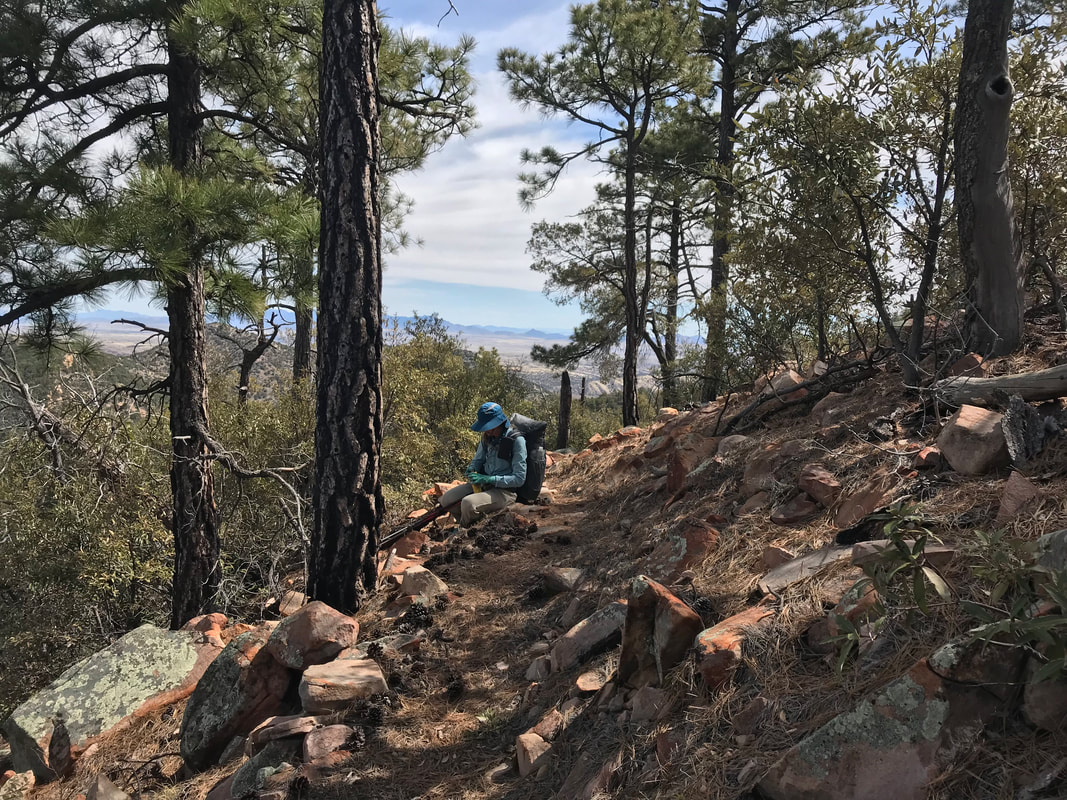
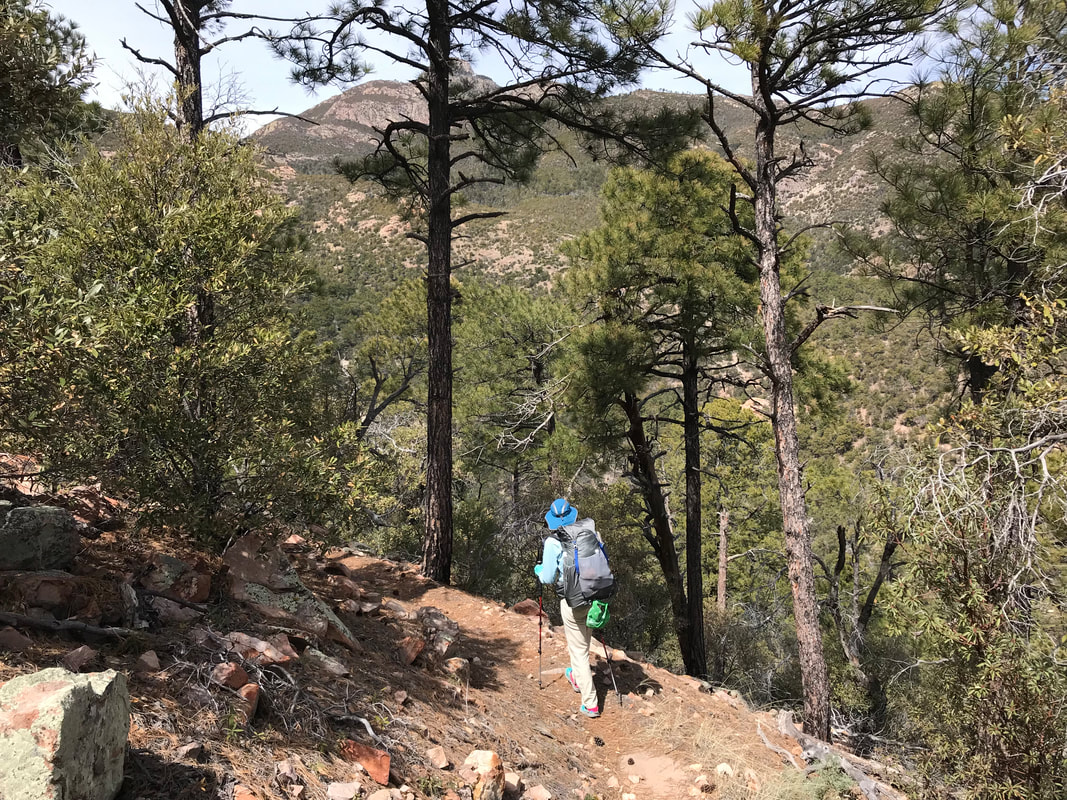
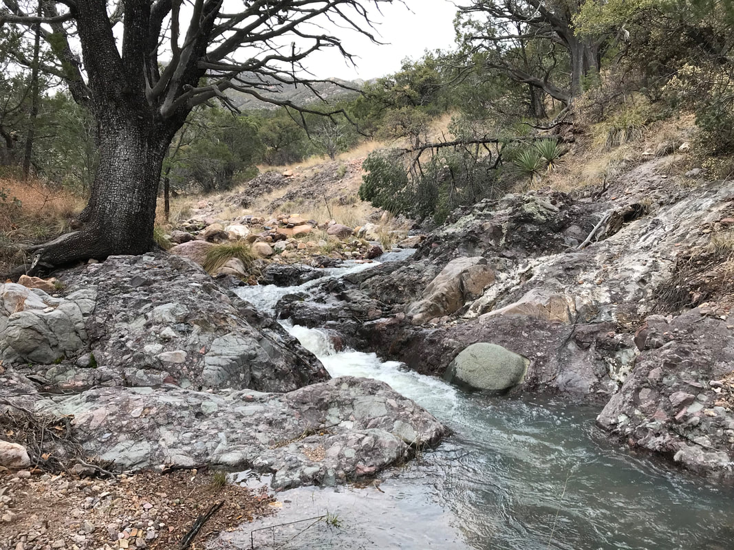
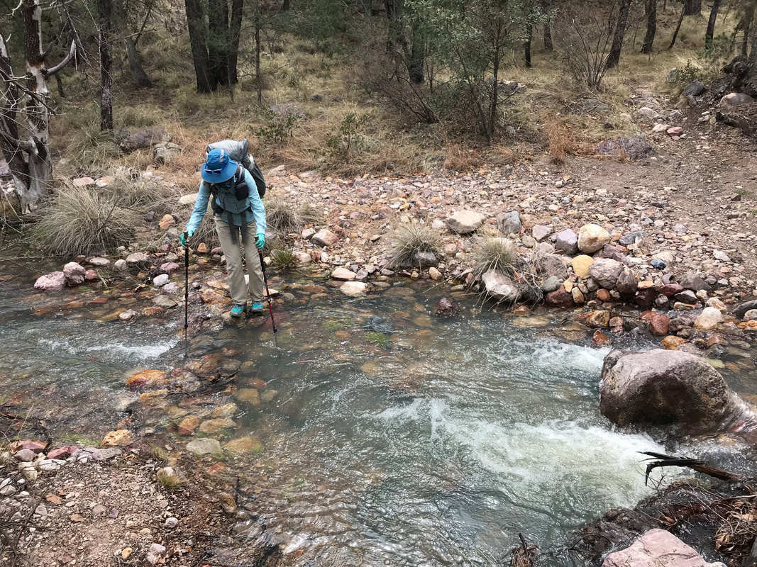
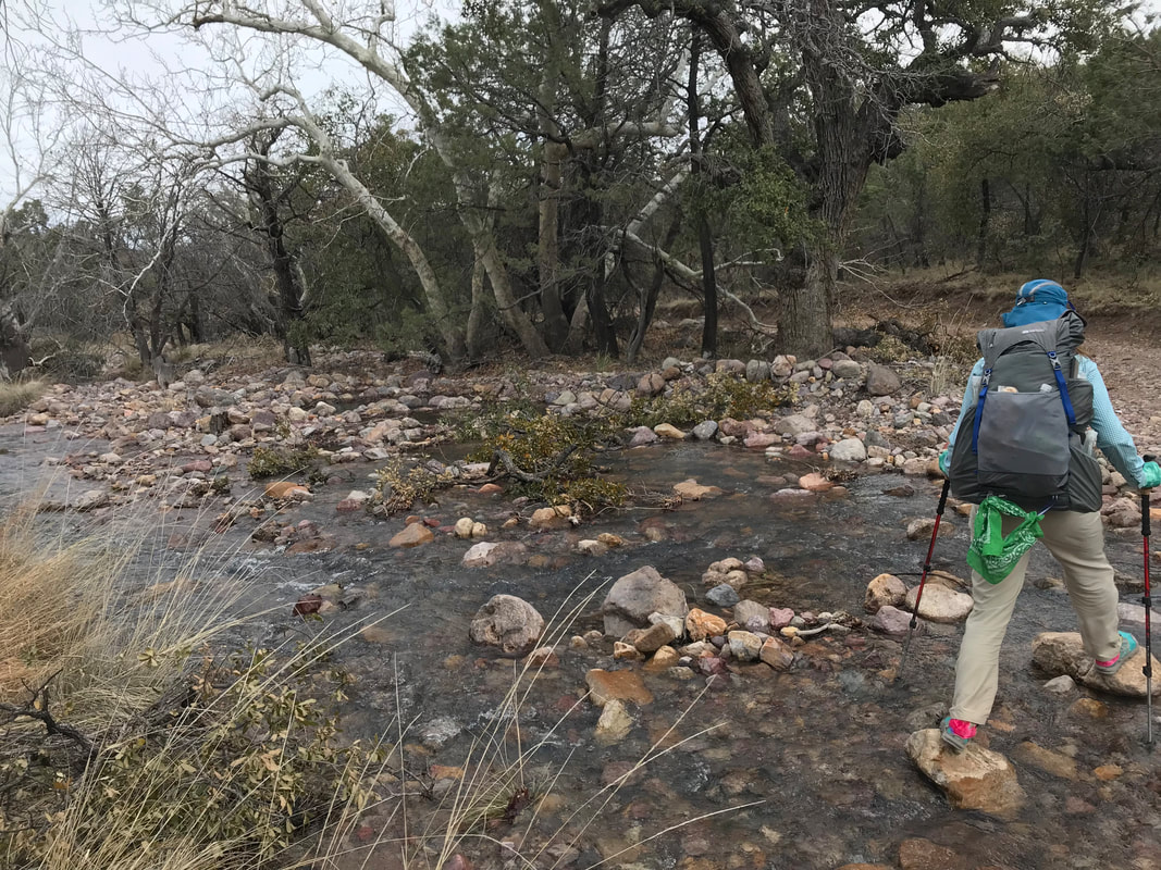
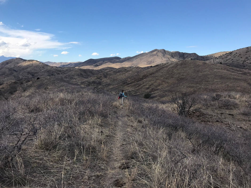
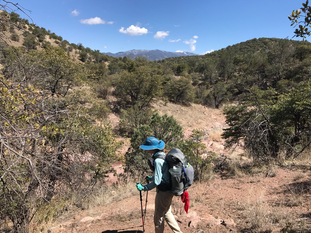
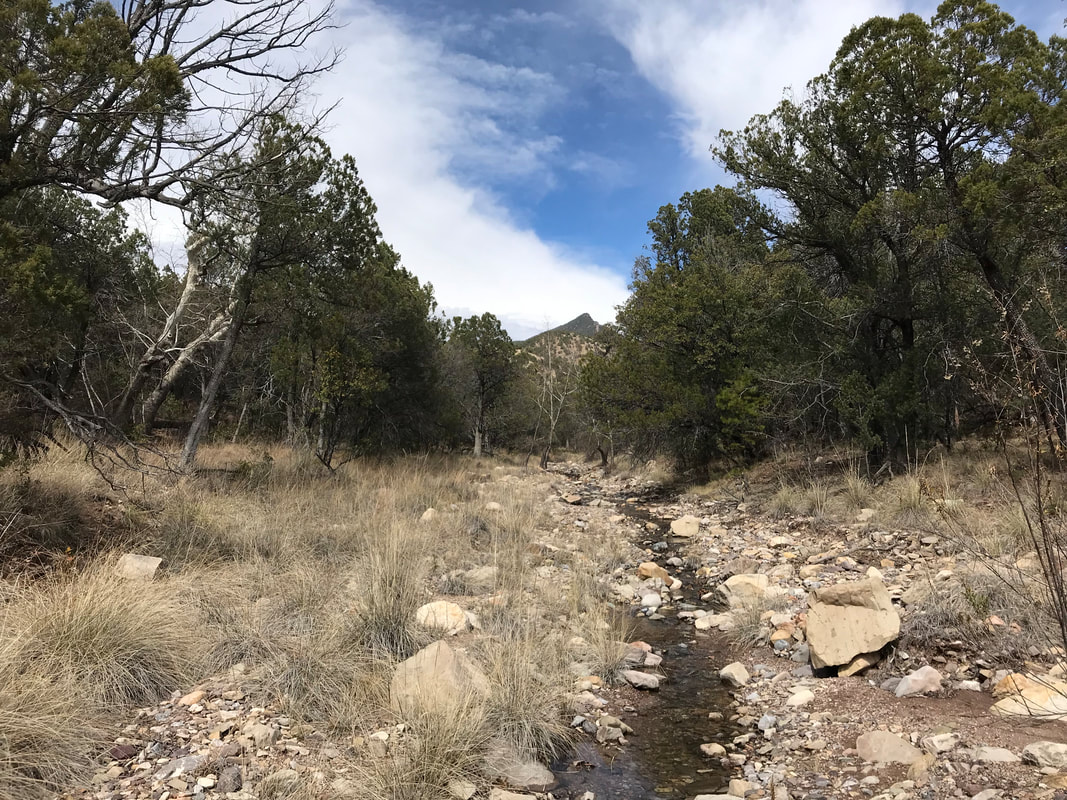
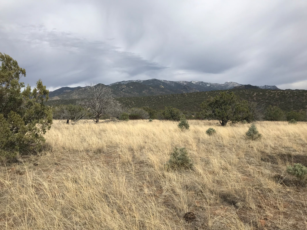
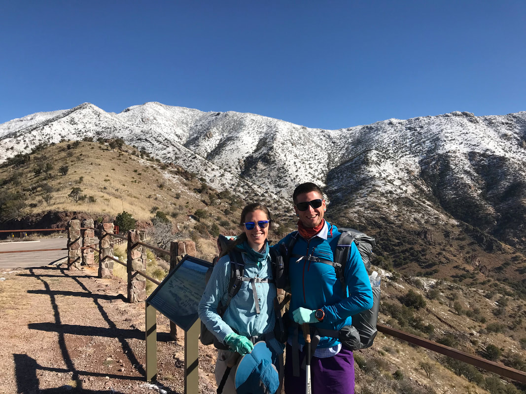
 We woke up early today to take on the longest day of our hike so far –> 13 miles. Getting up at 6 am, we unknowingly began a 2000 ft. ascent up the Santa Rita mountains near Mt. Wrightson. We have maps which provide plenty of elevation and topographic information, but I have grown to love the excitement of tackling terrain as it comes on, especially on a well-marked trail. I was floored for the beauty of the high desert, and the opportunity to hike so near to the summit as I had incorrectly assumed that the route would keep us to the grassland foothills. Instead, creeks fed off snowmelt flowed through every wash as entered a high pine forest and had to perform several gushing stream crossings. Cacti and grassland became checkered with scrub pine and then full-on ponderosa as shade cast over us. It seemed so alpine, and (considering where we had been hiking) so unreal. One of the reasons I prize southeast Arizona is due to these Sky Islands, these biodiversity mounds that shift one from low and dry to cool and wet in a matter of miles.
   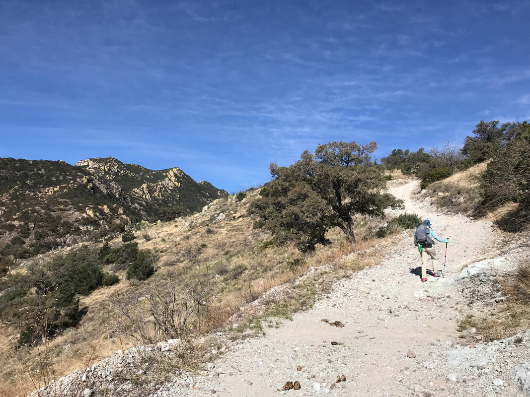   
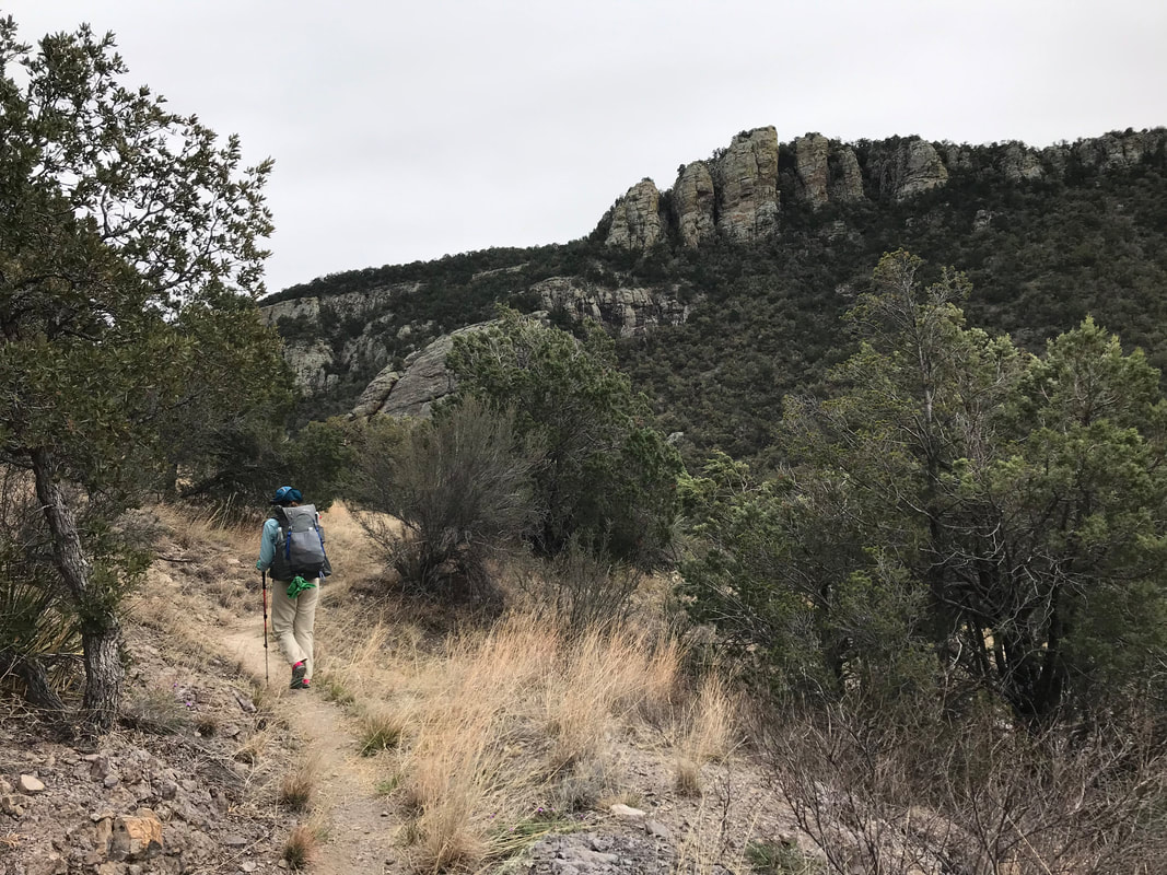
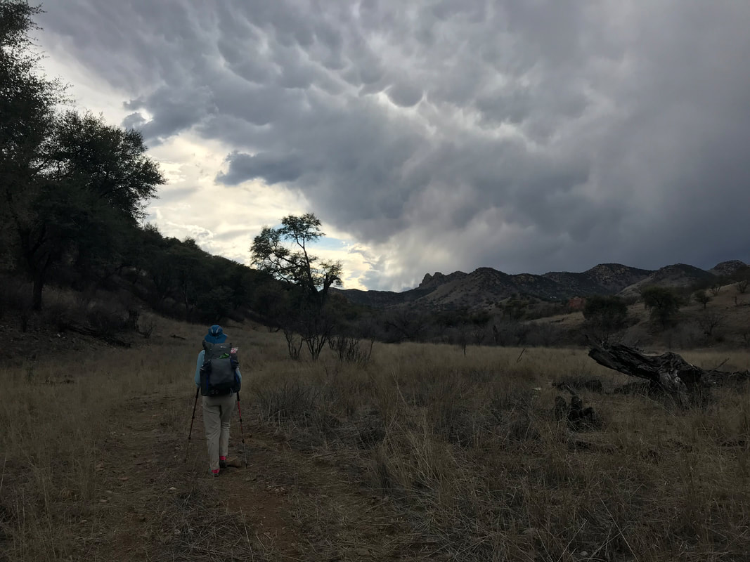
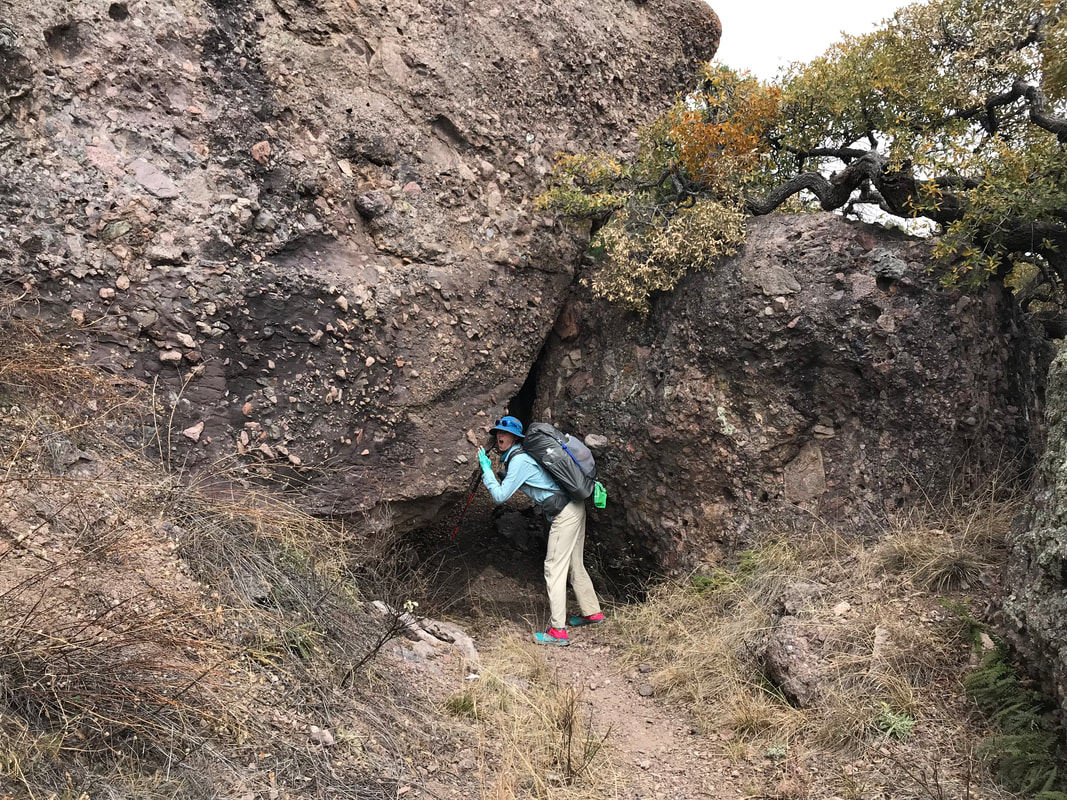
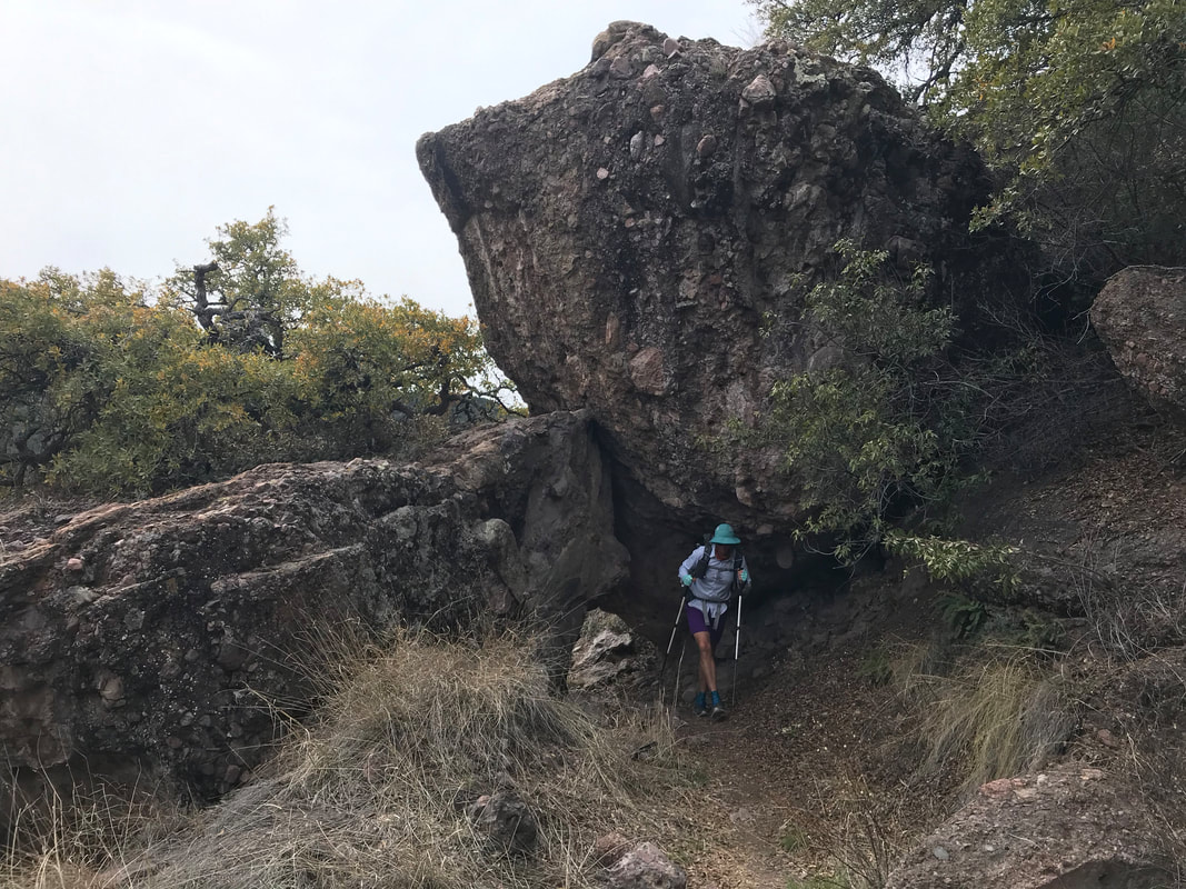
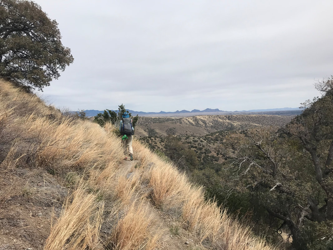
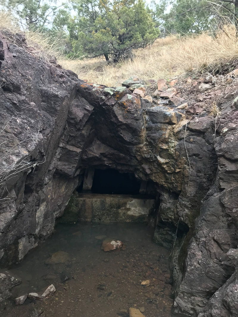
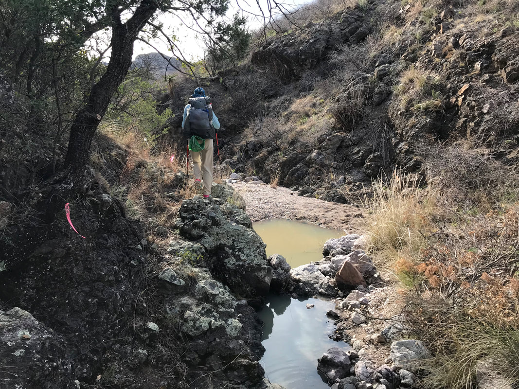
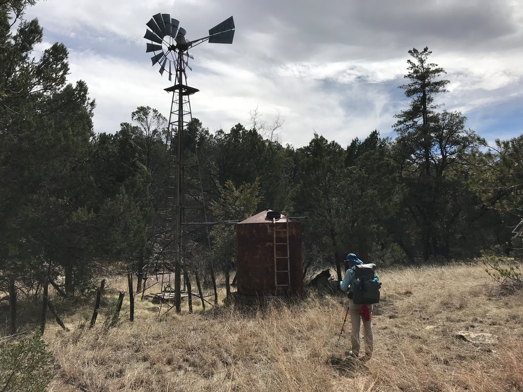
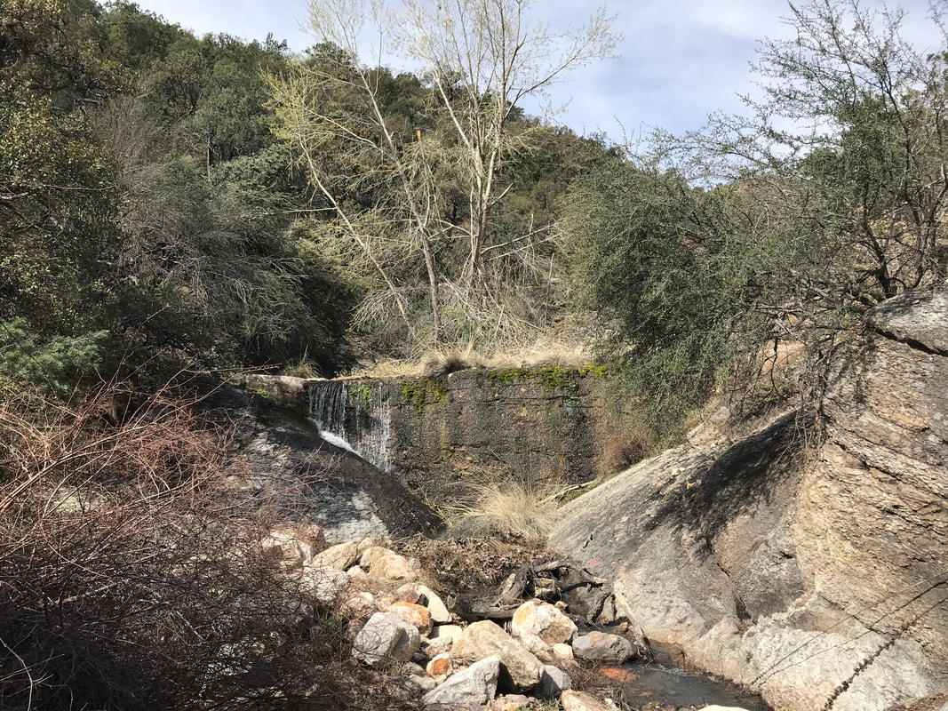 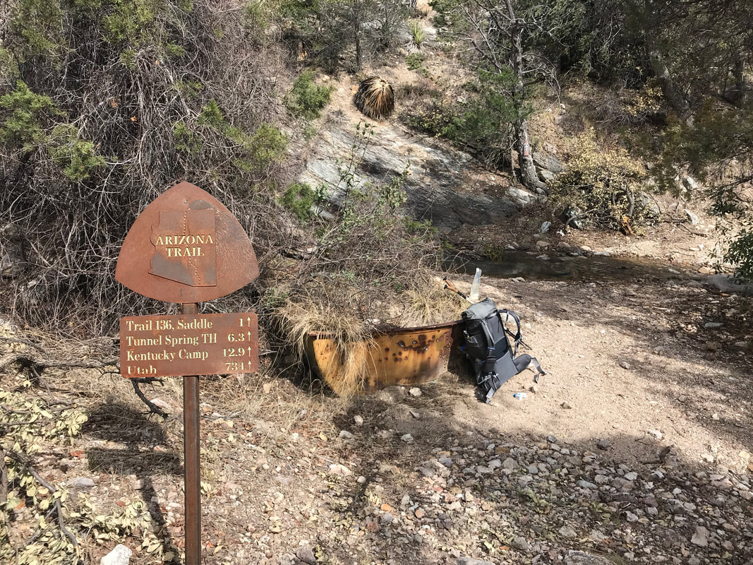 Coming over a saddle, a massive rushing stream/river filled the ponderosa-choked canyon next to us with the roar of moving water. We stopped to eat, take in the snow-crusted north face of the peak, and then descend as the day began to cool. After a 1000 ft. descent, we found the side-trail leading to Bear Spring. The sides of the mountain seeped with springs and moisture, so the spring wasn’t even pressing for our water needs today. Regardless, I ran down to Bear Spring to find an old tub with crystal clear water flowing from a spring pipe - gorgeous. Janna stayed at the trail fork and ran into a hiker we wouldn’t see again until near the Grand Canyon. Back on route, Janna and I followed the AZT as it mellowed into the contours of an increasingly widening valley with granite monoliths smoothing lining the tree-filled valley. We passed by a 100-year old mine, skirted large granite and rhyolite cliffs, while the river coursed below. Part of the trail went through a dynamite blasted tunnel, proving the previous history of the route as belonging to a mine track. Keeping to the contour line, wen entered grassy foothills again on the slow descent. The full north face of Mt. Wrightson came into view, covered in snow. We camped near Cave Creek that evening.
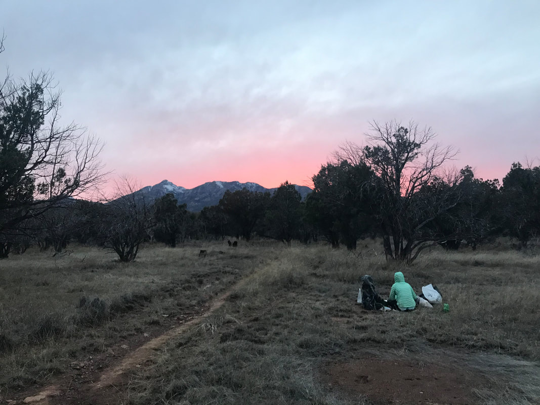
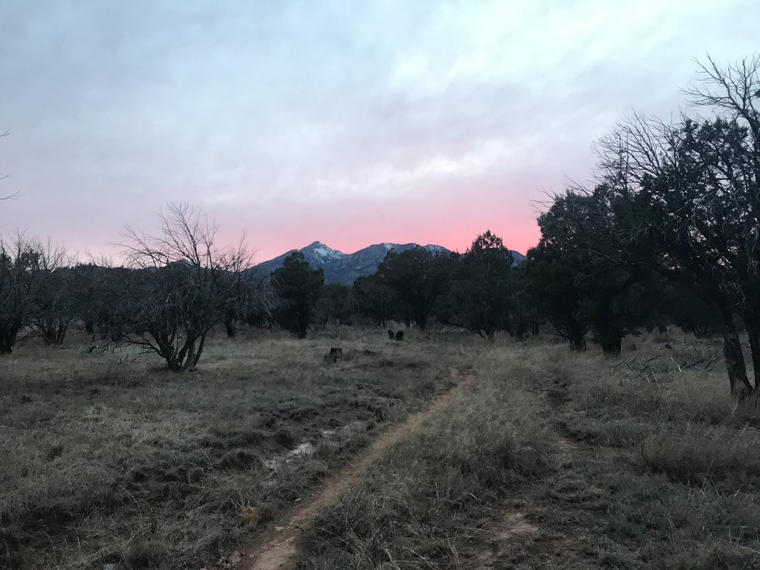
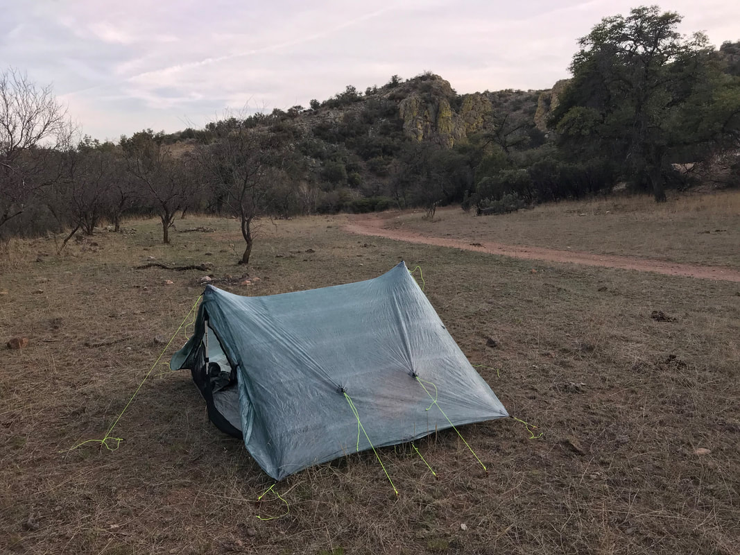
     The temperature throughout the day stayed low due to super cloudy conditions. Cool day turned into colder evening. After setting up camp, we ate dinner in the dimming light out in bunch-grass meadow. As the sun set to our west, the sky along the Santa Rita ridgeline threw off an iridescent pink that settled into deep black. Janna and I reflected on the conversations that day, steeped in our future, conquering the AZT, goals for next adventures, and our bodies. Per our cold-soaking regimen of cooking, we agreed that from here on out, we would set our food to cold-soak in our packs at 4 pm each day, hopefully giving us a solid 2 hours before dinner drove us to eat. Today had been our first day confidently hitting that interval, thus the tacos for dinner (Fritos, dehydrated beans and rice) were awesome. As I lay in the Triplex in the absolute dark, a massive pack of some 20+ coyotes broke into howls, the calls hovering seemingly feet away. The night remained studded with their calls, the cries continuing for up to 15 minutes at a time - all on repeat. Coyote calls always make me feel comfort and I slept hard.
0 Comments
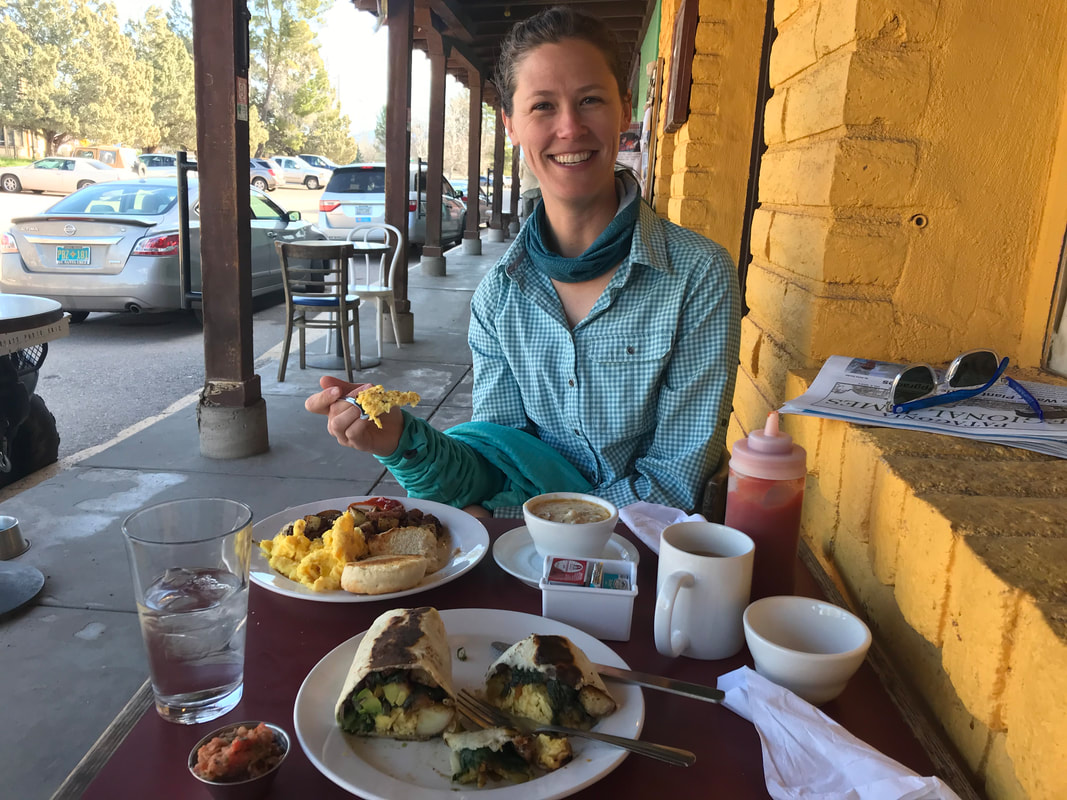
 Waking up late the next morning, (always a luxury to enjoy in town), we had a few last chores to do. Namely, two that annoyed me deeply. First, my feet were still throbbing in my arch from my insoles (the same ones I had worn extensively before, including my NOLS trip). In addition, I had began to get some inner thigh chafe as sweat accumulated on my thighs in the desert heat and the crystals therein brought friction with every rub. I had ordered a different pair of insoles and better boxer briefs (Saxx for some pouch protection for my genitals and thighs). We ran one last time to the post office to send home the insoles and former pair of boxers before we headed back to Gathering Grounds cafe for one last epic vegetarian breakfast burrito. Satiated in the way that only follows a meal post-workout, we finally left town at 11 am. We only had 8 miles ahead of us, which brought little urgency to the time. Leaving Patagonia involved a road walk that quickly transitioned to gravel Eventually, we reached a section of trail that had a reroute due to nearby mine cleanup and reclamation. The views of the Santa Ritas were simply incredible, with lingering snowpack on the upper peaks and north faces. 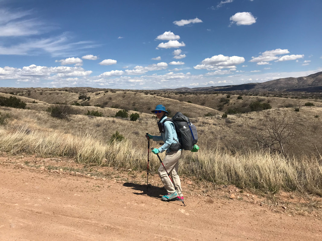 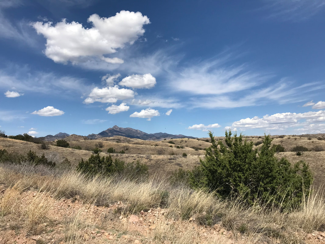
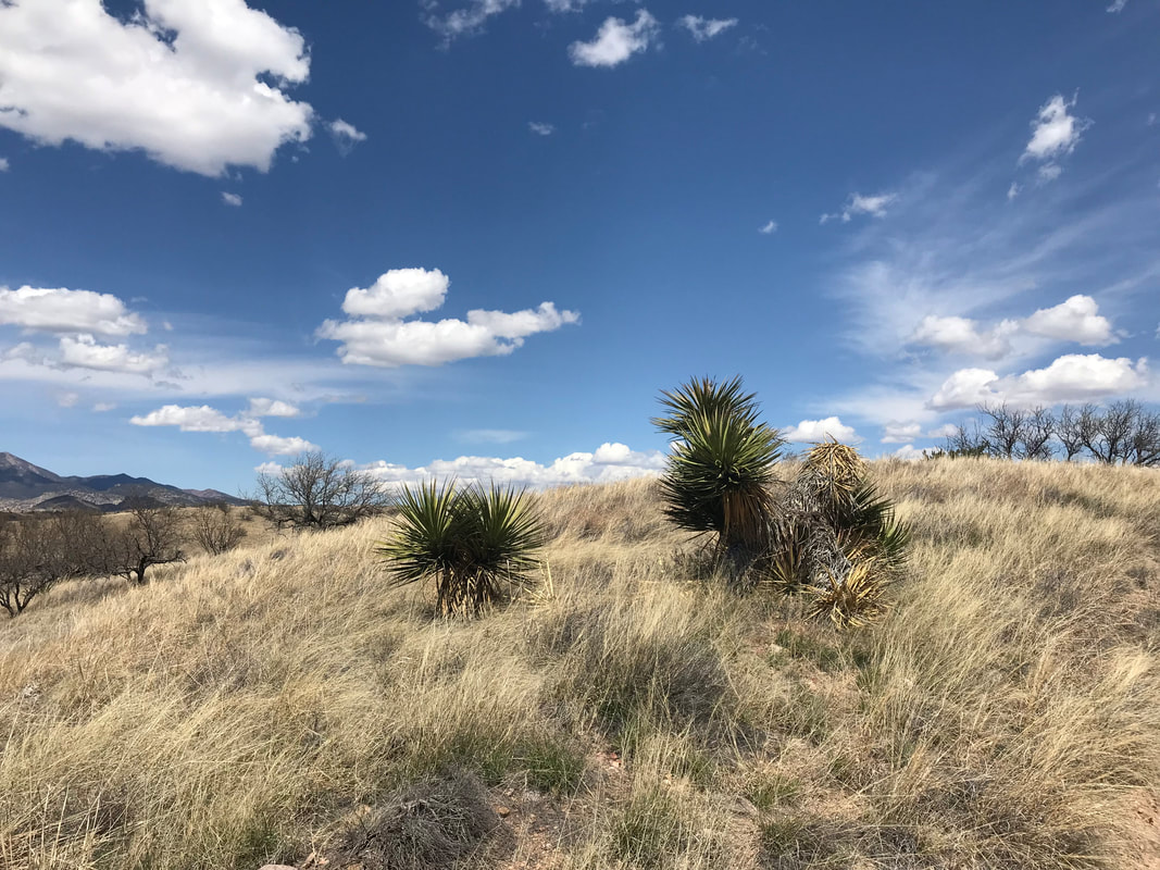
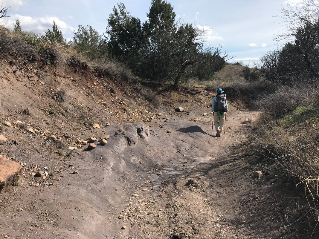
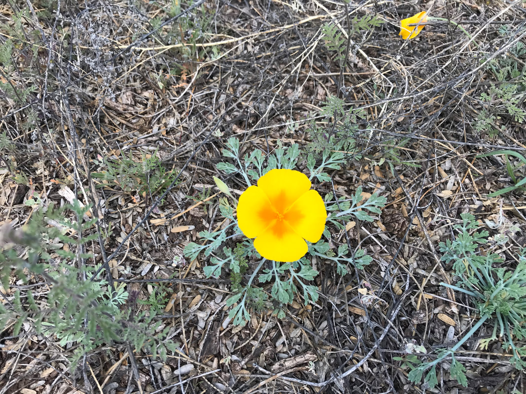
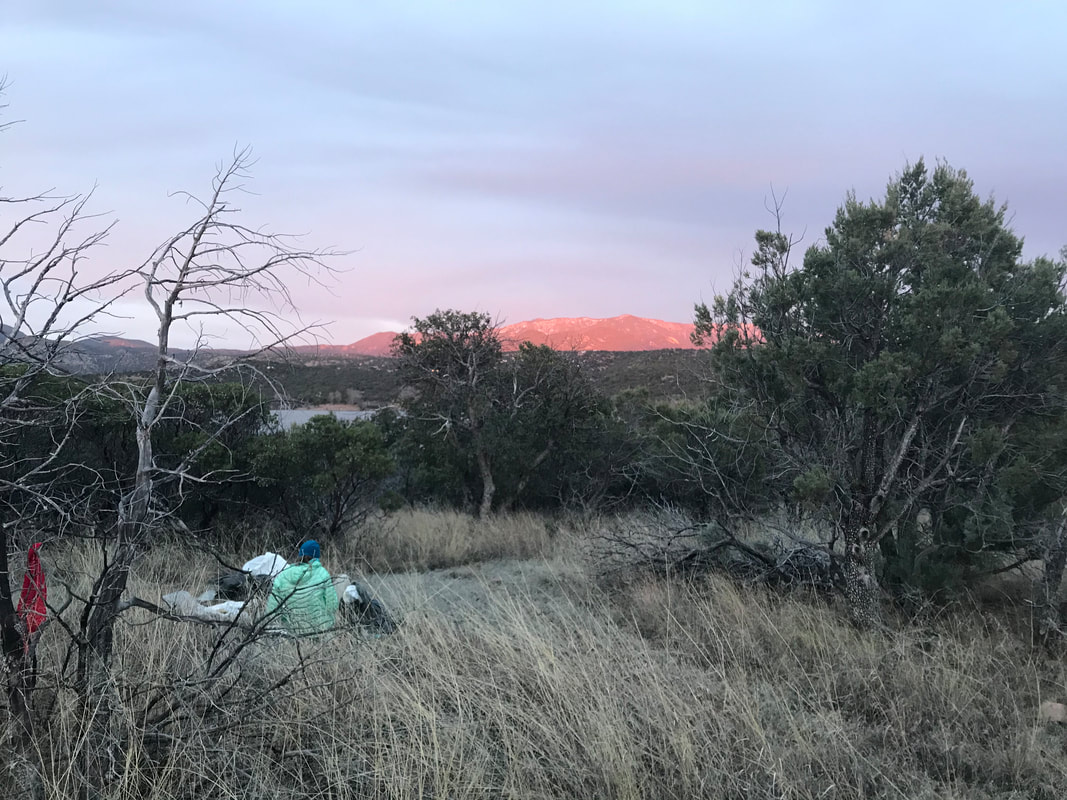
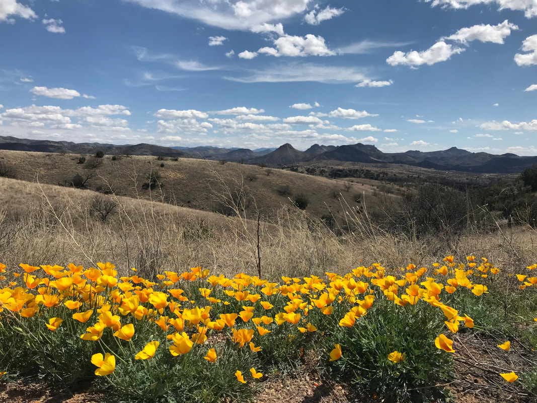
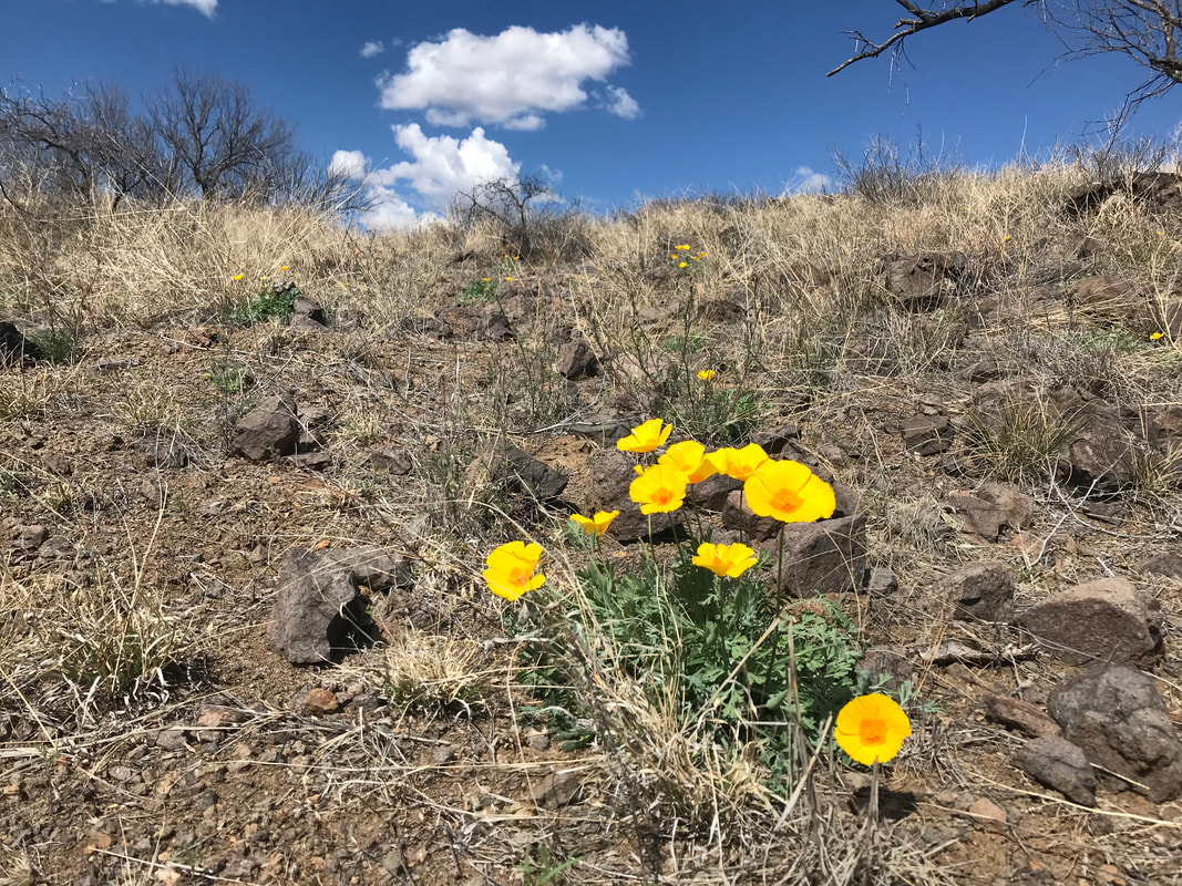
   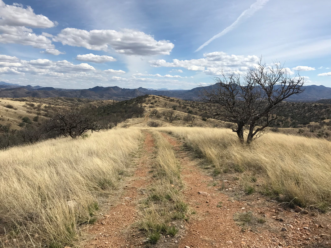  The AZT reroute took us up and over doubletrack on grassland hills, punctuated by mesquite and the occasional palo verde. Old agave stalks stood rigid in the distance while a few Mexican gold poppies erupted from the tan grass. Up and down multiple gullies, the trail summited a large hill, passed through a barbed wire gate, and basically disappeared. Small ribbons flagged in mesquite became the course to follow, albeit as a little unsurely, for the next several miles up and down washes and cat-claw filled valleys. The terrain was particularly steep and I could feel my knee. We happened to stumble upon a cattle tank, unmarked on the maps, but right along the trail where we could refill with some cold water. After bushwhacking down a hillside into a thicket of mesquite and old cottonwood, we stumbled into a massive abandoned migrant camp filled with backpacks, shoes, water bottles, caffeine pill boxes, and other jettisoned items. The juxtaposition of our desire to hike this route was immediately brought into focus against the contrast of others struggling here in this same place starkly different than our own. We eventually made our way down a steep wash coupled with several stream crossings. Picking our way across a plain choked with cat claw, we spilled onto the main route again. A half mile down the trail we crossed Anaconda Spring, in full flow, and found some great campsites up a hillside. The sunset was a brilliant pink display as a windy night unleashed on us. 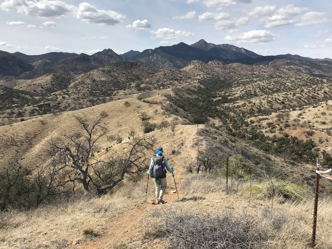
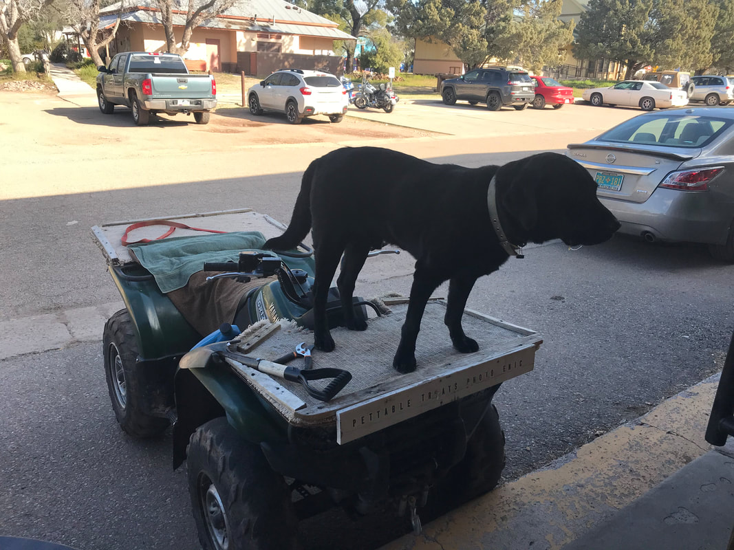
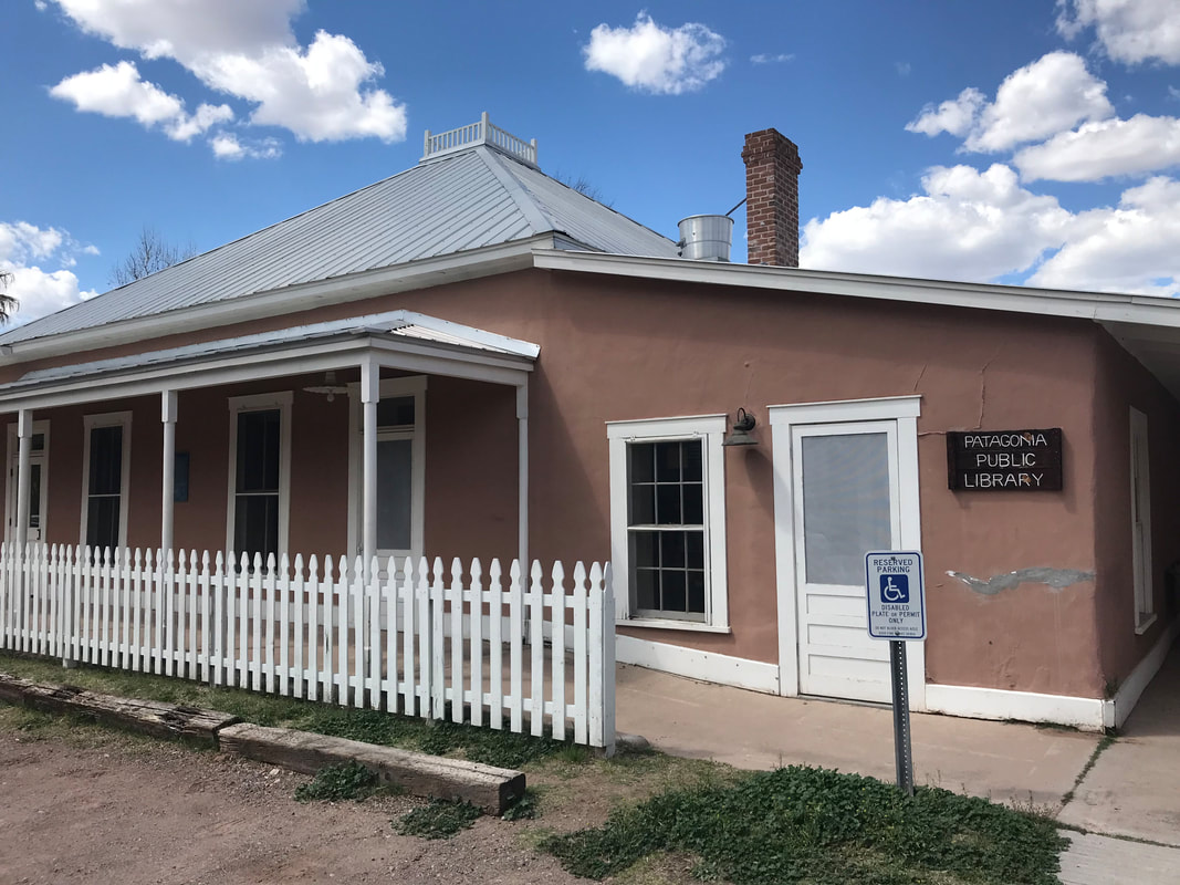
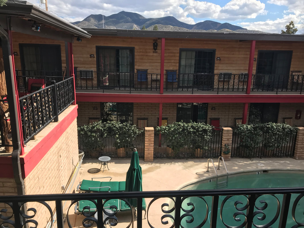
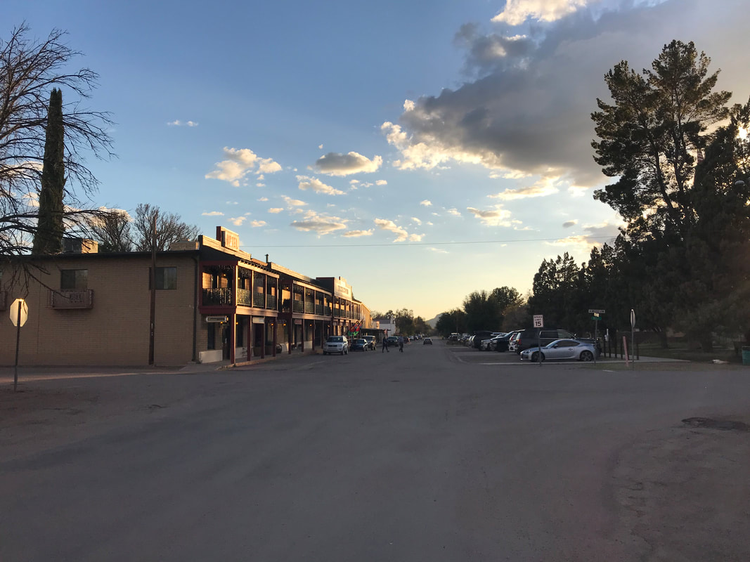
    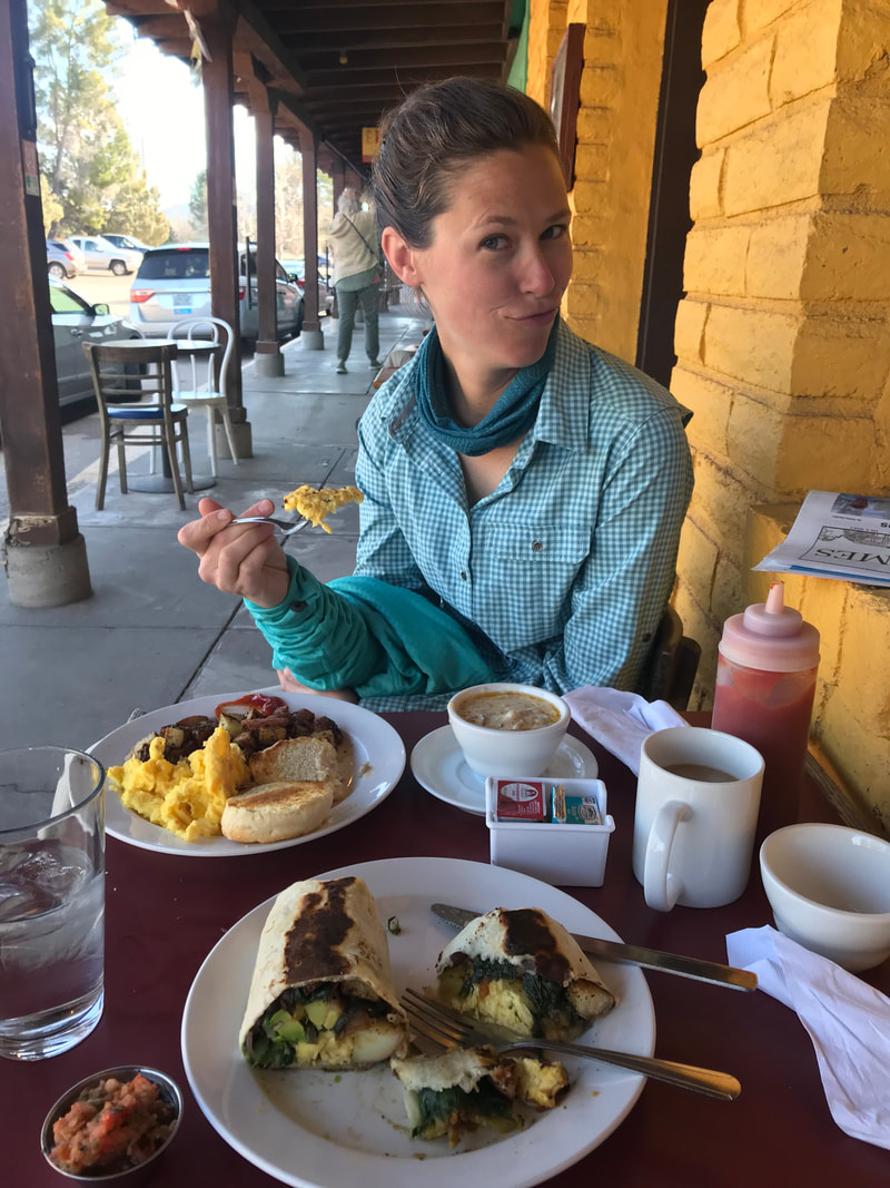 It felt particularly monumental to arrive in Patagonia because, honestly, this was the place I was unsure we would reach given the state of my knee. We love this town and decided we would take a zero day to allow my knee to rest/recover. Janna got us a room at the Stage Stop Inn. The historic hotel was followed by a morning at Gathering Grounds restaurant, where I honestly got the best breakfast burrito I’ve ever eaten. After watching a four-wheeler roll up with a dog on the back, we made our way over to the Patagonia Public Library for the rest of the morning. We laid out our itinerary for the remainder of the trip while we took advantage of the free wifi. Knowing that we had successfully made it here, we felt compelled to take the rest of the itinerary seriously. The late start due to the snow storm meant we needed to make up days to be done in time for Janna to head back to her school. Additionally, we still wanted to get to Phoenix to meet up with Taylor (who was flying out from Ohio with her friend for a short spring break vacay). For lunch, I got Gorditas from MJ’s downtown, and then we hung out at the town park before making our way to the hotel to check in. Running to the post office, we picked up our drop boxes and bounce box, signed the official AZT register kept there, and then went grocery shopping. Patagonia has a true locavore market with organic offerings called Red Mountain Foods, in addition to a small corner market with traditional fare. Stocking up on supplies for our push to Colossal Cave, we ran to the laundromat and got dinner while everything washed/dried. Returning to the room, we spent the evening rebadging good, cleaning gear, and reorganizing before watching Wonder Woman and passing out.
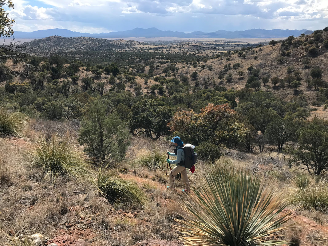
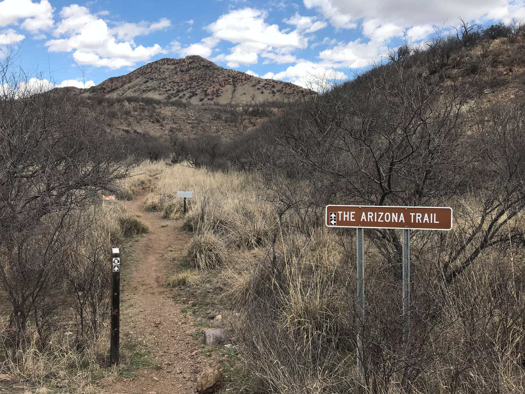
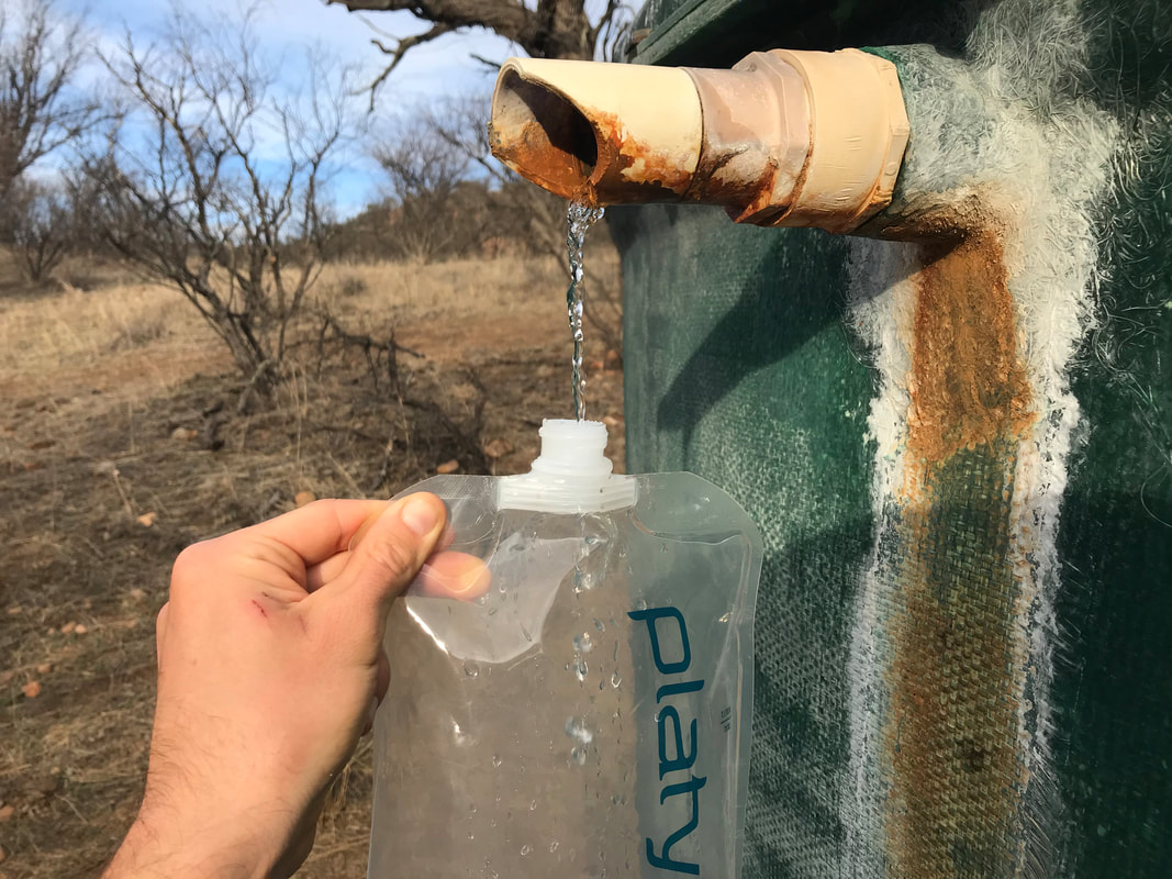
  Loving the campsite near Red Bank Well, we got up early the next day to make the last little push into Patagonia, AZ. This was big to use for several reasons: (1) I had so much doubt prior to the trip about my knee that Patagonia seemed proof of my ability to hike and (2) we always loved taking trips down to Patagonia when visiting southern AZ. A morning with no clouds meant the solar well was pumping strong this morning providing us all the water we needed to get to town. We followed the AZT down the canyon/wash further and cows continued to abound. The Arizona Trail Association had a section of brand new singletrack for us to hike which made the walk quicker by avoiding a sandy wash. 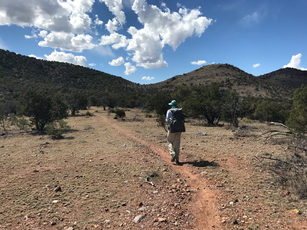
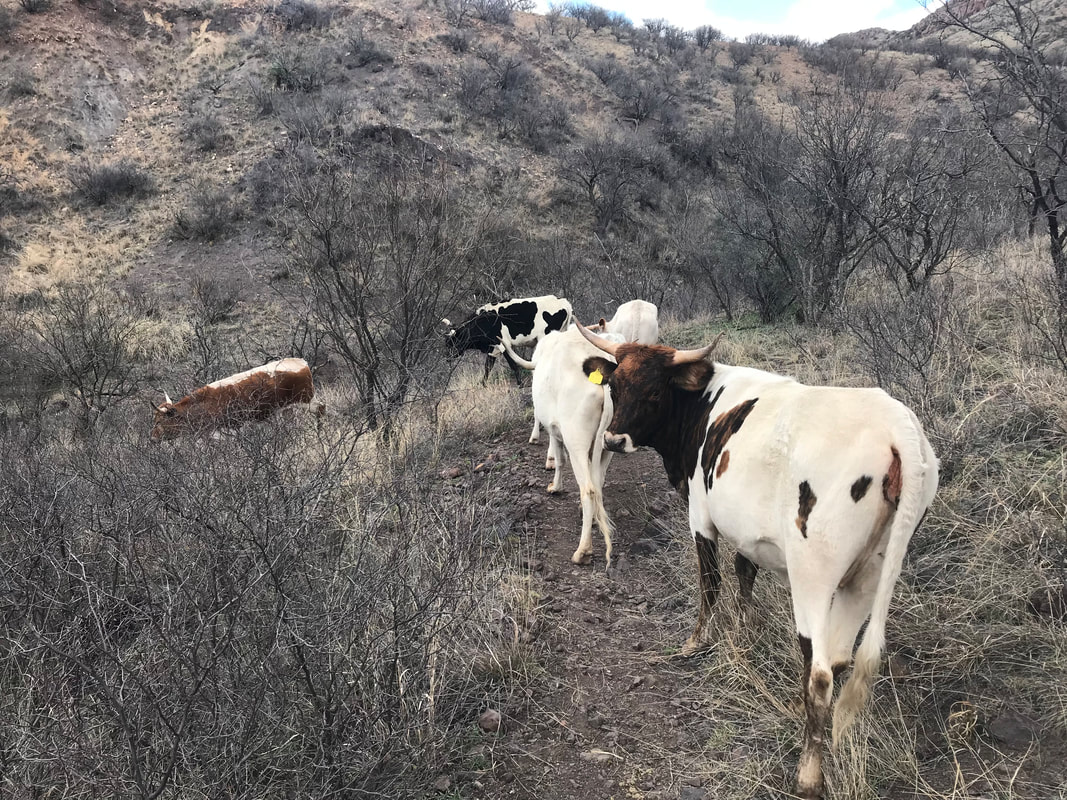
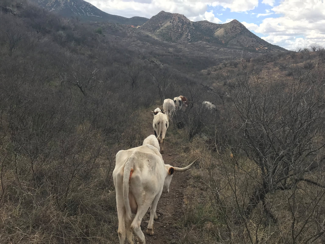
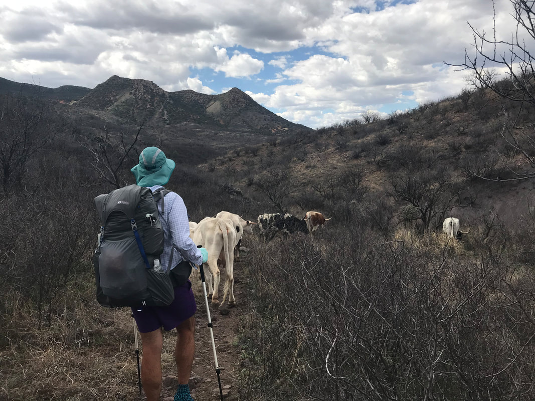
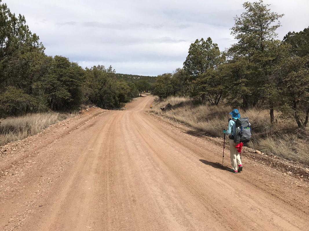
 The measure of distance was reinforced by a change in botany as ocotillo and Mexican gold poppies sprang into the landscape. The Patagonia Mountains loomed ahead red with iron and streaked with woody green. We rounded a hill and found a crazy steep decent through a fenced area with of course…cows. Except here, the terrain was so steep and chocked with cacti and mesquite that the only reasonable way to the bottom was on the trail, which is exactly where all the cows were. In a long line they stood taking up the trail, refusing to move. I started clacking my trekking poles together while approaching them, audibly plodding them to move. Slowly and with frequent stops, the herd made a move down the trail while I followed a couple feet behind the rear. Fifteen minutes later, the cows finally left the AZT and we could continue down to Harshaw Road. It was super nostalgic to hit this road because the AZT trailhead is where we parked the car for the three days we did the Sky Island Odyssey bikepacking trip. Turning towards town, we made the three mile road walk to Patagonia while massive mining trucks streamed by every few minutes. About a ½ mile outside town, we found an amazing RV park (free hot showers and a rec room with wifi and couches for campers!). After needed hot showers and washing our clothes while bathing, we sat outside in the sun to dry and relax. As early afternoon hit, we walked the last 0.5 miles to town for food (a massive kale salad and enchiladas) at the Wild Horse Restaurant. I slept hard that night. 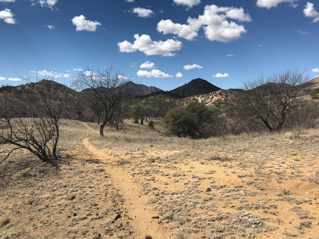 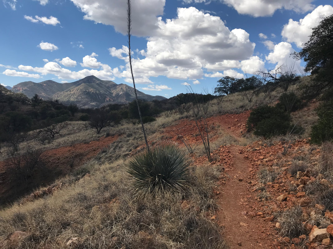 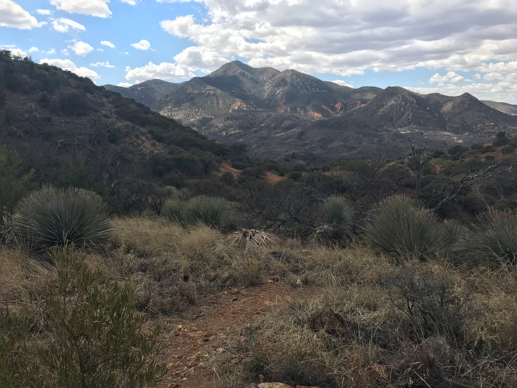
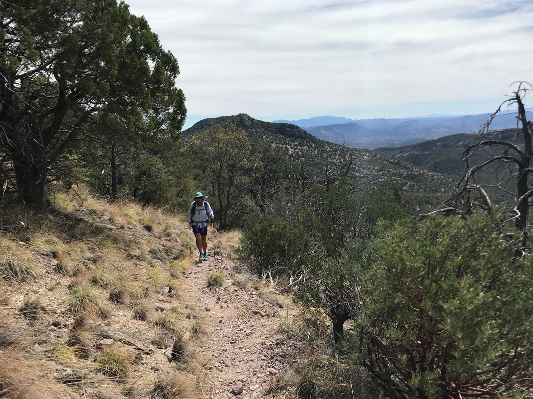
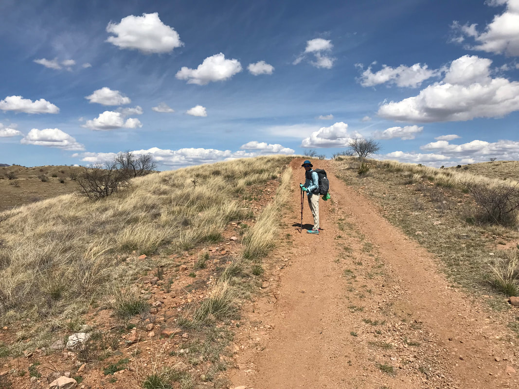
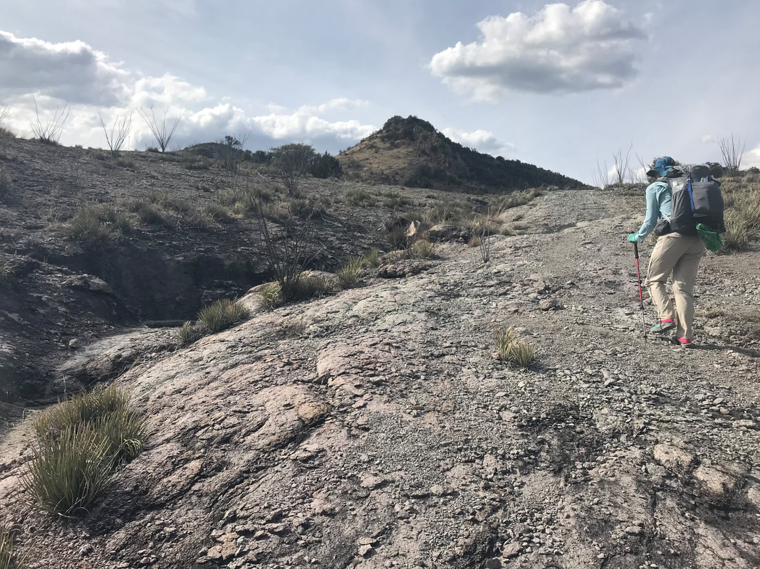
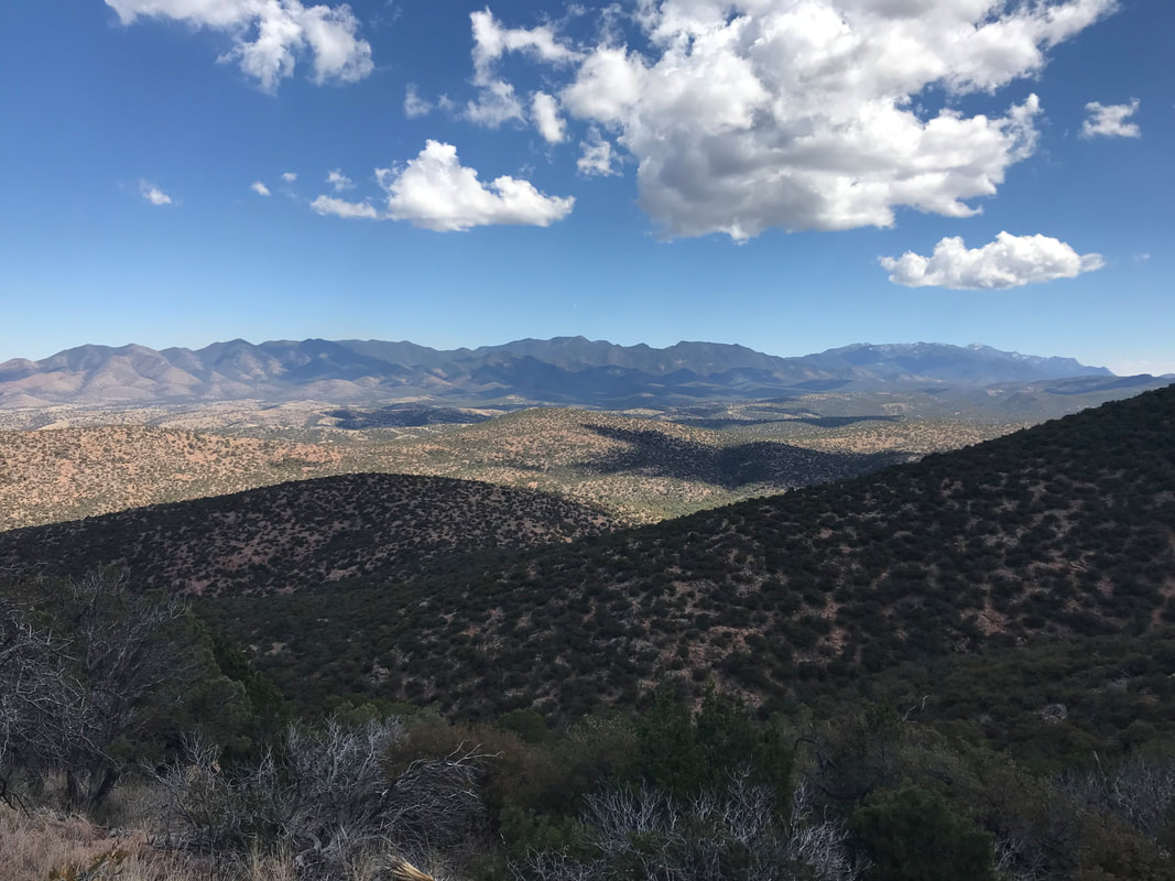
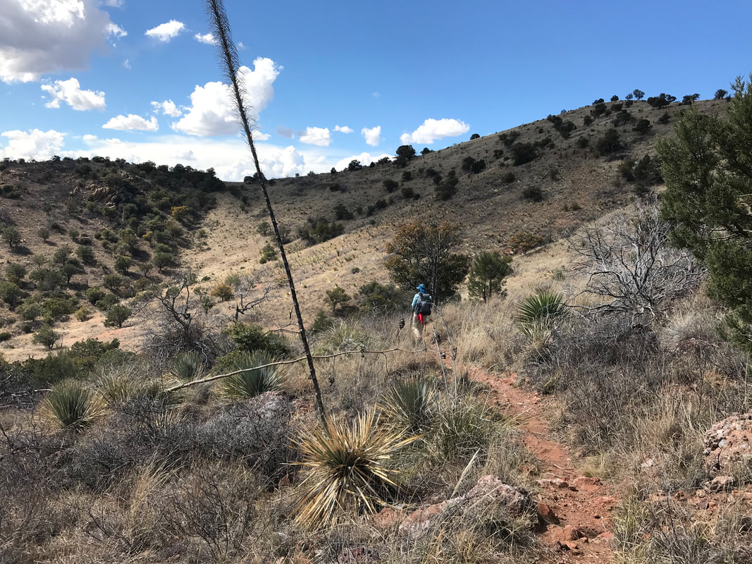
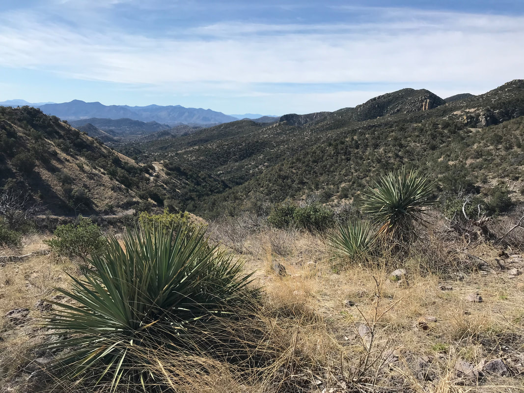
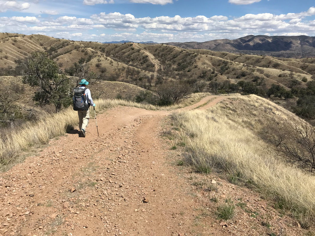
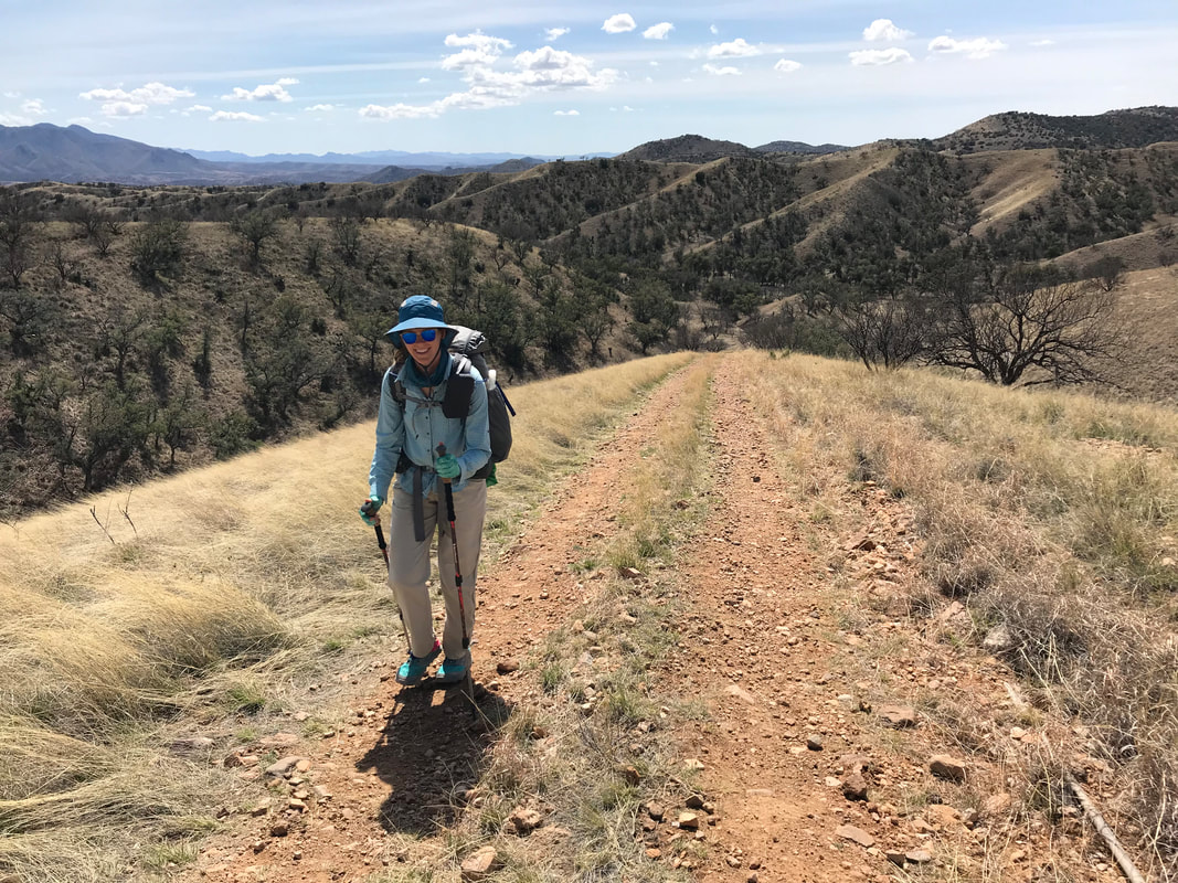
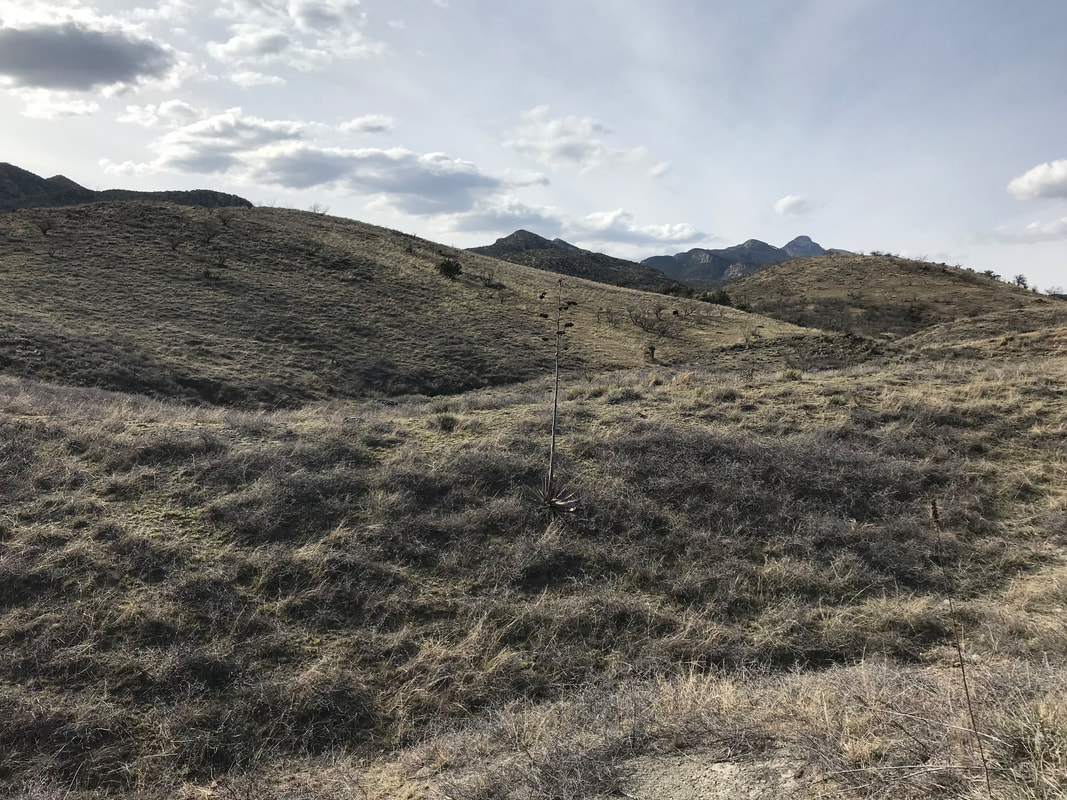
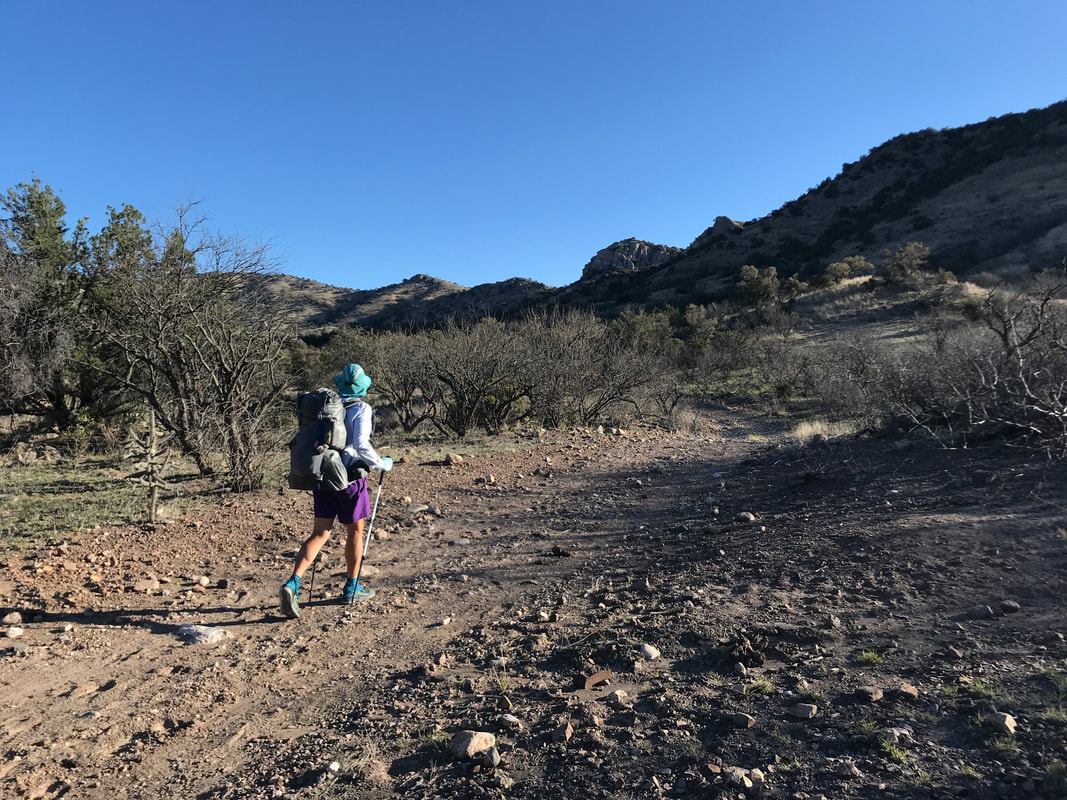
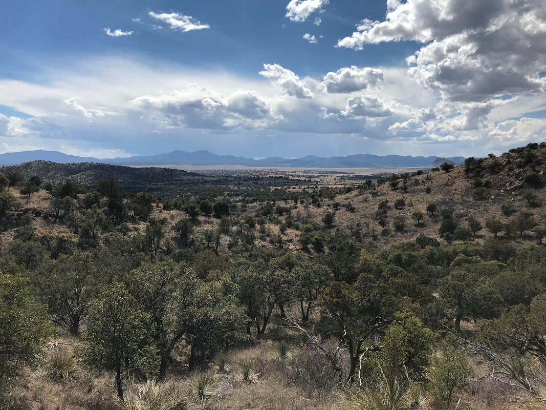
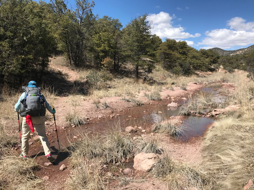
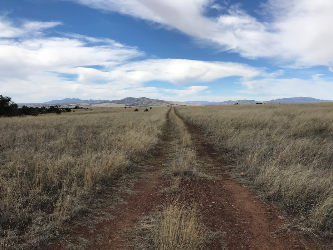
   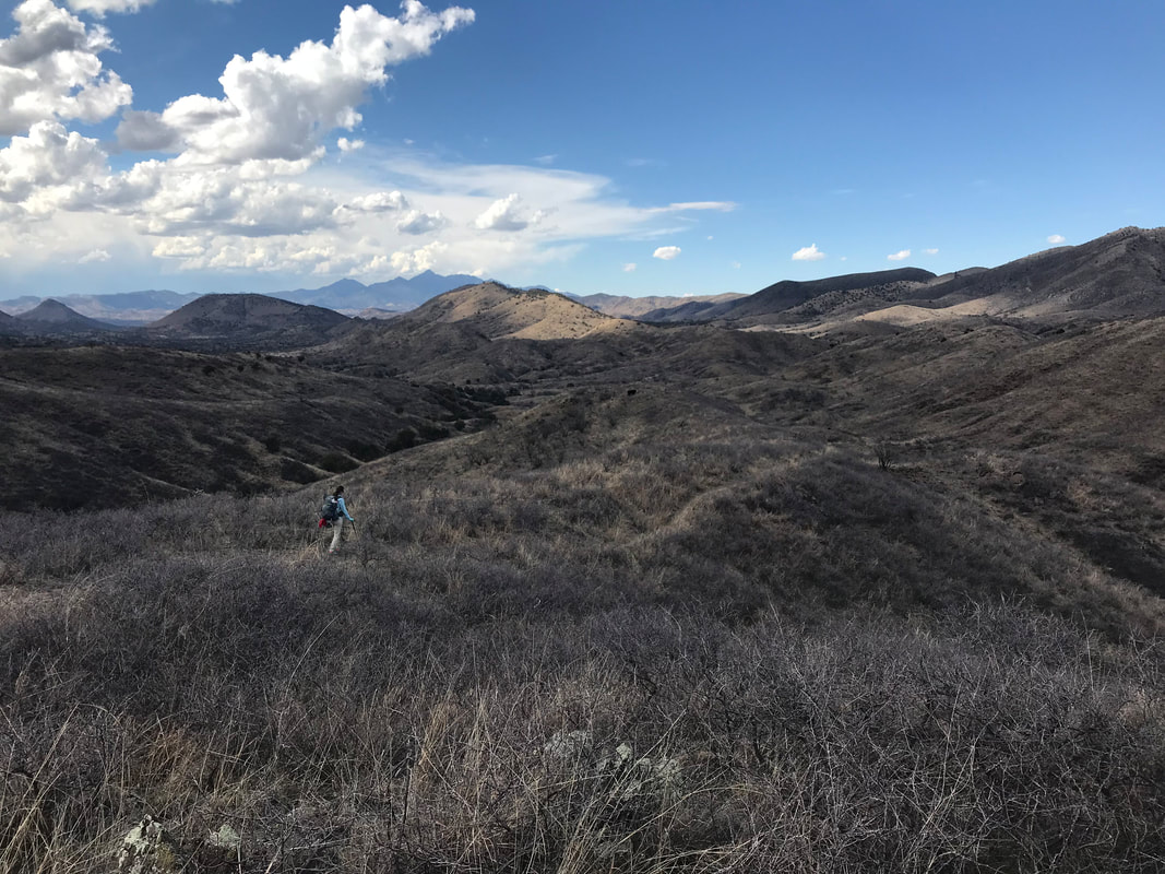 The day started with a wet triplex from the night before. Knowing we only had 10ish miles to go today made the mornings relaxed and long. The slow pace meant that we didn’t have to shove miles in before rest, and therefore, we could take longer to enjoy breakfast and dry out the shelter. We went back down to the metal cattle tank and filled up what we needed for the day. Returning to camp, we heard a bunch of AZTers coming up the road. They stopped down at the cattle tank and voiced their disappointment about the lack of water. Realizing they didn’t know how to use the irrigation control valve, Janna ran down to fill them in on how to get the water. The first response from one hiker (seeing us with our gear drying and eating our breakfast late in the morning) was a condescending singular question asked in the tone of a adult talking to a child: “Is this your first thru-hike?” Shocked at the patronizing tone, we stood as she relayed how they were all triple crowners and loved #thruhikerlife. She asked us if we had trail names, which we did not at the time. Hearing we didn’t, she (amongst the group) immediately scanned our packs and equipment and then walked on without further conversation to us. We stood there a little shell-shocked at the tone and obvious judgment of our hiking state. In bike touring at camps each night, there was always a diverse group of riders with bikes from carbon racers to steel 1970s clunkers - but it never mattered. There was always a universal acceptance of being on the ride and sharing in camaraderie no matter your style/income/weight/approach. It definitely stung a bit (here) that tones and pointed questions were offered more as judgmental bents rather than genuine conversation; especially when we had helped them access water. From that moment, I promised to myself to be the type of hiker I wanted to meet, to ask the questions that mattered to me: What do you think of the beauty? Have you seen any cool wildlife? What do you think of Arizona given the landscape you’ve come through? What are your impressions of the trail? Shaking off the encounter, we ate the rest of breakfast as the sun lit up another beautiful day in the Canelo Hills. We climbed up towards the high point of the hills and got cell reception enough to check in with family. The high point was awesome and provided awesome views of the whole grassland ecosystem stretching out in the valley below while multiple small ranges of southeast Arizona rising up. We realized we could see a dirt road stretching far in the distance that was the route we took in November when we bikepacked the Sky Island Odyssey eastern loop. 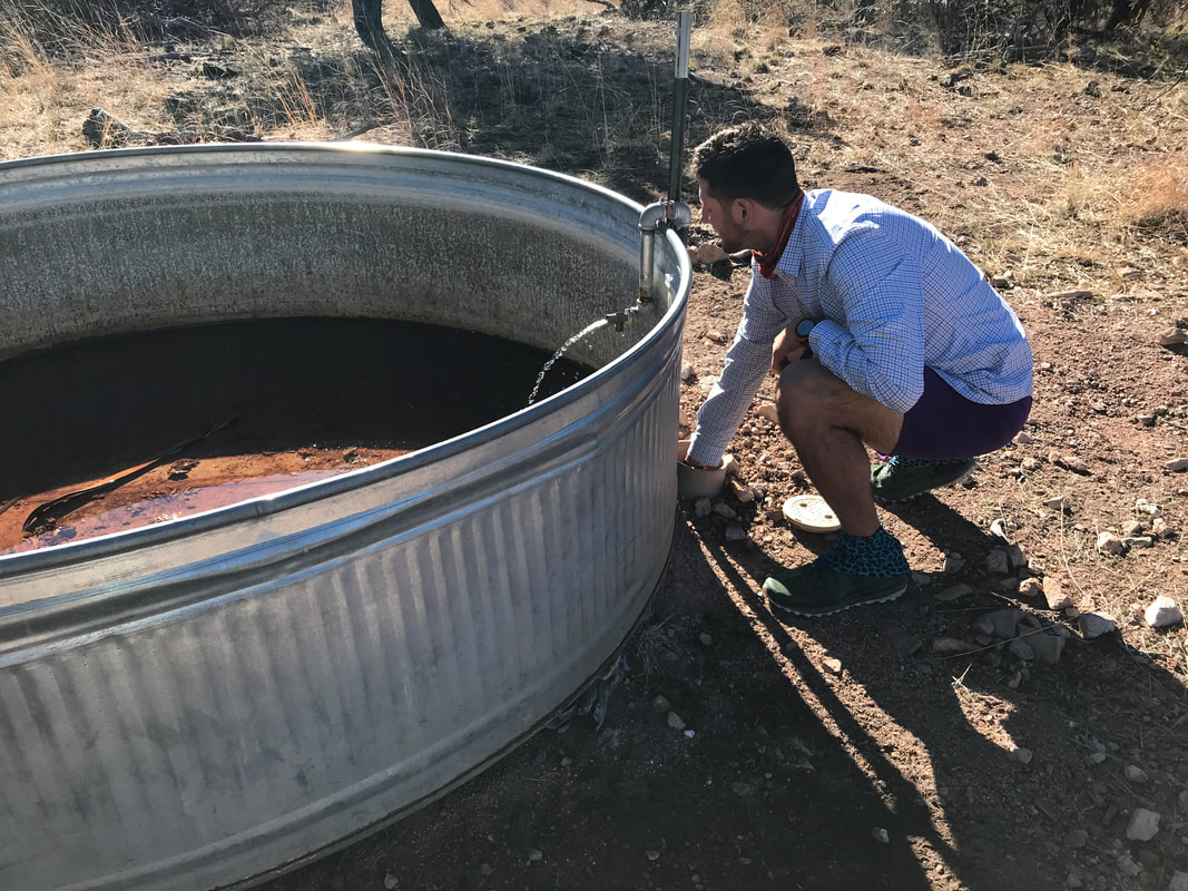 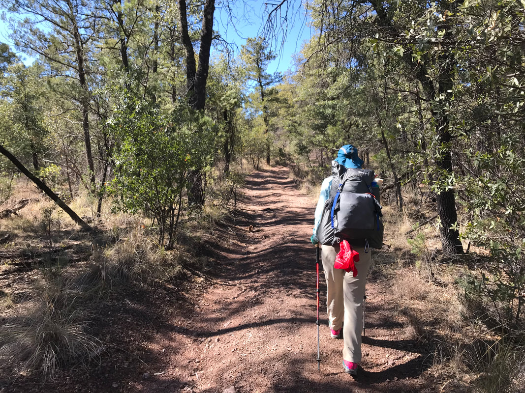 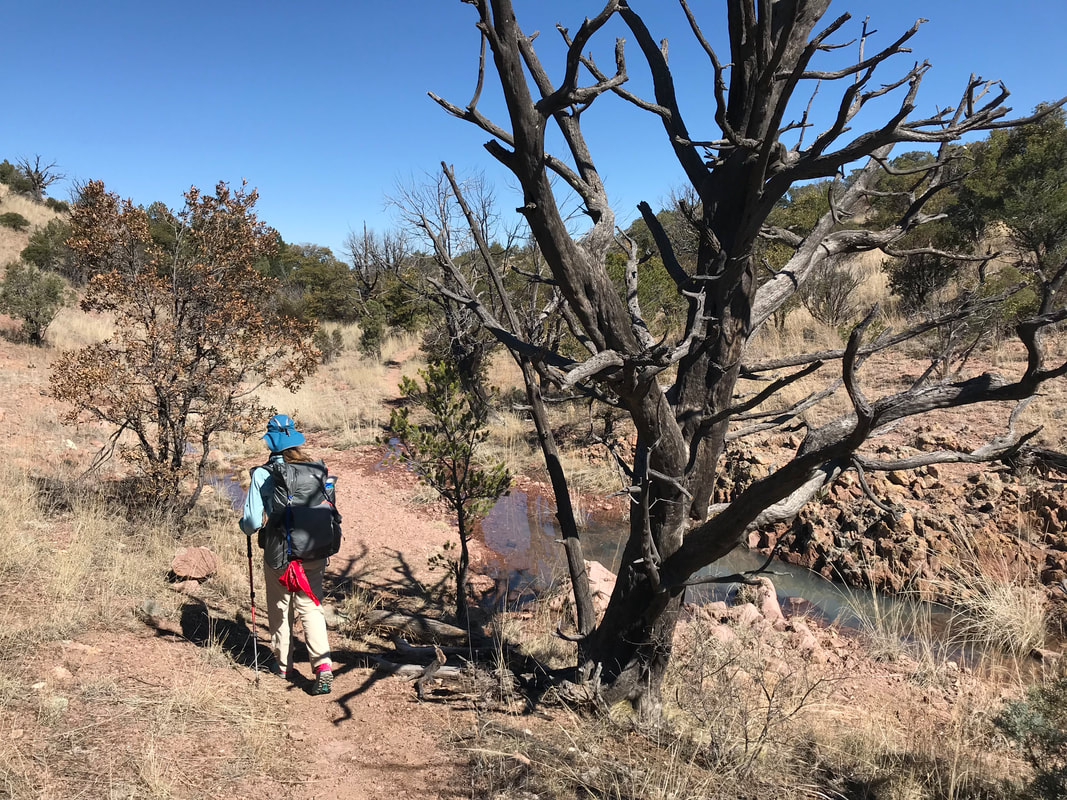 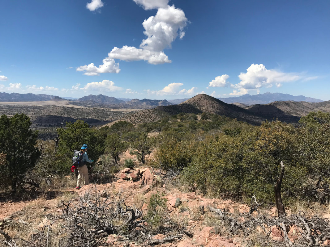
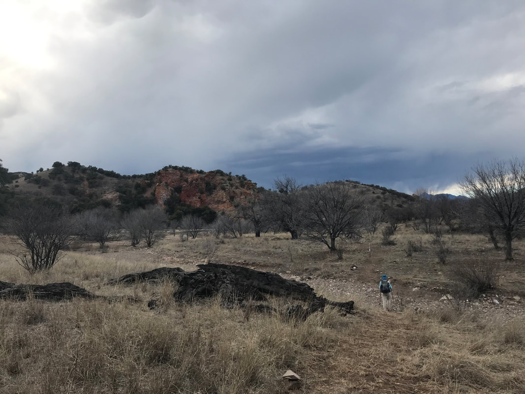
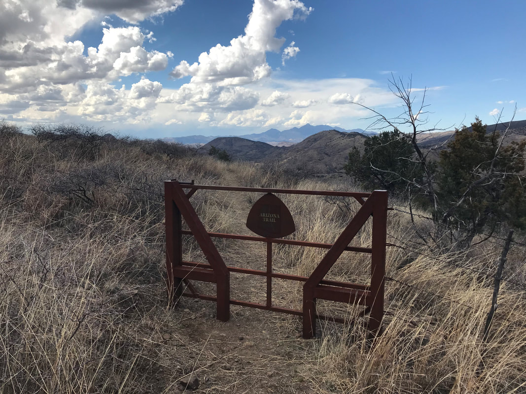
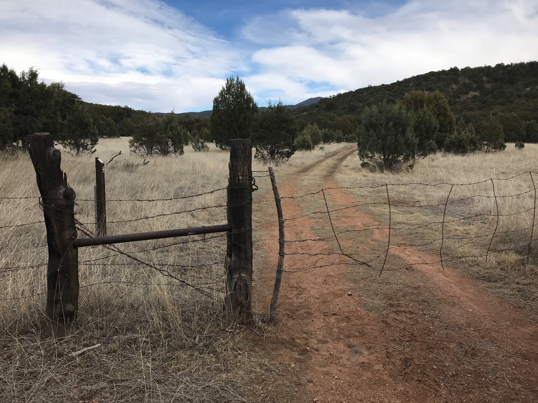
 Descending from the peak, we met several day hikers who let us know water was flowing near a parking lot at Canelo Pass. Looking to the south at where we had come, we noticed a large smokescreen rising from the flanks of the Huachucas –> a possible prescribed burn? Unsure of the potential for wildfire danger, we kept an eye on it for the next several hours. Simultaneously, the horizon was punctuated by a large Border Patrol blimp making flyways over the range. Clouds continued to build across the hills throughout the day as massive white fluffs turning steadily to darker shades of gray. At Canelo Pass, I decided to get some water from the interim stream flowing over desert granite nearby. I was filling up my water about to move on when I looked down and saw a giant pile of human poop and toilet paper literally 1 foot upstream from where I had just gotten my dip. Sicked out and with a verbal “fuck!” I dumped the contents and moved upstream carefully eyeing the banks for further excrement. Water filled, we continued over the pass up a small hill where the land become drier and filled with yuccas. A sweet AZT gate stood sentinel at the top fo the hill and overlooked lush grasslands flanking the Patagonia Mountains on the other side. We entered the gate and descended a canyon heading outwards. Clouds continued building steadily overhead, approaching the distinctive anvil-shape of thunderheads. We hit some double track in the grasslands for a while before entering a second gate. This second gate might as well have been the entrance to a cowpocalypse. 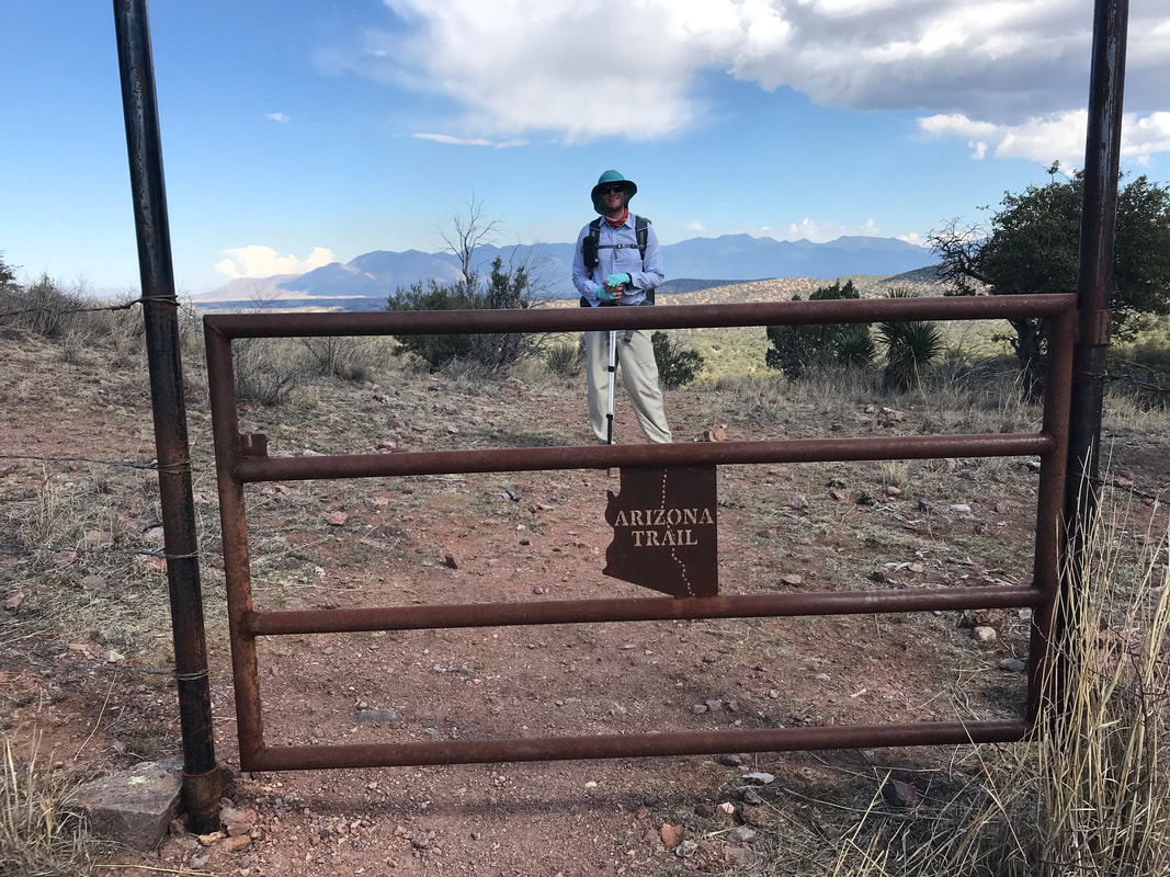
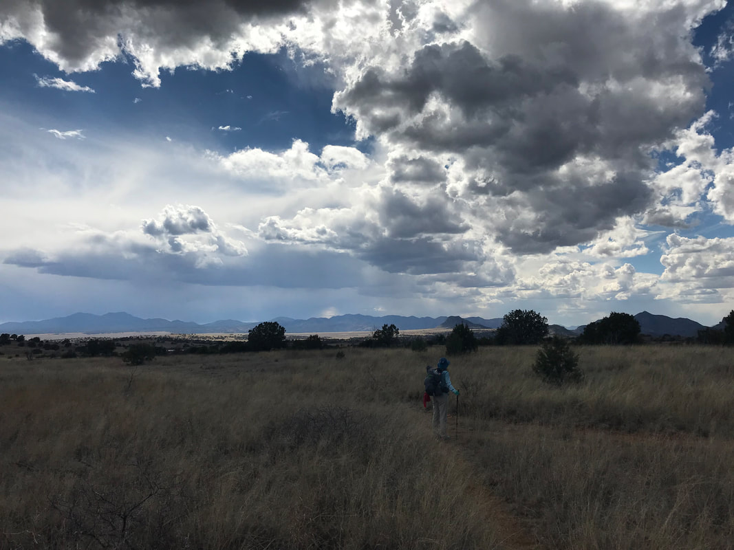
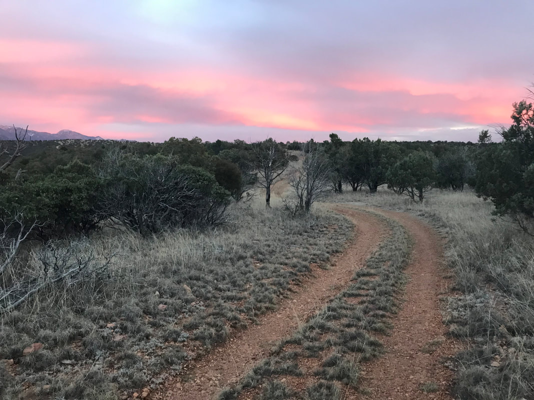
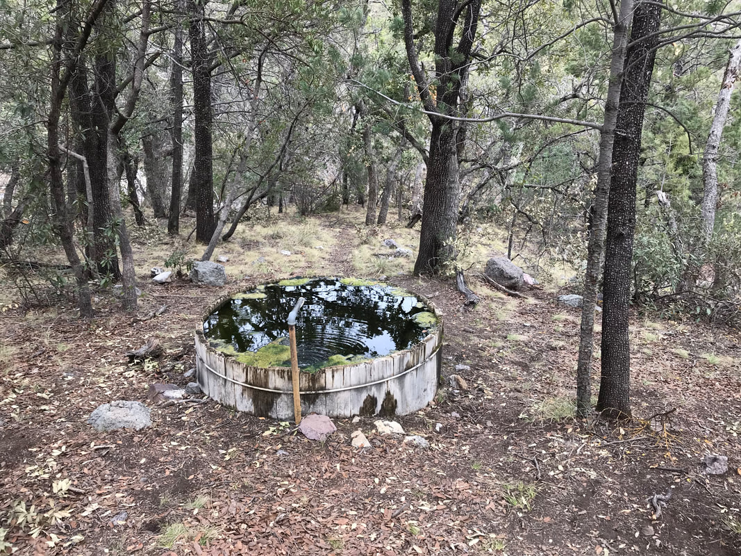
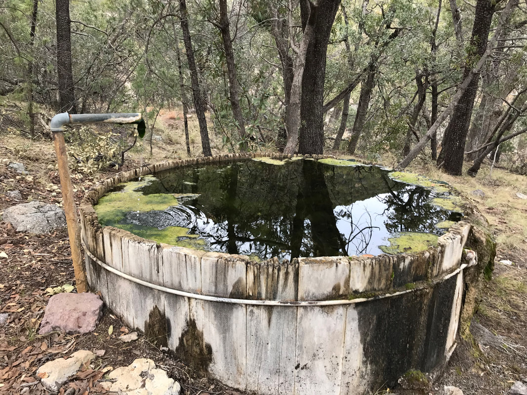
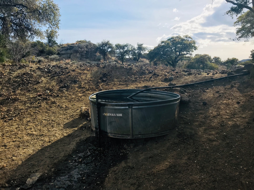
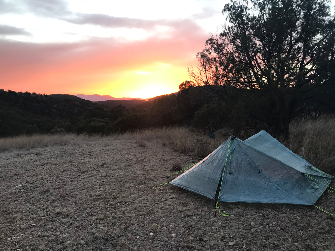
   After closing the gate, my immediate impression of the forthcoming area was sweet grasslands and a gentle descent down towards a canyon; and it was, at first. But as we continued down the canyon and rolling grasslands, more and more cows began popping up and the landscape became more denuded and shit-filled. Grateful for the clouds keeping heat down, we began keeping an eye out for water. Dirt cattle tanks popped up, but the amount of eutrophic algal growth and the opaque brown water with floating cow turds were immediate turn-offs. I suggested we keep going until we find better sources. We passed several cow skulls and the grasslands continued to be overgrazed as woody shoots stood alone, left by the cow crunch. A creek began cascading down from some cow-shit ponds and I contemplated drinking from them…until we passed the massive bloating and half-decayed carcass of a cow body laying half-in the stream. Knowing that all water downstream was now contaminated, we kept pushing. Comments on Guthook indicated a solar-powered cattle tank ahead - our goal for sure. Simultaneously, the thunderheads became increasingly prevalent as lightning/thunder accompanied. Feeling exposed in the grasslands, I felt a panic that made me move quicker. Suddenly, the solar-powered tank was in front of us. Thirsty and anxious, I turned on the irrigation valve from the ground-submerged box but no water came out. The sky was so dark from the imminent storm that not enough light could power the pump. We decided to push on and get to Red Bank Well, another noted solar-powered cattle tank several miles ahead. We entered a narrow wash of a canyon, noting that the trail literally was in the wash or next to it. This was important because we didn’t want to get caught in a flash food if the storm opened up. Lightning began flashing repeatedly. The sky had the appearance of black fish scales. The wash began to broaden out, entering a wide valley where Red Bank Well was. Luckily, enough light was present to produce a trickle of water that flowed from a broken PVC pipe sticking out of the top of the tank. The storm moved ahead of us and then outpaced us as it dissipated with the arrival of evening. Arizona oak thickets stood on an adjacent hill where we found a solid spot to camp for the night. As we ate dinner, the sound of Border Patrol drones filled the dark with noise. The buzz of drones continued through most of the night. However, I felt pumped to get to Patagonia tomorrow because it was a small milestone indicating that my knee was holding up well. 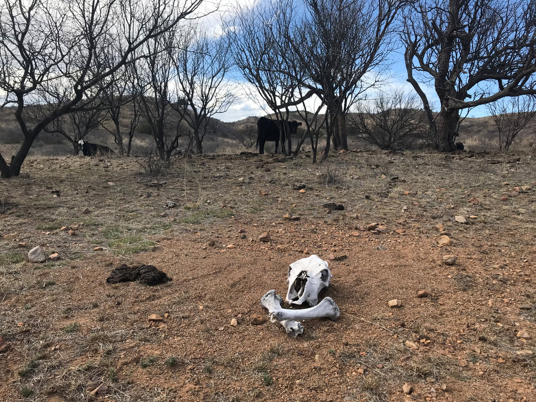 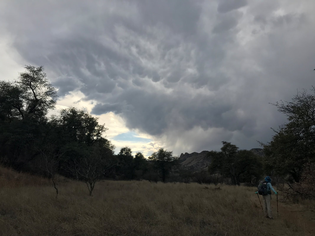
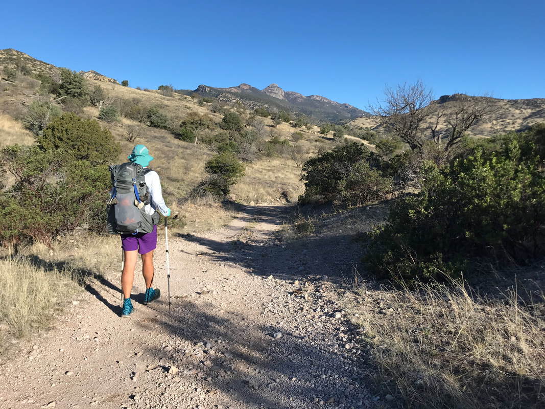
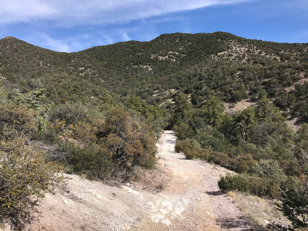
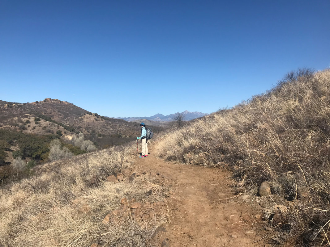
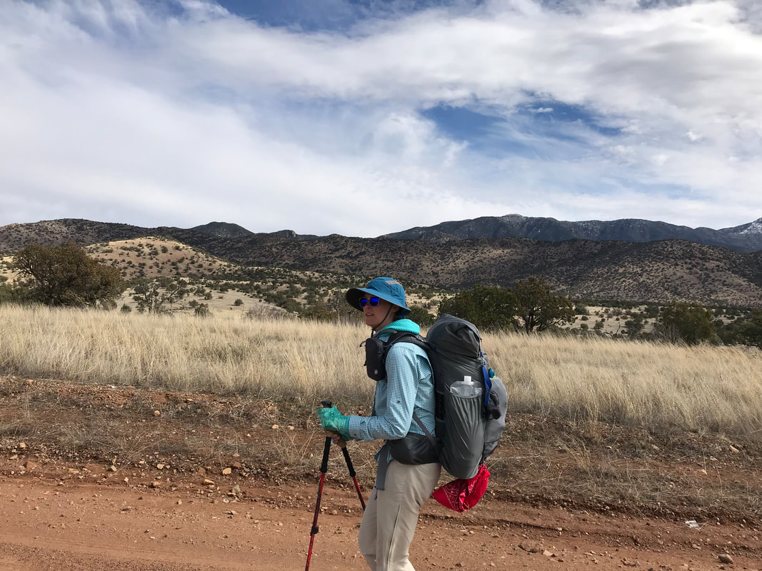
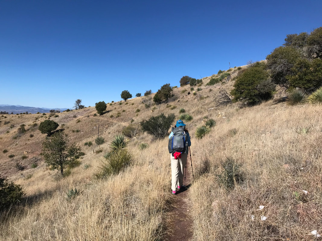
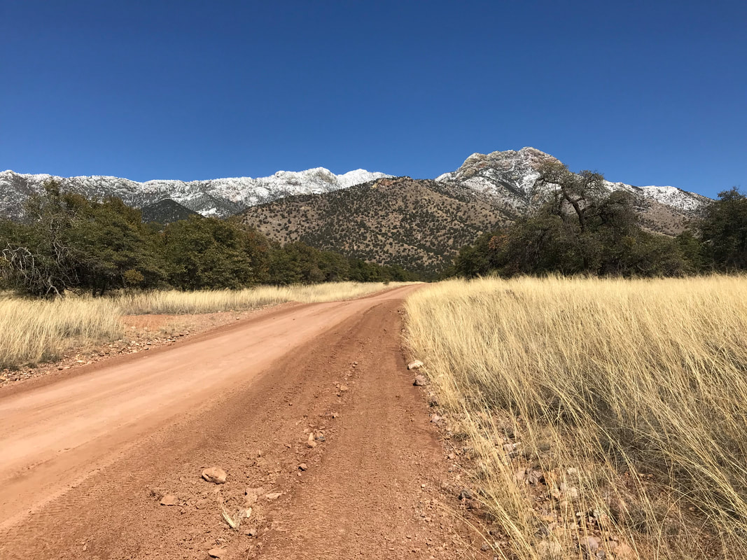
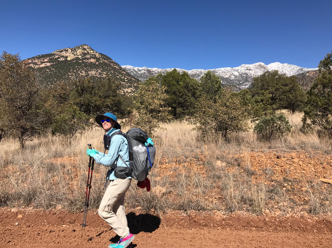
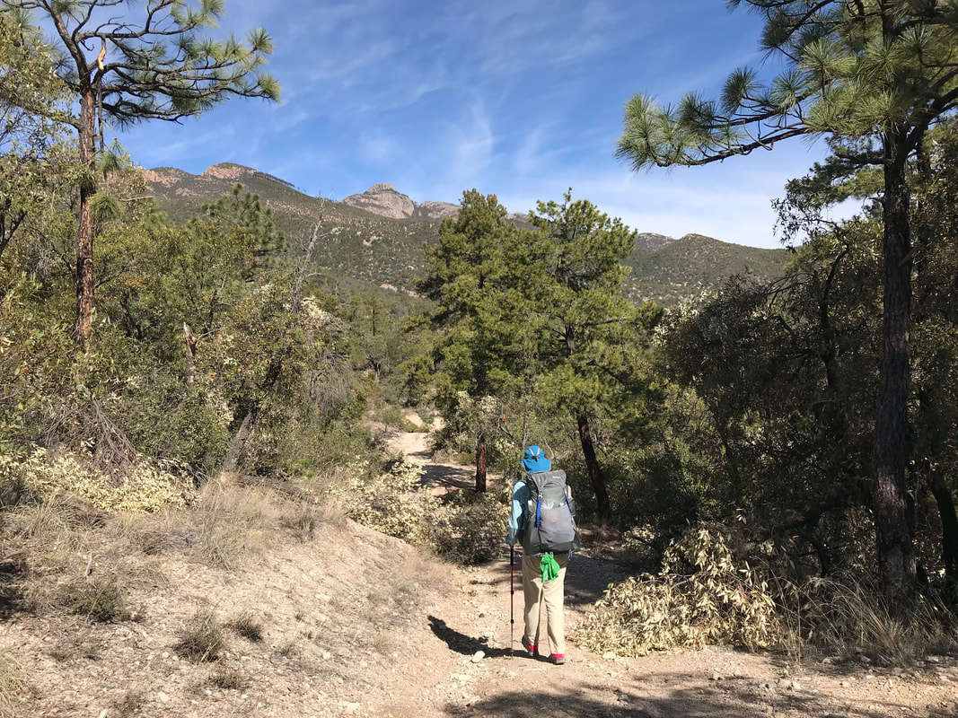
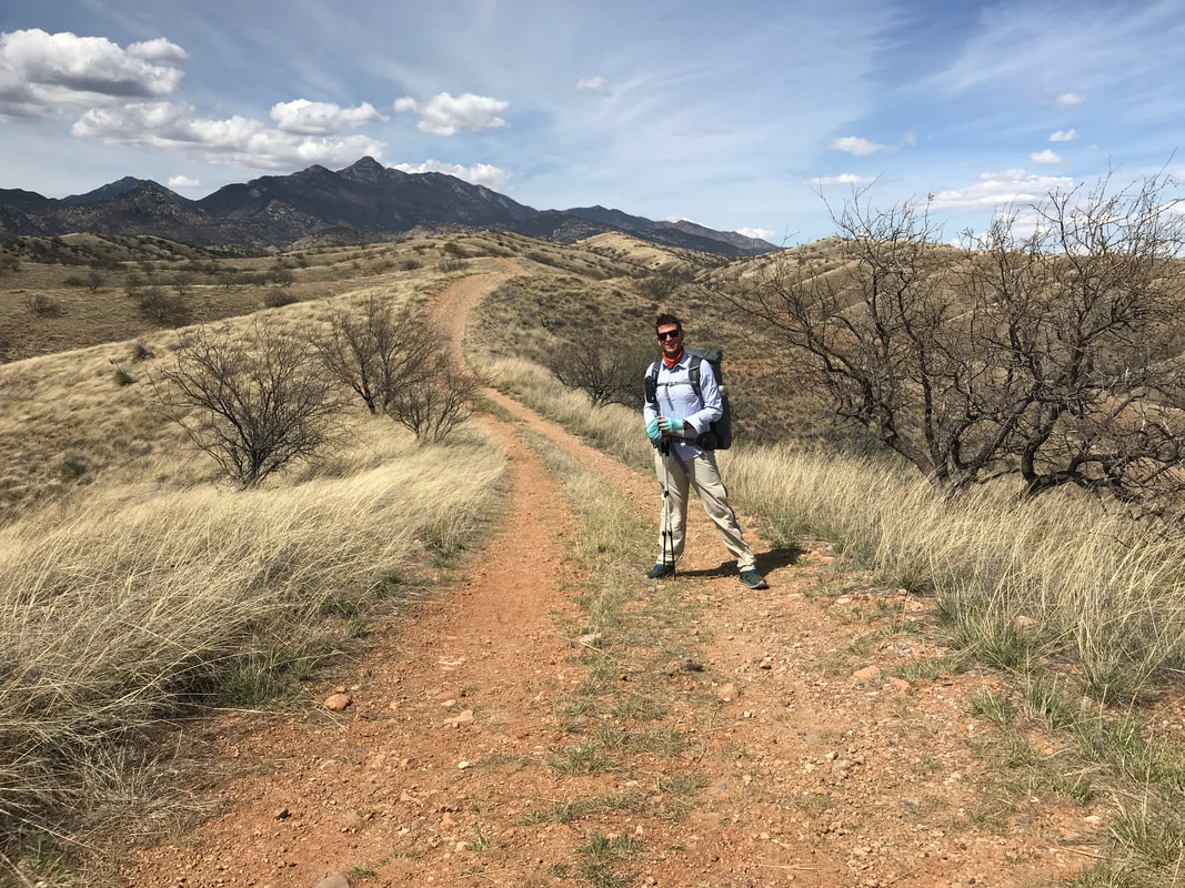
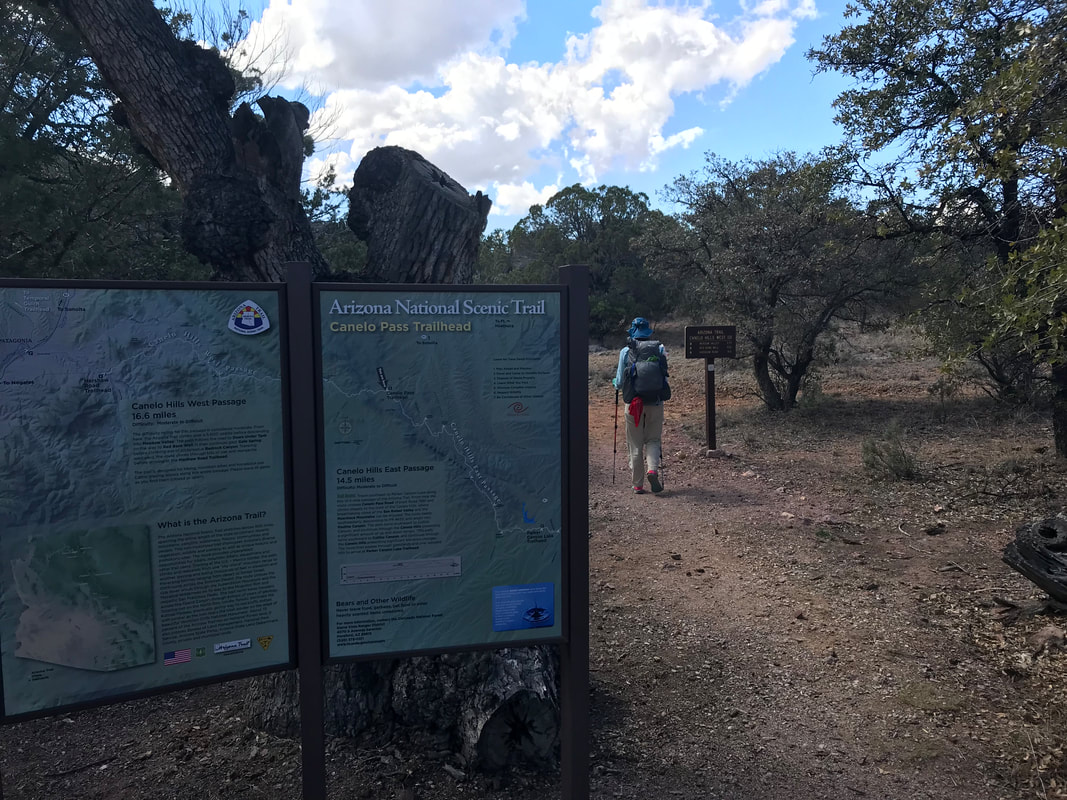
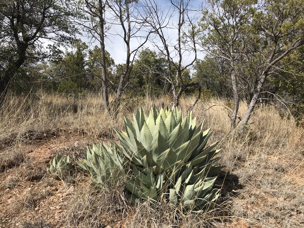
   The lightning storm continued dryly through the night, during which, I climbed out of the triplex to watch. The sky overhead was a smack of Milky Way starlight while a silhouette of cumulus hung over the Huachucas. I freaking love desert night skies. In the morning, after packing up, we casually ascended the rock-studded double track and found the nearby trailhead. The dirt parking lot proved just high enough to receive full LTE reception despite the distant location. Janna and I both called home to check-in with the fam. Finishing a long talk with my parents about the winter conditions on the peaks, I contacted REI and ordered some boxer briefs and insoles to be sent to Patagonia, AZ. I had been wearing Ex-Officio boxer briefs for years and brought along a heavily-used pair which now began to disintegrate on Day 3. Damn. The insoles were more annoying to me as I had been wearing Saucony Xodus Iso shoes for years, using them both for my ultrarunning in the desert and on a previous thru-hike of the John Muir Trail. Yet the arch on my right foot seized with pain in spikes after few minutes. Purchases made, we saw the trail stretch ahead over the Canelo Hills. The Canelo Hills are a series of dry sprawling grassland hills peaked by mesquite and scrub oak. Typically dry, this passage of the AZT was honestly chock-full of water in all the washes following the snowmelt on high. Again, the biodiversity was awesome as stacked into these lower sandwiched ranges were plants such as sycamore, oak, pine, juniper, yucca, cacti, and grass. Fucking amazing. 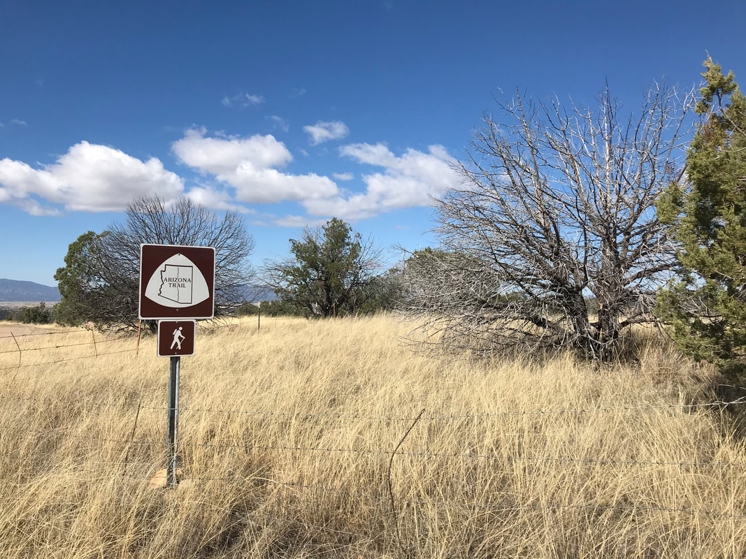
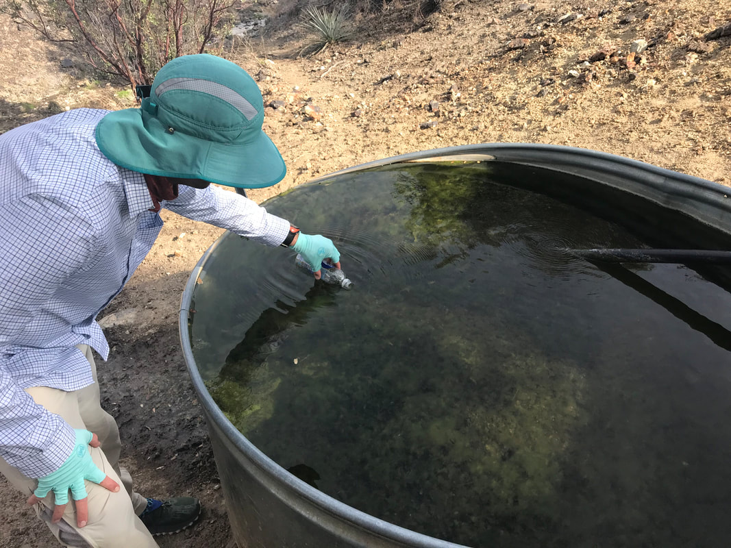
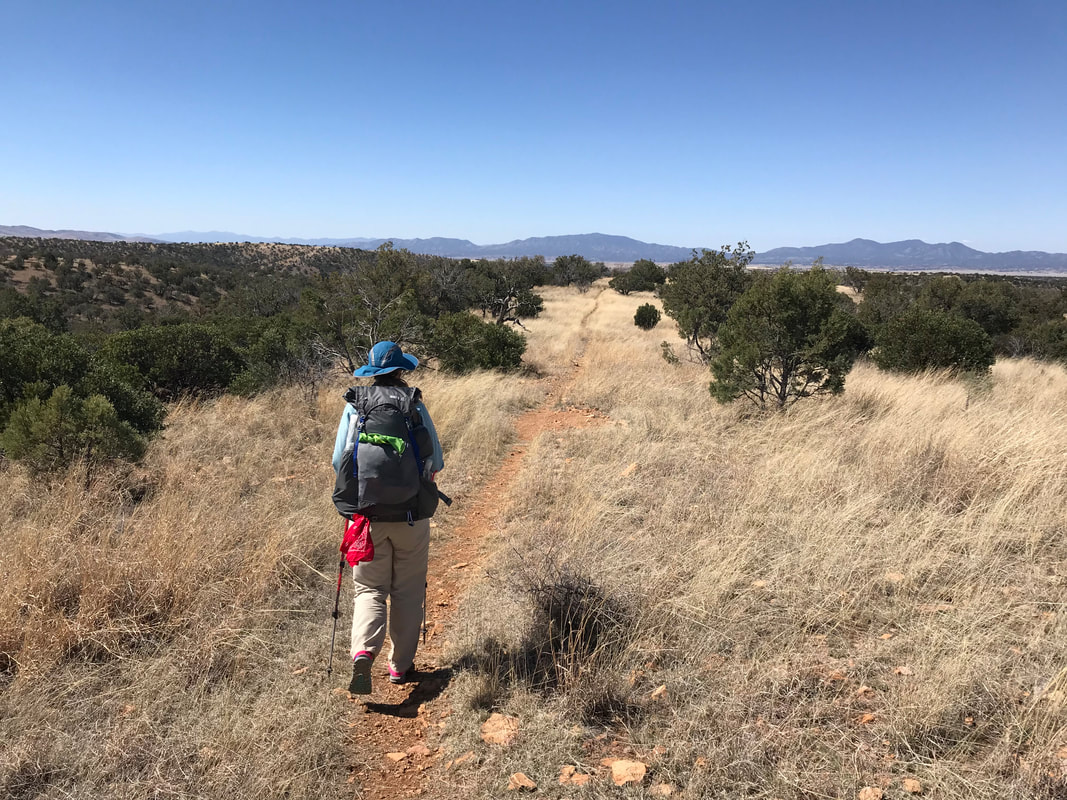
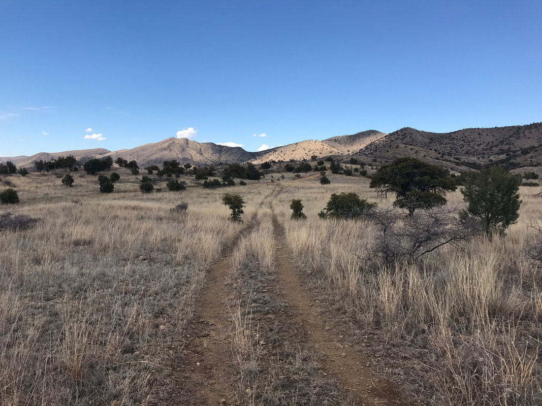
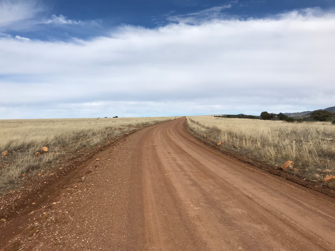
 The day heated up quickly into the low 80s. A thru-hiker caught up to us at our slower rate. Happy Joe turned out to be a triple crowner (completed in the 90s/early 00s) who had a few weeks off from work to come and do the southern 300 miles of the AZT. A great conversationalist, he asked if he could hike with us for a bit - I loved that approach and attitude towards others he had. After about a half hour, he peeled off to continue his faster pace. Before we had left Parker Canyon Lake, we had filled up 4 L of water, unsure of the certainty of water in the hills. We were going fairly slow in an attempt to start the hike with 8-10 mile-ish days that would grow as our muscles conditioned and my knee continued strong. The 4L of water definitely were heavy, but the slower rate meant we wouldn’t hit sources as frequently and necessitated the haul. The light of day hit that sweet golden hour as the golden grass of the hills lit up in later afternoon/evening. After several passes, we started heading downward along an old dirt road following the perimeter of a barbed-wire fence. 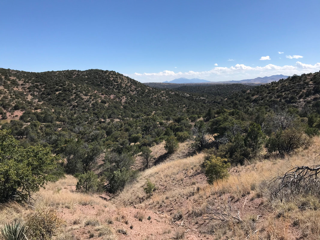 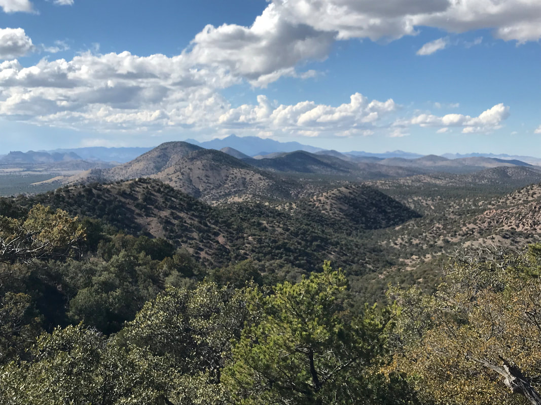 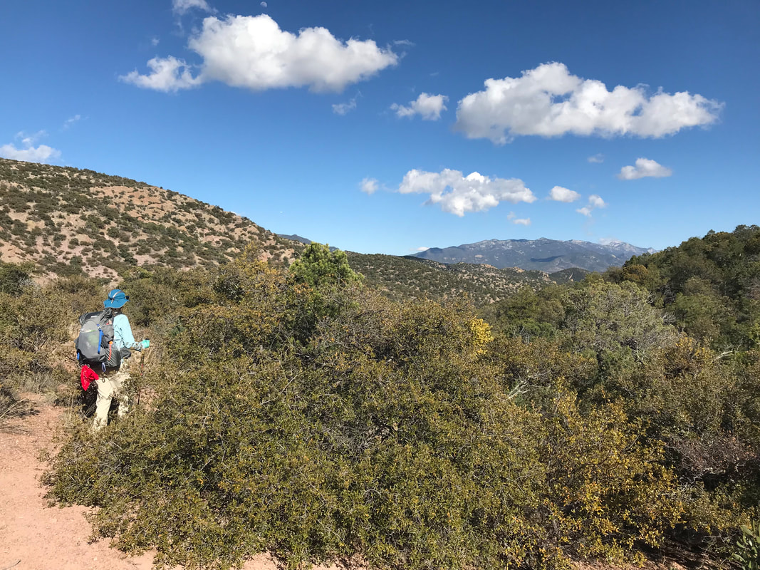 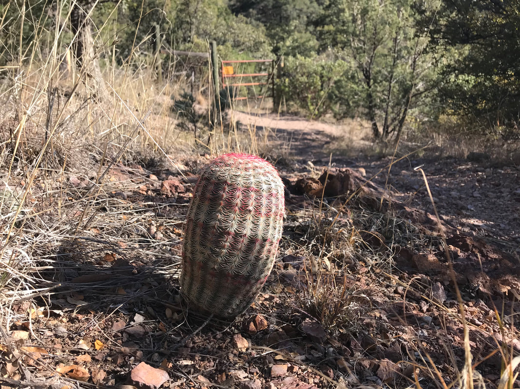 Arriving at the first potential water spot of the evening, it was nothing a giant cattle tank empty with the irrigation control valve switch left on. The second tank had about 6 inches of stagnant and rusty water sitting in the bottom. Luckily, we found a third cattle tank a little further on that was unmarked on Guthook. The inside was filled with wet rust, but an irrigation control valve switch turned out clear and excellent water. We collected what we needed for the night and decided to camp near the dirt road as this was the only area that had a spare area of level ground. Just as the previous night, a huge cumulus storm cluster built up with lightning flashes and drifted towards us. Shoving mouthfuls of cold-soaked beans/rice/tortillas into our mouths, we got into bed just as rain began to fall. The storm proved more electrical than wet as rain ceased pretty quickly. In the middle of the night, Janna started shaking me, asking me what that noise was. I quickly pulled out my earplugs and heard some sort of wildcat screaming and calling while walking back and forth down the dirt road in the dark next to us. Definitely made me hyperawake for a bit. Concluding it was probably a bobcat, I fell back asleep. 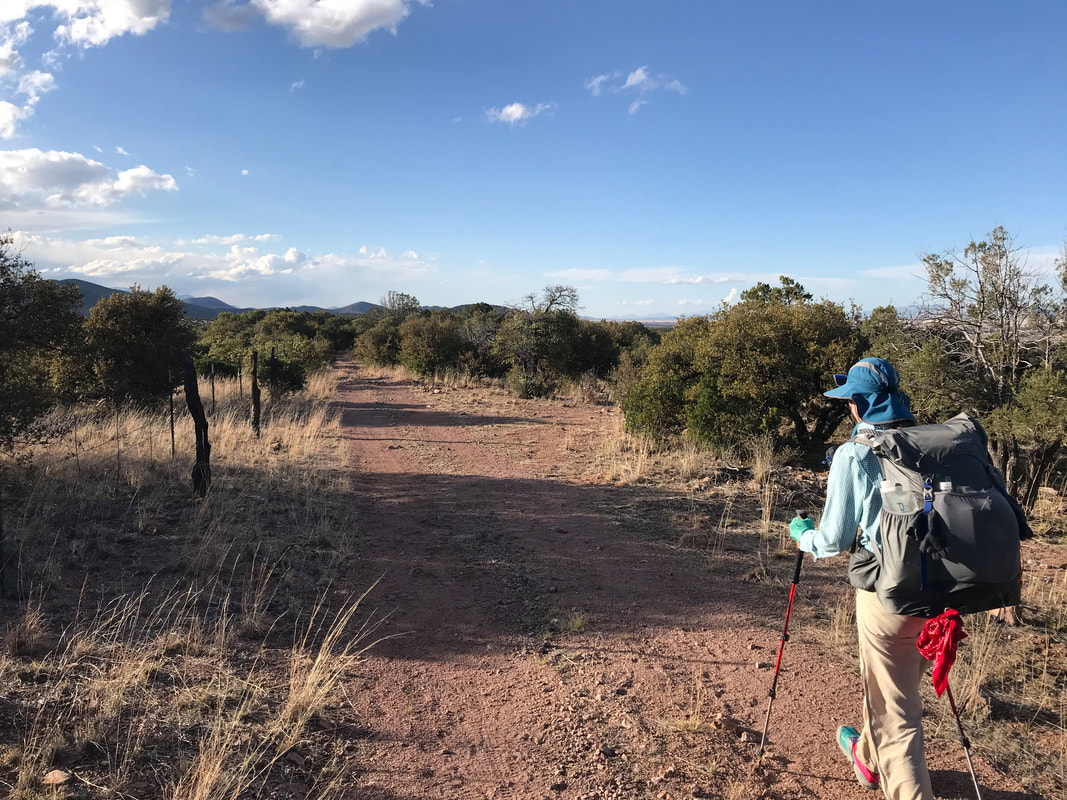 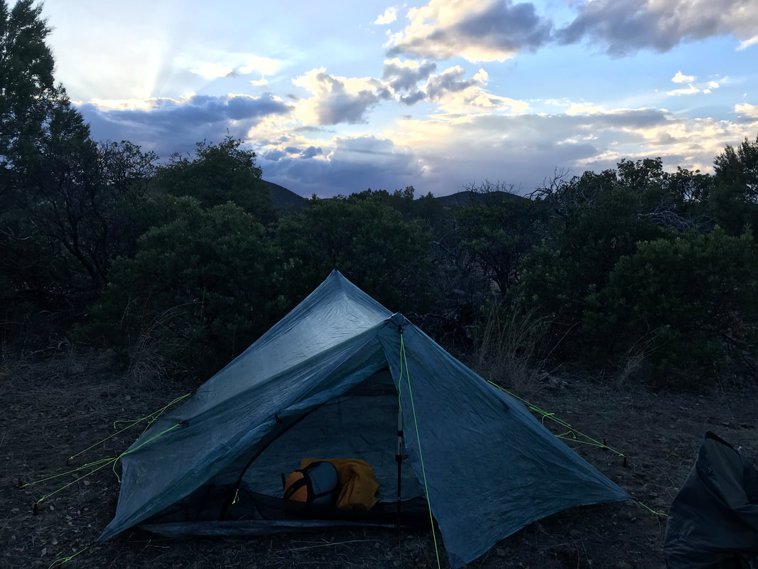 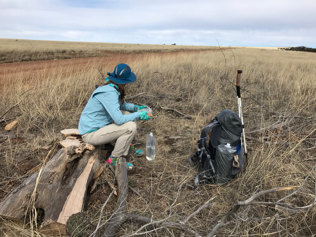 The decision not to summit the official route was reinforced by a night in the upper 20s. Later, after running into several of the AZTers we saw the first day, we learned that the temperature on top had been 10-15 degrees during the night. The first hiker we met said that it was pretty sketchy, but he seemed pleased to have gone up and over. The next two hikers had the wide-eyed disillusionment of a child opening a gift only to receive shit. They were pretty shaken by the experience and said that snow was knee-deep at least, there was a complete lack of visible trail, that descending was steep and slick, and that all the hikers seemed to be following each other out of sheer desperation to not get lost in the winter conditions on top. Asked whether they would go back on top they firmly reiterated NO. We ate and got walking quickly to get our metabolic engines going in the morning cold. The forest road continued in front of us, rolling over several small hills while Border Patrol infrared towers and stations dotted the horizon. The grasslands continued their freaking gorgeous sways as we essentially walked west right along the border with equally beautiful views of Mexico stretching out to our south. 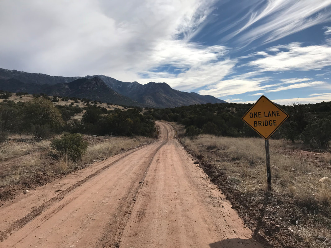 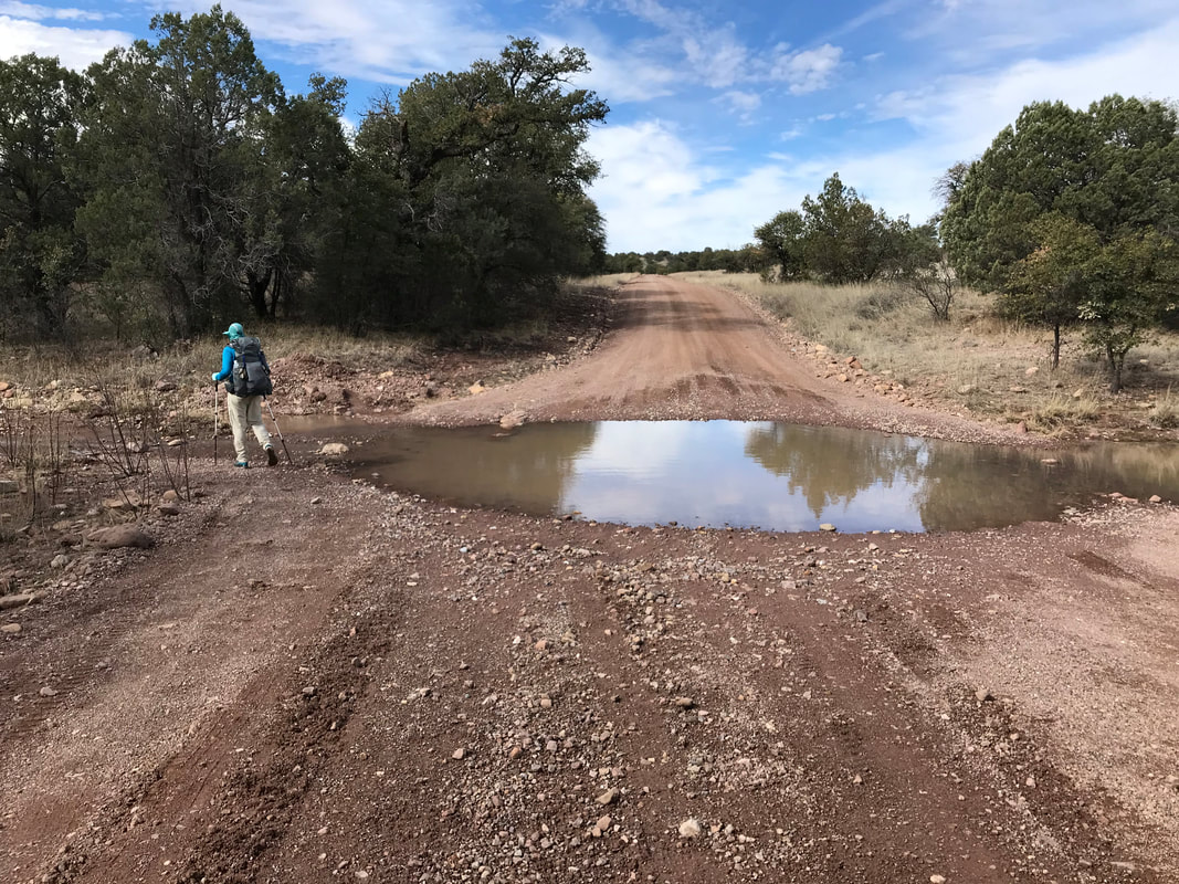
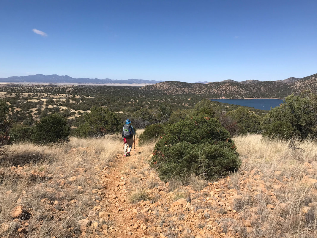
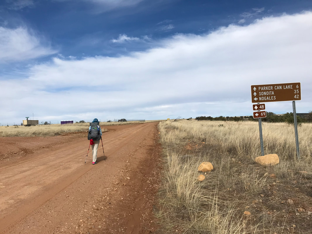
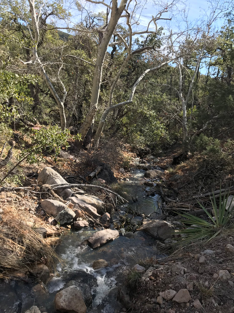
   The alternate road walk continued to meander along the contours of the Huachucas before curving northward and intersecting with the official AZT. The road was saturated with rapid snowmelt and water continued to flow in what would usually be dead washes, meaning water carries were easy all day. The road eventually crescendoed up a plain, gradually leveling out while a spiderweb of intersections ringed out dirt roads to Nogales and beyond. I made a mental note to return here and gravel grind after the trail. As the day continued, temperatures ran high and my feet began to swell. The arch under my right foot seriously began to hurt and I pulled out my insole to relieve the pressure around midday. The road turned north to intersect with the AZT in a stunning sycamore and oak canyon where water ran clear and cold over fallen red leaves. I stopped and just felt completely absorbed by the biodiversity present in Arizona - he we were, sitting at the intersection of a mountain range, riparian canyon, and high grassland. Hummingbirds fresh north from Mexico flitted through the shade and ferns sprouted near rock crevices. The trail traced the creek flow for several miles before making a hairpin adjustment and sauntering south again. Mid-afternoon, we approached Parker Canyon Lake, a reservoir set in the western haunches of the Huachucas. It held spectacular scenery with the mountain backdrop providing border to a framed water/grass interface. 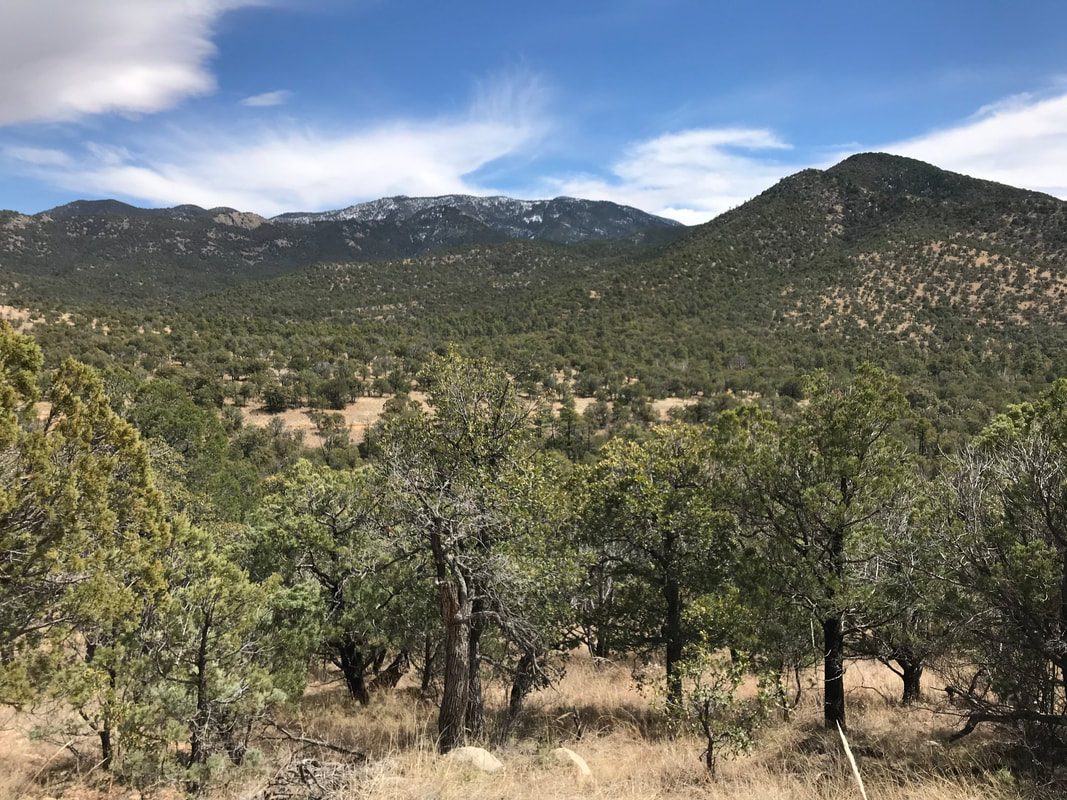
     Taking note from Guthook (an app that covers many long trails in the US and abroad), we climbed through a fenced double track that descended towards the lake. Simultaneously, my head began an explosion in a full-on migraine. I literally found myself stumbling down the hill, going blind in my left eye, and eventually just sitting in the shade. It was necessary to continue descending to the lake because it was our only sure water source for the night and morning, but we were unsure of where to camp. The surrounding area was now steep, rock-chocked, and uninviting to a good night’s sleep. I took ibuprofen before continuing down the long double-track to the lake. With each step, nausea swept up my core and I tipped towards the ground in a dry-heave. Janna hiked ahead to scout a good place to camp and found an easy descent to the lake. Further from the water, we found a solid camp spot situated on a rise that provided 180 degrees of amazing views. As the heat of the day subsided with the arrival of evening, the cool temps and pain killers successfully eradicated my migraine. Pain abated, we made dinner with tortillas and cold-soaked lentils and mashed potatoes with hot sauce. Feeling so much better, we walked further down the double-track to explore. One of the best sunsets I had ever seen widened over the lake and mountain range. Later in bed, a massive dry lightning/electrical storm opened up over the Huachucas and the lake, lighting up the inside of the Triplex with white and pink flashes throughout most of the night. 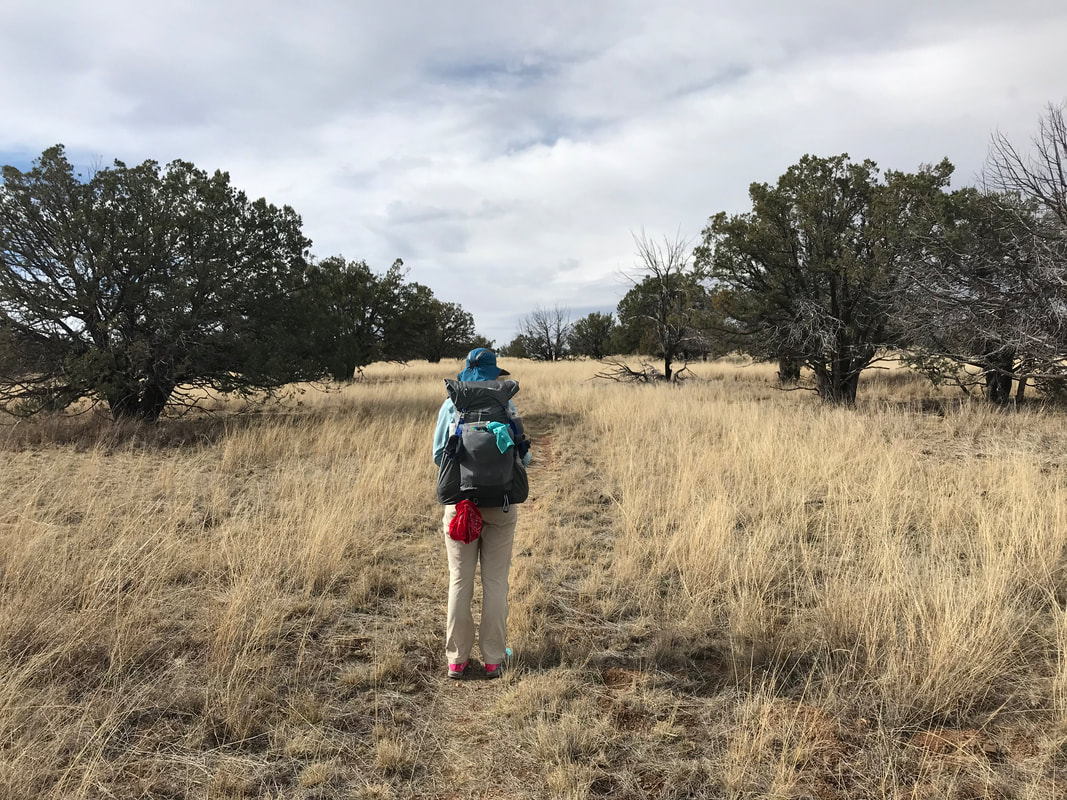 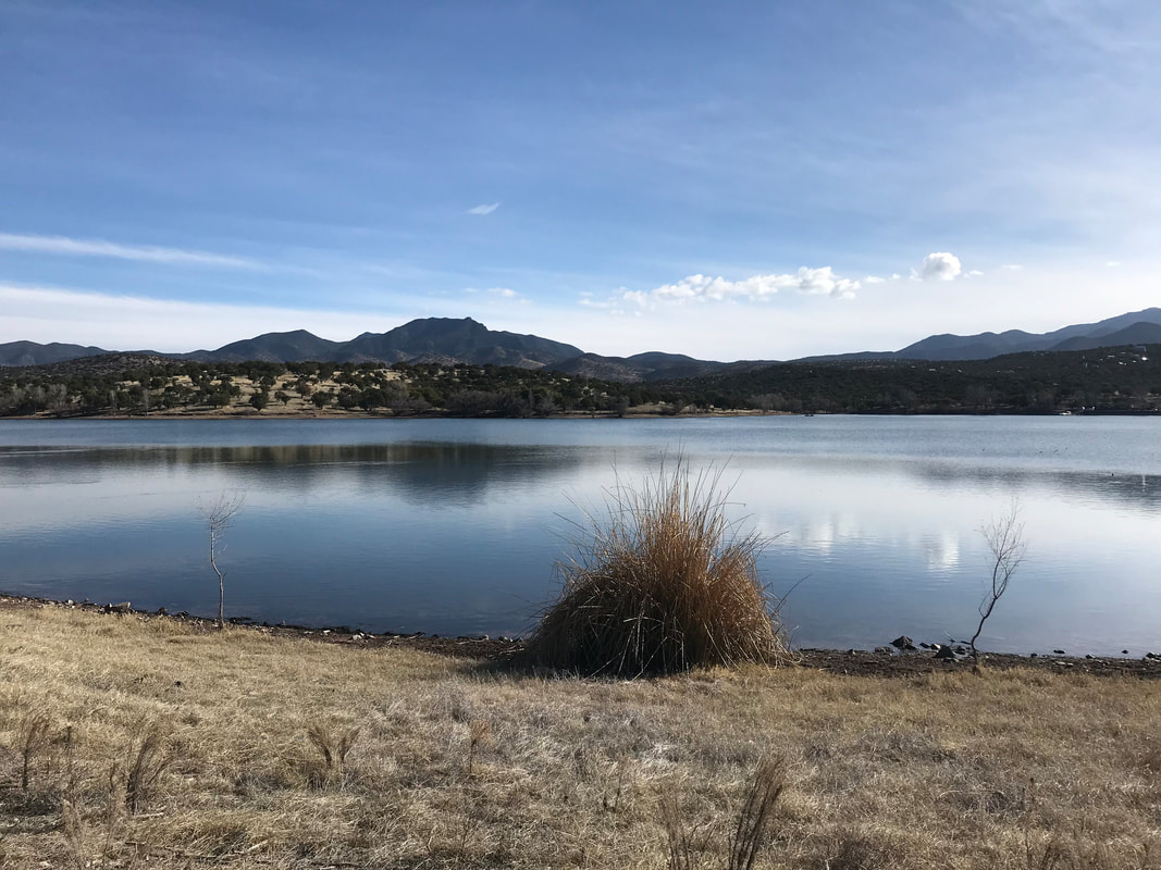
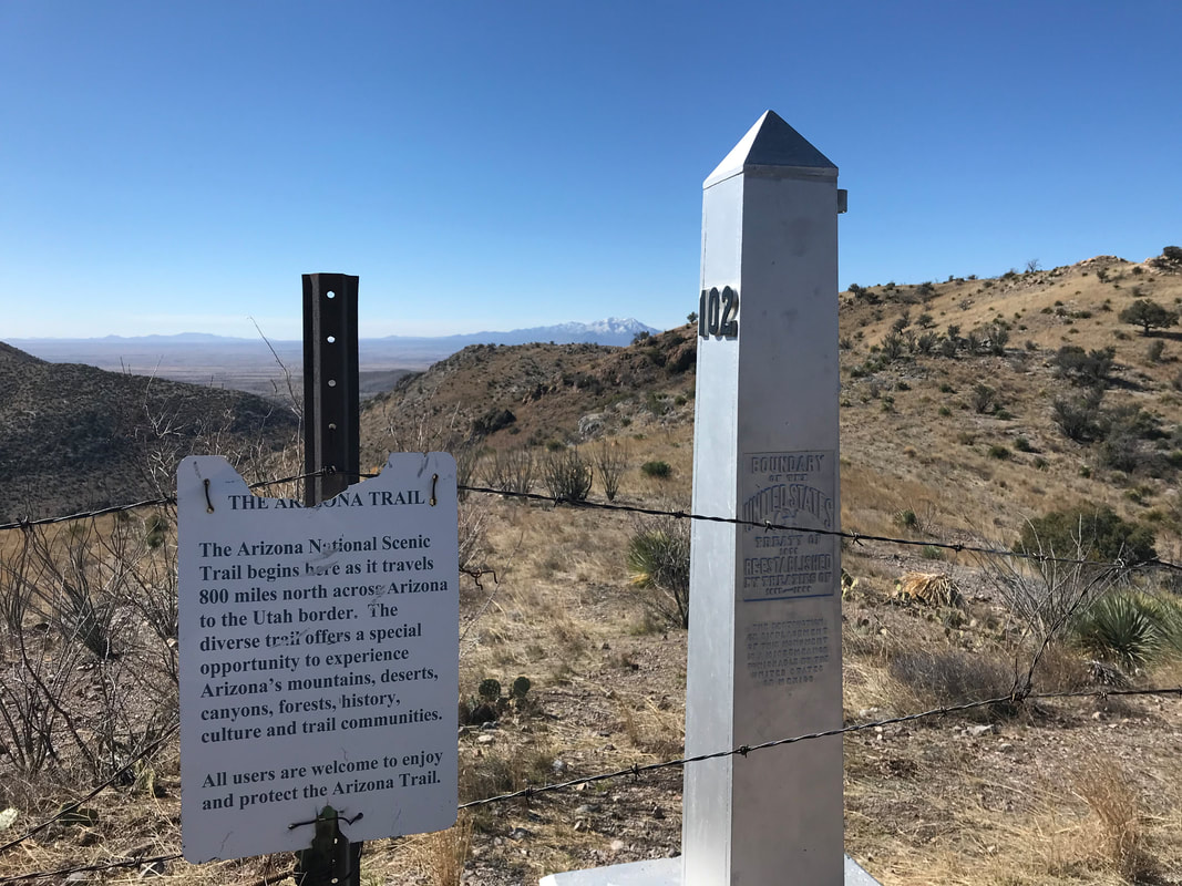
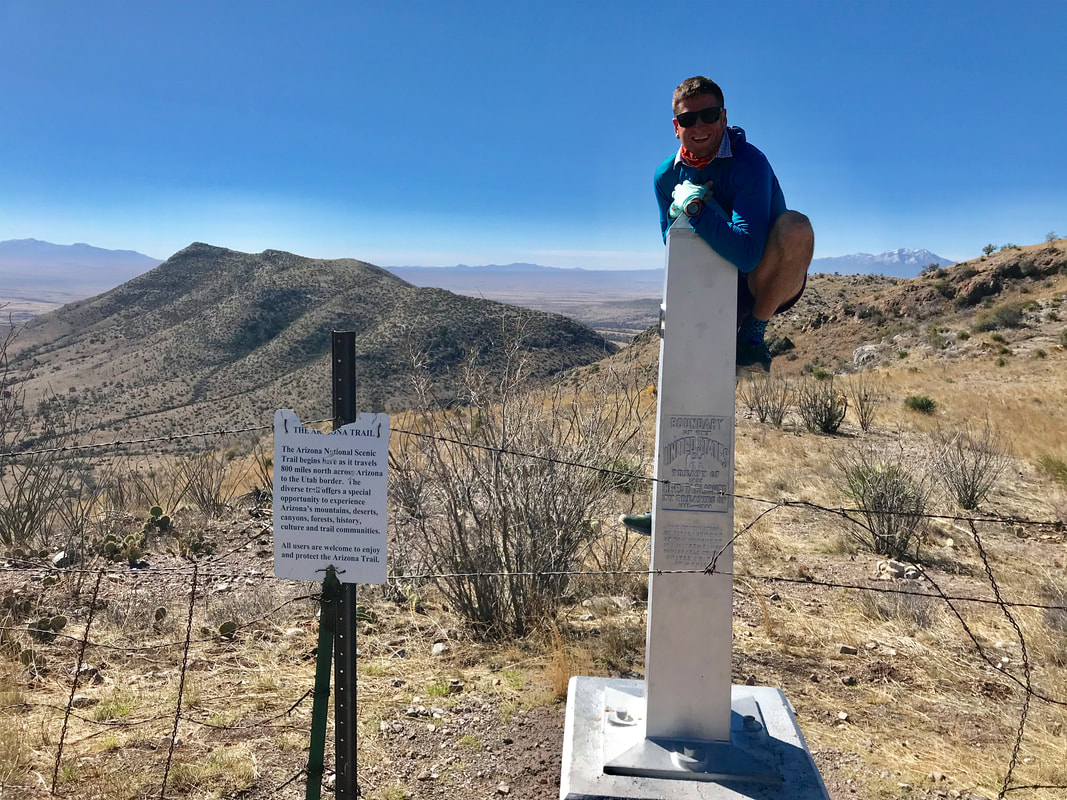
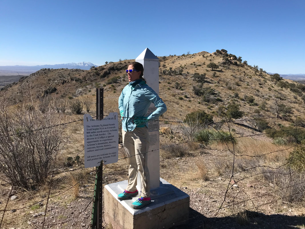
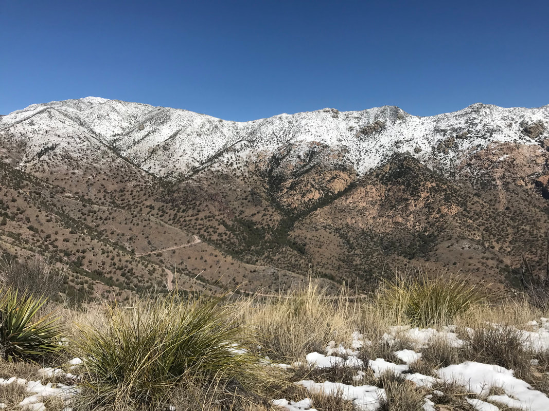
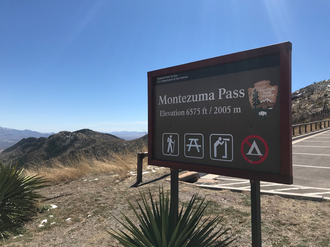
  Although we planned to start the Arizona Trail on March 12, winter storm Ulmar slammed into Arizona for three solid days beginning March 11. Sitting at home with gear collected and plans unfurled, we decided to forgo our original start and move it to Wednesday, March 13. Ulmar continued to cover most of the state in snow from north to south along every mountain spine, even making the rare appearance of ground-fluff in parts of Phoenix. Typically, I would be floored for such a difference in weather. I would wake early and draw myself to the mountains for rarities as frozen precip in the desert. This moment, however, was marked by strong anxiety. I felt an unhinged fear that crept, beginning as doubt in my knee pain and spreading to my mind, as a fear of never starting never completing. As Ulmar cycled out of AZ, its tailwinds continued to pummel southern sky islands on the morning of March 13. Convicted, I decided this would not hold us back. Catching a ride with our friend Colleen, Janna and I threw our gear in her car and began the ride down to the border. The highway stretched across the flat tope basins as opposing ranges remained obscured by storm clouds on high. Approaching the Santa Catalinas outside Tucson, visibility of the peaks remained only for the bottom quarter of each mountain. High wind advisories continued to beckon from the weather app on my phone as I increasingly fell in with hesitation once more. I scanned every thread of information I could find on conditions in the Huachucas, our first range and the start of the AZT at the border. Mountain Forecast indicated any elevation 8,000 ft. and above would face winds 40-50 mph with gusts up to 60/70 mph. Elevation from there and above had received 18+ inches of snowfall on top of the foot or two of snowpack already present. Pulling into Sierra Vista, staring at the Huachucas, it was like a winter hurricane was slicking the peaks. Colleen drove us to the entrance of Coronado National Memorial on the southwest edge of the range. We jumped out of the car for the requisite photo at the park boundary entrance. I know it doesn’t look like much in the picture above, but the winds were driving a solid horizontal rain that coated one side of the car in sleet and left the lee of the vehicle dry to the touch. Colleen said we were crazy. Arriving at the visitor center, my risk management went into play. Much to my surprise, Janna was all about starting. I just couldn’t balance the weight of my knee injury with the reality of a 4,000 ft. ascent into a winter storm warning. Hell no. Persuaded by reason, we had Colleen drive us to a motel in Sierra Vista to wait one more day. Securing early check-in, we lay in bed hashing out logistics for tomorrow. Post-confirming a shuttle to take us to the park and discovering that the park provides transit to the saddle where the AZT can be accessed, we spent the rest of the day walking around town grabbing food and ruminating on the hand of god laying waste to the mountain. Dusk crept edgily along the Borderlands as frost dropped in altitude, and the mountain continued to be smeared by a white mass of fury. Waking the next day brought a new world of change to the peaks. Morning revealed that the siege of cumulus from the previous night was completely gone. It seemed incredible that such a storm that seemed unwilling to move from its perch had so quickly and perfectly vacated. The air was steady still. Every pine on the mountain was visible from the city. They sat high, frosted in a blanche crust that made their every detail discernible from afar. Pumped, we ran to grab some free continental breakfast before our shuttle picked us up and dropped us at the Coronado National Memorial again, around 8 am. We grabbed two free spots on the park shuttle and sat back as we were carried to the saddle at Montezuma’s Pass. 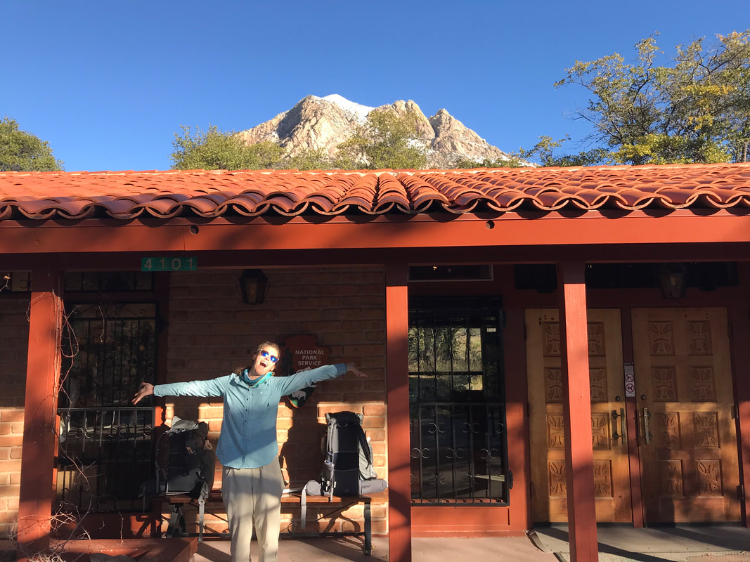 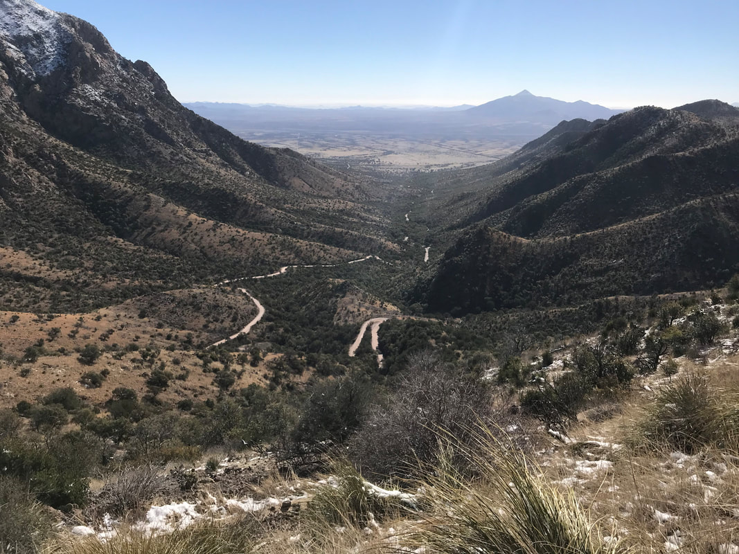 The pass provided incredible views. To the north, a flank of the range was dressed in white with a defining presence where the freezing line fell. To our south, Mexico spread out before us with its own abundance of sky islands dotting the high grasslands, each capped in snow chain linked to the Sierra Madre. A recent prescribed burn in the park made the remaining grass stand in contrast - gold upon black. And there was a huge bottleneck of thru-hikers beginning the trail. It seemed that many AZTers had been stopped by the storm; now, they were scrambling to begin later than intended. The southern terminus of the AZT can’t be reached via a direct drive and is instead reached by descending several miles of switchback to the border fence, which, in this rugged corner of southern AZ, exists as barbed wire. The terminus exists officially as a border monument. We hopped the barbed wire to take photos from Border Monument 102 before turning around and climbing back up the range to the saddle once more. The whole time, the views blew my mind as the high Sonoran desert grasslands, filled with cacti and mesquite, stood mottled with large ranges and their snow-packed-peaks. Simply incredible to see. 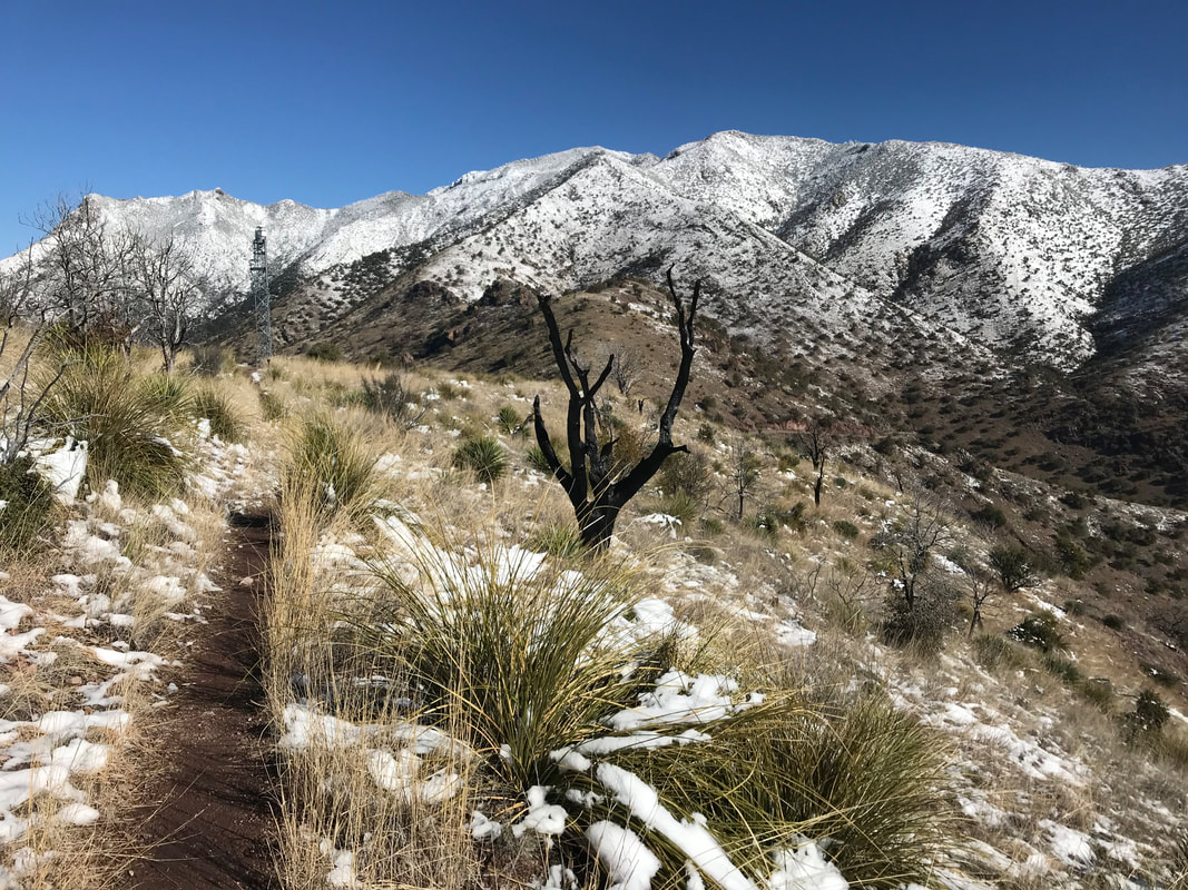 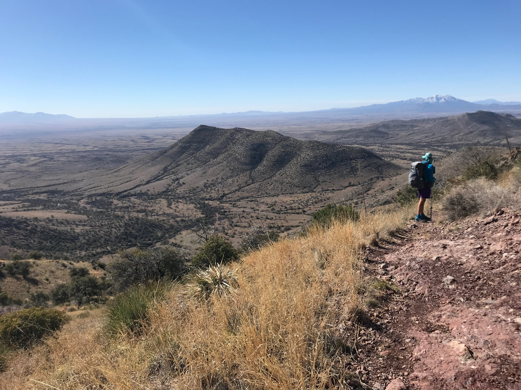
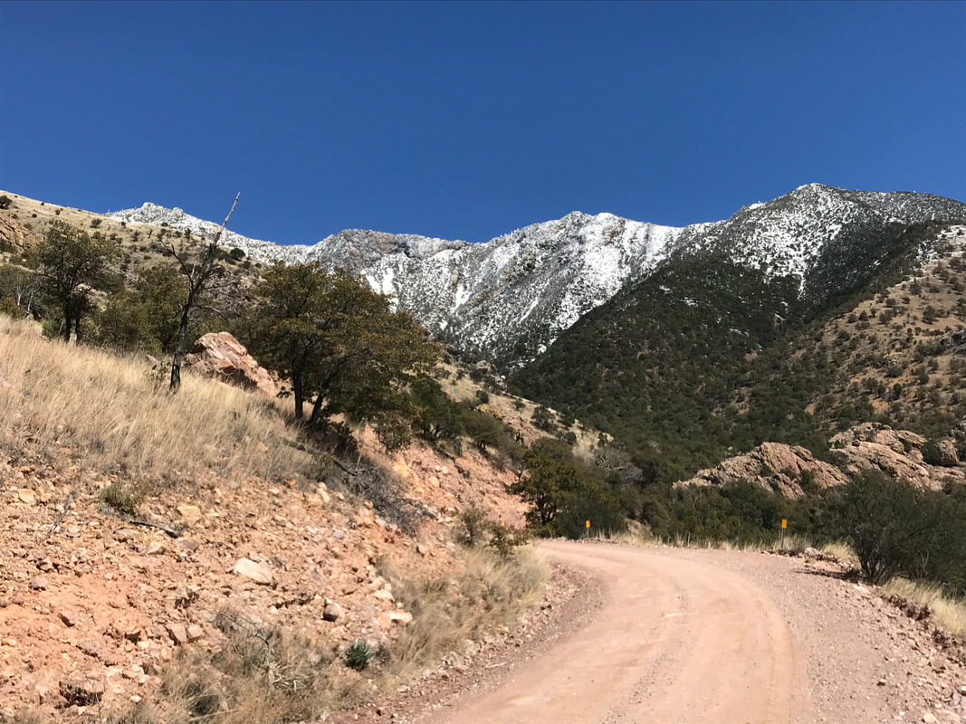
    Returning to the pass, we sat at a picnic table and contemplated next moves. Nearly every thru-hiker we passed indicated they were ascending the range with conviction, regardless of conditions. Speaking with some rangers, they seemed less convinced that this was the course of action to follow, saying that that it was doable but that the trail was likely completely invisible under several feet of snow. Considering this was Day 1 and we had not yet built the necessary muscle support that would come later with miles for my knee, we decided to take the AZT Mountain Bike Alternate down a dirt forest road that lay swaddled between the Huachucas and the border fence. When we made the decision, Janna and I committed to the idea that there would be no regrets by deviating from the purist route. And later that would prove to be a decision reinforced as best. We lost elevation until we returned to the range below. The sawback range remained on our north, studded with snow quickly melting. The only listed water source was Bear Creek Canyon several miles ahead but every wash normally dry held a steady stream of water. The views continued to drive our walk forward and I got stoked as a coati walked across the road right in front of us. As spring evening quickly arrived with dusk coating the sky around 5 pm, we found a solid set of camping sites near the road. We ate dinner as temperatures began to plunge into the low 30s. Another AZTer came down the road in the twilight, letting us know that he had also decided to take the alternate after learning that conditions on top were so bad that SAR had to be contacted for a helicopter rescue.
 One of the things I most love about life is its spontaneity. Give an inch of time and watch life fold in on you and make creases you could have never dreamed. Give life a foot and you feel what the oldest trees do - that growth is tenuous but pushing. It’s been six years since the New Years that brought 2013. 2013 entered while I lay in a hotel room outside of the Sierra Nevada. The morning was spent falling in love with Death Valley National Park, a place I had no expectations for. But that evening was all about my inner world. I lay in bed and thought about what I wanted from life. Complacency and convenience had clouded my life with the threat of that goal: comfort. I had put on considerable weight, the trip represented my first earnest foray outside in some time, and the strength of my integrity to live purposefully had waned with the cold season. Stock blocks of unease lay crumpled in my mind. And for me, that’s a cause to look inward. I thought about the things I had desired in middle school - hiking the Appalachian Trail. Exploring endlessly. Being a guest to the outdoors. Things yearned for nondescript. The scale of light triggers photosynthesis or its ceasing. The scale of a mind juxtaposing current with antecedent ensures change or remorse. I chose change. Laid down by size, I scaled up a series of outdoor plans that would be encapsulated by the next. First year I would do the Great Ohio Bicycle Adventure across the state and complete my first century ride. Year two would involve a self-supported bicycle tour from Vancouver, British Columbia to the border of Mexico south of San Diego on the Pacific Coast Highway. Thru-hiking the John Muir Trail and climbing Half Dome would be year three. Year four would the big one - a thru-hike of the Appalachian Trail. All activities building on each other. Experience and endurance culminating to the next step while I put in hours during the year to lose weight. Timelines are always drawn linear, but mine managed to split reckless at times. I managed to smash my body in a mountain bike accident in March of 2013, got hit by a car on our bicycle tour in California in 2015, and then in January 2017 I split my patellar tendon open in an ultramarathon race. These were fucking frustrating moments. As stated, the unpredictability of life will draw down creases that I, at least, never imagine. The length of my timeline spread in latitude, but it managed to include goals I didn’t know I craved until they sprung: getting back into mountain biking, taking up gravel grinding, attending a NOLS backpacking/rock climbing course in the Wind River Range, bicycle touring the Olympic Peninsula, embracing the importance and meaning of teaching environmental science, and finding that deep meaning of loving humanity by being an educator. The pain in my knee from compounded endurance efforts (precipitating with the ultramarathon) has been emotionally erosive at times. Despite this, I seek times in what could be called the Extraordinary World. The Ordinary World is the straight-lined concrete of sidewalks and calked-lined showers. It is the influential hand of humanity. It absolutely has meaning. But it is the domain of the everyday and therefore the Ordinary World. The wild spaces, soiled or untrammeled, constitute the Extraordinary World - the place I leave and recognize I did not get enough of. The place of extended visits that never count toward overstaying. If something gives you meaning, let fire light your movements to it. And this is where I find myself now. After the rules of life have subsided and my plans have fruited or rusted, I am now preparing to hike the Arizona Trail. We plan on starting at the border at Coronado National Memorial. The original plan was to begin today, but when you wake up and see this warning: “Winter Storm Warning from MON 8:00 PM MST until TUE 8:00 PM MST…WINTER STORM WARNING REMAINS IN EFFECT FROM 8 PM THIS EVENING TO 8 PM MST TUESDAY ABOVE 6500 FEET… * WHAT…Heavy snow. Total snow accumulations of 8 to 18 inches expected, with localized higher amounts on the mountain peaks. * WHERE…Galiuro and Pinaleno Mountains, Chiricahua Mountains, Dragoon and Mule and Huachuca and Santa Rita Mountains and Catalina and Rincon Mountains. * WHEN…8 PM today to 8 PM Tuesday. * ADDITIONAL DETAILS…Look for significant reductions in visibility at times. PRECAUTIONARY/PREPAREDNESS ACTIONS… A Winter Storm Warning means heavy snow accumulations are expected. Gusty winds and blowing snow are also possible. This will make travel very difficult or impossible…especially in the mountains.” 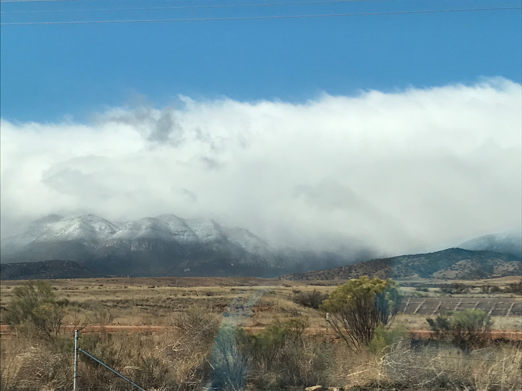 Considering that our first site tonight is around 8,000 feet, we decided to forgo immediate mountaineering conditions for a few days. Thus, the start of our thru-hike will begin on Thursday, March 14. Considering the state of my knee, I harbor no certainty about the how far we will make it. 50 miles to Patagonia? –> most certainly. All the way to Oracle and on to Phoenix? –> hopefully. All the way to Utah at Vermillion Cliffs National Monument? –> man I hope so. The only way to know is to begin. And that’s how life is. Give life an inch and it begins to fold. I choose to begin with that inch. 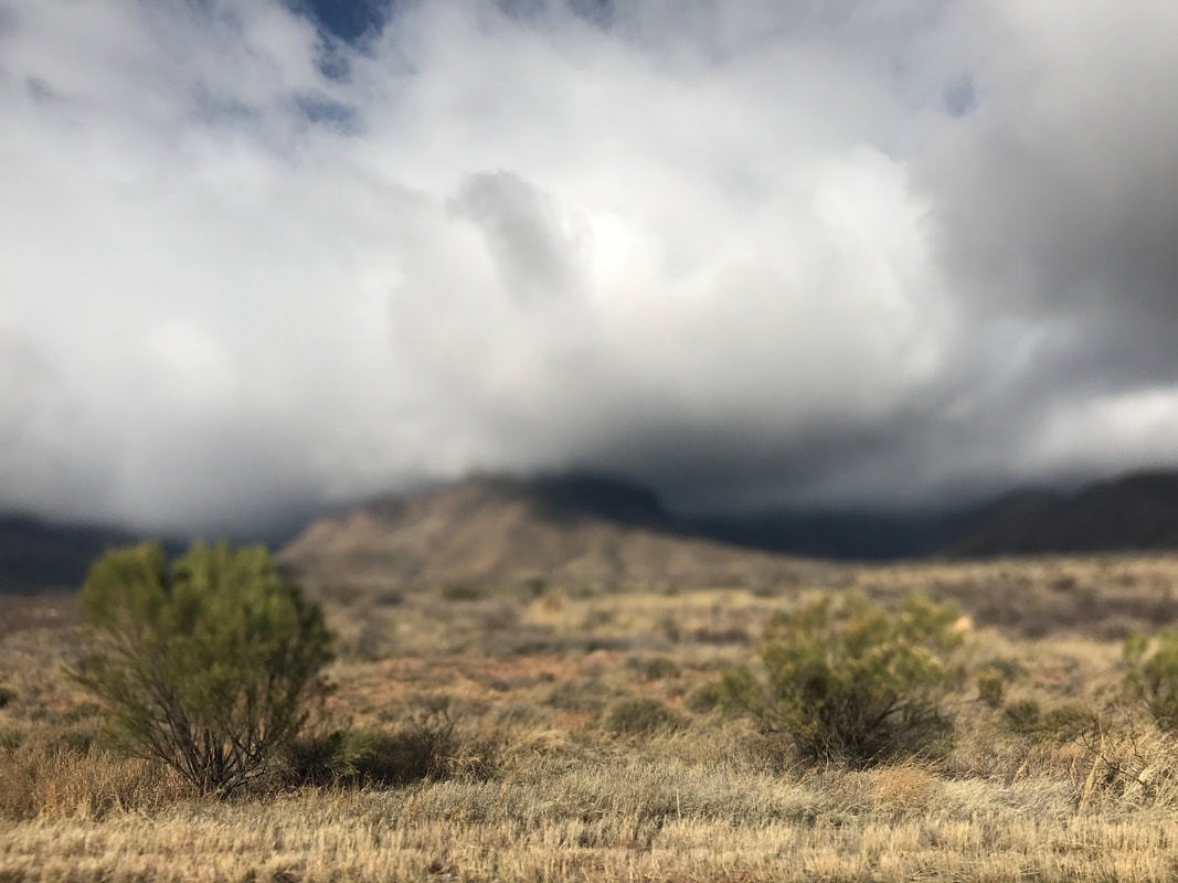 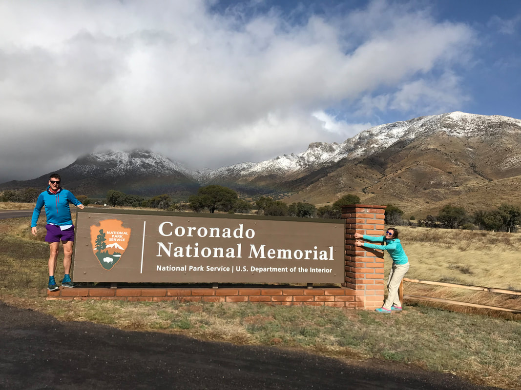 |