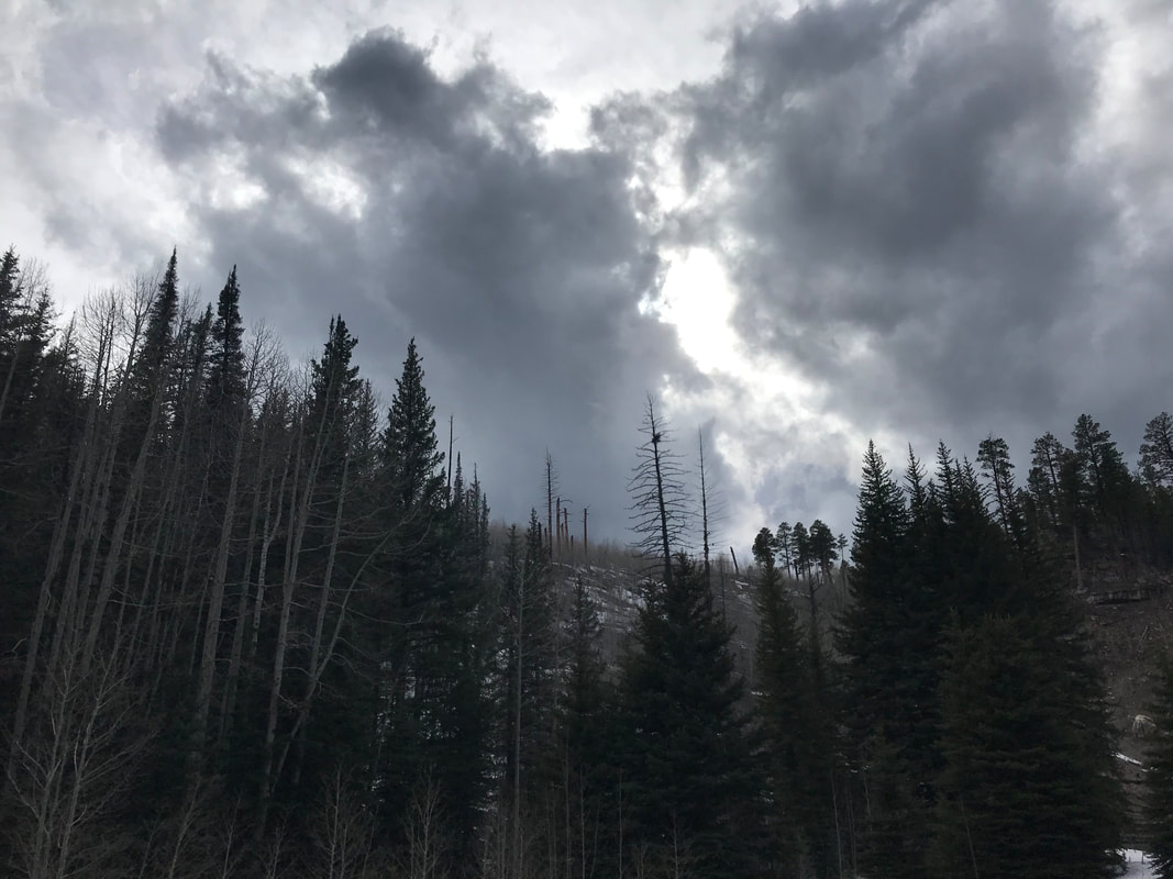
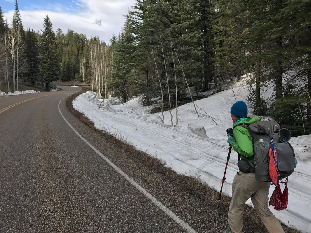
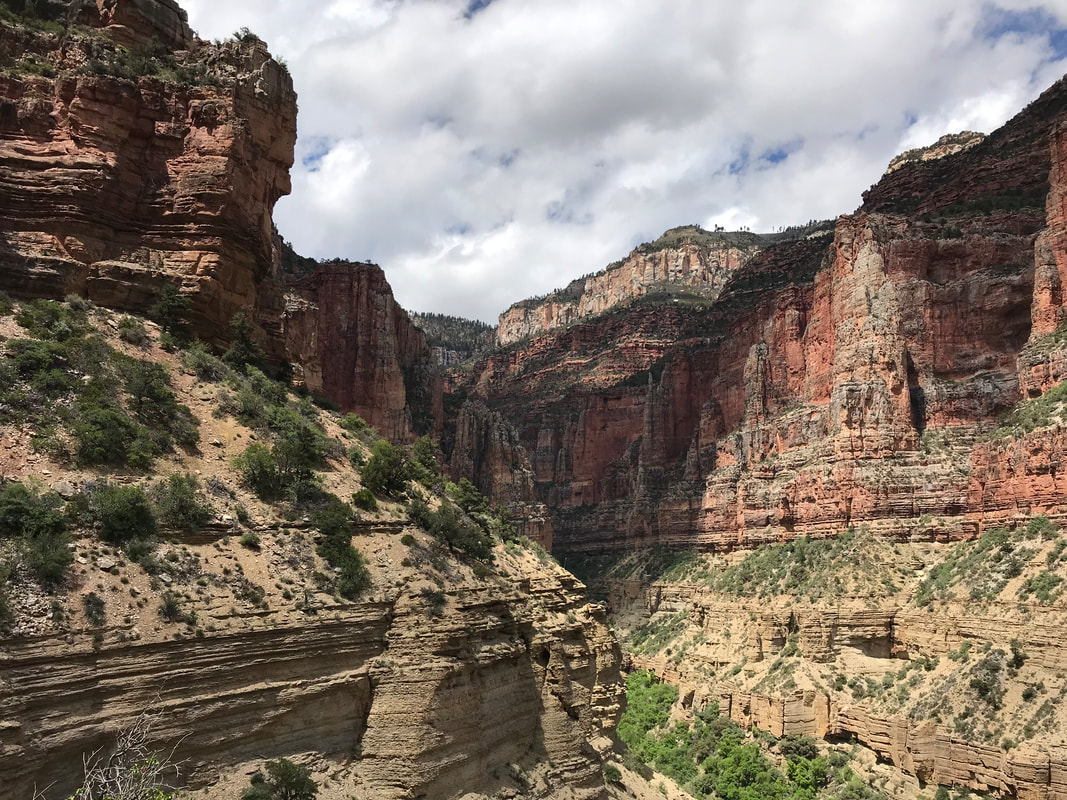
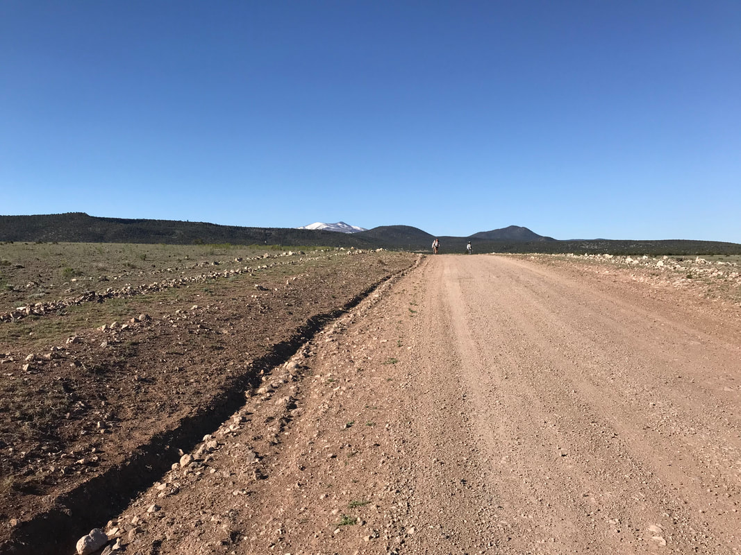
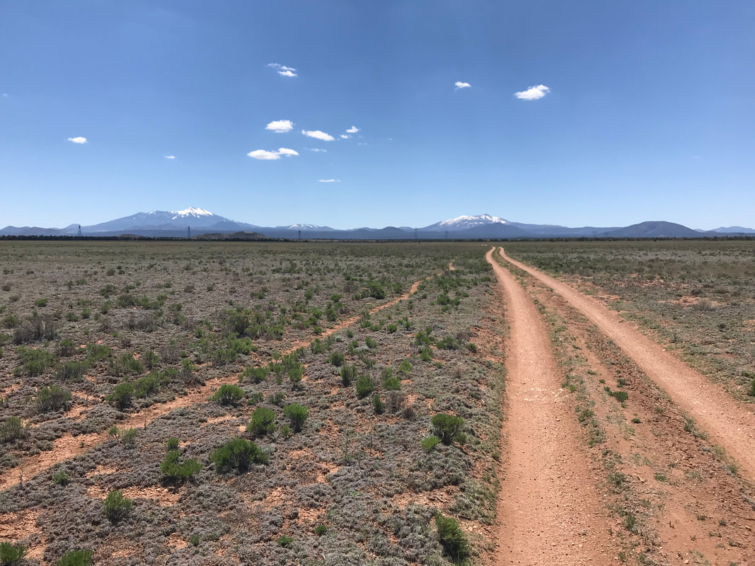
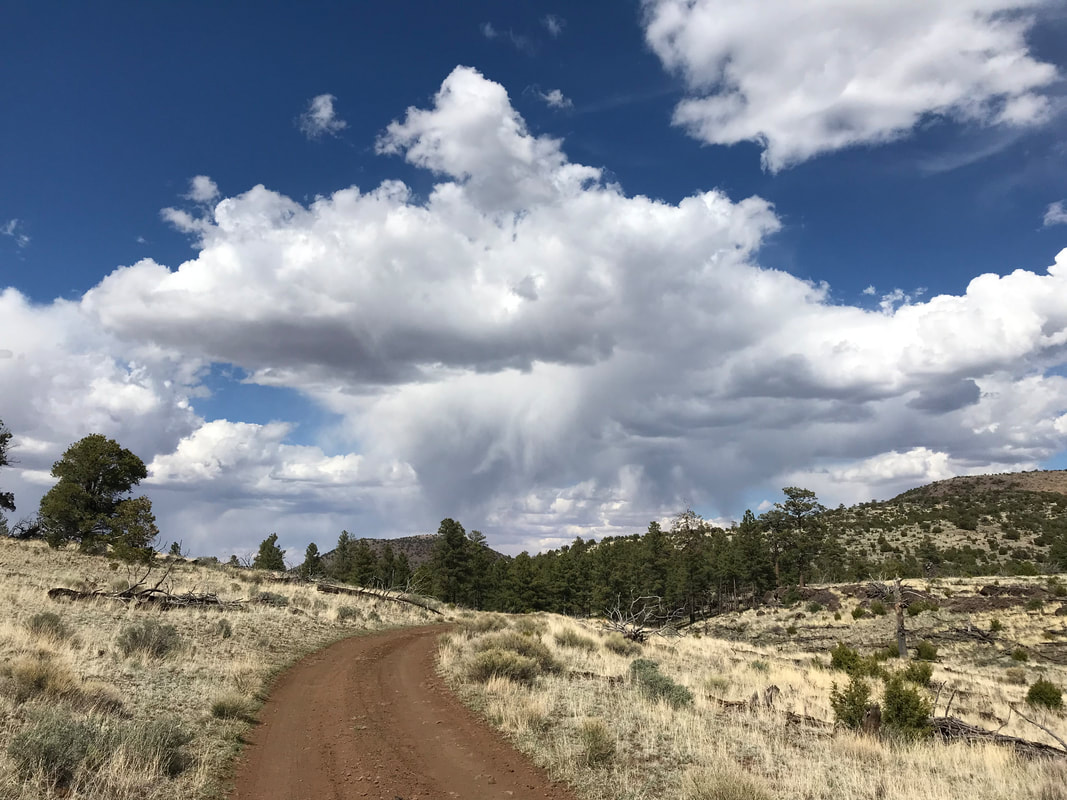
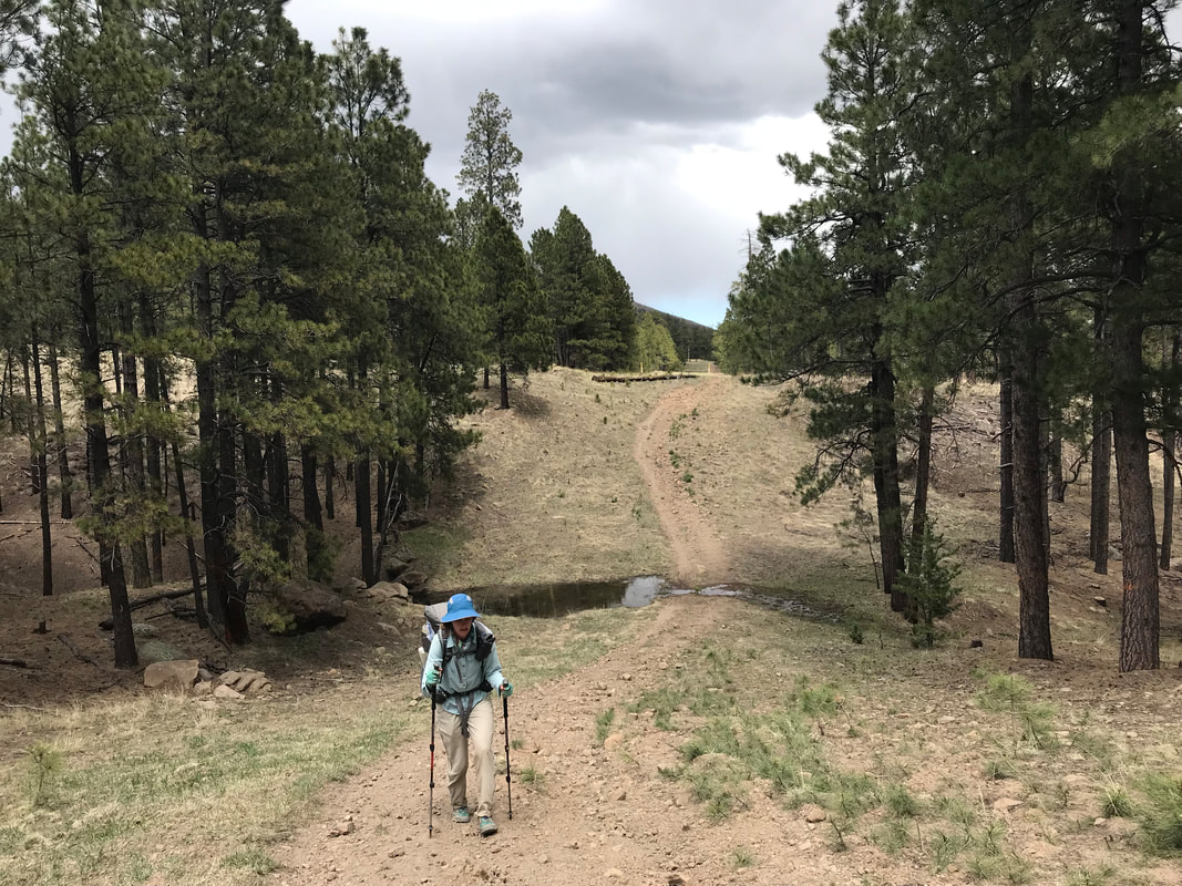
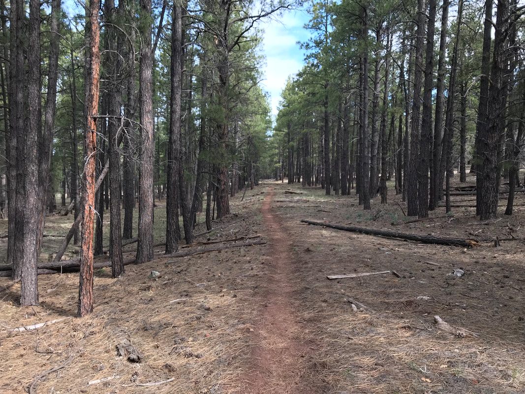
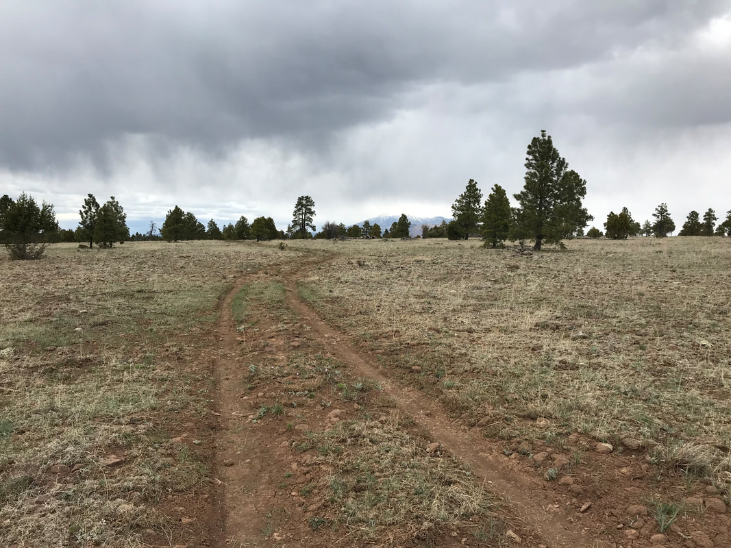
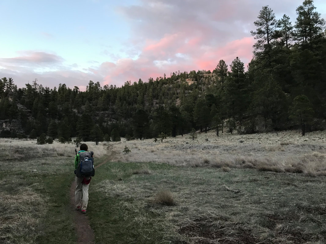
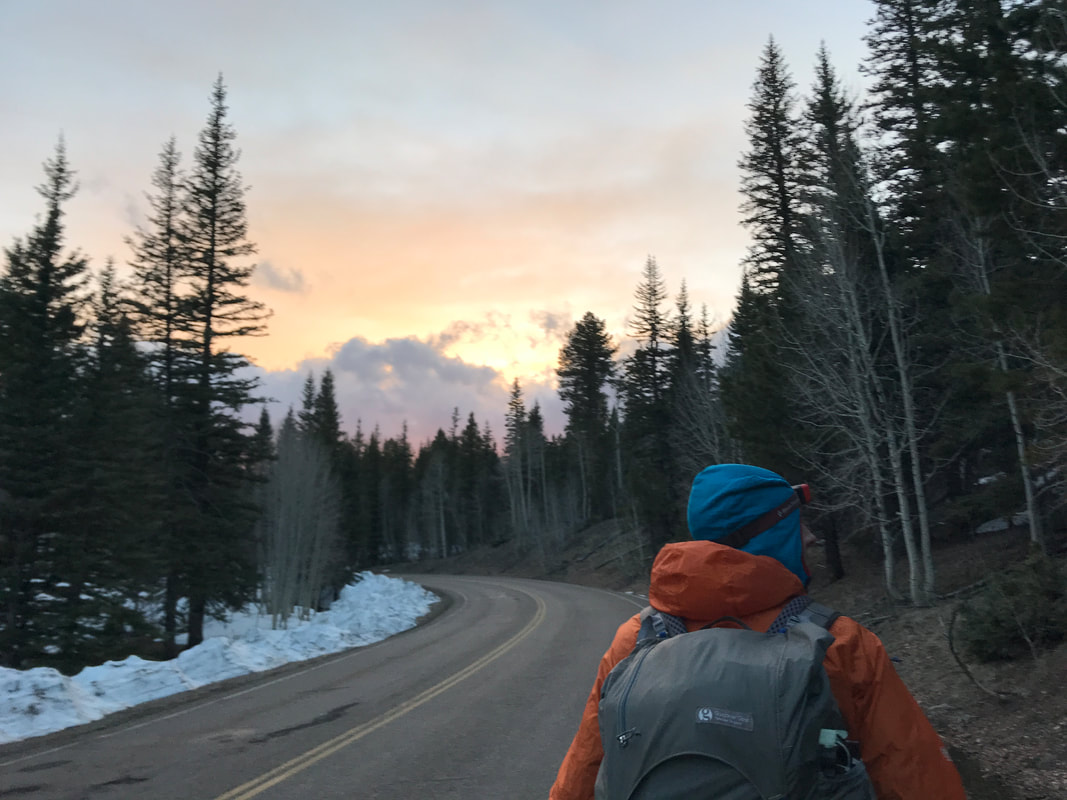
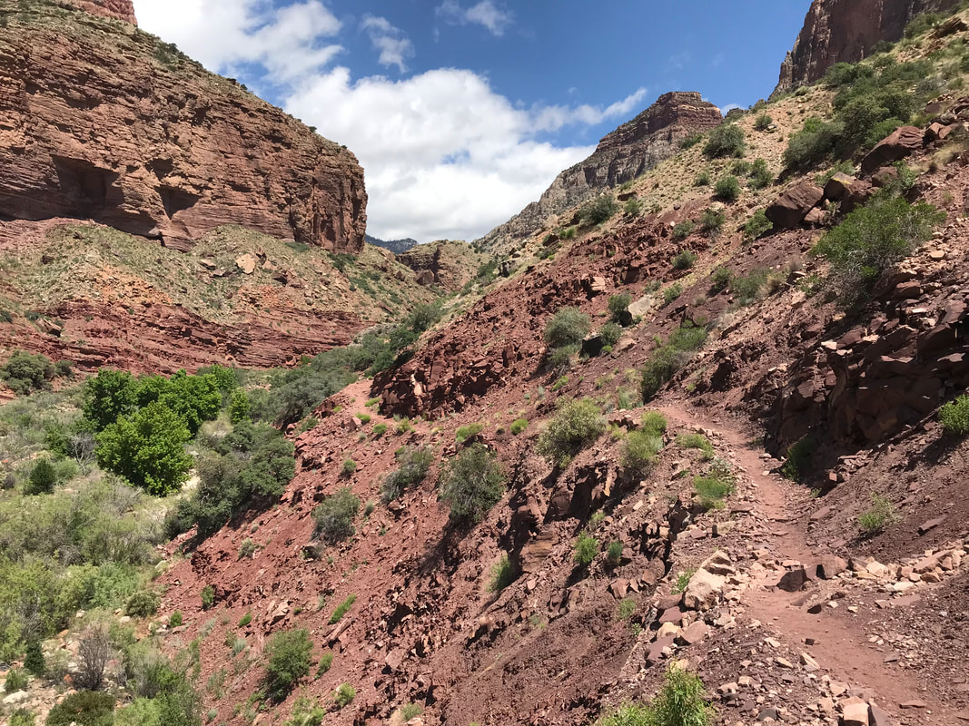
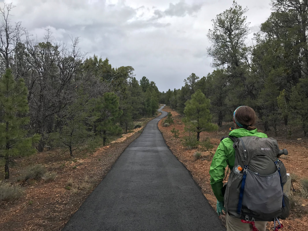
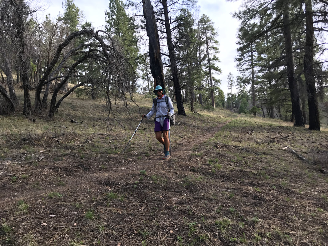
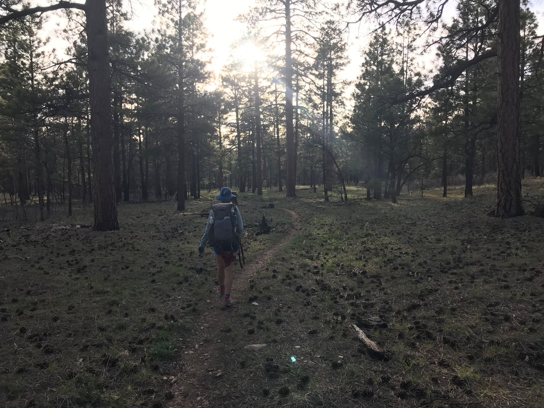
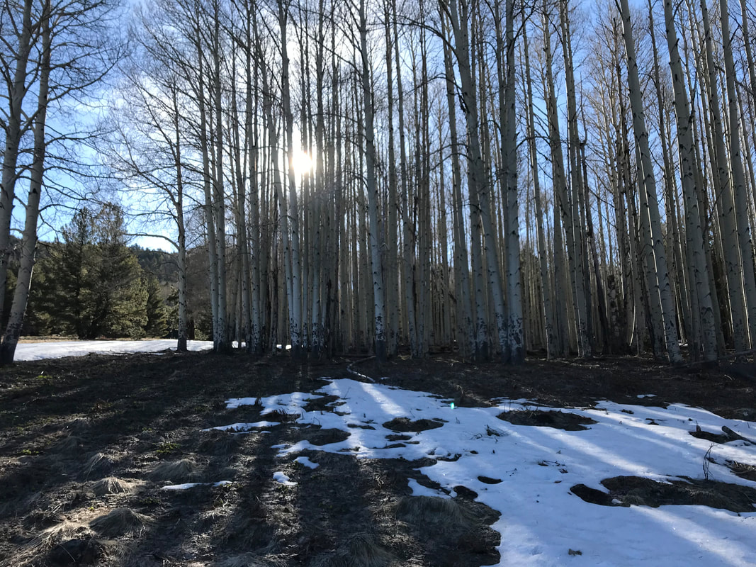
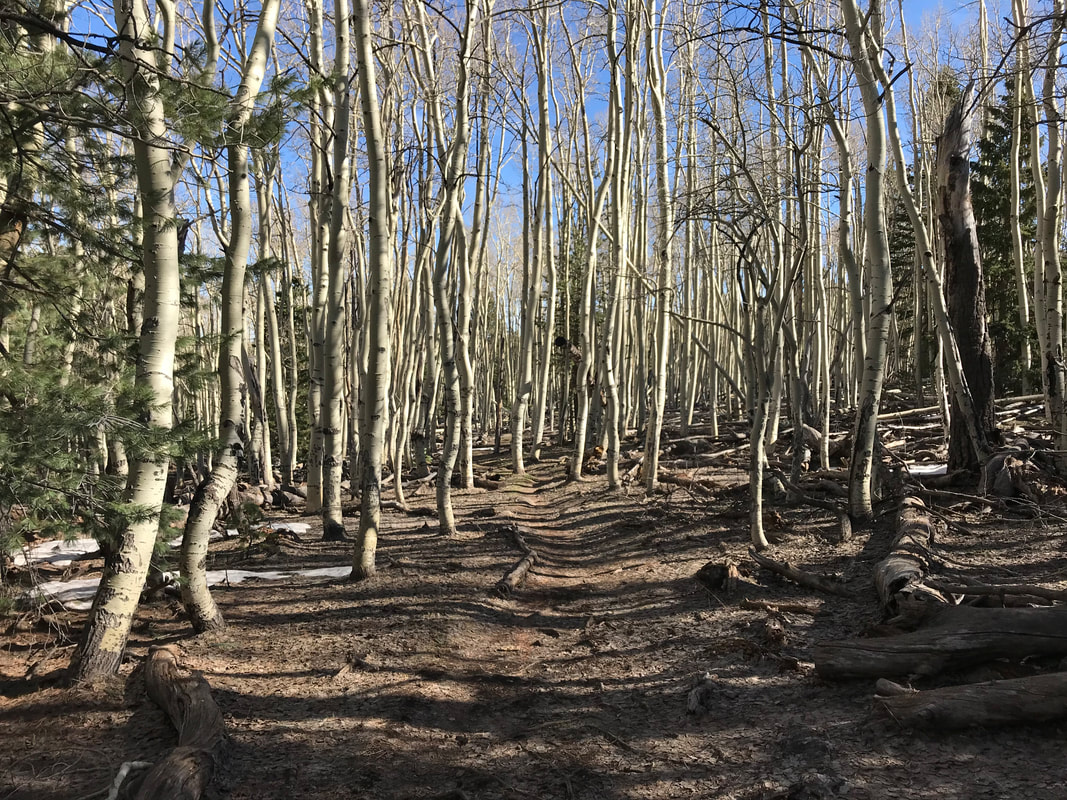
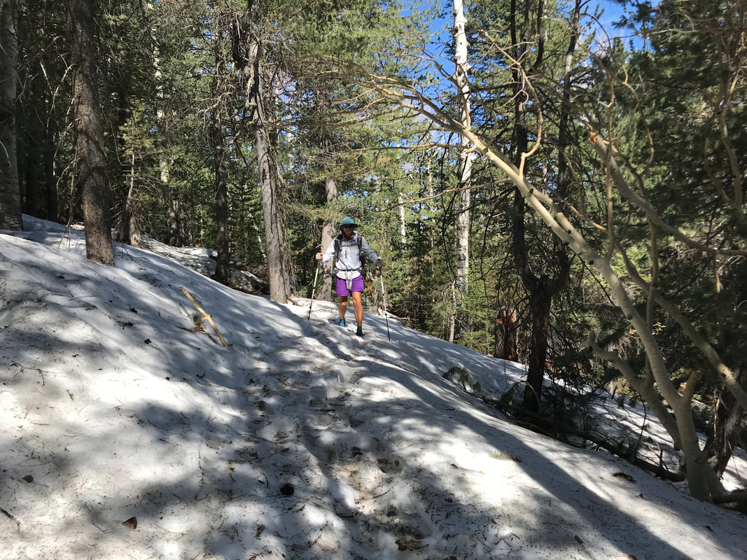
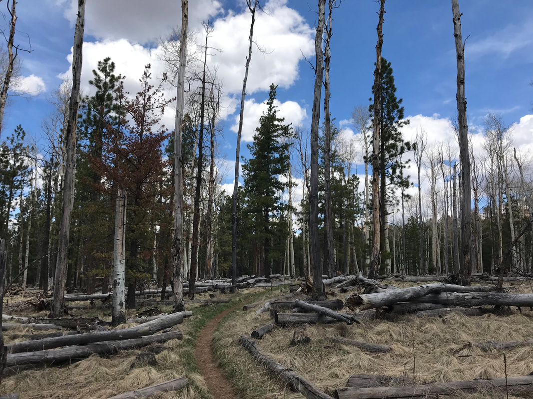
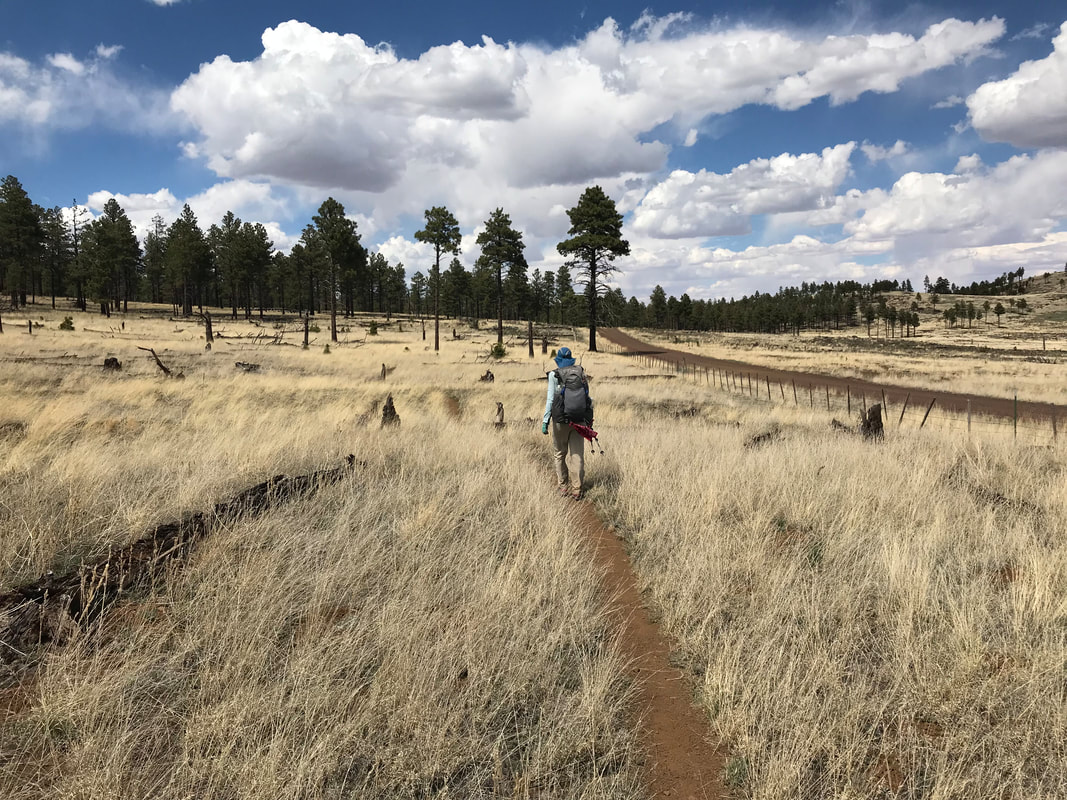
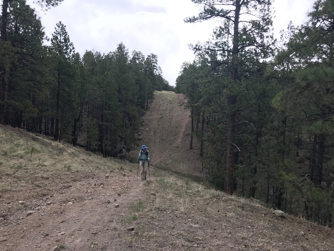
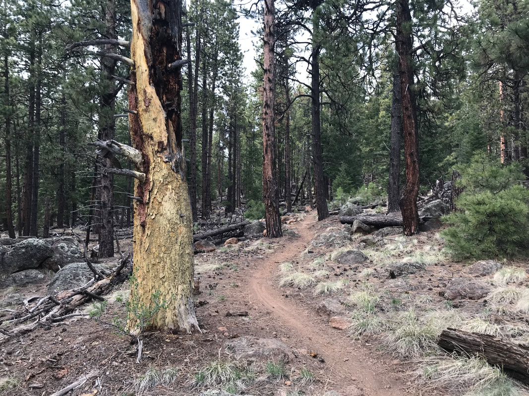
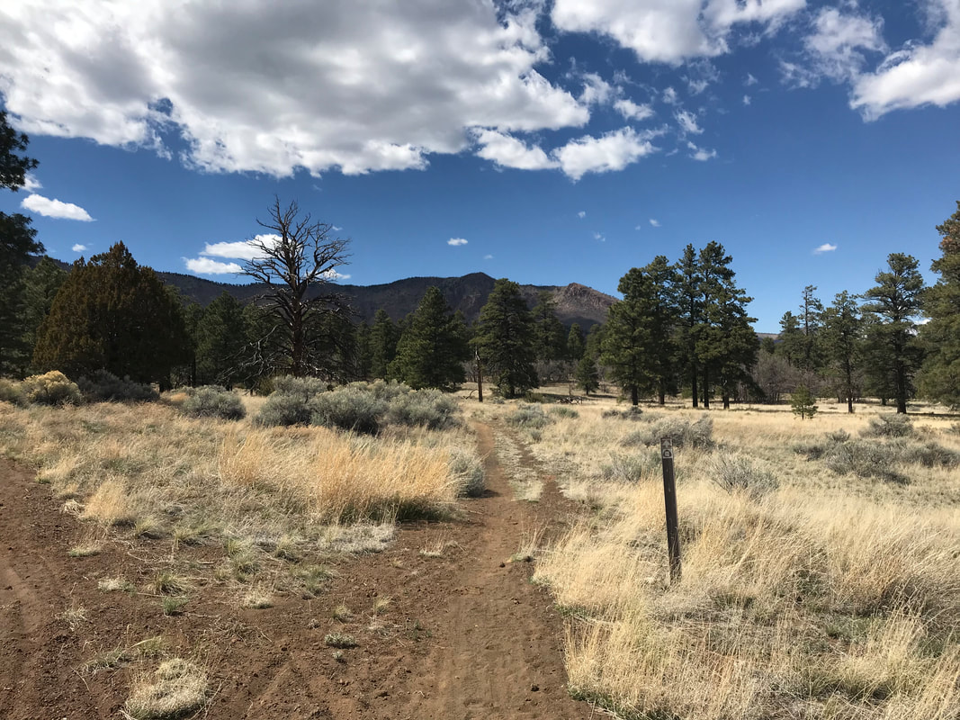
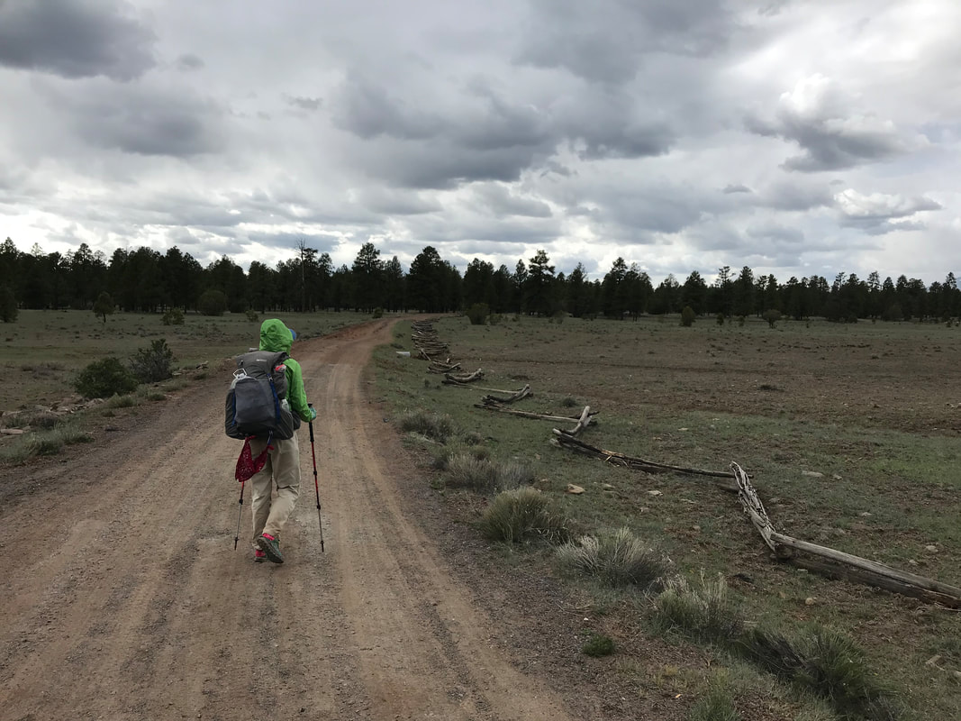
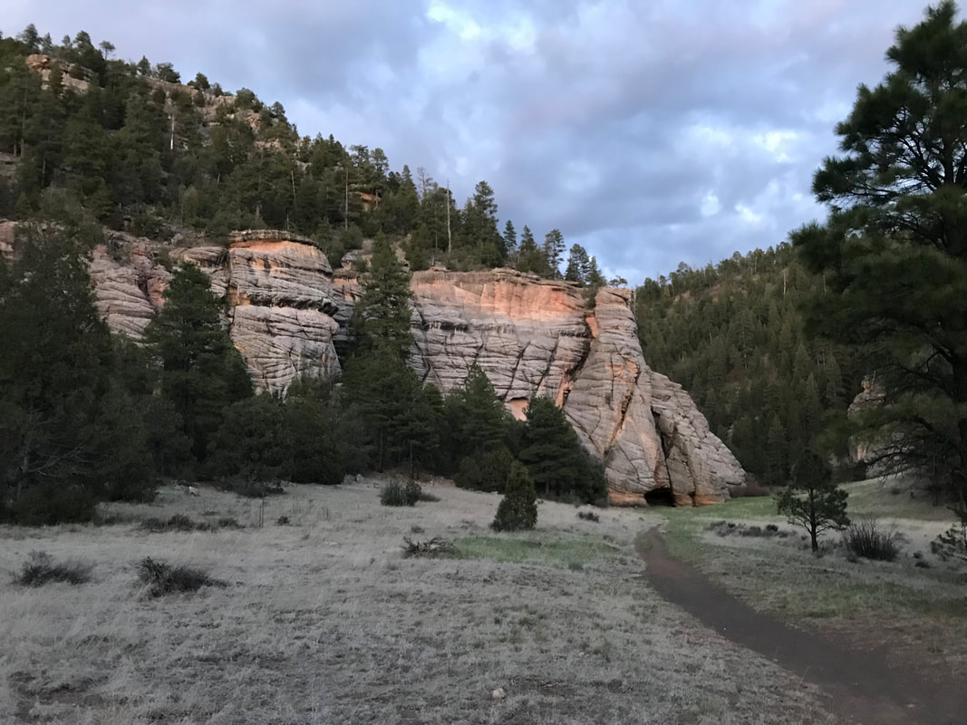
 Part 3: Into the Winter on the North Rim 10 more miles was also that separated this long day from sleep and relaxation. We pivoted immediately from the North Rim trailhead towards the AZT across the clear highway. Snow lay in small patches here and there, but nothing intimidating. Overhead, blankets of blue sky spread out from the mountain clouds. Things looked great. As we crossed the highway towards the AZT, we peered down the trail into the thick woods which lay sliced and lashed with snow embankments that we knew would take time to climb up and over. Plus, we read that someone had done the trail proper in this area only a few days before and used snowshoes for a good portion. Given that beta, and the late afternoon chasing us, we decided to hike the snow-free highway out of the park. Man was I feeling good. It was even mildly sunny now. I felt that hardest part was behind us. This was nothing. This was merely a road walk on with a slight uphill and then we would descend. The snow wasn’t even that bad! We’d easily find a place to camp tonight, even after dark. The storm looked like it was giving in. A mile or two in and keeping a good 3 mph pace, the bikepacker we had passed up the Canyon passed us on his now reassembled bike. He was starving, out of food, and going to bike the 40 mile to Jacob Lake Inn tonight to catch a hot meal before the last push to finish the race. We bid him goodbye has he pushed ahead. The daylight was fading, but we had a solid 4 hours left until total darkness. What we didn’t plan on, and what I had totally forgotten, was that the North Rim sits at 8,000 feet but rises as your move inland on the Kaibab Plateau, rising to over 9,000 feet. As we walked, I began to realize our pace was slowing from going uphill combined with our fatigue. As we gained elevation slowly, the tree diversity was awesome: firs, spruce, aspen, pine, and more. But the snow that started patchy and uneven became an even, constant carpet. There was a direct relationship between the further we walked, the higher the elevation we gained, and the thickness and spread of snow around us. Plus, the innocuous clouds I had thought away were thicker here as we were truly in the alpine. They moved fast and low, leaping overhead and smashing into each other. The threat of a storm in the late hour became real. The temperatures were also starting to drop, both from the elevation and the setting sun. 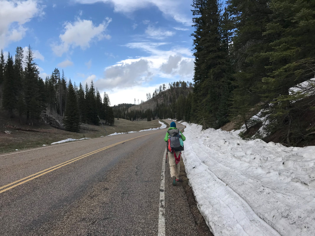

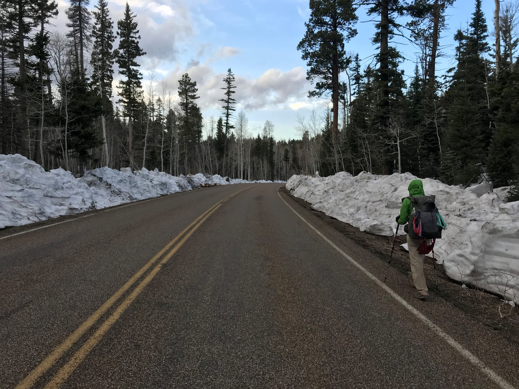
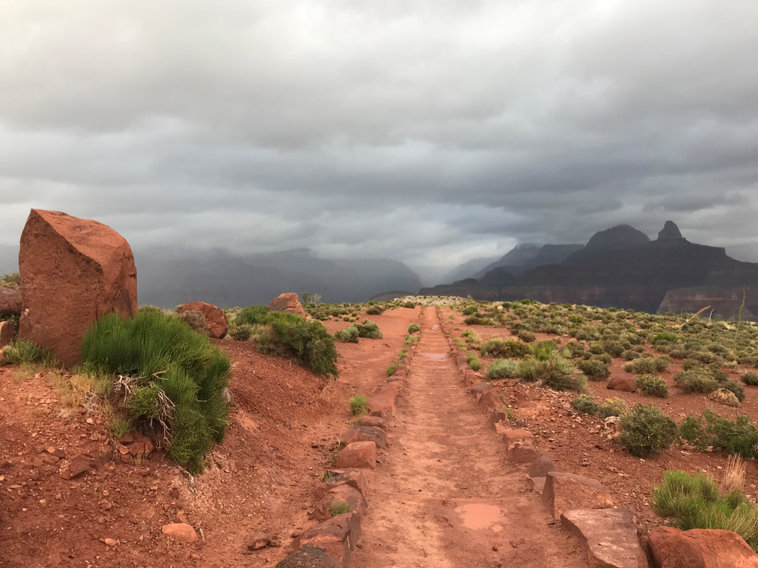
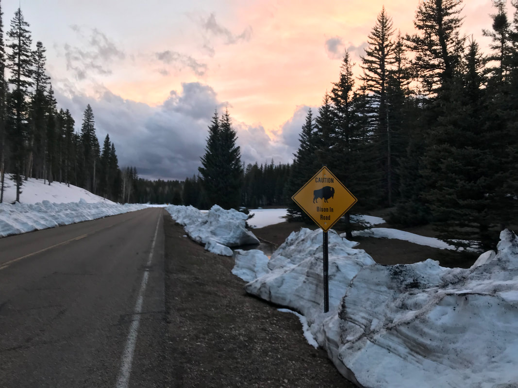
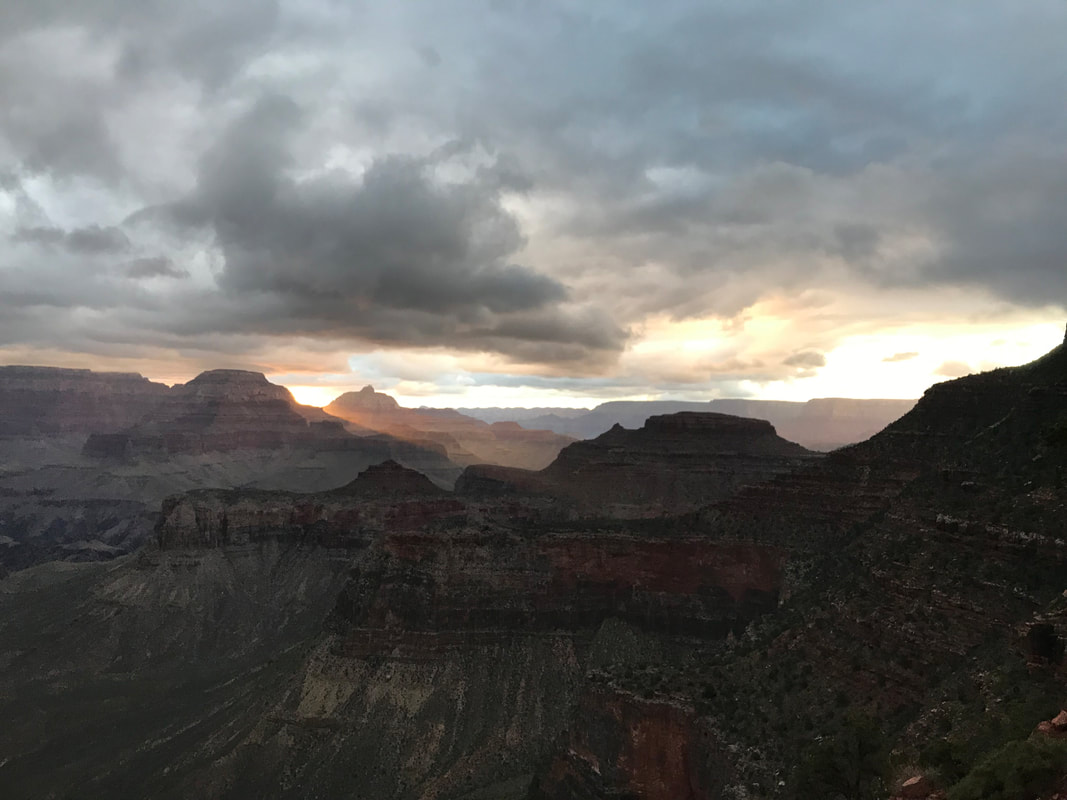
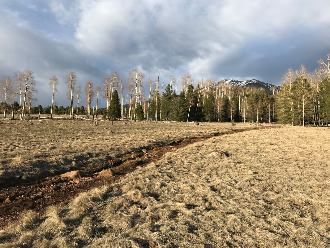
 By 6 pm, the reality of the snow set a slow anxiety in me. We were walking a paved road through a corridor of 6 foot deep snowpack. It was clearly at my body height and only seemed to be rising next to us the further we walked. I realized we were going to have to climb the 6 foot side drifts to even walk on top, let alone find a place to camp. I was prepared for snow camping, but the thought of constructing snow anchors after this long day was a major turn-off. Nearing 9,000 feet in elevation, the road had a pull-off complete with trashcans. Janna and I sat down on the wet pavement and ate a cold-soaked dinner. A porta potty sat behind us, its roofs and walls collapsed and crushed by the monstrous weight of deep snowpack here on the remote Arizona Strip. We ate quickly, steadily, if only to gain calories and get moving again. I found myself not hungry again. My appetite had waned as the snow drifts grew. After 20 minutes, we were back on the road. Now, splintered fallen trees lay wedged horizontal in the snow. What low and flat ground was available had pooled slight snowmelt into ribbons of ponds and streams. Everything else was snowcapped and vertical. The choice in campsites was becoming equally thin and we were still four miles from the park boundary. The North Rim is composed of vast, thick, and remote alpine woodlands interspersed with massive high-altitude meadows. I was planning on crossing these meadows at the park boundary to make the woods and secure some wind blockage as it looked like a winter storm was building up for the night. We pushed on, racing the clock and loss of sunlight. A sign appeared warning of bison. I thought, “Dammit. I don’t want to run into a massive herd of cold-stressed bison in the dark alone.” We kept moving, the snowpack grew thicker and deeper. Janna and I grew quieter and quieter. A blazing sunset lit the plumy clouds in front of us in an orange sulfur glow as evening approached. It was beautiful and we stopped for a few quick photos. We were so close to the park boundary, but we were wedged in on both sides of the road by a nearly 8 foot snowpack in places. 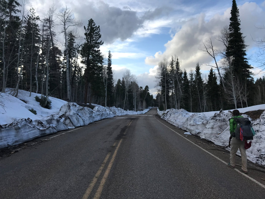 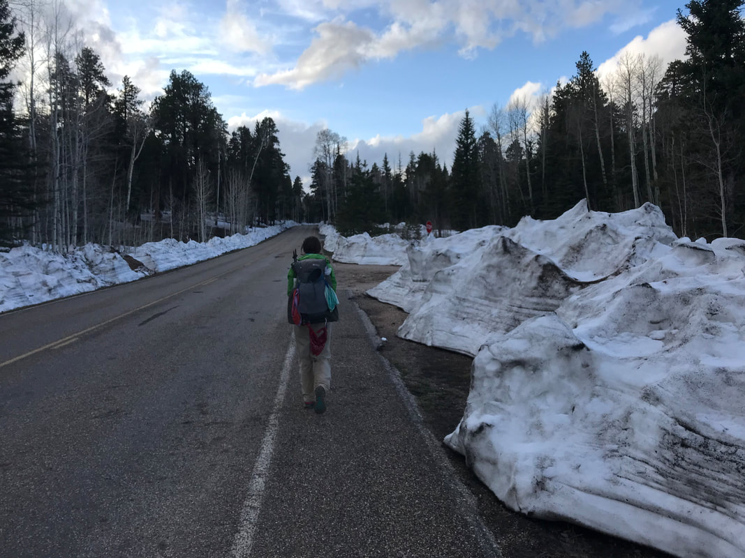  
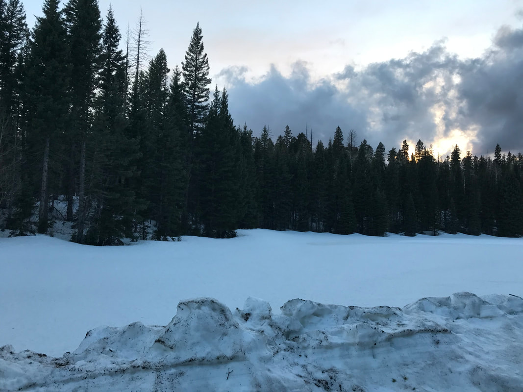
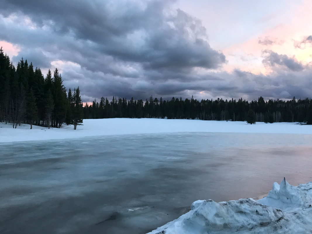
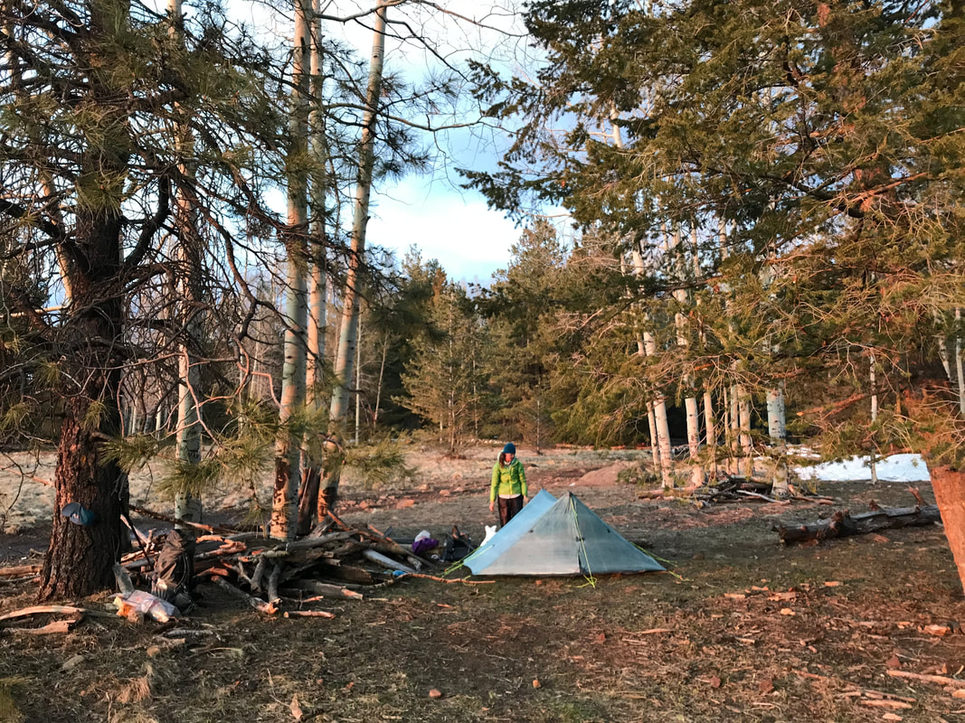
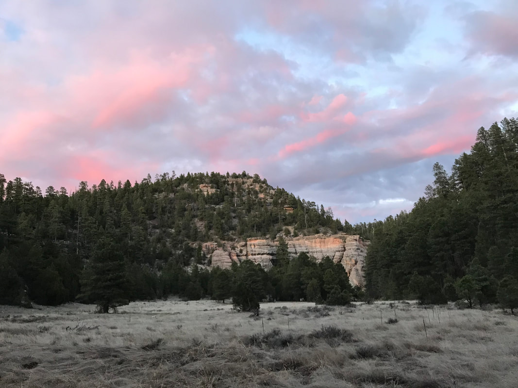
  At 8 pm, we finally reached the park border. A single ranger booth blockaded with plywood and sealed tight for the abandoned winter months stood stoically in the magenta glow of dying light. I noted on a sign that one could break in for emergencies in the winter, but would definitely face a federal charge. A massive locked gate stretched across the road. In the last vestiges of light, we climbed through gaps and stood on the park boundary. A massive winter scene and impending blizzard lay before us. The temperature was now firmly in the upper teens as the clouds unleashed by the absence of the sun billowed 20 - 30 mph constant wind across the open alpine snow. On either side of the road a 6-8 foot snowpack stretched for hundreds of meters to a distant treeline. The beautiful meadows of summer were now frozen lakes and streams. Literally. A veneer of ice indicated that most of what were looking at were snowbridges that could punch through to frigid water of unknown depths. There was no way we would walk across the ice to the treeline - it was a terrible risk. Janna pulled out her headlamp and found the batteries completely dead. The prospect of navigating these snow fields in the dark with a single headlamp while avoiding plunging into water and potential frostbite hit me hard. I started to panic and felt warm despite the temperatures. Janna kept coolheaded and reminded me we could keep walking. We had food, we had water, we had all our winter clothing on. If it meant doing over 40 miles, we would do it until we found a safe place. But still, that thought fucking SUCKED. The wind began to pelt us with snow as we walked quickly in twilight. The winter storm began to snow heavily on us. The temperature was now in the lower teens. Another mile or so and Janna saw that the treeline seemed to grow closer to the road. We could just make it out with my headlamp in the dim and flurries. I carefully ascended the adjacent snowpack and began to carefully navigate across the snowy meadows. I used by trekking poles to prod the space ahead of every step I took for weakness indicating I could posthole or plunge into water lying below. After 10 minutes, we made it to a thick pine and aspen grove. We began walking up and down uneven mounds of packed snow in the trees, searching, searching, searching for a spot to camp. Then, there! Behind a thick stand of aspen densely packed together was a completely flat and snowless spot in a size manageable for the Triplex. The constant barrage of wind had piled snow on the windward side of the trees leaving the lee essentially barren. It was perfect. I cannot express how FREAKING HAPPY we both were to have found this spot. Quickly, but with attention to detail, I began setting up the Triplex in storm mode, using every tie-out, grommet, and guy-line to secure it to the earth and prepare it for a snowstorm of unknown length now hitting us. It was fucking COLD. My hands were freezing. The shelter now standing, we climbed inside and blew up our Neoairs that were already frosted over from what little condensation had been in our breath. I put on every article of clothing I had, shells and rain-gear included, and placed my pack under my pad for additional warmth. The shelter sealed up tight, massive gusts of wind began wracking the shelter, bringing bursts of cold and spindrift inside. Out loud, I said, “Did you check for widowmakers or dead branches near us?” Almost immediately, a gust hit us followed by a tree groan and the smashing sound of splintered wood as a branch landed on top of us. We were fine but it scared the shit out us both. Quickly, I went back outside into the snowstorm and wind, my headlamp on high beam to examine every tree nearby. The trees were solid and that seemed to be the only branch over us that was dead. I scampered back inside and bundled up again. The storm would whip us back and forth for several hours throughout the night before dying out in the early morning in a total silence. We had hiked 36 miles and nearly 8,000 feet of gain. None of that helped me to sleep as the bitter cold and adrenaline-pumping of the wind/storm made for a sleepless night. Hail, sleet, and snow pelted us in waves. I did sleep some, but found myself shivering and doing sit-ups several times that night to keep warm before a calm dawn broke with dark snow clouds looming over everything. 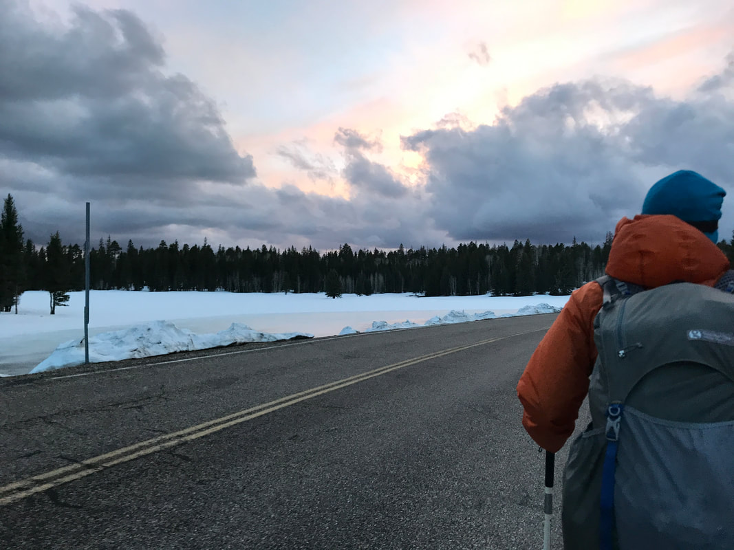 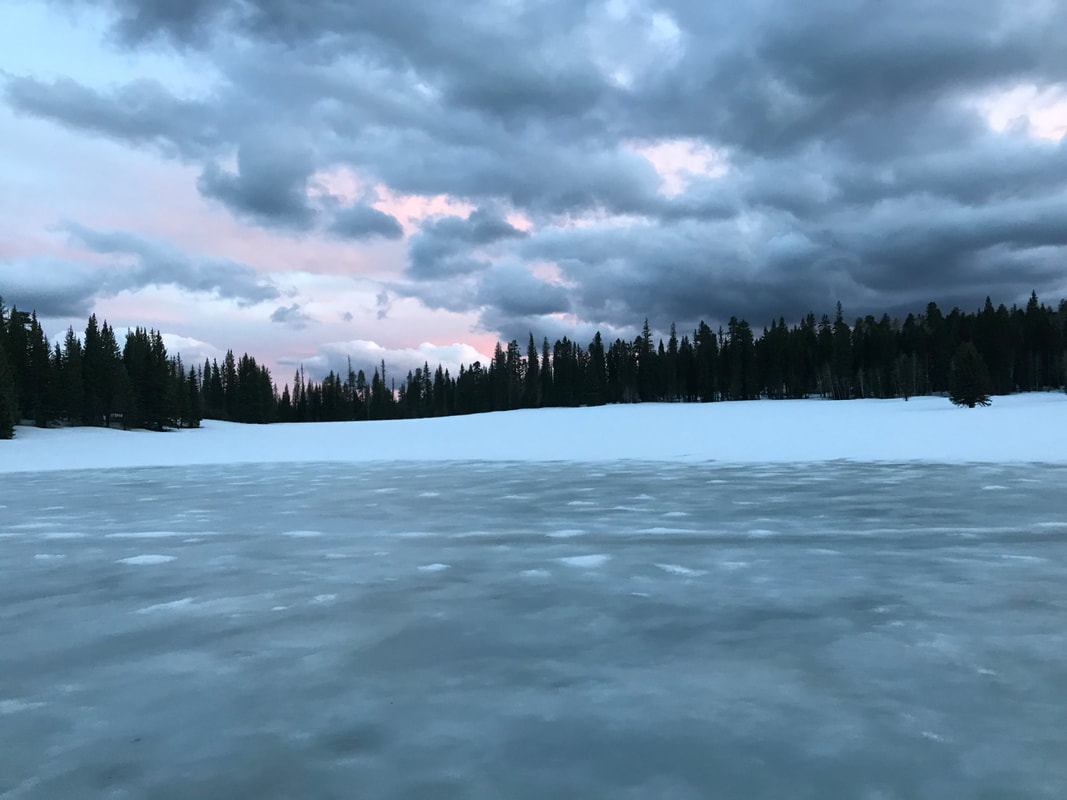 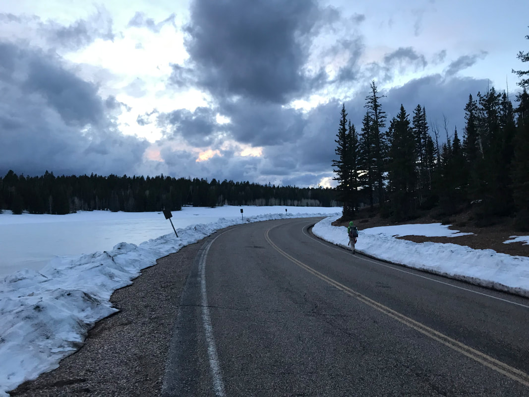 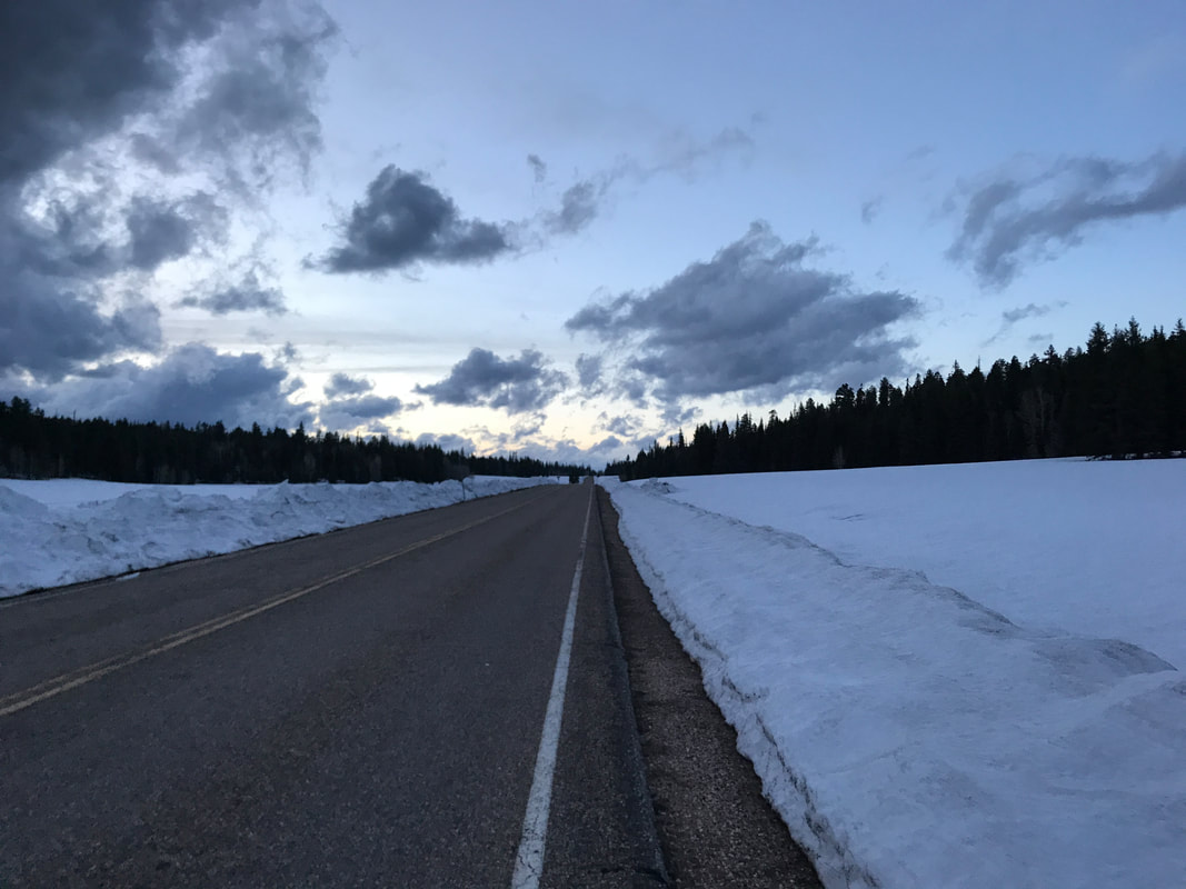
0 Comments
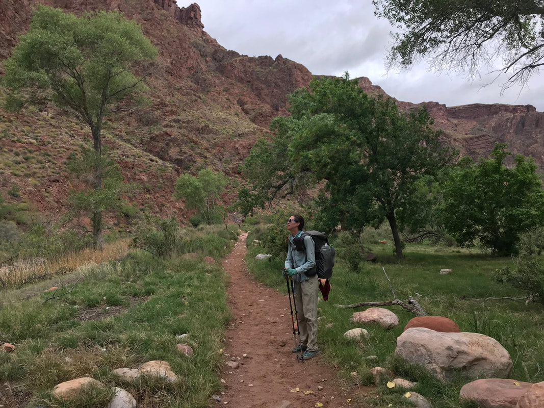
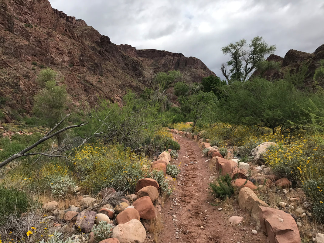
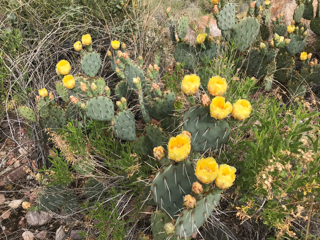
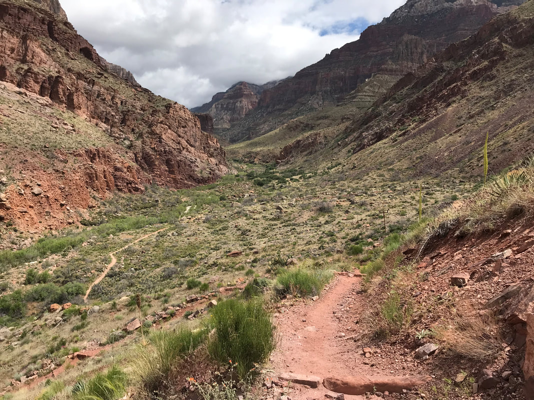
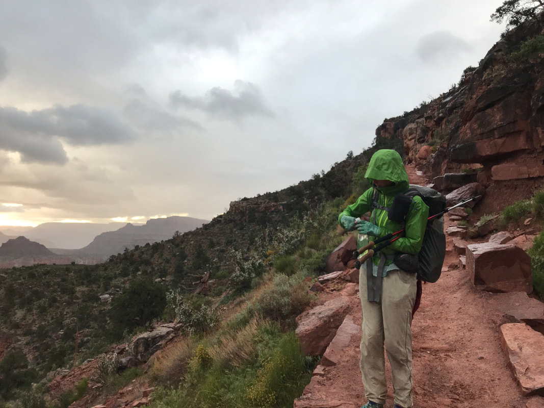
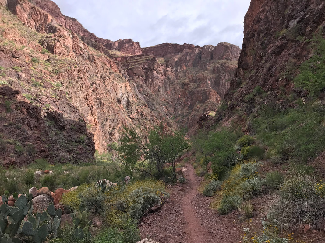
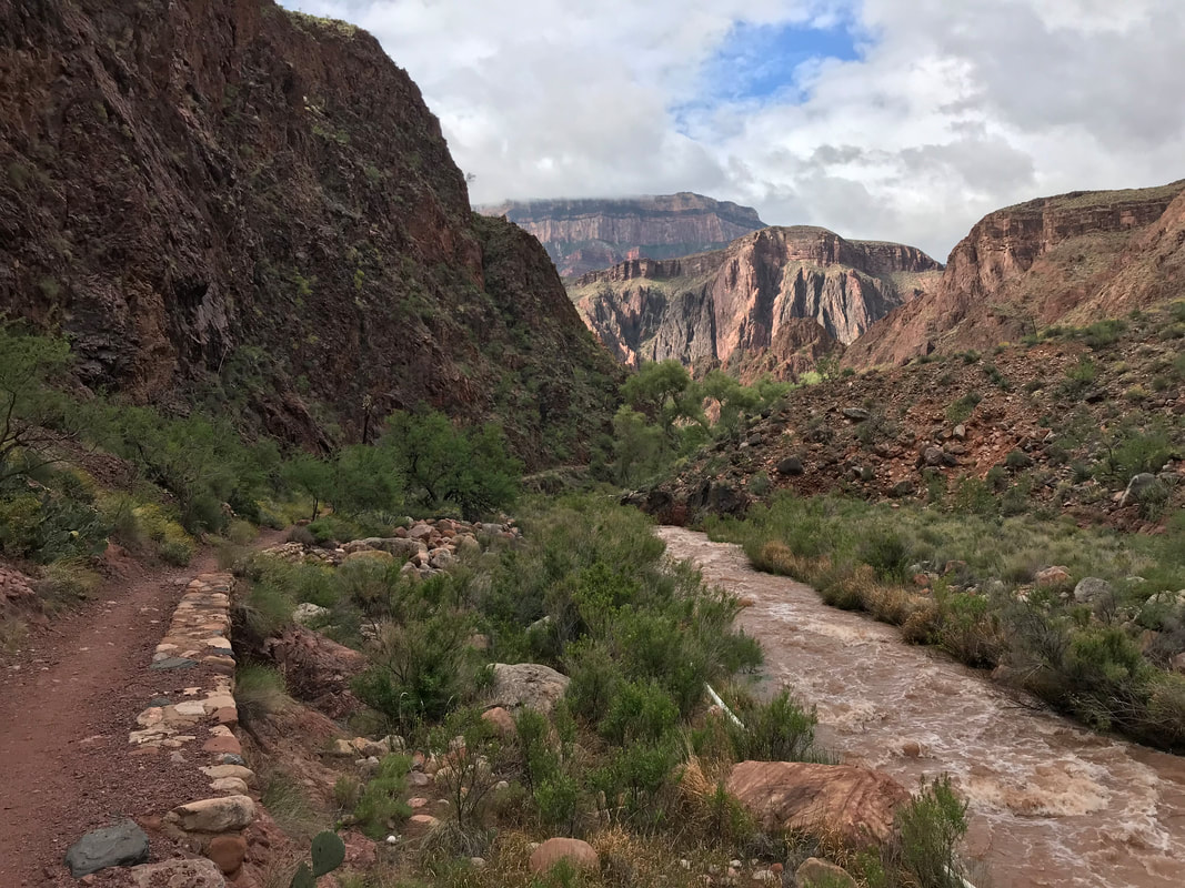
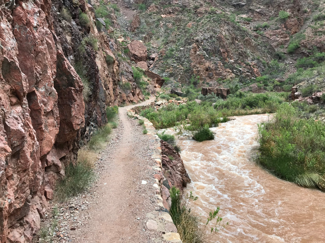
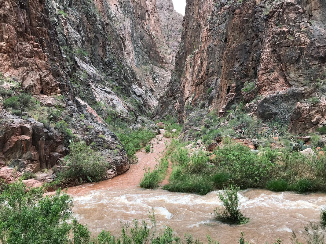
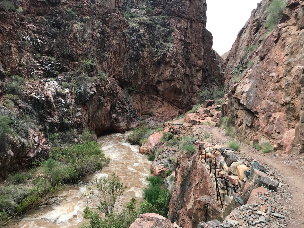
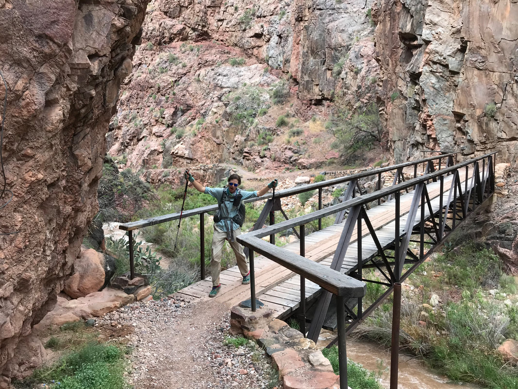
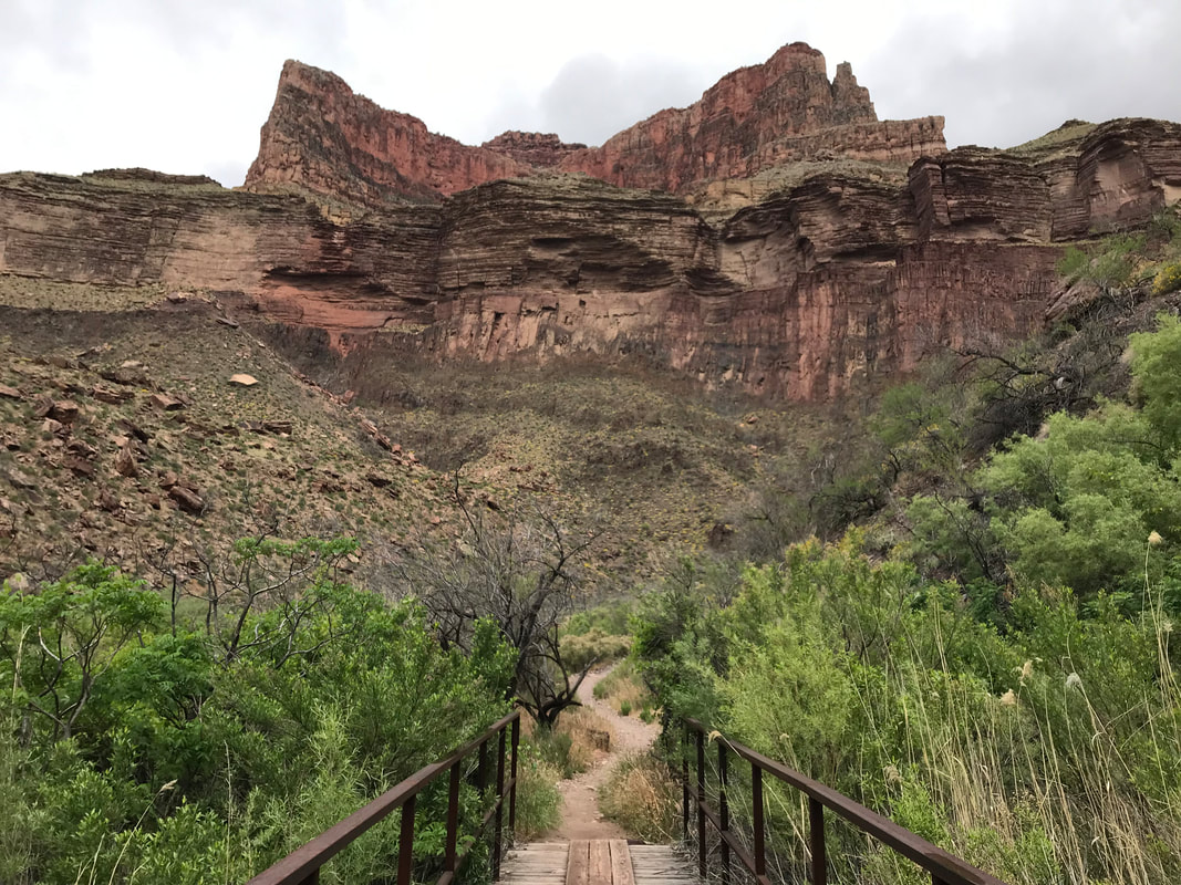
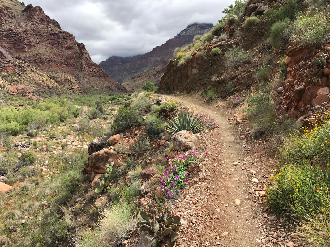
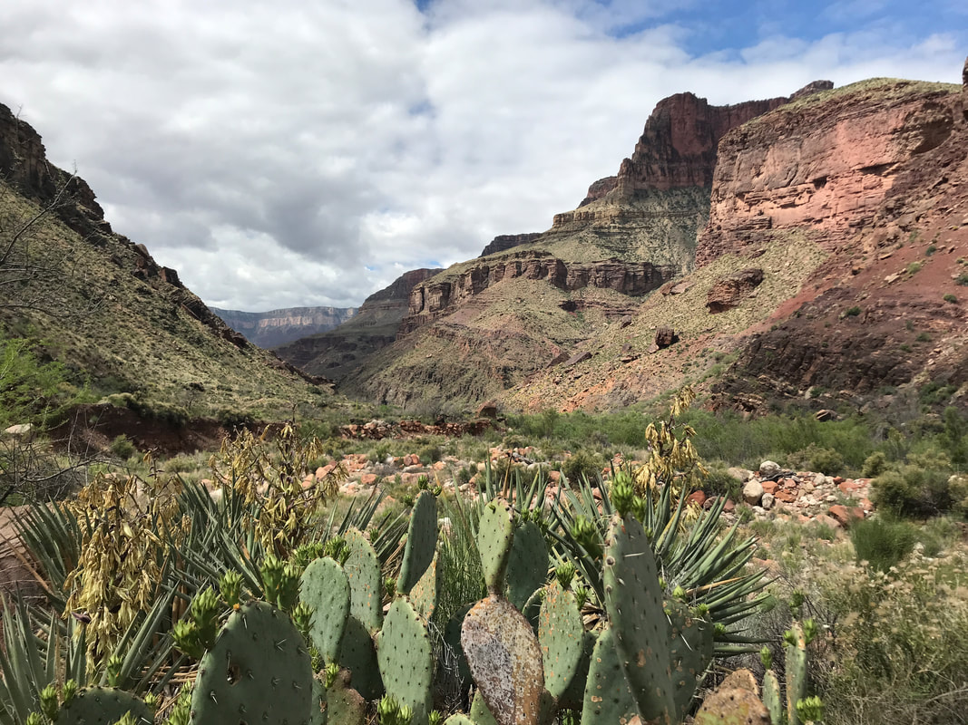
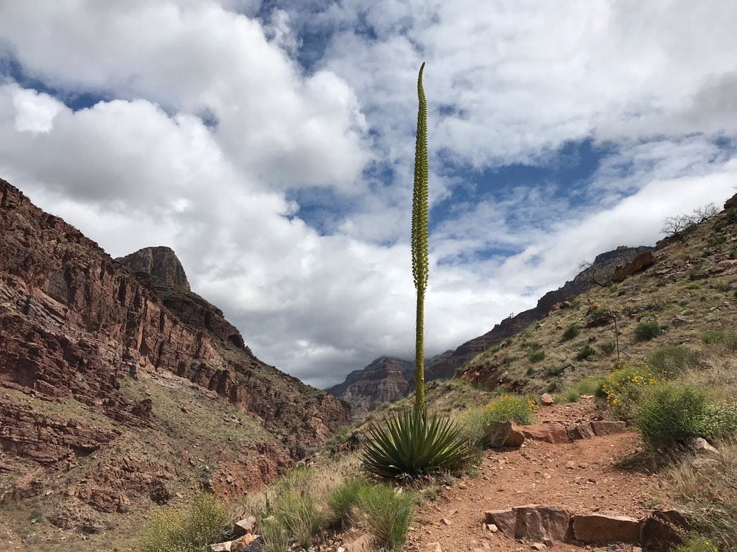
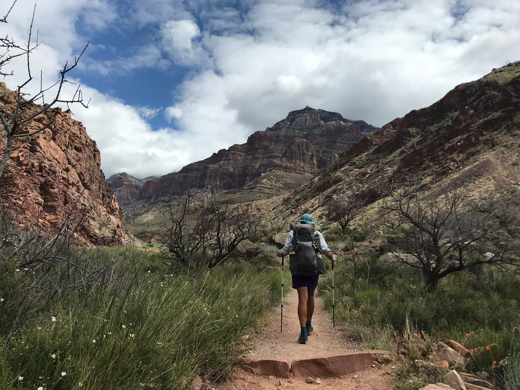
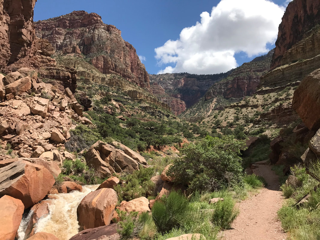
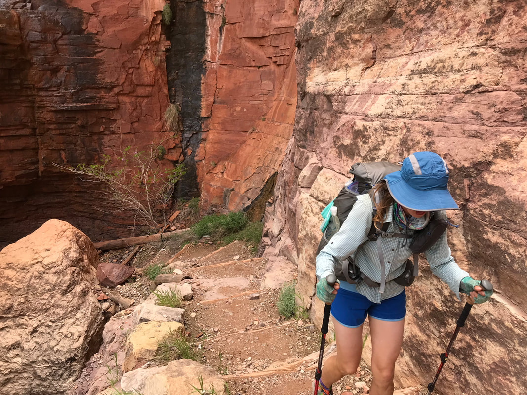
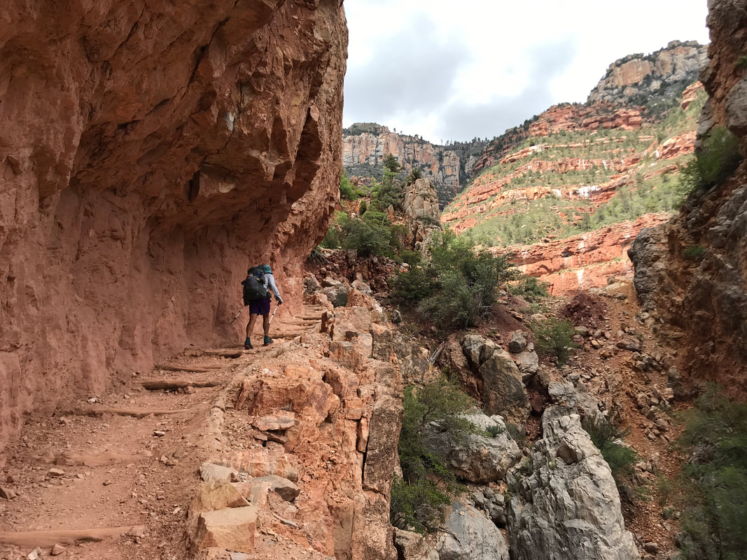
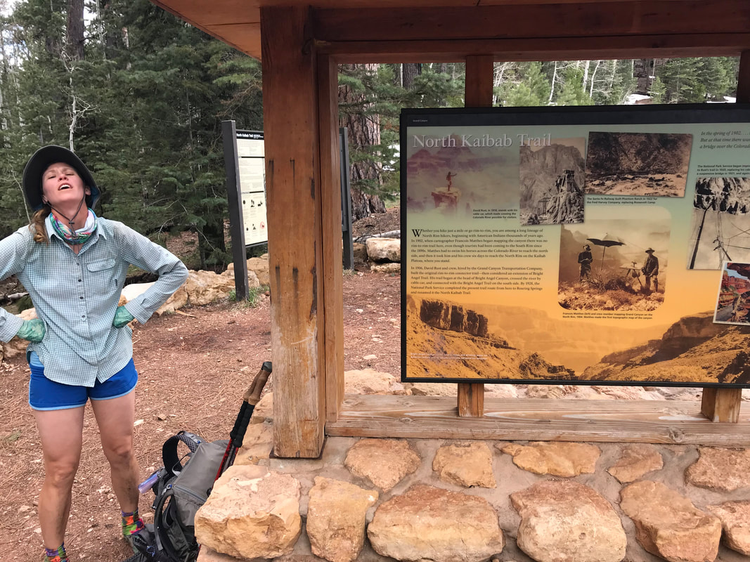
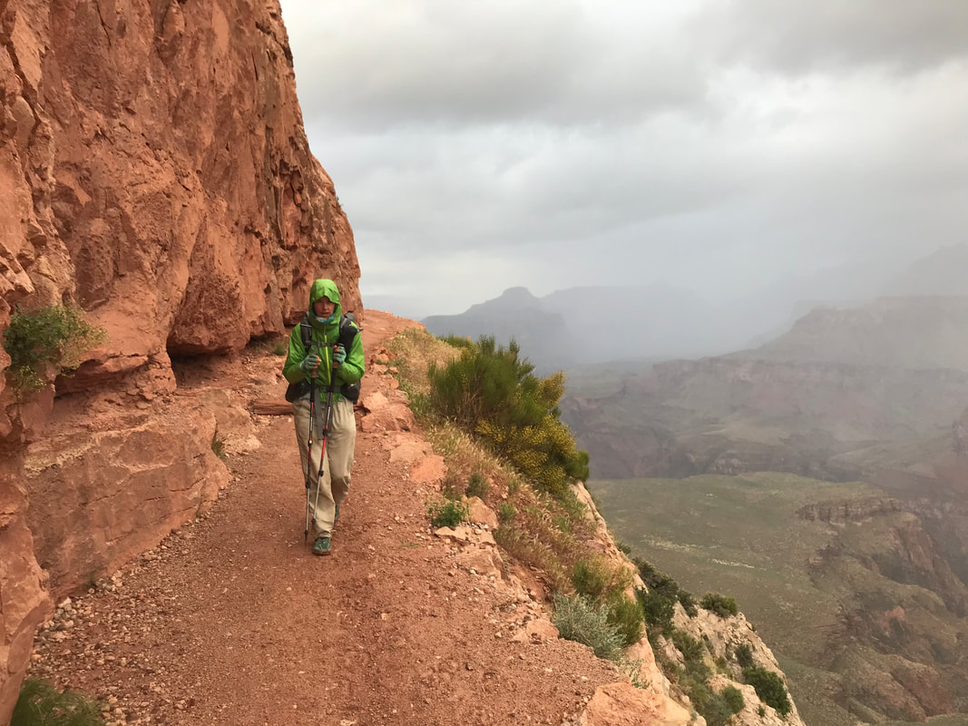
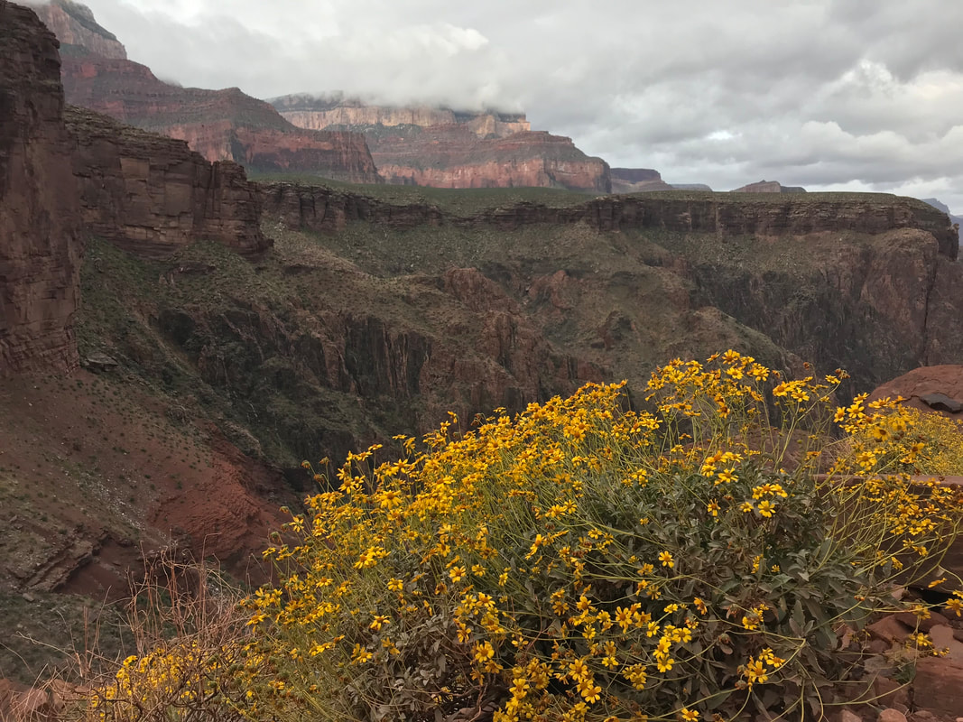
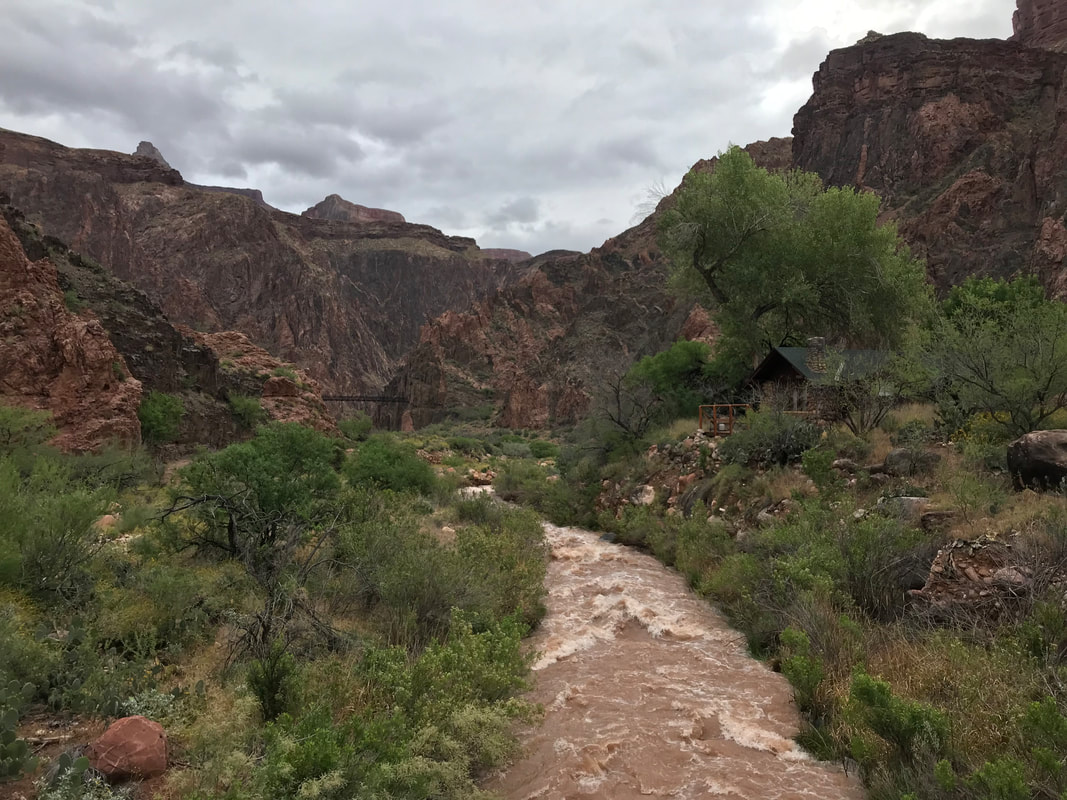
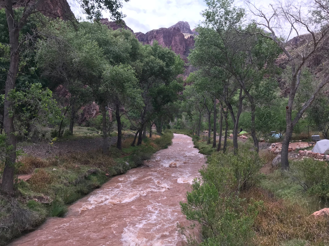
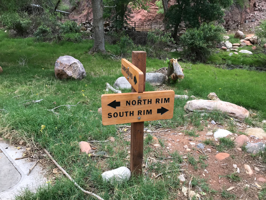
 Part 2: Up the North Rim of the Grand Canyon The Grand Canyon can be a place of extremes. Cold and pine on the rims transition to hot desert within. After standing in front of the north/south rim junction sign at Phantom Ranch, we marched our way north on the skinny singletrack parallel to Bright Angel Creek. For all of our adventuring in the canyon, both below and above, we had never actually hiked the North Kaibab Trail. Thus, I was excited. Proud to hit our time interval, but nervous and excited. The trail immediately was boxed up by narrow canyon walls while turbid Bright Angel Creek raged next to us, fed by tributaries gushing from springs in canyon cracks fed by a deliciously solid snowpack on high. The cloud cover which brought rain and cold was finally beginning to dissipate to our south. Ceiling cracks of blue sky fed a rising temperature down below. It was then I realized how grateful I was for cloud cover while traversing the canyon on the cusp of May and foresummer. As we hiked, that old biological urge hit: pooping. In all my anxiousness in the 24 hours prior, I had not found myself relaxed enough to do a proper bowel movement. Now, miles into a long day and exercise coupling the massive meals I had consumed pushed my internal maintenance to scream STOP. But I couldn’t. You simply don’t poop in the heavily traveled corridor of the North and South Kaibab Trails. I held onto the urge like a boiling fire inside me, urging myself to get to Cottonwood Campground where privies could be found. But first, I had to hike 8 miles uphill while desperately needing to defecate. I consider this the second worst time I have ever had to poop in my entire life. I was in a full sweat between the heat and my needs. My eyes kept registering the shear beauty of the trail and blooming plant life around me. And then my need grew so bad I began to dry heave. But like a boss, I still did not go. Somehow, over 8 miles, I made it to Cottonwood Camp at 11:15 am. Whereby I flung open a bathroom stall and destroyed it. There is nothing more to say than backpacking allows such things to be spoken of. We took a 15 min. break at Cottonwood Campground which was entirely deserted save for us. We had seen nearly no one on the South Rim descent, a gift for early task. Now, no one was on the north side either probably due to the fact that the North Rim proper wasn’t yet open for the season and stood gated and chained on top. Any hikers heading this way were merely on day trips save for AZTers. Pushing on, then trail skirted cacti, amazing geological mounds, buttes, and house-sized boulders. We crossed several small bridges as the trail laced back and forth over Bring Angel Creek. It was extraordinarily beautiful. Another hour or so later found us at the Pumphouse - the last easy water before the push to the top. Feeling strong, awake, and good in temperature, we took a slightly longer break before filling 3 L each and eating some chocolate. We plunged on northward.
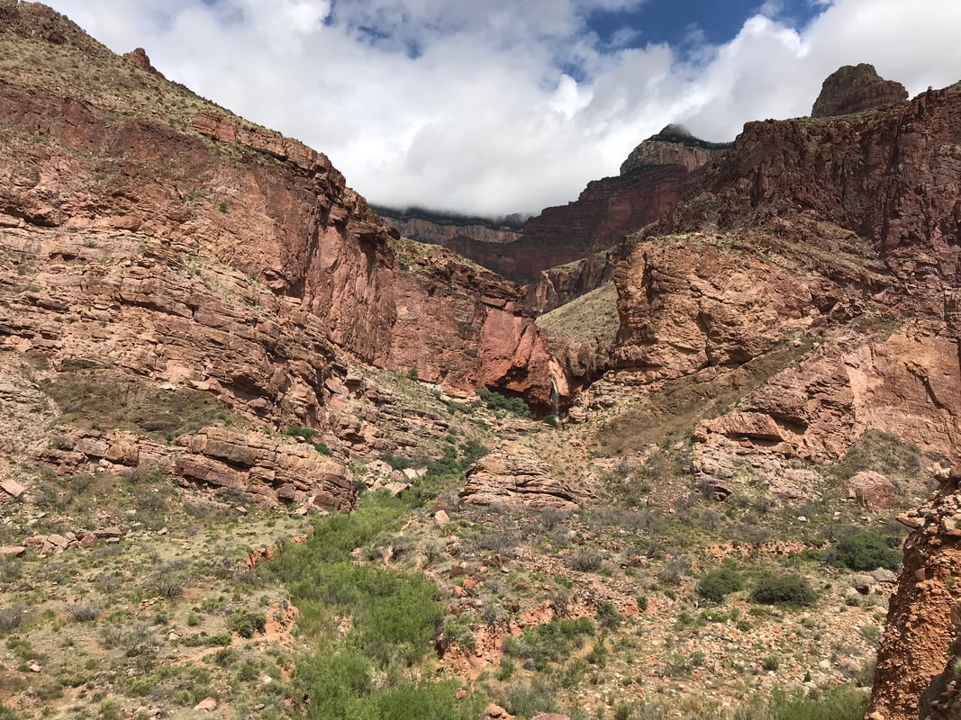
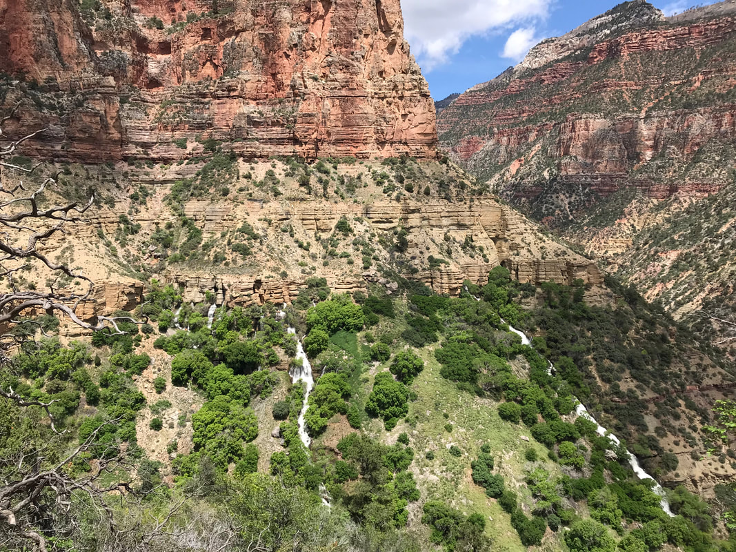
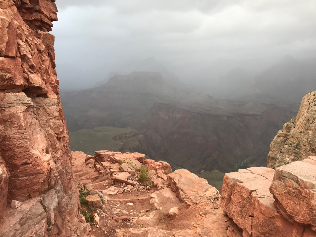
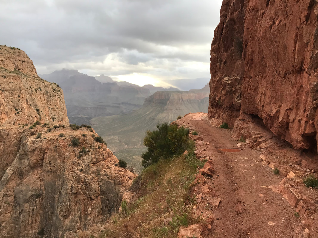
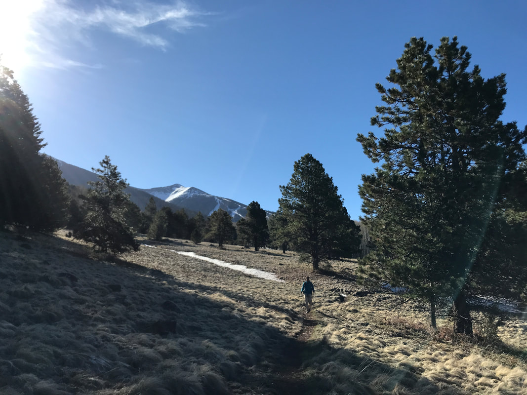
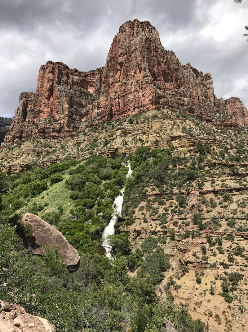
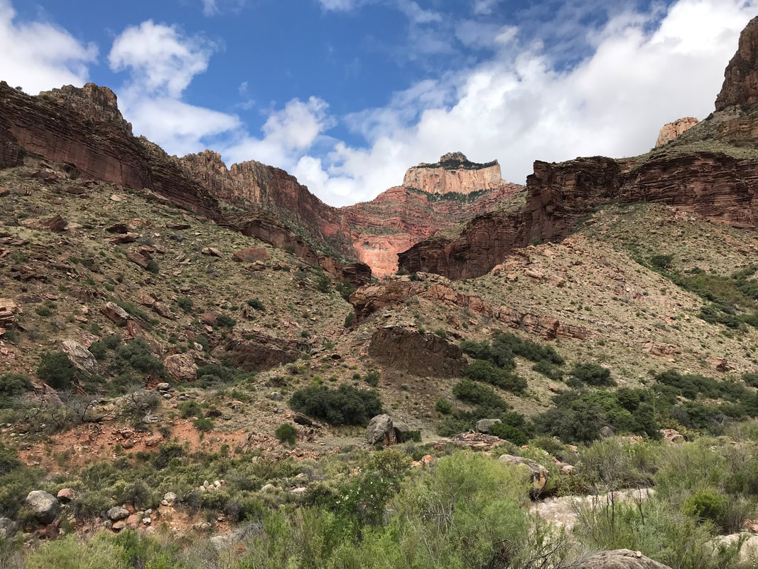
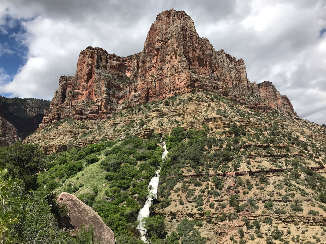
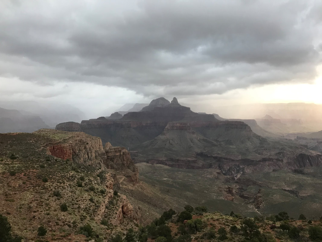
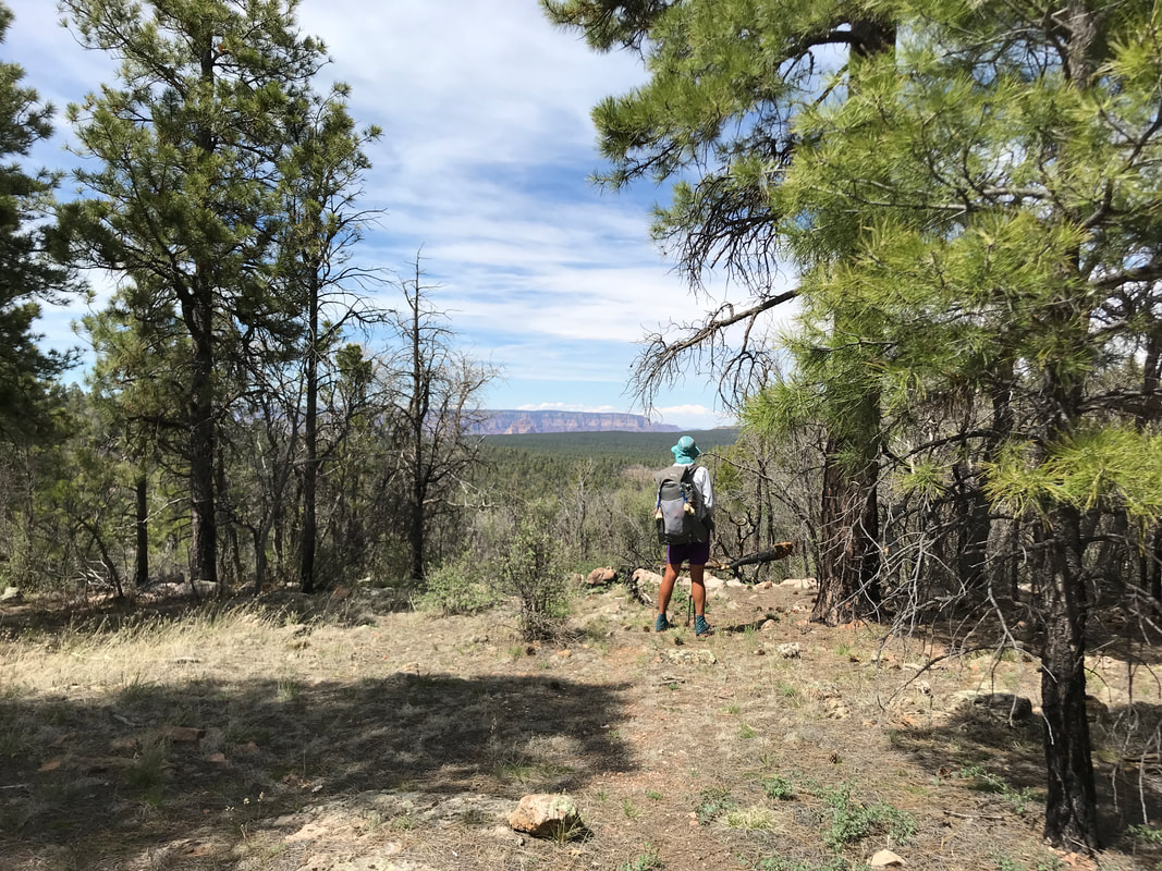
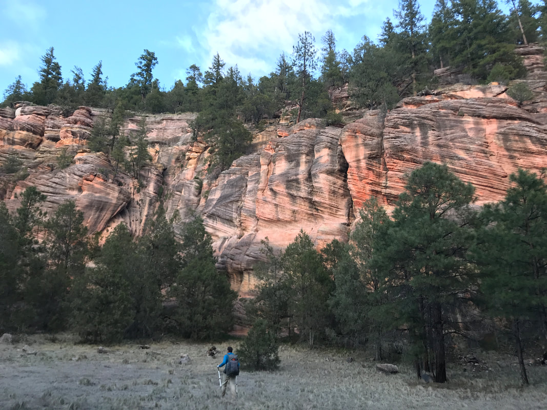
       The clouds continued to dissolve in the south so that the full desert Sun was on us. Ominously, the cloud cover stayed hushed and full on the North Rim, belying the conditions in wait. As the trail moved up the canyon, it began to ascend up switchbacks before making a sudden and defining left and moving up a massive butte. To our rights, a large butte across the way stood with a green tropical mass of plants on its flanks. From high up, a gnash in the solid rock gushed out Roaring Springs. I had no idea what Roaring Springs would look like and it was stunning. I felt like I was in South America as the spring water fell in multiple waterfall rivulets vertically down the face of the butte, threading through and feeding the lush vegetation below. Simply incredible. We stood to admire the scene. The power of this single spring fed not only Bright Angel Creek below but also the entire infrastructure of the South Rim as a water pipeline carried all that water across the Colorado and up from river to the park buildings above. The Grand Canyon always amazes me. We now picked up the pace, trying to get to the top by 3 pm. We sweated hard with the soaring sun, but it felt good to be warm and dry after so many days and nights of damp cold. The sweat began to drip off me and I rolled up sleeves and unbuttoned my shirt to encourage evaporative cooling. By 2 pm we had run into two small groups, both of which were out for day hikes having camped at Cottonwood Campground the night before. We also ran into Ohm Boy, one of the hikers we had spent a dinner and night with at East Cedar Tank back out of Babbitt Ranch a few days prior. He had already gone up to the top, was heading back across to meet a friend, and then would turn around to head all the way back across with them. Truly a badass. Lone stands of pine began to grow trailside as we neared the top. The air became a little chilled as we were approaching the cloud cover brooding on top. 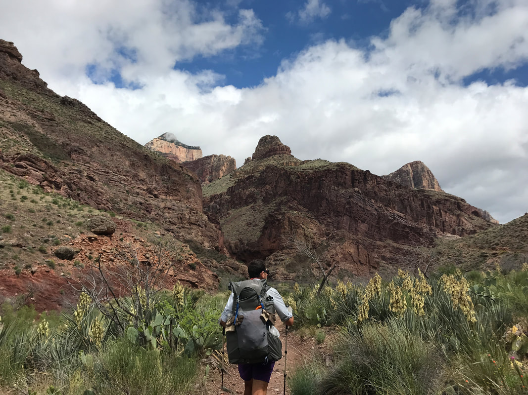
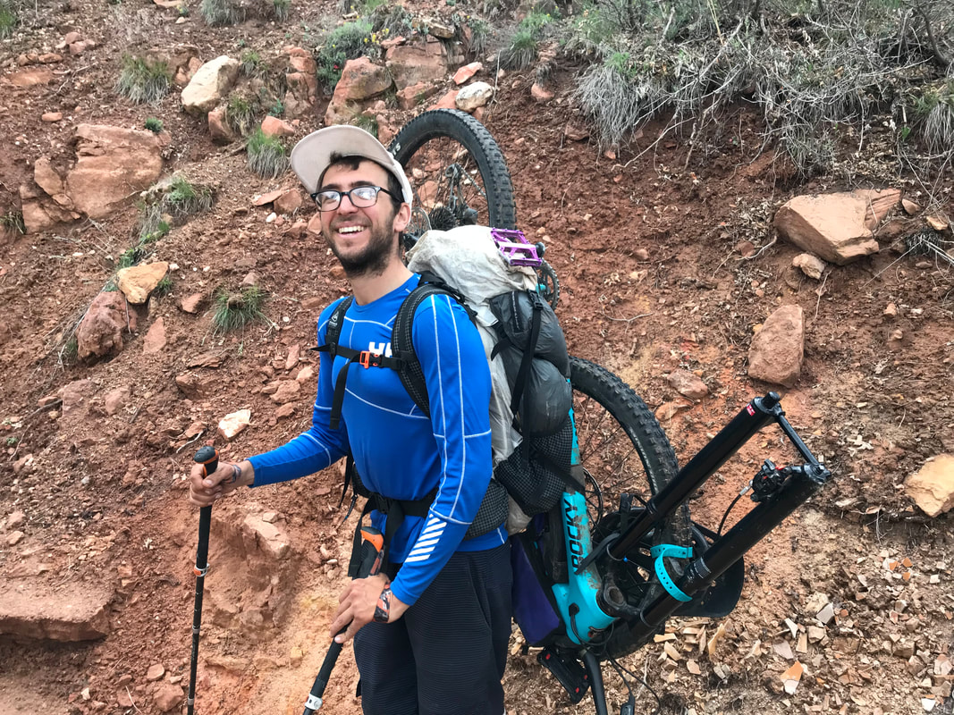
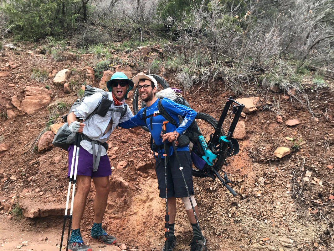
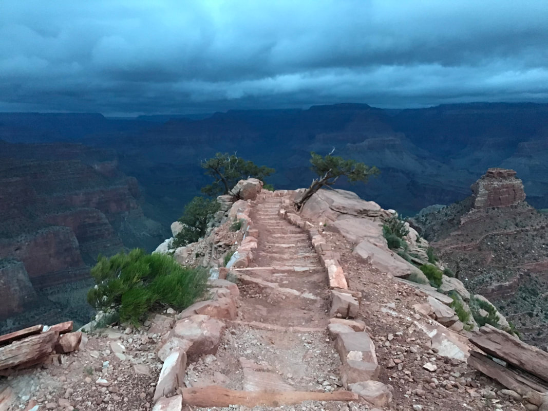
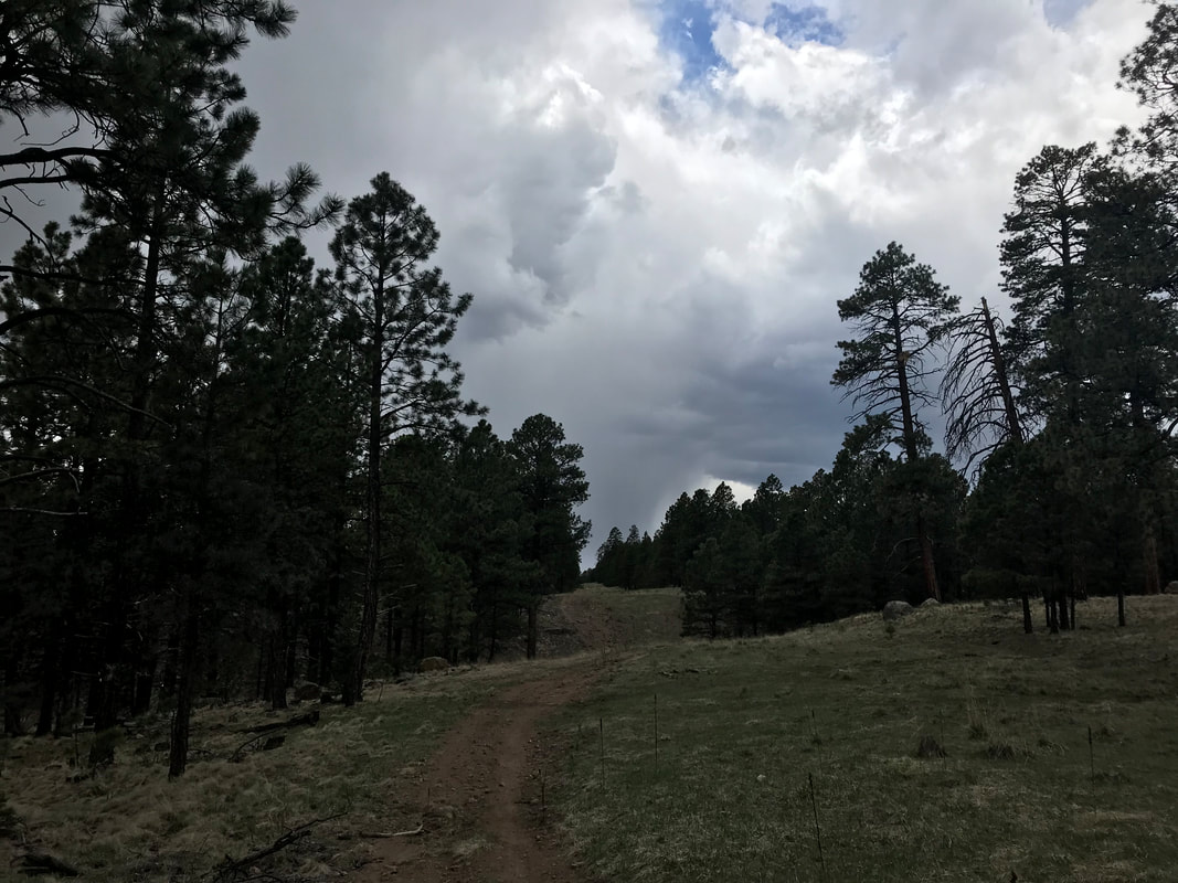
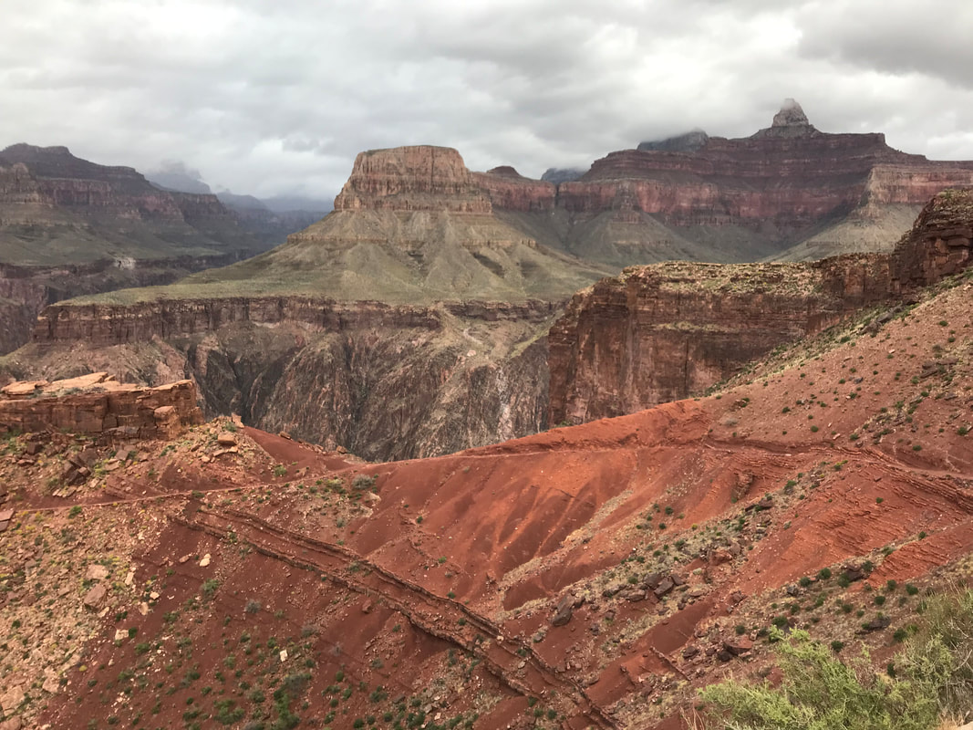
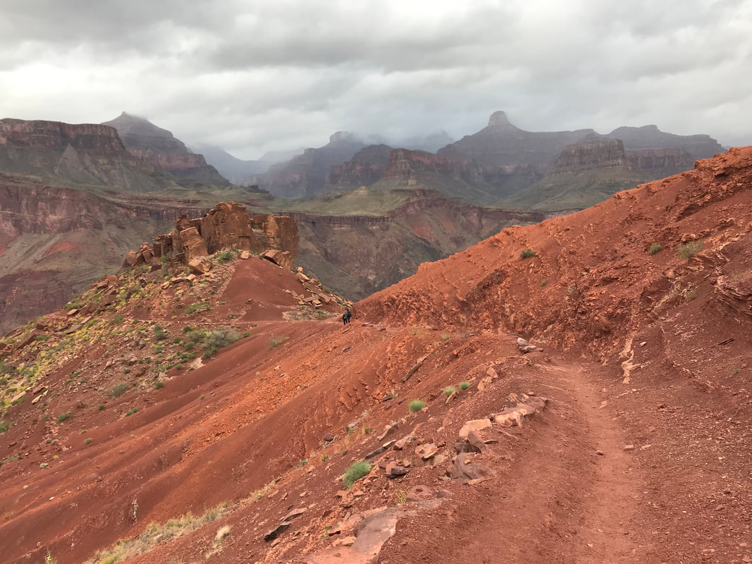
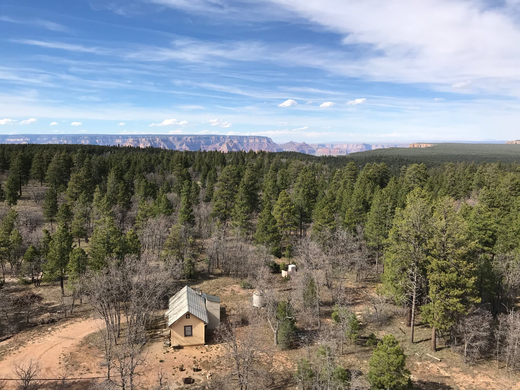
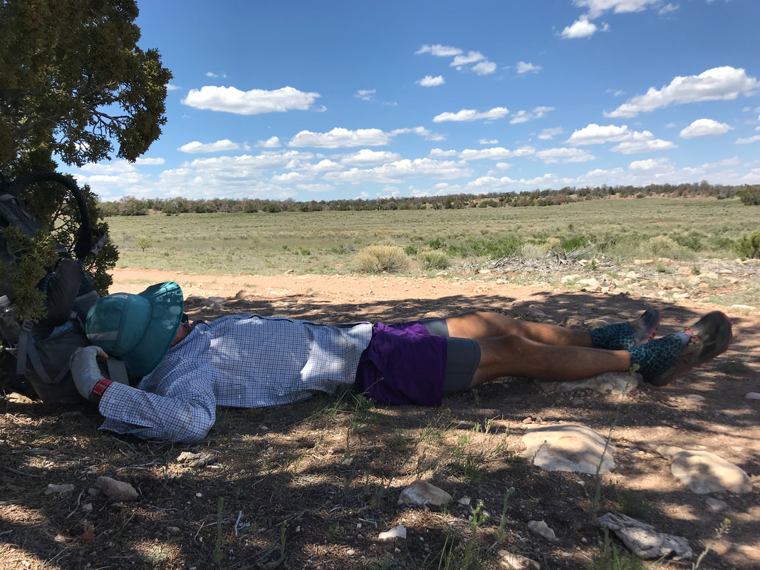
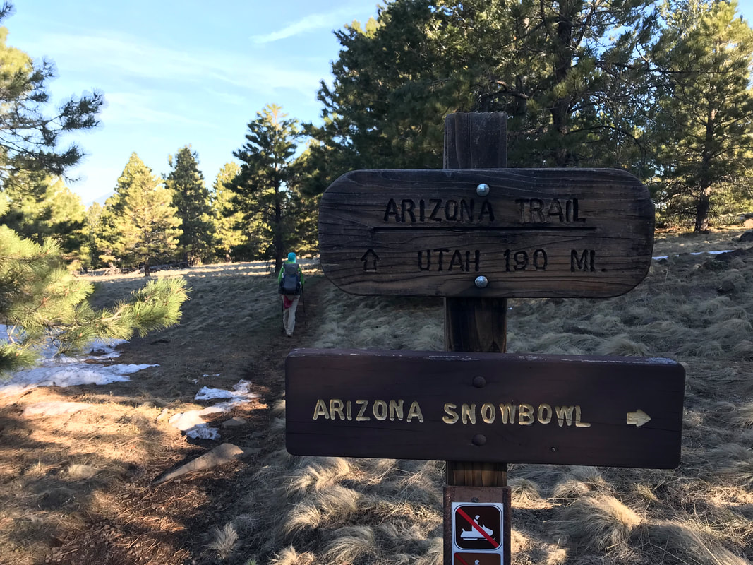
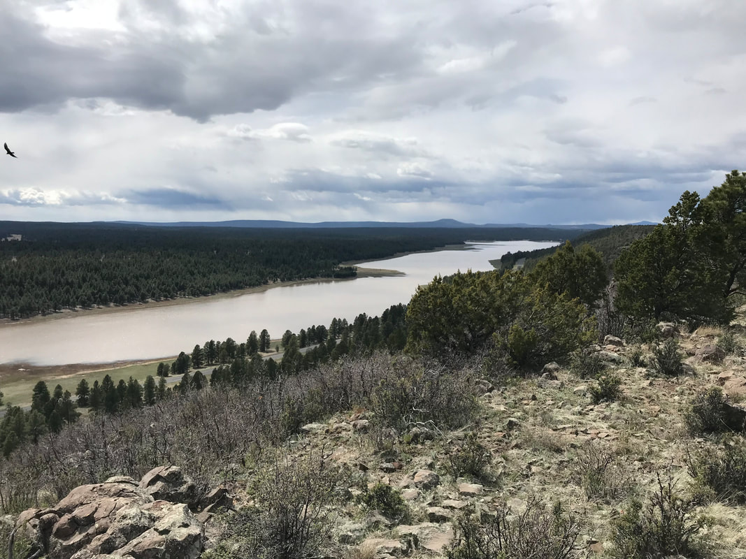
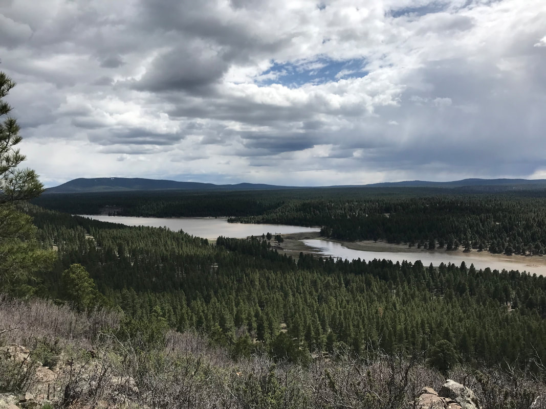
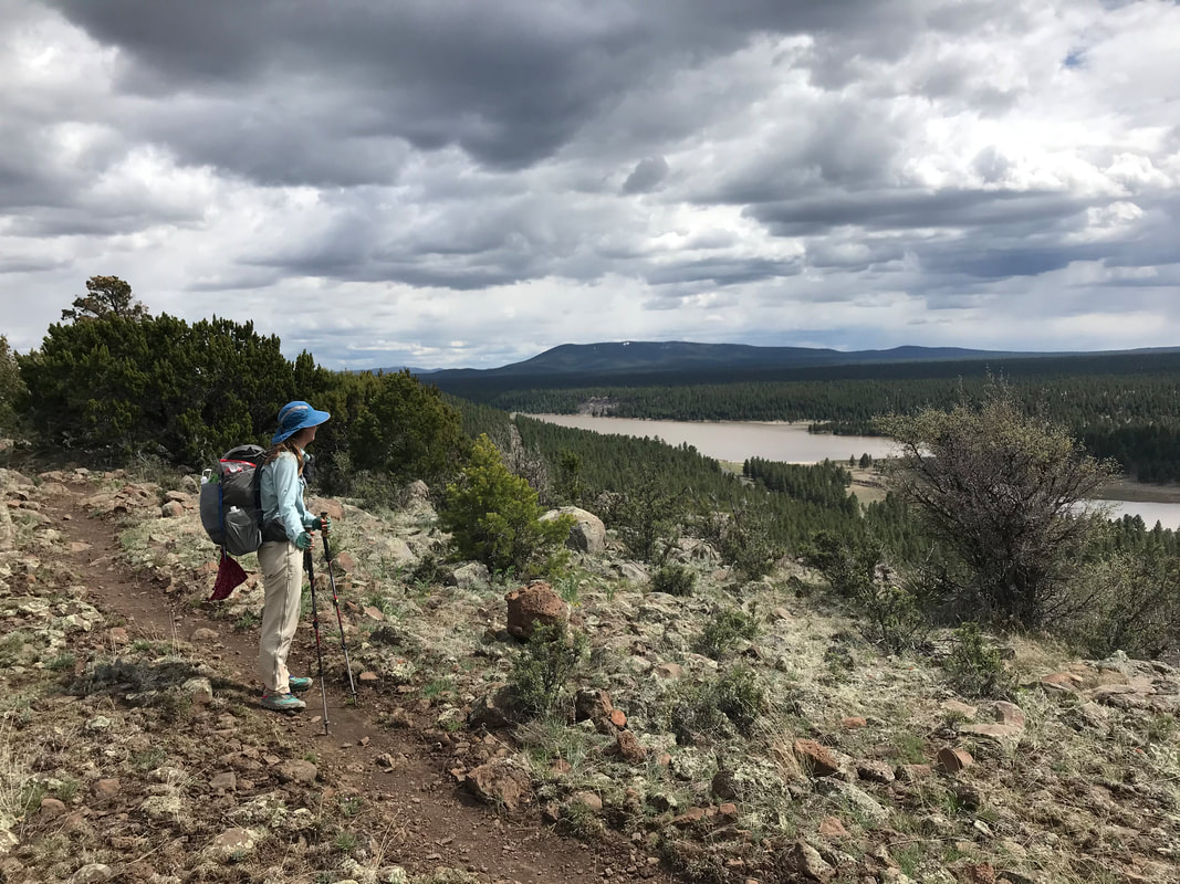
  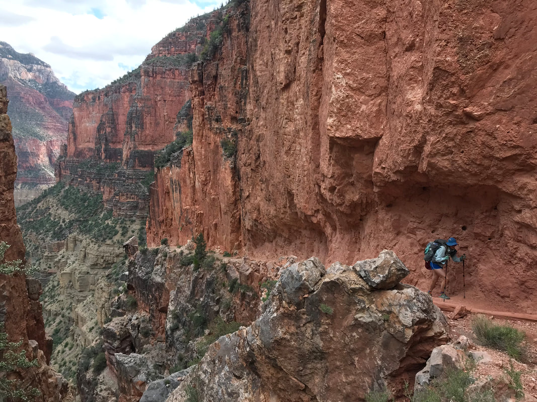 I could hear someone hiking ahead of us with great exertion. Rounding a corner Janna and I ran into an AZT 750 bikepacking racer. Definitely near the back of the racers, he was dedicated and finishing his competition. One of the challenging aspects of bikepacking the AZT is that Grand Canyon National Park does not allow any bikes on the trails. Therefore, all bikepackers have to dismantle their bikes, strap them to their bikes, hike down and across the Grand Canyon, reassemble the bike on the other side, and then ride to the finish. This dude was hurting pretty bad as the hike and weight of the mountain bike (plus gear!) on his back had stressed his knee. We gave him big credit and passed him as he slowly and methodically made his way towards the top. Nearing the top, our speed built as it was pass 3 pm and moving on. We were anxious to see if the faucet on the North Rim was turned on for easy water, If not, we were going to have to hike into the park to an old cabin that had a pump out back - these additional miles were NOT appealing to me at the moment. At 3:30 pm on the dot, we summited the Grand Canyon and looked back across the way, realizing we had covered those 26 some miles in nearly 12 hours with around 7,000 feet of gain since this morning. As our luck, a Park Service employee who had just arrived on the North Rim was literally turning on the faucet for the season. We were the first hikers to catch a drink from it for 2019, so we absolutely made sure to purify it from the winter sit. The ultrarunners we had chased down the Canyon this morning were sitting nearby and they congratulated on us for our speed as we had summited only shortly after they had and they were running with tiny packs. We all sat and drank loads of water while consuming tons of calories. They left shortly before we did as they didn’t planned to be finished into nearly midnight tonight. The cloud cover overhead, that brooding parent, began to settle down closer to the tree tops. The climate here at 8000 feet, nearly 1000 feet above the South Rim elevation, had maintained a storm status that had vacated the South Rim. Now, 3:45 pm, we had allowed ourselves a 15 min break. We had taken 4 breaks, totaling 10-15 min. each in sum today. We were tired but still needed to hike the 10 additional miles to get to the park boundary where we could legally disperse camp. As the North Rim had not yet officially been unlocked for the season, we were told we could not camp in the campground. Now, the last push to the end. To be continued in Part 3… 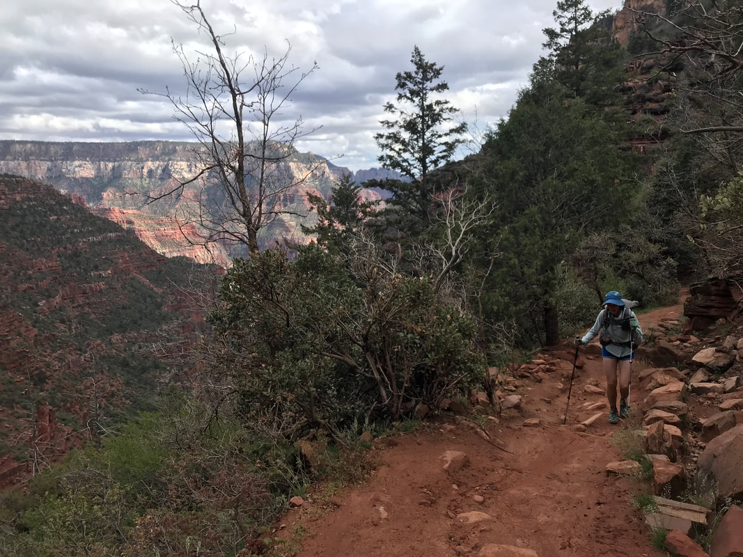
  A day where life stretches and feels like more than one. Although this was all a single day, the events are stretched over three posts, easily three chapters of experiences somehow all placed in a single rise to set. Part 1: Into the Grand Canyon from the South Rim The night was fierce with thought. I struggled to find a place for my thoughts amidst the growing concern for how we were going to accomplish tomorrow. Night noises of campers and dogs spiked my blood pressure. I was aware of how little I was sleeping before the monstrous push to come. The storm curled up over the South Rim and pecked the shelter with rain that raced into sleet and hail. Thunder clapped overhead. Night became as restless as me. The temperature plummeted below freezing. At 2:30 am I stared up into the rustling shelter cloth. At 2:50 am I turned to my right. My open eyes met Janna’s own. “Let’s go,” was all I said. We both sat up. Donning puffies as breath condensed into frost, we packed hurriedly and quietly in the belly of dark as commitment boiled in my heart. We exited the Triplex now thoroughly coated with ice and a film of wetness. I dismantled what I could and forced my numb fingers to push it into my pack. We pulled food out of the canister and ate not of hunger but of preparation for what we were going to ask of our bodies. Frosted mini-wheats and peanut butter. A handful of trail mix for taste diversity. Both standing in still air as a lull in the storm bore no precipitation. Shivering and avoiding shining light on the shelters of others wrapped in down waiting for a warm and dry dawn to camp below the rim. “Let’s go,” was all I said. And we soldiered into the night. What little grace in the storm elapsed into a slow flurry of snow that evidenced the cold. We walked down the empty paved campground road that intersected with the bikeway, which we took north. The wind curdled ice against our cheeks as the snow picked up. The AZT veered off the paved bikeway onto a rocky jeep road I didn’t know existed in the park. We passed silently between shadows of junipers and pines. It just snowed. A few miles later, the AZT crept out onto the South Rim path and we caught our first view of the deep dark behemoth of sleeping canyon below. Sulfur lights sucked color from adjacent parking lots and the depth of the North Rim was lost in the mixture of black and cloud. We walked until the illuminated “Kaibab Trail” appeared. I took one photo using the available light to capture the 3 am cold. Janna and I both used the restrooms one last time, deposited the few ounces of trash we didn’t want to add to our loads, and filled up 2 L of water. We replaced puffies with fleece as sweat was sure to come. At some point, a car quickly pulled up and dropped off a number of individuals equally gasping in the dark and preparing for what I imagined was a day as long as ours. They descended. I visit the Grand Canyon several times a year, a joy I don’t overlook by living in Arizona. This brought some relief and a sense that I had done this many times previous. But this was still unique. It was the AZT. Before I set foot in the Grand Canyon, I made mental goals of reaching the bottom in 2-2.5 hours. Invisible, arbitrary hourly goals were laced in my head for me to compete against to ensure we found ourselves again this evening to come safely in our tent. And we slipped below the rim, descending in the full dark. The straight-edged cliff walls next to us bounced back our headlamp beams as the snow sputtered. We were hyper-aware of our footing. No need to twist an ankle in the dark or saunter with the wind off an edge. Back and forth, the constant pattern of switchbacks. It was INSANE how windy it was. Like the storm was rolling below and coming up from the Earth. Dawn swept gingerly into the color of the sky. An hour in and the fullness of the world around us was revealed as red rock and gray sky. To be honest, it was spectacular. I’ve seen the Grand Canyon many times in all the sun and blue skies and even storms from above. But from below with the earth shrouded in the cloth of mist while dawn pierced a hole? It made for memorable views of depth, color, hue, texture, and adrenaline. Turn a corner and be blasted by wind and rain. Turn another corner and be still with warm sun orange and rose in the fog. Low slung blankets sweeping the rim roof above. Vermilion rock cleaned by rain and stark to the shadows. Truly, truly incredible.
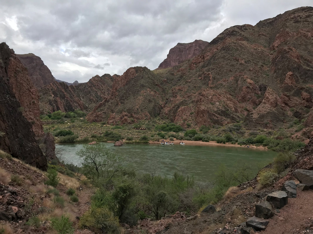
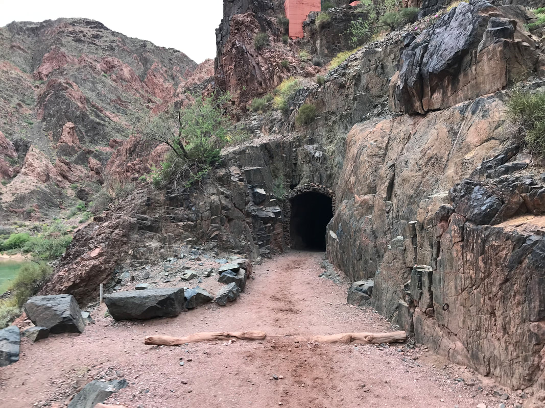
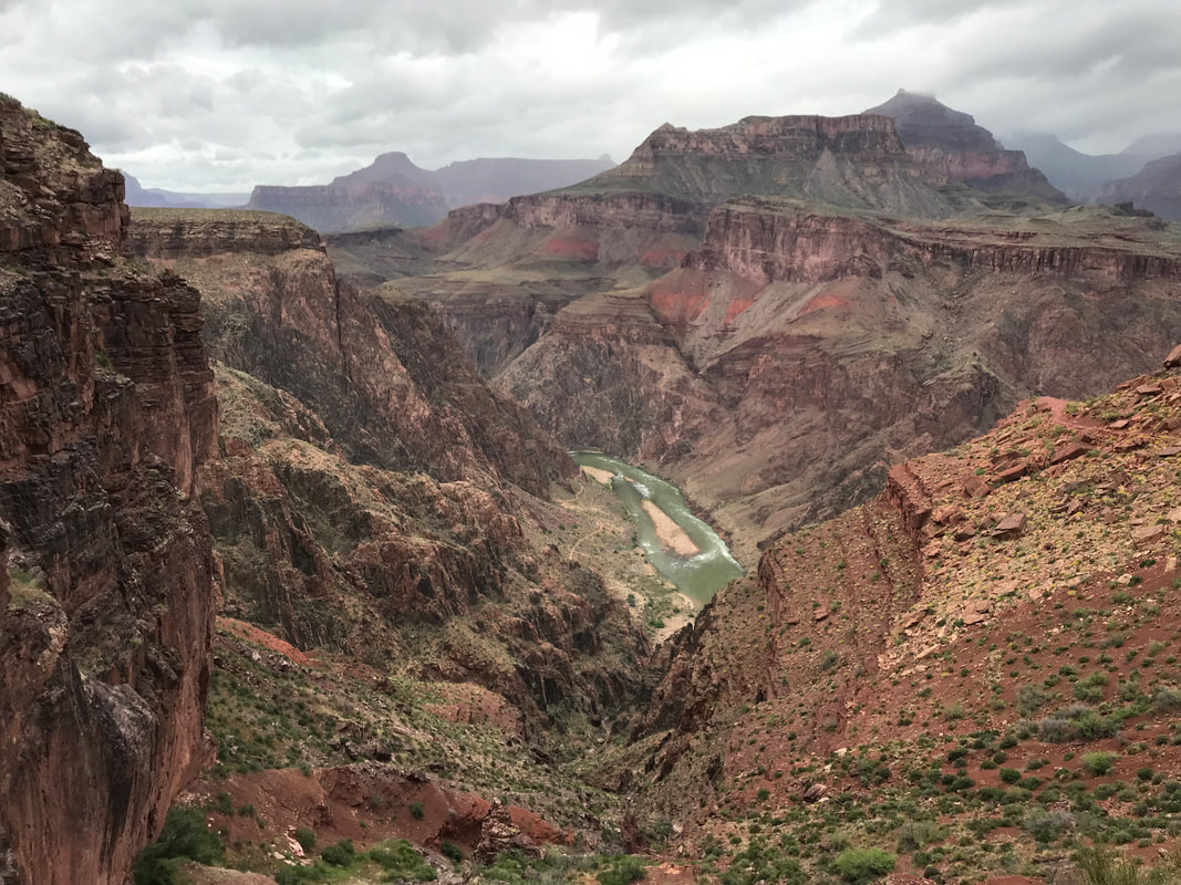
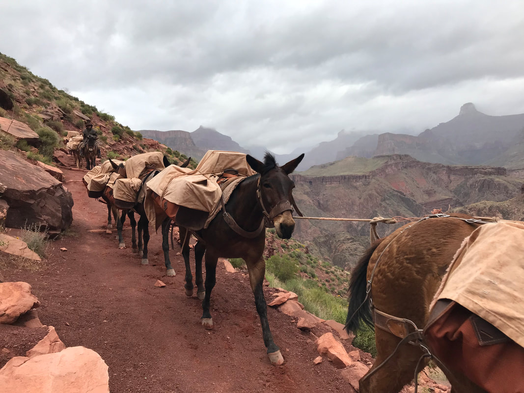
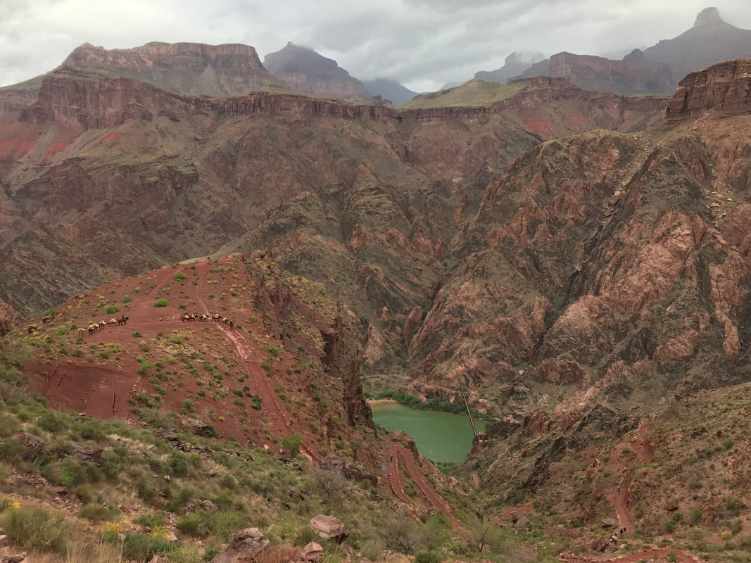
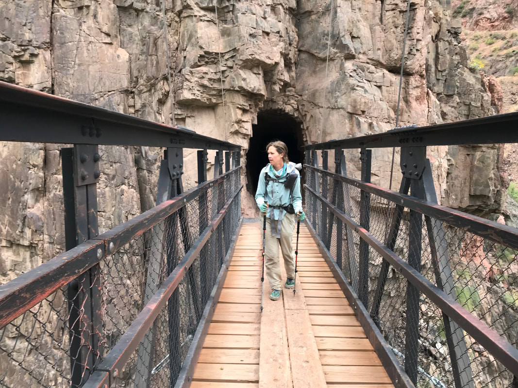
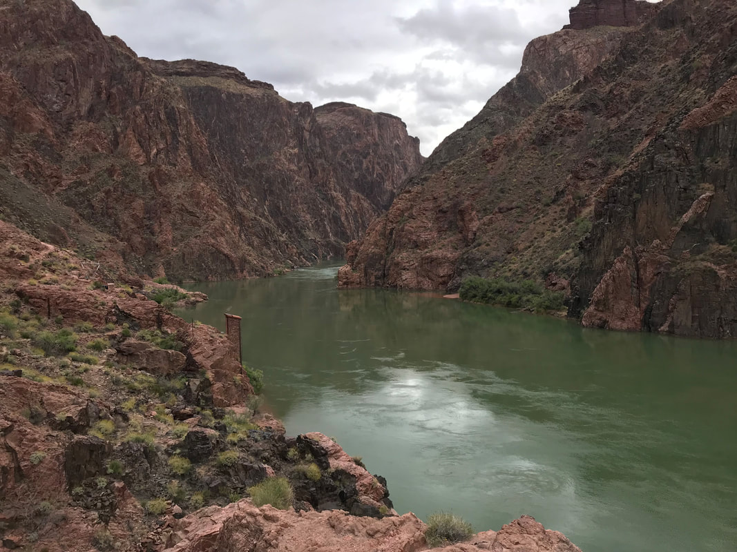
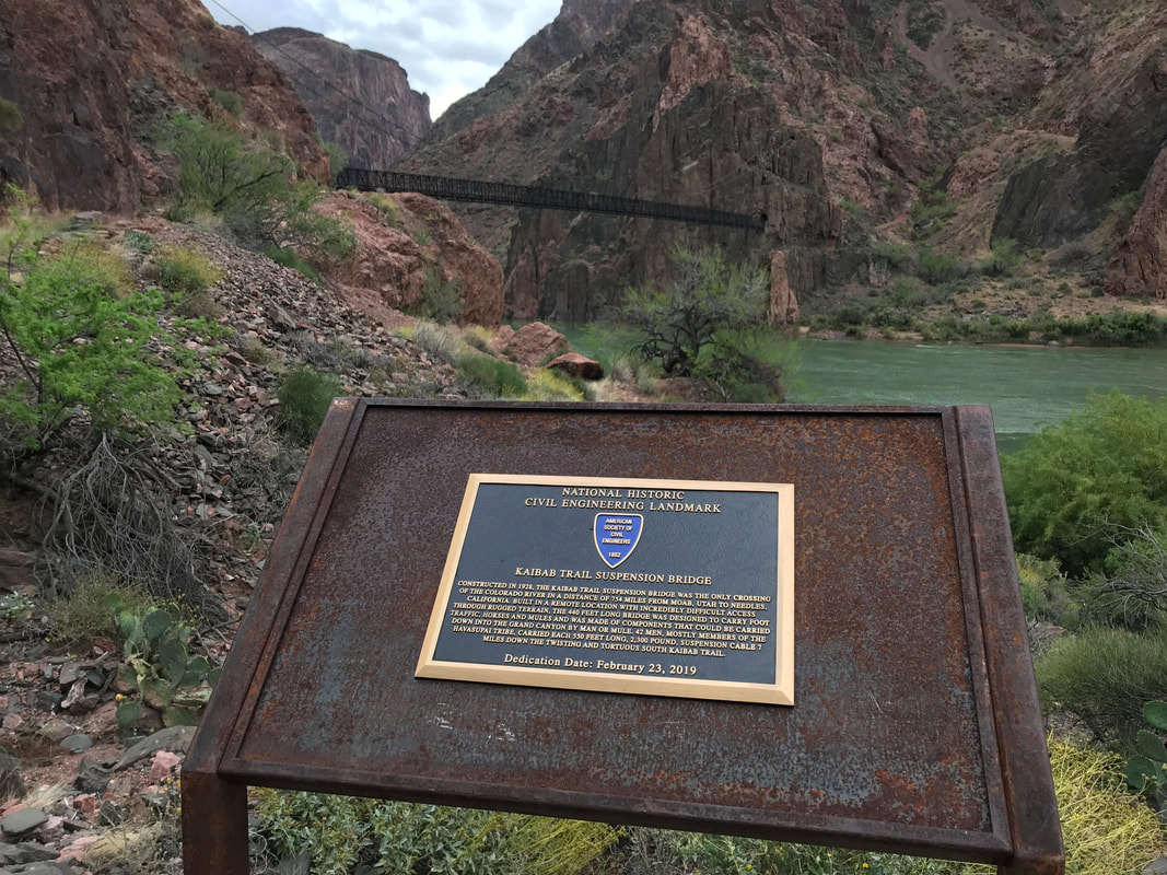
 An hour in and we had made the first round of bathrooms, packed jackets away, and the rain had lessened as the climate of the inner canyon claimed its place. Greater warmth and a dryness denying the storms on alpine cliffs on the south. To the north though…another story. Our path lay in the path of a mighty snowy and rainy storm letting loose on the higher North Rim. Views continued to be epic. Rain falling below and ending just as dramatically. Every space held breath. We caught up near the individuals who started the morning right before us. They were a group of ultrarunners doing a rim-to-rim-to-rim in a day. A surge of joy hit me to think we were keeping pace with them with full backpacking loads. Behind us, the daily train of mules and park rangers came up on us. We stepped to the side as the linked mules took priority and descended in front, carrying loads of supplies down to Phantom Ranch and Bright Angel Campground in the heart of the Canyon. Nearing hour 2, we caught our first views of the absolutely legendary Colorado River below. Although not its natural silt brown, the vivid blue-green still brought a sense of reverence that always occurs when I approach the arterial vein of the Southwest. Two and a half hours in found Janna and I passing through the tunnel where the South Kaibab Trail passes through the rock earth to exit at a suspension bridge providing one of the few crossings of the Colorado. The turquoise water ran powerful, swift, and beautiful below as we made bottom, passed by several ancient Native American structures, and wove our way to the Bright Angel Creek. Here, we made a sharp right, paralleling the creek lined with verdant green cottonwoods while Bright Angel raged with snowmelt below. In track with the times I had set, we entered the campground at 8:15 am. There was time for a 10 minute rest, a quick use of restrooms where sleepy campers were waking at the bottom while we were already 1/3 of the way through our day. We filled up with 1 L each of water. Although it had been cold on top, the canyon bottom was warm. The clouds were abating the heady heat for the moment and we took that climatic advantage to carry a little less water weight on our initial ascent. We stood in front of the Phantom Ranch cabins, and took a single picture of the South and North Kaibab Trail interaction before we faced north to begin our climb. To be continued in Part 2… 
    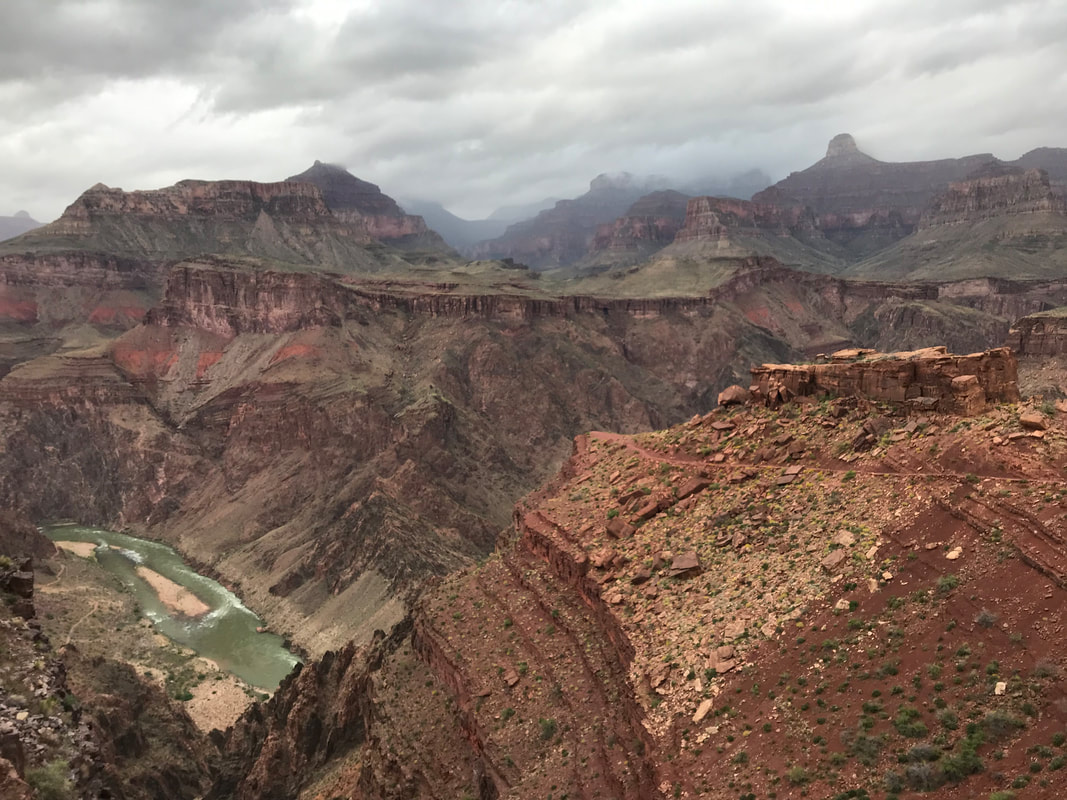    
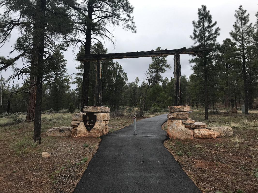
      AZT - Day 47 - Grand Canyon National Park - South Rim at Mather Campground (Trail Mile 688.4)4/29/2019 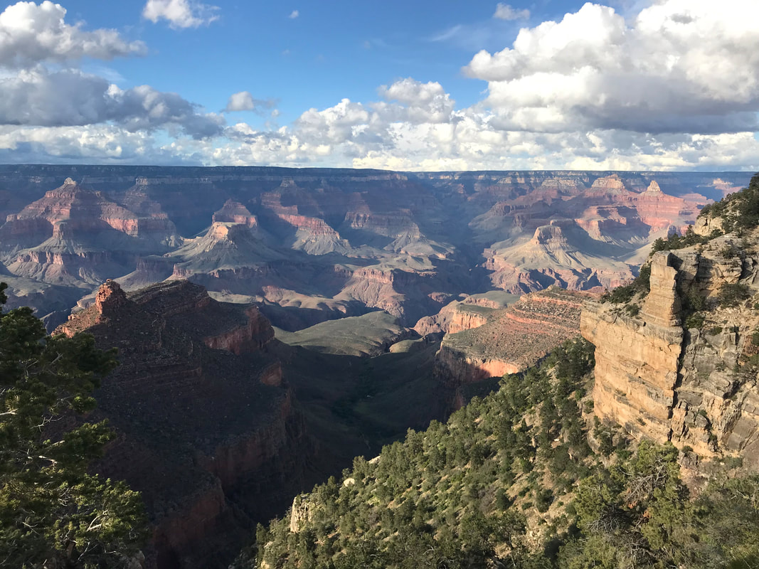 Today would mark the beginning of the most insane physical and mental 48 hours of the entire AZT. Waking up, I had no idea what would happen. ———————————————- Janna and I were up at dawn, ready to high-tail it to Tusayan in order to get some hot breakfast. It had rained pretty much all night so the earth outside the Triplex was soaking. We managed to pack up in a 15 minute span where no rain fell, immediately followed by a drizzle the moment packs were on. We jumped back on the dirt forest roads crisscrossing the southern Kaibab National Forest. Not 0.5 later and we began to sniff the distinct odor of woodsmoke. Suddenly, we the road we were walking on was flanked on both sides by charred and actively smoking trees from a controlled burn. Flames still shot up in places spooking us into how close we had unknowingly slept to this controlled fire last night. Thick blankets of clouds hung low drifting among the tops of the ponderosa pines making up the forest around us. The temperature hovered in the mid-40s as mist and rain fell on concurrently. We walked through the woods, soaked, cold, and eager for the promise of an all-you-can-eat breakfast buffet. At some point, I picked up reception and talked to Harrison, filling him in on our location as we crossed a field of sage. Several miles later the sound of distant cars heralded the town as the double-track opened up into a larger road. We walked slowly and carefully next to several large male elk laying next to the trail, all slowly chewing plants, watching us intensely but unwilling to budge when they had become so accustomed to gawking tourists. With that, a spread of barbed wire fence appeared in front of us leading into the back area of a large RV park. We carefully opened the barbed-wire fence and as I scooted through, a barb caught on the front mesh of my bag and completely disgorged the contents as a full rip seared across. My water filter and empty Platypus bottle fell out. I quickly placed them back in, grabbed some Tenacious Tape, and attempted to secure the ripped mesh closed again. That task accomplished, we walked quietly through the sleeping RV park, past the behinds of several large buildings, and spilled into the street of downtown Tusayan. Tusayan is a very small, but real gateway/tourist trap town just outside the boundaries of Grand Canyon National Park. Charter buses, throngs of cars, and a large number of people all made their way towards the park entrance just north of the traffic circles in town. Amid the hotels and gift shops lay a number of restaurants, including a Mexican one that fellow hikers has recommended as having the BEST all-you-can-eat breakfast buffet. Chilled from freezing cold and rain, we entered the restaurant and saw the most INCREDIBLE spread of food I could possibly imagine. We paid the very reasonable price and began stacking up multiple plates of pastries, toast, jams, sausages, bacon, pancakes, fruit, eggs, yogurt, and multiple cups of hot chocolate to warm the body and provide even more calories. To this day, I consider that one of the best breakfasts I have ever eaten in my life. Hunger truly is the best seasoning. We consumed plate after plate of steaming hot breakfast food, putting back the calories and macronutrients; my legs soaked up the energy and protein, urging even more consumption. I took a picture of myself per Harrison’s request right before I ate. The selfie is below to which Harrison described myself as a “Sad Aging Vampire.” After consuming several plates of food, Rand and his friend happened to walk in and we laughed and caught up with him. He assured us the easy opportunity of getting a permit in the Grand Canyon as AZT hikers. Several other thru-hikers we had talked to occasionally also entered, some indicating they were taking a Zero Day here to stay in a hotel before the push to the end. Janna and I played with the idea, but decided to keep our schedule of hiking into/sleeping in the Grand Canyon tonight, exiting onto the north rim tomorrow, and making 18-20 mile days to meet our ride with Darren on the following weekend. Filled with food, completely dry and warm, I felt a resistance to leave the welcoming restaurant and plunge back into the rain. But we had to get to the Backcountry Permit Office to see what we could grab. The rain had abated while we ate, but now it was more cold and raining steadily as we exited. We crossed back over the road, carefully returned to the AZT via the barbed-wire fence, passed several lounging elk, and found ourselves paralleling the highway of cars steadily heading into the park. The AZT passed through a culvert under the cars and joined a paved bike path on the other side. 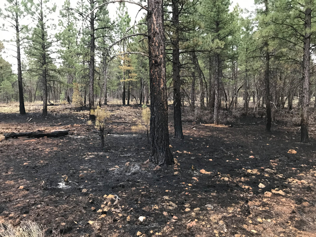 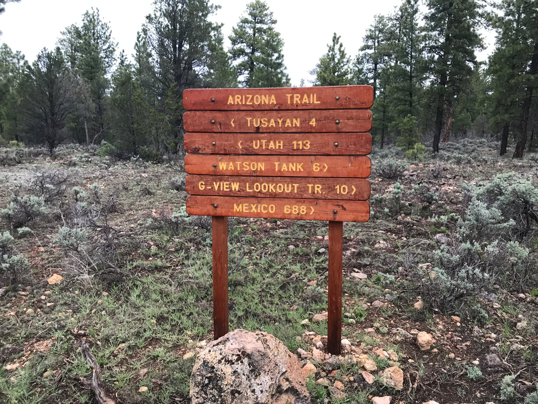 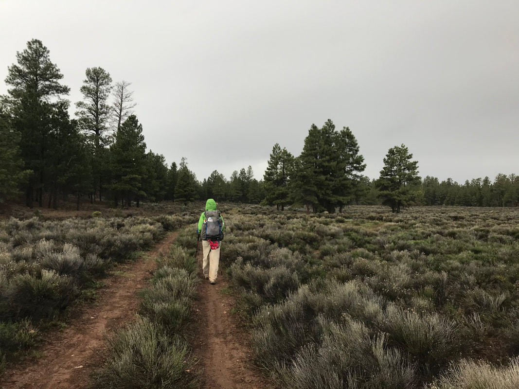  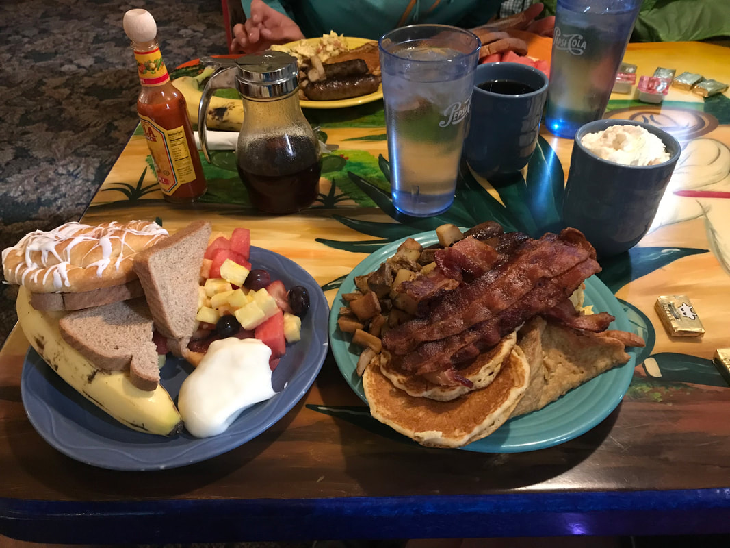 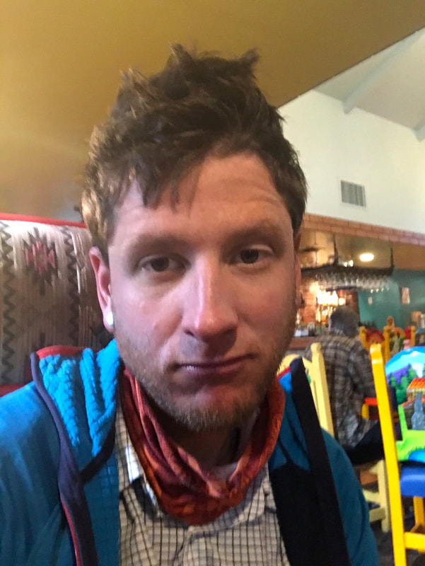 We felt relaxed, moving lazily along the paved path, feeling secure and dreaming of the first views of the Grand Canyon to come. Janna was walking ahead of me on the path when she suddenly stopped, turned and faced me, blood running down her face. Her nose began gushing a severe nosebleed - the worst I had ever seen in my life. Blood didn’t lightly trickle, it kept a stunning and worrisome flow. I had her sit down on a boulder adjoining the Tusayan Bikeway, her head cocked slightly with a hand applying pressure across the nasal ridge. Even then, it seemed to do little to abatement. After 10 minutes of holding, she released the pressure and a massive blood clot exited, smacked the ground, and a flush of new blood began anew. I retrieved gauze from the first aid kit which we used to plug her nose while she applied pressure again. I was getting a bit worried as we were now approaching 20 minutes into the nosebleed. Thankfully, the clot kept this time. When she removed the pressure, it held and we began cleaning up the blood that covered our feet and clothing. While we had been trying to control the nosebleed, I had kept a watch on the sky as a swath of grizzled clouds began to swirl and move quickly overhead. One cloud after another moved so fast overhead, that I knew a storm was boiling on top of us. As soon as the last blood was wiped, I whipped out my phone and accessed the weather app only to have the weather warning go audibly sound as a severe thunderstorm warning shaded our area. Within two minutes of the end of the nosebleed, loud thunder clapped from afar. We quickly pulled on rain layers and began to walk. The speed of clouds flying overhead made me very alarmed and want to walk faster. We were so close to the Grand Canyon, yet it felt like obstacles were being thrown left and right at us. With that, a volley of lightning strikes and reverberating thunder began to strike around us turning the drizzle into a torrential downpour as temperatures plummeted. The nearness of lightning strikes was so bad that we ditched our packs, separated from one another, and found uniform groups of trees to stand near. The thunder roared, the freezing rain completely soaked us, and adrenaline pumped for the worst storm we had been through yet. After 10 minutes of razor intensity, the storm that rolled in quickly now ran out just as fast. The torrential rain sizzled into drizzle. The thunderclaps and strikes gained distance from us. Cold and wet, we gathered our items and now made time to the Grand Canyon. We were hoping to get to the Backcountry Permit Office earlier than later, but now it was becoming early afternoon. The bikeway passed through an old stone and metal arch signifying the boundary line for Grand Canyon National Park. This simple archway was actually the original entrance into the park, now replaced by the car-friendly one. A few miles later, and we came into the outskirts of Grand Canyon Village. Given the time, we decided to forgo grabbing a spot at the hiker/biker sites and immediately head for the permit office. We jumped on a park bus and recognized some fellow thru-hikers. One turned out to be a girl we had lounged with on the Gila River way back in central Arizona. We caught up and it turned out she worked for a summer at Denali and knew a common friend. She was actually skipping the Canyon and returning to Phoenix as she her trip’s time was up, and she needed to return to work. As we jumped off the bus at the Backcountry Permit Office, Bilbo jumped on, literally at the same time. We laughed, hugged him, and told him we hoped to see him later in the day. We walked the half-mile or so over to the office and entered the warm climate-controlled room. Two lines of hikers deep with AZTers stood in front of us. I was rather shocked. It turns out that the storm and rain we had been stuck in for the past two days had led to an inversion at the Grand Canyon. This meant the cloud layers had stayed below the rim walls, filling it like a fog sea. In an effort to prevent accidental death from walking off a ledge, the park service had prevented hikers from heading down. This, combined with the desire for AZTers not to hike down in the proceeding days’ storms, meant a large bottleneck of AZTers had built up. Now, everyone was making a go of it, looking to head down into the Canyon tomorrow. Inside we saw Frisbee and Stubs again! We hadn’t seen them since Oracle and were surprised we had caught them as they had been covering 20 - 30 miles a day for weeks. It turns out Stubs had gotten sick and they had taken two weeks off in Flagstaff to recover. It was great to see them. However, the line of AZT 750 bikepacking racers and AZT thru-hikers suggested permits were going to be tight. Instantly, I had a feeling of unease about our ability to acquire one. What happened next is something I didn’t see coming. I’ll avoid detail here as there is little constructivism that will come from posting it. There were some unpleasant interactions with another individual that lacked respect and left me feeling belittled. The consequences of this interaction were hotly digested and dissected between the two of us over the next few days. Regardless, I’ll fast-forward and say that by the time we walked out of the Backcountry Permit Office an hour later, we and the other AZTers behind us found ourselves permit-less and facing a gauntlet day tomorrow that would require a cumulative 36 mile descent and ascent into and out of the Grand Canyon in a day followed by a 10 mile hike outside park boundaries to disperse camp. This stressed me out big fucking time. No camping permit achieved, we now found ourselves in hardcore adrenaline-planning-mode. Our original plan of taking the afternoon off to relax, sleep in, and do a leisurely hike down was replaced by a need to cover 36 miles beginning in the middle of the night. My mind became a checklist:
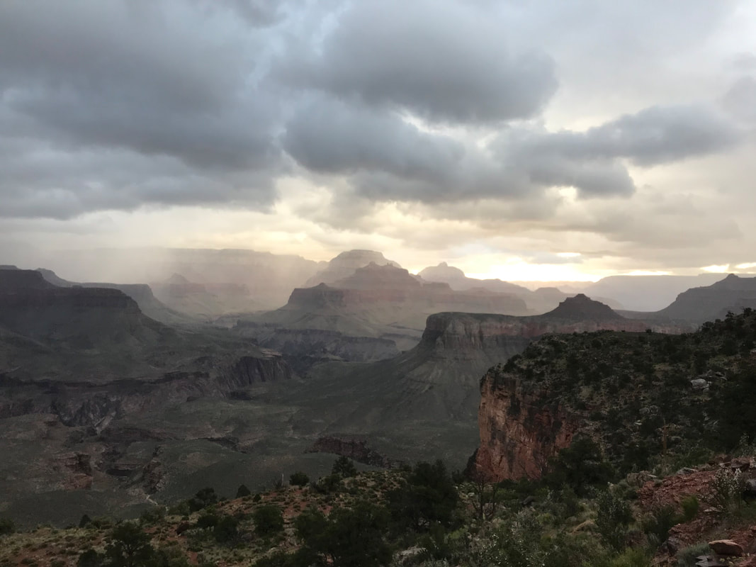
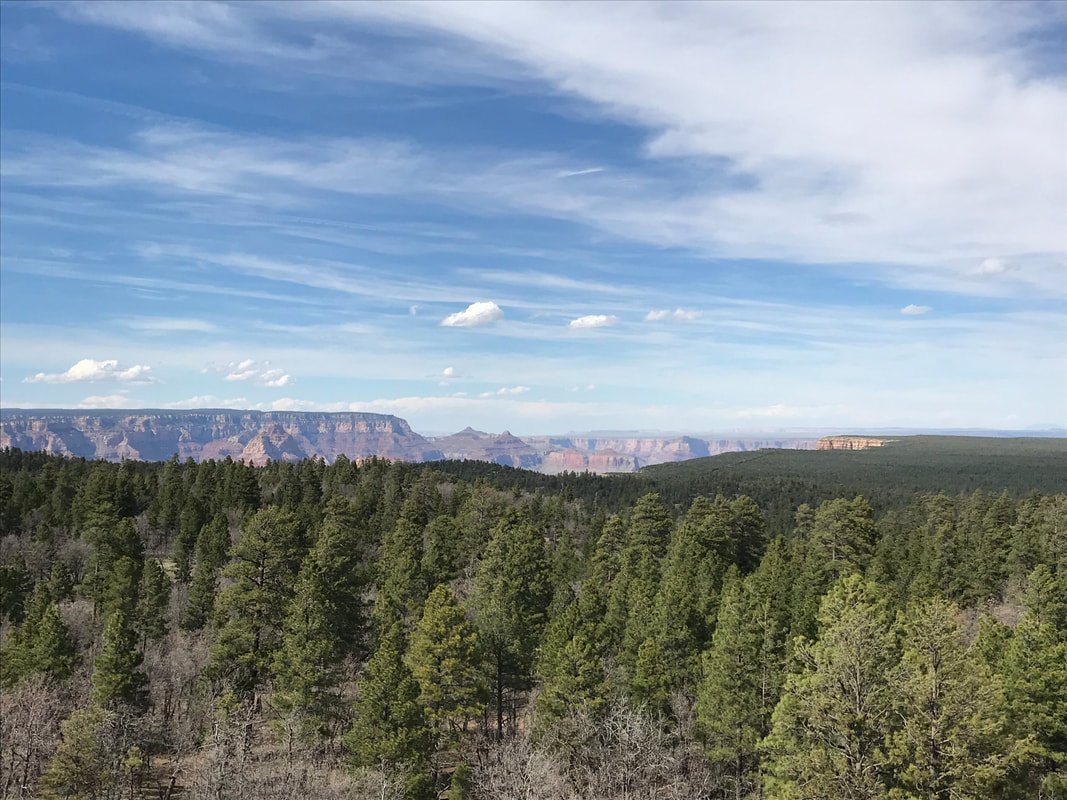
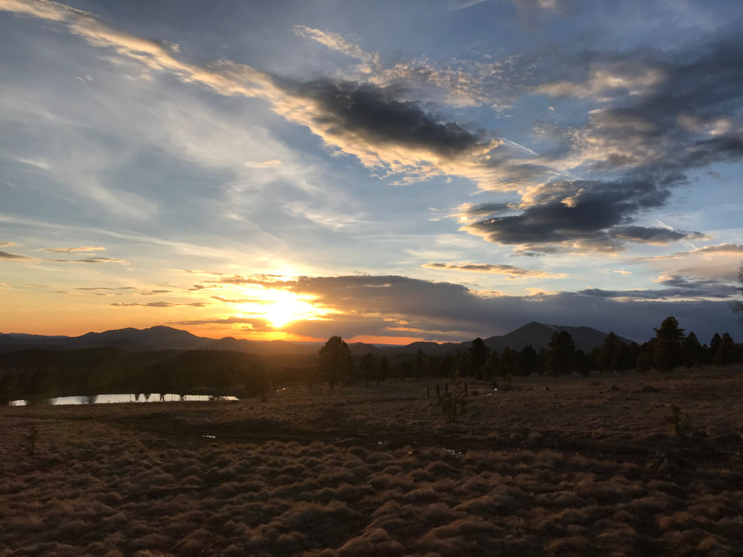
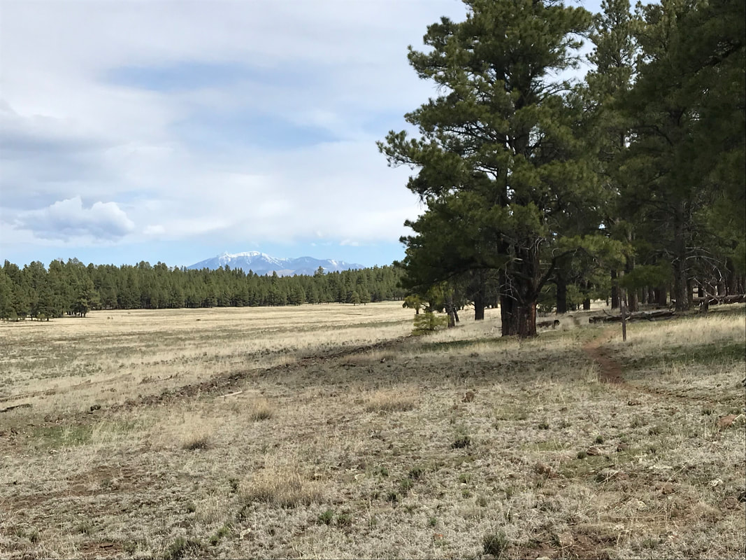
I felt like a bee racing this way and that. Bilbo entered the Backcountry Permit Office as we left and we gave him the bad news. He luckily had time to spare and adjust his schedule. We shared our itinerary with him and made plans for Janna to see him this summer when she headed to Washington D.C. It was to be our last time seeing him. We exited the office and the rain began to fall almost dramatically. The wind and cold kept the temperature hovering in the lower 50s as a high and we jumped on a bus to head to the post office and general store. Once out, I was pacing back and forth frothing with thoughts. Janna calmed me down and said we had this: we just needed to get done what needed to be done - go stepwise. First, we got our boxes from the Post Office. Our last bags of dehydrated beans - it felt monumental. Next, we went into the general store where we ordered hot chocolate and took turns shopping around the store grabbing what we needed for the next several days. The store let us use some indoor chairs and a table to unpack and repack food. All the while, we continued to eat. Unfortunately, my appetite began to wane hard as my thoughts became clouded with the reality of what tomorrow would require. We finished, went outside into the blowing cold and caught a bus over to Mather Campground again. We got approved for a hiker/biker site and went to go setup in a large group of bike tourists, backpackers, and bikepackers. The storm that had hit us earlier in the day had ripped a massive limb off a pine nearby that crushed a building and crews were at work chainsawing it apart. Food secured in animal-proof bins and the shelter setup in storm mode for a long night of promised rain and cold, we caught another bus to the South Rim. From there we caught our first glance of the Grand Canyon on this trip (see photo above). As evening approached, and with it more drizzle and cold, we grabbed dinner at a restaurant overlooking the Canyon. Had it been any other time, I would have relished the superb eating views. However, I could barely stomach dinner as my appetite was flat gone. Janna, having accepted the inevitable tomorrow more-so than I, ate heartily. I was freaking jealous. Post dinner and a meal I barely ate two bites from, we exited the restaurant into the deep dark of twilight. Massive storm clouds had blown in all evening. In the dying light, we caught a glimpse of a winter storm pummeling the North Rim across the chasm. On the slightly lower South Rim, we found ourselves on the bus back to the campground, heading immediately to bed. Once in the Triplex, a series of sleet and thunder continued to hit us until I restlessly drifted into the shallow sleep of stress to come.
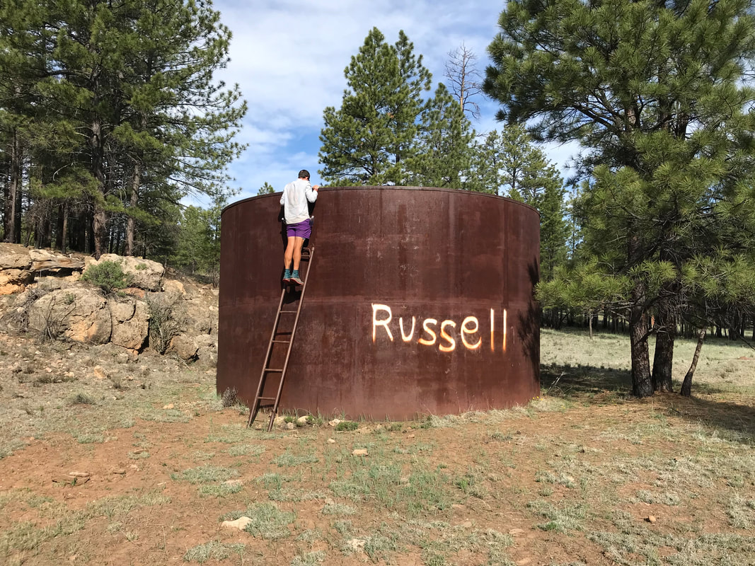
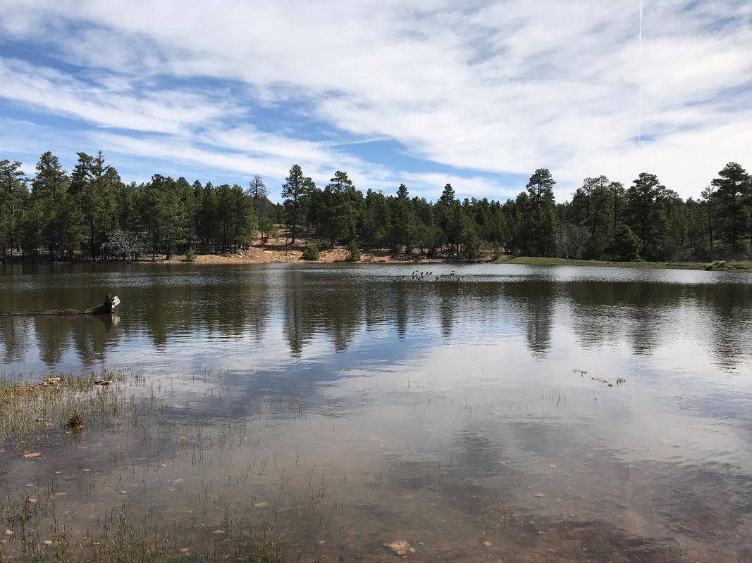
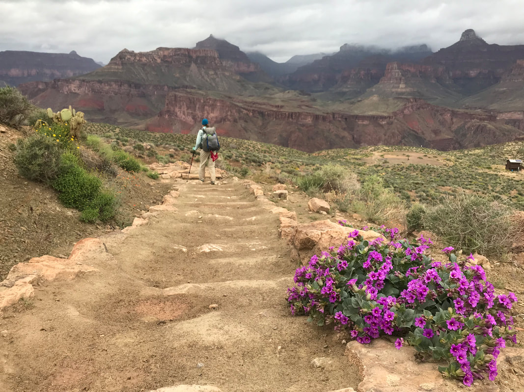
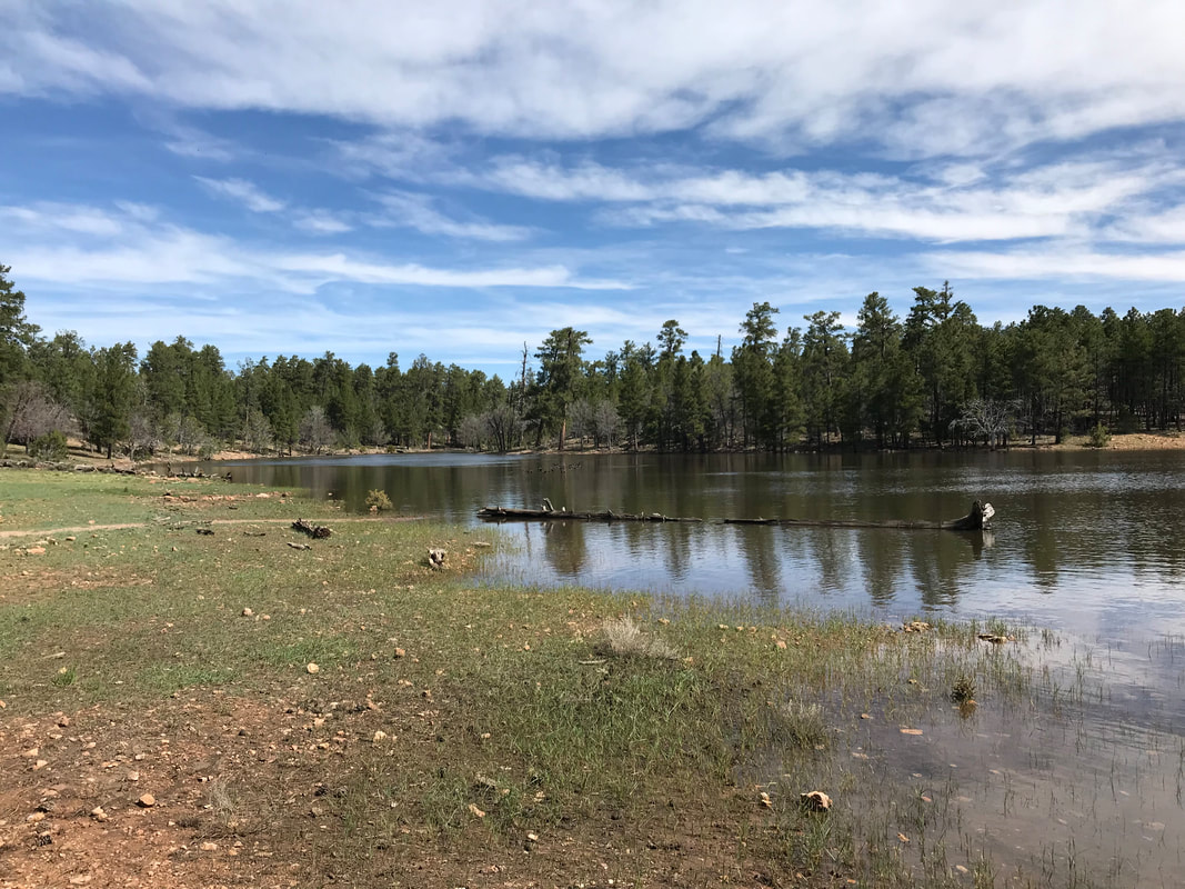
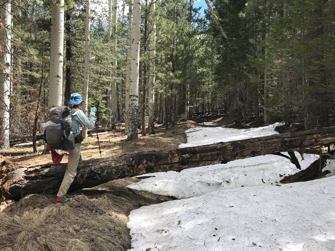
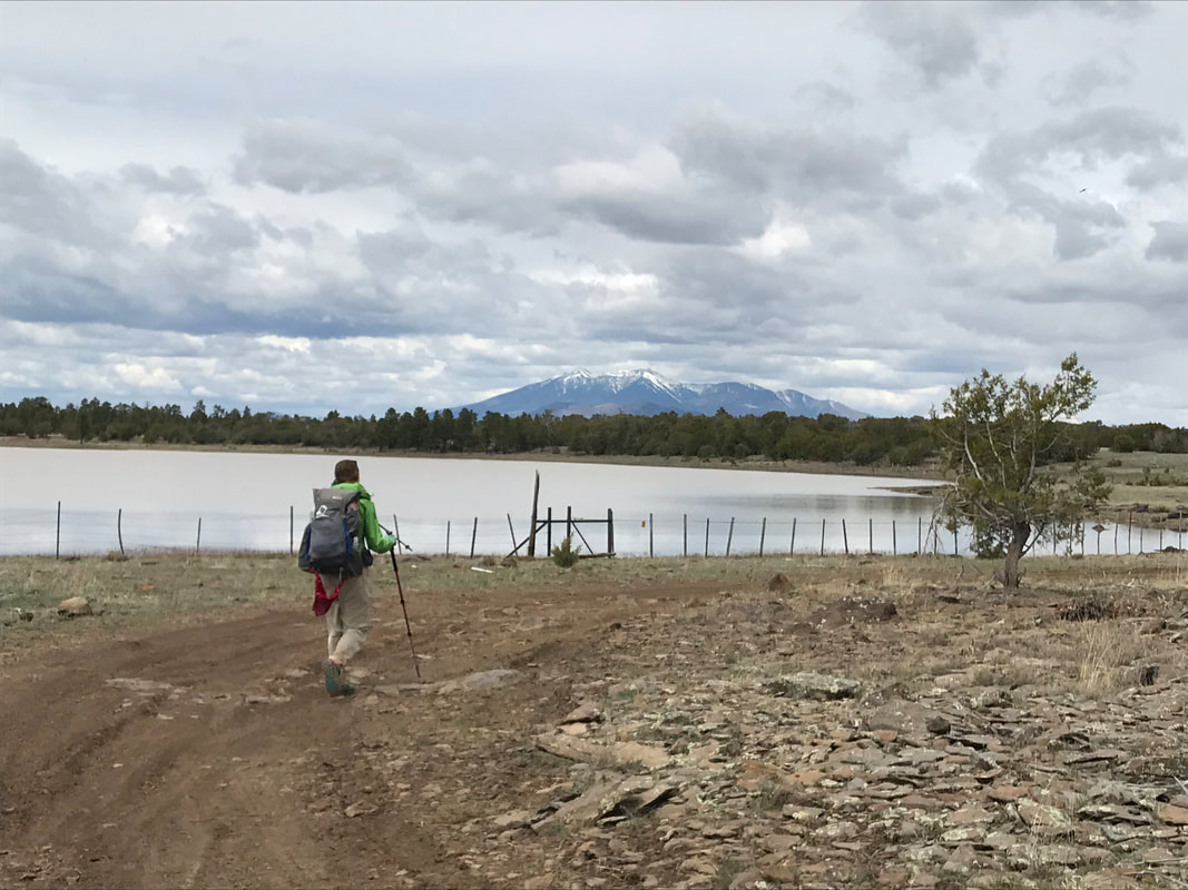
   After thoroughly using the 5 L gathered yesterday for liberal water drinking, food preparation, and of course, the backcountry bidet, we got up and got moving to Russell Tank. And today we would get our first view of the Grand Canyon. Bilbo was out after us, and so Janna and I meandered our way to Russel Trough where we filled up on water. The Kaibab Forest was dense with ponderosa now, stretching our limitlessly - a throwback to the Mogollon Rim just a short while ago. We drank water and walked along the double track rolling through the woods. A couple hours later, we arrived at Russell Tank, which was more of a large alpine lake than a shallow depression of cowshit water. It was absolutely gorgeous with abundant bird life and many places to sit and enjoy the view. I took the opportunity to use the trash cans to dump trash (bye-bye extra large bag of free M&Ms that I was now officially sick of after 24 hours). Then, I walked down to the shore of the lake and cleaned the salt and dust out of my socks, as well as washed my feet. Bilbo caught up with us and we spread out, each of us taking some space to enjoy the silence and views. My feet clean and my water refilled, Janna and I walked with Bilbo through a grove of ponderosa that the AZT wove through. Our pace outmatched his, so we pushed ahead passing by multiple remains of half-eaten elk. The blur of green pine covered the surrounding views, but our progress was well-measured by the hum of excitement that were approaching the Grand Canyon. By midday, we descended a steep embankment in the woods, sharply switchbacked to a canyon floor and up the other side where a small thinning in the trees allowed us a view of our position. We were poised on top of a high plateau with commanding views of a drier, stunted-tree plateau below. And there! In the distance, was a thin stripe of red sandwiched in green: a sliver of canyon rock! 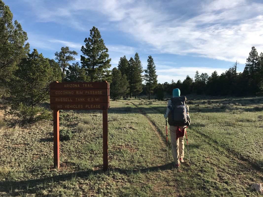
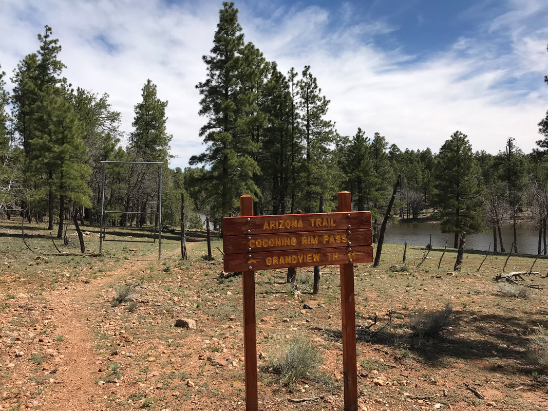
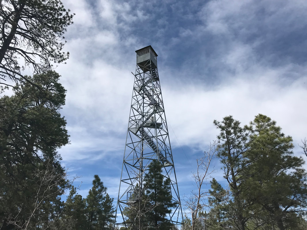
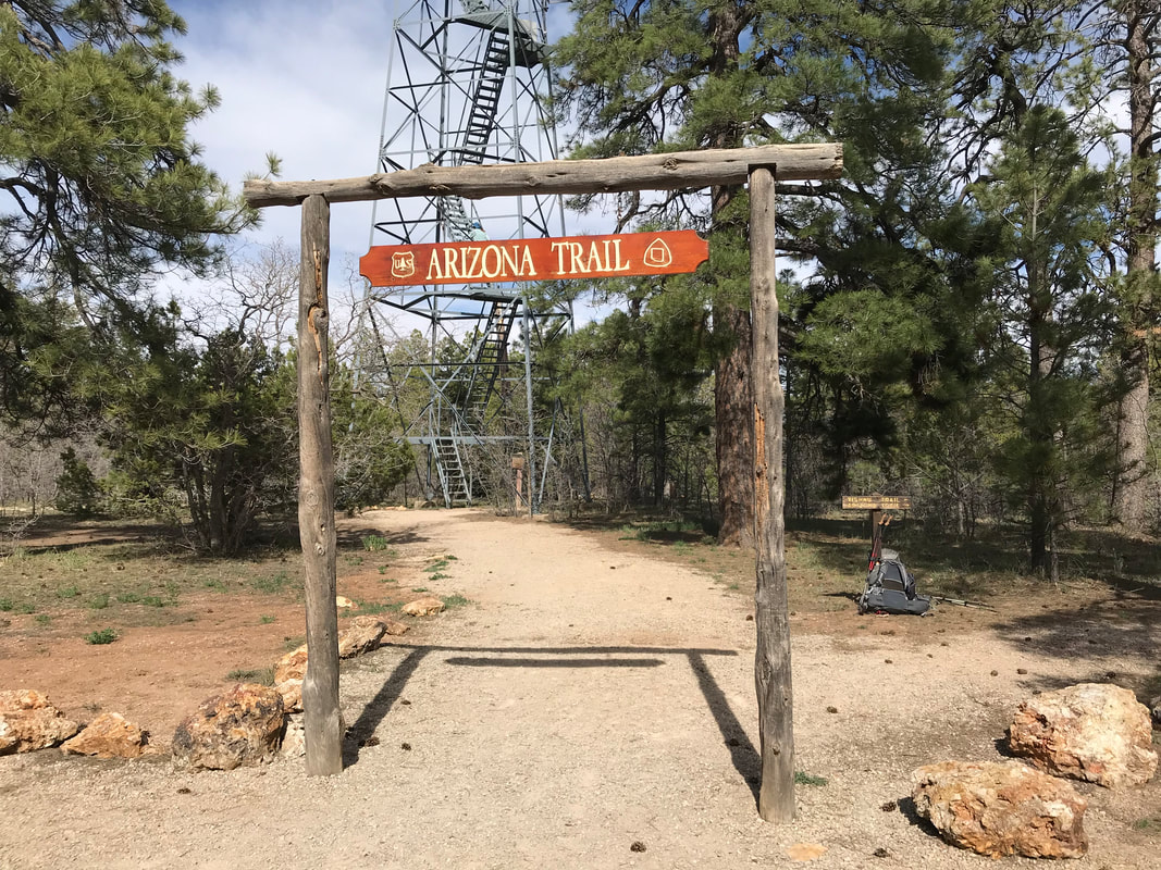
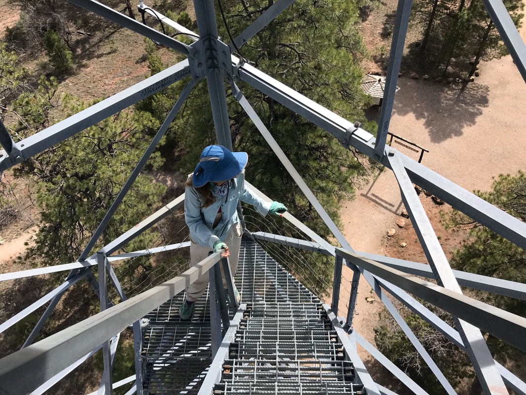
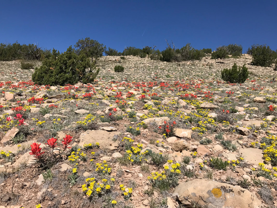
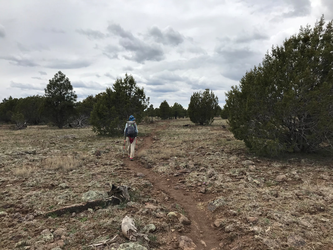
  Excited, we pushed on and by 2 pm, we arrived at the Grandview Trailhead. Here, multiple cars were parked and people milled about below a massive fire tower. Multiple plaques commemorating history and describing the history of wildfire on the land stood about. We left our packs by a trail marker and climbed up the fire tower. Several stories up, the views was AWESOME. Behind us, the vast monolithic ponderosa forest stretched with views of the snow-peaked San Francisco Peaks in the distance. And before us, The carved earth showed its insides as spires and buttes thrust upward from the Grand Canyon. Every bend in the land as the cusp of that fall was as obvious as a knife cutting butter. It was spectacular and proved we had gotten this far. Upon descent, we rand into Rand, the thru-hiker Janna had talked to back in the Santa Ritas during our first week on the trail! He had just finished and was back with a friend who drove to pick him up and wanted to see the area. He gave us some beta about the trail ahead and assured us we could secure sites in the Grand Canyon as AZT thru-hikers. He also said the snow as tough on the North Rim and wouldn’t abate until Jacob Lake. With that, he replace our algae-water with fresh water and gave us a whole box of oatmeal pies to eat. All I can say is: CREAM OF OATMEAL PIE. Janna and I hiked ahead and passed by remains of past burns and the forest in various stages of recovery. Apparently, parasitic mistletoe was so bad here in the 1900s that it killed most of the forest which easily caught flame. Now, it was being managed after years of fire suppression followed by bad burns. As the afternoon wore on, Bilbo caught up to us and we walked and talked for several miles. The three of us moved in and out of meadows of fresh green grass and into the massive stands of pines. As early evening approached, Bilbo decided he would camp early as he had a hotel for a Nero Day in Tusayan planned and couldn’t check in until later in the day. We bid him goodbye and good luck. We exchanged contact information as it seemed our trip itineraries were parting ways. As evening approached, Janna and I contemplated a 30 mile day to camp right outside of Tusayan, but decided against it as exhaustion set in. We ate dinner in the evening dark as cold dropped hard into the area. We pushed on hiking in the dark until we entered an area with excellent flat spots. We wandered into the woods in the dark and picked a place suitable for a camping and just a few miles short of town. We battened down the tent and just made it in as low-slung clouds that gathered over the course of the evening began to putter rain onto us for the rest of the night. 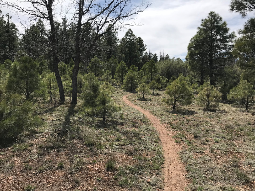 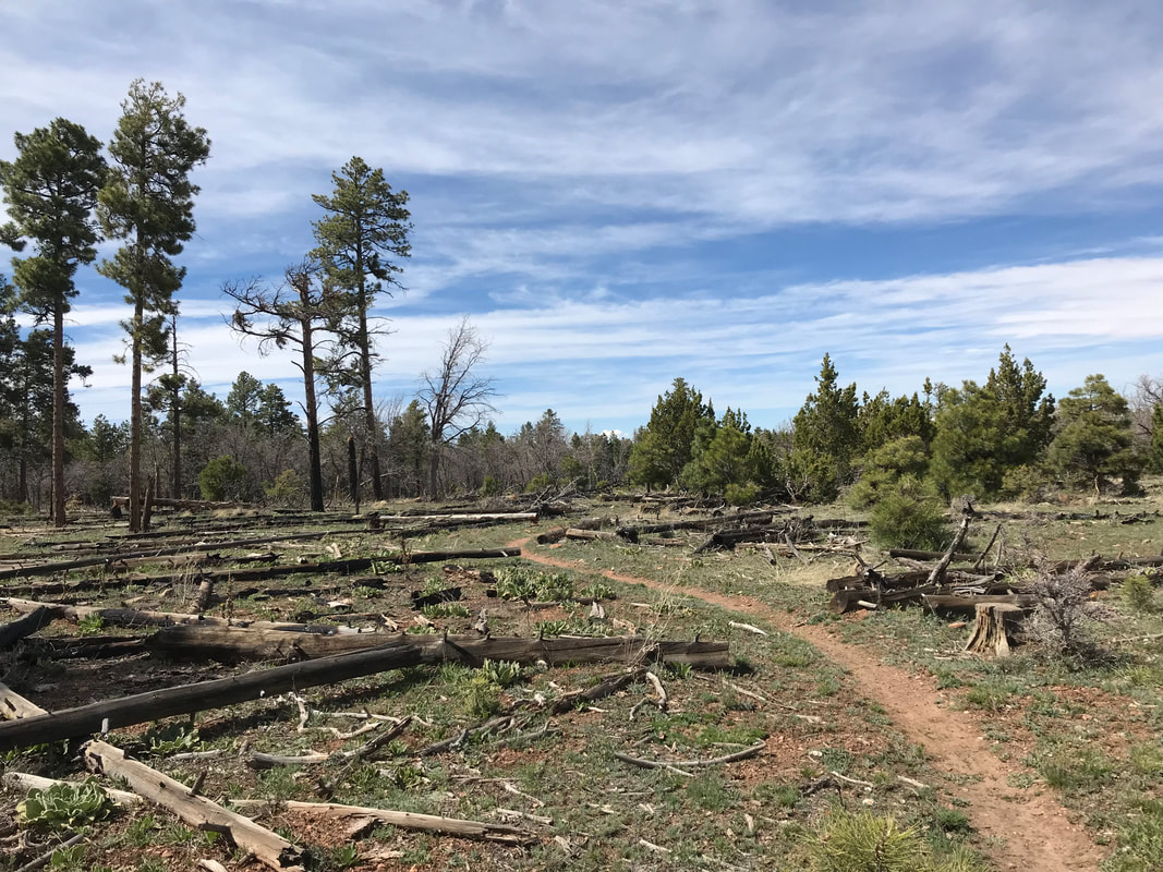
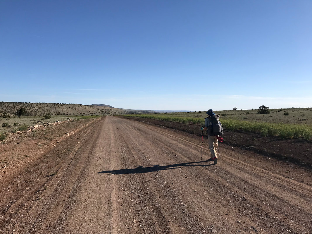
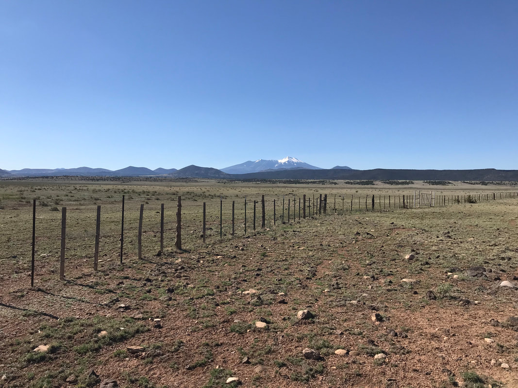
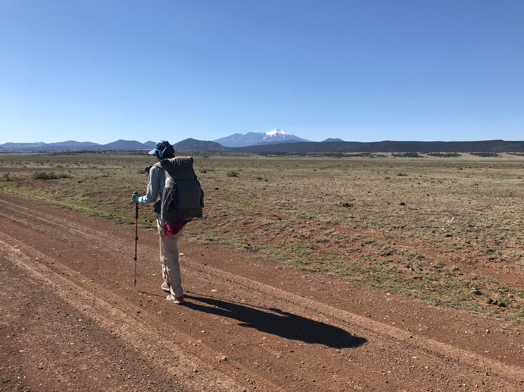
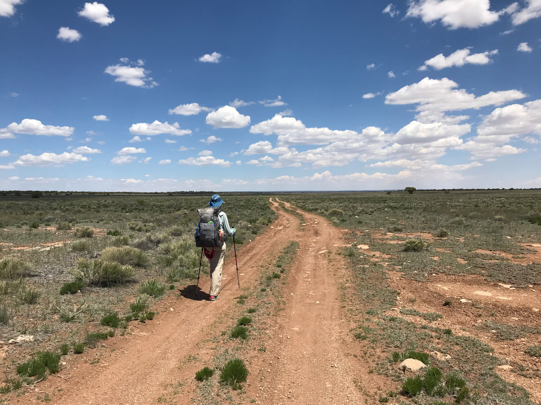
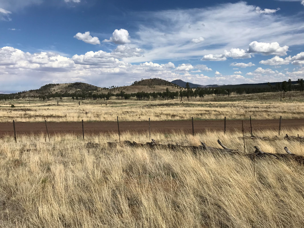
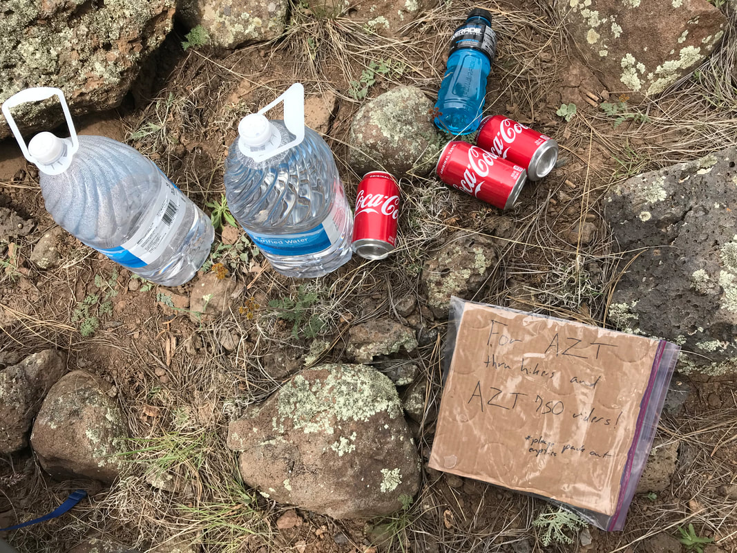
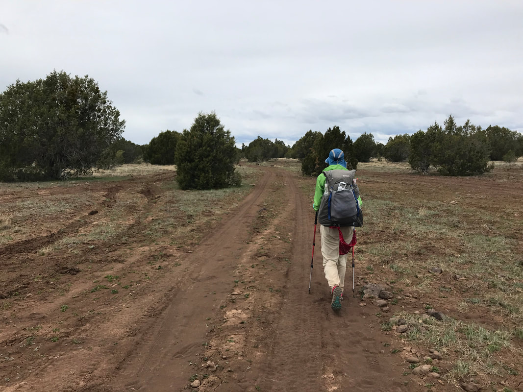
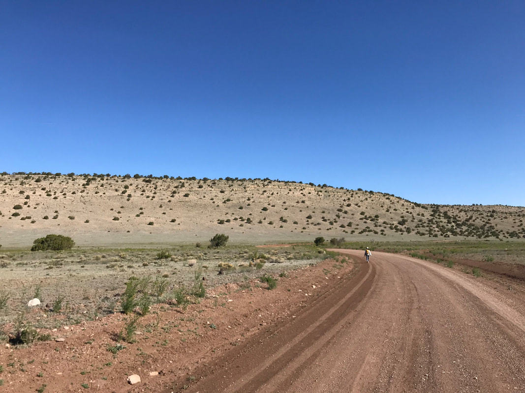
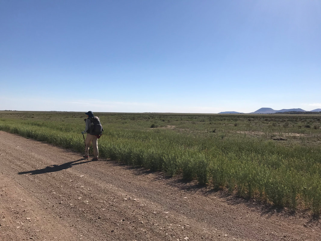
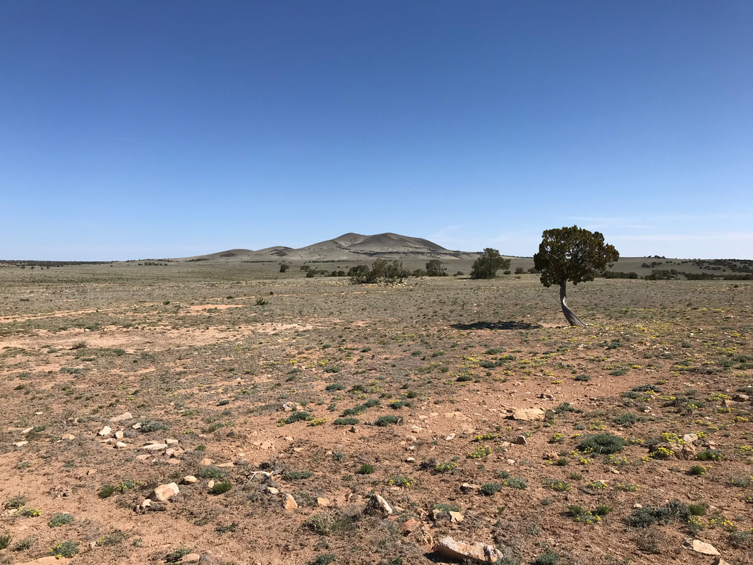
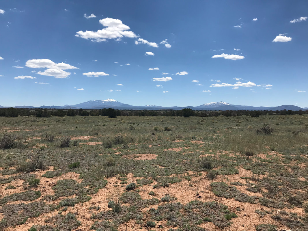
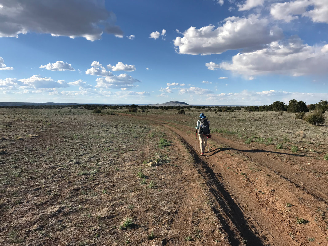
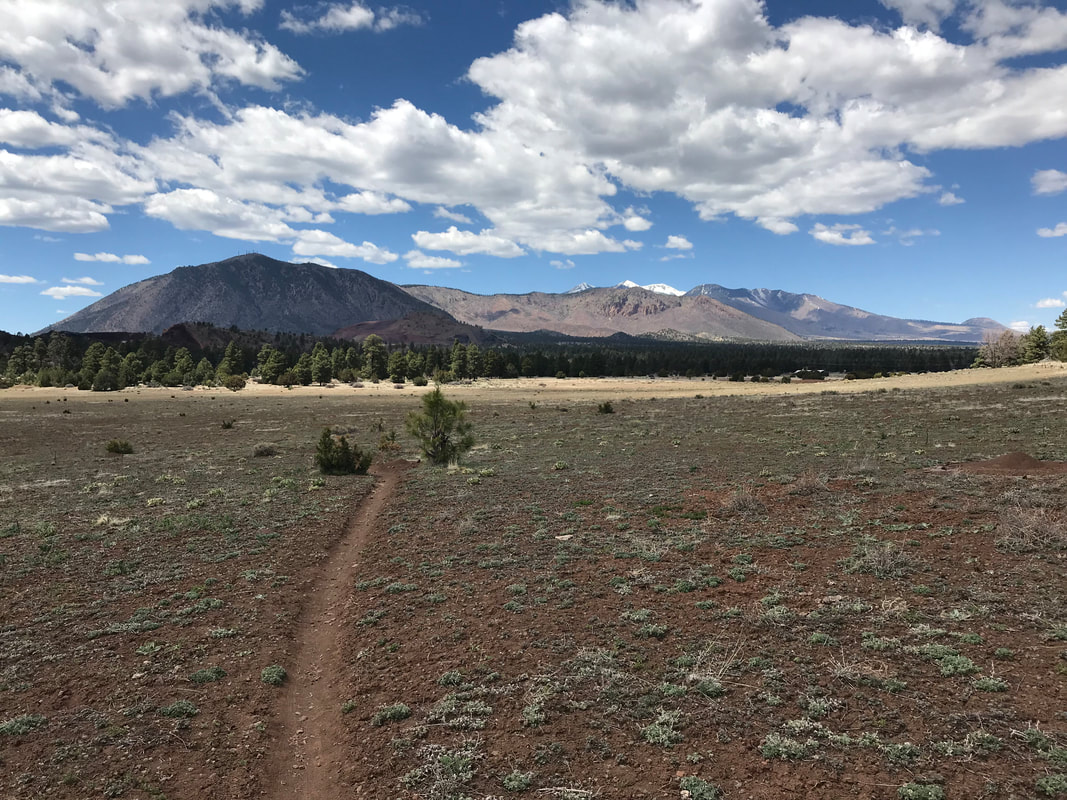
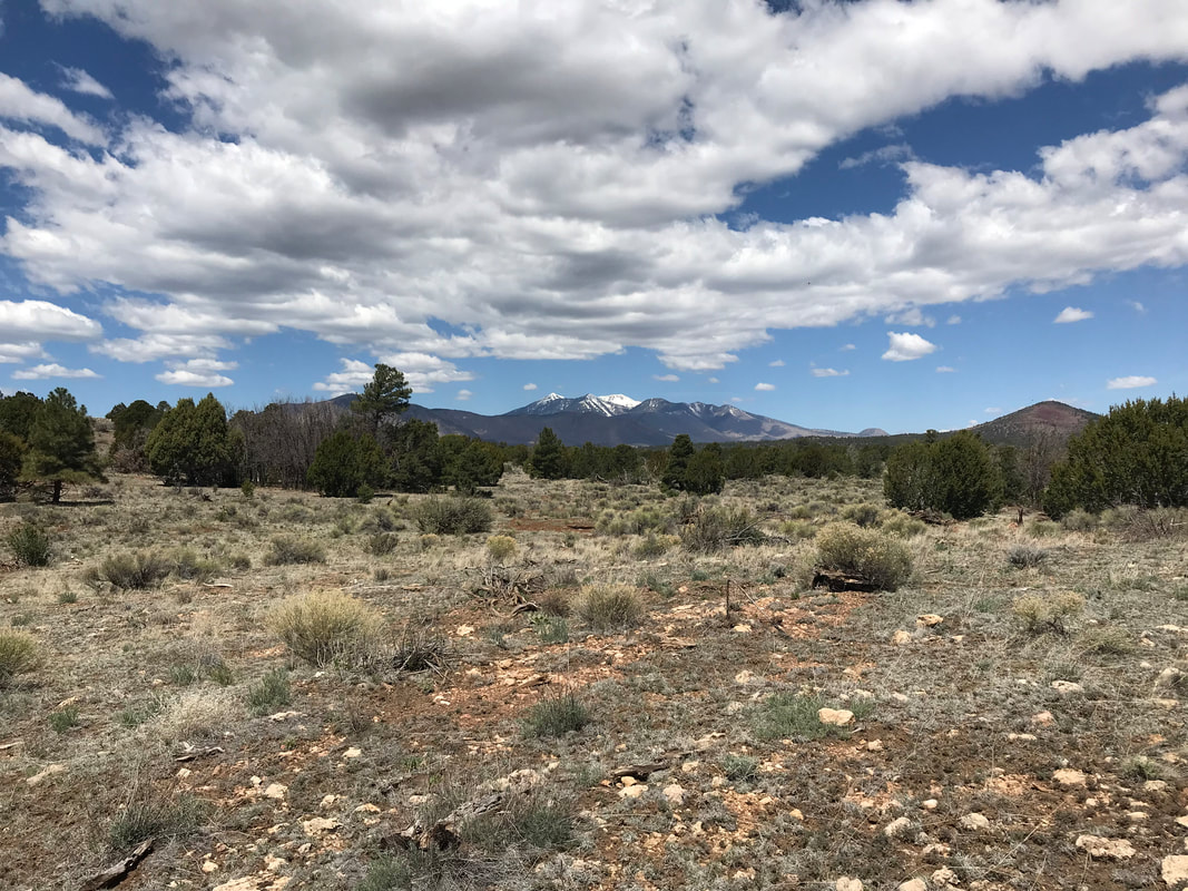
      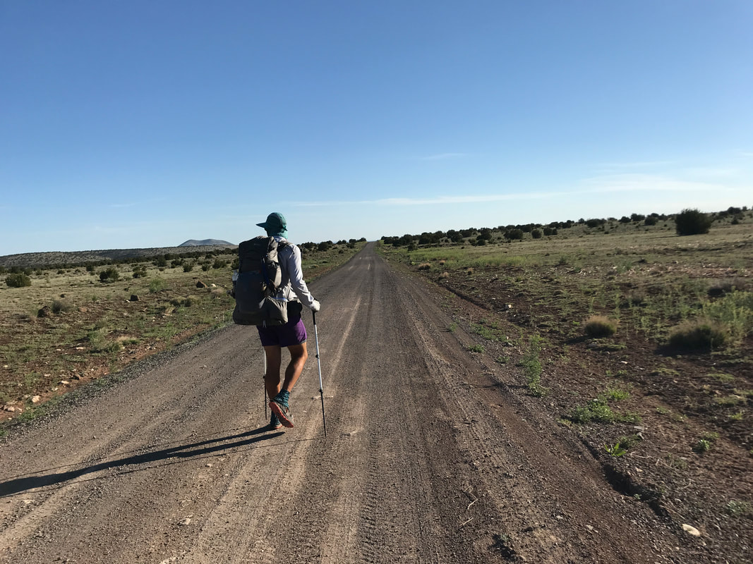 Now that we were back in the high desert, crossing vast plains with little cover, the daily heat brought challenges again. In an effort to combat it, the big group of thru-hikers we found ourselves in, strangely enough, woke up early to get going. All day, we were in a giant sagebrush basin with little vegetative cover. The views were incredible. Behind us, the snowy husks of Humphreys Peak and Kendricks Peak loomed stark against a flat arid-land. The sense of distance and expanse seemed unmatched by any other segment of the Arizona Trail. This is why I love this state. The shear diversity of landscape and biome all slammed into a single state. A few miles bring you from the equator to the poles. The morning was cold with a slight wind as we left East Cedar Tank and rejoined the rocky double track crossing Babbitt Ranch. We got to the Arizona Trail segment trailhead where a small scattering of low-hung juniper provided some wind protection. Detour was sitting on some rocks with the hiker box open. It was stock full of water jugs and snacks, which she was enjoying in the early morning. As we talked to her, a van pulled up out of the horizon and four backpackers got out. It turns out they had been hiking the entirety of the AZT in segments for the last couple of years and this was one of the last ones they had left. Their driver-friend was going to drive 10 miles ahead and setup a day camp they were walking to. With generosity, they let us know we could grab water from the van when we passed it. This was super helpful as I think we had 20 miles until our next water source and then another 20 to the following one. Such was the nature of this section - reliable water at repeated 20 mile intervals. Their offer meant we could carry less water weight and drink a little more freely in the day’s heat. Despite the vast and remote nature of this segment, there was soon a string of thru-hikers staggered to the horizon along this lonely dirt road crossing the high desert. Ironically, the most AZTers I had seen at one time. The thru-hikers covering 40ish miles a day rose and snapped to the trail at day break. Their 3+ mph average quickly outpaced us all. Everyone else was going more of less the same speed - everyone playing chase to each other. As the morning went on and we approached an isolated rise to our lefts, a pair of thru-hikers going south passed us. They let us know they had stashed water north of us they no longer needed, making it public. I laughed at the relative abundance of water that had fallen on us in this dry section. We passed a few jugs of public water and turned right and left onto dirt roads leading to remote ranches and who knows where. The AZT stuck to some double track that went up a rise covered in poppies and fireweed and then stuck to a high view of the San Francisco Peaks in the distance. We came up on a van packing up camp gear - they were the team with the southbounders. They offered some free food and I took an ENTIRE monster bag of peanut M&Ms. I ATE SO MANY it felt like my teeth would fall out. 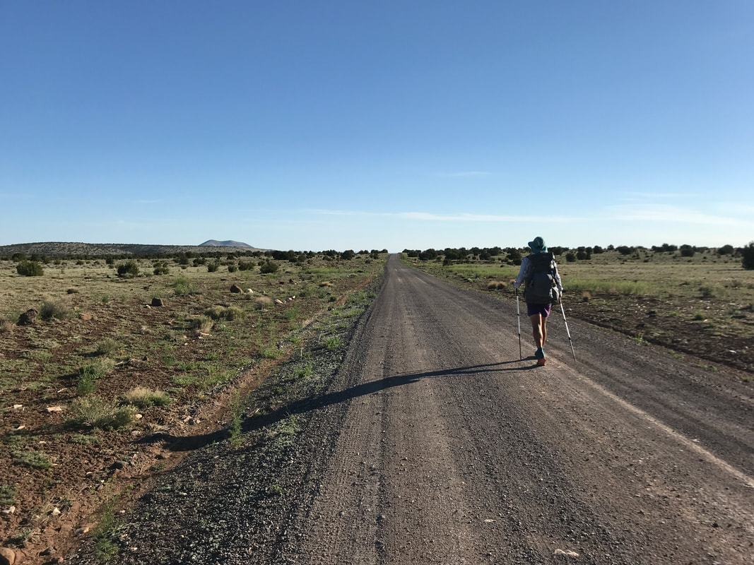
    Bilbo caught up to us at this point and we walked together for several hours talking about the backpacking scene, ultralight vs stupid light, the nature of trails, and his distilled wisdom from 70 years of living. Soon, another thru-hiker caught up to us. It turns out he had attempted the FKT on the Florida Trail earlier this year and was out here now doing 40ish miles a day. He talked to us for a bit before pushing on to catch the other large-mile hikers we had camped with last night. Around noon, Bilbo split from us to take a rest and we pushed forward as some straggler junipers started appearing. As the heat picked up, I found a nice shady spot and took a siesta nap. Some time later, we got up and kept moving. Now, the doubletrack was approaching some topography as a small canyon rounded up around us and we approached the 20 mile mark for the day. Lockwood Tank was straight ahead - a necessary water source to hit because the next one wasn’t for another 20 miles. Except this one was notorious. Walking up to the area, the Arizona Trail swerved left but we went straight up a rise and saw a trough and rusted metal tank down the hill. All of which were surrounded by some 40 uncastrated bulls. I had never seen so many hulking bulls in my life. I walked up slowly, cautiously making myself known, talking to the bulls, being like: “Hey bull…you’re my friend. Just chill man while we get some water.” They stared hard at us. Some stood behind others. They were all colossal. The decision to avoid the trough was easy as there were 10 bulls actively drinking from it and I wasn’t going to fuck with that. The metal tank was where I headed. There was a rusty ladder hanging off the top so I climbed it, peered in, and saw that the water was about 4.5 feet down, a good foot or two beyond my reach and probably a solid 5.5 feet of water. Now began the puzzle to solve - how to get water out. On Guthook, we read that someone flipped the ladder in, climbed down, got water, and flipped the ladder out. Fuck that. That was insane to do. I tried to sit on top and balance to do the stupid ladder thing, but I almost fell in. Then, I was like, “I’m totally just going to jump in. I’m tall enough I can just stand in the water and I can fill them up and pass the water bottles out.” Janna flatly rejected leaving me stranded in a large rusty basin of water. At this point Detour came and joined our decision-making. I realized I had some duct tape and Detour had massive Smartwater bottles. I taped one of her massive bottles to the end of my trekking pole, extended the trekking pole, and shoved it down until it was submerged and could be fished back out. Perfect. We scored a ton of water and waited for Bilbo who, legendary for his age, was a pretty small due at 70 years old and there was no way he could reach down. He showed up and was entirely grateful for the help. 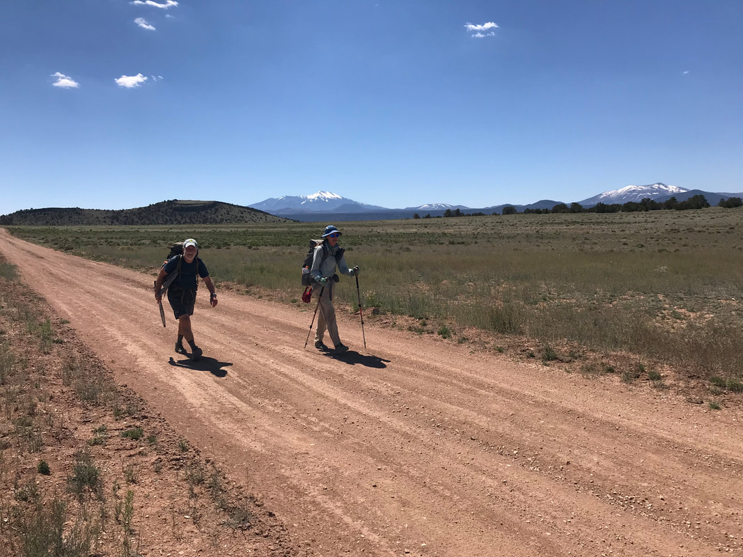 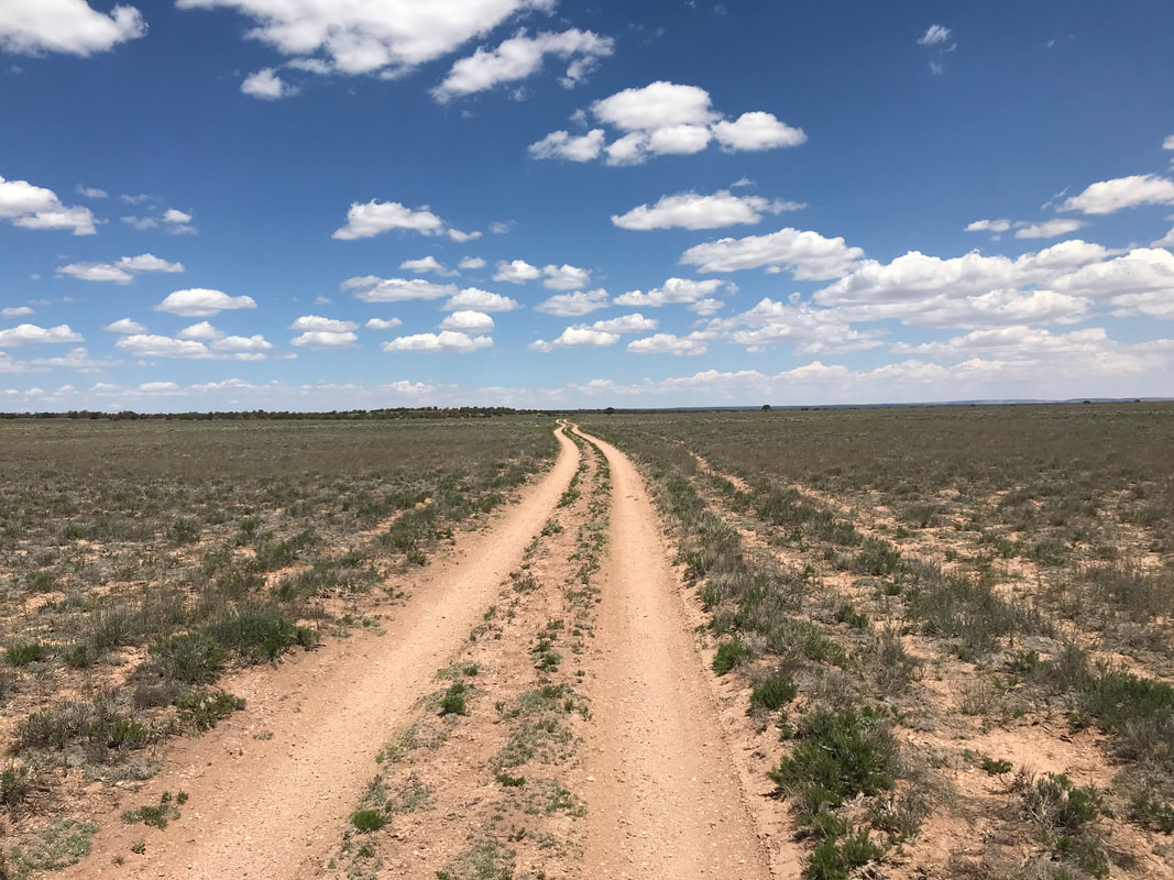
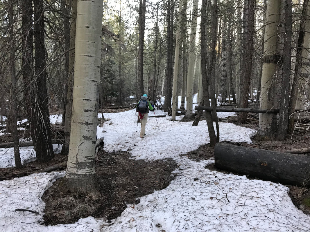
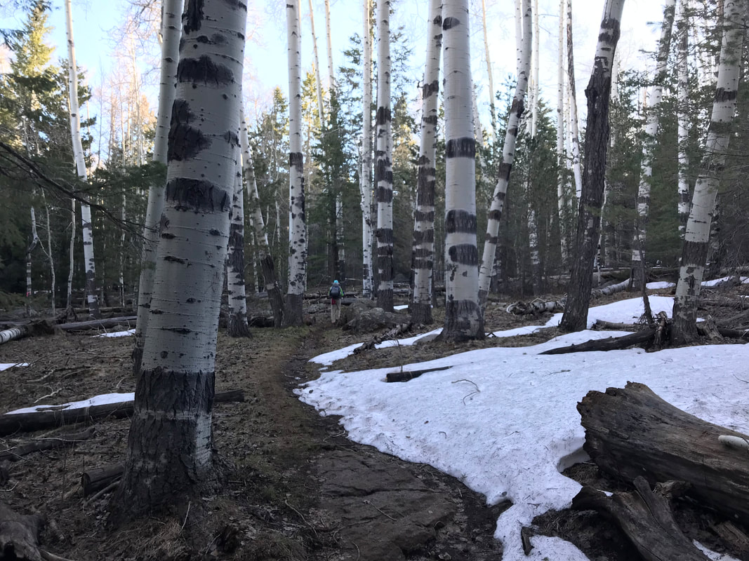
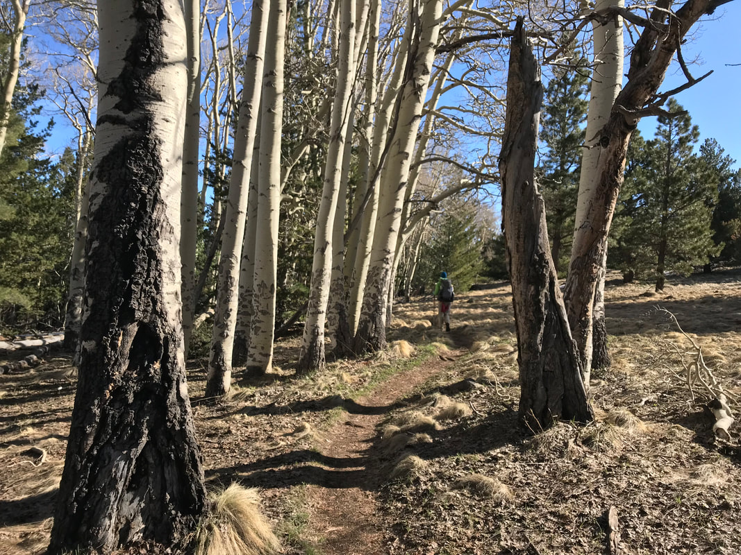
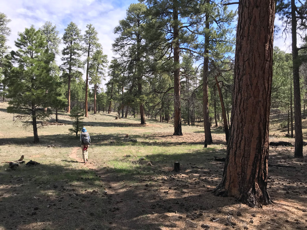
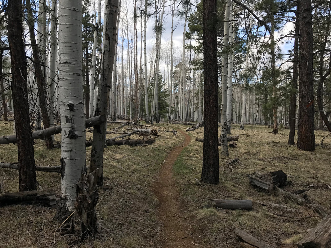
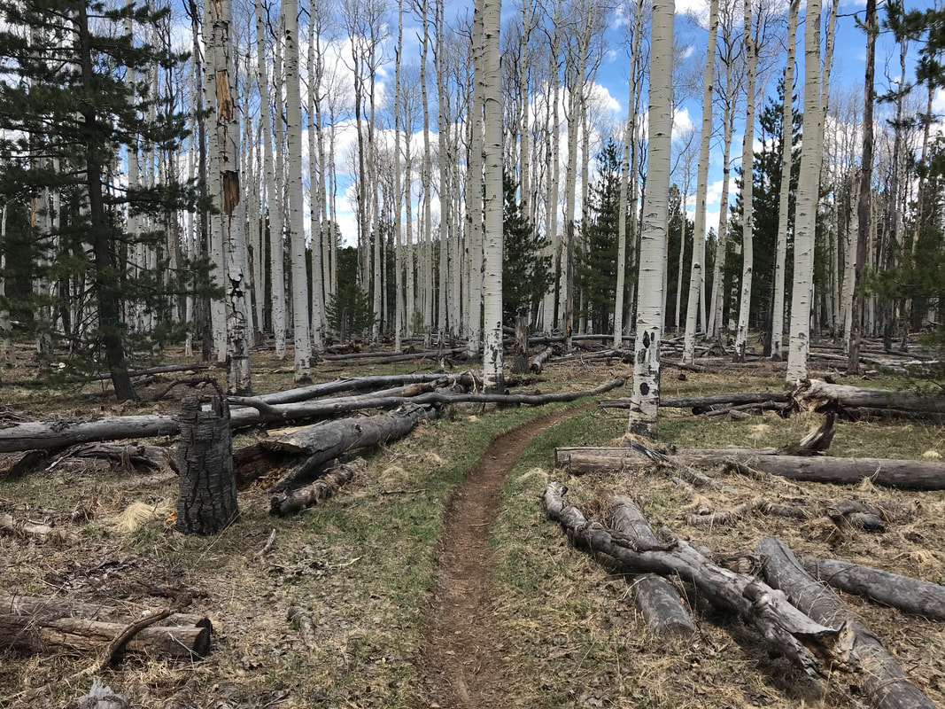
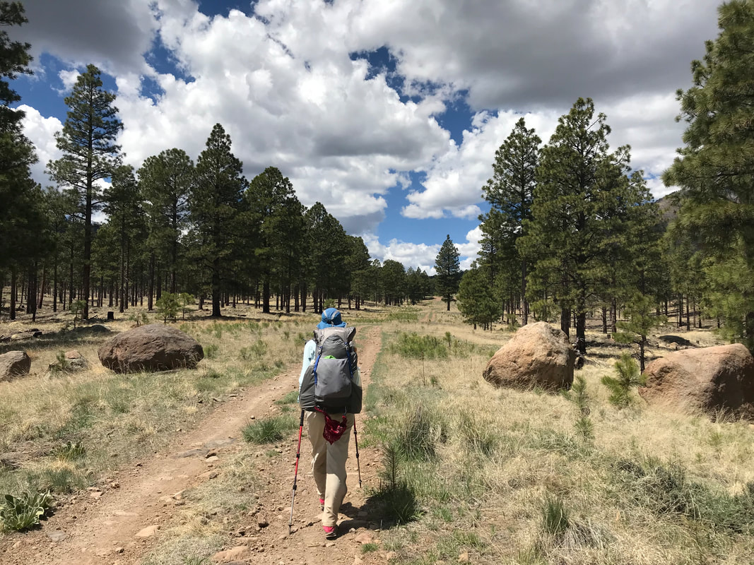
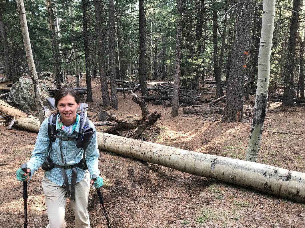
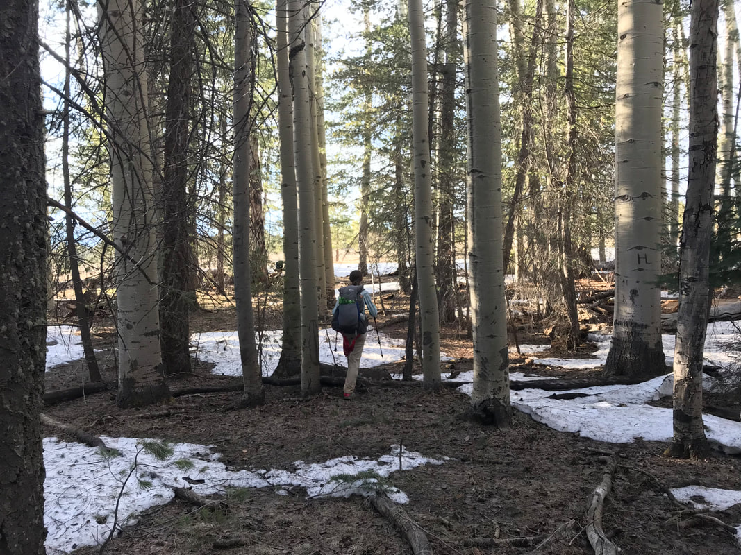
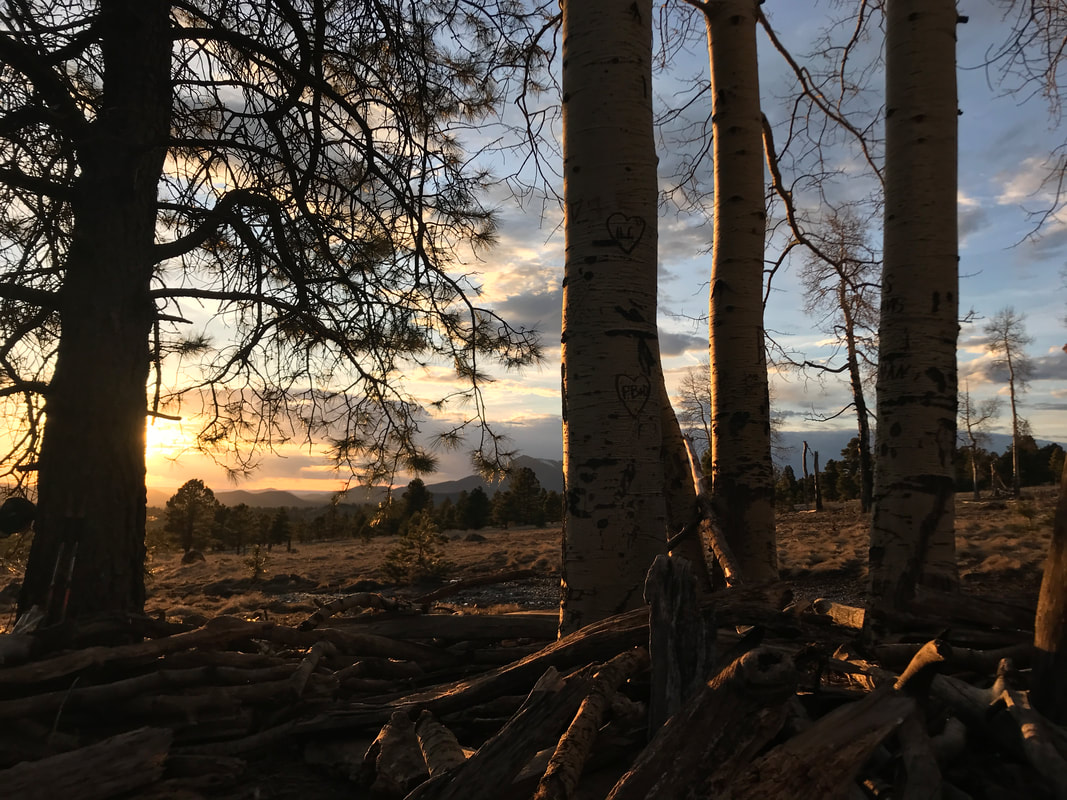
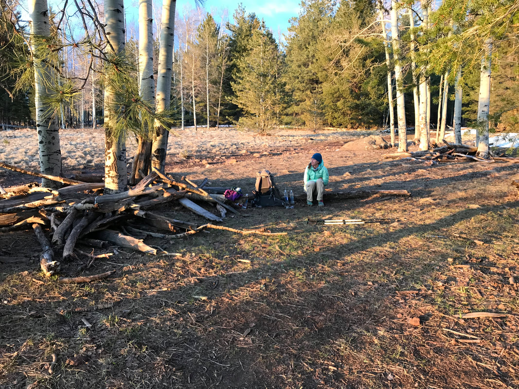
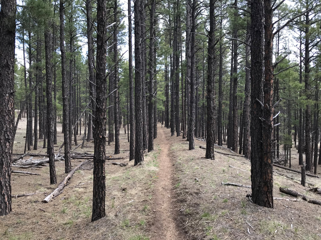
  Water obtained and carrying 5 L each, Janna and I walked back out to the AZT and joined the dirt doubletrack. Maybe 40 minutes later, a bikepacker came up behind us on the AZT 750 race! He was French, exhausted, and literally almost falling off his bike from not sleeping for days. I couldn’t believe he was still going but I cheered him on despite almost falling asleep while riding. With that, the AZT left the doubletrack into the singletrack that cut across a plain of Arizona sage and plunged into the southern boundary of the Kaibab National Forest. I was very excited to be in this area as this suggested the shear nearness of the Grand Canyon. As afternoon drifted towards early evening, we walked several more miles repeatedly passing and being passed by Detour. We passed through ponderosa-juniper-pinion forests that rose with the slight elevation gains on the land. Finally, we walked across a large sagebrush field and saw the old historic sign for Moqui Stage Station along this ancient stagecoach route. With that, a brisk wind had picked up in early evening and a thunderhead of clouds was building in the east. We decided to camp in the forest nearby and found an excellent spot with wind protection and not too many branches should a storm hit us tonight. Detour decided to push ahead to meet a friend at the Grand Canyon tomorrow and we bid her goodbye. Bilbo came upon us in early evening and we invited him to camp with us. We all sat around eating dinner with another thru-hiker named Tyson showed up, someone Bilbo knew. We invited Tyson to eat with us. He was an awesome guy who lived in Alaska part of the year and down in Arizona doing vanlife for the moment. He pushed ahead after dinner, making plans to hit the Grand Canyon tomorrow as well. Fed and satiated, Bilbo, Janna, and I climbed into our shelters and passed out under the glory of stars and darkness.  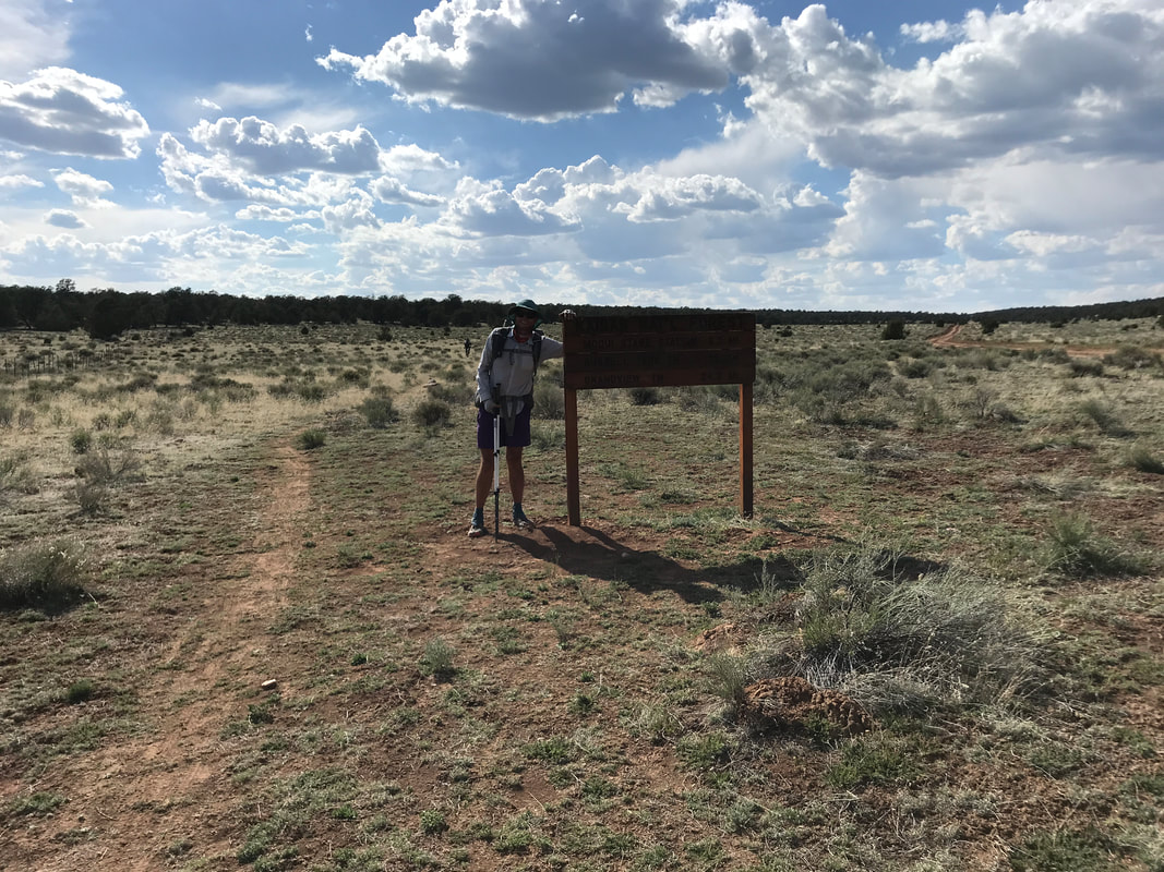 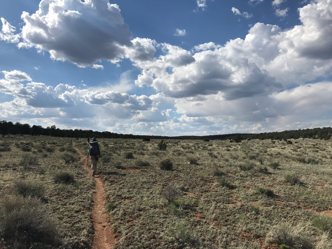 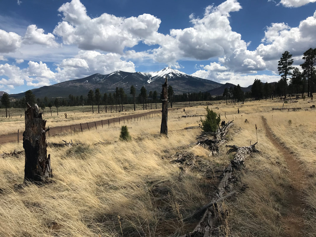 I slept incredibly well, deep, and woke up feeling well-rested. Sleeping at nearly 9,000 feet next to snow drifts meant a crispy morning. By the time we crawled out, Bilbo was packing up his last items and heading on his way. We told him we were aiming for East Cedar Tank out on the Babbitt Ranch property. He gave us his goodbye and got going, knowing his own pace and circadian rhythm well. I took my time this morning, sitting on fallen aspen logs, looking up at the sun rising over the snow-crusted San Francisco Peaks. Once we got going, we felt the cold even more pushing through snow drifts with damp shoes at 6:30 am. The trail drifted up and through thick aspen groves before crossing a large prairie where rushes of snowmelt filled the trail like a channel (see the photo below). Keeping to Leave No Trace principles, we walked through the 35 degree F water and broken ice as our feet froze. I was in good spirits and kept saying, “Keep moving to keep the metabolic heat up!” to ward off the frost-numbness painfully eating my feet. A few more crossings of rushing snowmelt runoff brought us through a steep embankment of snow I plunged down before we were back on dry ground, both us wet and shivering. From here, the Arizona Trail wound into the aspen forest, the aspen skeletons and yet unbudded from spring. At some point, the sun hitting us finally warmed us up enough to stop and eat breakfast (Frost Mini-Wheats!) on a large fallen aspen while sitting in the sun with shoes and socks off to warm up. Filled with calories and a bit drier, we joined the trail again as it curved far above Hart Prairie and the Nature Conservancy property below. Then, we walked through more snow in the woods before the descent off the flank of Humphreys Peak began in earnest. As we slowly descended off the north side of the mountain, the snow began to recede while the vegetative alpine carpet began to breathe the air of fresh ground in spring decomposition. Further and further we switchbacked back and forth downwards - a reminder of how I had mountain biked up this singletrack a few months earlier. Suddenly, we ran into two thru-hikers going southbound. Our group and theirs had been slowed by the constant need to route around, under, and over fallen trees from the winter that crisscrossed the trail, or snowdrifts against them that made creative moves a must.
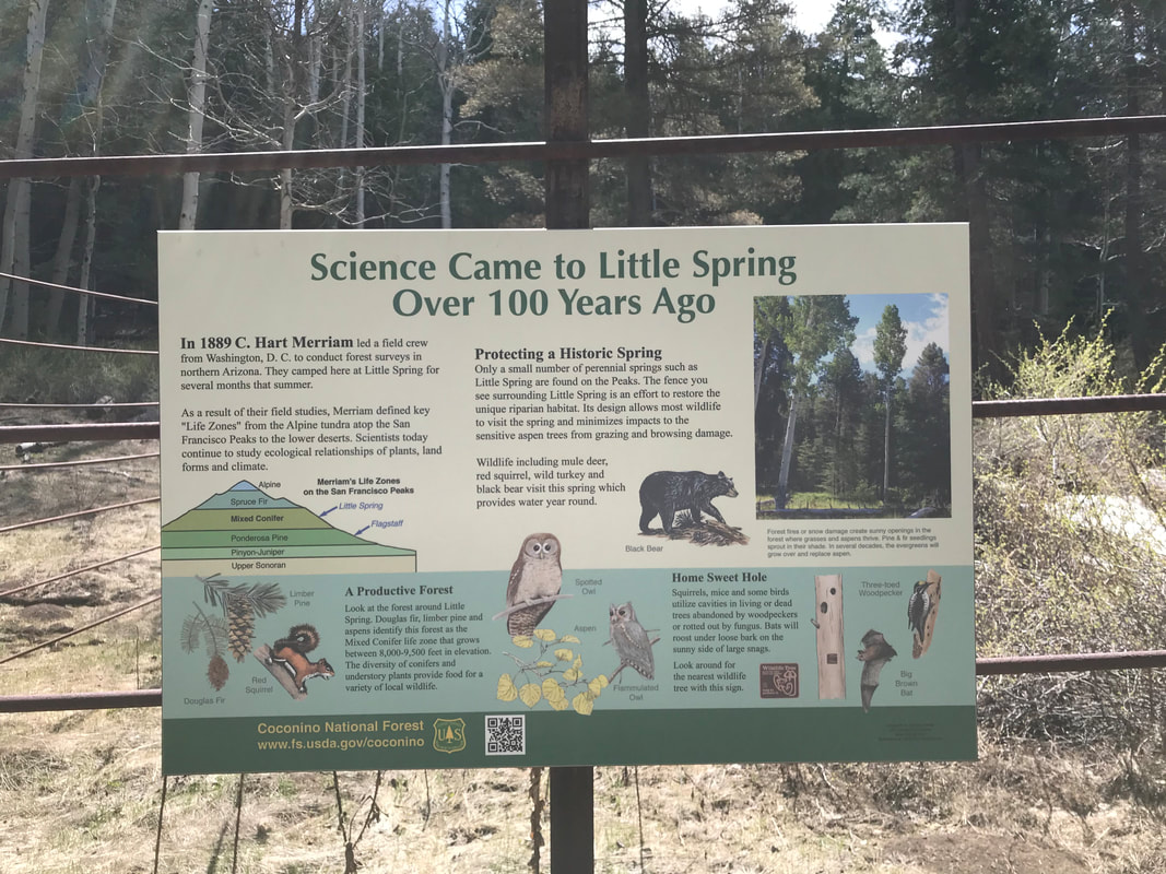
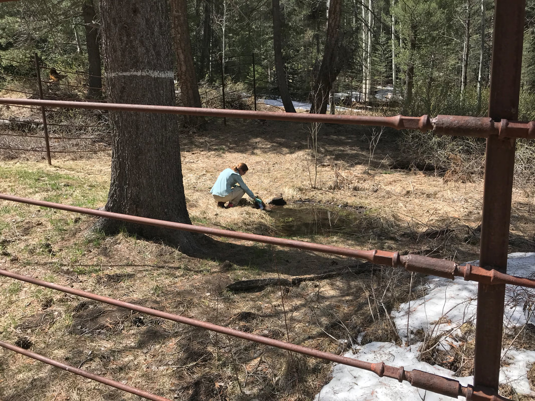
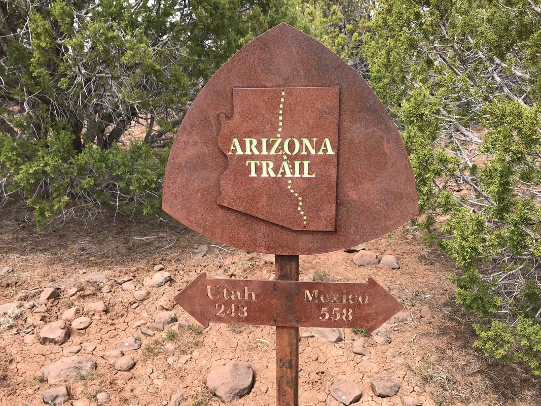
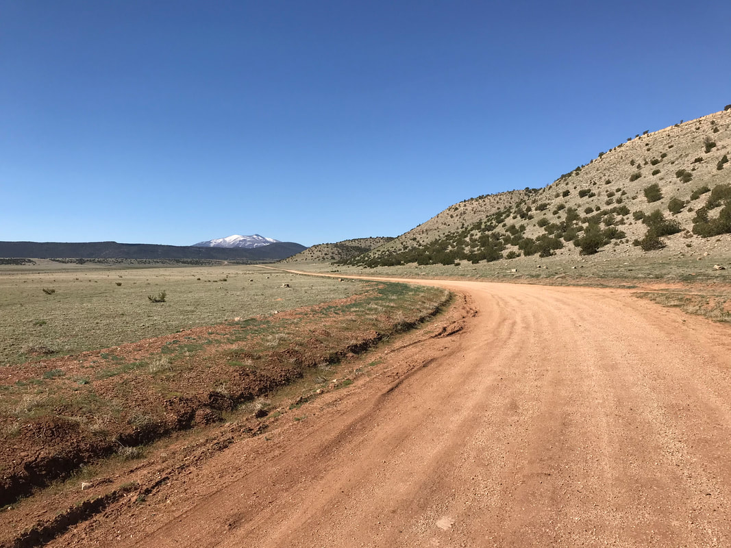
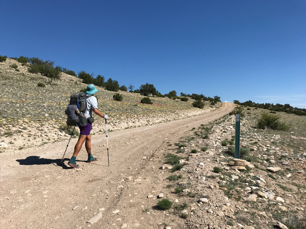
  It turned out they were originally thru-hiking the Hayduke Trail. The Hayduke Trail (so-named for Edward Abbey’s “Monkeywrench Gang”) is more of a route than trail proper. It stretches 800 or so odd miles from Arches National Park in Moab, Utah through Canyonlands, across the Grand-Staircase, down to both the north south rims of the Grand Canyon, back up to Bryce Canyon, and terminates at Zion National Park. It’s a route for truly experienced desert backpackers only and requires canyoneering and orienteering to the max. These two looked destroyed. The reason why? Not the desert. But the snow on the North Rim of the Grand Canyon. They both had shadows under their eyes and spoke of the monstrous snowpack, breaking trail for hours day after day while postholing, and how bad the winter was on the Arizona Strip. This was our first encounter with anyone coming off the North Rim and it definitely woke us up. I had seen some reports on the Facebook AZT page of hikers crossing 40 miles of 10-15 feet deep unbroken snowpack between the North Rim and Jacob Lake that kept my senses alert. Their story’s corroboration had me hoping that increased warm temperatures would lead to more melt before we arrived. Essentially, they had crossed the Grand Canyon at the north to south rims and just kept going south on the AZT. As we were talking, another thru-hiker came up behind us and caught us: Fenway. Once we departed the Haydukers, Fenway stayed with us for a bit before we split at an abandoned forest road. We were looking to fill up water one last time before heading down in the high desert again and this seemed to be it. Little Spring (the official name) lay 0.6 miles down a overgrown forest road. Literally, this road was so overgrown that we walked a quarter mile past it before we realized it, turned around, and had to use Guthook to confirm that barely perceptible “road” was indeed where we needed to go off-route for search of water. The walk down the 0.6 mile road was more like a maze and obstacle course as years of downed trees and uprooted trunks combined with the corrosion of erosion had erased an easily navigable path. Using Gaia GPS, we located the spring, which was itself off the abandoned road. It ended up being awesome. An old and wide-barred metal fence surrounded it filled with very nice historical plaques. It turned out that Little Spring was very historic: it was the place where C. Hart Merriam in the late 1800s came and camped. It was here he formulated the concept of “Life Zones.” As the altitude of an area increases, the types of dominant plant, temperatures, and climate also change in response, such as an increase of altitude almost correlates to moving in latitudes towards the poles. This was a truly historic site for the field of ecology. We filled up water from the dripping spring that was gorgeously clear and made our way back to the trail.
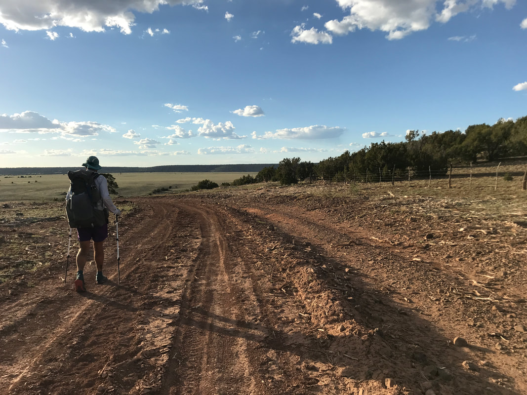
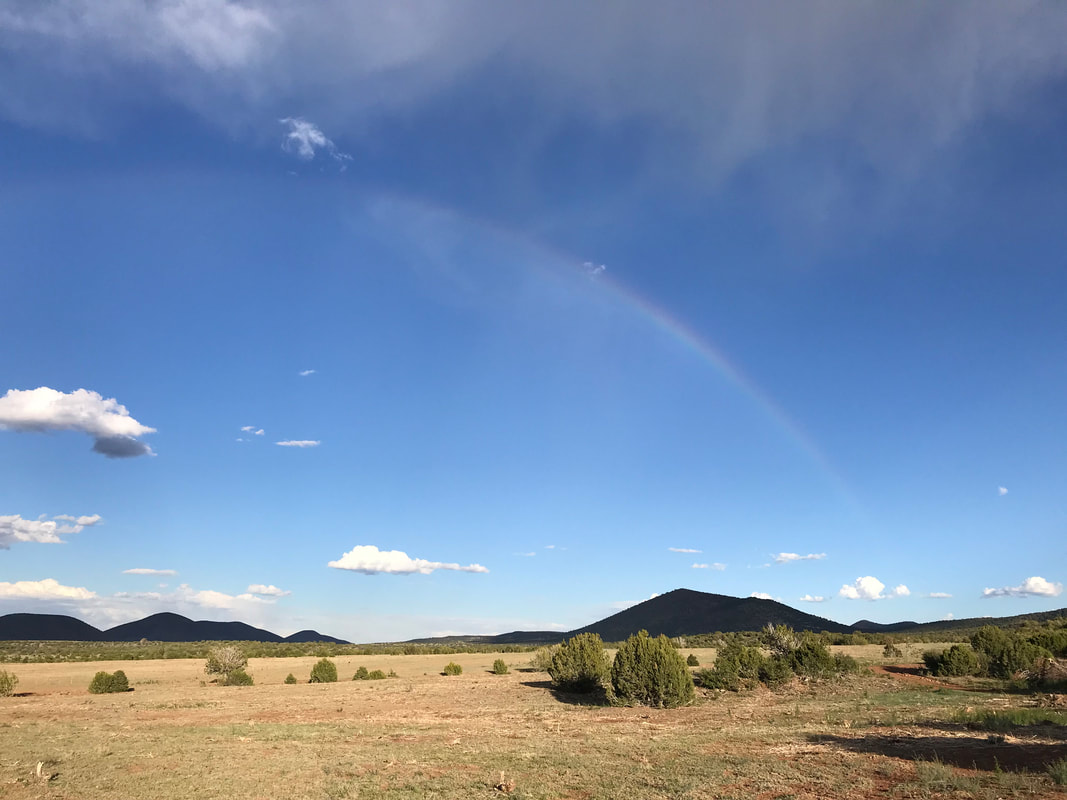
   With that, we continued descending the peaks, passed over a major forest road, and continued plunging through a thick forest of aspen surrounded by dead ferns brown since last autumn. The land became increasingly arid with the aspen falling away until only ponderosa and juniper remained and the arid grasslands took over. It was crazy how quickly we were able to cover miles; a quick turn around revealed the peaks in all their snowy glory, prominent with the blue skies and white cloud accents. It was freaking beautiful. The heat of the day was really going now and we passed Fenway and Detour sitting by a hiker box and drinking beers left by someone kind. Janna and I continued on having plenty of water hard-won on our backs. The AZT paralleled a forest road and we passed several school buses of middle schoolers out volunteering on a school day to do trail work with the Arizona Trail Association - which was AWESOME. Shallow peaks formed on our rights of old volcanic craters now filled with grasses, shrubs, and solitary pinion pines. The Arizona Trail joined the historic stagecoach route which was now a ROUGH and rocky double track descended through blankets of junipers. We easily covered ground though and by early afternoon we were descending into the wide high plans of Babbitt Ranches. The land is privately held but they have a generous relationship with the AZTA to allow hikers, equestrians, and bikers to pass and camp through their lands. To our left, a large granite cliffside sat while a single storm-burst formed and expelled wind, rain, and snow from nowhere on us before evaporating and leaving a large faint rainbow arcing across the plains. It was stunningly beautiful and totally different than anything we had yet seen. The wind began to pick up as evening approached. We left the gnarly-rocky doubletrack to take a side-route up a hill to East Cedar Tank - a reliable water source. There, we found Bilbo again! He had camp setup and was enjoying the immense views for miles and miles into the open grasslands and small cinder cone volcanic hills stretching into the distance. We setup camp with him. Detour, and three other thru-hikers showed up in late evening with the last light of day almost already gone. Our entire group sat and ate dinner together, laughing and sharing stories. Turned out these new hikers were covering 30-40 miles a day. Insane. With the night fully here, everyone got into their shelters as a fierce wind roared across the plains and pummeled our shelter. Most people were bivying in the cold and the slap of their bag fabrics filled the air. The Triplex shuttered under the uninhibited wind, so I jammed some earplugs in and snuggled deep, grateful to walk from the subalpine zone to grassland deserts in a single day.
    Despite being inside a building with all the comforts of a bed, I slept terrible for some reason and woke up with a headache. We packed up with a sense of exhaustion, the calm of yesterday somehow vacant. Mike drove us to the post office to send our bounce box home before joining us at MartAnne’s for breakfast. A killer place for breakfast in Flagstaff, it sports a massive menu with generous helpings, especially for the hungry hiker. We walk in, grab a seat, and are putting back some fresh-squeezed orange juice, when we here a commotion at a table over. I look over and see a group of older looking people all staring at us hardcore, very directly, and then talking excitedly together. It’s then that we hear a: Forrest? Janna? It’s Bilbo!!!! We haven’t seen him since south of Tucson!!! He’s there with Junco, his wife, and several other thru-hikers. We all get up and give hugs. Both Janna and I are so heartwarmed to see him. Turns out, everybody is heading back out on the trail today and we just all happened to eat at the same breakfast place. All of us begin to eat ravenously large breakfast burritos and chilaquiles, aware that this will be the last hot food until the Grand Canyon. Filled to the brim, we all take a photo together before exchanging plans for the next few days and heading out. Mike (are we ever so grateful for you!) drives us to the outskirts of town back at the Elden Pueblo Ruins parking lot. We wave goodbye as he heads back to work. Our packs our heavy with food (trail hunger has fooled us into carrying SO MUCH more than necessary on this part, lol), and we jump a wooden fence to rejoin the trail. The Arizona Trail heads up towards the flanks of Mount Elden before splitting off a reroute. Flagstaff, along with the rest of the state, is undergoing a massive effort to curb potential future wildfire by thinning all national forests to pre-European levels (before extensive fire suppression). Although the trail proper heads further up the mountain, there is heli-logging going on top - literally loggers on top thinning tree stands and then a helicopter hovering, wrapping, and hoisting the trees away. In an effort to not kill anyone by the unlikely dropping of a tree, all the trails in the area have been closed or rerouted during operations. With that, Janna and I head around the mountain circumventing the process where we clearly can see helicopters carrying trees away - which is mind-blowing to view. We come around a bend and a guy is walking towards us marking flags along the route for an upcoming running race. He excitedly tells us that we are near a parking lot where he just pulled up and parked 5 minutes ago and saw a mountain lion that hid behind a boulder. Super alert, Janna and I continue past him, looking all around us for signs of the cougar. We’re not too worried though as there are tons of deer to serve as more suitable prey in the area. The reroute joins an old double track and powerline road deep in the ponderosa woods and turns straight up a rotund flank of the San Francisco Peaks. It’s an arduous climb up and down rolling hills on repeat. As we walk, big thunderheads begin to build overhead. The weather had originally called for bluebird skies all day, but such is the nature of mountains. The clouds darkened, the sky winced. We kept moving, watching the gray turn black. Then…bam! A crackle of thunder as lightning lit the scene. We immediately left the open powerline road to shelter away from metal in the even height of trees. The rain came down for a few minutes and then ceased fairly quickly. After 15 minutes, the lightning was gone, the thunder choked up, and we returned to our route. Shortly thereafter, we ran into a biker on Salsa El Mariachi who was racing the AZT 750. We talked about Industry 9 hubs he was sporting before he moved on, back to his race. The undulating hills continued up and down repeatedly. It rained again, and we opted just to leave rain gear on as temperatures dropped.
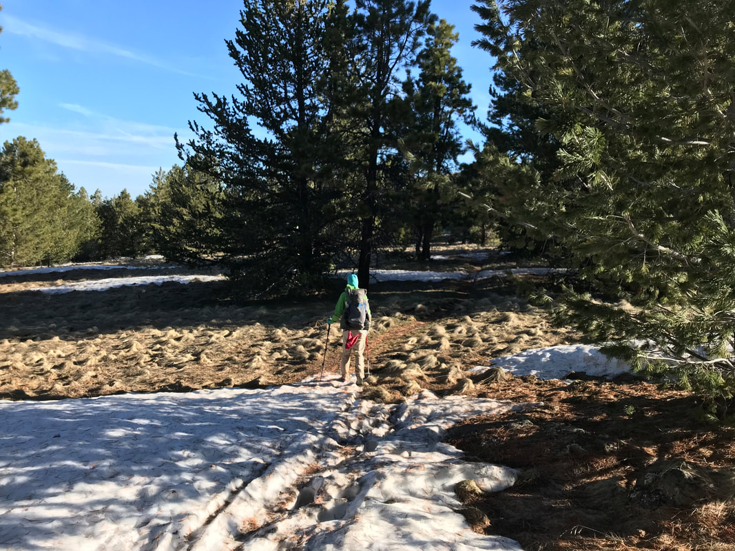
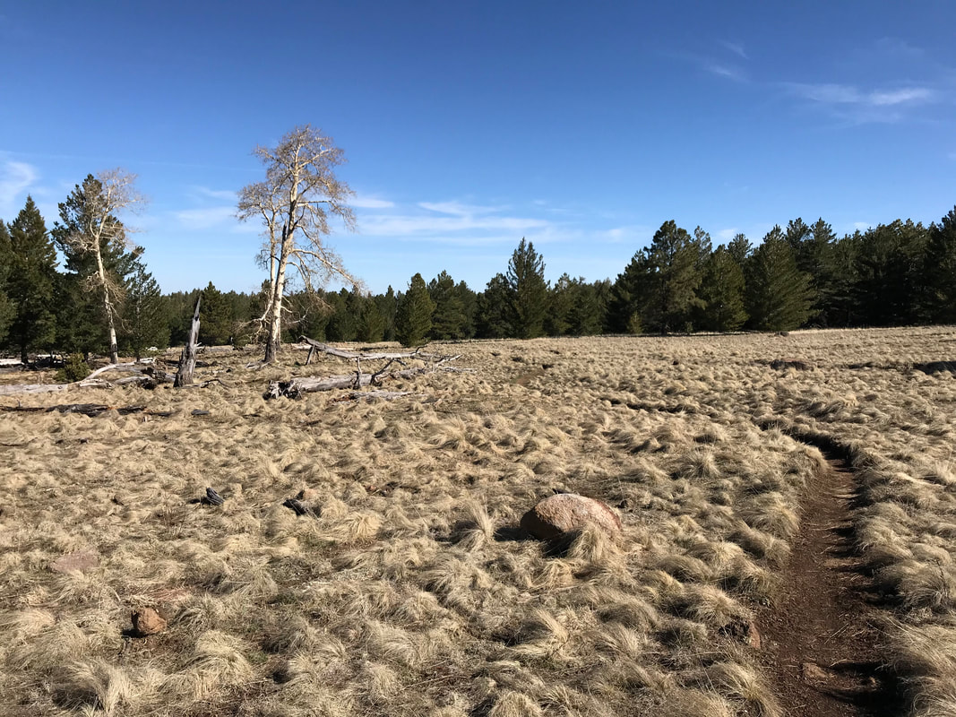
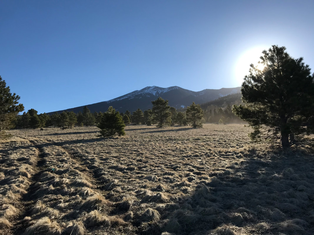
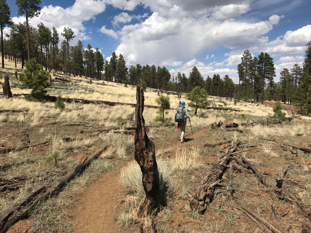
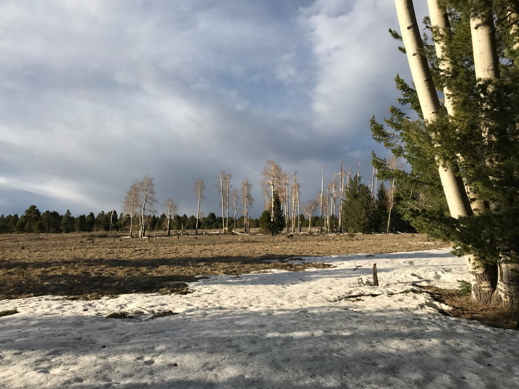
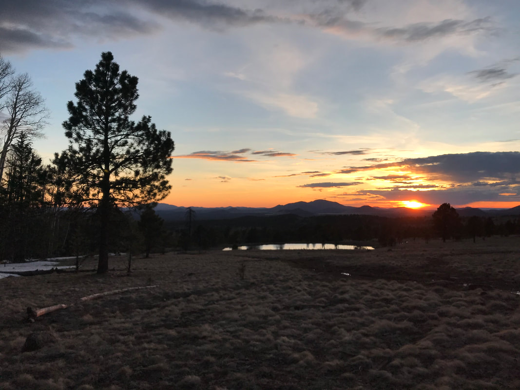
 Finally, past the no-entry zone for timber harvesting, we regained the AZT. We wound through the woods on the singletrack making up a circumference of the mountain where my jaw dropped at the impact of the harvest. Just last fall, I had done a massive gravel and singletrack mountain bike ride around the entirety of the peaks down this very section. Instead of thick trees, it was sparse singletons. I’ll support what science says here but the visual impact was a bit disappointing. Around this time, my headache began to creep back up and Janna and I decided to eat and take a break since we were making good time. Laying on our packs, a thru-hiker named Detour came hiking up. After a brief conversation, she pushed on, and us the same. We played leapfrog with her for several miles, each of us getting ahead and then taking a break to kick back and eat - no one in a rush. As afternoon came on, the trail crossed Snowbowl road and began an ascent up towards the ski resort. As elevation topped 9,000 feet, the biome began to change as vegetation took on a stronger alpine look. Gone where homogenous ponderosa stands; now stood aspen, firs, and spruce. All deciduous lacked their leaves as spring had yet to bring bloom in the alpine. Snow lay packed in the woods, some of the biggest patches we had yet seen on the trail in total. And there it was: the 600 mile marker. We were 75% done. Pictures taken, we pushed upwards as thick soil made up the A horizon. The smell of decomposing organic material mixed with snow, pine, and plant matter. The trail curved and I stopped. A wave of nausea and my morning headache returned full force. I took some acetaminophen which kicked in thankfully. In late evening’s light, we left the trail, hiking through the snow, and exited the forest into a giant prairie making up the slopes of Humphrey’s Peak. Down below, Alfa Fia tank glowed with the setting sun. There was Bilbo! He was setup in the woods and enjoying his evening dinner. We talked to him for a bit before we walked up and found a nice flat and sheltered spot next to a fallen aspen. Detour soon exited the woods and camped down near the tank. We filtered water in the frosty evening, temperatures already approaching freezing. We ate dinner and watched a STUNNING sunset. The adjoining peaks silhouetted, the grass golden, and the clouds providing depth. Best sunset ever for eating dinner. 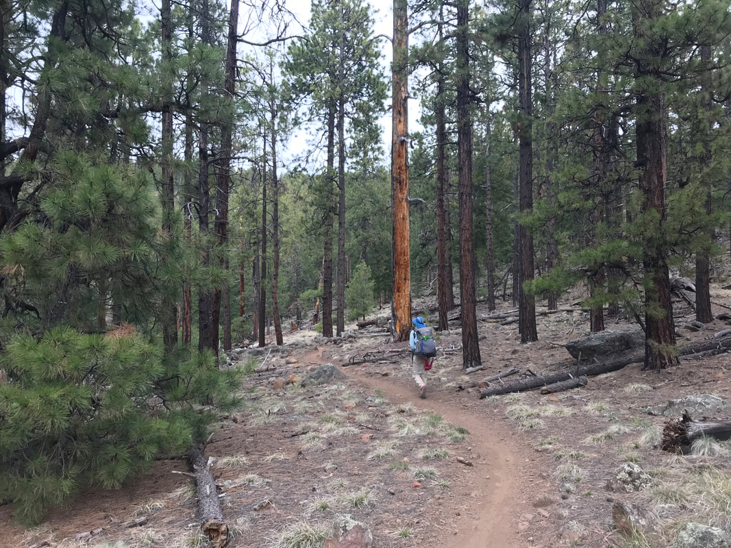 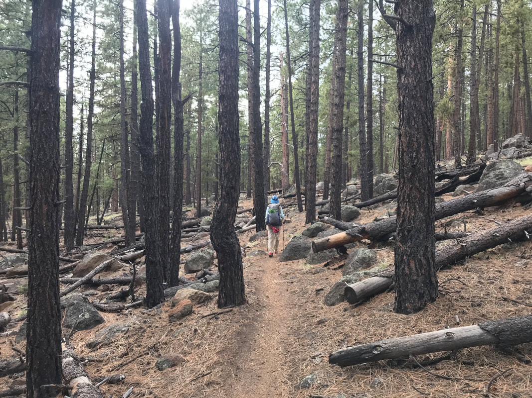
           Janna and I woke up to the inside of the Triplex completely rigid with iced condensation. That’s the thing about single-walled shelters - they boast awesome weights but condensation is always an issue. Especially when cold freezes it into sheets. But this time, the sheet of ice was also on the outside from the rain turned frozen last night. Slipping out into the daylight, we hiked for a while before finding a wildlife tank with fence we jumped. After getting water, we walked down the trail which stuck to the edge of the plateau paralleling Walnut Canyon below. And with the signature of a sign, we officially entered Walnut Canyon National Monument. The cliff dwellings are situated down in the canyon via access by the National Monument entrance. We had talked previously about going there, but (since we already have) our time table was tight today, we crossed the main road, and continued on the AZT towards Flagstaff. Janna and I had calculated out exactly how many days we needed to complete for us to be picked up in time by Darren at the Utah border and still be able to get her back in time for returning to work at her school. Given the distance left, our daily pace, and the number of days left, we had decided back in Pine that we couldn’t afford any more Zero Days. We would need to hike everyday to get the whole trail done on time. Today, we were doing a Nero, heading to Flagstaff and getting there early (still doing miles), but taking the afternoon off to rest and relax. No Zero, just a Nero, and we would be back on trail tomorrow morning. To maximize our rest/recovery today, we wanted to get to Flagstaff as early as possible to provide more hours for our legs to recover by sitting and consuming as much food as possible.
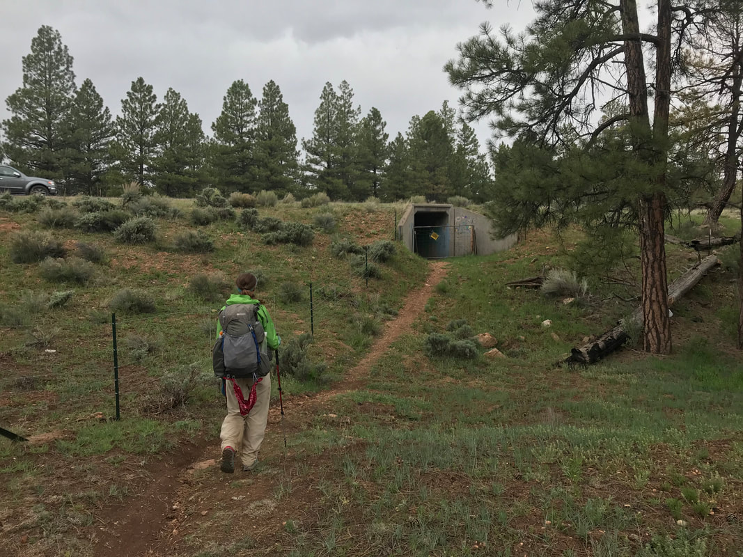
     The Arizona Trail continued through the pines but then turned northwest, exiting the park and slowly entering the high grasslands west of Flagstaff. Pine gave way to juniper, juniper gave way to grass and shrub. Eventually, the trail turned north and approached Route 66. Two culvert tunnels underneath both sections brought us to the other side where the Arizona Trail abruptly turned east and headed back towards Flagstaff. By now, the San Francisco Peaks were in full view - massive and growing bigger with every step. It was so nice as the blue skies of morning held. For the past several days it seems we had been rained on intermittently once morning had passed. The sun was out in full force and we welcomed the warmth. Heading towards Flagstaff, we ran into a retiree thru-hiker named Junco. His love of birds was emanated in his trail name. A native of Flagstaff, he gushed about living there. He bid us on and hoped to see us again on the trail. We pushed ahead, paralleling Route 66 and its corresponding railroad where several train rushed ahead of us. The trees began to appear again as we gained the flanks of the peaks. The route took us on the urban trails route, crossing us first by the city landfill, and then up a canyon and across a flat with great views of peaks. We crossed under a culvert and popped out at Elden Pueblo Ruins near the parking lot. With that, we walked across Route 66 and beelined it for the Marathon gas station there. All I wanted was ice cream. I purchased two monster ice cream cones and sat outside on the chewing gum-filled concrete sidewalk, happily putting back the calories while calling for a Lyft. The Lyft driver showed up and we apologize for our smell and appearance, requesting a trip to drop us off at REI. Once there, it was time for us to switch shoes as the rough granite had destroyed my Hokas. Plus, my feet had been swelling laterally leading to the blood blisters on the top of my big toes. I loved the cushion and wanted some cushion, but alas Altra Olympus were out of stock. I got some Lone Peaks instead, which did just fine the rest of the trail and Janna got a new pair too. As I was trying them on, I saw a man race over to the shoes. He was frantic, disheveled, wearing an ultrarunning vest and a bike helmet. I ran over to him and asked him if he was racing the AZT 750. Dude…this guy was in first place. He was literally running in here to get new shoes because he blew out holes where his toes are on his cycling shoes. I had never seen that on cycling shoes before. Plus, he knew he was going to have to cross the grand canyon and wanted something he could hike in. He grabbed some La Sportiva Bushidos and wished us luck. I grabbed a quick photo with him (see photo below) before he ran out the door to rejoin the race and attempt to keep his first place position. Our new shoes secured (and our old pairs with holes and destroyed tread thrown away), we headed out to the parking lot to be picked up by Esther. Man was it good to see her. She picked us up and we all went over to Red Curry downtown for some large salads and excellent vegan veggie rolls and curry. Stuffed, she dropped us at Safeway so we could make our next resupply before our last one at the Grand Canyon. We grabbed more ice cream there (my muscles were aching for calories) and Mike picked us up to take us back to their place. Once there, we showered FOREVER in HOT water. It was simply amazing after the cold rain the past several days. Afterwards, we all sat in the living room talking about life and exchanging stories. As evening came on, the four of us headed downtown to Annex for burgers and drinks. Some of my former students and now college attendees (Catherine, Ana, and Malleni) came to meet us. It was great to catch up, have long conversations about life, and see everyone again while eating unholy amounts of food. Stuffed and content with chance to connect, we headed back to Esther and Mike’s place. Despite the late hour, Janna and I still had to wash and clean gear, do laundry, repackage food, and prep for the next section. Up until nearly midnight, we finally crawled into bed later than we had stayed up in weeks, exhausted but satisfied. 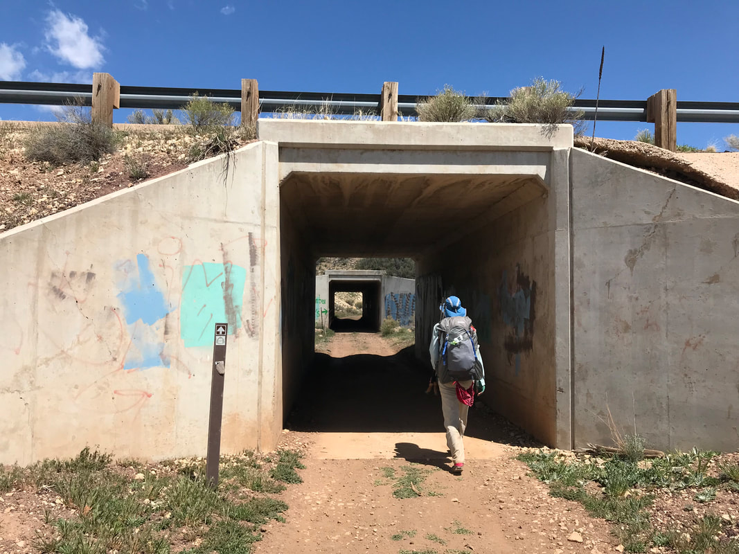 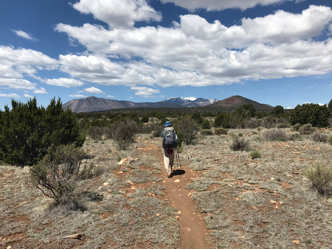
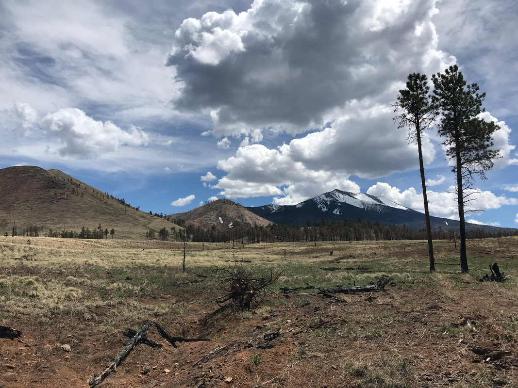
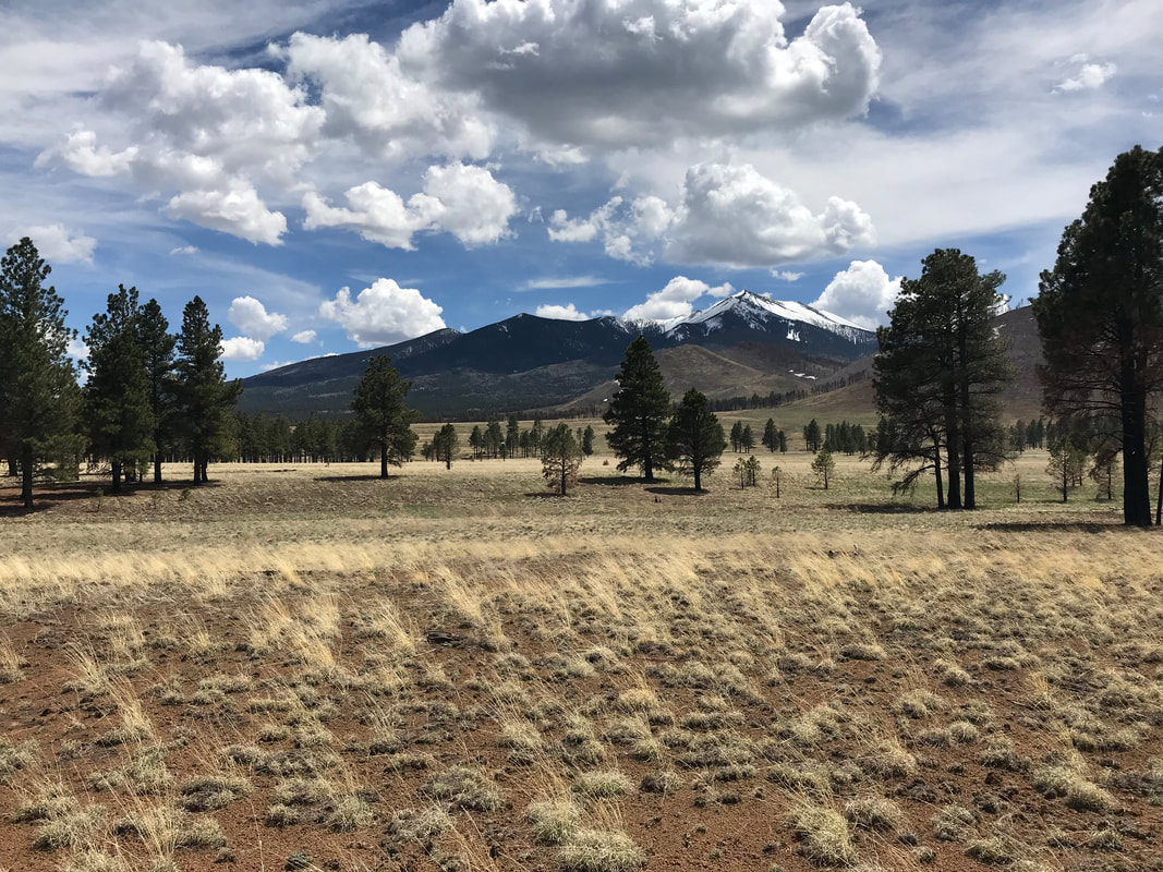
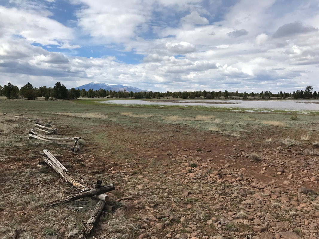
  Another below-freezing morning greeted us so we again got moving right away to keep warm before stopping to eat breakfast. The Arizona Trail through this section continued to be predominately flat. It essentially follows the path of the old rail line that timber companies used in the early 20th century. Here and there, old timber-cut pieces of rail ties would surface in the trail or sit alongside it, outlining the former line. Old rail gravel and chunked out volcanic rock formed borders on either side of the slightly raised path cut straight through the woods. After several miles (and some interesting historic signage from the USFS), it was warm enough to stop and eat on some boulders. For the past several weeks, I had switched to eating straight-up Frosted Mini-Wheats for breakfast. Oatmeal, despite years of trust, had become sick to my palate. Mini-Wheats were golden. Tons of fiber and sweet, they filled me up and got me going. I usually chased them with a peanut butter packet I stored in my crotch for warm keeping in the morning chill. We began to cross a series of grasslands meadows interspersed in the woods. Entering one, we got our first long-view of the San Francisco Peaks and notable, Humphrey’s Peak in the distance. The old supervolcanic crater rim stood caked in a deep winter snow. Stretching to 12,600 feet, these mountains are the highest points in Arizona. I’ve summited them several dozen times from multiple approaches. But to see them now, to know that we had hiked to them, that we would be going up them on the AZT, filled us with awe. They were another reminder of the distance we had traveled. More-so, the peaks were stunning with their snow-capped framing on the horizon. As we crossed the field, we got reception and checked in with our families. I checked on Instagram to see if Legend had set the AZT record. He just had, the day before: 15 days, 13 hours, and 10 minutes. An insane unsupported record. He reported doing crazy miles through deep snow on the Kaibab plateau/north rim still ahead of us. By now, the blue skies of early morning were quickly being replaced by the gray skies of rain and storms. A few miles more, and we plopped out on Lake Mary Road near Flagstaff. As we did, a road cyclist came biking up the shoulder dressed in neon yellow. We paused to let him pass but he rode right over to us and excitedly introduced himself. His name was Gil Gillenwater and it turns that he was the first person to ever thru-hike the AZT, back in 1982 before the trail was completed or established (according to the AZTA website). In the 80s, he and his brother decided that they could walk across Arizona using trails and forest roads they were both familiar with. Over a series of months they were successful; and when the AZT was completed, they reached out to the Arizona Trail Association with a documentation of their route (which roughly hewed the current trail) and were recognized as the first people to be “Trail Completers.” Gil was excited to meet us as AZT thru-hikers, and fellow lovers of cycling. We spoke for quite awhile about our experiences, thoughts, and reflections on the trail. Serendipity to walk across the state and pop out on a highway in front of one of the first people to complete the route you walked. Gil gave us his contact info and cycled away while we crossed the highway and headed back into the woods. Fired up on that meeting, we crisscrossed up a hill. As we hit the top, we came upon some trail magic. There were several cans of Coca-Cola, bottled water, and some Powerade. Janna was more than enthused. She was like, “YESSSSSSSSSS” for the pop. I decided to join her in taking in the rare drinking of soda that I do. We placed them in our packs and decided to save them for lunch. We got walked and the hill eventually came out on a high plateau covered with juniper and pine. The sky overhead looked like imminent train with clouds rolling over each other in a gray soup. The wind picked up on top and we donned rain jackets for a combo of warmth and wet protection. After another mile or so of hiking, we came upon a large lake next to some rutted double track the AZT had joined. Humphrey’s Peak loomed large and ice-capped in the distance. It was beautiful so we definitely had to eat here. We sat in the gray gloom enjoying the mountain views and chugged back some Coke. I immediately regretted it. That shit never makes me feel good afterwards, and I wished I had taken the Powerade instead. Janna on the other end…pumped. She loved that stuff.
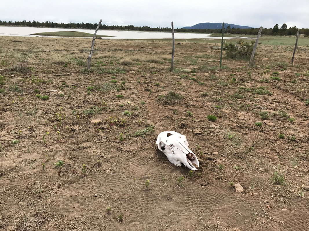
We ate until it began raining and got moving. The trial remained flat but rutted in the clay. We passed by a second lake fenced to keep cows from ruining the shores, but a cow skull lay there regardless. Now, the trail kept to the wide and high plateau and turned directly towards the peaks. A bikepacker same riding by, his bike the same as my own - a Surly Karate Monkey. We talked to the guy who turned out to have been racing the AZT 750, but quit due to a mechanical failure that put him so far behind he decided it wasn’t worth it to continue. Now, he had driven ahead here to take a few days to bikepack the area and take in the sites. The wind was still kicking as we walked across the grassy plain interspersed with low-hung clouds. To our left and down below the plateau, Lake Mary stretched elongated with the winding road paralleling. We were high above the road and lake but with excellent views. The trail took us near an observatory on the lone mesa before spilling us out towards another series of lakes with old wood fencing to keep cows out. The trail then moved into the woods over several miles slowly descending to a large plain. Near the bottom, we came upon a large jug of water left for AZT thru-hikers as the water in the lakes was noted as “contaminated” according to the Flagstaff District. We filled up, ate a bunch of food, and crossed over a dirt road past a field and into the pines again. Torn deer and elk legs law strewn about - evidence of some predator in the area. 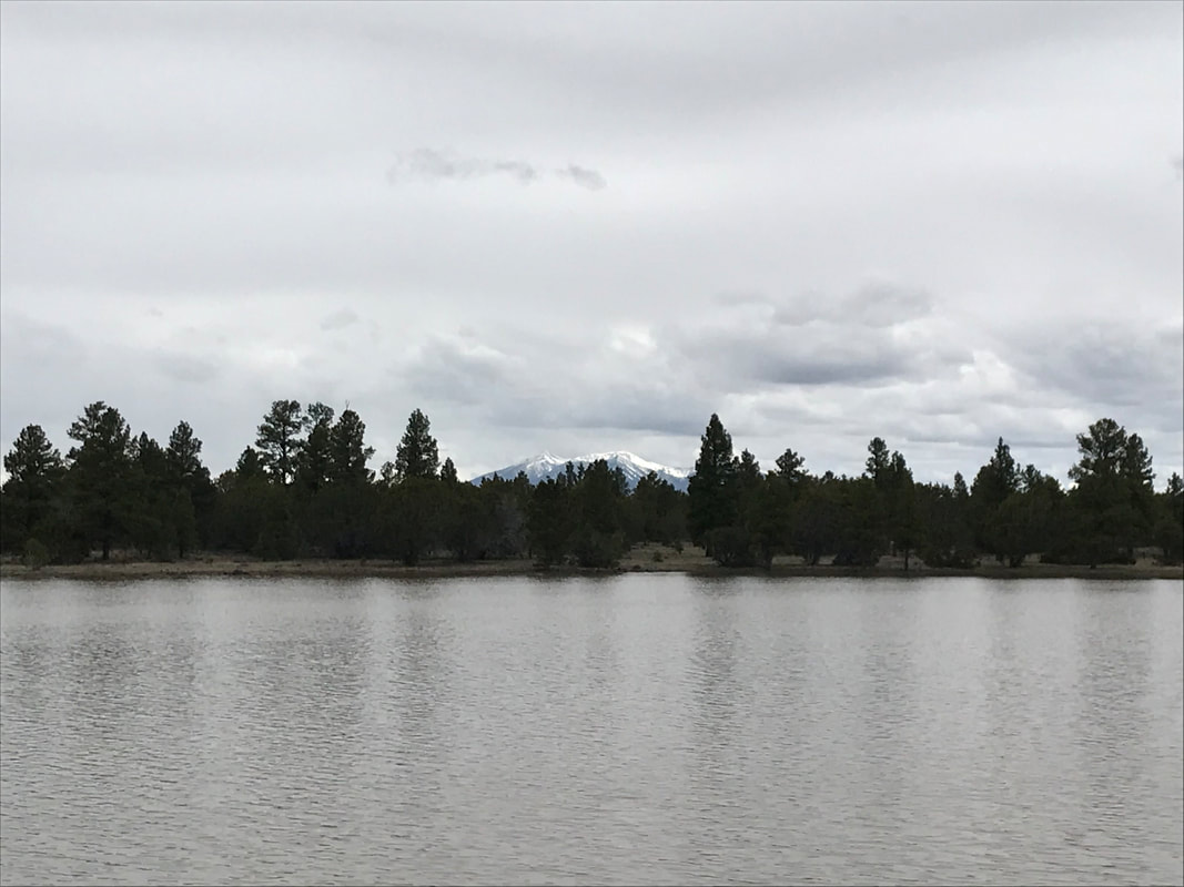 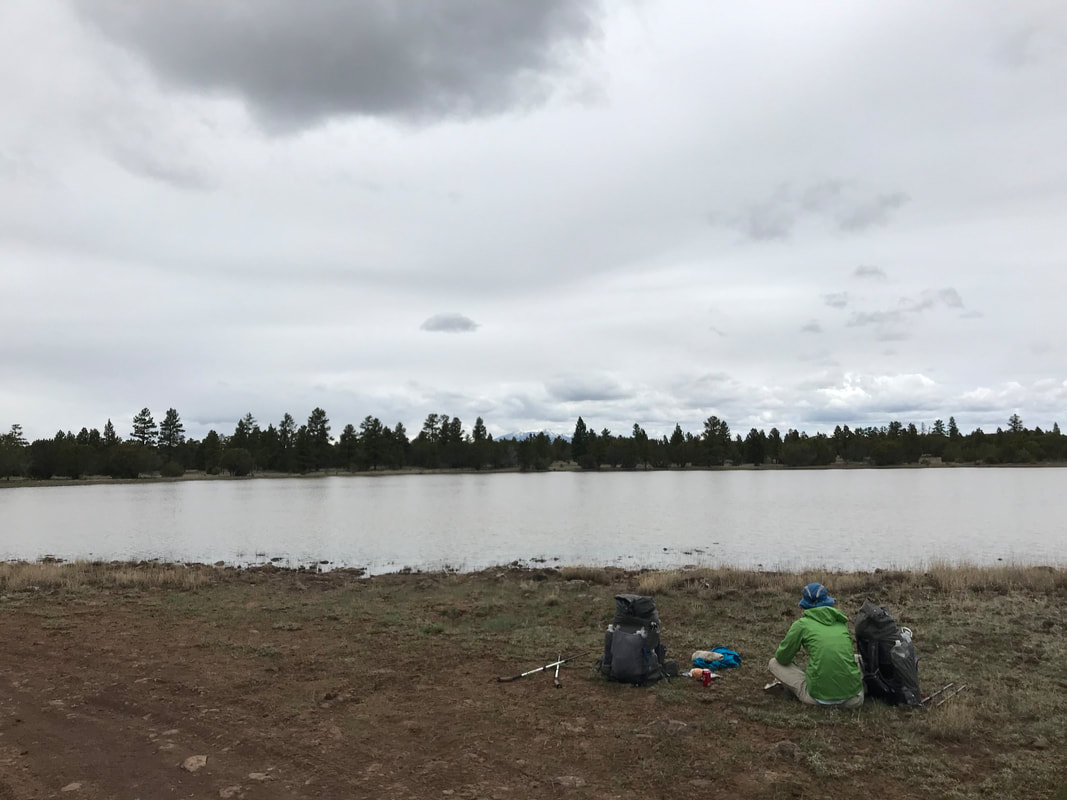
     After miles more of walking through rocky volcanic hillsides, evening began to approach. I REALLY wanted to get to Walnut Canyon before it was dark. We had visited Walnut Canyon National Monument a few years before and loved the preserved cliff dwellings. Although the AZT doesn’t go into the National Monument proper, it does enter the lower Walnut Canyon with its legendary rose-colored sandstone walls. Our food was pre-soaked and around 5:00, we decided to have dinner trailside before pushing on. Eating quickly, I pushed for us to keep going lest the dark ruin the opportunity to see the canyon. The trail began a long descent into the canyon. As evening’s darkness brushed the light aside, the pastel walls rose up beside us. It was stunning. Literally in the bottom of the canyon, the setting sun was providing even better lighting to take it all in. We took a ton of pictures as a beautiful sunset with sun unseen left the clouds overhead red, orange, and pink with the dying light. We walked up the canyon floor, me stopping to take picture after picture of the sky colors and the soft colored rock walls. You know that moment when life unfolds in a way that catches your adrenaline so well that there is no where else you’d rather be? That was me. A sunset in a northern AZ canyon. Colored earth and ceiling. Blending as twilight erased the horizon. We stood in the canyon even as full darkness settled to suck up the last hues. Now fully in the darkness, we had to climb out of Walnut Canyon as no camping is allowed down in there. Donning lights, we started switchbacking up the AZT for another mile or two until, looking for a good spot to setup camp away from wind and with some weather protection in case it stormed tonight. We found a thicket of pine on a knoll back on the opposing plateau. Pushing through the trees, we found a great site flat and protected by vegetation. Setting up camp, we walked back out to the trail to eat some snacks in the dark before setting up our Ursacks. The wind picked up and we got back to the Triplex, getting inside just moments before it began to rain in earnest. 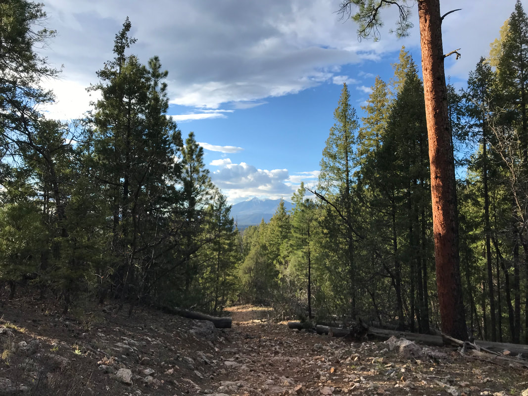 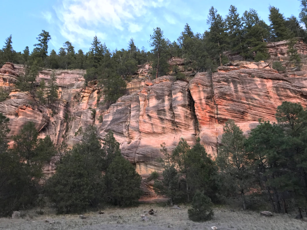 
  |