1. Route Stats
Location |
Days to Ride |
Length |
Elevation Gain |
Number of Capes |
Grand Canyon - North Rim, Arizona, USA |
10-17 Days |
639.4 Miles |
43,750 Feet |
31 |
Physical Difficulty* |
Technical Difficulty* |
Seasons |
Tire Size |
7/10 |
6/10 |
Best: Mid May - June Best: September - Mid Oct. |
Recommended: 2.5"-2.8"; Minimum Tire Size: 2.3" |
*Based on Bikepacking Roots Route Rating Scale (More info found under "Route Difficulty, Surface Conditions, and Direction to Ride"
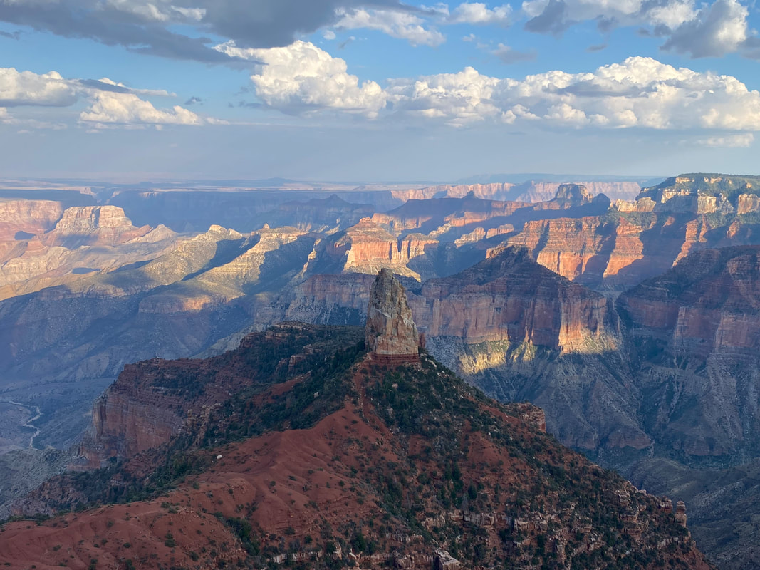
2. North Rim Capes Overview
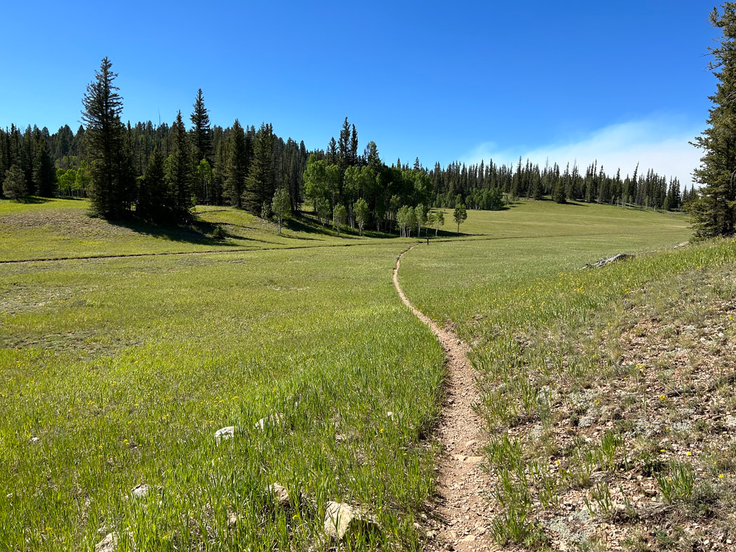
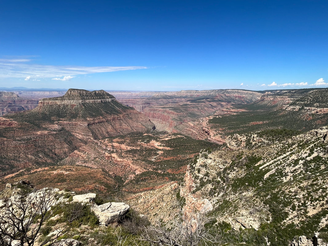
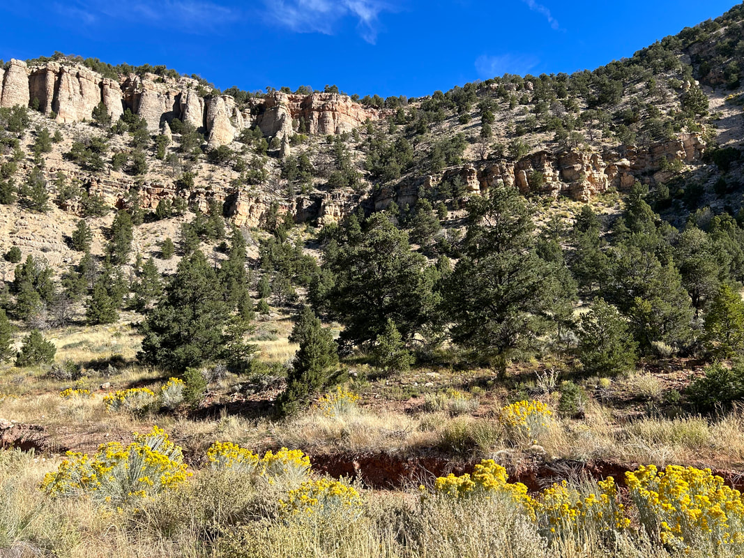
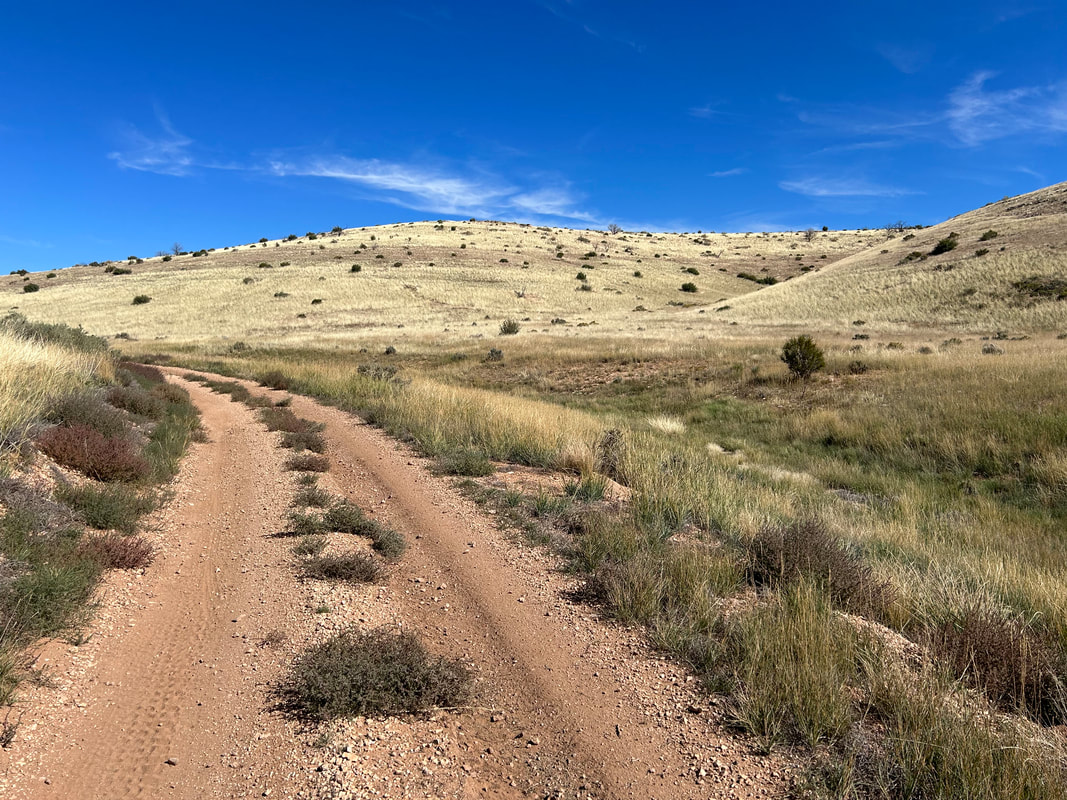
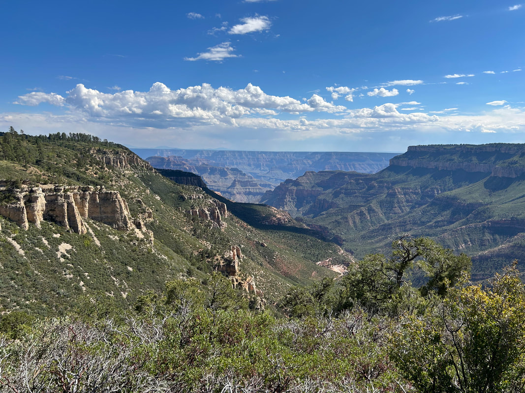
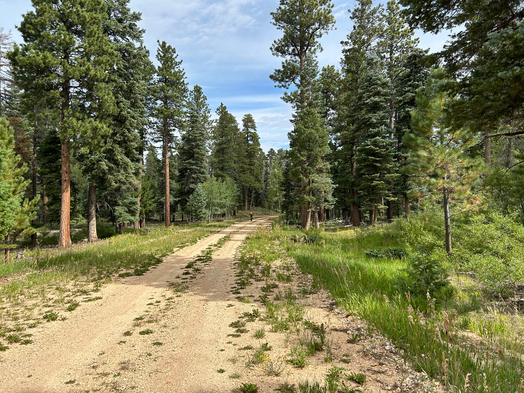
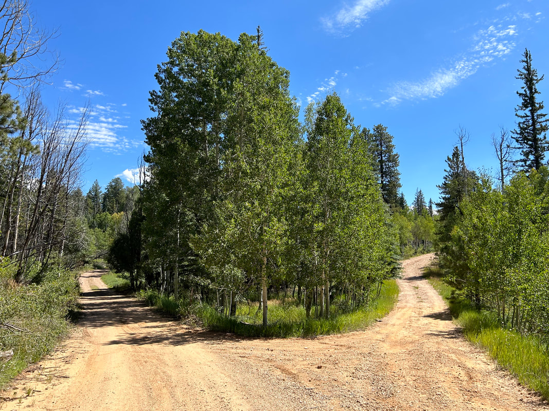
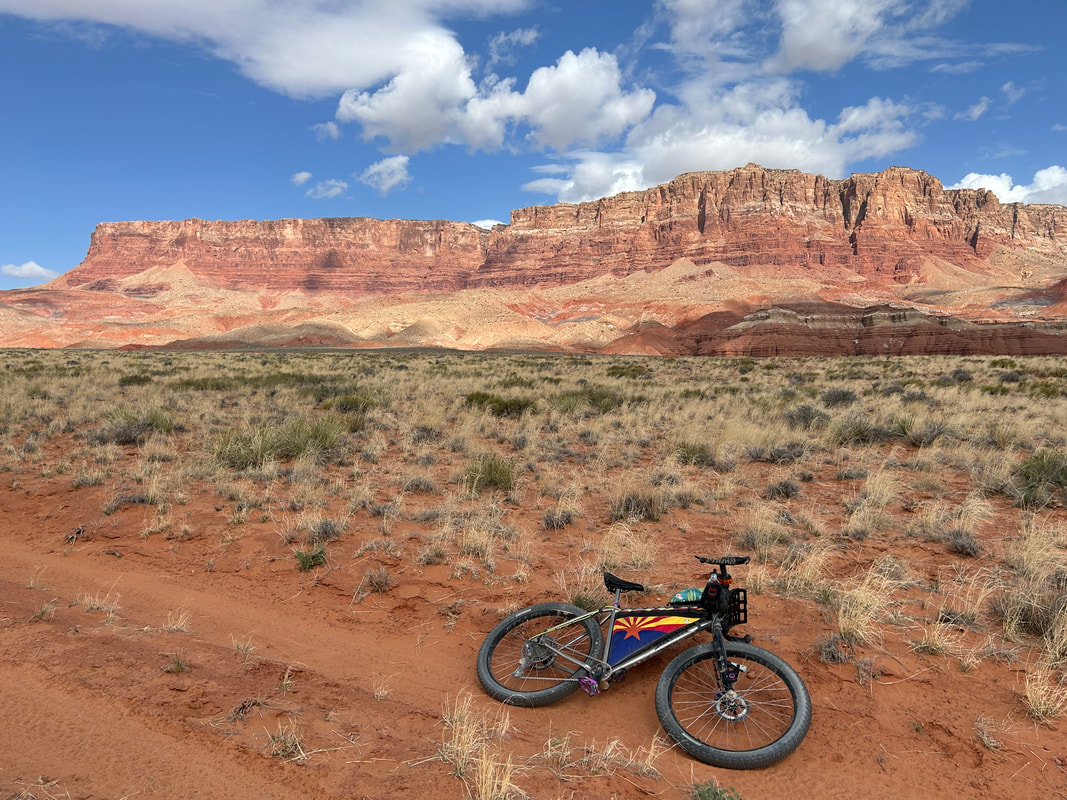
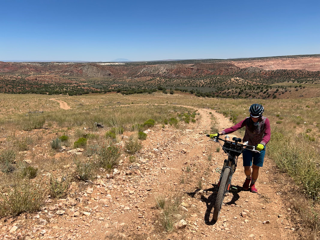
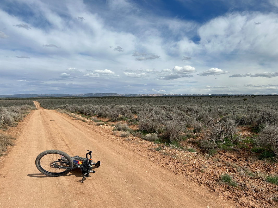
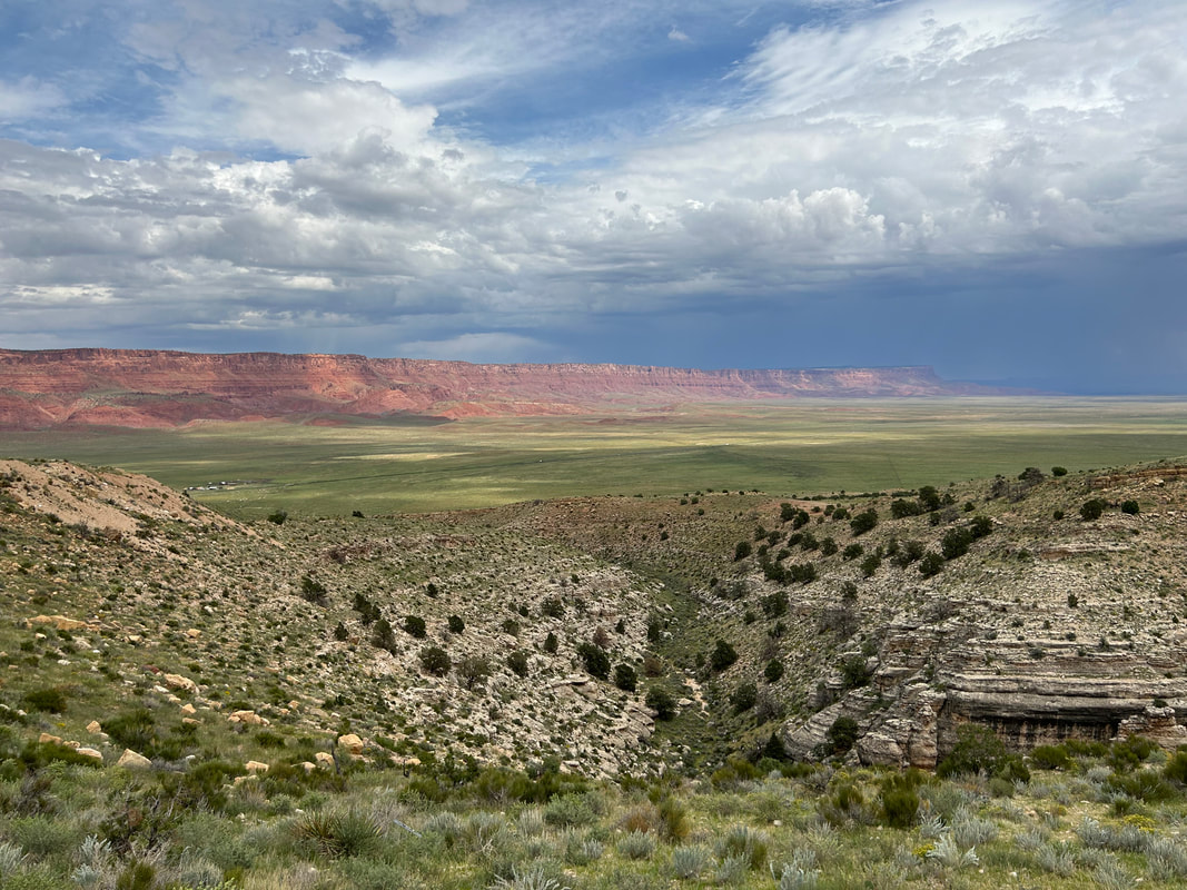
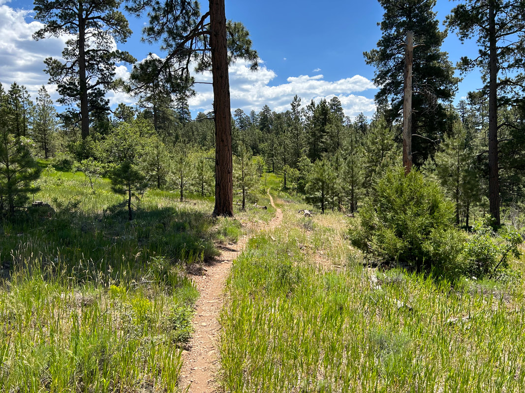
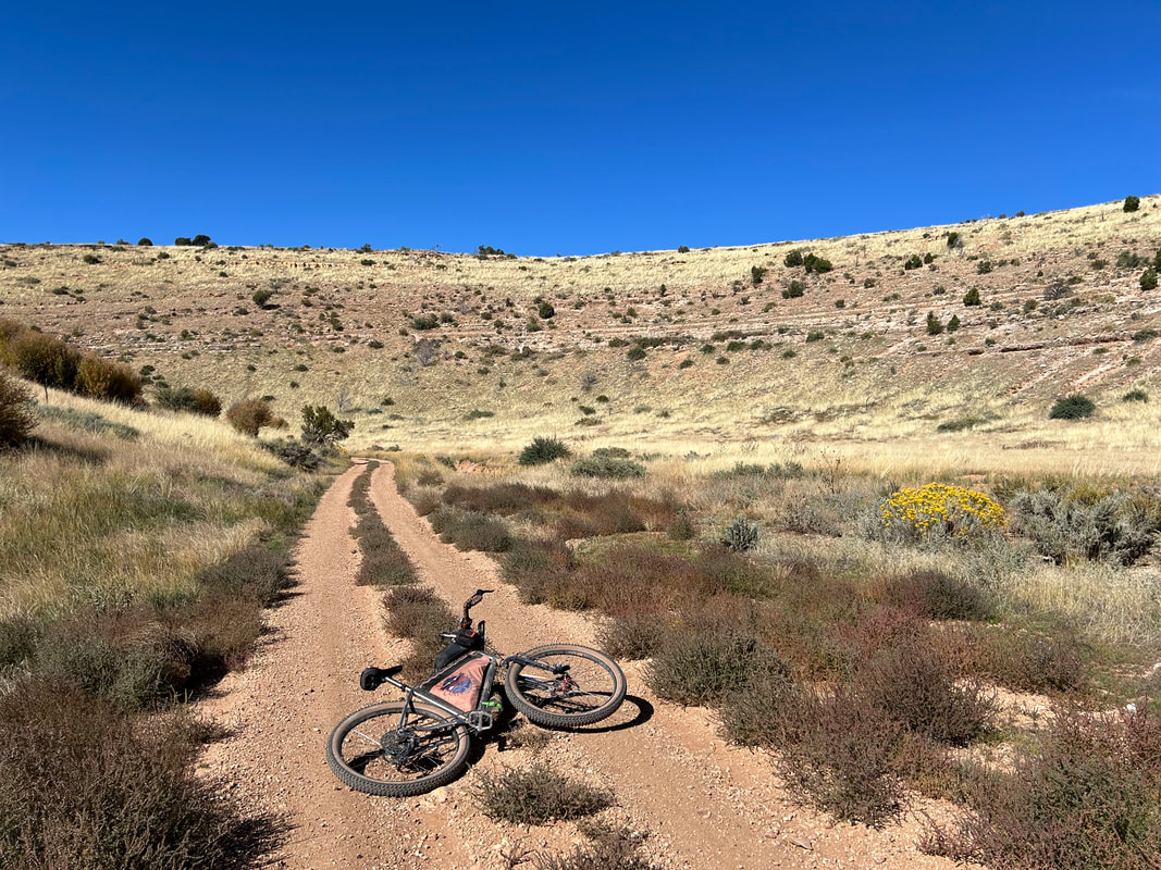
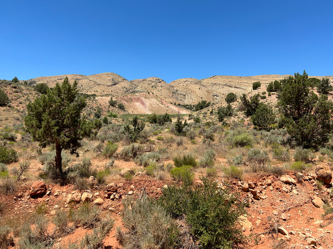
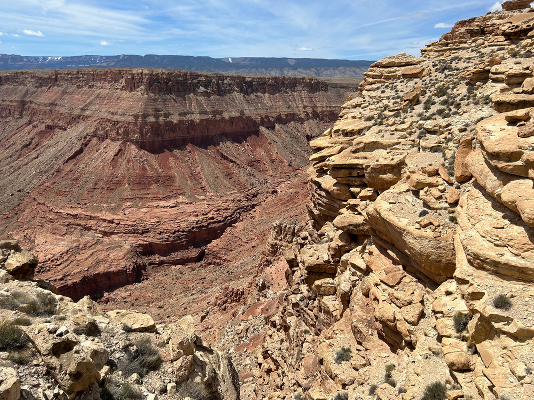
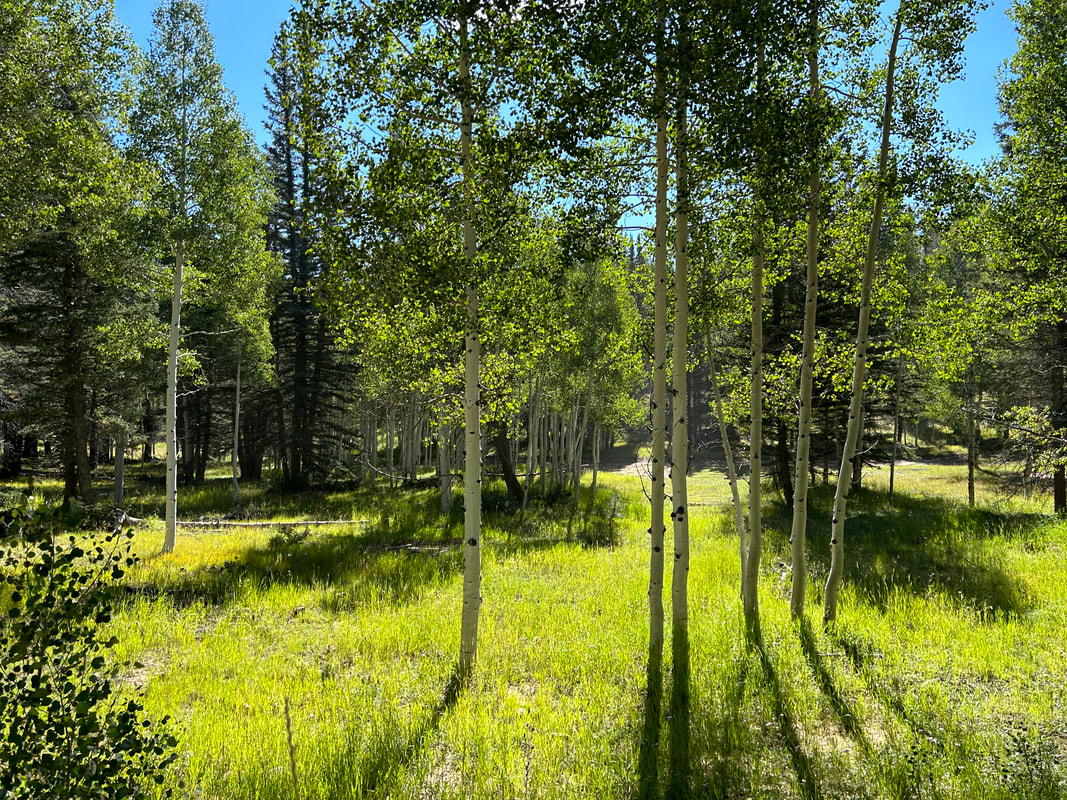
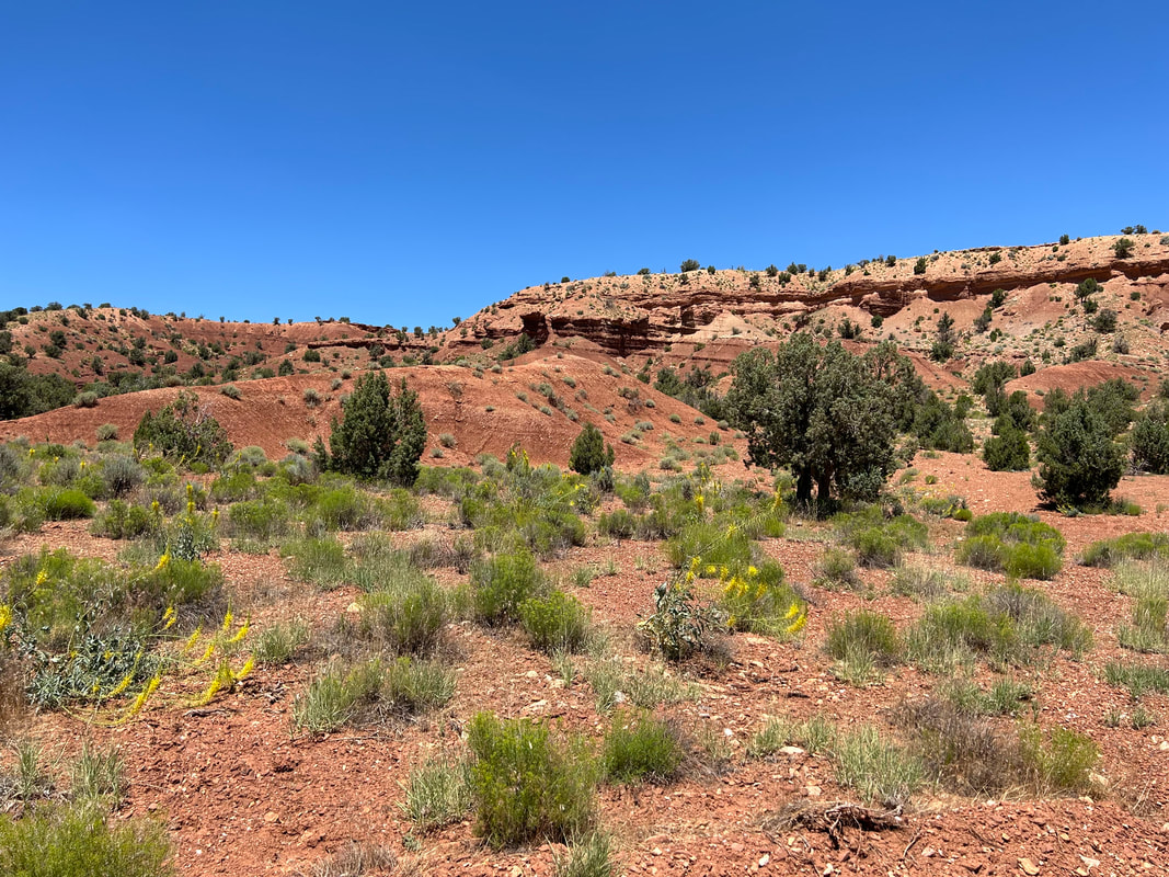
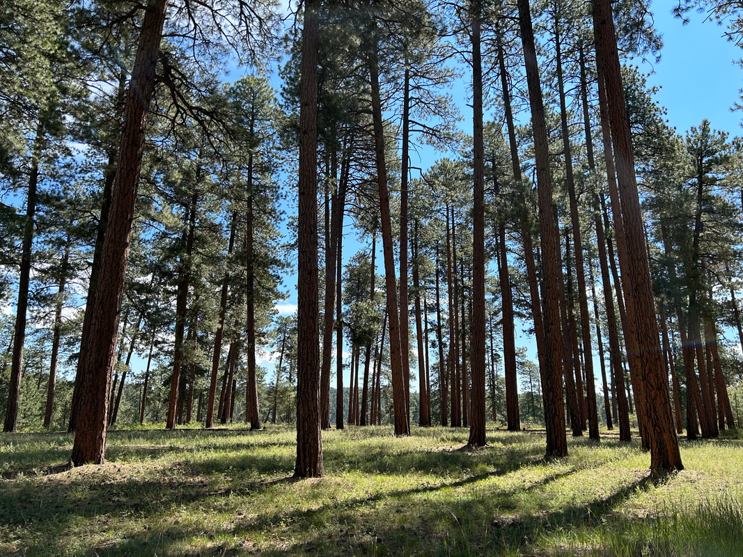
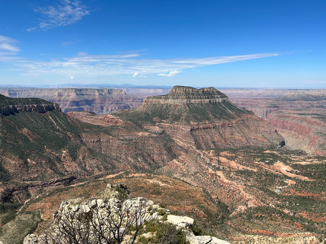
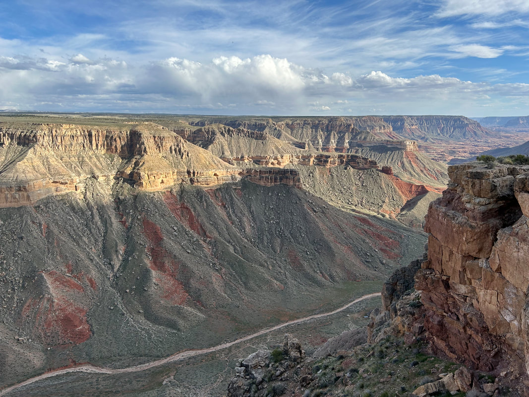
The Capes of the Canyon on the North Rim takes riders from the desert base of Vermillion Cliffs National Monument at 3100 feet to the subalpine meadows and sprawling aspen forests of the Kaibab Plateau at 9200 feet. In-between, it weaves a circumference dirt tour of North Rim viewpoints along the edge of the Grand Canyon. Capes include Navajo Bridge, Badger Creek Rapids, Gunsight, Jumpup, Sowats, Thunder River, Crazy Jug, Monument, Parissawampitts, Fence, Locust, North Timp, Timp, Fire, Swamp, Point Sublime, Bright Angel, Point Imperial, Vista Encantada, Roosevelt, Walhalla, Angel's Window, Cape Royal, Nankoweap/Saddle Mountain, Marble Viewpoint, East Rim, Dog, Buck Farm, Bedrock, Twentyseven Mile Rapids, and down in the Canyon at Lees Ferry. The route starts at Lees Ferry where riders can touch the Colorado River to begin and later finish their rides. Look forward to multiple views of the esplanade along the Kanab Creek Wilderness, the possibility of sleeping in old Forest Service cabins at Jumpup and Big Springs, riding across the arid plateau of House Rock Valley, peering over the bench of Marble Canyon, and seeing high-altitude meadows cupped by conifers.
The goal of the route is to hit every bike-legal track that takes a rider to views of the Grand Canyon along the North Rim, Kaibab Plateau, and Marble Canyon. It provides an additional tour of the Colorado Plateau by way of an extensive network of forest service roads that wind through ponderosas, spruce, firs, aspen, sage, tablelands, and plateaus in and near the Baaj Nwaavjo I'tah Kukveni National Monument and the Kaibab National Forest. This route offers remote high-country riding down seldom-visited roads, a chance to bike singletrack along the Grand Canyon at Rainbow Rim, multiple opportunities for dispersed camping at the rim edge, sections of the Arizona Trail, and, for those who store their bike on top, the chance to hike down into the inner gorge at notable trailheads within Grand Canyon National Park.
The goal of the route is to hit every bike-legal track that takes a rider to views of the Grand Canyon along the North Rim, Kaibab Plateau, and Marble Canyon. It provides an additional tour of the Colorado Plateau by way of an extensive network of forest service roads that wind through ponderosas, spruce, firs, aspen, sage, tablelands, and plateaus in and near the Baaj Nwaavjo I'tah Kukveni National Monument and the Kaibab National Forest. This route offers remote high-country riding down seldom-visited roads, a chance to bike singletrack along the Grand Canyon at Rainbow Rim, multiple opportunities for dispersed camping at the rim edge, sections of the Arizona Trail, and, for those who store their bike on top, the chance to hike down into the inner gorge at notable trailheads within Grand Canyon National Park.
3. Map and GPX
Surface Color Guide
- Purple = Improved Dirt Surface (2WD, Wider, Smoother, Better Maintained, Intact, Graded, etc.)
- Red = Rugged Dirt Surface (4WD, Doubletrack, Rough, Less Maintained, etc.)
- Brown = Primitive Dirt Surface (Particularly Rocky, Rutted, and Eroded)
- Black = Singletrack
- Yellow = Sand (Intermittent with Hard Pack; Mild/Medium Depth)
- Blue = Vehicle Pavement
- Green = Paved Bike Path
Route Guide Sections
- Route Stats
- Route Overview
- Map and GPX
- Alerts and Closures
- Route Design Philosophy and Vision
- Route Description
- Route Difficulty, Surface Conditions, and Direction to Ride
- When to Ride (Temperature + Climate)
- North Rim vs. South Rim Capes
- Capes Connectors
- Ecoregions and Landscape
- Where Bikes Are Allowed and Not Allowed
- Native Nations and This Land
- Leave No Trace and Bikepacking Ethics for the Colorado Plateau
- Water Sources
- Camping
- Food and Resupplying
- Sample Route Itinerary
- Fees and Permits
- Getting to the Start
- Parking
- Additional Important Information
- Other Rides in the Area
- Acknowledgments
- Social Media and Route Updates
4. Alerts and Closures
The Southwest is a dynamic region. The Capes of the Canyon is subject to wildfires, flash floods, extreme heat, blizzards, monsoon storms, and death mud. Grand Canyon National Park, Kaibab National Forest, and the Bureau of Land Management are the main land management agencies who may issues closures for access. BEFORE you ride, make sure you check EACH of the links below to see if important alerts or closures will affect your riding of the established routes. Be prepared to use maps to find alternates should a sudden change in route conditions occur.
Good physical maps for the region can be accessed or purchased below:
Good physical maps for the region can be accessed or purchased below:
5. Route Design Philosophy and Vision
This route was not designed to be a straight point-to-point endeavor. Instead, it weaves, spiderwebs, and wraps around the famously sought and the little seen aspects of the Grand Canyon rim region. When I ride, I ride for topophilia - a love of place. I ride to know an area's biodiversity, to breathe its odors, to see its beautiful niches, and to appreciate its detail. This route represents that approach.
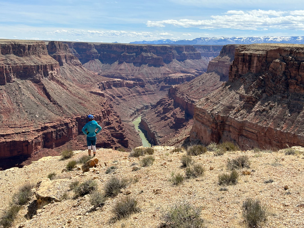
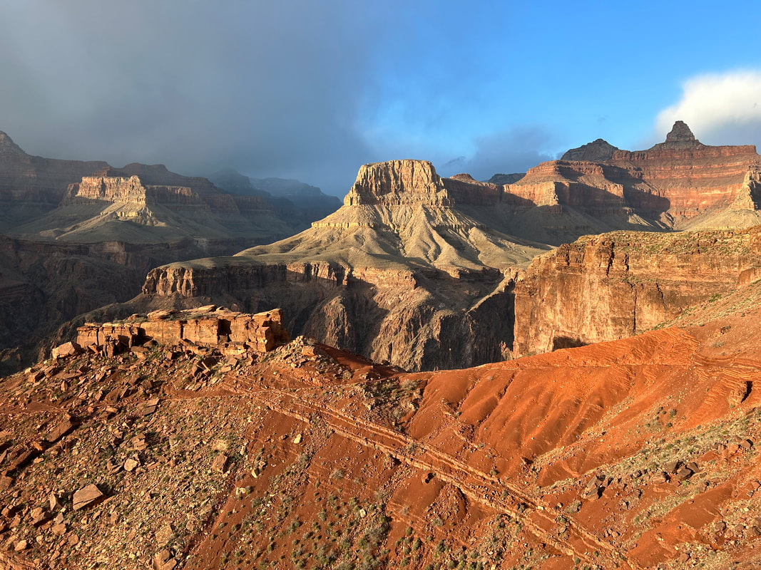
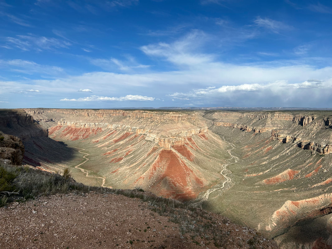
A "cape" in geography refers to a high point of land that extends into a river, lake, or ocean. As unusual a comparison as it may seem, I often feel the Grand Canyon is analogized best as where ocean meets land: the rims swell as elevated crests before plunging into a volume of space a mile deep. The canyon is a sank range, an inverse mountain. When you ride to the capes on this route, you'll stand on juts of land protruding into geological space. The primary goal of the Capes of the Canyon is to take riders to notable rim overlooks of the inner Grand Canyon gorge. Your goal as the rider is to hit each one and soak them in. Sure, you can cut off time and distance by eliminating some of the spokes on the circumference of this ride, but know that you'll be missing some singularly interesting landscapes, ecosystems, history, culture, and views.
Ride the spokes.
6. Route Description
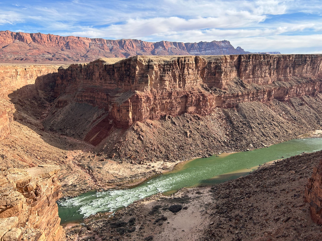
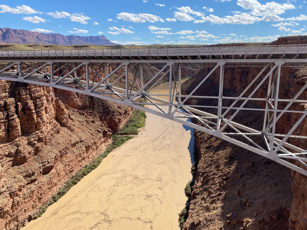
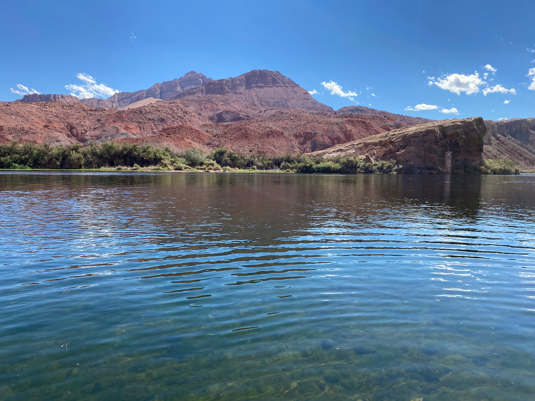
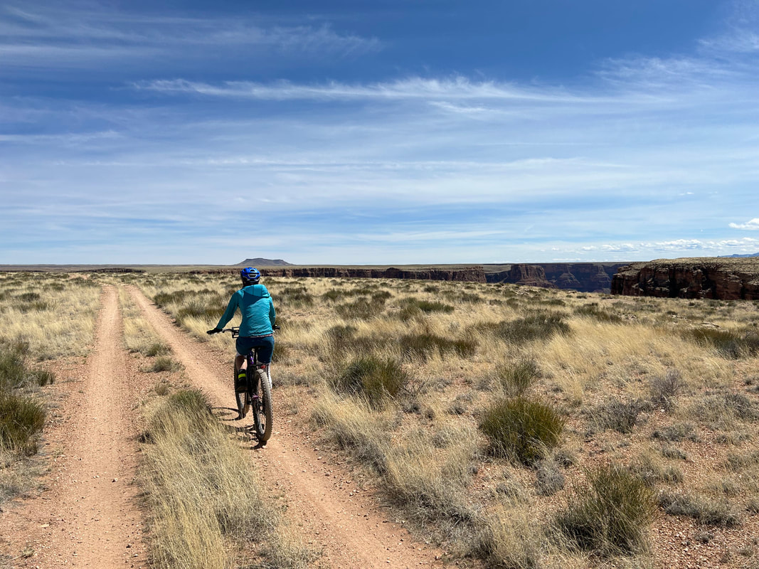
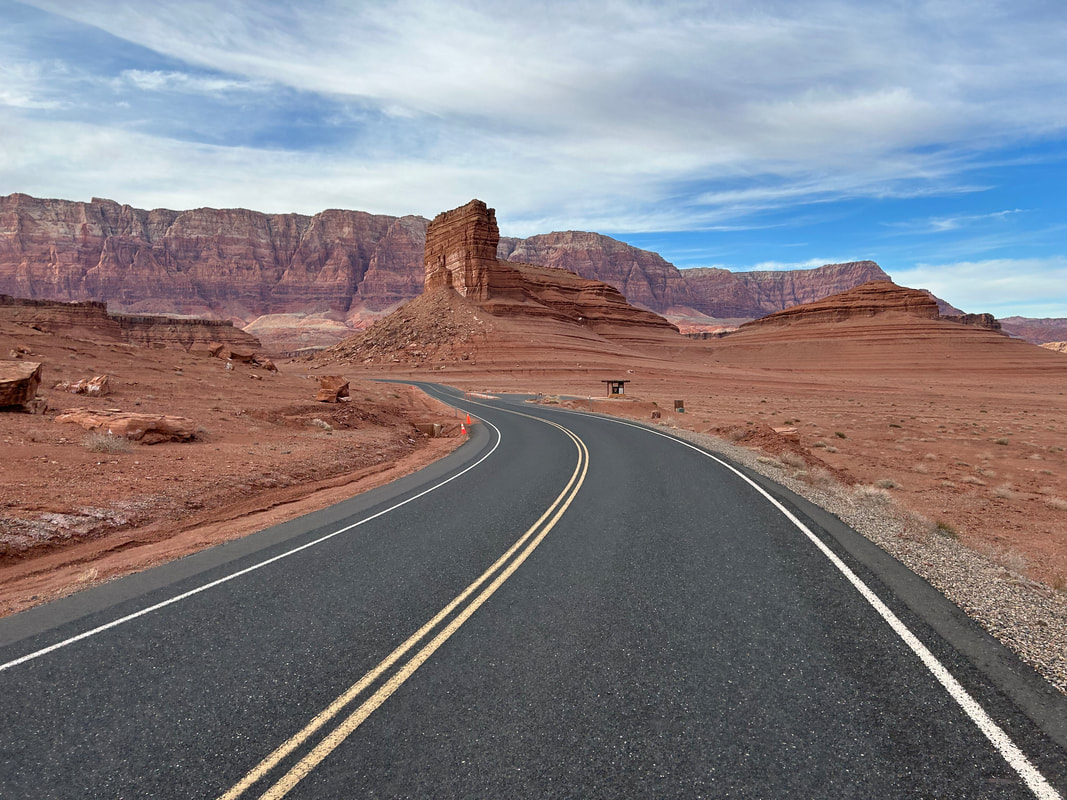
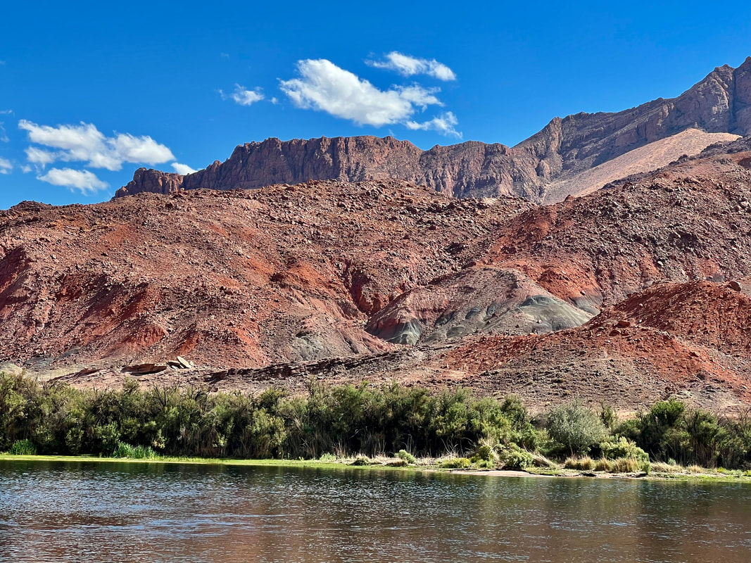
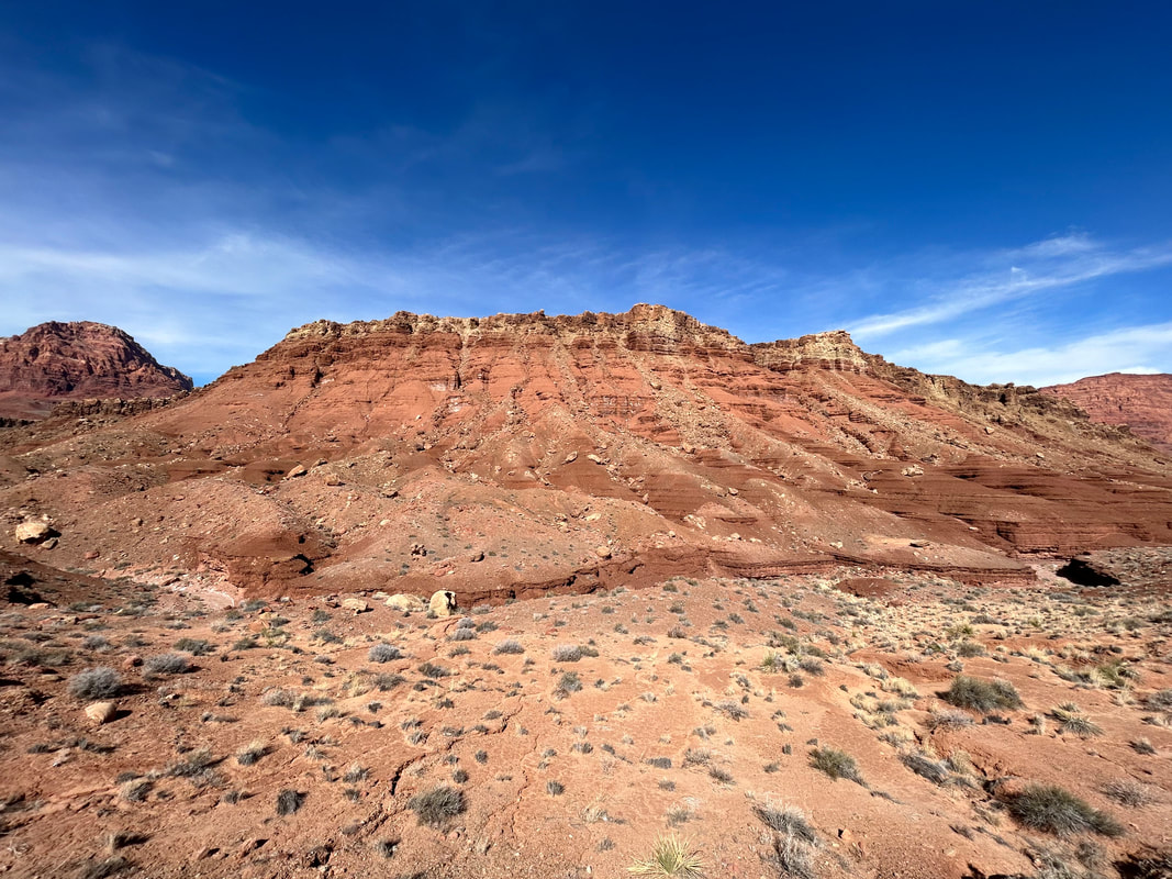
Start your ride at the low point of the route at Lees Ferry located in Glen Canyon National Recreation Area and Grand Canyon National Park. Leave your vehicle in the long-term parking noted on the map. Begin by walking down the boat beach to the Colorado River. This is the only place on the route, at 3100 feet, where your bicycle can be ridden to the river below the rim. Look at the stratified rock faces around you and begin to ride up and through the tumbling stone landscapes of Vermillion Cliffs National Monument. At the top, turn left on 89A briefly to arrive at your first cape: Navajo Bridge. Walk out on the bridge to stand over the Colorado River snaking its way through Marble Canyon below you. On the other side of the bridge is the Navajo Nation. Look under the bridge and along the surrounding rock faces for the largest bird in North America (and one of the most endangered), the California Condor. Reintroduction efforts in the area have been successful and the large carrion-eaters roost and frequent the shear rock faces of Marble Canyon and Vermillion Cliffs.
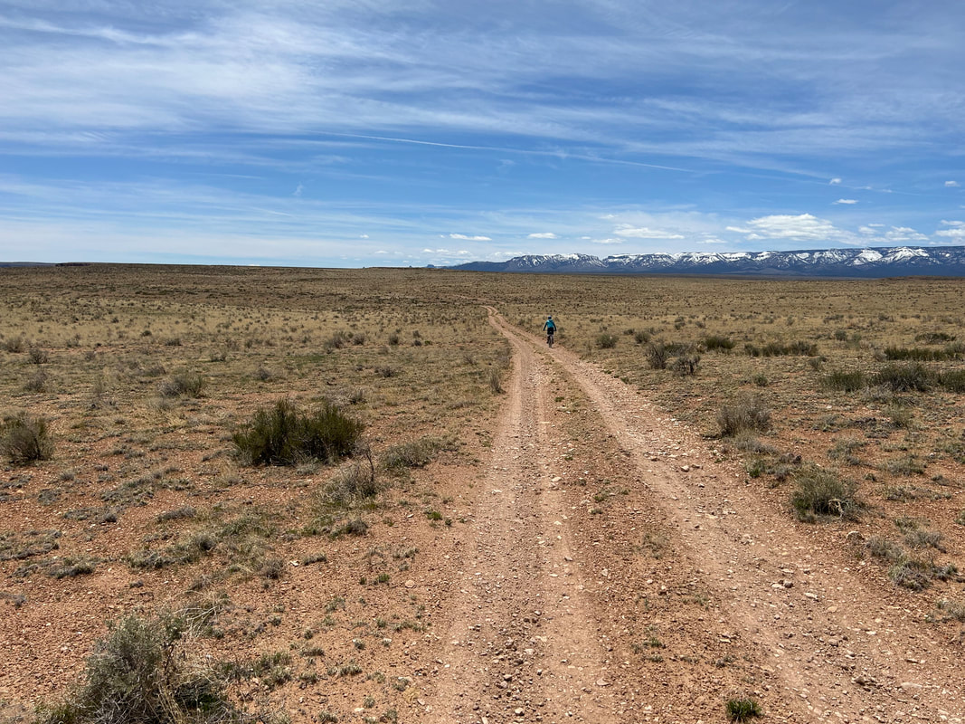
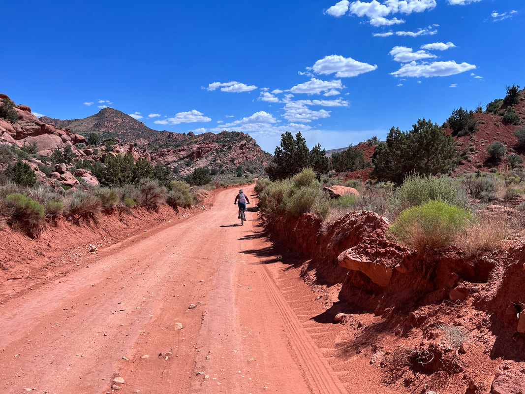
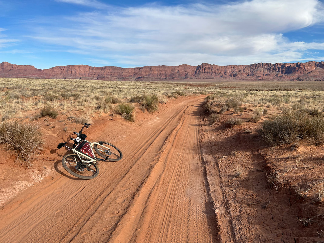
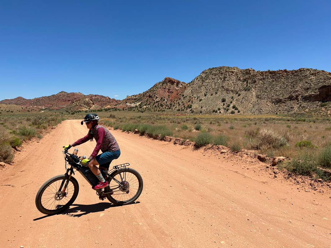
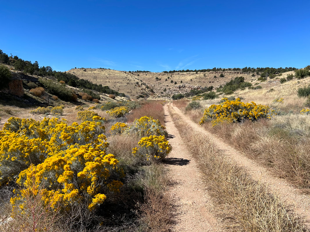
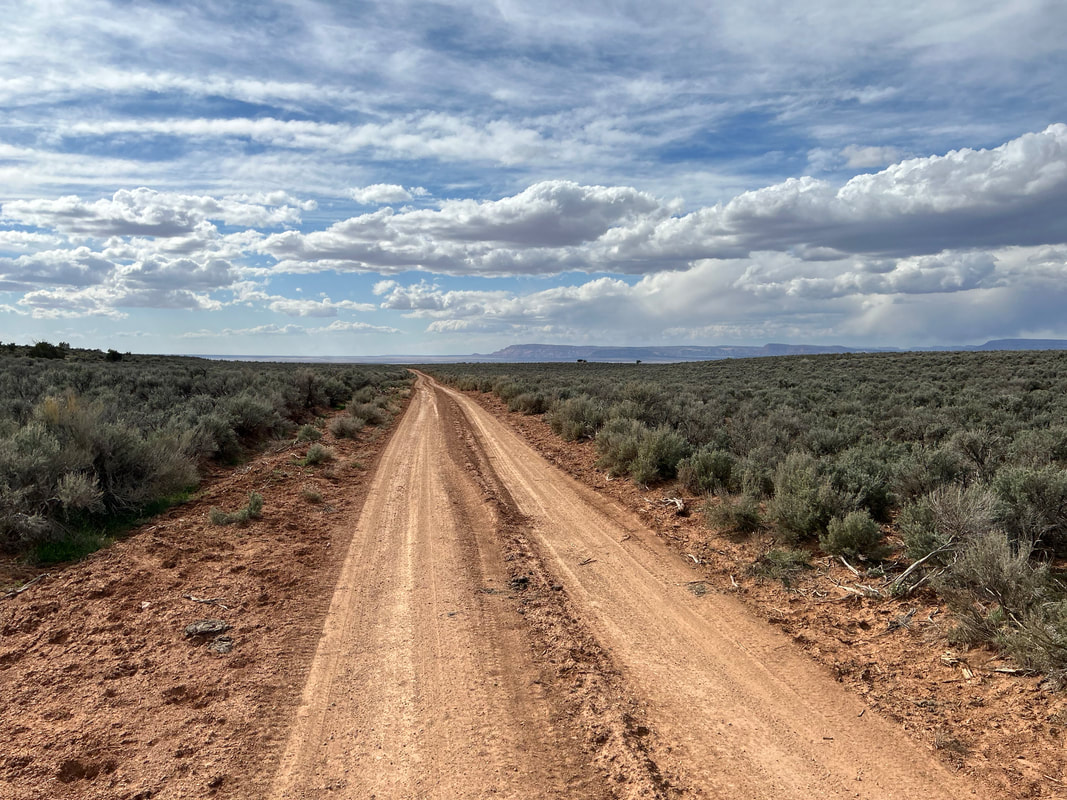
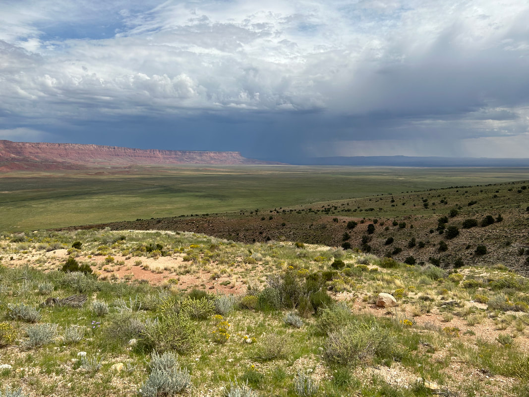
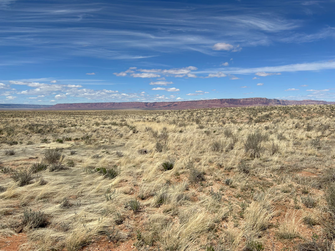
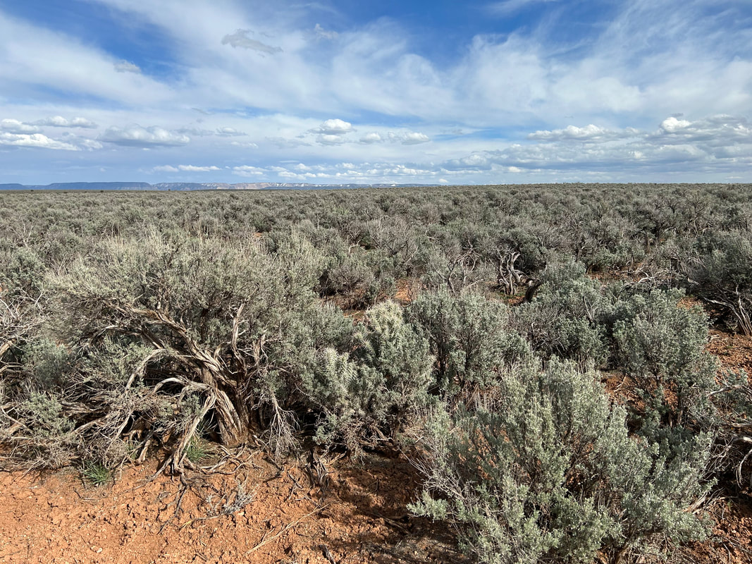
Once on paved 89A, head right and continue around the cliff faces. You'll swing a left out on dirt out to Badger Creek Rapids Overlook for Cape #2 in the Baaj Nwaavjo I'tah Kukveni National Monument. Head back and keep to the shoulder of the paved highway. Make sure to wear bright colors, a mirror, and using flashing lights. Traffic is typically low on Highway 89A but highway speeds are fast, and there is little actual shoulder to ride on. At the end of the Cliffs, take a right on unpaved House Rock Valley Road to cross back into Ancestral Footprints of the Grand Canyon National Monument. As the valley closes up, you'll arrive at a Condor Viewing Site managed by The Peregrine Fund. Stop and look through the binoculars at the whitewash along the cliffs where endangered California Condors are released each September and where many come to permanently roost. Continue to steadily climb until the Paria Plateau evens out with you to your east. Intricate, colorful, and gorgeous rock formations will begin to pour out of the sand in large swirling pyramids and butte chunks such as Coyote Buttes and The Wave (both require permits to view). At Stateline Campground you can grab a campsite, see the northern terminus of the Arizona Trail, and then cross into Utah. Continue on as the wall of vibrant orange, reds, ochres, and purples to your right become the southern boundaries of Grand Staircase Escalante National Monument and its famous Cockscomb.
At Buckskin Gulch Trailhead, you'll swing left and climb up an old dirt road into the Buckskin Mountains before turning south and reentering Arizona. Continue south cycling on top of the mountains/plateaus until you reach Winter Road and swing west. The desertscape here can be quite exposed so make sure you fill up at all Wildlife Tanks you come across. The juniper, sage, and grasslands will begin to slop you down towards Highway 89A where you join it shortly to arrive at Fredonia, AZ. Fredonia offers some convenience store resupplies, water, and lodging. Swing south on FR 22 just outside town to begin a long climb back up towards the Kaibab Plateau that cuts across BLM land. Make sure to turn around frequently to catch awesome panoramas of the Grand Staircase along with the mountain formations of Bryce Canyon and Zion in the northern distance. The road here is paved but little used so expect only a small amount of vehicular traffic.
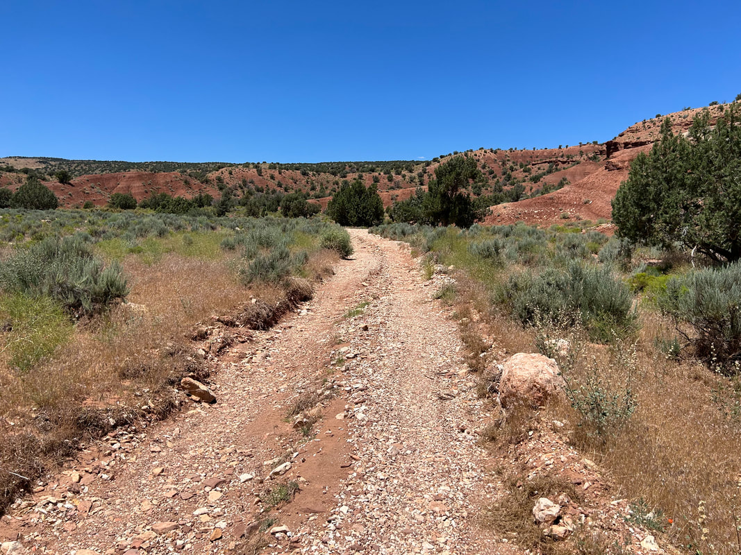
A new cape awaits for riders as you peel off into the desert of the Baaj Nwaavjo I'tah Kukveni National Monument on a dirt road down to Gunsight Point. The route parallels the eastern edge of Kanab Creek and provides a viewpoint straight down the Kanab Creek Wilderness. After retracing, you jump back on pavement to enter the Kaibab National Forest. You will come to an intersection with dirt FR 461. Turn left for a ride up Warm Springs Road to Jacob Lake for access to lodging, camping, a general store, and a restaurant. Grab some famous cookies from Jacob Lake Inn and check out the Kaibab Plateau Visitor Center as well as Kaibab Squirrel Area.
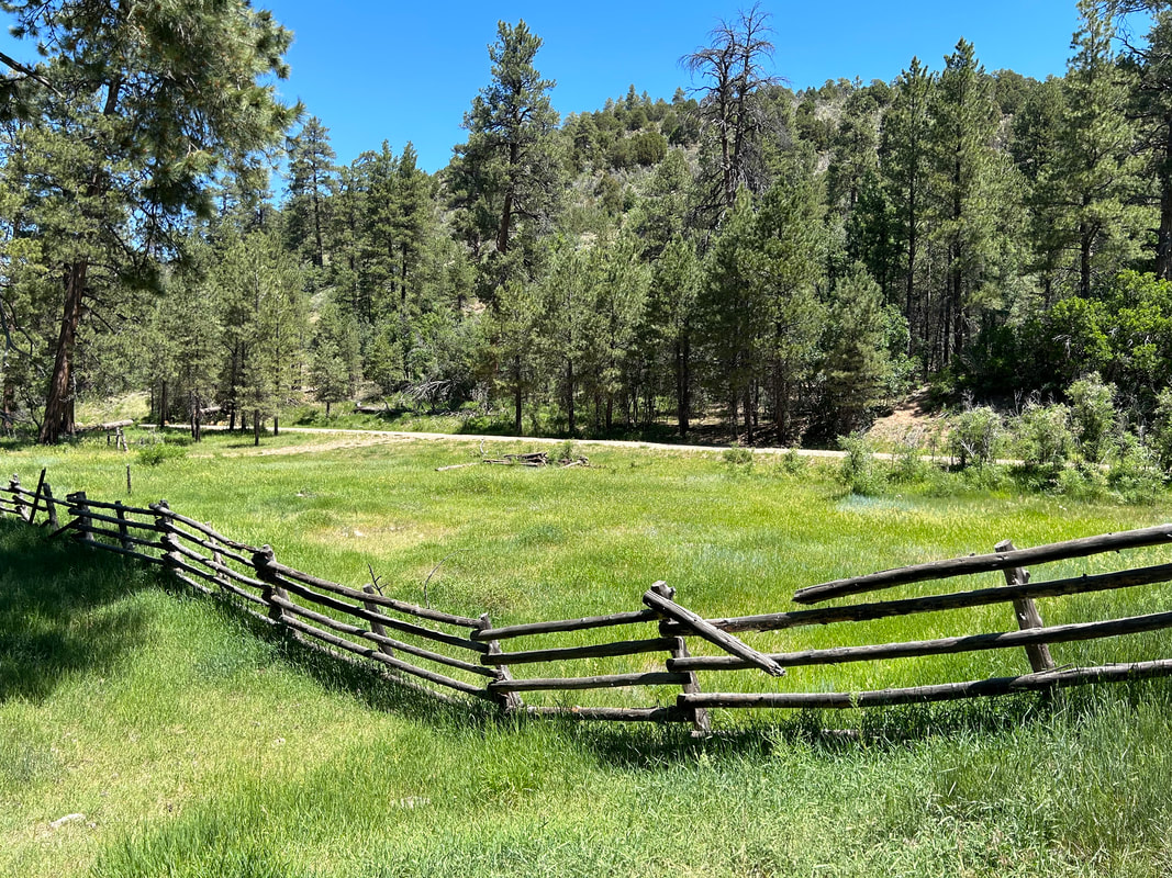
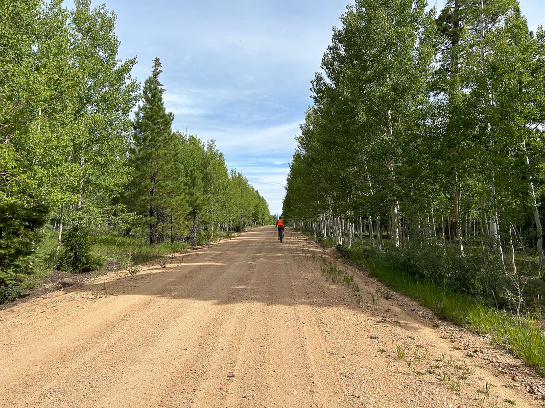
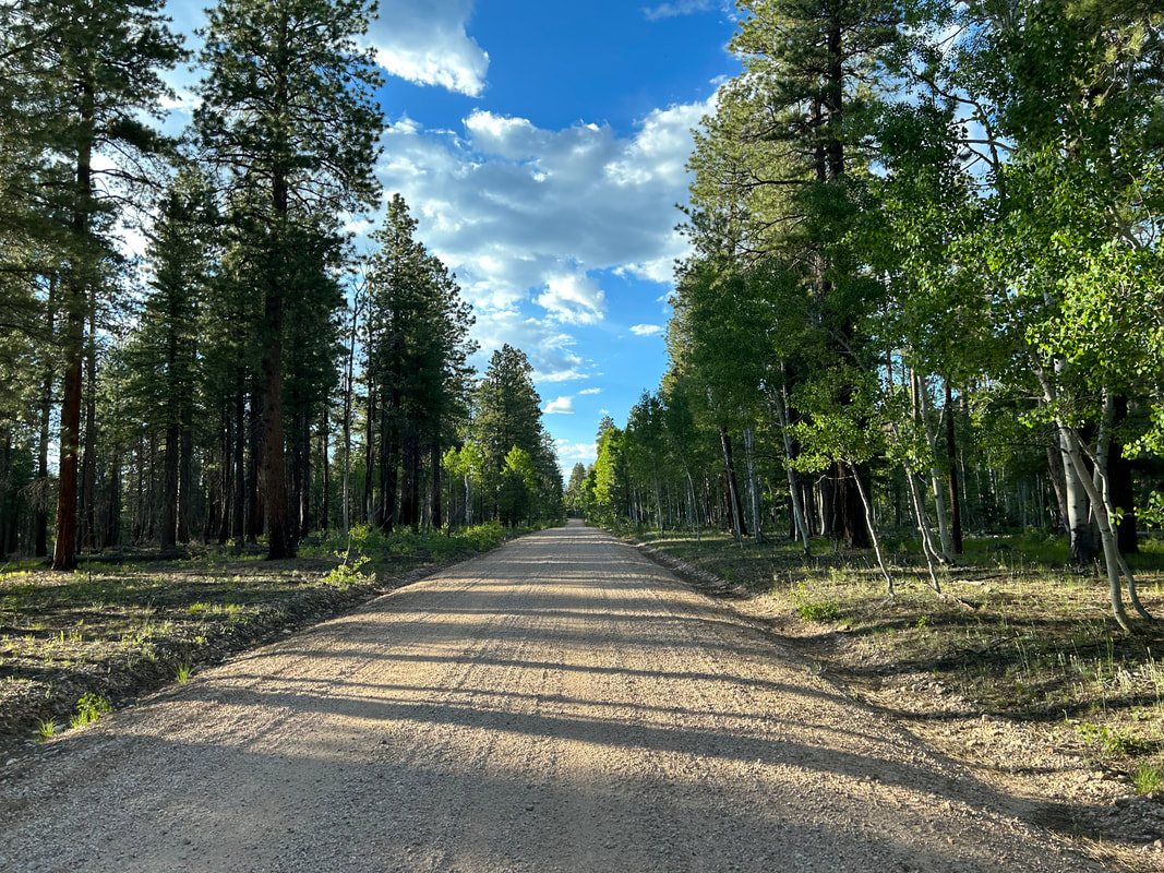
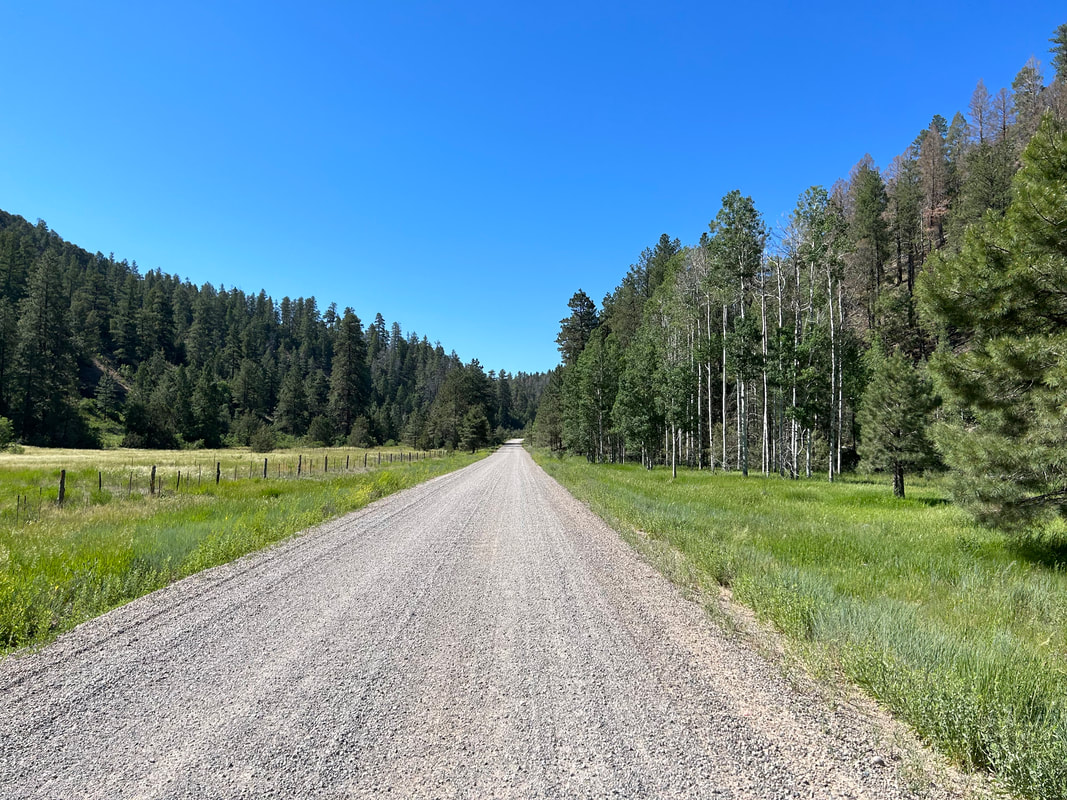
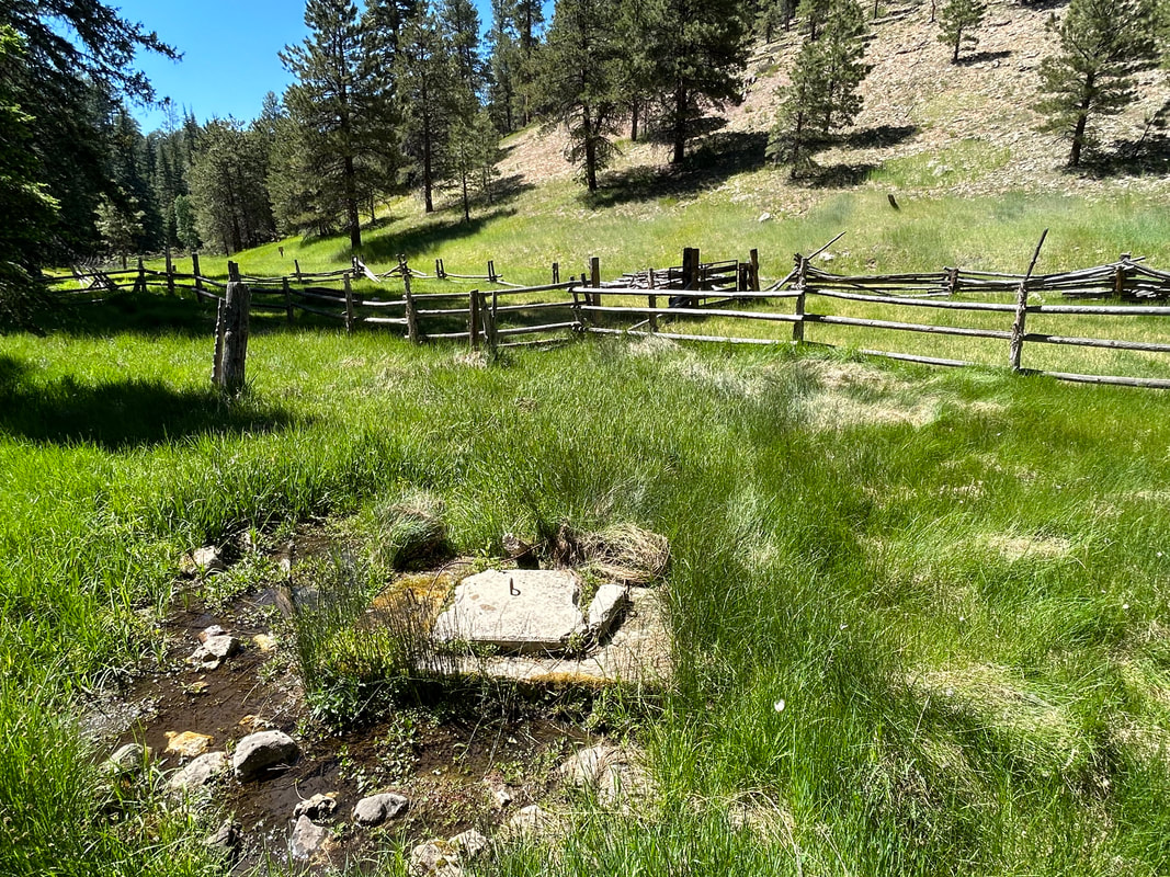
Head south on FR 282 past Jacob Lake proper through thickening ponderosa and grassy meadows. You'll hit an old burn scar now dense with young aspen before heading back into mature pine forest and descending Castle Canyon to FR 22. Heading north on this well-maintained gravel road brings you to the most reliable water source on the Kaibab Plateau: Big Springs. Big Springs is a gushing high-quality water source that careens down the side of a cliff near a USFS service site and cabins. When the USFS cabins are open for rental, plan to get reservations ahead of time and stay for a day to enjoy the showers, water, and common rec center/kitchen. If you're just passing through, fill up water from a spigot found outside the fence of the USFS site before continuing on.
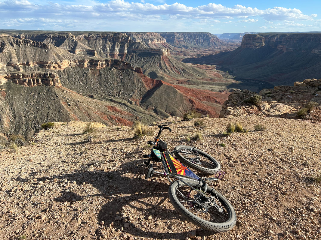
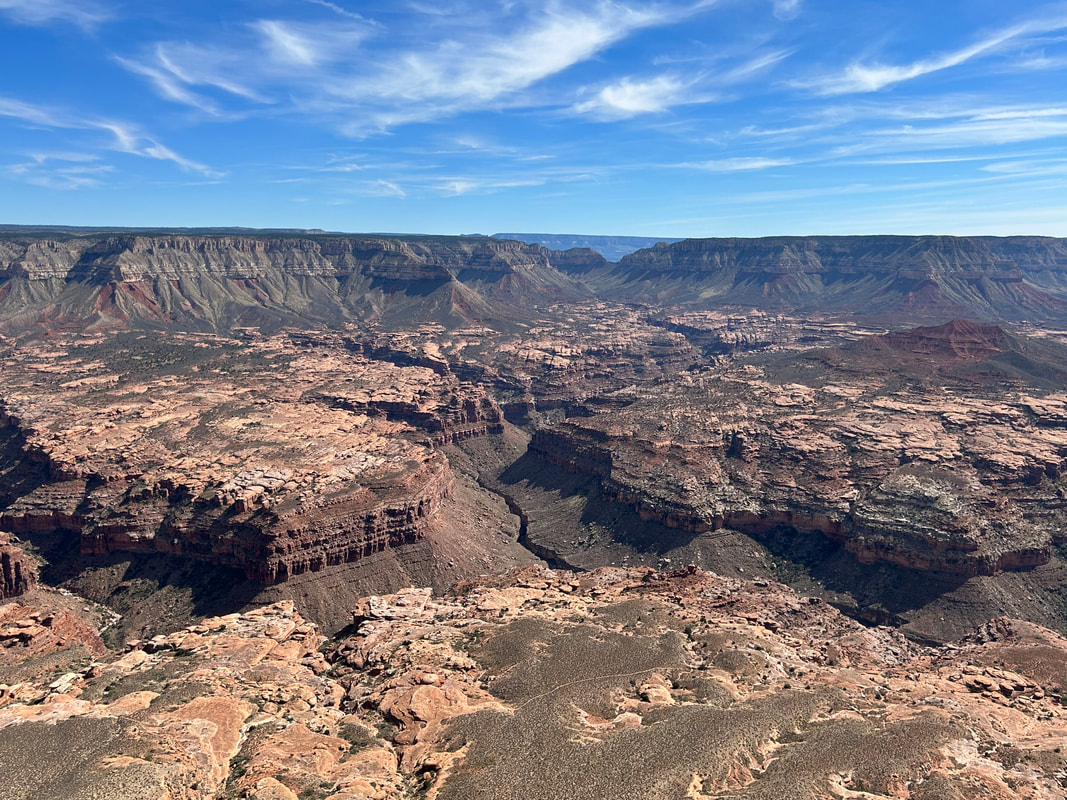
Continue a gradual descent on FR 22, eventually swinging a west on a decline out to juniper-pinyon plateaus along a sliver of road winding between the Kanab Creek Wilderness with the plunge of Jumpup Canyon to your left. After hitting Jumpup Point, retrace your route back to a turn at the Jumpup Divide that descends to Jumpup Cabin (USFS rental by reservation only). Get ready for a big climb up Pine Hollow to FR 427 where a turn south takes bikepackers towards the mouth of Big Sowats Canyon. At an intersection with FR 233, turn right for a one-way trip out to Sowats Point along Kwagnut Hollow for a view of the sprawling esplanade shelf. Several Wildlife Tanks can be found in the area for a water fill-up. Retrace your route and then head south out to Thunder River Trailhead at Indian Hollow with views of Deer Creek Canyon opening up in front of you. Retrace, head south, and reach Crazy Jug Point and Monument Point - the former is an epic place to dispersed camp along the rim of the Grand Canyon with southerly views of the Tapeats Amphitheater.
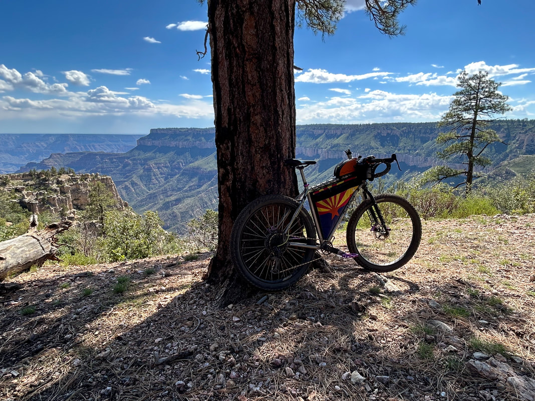
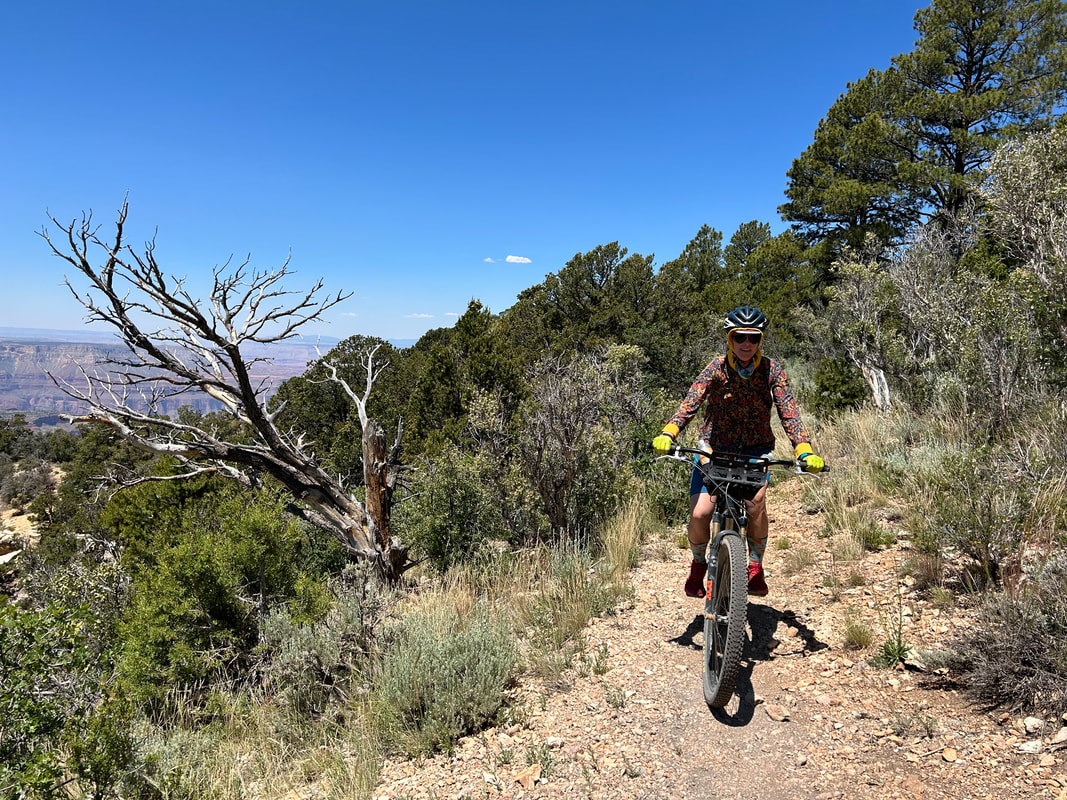
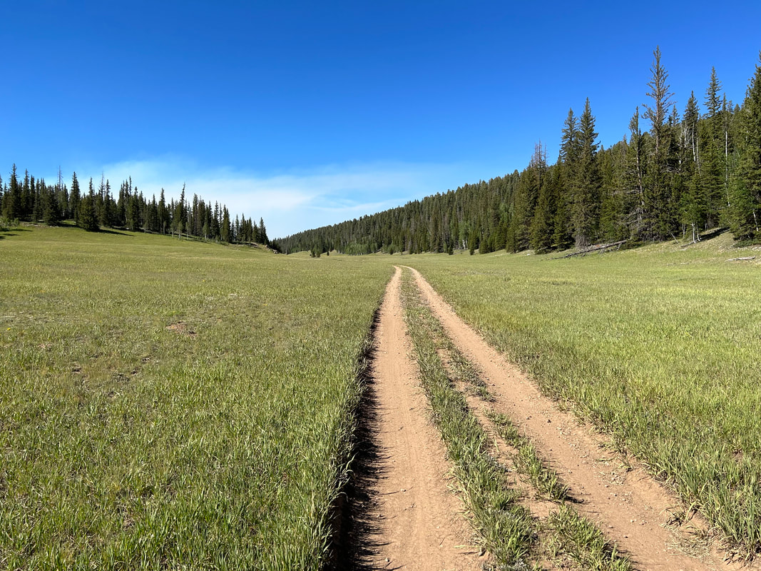
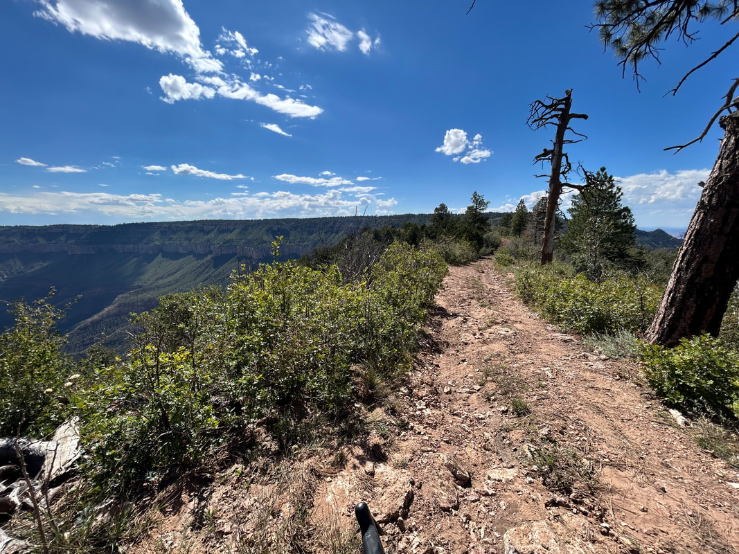
Swing into the Kaibab National Forest before winding back out to the the only mountain bike singletrack along the edge-proper of the Grand Canyon: Rainbow Rim. Jump onto its northern terminus at Parissawampitts Point and start a repeated meander inland along side-canyons that turn and veer back out to points, capes, and stunning views of the heart of Grand Canyon National Park. After the southern terminus at Timp Point, head inland from the rim edge towards the interior of the Kaibab Plateau. Climb elevation riding up FR 206 through Quaking Aspen Canyon (grab some water at Quaking Aspen Spring) that joins FR 226 south of Dry Park. Enjoy the high elevation meadows of Dry Park before turning on FR 206 once more and heading southward up a big climb.
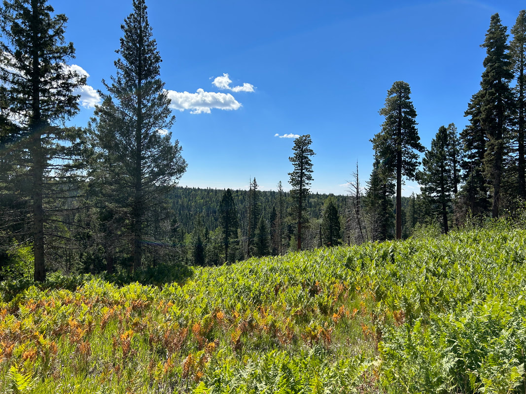
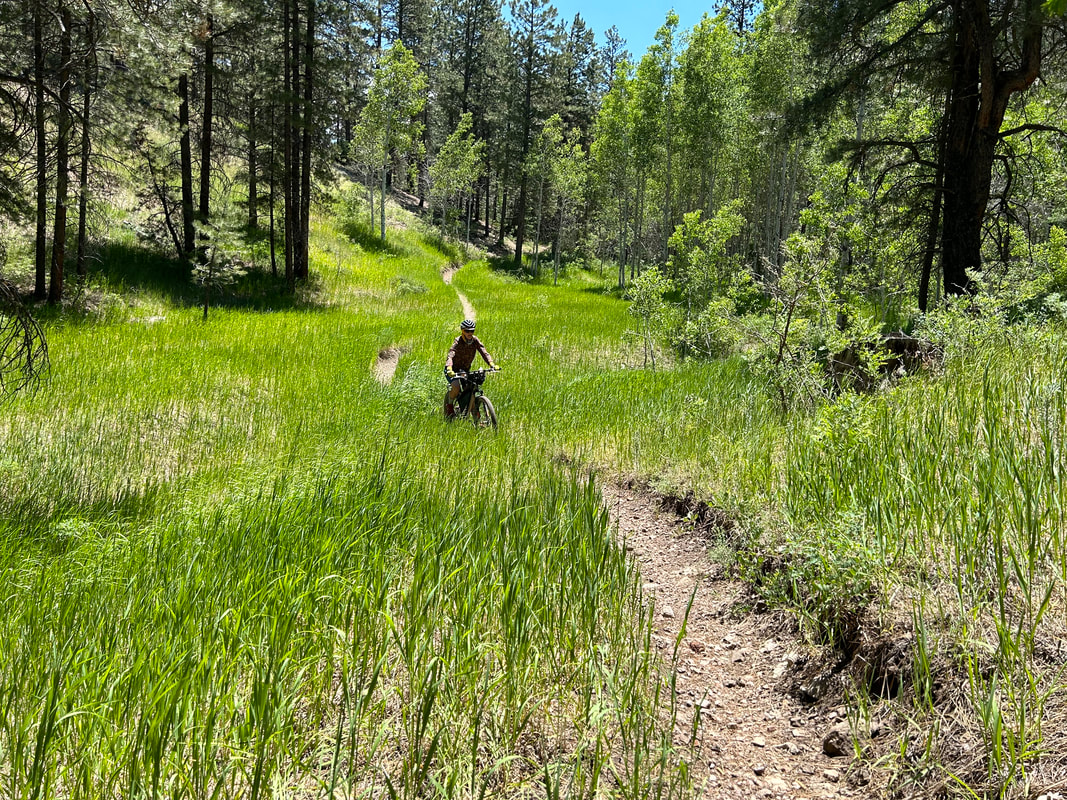
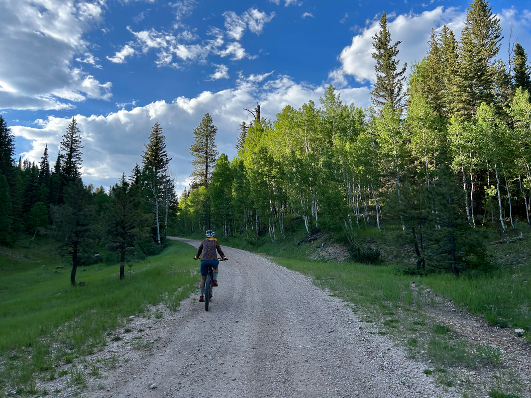
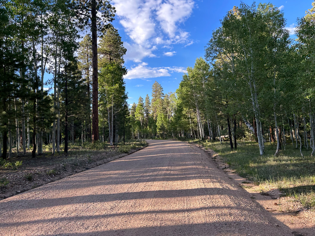
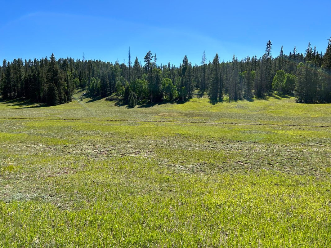
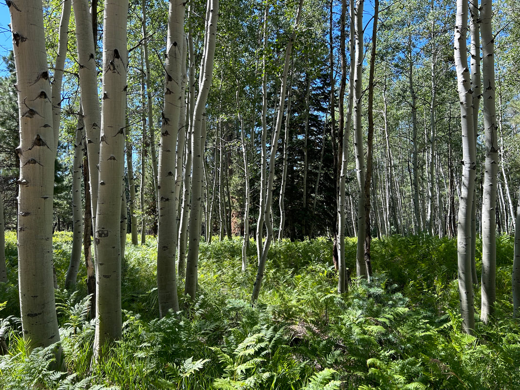
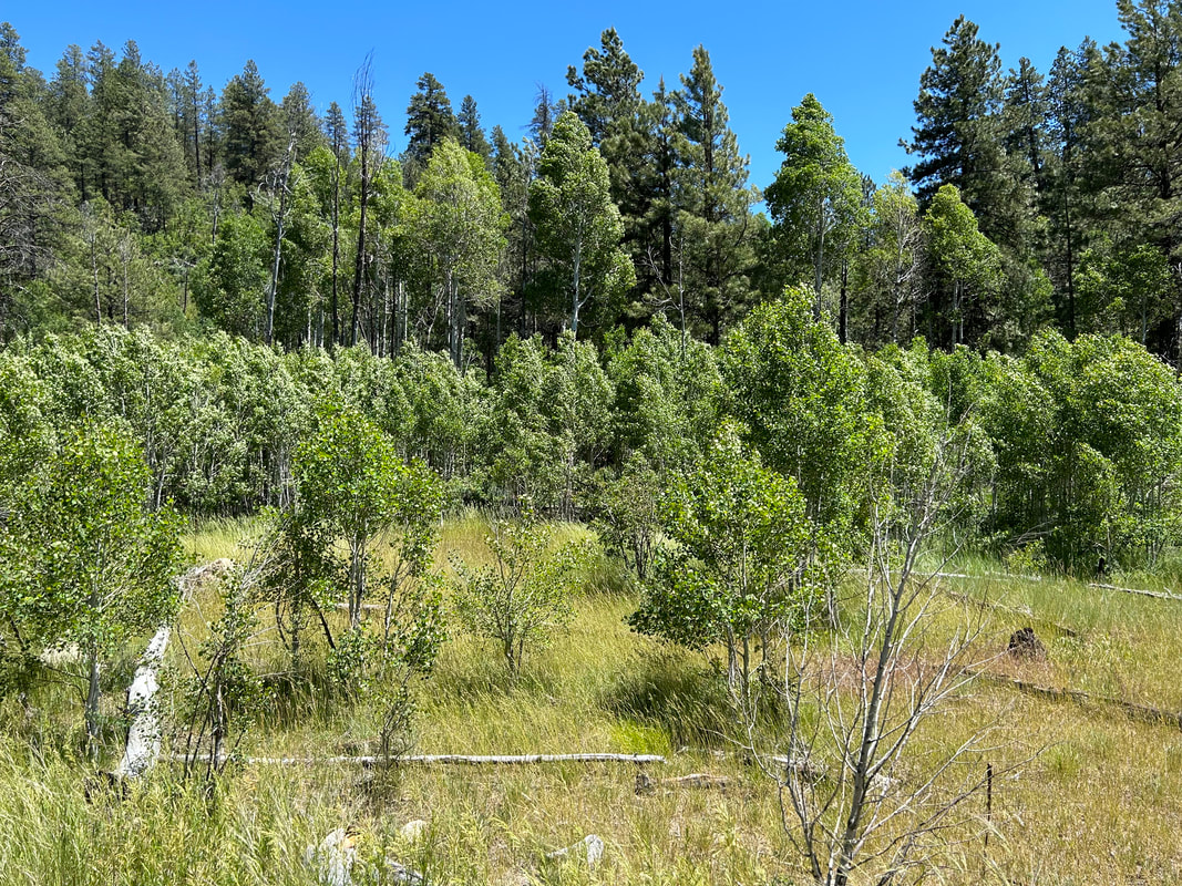
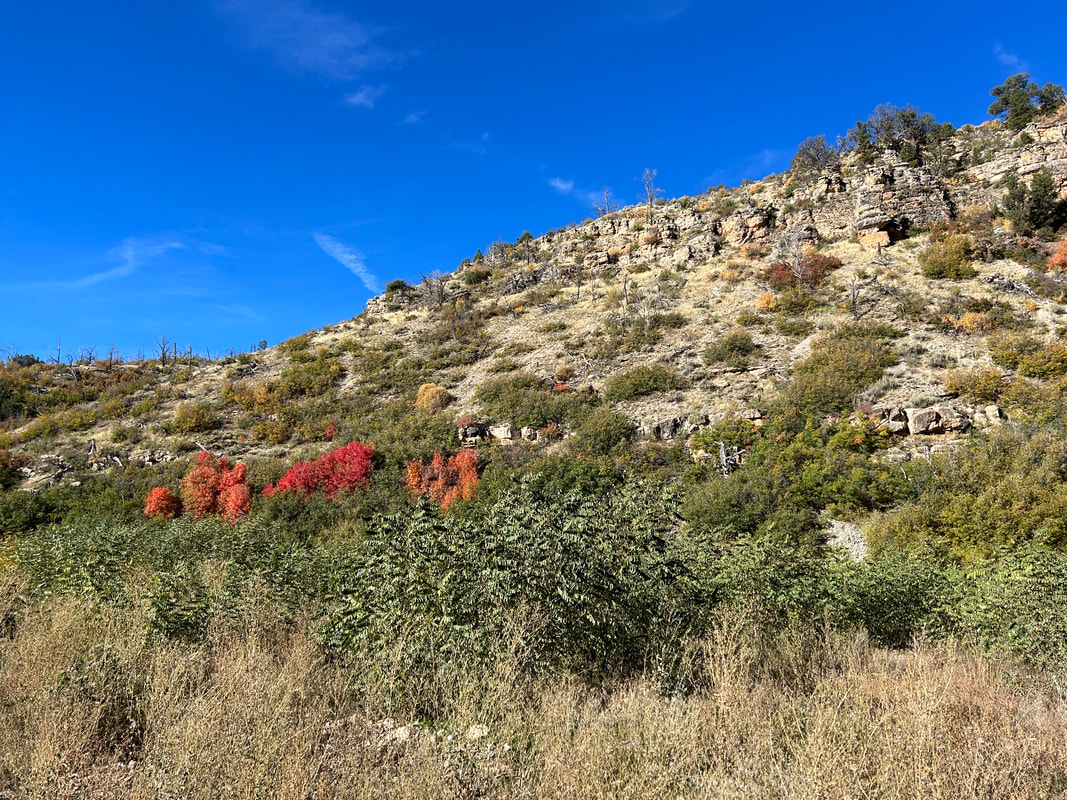
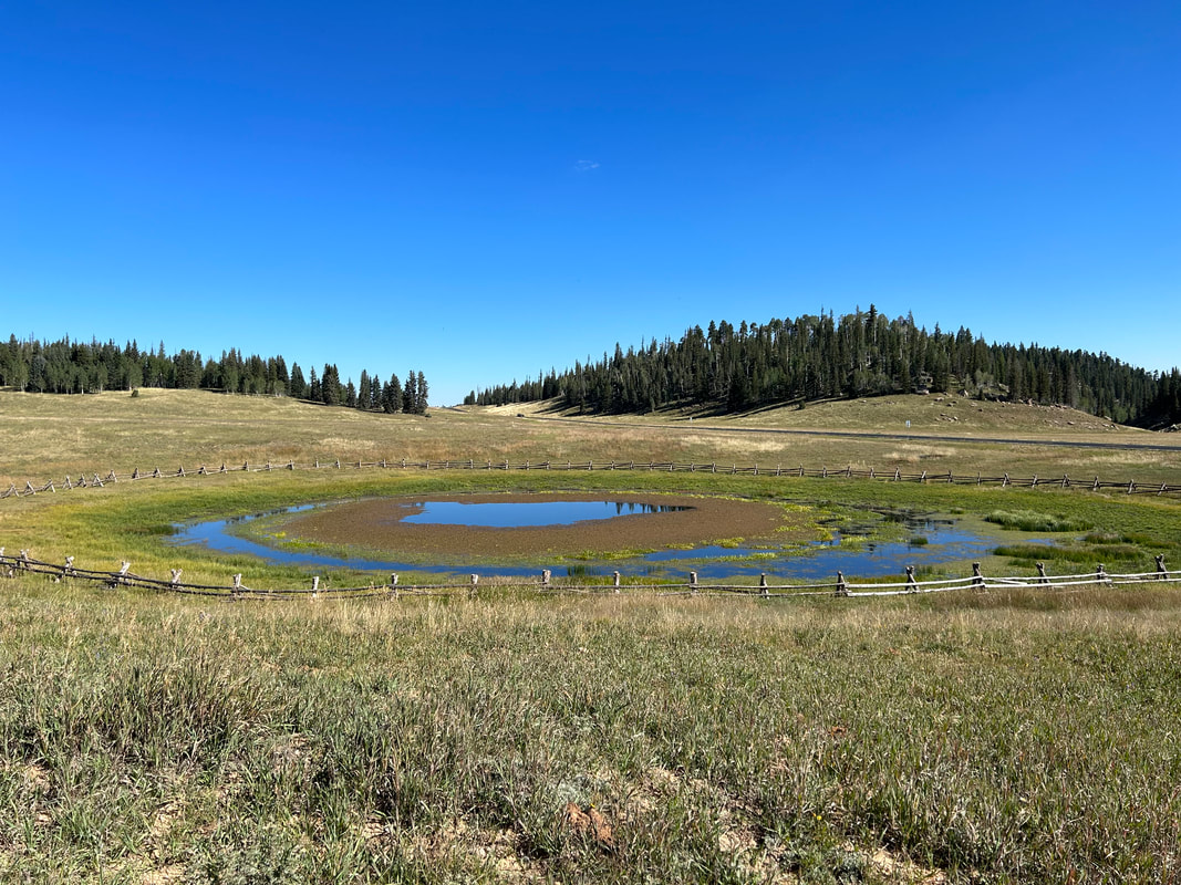
Out of the meadows and into the forest, the climb takes you to the highest elevations on the route at 9200 feet. Ponderosas quickly fall away to spruce, aspen, and firs as you ride high on ridges overlooking the subalpine meadows of Demotte Park. Take a side road down to the food resupply at North Rim Country Store, DeMotte Campground, and Kaibab Lodge. The campground is set back in the aspen and has running water. Kaibab Lodge has cabins, rooms, and meals in their restaurant. North Rim Country Store has the camping food essentials and a coffee/food truck. Now resupplied, ride along the massive meadows that fill with mule deer and bison. Climb up a ridge and start a subalpine ride through unbelievable groves of aspen that turn ember and yellow come autumn.
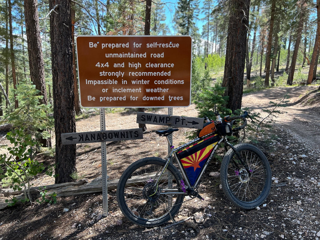
You'll head downhill and out towards Fire Point and your first entrance into Grand Canyon National Park. Make sure to secure a backcountry permit if you want to camp here with an overlook of Saddle Canyon. Retrace your route east, head south, and enter the full boundary of GCNP. All dispersed camping beyond this point is prohibited so make sure you have an idea of when you'll hit campgrounds and secure reservations beforehand. Next up is Swamp Point where the North Bass Trailhead is located along with views of Muav Canyon. Retrace and head south to Kanabownits Spring and Kanabownits Lookout Tower; the old fire tower is on the list of registered historical places and worth the small uphill. The spring might take some effort to find for a water resupply.
Heading south, the route curves along the Walla Valley and Kanabownits Canyon before a turnoff for Point Sublime. Head towards this cape as the landscape descends gently to ponderosas before being spit out onto a peninsula land jutting into the heart of the Grand Canyon. Seek a backcountry permit from GCNP beforehand and spend a night camping under incredible dark skies along the edge of the canyon at Point Sublime. Retrace your route and begin a rutted, rocky, rotten, eroded and hike-a-bike section eastwards towards the Widforss Trailhead. You'll cross The Basin midway where subalpine meadows spread their latitude while ringed by spruce and aspen. Keep an eye open for bison and give them plenty of space if they are on the road. Join the AZT at Widforss TH and take it to the North Kaibab Trailhead where a reliable water faucet is turned on by the NPS from May 15 - October 15. From here, a short ride on the North Rim Greenway brings you into the North Rim Campground and North Rim Village.
The North Rim Campground has hiker/biker sites that you can camp in for $6 a night with water spigots. The North Rim General Store, located in the campground, has a full resupply available. When you ride down to the North Rim Lodge in the village, there are a few restaurants, more water spigots, and lodging. Park your bike and hike out to Bright Angel Point with full views of the South Rim, then retrace your way up the North Rim Greenway to the North Kaibab TH where you will keep to the road and turn east on Cape Royal. As a forewarning, the paved road up to Cape Royal has no shoulder, has many blind curves, and can be heavy with traffic. If you choose to ride up this portion of the route, you'll first hit Point Imperial - the highest viewpoint in Grand Canyon National Park at 8803 feet. Retrace the route and head out to Cape Royal to get a view Angels Arch and a hike on top of it. Retrace the route and head back towards Widforss TH.
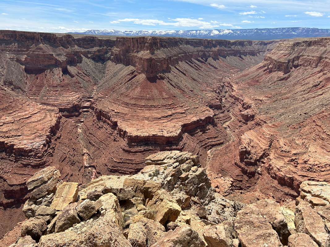
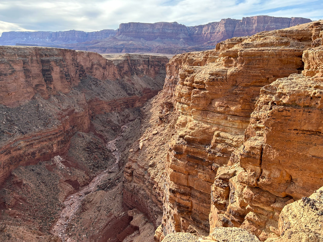
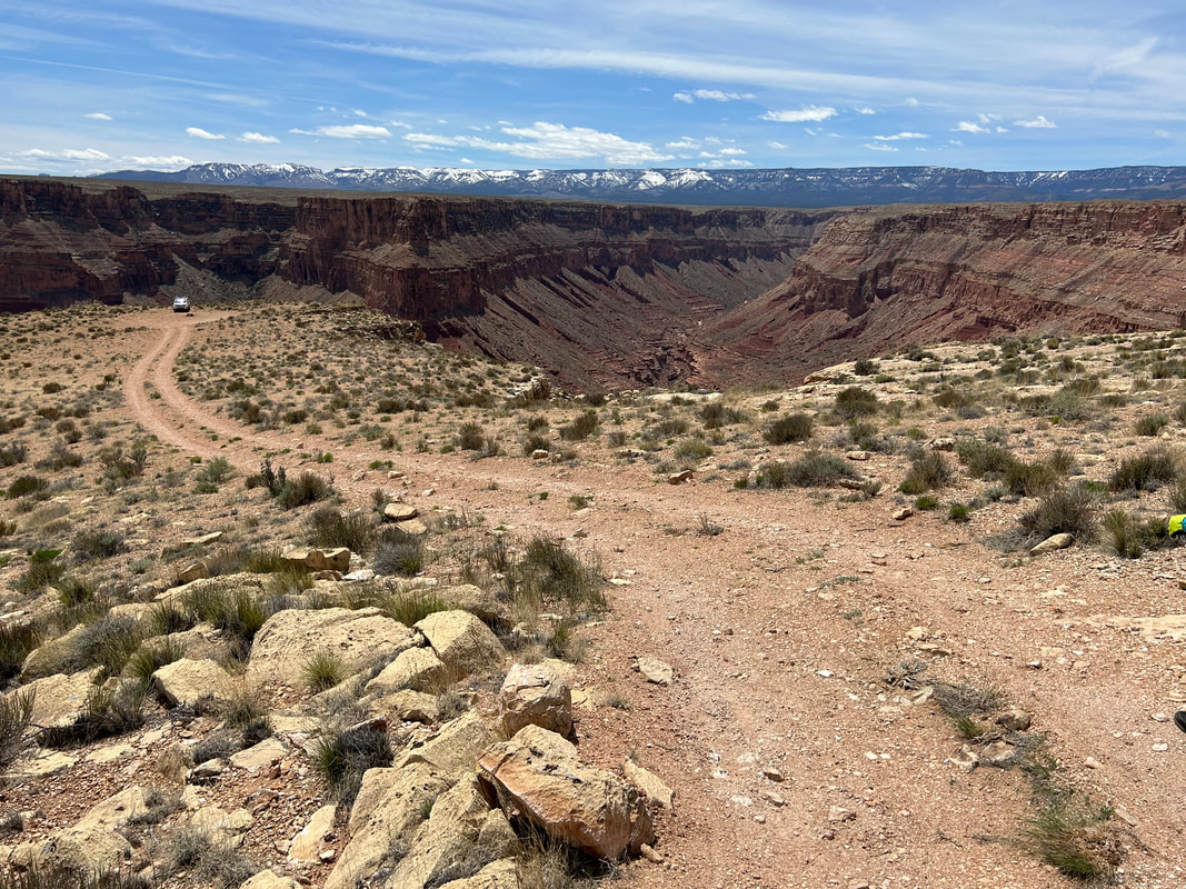
Jump on the AZT at Widforss TH and ride singletrack through young aspen stands all the way to the boundary of Grand Canyon National Park. Stay on the AZT, cross over into the Kaibab National Forest, and take a side ride up to the historic North Rim Lookout Tower were Edward Abbey spent some time as a ranger. The AZT will intersect with the smooth and beautiful dirt road of FR 610. Staying on here carries you out to Nankoweap Trailhead and a view of Saddle Mountain Wilderness plunging into the Grand Canyon. Retrace the route and swing a side-turn north towards Marble Viewpoint and some of the best dispersed camping on the route if you camp out on the bald at the terminus. Views of the East Rim, Saddle Mountain, Grand Canyon, Little Colorado River Gorge, Grand Staircase Escalante, Navajo Mountain, and the approaching Vermillion Cliffs will all spread before you.
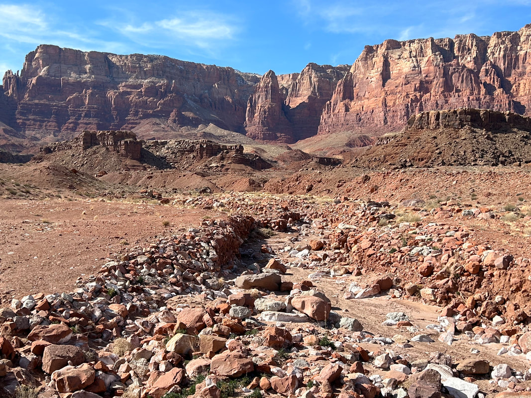
Retrace the route and jump back on the AZT which churns and weaves through high subalpine meadows and deep spruce thickets up, down, and across the Kaibab Plateau. Arrive at the East Rim Viewpoint and opposing views of Marble Viewpoint. Ride on FR 611 towards DeMotte where a side-trip provides an opportunity for one last resupply before descending off the Kaibab Plateau. The last cape on top of the Kaibab will be seen at Dog Point out along a smooth dirt FR 610. After, you'll join a section of AZT singletrack that heads north through meadow valleys with dirt roads coursing through the high elevation before approaching a massive drop-off down to House Rock Valley located in the Baaj Nwaavjo I'tah Kukveni National Monument. This is FR 213 and it can be eroded, rocky, and decayed. Now out of the subalpine and into the desert, you'll ride out to remote Buck Farm Viewpoint and Twentyseven Mile Rapids Overlook for stellar viewpoints into Marble Canyon. Retrace and cross House Rock Valley back to your original intersection on Highway 89A. Enjoy watching the profile of the deeply sanguine and multicolored rock face of Vermillion Cliffs National Monument ever-growing before you.
Ride pavement northeast along the perimeter of the Vermillion Cliffs. You'll hit Cliff Dwellers Lodge with its motel and restaurant. Ride on and miles later you'll hit Vermillion Cliffs with its tavern, gas station, and motel. As you cycle on, you'll finally come to Marble Canyon and its gas station, convenience store, motel, and post office. Head north and begin a descent back to your vehicle and a return to the low point of the route at Lees Ferry. Enter Glen Canyon National Recreation Area as you snake through sandstone and desert varnish down to the foot of the Colorado River. Walk out and touch the Colorado River once more; watch the rafters put in for their river expeditions. You have risen from river to rim and back to river again.
Once on paved 89A, head right and continue around the cliff faces. You'll swing a left out on dirt out to Badger Creek Rapids Overlook for Cape #2 in the Baaj Nwaavjo I'tah Kukveni National Monument. Head back and keep to the shoulder of the paved highway. Make sure to wear bright colors, a mirror, and using flashing lights. Traffic is typically low on Highway 89A but highway speeds are fast, and there is little actual shoulder to ride on. At the end of the Cliffs, take a right on unpaved House Rock Valley Road to cross back into Ancestral Footprints of the Grand Canyon National Monument. As the valley closes up, you'll arrive at a Condor Viewing Site managed by The Peregrine Fund. Stop and look through the binoculars at the whitewash along the cliffs where endangered California Condors are released each September and where many come to permanently roost. Continue to steadily climb until the Paria Plateau evens out with you to your east. Intricate, colorful, and gorgeous rock formations will begin to pour out of the sand in large swirling pyramids and butte chunks such as Coyote Buttes and The Wave (both require permits to view). At Stateline Campground you can grab a campsite, see the northern terminus of the Arizona Trail, and then cross into Utah. Continue on as the wall of vibrant orange, reds, ochres, and purples to your right become the southern boundaries of Grand Staircase Escalante National Monument and its famous Cockscomb.
At Buckskin Gulch Trailhead, you'll swing left and climb up an old dirt road into the Buckskin Mountains before turning south and reentering Arizona. Continue south cycling on top of the mountains/plateaus until you reach Winter Road and swing west. The desertscape here can be quite exposed so make sure you fill up at all Wildlife Tanks you come across. The juniper, sage, and grasslands will begin to slop you down towards Highway 89A where you join it shortly to arrive at Fredonia, AZ. Fredonia offers some convenience store resupplies, water, and lodging. Swing south on FR 22 just outside town to begin a long climb back up towards the Kaibab Plateau that cuts across BLM land. Make sure to turn around frequently to catch awesome panoramas of the Grand Staircase along with the mountain formations of Bryce Canyon and Zion in the northern distance. The road here is paved but little used so expect only a small amount of vehicular traffic.
A new cape awaits for riders as you peel off into the desert of the Baaj Nwaavjo I'tah Kukveni National Monument on a dirt road down to Gunsight Point. The route parallels the eastern edge of Kanab Creek and provides a viewpoint straight down the Kanab Creek Wilderness. After retracing, you jump back on pavement to enter the Kaibab National Forest. You will come to an intersection with dirt FR 461. Turn left for a ride up Warm Springs Road to Jacob Lake for access to lodging, camping, a general store, and a restaurant. Grab some famous cookies from Jacob Lake Inn and check out the Kaibab Plateau Visitor Center as well as Kaibab Squirrel Area.
Head south on FR 282 past Jacob Lake proper through thickening ponderosa and grassy meadows. You'll hit an old burn scar now dense with young aspen before heading back into mature pine forest and descending Castle Canyon to FR 22. Heading north on this well-maintained gravel road brings you to the most reliable water source on the Kaibab Plateau: Big Springs. Big Springs is a gushing high-quality water source that careens down the side of a cliff near a USFS service site and cabins. When the USFS cabins are open for rental, plan to get reservations ahead of time and stay for a day to enjoy the showers, water, and common rec center/kitchen. If you're just passing through, fill up water from a spigot found outside the fence of the USFS site before continuing on.
Continue a gradual descent on FR 22, eventually swinging a west on a decline out to juniper-pinyon plateaus along a sliver of road winding between the Kanab Creek Wilderness with the plunge of Jumpup Canyon to your left. After hitting Jumpup Point, retrace your route back to a turn at the Jumpup Divide that descends to Jumpup Cabin (USFS rental by reservation only). Get ready for a big climb up Pine Hollow to FR 427 where a turn south takes bikepackers towards the mouth of Big Sowats Canyon. At an intersection with FR 233, turn right for a one-way trip out to Sowats Point along Kwagnut Hollow for a view of the sprawling esplanade shelf. Several Wildlife Tanks can be found in the area for a water fill-up. Retrace your route and then head south out to Thunder River Trailhead at Indian Hollow with views of Deer Creek Canyon opening up in front of you. Retrace, head south, and reach Crazy Jug Point and Monument Point - the former is an epic place to dispersed camp along the rim of the Grand Canyon with southerly views of the Tapeats Amphitheater.
Swing into the Kaibab National Forest before winding back out to the the only mountain bike singletrack along the edge-proper of the Grand Canyon: Rainbow Rim. Jump onto its northern terminus at Parissawampitts Point and start a repeated meander inland along side-canyons that turn and veer back out to points, capes, and stunning views of the heart of Grand Canyon National Park. After the southern terminus at Timp Point, head inland from the rim edge towards the interior of the Kaibab Plateau. Climb elevation riding up FR 206 through Quaking Aspen Canyon (grab some water at Quaking Aspen Spring) that joins FR 226 south of Dry Park. Enjoy the high elevation meadows of Dry Park before turning on FR 206 once more and heading southward up a big climb.
Out of the meadows and into the forest, the climb takes you to the highest elevations on the route at 9200 feet. Ponderosas quickly fall away to spruce, aspen, and firs as you ride high on ridges overlooking the subalpine meadows of Demotte Park. Take a side road down to the food resupply at North Rim Country Store, DeMotte Campground, and Kaibab Lodge. The campground is set back in the aspen and has running water. Kaibab Lodge has cabins, rooms, and meals in their restaurant. North Rim Country Store has the camping food essentials and a coffee/food truck. Now resupplied, ride along the massive meadows that fill with mule deer and bison. Climb up a ridge and start a subalpine ride through unbelievable groves of aspen that turn ember and yellow come autumn.
You'll head downhill and out towards Fire Point and your first entrance into Grand Canyon National Park. Make sure to secure a backcountry permit if you want to camp here with an overlook of Saddle Canyon. Retrace your route east, head south, and enter the full boundary of GCNP. All dispersed camping beyond this point is prohibited so make sure you have an idea of when you'll hit campgrounds and secure reservations beforehand. Next up is Swamp Point where the North Bass Trailhead is located along with views of Muav Canyon. Retrace and head south to Kanabownits Spring and Kanabownits Lookout Tower; the old fire tower is on the list of registered historical places and worth the small uphill. The spring might take some effort to find for a water resupply.
Heading south, the route curves along the Walla Valley and Kanabownits Canyon before a turnoff for Point Sublime. Head towards this cape as the landscape descends gently to ponderosas before being spit out onto a peninsula land jutting into the heart of the Grand Canyon. Seek a backcountry permit from GCNP beforehand and spend a night camping under incredible dark skies along the edge of the canyon at Point Sublime. Retrace your route and begin a rutted, rocky, rotten, eroded and hike-a-bike section eastwards towards the Widforss Trailhead. You'll cross The Basin midway where subalpine meadows spread their latitude while ringed by spruce and aspen. Keep an eye open for bison and give them plenty of space if they are on the road. Join the AZT at Widforss TH and take it to the North Kaibab Trailhead where a reliable water faucet is turned on by the NPS from May 15 - October 15. From here, a short ride on the North Rim Greenway brings you into the North Rim Campground and North Rim Village.
The North Rim Campground has hiker/biker sites that you can camp in for $6 a night with water spigots. The North Rim General Store, located in the campground, has a full resupply available. When you ride down to the North Rim Lodge in the village, there are a few restaurants, more water spigots, and lodging. Park your bike and hike out to Bright Angel Point with full views of the South Rim, then retrace your way up the North Rim Greenway to the North Kaibab TH where you will keep to the road and turn east on Cape Royal. As a forewarning, the paved road up to Cape Royal has no shoulder, has many blind curves, and can be heavy with traffic. If you choose to ride up this portion of the route, you'll first hit Point Imperial - the highest viewpoint in Grand Canyon National Park at 8803 feet. Retrace the route and head out to Cape Royal to get a view Angels Arch and a hike on top of it. Retrace the route and head back towards Widforss TH.
Jump on the AZT at Widforss TH and ride singletrack through young aspen stands all the way to the boundary of Grand Canyon National Park. Stay on the AZT, cross over into the Kaibab National Forest, and take a side ride up to the historic North Rim Lookout Tower were Edward Abbey spent some time as a ranger. The AZT will intersect with the smooth and beautiful dirt road of FR 610. Staying on here carries you out to Nankoweap Trailhead and a view of Saddle Mountain Wilderness plunging into the Grand Canyon. Retrace the route and swing a side-turn north towards Marble Viewpoint and some of the best dispersed camping on the route if you camp out on the bald at the terminus. Views of the East Rim, Saddle Mountain, Grand Canyon, Little Colorado River Gorge, Grand Staircase Escalante, Navajo Mountain, and the approaching Vermillion Cliffs will all spread before you.
Retrace the route and jump back on the AZT which churns and weaves through high subalpine meadows and deep spruce thickets up, down, and across the Kaibab Plateau. Arrive at the East Rim Viewpoint and opposing views of Marble Viewpoint. Ride on FR 611 towards DeMotte where a side-trip provides an opportunity for one last resupply before descending off the Kaibab Plateau. The last cape on top of the Kaibab will be seen at Dog Point out along a smooth dirt FR 610. After, you'll join a section of AZT singletrack that heads north through meadow valleys with dirt roads coursing through the high elevation before approaching a massive drop-off down to House Rock Valley located in the Baaj Nwaavjo I'tah Kukveni National Monument. This is FR 213 and it can be eroded, rocky, and decayed. Now out of the subalpine and into the desert, you'll ride out to remote Buck Farm Viewpoint and Twentyseven Mile Rapids Overlook for stellar viewpoints into Marble Canyon. Retrace and cross House Rock Valley back to your original intersection on Highway 89A. Enjoy watching the profile of the deeply sanguine and multicolored rock face of Vermillion Cliffs National Monument ever-growing before you.
Ride pavement northeast along the perimeter of the Vermillion Cliffs. You'll hit Cliff Dwellers Lodge with its motel and restaurant. Ride on and miles later you'll hit Vermillion Cliffs with its tavern, gas station, and motel. As you cycle on, you'll finally come to Marble Canyon and its gas station, convenience store, motel, and post office. Head north and begin a descent back to your vehicle and a return to the low point of the route at Lees Ferry. Enter Glen Canyon National Recreation Area as you snake through sandstone and desert varnish down to the foot of the Colorado River. Walk out and touch the Colorado River once more; watch the rafters put in for their river expeditions. You have risen from river to rim and back to river again.
|
|
|
|
|
|
|
|

|
|

|
|
|

|
7. Route Difficulty, Surface Conditions, and Direction to Ride
Route Difficulty |
Physical Difficulty = 7/10
Technical Difficulty = 6/10
The technical difficulty of the route is due to the abundant spread of surfaces that range from pavement, to smooth dirt, to ultra-chunky doubletrack. There are most certainly stretches where several miles will be rugged and rocky. There are also miles of gorgeous wide dirt roads coursing through the woods or across plateaus. More on notable rocky sections can be found under "Surface Conditions" below.
The physical difficulty is mostly due to the climbing. Make no doubt, this route is hilly and often steep. The North Rim Capes travels across the mountainous folds of the Kaibab Plateau; the route ascends to 9200 feet from the Colorado River at 3100 feet. Although most of the roads are gradual, there are long climbs at times. And most salient, almost every cape has to be reached by traveling one-way down a dirt road that invariably descends several hundred to a thousand+ feet. This means that you must immediately turn around and climb back up to rejoin the route's loop. You will think about this each time you head to a cape. But take succor in knowing that those views of the Grand Canyon are well worth it.
Noteworthy Climbs
In addition to these long, often unrelenting climbs, riders should expect rolling terrain that frequently ascends and descends ridges and canyons across the Kaibab Plateau. Again, be ready to climb.
Finally, there are conditions difficulties on this route. These include climate, temperature, environment, elevation, water, and resupplies.
The difficulty ratings are based on Bikepacking Roots Route Rating Scale found below:
Technical Difficulty = 6/10
The technical difficulty of the route is due to the abundant spread of surfaces that range from pavement, to smooth dirt, to ultra-chunky doubletrack. There are most certainly stretches where several miles will be rugged and rocky. There are also miles of gorgeous wide dirt roads coursing through the woods or across plateaus. More on notable rocky sections can be found under "Surface Conditions" below.
The physical difficulty is mostly due to the climbing. Make no doubt, this route is hilly and often steep. The North Rim Capes travels across the mountainous folds of the Kaibab Plateau; the route ascends to 9200 feet from the Colorado River at 3100 feet. Although most of the roads are gradual, there are long climbs at times. And most salient, almost every cape has to be reached by traveling one-way down a dirt road that invariably descends several hundred to a thousand+ feet. This means that you must immediately turn around and climb back up to rejoin the route's loop. You will think about this each time you head to a cape. But take succor in knowing that those views of the Grand Canyon are well worth it.
Noteworthy Climbs
- Climbing up into the Buckskin Mountains from House Rock Valley Road
- Ascent up to Jacob Lake
- Climbing up from Jumpup Cabin to FR 427
- Heading up to Demotte from the end of Rainbow Rim through Dry Park
In addition to these long, often unrelenting climbs, riders should expect rolling terrain that frequently ascends and descends ridges and canyons across the Kaibab Plateau. Again, be ready to climb.
Finally, there are conditions difficulties on this route. These include climate, temperature, environment, elevation, water, and resupplies.
- Temperatures on the route widely swing between well over 100 degrees at Lees Ferry to well below freezing at the Kaibab Plateau high point. This means a narrow, ideal window of early Summer and ripe Fall for riding comfortably. You can try riding into the Summer, Spring, or late Fall, but you will find either extreme heat, several feet of snow, or lots of mud.
- There is little shade and lots of exposure around the Vermillion Cliffs and Marble Platform. Trees are rare - it is a desertscape.
- The Canyon Rim edge is much hotter than further away due to convection currents. Be aware of that in the hotter months when riding to each cape.
- The high elevation gain and high altitude (9,000+ feet) will challenge riders not acclimatized.
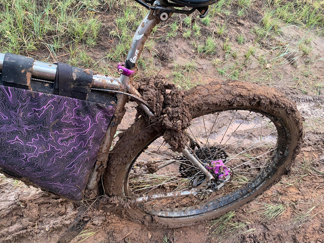
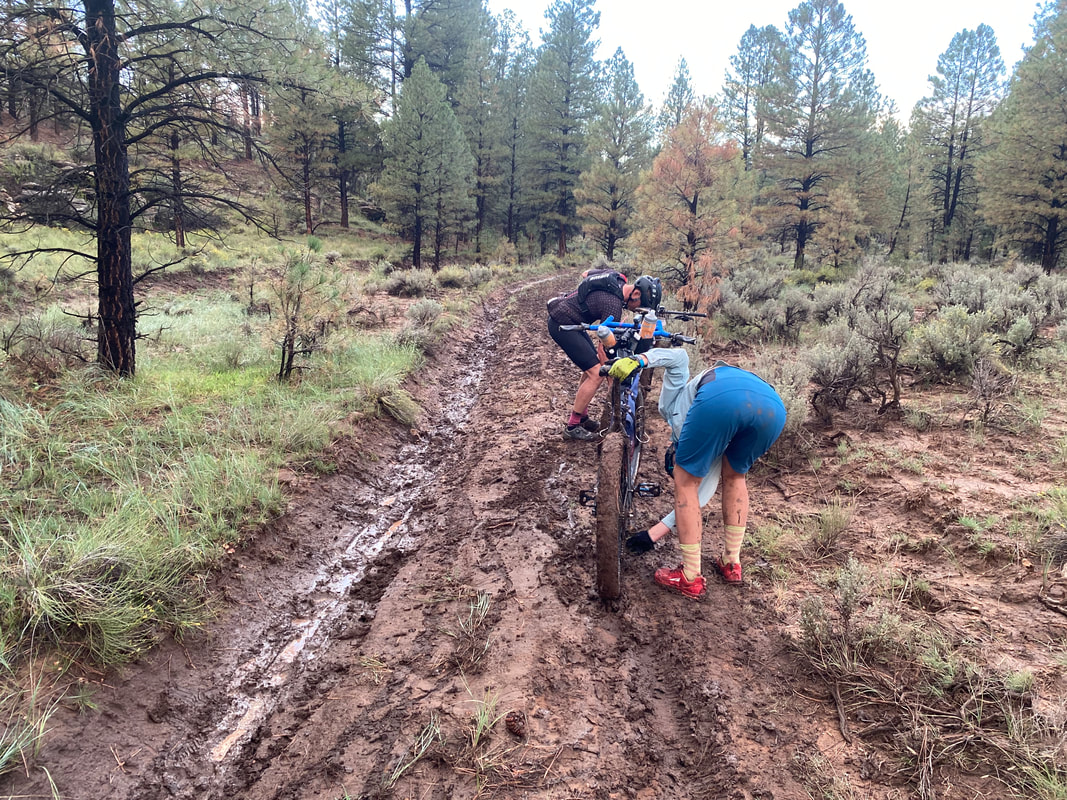
- Peanut butter mud is a very real possibility if it rains on the dirt roads.
- The scarce nature of water and infrequent food resupplies requires riders to carry several days of resources at a time. Always bring more water than you need should a spring or wildlife tank be dry. A stretch of 179 miles exists between food resupplies at Jacob Lake and Demotte.
The difficulty ratings are based on Bikepacking Roots Route Rating Scale found below:
Physical Difficulty |
Technical Difficulty |
7-8 – Very rugged terrain with abundant climbing, some of which is very steep and unrideable |
5-6 – Continuous sections of track may be rocky, loose, and steep; (e.g., 4×4 roads or singletrack in rugged/rocky terrain) suitable for intermediate mountain bikers |
Surface Conditions |
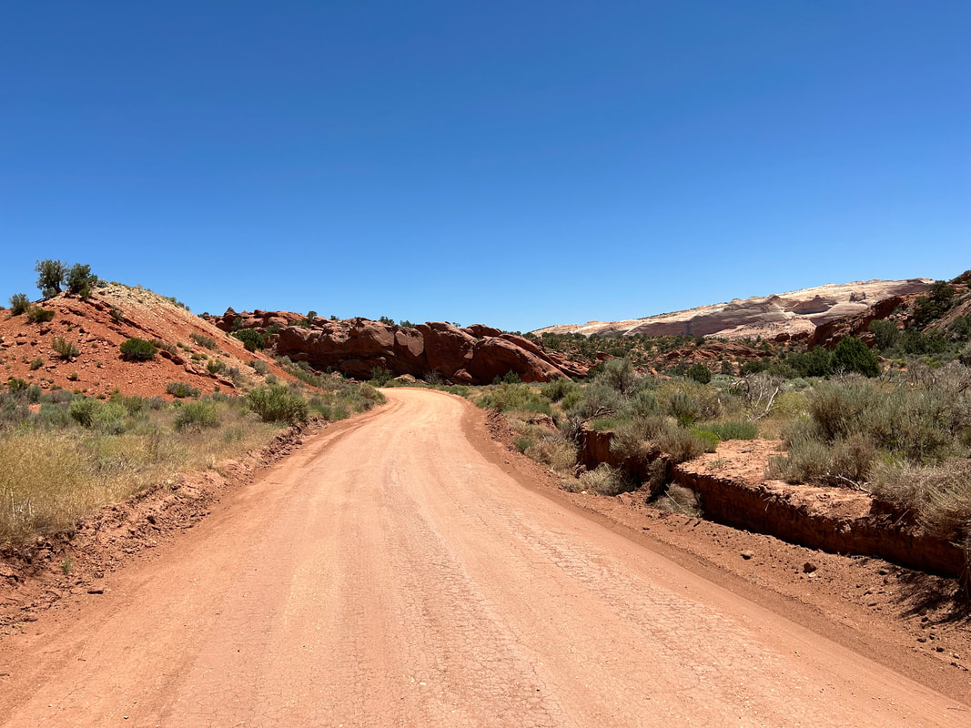
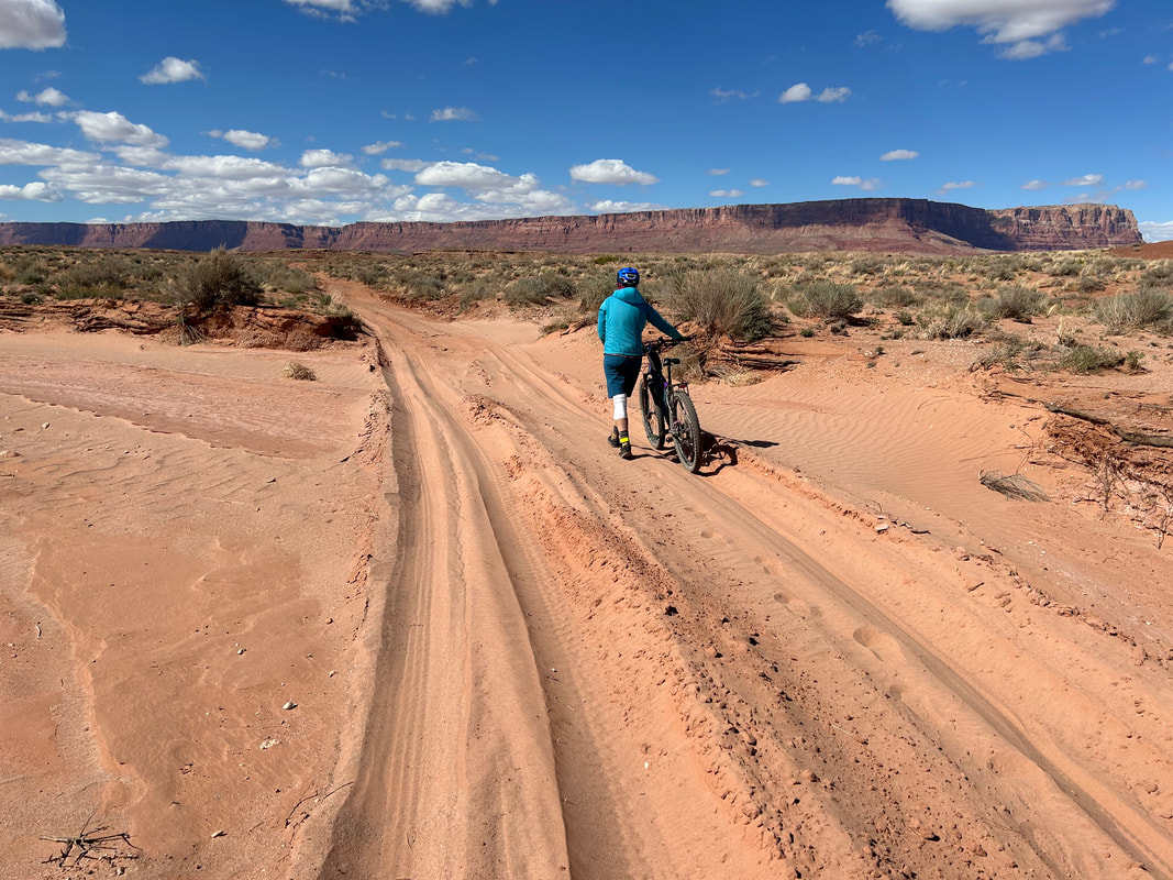
The North Rim Capes travels down a trove of Forest Service roads and old doubletrack. Some of the Forest Service roads are regularly maintained, wide, lightly graveled, and sometimes hero dirt. The spurs off of these carry riders down smooth, to chunky, to somewhat decayed doubletrack - especially out to the most remote capes of the route where vehicles infrequently travel. The dirt roads in Grand Canyon National Park are especially poorly maintained. I've been told the USFS puts spending priority on their unpaved roads while the NPS has their unpaved roads on the bottom of the spending list. Overall, there can be extended sections of washboard, ruts, and chunk with ample babyheads. Some of the viewpoints that the North Rim Capes utilizes are very remote and are often littered with tree blowdowns come early summer. The deadfall will get removed, but anyone traveling in the early season may have to go around/over trees until agencies clear them up.
If any rain/snow is forecast, most of the unpaved route will become peanut butter/death mud and impassable in places. Leave No Trace and avoid riding at these times until the route dries out. In addition, flash flooding from precipitation is a real possibility in the lower portions of the route around the Marble Platform and House Rock Valley - stay safe and stay out of washes or low areas at those times.
Noteworthy Primitive, Rocky Surfaces
Noteworthy Vehicular Pavement
If any rain/snow is forecast, most of the unpaved route will become peanut butter/death mud and impassable in places. Leave No Trace and avoid riding at these times until the route dries out. In addition, flash flooding from precipitation is a real possibility in the lower portions of the route around the Marble Platform and House Rock Valley - stay safe and stay out of washes or low areas at those times.
Noteworthy Primitive, Rocky Surfaces
- The climb up into the Buckskin Mountains from House Rock Valley Road
- Some of the ride to Jumpup Point
- The last part of the road out to Sowats Point past the parking area for Jumpup-Nail Trail
- Some portions of the Rainbow Rim, especially near Parissawampitts Point
- FR 206 down to Quaking Aspen Spring
- The road out to Swamp Point (especially after monsoons)
- The entire road between Point Sublime and the Widforss Trailhead. This can be quite aweful with washouts, erosion, steep babyhead sections, hike-a-bikes, and chunk.
- The descent off the Kaibab Plateau on FR 213 to the Marble Platform can be eroded and steep
- There is a good sandy stretch (ie. fine-grained sinking stuff) when riders return to Highway 89A from the Marble Platform
Noteworthy Vehicular Pavement
- Around the south face of the Vermillion Cliffs/Lees Ferry area: Has little shoulder and high speeds on the road, but traffic is typically light. There are good lines-of-sights for both cyclists and drivers.
- Leaving Fredonia southwards to the Kaibab Plateau: Has very little traffic. There are good lines-of-sights for both cyclists and drivers.
- The ride out to Cape Royal and Point Imperial in Grand Canyon National Park: Is windy, twisty, and has poor lines-of-sight on the curves. Plus, it is heavily vehicled in GCNP. If you choose to ride this portion make sure to ride defensively and wear bright colors. As a heads up, GCNP does not recommend bicyclists on this stretch of road (but it is legal to ride and definitely is ridden).
|
|
|
|
|
|
|
|
Direction to Ride |
The route is intended to be ridden in a counterclockwise direction. The reasons for this include:
- There is an anticipatory build of capes as riders begin with the Kanab Creek Wilderness side-canyon views before working their way to the full sweep of Grand Canyon's heart. Especially for those who have never seen the Grand Canyon before, the momentum of increasing view-grandiosity will be awesome.
- An opportunity to acclimatize to elevation by riding up from the desert to the subalpine.
- The thrill of beginning and ending at the Colorado River.
- Avoiding having to ride/push up gnarly forest service road FS 213 from House Rock Valley (you will descend it instead).
8. When to Ride (Temperature + Climate)
When to Ride |
Time of Year |
Average Highs |
Average Lows |
Precipitation |
Snow |
Best Time |
Early Summer (Mid May - June) |
High Elevation (North Rim): 63 - 74 F Low Elevation (Lees Ferry): 88 - 100 F |
High Elevation (North Rim): 35 - 42 F Low Elevation (Lees Ferry): 57 - 67 F |
High Elevation (North Rim): 0.40 - 0.62" Low Elevation (Lees Ferry): 0.12 - 0.38" |
High Elevation (North Rim): 0.0 - 2.0" Low Elevation (Lees Ferry): 0.0" |
Best Time |
Fall (September - Mid October) |
High Elevation (North Rim): 56 - 67 F Low Elevation (Lees Ferry): 77 - 91 F |
High Elevation (North Rim): 32 - 41 F Low Elevation (Lees Ferry): 49 - 61 F |
High Elevation (North Rim): 1.82" Low Elevation (Lees Ferry): 0.80 - 0.98" |
High Elevation (North Rim): 0.0 - 4.0" Low Elevation (Lees Ferry): 0.0" |
Less Recommended |
Summer/Monsoon Season (July - August) |
High Elevation (North Rim): 74 - 77 F Low Elevation (Lees Ferry): 100 - 104 F |
High Elevation (North Rim): 47 - 49 F Low Elevation (Lees Ferry): 70 - 73 F |
High Elevation (North Rim): 1.92 - 2.81" Low Elevation (Lees Ferry): 0.87 - 1.10" F |
High Elevation (North Rim): 0.0" Low Elevation (Lees Ferry): 0.0" |
NOT Recommended |
Winter and Spring (Late October - Early May) |
High Elevation (North Rim): 38 - 52 F Low Elevation (Lees Ferry): 49 - 77 F |
High Elevation (North Rim): 17 - 28 F Low Elevation (Lees Ferry): 28 - 48 F |
High Elevation (North Rim): 1.65 - 3.82" Low Elevation (Lees Ferry): 0.36 - 0.61" |
High Elevation (North Rim): 12 - 30" Low Elevation (Lees Ferry): 0.0 - 2.1" |
All the data above are presented as ranges of monthly averages.
***Visit these links to view further climate information:
***Visit these links to view further climate information:
- Grand Canyon National Park - Weather and Climate
- US Climate Data - North Rim, AZ
- US Climate Data - Marble Canyon/Lees Ferry, AZ
Time of Year |
Description of Conditions |
Early Summer (Mid May - June) |
|
Fall (September - Mid October) |
|
Summer/Monsoon Season (July - August) |
|
Winter and Spring (Late October - Early May) |
|
9. North Rim vs. South Rim Capes
The Grand Canyon bisects the portion of the Colorado Plateau found in Northern Arizona into two distinct halves. The South and North Rims offer riders different views, perspectives, elevations, temperatures, climate, vegetation, and remoteness. Thus, the COTC exists as two circuits.
|
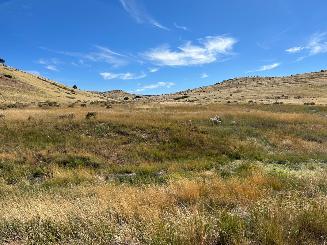
The North Rim Capes of the COTC is the less accessible and more remote ride. The North Rim of the Grand Canyon is a nearly 4 hour drive from Flagstaff, AZ and receives only a fraction of the visitors that the popular South Rim receives. The route often travels down rarely driven or ridden roads into lesser-seen parts of the Kaibab Plateau. Riders should be prepared to self-rescue and be self-sufficient on this route as hitching a ride may be unlikely if a problem arises. Truly reliable water resupplies are few with longer distances between sources. Food resupplies are even fewer. Bikepackers should expect to carry several days worth of food and at least 24 hours worth of water for several stretches. The landscape makes dramatic swings between high elevation subalpine and lower elevation exposed desert - make sure to acclimatize. The North Rim's winter weather is more extreme, making the riding season much narrower than the South Rim Capes. The landscape juxtaposes thick aspen groves and spruce with raw rocklands seeded with sparse grass and sage. This route is longer with far more elevation gain.
Range of Days to Ride: 10 - 17 days |
Across the Grand Canyon, the South Rim Capes of the COTC is the more accessible of the two. Only located a 1.5 hour drive from Flagstaff, Arizona, the South Rim encompasses the Coconino Plateau and the more developed Grand Canyon Village area. Riders entering Grand Canyon National Park will find longer paved stretches along the rim as well as more vehicles and people. This isn't to say the route is frontcountry - for more than 75% of the route takes in dirt forest roads and little traveled doubletrack that the majority of visitors to the South Rim simply don't visit. The route provides more opportunities for resupplies and water. The landscape is lower in elevation allowing the route to be ridden for a greater portion of the year. The landscape can be generalized as arid-uplands and desert, with dominant vegetation being the juniper and the pinyon pine. This route is shorter and there is less overall elevation gain.
Range of Days to Ride: 4 - 6 days |
10. Capes Connectors
The Capes Connectors provide options to connect the North and South Rim Capes of the Canyon in three ways.
Further information on each of the Capes Connectors can be found at this webpage:
- Inner Canyon Connector
- Paved Connector
- Western Wildlands Dirt Connector
Further information on each of the Capes Connectors can be found at this webpage:
11. Ecoregions and Landscape
|
|
|
|
|
The Grand Canyon is located on the Colorado Plateau. The vast changes in elevation, roiling geology, and local microclimates lead to a rich offering of ecoregions. Landscapes in the region span from low desert and riparian strips along the Colorado River at the bottom of the Grand Canyon to subalpine mixed conifer forests and meadows at the highest points along the Kaibab Plateau of the North Rim. The North and South Rims vary considerably in elevation, precipitation, and temperature, providing cyclists very different experiences between the two circuits.
Marble Platform
Escarpments
Grand Canyon
Arizona Strip Plateaus
Semi-Arid Benchlands and Canyonlands
Cold Desert Sagebrush-Grasslands
Montane Conifer Forests
Northern Woodlands and Sagebrush
Arizona/New Mexico Subalpine Forests
Montane and Subalpine Grasslands
Inner Canyon For riders looking to stash their bikes on top and hike over the rims into the inner gorge of the Grand Canyon, a unique ecoregion awaits. The inner canyon of the Grand Canyon is its own unique ecoregion composed of limestone, granite, shale, sandstone, and metamorphic rock. Starting from the rim edge and descending, pinyon, juniper, and firs will straggle and then fade as sage, Mormon tea, and rabbitbrush cling to the exposed rock. In many ways, descending to the Colorado River is descending ecologically from Canada to Mexico. Temperatures at the bottom differ from the top by nearly 20 degrees F. The Colorado River flows at elevation 2000 ft. and is frequently lined with rich riparian corridors. Hikers can expect to see cottonwoods, willows, mesquite, and tamarisk along the waterfront and especially lining side tributaries. In warmer months, these plants stand out as incredible neon green oases promising shade among the cooking red and ochre rock. Know your physical limits. It is a 5000-6000 foot vertical climb from the river to the rim. During summer, temperatures at the bottom of the Canyon can be nearly 120 degrees F. DO NOT attempt to do a rim to river hike when temperatures are elevated for your safety and the safety of first responders. Cool temperatures on the rim don't make cool temperatures in the canyon. Further Ecoregion Information: |
|
|
12. Where Bikes Are Allowed and Not Allowed
North Rim Capes Specific Bike Access
General Access
Bikes are STRICTLY forbidden below the rim in the inner gorge of the Grand Canyon. DO NOT RIDE YOUR BIKE DOWN INTO THE CANYON - you will get fined, it is illegal, and you will hurt the perception and opportunities of other bikepackers on this route. There are certain trails on top that are also off-limits to bikes; this route expressly avoids them. No cross-country travel in Grand Canyon National Park; practicing Leave No Trace means staying on established trails, roads, and paths.
Finally, respect tribal land and do not ride without permission in either the lands of the Kaibab Band of Paiute Indians just outside of Fredonia or the Navajo Nation (Diné) just across the Colorado River at Marble Canyon. This route stays explicitly within land domains where riding is public and legal. Although it may approach boundaries with the surrounding tribal nations, you should never ride onto the reservations without securing tribal government permission. Doing so otherwise is disrespectful and unlawful. I must note that although this route stays on "public lands," the formation of Grand Canyon National Park involved the forced removal of tribes such as the Havasupai, and they have endured legal battles to keep their vastly smaller chunk of land out of their historical precedent. Know the land you are riding on is traditionally theirs, know their current reservation boundaries are smaller than where they historically inhabited, and know where you are riding to keep yourself both legal and respectful.
Beyond that, almost all paved and unpaved roads on top of the rim are free and fair for riding a bike on. The Arizona Trail passages up on the rim of the Grand Canyon also allow bikes to be ridden. There are TONS of dirt roads, double track, and more that this route doesn't even begin to touch, all available for bike travel.
- When traveling out to Jumpup and Sowats Point, make sure to stay on established roads/the route and not to stray into the Kanab Creek Wilderness which will come right up to the road in places. Bikes are not allowed in Wilderness Areas.
- No riding singletrack or trails above the rim in Grand Canyon National Park except for the Arizona Trail. You are allowed to cycle on any established dirt roads.
- FR 220 that descends off the Kaibab Plateau down to the Marble Platform/House Rock Valley is the border of the Saddle Mountain Wilderness. Make sure to stay on the road or camp north and east of it to keep your bike out of a designated Wilderness.
General Access
Bikes are STRICTLY forbidden below the rim in the inner gorge of the Grand Canyon. DO NOT RIDE YOUR BIKE DOWN INTO THE CANYON - you will get fined, it is illegal, and you will hurt the perception and opportunities of other bikepackers on this route. There are certain trails on top that are also off-limits to bikes; this route expressly avoids them. No cross-country travel in Grand Canyon National Park; practicing Leave No Trace means staying on established trails, roads, and paths.
Finally, respect tribal land and do not ride without permission in either the lands of the Kaibab Band of Paiute Indians just outside of Fredonia or the Navajo Nation (Diné) just across the Colorado River at Marble Canyon. This route stays explicitly within land domains where riding is public and legal. Although it may approach boundaries with the surrounding tribal nations, you should never ride onto the reservations without securing tribal government permission. Doing so otherwise is disrespectful and unlawful. I must note that although this route stays on "public lands," the formation of Grand Canyon National Park involved the forced removal of tribes such as the Havasupai, and they have endured legal battles to keep their vastly smaller chunk of land out of their historical precedent. Know the land you are riding on is traditionally theirs, know their current reservation boundaries are smaller than where they historically inhabited, and know where you are riding to keep yourself both legal and respectful.
Beyond that, almost all paved and unpaved roads on top of the rim are free and fair for riding a bike on. The Arizona Trail passages up on the rim of the Grand Canyon also allow bikes to be ridden. There are TONS of dirt roads, double track, and more that this route doesn't even begin to touch, all available for bike travel.
13. Native Nations and This Land
The land around and including the Grand Canyon is the current and traditional home to eleven federally recognized tribes (as well as other non-federally recognized tribes) including the:
Native people are absolutely still here in the area, and have been here for thousands of years. The Grand Canyon is both an actual and spiritual home. To many Tribes, the Canyon is a Living Landscape. When you as a rider are bikepacking through this area, make sure to treat the Living Landscape as as you would a literal home: Recreate with Respect. Act with care.
The Grand Canyon is a Cultural Landscape; It is not a theme park.
The founding of the National Park involved the forced removal of indigenous groups, especially the Havasupai. The Havasupai's traditional land included not only the namesake canyon they still live in today, but many of the Grand Canyon's riparian gardens and campgrounds, including Ha'a Gyoh (Havasupai Gardens) and Mather Campground. The Park spent many years shuffling Havasupai families around, taking advantage of labor, restricting their land use, and forcing them outside the new federal boundaries.
Grand Canyon National Park has spent the last few years moving in the direction of rebuilding relations with associated tribes of the area. Recently, the Park has worked to turn Desert View into the Desert View Inter-tribal Cultural Heritage Site. The work to move towards rebuilding relations is going to take work by the Park. Words of intention show a desire to move the needle; more authentic action will need to be done. Further information on the tribes of the Grand Canyon area and the history of Native/park relations can be found below:
In August 2023, President Joe Biden created the Baaj Nwaavjo I'tah Kukveni (Ancestral Footprints of the Grand Canyon) National Monument. This effort was led by a coalition of Tribes in the area with an eye towards protecting their Ancestral Homelands, preventing uranium mining from impacting the watershed, and safeguarding the cultural and ecological aspects of the region. Nearly 1 million acres in size, and spanning land on both the North and South Rims, the National Monument now encompasses the entire Kaibab National Forest in the Tusayan District, parts of the North Kaibab District, and BLM lands around the House Rock Valley area. The Capes of the Canyon travels extensively through these ancestral lands. Keep the successful efforts of the Grand Canyon Tribal Coalition in mind, as well as the intent of the Baaj Nwaavjo I'tah Kukveni, as you bikepack the route. Further information on the Ancestral Footprints of the Grand Canyon NM is found below:
- Havasupai Tribe
- Hopi Tribe
- Hualapai Tribe
- Kaibab Band of Paiute Indians
- Las Vegas Band of Paiute Indians
- Moapa Band of Paiute Indians
- Diné (Navajo Nation)
- Paiute Indian Tribe of Utah
- San Juan Southern Paiute Tribe
- The Pueblo of Zuni
- Yavapai-Apache Nation
Native people are absolutely still here in the area, and have been here for thousands of years. The Grand Canyon is both an actual and spiritual home. To many Tribes, the Canyon is a Living Landscape. When you as a rider are bikepacking through this area, make sure to treat the Living Landscape as as you would a literal home: Recreate with Respect. Act with care.
The Grand Canyon is a Cultural Landscape; It is not a theme park.
The founding of the National Park involved the forced removal of indigenous groups, especially the Havasupai. The Havasupai's traditional land included not only the namesake canyon they still live in today, but many of the Grand Canyon's riparian gardens and campgrounds, including Ha'a Gyoh (Havasupai Gardens) and Mather Campground. The Park spent many years shuffling Havasupai families around, taking advantage of labor, restricting their land use, and forcing them outside the new federal boundaries.
Grand Canyon National Park has spent the last few years moving in the direction of rebuilding relations with associated tribes of the area. Recently, the Park has worked to turn Desert View into the Desert View Inter-tribal Cultural Heritage Site. The work to move towards rebuilding relations is going to take work by the Park. Words of intention show a desire to move the needle; more authentic action will need to be done. Further information on the tribes of the Grand Canyon area and the history of Native/park relations can be found below:
- Voices of the Grand Canyon Film
- I Am the Grand Canyon: The Story of the Havasupai People
- Associated Tribes - Grand Canyon National Park
- The Voices at Grand Canyon Storymap - Grand Canyon Trust
In August 2023, President Joe Biden created the Baaj Nwaavjo I'tah Kukveni (Ancestral Footprints of the Grand Canyon) National Monument. This effort was led by a coalition of Tribes in the area with an eye towards protecting their Ancestral Homelands, preventing uranium mining from impacting the watershed, and safeguarding the cultural and ecological aspects of the region. Nearly 1 million acres in size, and spanning land on both the North and South Rims, the National Monument now encompasses the entire Kaibab National Forest in the Tusayan District, parts of the North Kaibab District, and BLM lands around the House Rock Valley area. The Capes of the Canyon travels extensively through these ancestral lands. Keep the successful efforts of the Grand Canyon Tribal Coalition in mind, as well as the intent of the Baaj Nwaavjo I'tah Kukveni, as you bikepack the route. Further information on the Ancestral Footprints of the Grand Canyon NM is found below:
14. Leave No Trace and Bikepacking Ethics for the Colorado Plateau
Bikepackers, like all backcountry users, leave an impact on the land, vegetation, and wildlife of the places they travel through. Leave No Trace outlines specific actions that bikepackers can take to minimize their impact on the land. Below are some considerations I would urge bikepackers on the COTC to take that are specific to this area.
|
|
Ride on Dry and Compact Roads/Trails
The soil of the Colorado Plateau has a high clay and silt content with some serious caliche. Rain and snowmelt will turn the ground to peanut butter mud, or even horrendous death mud. It will clog up your tires and derailleurs. Even worse, it tears up the roads and trails as you leave long ruts and holes in the ground behind you. If there is rain in the forecast, don't ride the route. Wait for it to dry. This could take hours, days, or weeks depending on the time of year.
Avoid or Simply Don't Use Campfires
Climate change has been exasperating the aridity of the Southwest. Soils are drier, snowpack is lessening, air humidity is decreasing, and trees are dying from drought-associated stress. In foresummer (May/June) and windy days, conditions can be ripe for increasingly destructive wildfires. Northern Arizona has been stripped of many an acre by headline-grabbing infernos. Enough negative consequences of human-caused wildfires from campfires has led me to almost entirely abandon the practice in the backcountry. I cook stoveless, I pack layers for the cold, and I bring food to build my metabolic heat when I know the temperature will drop. I urge other bikepackers to consider doing the same on this route. If you do want to cook with heat, avoid alcohol/cat stoves and use fuel-controlled stoves like Jetboils and Whisperlites.
Look but Don't Disturb or Photo-Geotag Cultural and Archeological Items
There are parts of this route that may pass by unmarked sensitive cultural/historical/archeological sites or items. If you see or stumble on something, look at it, enjoy it, and learn more about the item when back in the frontcountry. Leave it exactly where it is and do not collect it. DO NOT post locations, geotag photos, or post the items on social media. This is at the request of both the Native Tribes of the area, Grand Canyon National Park, and Kaibab National Forest.
Avoid touching these items as well. Remember that this place is a Living Landscape to many Native groups - this means all items contain a life force and are alive in some way that creates a balance of nature. Take on an approach that treats all things (animate, inanimate, natural, cultural, etc.) as deserving the respect, dignity, and privacy that we would want/expect for ourselves by others. Looking through this different "cultural lens" takes some work. Taking these actions are an opportunity to demonstrate respect and awareness of Indigenous perspectives of the world.
Camp at Least 0.25 Miles from Water Sources
Plan to camp 0.25 miles or further from all water sources on this route, especially the Arizona Game and Fish Department wildlife tanks. More information on water sources can be found below.
***Leave No Trace is much bigger than just these four - I wanted to mention these four specifically for the COTC because of their local importance. Both Bikepacking Roots and Bikepacking.com have excellent resources on Leave No Trace for backcountry cyclists. These include:
Bikepacking Roots has the Love Where Your Ride Campaign where they partnered with the Leave No Trace Center for Outdoor Ethics to make bikepacking specific principles. Visit the site to see a breakdown of each principle listed above.
Backpacking.com has the Leave No Trace for Bikepackers: Ride. Camp. Respect principles where they outline many of the same items listed above but also include Know the Land and Represent the Community (both excellent inclusions). Visit their website to read more.
The soil of the Colorado Plateau has a high clay and silt content with some serious caliche. Rain and snowmelt will turn the ground to peanut butter mud, or even horrendous death mud. It will clog up your tires and derailleurs. Even worse, it tears up the roads and trails as you leave long ruts and holes in the ground behind you. If there is rain in the forecast, don't ride the route. Wait for it to dry. This could take hours, days, or weeks depending on the time of year.
Avoid or Simply Don't Use Campfires
Climate change has been exasperating the aridity of the Southwest. Soils are drier, snowpack is lessening, air humidity is decreasing, and trees are dying from drought-associated stress. In foresummer (May/June) and windy days, conditions can be ripe for increasingly destructive wildfires. Northern Arizona has been stripped of many an acre by headline-grabbing infernos. Enough negative consequences of human-caused wildfires from campfires has led me to almost entirely abandon the practice in the backcountry. I cook stoveless, I pack layers for the cold, and I bring food to build my metabolic heat when I know the temperature will drop. I urge other bikepackers to consider doing the same on this route. If you do want to cook with heat, avoid alcohol/cat stoves and use fuel-controlled stoves like Jetboils and Whisperlites.
Look but Don't Disturb or Photo-Geotag Cultural and Archeological Items
There are parts of this route that may pass by unmarked sensitive cultural/historical/archeological sites or items. If you see or stumble on something, look at it, enjoy it, and learn more about the item when back in the frontcountry. Leave it exactly where it is and do not collect it. DO NOT post locations, geotag photos, or post the items on social media. This is at the request of both the Native Tribes of the area, Grand Canyon National Park, and Kaibab National Forest.
Avoid touching these items as well. Remember that this place is a Living Landscape to many Native groups - this means all items contain a life force and are alive in some way that creates a balance of nature. Take on an approach that treats all things (animate, inanimate, natural, cultural, etc.) as deserving the respect, dignity, and privacy that we would want/expect for ourselves by others. Looking through this different "cultural lens" takes some work. Taking these actions are an opportunity to demonstrate respect and awareness of Indigenous perspectives of the world.
Camp at Least 0.25 Miles from Water Sources
Plan to camp 0.25 miles or further from all water sources on this route, especially the Arizona Game and Fish Department wildlife tanks. More information on water sources can be found below.
***Leave No Trace is much bigger than just these four - I wanted to mention these four specifically for the COTC because of their local importance. Both Bikepacking Roots and Bikepacking.com have excellent resources on Leave No Trace for backcountry cyclists. These include:
- Plan Ahead + Prepare
- Travel + Camp on Durable Surfaces
- Dispose of Waste Properly
- Leave What You Find
- Minimize Campfire Impacts
- Respect Wildlife
- Be Considerate of Other Visitors
Bikepacking Roots has the Love Where Your Ride Campaign where they partnered with the Leave No Trace Center for Outdoor Ethics to make bikepacking specific principles. Visit the site to see a breakdown of each principle listed above.
Backpacking.com has the Leave No Trace for Bikepackers: Ride. Camp. Respect principles where they outline many of the same items listed above but also include Know the Land and Represent the Community (both excellent inclusions). Visit their website to read more.
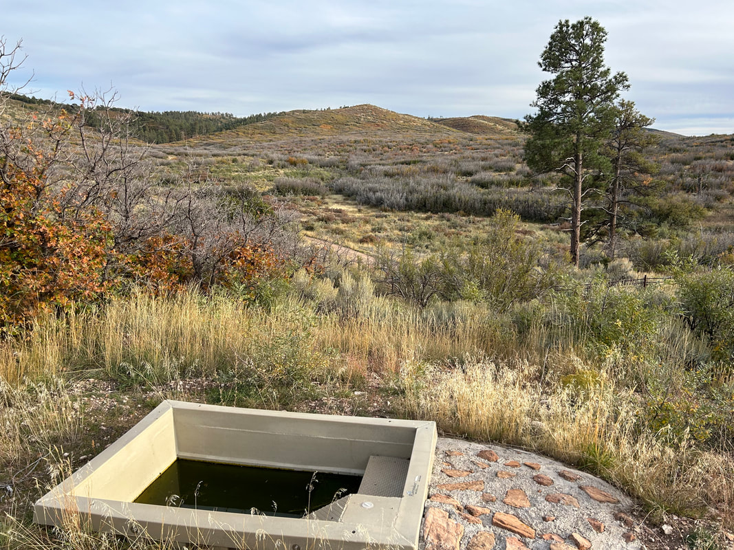
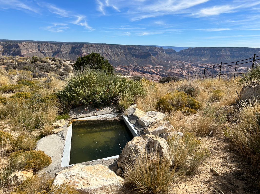
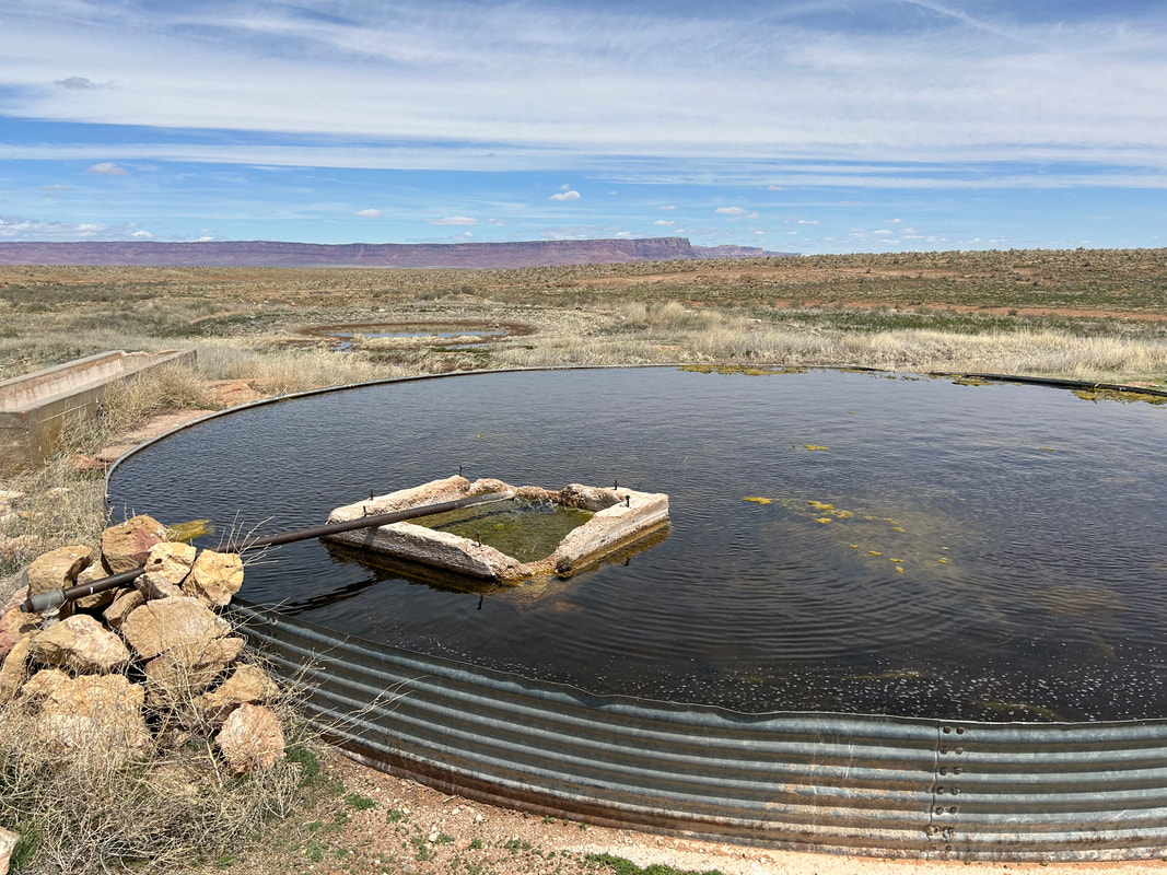
15. Water Sources
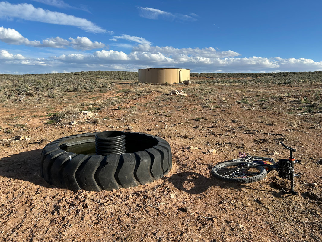
Water is scarce along this route. The Kaibab National Forest is considered the driest national forest in the United States. Although the North Rim is higher than the South Rim and consequently receives an average of 25.8 inches of moisture a year, most quickly percolates through the porous rock of Kaibab Limestone that makes up the upper layers of this area. Within the canyon, water exits through numerous springs, but up on top, it's a relatively dry area. Springs may require you to stash your bike on the rim to hike down and retrieve water. The tablelands and canyonlands around the Vermillion Cliffs, House Rock Valley, and Buckskin Mountain are true desertscapes with little reliable surface runoff or pools. Plan to carry several liters of water, sometimes enough to last at least 24 hours and more than you think you'll need should you arrive at a source and find it dry.
|
|
|
|
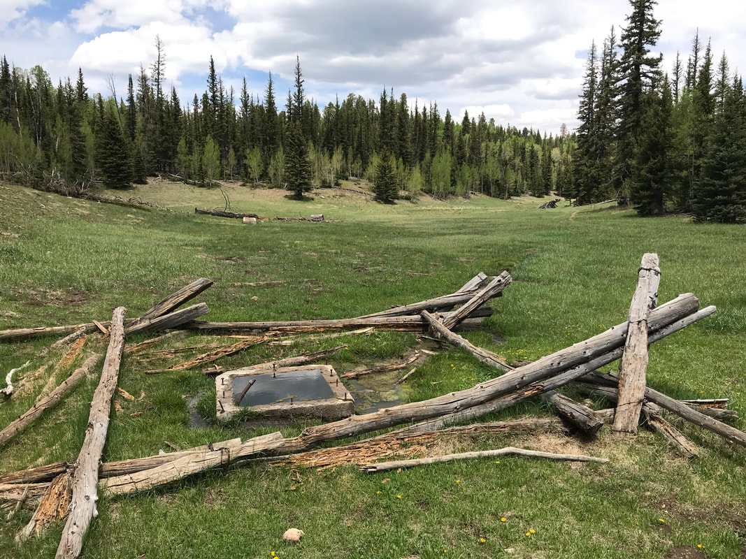
Definite water can be found at Lees Ferry Campground, Fredonia, Jacob Lake, Big Springs, Demotte, and the North Rim Village area in GCNP. Beyond that, water is mostly found in dirt cattle tanks, metal cattle tanks, springs, and Arizona Game and Fish Water Catchments. The AZGFD Water Catchments help provide water to wildlife in the ever-drying environment of the southwest under climate change. There is no camping within 0.25 miles of AZGFD Wildlife Tanks (or other water sources). This route requires riders to dry camp. Be prepared to load up at water sources so that you can camp far away from them.
Consider making a donation to help the AZGFD keep these wildlife tanks stocked at AZWildlifeHero.com. You can also donate to Wildlife Water Works which is a nonprofit whose mission is to, "Replenish, Refurbish & Create Arizona Game Water Catchments." Donations to Wildlife Water Works can be made here. I suggest a minimum donation of $25 because it's hard work by volunteers to keep these water sources maintained and filled.
***Water sources on the Colorado Plateau, as with the rest of the Southwest, are often ephemeral or unreliable. To help give riders a sense of water availability, I've rated sources using the scale below.
Water Reliability Scale:
1 = unreliable; 2 = seasonal;
3 = mostly reliable; 4 = definite source
|
|
16. Camping
There is no dispersed camping within the boundaries of Grand Canyon National Park. However, there is an established camping site at the North Rim Campground. The North Rim Campground near the village has a fantastic hiker/biker site for walk-ups arriving by foot or bicycle. The hiker/biker site is shared with other cyclists and backpackers and costs $6 per night per person. The North Rim Campground is conveniently located next to the the North Rim General Store and is only a short ride away from the lodging, restaurants, and Post Office (M-F, May 15 - October 15, 8:00 am - 12:00 pm, 1:00 pm - 5:00 pm) in the village. Lees Ferry Campground is located within Glen Canyon National Recreation Area and also requires camping in the established campground. This campground is first come, first served.
If you want to stay at the backcountry campsites above the rim at Fire Point, Swamp Point, or Point Sublime, you will need to reserve backcountry permits through the GCNP Backcountry Information Center or online at Recreation.gov. Here are the steps to take to reserve these sites:
If you want to backcountry camp anywhere else above the Rim in Grand Canyon National Park, you'll need to navigate to the same link above and make sure to choose the proper Use Area. This Use Area Map will help you determine which zone is appropriate for your intended backcountry campsite.
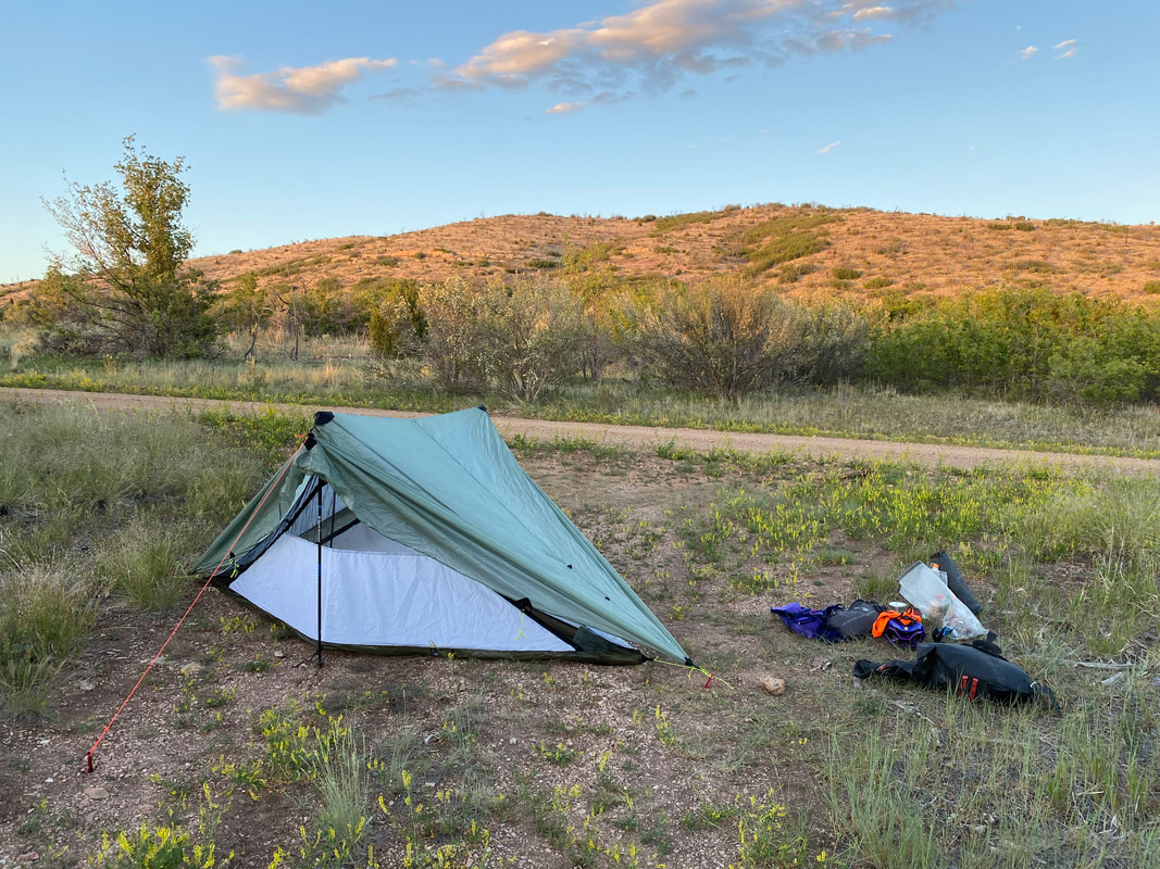
Outside of GCNP in the the Baaj Nwaavjo I'tah Kukveni National Monument, Kaibab National Forest, Vermillion Cliffs National Monument, and House Rock Valley, excellent and numerous dispersed camping abounds. The North Rim is truly one of the most remarkable places to disperse camp right up against the edge of the Canyon at so many locations for those making the remote trek out. Just make sure to pay attention to boundary lines between Grand Canyon National Park and the Kaibab National Forest.
If you want to stay at the backcountry campsites above the rim at Fire Point, Swamp Point, or Point Sublime, you will need to reserve backcountry permits through the GCNP Backcountry Information Center or online at Recreation.gov. Here are the steps to take to reserve these sites:
- Head to Recreation.gov for Grand Canyon National Park Backcountry Permits.
- Click "Check Availability" under Available Permits on the right hand side.
- Choose the button tab "Above Rim Areas - North Rim" at the top.
- Choose from the following options:
- NJ1 - Fire Point Campsite - Large or Small Group
- NJ2 - Swamp Point - Campsite - Large or Small Group
- NH1 - Point Sublime - Campsite
If you want to backcountry camp anywhere else above the Rim in Grand Canyon National Park, you'll need to navigate to the same link above and make sure to choose the proper Use Area. This Use Area Map will help you determine which zone is appropriate for your intended backcountry campsite.
Outside of GCNP in the the Baaj Nwaavjo I'tah Kukveni National Monument, Kaibab National Forest, Vermillion Cliffs National Monument, and House Rock Valley, excellent and numerous dispersed camping abounds. The North Rim is truly one of the most remarkable places to disperse camp right up against the edge of the Canyon at so many locations for those making the remote trek out. Just make sure to pay attention to boundary lines between Grand Canyon National Park and the Kaibab National Forest.
17. Food and Resupplying
There are several food resupplies on this route. However, they are greatly spaced. The distance between Jacob Lake and Demotte alone is 179 route miles. The remote nature of this route means riders need to carefully plan how much food to carry and to expect several days between resupplies.
- Miles 6.4-18.8 - Marble Canyon: Chevron Gas Station, Marble Canyon Lodge; a few miles later are Lee's Ferry Lodge and Cliff Dweller's Lodge. Hit all these locations again at the end starting at Mile 624.4
- Mile 106.8 - Fredonia, AZ: Chevron Gas Station, Family Dollar
- Mile 171.0 - Jacob Lake, AZ: Jacob Lake Inn + Restaurant; I encourage this optional side-ride.
- Mile 349.8 - Demotte: North Rim Country Store with coffee stand, Kaibab Lodge with its restaurant (North Rim Country Store is open May 15 - Oct. 15)
- Mile 425.5 - North Rim Village: North Rim General Store, North Rim Lodge, Deli in the Pines (All are open May 15 - Oct. 15. Expect dwindling supplies at the North Rim General Store the last few weeks prior to Oct. 15 as they attempt to sell off inventory for the winter)
- Mile 522.9- Demotte: North Rim Country Store with coffee stand, Kaibab Lodge with its restaurant
- Mile 624.4-633.0 - Marble Canyon: Cliff Dwellers Lodge; a few miles later is Lee's Ferry Lodge and after that comes Marble Canyon Lodge and a Chevron Gas Station
18. Sample Route Itinerary
This is a suggested itinerary. Use it as a rough guide for your own planning purposes. Feel free to use it, adapt it, or don't use it all and make your own plans. Plan your trip on this route based on your own strengths, comfortabilities, experiences, wants, and needs.
Day |
Mileage |
Elevation Gain |
Route Description |
1 |
~51 Miles |
3580 ft. |
|
2 |
~56 Miles |
3120 ft. |
|
3 |
~64.5 Miles |
4925 ft. |
|
----- |
Optional: 0 Day |
----- |
|
4 |
~24.5 Miles |
1300 ft. |
|
5 |
~50 Miles |
3600 ft. |
|
6 |
~44 Miles |
3660 ft. |
|
7 |
~33 Miles |
3070 ft. |
|
8 |
~27 Miles |
2408 ft. |
|
----- |
Optional: 0 Day |
----- |
|
9 |
~58.5 Miles |
3850 ft. |
|
10 |
~20 Miles |
2400 ft. |
|
11 |
~50 Miles |
4020 ft. |
|
----- |
Optional: 0 Day |
----- |
|
12 |
~49.5 Miles |
3830 ft. |
|
13 |
~43.5 Miles |
2250 ft. |
|
14 |
~58.5 Miles |
1830 ft. |
|
15 |
~15 Miles |
300 ft. |
|
19. Fees and Permits
- Grand Canyon National Park requires a fee for entry. No cash, credit/debit only. ($35 for a vehicle; $20 for a bicycle).
- Glen Canyon National Recreation Area requires a fee to get to Lees Ferry. It is an automated fee machine . No cash, credit/debit only. ($30.00 for a vehicle; $15 for a bicycle).
- Baaj Nwaavjo I'tah Kukveni National Monument, Kaibab National Forest, and Vermillion Cliffs National Monument have no fees.
- A Recreational Land Use Permit is required for any travel or camping on Arizona State Lands. Apply for and pay for one before you head out on the route. Carry it with you.
20. Getting to the Start
There are three main ways to the get to the start of the Capes of the Canyon.
You can rent a car easily in Flagstaff, Phoenix, or Las Vegas - these are the three main cities people fly into for visiting the Grand Canyon.
For those interested in flying to Flagstaff and then biking to the start, there are a few options. You can either fly with your bike and ride it right from the airport, or you can ship it to one of the many bike shops in Flagstaff (my favorites are Flagstaff Bike Revolution and Absolute Bikes).
There are five main options for biking from Flagstaff to the Grand Canyon.
I've designed the Flag to Capes Connector as a fast, gravel and dirt forest-road based approach. The Flag to Capes Connector provides a direct route for bikepackers looking to arrive at the South Rim of the Capes of Canyon by plane and bike from Flagstaff, AZ instead of by car. From there, you'll need to use the Capes Connectors to get to the North Rim. More information on the Flag to Capes Connector can found under the Ride with GPS link and GPX below.
- Drive to the start (a personal car or rental).
- Fly into Flagstaff, AZ and bike here.
- Straight-up bike to the start from wherever.
You can rent a car easily in Flagstaff, Phoenix, or Las Vegas - these are the three main cities people fly into for visiting the Grand Canyon.
For those interested in flying to Flagstaff and then biking to the start, there are a few options. You can either fly with your bike and ride it right from the airport, or you can ship it to one of the many bike shops in Flagstaff (my favorites are Flagstaff Bike Revolution and Absolute Bikes).
There are five main options for biking from Flagstaff to the Grand Canyon.
- Flag to Capes Connector (dirt roads and multi-use paths - goes to the South Rim)
- Capes Connectors (dirt, paved, or hiking - go from the South Rim to the North Rim)
- The Arizona Trail (singletrack)
- The Western Wildlands Route (singletrack and dirt roads)
- Grand Canyon Connector (paved)
I've designed the Flag to Capes Connector as a fast, gravel and dirt forest-road based approach. The Flag to Capes Connector provides a direct route for bikepackers looking to arrive at the South Rim of the Capes of Canyon by plane and bike from Flagstaff, AZ instead of by car. From there, you'll need to use the Capes Connectors to get to the North Rim. More information on the Flag to Capes Connector can found under the Ride with GPS link and GPX below.
21. Parking
Park your vehicle in the paved long-term parking at Lees Ferry. There is signage at the area, and there is a POI for it on the RWGPS map. Parking is for 30 days max. Although the Parking Limit says 14 days, I've been told it's treated loosely because this is also where rafters leave their vehicles for a 30 day Colorado River trip. Make sure to leave your Park Pass/Permit visible on your dashboard.
In the occasional event that the parking lot is filled up, reach out to some of the lodges nearby (Marble Canyon, Lee's Ferry, Cliff Dwellers). No promises, but I've found that if you patronage the business by staying the night, they'll be more willing to work with you (especially if you offer to pay to safely leave your car).
In the occasional event that the parking lot is filled up, reach out to some of the lodges nearby (Marble Canyon, Lee's Ferry, Cliff Dwellers). No promises, but I've found that if you patronage the business by staying the night, they'll be more willing to work with you (especially if you offer to pay to safely leave your car).
22. Additional Important Information
- Hunting Season: Starts in September and goes through December. The Kaibab National Forest on the North Rim is considered one of the best mule deer hunting areas in the United States. Hunting season is a big deal here and the forest will be filled with hunters looking for deer and bison. Expect to see more trucks, backcountry campers, ATVs, and individuals on foot. WEAR ORANGE and make yourself visible as you ride. Be smart and be seen during hunting season. Wildlife Tanks may have more hunters scoping them out.
- Dark Skies: Grand Canyon National Park is an International Dark Sky Park. This means that you can expect to have anywhere between Bortle Class 1 - 3 night skies overhead (even better night viewing during a new moon). The Bortle Class Scale is used to rate night skies on their clarity and lack of light pollution. A Bortle Class 1 is the darkest possible and there are several locations along these routes where, should you camp, you will have this level of darkness. Here, night skies will be virtually unimpeded by artificial light. You can use the following sites to explore more:
- Fences: There may be "cowboy fences" on this route which consist of barbed wire wrapped around vertical wooden branches that are strung across roads. They can be opened by removing a loop of wire on one side. Most importantly, leave fences as you found them; re-close them if they were closed.
- Black Bears: There are black bears which means you need to properly store your food at night using a bear-aware method.
- Hantavirus and Plague: Bubonic plague and hantavirus are frequent enough amongst the rodent population that you should avoid their saliva, feces, urine, and direct bodily contact. Be careful when entering old cabins and caves where droppings are plentiful and ventilation is limited. These are prime areas for possible contraction of these diseases.
- Bugs: Mosquitoes and biting flies can be abundant on this route in the forest valleys and drainages where moisture and standing water collect. This will be especially true in the summer and early fall, especially if precipitation has been plentiful.
23. Other Rides in the Area
There are several other routes located in the area for those interested in checking them out:
24. Acknowledgements
I'd like to thank Janna, Kate, and Dan for their time riding, scouting, and helping me network within Grand Canyon National Park. For sharing beta from his own scouting trips and discussing water sources in the area, I'd like to thank Kurt Refsnider. I'd like to thank Matthew Jenkins for sharing an alternative option on the Marble Platform and Emily Hansen for information on Dog Point. I'd like to give a huge shoutout to Rebekka Anderson of Erosion Studio for her fantastic artwork creating the route logo. For his thoughts and guidance on Indigenous perspectives of the Living Landscape, I'd like to thank Jack Pongyesva of the Intertribal Centennial Conversations Group and Grand Canyon Trust. Finally, I'd like to thank Bikepacking Roots for showcasing the Capes of the Canyon under their Community Routes Project (CRoP).

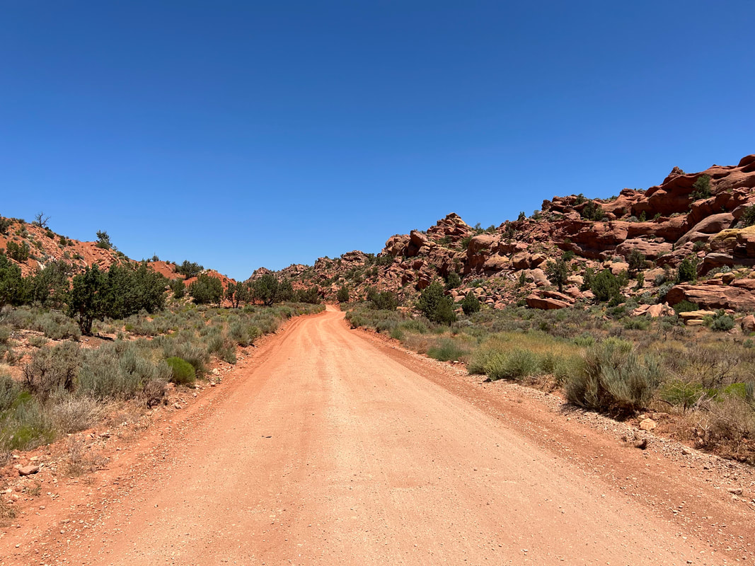
25. Social Media and Route Updates
Route Updates:
Rider Feedback: Use the Comment box below or email me to give a trip report, list any concerns, or provide an update on the route. Make sure to give:
Rider Feedback: Use the Comment box below or email me to give a trip report, list any concerns, or provide an update on the route. Make sure to give:
- Date
- Location and Mile
- Feedback/Trip Report Details