0 Comments
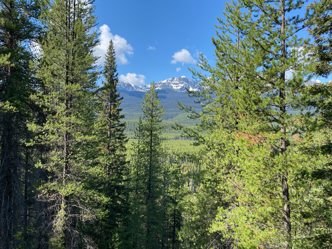
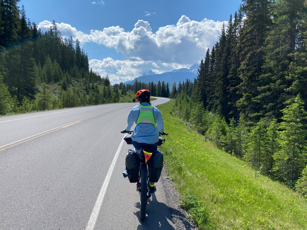
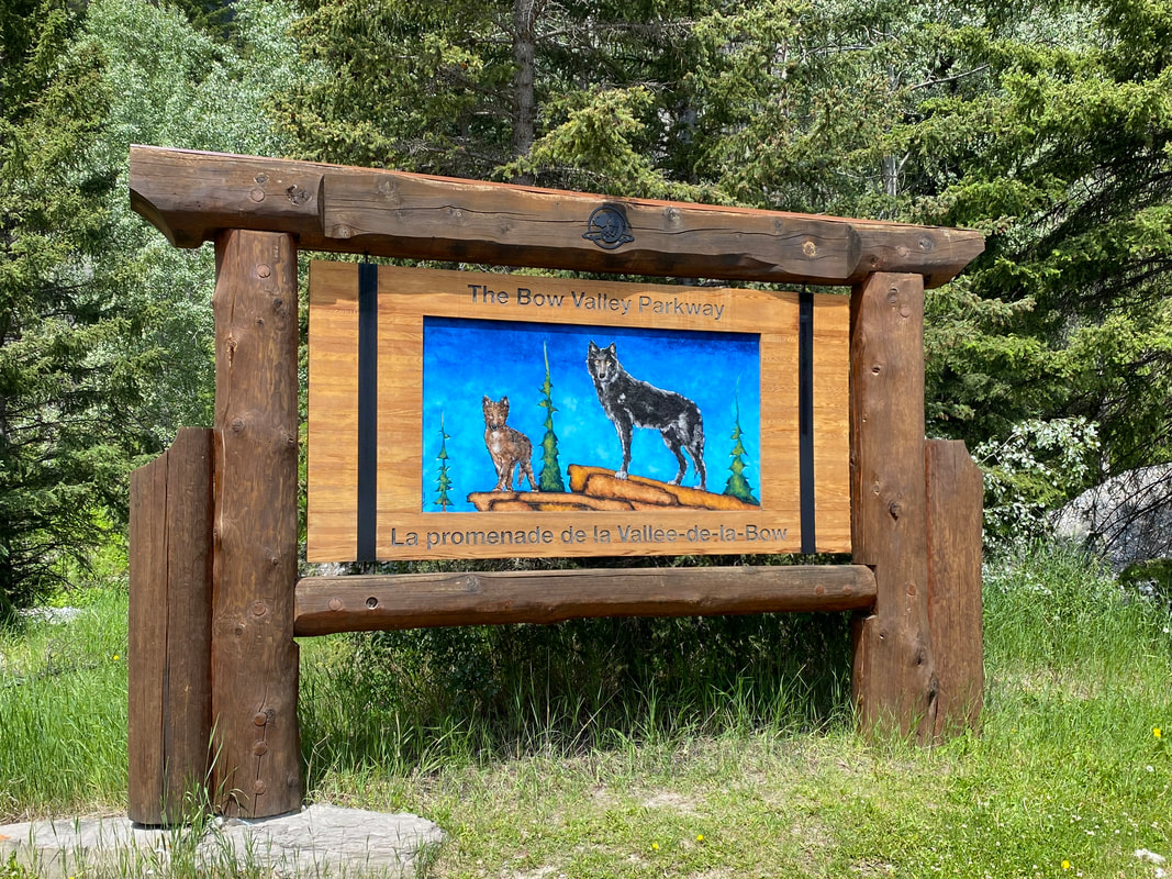
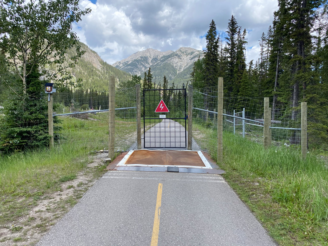
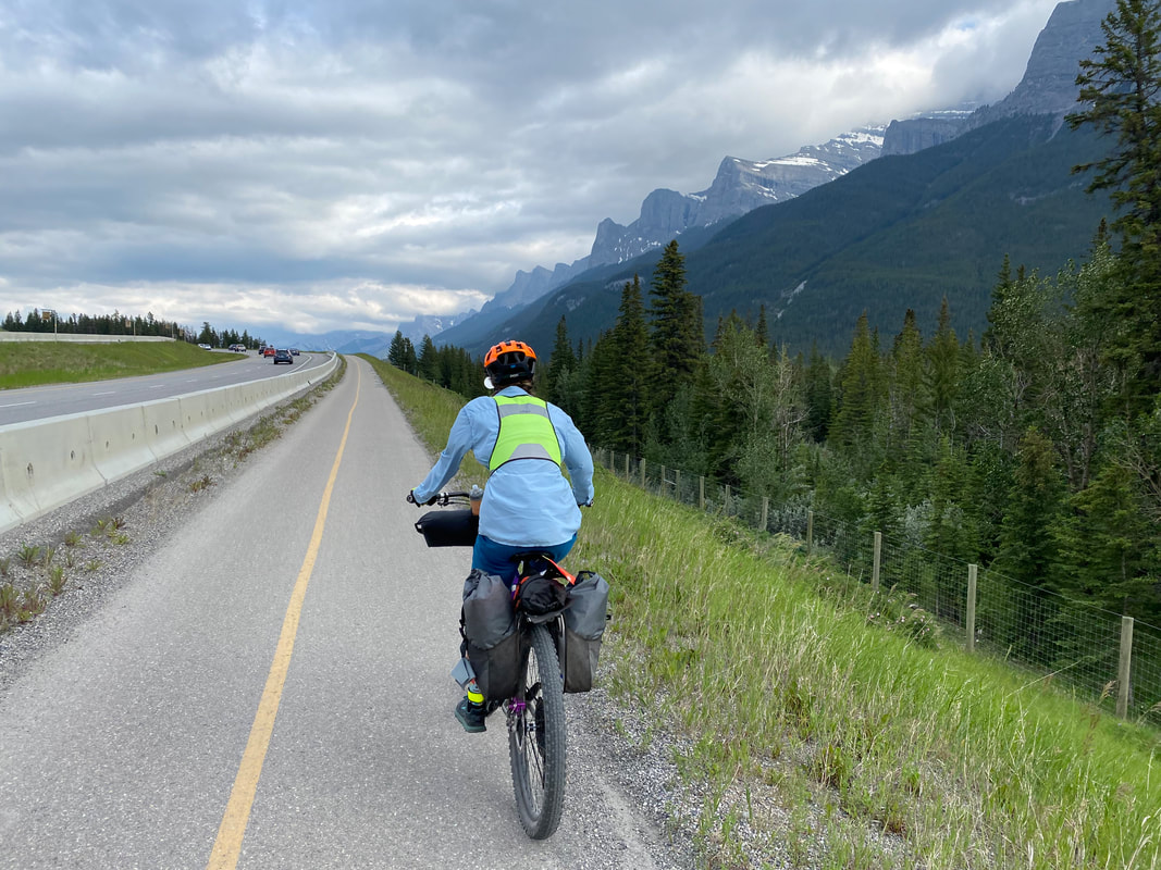
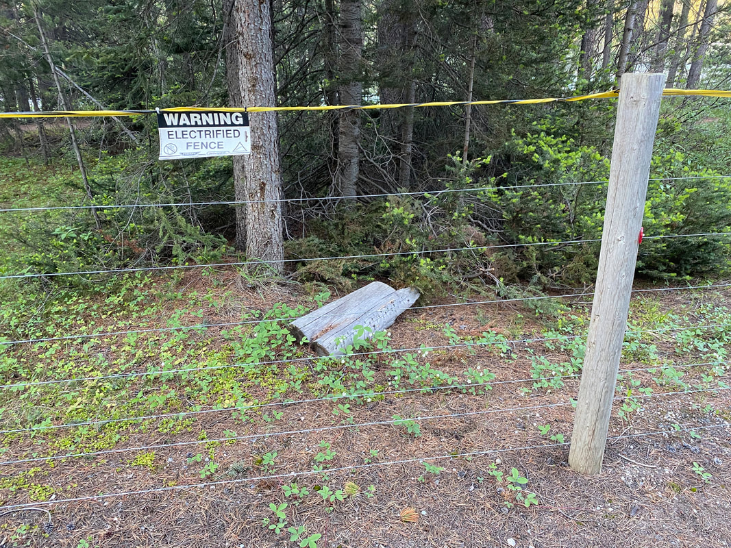
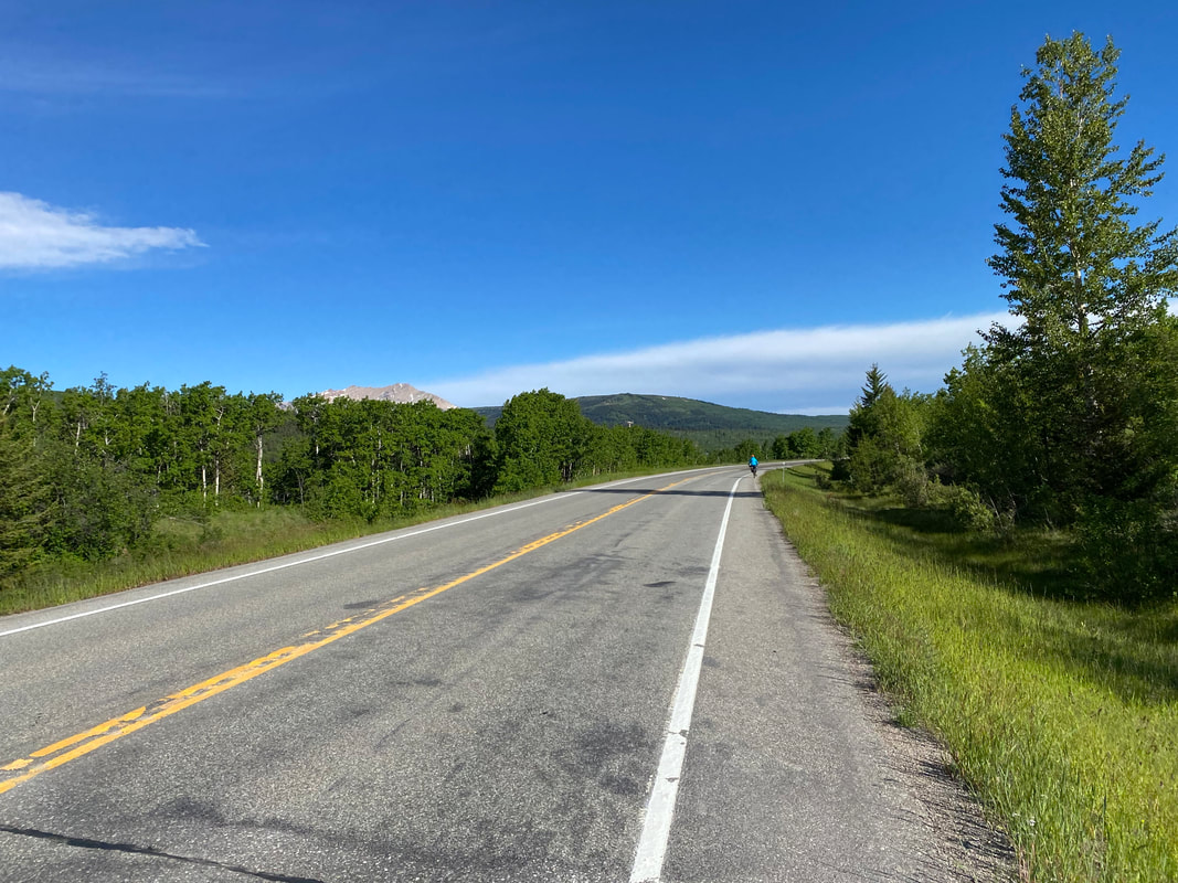
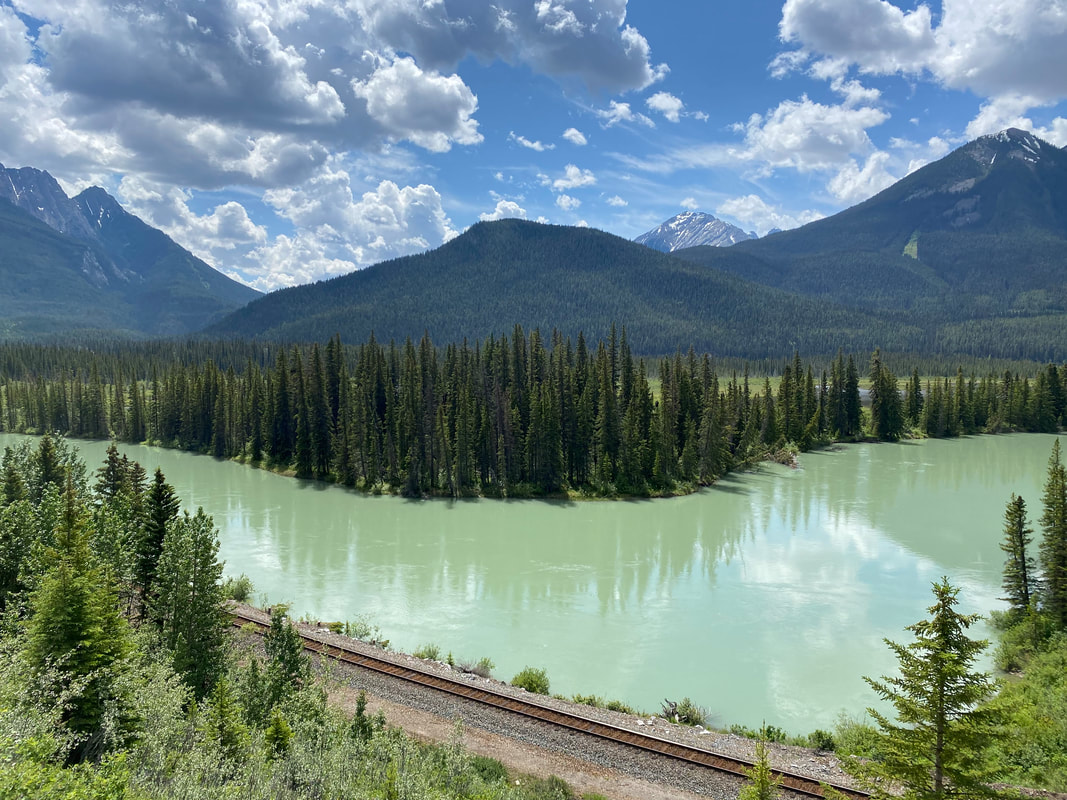
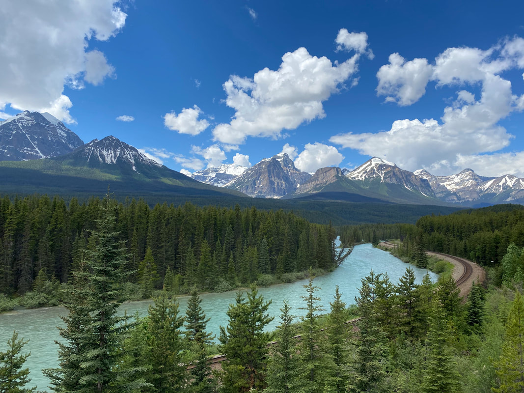
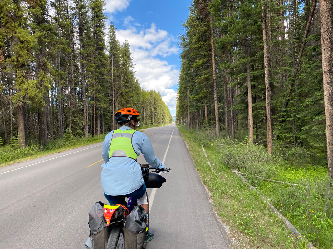
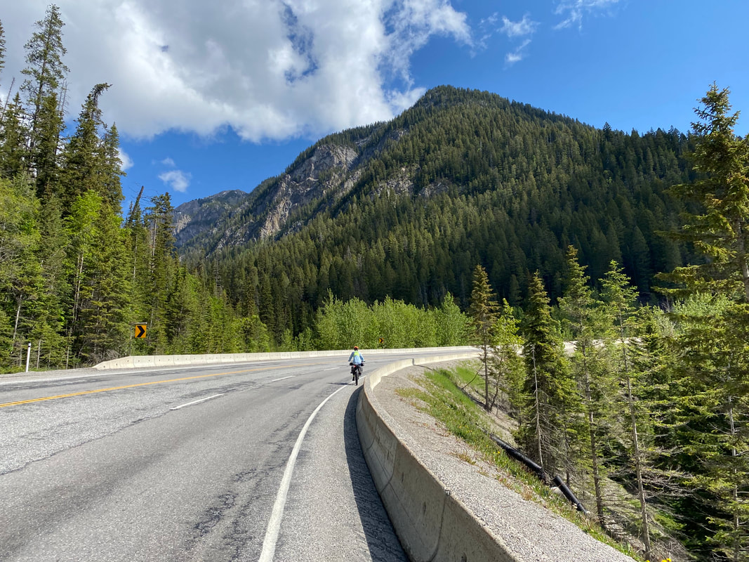
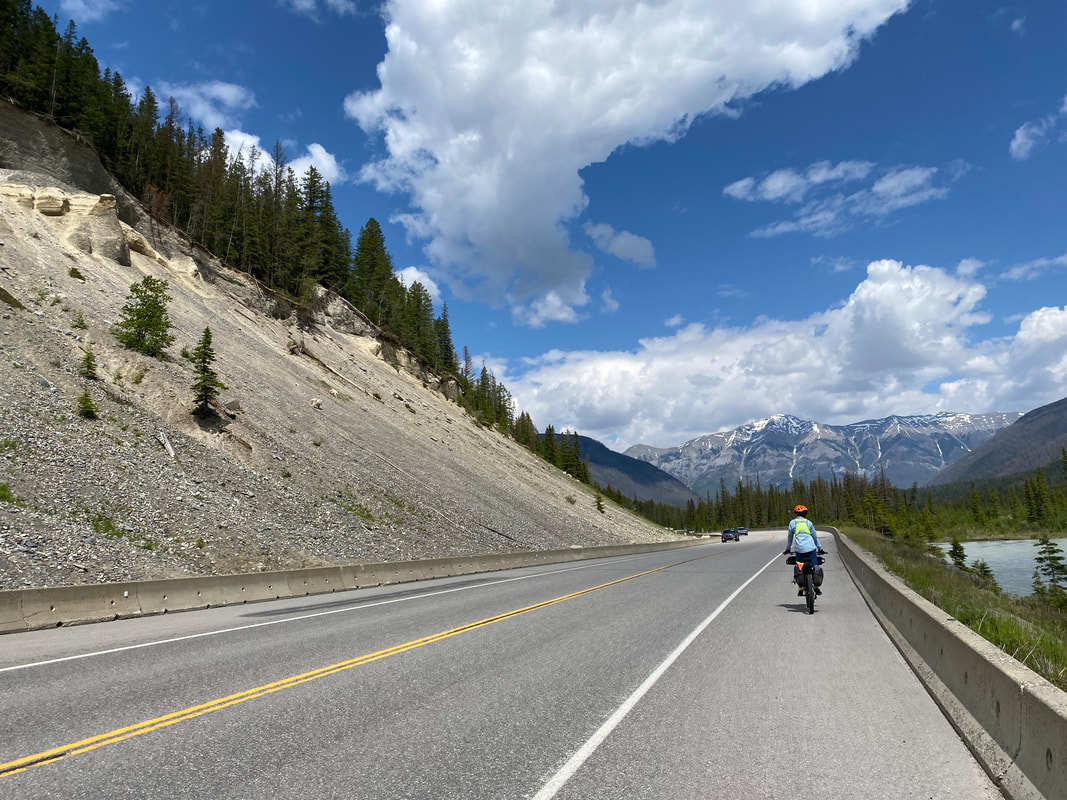
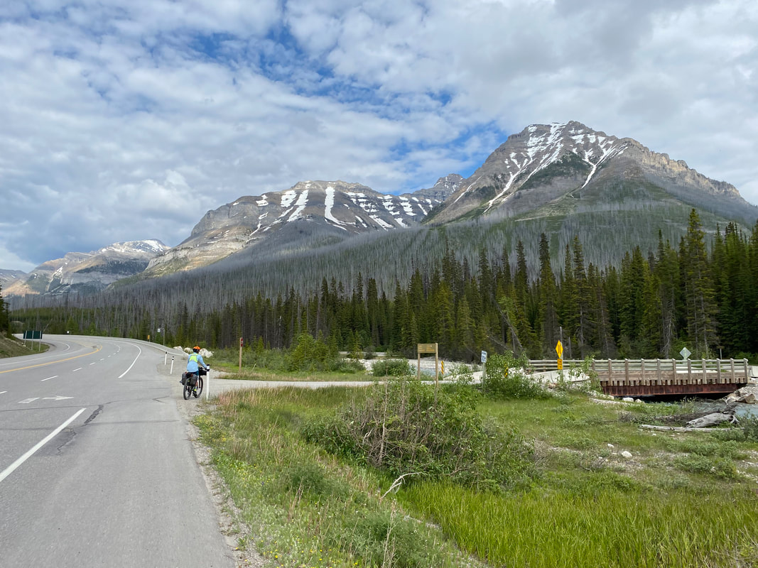
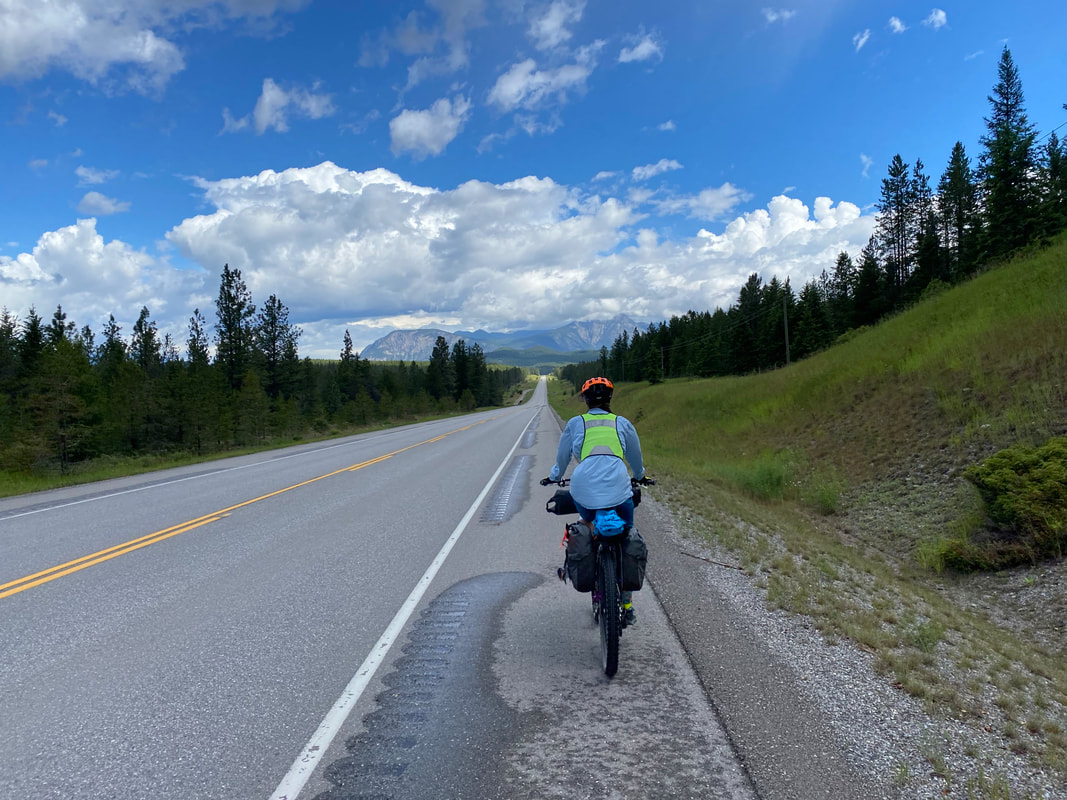
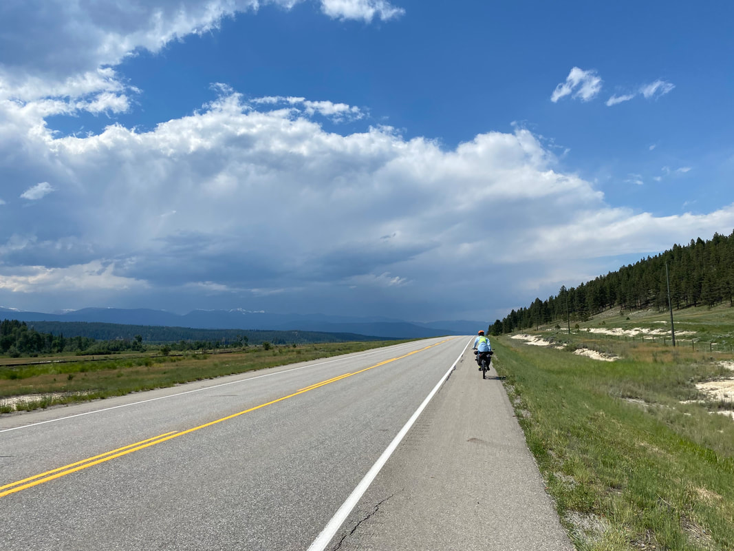
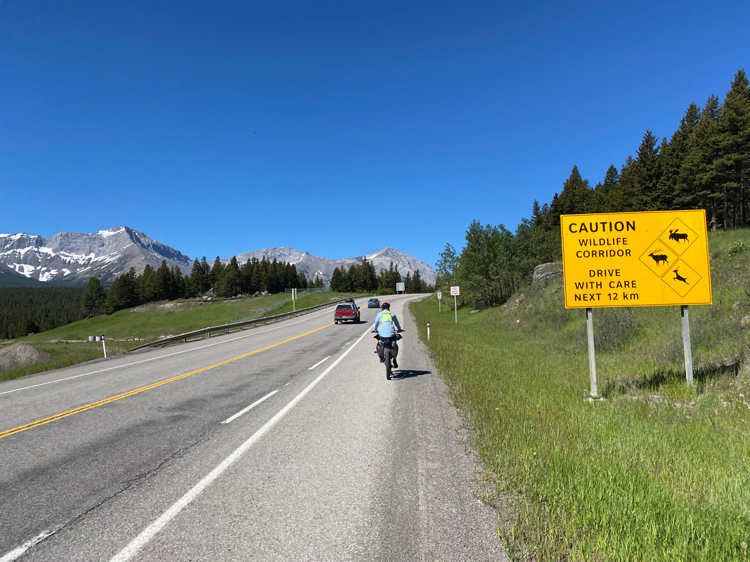
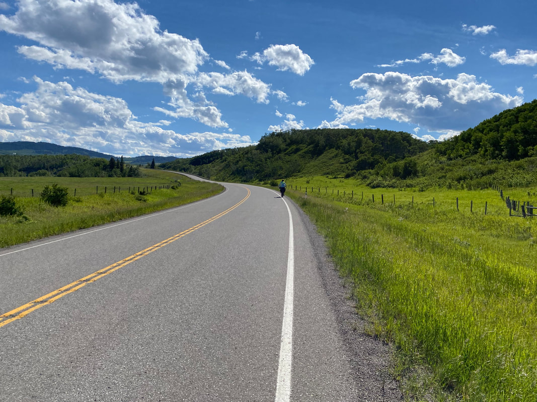
52.75 Miles; Lake Louise Campground in Banff National Park, AB to Canmore, AB 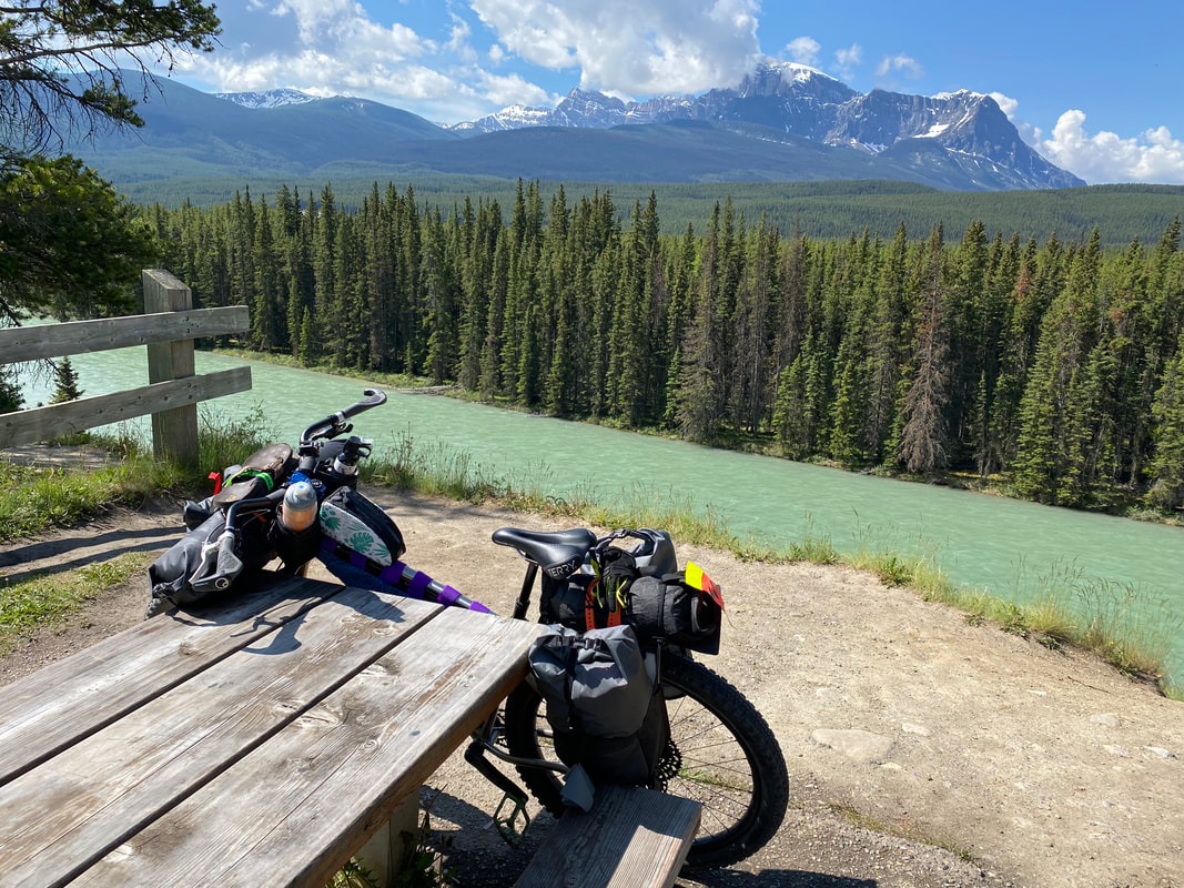 My knee is flaming. I wake up and realize just how good a call it was to make in deciding to end our ride. Any more pushing past today would cause some serious damage to my already inflamed patellar tendonitis; Janna is in the same boat about her Achilles. We break camp after sleeping in, making our way to the Trailhead Café in Lake Louise, and then jump on the Bow Valley Parkway once more to head east across the Rockies to Canmore, Alberta where a hotel and a U-Haul are waiting for us. The Bow Valley Parkway was as gorgeous as the day before and way more active with wildlife. A car pulled over to call out to us warning of a grizzly ahead. We started bear calling while cautiously moving forward. Unfortunately, we didn't get a chance to catch a glimpse. We paralleled the Bow River once more, all tepid and glorious in its gray-green sheen against a backdrop of the Bow Valley circumferenced by blackened peaks of the Rockies. We passed the point we had originally joined the route yesterday (in the opposite direction) and pedaled slowly through neon green meadows of rich vegetation. My knee was burning hard with tendonitis and Janna was gingerly flexing her Achilles to keep ourselves moving forward. Around mid-morning, a black bear jolted across the road in front of us before disappearing into the trees. The Bow Valley Parkway ended and we joined up with the awesome multi-use Heritage Trail paved path. At once, the path entered an electrified fence and matt, sealing us once more away from the wildlife near the adjoining highway. Jurassic Park. 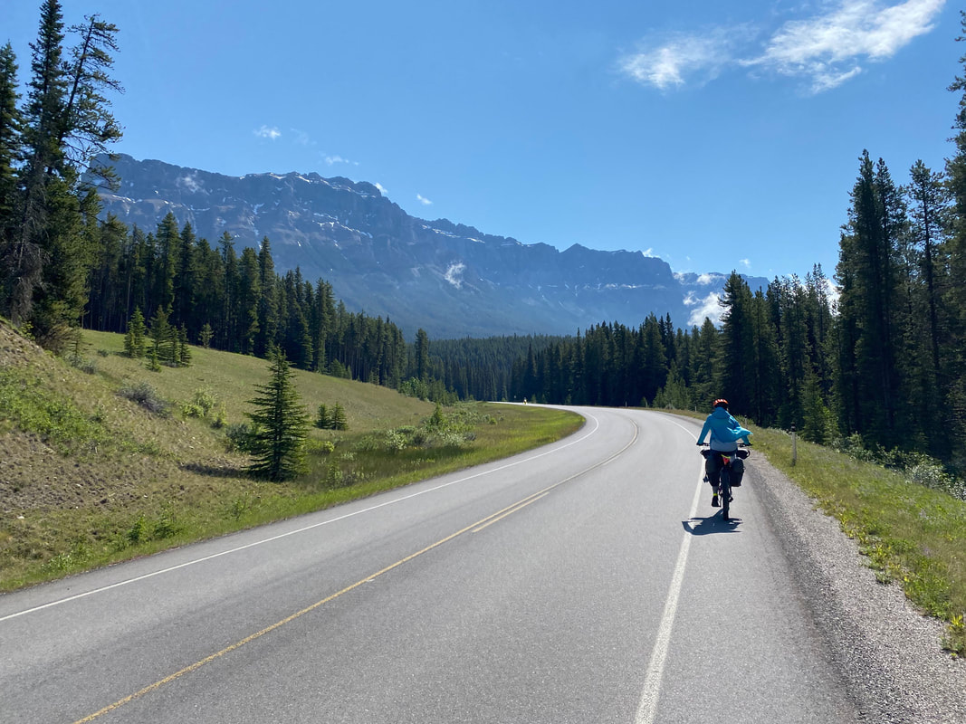
   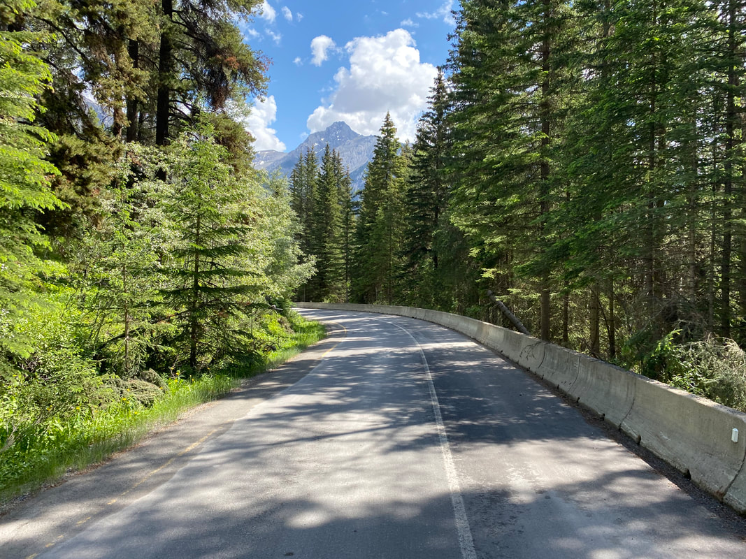    
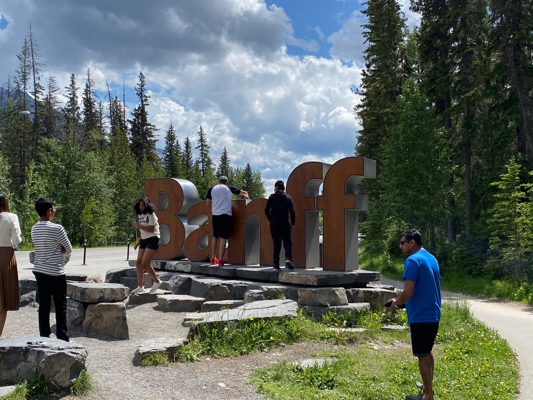
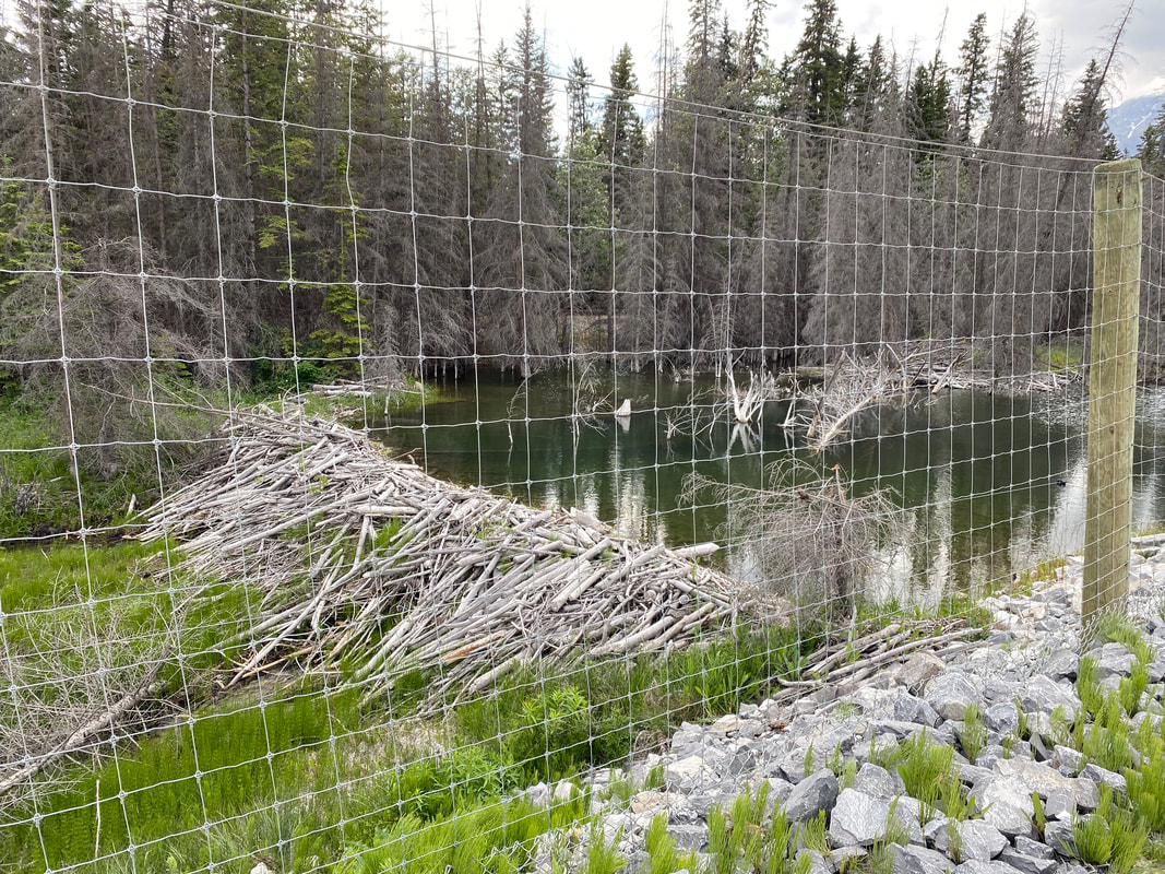
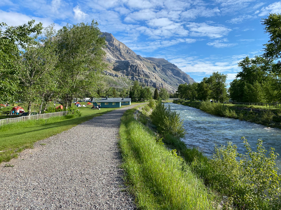
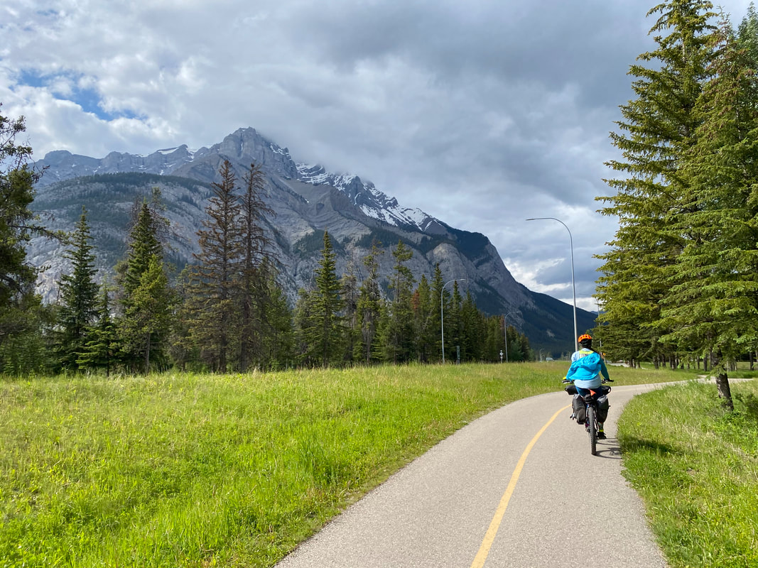
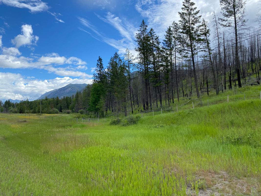
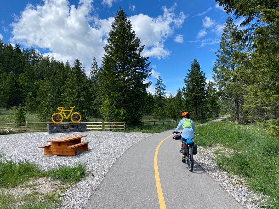
We rode along through the tree before the path brought us pass the Vermillion Lakes and then spilled us into downtown Banff, AB. I was fairly mind-blown by the high-scale appearance, high prices, and high opulence of the place. It was gorgeous for sure, but one of the cheapest lunches we could find was still many dollars over anything I would even pay at the Grand Canyon. Janna and I locked up our bikes before taking a walk around the downtown district to see the sights as we felt we would probably never visit again. Satiated by early afternoon, we jumped onto the Banff Legacy Trail, another paved multi-use path, that led us out the north part of town. The trail paralleled the Trans-Canada Highway with the large electrified wildlife fence to our rights. The Bow River also flowed next to us; its tributaries and side-streams in this part were filled with beaver dams and lodges. Storm clouds began to gather over the peaks as the weather system forecasted to dump days of endless rain on the area showed their bellies. We read that it would be nearly impossible to see the glaciated mountainsides in the coming days, leaving us grateful to see what we had and lessening the sting of ending a trip early without passing through the entirety of the Icefields Parkway (we'll come back and bike this for sure).  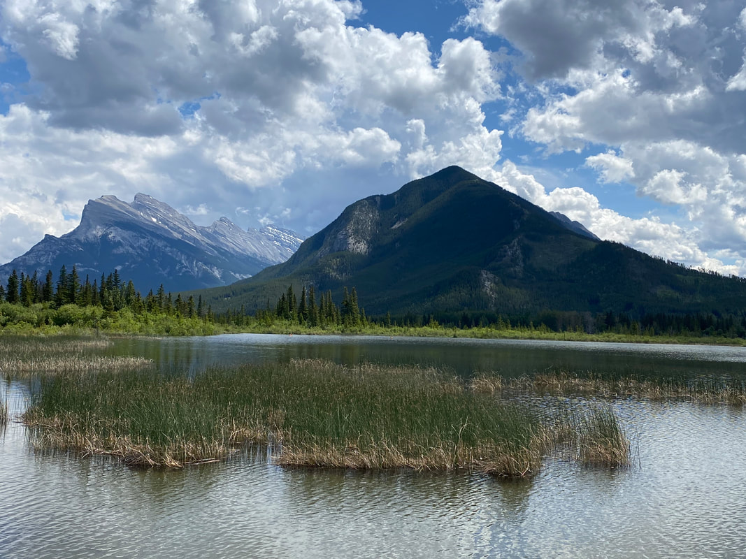
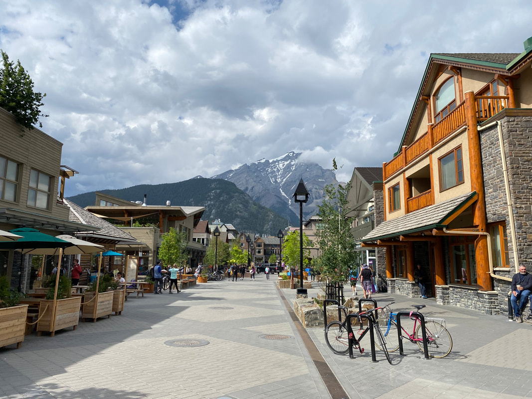
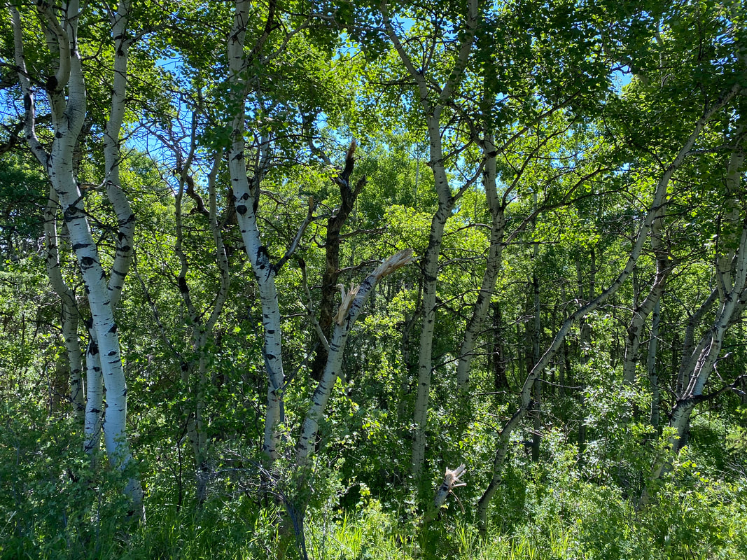
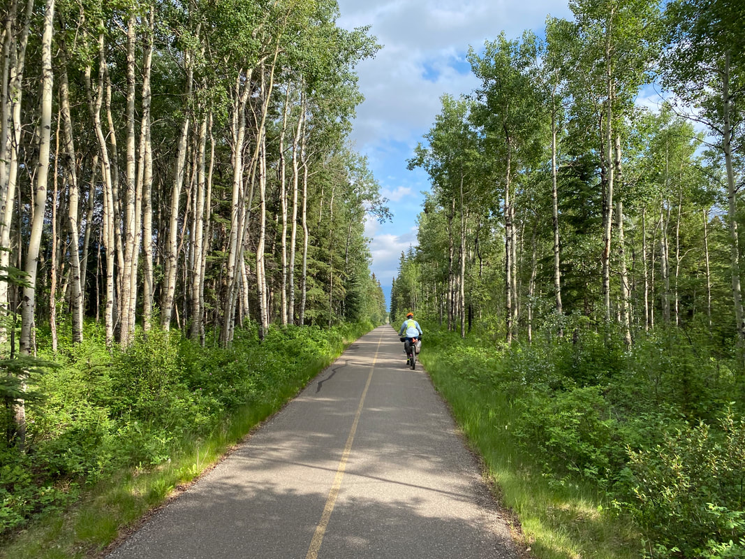
 By early evening, we were pulling through aspen groves and into downtown Canmore where we had a hotel booked for the night and a U-Haul rental waiting for us to load our bikes in before driving back to our car. The last dapples of light centered around the grasses at the feet of the hills as the storm bedded down. We caught showers, unloaded our gear, and rested our inflamed tendons. 700 miles down some beautiful northern Rockies landscape lay behind us and we looked forward to wrapping up our trip back in the States the next day.
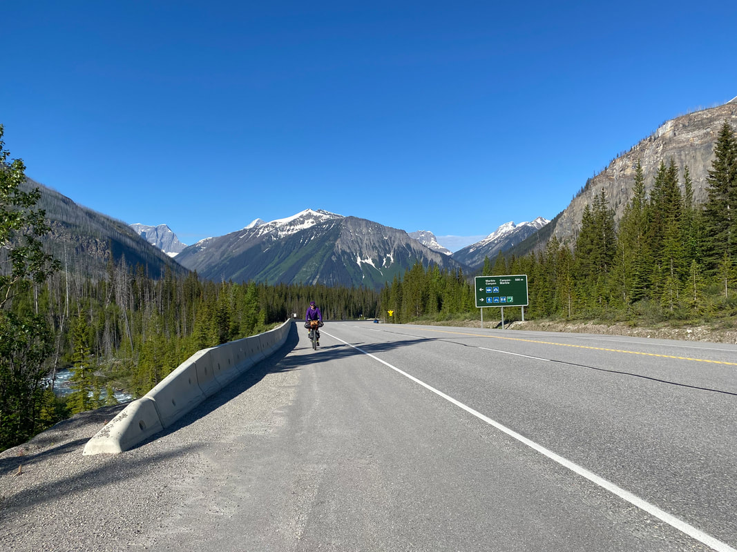
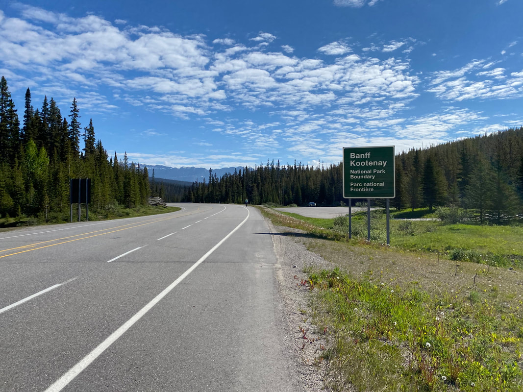
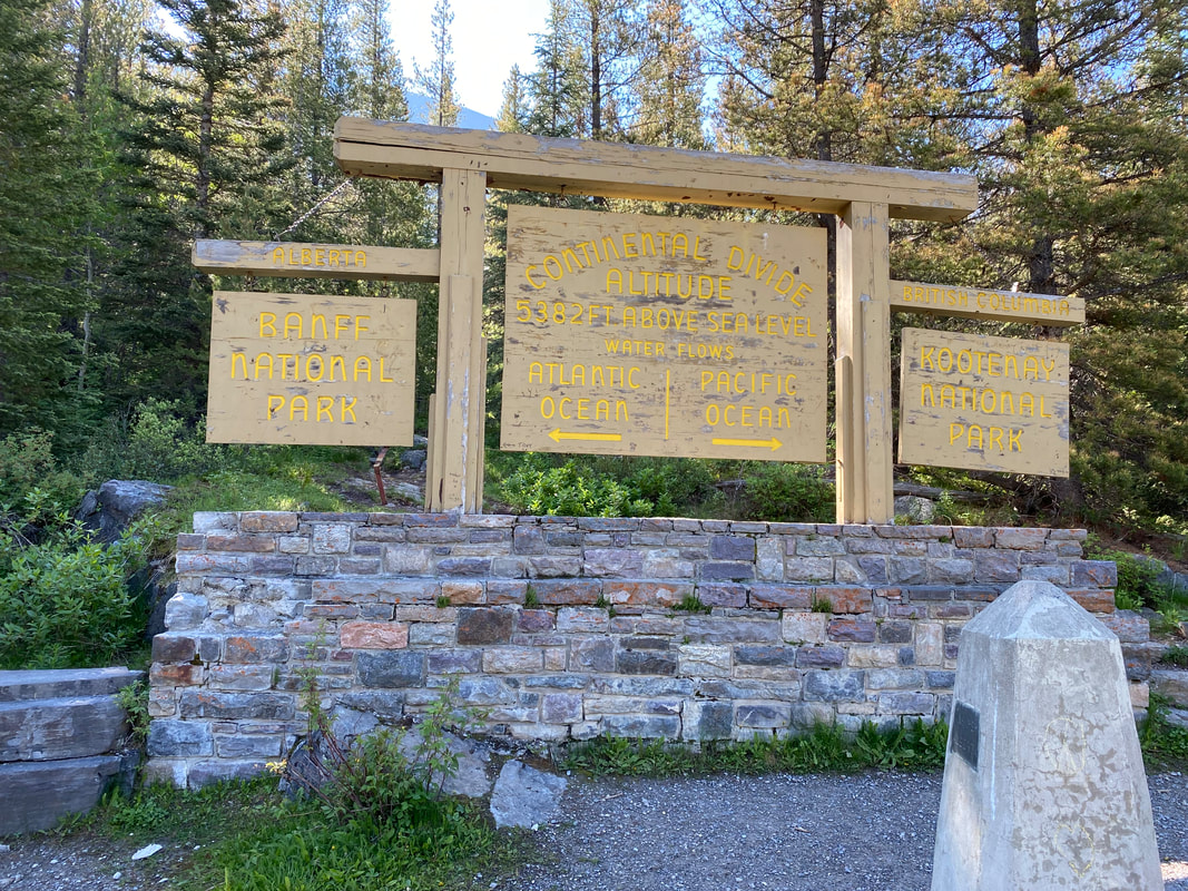
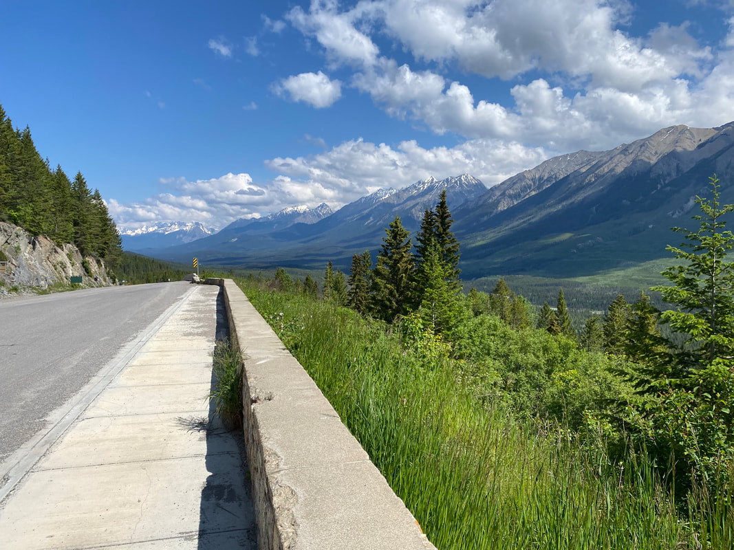
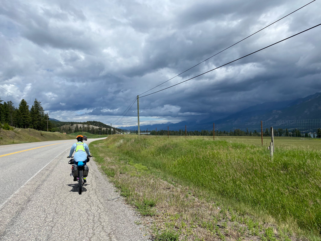
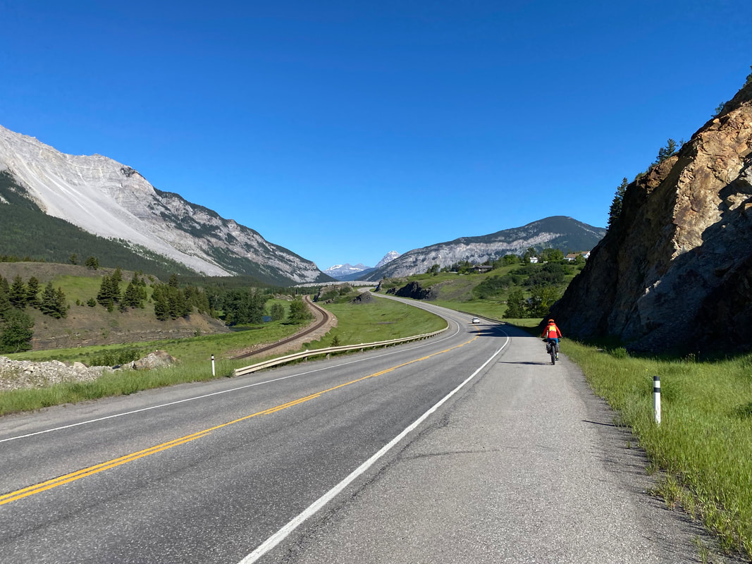
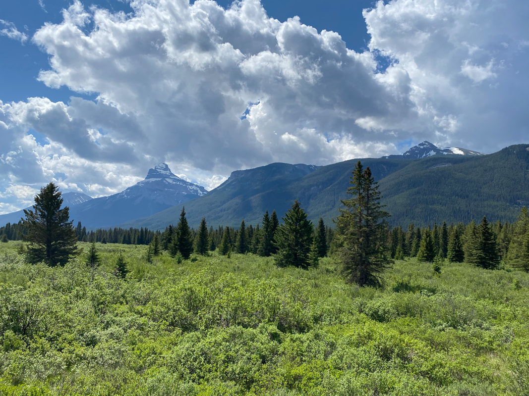
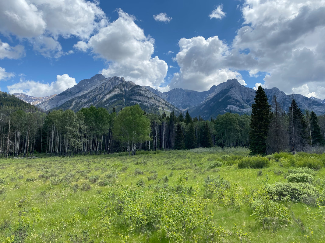
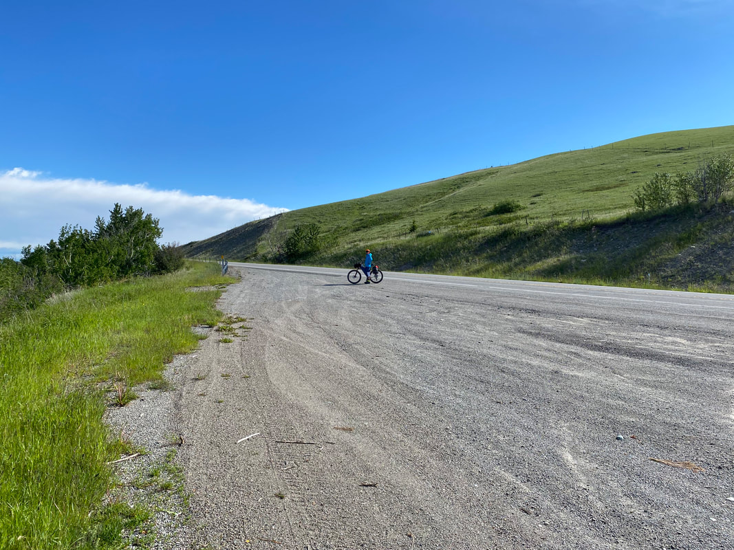
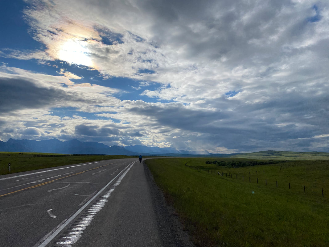
 28.76 Miles; Marble Campground in Kootenay National Park, BC to Lake Louise Campground in Banff National Park, AB 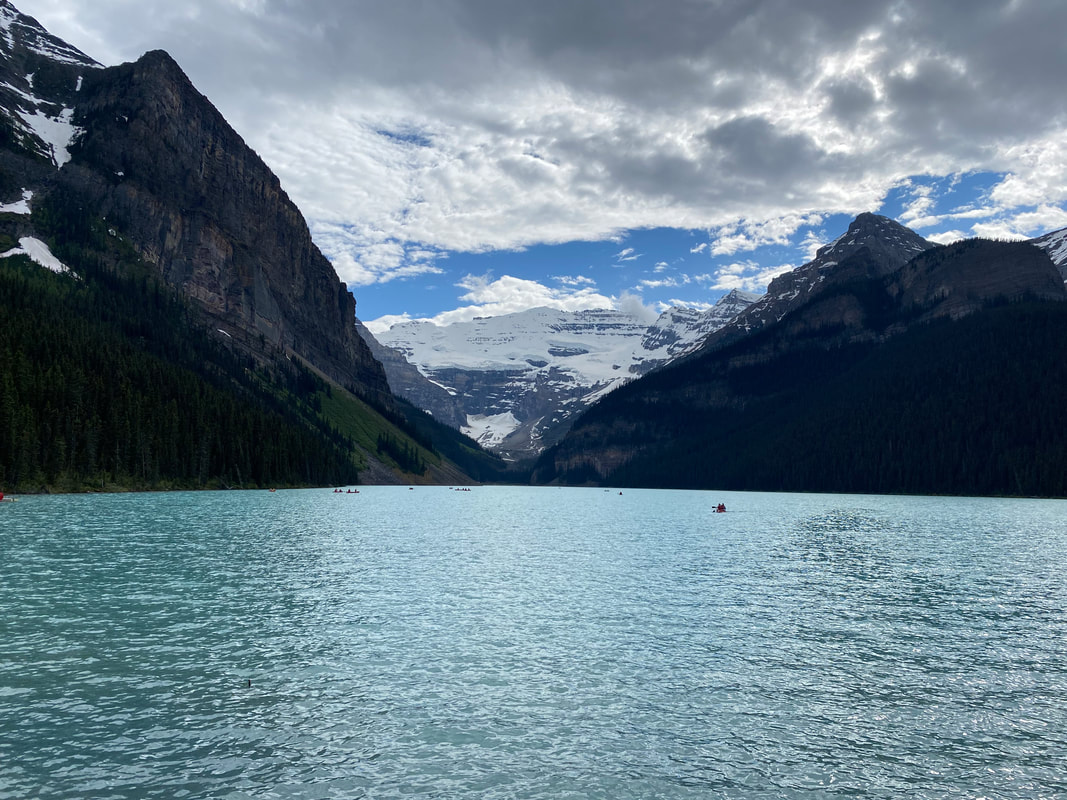 I awoke with my patellar tendon absolutely gushing that deep pain all too familiar to me and indicative of sustained patellar tendonitis. Janna awoke barely able to walk from the searing Achilles pain making itself known. Today was planned to be short. It also coincided with Canada Day (which had a feel similar to me of the Fourth of July in America). The roads would be packed, the campgrounds even more-so, but luckily we had reserved a tent site ahead of time at Lake Louise Campground. Unlike many parks in the USA, the parks in Canada did not save sites for those arriving by foot/pedal, precipitating the need to reserve everything ahead of time. In fact, we saw some cyclists along the route going the opposite direction who daily seemed stressed about trying to find camping accommodations each night due to their lack of reservations. We roll out of Marble Campground slowly and gingerly so as to not flare up further pain with our bodies. The morning is bright and blue, leading to gorgeous panoramas of the surrounding peaks on the northern edges of Kootenay National Park. We push back out onto the main highway and start our ways north towards another Continental Divide crossing. We talk to a family passing through about Canada Day and the state of snow in the surrounding peaks before pressing on and entering Banff National Park and the province of Alberta. 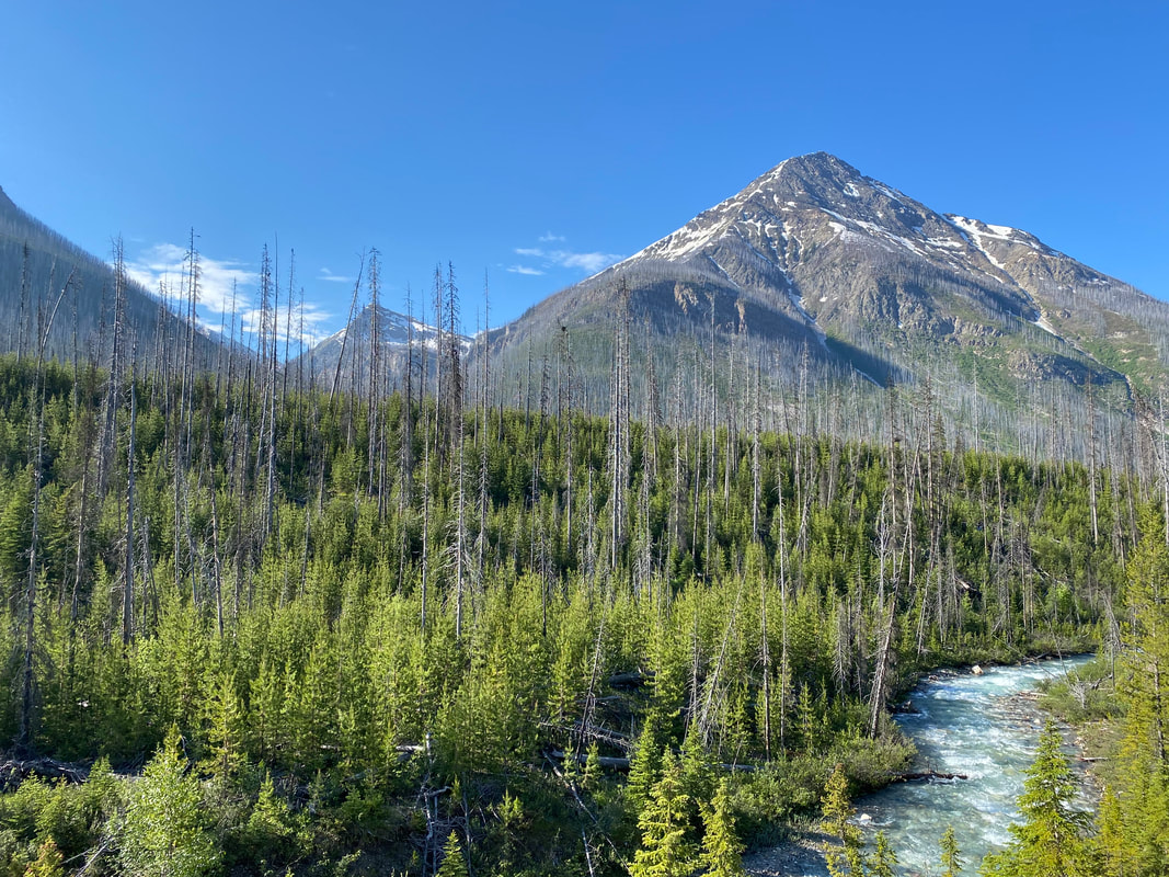
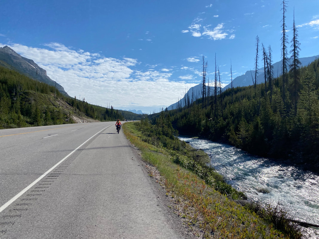 
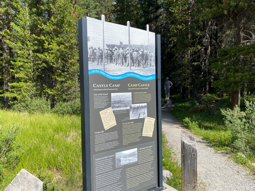
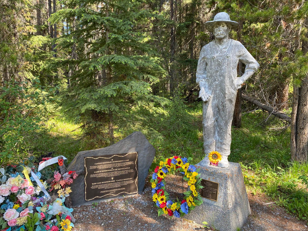
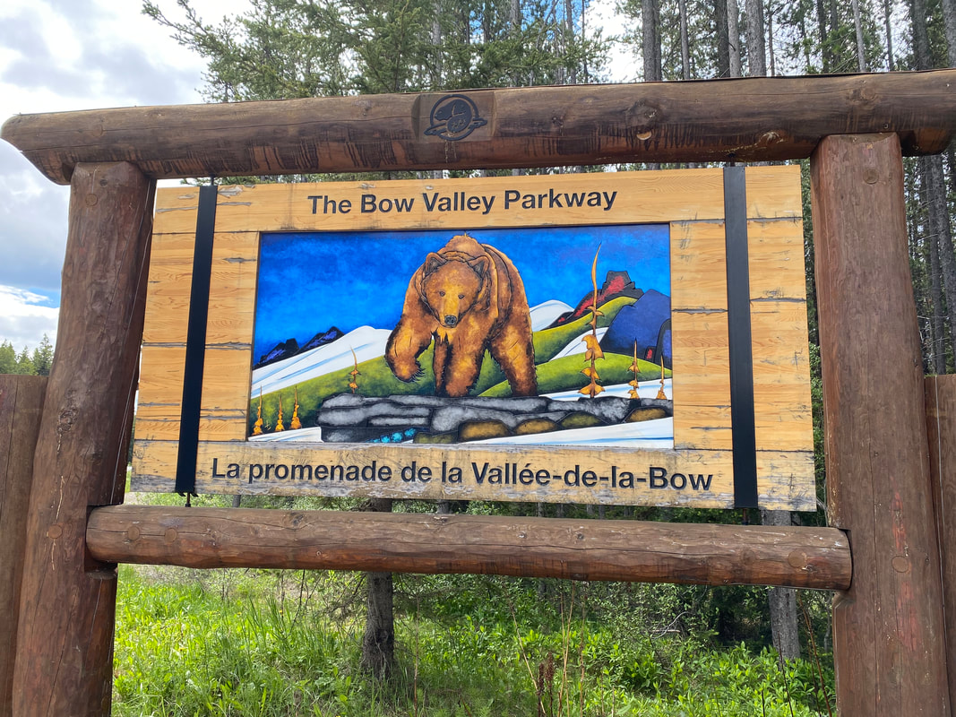
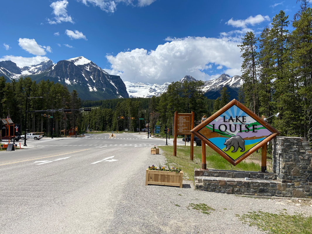
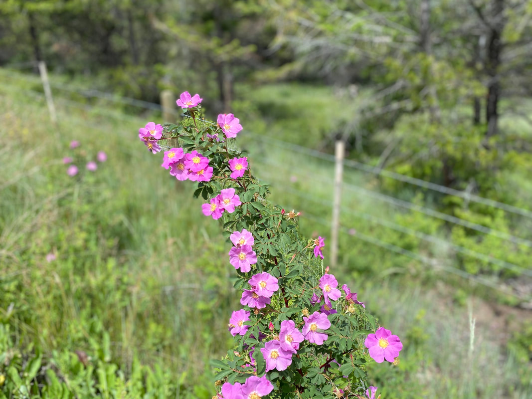
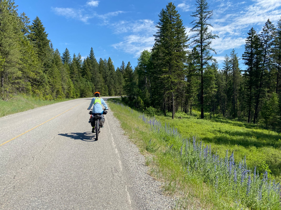
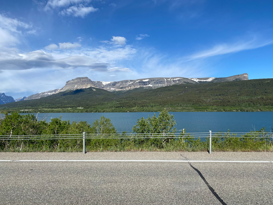
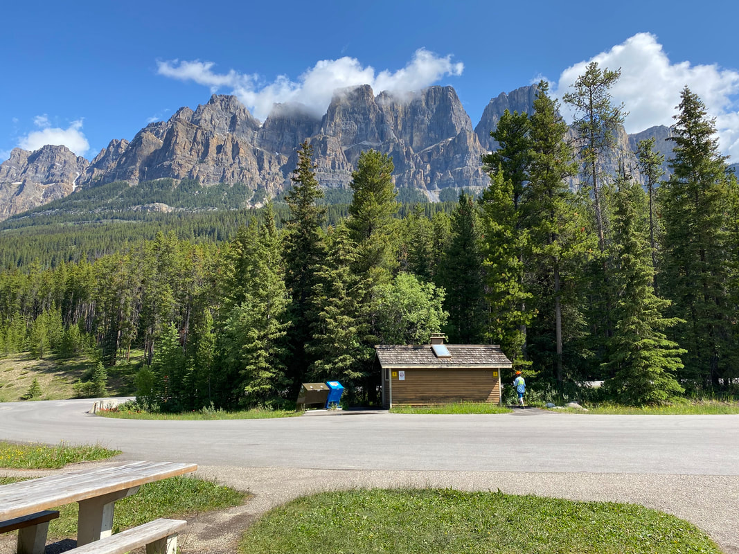
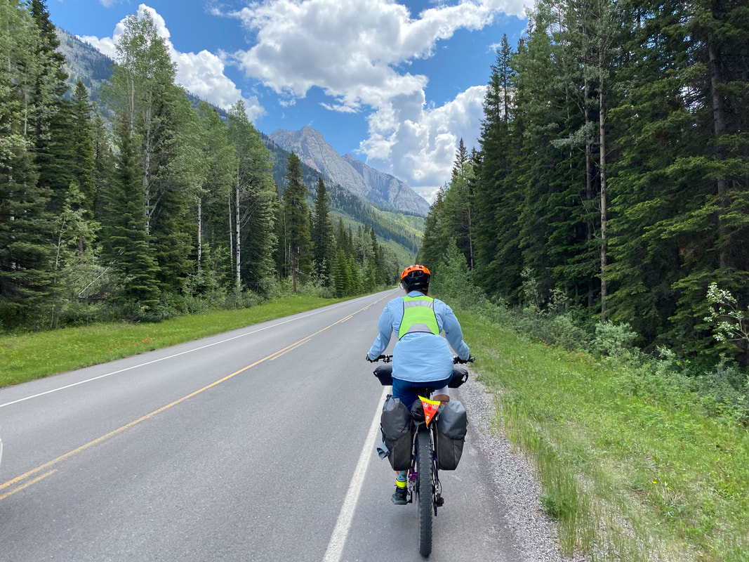
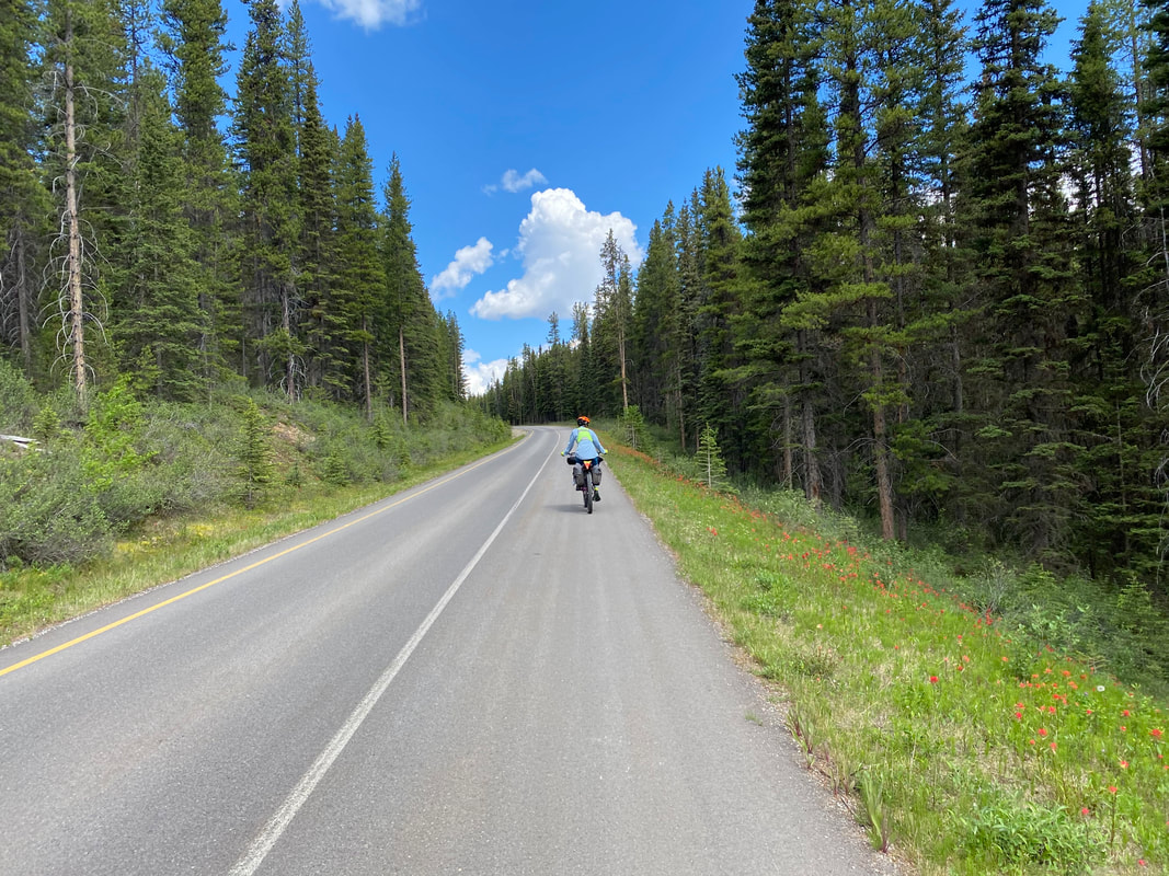
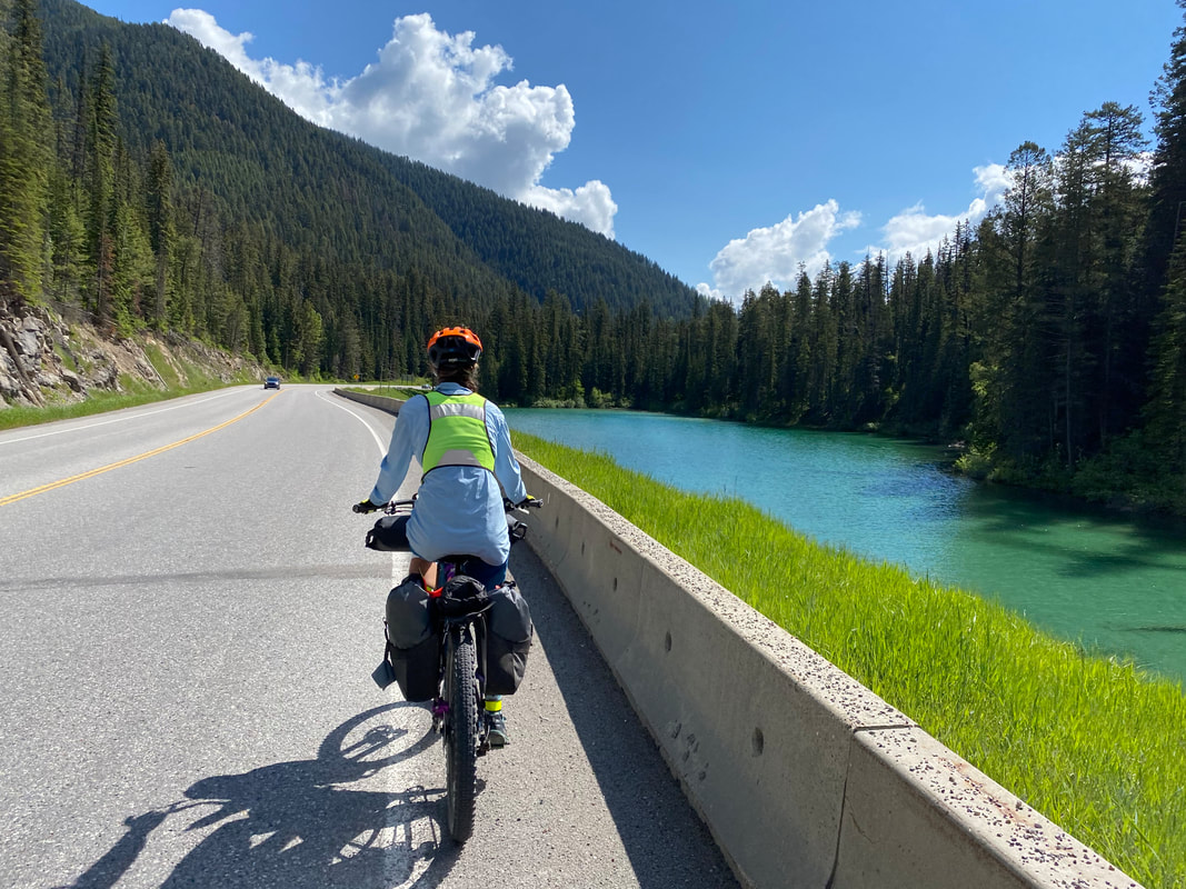
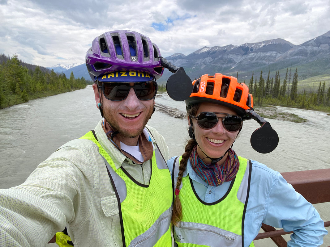
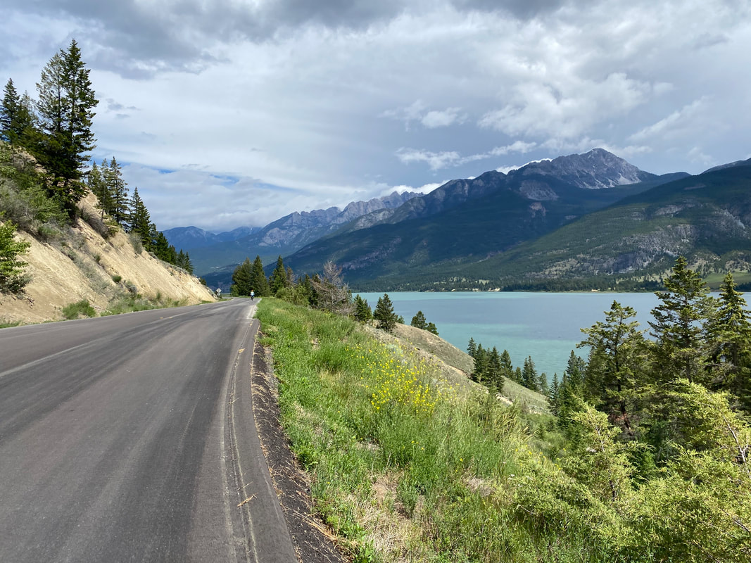
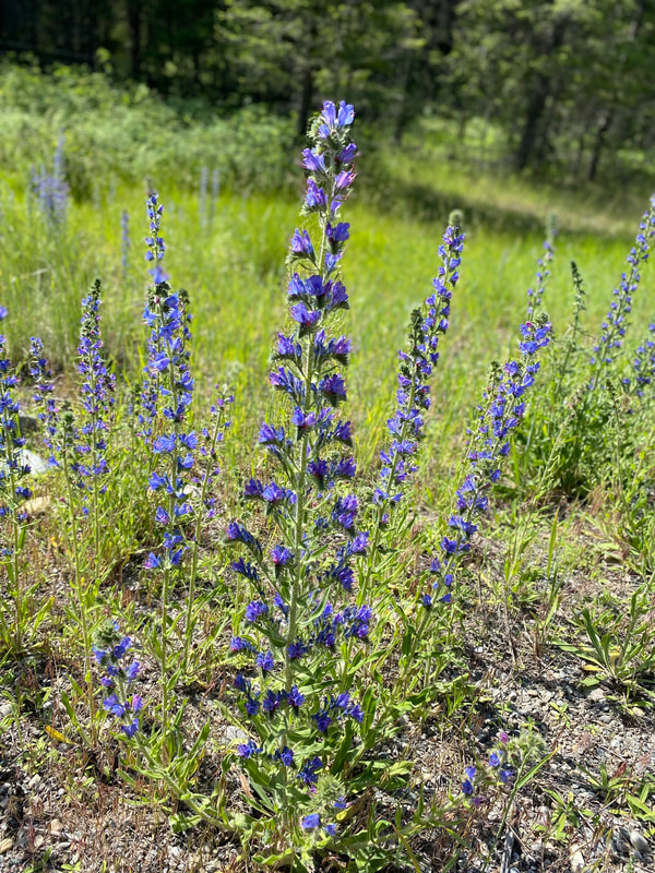
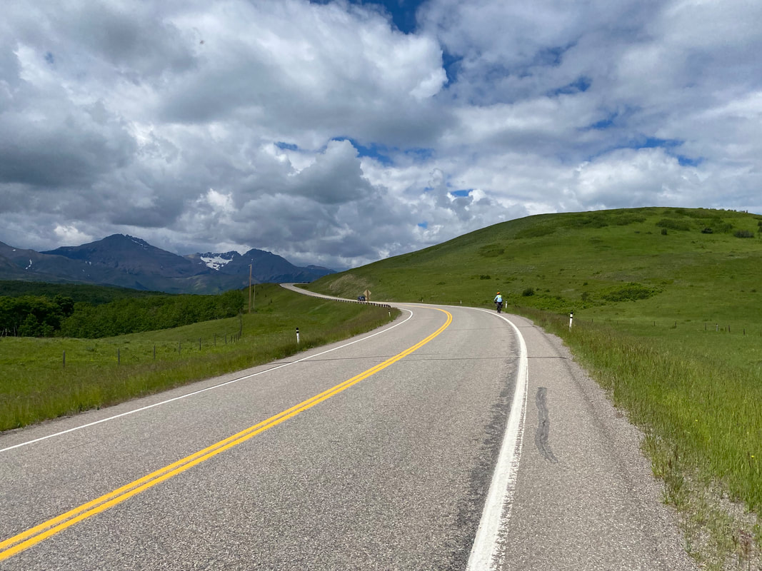
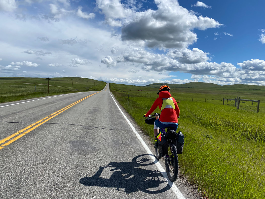
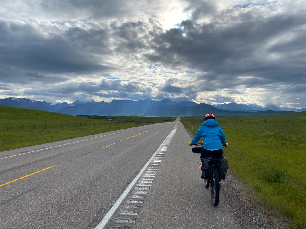
 Janna and I jet down a descent and cross over the Bow River to join the epically beautiful Bow Valley Parkway. The Parkway is a lesser-driven road but chock full of cyclists. Most are gravel and road riders out for holiday spins; we're the only long-distance travelers we meet. The Parkways spills between the Bow River and adjoining Rockies leading to gorgeous vistas of the snowmelt-swollen valley. We pass by a monument/memorial to the Castle Mountain Internment Camp; this was Canada's version of ethnocentric-Ukrainian internment during World War I. Miles and miles of richly fresh-with-new-growth, woodlands shot up around us. Wildlife was abundant, the peaks were momentous, and the continuing views of the Bow River made me stop every chance I got. Wildflowers sprouted from the ground densely along the shoulder. And with that, we exited the Bow Valley Parkway and descended down to Lake Louise. We ran into a German bike-tourist who was stressed about not having camping reservations for that night so we invited him to join us. The three of us biked down to Lake Louise Campground, which featured an insane line, comparable to the Grand Canyon, in order to get in; I felt super grateful we had made reservations ahead of time as there was absolutely no place to book in the area on Canada Day. The campground itself was completely surrounded by a high-wired electric fence to keep bears out. Even the cattle guards across the road at the fence-line were electrified. Again, Jurassic Park. Our fellow cyclist headed out to bike up to Moraine Lake. Janna and I were both suffering heavily from her Achilles and my patellar tendonitis. We thus decided to grab tickets on the bus to the actual Lake Louise. And it was insanely packed with people. Honestly, it felt like I was standing outside a ride at Disney World - just to get up to the shore of the lake. It was a pretty lake and the opposing views of glaciers tumbling down into it were breathtaking. But the density of people made it nearly impossible to view it without being jostled back towards the parking lot. We snapped a quick photo and agreed that we enjoyed the Bow River and its namesake river more from earlier in the day. 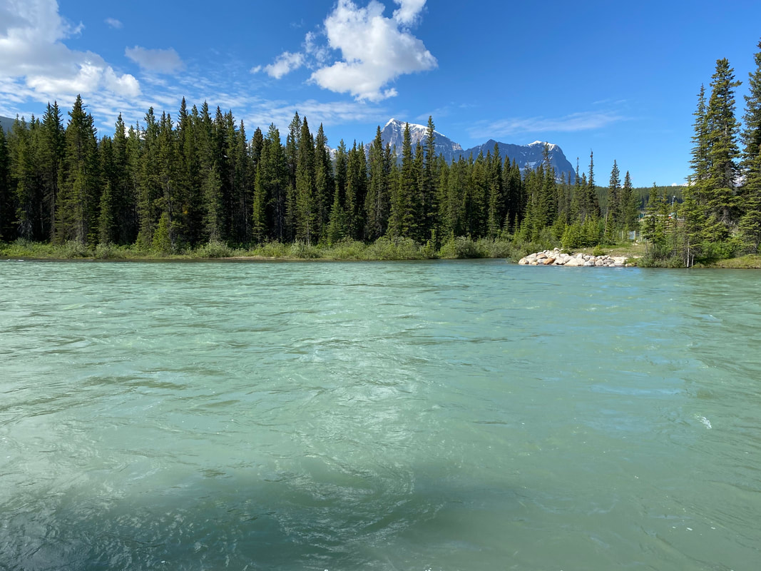 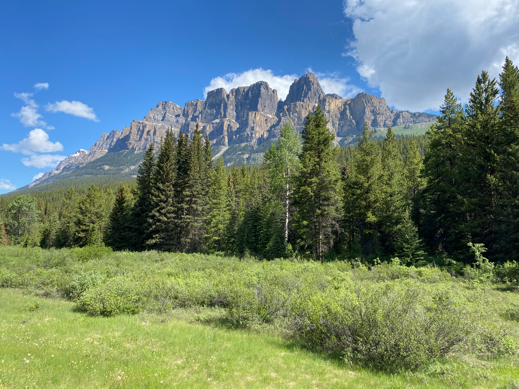
And we made a hard decision. Both our tendons were flared, biting, piercing, and burning. Despite our desire to continue, we had been down the road of overuse injuries and pushing our bodies when we shouldn't too many times before. Better to heal a short-term injury then a long-term. In addition, a weather system was moving in that would storm on the area for the next 7 days or so - obscuring all the views we definitely wanted to see. Janna and I decided to call the trip over and start putting together an itinerary to get back to our car in Montana. We caught the bus back down to the campground from Lake Louise, ate some food at the local café, let our new cyclist friend know we were bowing out, and then just enjoyed the evening in the pines. The campground was raucous with revelers on holiday, but we had a nice corner to ourselves. The sun dipped, so we scuttled in to sleep and prepare for our last day's riding tomorrow. 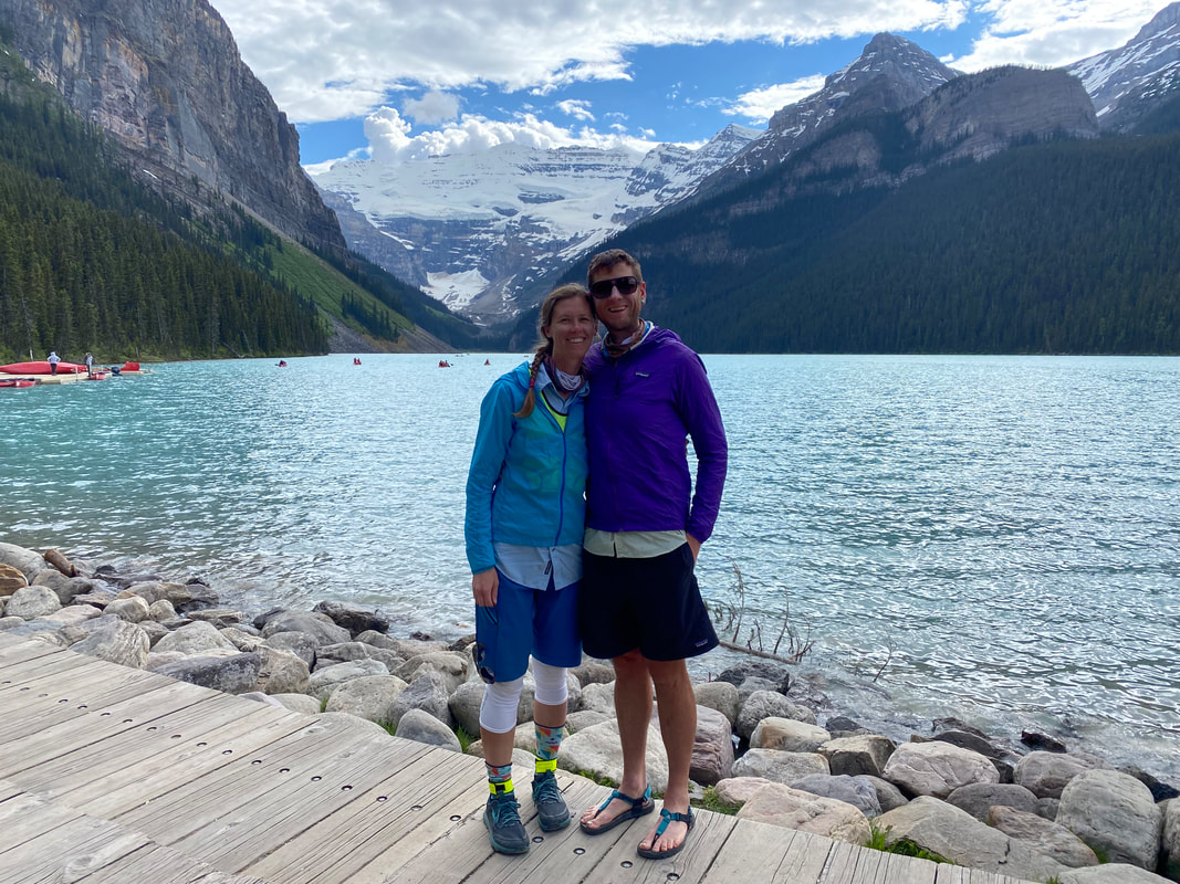 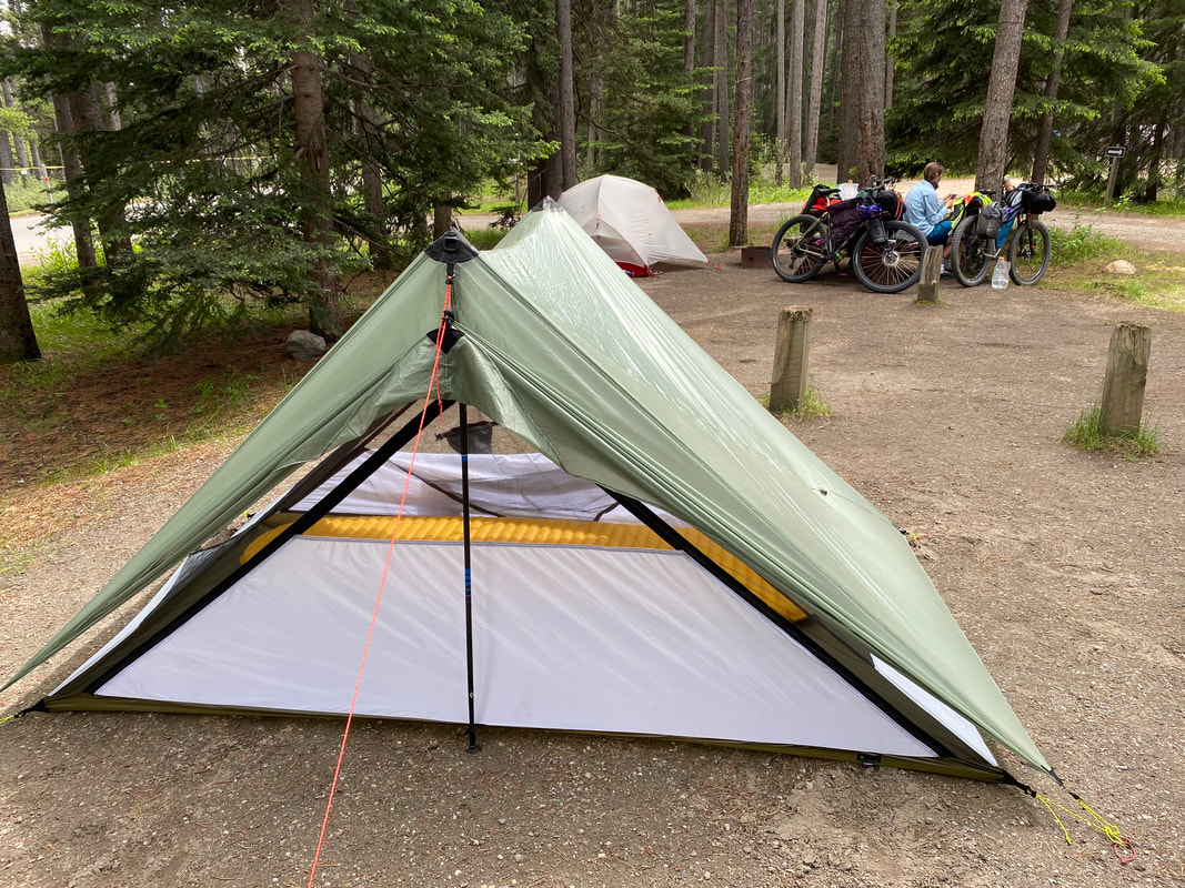
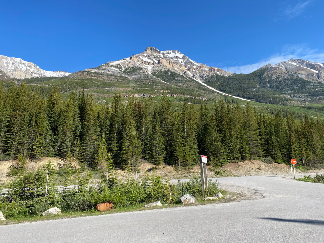
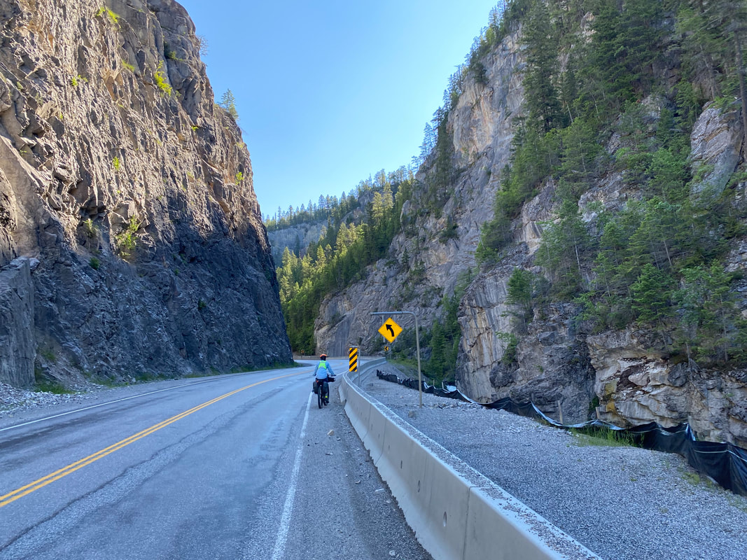
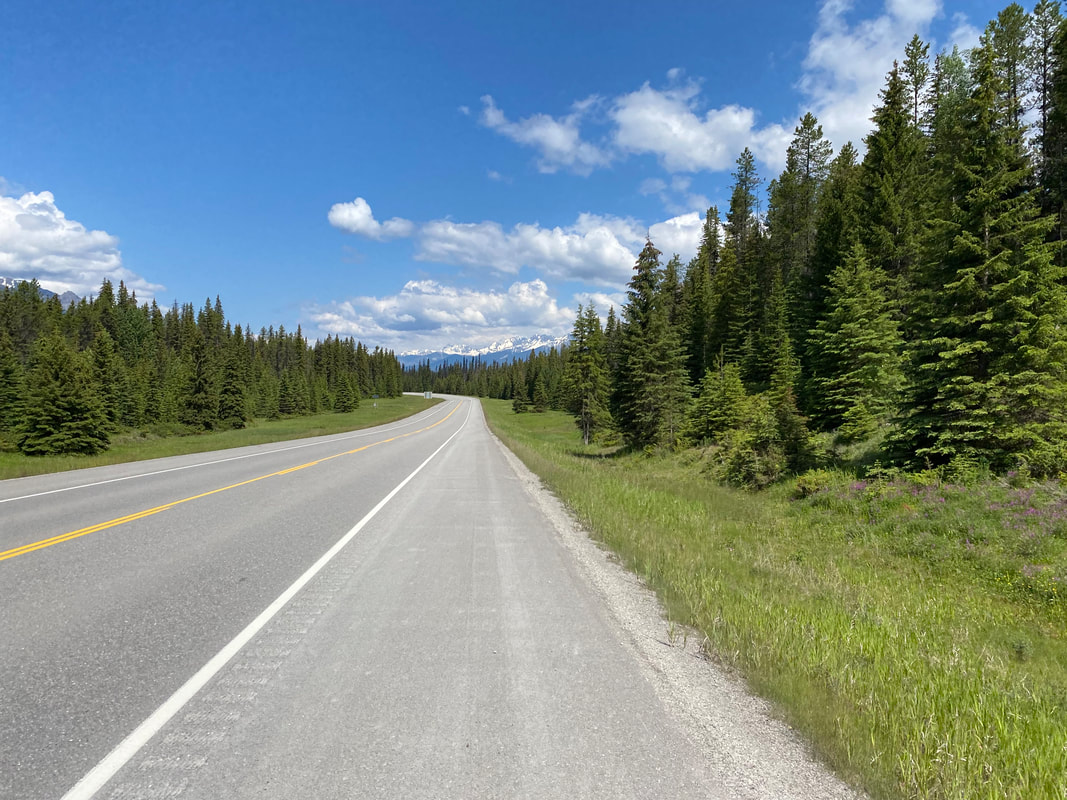
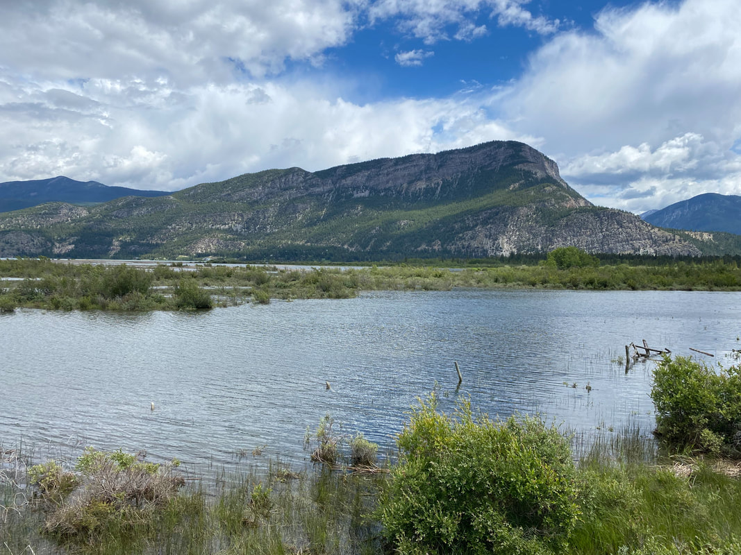
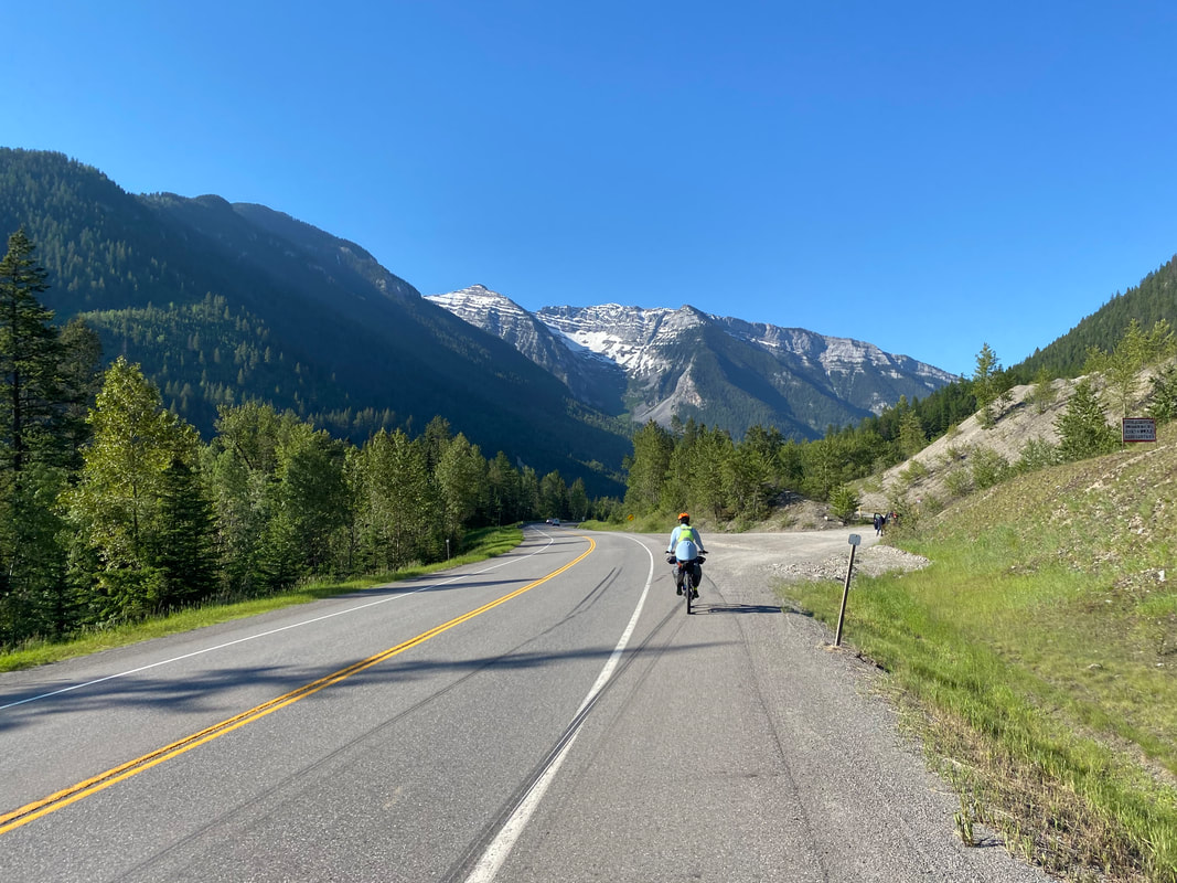
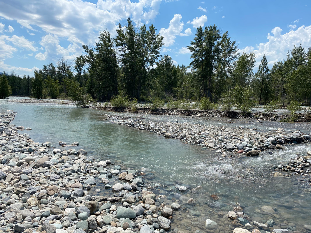
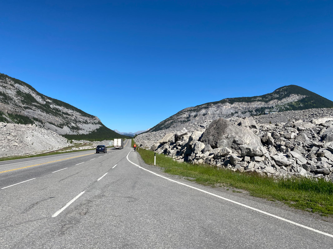
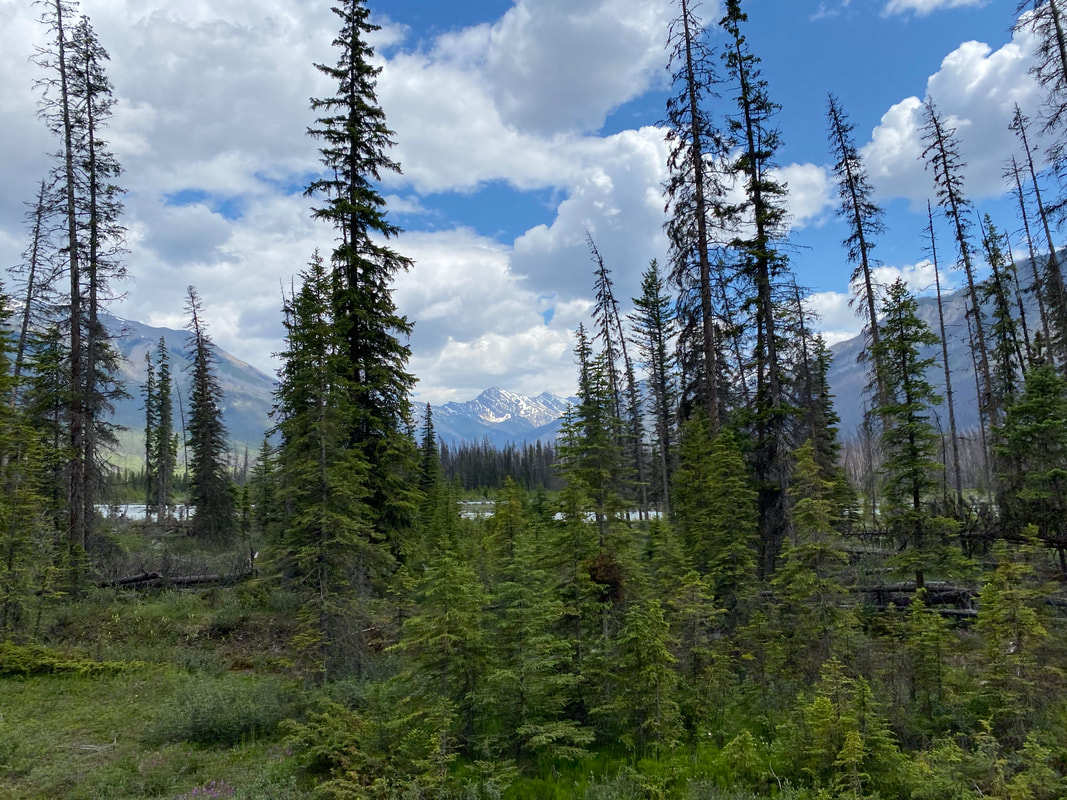
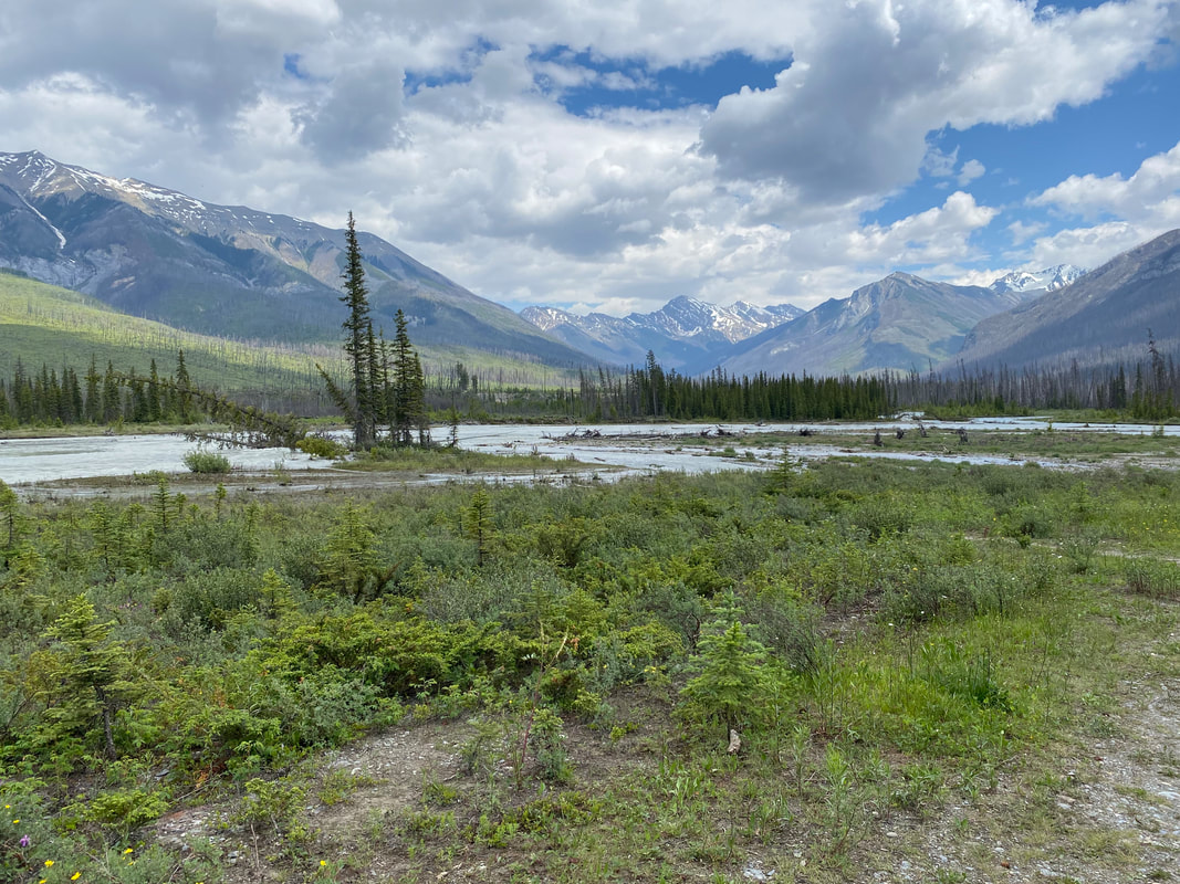
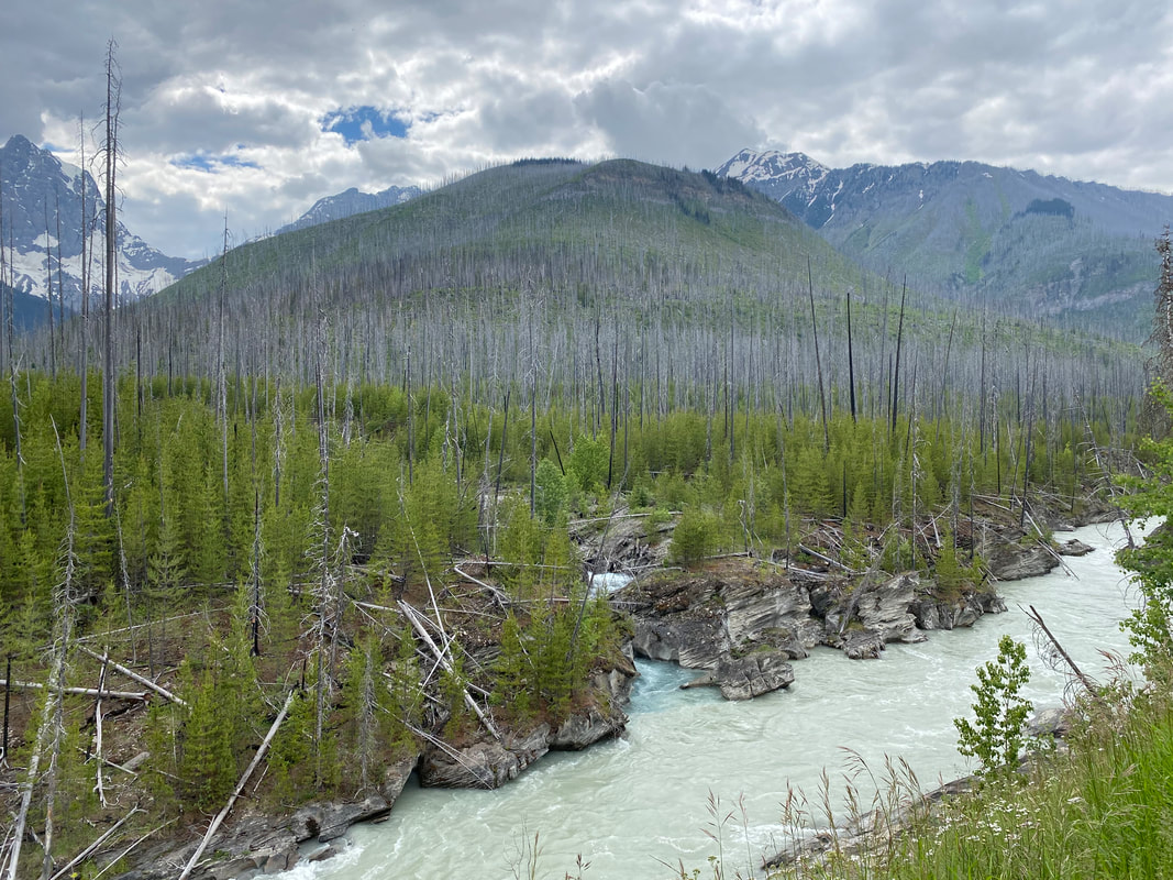
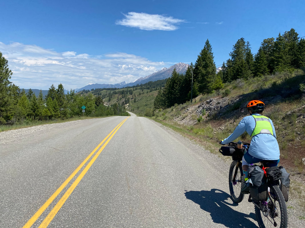
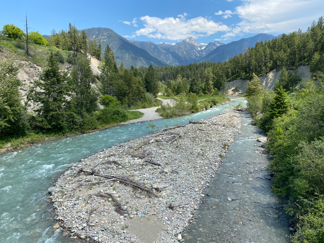
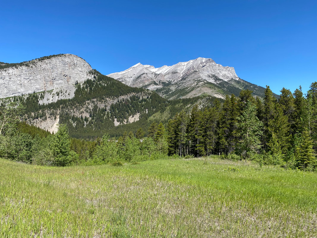
58.52 Miles; Redstreak Campground to Marble Campground in Kootenay National Park, BC  We slept in late to relish a shorter day today. In fact, after rousing, we rode down to Radium Hot Springs. Some people passing through the campground the night before informed us that there was no good food nor resupply worthy. They were absolutely wrong. We went to the Bighorn Café in town where I ordered a breakfast veggie potpie and a vegan curry pasty. Janna got her own fixings which we sat back and enjoyed on a sunny morning. Food consumed, we headed north of town towards the official entrance to Kootenay National Park. Our goal for the day was to bike across most of the park and stay at a primitive frontcountry campground. Kootenay National Park would prove to be one of the incredible highlights of this trip, and a place I would bike through again with anticipation. I knew little about the place, and it seemed most tourists were content with passing through in vehicles on their way to Banff. However, this National Park boasted the swollen Kootenay River pulsing with CFS far greater than it should be this time of year due to the early summer snow storms. Huge glaciated valleys framed by rocky peaks. Massive waterfalls, dense megafauna, striated river seams, and glacial headwaters. I freaking loved it. Immediately, Janna and I started up the main climb; a long sustained grade with copious signs warning of hazards: Avalanches, Rock Slides, Bears, and No Cellular Service for the Next 105 km. The canyon we were entering narrowed up as careening waterfalls eroded the side of the highway. We climbed past the facility built around the namesake Radium Hot Springs and past the sign warning of no cell service. Immediately, the highway was buoyed on both sides by repeat signs every mile or so indicating EXTREMELY HIGH and DANGEROUS BEAR ACTIVITY. All drivers must not stop nor leave their vehicles for any reason for the safety of the human occupants. I exaggerate not because these signs were posted everywhere. There were even signs that would be lit up saying very active bears were in the area and to not stop the car for any reason. This, of course, was juxtaposed with us who were plainly on bikes with no large glass or metal shields around us, unlike our motorized road-partners. At first I thought the signs were there to keep people moving in their cars (to prevent wildlife traffic jams), but the amount of raw food along the shoulder (McDonalds, wrappers, candy bars, french fries, etc.) made me wonder whether the bears were food/people aggressive because of the amount of conditioning occurring from people LITERALLY THROWING THEIR FOOD out the windows. We kept passing piles of fast food flung from cars and smeared all over the shoulders - which we had to bike through. The bears would be active indeed. Likewise, as we rode, there were massive piles of Grizzly and Black Bear scat all over the place. Any section of the road seemed to have gigantic piles of bear feces and large tear-aways from bears digging. Janna and I began loudly bear calling lest be turn a corner and run into some unintentionally. Near the top of the climb, a large teal and emerald lake sat next to the road. It was gorgeous to look at but completely closed due to the bear activity. Again, signs mustered people onward for their safety. 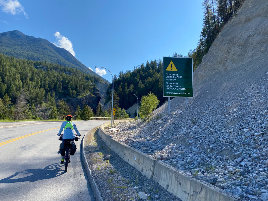 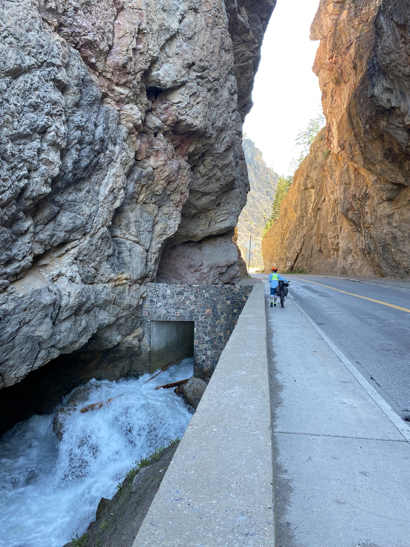 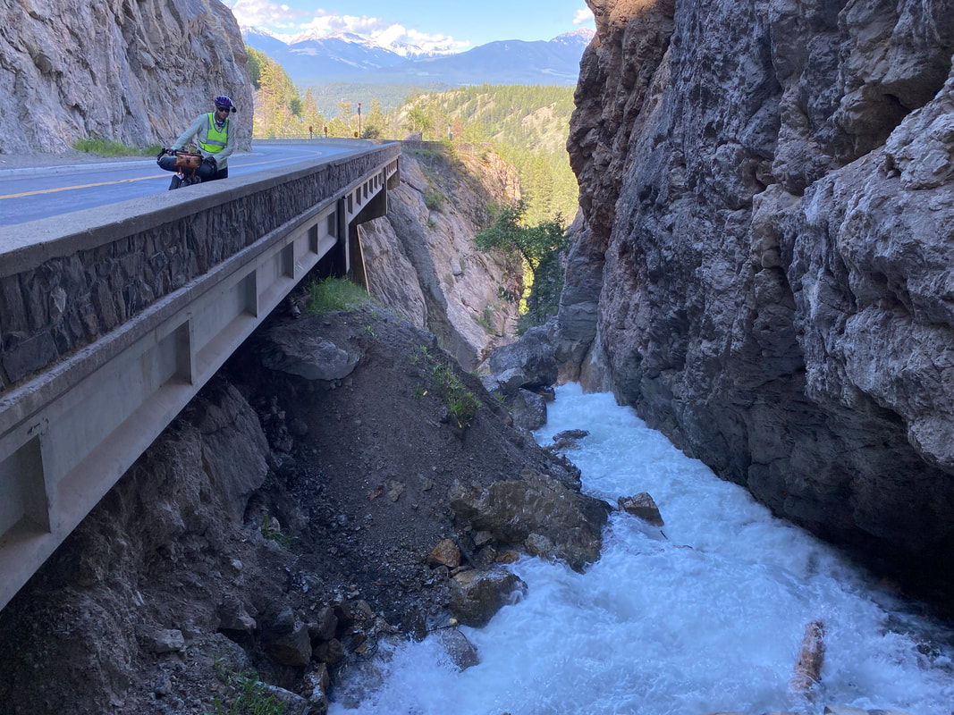
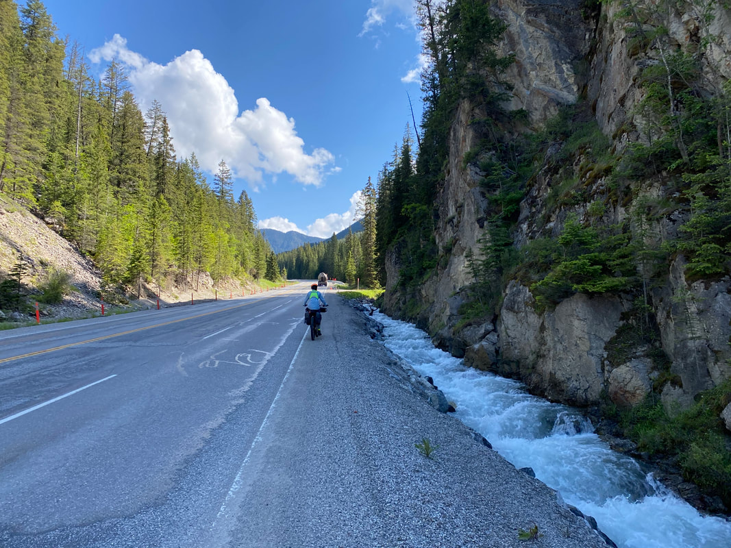   
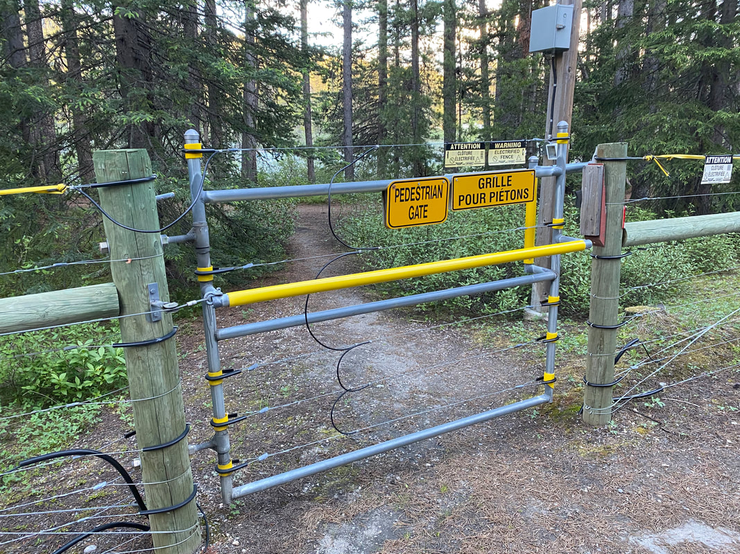
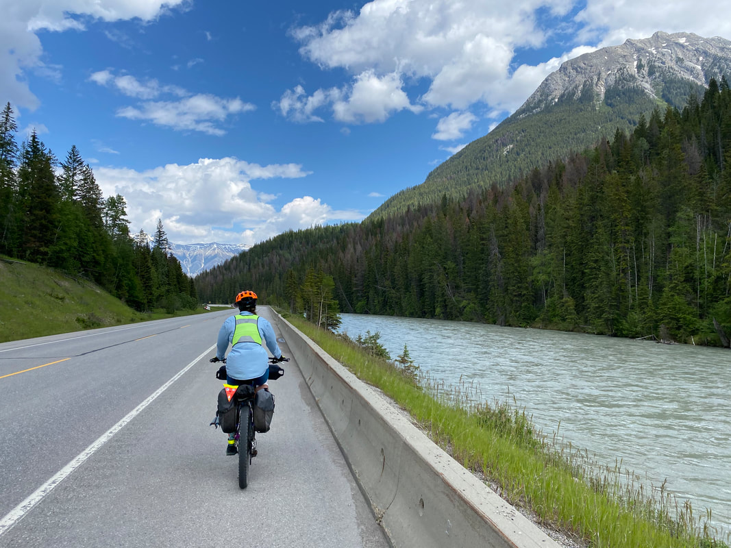
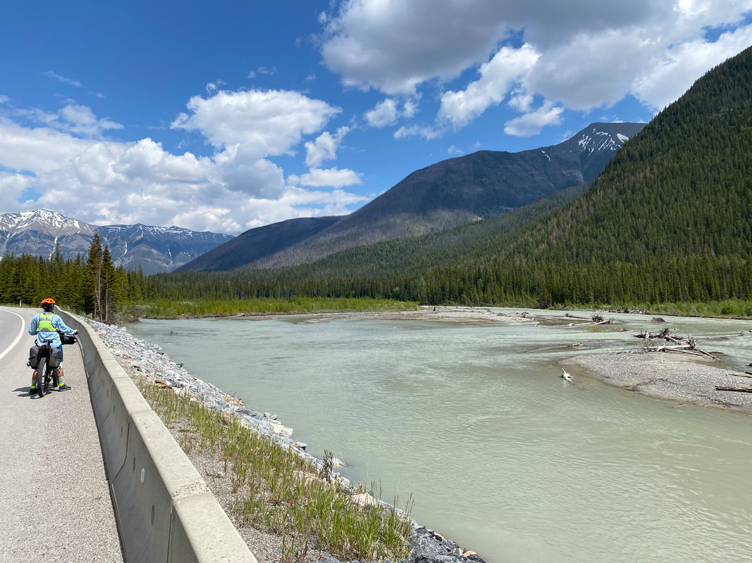
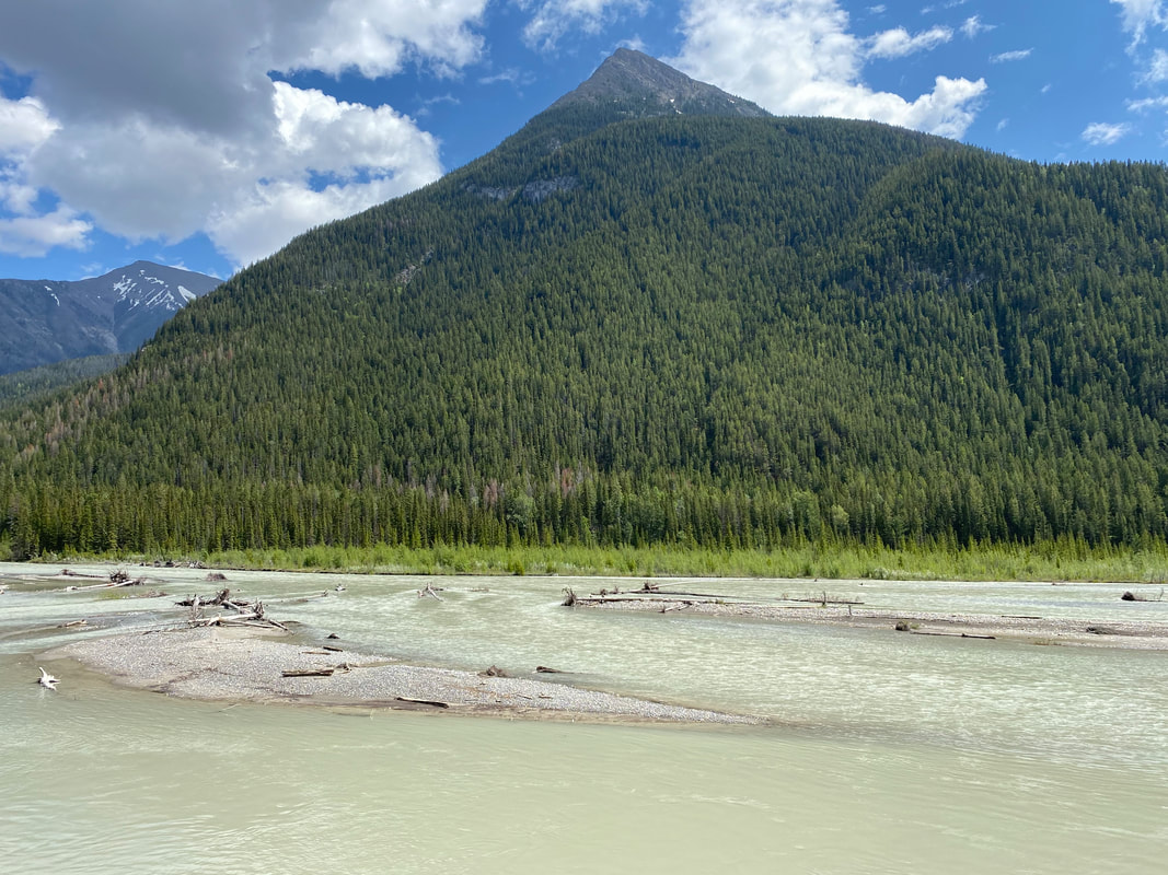
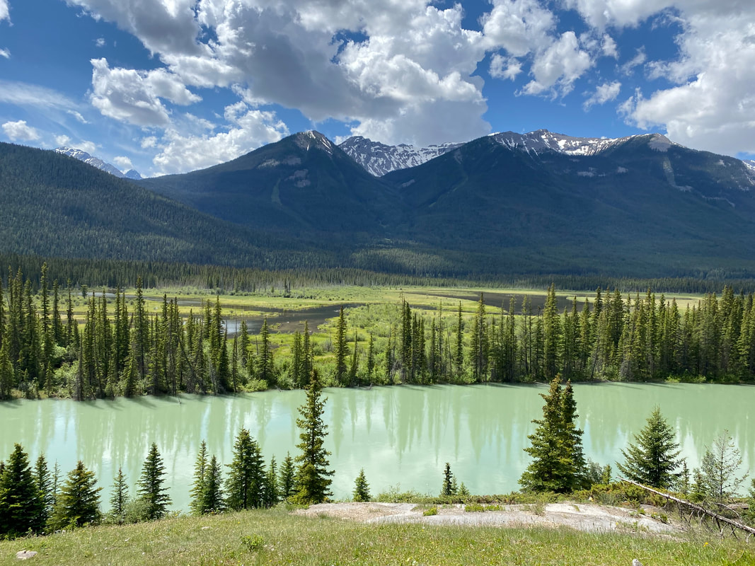
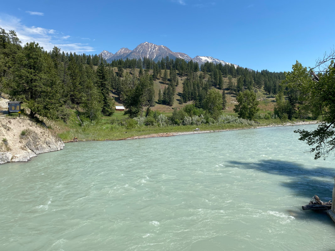
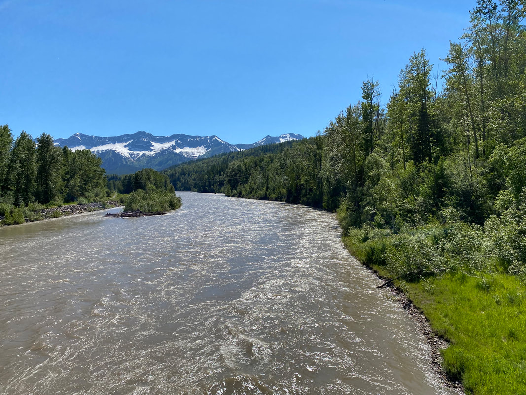
We came to a pullout where several cars were pulled over despite the numerous signs indicated the pullout was closed for passenger safety from bears. We pulled over as well and ate some food, taking in a massive view of the Kootenay River Valley below. Then, it was a fast-paced downhill off the saddle and into the aforementioned river-carved plain. At the bottom, we joined the Banff Wilderness Parkway and spun our ways north past signs indicating it was safe to hike but to be bear aware. The slate gray-green flow of the Kootenay River caught my attention so we biked over to a spur dirt road where rafters put in. We ended talking to some rafters for quite some time. The dads were putting in for a multi-day journey with their daughters during what they said was peak seasonal flow from all the late-winter storms. I loved watching the Kootenay move past, absolutely surging with glacial sediment. Janna and I stood along the banks before rejoining the highway while the Kootenay kept as our eastward passenger. This pattern of adjoining-river-riding would comprise the rest of the day - and I loved it. A fence rose up quickly to parallel the highway on both sides - boxing us in from the river and forest on either flank. And it was electrified. Janna and I were both bewildered by it, and kept commenting that we felt like we were in Jurassic Park. I later learned it was constructed to keep the wildlife all the highways, and consequently bears and people alive from prevented accidents. We stopped for lunch at a covered pavilion located inside the fence before moving on down the roads towards increasing varied peaks. 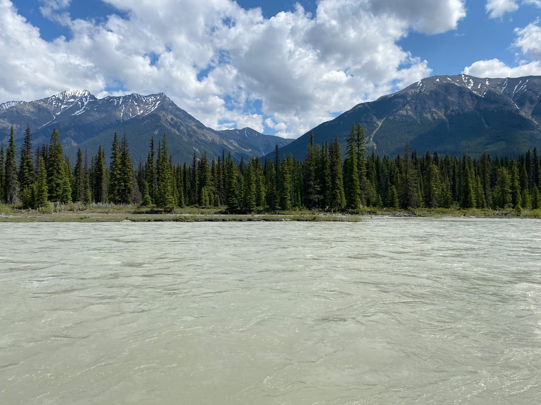 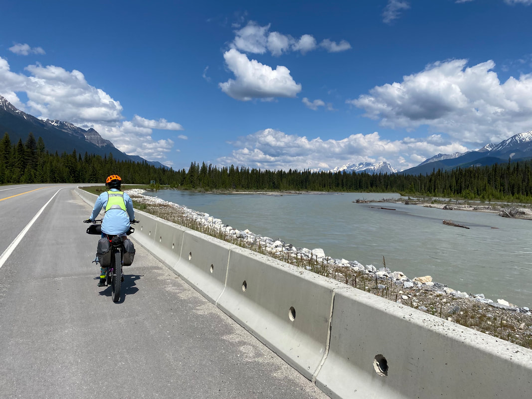  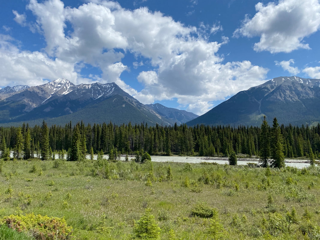 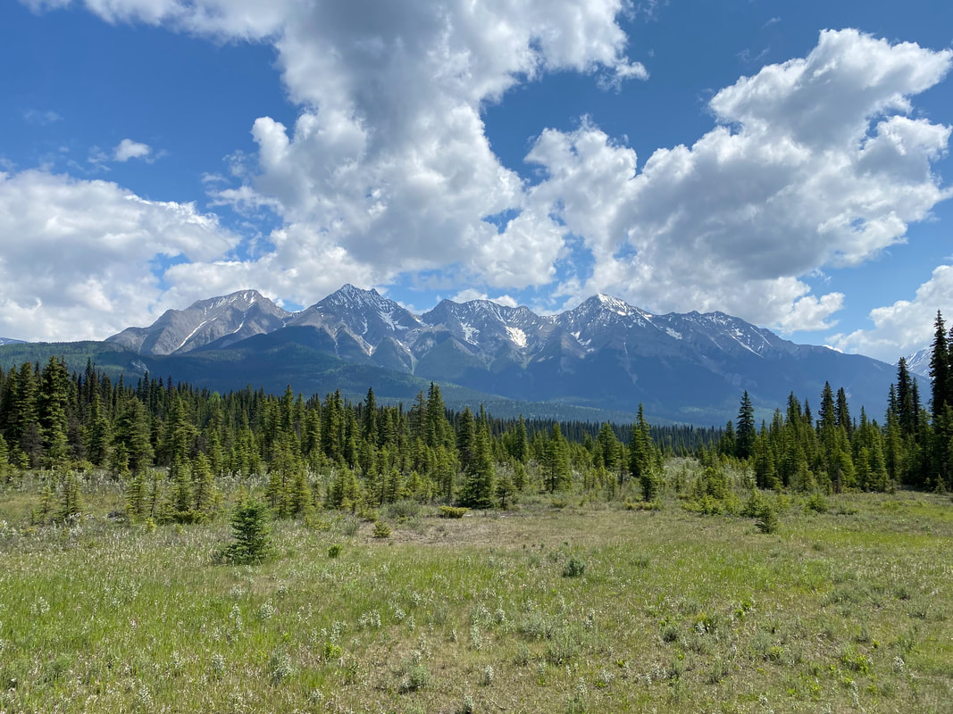
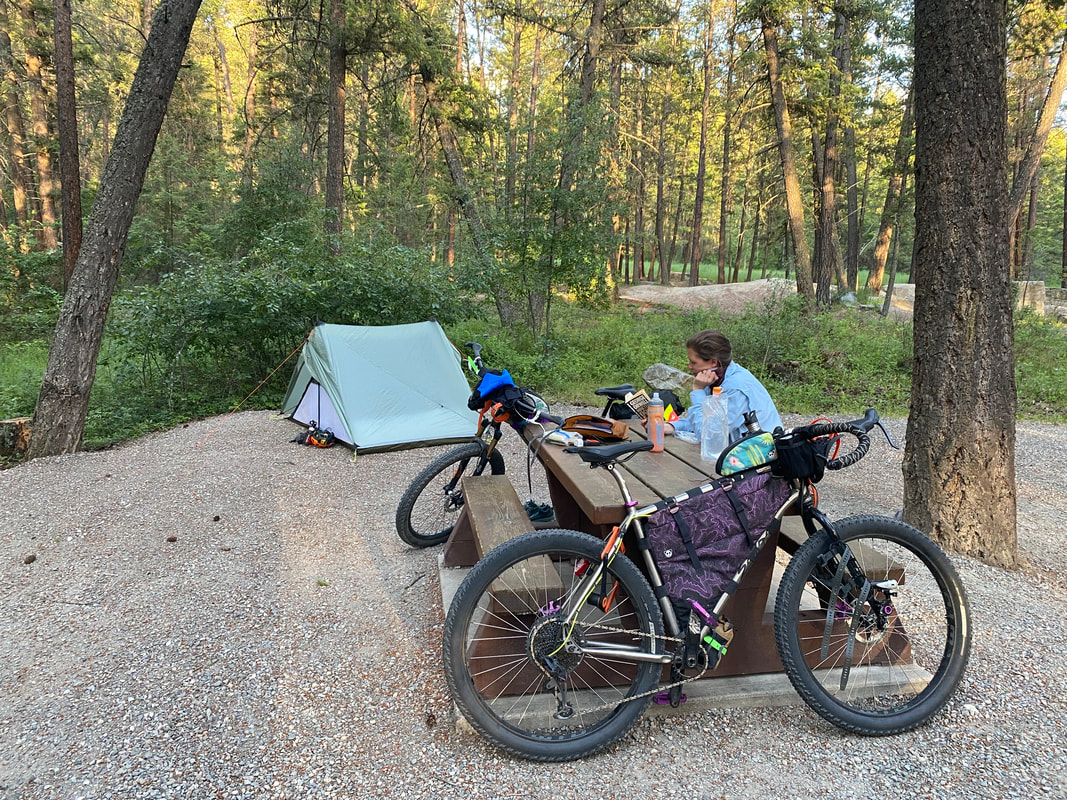
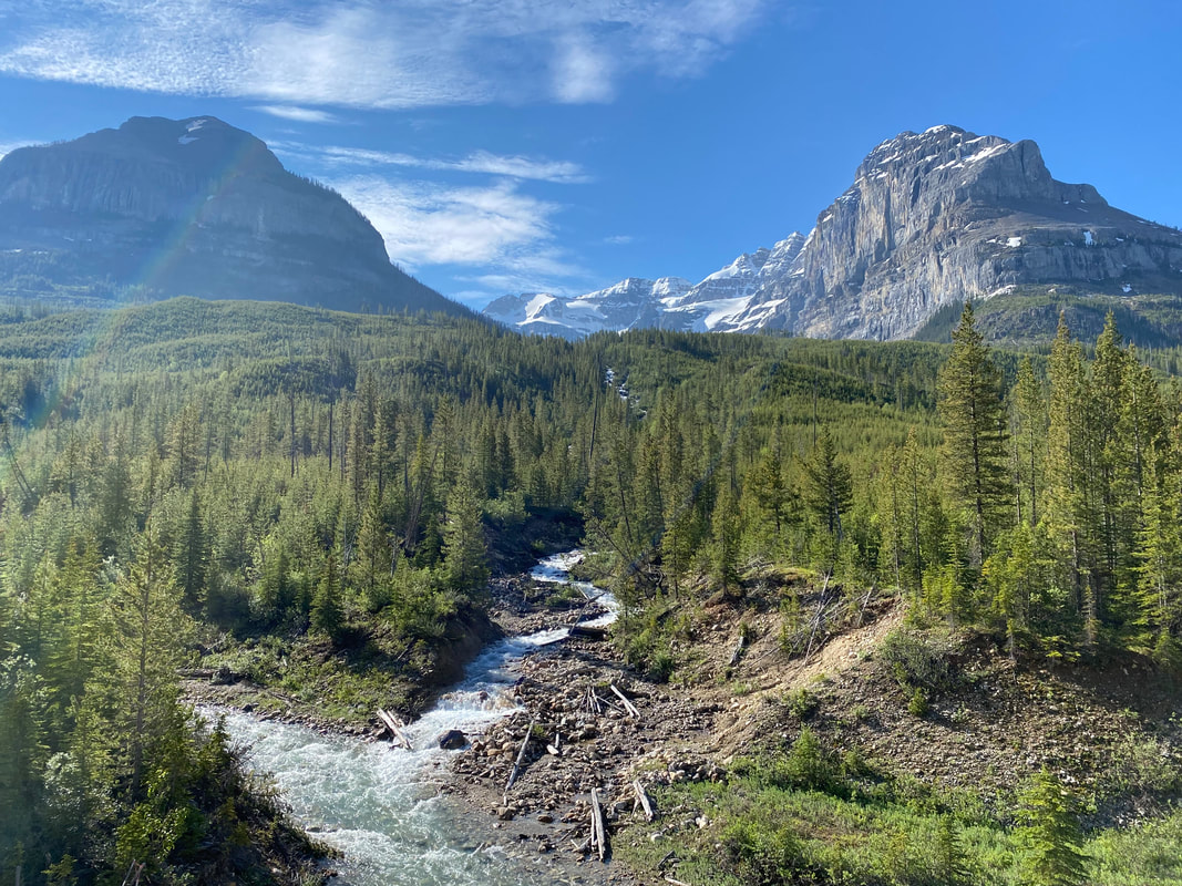
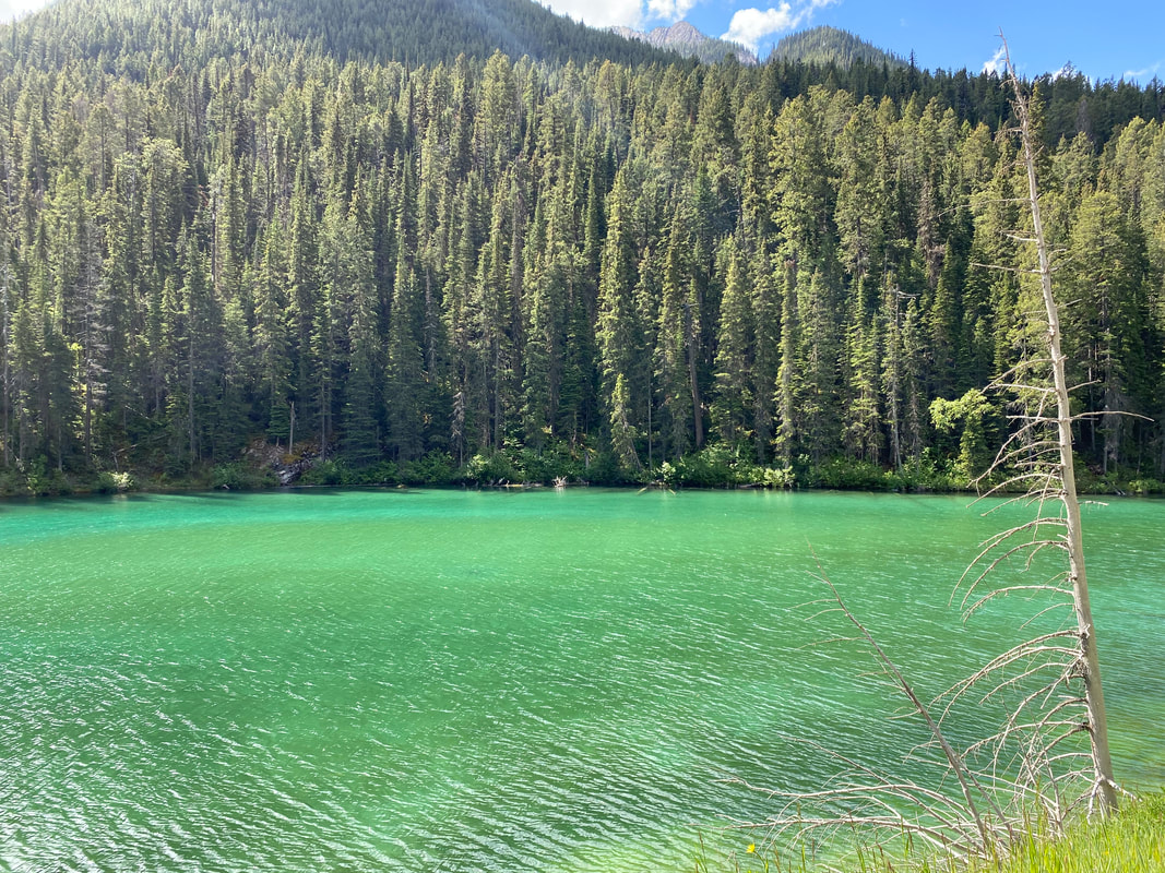
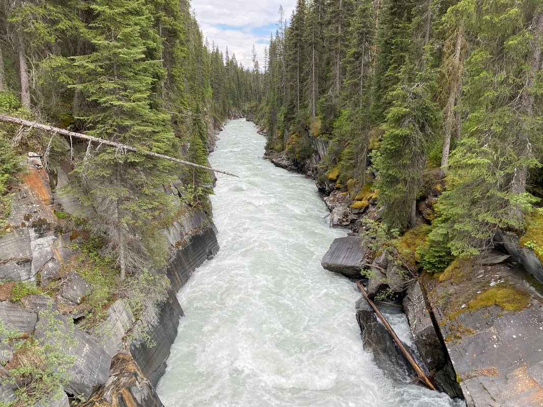
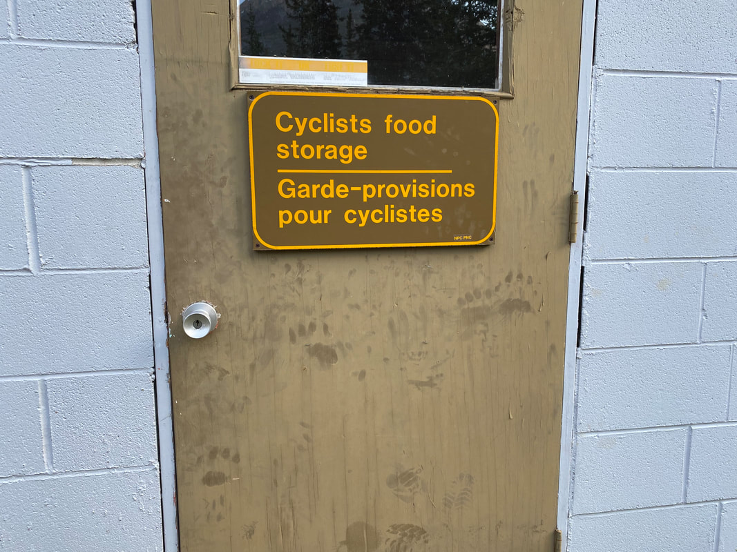
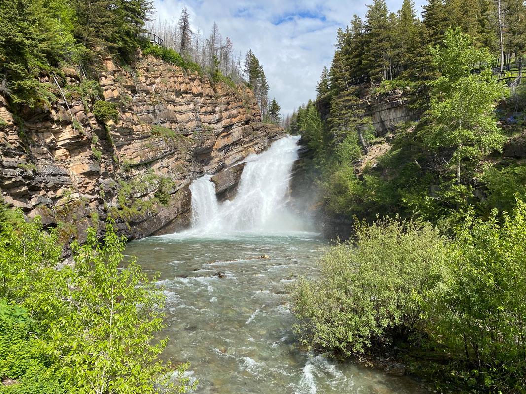
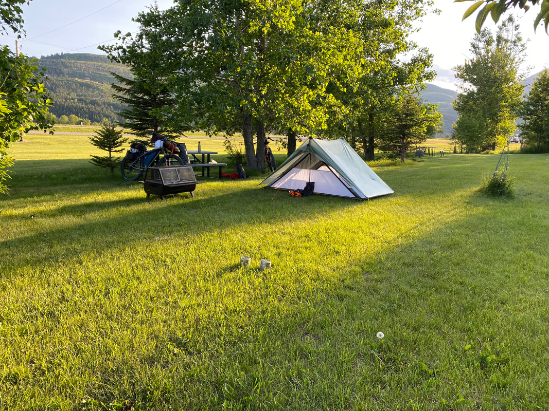
 Suddenly, we came to aptly named "Goat Crossing" where some 30 or more mountain goats were feeding and galloping right next to the opposing highway shoulder. Traffic was stopped in both directions requiring us to navigate carefully around the vehicles. After watching the mountains goats for some time, we pushed as the Vermillion River (a tributary of the Kootenay) drew close. Janna and I kept pulling over to wander out along its banks and walk back some trails to see its spread amongst the conifers and heightened clouds. We stopped and walked down a trail to check out a narrow gorge carved by the Vermillion suddenly funneled through narrow, dense rock. As the day wore on, we finally arrived at Marble Campground, which proved to be greatly primitive for a frontcountry site. It seems everyone tries to stay in developed Banff or Lake Louise some 40 miles away, leaving this site relatively open and arguably undeveloped for such a rugged area. We had reservations and made our way to our site where another couple was already occupying it. They refused to leave the site (even them with a car and us on bikes). No host on hand meant we had to find another site, which we luckily did. We asked around about storing our food in this dense bear area and were pointed to a shed labeled "Cyclists food storage." Most notable of all was the number of claw-scrapes and bear paw prints plainly all over the door. We stuffed our food inside and were grateful to be sleeping away from the shed in a site with not much disturbance. As late evening light faded, I noted again that my knee seemed even more aggravated than the day before. In fact, it felt like a roaring reminder of patellar tendonitis - the worst I had felt in years. In addition, Janna had started complaining about searing Achilles pain throughout the day. We hoped that a good night's sleep would ameliorate both. 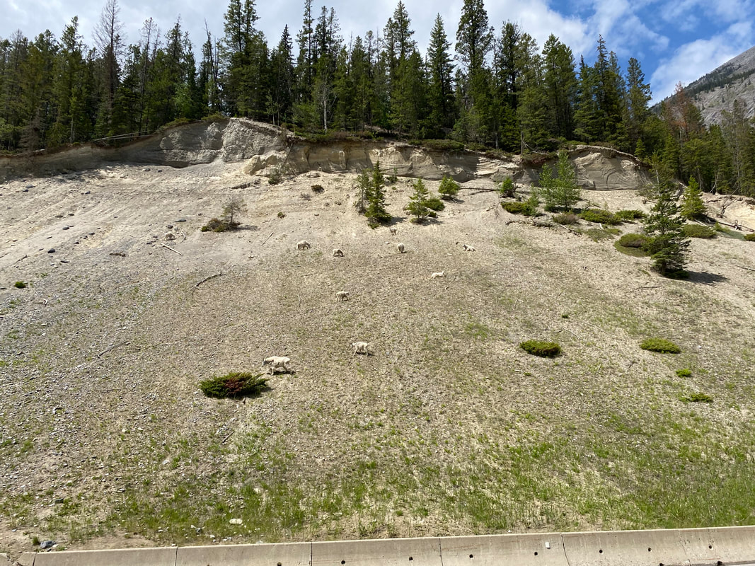 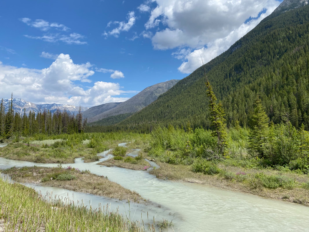
 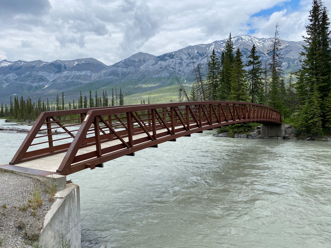   
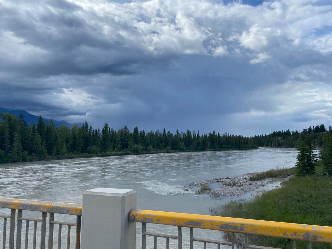
   74.16 Miles; Wasa Lake Provincial Park, BC to Redstreak Campground in Kootenay National Park, BC 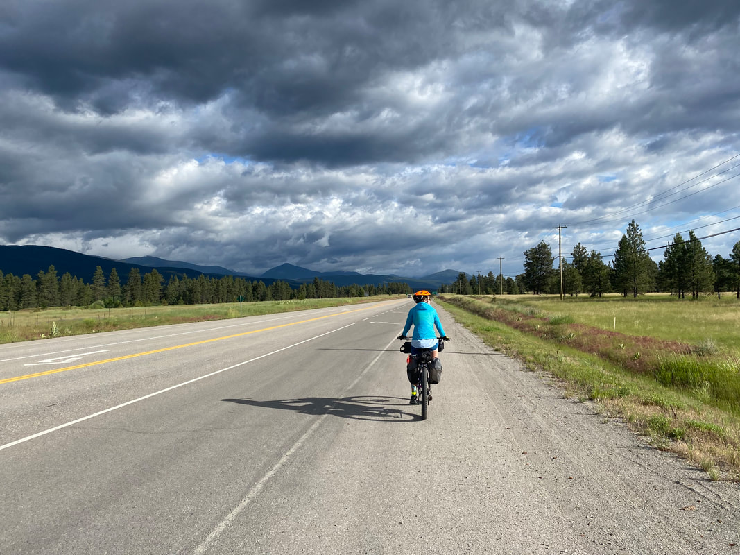 Bounded awake by another day of long riding, thunderclaps, squalls, and flashes of lightning lit up the morning dawn. We crawled out of the Eolus into resounding pitter as rain gashed the still air. Janna and I quickly packed up and jumped out onto the Kootenay-Columbia Highway that would serve as main conduit across the river-valleys today. Thick rain mats carpeted mountainsides above verdant grass meadows strewn with ponderosas in this terrain of rain shadow (but raining nonetheless). Two touring cyclists can belting down the highway the opposite way. We all stopped to talk. They were doing their own road touring version up and around the peaks of the area, albeit a very soaking one given where they came from. After goodbyes, the swollen and rushing Kootenay River slid by us as Janna and I used the Springbrook Bridge to cross it. The rain came down in earnest as we pedaled hard toward Canal Flats. We climbed higher and higher up a pass as lightning flashed overhead and resounding echo-booms rolled the hills. Then, we tumbled down towards the only general store in the area famished from the biting bold and rain. I bought loads of strawberries and sourdough bread; I ate and ate until metabolic warmth furnaced within.
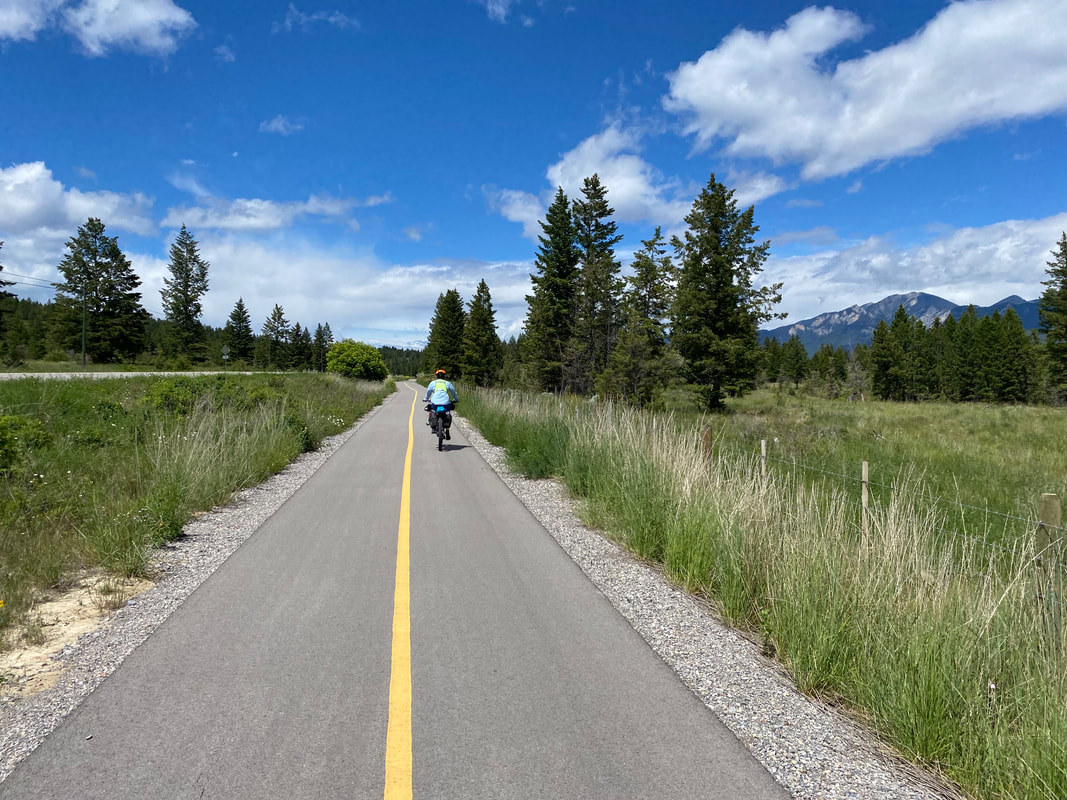
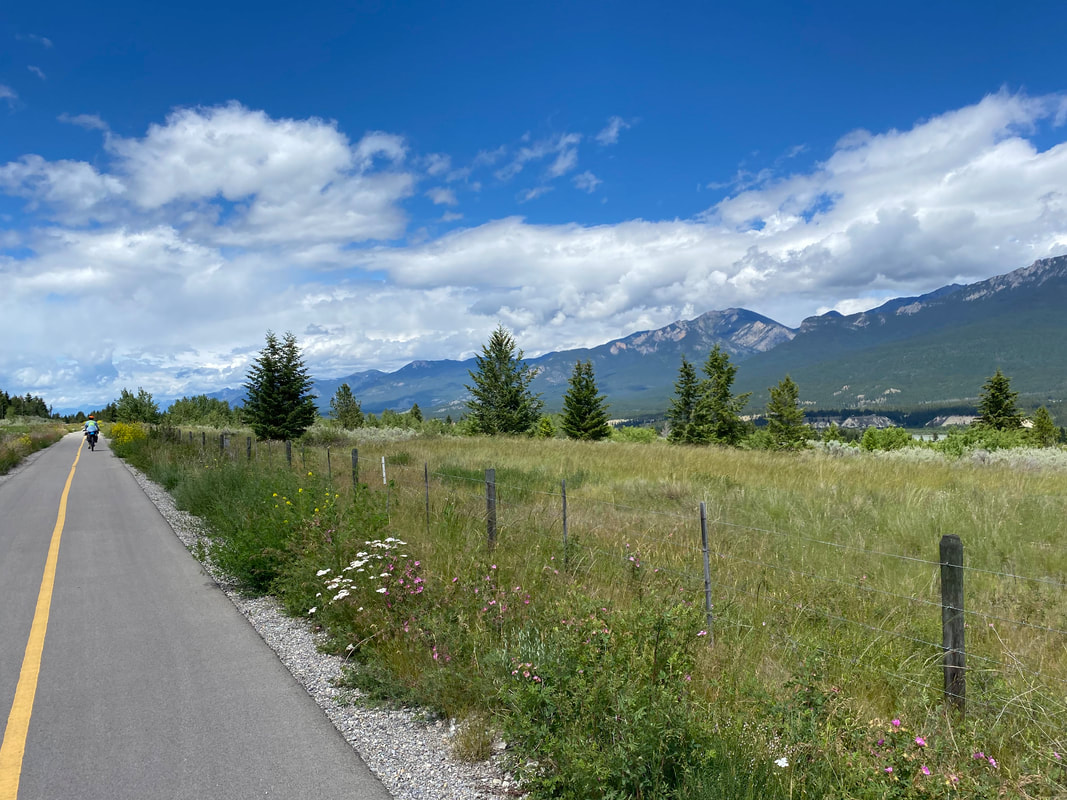
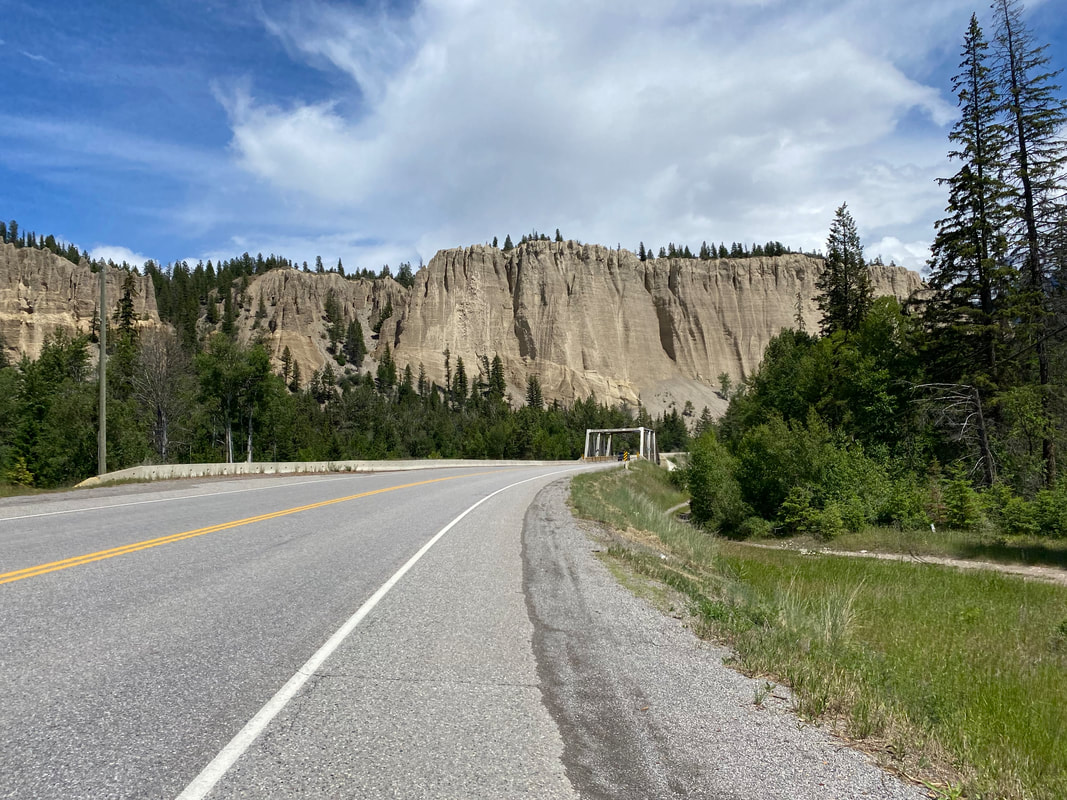
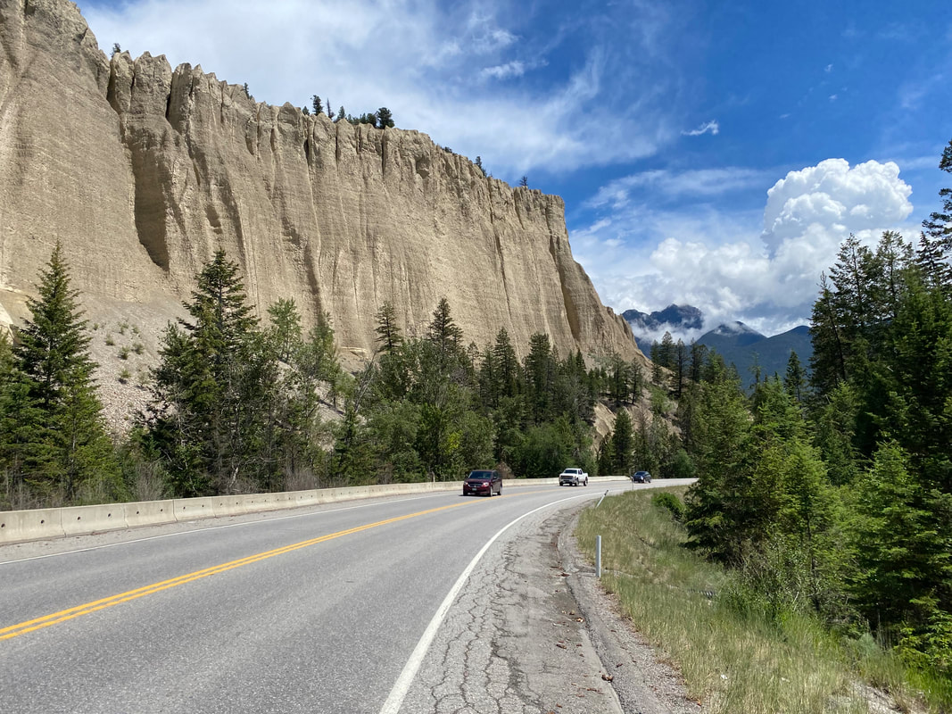
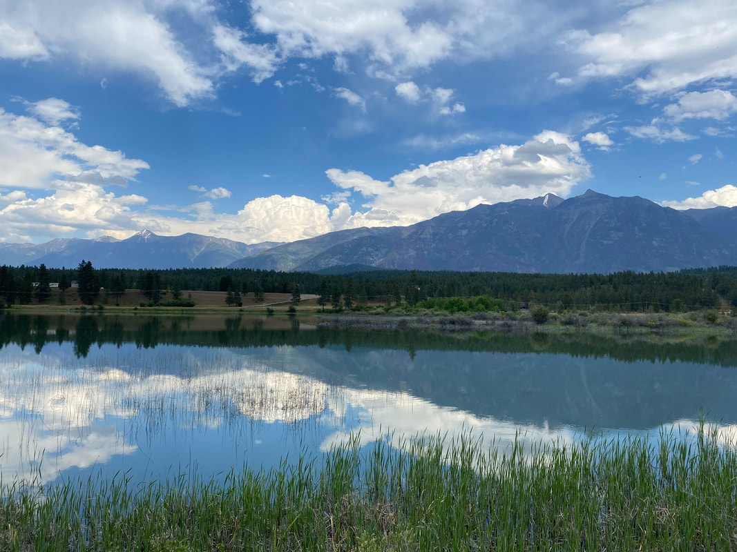
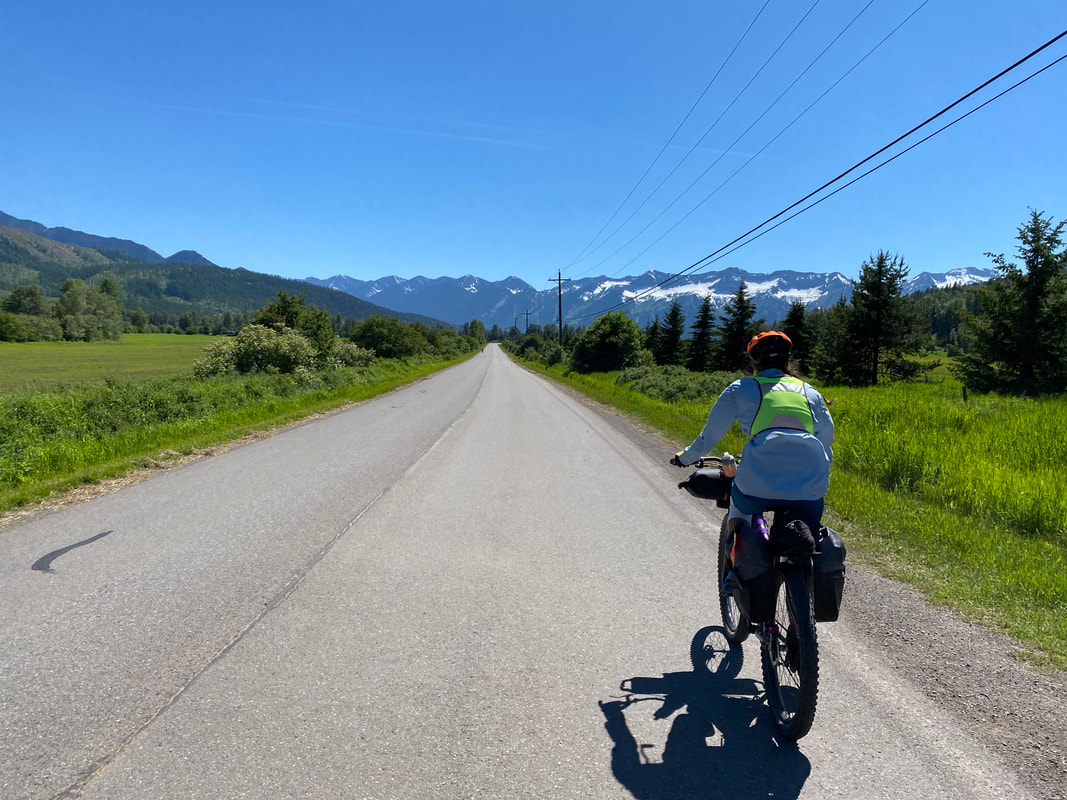
   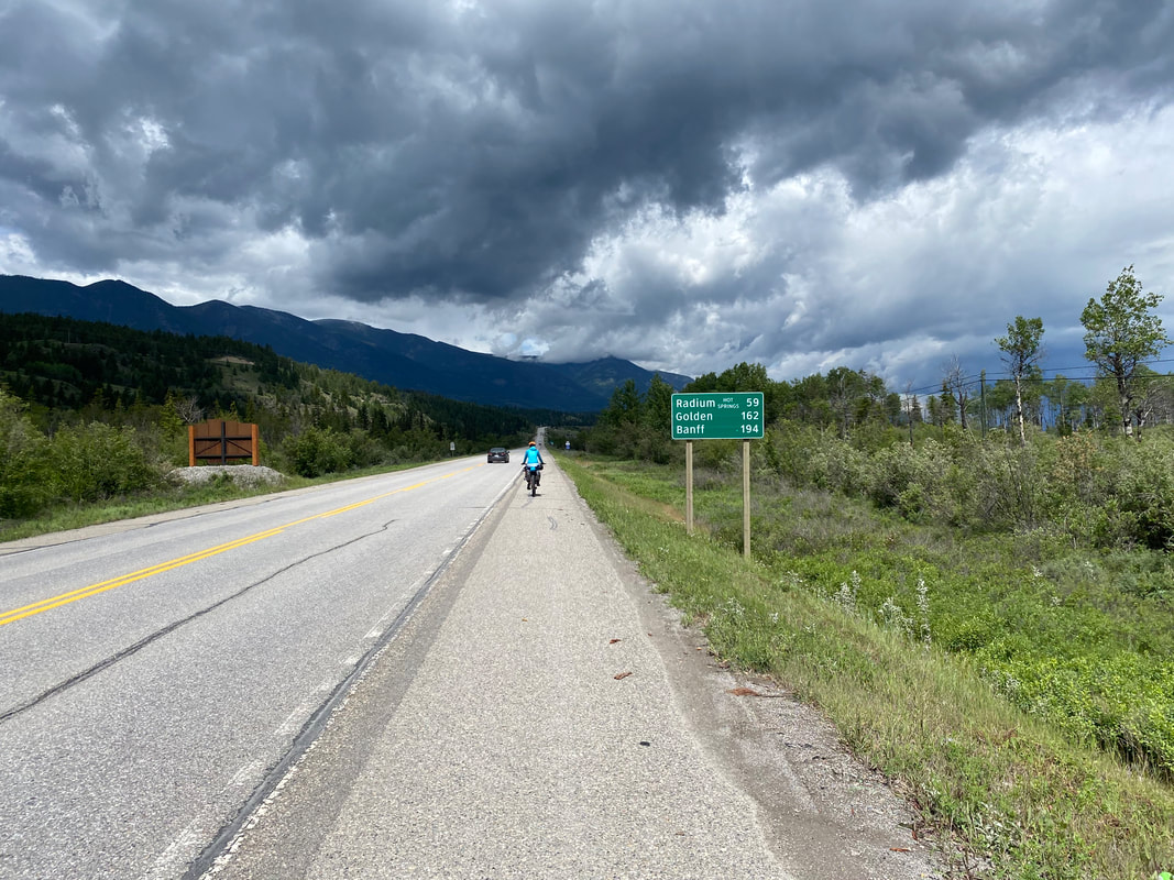 Warm, but facing a headwind, Janna and I rejoined the highway to push north. The southern shores of Columbia Lake stretched out to meet us as we left the highway to careen down side-roads off its western edge. We cycled back onto the highway as dry conditions set in. Near the town of Fairmont Hot Springs, a cliffside of desertscape hoodoos opened up unexpectantly. As the hoodoos receded, we joined the incredibly scenic Legacy Bike Path that took us to Invermere. The path took us safely off vehicular highways through the Windermere Lake Provincial Park. Everywhere, meadows lit up with flowers and wild roses grew thickly. The views were incredible and the miles quiet and smooth along this long-distance bike trail. 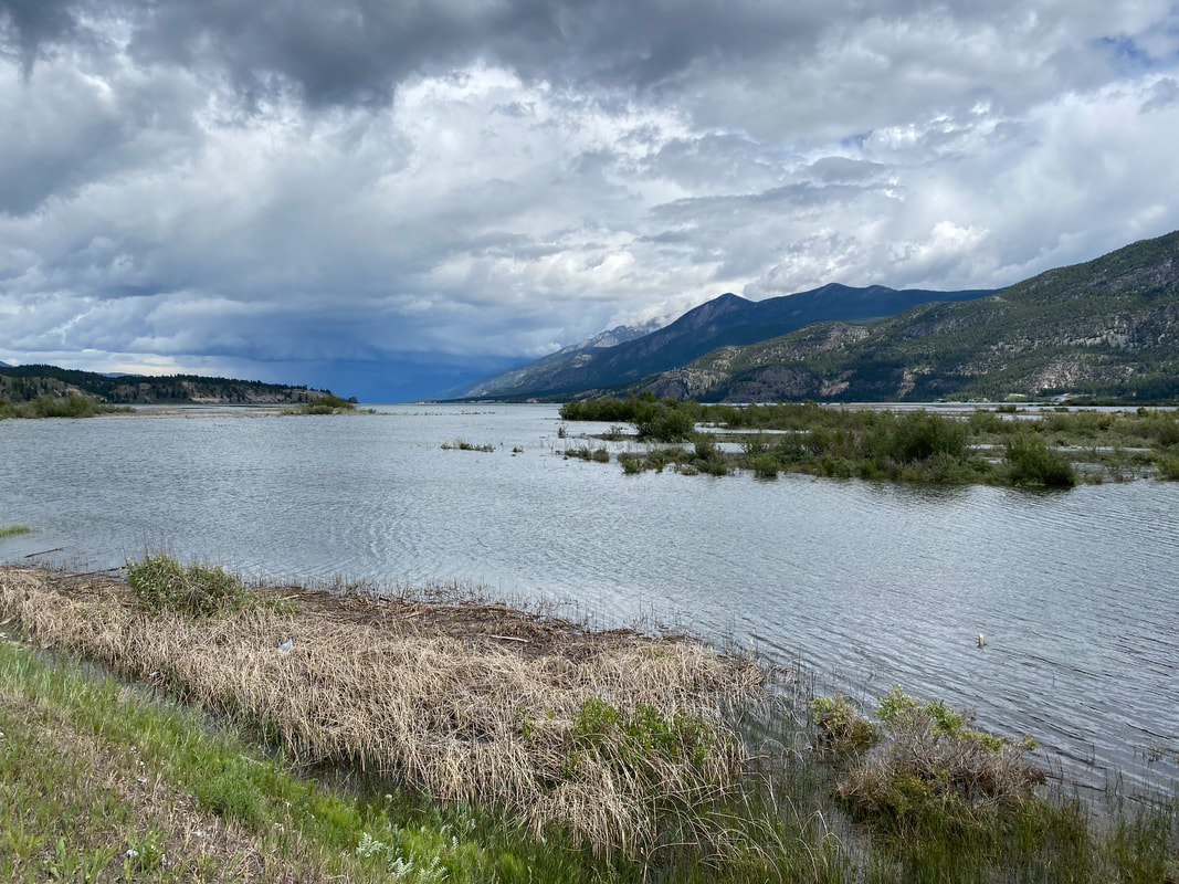
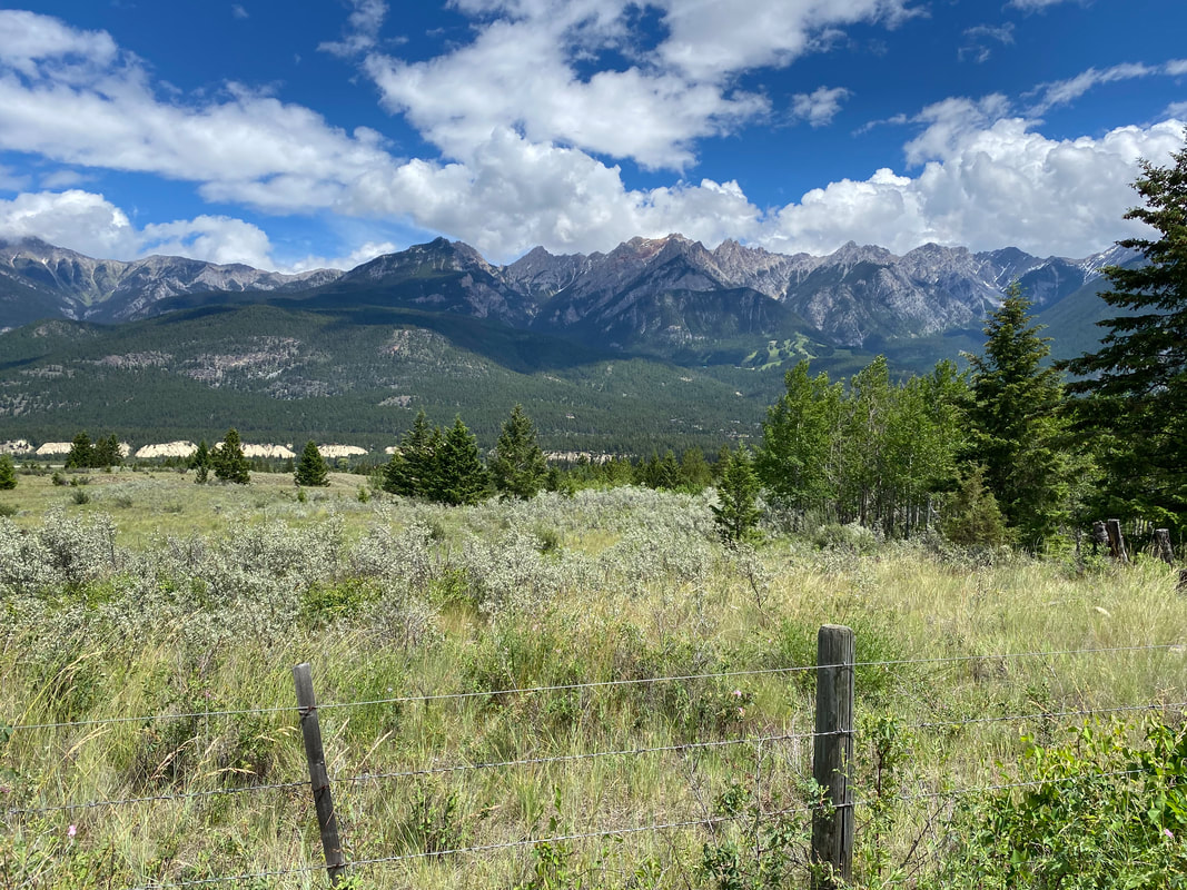
 Once in Invermere, we grabbed several days worth of groceries for the ride to cross Kootenay National Park tomorrow. After, we rejoined the highway and met a significant headwind that battered us to slow crawl across the landscape. By early evening, the lush and flooded valleys of Radium Hot Springs laid out before us. We turned up a mountain road and began a steeply graded climb to Redstreak Campground - the southernmost frontcountry campground in Kootenay National Park. Our campsite was located at the back of the campground and afforded a sweeping view into the valleys below. We showered and rested. And notably, my knee felt off - very off. 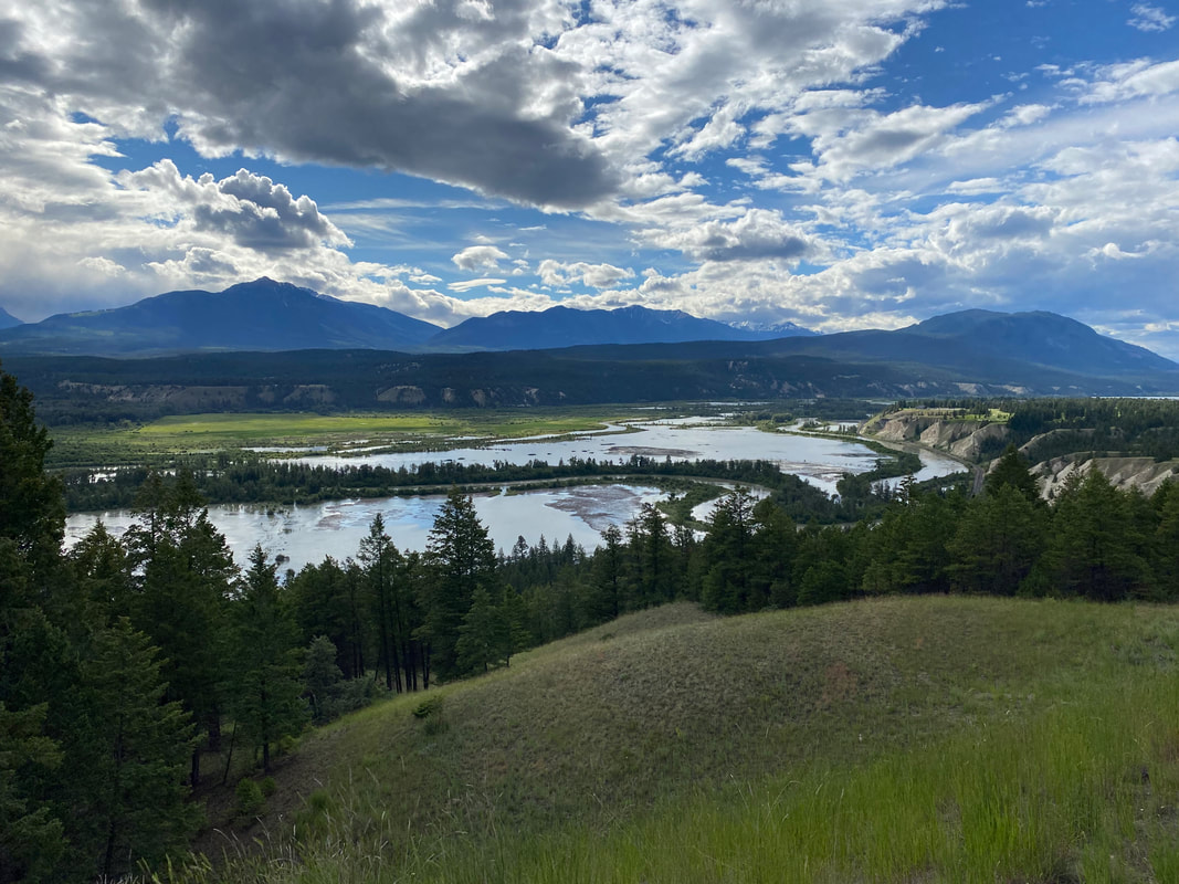 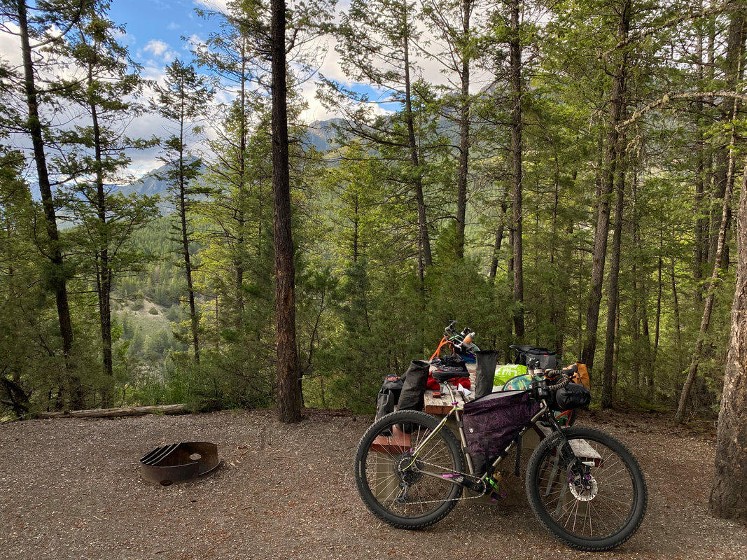 73.92 Miles; Fernie, BC to Wasa Lake Provincial Park, BC 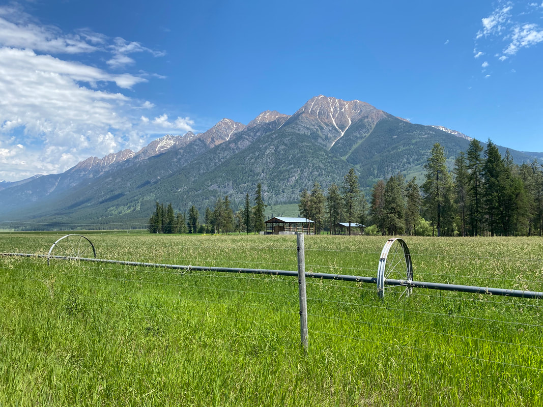 Morning crept on so we awoke to cover a long day's riding. Back out onto the heavily trafficked-highway, we veered left and downhill through the gaps and passes of the smaller Rockies before turning onto some backroads. The quiet ponderosas close in around us in this arid part - the nostalgia for AZ is great. Verdant grass sways with purple lupine. All so lush with so much winter precipitation. Conversation drifts and flows around our lives at the Canyon and who I want to be authentically in the change of setting. And the temperatures rise. Soon, it's 85-90 degrees out and the sweat breaks off my brow and down my chest. Meltwater streams pulsing with sediment and iceberg blue gush down ravines and across neon green valleys. I jump off my bike and plunge my face, hat, and neck gaiter in them to cool down. 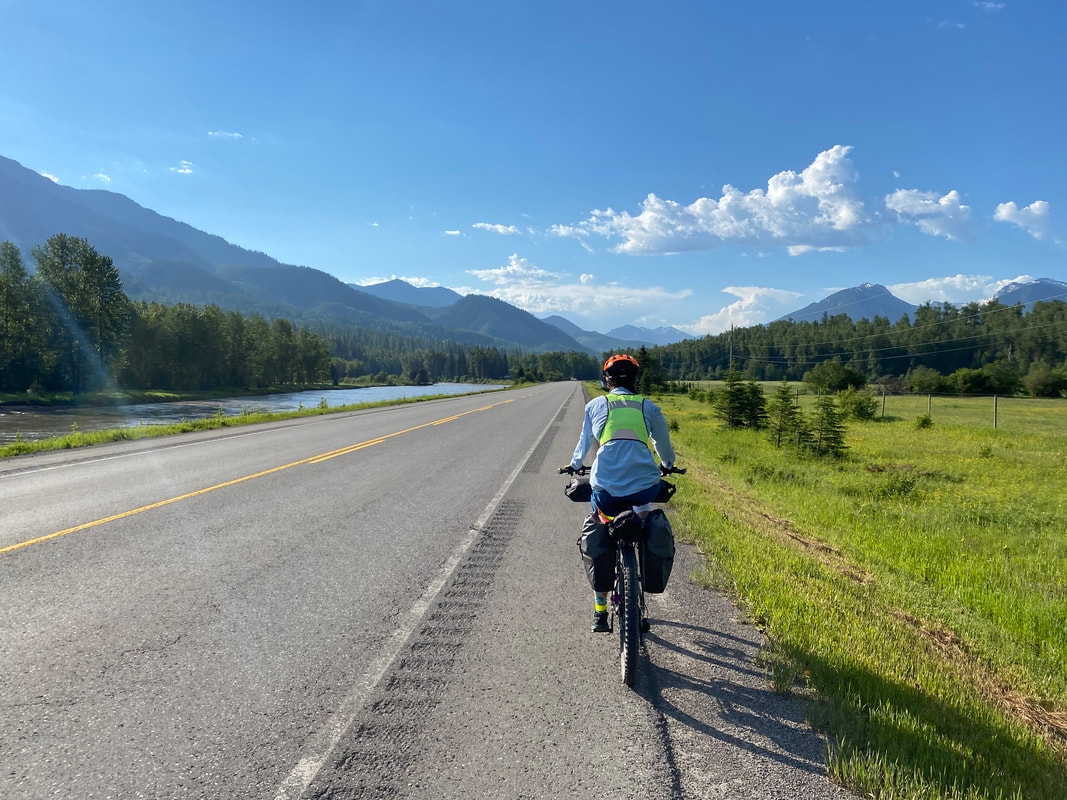
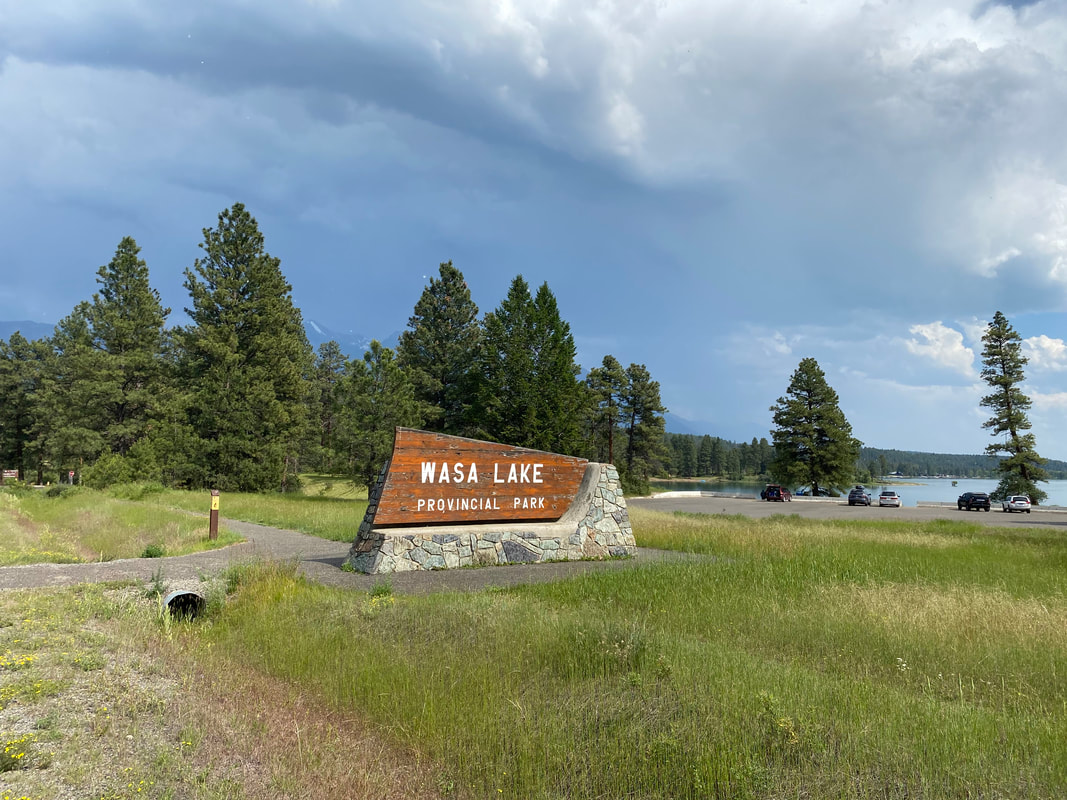
   We ride along a massive mountain range crisp and sharp with contrast provided by swelling storm cumulus above and carpeted meadow grass below. Snow creases cracks. The day's weather swells with heat and the crackle of weather. We swing into Ft. Steele Resort as the temps smidge above 90 F. We collapse on picnic tables relieved with shade. I am present-minded; I am in the moment. So many times I feel that frontcountry distractions pierce my attention to pieces and now, singularly on a table under a tree, there is no attention but now. It rivets me to immediacy. Thunder breaks the plane of thought. The heat has led to uplift and moisture-rich clouds are now bubbling and streaking blue from the sky. Day turns to night as a significant weather advisory erupts. We are on our bikes in the open - I embrace the rain. Janna and I pull into Wasa Lake Provincial Park where we claim a spot under trees next to whitecaps forming on the windy water. We eat an early dinner and return to our tent under threat of further rain. The Eolus gets battened down before we climb in for a windy/rainy night. 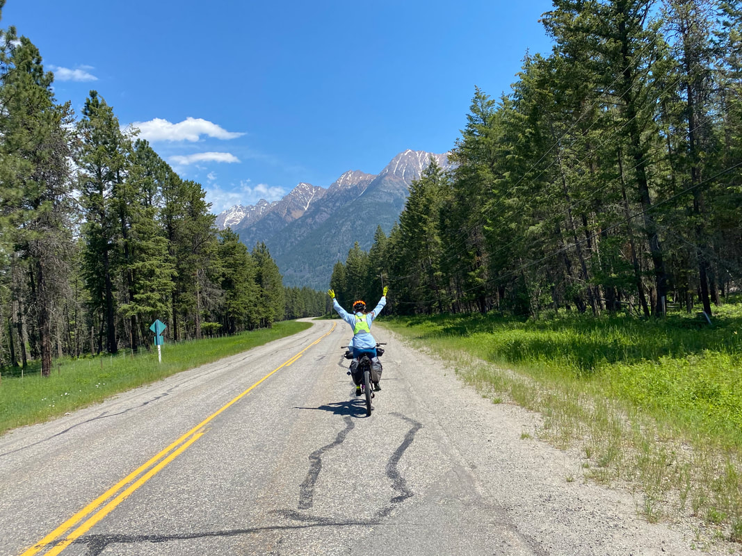  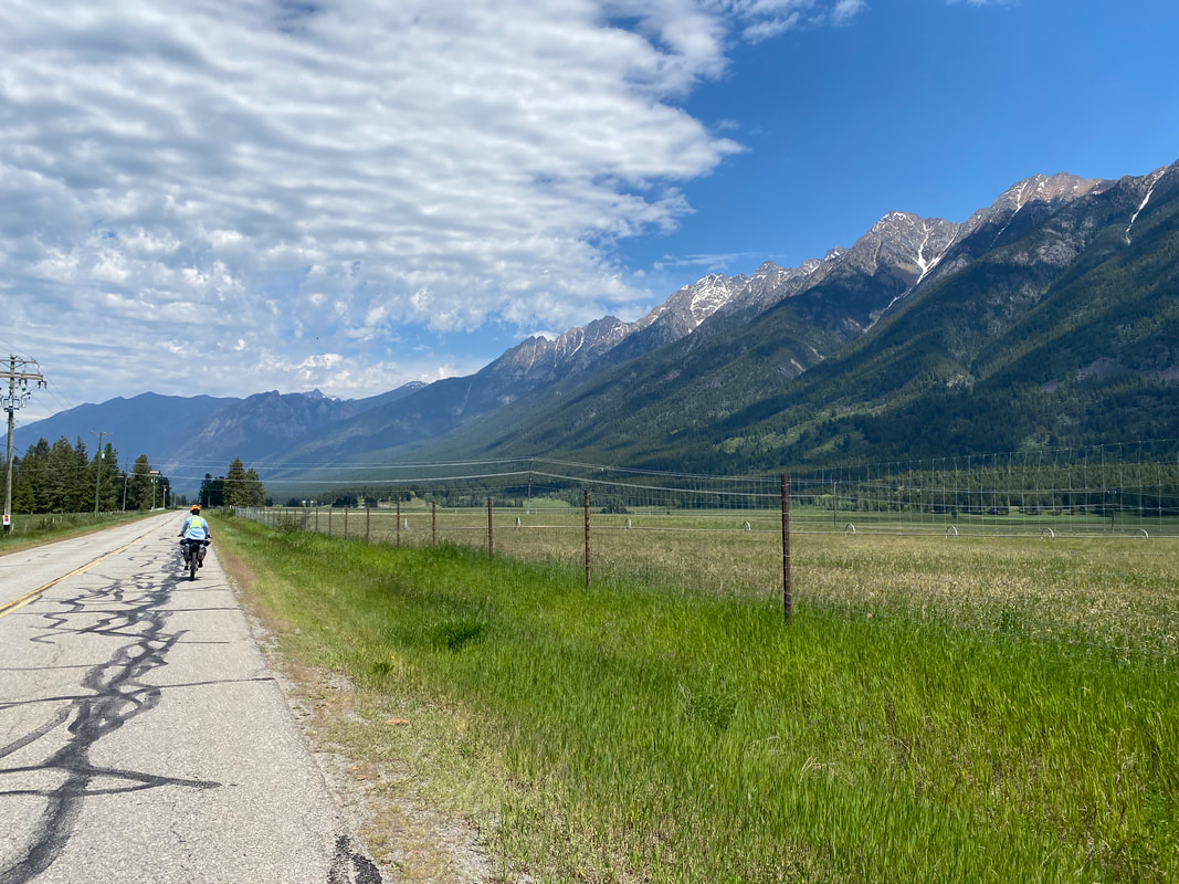 
0 Miles; Fernie, British Columbia 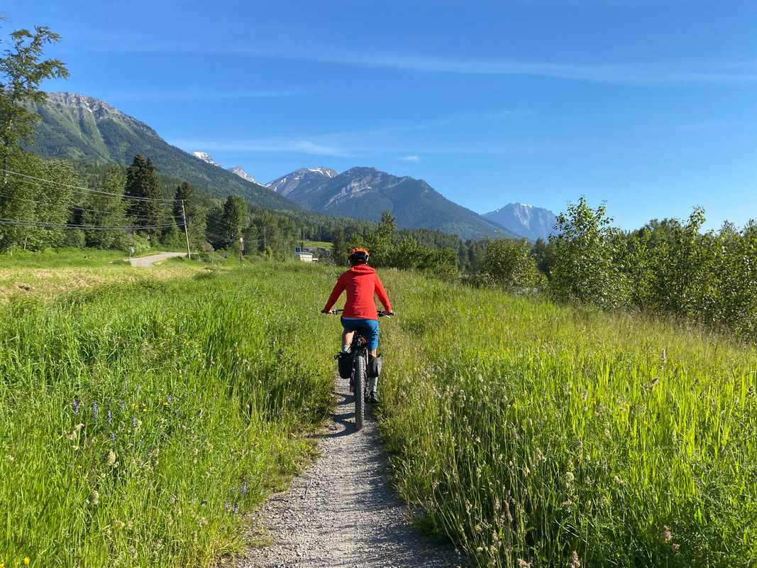 As a proper Zero Day entails, Janna and I sleep late into the morning. Eventually roused by light, we ride our bikes lazily around Fernie to enjoy downtown and eat quantities of food earned by miles. But, most shockingly, we hear news from Canadians that Roe v. Wade has been overturned in America by the Supreme Court. Shocked, quite understated.
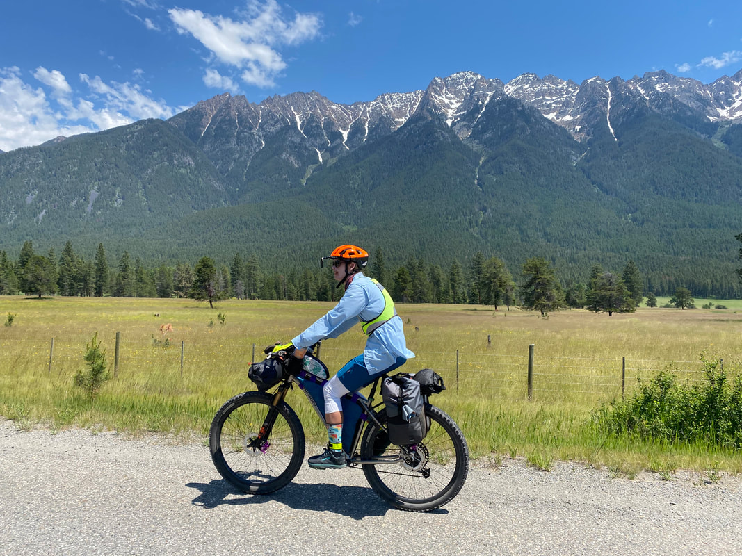
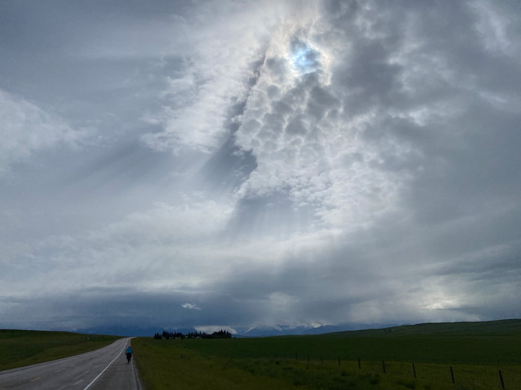
The rest of the day is spent enjoying the sun, hanging by the river, eating a ton of fruits and veggies, watching The Umbrella Academy on Netflix, and then laying in bed for relaxation. Proper Zero Day through and through. 54.92 Miles; Crowsnest Pass to Fernie, British Columbia 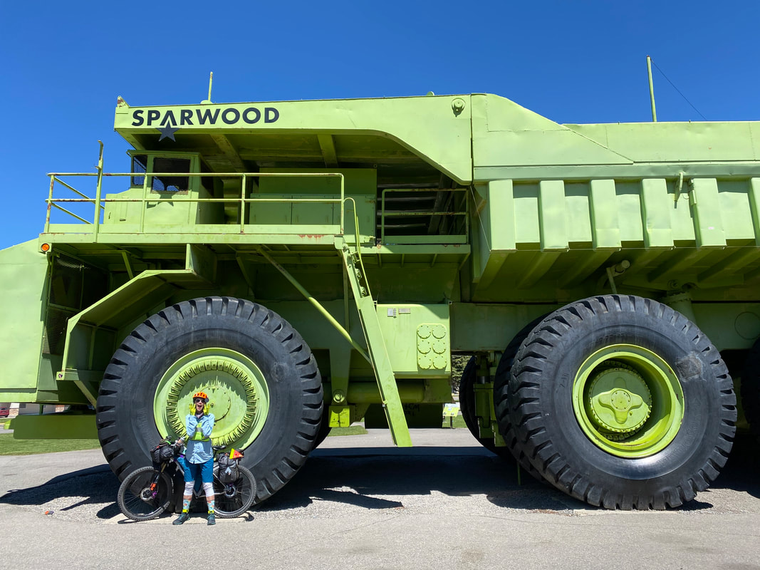 We have a hotel booked in Fernie tonight and a planned zero day for tomorrow - a bed is calling after days of cold and rain so we awake early and head out on the highway. After riding across plains and headwinds, it feels monumental to be entering back into the black hulks and green draperies of the northern Rocky Mountains. Large gray boulders and the sheen of decades-old rockslides grinding faces of peaks dab our peripherals. The shoulder is good and we make time across slung-valleys sharply green. Midmorning we arrive at a large lake where we pull up and eat some snacks. Three rock climbers stop to talk to us about the area. They had competed in the ultra the day before and were now heading into the mountains for a few days of climbing. They offered up some vegan, homemade granola bars which in turn we relished. The climbers detail us about the location of the largest cave in North America nearby - here in the Canadian Rockies. Their eyes alight with a sense of passion and place that only makes me appreciate the landscape even more. 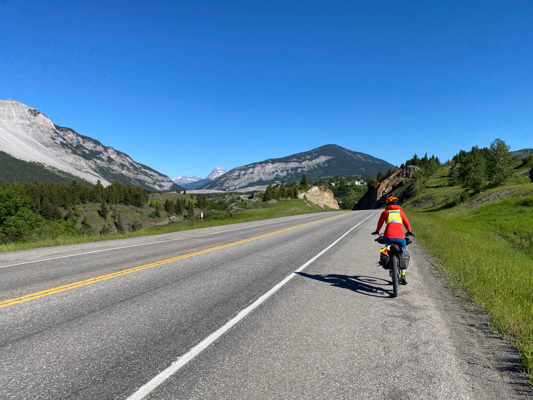 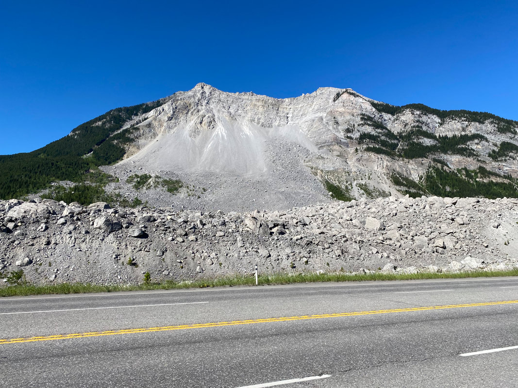
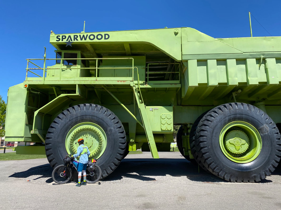
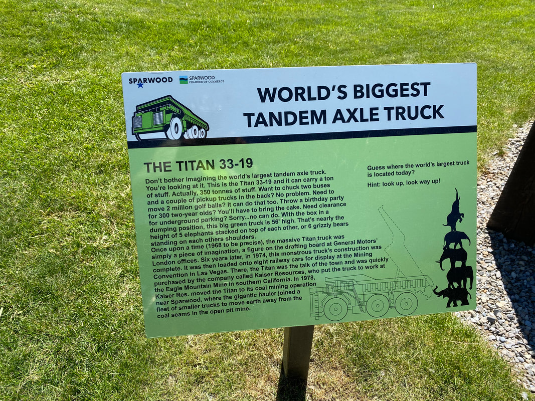
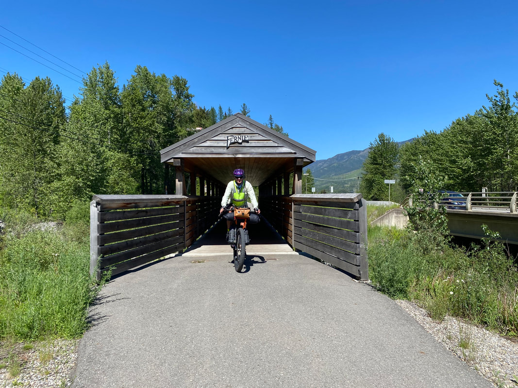
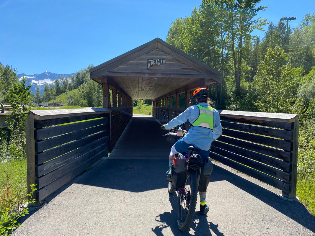
Back on tarmac, the hours slip by bringing us to the famous Tour Divide stop of Sparwood. Jann and I zip over immediately to see Titan - the largest ruck in the world. Titan was used for mining extensively before being retired as a local attraction (a singular truck takes singular components that were too expensive to upkeep/produce with economy of scale). We head into a grocery and get a ton of fruit which hits the spot. By midafternoon we arrive in Fernie, concluding that is an awesome town! The bike culture is strong and visible. We head over to Straightline Bikes due to the absolutely incessant creaking/clicking in my bottom bracket after that powerspray rainstorm a few days ago. The mechanic strips everything from the cranks and BB, wipes down, regreases, and reassembles it all on the spot. The clicking is gone - any water that worked its way in there is now out. I profusely thank them; the shop regals us with stories of all the Tour Divide racers who recently came through prior to the snow storm a week or so ago and ended up needing rescued south of town. This forced overextension of the local SAR and there was definitely some local frustration over that. We swing by a grocery in town to grab some food for dinner before making our way to the Stanford Hotel on the other end of town. The weather is great, but we settle in for some rest and showers. 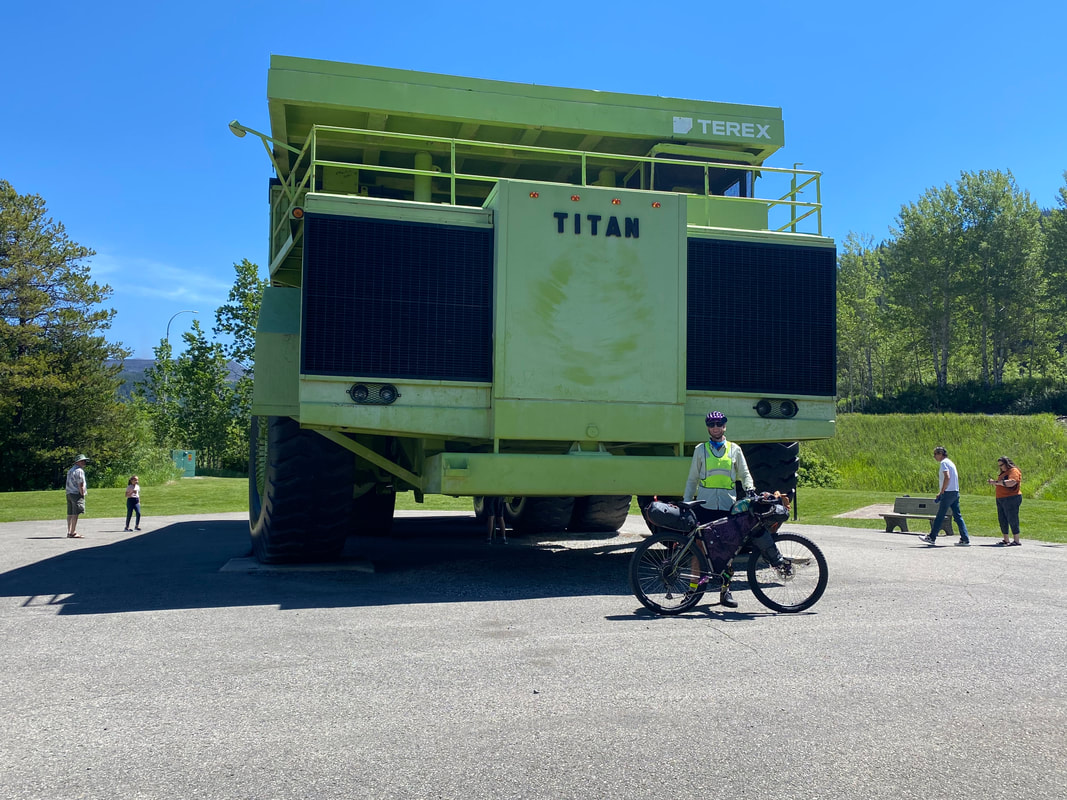
    60.96 Miles; 3,321 Feet of Gain; Waterton Lakes National Park to Crowsnest Pass 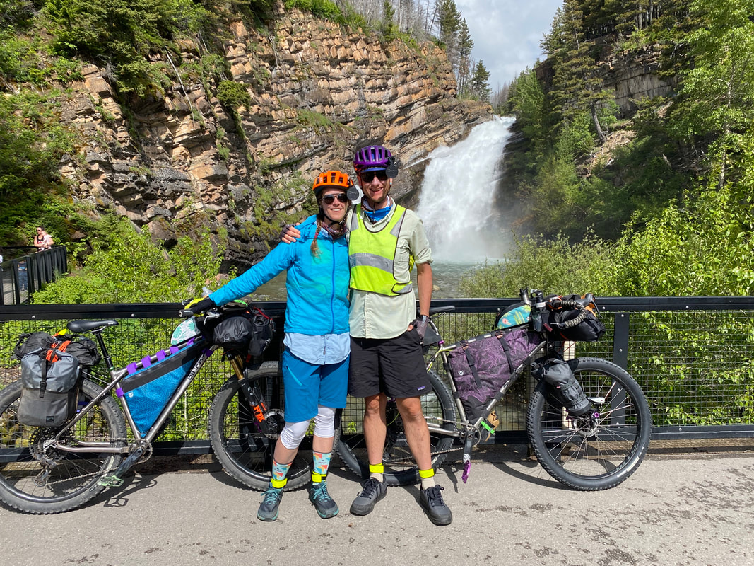 After a day of long riding in wet and frigid conditions, Janna and I took advantage of what was predicted to be a sunny day to sleep in and commence riding only when rested and warm. The Sun rose early, but we didn't rise until 9:30. Even then, we walked around the area, ate lunch on a bench next to the calm lapping waters of Upper Waterton Lake, and walked along rushing Cameron Creek. We departed at 11:30 am. Our way out of Waterton Lakes National Park was languid and slow. It afforded us a second opportunity in 24 hours to watch a much larger mother grizzly and her two cubs crest a hill and then brisk down the grass on the other side. They were far enough way that we stopped riding and watched them for about 15-20 minutes. Shortly thereafter, a loud, resonating clicking noise began emanation from my bottom bracket. This because a massively annoying noise over the next few days for it was constant, loud, and played at my fears that something was wrong. Instead, it seems that the intense horizontal power-washing we had received in the storms yesterday has forced water past the grease and into housing on my frame. 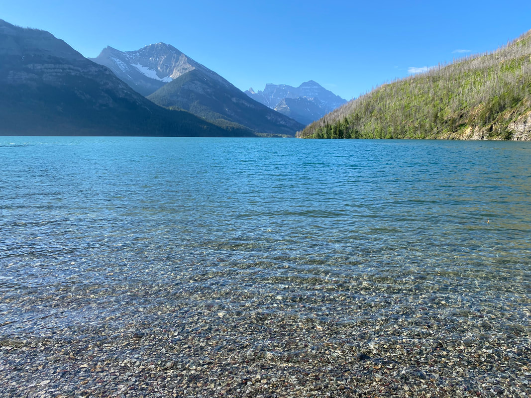 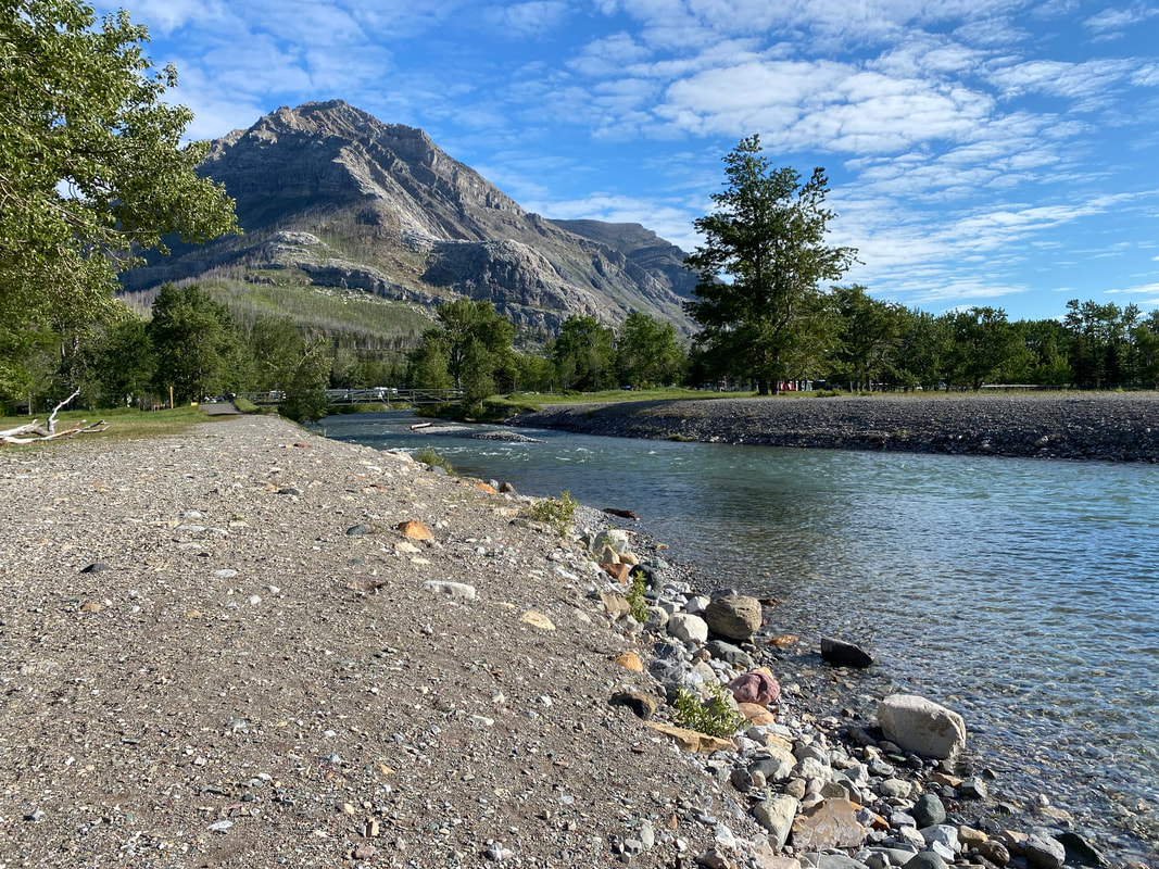
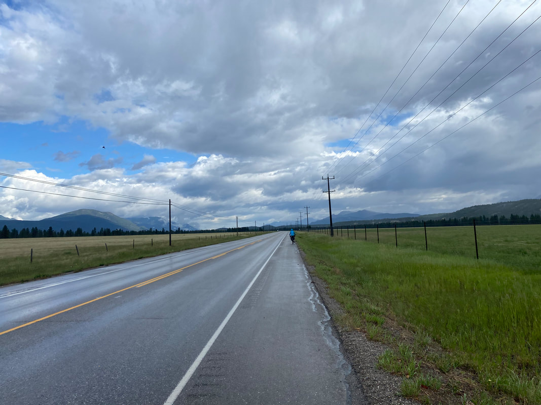
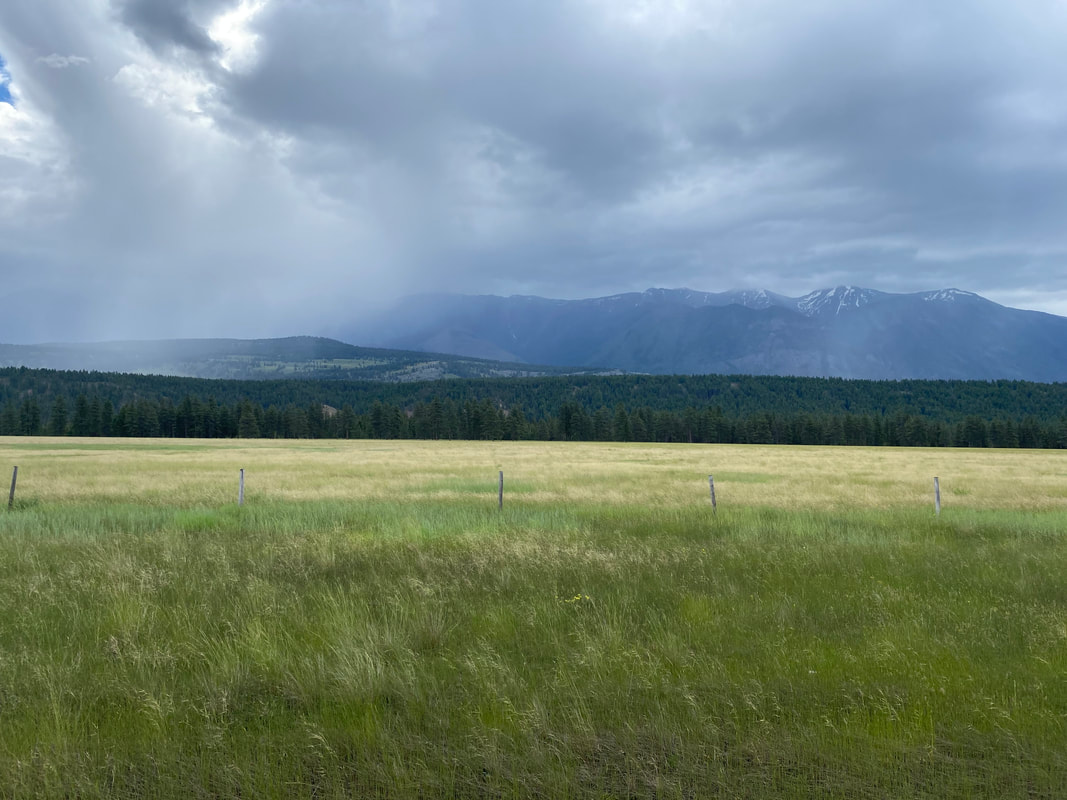
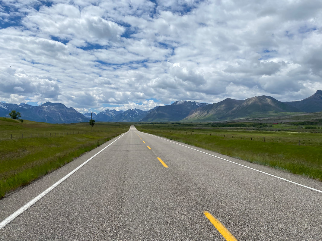
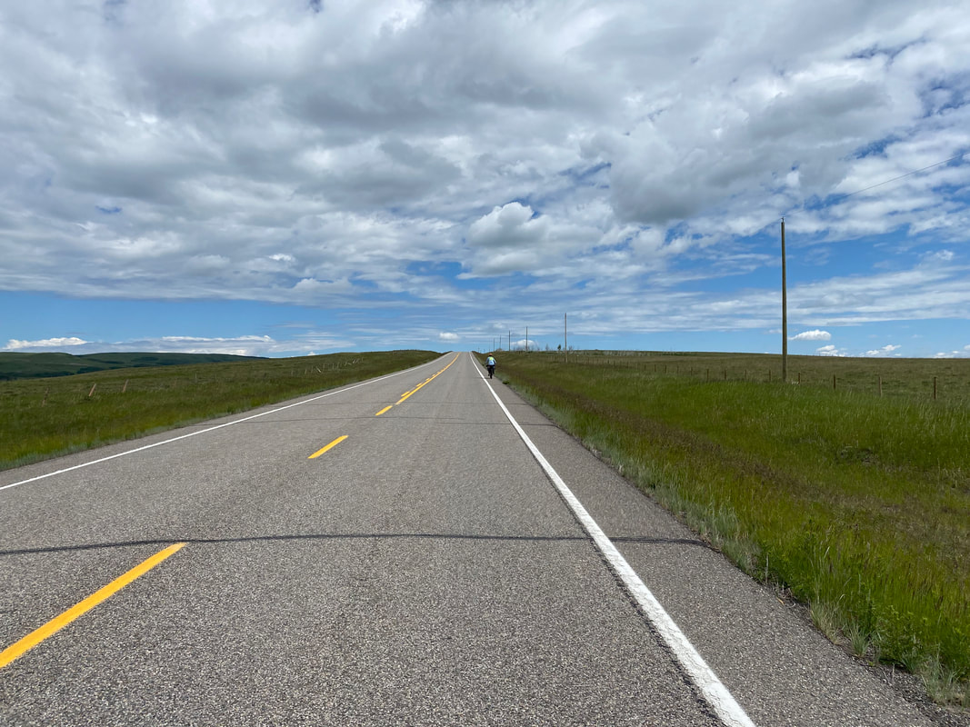
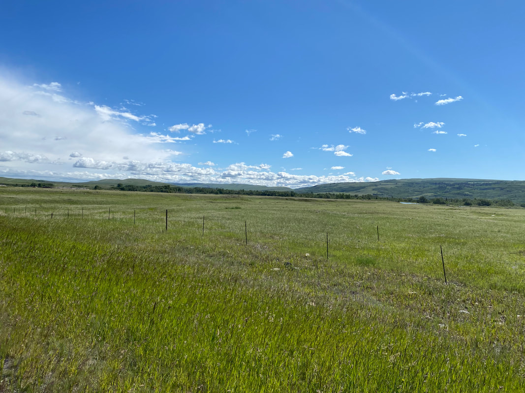
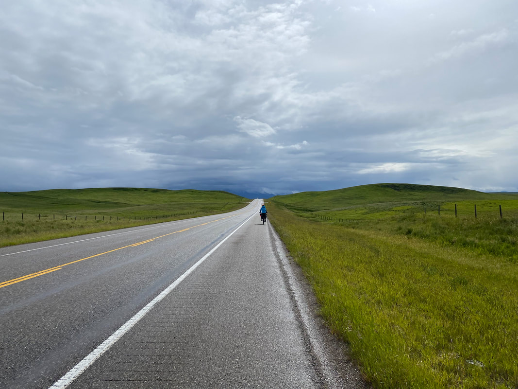
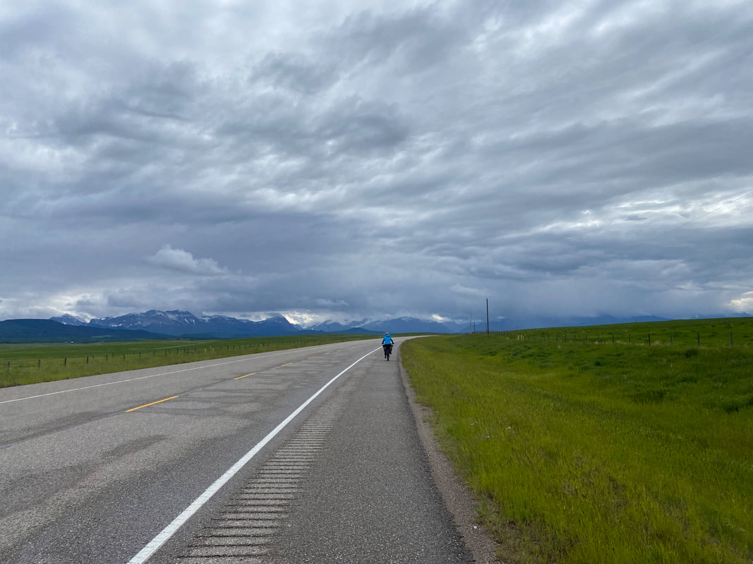
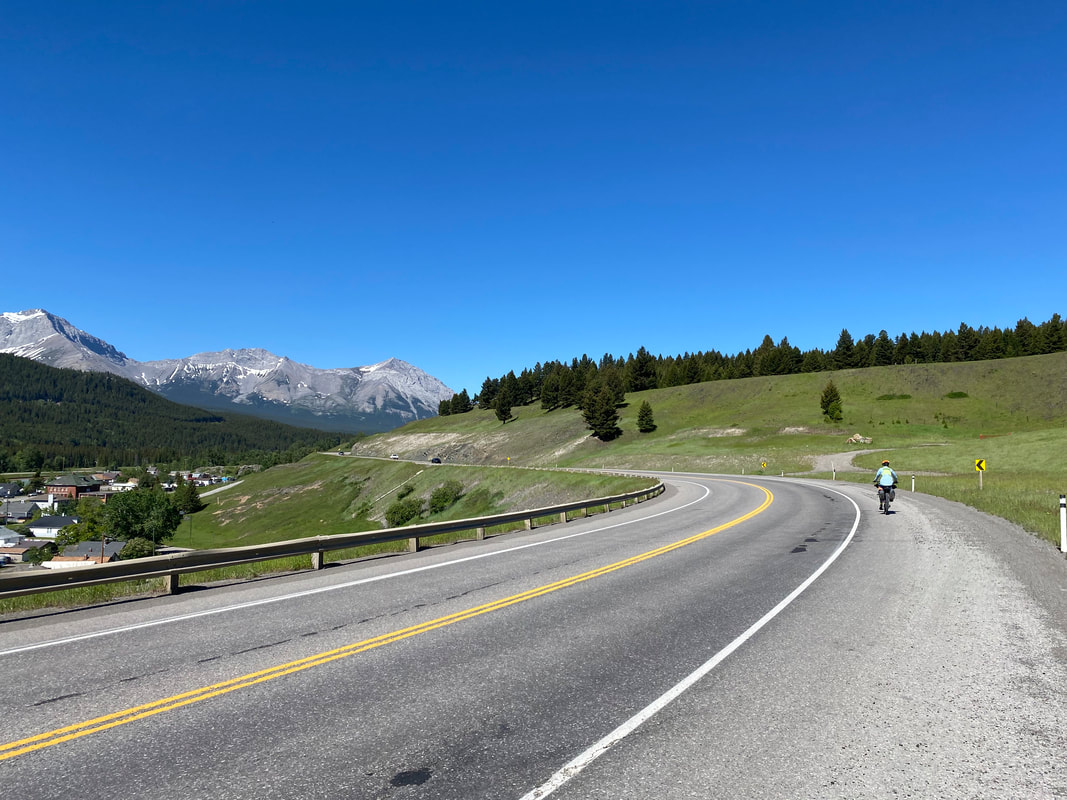
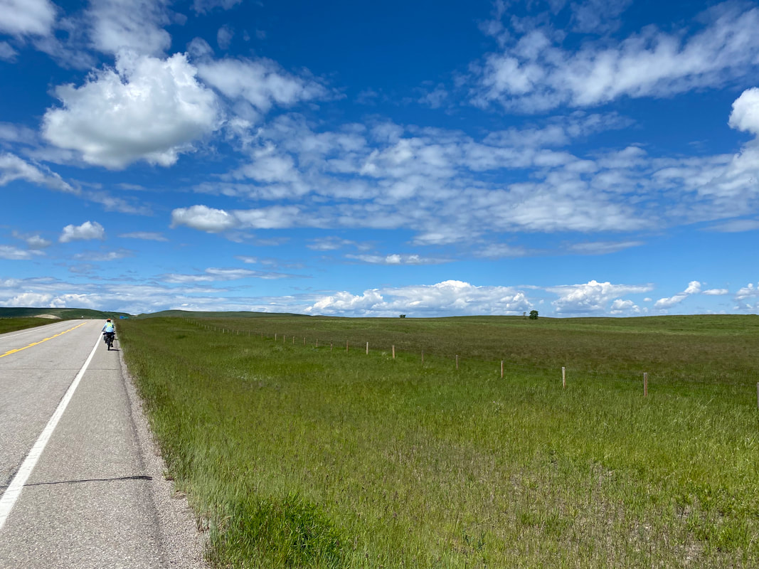
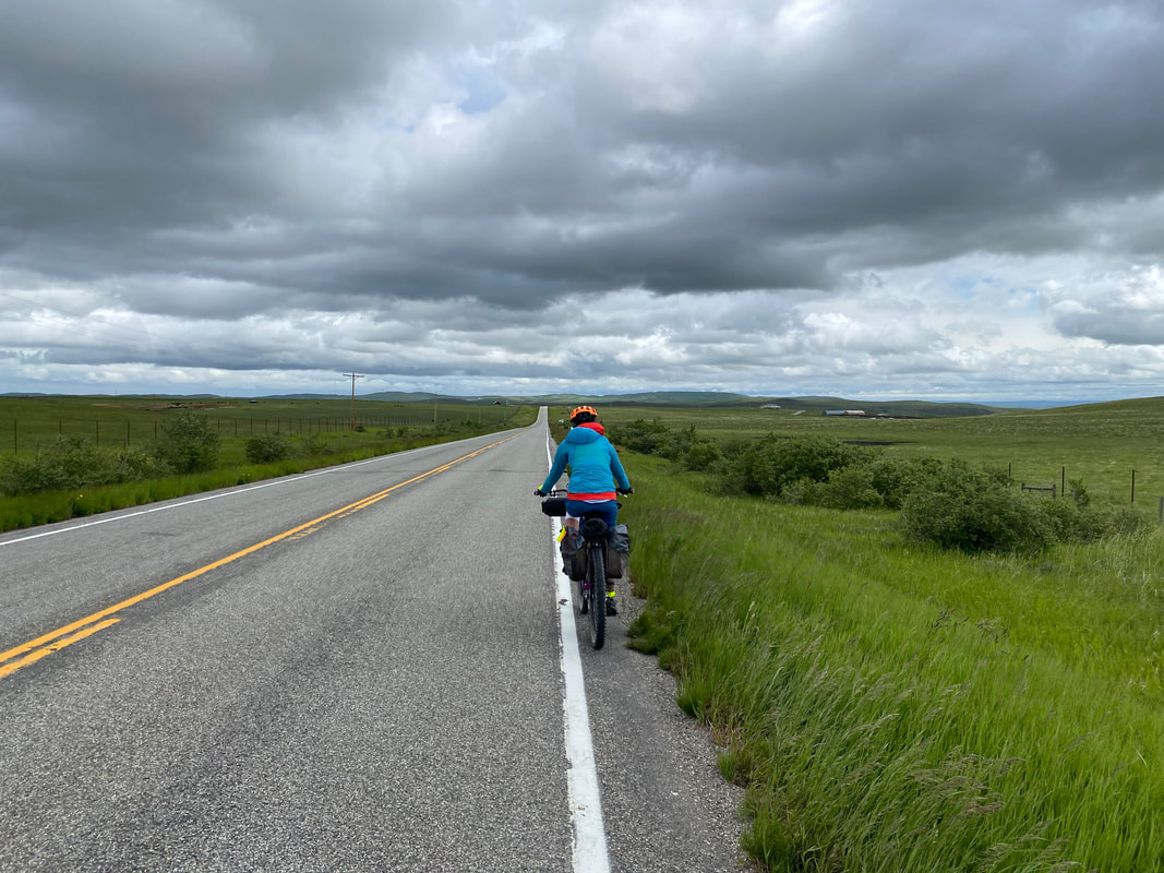
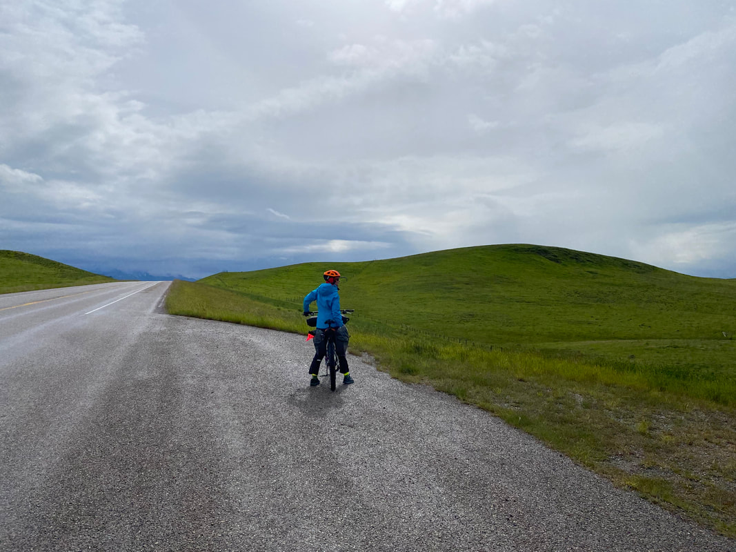
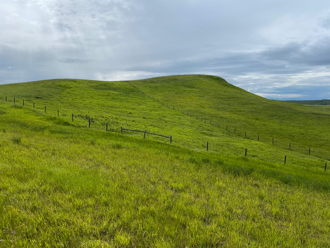
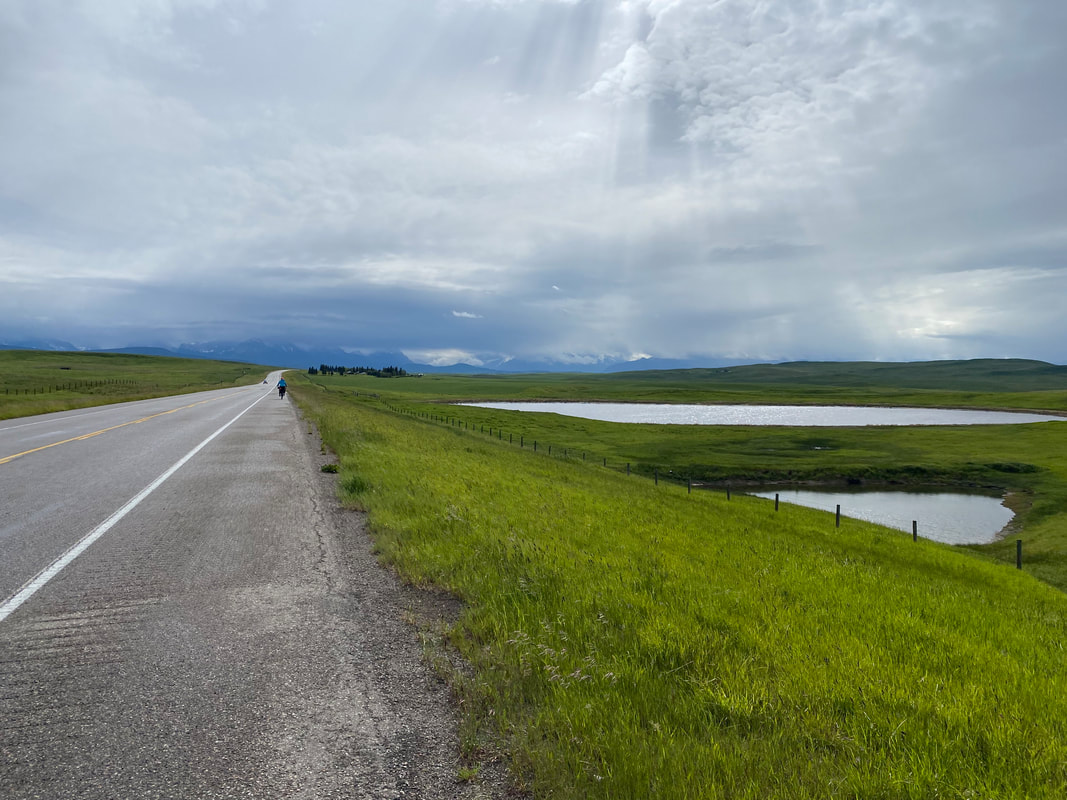
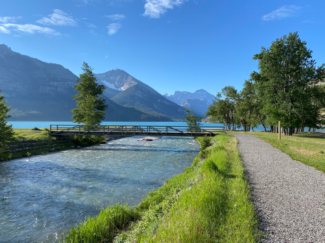    We left the Park boundaries and began pedaling north. Our route today would take us along the foothills and rolling prairies once more of the Northern Rockies. We did a gradual climb up through glade-green meadows until reaching the overlook of the Waterton Preservation Area and Waterton Park Front. Apparently, this area is famous for its wild storms, raging winds, and unpredictable conditions. I'm sure the previous day would have provided a strong example. But today, the air was benign and the overlook completely calm. From there, we headed out onto the green prairies. Mountains lulled away, replaced by flatlands and gentle curves pulsing with bodies of grass pushing for photosynthesis. The mountains become horizon-fodder and only distant silhouettes. We biked our way to Pincher Creek where we stopped at a grocery to resupply and have some fresh produce. The sun was beating down hard now. We avoided the worst of it by sitting in a bench in the indoor mall and eating kale, sourdough bread, and lots of hummus. 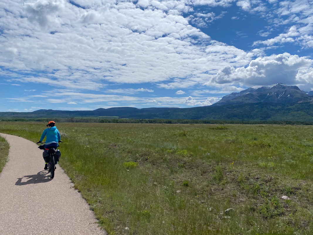 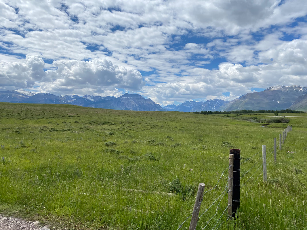 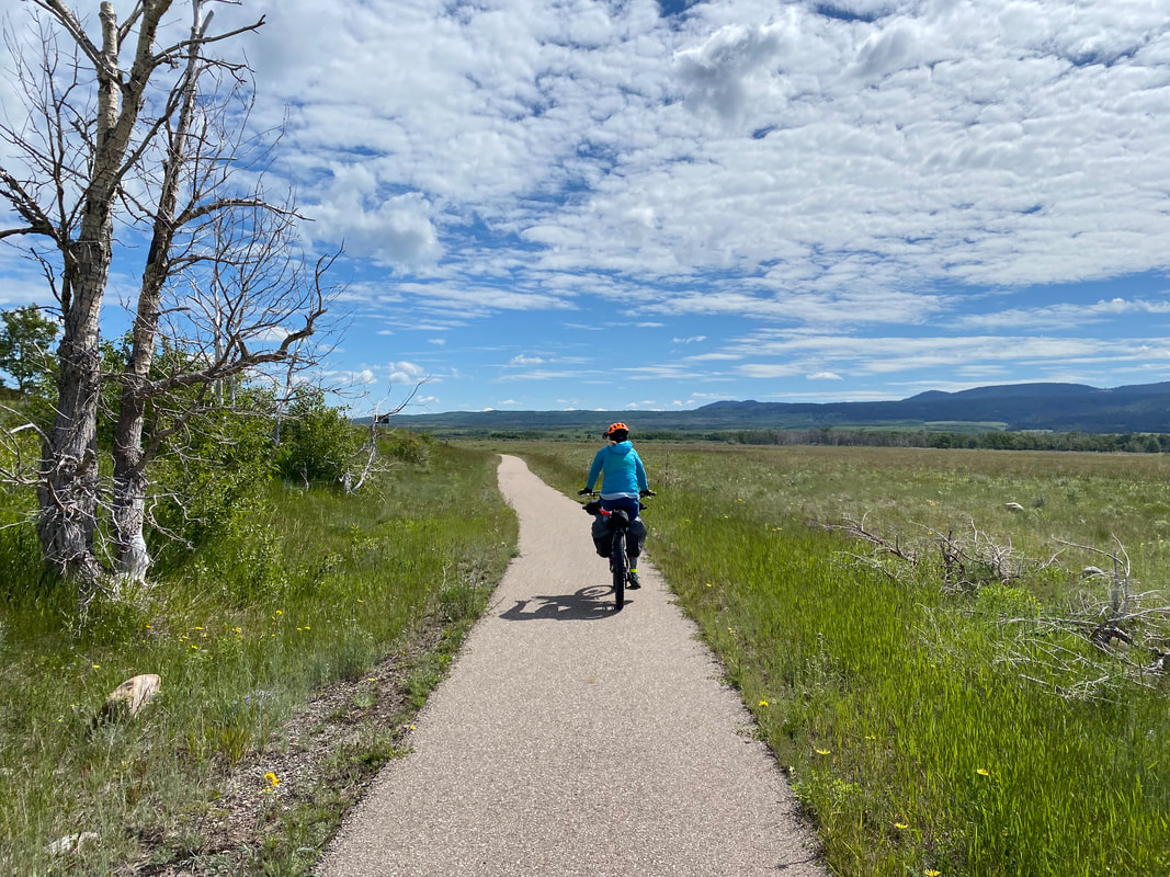
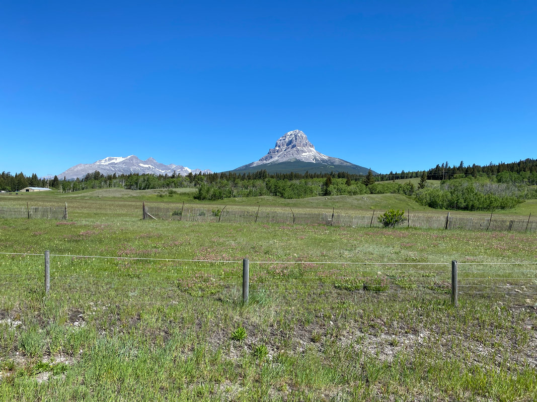
   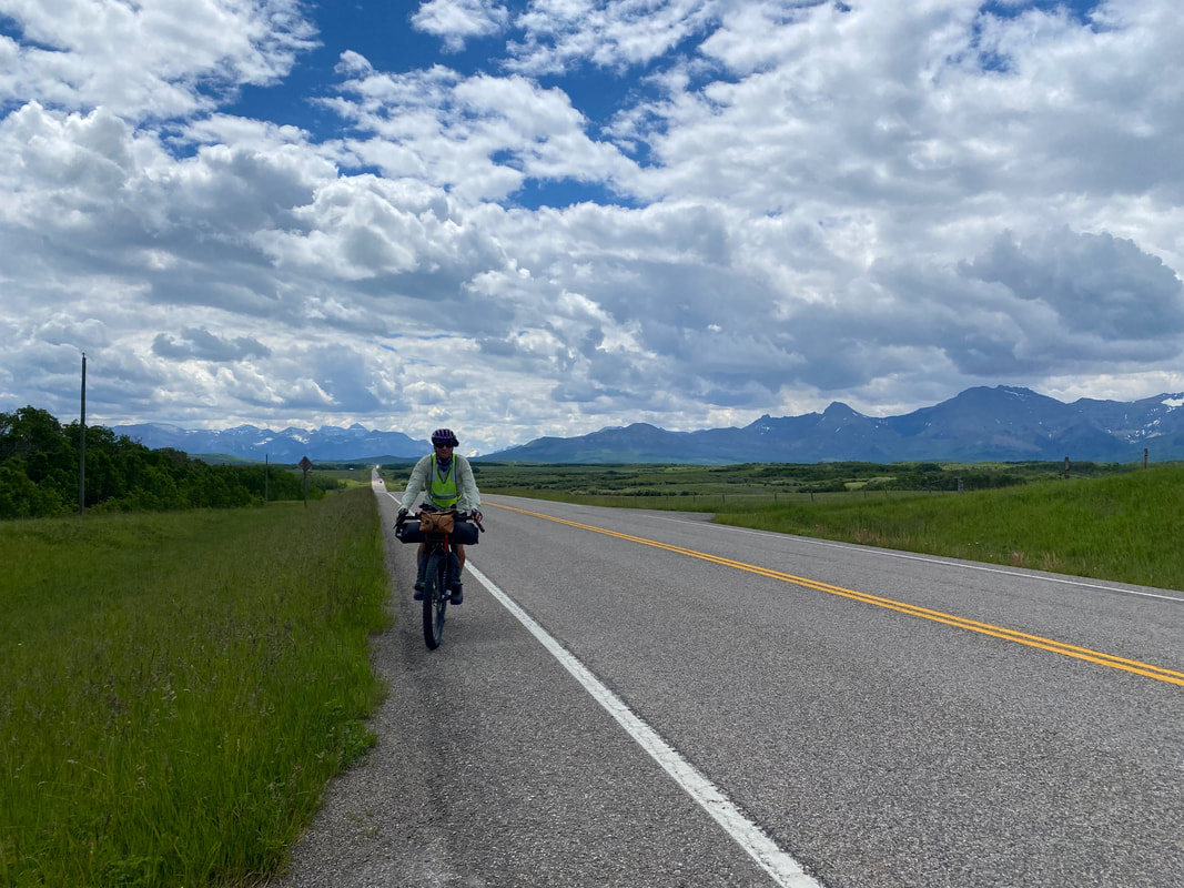  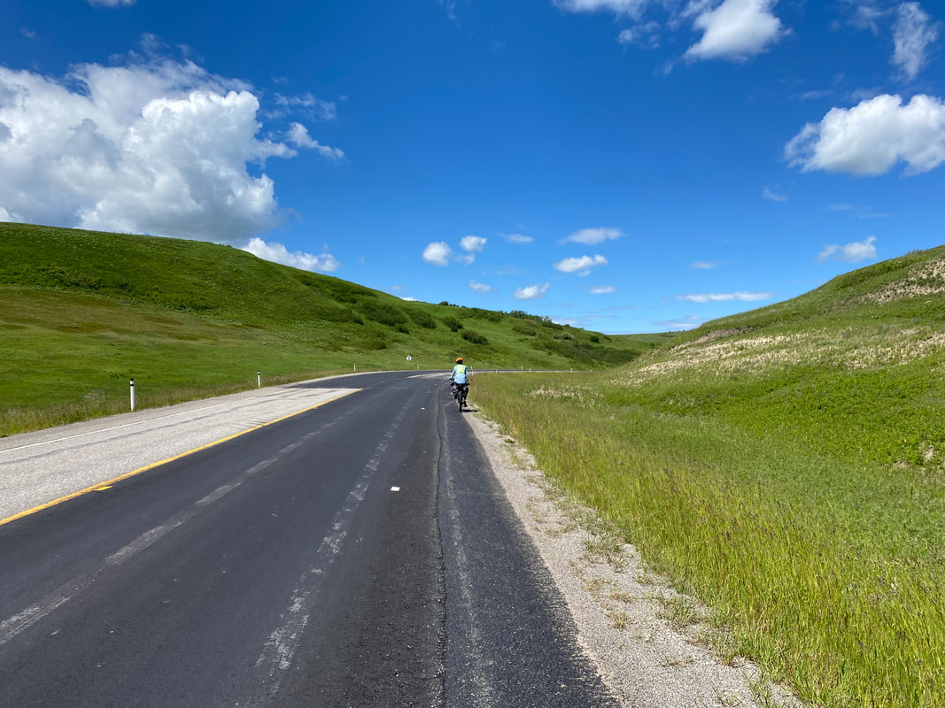 We left Pincher Creek and went westward back towards the mountains. As before, the land rose up and we began long and slow ascents first into the foothills, and then into the mountains proper. We turned left onto busy Crowsnest Highway and made our way to our camping spot for the night at Crowsnest Pass RV Park. It was an awesome little place with great showers and a broad lawn all to ourselves to camp on. It turns out that an ultramarathon, the Minotaur Ultra, had just occurred so the campground was filled with runners camping for the night. We ended up talking with many for hours. The night's main conversation surrounded us as Americans and many questions given to us regarding gun culture, school shootings, and beer in pharmacies that baffled the Canadians we spoke to. 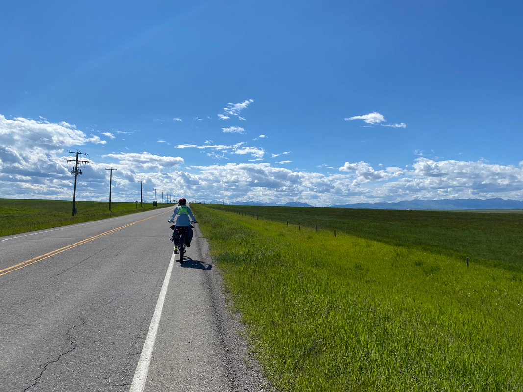
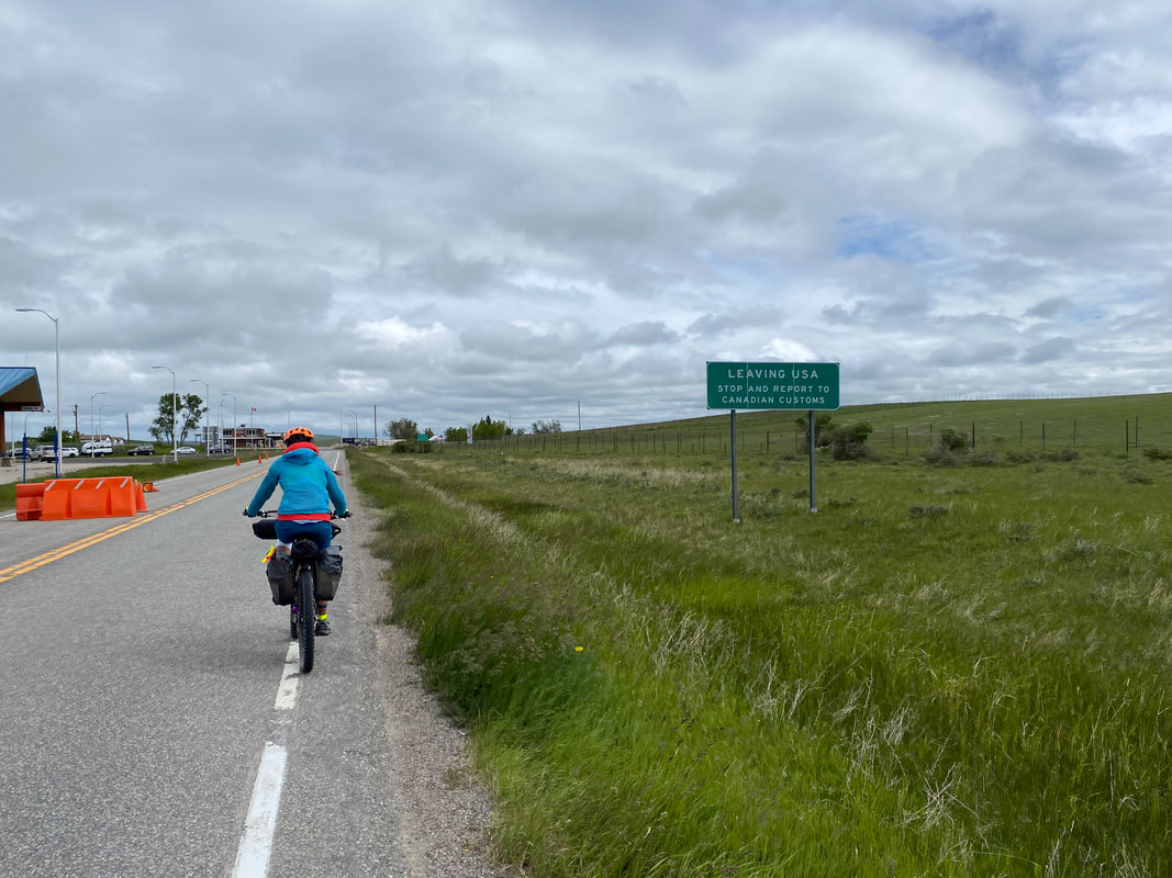
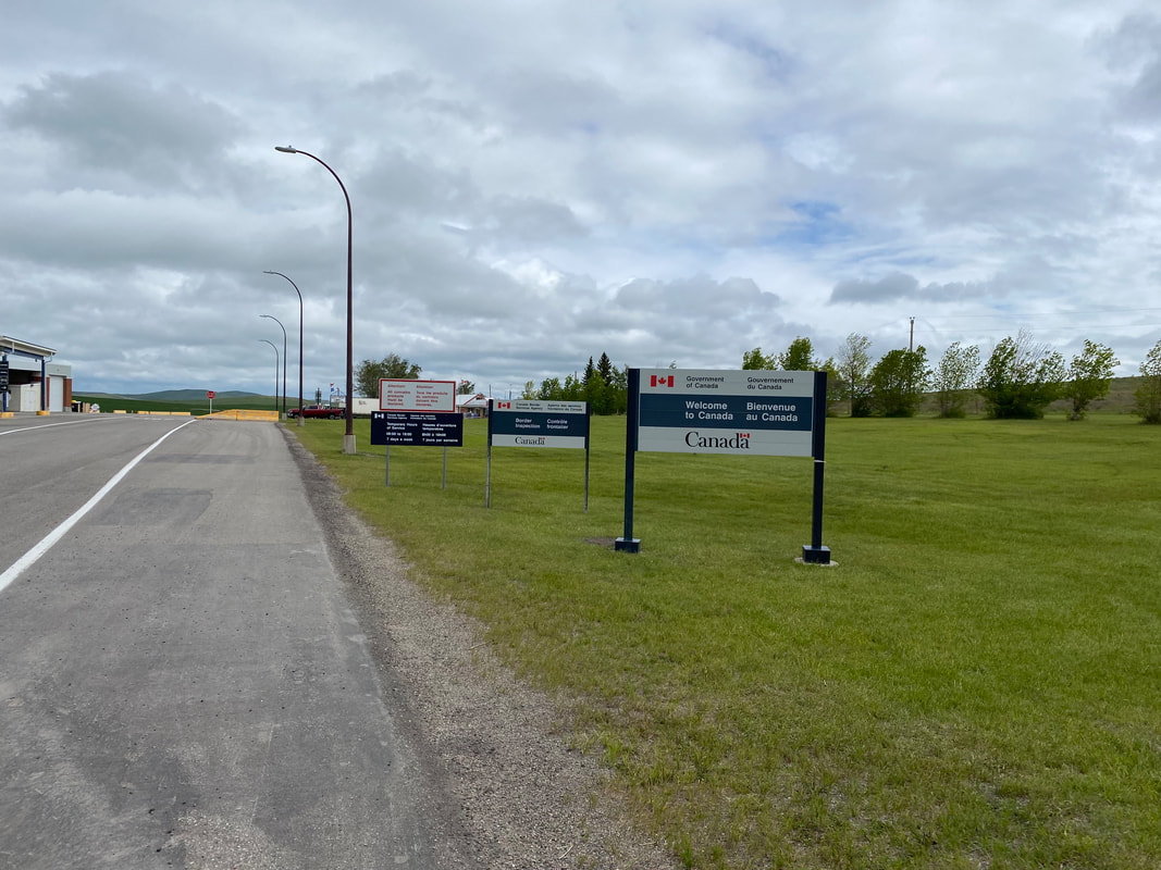
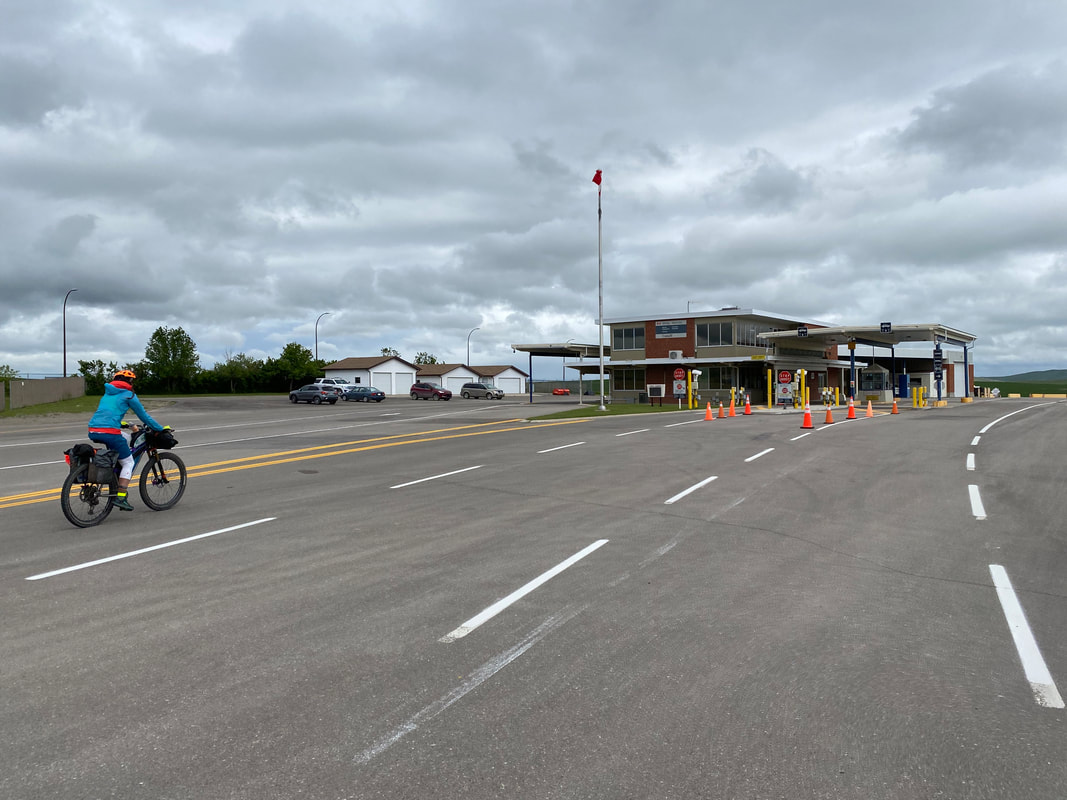
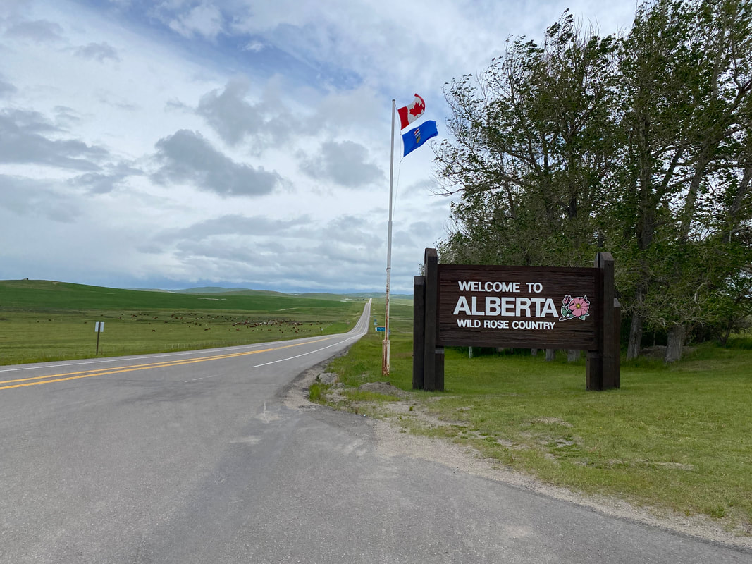
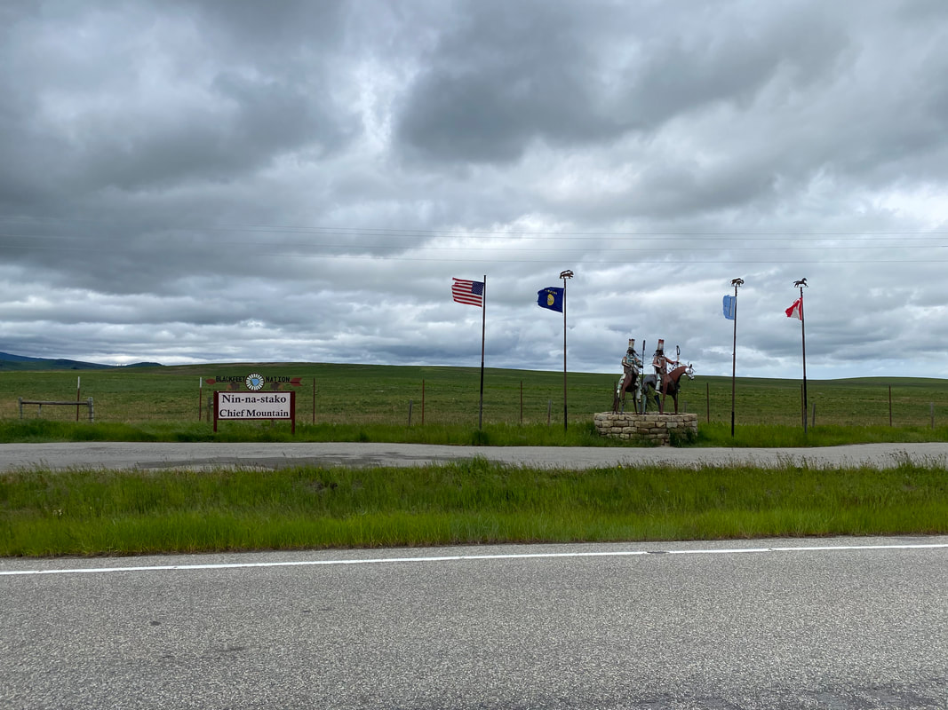
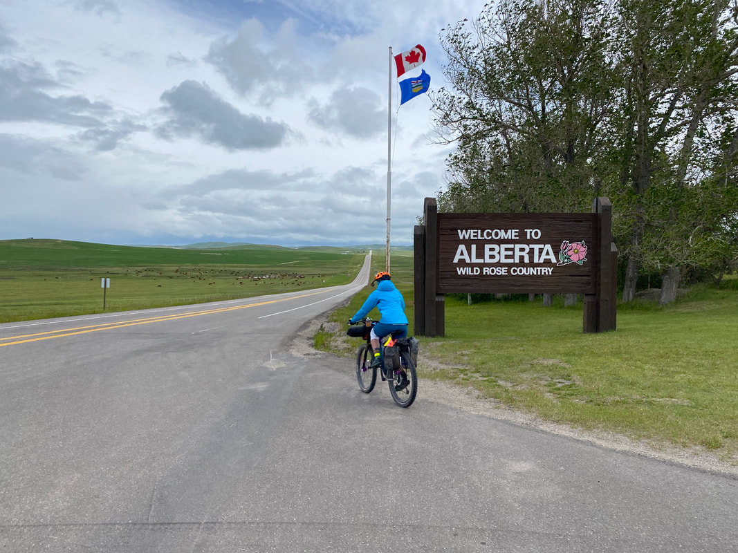
  70.84 Miles; 2,838 Feet of Gain; St. Mary, MT to Waterton Lake 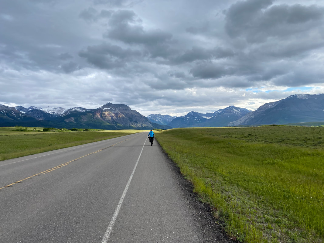 The evening before while in St. Mary, Janna and I had received two critical pieces of information pertaining to this day to come. 1) The original border crossing to Waterton Lakes was closed indefinitely. 2) A massive early summer snow storm was coming to bear upon the area starting tomorrow. The storm would whip winds, with directionality heralding form the north, northwest - our exact direction of travel. We should expect 40 mph headwinds with 60 mph gusts, plummeting temperatures with highs in the low 30s, torrential rain, and snow dropping several inches at our destination. In response, we spent the evening scouting a new border crossing further east out on the plains at Carway Crossing, out towards Cardston, Alberta. The crossing was absolutely open there, but the change in travel would add some 30 miles to our day's riding. In addition, it would take us further onto the open plains and more-so into the brunt of the winter storm. With no topography to provide an windblock, we would need to expect some tough riding. So we went to bed early, far before sun's rest. And we woke early, to move as much tarmac beneath our wheels as possible before blue sky crumbled to gray and snow. At morning crack, my eyes opened. Frost crisped our shelter's walls. Yesterday's dapper warmth was replaced by low pressure and front's cold. I plunged my arms and legs into pants and down jacket before leaving the Eolus. The morning's first breath caught my own in sharp inhale. The sky was blue and subtle. No wind was here. But it was coming. We quickly packed our gear, nestled in layers, and struck out alongside St. Mary Lake. It's blues mirrored the sky in frequency. Our direction headed north - right where cirrus clouds riding the head of the front began streaking high in the atmosphere. Golden hour seemed to stretch as grasslands punctuated by aspen lined the route. Every blade was new-birth green, stretching towards the sun and well-watered by the wet spring. Eventually, St. Mary receded and we reentered the Blackfeet Nation near Babb. The Rockies to our lefts pushed further away. Grasslands swallowed us as sea. The clouds became shapeless and smeared. The blue skies twinkled out. Grass began to ripple. A yawning wind pressed against our faces. I felt unsure of what the day would bring; how it would end and what state we would be. But that grass. Its vibrance seemed unmatched. As the last houses on the open plains kept to the Rockies, we turned around to see the mountains receding behind and the unhoused prairies stretching all around. And then low-slung cumulus wafts came sprinting across the plains. The sky darkened and a hand of atmosphere clutched my front and shoved me back. The storm nacently was hatching. We arrived at Carway Border Crossing on the border between Montana, USA and Alberta, Canada. The wind was ironing our garments to our skins. We approached the entry station, talked to the crossing officer, and went and hid behind an outdoor wall. The wind was building exponentially by the minute. Quickly we pulled out every piece of rain gear and prepared to take on the brunt of rain and wind. I snapped a quick last photo or two of the "Welcome to Alberta - Wild Rose Country" signs. Within 15 minutes of continuing out on the prairie on relatively flat terrain, the shear force of headwind had slowed our momentum to 3-4 mph - a speed I could nearly walk faster than. Then, to our left, I saw a blanketing wall of water approaching, slamming from the sky. We jumped off the bikes and slid down a shallow embankment next to the highway as a surge of 180 degree rain sluiced parallel to the ground. Temperatures dropped immediately to the mid-30s and hail came raging on. From this point on I couldn't take any photos because of how drenched the conditions were and the need to keep all my fingers constantly covered in protective gear. All photos from this point forward are from hours later after the worst of the storm had past.
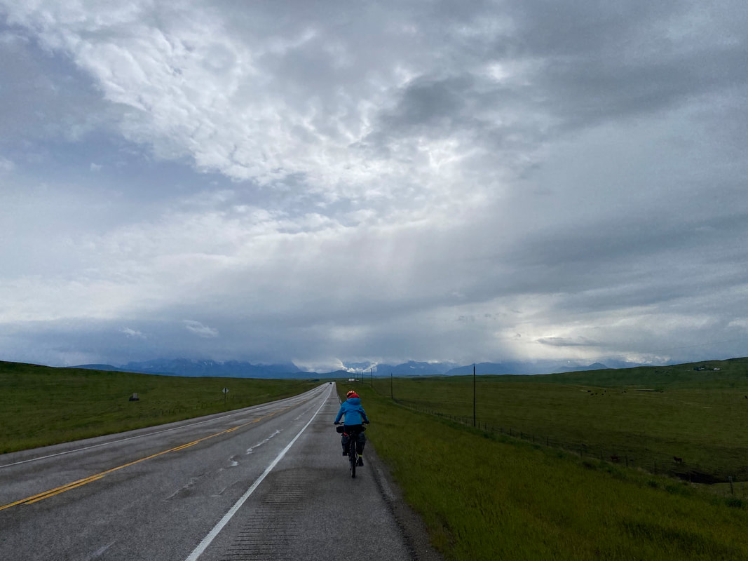
 Janna and I decided to get back on our bikes and keep moving. We needed the metabolic heat that the wind, sleet, and rain were sapping from our bodies. We also needed to move forward because our reduced speed threatened to arrive us significantly late into the night. I was so thankful for the intense rain layers we brought for the Northern Rockies. We remounted our bikes and pedaled like machines into the heart of a prairie thunderhead. Gales and gusts knocked me nearly over repeatedly. My left side was coated in a sheen of ice as graupel and sleet hit my body perpendicular. My right was incomprehensibly bone dry. I could see frost outlining my sunglasses that I wore solely to keep the weather out of my eyes. My core shivered. My muscles responded. I kept biking at an absurdly slow rate. Machines - rhythmic and unintelligent - moving and unyielding. That's what we were in those hours. The heart of the storm roared over and around us at one point, making it seem twilight. I saw a small country road, pulled over, turned my back to the striking air, and tried to keep putting food in my mouth to keep that metabolic engine going. Hours went by, the powerwash at 30 degrees kept raging against our bodies. By early afternoon, we rolled into Cardston, Alberta. City streets opened around us and we, without discussion, agreed that finding a place indoors to get some food was a must. We arrived at Heuse Tacos - a little restaurant with fish tacos downtown. We locked up our bikes in the rain and snow and walked in. The place was idyllic - it was only its second open day and the family running it welcomed us to stay for several hours to warm up, eat copies calories, and dry ourselves. We did so sans protest. I ate tater tots and fish tacos, and then went back for more. All that food warmed us up, and the rain began to relent outside. The temperatures stayed firmly around 35-37 degrees, but precipitation had decreased to a mild drizzle. I ran across the street to a Canadian bank to exchange currency. After, we biked to large grocery, bought more food to eat right there in the cold, and then got pumped out to head directly west straight to the Rocky Mountains we could no longer see. Now the prairie was even more green. That hosing wash lit up the grass and the foliage thrust forth to snap the sun's light. The side of the highway was wet, but the rain became intermittent. I snapped a few pictures of gray cumulus churning over neon green. It was utterly fantastic. Janna and I rode into the headwinds that seemed ever-so-less at the angles we now faced them. I kept stopping to take pictures of the green hillsides rolling out with the filtered storm light casting upon them. Silhouettes of the Rockies grew on the horizon; their massive roots visible below cloud line while heads cast high, pallid, and indistinct in the snow-bronzed clouds. For a few tantalizing seconds, the sun pierced a halo blue amid the rage of gray and sun burst forth. But the temperatures were still cold. And the distant mountains had a distinct layer of new snow resting on their flanks.   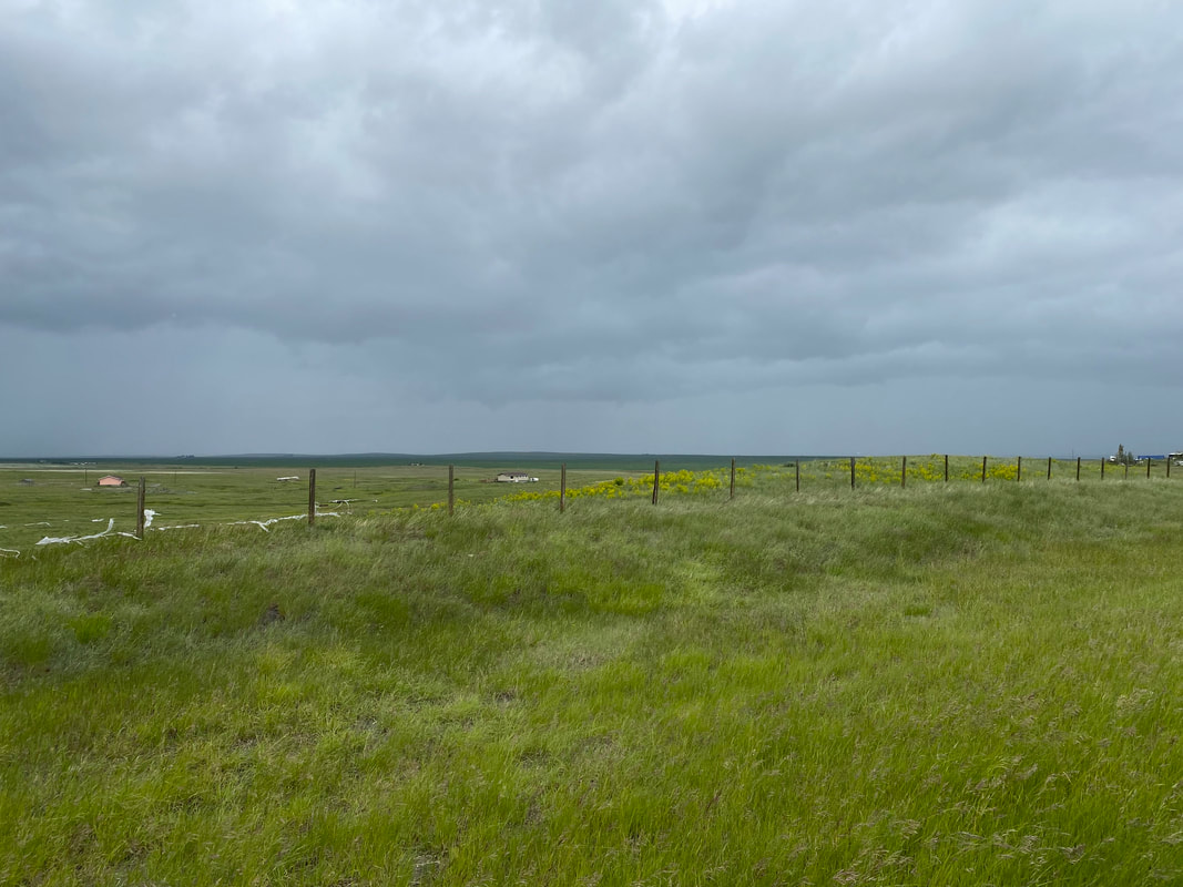 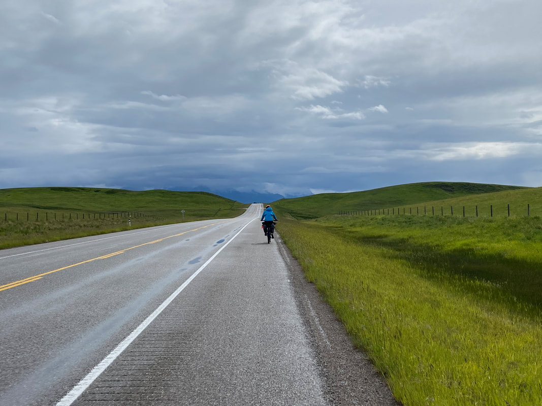
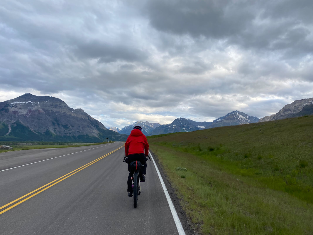
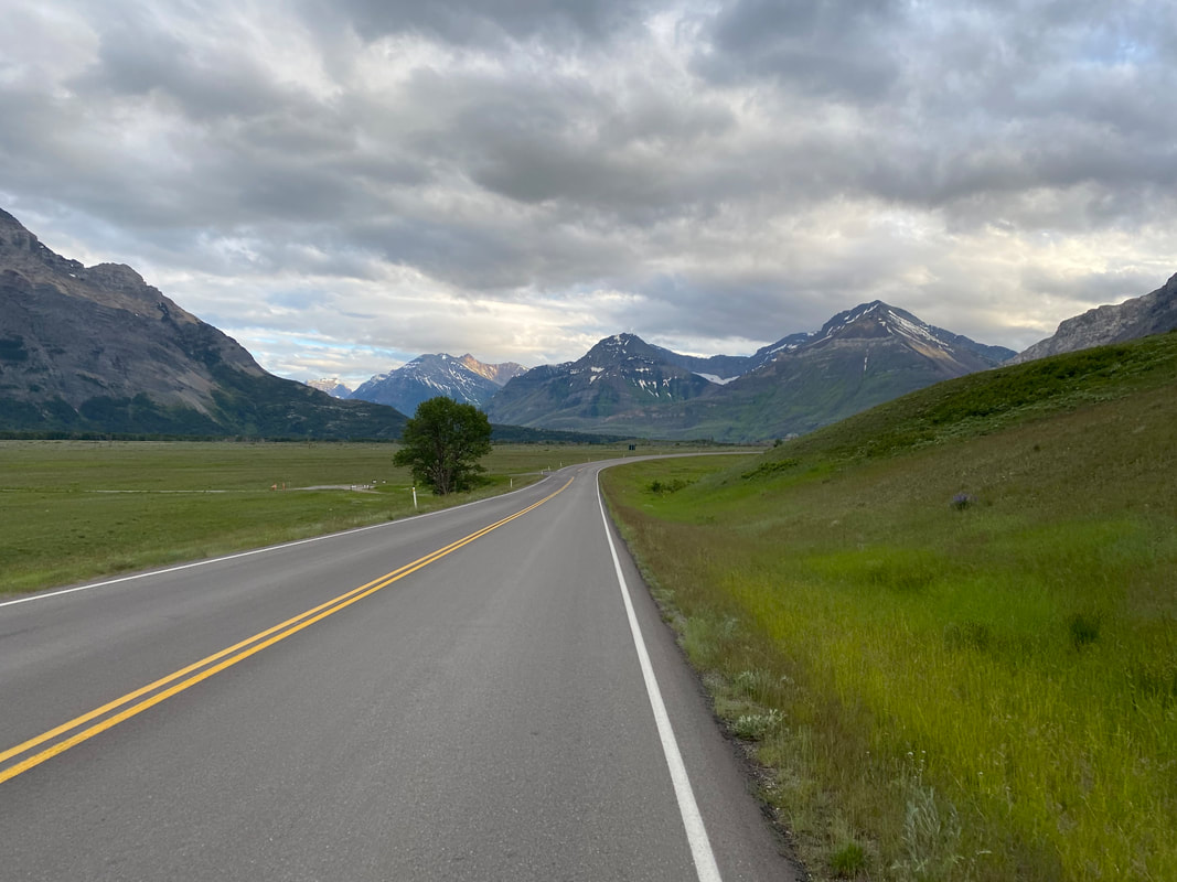
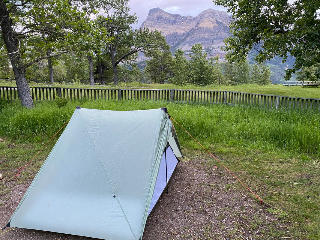
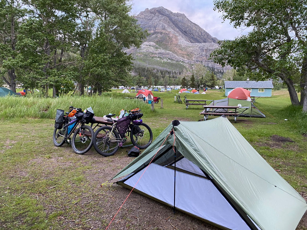
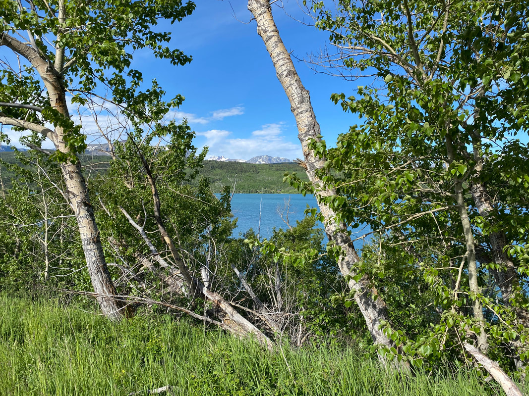
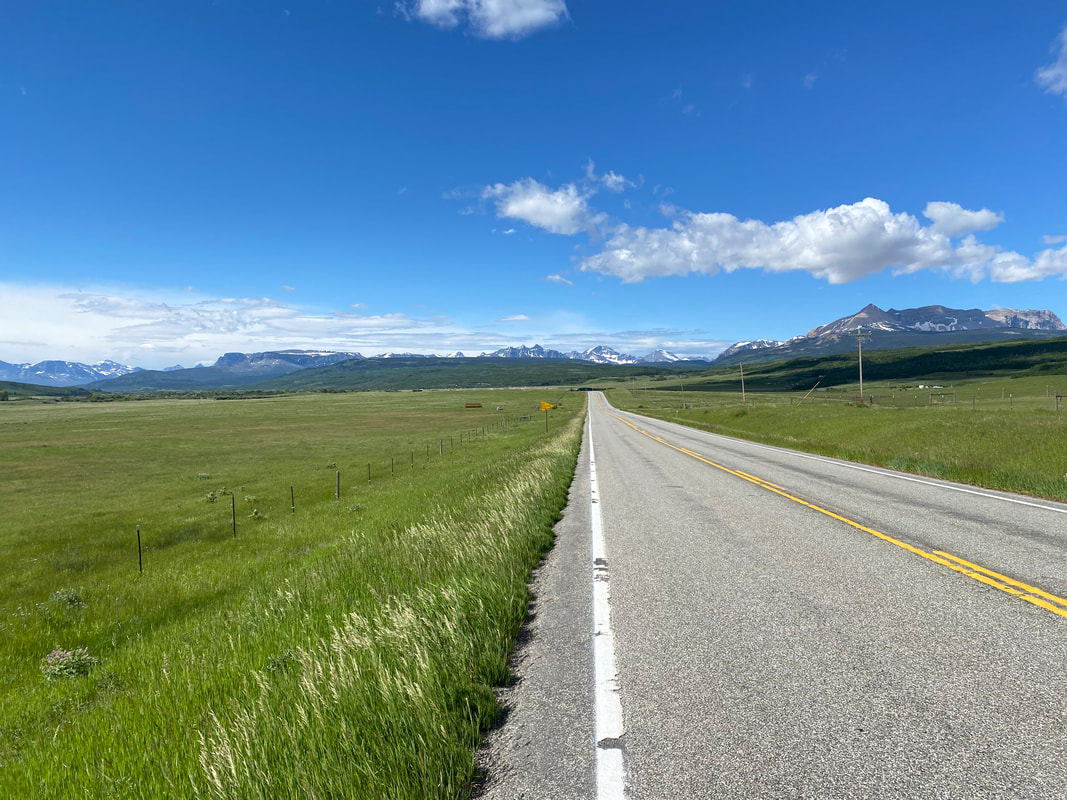
   Early evening came crawling on, but due to the northern latitude, the sun would stay out well past 11 pm. More blue cracked in the roll clouds. We dipped down towards the flanks and foothills of the Rockies. Rivers sucking on the runoff raged around us into the distant plains pregnant with silt and whitecapping as they went. Trees began to appear in the lees of hill-folds. I began to keep my eyes pealed for large wildlife. We stop at a lonely gas station empty of customers to shake the cold and catch a restroom. We need to keep going, it's almost 9 pm. The storms begins to break up in earnest. The wind abates. The long golden hour of the north begins to preen. And we arrive at the front signs to Waterton Lakes National Park. It seems that we have arrived at the most remarkable hour of light, cloud, peak, and grass - everything contrasts sharply and my breath is taken back at the beauty. It feels utterly wild. Herds of ungulates graze on open plains while shards of mountains rise from the neon flatlands. Alder and willow grow in the drainages, lining the waterways. Lower Waterton Lake swallows the land around us at 9:30 pm. I am taken still by the delicate snow on mountainsides, freshly fallen. By the warmth of light hitting us. By the still air now surrounding us. It is mixture green and white. After checking in at the entrance ranger station which is staffed until 11:30 pm on these long northern day-nights, we ride down a bike path. I look to my right and stop suddenly. On a hillside next to us, about 50-75 yards away, is a mother grizzly bear with two cubs. It's my first view of a wild grizzly bear, let alone one with twins. They forage in the tall, lush grasses (I eye my bear spray in wait). We head to the opposite side of the road, watch for a few minutes, and then ride further into the gorgeous splayed valley as mountainside swallows the road. I am awed by the beauty of it all. We arrive at the manned campground station at 10:00 pm and are directed to our reserved campsite, which turns out to be adjacent to a large field near a river tumbling into Waterton Lakes. We setup the shelter, amazed to be here despite a tough day. And to add to the sweetness of it all, the bathroom/shower facilities here are the best I've ever seen in my life. Literally, the public showers have granite countertops, unlimited hot water, and seem cleaner than my personal shower at home (or even a hotel!). We let the warmth of hot water steam our blood and return movement to hand muscles. We eat at 11:30 pm just as the last glows of day fade from the horizon. 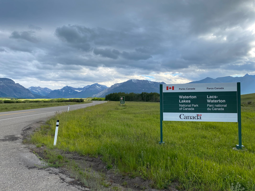 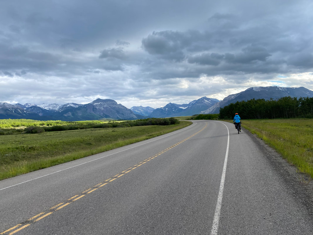 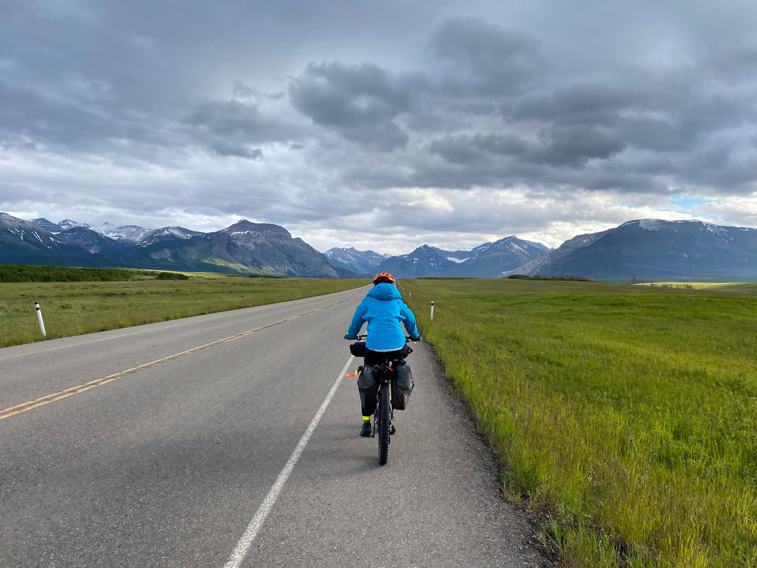 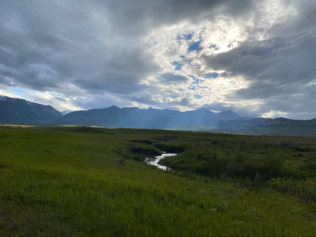 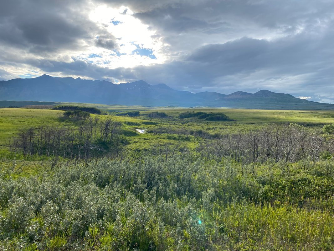 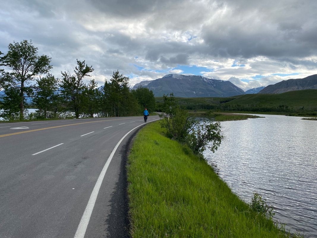 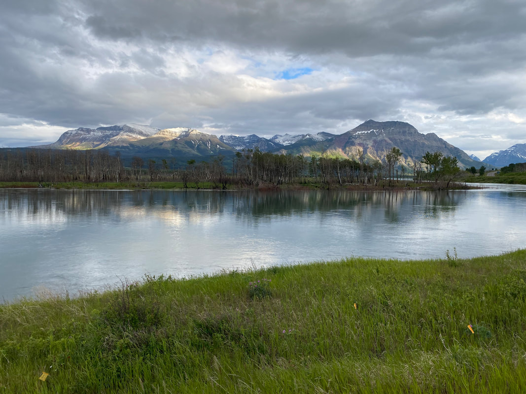 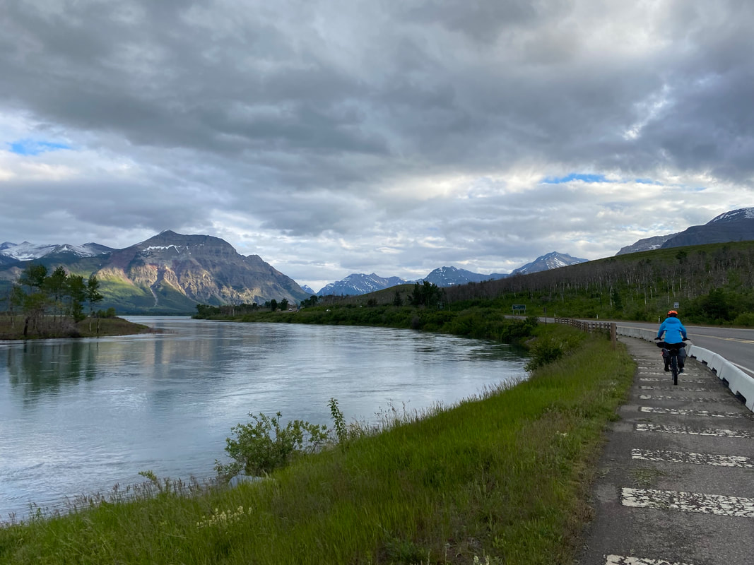 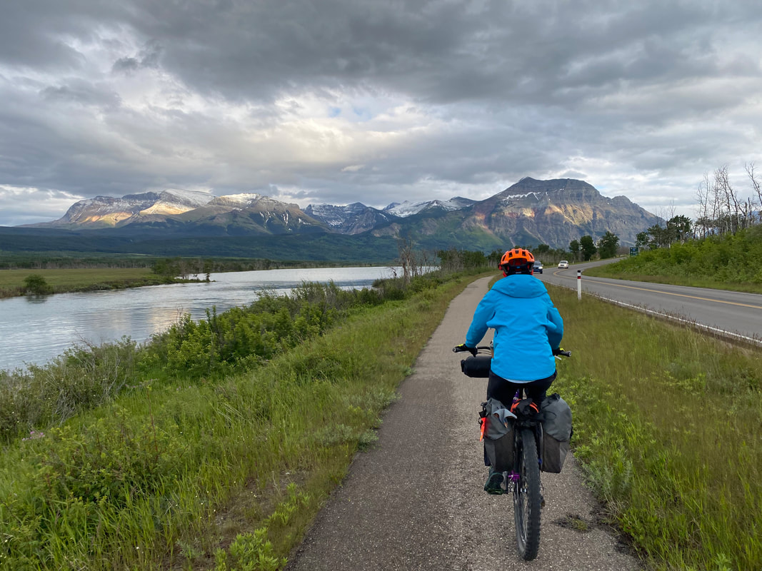 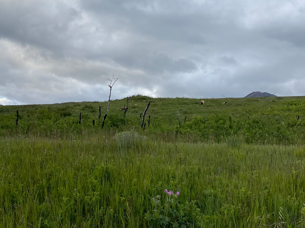 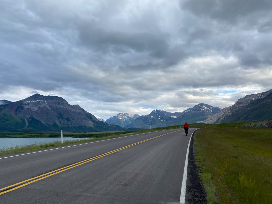
|