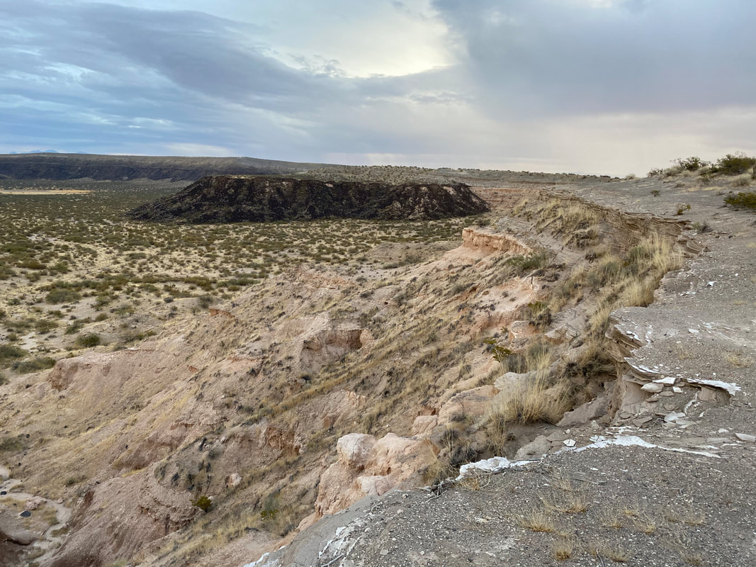
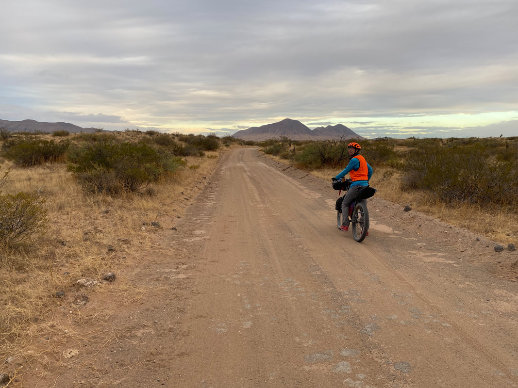
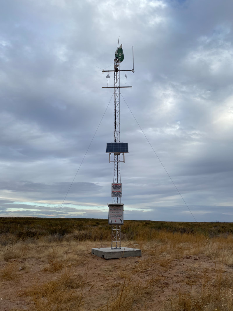
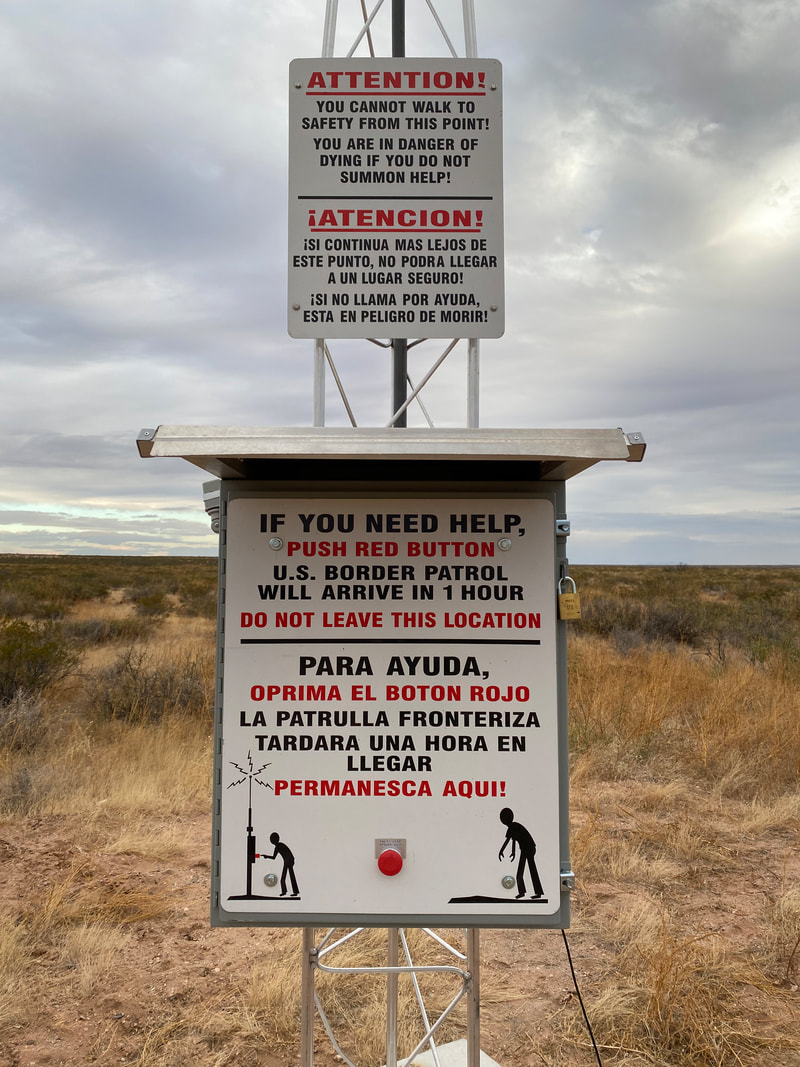
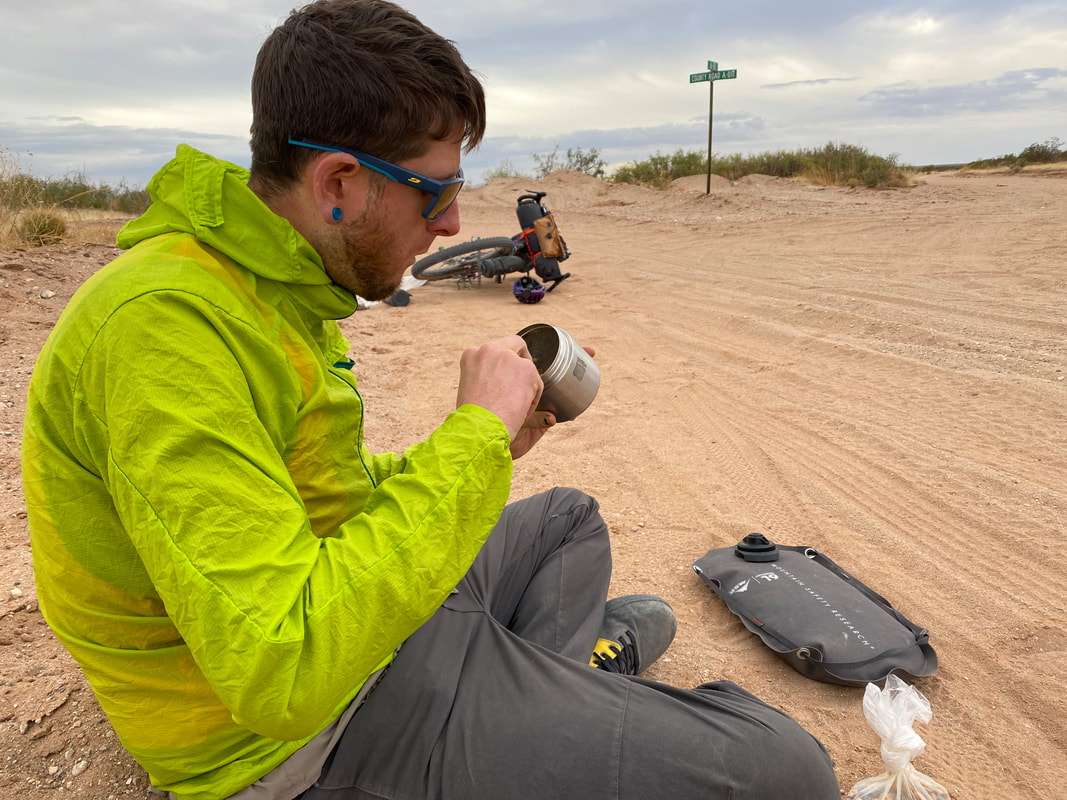
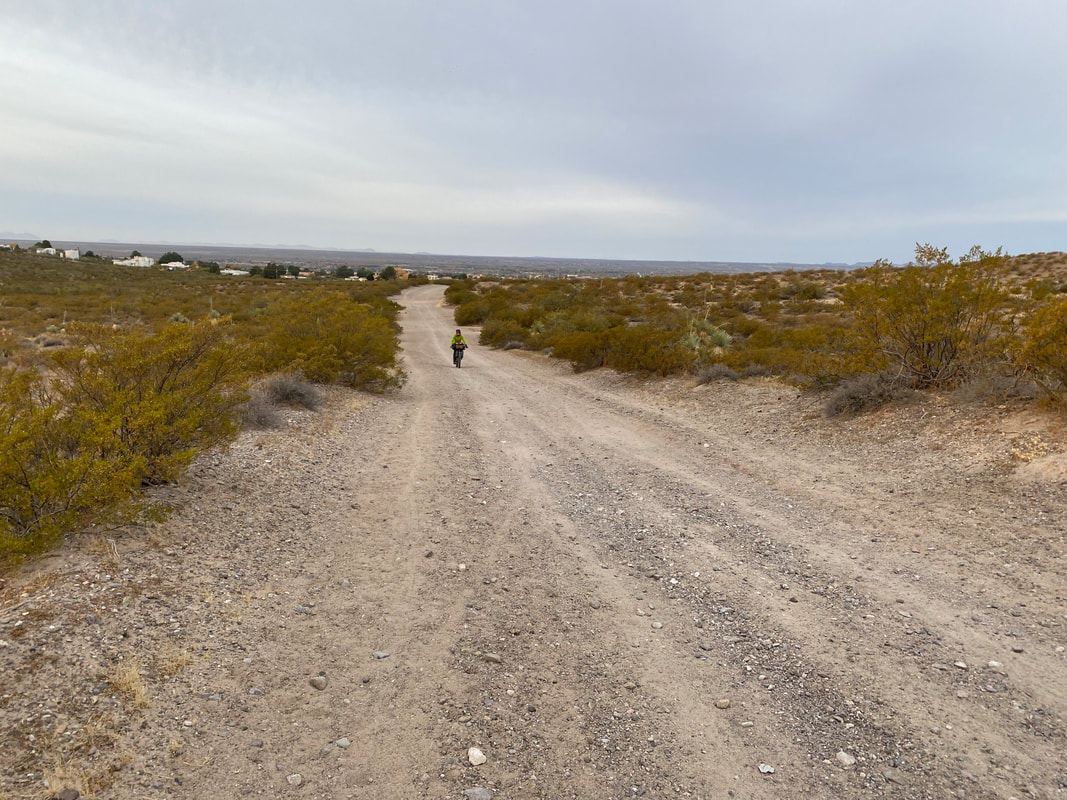
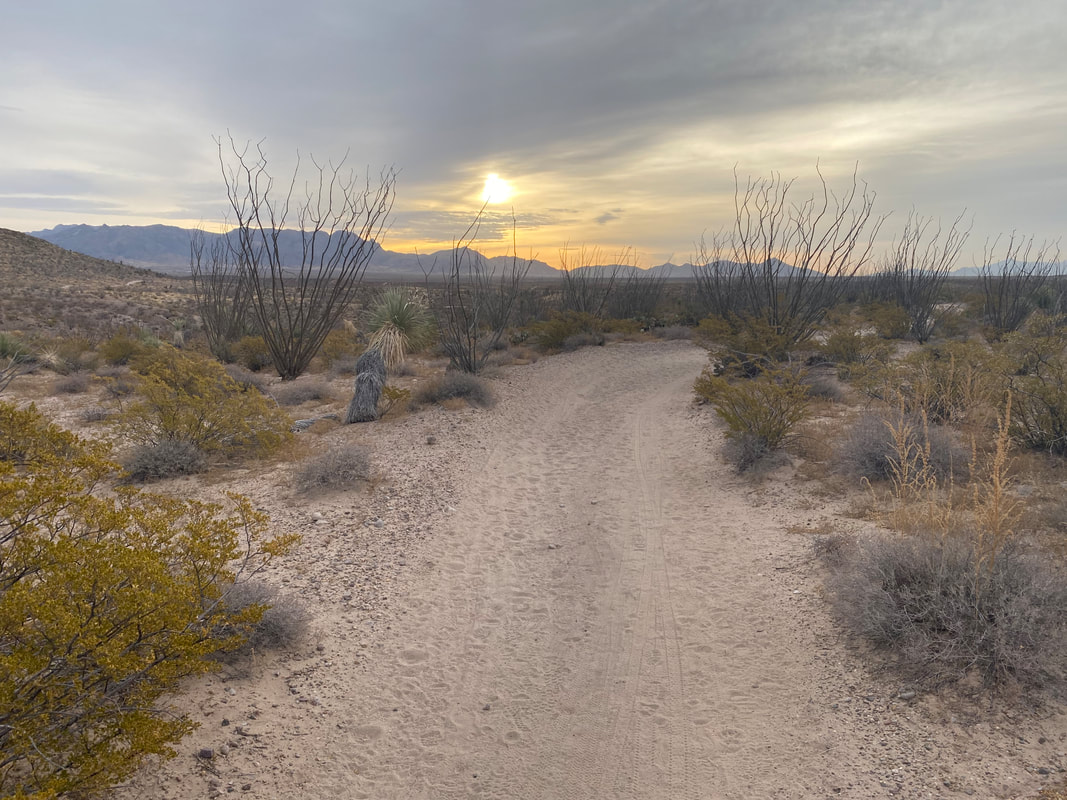
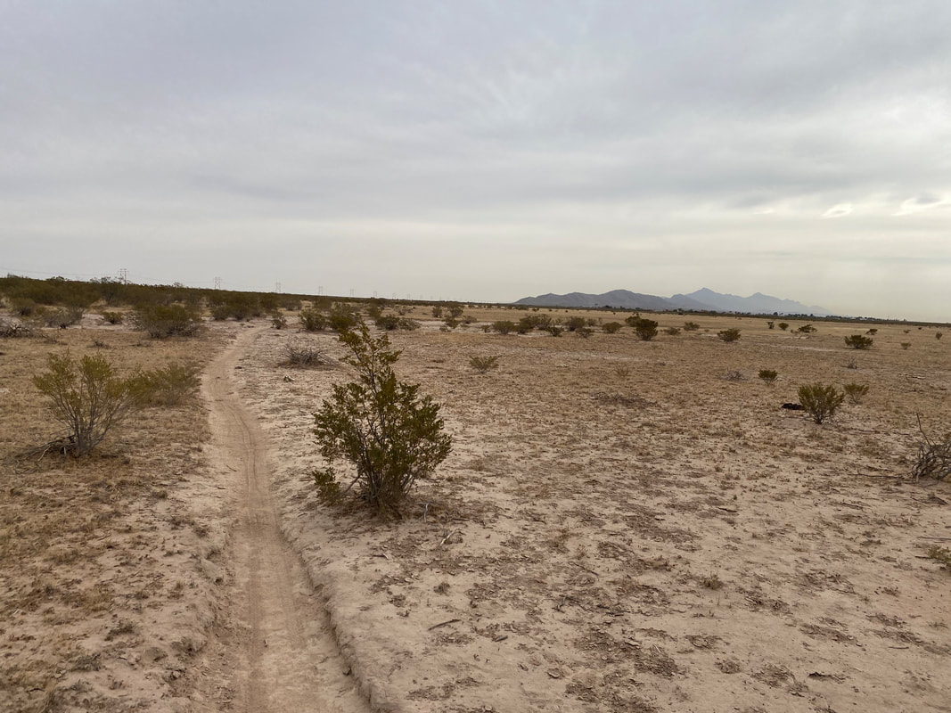
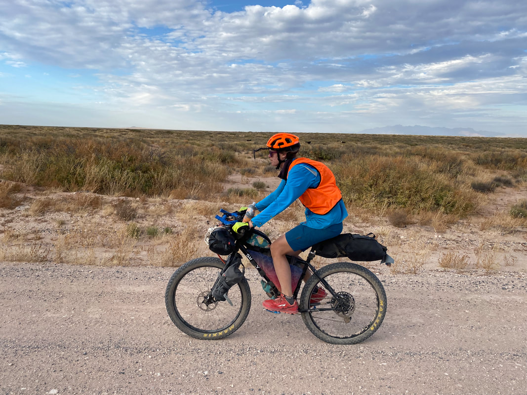
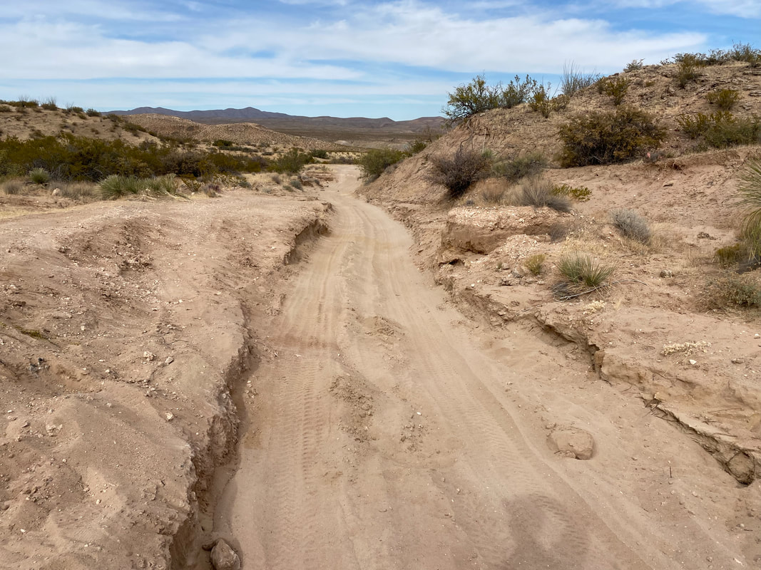
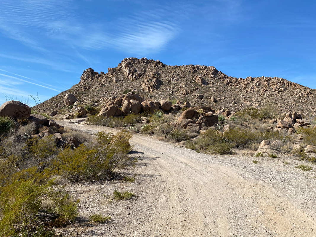
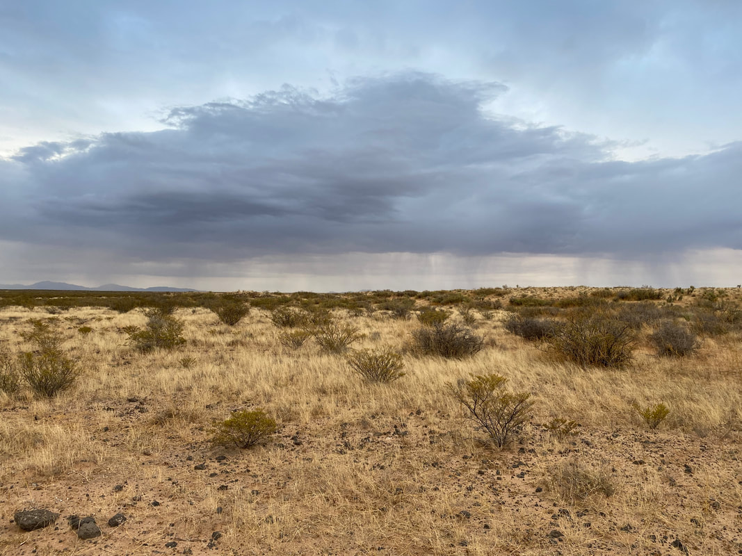
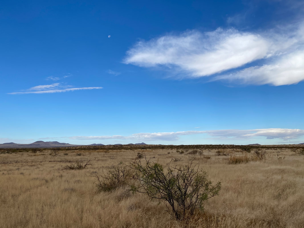
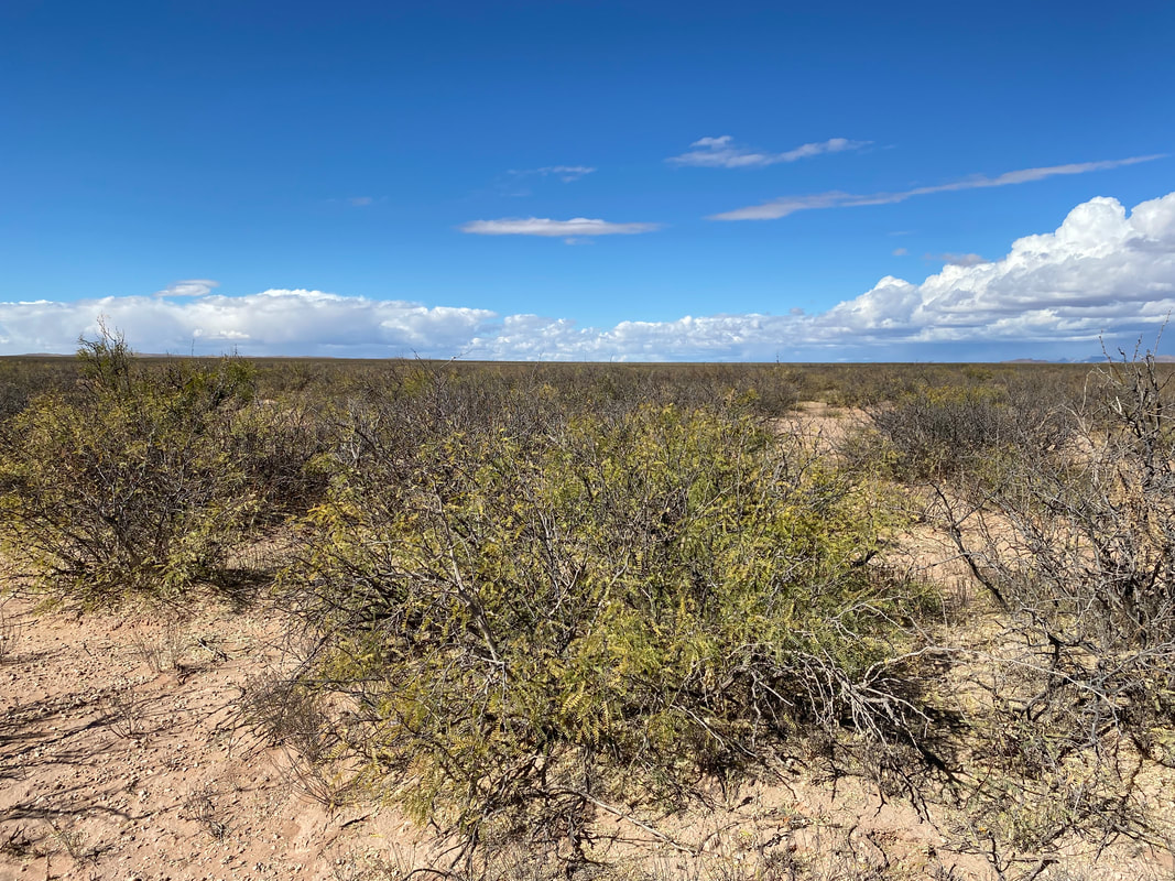
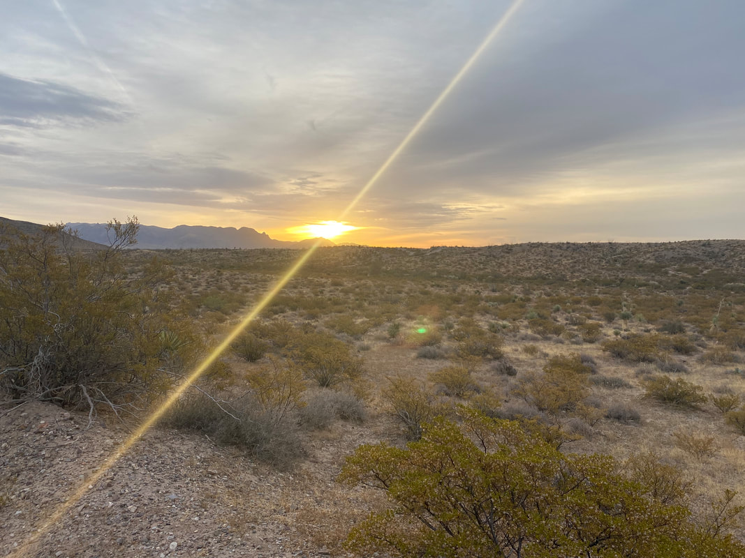
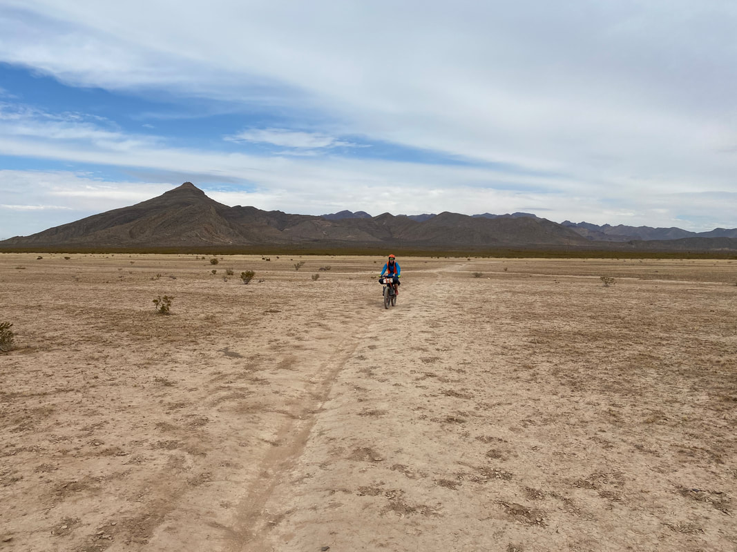
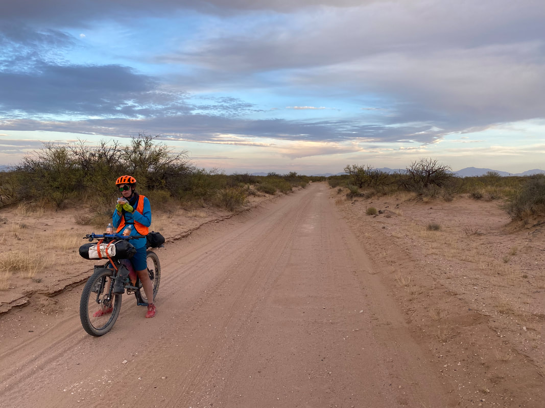
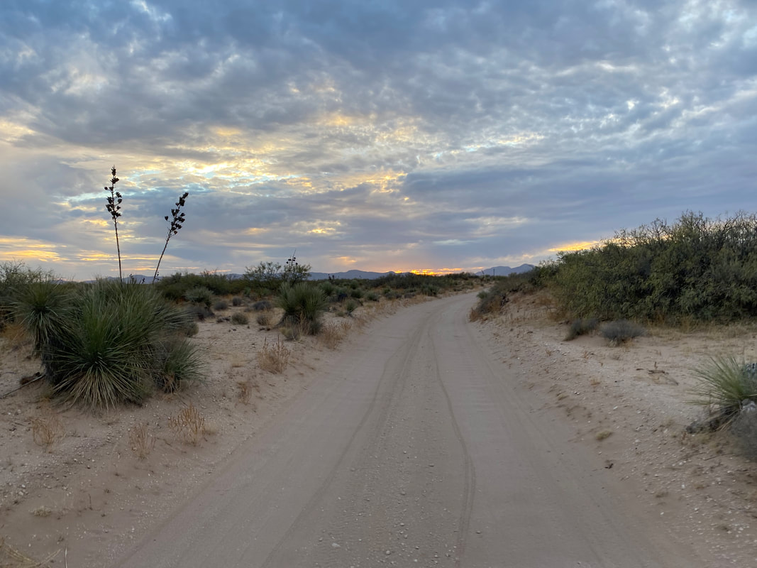
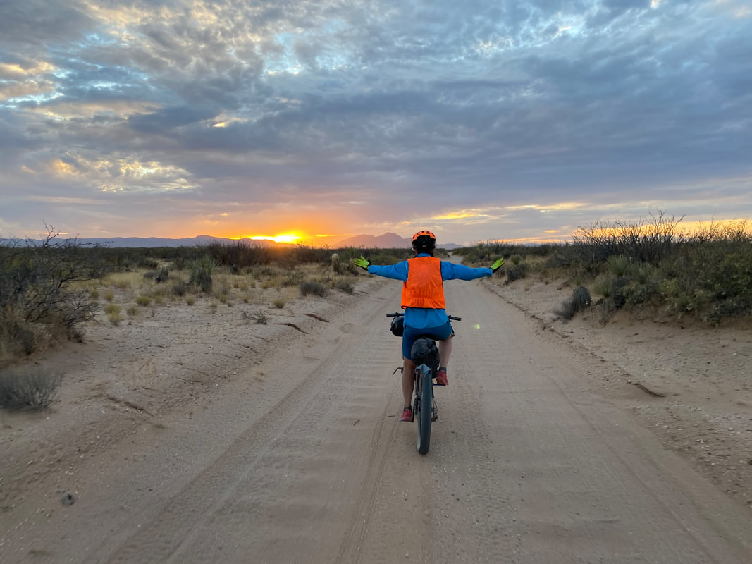
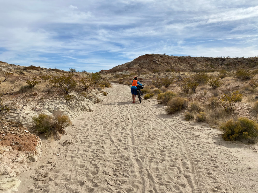
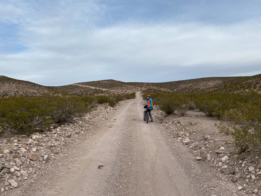
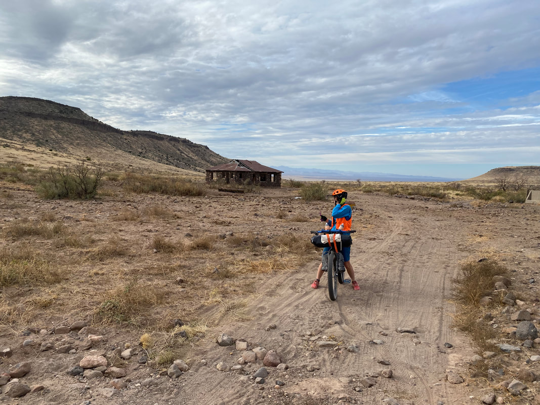
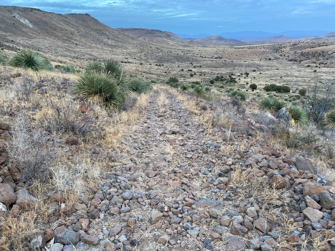
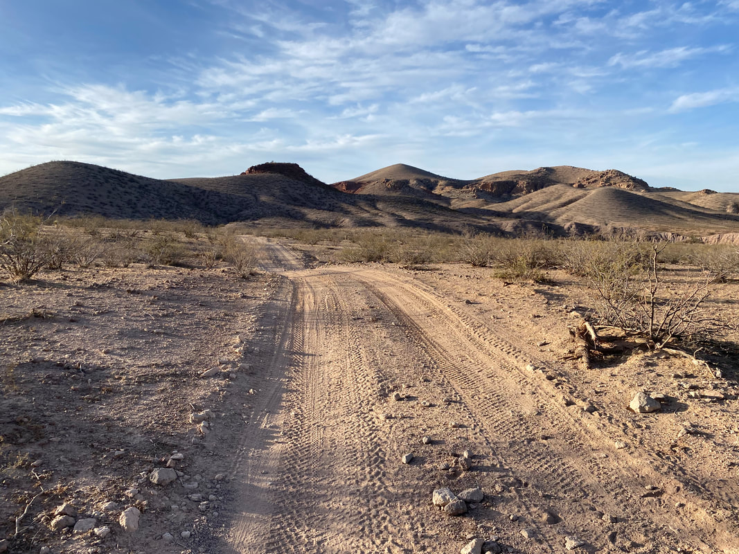
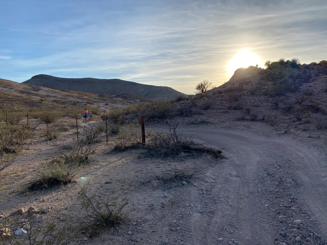
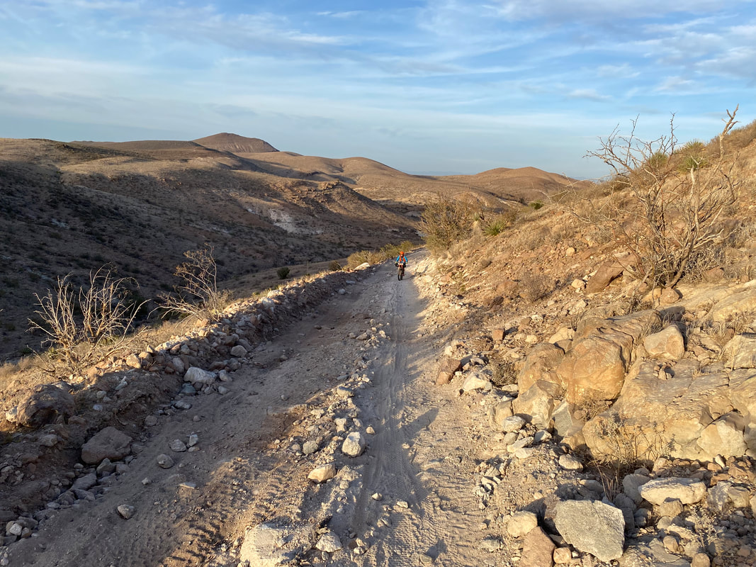
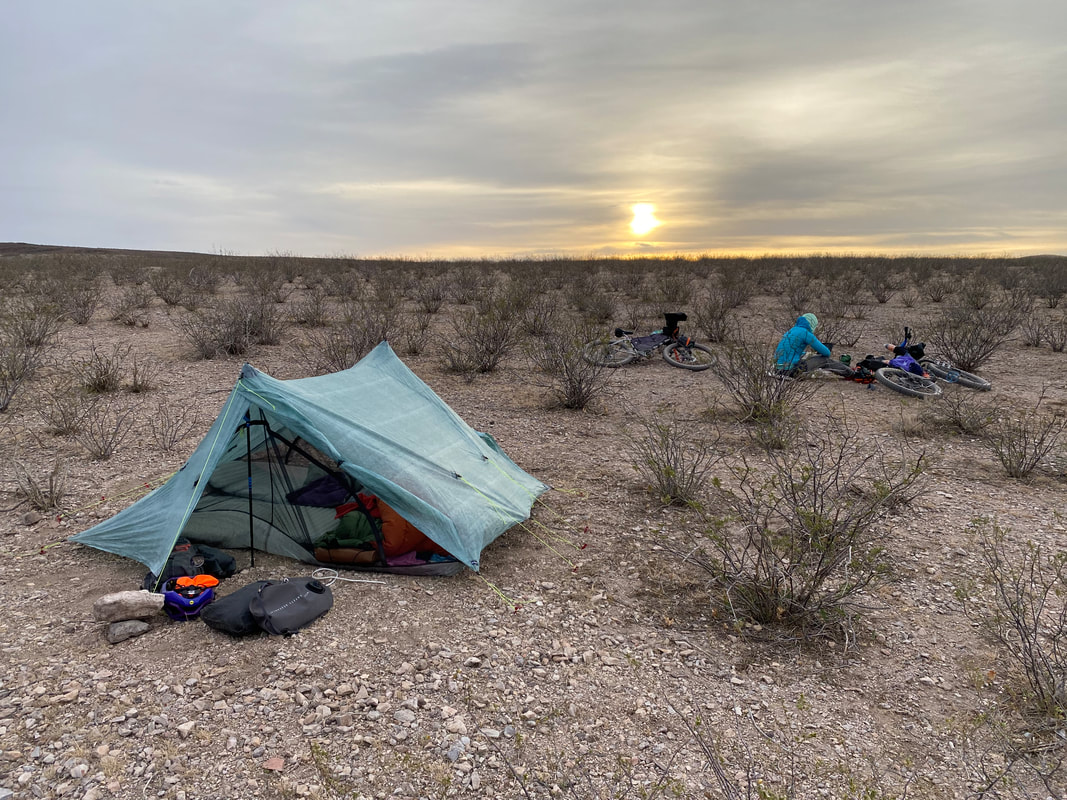
52.5 Miles; Kilbourne Hole to Las Cruces, NM  At 1 in the morning, I wake up to the rustling of the tarp fabric. I ignore it and will myself back to sleep. But then, sometime soon, it starts making a noise again. I wake up and realize a strong wind is hitting our shelter on the broadside. I nuzzle Janna lightly and ask her if she thinks the test will be okay in our exposed and salient location. She says yes and drifts back to sleep. The wind continues to build, occasionally bursting with such power as that the fabric ripples and echoes with noise that wakes me up. A wind storm has decidedly built during the night. The patter of rain starts and I ask Janna if we should pack up and move the shelter in the dark. She says she feels confident it will be okay. I shove earplugs in deeply and go back to sleep. Around 6 am, I wake up as the wind is in full force. Janna is awake and looks exhausted; she admits she hasn't slept for a while to the noise of the tarp shaking and whipping in the wind. "Damn, the front must have arrived early in the night. I hope the road doesn't decompose to peanut butter mud," I say out loud. I unzip the Triplex and poke my head out of the flapping doors. A larger squall of rain is barreling towards us in the distance and wind directly in my face is intense! "Holy shit, it's gotta be a constant 30 mph!" I exclaim. "Do you want to leave right now or wait?" Janna asks me. "I want to lay in the warmth of my quilt and tent until the rain passes. Let's wait at least 15 minutes," I respond. Not 10 seconds later, a 40 - 45 mph gust slams the Triplex, rips all the stakes from the ground, and sends my trekking pole support inwards where it hits my arm. "SHIT!" I yell. Janna's trekking pole is holding but I'm laying prostrate trying to prevent the strong gusts from flipping us and our shelter end over end. All my cycling gear that had been stored safely under the vestibule is now in the full brunt of the wind. I imagine my helmet and clothing bags flying off the side of the peninsula some 50 feet down to the next shelf of rock and land. We have to get out of here NOW. As my spread body is holding down my side of the tarp in the wind, I tell Janna to exit on her end and attempt to find a place nearby with some sort of wind-block. She climbs out and the other trekking pole goes as the shelter completely flattens on me and snaps intensely in the wind. Janna comes over and tells me that she found a small bunch of yucca nearby that provides a foot or two of wind blocking. I climb out of the tarp barefoot and drag the shelter with all sleeping gear wildly whipping in the wind behind the yuccas. I run back out into the full gale upon us. Dark squall clouds roil overhead as a curtain of speeds across the open crater in front of us towards us. Somehow, my bike gear has barely budged in the wind and nothing has scattered. I quickly grab my shoes and put them on as well as my rain jacket as raindrops arrive seconds later. I turn and stare towards the sun rising in the distance as an explosion of red/orange/pink splinters the sky's storm rolls with color. I snap a single picture as the yuccas begin to shake and spread in the wind. The rain starts falling in earnest, but the morning is probably in the 40 -50s, so not as cold as it could be. While the curtain of rain passes over, I sift through the collapsed shelter fabric to pull out my sleeping gear and try to get it them put away before they get too wet. The rain passes followed by some dry with another curtain of rain threatening in our direction in the distance. We quickly pack up the rest of our gear, relieved that nothing has vanished in the crazy storm gusts. We stagger up, bracing against our bikes in the wind and make our way back from the peninsula of land jutting into the crater back to the large expanse of creosote which blocks the wind simply well. We jump on the bikes and head down the dirt road that meets back up with the main county road. The road seems appears sunken below an earthline of silt and so trades wind for sand as the primary difficulty. We weave through a land of sand and bush getting ever closer to the Potrillo Mountains which rise as prominent cinder cones amid the volcanic-scape. We dodge the next curtain of rain and intersect with a second county road that leads southward in a giant loop sandwiched between the US/Mexican border and the Potrillos. Apparently, the older version of the route took this additional loop; it was removed in the current route guide because of miles of crazy deep sand. We turn where the road converge and find the source of the flickering light from the night before - a Border Patrol Emergency Station. It's a large white tower powered by solar with a dual-language guide, graphics of humans suffering from heat, and a large red button to be pressed in survival situations. We are only a few miles from the border, so this station sits for immigrant use when crossing the desert. After having skipped breakfast to escape the exposure, we sit below the tower and eat what breakfast we have remaining. 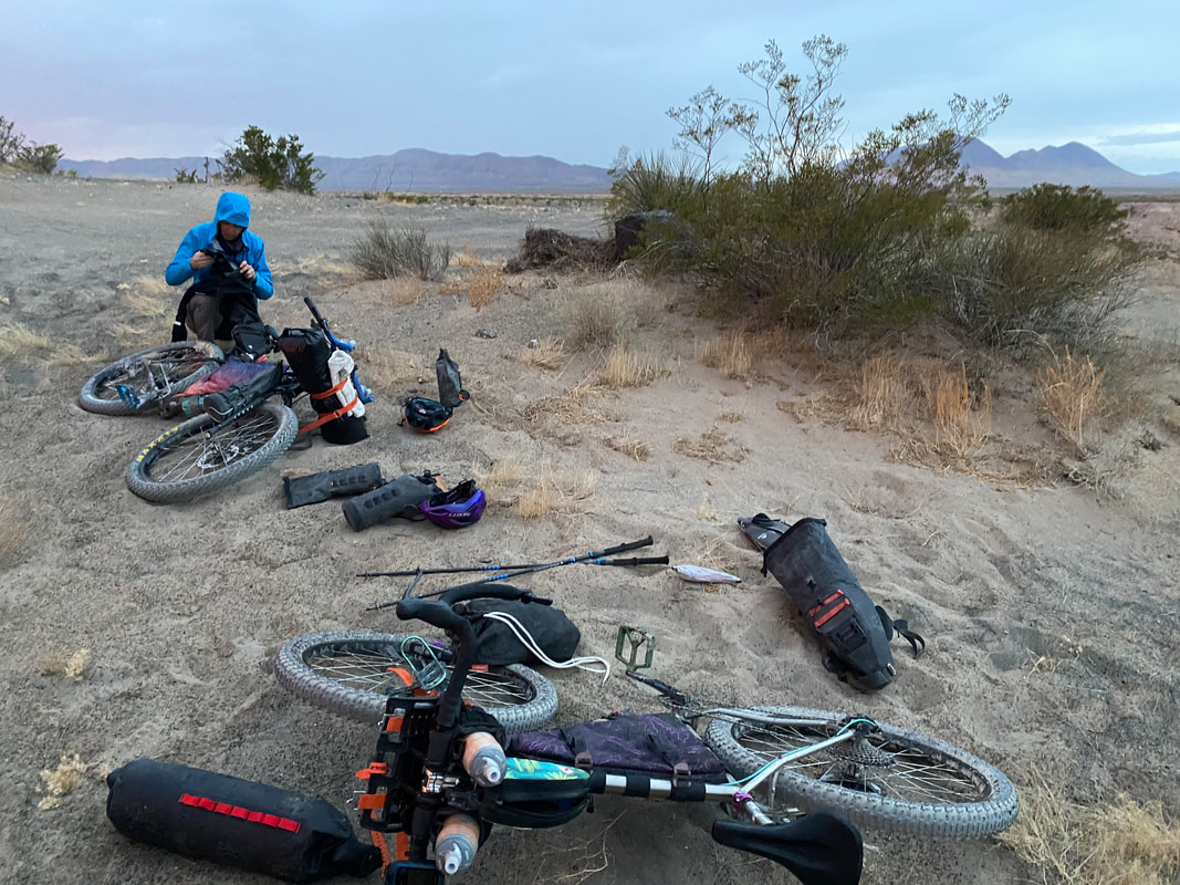 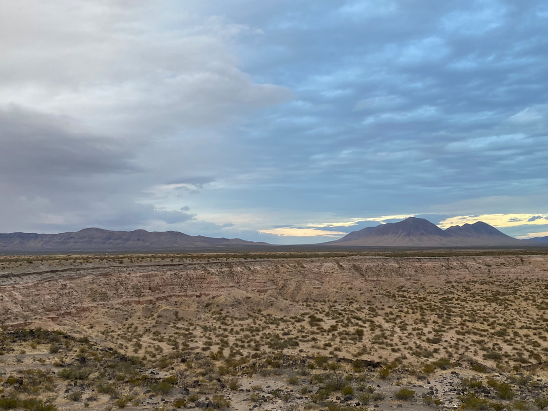 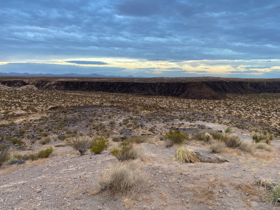

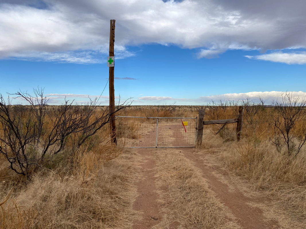
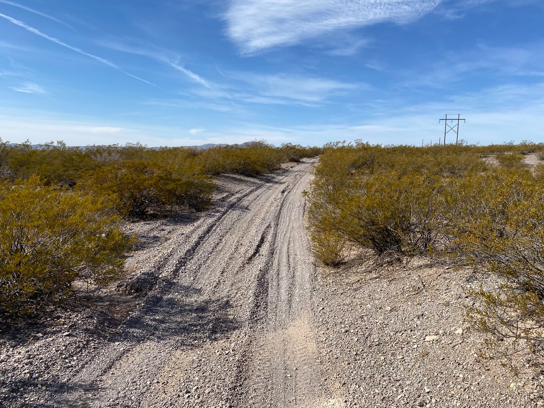
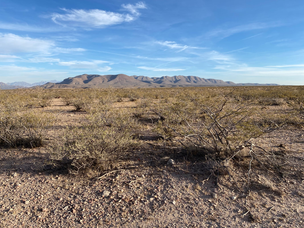
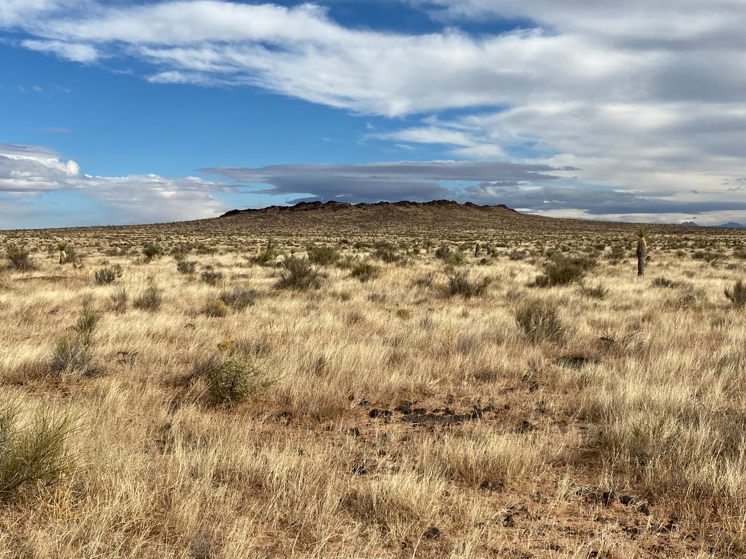
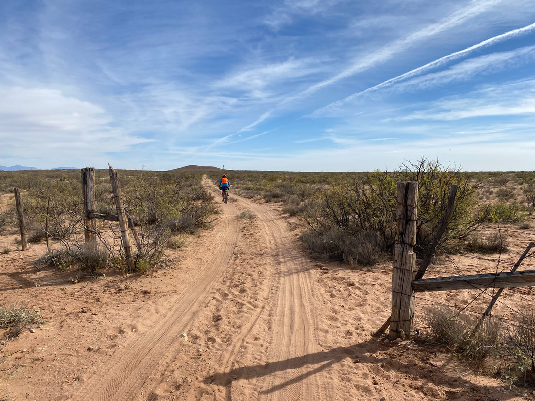
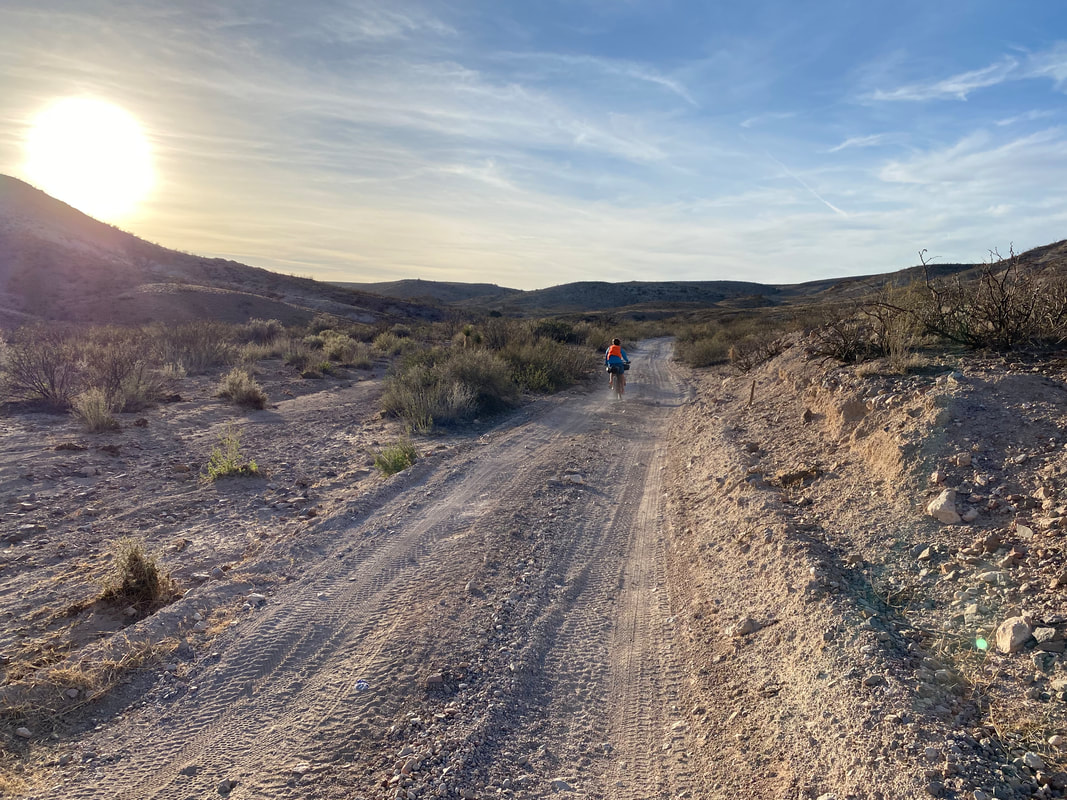
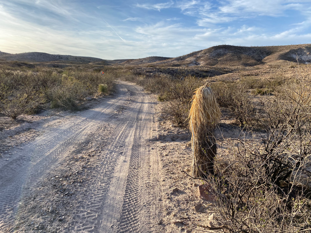
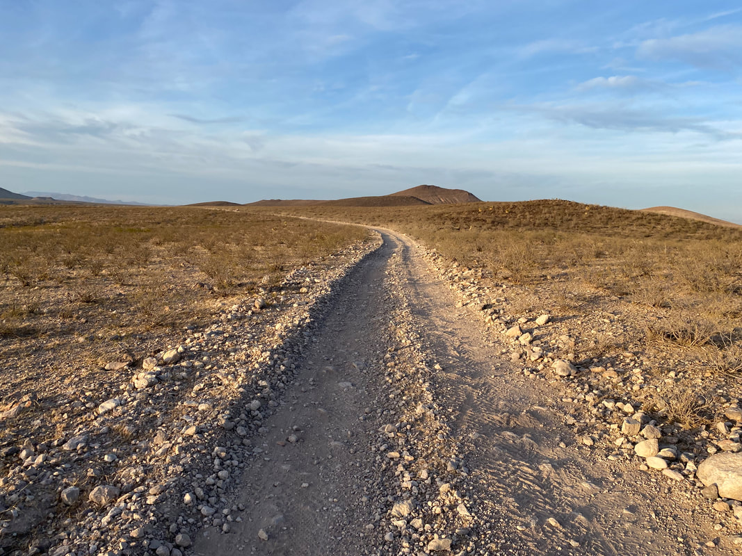
Fed and better organized, we pack up and start out across the vast grass and creosote land. We pass by the Aden Lava Flow Wilderness and the Aden Crater Wilderness, the former made of black flows of volcanic rock and cinder that have solidified into rolls of land now studded with barrel cactus and grass. The double track alternates between comfortable smooth and chunky with large black rocks. Every time we pass a fence-line for cattle, prominent signs listing Border Patrol sector titles and 911 directions adorn the barbed rails. We have a good tail wind, the sky is wicked blue with drafts of clouds whisking at stratus level along with a moon still visible. It's gorgeous. The miles pass easily until about noon when we leave the sandy double track and join a main country dirt road that parallels the massive El Paso Railroad line from some 15 miles. The route proper takes the county road west until it meets a road that properly crosses the road. However, the route guide indicates that, "if we look hard enough, we should find a gate in the fence where we can quickly cross the massive group of tracks." The guide also warns that high use of these rails, the dangers of trains, and to use solid judgment. With the prospect of shaving off nearly 15 miles of unnecessary riding, we turn east instead to investigate a "gate" in the massive string of barbed wire and wooden fence that parallels the track endlessly in either direction, obviously to keep free ranging cattle off the tracks. Down the tracks a hundred yards or so, I find a "gate" in the fence that consists of a series of long cactus skeleton rods strong with barbed wire in a cowboy gate. I can see distinct, but old bike tire tracks in the sand on the other side. Cautiously, I let the cowboy gate of barbed wire and wood fall to the ground walk up to the tracks to investigate. A massive train is coming down the tracks so I scamper back down and rehook the gate. Straight from El Paso, a long train dragging endless cars filled with cattle head westward for what must be a future slaughterhouse. Janna and I lounge on the county road out of sight. As soon as the last car passes some 10-15 minutes later, I quickly unhitch the cowboy fence and we start sprinting across the tracks. As we get to them, I look left and see that a second train is on its way. I yell at Janna to run as the train is nearing and we need to get the fuck out of there. The tracks rise deeply and catch our wheels as we drag our loaded bikes. I hoist the bike up on my shoulder in pure adrenaline and run down the other side into a field of catclaw with no trail. Janna struggles close behind and I shred my calves to pieces as I spring with my bike through the large-thorned plants. As I reach the barbed wire fence on the other side, I realize I don't see a cowboy gate to exit. I swivel my head back and forth and think for a moment that we're going to have to jump the barbed wire fence with our bikes somehow. Then, I look down and see bike tire tracks meandering towards a 90 degree angle in the fence outline. I sprint over and see a metal stake holding up another cowboy gate just out of the way. I unhitch it, shove my bike through, Janna shoves her bike through, and the second train comes right away. We quickly jump on our bikes and sprint off down the county road at full adrenaline-kicking speed, attempting to get away from the rails as quick as possible. 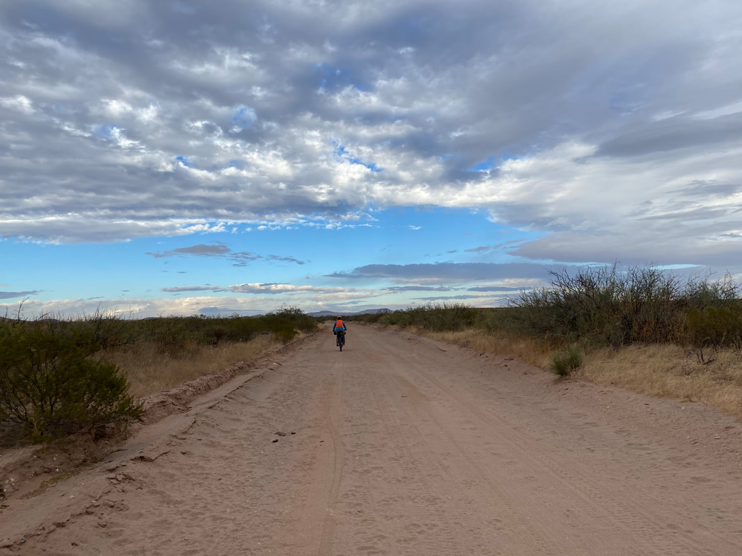 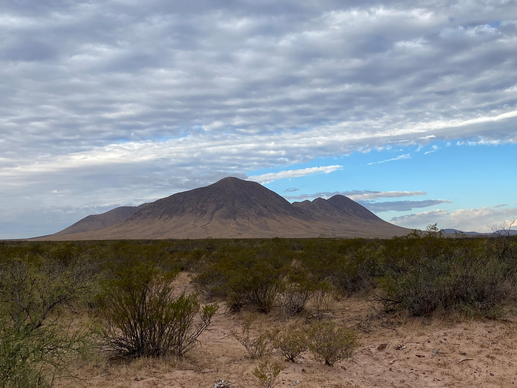 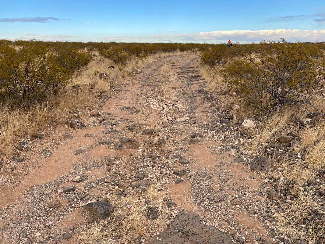 
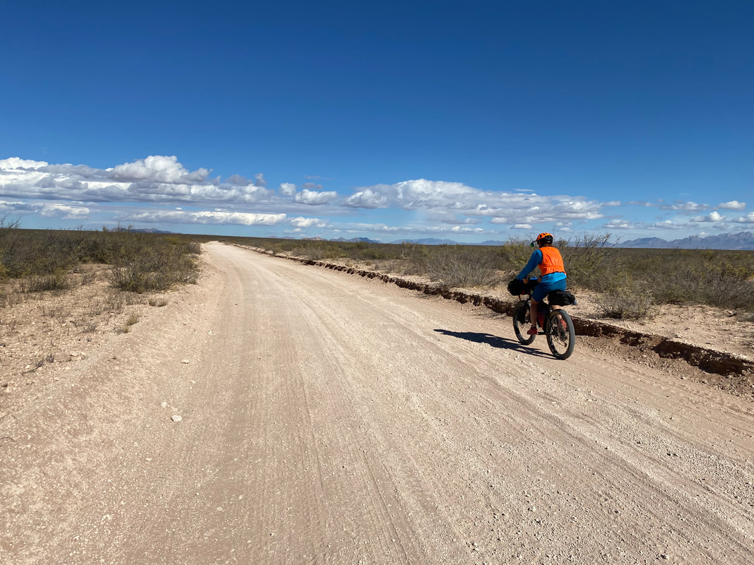
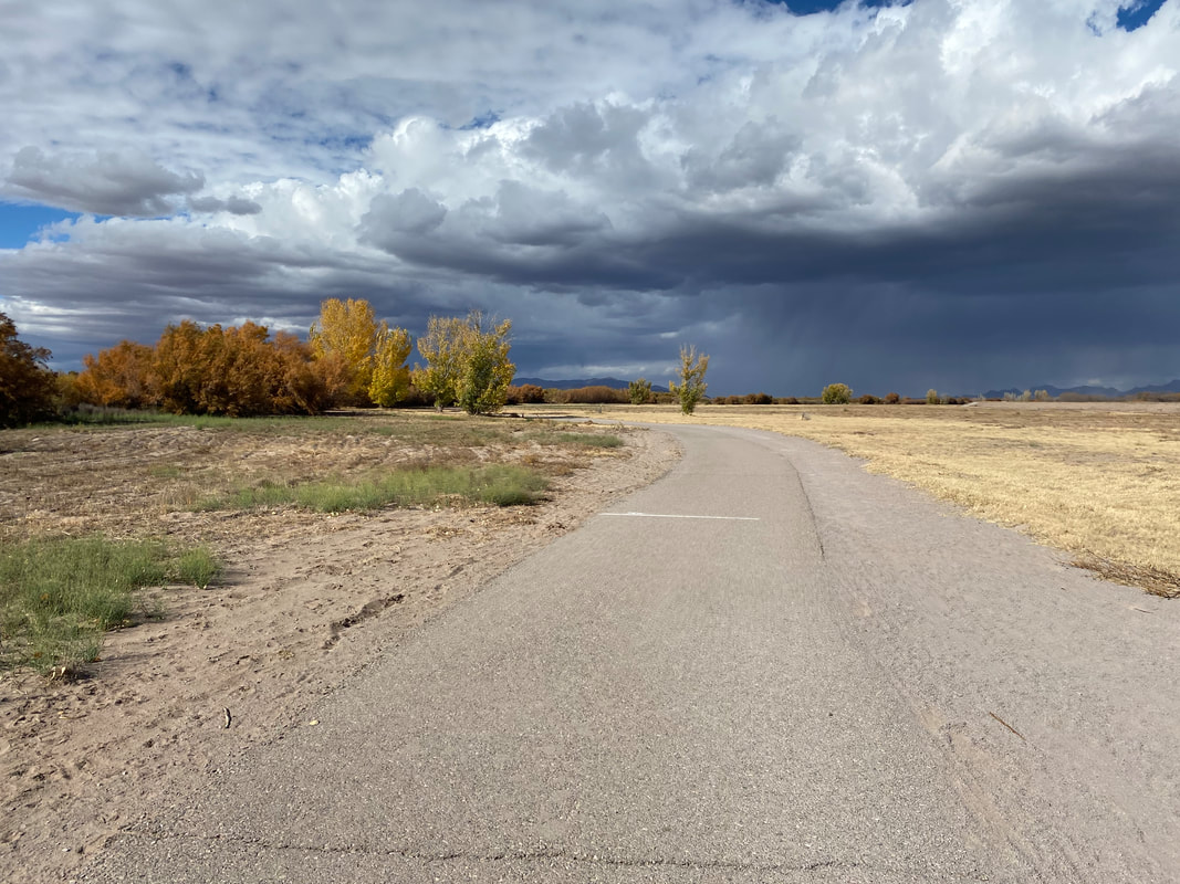
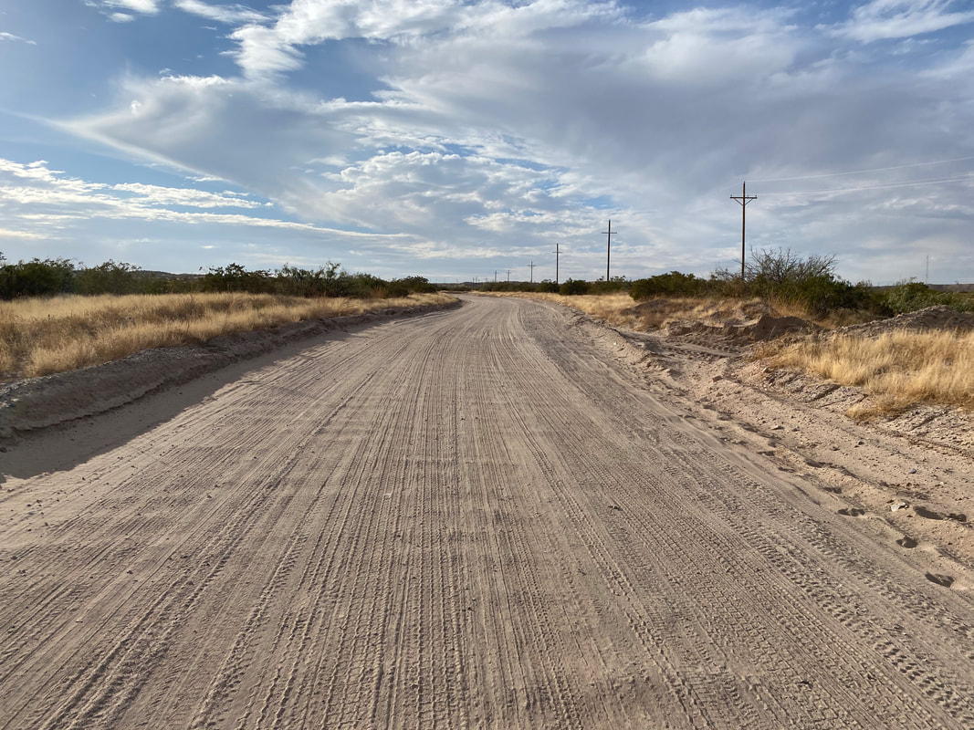
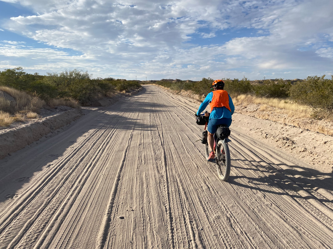
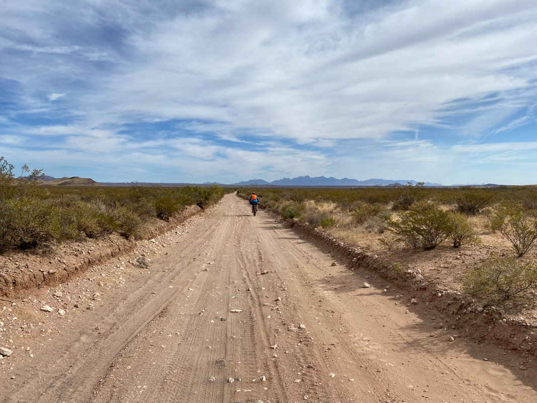
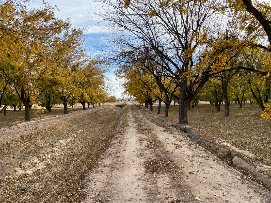
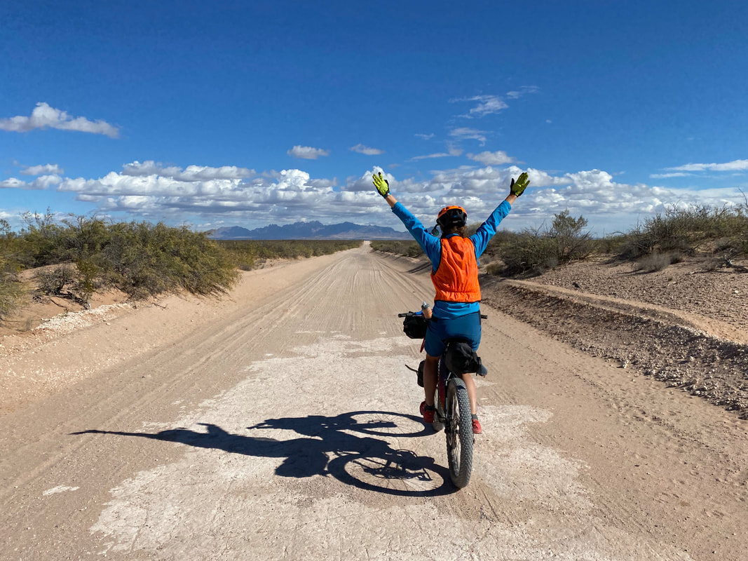
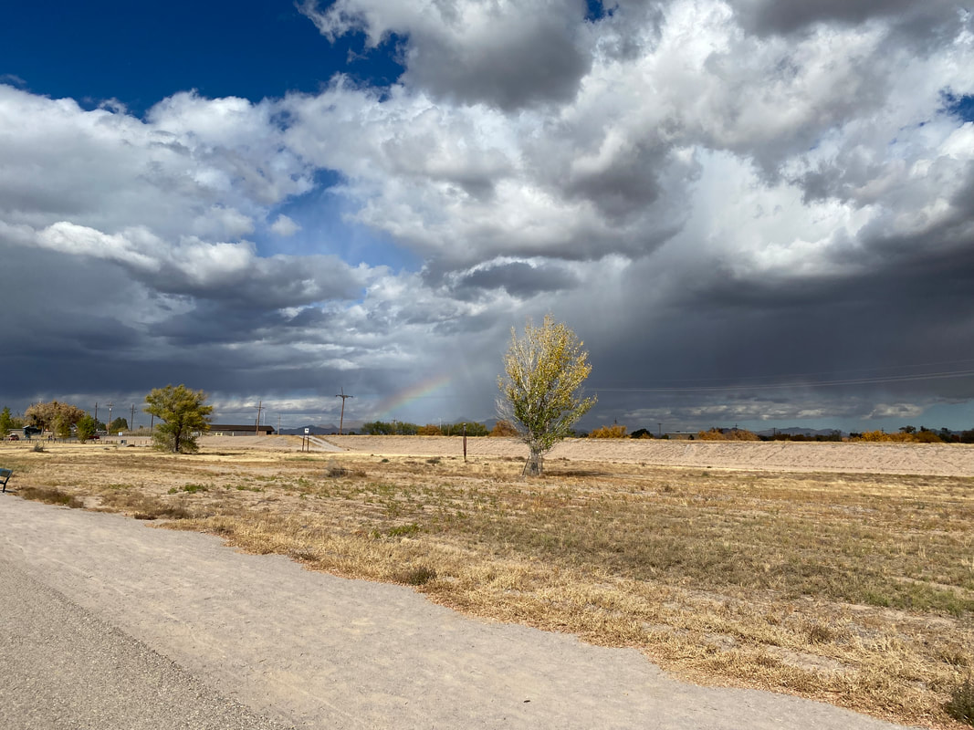
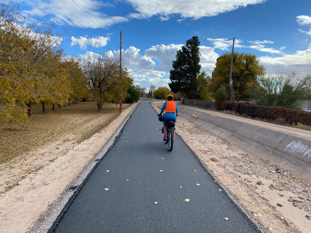
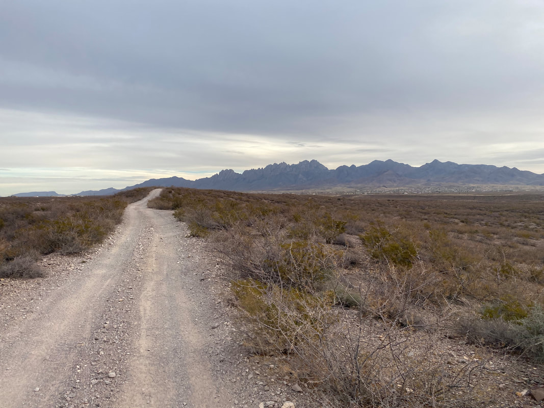
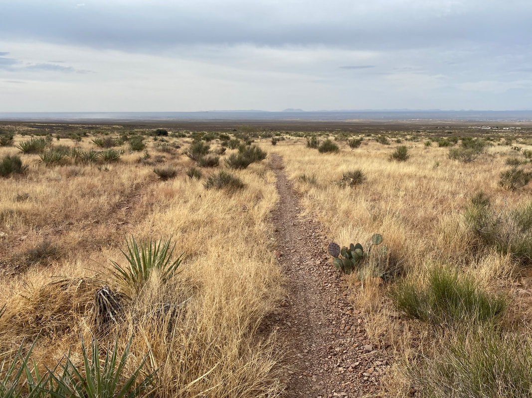
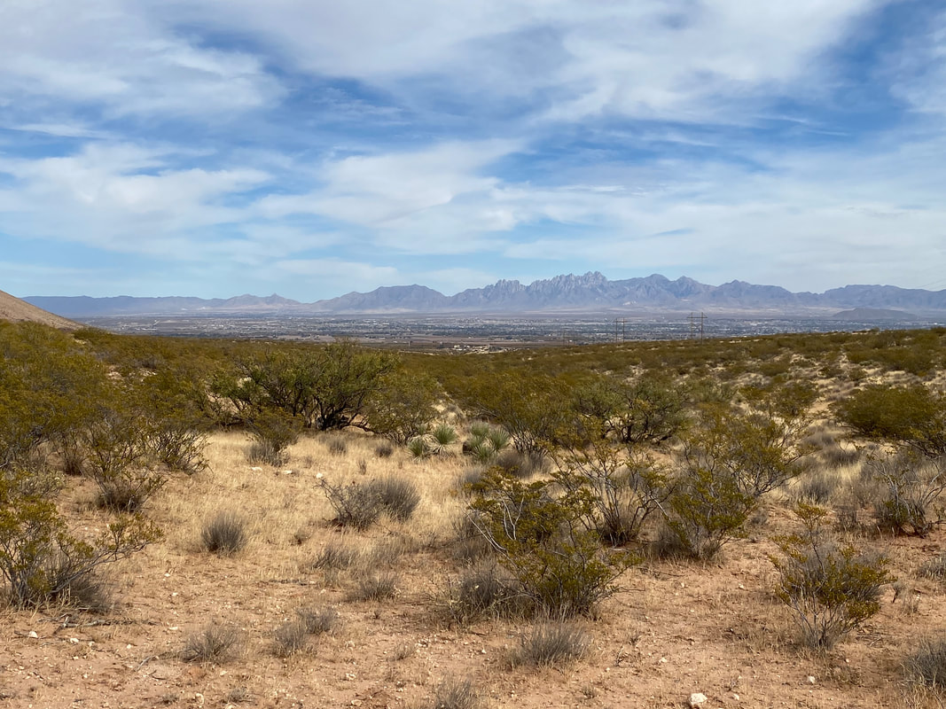
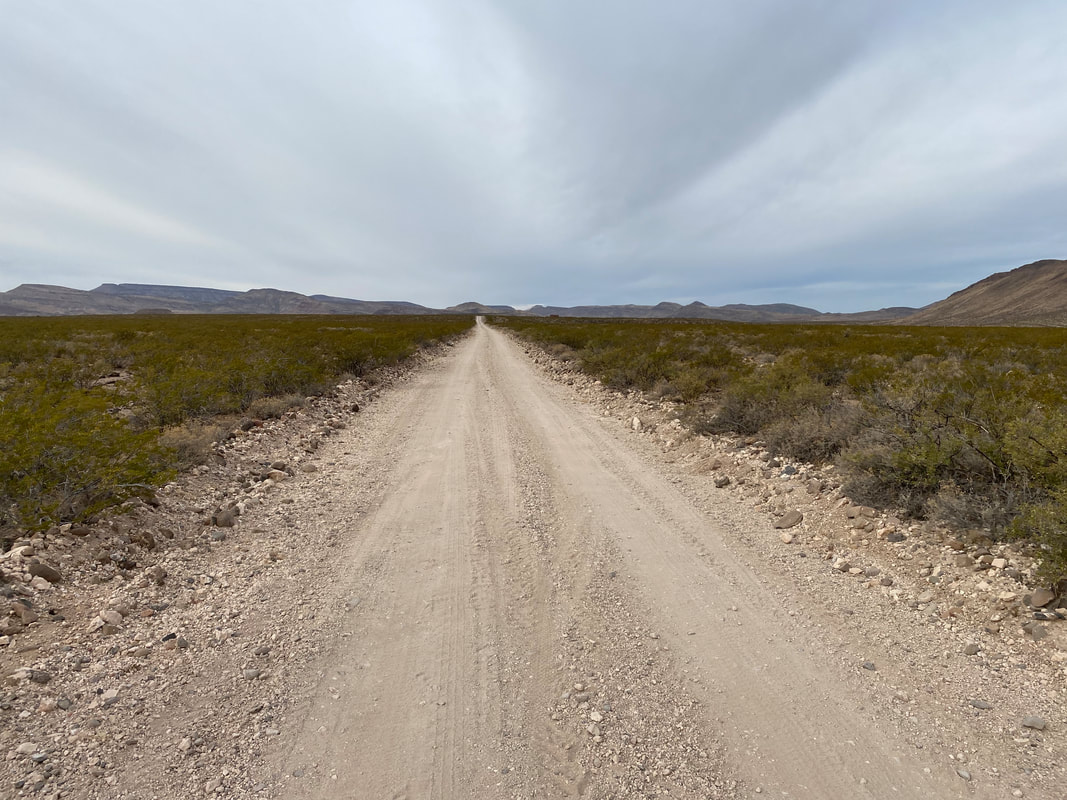
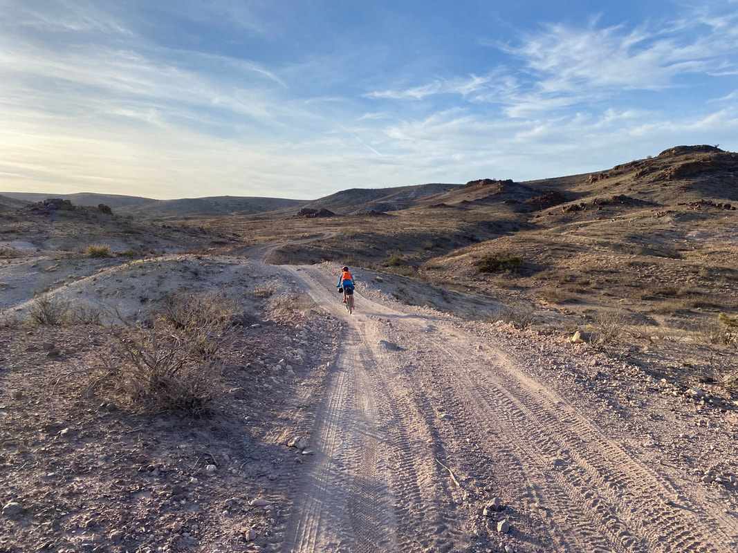
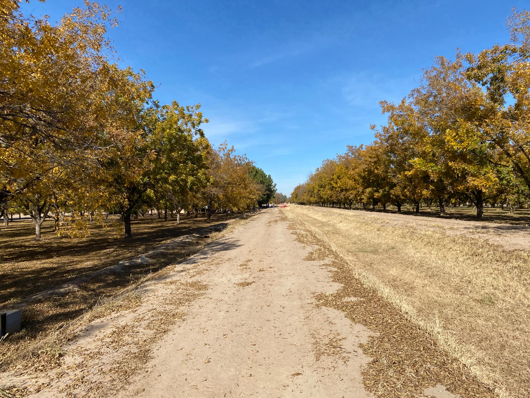
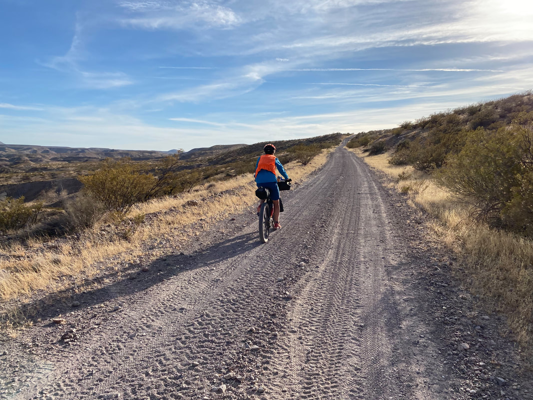
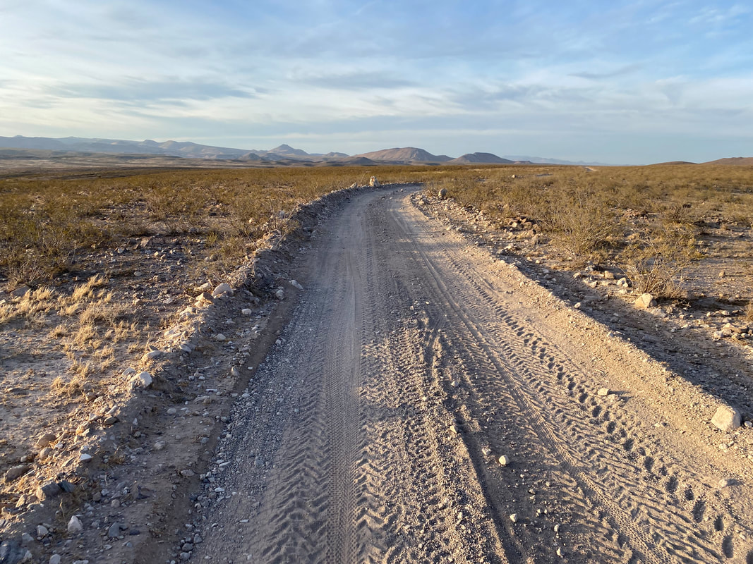
    This last main hurdle of our ride complete, we laugh and enjoy a smooth, wide, white-dust, graded dirt road that spirits us straight towards the Organ Mountains rising once again on the horizon. I feel absolutely victorious. We stop to eat snacks on the wide and flat plains of creosote. I can see roll clouds arriving in the distance, crashing in over Las Cruces as the cold front and the winter rains make their first appearance there. The road eventually careens down a gentle grade that then picks up speed delivering us easily to the Rio Grande once again. Jumping onto the levee system for one last time, we make our way northwest towards downtown proper. A massive headwind is picking up as the system moves in, bringing us to a crawl. As we enter the city limits and leave the last of pecan groves behind, the route takes us onto a spur paved multiuse path that parallels with the Rio. With no farms to remove water in this section, the surface moisture returns as well as lush zones of cottonwood and tamarisk. The birds abound. The juxtaposition of light from behind and dark storm clouds roiling ahead is awesome, even inviting a rainbow to burst forth in the contrast of light and shadow. A few more miles of levees and canal riding later we arrive back in downtown Las Cruces where started our ride 5 days prior. A large Christmas Tree has now been erected in the center of the plaza. We take photos of our end and back our way back to the Inn where our car is parked. We make our way to our AirBnb for the evening, finishing the day with some excellent chili rellenos at a local restaurant. We sleep hard that night after last night's wind. When we wake in the morning, it is 35 degrees and pouring down rain in torrential sheets that last the day. I revel in the fact that we finished our ride in the perfect weather window.
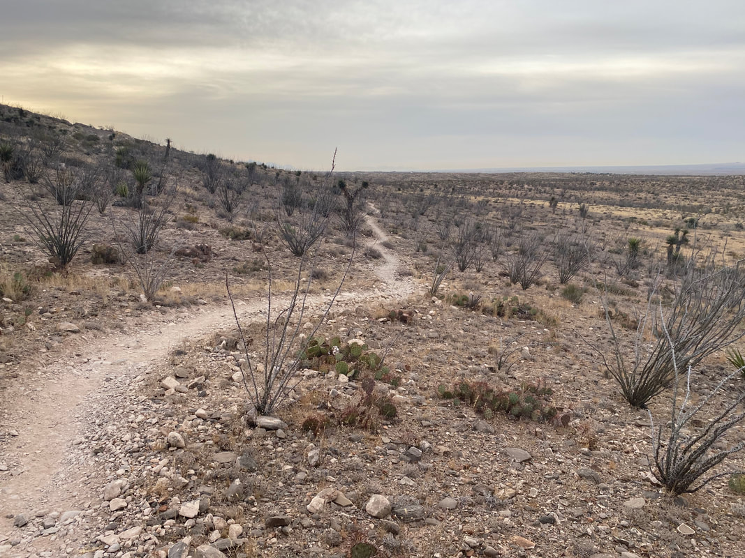
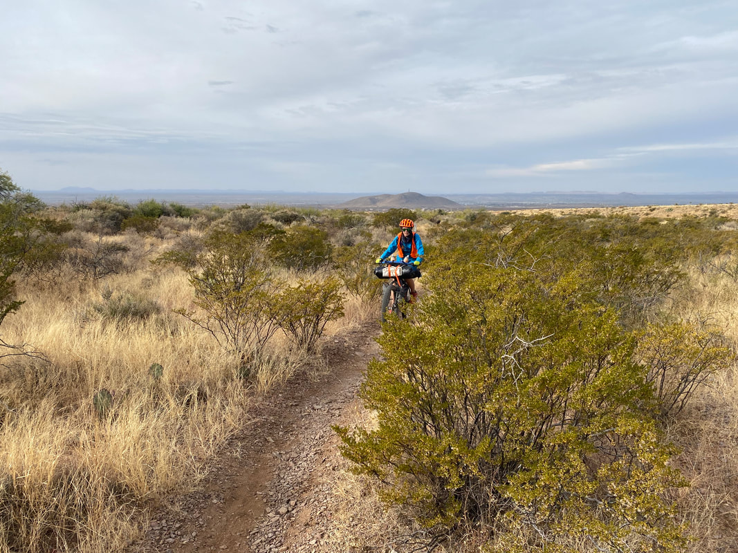
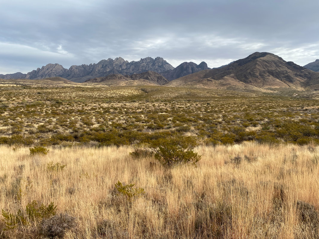
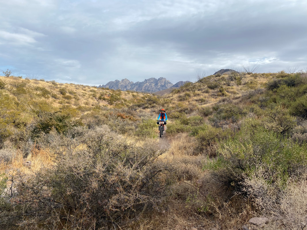
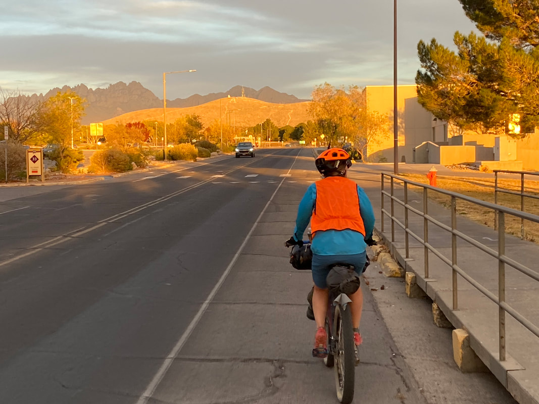
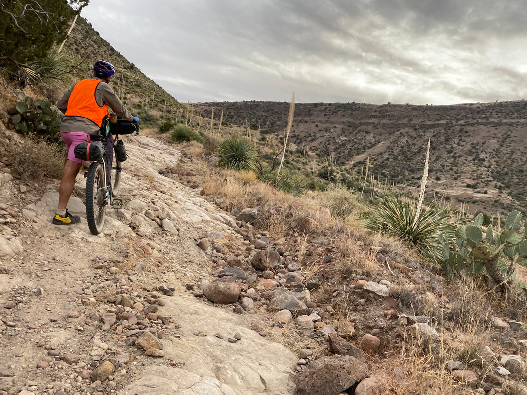
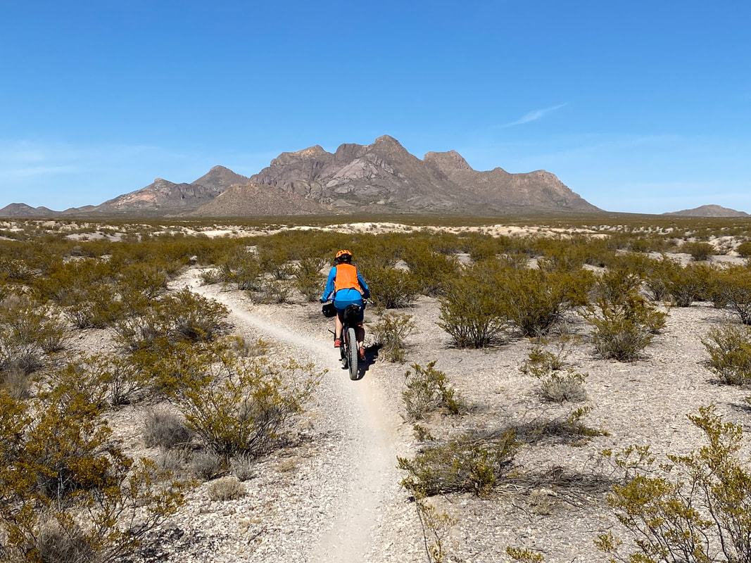
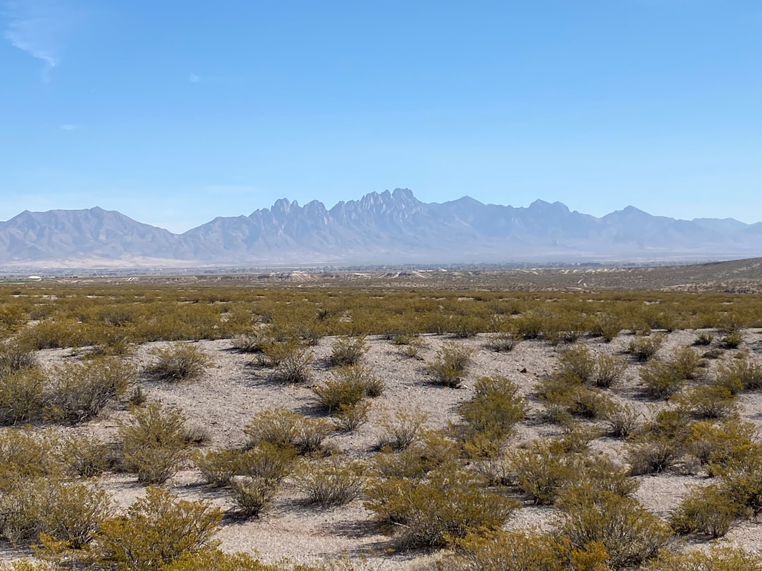
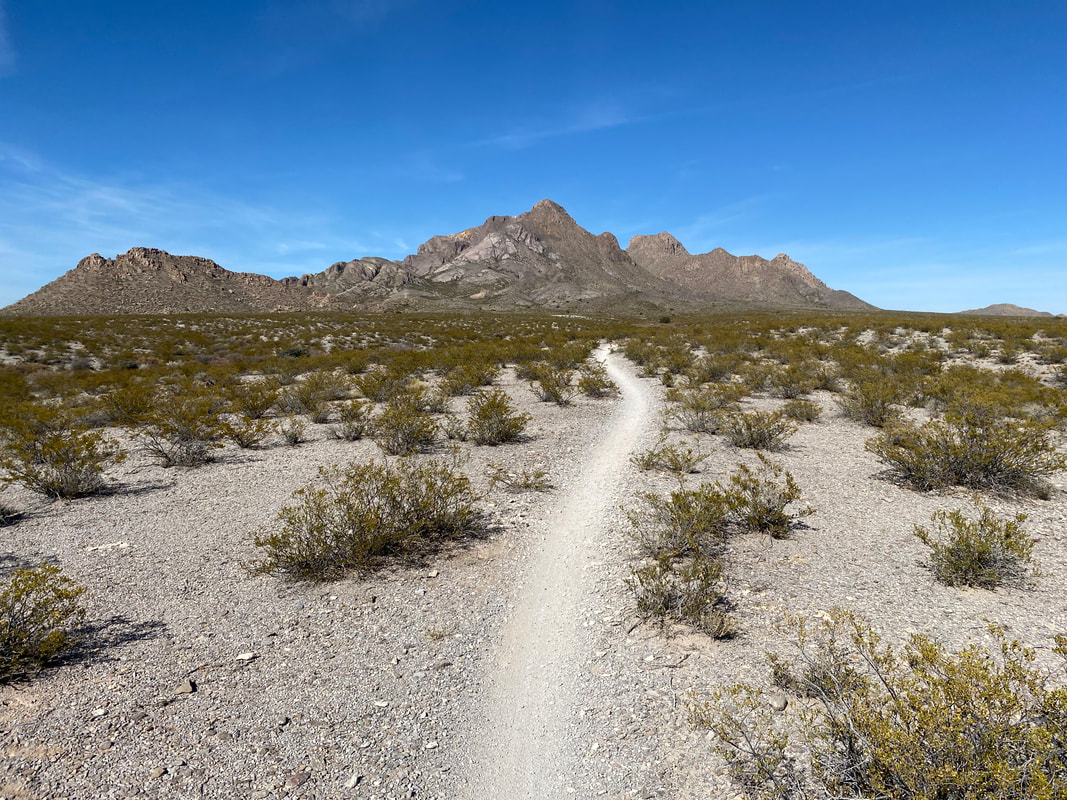
    68.6 Miles; Las Cruces, NM to Kilbourne Hole in Organ Mountains-Desert Peaks NM 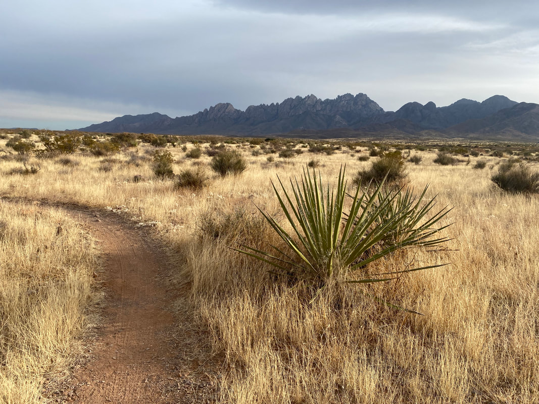 We woke up pre-dawn at 5 am because we knew the day would be nearly 70 miles along with nearly 30 miles of singletrack. We rolled out in the glistening end of dark as first breath of dawn tinged the top of the horizon of the bowl Las Cruces sits in. We pedaled north out of the NMSU campus and joined a sandy uphill road. Luckily, this exertion got our metabolic heat pumping to fight the frigid 30-40 degree temperatures. Soon we passed a gate to cars and climbed right below the A on A-Mountain. The Sierra Vista Trail shot south from here, providing epic, rolling, curvy, and not-too-technical singletrack to mix up the experience. Although the cloud cover was thick and washed the light to a faded quality, it made the Organ Mountain peaks we now rode directly below even more distinct and gorgeous. Janna and I both remarked that they reminded us of the mountains found in southern Arizona sky islands. All around, Christmas cholla were brightly fruiting their characteristic red bud fruits in contrast to the cholla's evergreen bodies. Golden grasses, granite-pocked peaks, jagged yuccas, and copious catclaw acacia lined the whole of the trail. After leaving the Sierra Vista Trail to ride a powerline road, we rejoined the trail proper outside a neighborhood. I could not believe how absolutely gorgeous the landscape looks backlit by the Sun and contrasted with the deep hovering clouds overhead.
 The Sierra Vista wound directly towards the Organ Mountain peaks and then continued their trace along the roots of the range southward. I kept stopping to take a million photos from the stark and gorgeous high desert/grassland landscape. We passed a few mountain bikers day-riding in the opposite direction and a few hikers; but, we were shocked by the relatively few users found on the trail on such a gorgeous day. The miles rolled on punctuated by short hike-a-bikes up drainages intersecting the trail. Once we crossed a parking lot for a main trail access point, the trail really began to become overgrown moving south. The vegetation began drier and thornier, and catclaw reached in large bands across the trail, ripping and shredding both my hands and legs as we passed. It was honestly the most catclaw I had ever seen growing in an area in my life - some of it seeming to stretch over entire foothills as the one visible species growing. The terrain became more barren, the granite and sandstone more exposed, and we started descending towards the I-10 and the Rio Grande. Suddenly, the Sierra Vista Trail spilled us onto the basin plains which were super flat and thick with dusty silt. We followed cattle-pocked singletrack until we met a paved road descending to the I-10 near Vado, NM. A couple of miles of dodging semis and other highway traffic bring us to the levee system along the Rio Grande which we jump on. 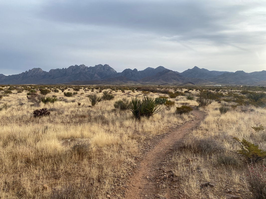 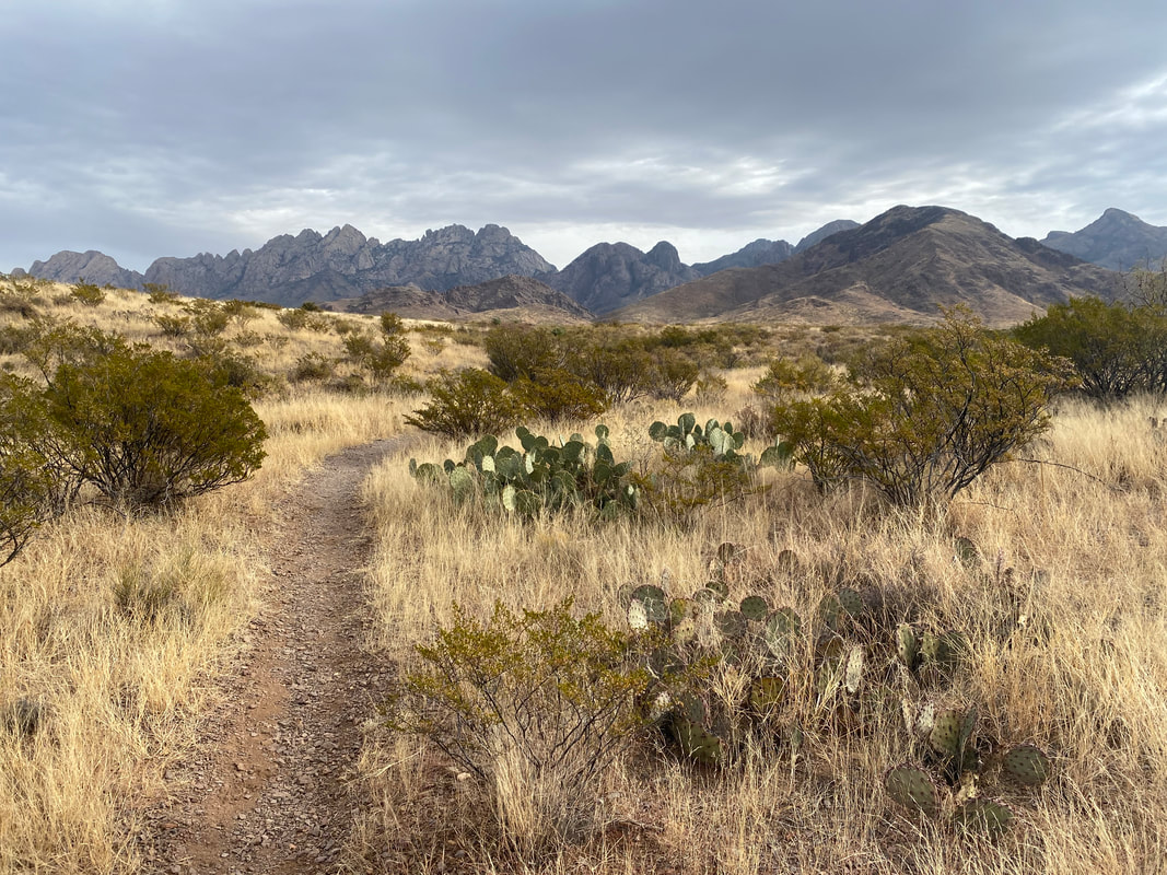 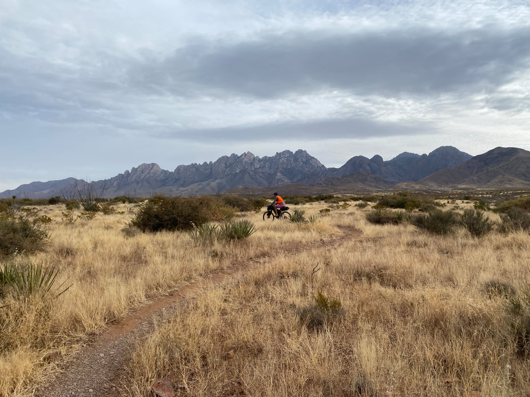 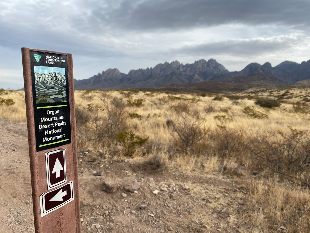
     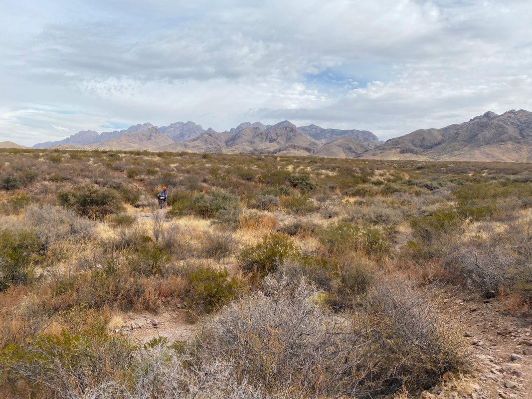
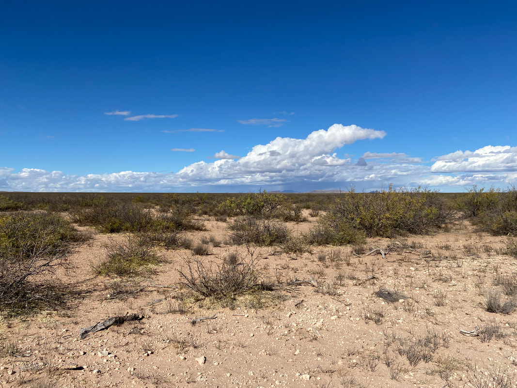
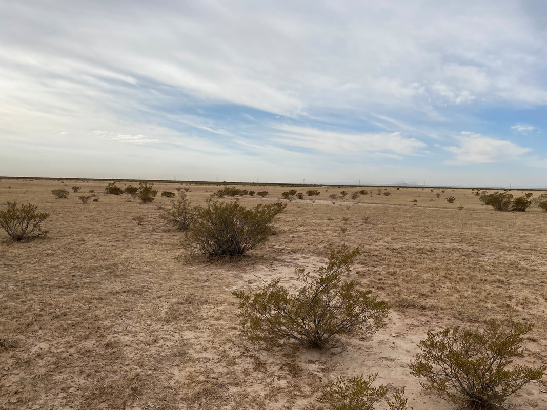
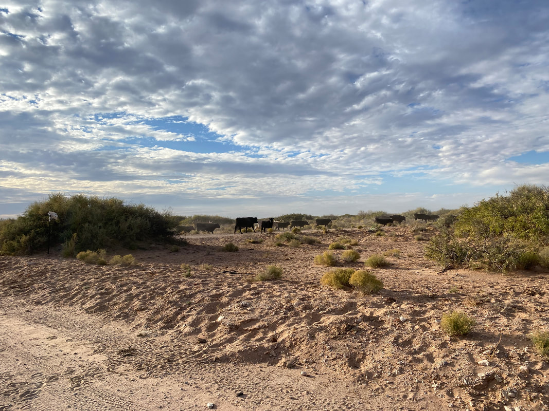
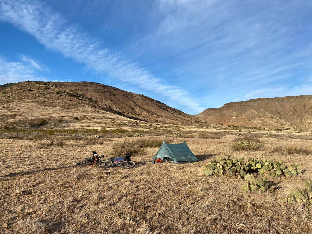
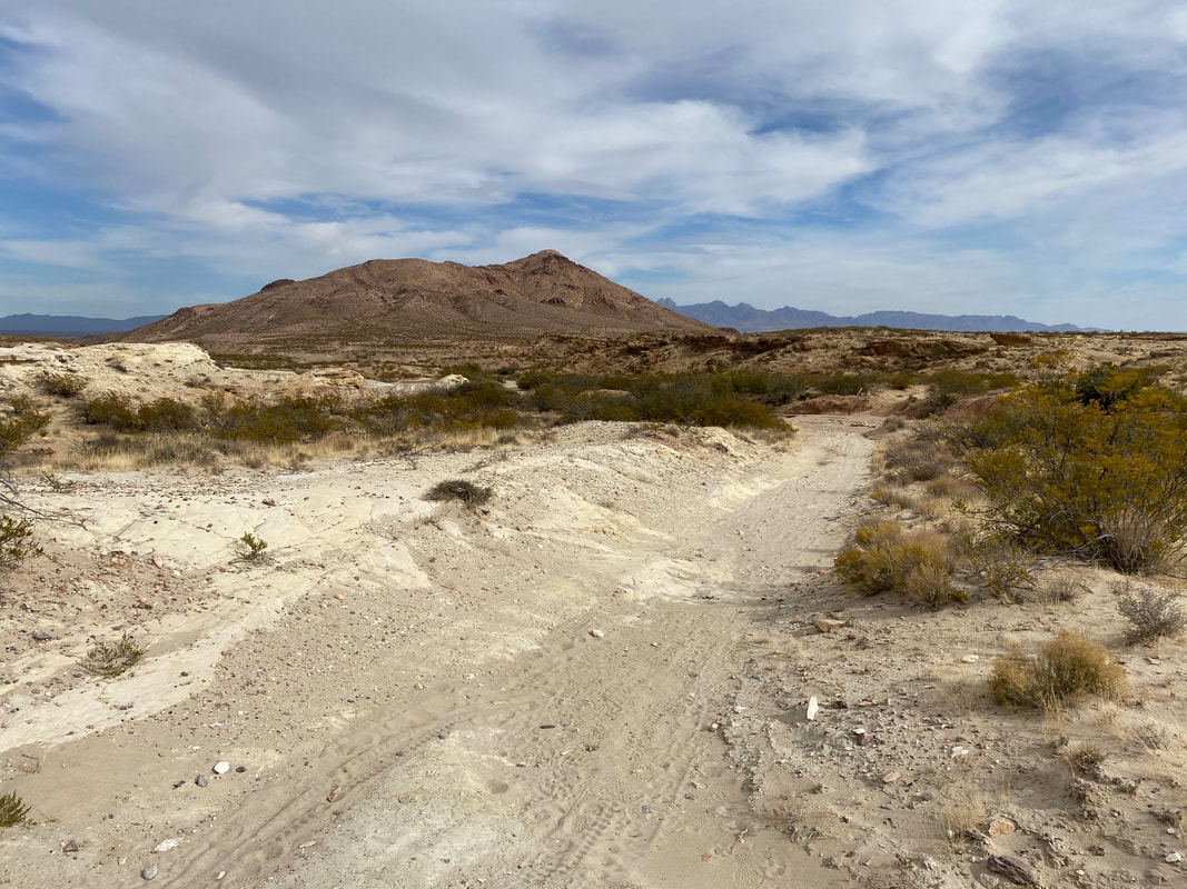
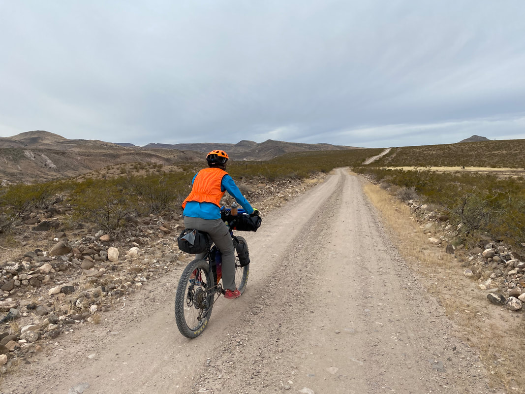
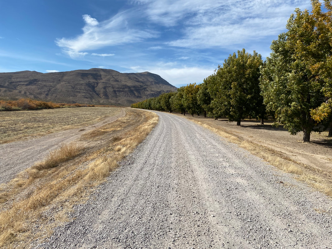
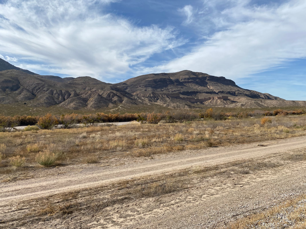
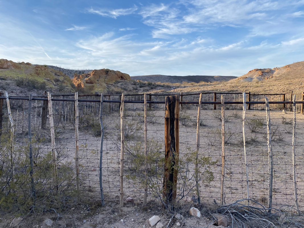
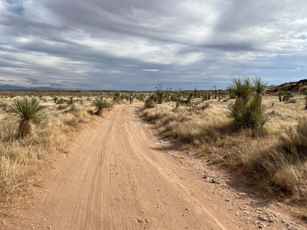
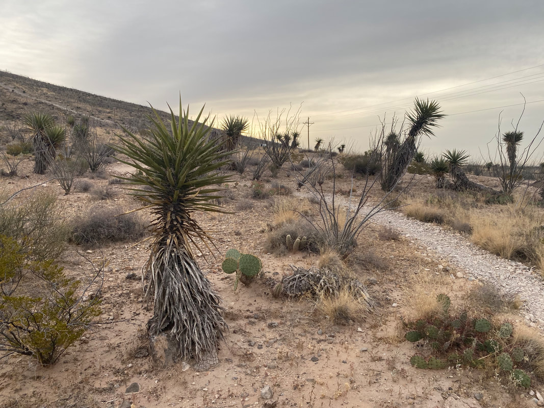
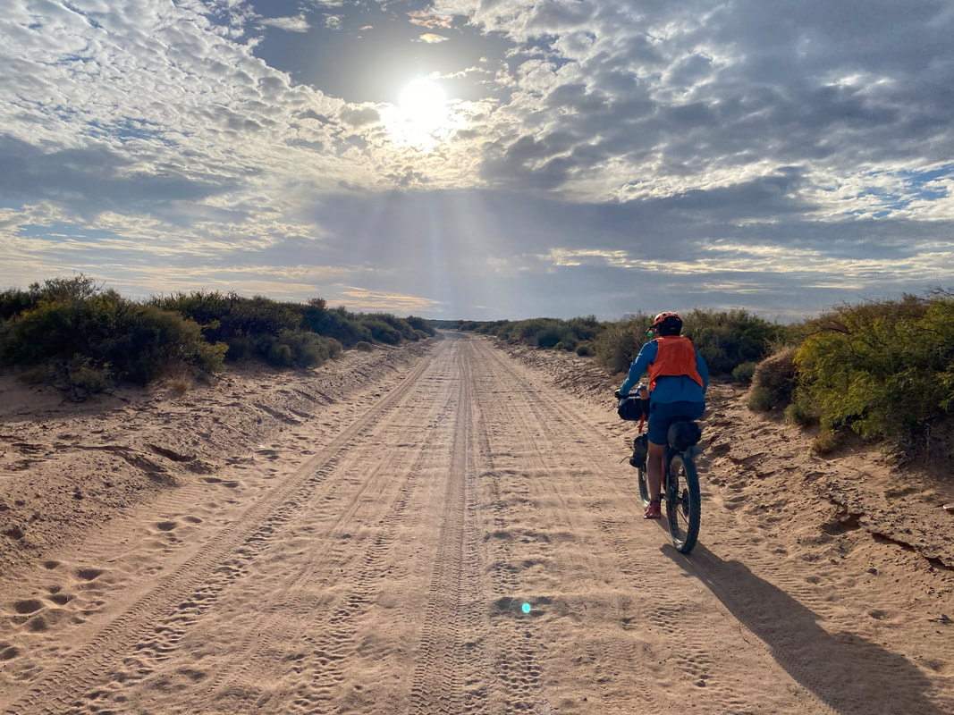
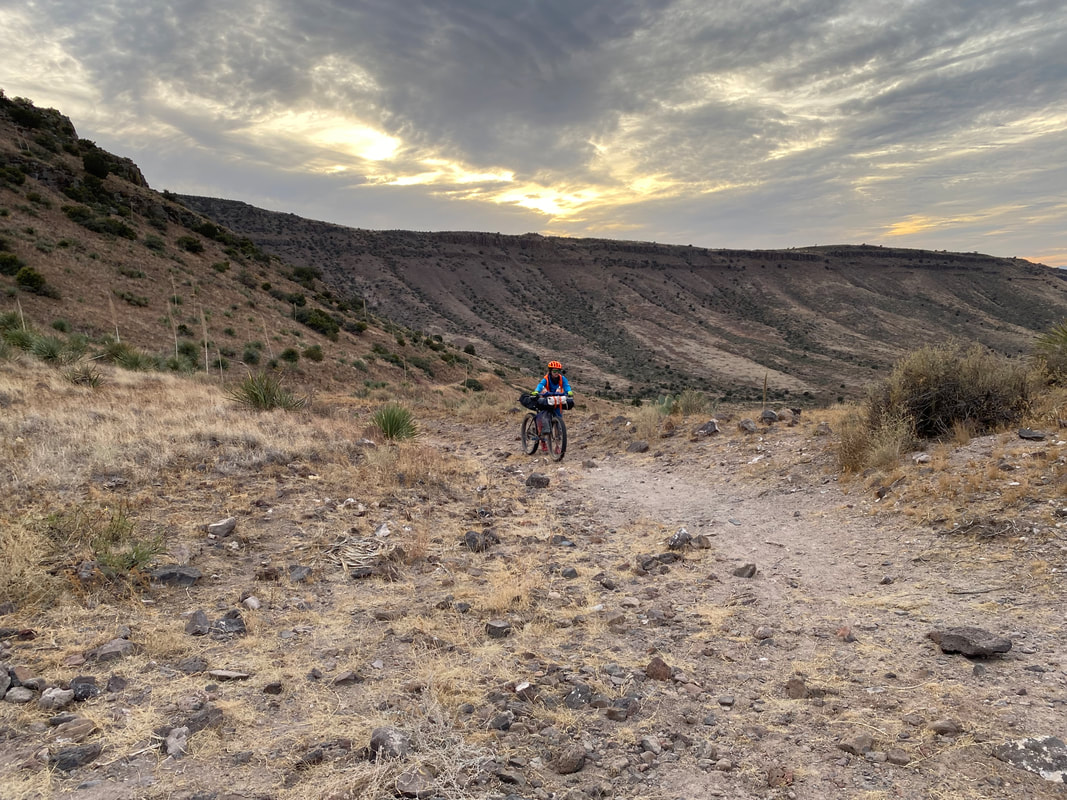
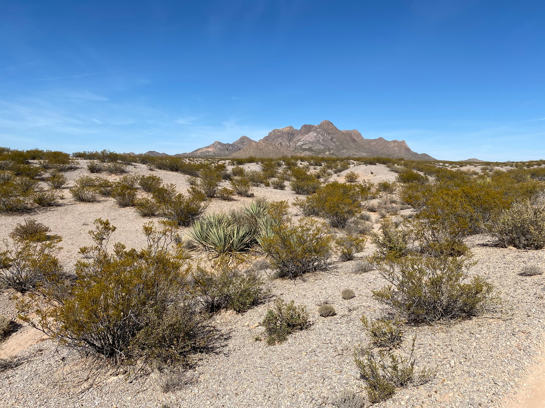
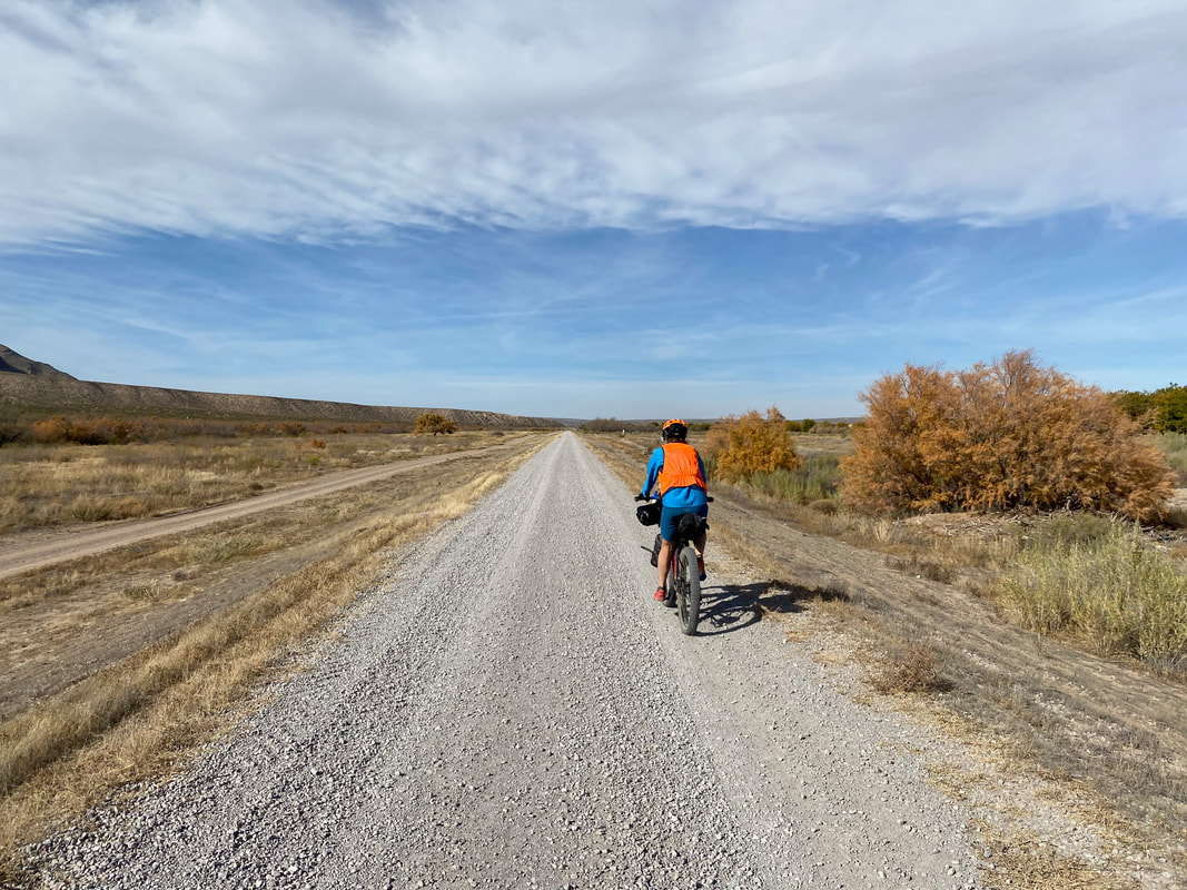
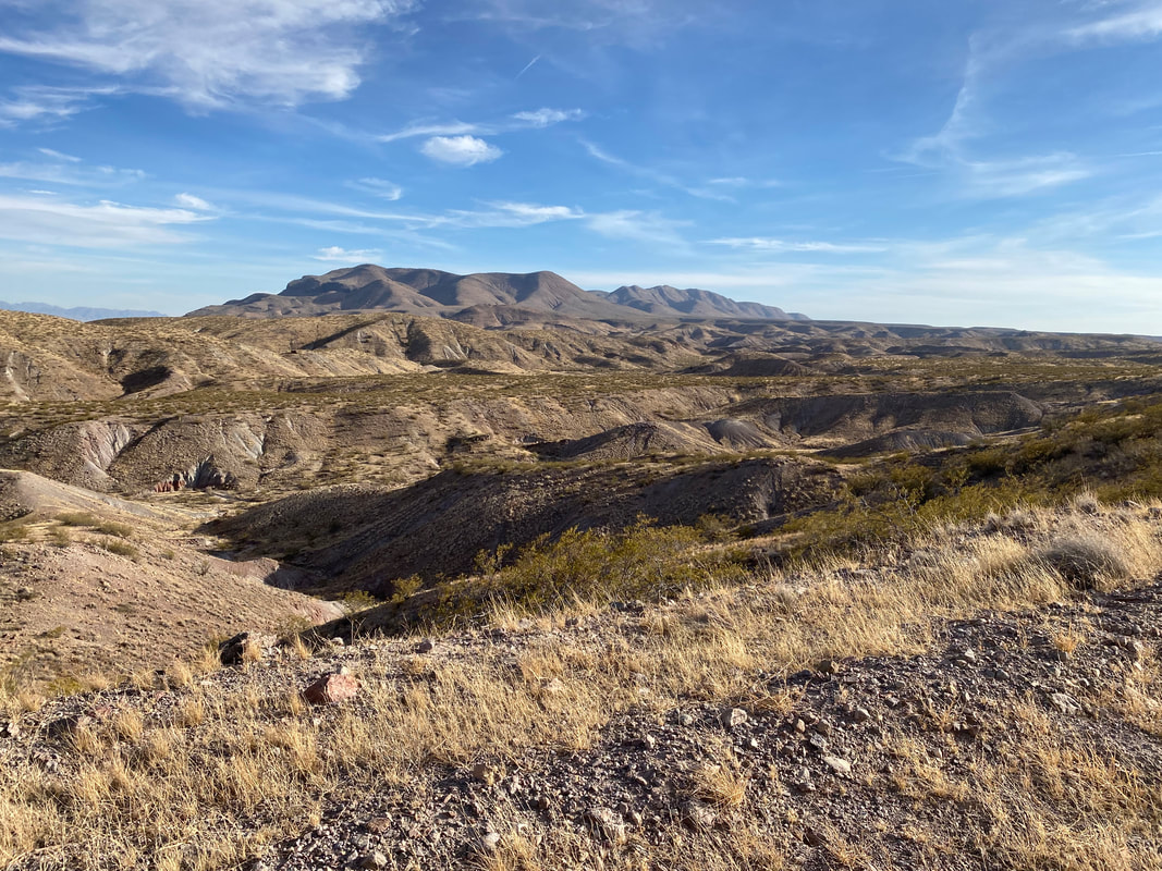
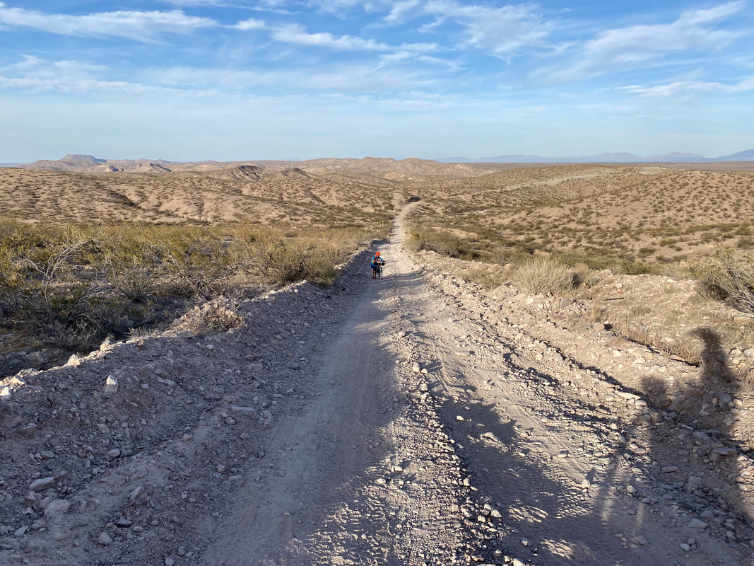
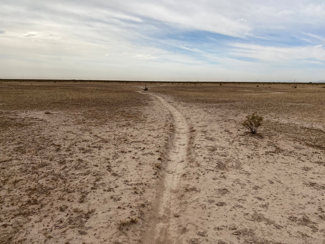  The cold morning has transitioned to a warm afternoon made even warmer by the direct sunlight. I can feel a strong sweat as we pedal the next 20 some miles down the levee. Most of the Rio Grande levee riding up to this point has been smooth, but this stretch is washboarded and coupled with notable headwind. We pass by pecan grove after pecan grove. The farms seem to all be patrolled by ranching dogs which vigorously pursue us as we approach their properties adjacent to the levee. Not only that, but we several groups of feral dogs that lounge on the levee. We walk our bike carefully between these small packs which only lazily bark lightly and don’t give chase luckily. We reach the end of our levee riding and cross into Anthony, Texas to get some food and water at a Family Dollar; we are now closer to El Paso, TX than to Las Cruces, NM. With 8 liters of water ladled up on the bikes each (we won't hit a definite water resupply until we hit Las Cruces tomorrow evening), we cross back into New Mexico and snake through the town of Vinton and its streets made of flowed river silt. We pass out of town and begin a climb out of the bowl of the Rio Grande Valley and make our way on a sandy county road out towards the Potrillo Mountains and Kilbourne Hole in the last unit of the Organ Mountains-Desert Peaks National Monument. On the way out, a large group of longhorn cows stands defiant on the road, large bulls stamping their hooves on our approach. Janna does her best "Heartland" impressions to get the cows moving and they quickly break into a run across the road to allow us through. Miles later, we hit the relatively flat expanse of high Chihuahua desert and hit some dreamy dirt roads along with a slight tailwind. Winter evening is rapidly moving in and we realize we won't make it to our campsite before sundown. We switch on lights, make headlamps accessible, and push on. Framed around the distant Potrillo Mountains, the sun sinks behind the clouds and bursts forth a smatter of color only winter deserts can provide. The loss of sun coincides with the loss of wind. Before leaving Vinton, I had checked the weather and noted that large cold front/low pressure system would be moving in tomorrow at some point and definitely the day after. But now, the air is calm. We pull up to the Kilbourne Hole as whatever light left at civil twilight is draining form the sky. The Kilbourne Hole is an ancient volcanic crater where some of the Apollo missions did astronaut training prior to their launches for the moon. The route on Bikepacking.com urges us to take a side dirt road loop that takes us onto a peninsula of land jutting ride above the cradle. The temperature is warmish and still. The night is deep and settled. The peninsula narrows to just 15 feet across before crumbling into the crater below. We found a relatively flatish spot and spend 20 minutes with our headlamps on manually picking up broken glass beer bottles and spent ammo shells and moving them away from where we'll pitch our tent. We can't see the crater in the darkness, but we know it spreads out and around us from where we camp. Usually, I don't camp in such an exposed, high, and wind-prone spot, but the location just seems so beautiful. The near-distant glow of El Paso bushes in the dark distance. Somewhere across the crater sea of dark, a single noticeable and repeating light flickers diligently in the dark. We climb into the tarp and fall asleep in the soup of absolute silence. 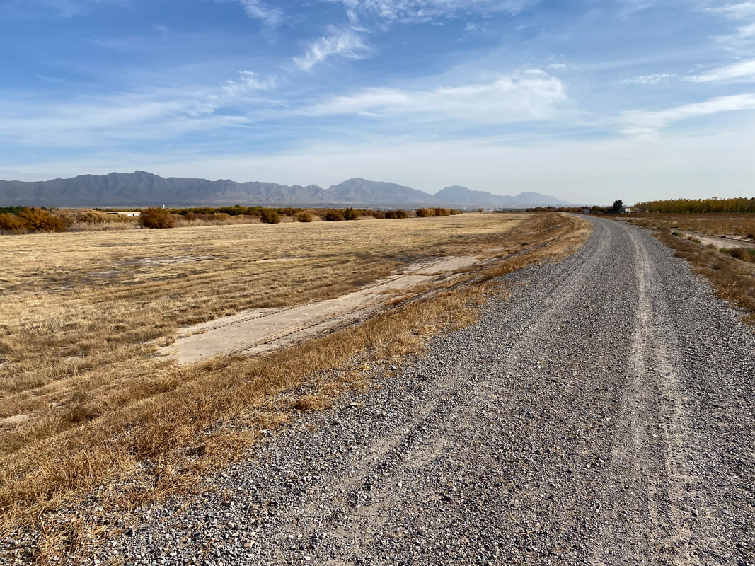
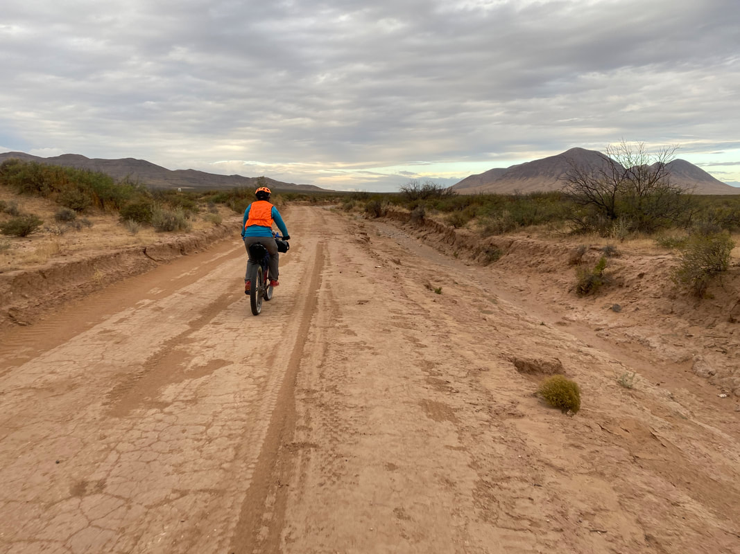
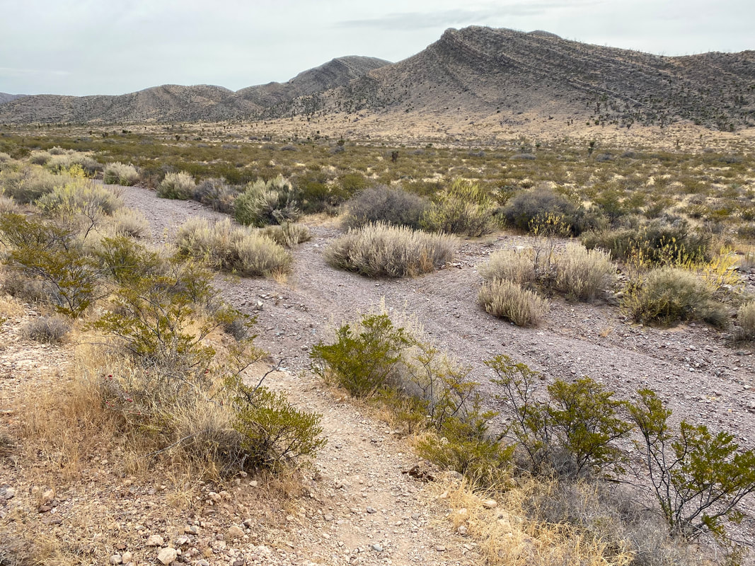
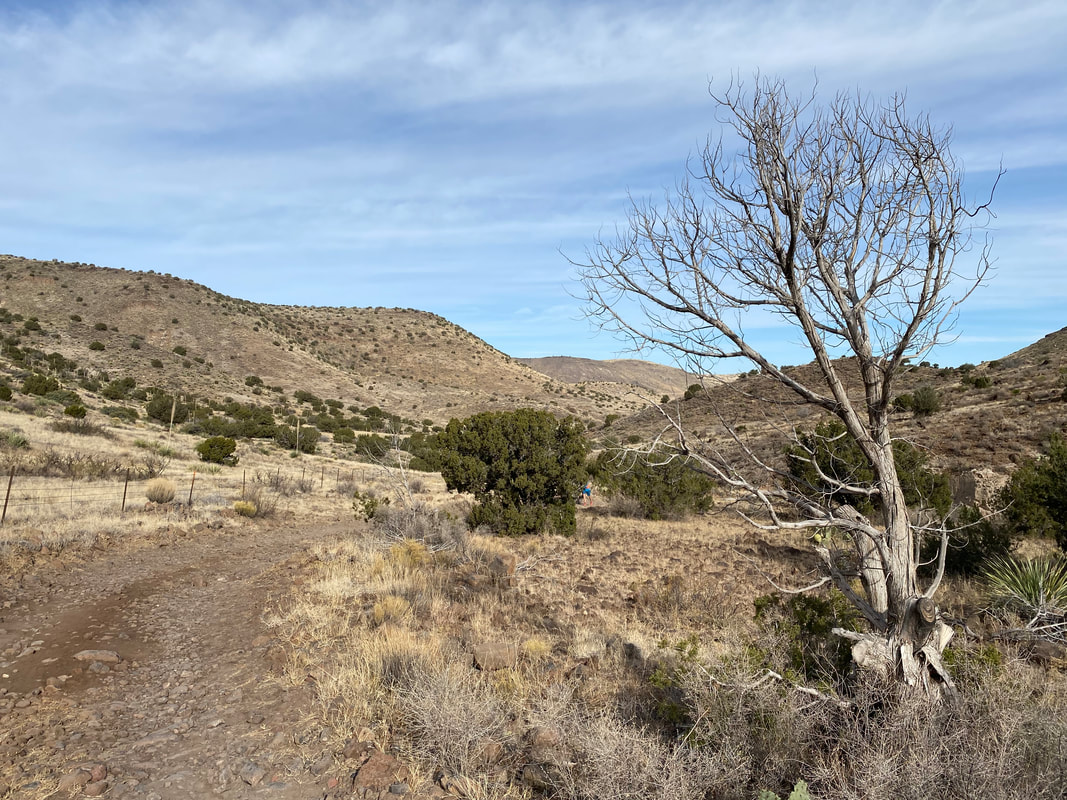
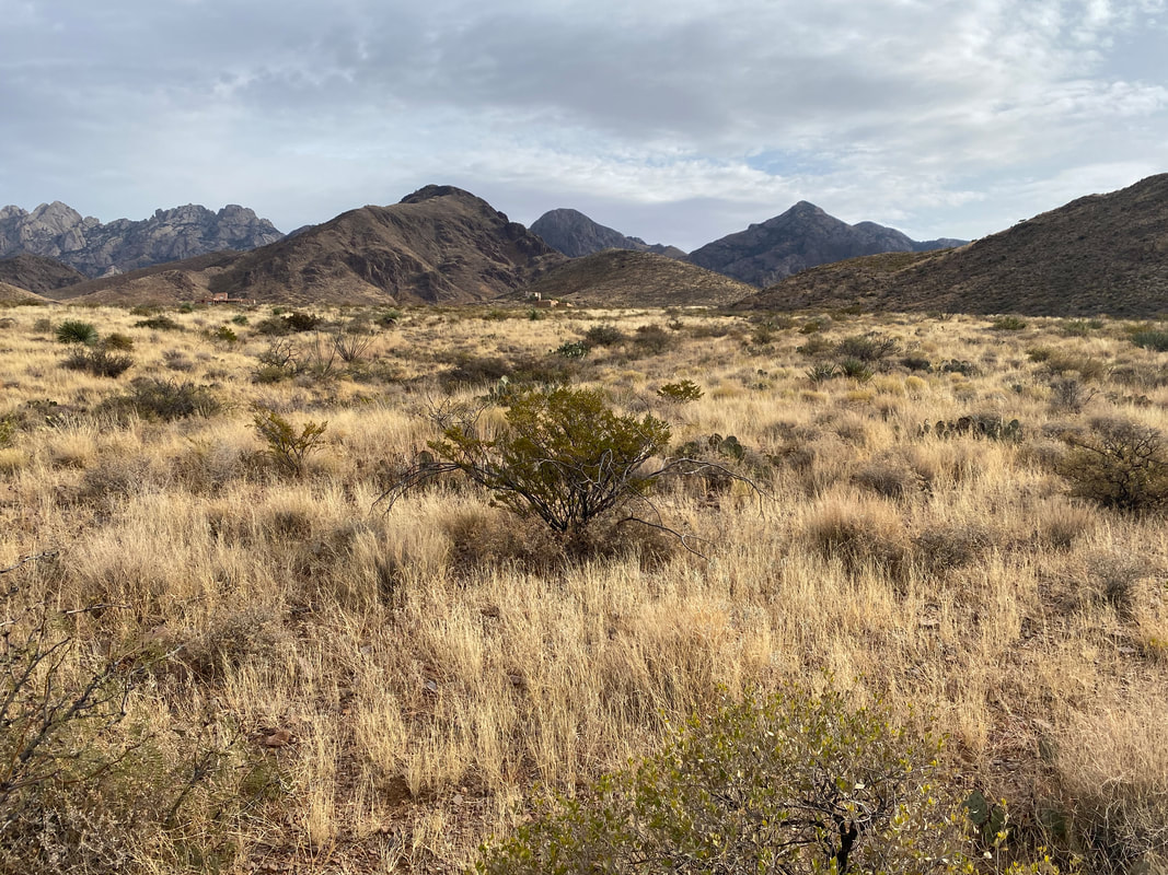
    45.3 Miles; White Gap to Las Cruces, NM  The full moon rose and stretched wide and bright in an arc shining through the tent. We slept long and hard after yesterday's rocky ascent up White Gap. Light streamed into the shelter as morning full glare indicated a late start. Packing up, we sped down dusty, rocky, rutted double track before ascending up a small hill all whilst threading the one non-wilderness strip in a landed of designated wilderness. We spilled forth onto the top of a hill with a paved county road leading back to Las Cruces. Flying down it, the miles rolled by. The rocky Las Uvas eroded away as butte turned to flat basin filled with creosote. One bend coming out of the Sierra de las Uvas revealed an incredible view of distant Organ Mountains proper to the south. 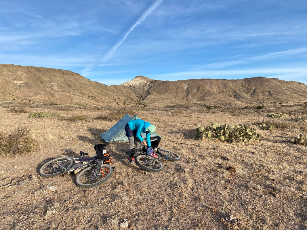
  The county road stretched linearly and distant, twinkling out in its own perspective. But, we turned off of it to ride down some side country roads that were all sand and packed basin dirt. Large yuccas cradled the roadsides, framing the Las Uvas distantly under a rich blue high-desert sky. The plus tires ate up the sand and we passed through some fencing before rejoining the pavement. We wove back onto dirt and shot out straight across the desert towards the ever-growing Organ Mountains and the bowl of Las, Cruces. Here, the sand deepened greatly in stretches causing me to slow in my grind to 2-3 mph and even hike-a-bike. The sandy double track joined a large and well maintained dirt road that seemed to trace an invisible gentle rim high above Las Cruces which sat gently sloping down below in the scooped bowl below the Organ Peaks. Then, the road decayed and plunged down into rotted red and white buttes and sandy washes that were stunning in appearance. After several hike-a-bikes through the sand, we came around a sharp corner and I wiped out in the sand so bad that I dislodged my saddle. I tuned the saddle clamp and sped down into some new neighborhood developments before reaching the Rio Grande once again. This time we sped south of it reentering the suburban outskirts of Las Cruces and the inner core of Le Mesilla, NM. 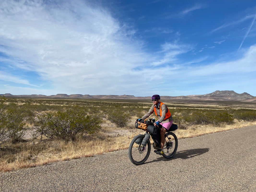 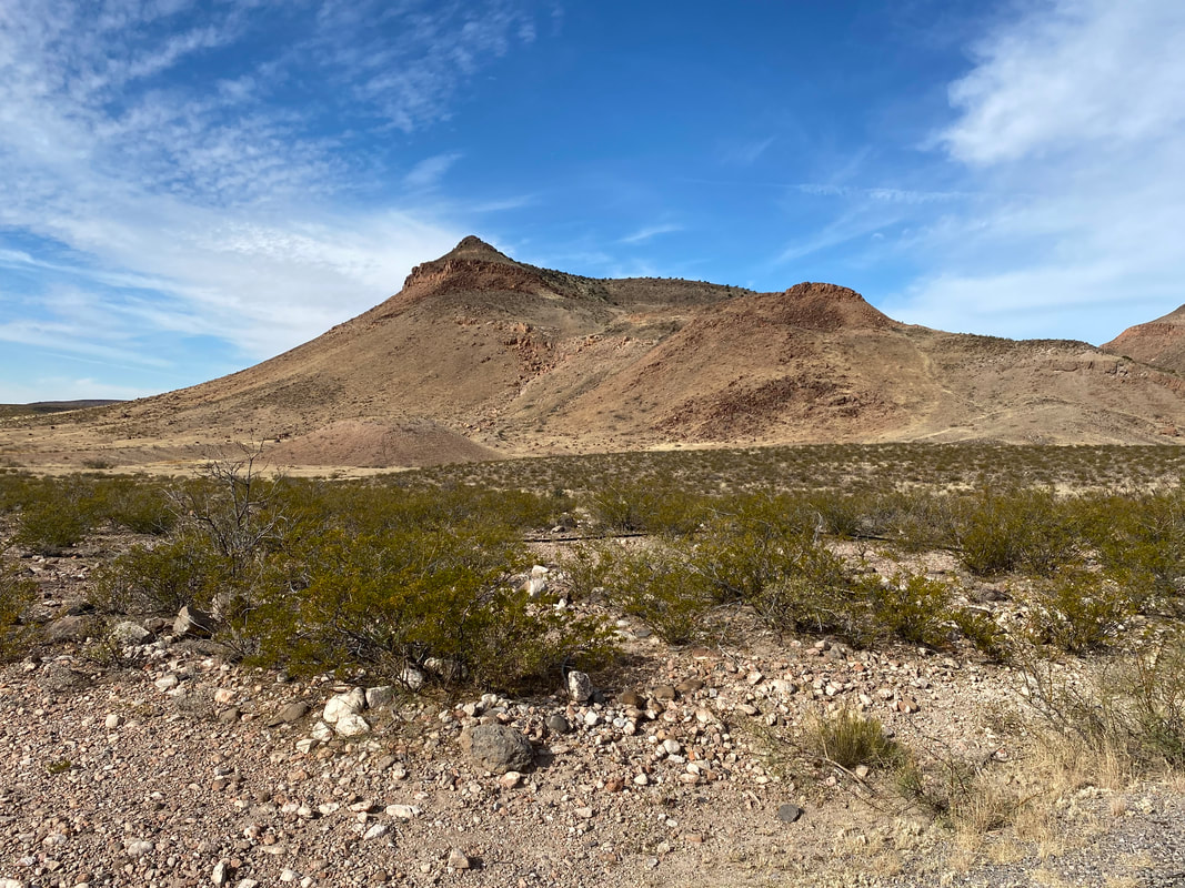 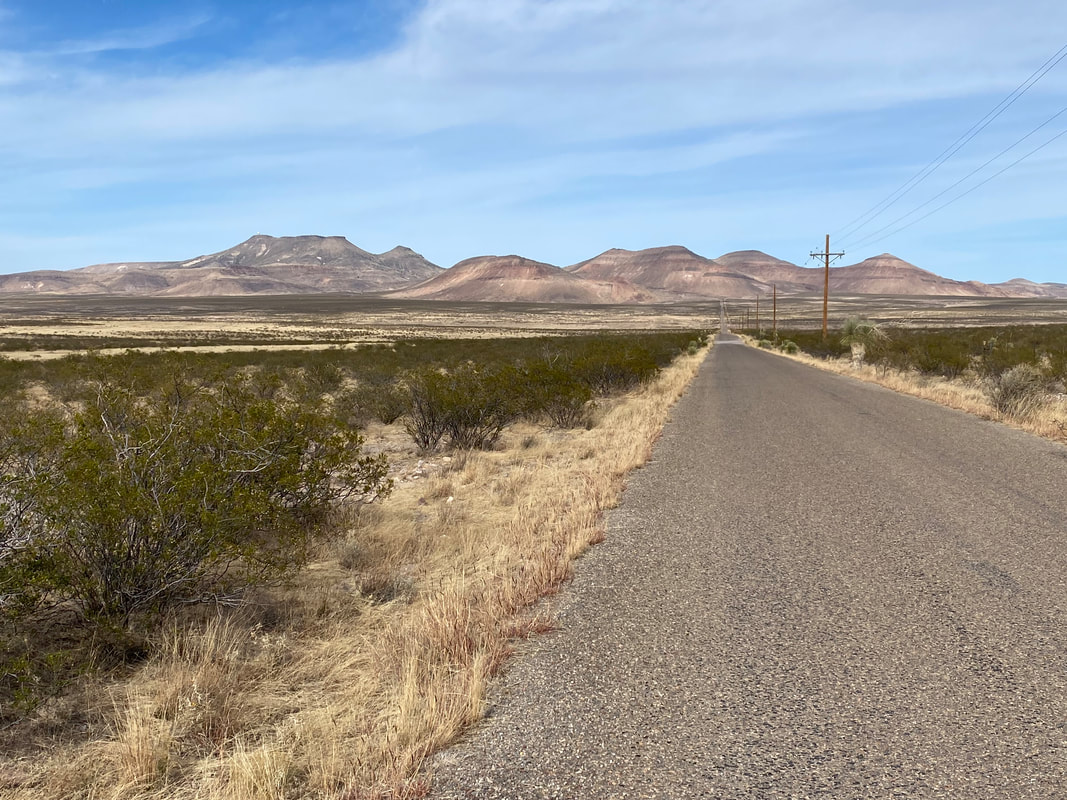  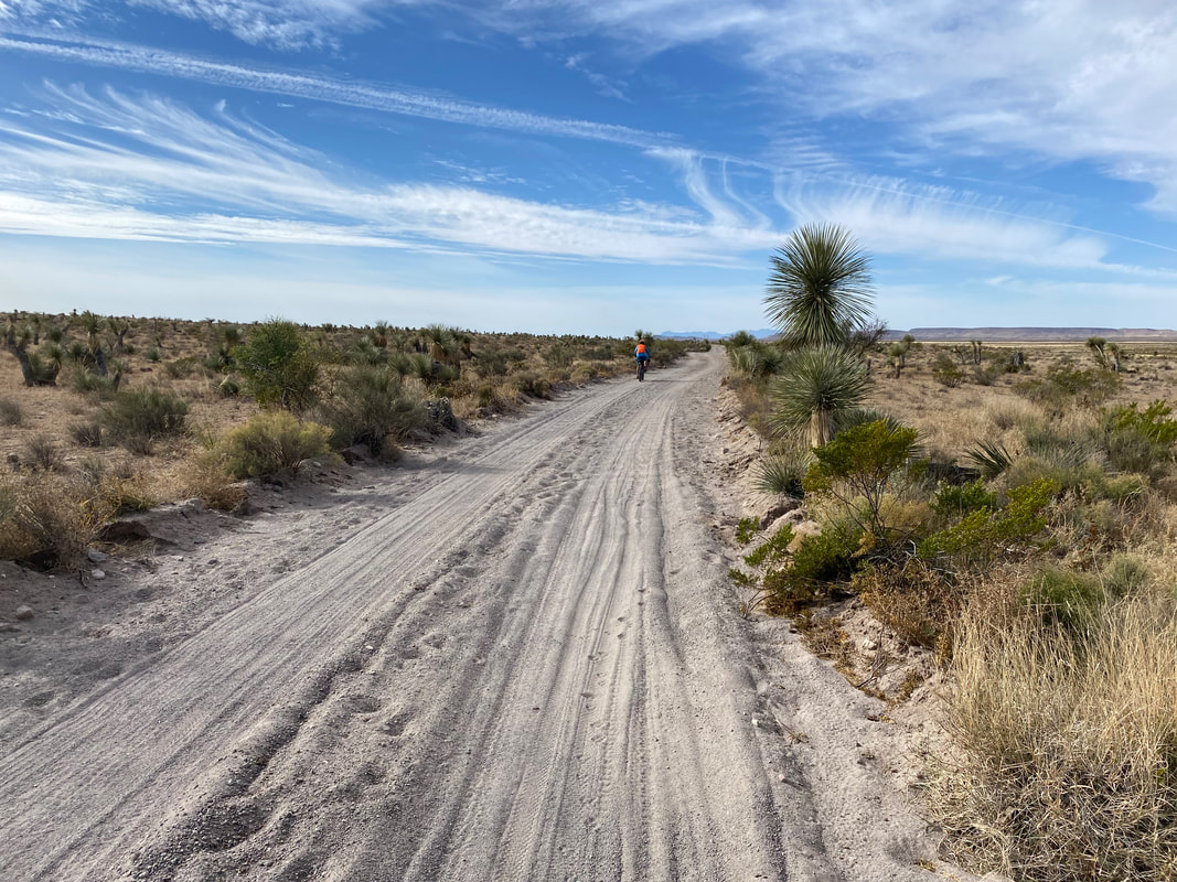 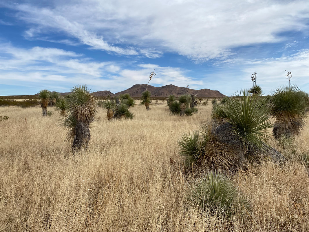
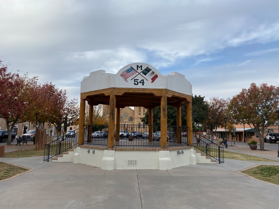
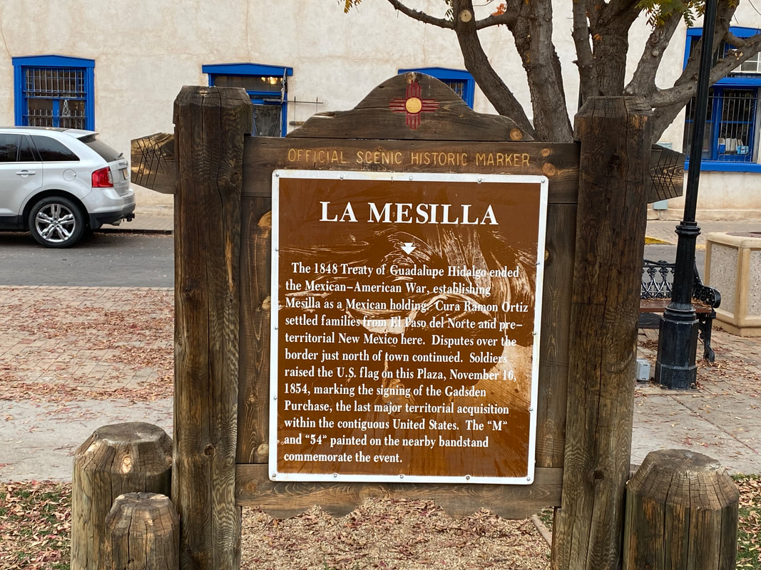
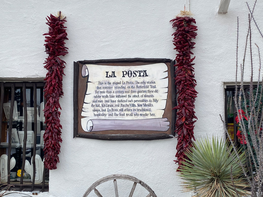
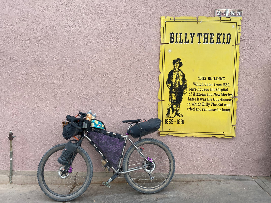
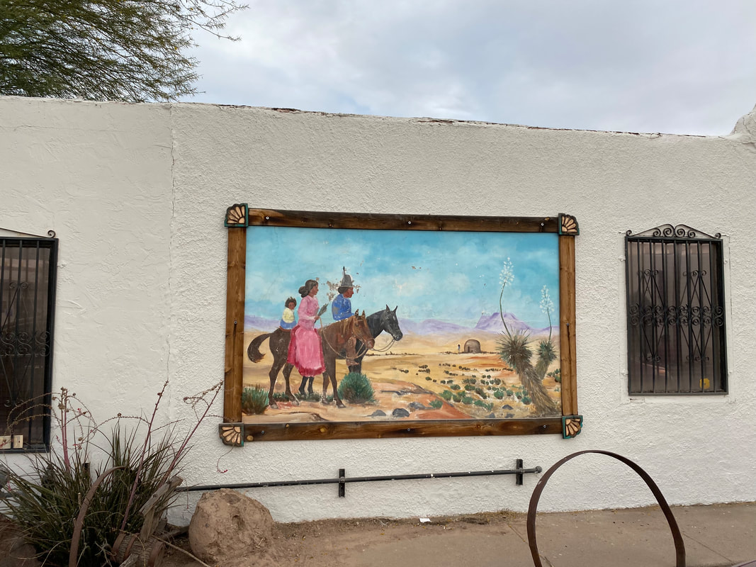
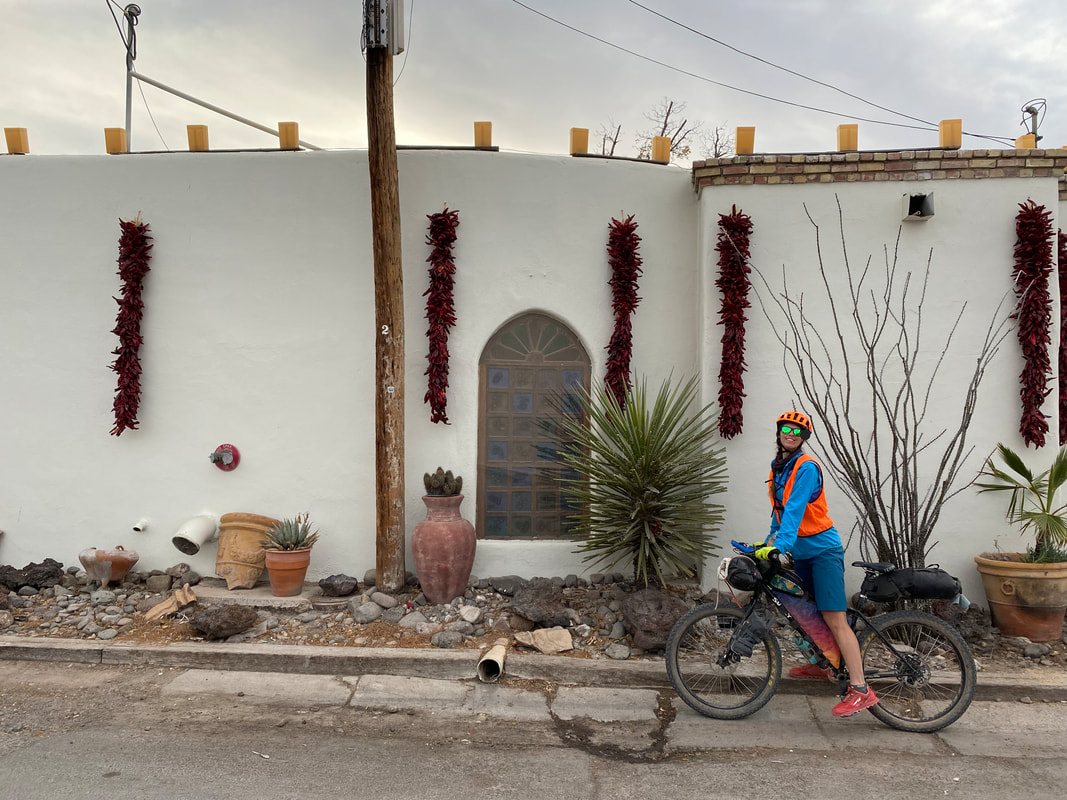
  La Mesillia proved to be a gorgeous little historical community tucked inside adobe stucco homes and historic business outcrops. The city center was the site of Billy the Kid's trial, the signing of the 1848 Treaty of Guadalupe Hidalgo, and site of the Butterland Overland Trail (precursor to the Pony Express). We headed over to La Posta de la Mesilla, the last standing posta from the Butterfield Overland Route, now converted into a famous mexican food restaurant. We agreed to eat there and ordered rounds of New Mexcian Chile Rellenos. Stepping outside into the winter evening, the temperature began to drop as we pedaled north towards downtown Las Cruces. The salmon pink overtones of sunlight on cloud draped the sky richly as we rode across the New Mexico State University campus before grabbing some lodging nearby.
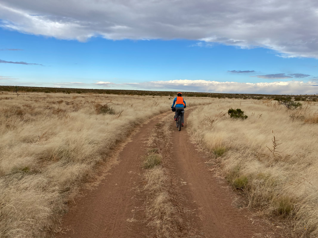
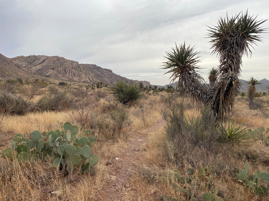
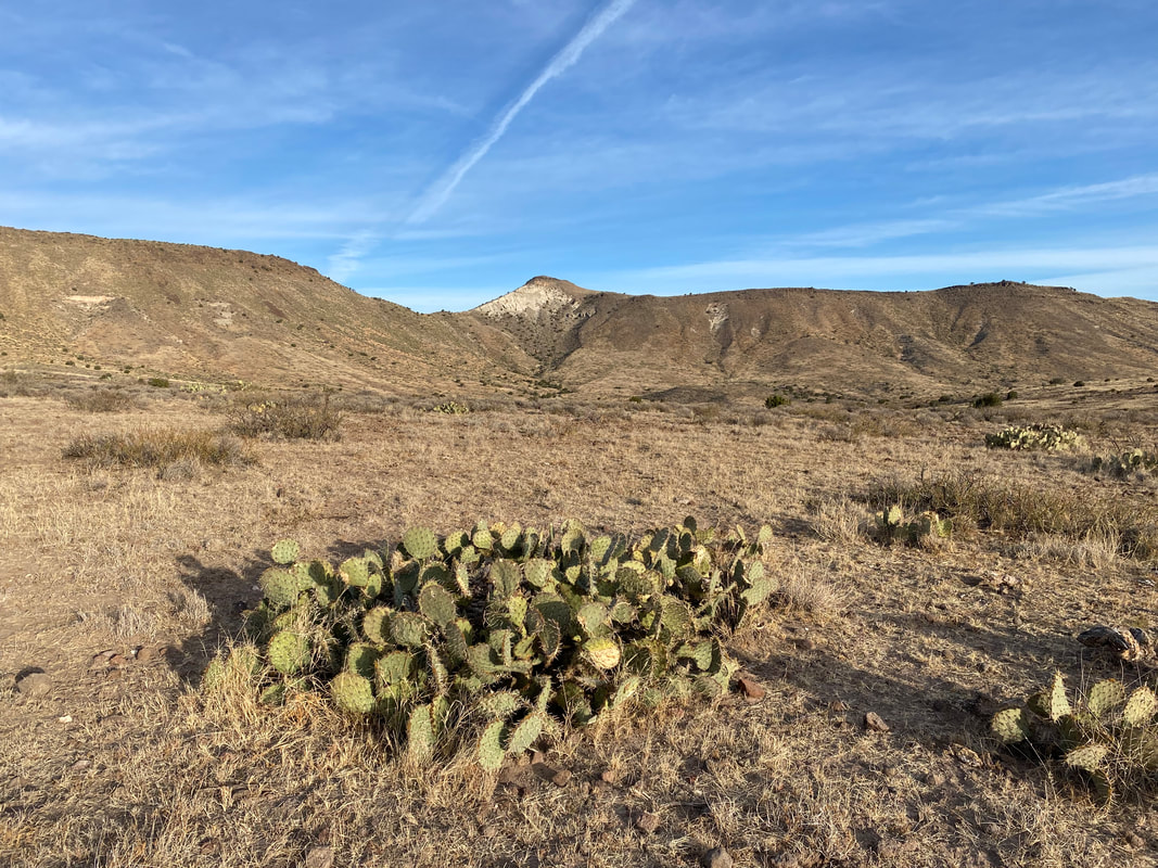
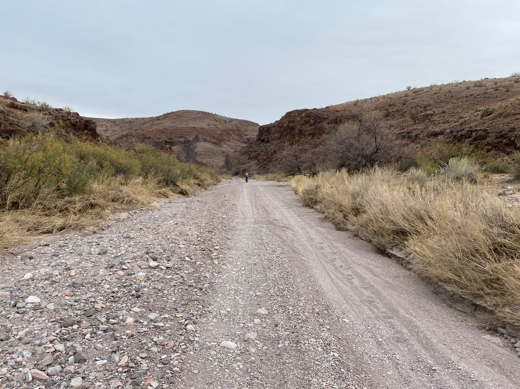
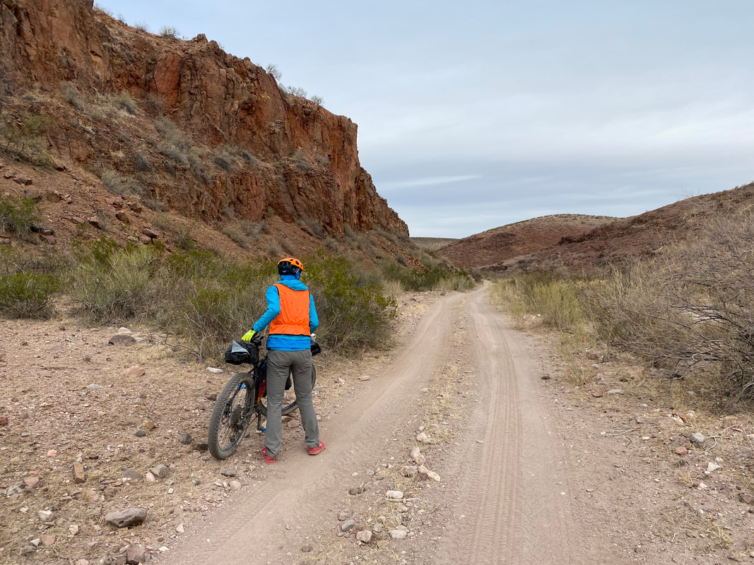
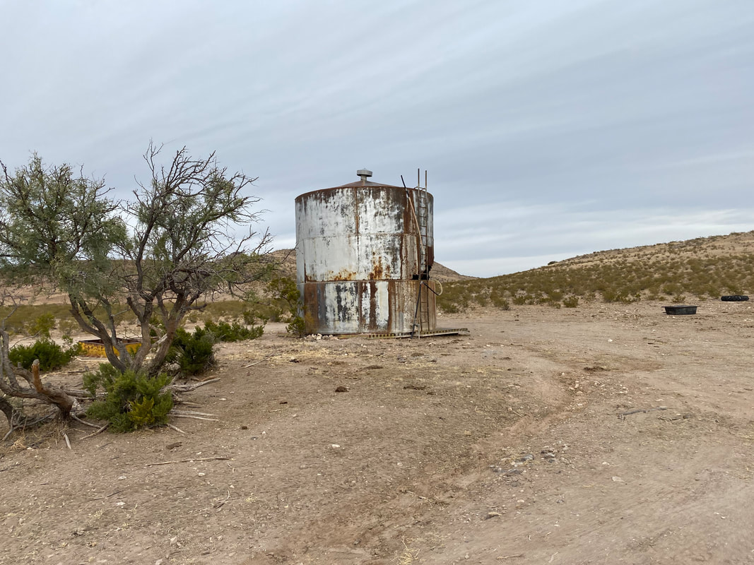
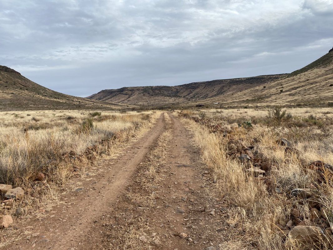
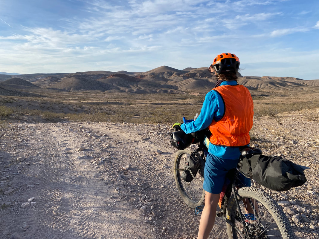
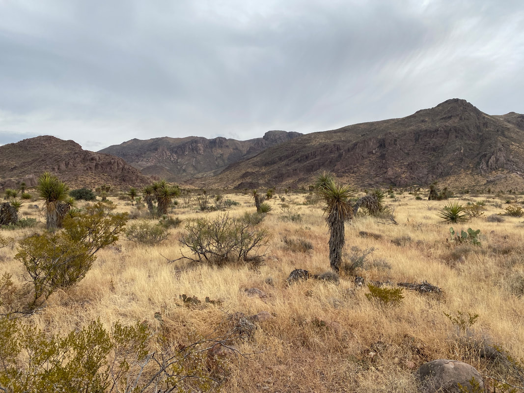
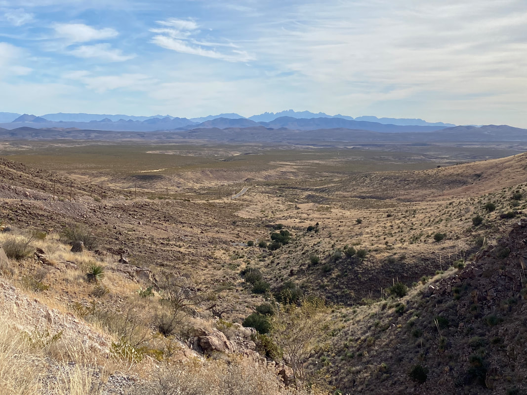
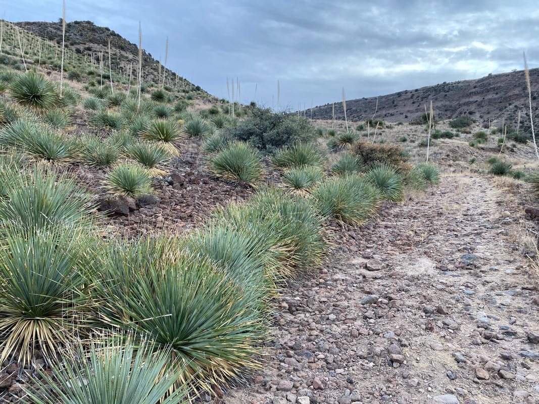
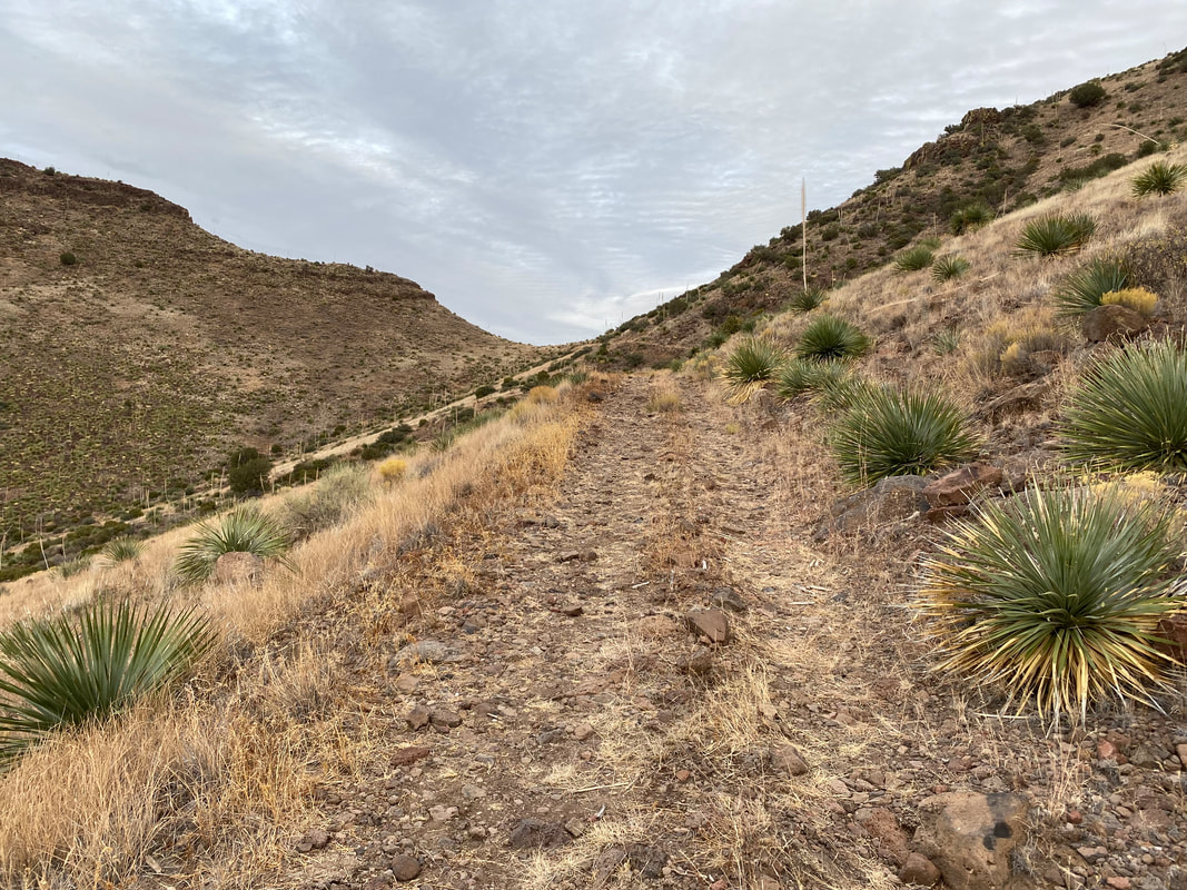
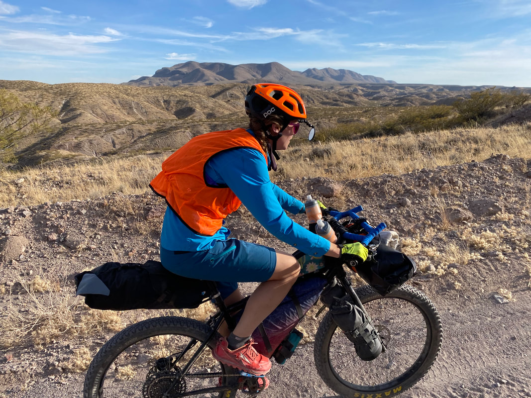
    47.4 Miles; Coyote Canyon Wash to Hatch, NM to White Gap in the Sierra de las Uvas - Organ Mountains-Desert Peaks NM 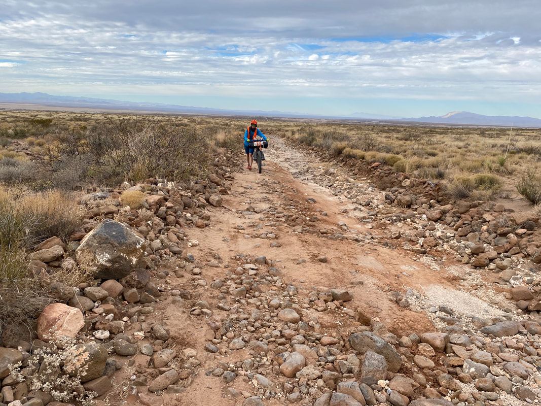 The night rang silent and still with nary a breeze to rustle the Triplex. Morning brought diffuse and washed light to the land as Sun rose along dust-bidden peaks and mesas into a smear of cloud. It was cold, but not too bad, so we sat among the creosote eating cold soaked breakfast oatmeal. When breakfast was done, we saddled the last of our water and gear on our bikes and descended to Coyote Canyon Wash proper. The air was tightly cold here, wrapping the yucca studded dust trail in the blur of timid light. We rode along a truly sandy wash. Janna's 3" plus tires gave her the extra plush needed to float over the loose ground. My 2.8" did it, but with a little more force and less forgiveness. We entered a short box canyon studded with red granite walls before climbing a few hills and settling at a cattle tank. We stripped off cold layers as sweat was piling with the climbs. From there, a sizeable, but gradual climb ensued. Pedaling hit the swagger of the big back cog until I jumped off my bike and started pushing the rest of the way uphill. At the top of the mesa, a strong wind blew head-wise, slowing my progress and forcing me to alternate between a wind jacket and naught. Clouds stayed smeared overhead. The road turned 90 degrees and then straightened into the distance, seeming to land at the cradle of the peaks in the distance. Janna and I alternated between chasing cows off the road and shouldering the lead in the headwind. We passed a few rusted out cattle troughs and then began a long, fun, and cold downhill back towards pavement and out of the national monument. 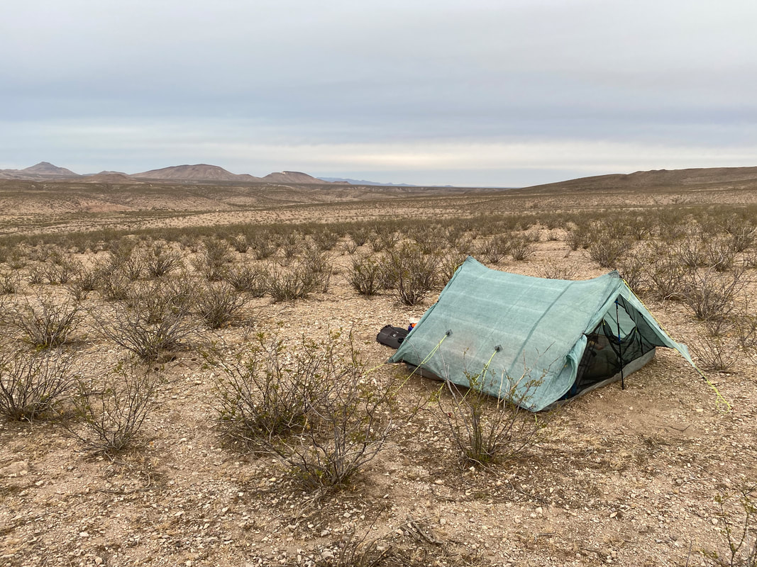 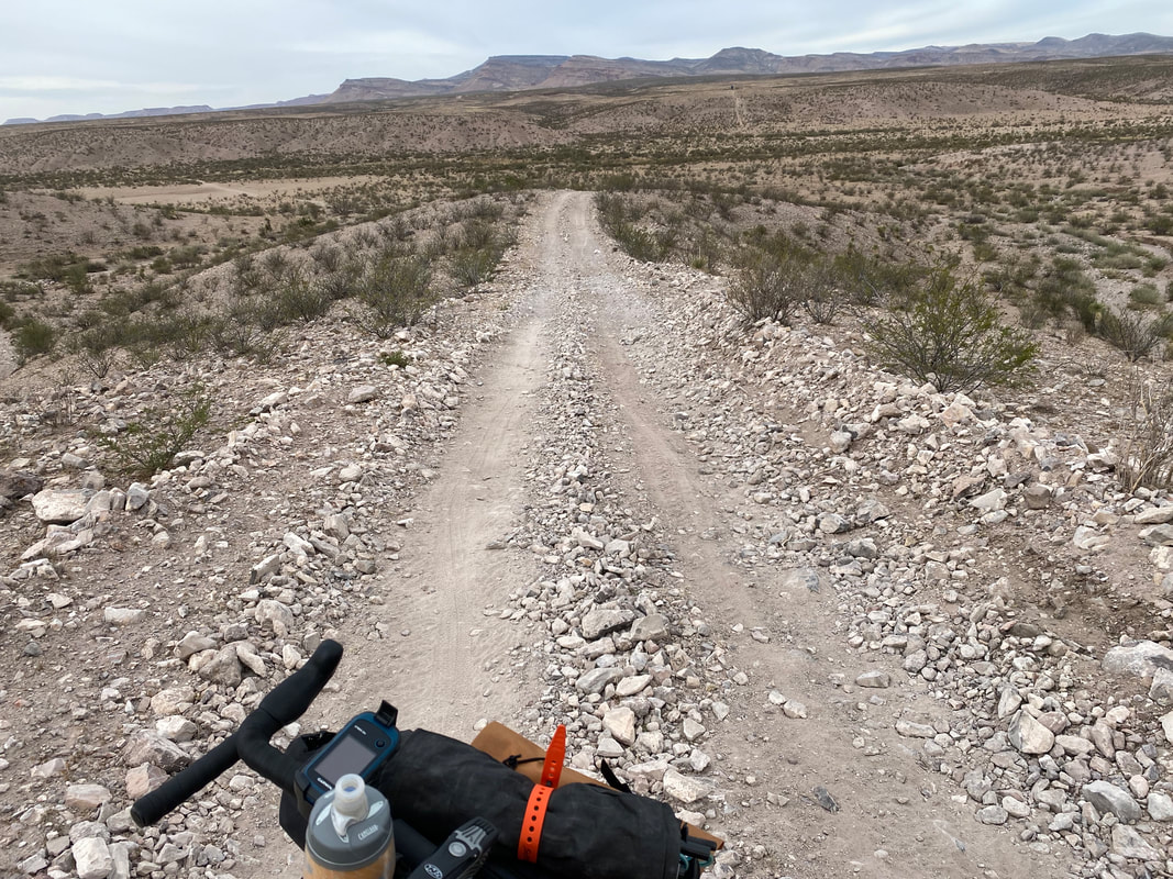 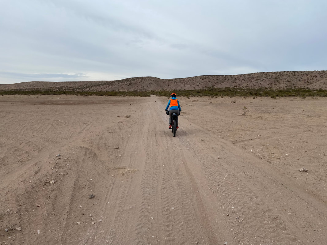 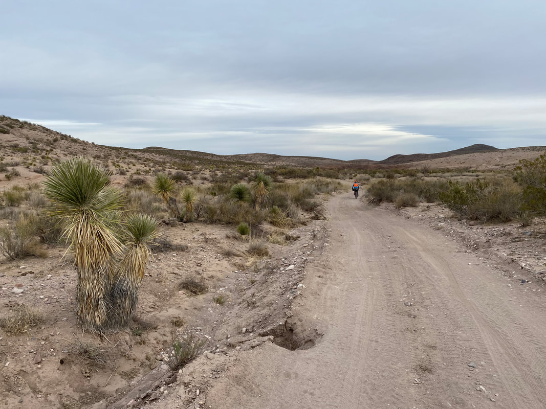
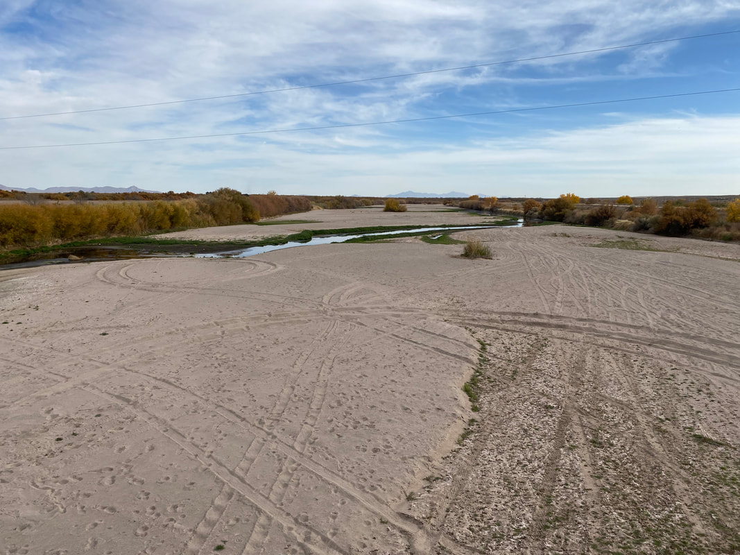
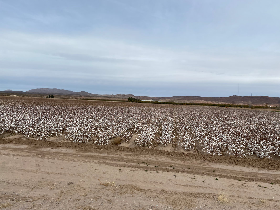
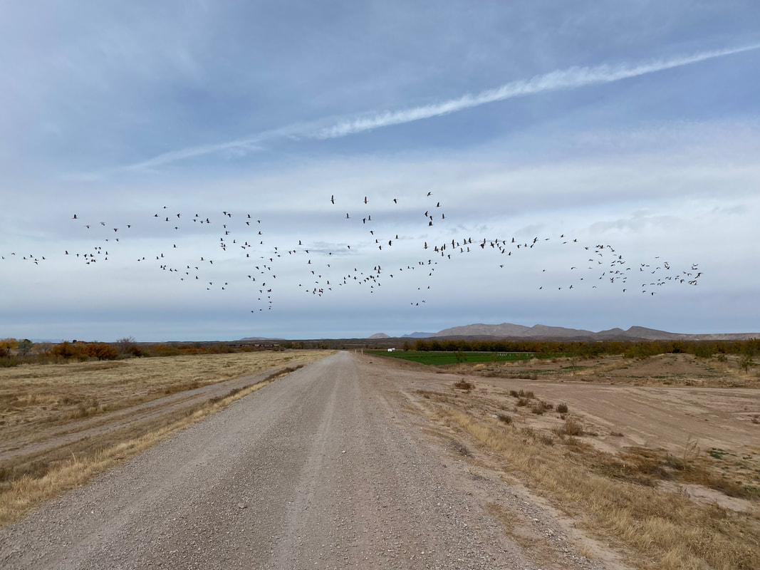
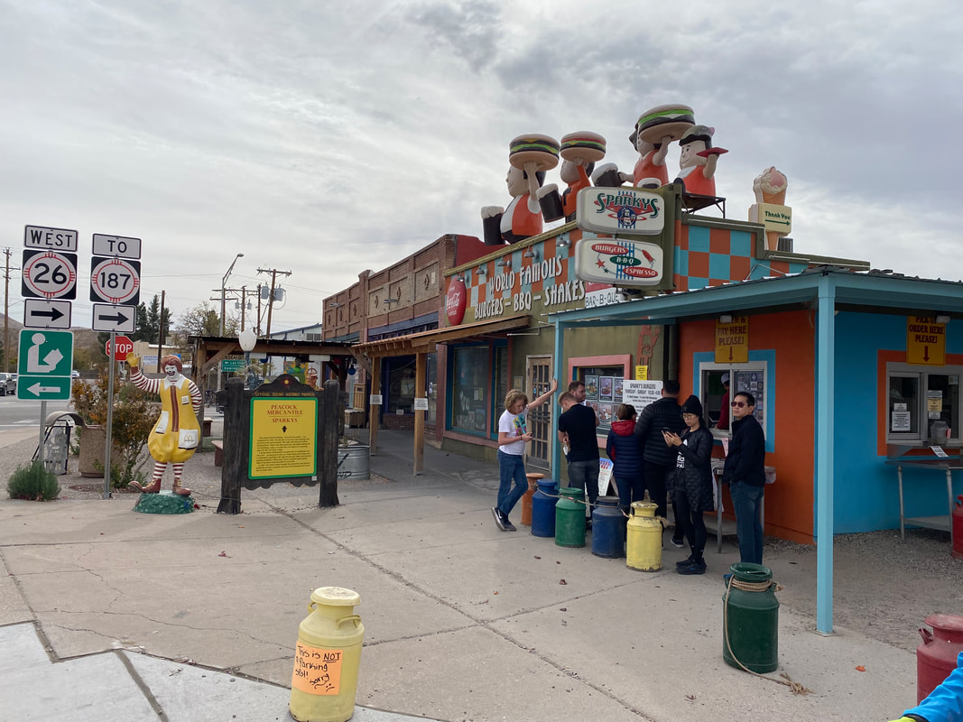
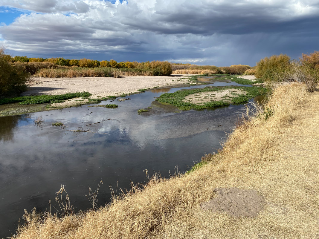
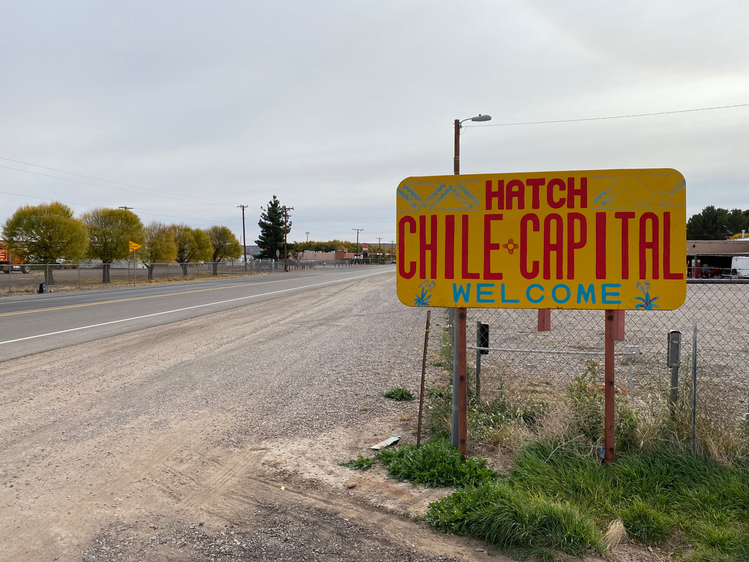
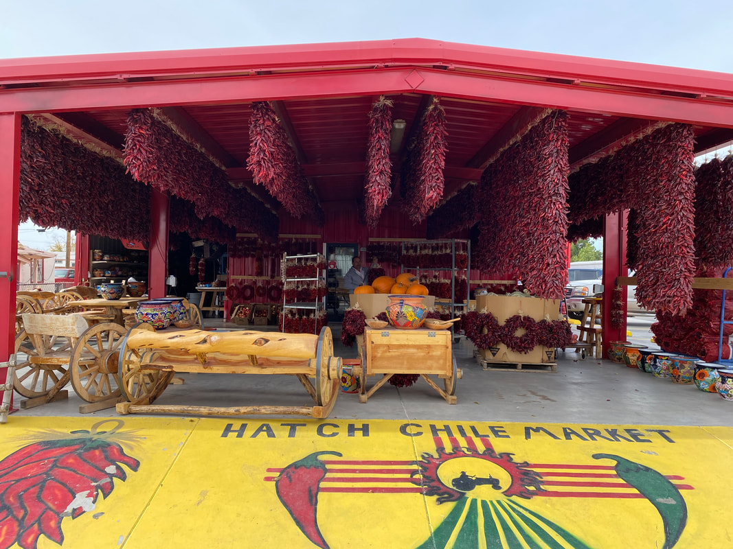
From here, we turned north and spun off onto a sandy wash that spilled us out on another levee along the Rio Grande. I paused while Janna ate a snack and heard a series of deep throated calls overhead. Looking up, the silhouettes of 30 or more large-winged birds flapped above us, swerving, and spiraling along the flows of the Rio Grande. Suddenly, I realized I was observing some sandhill cranes all gathering along this riparian zone. The levee shot straight along the Rio Grande. The number of sandhill cranes grew larger and larger as the surface water in the Rio equally grew. Large flocks stalked about recently plowed cotton and chili fields. As we approached on our bikes, they swooped large and raucous into the air, turning and coming back, crossing the levee and moving ahead before settling back down in the banks of the Rio, only to be repeated as we crossed paths again. The levee met up with the state highway where we turned and biked into downtown Hatch, NM. Chili stands, dried chili ropes, and restaurants with chili fare bustled along the highway. It was around noon and we beelined straight for Sparky's, which is the most famous of the bunch with their green chili cheeseburgers. As we rode up, another cyclist out on a large day ride from Las Cruces excitedly walked up to us. Turns out he had ridden the DangerBird 350 only a few weeks before (and done the route several times). He was stoked to see some bikepackers on route and asked if he could eat with us. He provided some excellent beta on the upcoming section was dry of water from Hatch until back in Las Cruces - thus, we needed to saddle up 8 liters each to get us through the next day and a half. As for the food at Sparky's, it was excellent and I chose to get a real green chili cheeseburger and fries. Satiated and with electronics recharged (I found an outlet nearby for our cell phones), we grabbed a few evening food items from a convenience store before rejoining the state highway. 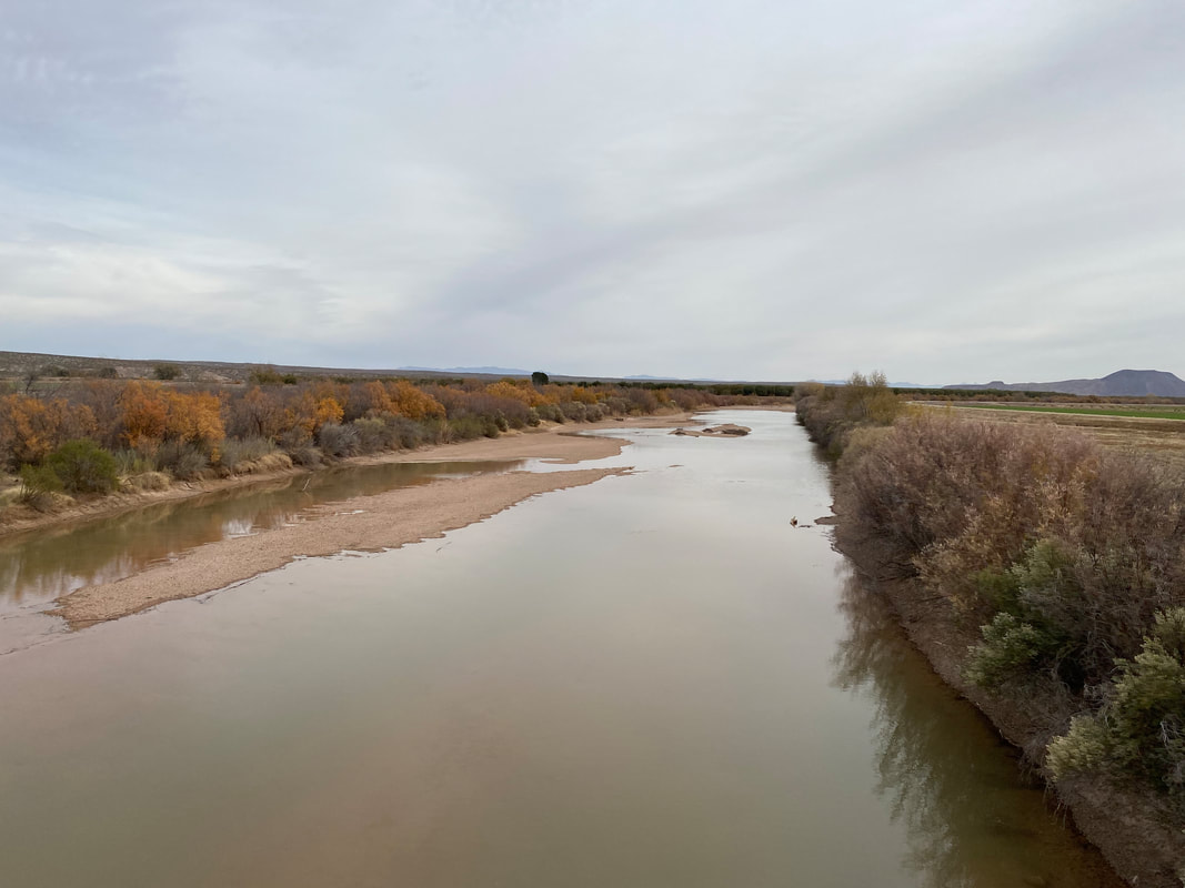
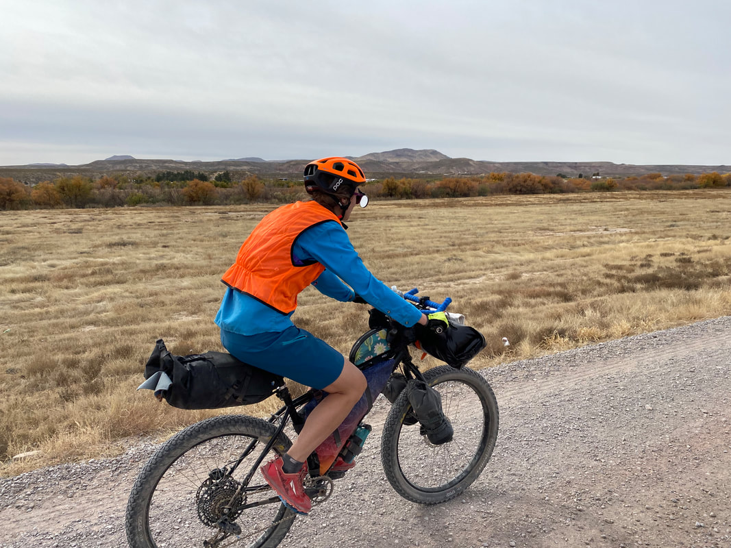  
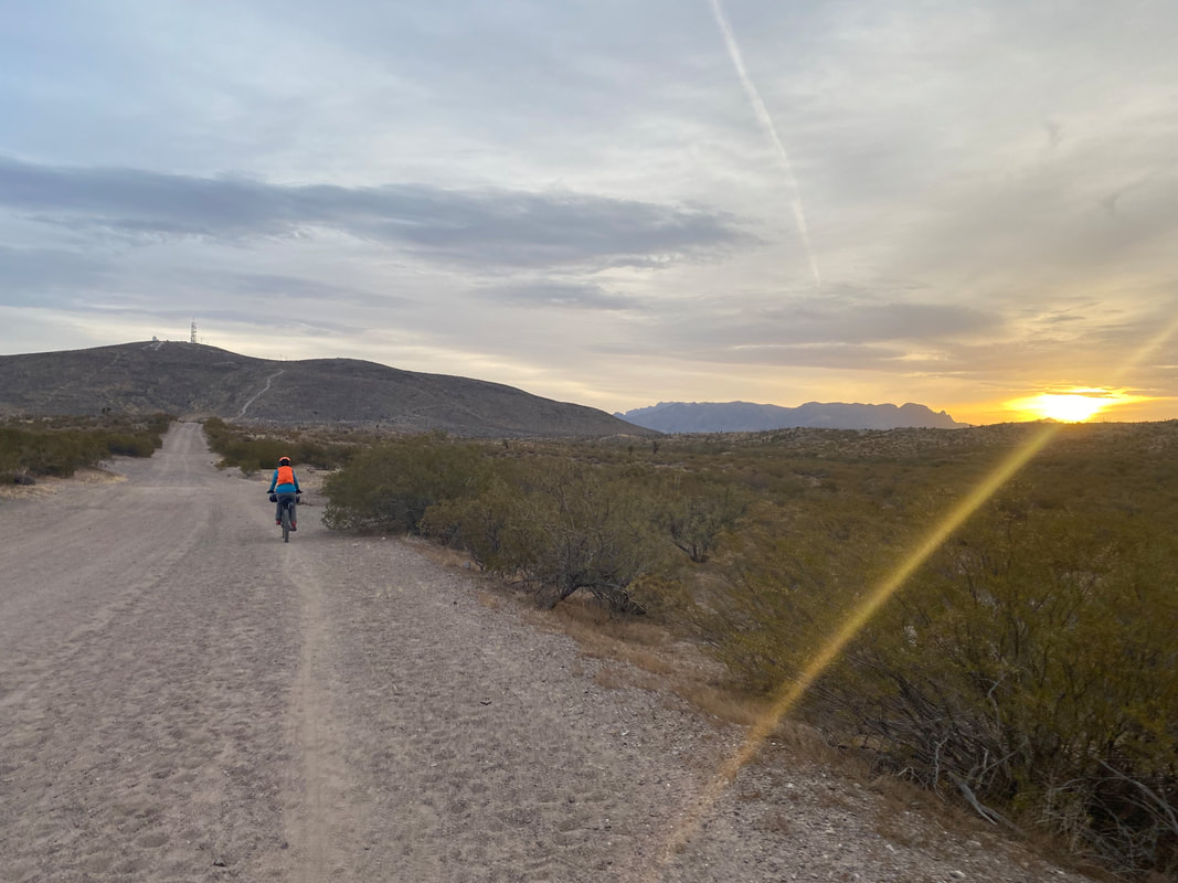
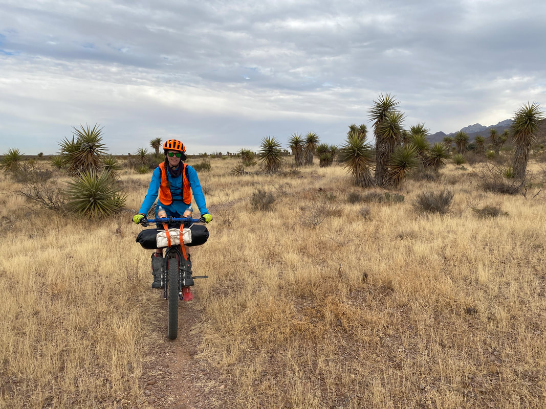
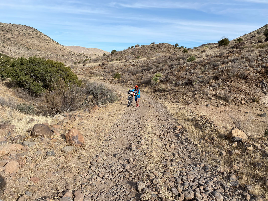
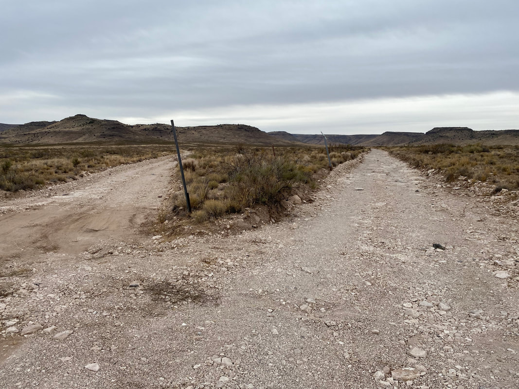
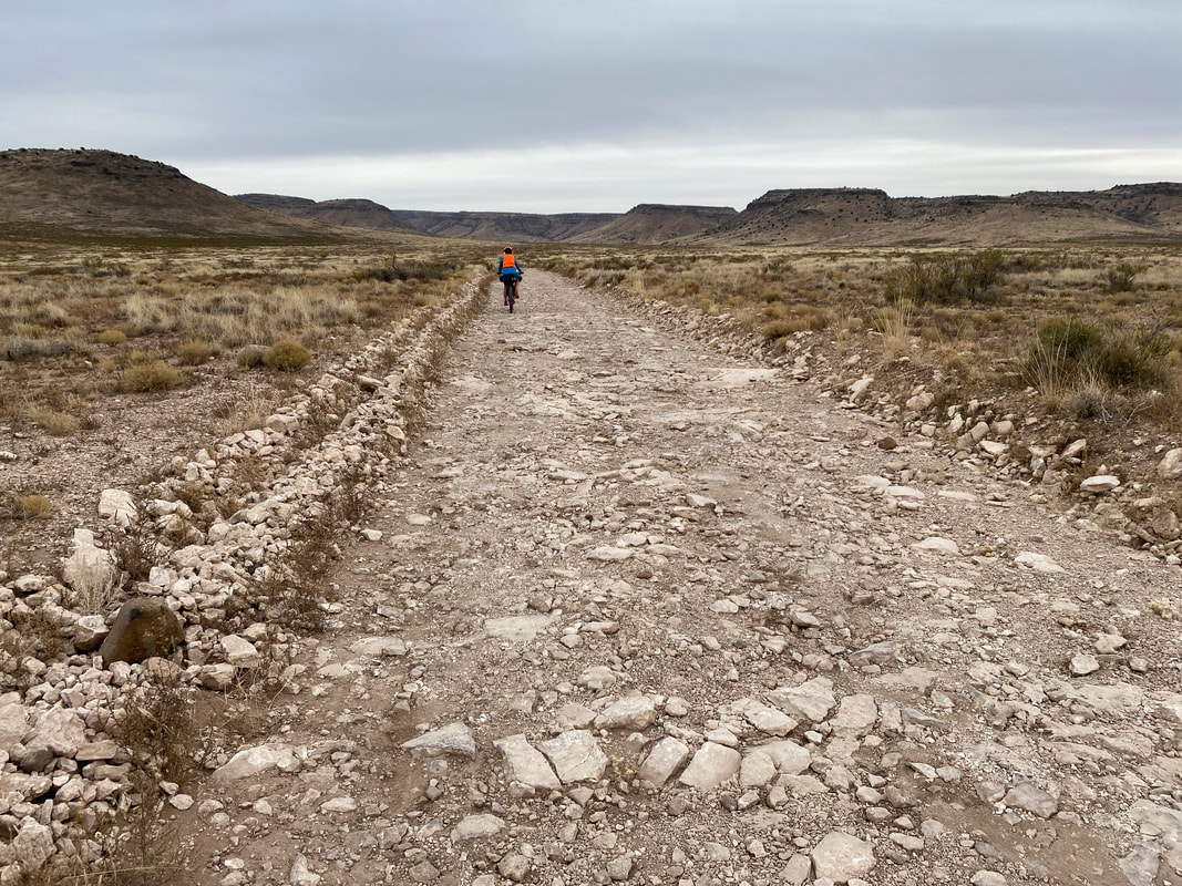
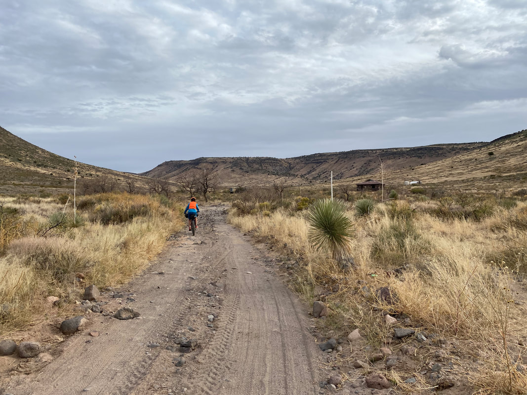
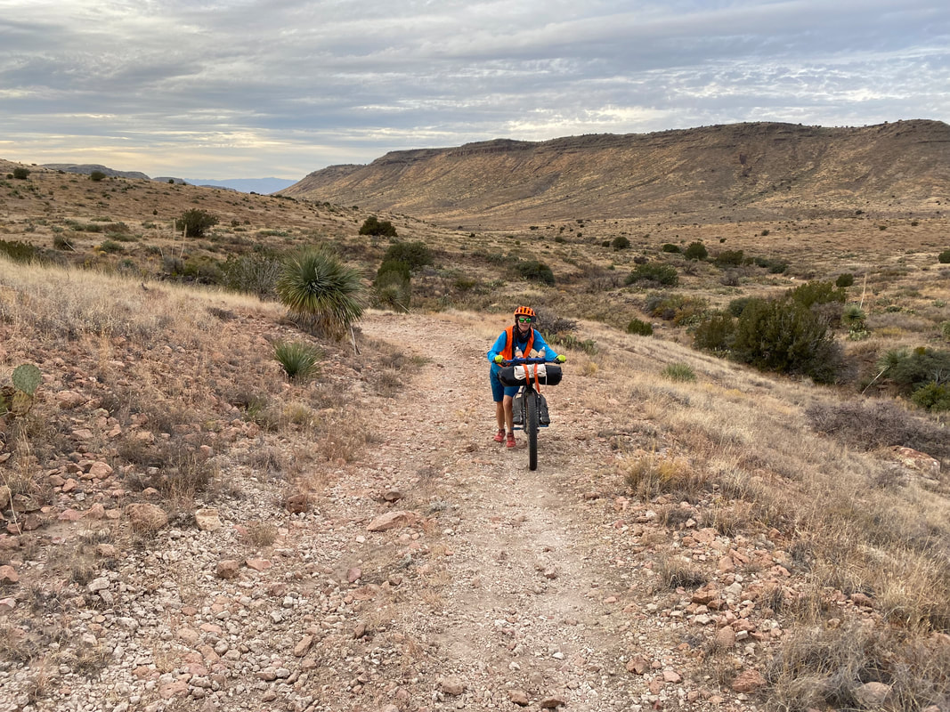
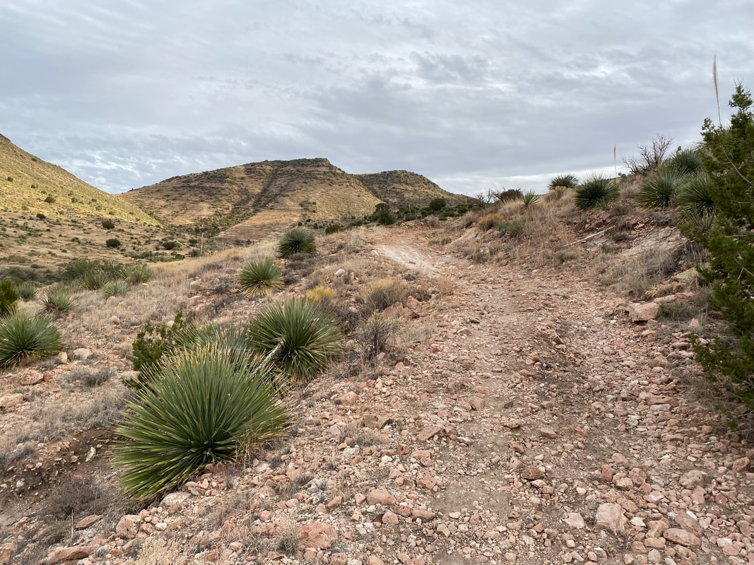
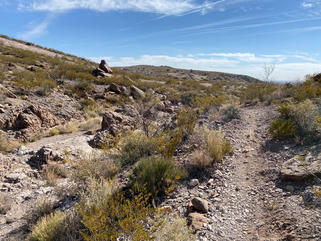
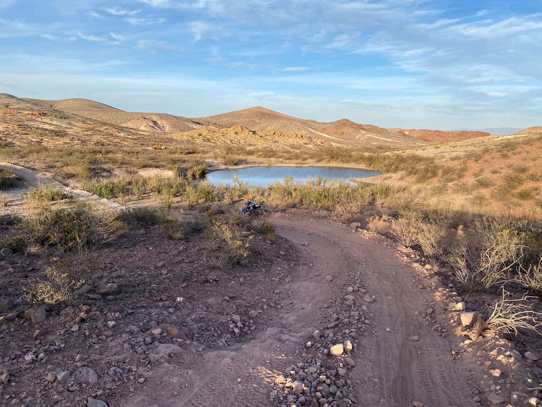
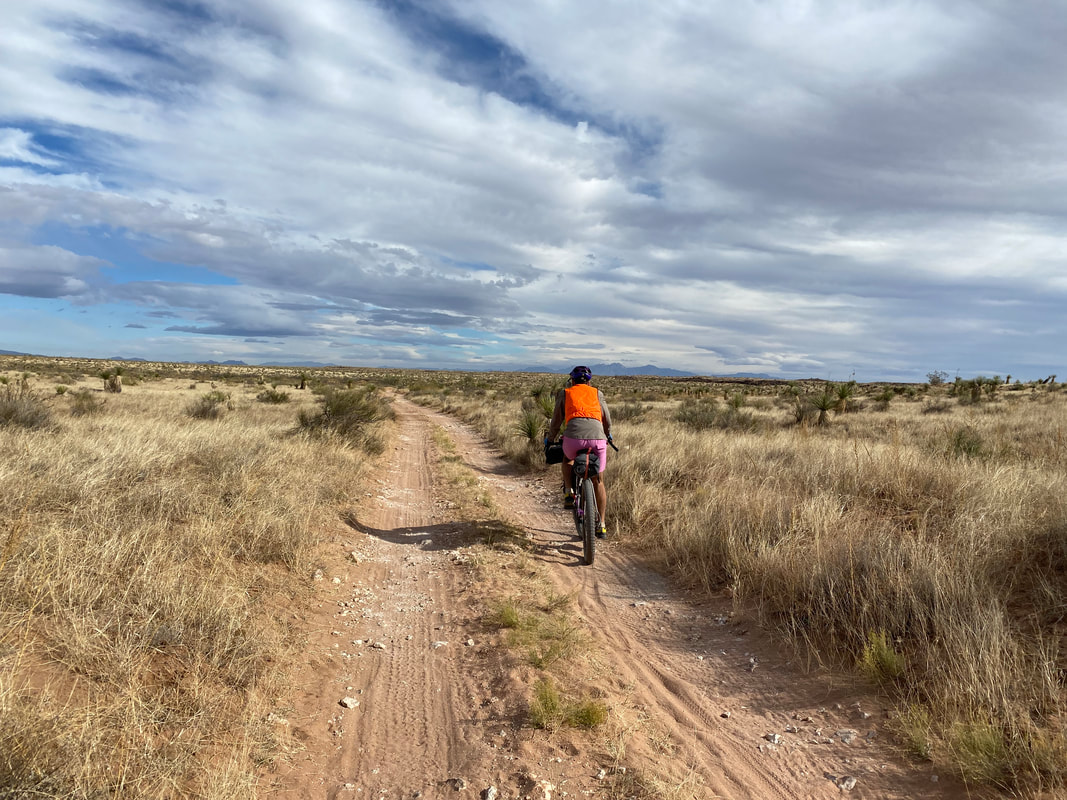
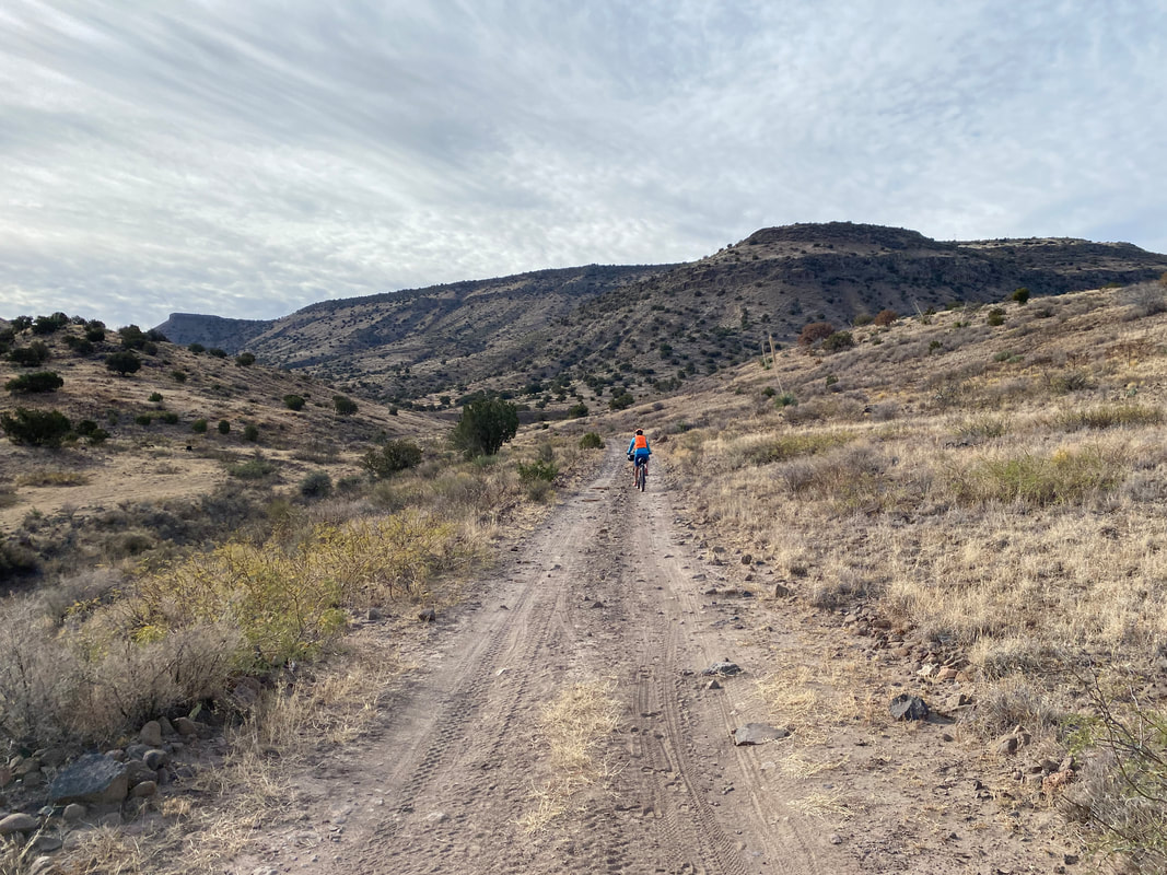
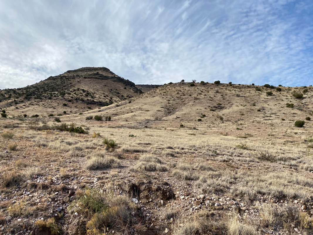
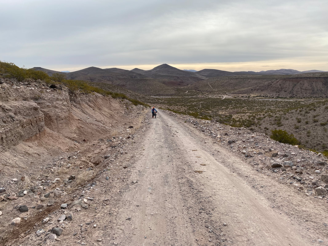
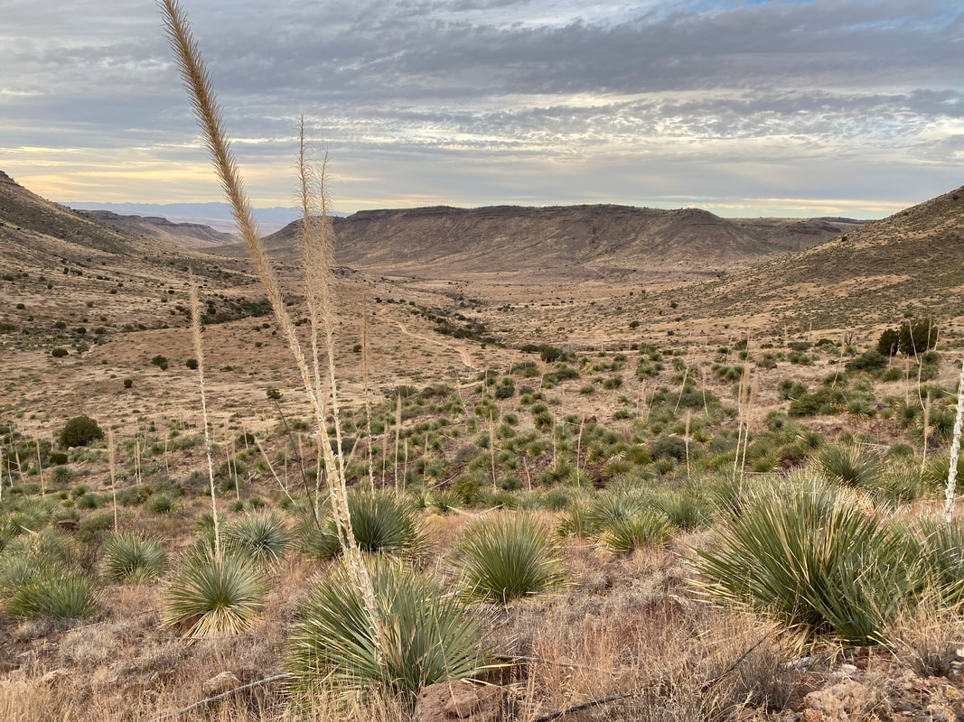
The cloud cover really began to thicken. Semis passed us as we rode the shoulder of the state highway for 10 miles. We passed a solar array with panels incredible and large. I kept catching myself thinking of riding along paved highways all summer in car-congested traffic; it reminded me of how much I enjoyed bikepacking on dirt roads where I didn't need to look over my shoulder every 10 seconds. Before long, we turned south off the highway and jumped on a dirt road. According to the route guide and the cyclist we spoke to earlier, the next section would be the most rocky and legendarily degraded of the route, all the way to White Gap. We now pedaled south on the northwest side of the Las Uvas. Dirt road crumbled to babyhead stubble where my pace slowed to 1 mph. The rocks were large, unavoidable, completely consuming of all lines, and saturated with sand in-between. But honestly, Janna and I loved it. It provided a change up of terrain, some different thinking and skills, and broke up the smoothness of the day. Plus, we're accustomed to Southwest gravel which would be mtb-worthy anywhere else. It didn't hurt that much of the dirt road riding we do around the Grand Canyon is precisely this primitive two track material. What made it better was that it wasn't punctuated by any steep climbs. Instead, the uphill was gracefully gradual. Suddenly, the dark of the sky softened as the sun burst through and some blue lit up a backdrop to the golden grass studded hillsides and plateaus of the valley we traveled up. We passed an old stone skeleton ranch house with windmill to tout. Grazing cows wandered around dispersely grazing. The afternoon wore on, the landscape got more beautiful, the yuccas more plentiful, the grass more golden, and the route steeper and rockier. I could see where the switchbacks of the old road bisected the wilderness area and provided our only bike-legal passage up and through White Gap, a cleft in the mountain top. Pushing and pushing and pushing. Rockier and rockier, the sun slinking away behind dirty golden plateau margins. My arms and shoulders aching as I took one step up, pushed with all my might, and then hit the brakes to hold the bike in place while I took one more step forward. And then I crested the top and peered into the high Uvas with careening valley and curved ridgelines carving out a small desert bowl. The last light of day was fading behind those same rock escarpments, beckoning me down to some state trust land that would afford us some camping. But as rocky as the up had been, the same could be said for the down that followed. This meant I needed to walk my bike down a road that seemed more stream of babyheads than anything. When the rocks began to waver, I jumped on and sat on my brakes, feathering down some real chunk shit in the gathering dusk. We would down desert washes and around hills looking for a flat location above a low spot to avoid the settling of cold air. In the very last twinges of discernible light before dark, I took a side dirt road going nowhere I knew but that seemed to head into a flat spread studded with prickly pear. Perfect. We setup camp in the dark with headlamps, watched the distant glow of Las Cruces on the continuing cloud cover, and enjoyed what we thought as a rather warmer winter evening up in the desert peaks. 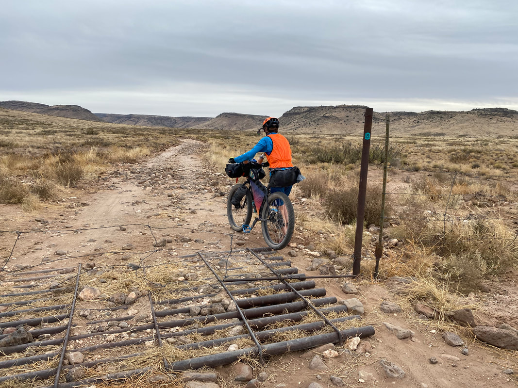 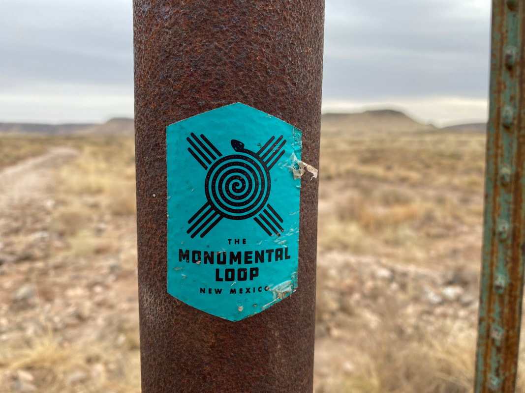 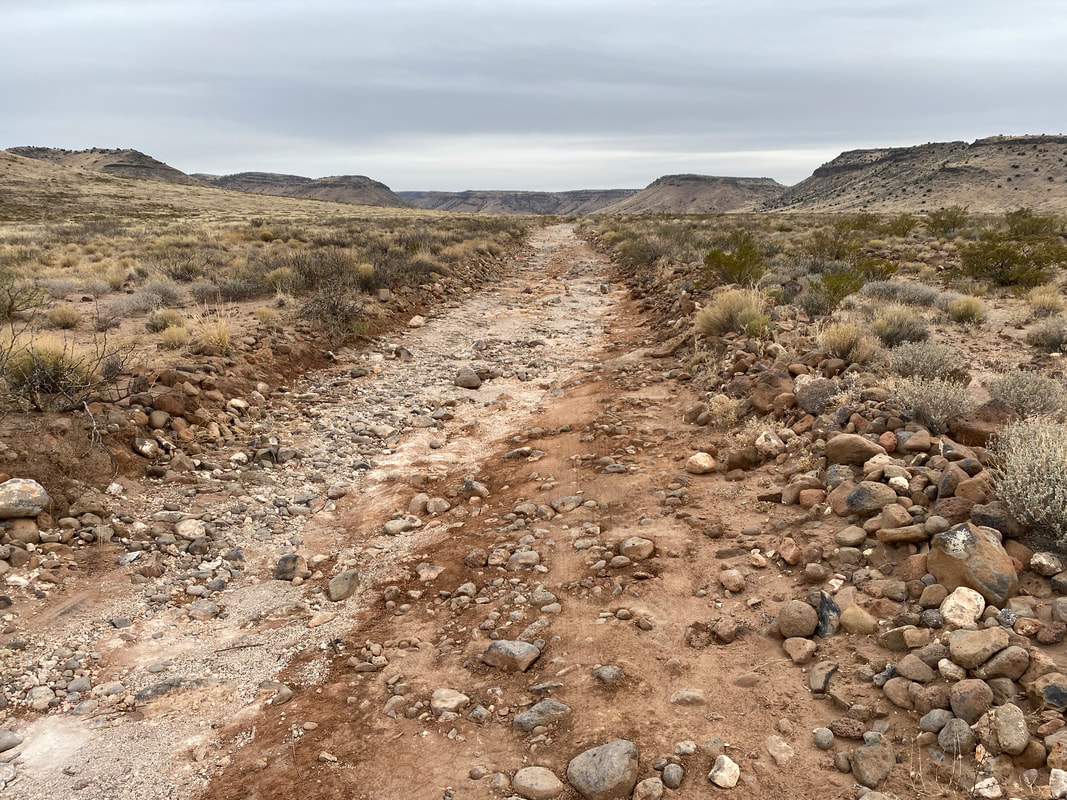 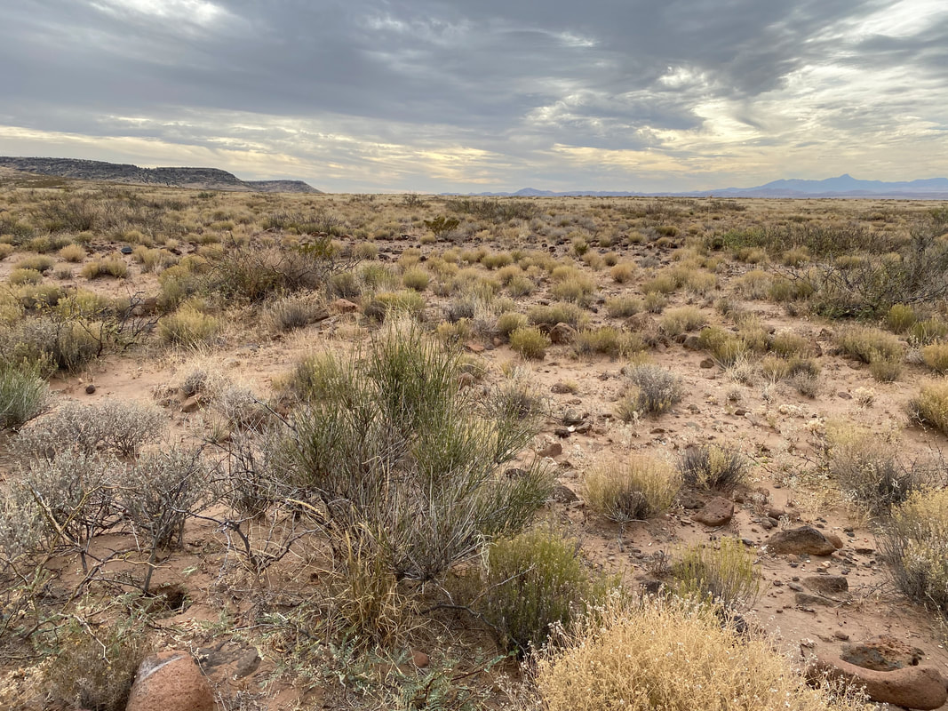
44.03 Miles; Las Cruces, NM to Coyote Canyon Wash in Organ Mountains-Desert Peaks NM
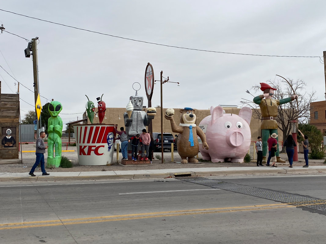
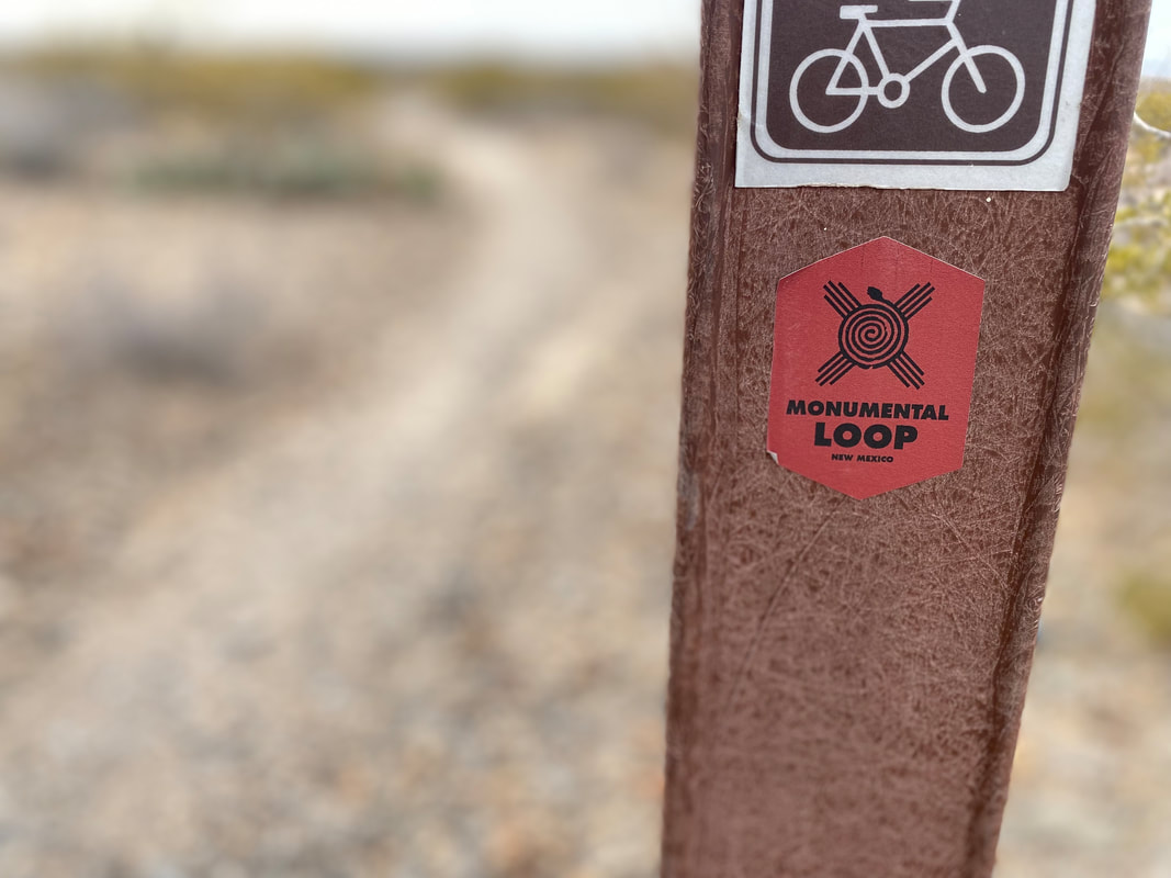
Following a fall slammed with life and events that spooled out itemized to-do lists, all I wanted to pursue was a backcountry adventure. With Thanksgiving Break approaching, I decided on a southern desert bikepacking adventure; immediately, the Monumental Loop came to mind. The Monumental Loop is a 257.3 mile bikepacking route based around southwest New Mexico in the Las Cruces area. It hits up all four units of the Organ Mountains-Desert Peaks National Monument, rides along the Rio Grande for several portions, hits up stellar food and famous green/red chilis, and traces several desert wilderness areas.
Wrapping up a slammed week of school, we slept in on Friday and then began the 9 hour drive down to Lac Cruces. The weather for the area was slated to be mid-60s and sunny for the most part - perfect weather after a summer of heat riding. Unexpectedly passing through Pie Town, we pulled off and took a side look at the Toaster House where I had stayed during my 2019 Great Divide ride. The owner's cousin was now semi-permanently living there; he came out to meet us and walked us through the property while nostalgia pumped ever-quick through me. The Toaster House still serves CDT hikers and GDMBR riders and was much cleaned up from when I rode through. He snapped some pics of us before we rolled over to the pie shops in town. The pandemic had wiped out two of the shops, but the remaining one was doing well - rebranded as Pie Town Cafe. The owner talked and reminisced about riders, the burgeoning loads of users on these trails, and she informed me that they had purchased the famous, now-closed, Pie-O-Neer Café. The Pie-O-Neer is open and now serving their famous pies again along with a number of meals in a full-serve restaurant. She sent me down the road to the Pie-O-Neer, informing the cooks to let me in to see the place. The community had rallied and the namesake pies were coming back after COVID's economic hit.
Back on the road, we arrived in Las Cruces right after dark. We stayed the night at the Lundeen Inn of the Arts, which was just a block or two from the start of the official route. Not only that, but the owner agreed to let us leave our car on their property for the duration of our ride for free.
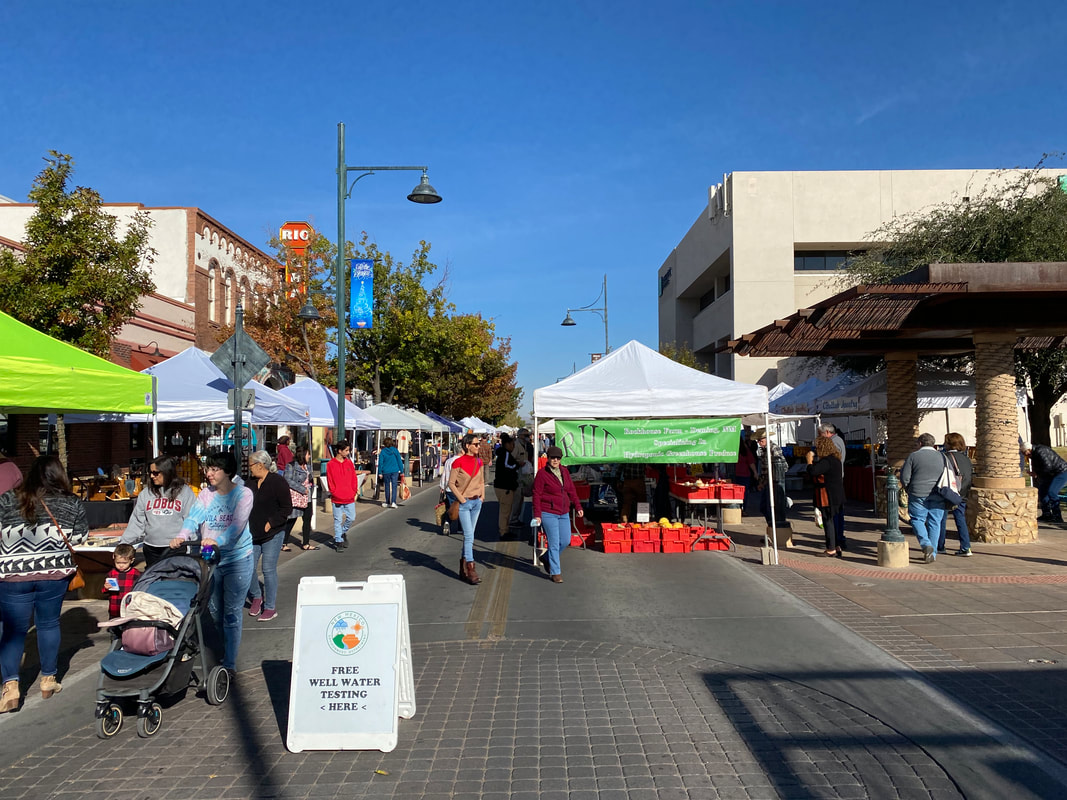
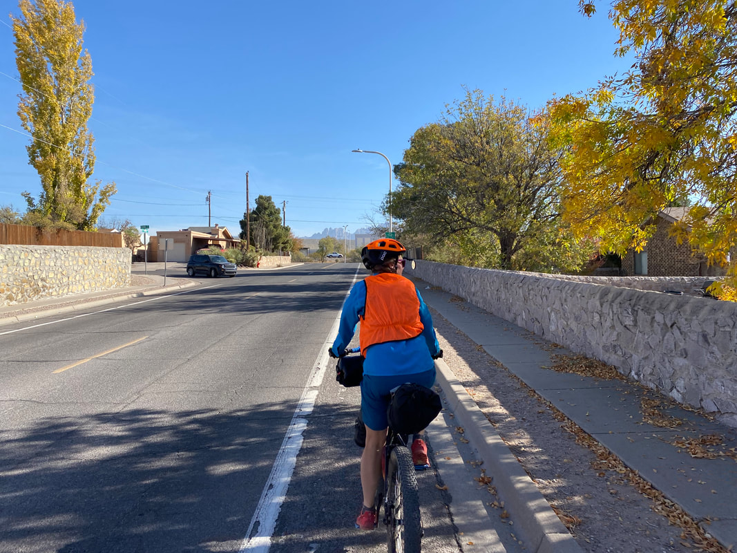
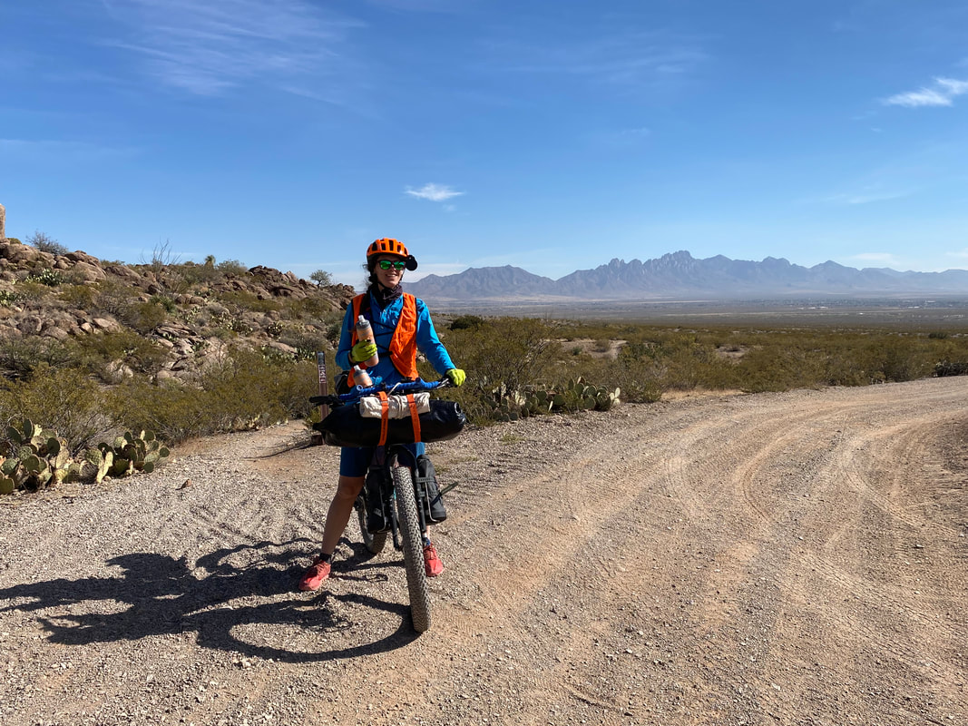
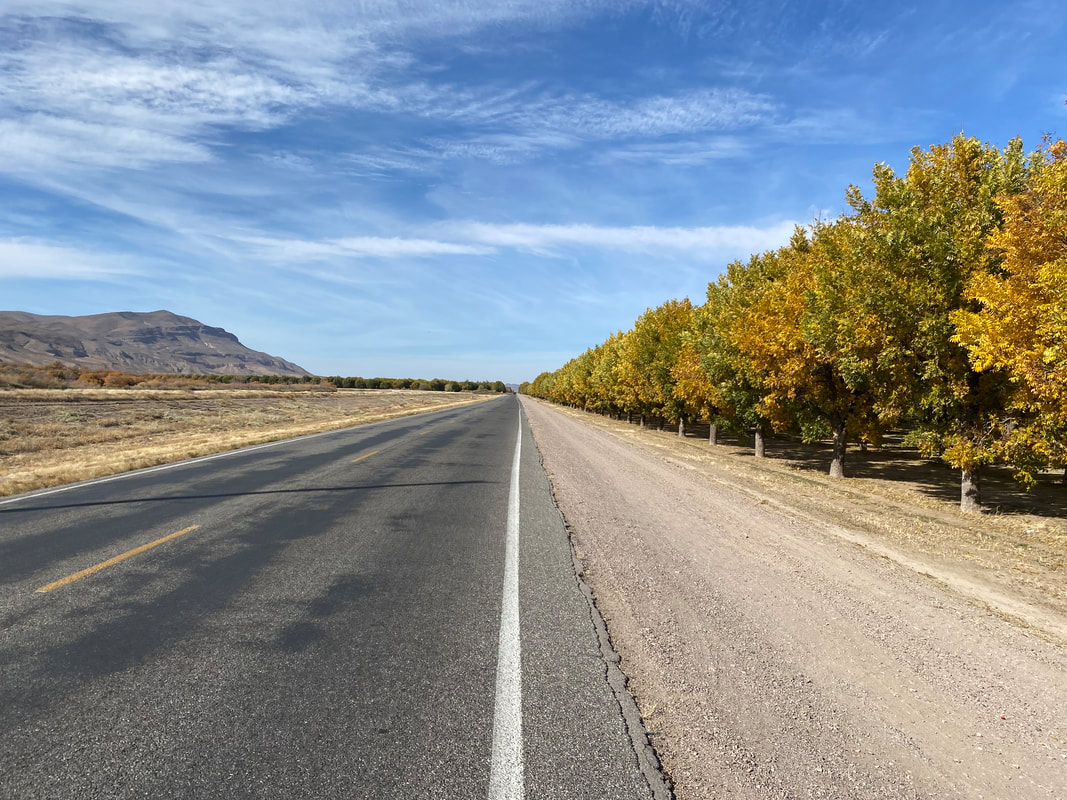
Morning came, breakfast was served, and we packed up the bikes in the Inn's parking lot. Saturday morning was crisp with desert autumn, every deciduous plant baked gold and curled with brown. The official route start was in the downtown plaza that was conveniently closed to cars and chocked full of the crowds for a local farmer's market. We slow pedaled down drowsy streets studded with historical homes smattered with Earth-tone stucco and adobe. The route eventually led to a bikeway that sped along canals. As rurality grew and urbanity receded, the blacktop drifted into crushed gravel, sand, and dirt along dusty canals filled with the dry stems of brittle yellow grass. Farmer's fields sped by along with rows of harvest-ready red chilis glinting in the sun. The Organ Mountains proper stood sketched on the skyline, their granite-pocked faces textured in a gorgeous autumn sun.
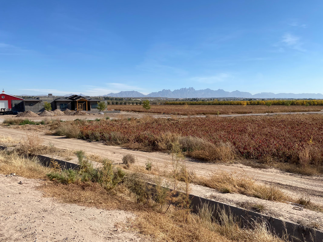
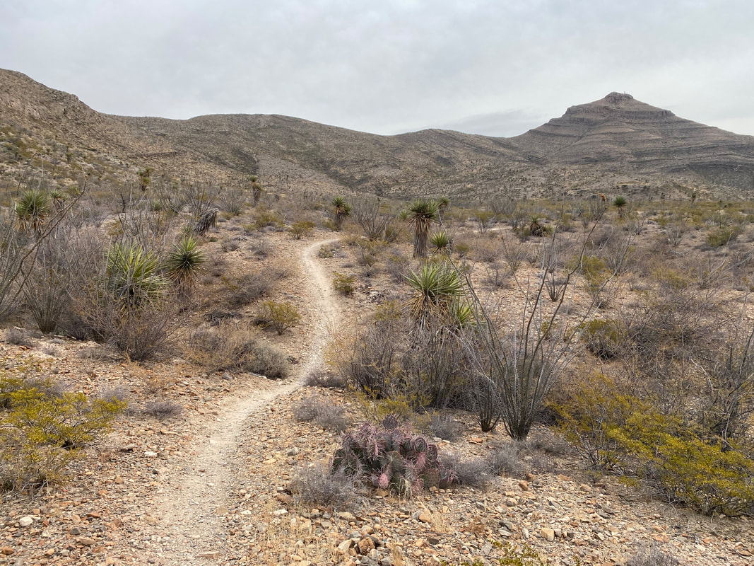
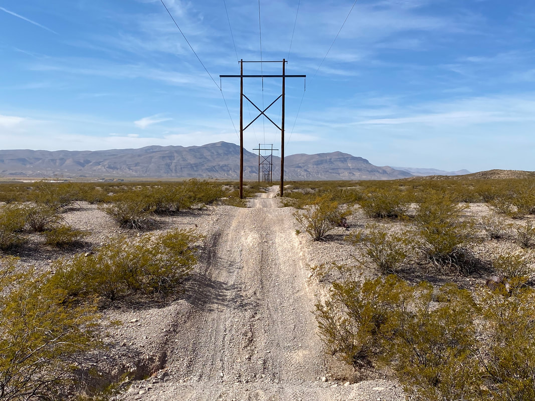
After a quick gas station stop, we pedaled up some neighborhoods where lawn xeriscaping gave way to open Chihuahuan Desert. Tread hit dirt and we rolled into the outskirts of the Organ Peaks-Desert Mountains National Monument. The route here turned into smooth, curvy, rolling singletrack as we made our way towards the distant desert peaks. Gaining them, the singletrack began to decay into a sandy wash with crumbling granite before meeting up with a well-sanded power line road. Miles sank easy as our plus tires sped us down to pavement along pecan grove. Here, we met the Rio Grande. Sucked dry (but still flowing subterraneanly) by pecans, cotton, and chilis, we jumped up on a flat levee and pedaled the dirt road hugged between jagged peak, sandy river, and leafy nut grove.
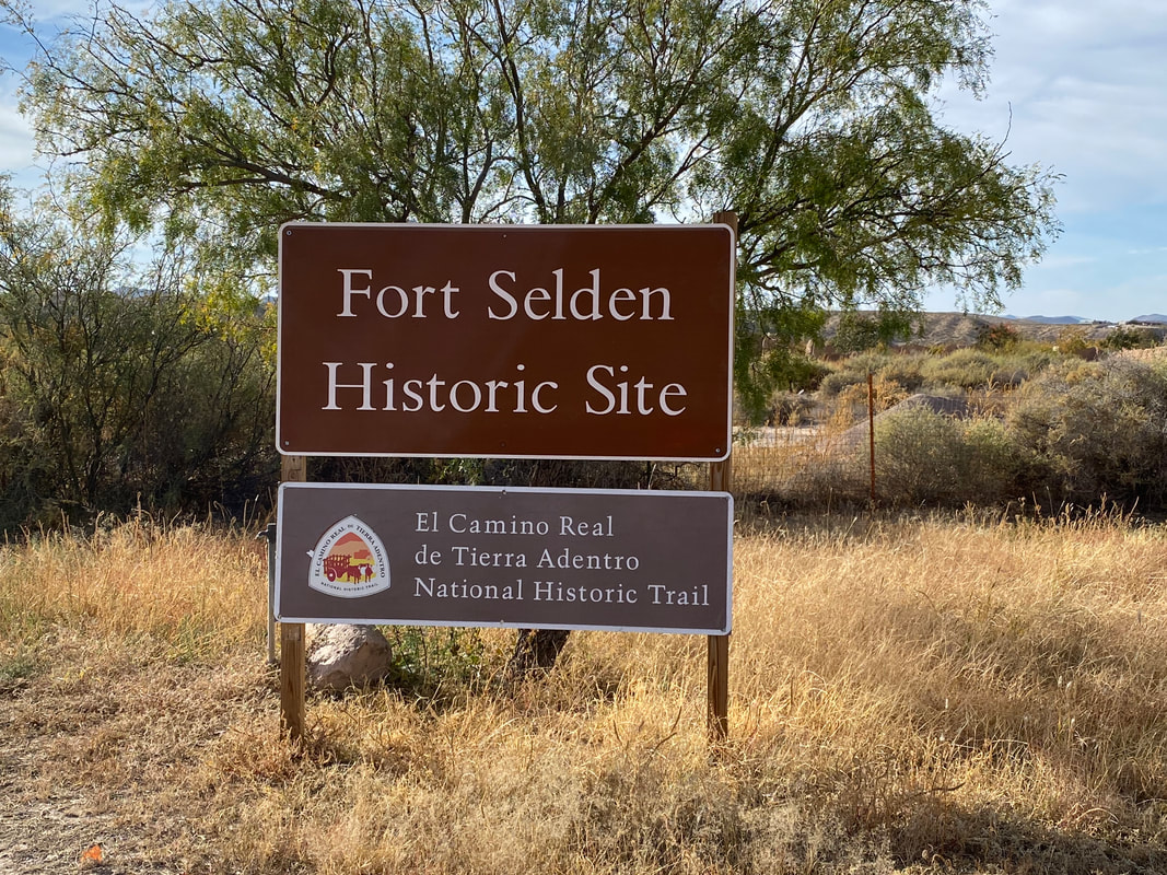
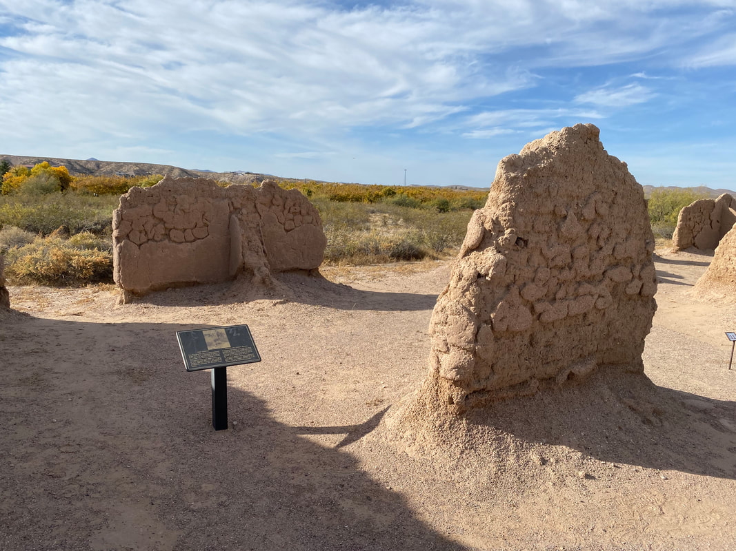
Several off-leash farm dogs raced out to us, barking intensely. We hopped off our bikes, calmly pushed by, and I yelled "NO," with alpha authority to get them to chill down. We pedaled onwards back to pavement. Here, we headed slightly off-route to hit up active-decay ruins at Fort Seldon National Historical Park before riding to a Family Dollar. We bought several gallons of water, each of us carrying 7 liters, as this would be our last water supply before sometime tomorrow. 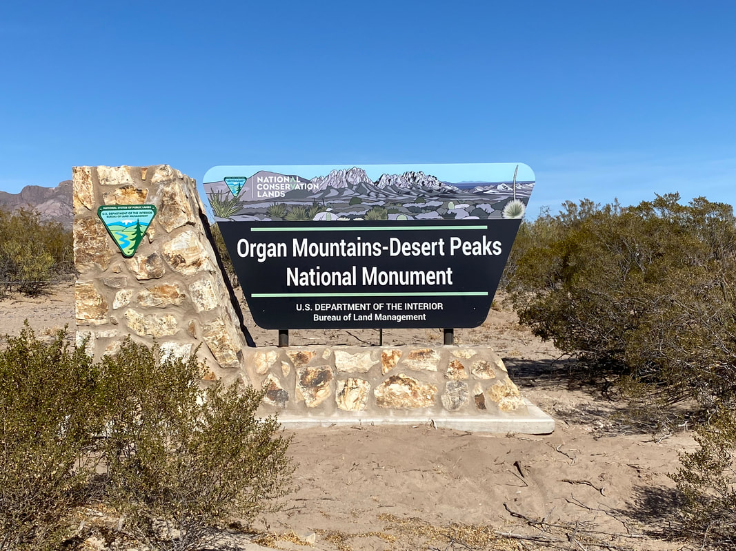
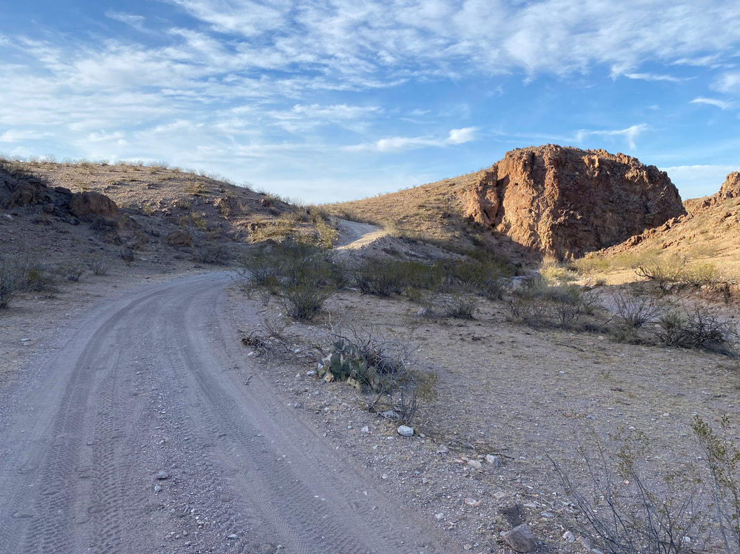
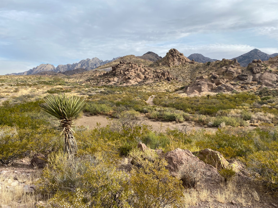
A mile or so later, we peeled off the highway and began into the Las Uvas mountains, another unit of the Organ Mountains-Desert Peaks National Monument. The route hit steep grade, forcing us to hike-a-bike up the ascending dirt road. I felt that warm peace that comes from soft light, dry silt, miles of desert dirt road, and that combination of deftly jagged rise and gently rolling hillside. It was gorgeous.
The sun began to sift through layers of thin cloud basking everything rightly, accentuating shadow and form, softening hard edges, making plant and rock the best versions of themselves. The dirt road held traces of bike tires recent. The road itself was fantastic, chunky, and fun for variety. We passed a dirt cattle tank recently dozed and filled full of water. We pushed bikes up steep climbs and skated down dusty smooth descents. The Sun began to dip with the winter hours around 4 pm. We pulled off on a mesa filled with cement-white earth and evenly spaced creosote to camp for the night. We didn't want to sleep low in the wash where the road led to avoid the settling of bitter cold. Cloud cover built steadily while we felt alone in the smooth world of winter desert; the moon was full and diffuse with the clouds. Even in dark, the world was bright with its light. Janna and I sat for a long time in the dark, talking about life, letting our food digest, and avoiding the 14-15 hours of dark ahead. 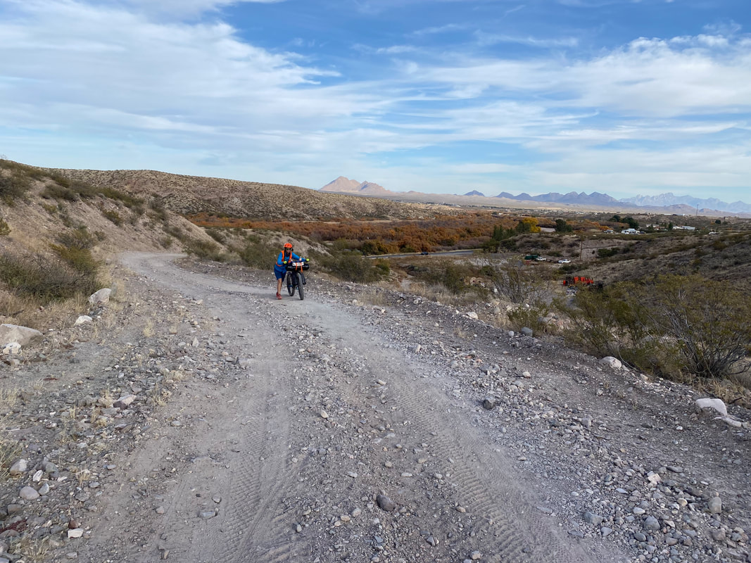
|