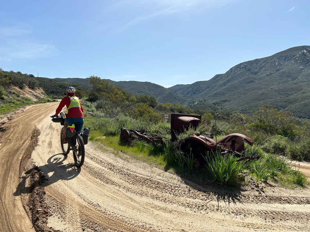
 Two years ago I made an initial attempt to ride the Stagecoach 400 in 2021 as a solo bikepacking trip. I made it five days in but abandoned the desert due to temperatures well over 100 degrees; after living and biking for years in triple digit heat, I didn't have the desire to experience Anza-Borrego under those temps. Instead, I twisted the route into a spiral and made my own tract around the San Diego area. But, the beauty and diversity of the route hung heavily in my mind. All I wanted to do was show Janna how incredible of a route it was. Mountains, Deserts, Ocean. Truly, a spectacular tour of SoCal spread. We thought about doing it last year over Spring Break, but the blizzard conditions that hit the route that year made it unpalatable. So Spring Break came this year. The temperatures warmed up enough to beat back the worst of winter on high but abate the onset of summer heat down low. Perfect. I planned out the route deciding to start the ride in San Diego which afforded easier opportunities to park the car as well as a push to get the desert done first before it had any more chance to heat up. That, and we loved Idyllwild as the optimal trail town to take a zero-day in during a mid-route rest day. Janna agreed. After a rough and tough end to quarter 3 of the school year, we were hankering for some backcountry adventure to shake the hold that work had on both of our constant waking thoughts. The Stagecoach 400 ended up delivering on everything...(Continue Reading)
0 Comments
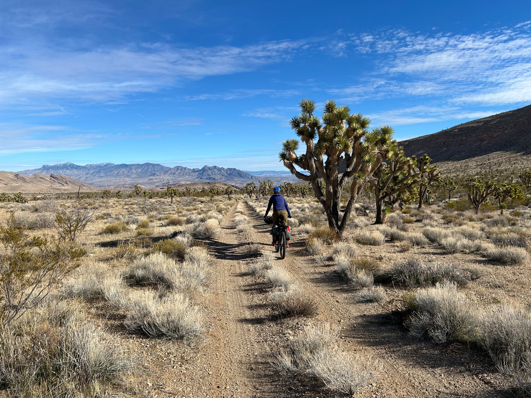
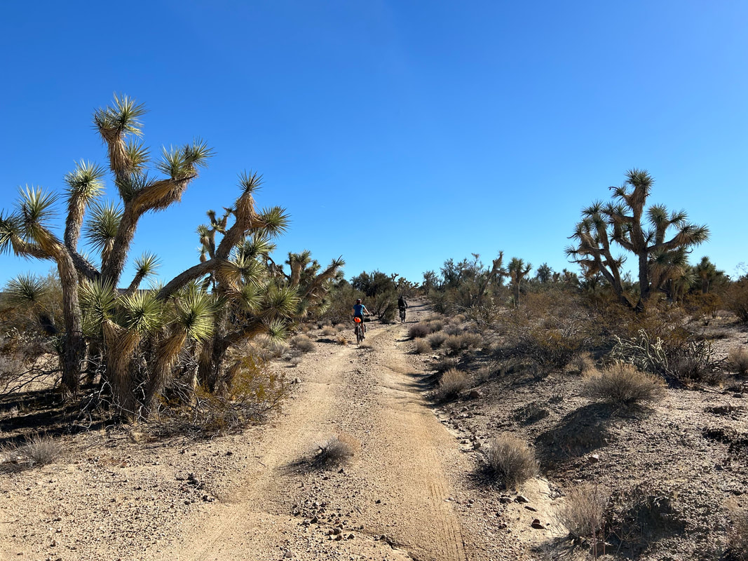
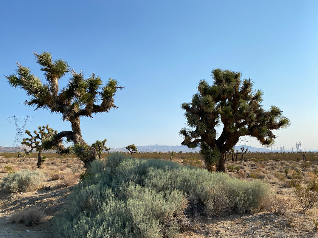
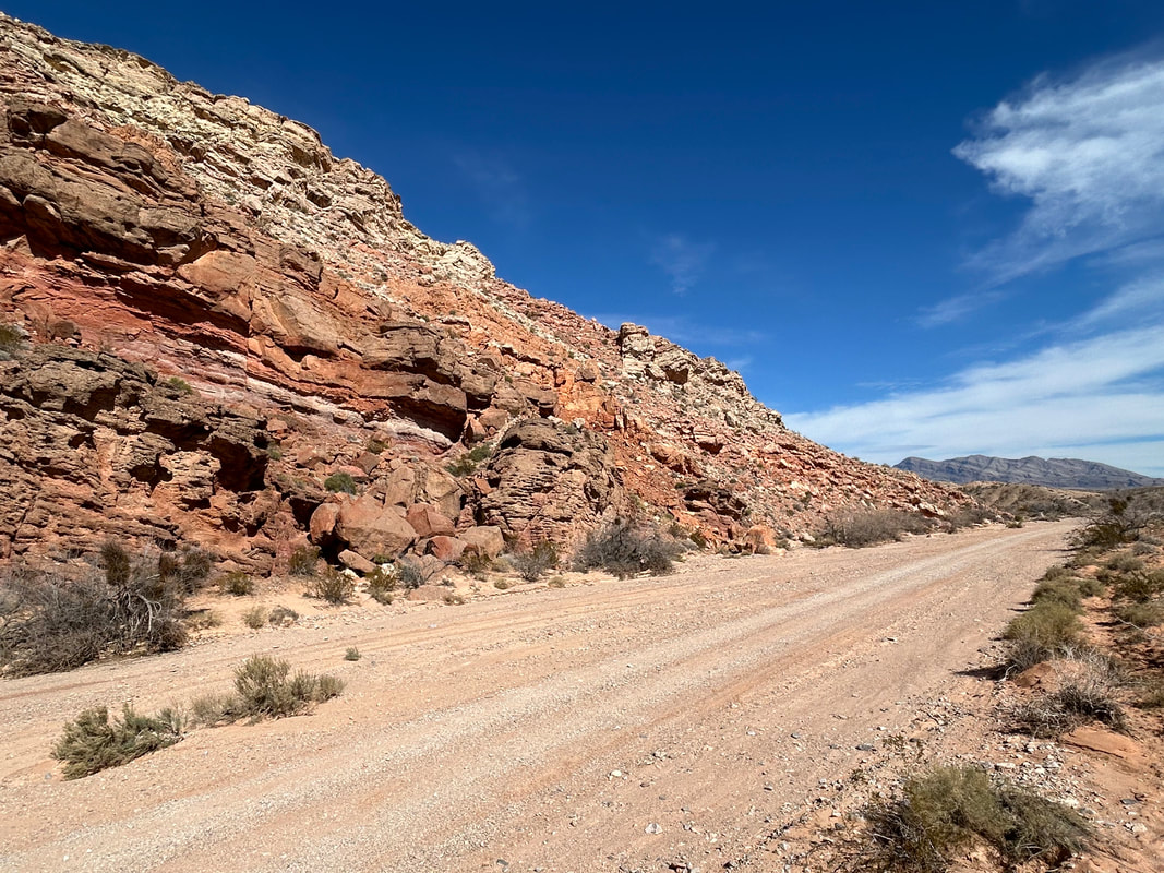 Gold to Grand Loop is a bikepacking route that travels through Gold Butte and Grand Canyon-Parashant National Monuments straddling the Nevada/Arizona border. It does a nearly full circumference ride of Gold Butte NM taking in opportunities for side hikes at Little Finland and Seven Keyholes Slot Canyon as well as cultural tours of the old Gold Butte Townsite. Take time to enjoy the dense Joshua Trees and exposed, vibrantly colorful geological formations along the route. From here, it's a big descent into the remote and little visited Grand Canyon-Parashant NM. You'll look at the distant Grand Wash Cliffs that officially mark the end of the Grand Canyon as the stratified layers dive into the Mojave Desert at Lake Mead. Stop at ecologically rich Pakoon Springs before a climb up and along the base of the Virgin Mountains. Then, climb up and over Lime Kiln Pass where an exhilerating descent carries you to the high desert town of Mesquite, NV. Eat some tacos and then finish the ride on the semi-paved Gold Butte Backcountry Byway that traces the banks of the Virgin River before ascending back up to Gold Butte NM and finishing the route at iconic Whitney Pocket.
Gold to Grand Loop sticks to excellent backcountry dirt roads and features evenly-spaced reliable water sources. It travels through environmentally important habitat for the Mojave desert tortoise but mule deer and big horn sheep are out here too. Junipers and Joshua trees intermix along with creosote and yucca along terrain that ranges from 1400 to 4600 feet. This is a great 3-4 day winter bikepacking trip close to Las Vegas and through the heart of where the Colorado Plateau and Mojave Desert meet. Continue to Full Route Guide 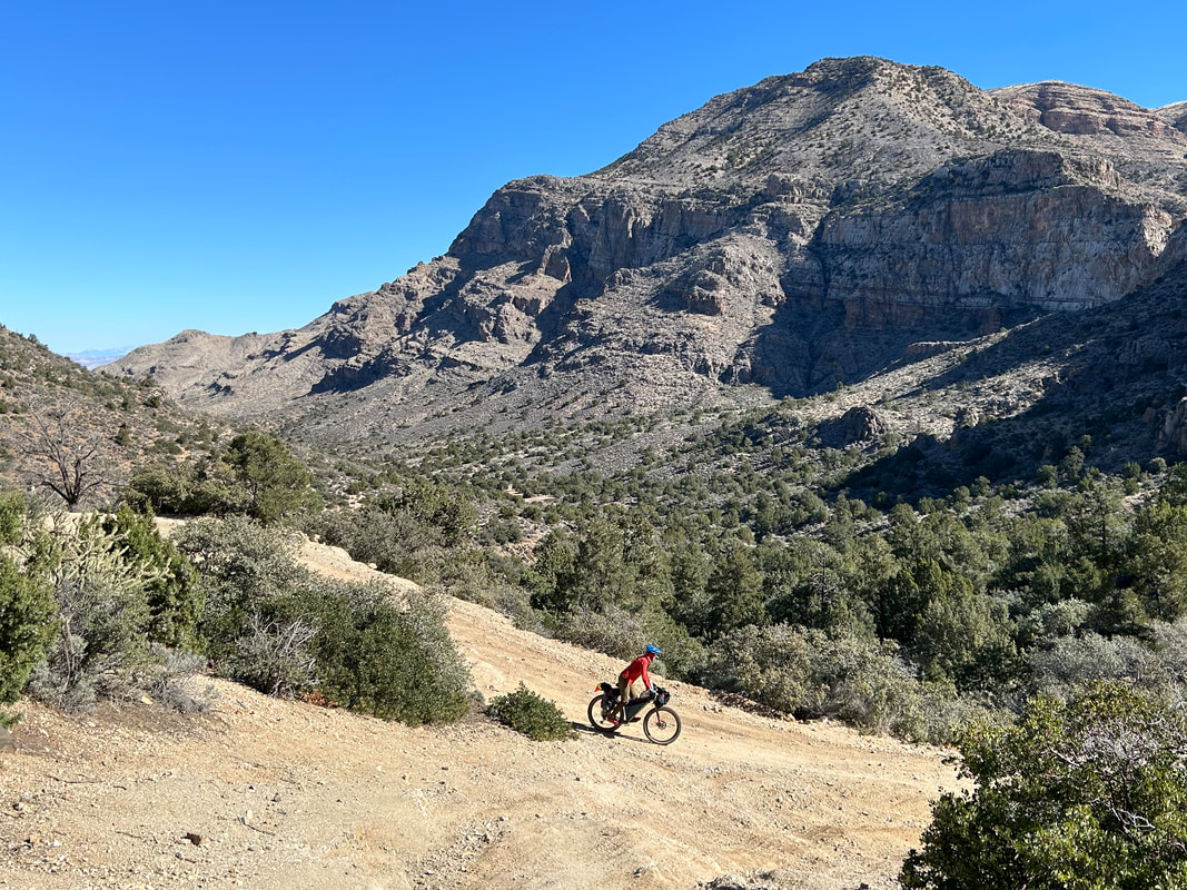 When we went to bed last night, both arrival at camp and laying down for sleep occurred well into the dark. I had a hard time visualizing where we were or what the area would look like. Waking up after such nights is always a moment of curiosity for me. I popped outside and looked around. We were camped on a little basin between an adjoining peak and the stunning snow-capped Virgin Mountains. A spill of juniper trees intermixed with Joshua trees. Janna and I sat in the sun eating breakfast while letting the sun crest over the landscape bringing its warmth. We knew the climb ahead was the crux, so we got going quickly...(Continue Reading)
 The night was calm, dark, and we slept hard. We awoke to one of those worlds where the desert sun angles its shine between muffles of cloud. Because we had arrived and biked after dark, I was curious to see what Gold Butte and its townsite looked like in the day. In the distance, far reaches of mountains many miles away stood incrusted in sheens of snow and ice over valleys of desert. We set up breakfast, feeling happy to be out here, followed by packing up our bikes. Then the two of us walked over to the actual Gold Butte Townsite. The area was littered with old mining equipment from a heyday of when a post office, lodging, saloon, brothel, and a city 2000 people living out of tents were found here in the 1800s during the height of a gold boom at Gold Butte. I found an old fenced mine shaft amid metal machinery. There was an old, but well-kept, cemetery for two men who had lived and died here in the middle of the 20th century...(Continue Reading)
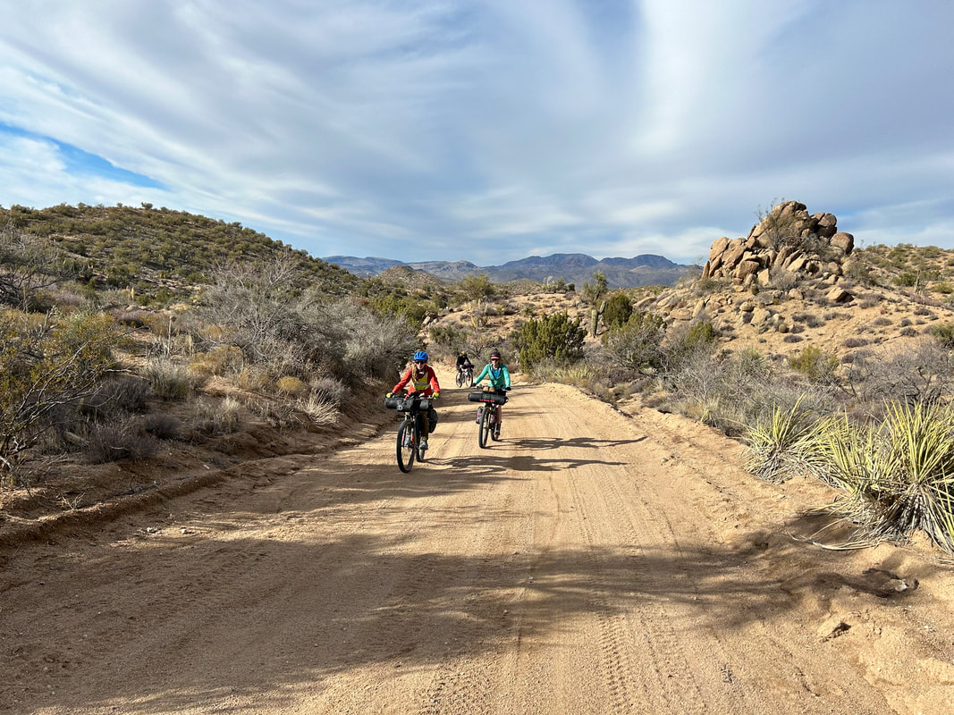
 In early November, Kate and Dan let us know that they were going to be down in Arizona for Late-December/Early-January. They wanted to head out on a bikepacking trip with us over MLK, Jr. Day Weekend. Kate suggested Gold Butte National Monument based on its desert-enviros plus her experience rock climbing the Lime Kiln Canyon area there. Her impressions were super-positive of the place and she wanted to go back and see more. I had followed the events of Gold Butte National Monument for about a decade, ever since the Bundys had an armed standoff with BLM employees over illegal grazing in the area. That, and my friend Lara from college now worked in the place with her husband for the BLM, and I had impressions from them that corroborated Kate's thoughts. I started digging into research on bikepacking routes in Gold Butte. Beyond a few day gravel rides, it seemed no established route was in the area. I reached out to cyclists who had spent some time in Gold Butte, and they reported the lack of water as a driving reason for the lack of a serious overnight option...(Keep Reading)
Tres Rios Loop - Day 3 - Around the Arrastra Mountain Wilderness and Across the Bill Williams River2/2/2024 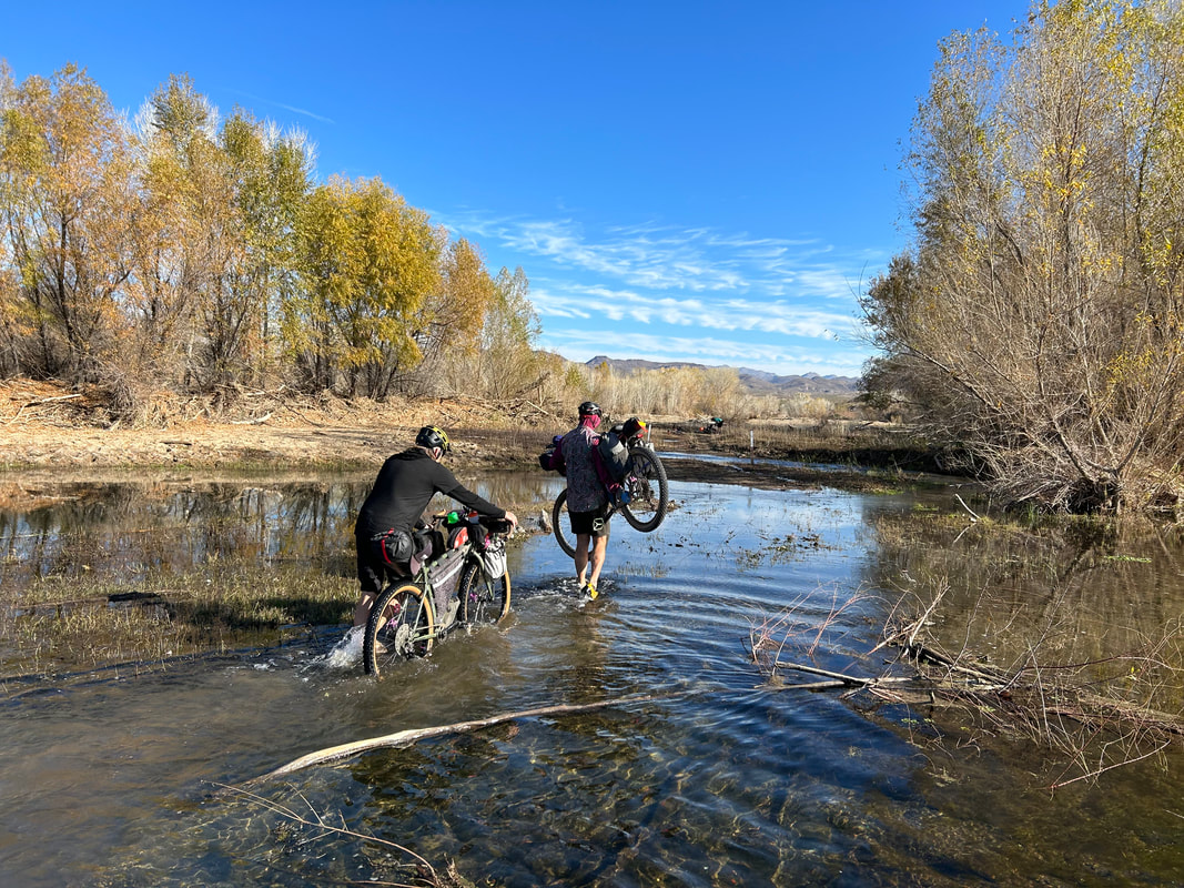 In the early hours of morning I hear Kate's alarm on her phone go off. I know it went off, but all I want to do in the morning cold/darkness of winter is curl up in my quilt and keep on sleeping. But, I know we need to move because today could involve some route-finding that might eat up some hours. So, it is time to move. Winter means dark mornings and today was no exception. I roll around in my quilt before I find the onus to get up and get moving in the dark. It certainly isn't as cold as yesterday morning. The desert morning brings soft, diffuse light that brightens pinkly on the craggy hillsides around us. Alamo Lake appears in the distance. All the bikes are packed and we pedal over to the side of the little general store to fill our waters from the outside hose spigot...(Keep Reading)
 Last night was the cold call of winter desert. The wash, rich with atmospheric moisture along the Santa Maria River, saturated our shelters with condensation that iced a quarter thick both interiorly and exteriorly. I wake up to pee in the night and feel my the top of my head scrape crystals from the inner walls. With dawn's cusp, we stagger into the diffuse light. Janna and I's bikes are caked in a quarter inch layer of soup frost - probably the thickest I've ever seen outside the Sierra Nevada. The frost is copious. It's probably somewhere in the mid-teens temperature-wise so we're all moving around slowly trying to keep fingers warm while simultaneously performing camp tasks. No one is too excited for the prospect of morning water crossings down the wash in these conditions...(Keep Reading)
 January is always the middle of winter here on the South Rim. And the craving for desert warmth and escape always hits true. When Janna and I were looking ahead to the MLK, Jr. holiday weekend, we decided to travel with Dan and Kate, who were scheduled for furlough and were going to be down in Arizona from Glacier NP at that time. The four of us wanted to catch up, and we felt a bikepacking trip through the desert deserved merit for an adventure all together. At first, we were looking at creating a route through Gold Butte NM, but we all felt a closer, warmer, and shorter route would be preferable since none of us had ridden much due to winter. At the beginning of December, Kurt Refsnider published his Tres Rios Loop...(Keep Reading)
Sierra Cascades - Day 11 - Out of the Mojave Desert and to the Start of the Southern Sierras1/15/2024 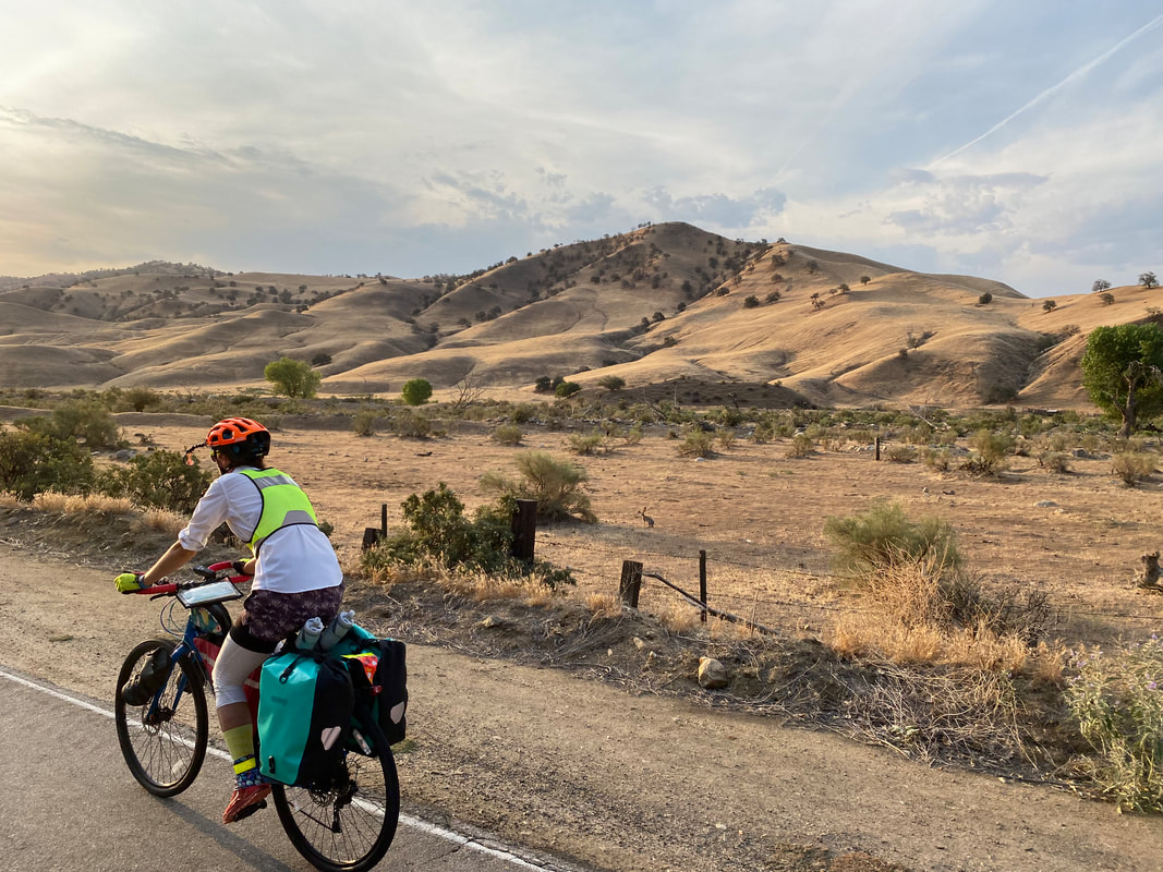 Today is predicted to be even hotter than yesterday. The extreme heat warnings and record breaking highs stretch across the entire zone we are biking. It makes last night's sleep in an A/C-filled room feel restorative and a form of recovery. The alarm for 2:30 starts too early. My body wants entirely to lay in the hotel bed. But we choose to move, need to move. The heat is too hard and too intense to excuse the night from moving our legs. This extreme heat warning keeps getting extended in time and expanded in region so that it seems to sit wide and full of fuming-brooding over the entirety of southern California. We also need to descend back down into the heart of Mojave Desert by going to 1300 feet today before climbing back up to 4300 ft. Janna and I aimed to be through that low section before any part of the midday heat was right on us...(Keep Reading)
 The night is long yet short. The Motel 6 we found, the one with bars over the windows and people milling around, really came to life shortly after we turned off our lights. First began the yelling outside. It seems a crowd had congregated in this common spot known to all. People starting banging on our window. Multiple times the door handle jiggled and some strong pushing followed on the locked door. I absolutely did not sleep. This was coupled with the fact that the Motel 6 turned off A/C to all rooms beginning at 11 pm. With the air off, and the nighttime temperature outside still over 100 degrees, the room began to cook...
|