0 Comments
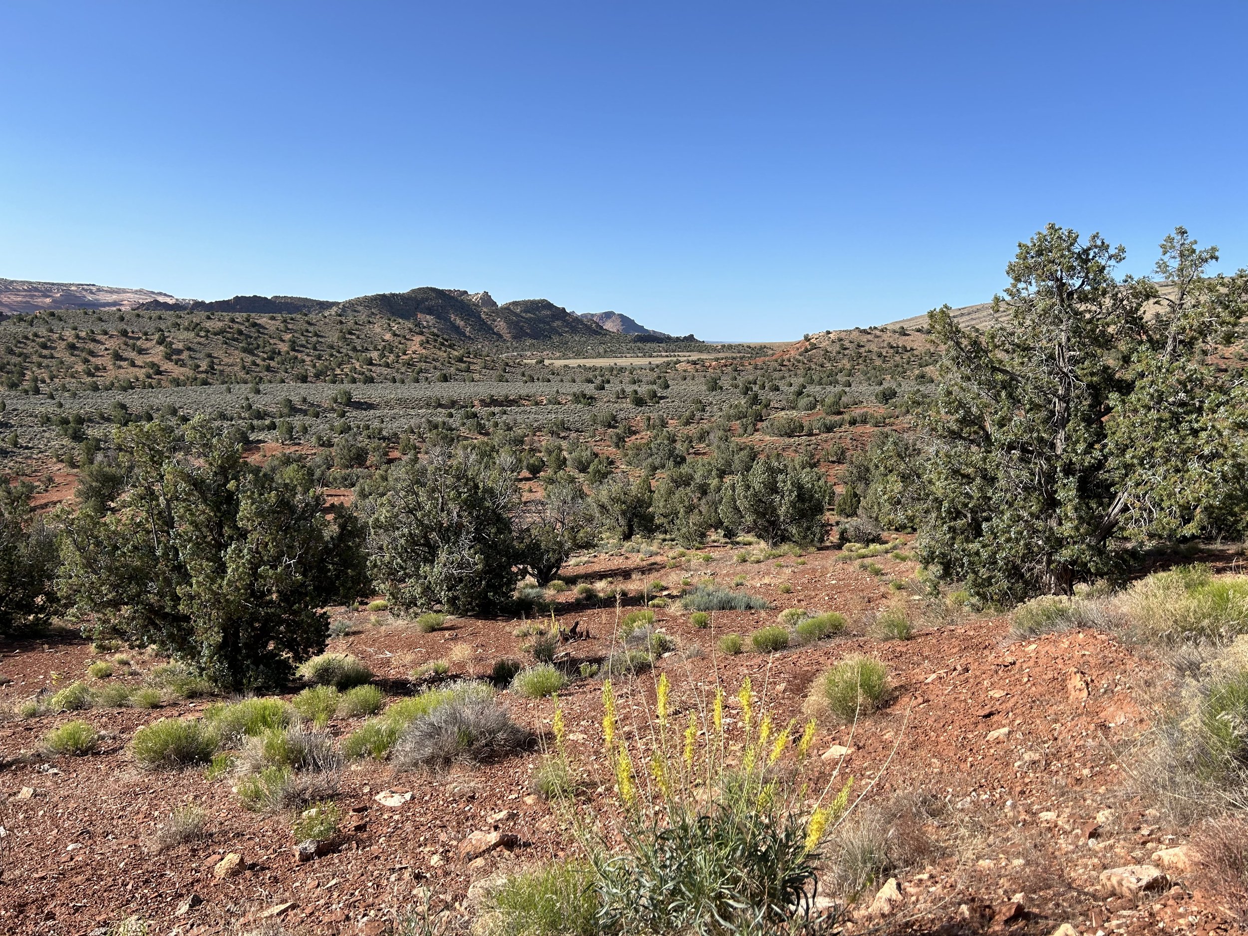
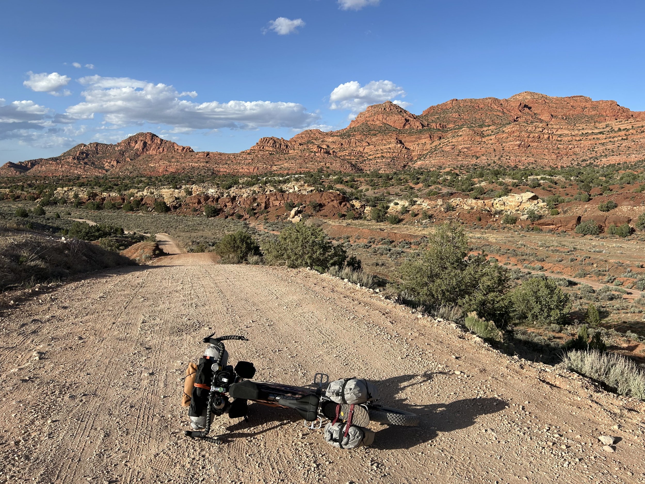
50.72 Miles 3,907 Feet of Gain Stateline Campground to Fredonia, AZ Sleep can be such a harbinger of peace. I awoke in the early dawn of summer to cool conditions in the shaded valley of Coyote Canyon. It was 5:30 am, and I had slept hard all night. But I knew today was forecast to be in the upper 90s again and I wanted to get going before the scorch line of light lit up the place. I packed quietly enough, but Roland awoke as soon as he heard me head down to the pit toilets. He was out with his camera by the time I got back. I ate breakfast at the picnic table with him, quietly talking about the surroundings, and then looking out at the beauty. The sun breached rock walls - it was time to go. I walked my bike down to the Arizona National Scenic Trail sign where Roland and I took a series of portraits. They featured both him and myself standing with the bike. He gave me his card with personal contact information and asked me to reach out when I was done with the trip. I expressed my gratitude in return. I said my goodbyes as he went back to light up his stove for morning coffee. I turned towards the AZT terminus obelisk, read the poem emblazed on it that I always read, and started to bike out to House Rock Road. A left carried me into the leeward shade of butte faces adorning the entrance to Grand Staircase-Escalante National Monument and Utah. Shortly thereafter I passed Wire Pass Trailhead (with no one there at the early hour) before cruising through pinyon-juniper shrublands and sage-frosted pockets. The cockscomb of red stones stumbled down narrow chutes around the road before opening to a valley near Buckskin Gulch. I swung a left on FR 720 and started up the rocky steep ascent into the Buckskin Mountains. This section often requires some hike-a-bike and today was no exception. I got off and pushed up the grassy slopes. Looking back gave glimpses of the swirled tops of the Coyotes Buttes' sandstone spires on top of the Paria Plateau. I turned and pressed forward knowing any elevation gained today would lessen the heat. About thirty minutes later, I popped out on top in a thicket of pinyon-juniper woodlands. This far north and this high, my gaze swiveled out into Utah and the stratified stepwise hunks of the Grand Staircase that were gorgeously in view. White cliffs, pink cliffs, chocolate cliffs, and vermilion at my feet. The lofty pinnacles of Bryce Canyon were just in view among the distant treed tops of the viewscape. I pedaled along doubletrack oscillating between rough and smooth as trees faded way to grasslands and sage only to plunge back into woodland ahead. But most notable was the cream-yellow blooms of cliffrose petals everywhere. The plant was at the height of summer flowering and the pastel flowers made me pull over again and again to smell and view them. After riding for some time, I arrived back at the Arizona/Utah stateline heading south along doubletrack that continued to open up to expansive views of the Staircase. The grasses along the route were notable for their shades of green that also spanned mauve and tan. The day was getting hot, even at this elevation of 6500 feet. I headed down some old roads towards Dead Man Canyon where a wildlife tank was reliably found. It was my first water source since yesterday, and I excitedly swiveled the manhole off a buried metal storage tank to dip my bottles in the deep and cold water. Rewatered, I was ready to continue on and pedaled down to the intersection with Winter Road. Here, I turned north on the well-maintained dirt road that cut towards Fredonia off the ridgeline of the Kaibab Mountains. The trees grew thick around me, and I took a long siesta in the shade before riding down what I knew was going to be a hot and exposed high desert section ahead. I continued into the sun and around a corner the drop-off from the mountains came into view as Winter Road lit out as a white line piercing the green forest in a series of switchbacks before bisecting a desertscape into the horizon. Honestly, it was my favorite view yet of the entire Grand Staircase so I stopped to stare for a good chunk of time. I started down the switchbacks which began smooth but then became chunky and uneven from the forces of erosion and deposition. Hopping off the bike to hike-a-bike down was my preferred motion; once at the bottom, the road smoothed up, and I rode on across the sagelands of the Great Basin Desert. Thick jumbles of invasive tumbleweed grew in large swaths that had desiccated and browned under the pre-monsoon sun of summer. It was high 80s on this side of the range - hot but manageable. Personally, I find the stretch of sage across a basin desert entirely beautiful. I stopped frequently to take in the views and take photos. But these breaks were short-lived with the summer sun coming straight down, generating high solar intensity that encouraged riding to town and to shade. An hour or two of pedaling brought me to paved 89A where a few more miles of shoulder riding carried me into Fredonia, AZ by 4 pm. I immediately bee-lined it to the Family Dollar in town for a resupply. The craving for ice cold electrolytes and an ice cream sandwich puckered my hunger into a boil - all I wanted was a cone to eat in the shade of the building out front. I grabbed some cold treats and then went out front to guzzle two Gatorlytes while stretched out on the shaded sidewalk - angled just right from the sun. The sun had been driving down with UV levels at 13 all day leaving my legs red and sunburned no matter how much sun screen I coated them in. The chance to duck into shadow could not be passed up. With snacks consumed and drinks finished, I rode the short way over to Country Rose RV Park. This campground turned out to be a great place to camp in town: it was clean with relatively private sites, each camp spot had its own water spigot, the campground was owned by a friendly guy who talked to me for a while about my biking, there were picnic tables, a shade tree at my site, and super clean restrooms/showers. I took an ice cold shower that washed the salt down the drain that I had sweated out all day from the heat of foresummer. I also drenched my clothes, wrung them clean, and line dried them on a fence. I sat on the picnic table in the shade while I called Janna for a check-in on the ride. Evening came on and the sun finally dipped below the western horizon cloaking everything in that sienna-blue fade of mid-summer. I finally climbed into the X-Mid as heat settled into the light cool of night.
The North Rim is simply my favorite place on Earth. I've had that deep-rooted scintillation for the place ever since Janna and I first stayed at Big Springs a decade ago and spent our time wandering the aspens and sinks of the Kaibab Plateau. There is no place on Earth more that I would rather spend time in than seated amongst the pines on a remote overlook gazing into the heart of the Grand Canyon on the North Rim's elevated landscape. And when we first rode bikes there, with a return almost immediately after we left, I knew it was THE place to dream of epic rides down hundreds of miles of unpaved roads that swirled through canyons, plateaus, and rugged outposts. After we moved to the Canyon five years ago, I set my heart and legs to the task of really riding the place more, which is where I strategized opportunities to see all the viewpoints of the Canyon.
I'd been aiming now to do another thru-bikepack of the North Rim - Capes of the Canyon for two years. I originally designed the route back in 2021 and did an early summer ride of it then. But the route back then was shorter, had a different start location, and lacked some viewpoints I've since scouted and added. All the updates in recent years have provided a more adventurous and scenic experience. Although ground-truthed on day-rides, the fullness of a thru-bikepacking trip kept beckoning me to head back out again on the route. That, and some planned major changes I was eyeing to include but wanted to ride first. 2023 was to be the year, but record-breaking snow kept the North Rim closed until July at Grand Canyon National Park. By that point, the heat of summer loomed along the lower portions of the route making a go unfeasible. I turned my eyes to the summer of 2024. A jam-packed spring of events and commitments at school kept me busy until the very end of May at graduation. I also thought I broke my back that month. This swirl of events threatened to delay a thru-ride for another year.
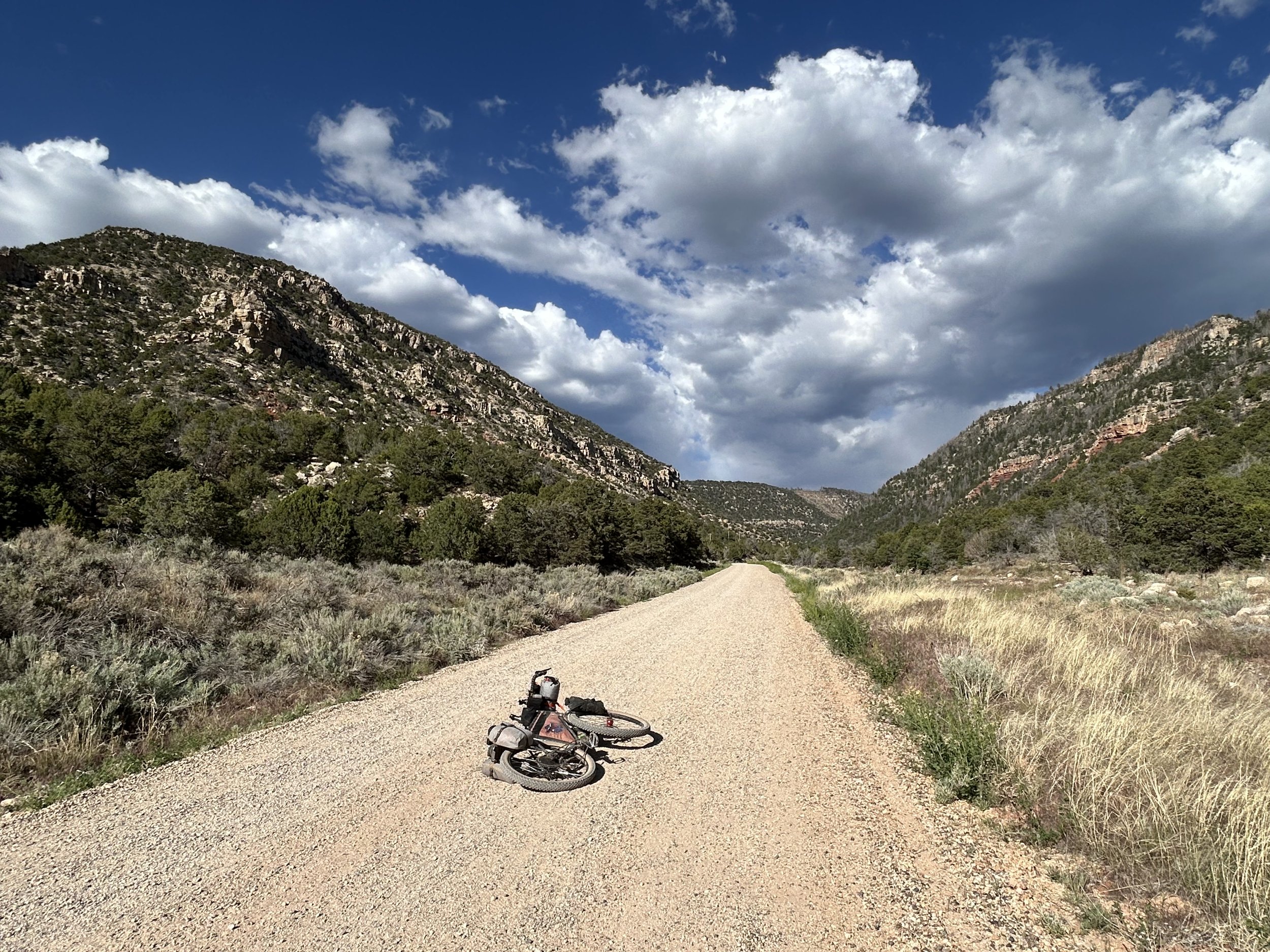
But I used my time well, healed, and managed to line up everything perfectly so that a thru-trip was possible. Graduation came and went, and the next day (the first day of summer break) found me driving across the Colorado River on my way to Lees Ferry. I craved the weeks I planned to spend in the desert and woodlands, but this was to be a solo trip as Janna was heading to Florida to visit with family. Late May is typically when temperatures begin to spike on the lower portions of the route, especially at what was then the current start at Lees Ferry. Upper 90s (possibly hotter) were forecast, but I knew I'd gain elevation to get out of the worst of it. So with school finished only 24 hours prior, I found myself checking into Cliff Dwellers Lodge for the night. I slept hard with the school year complete.
I set my alarm on my phone but didn't factor in the weird time zone overlaps that occur in the area. The Navajo Nation across the Colorado River doesn't use daylight savings time, but the BLM land where I was staying does, while just north a few miles was Utah where the clocks jump ahead. Unable to configure my location with precision for the time, my phone erroneously stayed in Navajo Time one hour ahead. So while I intended to sleep until 5:30 am to get up and start, I actually ended up waking at 4:30 am AZ Time (despite my phone reading 5:30 am). I was a bit confused in the waxing dark of early morning, and definitely desired more sleep given a large school year I was just on the tail of finishing, but once that alarm went off, my eyes were too open to shut once again. I got out of bed, dressed in my bike gear, threw all my stuff in the car, and drove down to the mouth of the Grand Canyon at Lees Ferry. The original start of the North Rim COTC was, at this time, at Lees Ferry. It provided excellent parking, an epic view from the heart of the Grand Canyon at the only place where a bike could be legally pedaled to its waters, and it felt like a fitting place to start and end the route. The drawback of this location was the large amount of pavement riding it entailed along an often shoulderless Highway 89A. Although HWY 89A is commonly toured by cyclists passing around Vermilion Cliffs, it is nonetheless used by cars going well over 65 mph. I've ridden it several times before, and on infrequently-vehicled days, it is doable to ride while looking at the rock strata. However, on days with frequent cars, it can be stressful and glaring. One of my goals for this thru-ride was to think of and scout possible alternative start locations that could reduce or even eliminate this section, plus vet once more my sentiments about riding HWY 89A (especially on holiday Labor Day Weekend as I was to come to experience). I pulled up to Lees Ferry in the sheltered shade of an unsaddled morning where the sun had not crept past the fortress rock walls boxing in the flow of the Colorado River. I parked my car in the extended/overnight parking lot where I took the next 40 minutes to stuff and pack everything on my bikepacking rig. It was cool, absolutely lovely. I biked to the Colorado River with that feeling of an adventure about to unfold nipping at my veins. The water slid by cool, blue, and full of clear contrast to the hulking rusty cliffs beachside. A slew of river outfitters were rigging boats and preparing for a multi-day trip from here to Diamond Creek. I biked up to the water's edge and dipped my wheels. One of the river guides called out and asked if I wanted a picture. I certainly did and took him up on his offer for a portrait. We talked briefly and several other guides joined in the conversation curious as to my destination, route, and timeframe. It turned out that I was planning to be back here the same day they finished their trip. That parallel of river runner heading through the bottom of the Canyon while I bikepacked the rim-tops was seeded in my head. But day was waxing and the sun threatened to burst forth overhead. I took one last look at my weather app and saw that although temps were to be in the mid-90s, a red flag warning was just issued for the entire region. Forecasters were expecting 30-40 mph headwinds with 50 mph gusts come from the west-northwest. That was the exact direction I was planning to head all day uphill. Flashbacks of the Santa Ana winds from the Stagecoach 400 this past March passed through my head. There was nothing to do but push forward and try to get some miles done before the gales started. I waved goodbye and pushed away from the water to begin a climb from here at nearly 3000 feet to an eventual 9000 feet in just a few days. I rolled down the smooth pavement next to striated cliffbands at the feet of Vermilion Cliffs National Monument where the sun was now torching the high up headboards of rock a deep red-orange. The road turned left as I crossed the Paria River and started down River Drive. I pedaled into the bright line of morning rays stretching over the rockheads and felt a smack of steam heat. Sweat dribbled and temperatures were already climbing. I looked back for one more peek at the Colorado River rumbling along at the Paria Riffles. I turned my head forward and saw the delicate blooms of Sacred Datura roadside. This is Colorado Plateau country wonderful in all the ways I love. I pushed on and started the gradual climb up the paved shoulder passing through tableland landscapes with barren patios punctuated by tufted bunch grass. Hues sang a somber sulfur orange while my shadow rode long before me in the morning light. I pedaled hard to keep ahead of the heat. I felt good, but I was very careful that my pedaling was balanced for the sake of my back that I still harbored fears of injury for. I popped out on top and swung a left down to Navajo Bridge.
I walked my bike out midway across the bridge for a proper look at the Colorado River cutting through the gorge of Marble Canyon below. The riverbanks were shadowed still, if only temporarily. A single juvenile endangered California Condor sat in the framework of the opposite bridge. It shifted and stared at me with its blackened head before scuffling over to a shadowed beam to rest. I jumped on my bike and pedaled shoulder-side up Highway 89A. At this hour, traffic was nearly nonexistent and I quickly passed the entry-sign to Vermilion Cliffs National Monument. The gorgeous banded cliffs jutted out in bays and capes to my right while a desert grassland smothered their base.
Right past Vermilion Cliffs and Lees Ferry Lodge I turned onto a red sandy doubletrack that cut perpendicular from the pavement straight out into the desert. The sand was sugary soft and quickly swept my tires out from under me as I wobbled and fishtailed. But that sand was short-lived as rock cut the tread and firmed out just a quarter mile or so later. I turned around to stare back at the rising faces of Vermilion Cliffs with a blanket of greenery, all watered proper from winter growth, set to task a complimentary slice of the color wheel. I passed a massive overlanding vehicle camped on the edge of Badger Canyon which was now rapidly deepening to my right in the form of a massive tributary gorge cutting down towards Marble Canyon. I neared Badger Point, left my bike in the parking area, and started to hike over the cliff edge for the iconic view of Badger Rapids streaking white contrails along the emerald rivulets of the Colorado River below. Stunning as always, I sat for a bit before reminding myself the sun wasn't so patient and more heat (plus wind!) were soon coming. I pedaled back the way I came and rejoined Highway 89A.
Around about 9:45 am I arrived back at Cliff Dwellers Lodge where I had slept the night before. The heat was really starting to rise, and I wanted a big breakfast. I leaned my bike outside and grabbed a table in the shade. A couple inside immediately picked up conversation with me regarding my trip, where I was heading, and how they couldn't imagine doing something like that on a bicycle. Soon enough, a massive breakfast burrito was before me. I dug in and called Janna as this would probably be my only reception for the day. Mid-conversation the wind gusts picked up outside. Slews of sand cupped my bike and then blasted skyward. I groaned knowing the headwind uphill was a battle all my own. I finished my breakfast and walked out to my bike just as two road touring cyclists pulled in. We excitedly approached each other; they were a couple from Germany touring across the United States and spending their time seeing the southwest. They had just descended down from Jacob Lake this morning with intentions of camping at Lees Ferry tonight. They informed me that had an excellent tailwind in their direction, and wished me luck for my faceward punch into it. The three of us grabbed some Gatorades from the store and then I was off.
It was at this point that the traffic picked up intensely. A vein of cars suddenly thrust in either direction along the highway as tourists flocked to the South and North Rims on the holiday weekend. What was normally a nominal flow of vehicles became an all-day surge that stressed me out. It sealed a nudging thought in my head that I needed to cull this paved section from the route. A weekend like this was not fun to bike roadside along a highway with speeding and distracted drivers. My goal became constant evaluation of a new appropriate starting location with sure, safe, and ample parking. There was nothing to do now but continue forward. The wind was a face-slam of power that slowed me down until I was in my granny gear for hours on end. For reference of how slow I was going and how intense the headwind was, at one point it took me 1.25 hours to go 5 miles on gently upward sloping pavement. It was nuts. And that ripping wind led to such flapping and force on my head that I slowly began to develop a headache that quickly morphed into a nascent migraine. The wind bit back the heat, but the heat cooked on nonetheless. I was entirely grateful for a turn onto unpaved House Rock Road when the intersection arrived. I had hoped the turn would take me out of worst of the blowing wind, but somehow a rotation in direction brought it more forcefully. I took a few Tylenol, consumed a salt pill, and drank a bunch of water while massaging my neck to reduce what was now a pumping migraine that was affecting sight in my left eye. What helped the most was distraction by beauty. I absolutely love biking on the cream surface of House Rock Road as it cuts dramatically up a cleft in House Rock Valley between the Kaibab Plateau shearing into the jagged Vermilion Cliffs. Large grasslands opened powerfully while whisps of fast-flowing clouds drifted overhead. I biked upwards gaining elevation. At the top of the climb, I realized that somehow the wind was cut by the landscape. Immediately a simultaneous rush of relief came to my migraine from the lack of face pressure as exhaustion hit my bones; the reality of a big trip so soon after a school had ended hit me head-on. But the views…I freaking loved them. Sage bunched up across the landscape as a downhill brought expansive distant views of the Grand Staircase-Escalante. The rugged folds of the yawning Paria moltenscape rushed reds, ochres, browns, and burnt oranges into a sorbet swirl of rock hues. And the clouds simply casting shadows overhead were texture to distract that headache. As afternoon coursed nearer to evening I biked on with the goal of camping at the Stateline Campground that night. The Stateline Campground sits on the border of Arizona and Utah nestled in a valley near the famed Wave at Coyote Buttes. It is also the northern terminus of the Arizona Trail - a place of significant triumph where Janna and I celebrated completing our thru-hike in 2019. It's a nice campground with established sites featuring picnic tables shaded by ramadas. There is no water, so I had packed enough to get me from Lees Ferry to the wildlife tanks I planned on hitting sometime mid-day tomorrow. What I wasn't prepared to see was an overflow of vehicles and packed campers at each site. Usually this campground only has a few people in it; I guess the holiday weekend brought everyone on vacation out to the spires and churns of The Wave, Wire Pass, and the Paria Canyon. I circled the campground once, utterly exhausted with the afterglow of my migraine and found no open sites. Boldly, I decided to scope a site where no one had tents and ask if I could camp with them. I caught the gaze of a father/son duo and walked my bike up to them. It turns out Roland and Lukas were very excited to play host to a bikepacker looking to camp with them. They both intended to sleep in hammocks slung up along the ramada, leaving the tent spot open for me. I gratefully got to work setting up my tent. No sooner had I finished then Roland came over and wondered if I wanted some homemade zucchini bread. Elated, I took my dinner over and joined him as he got to work making a full course meal. Roland let me know that he was a professional photographer with several published books and exhibits up across Europe. His son, Lukas, was a documentarian with a few videos to his name. They loved the Wave, Coyote Buttes, and the Grand Canyon, having returned here every few years for some of their favorite photogenic landscapes in the States. But they were highly intrigued by my bike setup and how I was traveling through this arid and remote landscape solo. We talked and laughed for a few hours while Lukas made dumplings from literal scratch and cooked them over portable stove setup. They shared their amazing food, and the three of us talked late until night had well settled. My headache was gone, my stomach full, but fatigue swept over me hard. Roland insisted that before I bike away in the morning that he get the chance to do a set of portrait photographs of me with my bike (and him with my bike too). I agreed and then climbed into my tent. I slept incredibly hard all night. |
Search for Articles or Blog Posts
Disclaimer: The Forrest Biome and its owner is in no way liable for personal injury, damages, or losses to personal property or body resulting from use, reference, or consultation with the backcountry resources and routes provided on this site or associated RWGPS pages. Although information will be updated on this site, its accuracy is not a guarantee. You assume all risks and liabilities for use of the site's information. It is your own responsibility to prepare and engage in outdoor recreation activities in addition to following local/federal laws, regulations, and policies when traveling through areas.