0 Comments
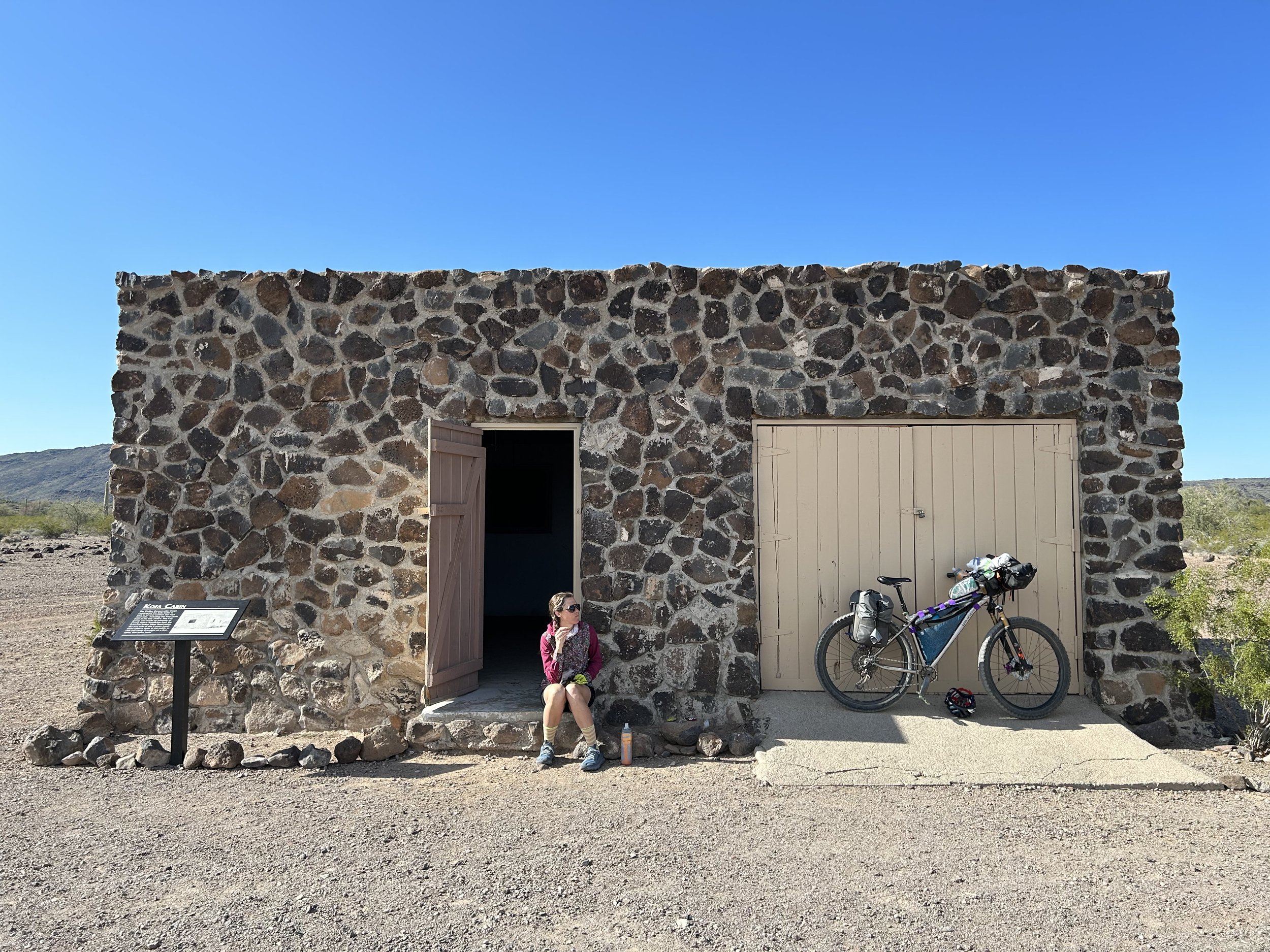
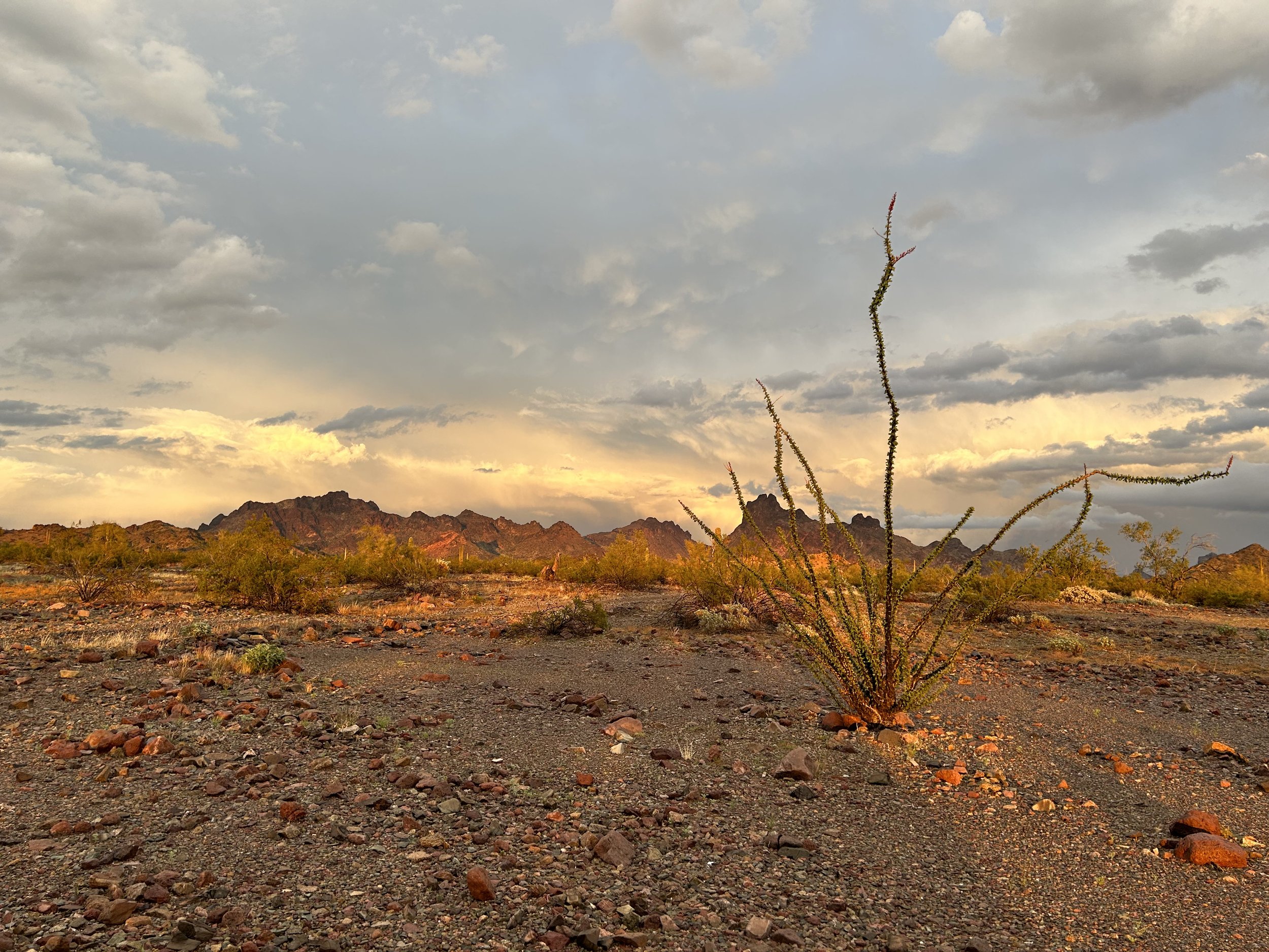
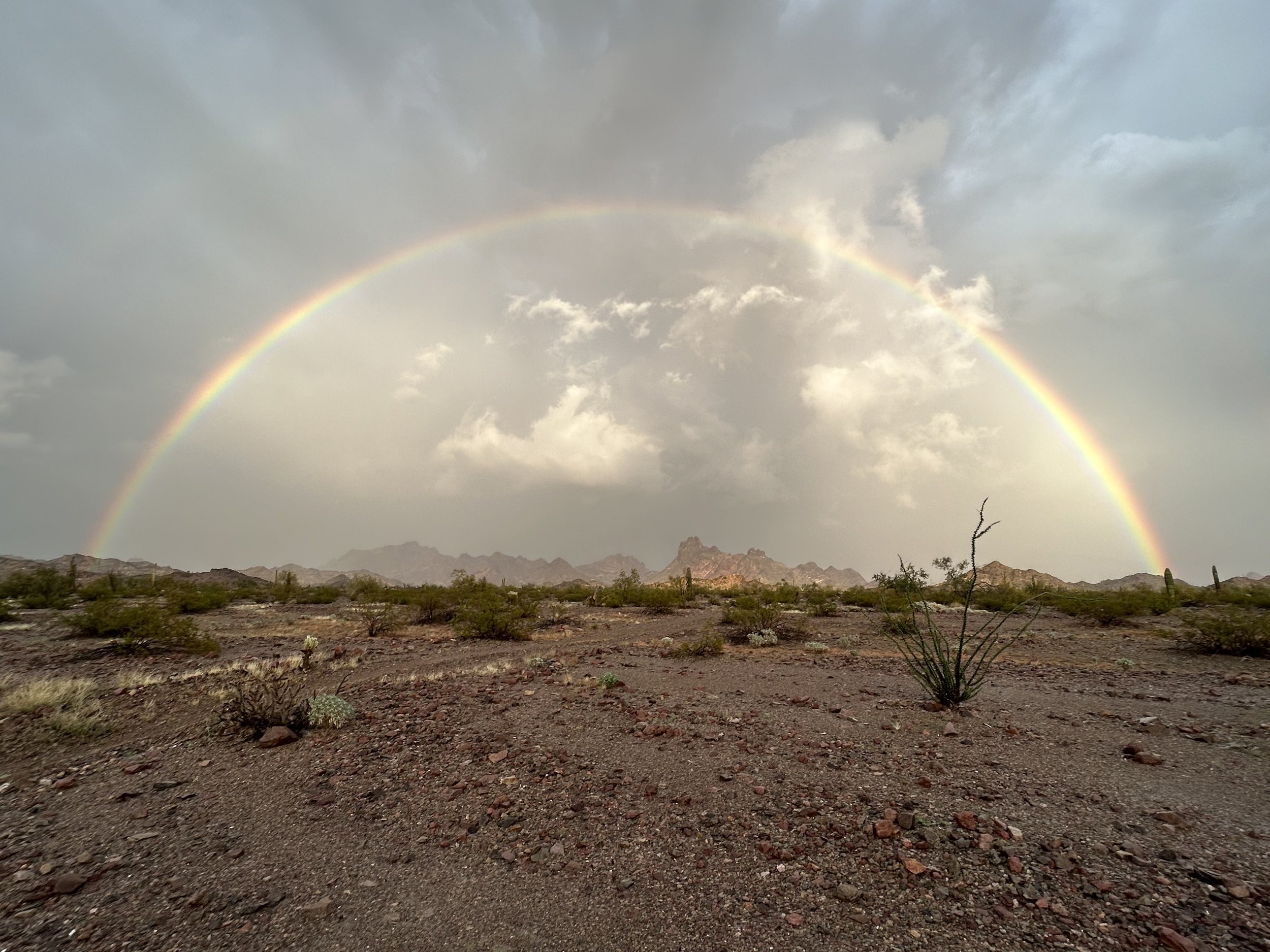
44.79 Miles; Coyote Peak to West Entrance of Kofa National Wildlife Refuge The night was still, calm, and silent. We awoke feeling rested and dry. Whatever humidity left in the air was making its way out today with a few lingering high-altitude rain curtains wisping across adjacent peaks. The pipeline road we were on was well-maintained, graded, and smooth. That, combined with a tailwind, pushed us along as a great rate. We soon reentered Kofa National Wildlife Refuge and left BLM land. Shortly thereafter, Janna and I arrived at the stone-masoned Kofa Cabin. It is a super cool building people can sleep in on a first-come, first-served basis. We looked around the area and ate a mid-morning snack in the shade of the structure. Today truly felt like it was going to be warm and dry. We pushed back out into the desert as the sun continued to light up the rock faces and shined upon the verdant green plant life. The route swung up and down washes and hills and climbed ever more steadily towards the jagged Kofa Mountains. Up near High Tanks Six and Tunnel Spring Canyon, we rounded a corner and were confronted by a hillside slathered in yellow poppies. They were dense, fully blooming, and filled the creases of the rock. We dropped our bikes on the road and started to walk up and down. The sunshine-yellows contrasted sharply, beautifully, with the greens and rocky browns of the old volcanic stone. I knew a profusion of flowers were possible given this winter's copious precipitation. It felt rightly gifted to be standing amongst the start of spring blooms. Many photos later, we got back on our bikes, hit the northern saddle of the range, and started descending down to the MST&T Road. The road became wide, graded, and fast-paced as we shot west. And like that, we were back on the north-south Pipeline Road from Day 1, now heading south. The miles spun by and the heat of the day continued. We found a thicket of mesquite along a wash crossing the track. Janna and I stopped to huddle in its shade before one last push. We reentered the sun and headed eastwards up a track towards the mountains where our car sat. We finished thinking this bikepacking route is a gorgeous Sonoran loop. The area's beauty definitely makes us want to return again sometime to summit peaks and enjoy some winter cycling. 50.86 Miles; Near Engesser Junction to Coyote Peak After the lightning-and-thunder show that lit up the inside of the shelter all night, we slept hard and woke to a world of clear air and saturated moisture. On the open plains of Kofa, the sun hit early and warmed early to our enjoyment. We packed up and started our way to Hoodoo Cabin where our next water resupply awaited. The brittlebush were coloring-up the landscape, all yellow and heavily contrasted with the ground that had become darkened by the rain. I felt like I was bouncing, literally, so I checked my rear tire and realized a significant amount of air had escaped leaving me almost riding on my rim. I stopped to flip it over, checked for gashes, holes, and sputtering sealant (saw none), so I pumped it back up. That task done, I raced along the washes of Engesser Junction to catch up to Janna. The route became Engesser Pass Road and wandered slowly north up a massive spill-wash in the desert. Striations of soil and sand made me know this wash was running with water last night from the storm. We started passing large scum bubbles and foam in large pilings along the wash. I was confused. It dawned on me that they were leftovers from what must have been a flash flood that came ripping through here from the storm and only now had just receded. I started scoping left and right and saw freshly dislodged plants washed up and stranded on the upper banks. It made me grateful that we stopped when we did last night in the storm. And that we didn't start earlier or we would have been met with a flowing river of sand, scum, and froth. These realizations shared, Janna and I kept biking up the wash. As we wound our ways around Courthouse Mountain and up to Engesser Pass, the humidity combined with the Sun left me feeling weak. A stream of sweat was dripping off me. I felt completely unacclimatized to the heat and moisture. At the top of the pass, Janna flipped her bike to fill her rear tire that was dragging too low. From there, the route started across a broad plain of rolling desert hills. The doubletrack was pocked with large puddles and peanut butter mudpots. The road itself was largely washed out in places requiring many slow hike-a-bikes. Babyheads and strewn stones lined several portions slowing me down with my rigid fork. A motorized dirt bike appeared ahead and then stopped when it reached us. The guy on it was flabbergasted that we were out here on bicycles and couldn’t get over it. He warned us of deep washouts ahead from the storm. We asked him where he stayed last night and how the storm was. He reported that he was north and east of us and got hit real hard in his trailer. It left the vehicle shaking from the wind gusts; it hailed so bad and so hard that he was worried about dents and a cracked windshield. We felt immediately grateful that we received no hail. We pushed ahead for another hour or so through more washes and several cholla fields. A gathering set of clouds loomed dark, low, and puffy over the adjacent Kofa Mountains to our lefts. As noon approached, an obvious rain curtain dropped from them and started towards us from the mountains downhill. We peeled left and arrived at Hoodoo Cabin. Hoodoo Cabin is an old 1940s former cattle ranch cabin that was originally constructed for ranch-hands to have shelter while checking fences in this often-intense and dry environment. Now, the area is federal Wilderness and a National Wildlife Refuge - no cows are allowed. No sooner had we arrived at Hoodoo Cabin then the skies opened up and sheets of rain came down in a steady flow. We put our bikes under the porch overhang and got inside, still dry. Some ATVers who had arrived before us were there, and we ended up talking. They warned us of Africanized honey bees with a nest in the bathroom so we avoided that. They also were incredulous that we were out here. One guy kept asking me over and over what maps I was using and how it could be that we were on Day 3 in an area he perceived had no water. They also reported awful conditions last night, flash flooding near them, and dangerous lightning strikes from that storm. Again, they said they couldn't believe we were in a tent given the storm. The ATVers left in the rain, so Janna and I decided to wait it out in the rustic indoors. We rested in some camp chairs left inside and ate snacks until the storm passed and rain whittled to only spittle. With that, we ventured outside and walked over to the solar-powered pump and windmill where a shadecloth-covered wildlife tank was found. We filled up a ton of water to carry until we reached Kofa Cabin and its water source the next day. Blue skies came out from the clouds and the rain curtain moved east into the desert. We biked out from Hoodoo Cabin and down towards the Little Horn Mountains. We were essentially chasing the storm, keeping it framed directly ahead of us; it provided amazing views all afternoon. At one point, some loose sand fishtailed my bike sending me over the handlebars and into a cholla. Luckily, I only had some trail rash and everything was good (and I easily got the cholla off me). We passed out of the Refuge and into BLM land. A Land Rover was pulled over, and we had a long chat with a guy about the storm and the area. The day was getting on. We crossed a pass and descended down Hovatter Road into a large valley gloriously lit with golden hour. Saguaros stood prominently amongst black volcanic rock and all plants were fully leafed, vibrant from the rain and spring sun. A truck passed int the other direction. It was an old couple out tending care to a local mine. They were also inspecting the road for flash flood damage from the night before as they were caretakers of the mine. After them, we passed out of the Little Horn Mountains and onto a large plain all aglow in golden hour. The road became wide and the plains flat. Creosote covered it in swaths. The light of day began to fade brilliantly in an afterburn of sun coming to dusk. Janna and I decided to continue biking past dusk and into the dark, because we felt strong, the temps were amenable, and the road was wide and well-graded. Dark befell, our lights turned on, and we rounded around stark Coyote Peak. Several miles later, we pulled over and walked our bikes out into the creosote plain to find a place to camp. 46.17 Miles; King Road to near Engesser Junction The patter of rain ceased as dawn ascended. No sooner had we exited the tent than the morning rain halted long enough for us to pack up our gear. It was VERY humid out and everything dribbled with moisture. We packed our bags quickly lest everything get more wet and then hit the road towards Castle Dome Mountain. All morning the clouds hung heavy in the sky as a gray blanket settled overhead. Intermittent rain dashes would sprinkle down on us before dissipating. Ocotillos and cholla sat vibrant green in the gloom. With the threat of rain strong, we decided to forgo a climb of Castle Dome and do it this winter. However, we both decided to ride our bikes out to the turnoff for the hike. We rode east of the Castle Dome Mountains and made our way up the gradual McPherson Pass. In this area, the clouds began to break, the blue sky pushed through, and cloud drifts just melted. It suddenly was sunny amid high humidity; we started sweating earnestly. I absolutely loved riding the the out-and-back up McPherson Wash. Again and again I stopped to swivel my head and take into the jagged upthrusts of ancient volcanic hearts; I could only say it felt like I was bikepacking through the Superstition Wilderness (if bikes were allowed). At the turn-around, we stopped and took a long snack in a wash framed by blossoming brittlebush all yellow in contrast to the clouds in the distance. We rode back out to the main road and swung east once more on Junction 76 Road. The sun was out in full force and the humidity and heat slowed my pace as my body was lacking acclimatization after a winter of deep snow. Janna and I swung south for a spur ride out to the Little White Tanks - a series of very deep and reliably filled water pocks in crumpled clefts of rock. The pools were full, clear, and absolutely gorgeous in the midday sun. We filled our reservoirs, drank deeply, and rode our heavy bikes back out to join King Road. Signal Peak, only just visited yesterday, sat in a deep umbra of rain cloud above it. We sped along King Road as more and more cumulus tufts gathered overhead. King Road turned north past a Sonoran Pronghorn breeding facility (alas, no pronghorn seen on the route). The road softened up and sank beneath the side-banks of gravel. Above, a noticeable atmospheric gathering of blackened-gray clouds loomed and concentrated evermore over the Kofa Mountains. I suddenly stopped and stared at a large anvil of cumulonimbus shooting thousands of feet into the air - almost like an epic thunderhead of late summer monsoons. I shook my head thinking a thunderstorm would be out of place this time of year and pushed on. Janna and I rode up past King of Arizona (KOFA) Mine and then swung east once more. The route curved around a bend of massive pillared peaks red and orange in the angle of light - more-so backlit by gathering cloud. And then I looked behind us to the west. There, gathering darkly on the horizon, was a massive thunderhead roaring out its noise and shooting lightning. To our southwest by Castle Dome Peak, a second storm was energizing, spreading its draperies of dark rain in sheets over the now-distant peaks. We started pedaling hard. The sudden boomerang-shape of roll-cloud racing across the plains directly towards us caught us off guard. Thunder boomed again and again. We could see cloud-to-cloud and cloud-to-ground lightning strikes on repeat hitting the further peaks. This was stunningly contrasted with a sharp demarcation of blue sky. The storm was bringing its own shape to the sunny skies directly ahead of us. And just like that, the two storms collided. Seeing a wall of impending rain approaching rapidly with high winds and copious lightning, we went into "seek shelter" mode. However, the section we were in was exposed Sonoran rockscape with only creosote and saguaro in abundance - we definitely were some of the tallest items out there. I saw a potential campsite next to a lone palo verde off the route so we beelined over to it. The winds were whipping and thunder bellowing. I yelled out to Janna asking her how many minutes we had until the now combined storm system was directly over us. "Minutes!" was all she yelled back. I quickly grappled with the stakes and poles of the shelter to get it erected. Then, the lightning flared overhead. We sprang towards a shallow wash nearby that looked unlikely to flood and would make us minimally lower than the surrounding plains (plus put some distance between us and the metal bikes). Janna and I separated out as a constant clang of spark and echo hung overhead. The storms had perfectly collided over us and became one of the most exposed electrical storms I had every weathered. The lightning flashed pink, red, blue, green, white, and yellow on repeat over us. Thunder rang out loud and hard. The rain fell in sheets as we took squatted lightning positions away from each other in the wash. The air was alive with humidity and static. Within minutes we were soaked through with cool rain. I was warm with adrenaline and freshly pedaled legs. We hunkered down and nervously waited as the storm ripped overhead, dropped rain, and then sped north and east. And the storm was over. We turned around and gaped at a gorgeous gray sky pierced with orange sunlight that now spilled from a cleared west. One of the best double rainbows of my life lit up over the desert plain, perfectly framing the Kofa peaks. Everything was so soaked, alive, and mottled with light. Color and rain pitted each other in a blend of shocking landscape that I just stood back to take it all in. It was amazing. The color of the setting sun lit up the plains behind us. We setup the rest of camp, ate a hearty dinner in the gathered dark. As night fell entirely, an aerial of resonant booms rang out for hours and hours as the storm sat miles just to our north over the desert and rained down thumb-sized hail (we later learned), intense gusts, and flash flooding rains. The light show felt like War of the Worlds with lightning bursting every few seconds for hours and hours on end. But it was past us, drenching a different world of the Kofa.
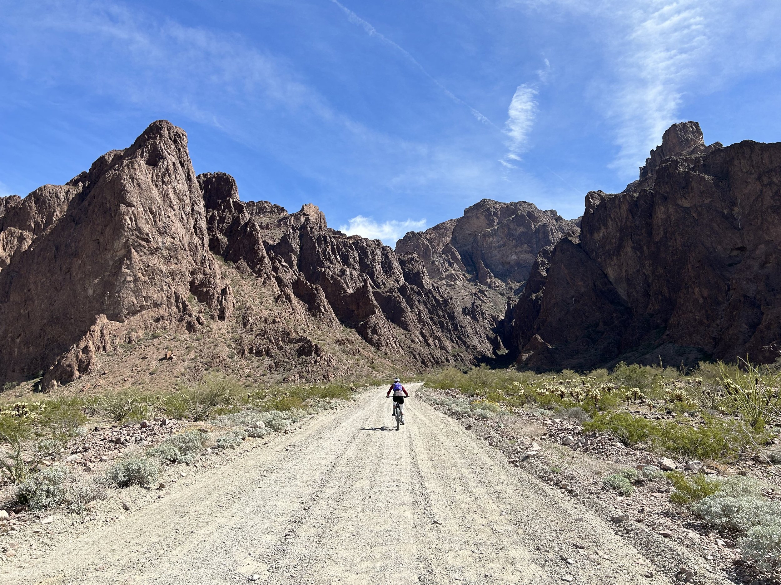
37.90 Miles; West Entrance of Kofa National Wildlife Refuge to King Road
Winter has been fecund with snow and rain this year. The South Rim has received well over 100 inches of snow; Janna and I talked with someone who's worked here for over forty years and he said this is the snowiest winter he's seen since 1986. Subsequently, we've been dreaming of warm temps and dry bike riding. Janna and I planned on doing the Stagecoach 400 for Spring Break, which I rode last year during amazing temperatures, to get some SoCal sun, mountains, and ocean. And then the week before Spring Break, another notable atmospheric river came off the coast to settle over the Southwest and bring massive inches of snow and thunderous rain. Idyllwild got caked in powder. The National Forest Service closed roads that were too muddy and trails that were too icy. San Diego looked to be doused in a week of consistent rain and mid-50s temperatures. All conditions the opposite of what we wanted. Mere days before break, we decided to quickly switch plans and find a route drier (we were still expecting rain - but intermittent) and warmer.
Kurt Refsnider had reached out to me after our El Camino del Diablo trip and had encouraged me to check out A Kofa National Wildlife Refuge Bikepacking Tour. He had made the route in Kofa National Wildlife Refuge and said it was a gorgeous Sonoran spread with good water, no cows, pretty remote, and awesome mountain scenery. I had put it on my short list but thought it might be out this season. Instead, with that winter storm coming, going to just north of Yuma seemed like a perfect time to ride the long version of the route. The temperatures looked to be mid-70s and partly cloudy with a chance of rain at times. Janna and I agreed to switch itineraries and so we headed to southwestern Arizona. We arrived at the western start and terminus of the route around 10 am. The hosts at the entrance to Kofa National Wildlife Refuge took our questions and happily invited us to safely leave our vehicle right next to them. We could see in the west the dramatic squall line of grey cumulus and windy wisps stretching their fingers our way; we needed to get moving before the storms arrived. Kurt did an excellent job making two versions of the route: a long and short. We opted for the long including the side rides out-and-back from canyons and additional hikes. I'd long wanted to see the namesake trees of Palm Canyon. The forty-odd palms here are California fan palms - the only native palms in the only original stand in the state. All other palm trees in Arizona are introduced and purposefully cultivated. I wanted to catch a glimpse up the narrow rock-shelf side-canyon where they grew while the light was strong, the sky blue, and the angle of Sun perfect for looking at them. We biked up to the sprawling jagged rock range before parking our rigs outside the Wilderness Area. A short hike in the heat of the day brought us to the foot of the trees, gorgeously framed by the heart of extinct volcanoes.
I hiked further up the canyon before turning around and catching the view of skies swaddled gray-monotone as the last blue slipped away behind us. We pedaled back down to our vehicle then headed north up Kofa Queen Canyon in an attempt to climb Signal Peak. But the storm rapidly advanced and the patter of light rain was soon on our backs. We rode up the canyon regardless which was beautiful and reminded me of the Superstition Mountains outside east Phoenix where I had spent loads of time backpacking and hiking. Brittlebush bloomed yellow along the wash of the road. Towards the end of the road and start of the hike we realized that the possibility of rain and thunder were possible, so we skipped the climb to the summit vowing to return in the winter for some more biking and mandatory summit hiking.
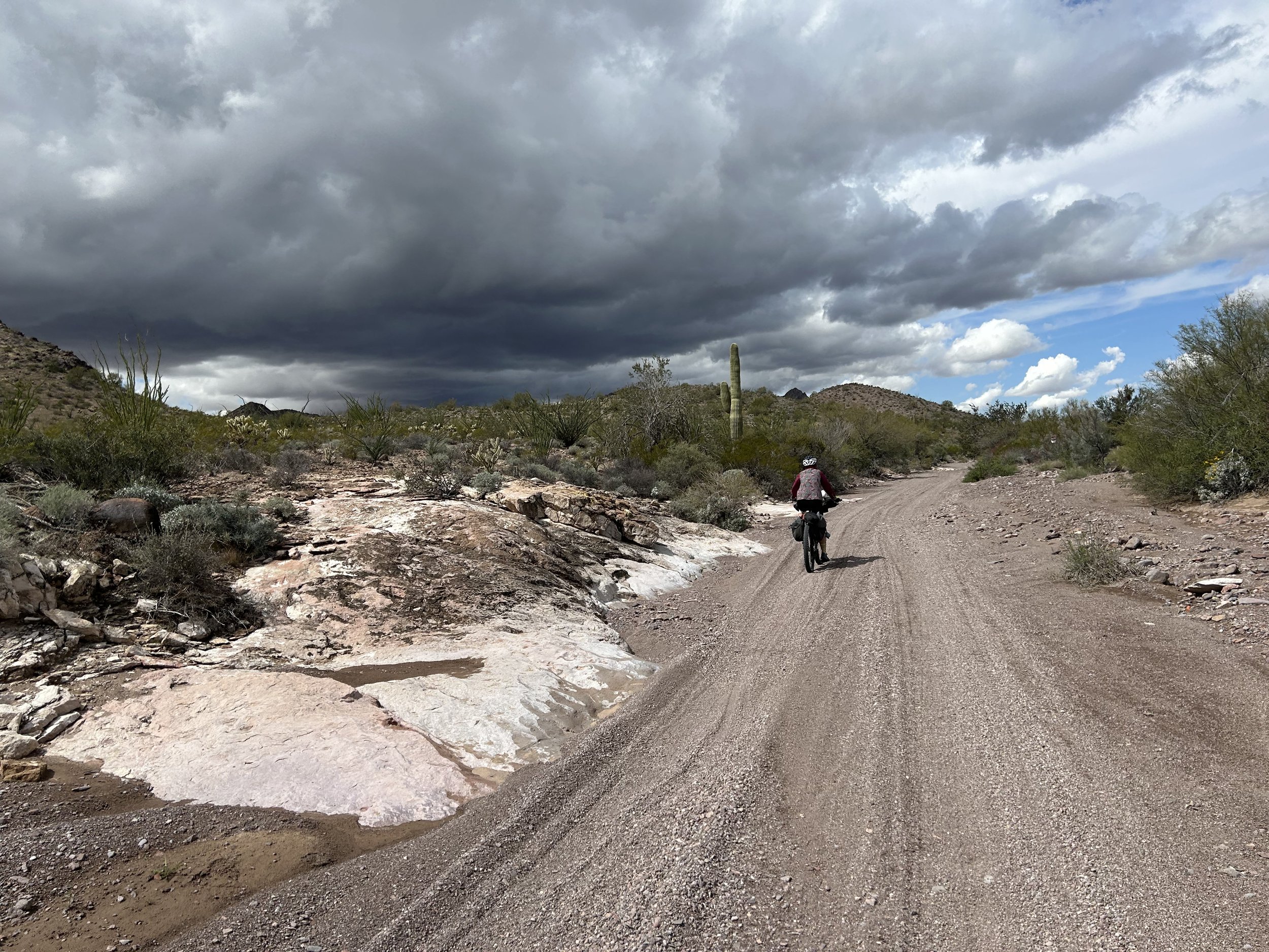
We pedaled back the car where we put the rest of our bikepacking gear on our bikes and filled our water reservoirs full because no certain water would be hit until the afternoon of the next day. By now, sheens of falling rain curtained the surrounding desert plains and obscured distant peaks. The wind had picked up into a frenzy so we biked down the route to the western pipeline road and then immediately shot south into hopefully drier conditions. The road was super flat and the dirt solid so we spun along quickly in the gathering contrast of dark clouds and backlit mountains. At the intersection with King Road we took a left eastwards into the gaining dusk. We sped past another set of well-established dispersed camping areas, up and over a rise/saddle in the range, and then sped alone down the dirt road into the heart of the Refuge. The last forecast I read predicted some solid rain and wind tonight, along with a slight chance of thunderstorms tomorrow (oh how intense they would end up being!).
Near a wide, raised wash we spotted an awesome campsite set back in creosote and mesquite. It was roundly protected on all sides with natural windbreaks, it was flat, and above any possible flash flooding. The shelter was out and setup in the glooming gray where we sat and ate a dinner of dehydrated hashbrowns, beans, and nutritional yeast with hot sauce. The dark came on quick with the clouds, and we had no sooner entered the shelter then a steady beat of rain came down on us throughout the rest of the night. |
Search for Articles or Blog Posts
Disclaimer: The Forrest Biome and its owner is in no way liable for personal injury, damages, or losses to personal property or body resulting from use, reference, or consultation with the backcountry resources and routes provided on this site or associated RWGPS pages. Although information will be updated on this site, its accuracy is not a guarantee. You assume all risks and liabilities for use of the site's information. It is your own responsibility to prepare and engage in outdoor recreation activities in addition to following local/federal laws, regulations, and policies when traveling through areas.