0 Comments
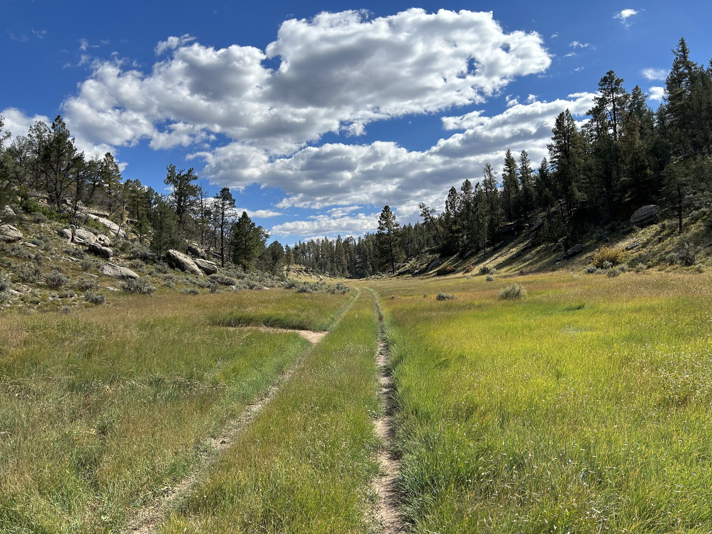
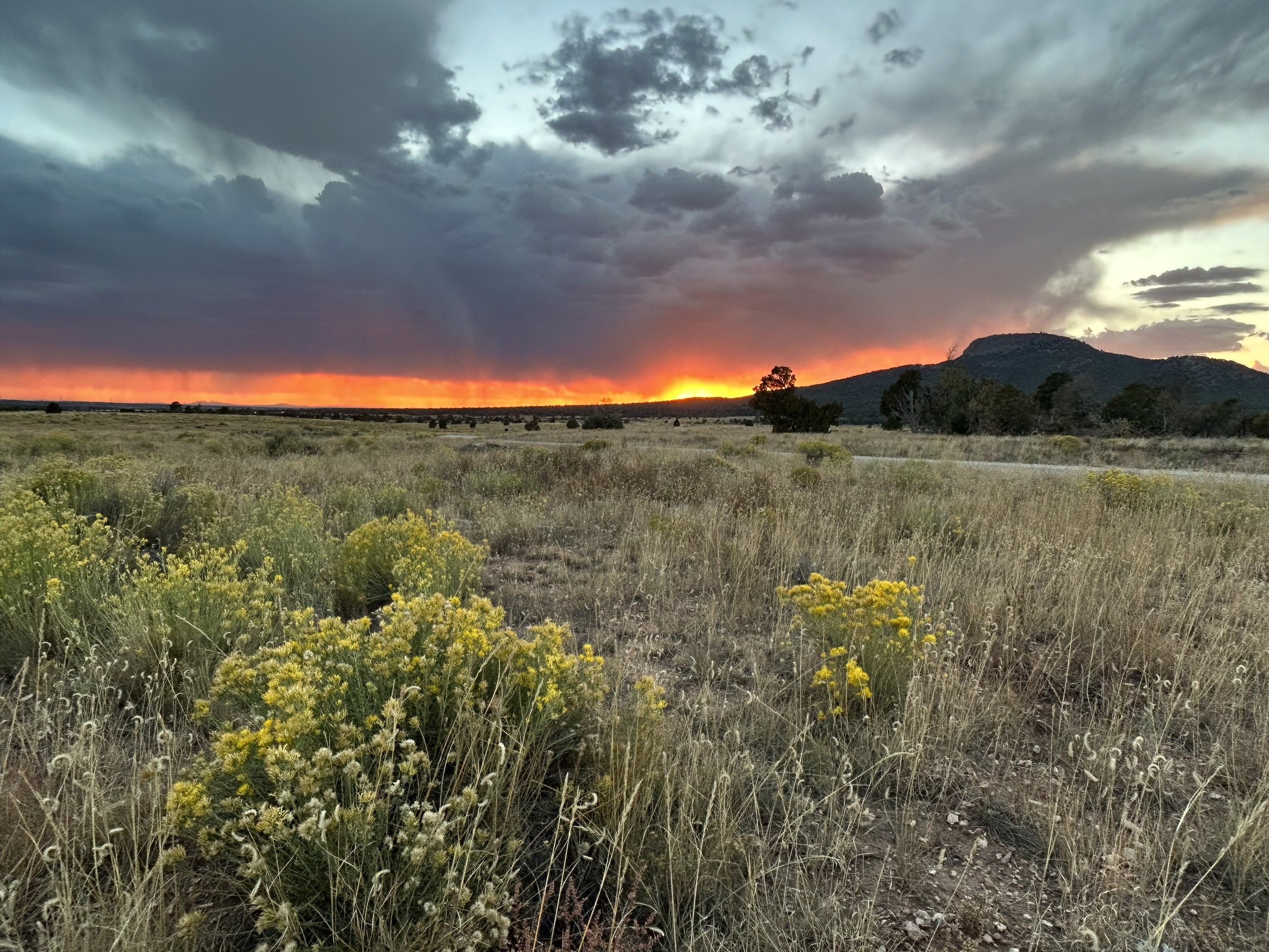
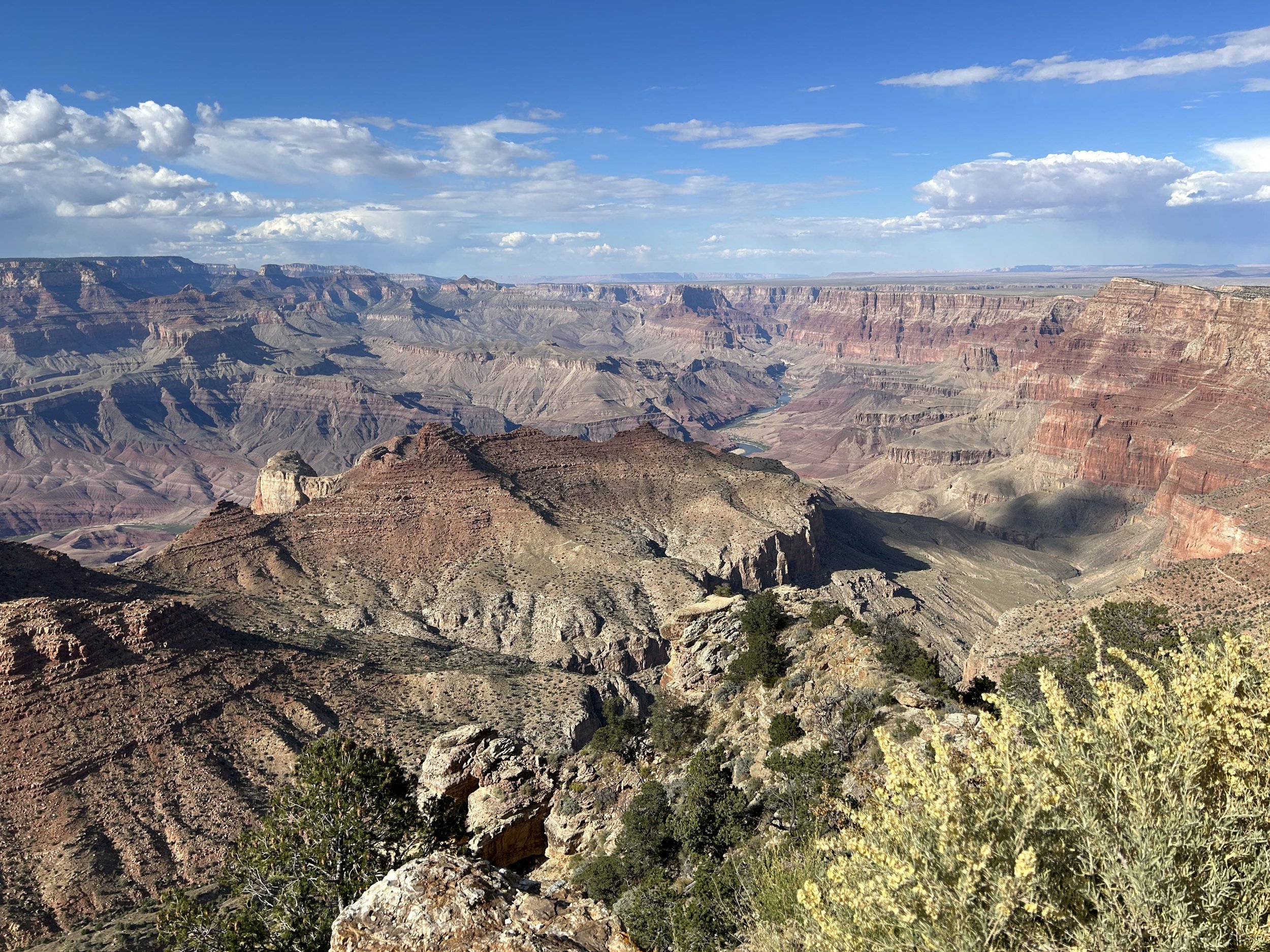
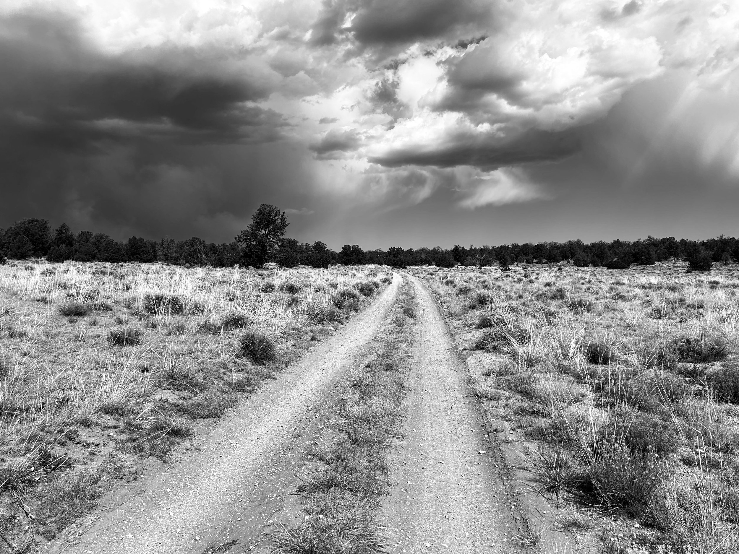
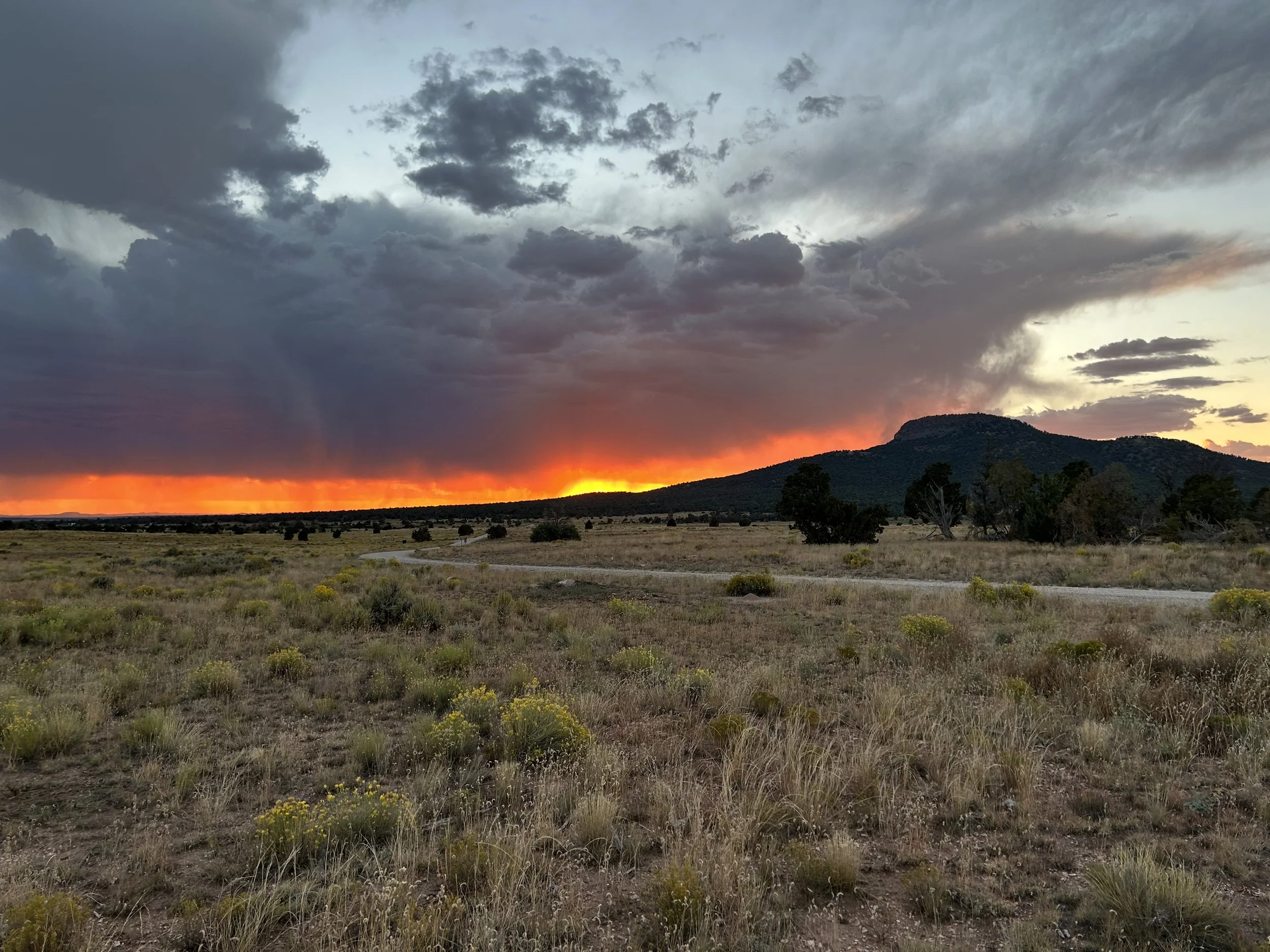
31.5 Miles; 1,525 Feet of Gain; South Rim Village to Tusayan, AZ After yesterday's big miles and elevation gain, I awoke today to find (rather unsurprisingly) that my hip was in some pain. Little did I know that a few days later I would find out I had a pelvic fracture. But for moment, all I knew was that it was throbbing. I had two days left on the route, but given the pain, I decided to do one last day shortly looped through the woods to retrieve my car in Tusayan. I didn't start riding until nearly noon and took Rowe Well down along the wash. Oaks thickly were burnt crimson on a sunny and breezy day. Today, there was indeed no storm. Heading out to Pasture Wash, the road was baked silt in the dry sun and the rabbitbrush had already lost its luster on the sage-plains. Alternatively, the floor of dirt below sage limbs was thickly carpeted with white petals of numerous blooming flowers. All the water sources I road by were copiously full and relatively clear of algal growth in the tilting sun of autumn. The doubletrack out to Coconino Wash was just as rutted as earlier in monsoon season, but someone had taken the time to fill in some particularly bad ruts with rock and gravel. I turned off into Coconino Wash proper just as it narrows up through a shallow canyon. The entrance was a dense floor of blue-green grass thickly growing as if in mid-summer. I was pretty shocked by the amount of vegetation fully photosynthetic. It was brilliant and stark against the fading pastels of brush turning brown. The grass had invaded the doubletrack, growing right in the tread - a testament to the moisture this year. I rounded a corner and entered the winding limestone abutments where white rock outcrops contrasted with pine on their shoulders. A whipping sea of meadow grass stretched before me down the whole route. It was vibrant, green, and mottled with gold. The miles passed purposely slow and beautiful through the heart of Coconino Wash. The wash ended as I climbed an adjoining hill through a cowboy fence. The next section was rocky for about a mile or two as I slowly climbed along an incline, gaining elevation amongst ponderosas and pinyons. The route smoothed out approaching the historical Apex railroad site. I crossed the tracks and continued along the smooth cindered previously-rail-now-road that headed just south and east of the airport before a right swing carried me on smooth doubletrack through the pines. I approached the section where the road swam under and around the railroad tracks. It's a cool and unique part of the route to ride under wooden trestles. I pulled my bike to the side next to the tracks as I heard the Grand Canyon Railroad Train actually approaching. The conductor sounded the horn as the rail came chugging out of the trees into view. I waved at passengers before pushing off into the golden afternoon sun that slants so early at this time of year. Much of the ride from here was a continuous, but relatively gentle, incline up to outskirts of Tusayan. I then jumped on the Greenway path that meandered into downtown as a tussle of bronze pine needles fell across the path from the wind. I arrived back at the car parked in the Imax Parking Lot feeling satiated from the opportunity to see fall so fully along the South Rim this year. 68.8 Miles; 4,054 Feet of Gain; Grandview to South Rim Village Somehow the night was warmer than the evening. Whether it was the storm passing and taking its gale or a warm front slightly moved in, but the dawn broke even and comfortable. Today was planned to be a big day. My pelvis was doing well, so I planned to make up some distance/time by hitting up all the capes and making it to the South Rim Village for the night. No rain was forecast, so I didn't feel compelled to hurry my morning too quickly. Instead, I used the latrines over by Grandview Tower, enjoyed a long breakfast, and then got comfortably going for a big descent off the Coconino Rim down to the Upper Basin. AZT singletrack was first for a short bout through the woods before a steep downhill that swept past USFS Hull Cabin. Red stalks/leaves of autumnal mint stood sentinel about the floor of the ponderosa woodland. The reds, yellows, and crushing oranges of their colors really made the whole scene fell like fall. But contrastingly, the recent rains had stimulated vibrant green new grass and a fresh bloom of rabbitbrush that spilled summer amongst the photosynthetically-depreciating leaves of other deciduous growth. I stopped over and over again to admire the colors making up the forest floor. Satiated, I pushed on and quickly sped down the road that traced a drainage by limestone walls and jutting cliffs before entering the outer edges of the Upper Basin. Here, the trees quickly gave way to an old burn scar now filled with rabbitbrush and grasses. The road along this section is best traveled by bikepackers as a downhill (which is how I designed it) due to the frequent ATV use that often leaves washboard intermittently. It's a pain on the uphill, but manageable on the down as long as you watch your line and keep to the sides. Even then, there are always sections that require standing to avoid the jolting shakes. Rabbitbrush was fading away here, but small purple coneflowers stood resolutely violet against the browning landscape. I could see the general distant area of Desert View, and I noted gathering cloud that looked might anvil-esque. Thinking it couldn't be rain, I pushed forward to where the wide gravel intersected with the highway. I crossed the highway and joined that dirt that gave way to the Lost Highway - Old HWY 64, now abandoned and thickly growing with successional vegetation. It's a cool section of pavement that only cyclists, pedestrians, and the odd ATV get to enjoy. I sped down the slope dodging bushes and grass tussocks growing out of cracks. Abandoned pavement turned to dirt doubletrack. I looked to my left only to see a massive gray cumulus system start rumbling thunder and throwing out lightning - and it was only 10 am. I sped up to dodge the cell lest it rain and turn my track to peanut butter mud. I turned right and started out to Cape #1 at the Little Colorado River Gorge Overlook. The road out to it is primitive, overgrown, rocky, and little-used. However, the hike-a-biking a times couldn't dissuade me from the epic view I knew lay ahead. Grasslands rose up. I turned to my left at a cowboy fence and gaped at the storm cell swelling my way. I quickly pedaled to the overlook of the gorge cut-in-Earth. It was awesome as always. I then turned and climbed up the grassy hill where the curtain of rain was fast approaching the Earth and making its way to me. I jumped on the route and quickly made my way back to the highway as cooling temperatures descended along with a spittle of rain. I threw on my rain jacket. But as I reached the highway, it seemed the storm was just missing where I was at. Instead, the road looked absolutely soaked heading up to Desert View meaning I had just missed the downpour. Feeling pleased, I started the long shoulder-ride up into Grand Canyon National Park. This is always a big, long ascent from just over 6000 feet to 7500 feet. I turned the pedals with that constant hum and vehicles gave me plenty of space as I kept to the side and entered the Park. I turned off for Desert View. Desert View Watchtower spiked the horizon and I descended to Cape #2. The swirling grays, bruised curtains, and scale-off-white clouds whipped around the Canyon just making an already stunning scene even more dramatic. I love it when storms brew over the Canyon - the play of shadow and light texturizes the inner gorge even more so, sprinkling color and contrast uniquely. I enjoyed sitting on a bench just staring at it all. I felt hungry so I headed over to the Market to grab some Gatorade (it was another atypically hot day) and some fresh fruit/hummus. As I ate outside, a couple sat down next to me. It turns out the guy used to head up the largest bike retail stores in Texas, and he was super interested in the riding I was doing. After peppering questions, they relayed that they now lived in Durango. And to quote him, "Durango is absolutely beautiful. I had never been to the Grand Canyon before, and I've held off a big part of my life because I thought we had the market cornered on beauty where we're at. I came here with no expectations and…was ABSOLUTELY BLOWN AWAY by how beautiful and epic this place is." He said the Canyon was the most amazing thing he had ever seen in his life. I always get stoked when I talk to people at the Grand Canyon for their first times as their excitement confirms that fire in me for this place. The day was now in early afternoon, and I still had some good elevation gain and miles ahead, so I said goodbye and jumped back on the shoulder of the pavement. As is necessary for the eyes and heart, I stopped at every Grand Canyon cape to take in the views set amid the day's storms. Mid-afternoon found me climbing up to Grandview again, this time for the overlook. This is the highest point on the South Rim and oaks grow well here in the wetter climate. In fact, the mid-October season was pushing them all to burnt orange, soft yellows, and even some poignant reds. The road was slick with recent rain and the views of the inner Canyon were shadowed by the storm clouds that now passed more heavily over the Sun and over the chasm. I rode quickly because one of my favorite sunset spots on the South Rim is at Shoshone Point. I wanted to hit it before sun slide behind clouds or below horizon. I raced up the dirt road leading to the point, left my bike at the pavilion, and then jogged out to the point proper just as a crimson slice of Sun slanted heavily on the top peaks of Canyon buttes while their masses lay in shadow. It was a powerful set of color and angle. I felt grateful. But the sun was now dipping below horizon, the cold was descending, and I still had some miles to cover. I got back on the bike, turned on my front light, and started biking along the Greenway towards Grand Canyon Village all while the rising bugles of male elk filled the woods. 48.1 Miles; 2,696 Feet of Gain; Red Butte to Grandview The bugling elk persisted into the early hours of the morning, whereby I got some sleep when I finally put earplugs in. Usually, October mornings have a bite of cold that gets chased by sun in the middle of the day. But as soon as the sun crested the horizon, it felt like a warm summer morning. I exited my shelter into dawn light calm and smooth. I packed up quickly knowing that today was forecast to have even more storms than yesterday. I wanted to make sure I didn't get caught in caliche substrate when the rain came. As I was eating breakfast, a bunch of USFS Hot Shot vehicles and fire trucks flew down the road I was camped next to. I noted that possibility of a fresh fire after last night's lightning show. A mile or so into my ride, I took the side-road down to the Wildlife Tank where I filled up on enough water to get me through to the Wildlife Tanks up by Grandview. The day was really heating up, and the forecast indicated it would be 80 degrees or higher around the low parts of the route. I drank a bunch of water and pushed on up the slow, all-morning climb that carried me from pinyons and junipers into the heart of ponderosas and oaks. All the oaks lining the route were red and yellow in fire hues for fall, even as golden rabbitbrush bloomed at their feet. I turned and headed south on a decline down to Moqui Stage Station where I ran into three bikepackers with large backpacking backpacks on. They were riding the Stagecoach 100 to the Canyon and then planning on immediately hiking down to the Colorado River and back up. We all talked for a while before gathering clouds roiled nearby. I kept biking easterly before a turn on smooth doubletrack took me across classic pinyon-juniper savannah in the heart of the Baaj Nwaavjo I'tah Kukveni National Monument. Suddenly, I rounded a curve and a large burn of smoke was shooting into the air from a wildfire either prescribed or monitored. Next to the rising smoke plume gathered dark cumulonimbus clouds that arced skyward before spreading anvil-shaped on top. The gloom of smoke and storm collided into a dark mass of atmospheric turmoil that equally swept down tendrils towards the Earth. I could smell the storm building. The sun was at such an angle that the sweep of sage-savannah next to me sat brightly in comparison to the skies of Mordor overhead. I double-downed on the doubletrack trying to cross the large plain of grass when lightning cracked overhead. Bolt after bolt snapped and curdled to cloud on repeat. My legs pushed hard as cadence spun me across the exposed grassy basin to a heart of pinyon-junipers. I turned up a wash recently wet as clay-silt substrate began sticking to my tires. Lightning and thunder echoes went off squarely over me; the heart of the storm was bullseye above my head. I found some evenly spaced/sized trees, dropped my bike, and found a place under my rain jacket to wait out the passing thunderstorm. I ate some snacks as the storm rolled by and continued booming east of me. The pass ahead was wet but doable, so I pedaled on as the smear of black sky hung low amid distant blue. The scenery was harsh and gorgeous. The South Rim Capes continued up a small climb and approached Peterson Flat where an abundance of rabbitbrush bloomed yellow across the sage-basin. But ahead, I noted large plumes and tendrils of the fire I had been watching all morning. I couldn't tell if the road I was on would go near it, so I pressed forward and hoped to bypass the burn. Some ten minutes later as I was leaving the sage behind and the smoke was gathering me, did I enter the woodlands only to find active burning trees and flame alight on fallen logs. It all looked rather tame, so I presumed it to be prescribed (and later confirmed by a sun warning of "Smoke Ahead." I rode into and past the smoldering burn line to exit into clear air. Able to breathe better, I stopped beneath the boughs of a ponderosa to eat a long snack. The big climb of the day lay before me. I was at the bottom of the Coconino Rim, and I needed to bike up, gradually, but for some 20 miles to Grandview tower at an elevation of 7500 feet. I started the long ride and watched as pinyon-junipers began to be replaced by ponderosas and oak again. All around me, isolated cells of thunderstorms raged darkly in the sky. But somehow, I didn't get rained on anymore. The same couldn't be said for the road which quickly began thick peanut-butter mud and clumping alarmingly to my tires. Several vehicles must have gone through the road because deep muddy ruts lined the usually smooth Rim Road surface. My bike slid and choked on the mud as I pushed through. But my eyes kept being drawn upwards to the many oaks lining the route all dressed in fall plumage. Yellows, oranges, and bits of red made the landscape pop from the browning grasses and darker evergreens. The temperatures continued to drop as elevations gained, storms blocked the sun, and the wind picked up. But then, the Rim Road widened out as I covered miles under ponderosa spreads. Grandview Tower and the Arizona Trail were suddenly upon me. I snapped a few pictures and began walking back into the trees which were mostly oak and changing colors rapidly. I spent some time enjoying the fall leaves before setting out to find a campsite. I biked down the singletrack of the AZT to get further into the woods and away from all the dispersed van/car campers for a little quiet and privacy. I found a solid grove of pine with a fresh bed of needles to camp under for protection from the swirling storms. I ate dinner as dusk rapidly gathered, bull elk began loudly bugling, and a cold night descended. 37.44 Miles; 1,394 Feet of Gain; Tusayan, AZ to Red Butte in Baaj Nwaavjo I'tah Kukveni National Monument The monsoon season this year proved to be above average. Notably, Tusayan (as a sample of the region) received an afternoon storm in mid-August that dumped more than 3 inches of rain around the washes of the town perimeter in about 45 minutes. A subsequent flood gushed into town permeating buildings/businesses. That surge of water also ended up being a harbinger of erosion; many parts of the South Rim region's lesser-used dirt roads were infiltrated with debris flows, flash flooding, and deep rocky ruts. I spent late-August through September riding portions of the COTC that I suspected were deeply impacted by the above-average moisture. And man, the roads were destroyed. I rode out to several remote areas on the route that had miles of debris overlaying the route or were rideable but completely jolting from the major rock beds now making the majority of the surfaces. I poured over maps, rode out to new areas, and ultimately ended up completely regrafting big chunks of the southwest and southeast passages of the COTC onto more suitable roads for riders. The result had some trade-offs, exchanging quality road for loss of unique scenery. Ultimately, serendipitously, I think the rains actually forced a better overall quality of route for most bikepackers. The only thing left after day-ride-scouting was to do a proper multiday trip on the South Rim Capes. I raced in the Stagecoach 100 in mid-September, only to crash at the start of the race such that I landed on a metal water bottle and absolutely crushed it flat with my left hip. The pain was bad but I finished the rest of the race. A few days later, the pain increasing, I made my way to the doctor's where they suspected I had torn my hip or labrum cartilage down in. An MRI was necessary to confirm, but I concluded that my Fall Break plans of bikepacking the Bears Ears region was highly suspect for safety and risk. I took a couple of weeks to rest and got some major improvement in the hip. I decided to use my Fall Break to ride the South Rim Capes. I wanted to do ride the whole route again, feel the new pieces I had recently moved, soak up the brilliant fall happening this year, and it was close enough to home that if my hip flared up (as I would find later that week), I could easily bail. After a late night drive back to the Canyon from Phoenix, I woke up, had a slow morning, and finally starting packing before driving down to Tusayan for the start. By the time I threw my legs over my rig, the day was nearing noon. And it was a glorious mid-day of Fall at that: Aspen changing down the streets of Tusayan along with late flaring bronzes of golden rabbitbrush everywhere. The air was calm and the skies blue. This was in spite of the fact that the weather forecast was calling for nearly daily monsoon-like thunderstorms each afternoon even as it was October. I turned off pavement and started the climb out of town in to the Baaj Nwaavjo I'tah Kukveni National Monument. All along the corridor of ponderosa pines stood bushels of oak that were putting on metallic overtones of gold, copper, and rose. The day had to be mid-70s and no one was driving down the backroads of the Kaibab. Even with this being October, dozens of flower species persisted in new and holdover blooms from the summer. Entire carpets of autumn-drying meadows were plush with white and yellow petals. New sprigs of lupine dotted the forest floors with purple and holdouts of paintbrush sang red amongst the browns and greens. And the rabbitbrush though pale in some areas was still vibrant and newly pushing blooms in others. After smoothly and slowly making my way through the changing colors of the forest, I crossed the highway, and started down to Anita Station. The ponderosas quickly transitioned to fields of sage interspersed with juniper and pinyons. I came out of a wash and entered the rolling hills of Coconino/Chino grasslands. The grass was perfectly dried yellow from the autumn change. Ahead, a massive gaggle of clouds grouped darkly on the horizon. Amidst the bruising cumulonimbus was the dispersed faint haze of fire from a prescribed wildfire burn east of my position. The stark contrast of cloud, smoke, sage, grass, and pinyon made me stop my bike over and over again for photos. It was hot for sure - easily 80 degrees F at this low point on the route. The distant shapes of the San Francisco Peaks and Bill Williams Mountain faded away as the thunderheads distant draped rain curtains. The South Rim Capes turned to meander east towards the clouds. I stopped to take photos of the storm clouds and strong Sun, only to turn and realize a significant storm system had developed immediately behind me in the past 30 minutes, and the tailwind I was enjoying was the outflow from it moving in my direction. I picked up my pace to keep ahead of the falling rain. I kept turning to stare at the shear mass of clouds barreling upwards and outwards into the atmosphere. As late afternoon was getting on, I crossed the highway and began swinging southward around the northern face of Red Butte. The fields of grass and sage swathing its base were memorizing in color starkness to the shaded peak above them. I didn't want to get caught in peanut butter mud so I made my way around the base and began swinging east into the storm dissipating before me as the one on my flank grew. I reached a line of pinyons and junipers just off the road. Although only 30-something miles into the day, I didn't want to push my hip too much, and with the approaching storms, I wanted to get a shelter up, so I took a C road back into the trees and vetted out a spot to camp with good wind protection. I set up camp and then gazed through the trees at a quickening display of orange and magenta. I realized an epic sunset was coming down angularly through the storm around the profile of Red Butte. I sprinted out to the road and raced out into the adjoining grasslands to catch a truly spectacular evening glow happening. The curtain of rain from the storm had settled to a slow pause of movement just west of me and Red Butte. Here, scale-cells of cloud swung upwards in blue-gray while the sun's rays came shooting through the hazy fall of rain. It produced a rich smear of red, orange, and purple that carried out horizontally across the plains while repeating lightning strikes went cloud-to-ground beneath it all. I was absolutely riveted by the scenery. Photos snapped before I just sat down amongst some rabbitbrush to take it all in until the last color closed on the horizon with the sun's passing. It was then that I hurried back to camp to eat some dinner in the gathering dark. I checked weather on my phone and say that the storm would eventually make its way towards me as a strong cell already evident by the flashing lightning and boisterous thunder cracking the dark night from here to Flagstaff. Food consumed and camp cleaned up, I made sure the tent was well-staked one last time before climbing in as wind hit the trees and steady patter of rain started. A lone male bull elk began calling in rut a hundred feet away. I had never heard an elk call so continuously. He would call nonstop (only a second or two for breath) for the next six hours while the storm swept over us. |
Search for Articles or Blog Posts
Disclaimer: The Forrest Biome and its owner is in no way liable for personal injury, damages, or losses to personal property or body resulting from use, reference, or consultation with the backcountry resources and routes provided on this site or associated RWGPS pages. Although information will be updated on this site, its accuracy is not a guarantee. You assume all risks and liabilities for use of the site's information. It is your own responsibility to prepare and engage in outdoor recreation activities in addition to following local/federal laws, regulations, and policies when traveling through areas.