El Lobo Lupus
Table of Contents
El Lobo Lupus - Day 1 - Red Cinder and Green Pines
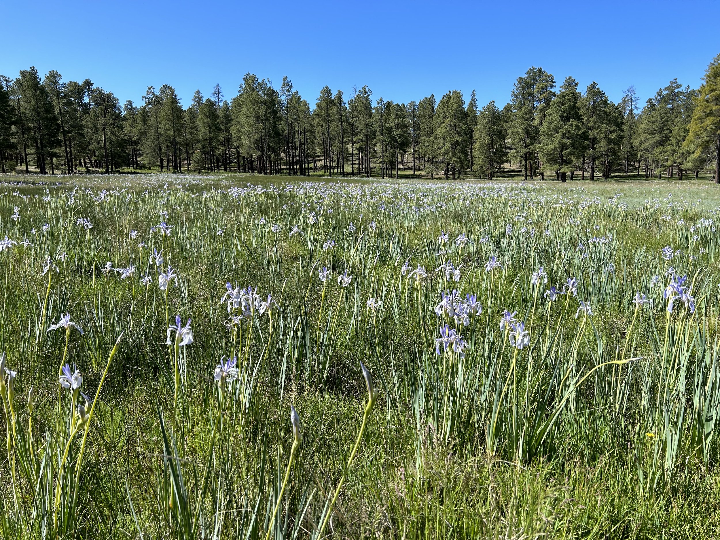
El Lobo Lupus - Day 2 - Irises Blooming Everywhere on the Way to Greer
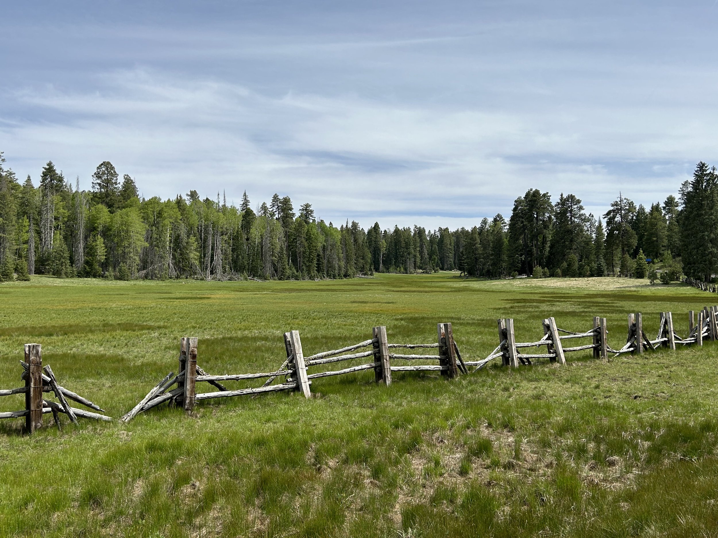
El Lobo Lupus - Day 3 - Crossing Vast Subalpine Meadows
El Lobo Lupus - Day 4 - Rain and Storms on the High Grasslands
El Lobo Lupus - Day 5 - The Top of Escudilla Mountain
El Lobo Lupus - Day 6 - Loop Around Escudilla Mountain
El Lobo Lupus - Day 7 - Zero Day in Alpine, AZ
El Lobo Lupus - Day 8 - Blue Range and Black River
El Lobo Lupus - Day 9 - The Black River and Hannagan Meadow
El Lobo Lupus - Day 10 - Blue Vista, Bear Wallow, and Big Lake
El Lobo Lupus - Day 11 - Riding the Apache Railroad Trail Across Subalpine Fields to Greens Peak and Finish!
El Lobo Lupus - Day 11 - Riding the Apache Railroad Trail Across Subalpine Fields to Greens Peak and Finish!
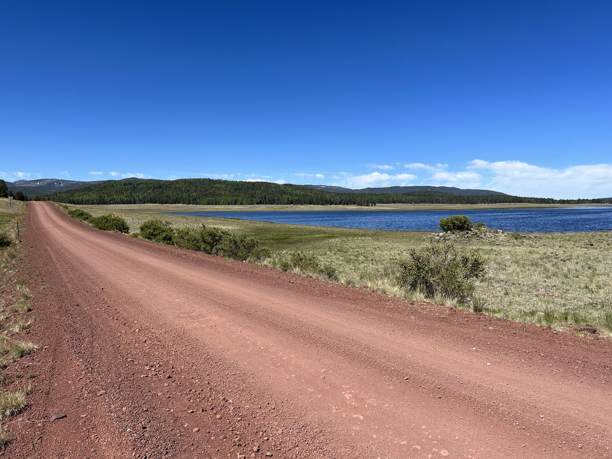
Janna and I slept intermittently. The campsite next to us arrived near midnight and spent an hour or so loudly debating how to setup their tents. Once it quieted down, I slept well. But Janna and I had discussed, and after looking over the next two days, we decided that we could easily finish in one long day given that the majority of the route was downhill. Early summer dawn hit us, and we quickly got up and packed up our camp in the near-frost chill of morning's light. The water of Big Lake was a sapphire blue, and the distant summit of Mount Baldy was now mostly snow-free save for a few spots.
El Lobo Lupus - Day 10 - Blue Vista, Bear Wallow, and Big Lake
Night was utterly quiet. We awoke at the first tendrils of cold dawn. Summer light entered the shelter, but the temps were easily in the upper 30s. We had a big day of climbing ahead of us to cover the distance to Big Lake. Nick came out of his woodland camp while holding a large air rifle he carried for, per his description, the large predators in the area. Hannagan Meadow Lodge wouldn’t open for breakfast for a while, so we ate our own breakfast and joined the shoulder of the highway. Highway 666, aka the Coronado Highway, undulating along a series of gradually rising hills to nearly 9300 feet. Thick aspen, large spruce, and a mix of semi-burned woodlands made up the corridor. The shoulder was decent and the traffic almost non-existent along the paved stretch.

El Lobo Lupus - Day 9 - The Black River and Hannagan Meadow
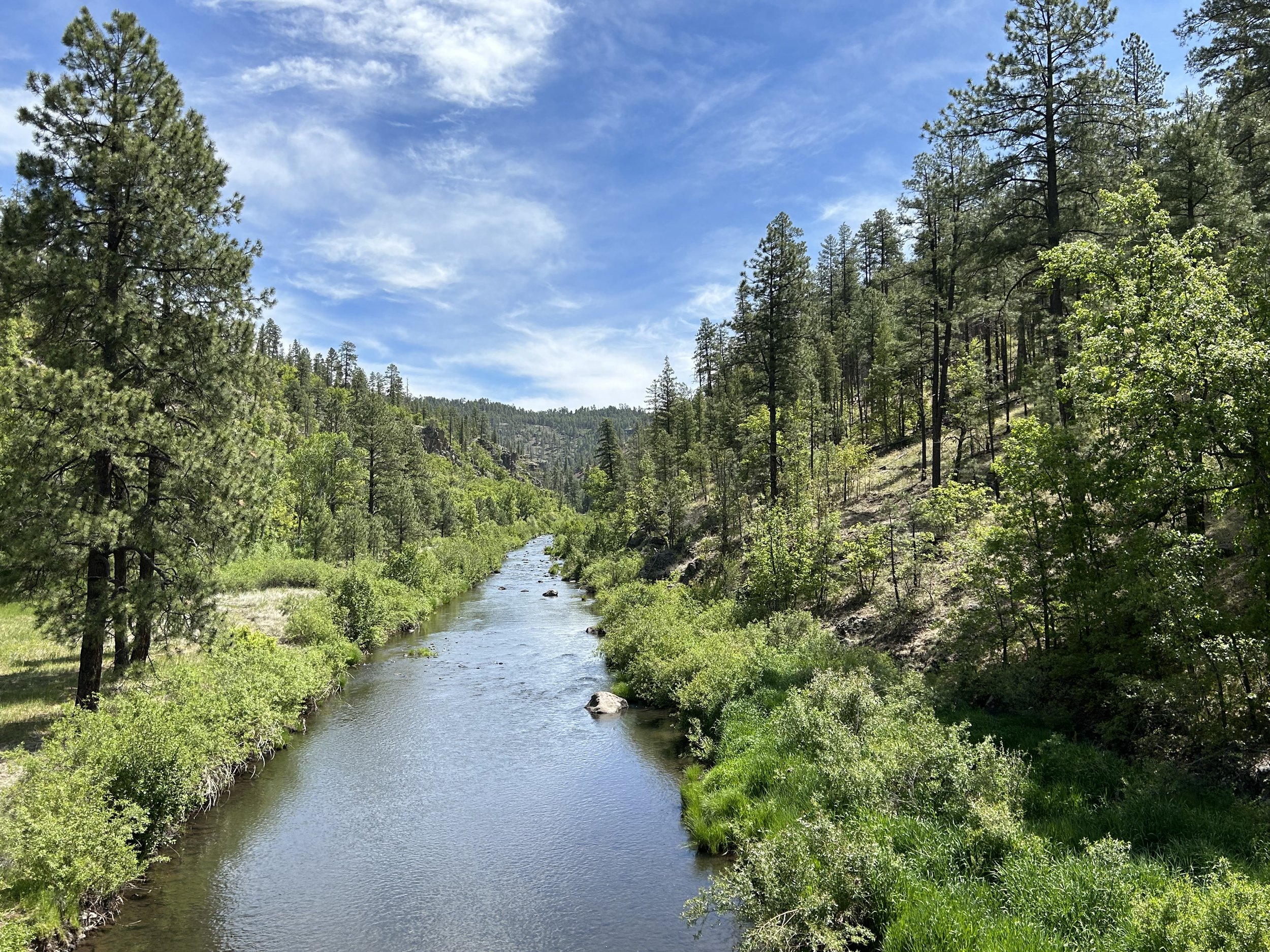
I slept soundly in that deep peace that comes from the sound of rushing water nearby. The morning was cold as sunk air densely packed down in the gorge next to the Black River. We knew we had a short day today (purposely planned after yesterday's big day), so we languidly arose only after the Sun nearly crested the walls of canyon. I exited the tent and immediately deposited myself in a seat in a patch of Sun working its way to warm the area. Satiated with light, I immediately went back down to walk along the banks of the Black River. Great blue herons stalked for fish or flew overhead. I walked the banks for 40 minutes taking in the curves and riffles of the water before heading back to camp to make some breakfast. After, I walked down to the Camp Host to confirm our payment. Once he realized we biked here and that we didn't have a campfire, he immediately rejected our payment and said we earned our campsite. He also told me to go find Upper Diamond Spring located in our campground within a fence. I moseyed my way back, searched the area, and easily found it. I made a note to grab water from here next time we biked through.
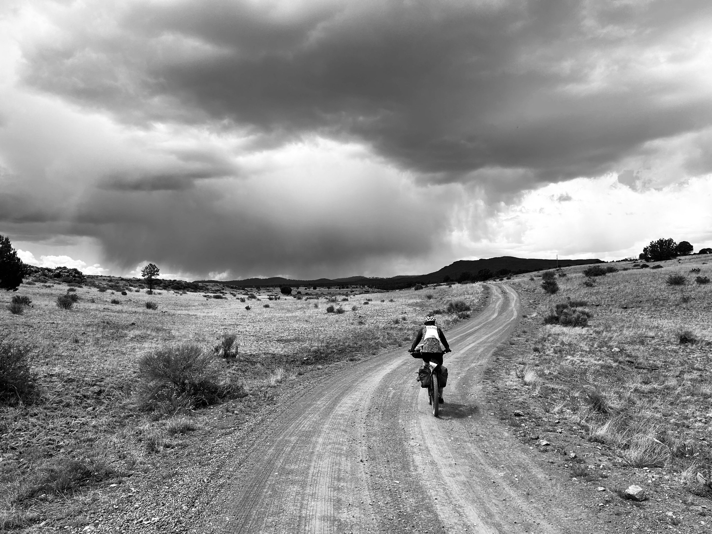
El Lobo Lupus - Day 8 - Blue Range and Black River
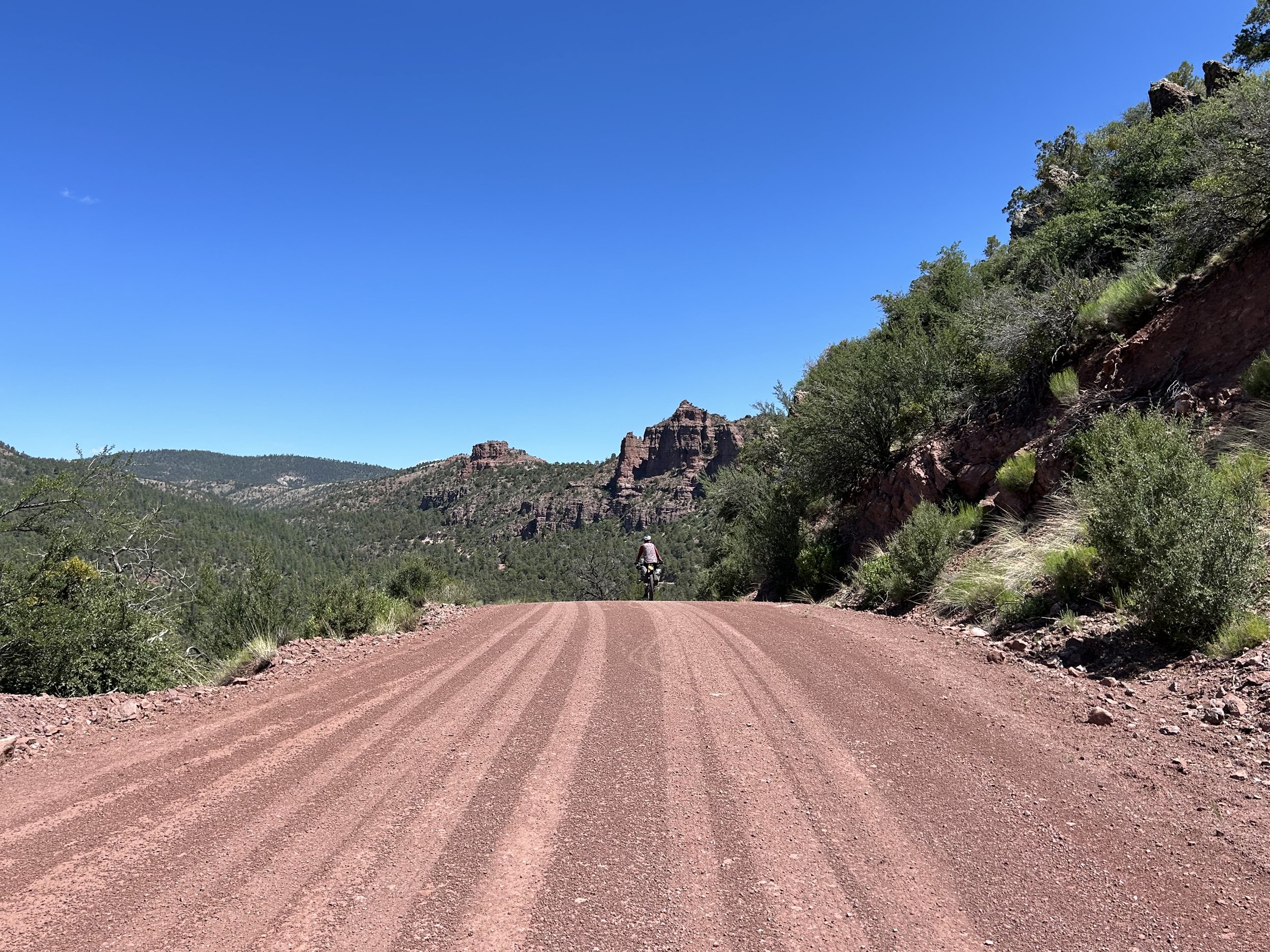
After a good night's sleep, we woke up ready to take on the crux of the route: a descent to the low point of the route at Blue, AZ off the Mogollon Rim followed by an ascent back up the same rim, a further climb up Middle Mountain, and a long contoured traverse to the Black River. The worst of the storm system that had hit us for days was now over with yesterday's thunderclaps. Instead, heat and sun would be our main concern as we lost thousands of feet of elevation before regaining the same and more.
El Lobo Lupus - Day 7 - Zero Day in Alpine, AZ
Janna and I both love the rest and recharge that comes with Zero Days. Especially when we can get to see a local area better. We awoke after a solid's night sleep to what was forecast to be a tempestuous day based on the weather forecast - lots of rain and significant thunderheads. We were grateful to have some indoors to relax in.
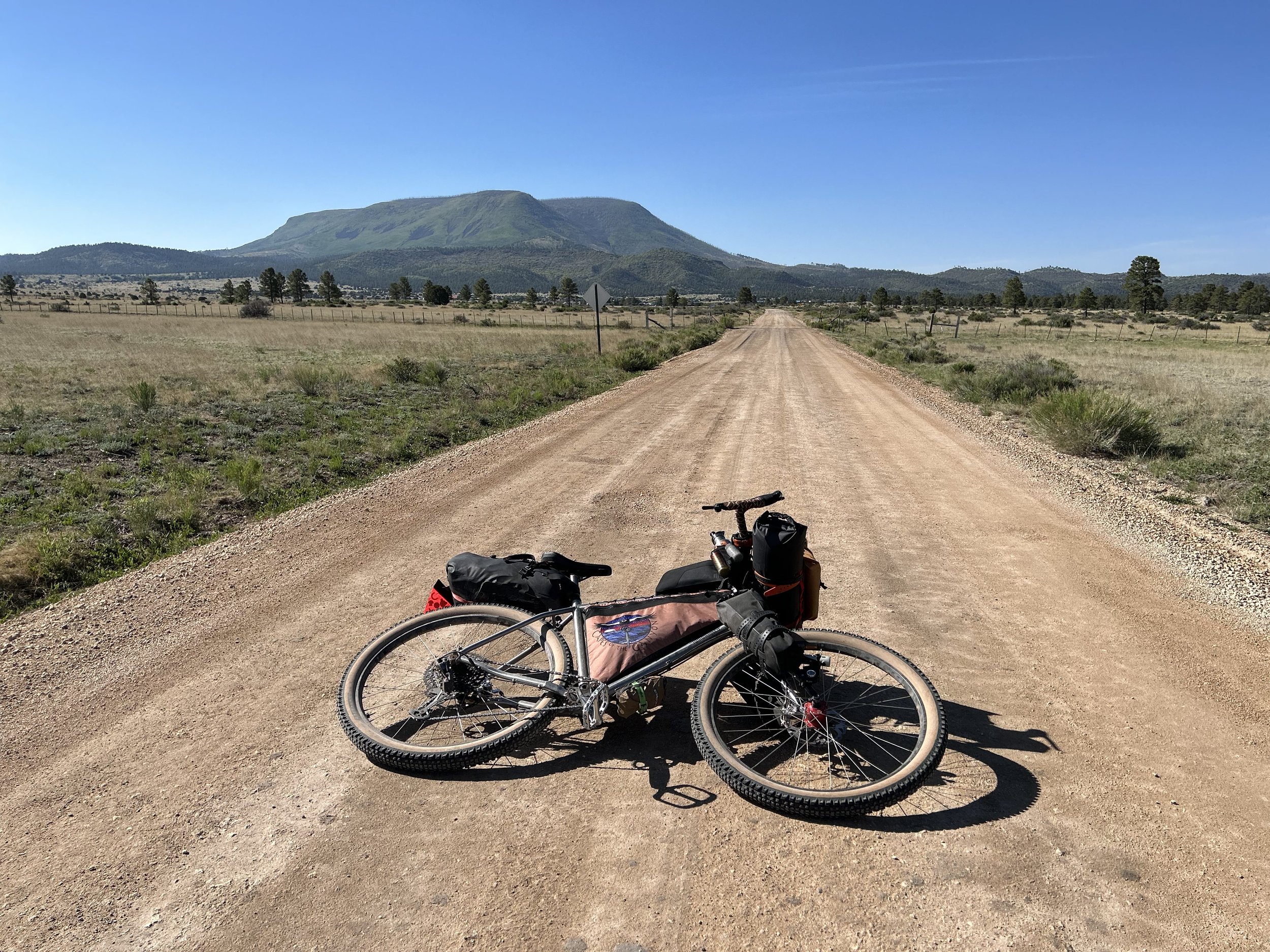
El Lobo Lupus - Day 6 - Loop Around Escudilla Mountain
After a long night's sleep, we woke up ready to head down the shoulder of the highway in order to do a loop around Escudilla Mountain. The shoulder was wide and welcoming for cycling as I recalled from riding it years earlier on the Luna Lake Tour with the Greater Arizona Bicycling Association. We peeled off on a side road through Nutrioso, stopped at the red old Post Office, spied the town's small lumber mill, and then pushed on to rejoin the highway and continue descending until we were back in the juniper-pinyon grasslands. El Lobo Lupus swung right, taking us off the highway and onto some of the best hardpack hero dirt I've ever ridden.
El Lobo Lupus - Day 5 - The Top of Escudilla Mountain
I slept terribly due to the fact that our dispersed campsite had a large pile of pine needles shoved into a pile nearby. The reason this bothered me was due to the fact that mountain lions will make those piles to cache kills. I unburied the pile after stumbling upon it when our camp was set up. There was nothing in it. But some primitive, annoying part of my brain leaked doubt and fear throughout the utterly silent night to the point where sleep barely came on when adrenaline was rushing my veins. Sometime in the night, a series of long-drawn howls, so unlike coyotes, rose from the Williams Valley below. The howls were so unlike a coyote, I really shot up to the realization that they were probably wolves. At 3:30 am, the birds started singing for the day. At 4 am, dawn was firmly upon us. I managed to catch a couple of hours of rest and stirred at the early hour to another day of potential rain. But now it was already hot with daylight hitting us. We ate slowly and packed up, pushing out and ascending the dirt road leading to camp.
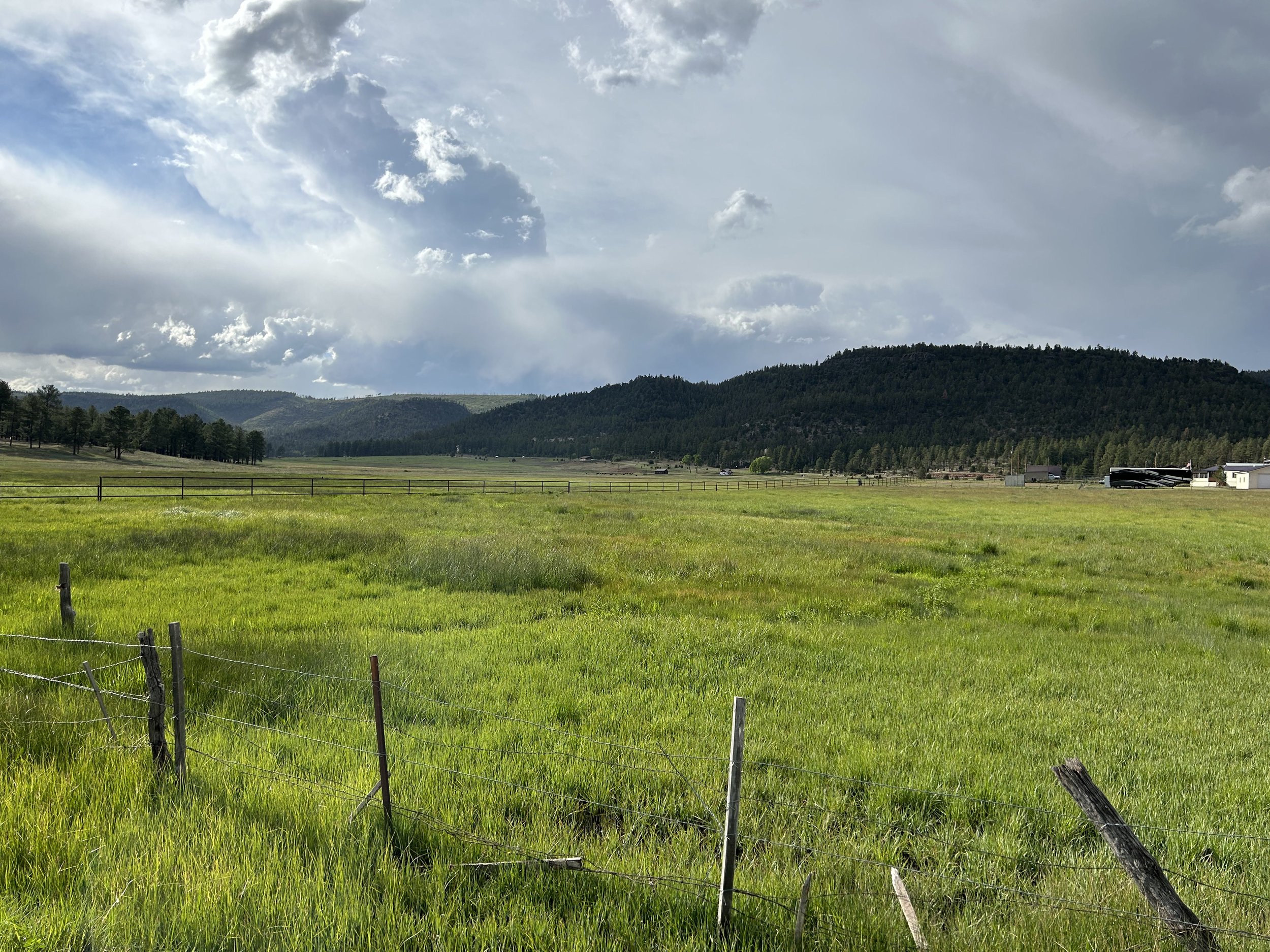
El Lobo Lupus - Day 4 - Rain and Storms on the High Grasslands
Janna and I woke up early to depart today. We knew we had some big climbs ahead of us, and that the storms that brewed yesterday would only intensify and rage today given the forecast. We wanted to ride early to (a) get to higher elevation before it rained lest the silty high-desert roads turn to peanut butter mud, and (b) we were hoping to make another big crossing of exposed high altitude meadow/grasslands (over 9000 feet) before thunderheads became a safety concern. Luckily, the storms were predicted to hit no earlier than mid-afternoon which should have provided us plenty of time.
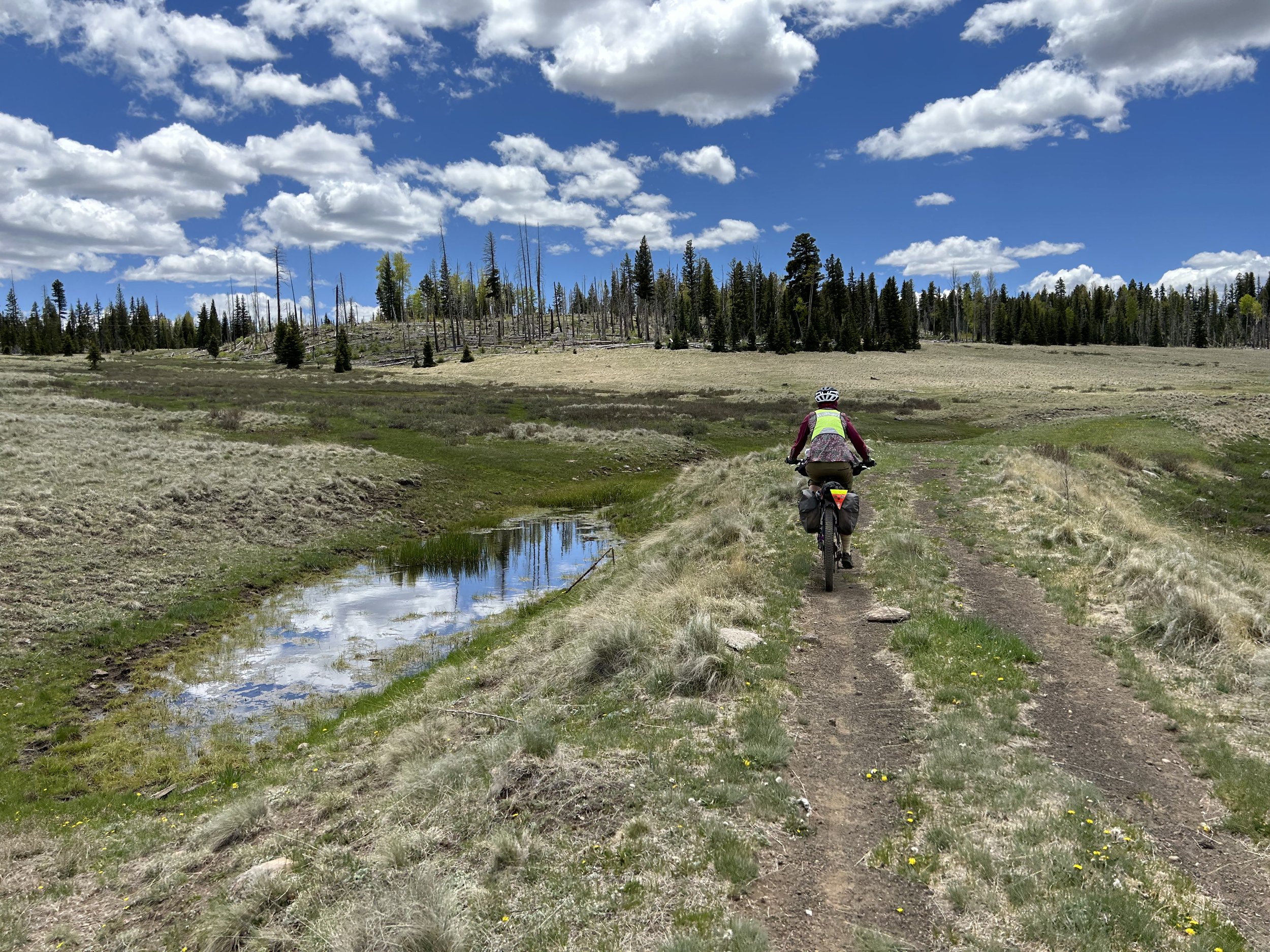
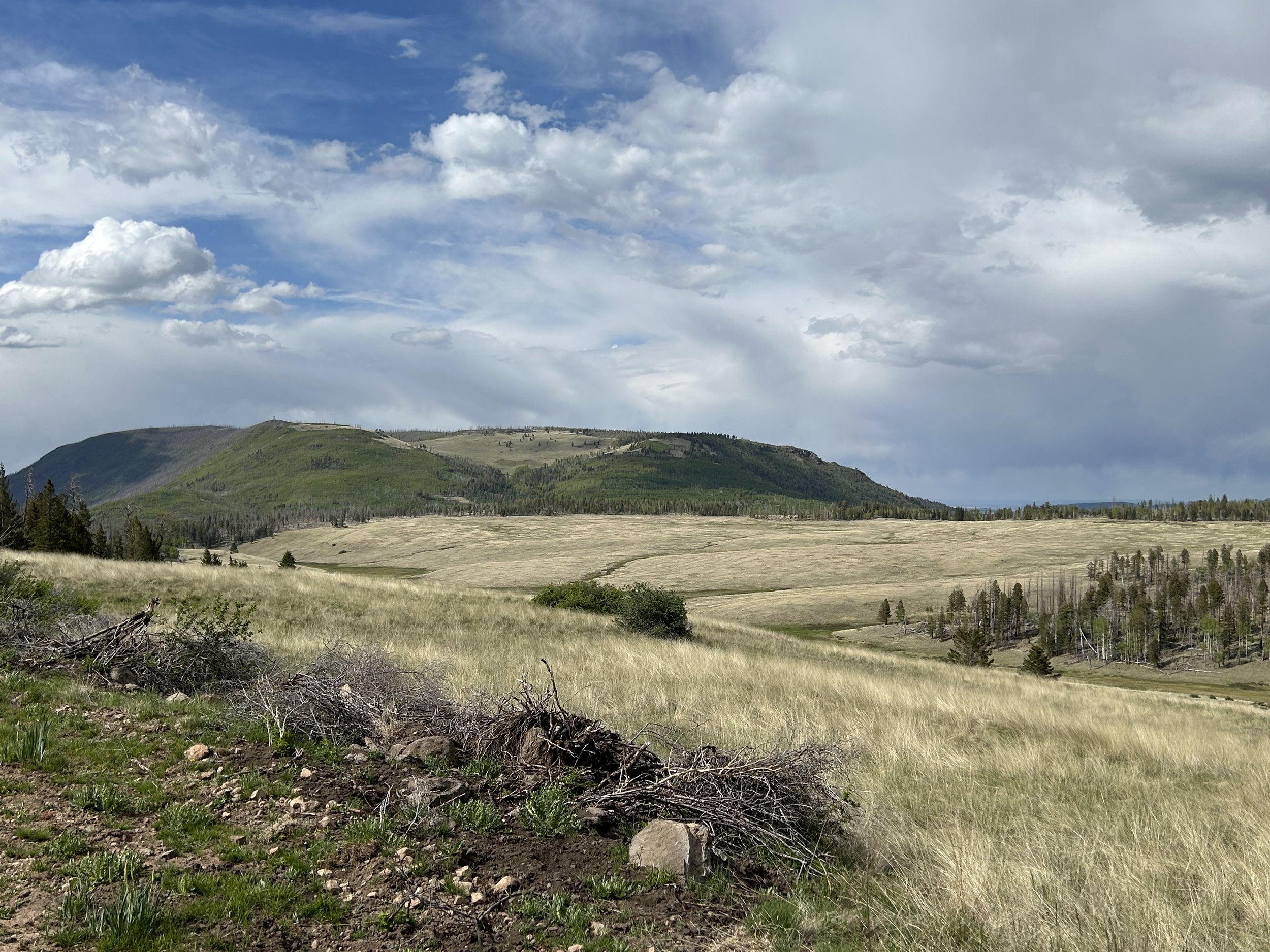
El Lobo Lupus - Day 3 - Crossing Vast Subalpine Meadows
We had read in the forecast that a front was coming through over the next few days, bringing the possibility of thunderstorms and rain. Given that today we'd be well over 9,000 feet crossing large high altitude grasslands, we wanted to get a move on so as to be under tree-cover when those storms came. Janna and I rolled out of our tent to clear skies which buoyed us with positivity about the day ahead. We ate breakfast and pushed out onto the shoulder of the quiet pavement. Shortly thereafter, we swung a right onto a side road through summer cabins before the pavement ended in gravel up a big climb to carry us out of the Greer Valley Recreation area and out to our first views of Mount Baldy. The whole time, our conversation centered around processing the school year that just finished and our lives at the Canyon. The uphill, the gravel mix, the ever-fostering presence of aspen, was exactly what we needed to talk out work and dreams for improving our craft next school year.
El Lobo Lupus - Day 2 - Irises Blooming Everywhere on the Way to Greer
The night was still as stone, and we slept hard. The cool of night began to sweep away at the sun's first glimmers. We had only 25ish miles ahead of us today, plus a reservation at the Rolfe C. Hoyer Campground in Greer, so neither Janna and I felt rushed. We took a long, enjoyable breakfast, took care of our bathroom needs, packed up our gear, and started uphill further into the Apache-Sitgreaves National Forest.
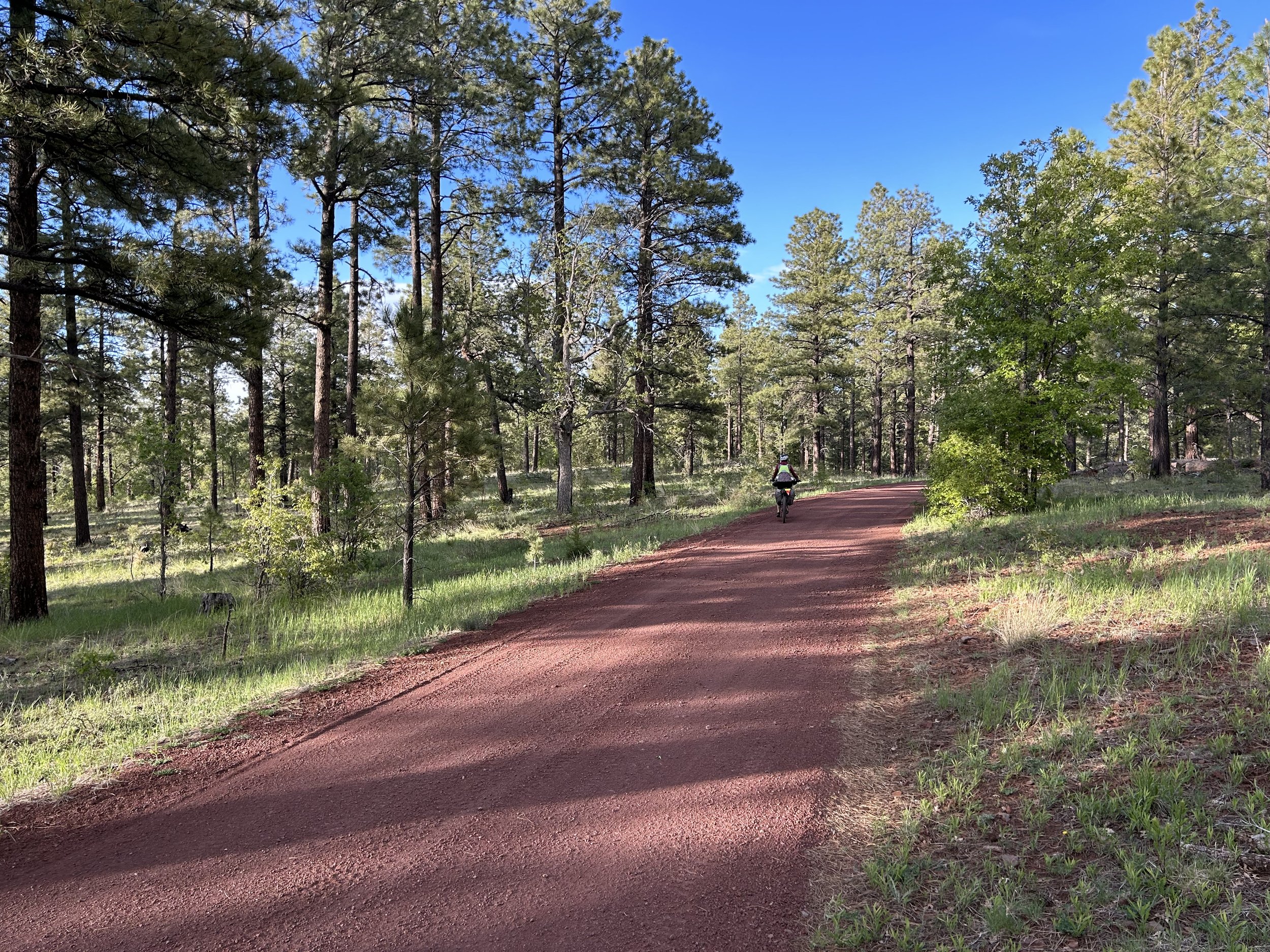
El Lobo Lupus - Day 1 - Red Cinder and Green Pines
It's been on my goal list for sometime now to link together all my favorite places in the White Mountains of eastern Arizona. Cool, elevated, gushing with streams and aspens, home to the Mexican Gray Wolf (El Lobo), and often overlooked, these "Alps of Arizona" have served as a biking and hiking location for me for years. Janna and I would head up to Big Lake with mountain bikes in tow nearly every Labor Day with Darren. I'd spend summer weeks camped at Hannagan Meadow Campground each night in order to spend my days wander-cycling around all the dirt roads and pockets of spur doubletrack I could find. And I'd dream of hearing or seeing a wolf.