1. Route Stats
Location |
Days to Ride |
Length |
Elevation Gain |
White Mountains - Arizona, USA |
6-11 Days |
412.1 Miles |
32,355 Feet |
Physical Difficulty* |
Technical Difficulty* |
Seasons |
Tire Size |
6/10 |
5/10 |
Best: Late May - Mid June Best: Sept. - Early Oct. Doable: Mid June - August |
Recommended: 2.4"-2.6"; Minimum Tire Size: 2.2" |
*Based on Bikepacking Roots Route Rating Scale (More info found under "Route Difficulty, Surface Conditions, and Direction to Ride"
2. El Lobo Lupus Overview
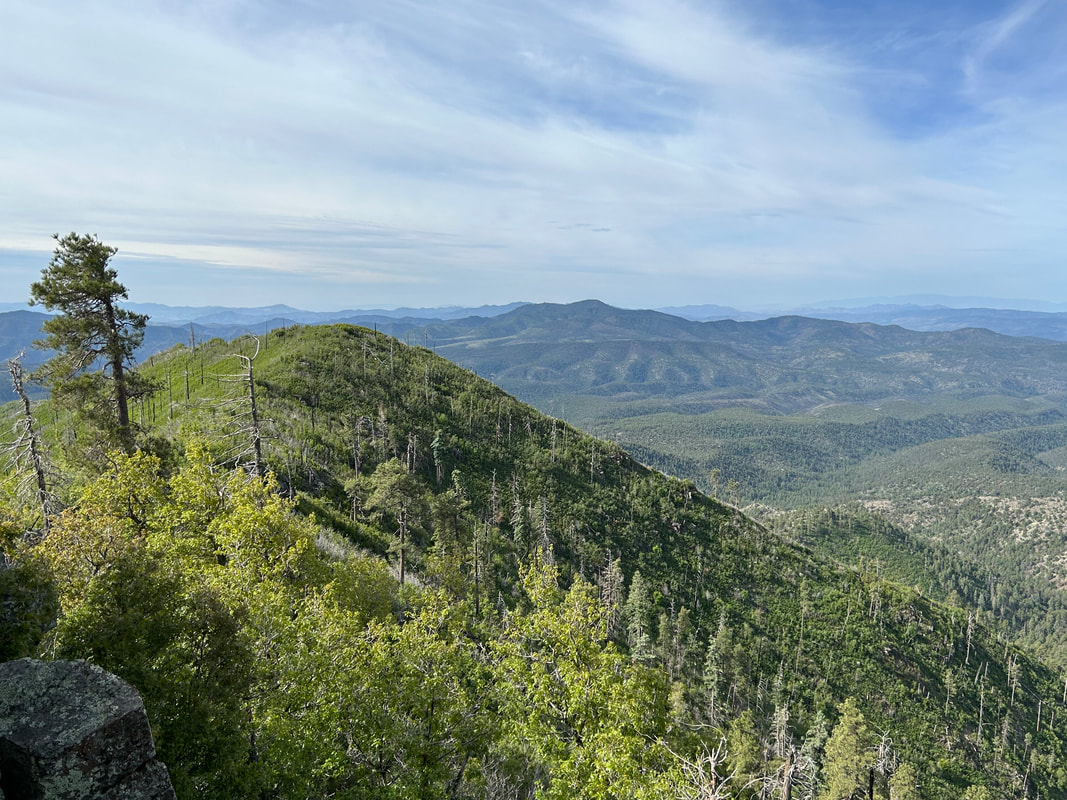
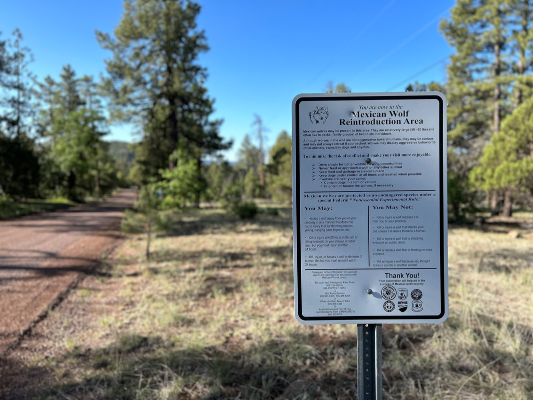
This bikepacking loop-us (“lupus”) heads through the high elevation heart of the White Mountains, Blue Range, and Mogollon Rim of eastern Arizona where the Mexican Gray Wolf has been reintroduced. The route name is a play on words as it is a "loop" involving the goal of seeing wolves (Canis lupus), especially the Mexican Gray Wolf which is commonly called "El Lobo." The Mexican Wolf is a highly endangered subspecies of the Gray Wolf. It was nearly wiped out by predator-eradication programs, but the species was reintroduced to Arizona and New Mexico in 1998 and has slowly increased to a population of over 200. Riders will travel through the territory of El Lobo - mountainous terrain known as the "Alps of Arizona." This land encompasses not only tributary headwaters of the Gila and Little Colorado Rivers but also some of the tallest peaks in Arizona at Escudilla and Baldy.
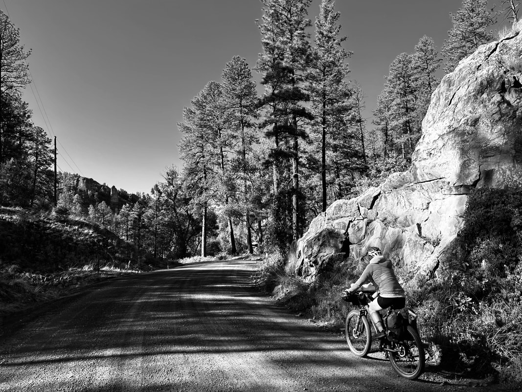
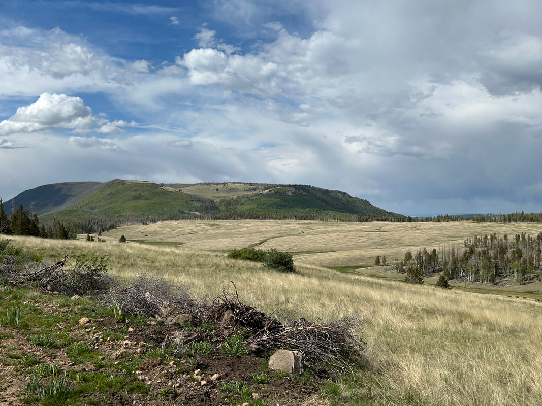
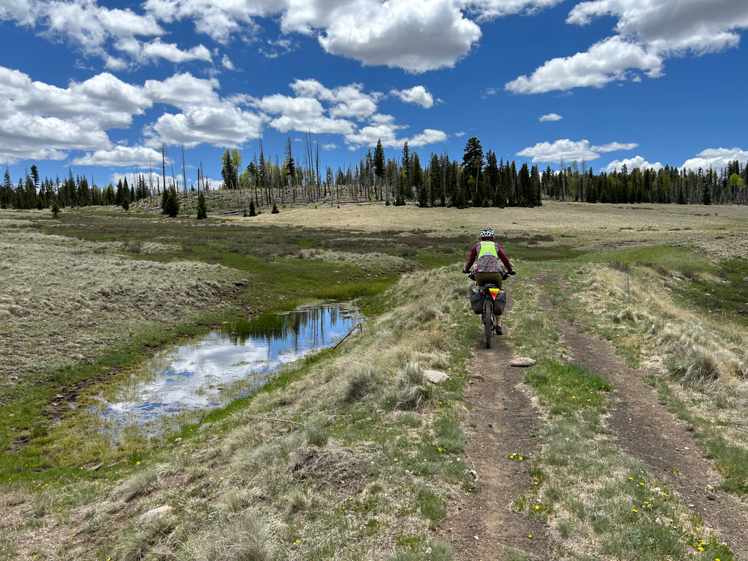
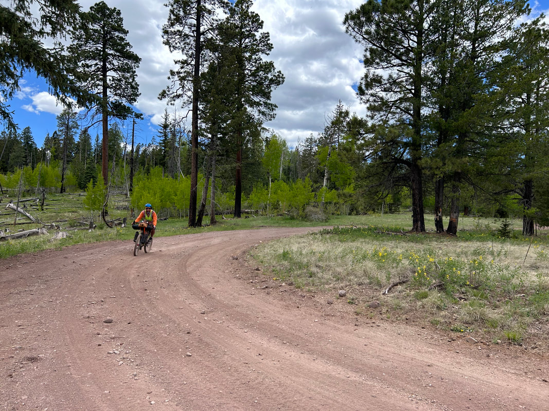
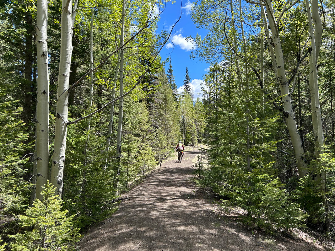
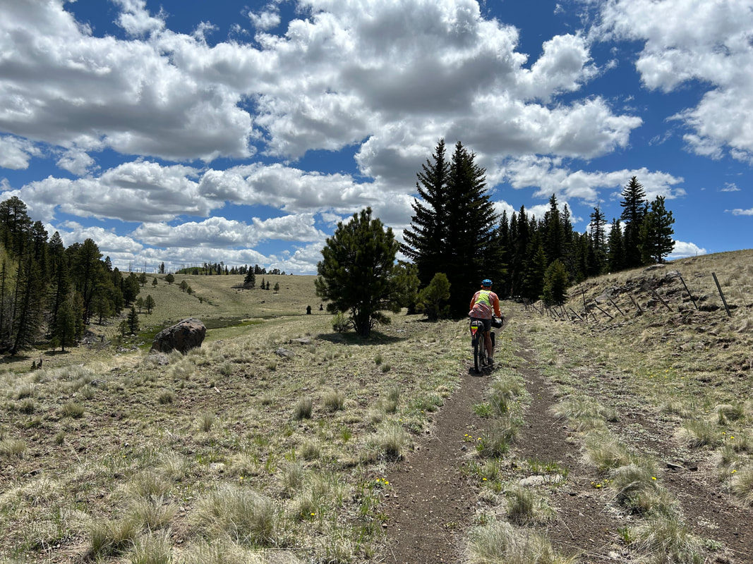
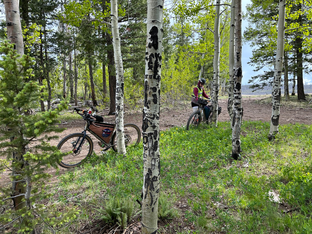
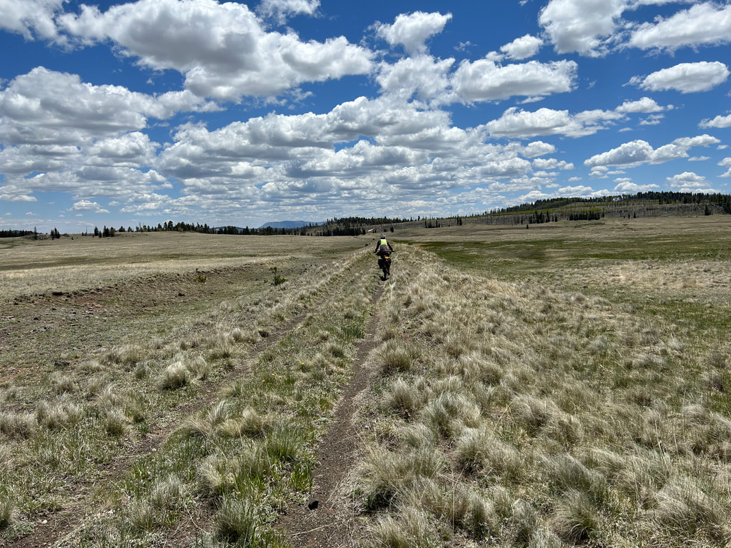
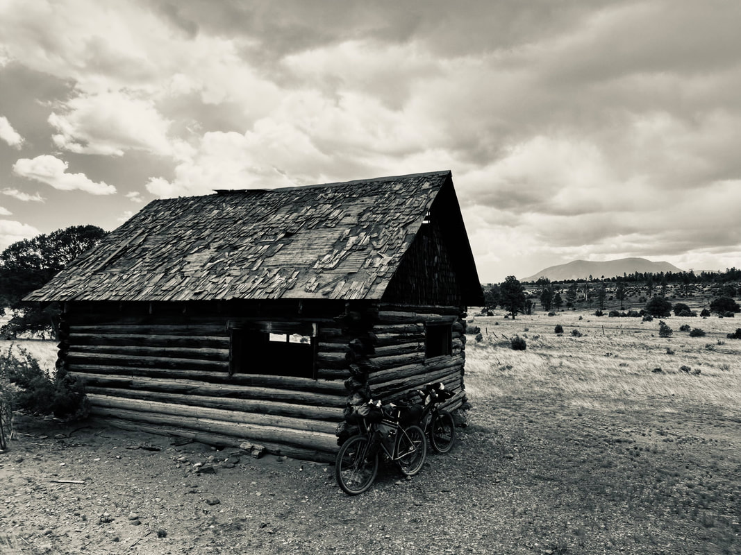
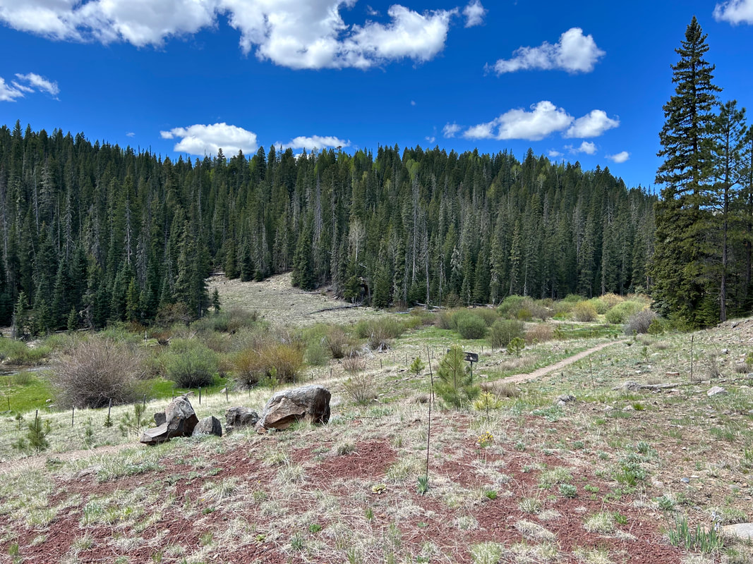
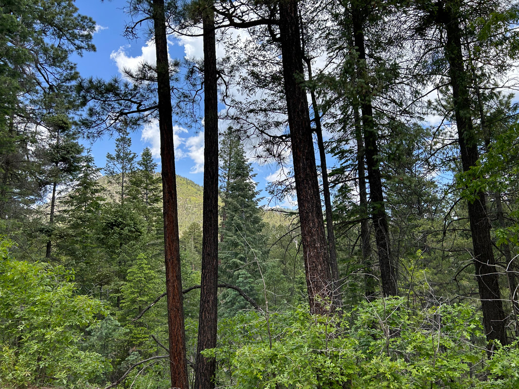
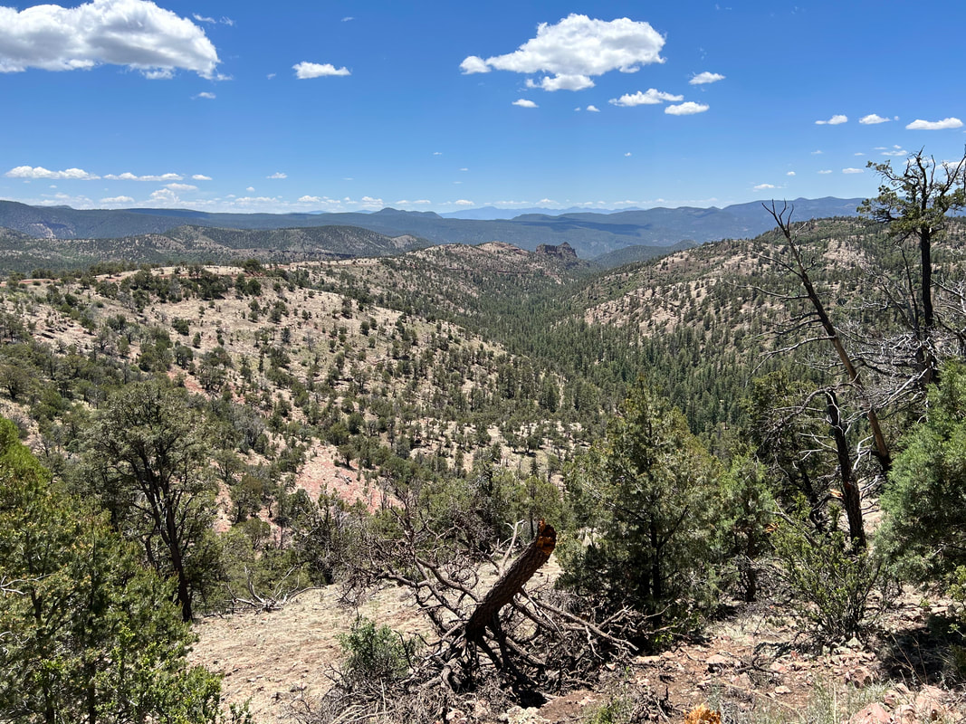
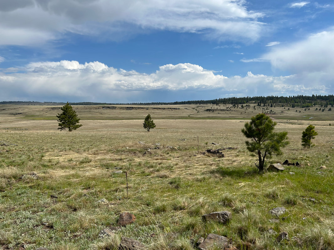
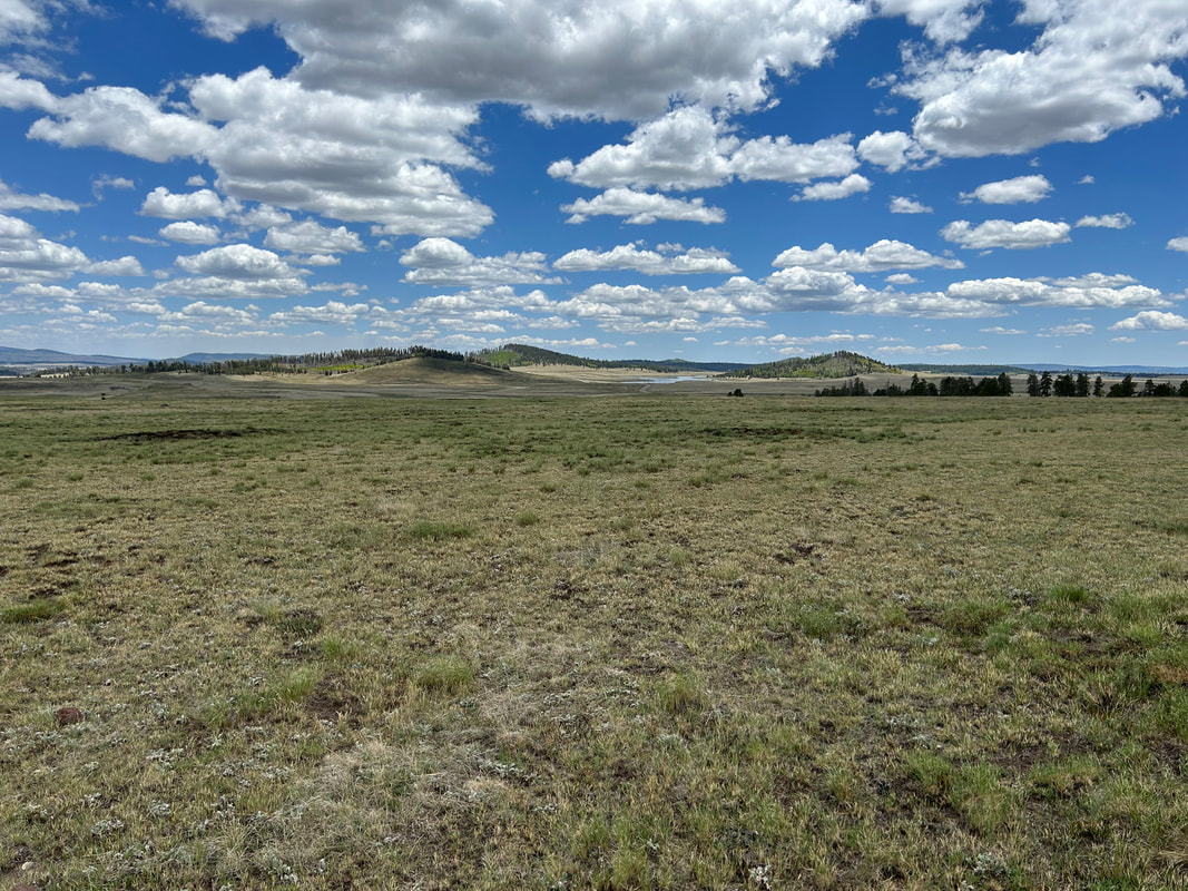
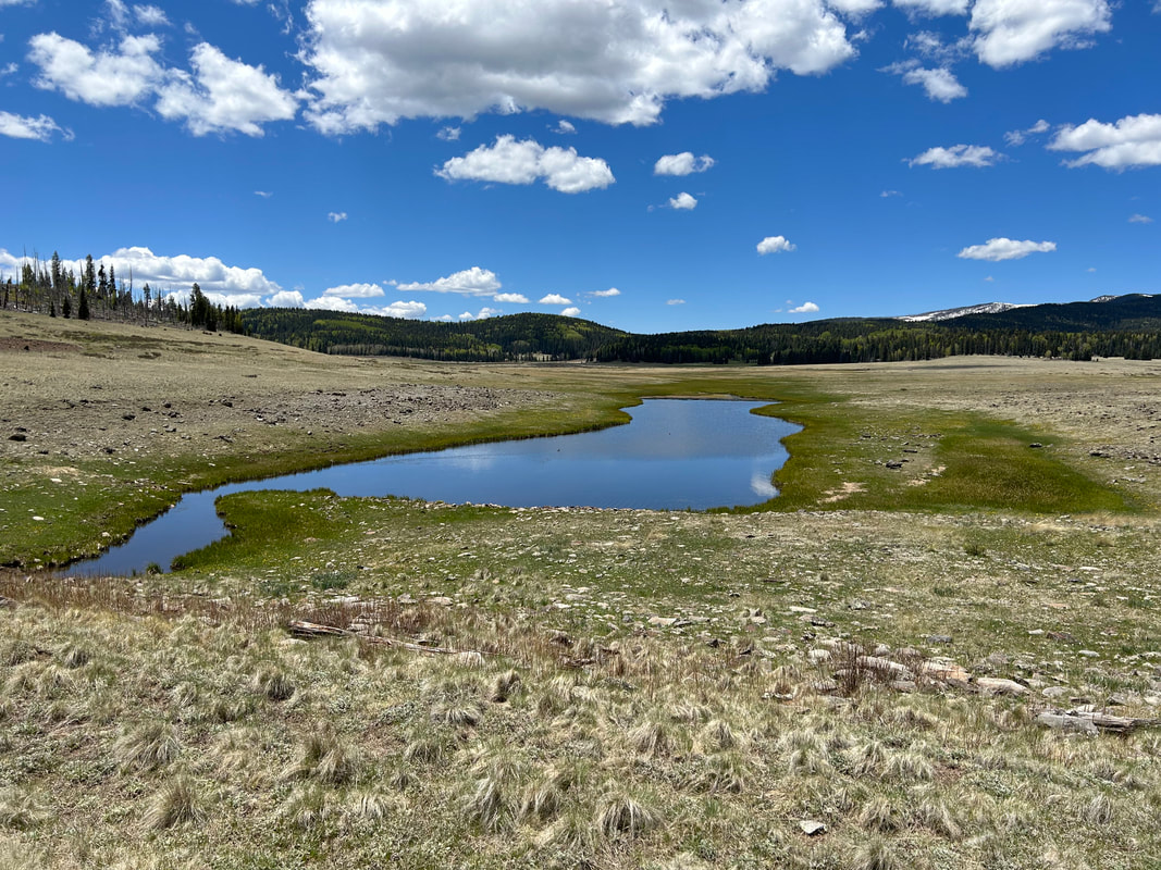
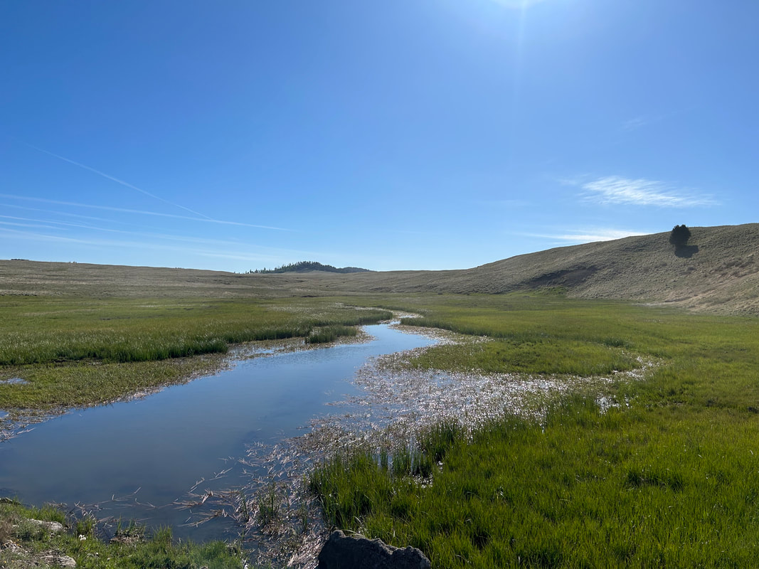
Bikepackers will traverse through miles of subalpine meadows lined with conifers and aspens, travel through dense ponderosa pine forests, ride along trout-filled rivers and lakes, and get endless high-elevation views. Cyclists will ride up to 10,000 feet on Escudilla Mountain and down to 5,800 feet along the Blue River near the last federally-designated Primitive Area in the United States. Look forward to riding along the banks of the Black River, staring at the complex neon greens of Hannagan Meadow, seeing the ecological succession of montane forests after the Wallow Fire, riding the perimeter of high-altitude Terry Flat, passing by enormous lakes in big sky country, and catching glimpses of wildlife such as Mexican Wolves, Black Bears, Mountain Lions, Elk, Big Horn Sheep, and Deer.
Bikepackers will traverse through miles of subalpine meadows lined with conifers and aspens, travel through dense ponderosa pine forests, ride along trout-filled rivers and lakes, and get endless high-elevation views. Cyclists will ride up to 10,000 feet on Escudilla Mountain and down to 5,800 feet along the Blue River near the last federally-designated Primitive Area in the United States. Look forward to riding along the banks of the Black River, staring at the complex neon greens of Hannagan Meadow, seeing the ecological succession of montane forests after the Wallow Fire, riding the perimeter of high-altitude Terry Flat, passing by enormous lakes in big sky country, and catching glimpses of wildlife such as Mexican Wolves, Black Bears, Mountain Lions, Elk, Big Horn Sheep, and Deer.
Blog Journal + Daily Photos of the Route
3. Map and GPX
Surface Color Guide
- Purple = Improved Dirt Surface (2WD, Wider, Smoother, Better Maintained, Intact, Graded, etc.)
- Red = Rugged Dirt Surface (4WD, Doubletrack, Rough, Less Maintained, etc.)
- Brown = Primitive Dirt Surface (Particularly Rocky, Rutted, and Eroded)
- Black = Singletrack
- Blue = Vehicle Pavement
Route Guide Sections
- Route Stats
- Route Overview
- Map and GPX
- Alerts and Closures
- Route Design Philosophy and Vision
- Route Description
- Route Difficulty, Surface Conditions, and Direction to Ride
- When to Ride (Temperature + Climate)
- Ecoregions and Landscape
- The Wallow Fire
- Where Bikes Are Allowed and Not Allowed
- Native Nations and This Land
- Leave No Trace and Bikepacking Ethics
- Water Sources
- Camping
- Food and Resupplying
- Sample Route Itinerary
- Fees and Permits
- Getting to the Start
- Parking
- Additional Important Information
- Acknowledgments
- Social Media and Route Updates
4. Alerts and Closures
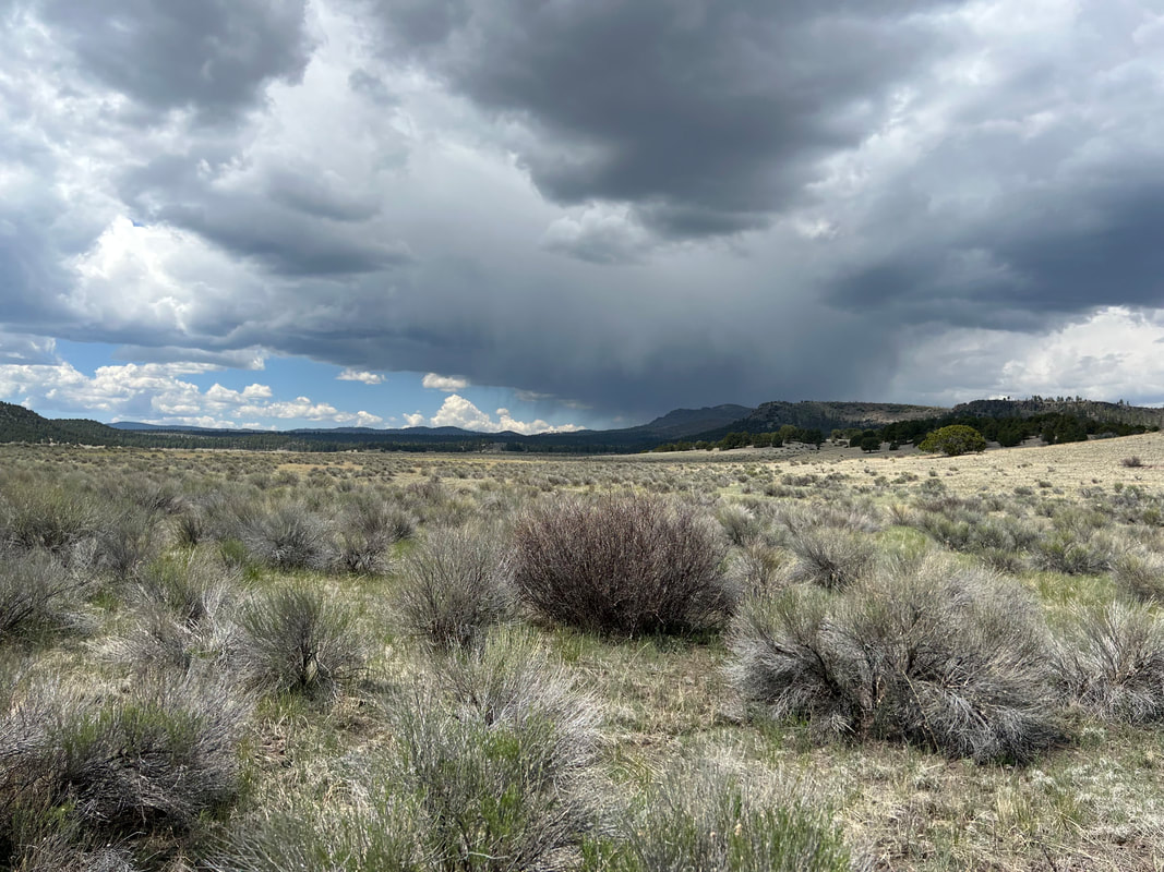
The Southwest is a dynamic region. El Lobo Lupus is subject to wildfires, flash floods, extreme heat, blizzards, monsoon storms, and death mud. The Apache-Sitgreaves National Forest is the main land management agency who may issues closures for access. BEFORE you ride, make sure you CHECK the link below to see if important alerts or closures will affect your riding of the established route. Be prepared to use maps to find alternates should a sudden change in route conditions occur.
Good physical maps for the region can be accessed or purchased below:
Good physical maps for the region can be accessed or purchased below:
5. Route Design Philosophy and Vision
The goals of the route are to:
When I first visited the White Mountains of eastern Arizona years ago, I was shocked to see miles of big sky country at 9000 feet filled with meadows, punctuated by peaks, and spotted with large lakes - all existing in Arizona. Even more-so, I was thrilled by the presence of wolves in this state and the reintroduction efforts for el lobo. I keenly remember peering down a dirt road just south of Alpine, AZ and imagining what it would be like to hear their howls on an overnight bike trip in that backcountry. When I set out to design this route, I wanted to make sure I thoroughly went down every fold of the Apache-Sitgreaves National Forest to maximize chances for wildlife viewing.
I also wanted the route to stick to higher elevations to allow for a southwest summer bikepacking trip. Summertime bikepacking in Arizona is difficult: the state has a heat that starts in spring and lasts right through autumn. A true summer route needs to maximize travel at altitude to take advantage of favorable temperatures. I tried to capitalize on that. Finally, I wanted to make sure riders on the route visited notable sights in the White Mountains not to be passed up - especially for those visiting the area for the first time. Thus, the route tends to form meandering lobes for its path instead of a direct line - this is intended. Embrace the opportunity to see every-fold of this landscape.
A great article on this area was published in the June 2023 issue of National Geographic. Although it focuses on the Gila Wilderness of New Mexico, the El Lobo Lupus is ecologically continuous with this region.
- Wrap and weave through the heart of Mexican Wolf (El Lobo) territory in eastern Arizona.
- Travel through the high-altitude "Alps of Arizona" for a rare southwestern summer bikepacking route.
- Hit up the most scenic, notable, and beautiful areas found in the White Mountains.
When I first visited the White Mountains of eastern Arizona years ago, I was shocked to see miles of big sky country at 9000 feet filled with meadows, punctuated by peaks, and spotted with large lakes - all existing in Arizona. Even more-so, I was thrilled by the presence of wolves in this state and the reintroduction efforts for el lobo. I keenly remember peering down a dirt road just south of Alpine, AZ and imagining what it would be like to hear their howls on an overnight bike trip in that backcountry. When I set out to design this route, I wanted to make sure I thoroughly went down every fold of the Apache-Sitgreaves National Forest to maximize chances for wildlife viewing.
I also wanted the route to stick to higher elevations to allow for a southwest summer bikepacking trip. Summertime bikepacking in Arizona is difficult: the state has a heat that starts in spring and lasts right through autumn. A true summer route needs to maximize travel at altitude to take advantage of favorable temperatures. I tried to capitalize on that. Finally, I wanted to make sure riders on the route visited notable sights in the White Mountains not to be passed up - especially for those visiting the area for the first time. Thus, the route tends to form meandering lobes for its path instead of a direct line - this is intended. Embrace the opportunity to see every-fold of this landscape.
A great article on this area was published in the June 2023 issue of National Geographic. Although it focuses on the Gila Wilderness of New Mexico, the El Lobo Lupus is ecologically continuous with this region.
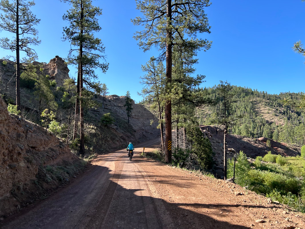
6. Route Description
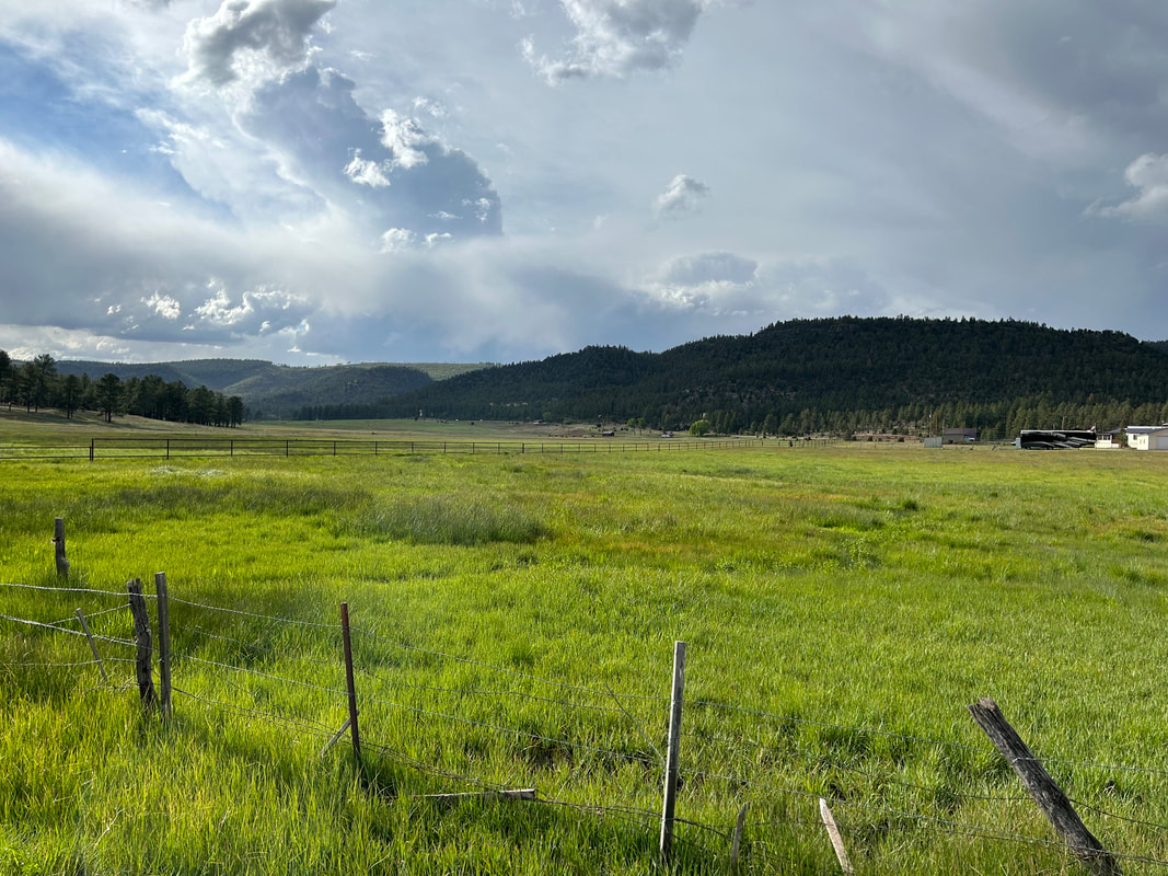
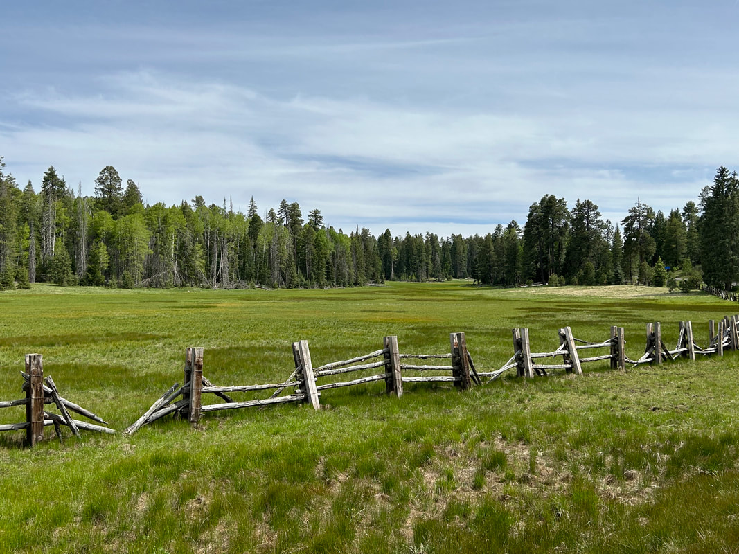
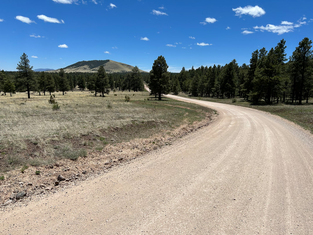
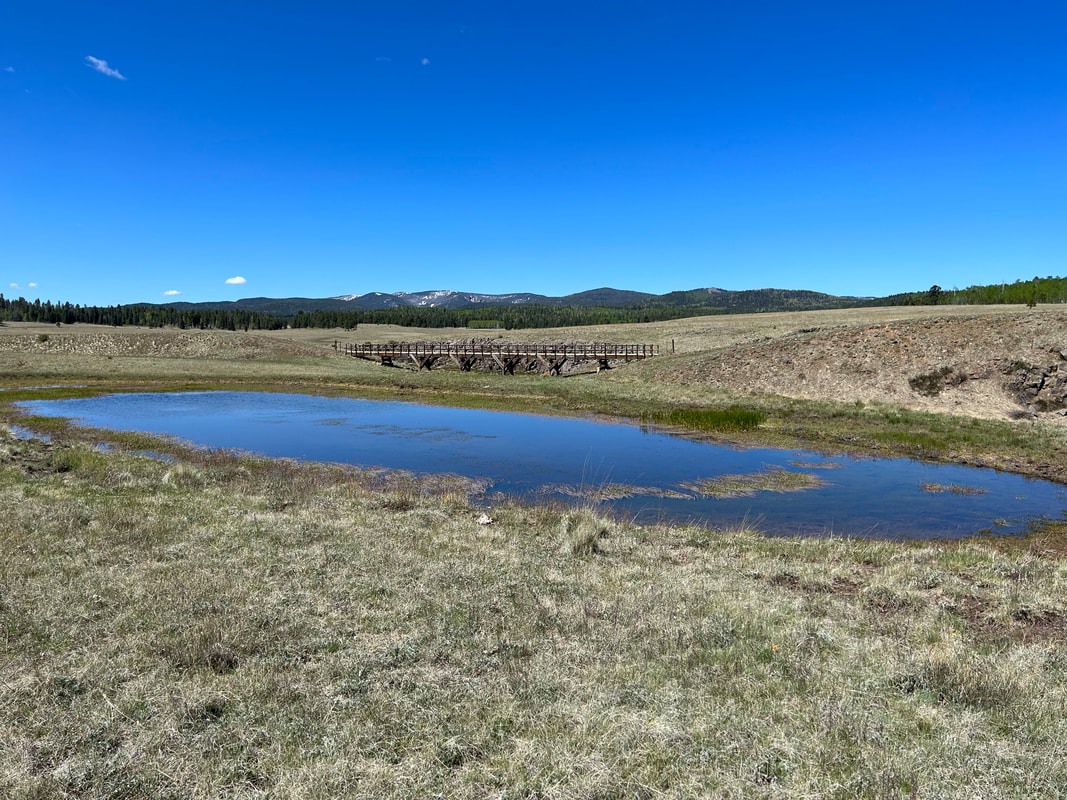
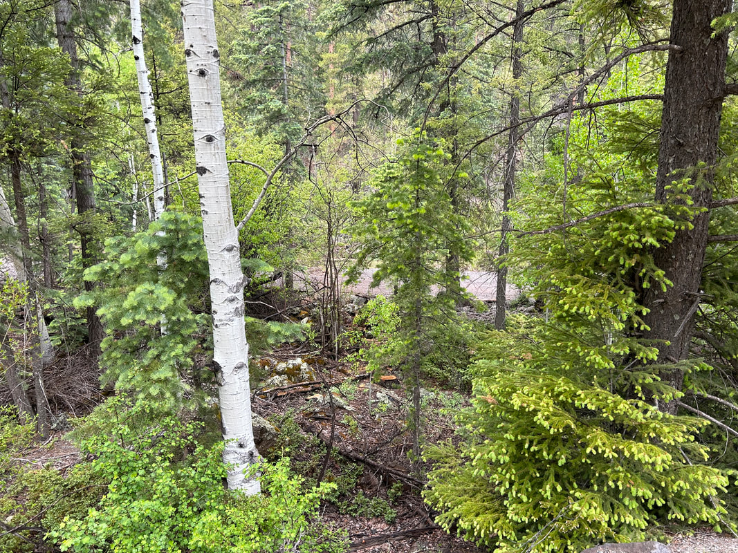
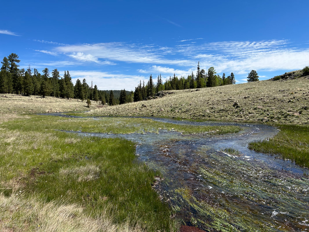
Begin in Show Low, AZ on the edge of the White Mountains. Ride out of the city along the shoulder of US 60 before turning onto dirt around Porter Mountain - this is the entry-point for the Apache-Sitgreaves National Forest, the main public land domain on the route. Go around the mountain to join Porter Mountain Road and descend to the quiet high-desert town of Vernon. Once here, resupply with water and then ride back up and into the mountains. You'll leave the juniper foothills behind as ponderosas and oaks begin to grow thickly along the edge of red cinder roads. Eventually, aspen and firs pop up as altitude increases. Exit the forest onto US 260 to head down into the mountain town of Greer. The area is lined with large ponds and creeks flowing through a verdant valley nestled between mountains. After a large climb out of Greer, you'll will enter the high subalpine valleys famous for the White Mountains.
Head towards snow-capped 11,409 foot Mount Baldy before jumping on the Apache Railroad Trail that takes bikepackers down to the West Fork of the Little Colorado River. Its gushing headwaters originate here on flanks of the second highest peak in Arizona before flowing down the mountain through thickets of spruce, willow, and aspen. Beavers live in the river and regularly dam sections of it, so keep an eye out to spot one. For riders wanting to avoid the primitive singletrack of The Apache Railroad Trail, there are alternate options to stick to the highway. The Apache Railroad Trail carries riders further into the montane forests before spilling them out into subalpine meadows coursing with creeks coming from snowmelt. Head up dirt road FR 409 that winds well above 9000 feet across exposed highlands pocked with lakes, grasslands, and small peaks wrapped in trees. Stop at Point of the Mountain Overlook to gaze at the Springerville Volcanic Field before descending to Springerville proper. For riders interested in a shortcut, turn right on Water Canyon Road (removes about 28 miles but you miss out on a resupply in Springerville and seeing Sipe White Mountain Wildlife Area).
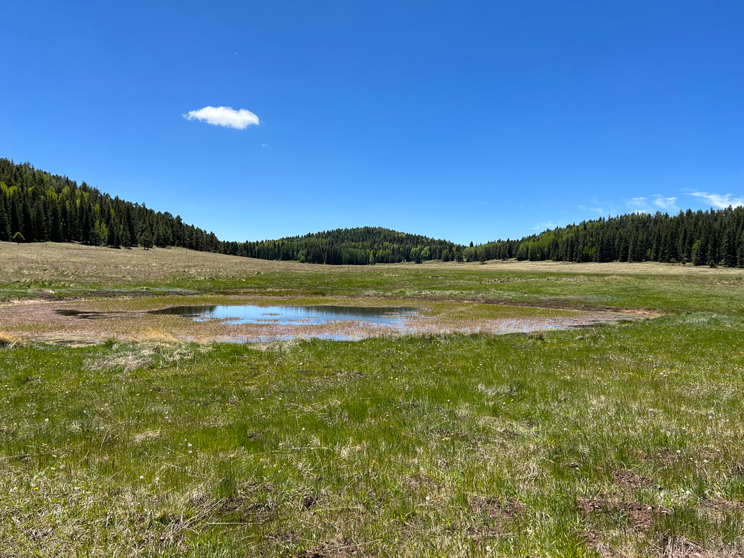
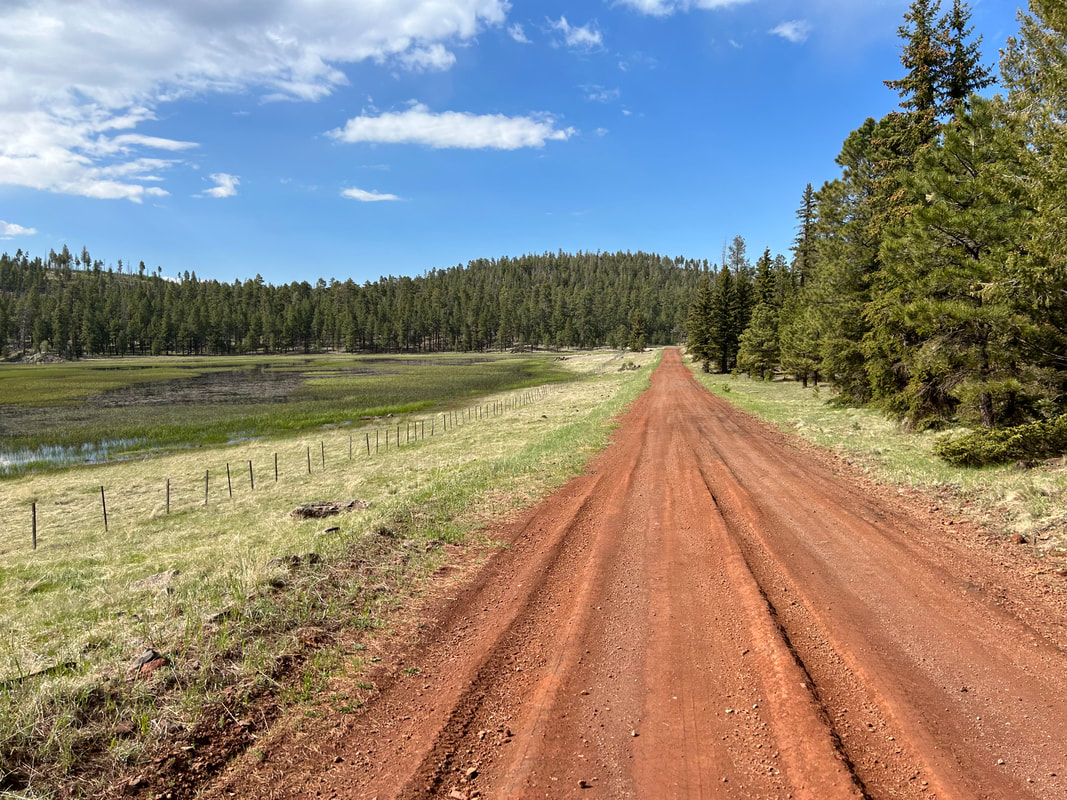
Springerville sits at 7000 feet in juniper-pinyon grasslands. It can get hot here so get an early start to ride out of the city up to Sipe White Mountain Wildlife Area. You'll bike along the roofs of savannah mesas, pass by the Visitor Center (make sure to stop and check out the excellent exhibits and lush picnic areas!), and start a long climb back up to 9000 feet via FR 85. You'll bike through the first of several burn scars from the 2011 Wallow Fire (more information below). Notice how dense groves of aspen are regrowing along the mountains as ecological succession occurs. A turn will bring you up FR 285 through ever-thickening groves of mature, unburnt spruce and firs before leading you back through successive waves of high-altitude grassland seas spotted with islands of lakes and peaks. You'll come to Williams Valley and the Three Forks area - these are favorite snow recreation areas in the winter and ecologically diverse spots. Keep an eye open for Big Horn Sheep here.
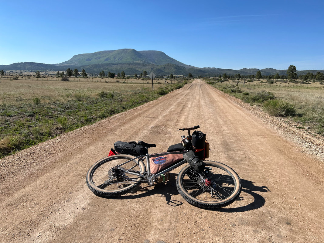
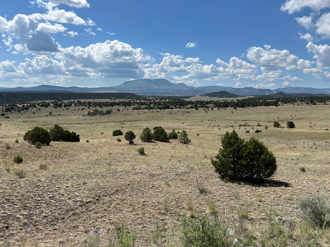
After a winding ride along the flanks of South Mountain, you will arrive in the town of Alpine, AZ at 8,000 feet. Resupply at the local general stores before starting a circumference ride around Escudilla Mountain. For riders interested in a shortcut, turn right on HWY 180 (removes about 53.5 miles, but you miss out on a ride around Escudilla Mountain as well as riding up to Terry Flat, the high point of the route). The beginning requires ascending up a large-shouldered highway to the Alpine Divide before descending down to the juniper-pinyon grasslands blanketing the feet of the mountain. Escudilla means "bowl" in Spanish - a reference to this volcanic cratered peak which is also Arizona's third tallest mountain at 10,916 feet. A side-ride will take you up a small loop at 10,000 feet along Terry Flat. It's a steep and tough ascent but absolutely worth it on top as you'll spin through dense aspen groves, burn scars, and along meadows filled with elk and home to wolves. This mountain was also where the last grizzly bear was killed in Arizona in the 1930s. A side-hike on Escudilla National Recreation Trail takes one to the mountain's namesake lookout where Aldo Leopold worked. Leopold is considered the father of wildlife ecology and his writings helped to inform the fledging land ethic and modern Wilderness designations. It was in his killing of a female lobo in the region that Leopold famously wrote, "We reached the old wolf in time to watch a fierce green fire dying in her eyes. I realized then and have known ever since that there was something new to me in those eyes, something known only to her and to the mountain. I was young then and full of trigger-itch; I thought that because fewer wolves meant more deer, that no wolves would mean hunters’ paradise. But after seeing the green fire die, I sensed that neither the wolf nor the mountain agreed with such a view.” (A Sand County Almanac).
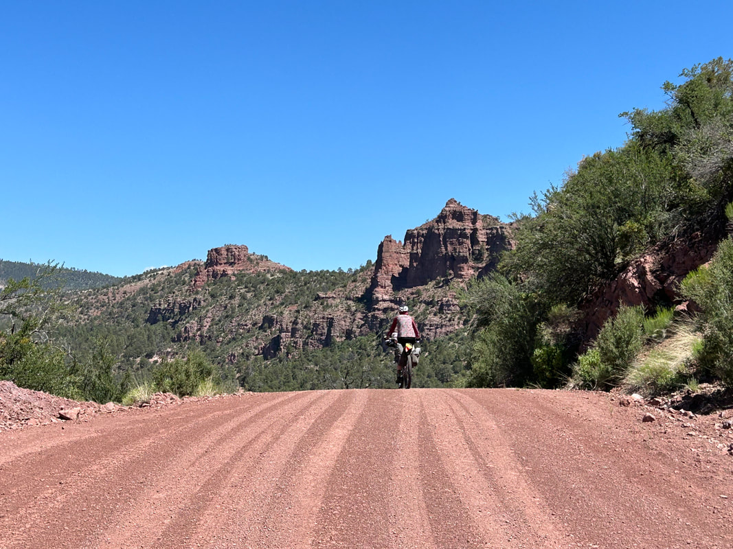
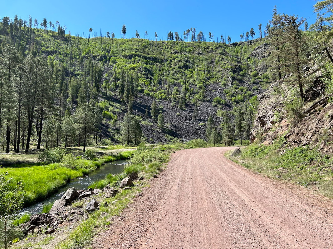
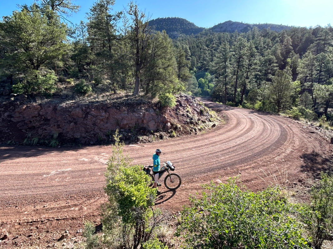
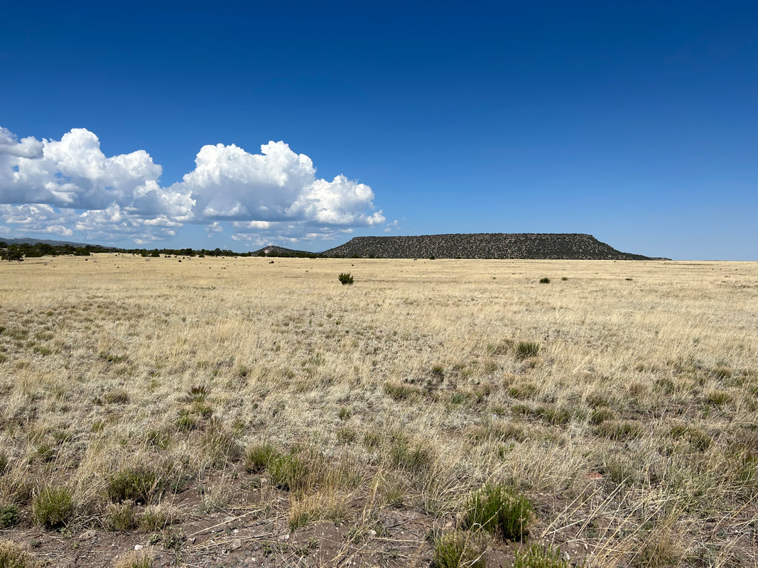
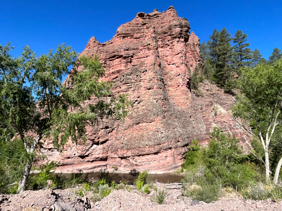
After descending, you'll wrap around the mountain along smooth dirt roads and steep ascents back to the outskirts of Alpine. Resupply again as the next push requires several days riding before an opportunity for a store. Head back out of Alpine along the side of the highway briefly before turning towards the small Arizona community of Blue. Blue is located at the lowest point of the route at 5,800 feet, meaning a long gradual downhill off of the Mogollon Rim. As you descend, the vegetation will become more arid-adapted as the route travels along the outskirts of the Blue Range Primitive Area. The Blue Range Primitive Area is the last such designated Primitive Area in the United States, although it's managed similarly as federal Wilderness. This landscape is a crumpled mass of mountains spilling and sluicing downwards along valley drainages to an eventual meeting with the Gila River. It is a rugged, gorgeous land to look at. The Blue River will adjoin your ride downwards as riparian Cottonwoods spring up. Cross the Blue River at the bottom before beginning a steeper ascent back up to elevation through the Red Hills area. Vermilion spires and columns will stand starkly as iron-rich rock juts from the surrounding hills in formations similar to Sedona. Finally, at 8,000 feet, you'll return to the Mogollon Rim and enter thick ponderosa stands.
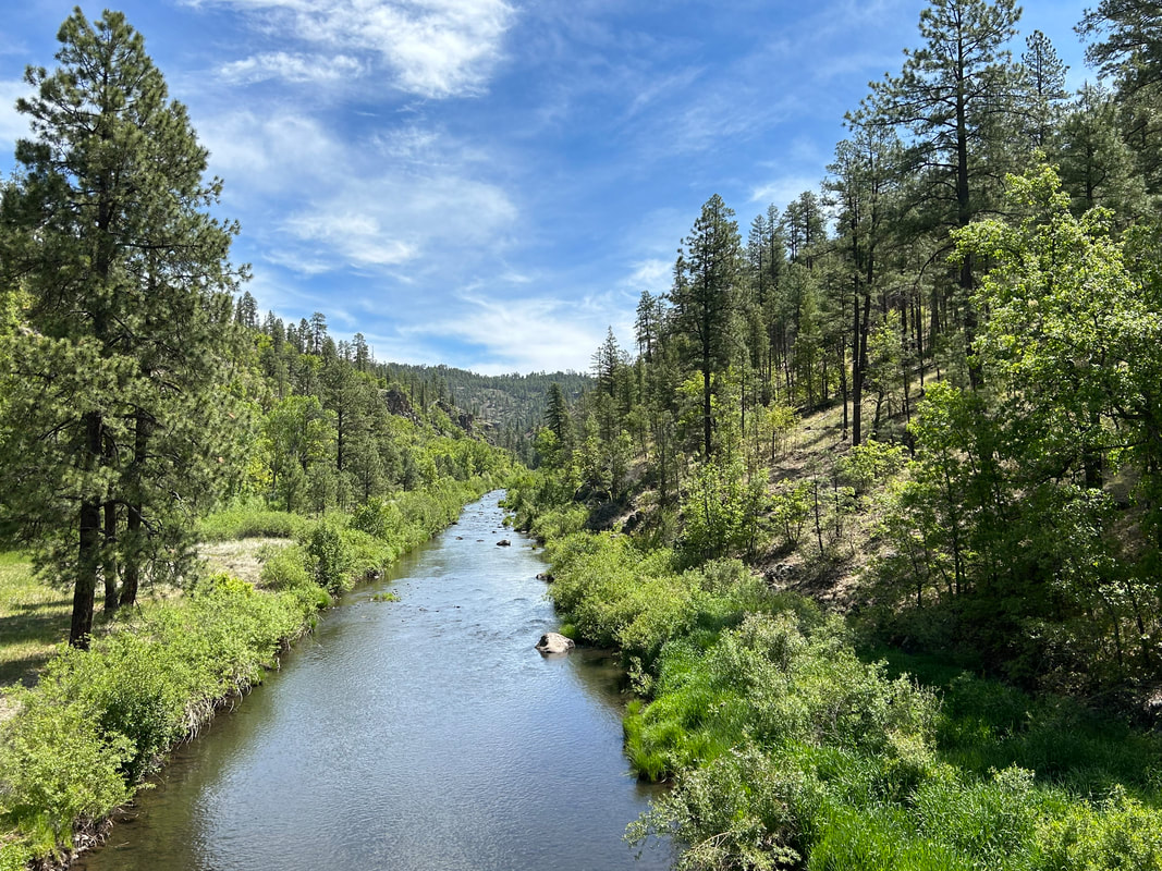
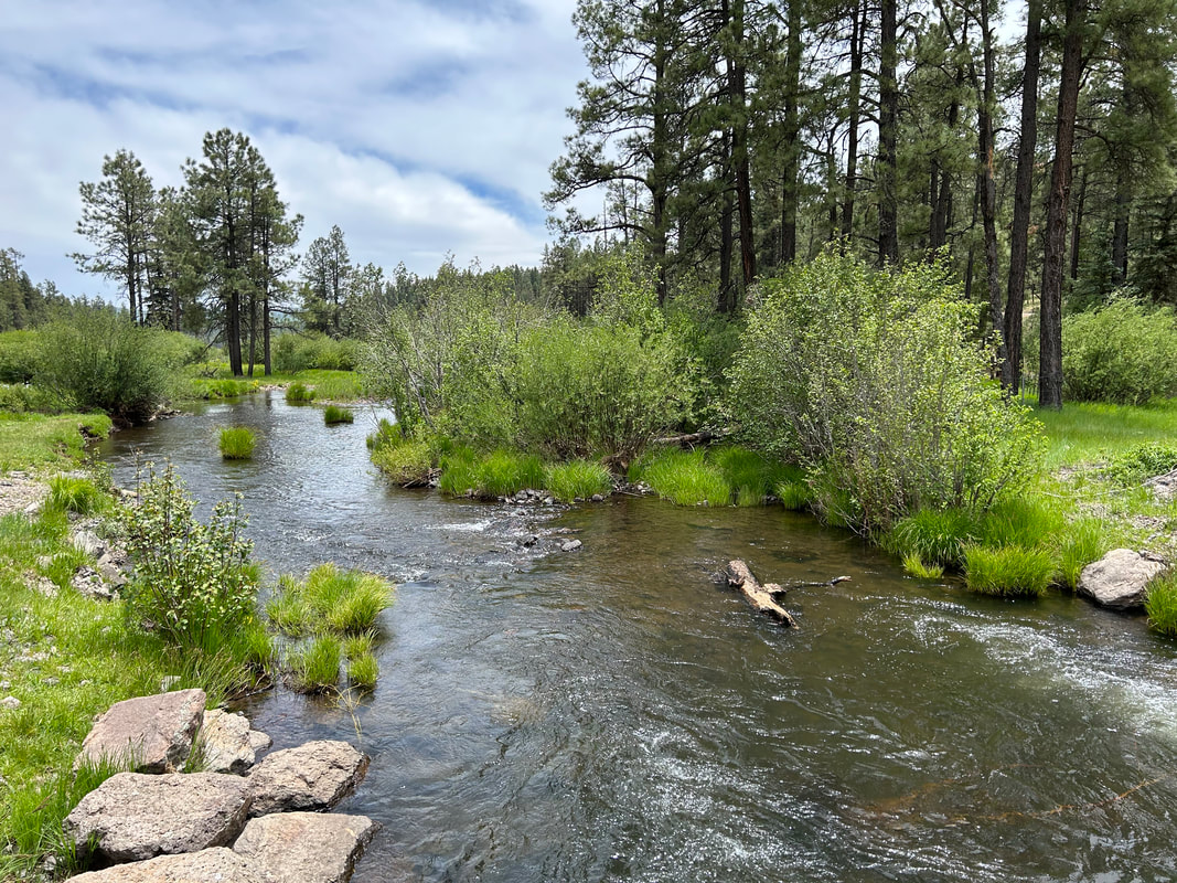
Ride along a ridge of Middle Mountain that heads through the heart of a burn scar from the Wallow Fire. The landscape will be exposed and filled with splintered trees along the horizon. However, the views are expansive and tremendous. You'll reenter thick forest and begin a sudden descent through lush foliage down to the East Fork of the Black River. The Black River is wide, clear, gushing, and reliable. You'll bike along its direct banks for several miles under the shade of trees in a notable canyon. Swim, relax, and camp; the Black River is famous for its trout fishing so bring a pole if can.
After several miles, you'll leave the Black River behind and climb up out of its canyon towards large ponderosa grasslands speckled with pronghorn. The trees will fade as you enter another Wallow Fire burn scar. Begin a steep, often rocky ascent up a mountain along a series of winding switchbacks that intermittently wander through new aspen growth and bare grassy flanks. Near the top, you'll reenter unburned forest thick with aspen and spruce at well over 9,000 feet. A dirt 4WD road will take you out out to the highway and Hannagan Meadow. Hannagan Meadow is a richly green, moisture-heavy meadow famous in Arizona for its lush colors, remoteness, beautiful campground, and Hannagan Meadow Lodge. Grab a meal here (there is no general store) before riding along the highway out to Blue Vista. Blue Vista provides an overlook out to the distant desert and Sky Islands region around Mt. Graham. Turn around and head into the forest once more.
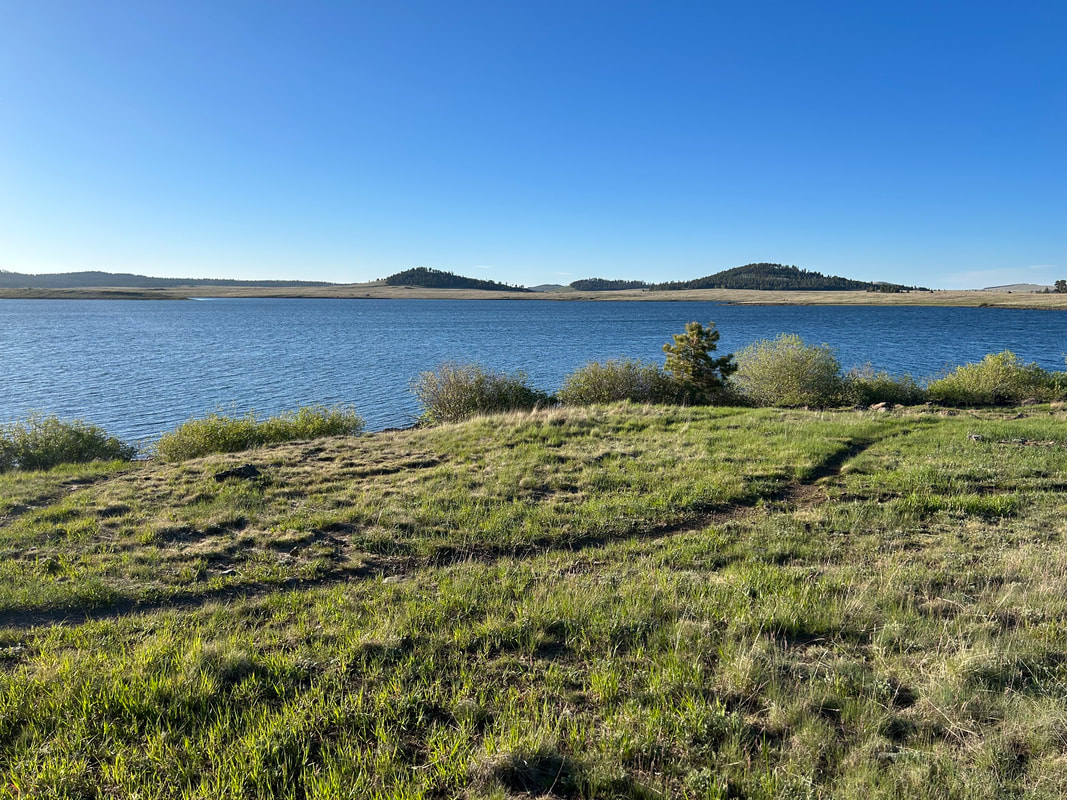
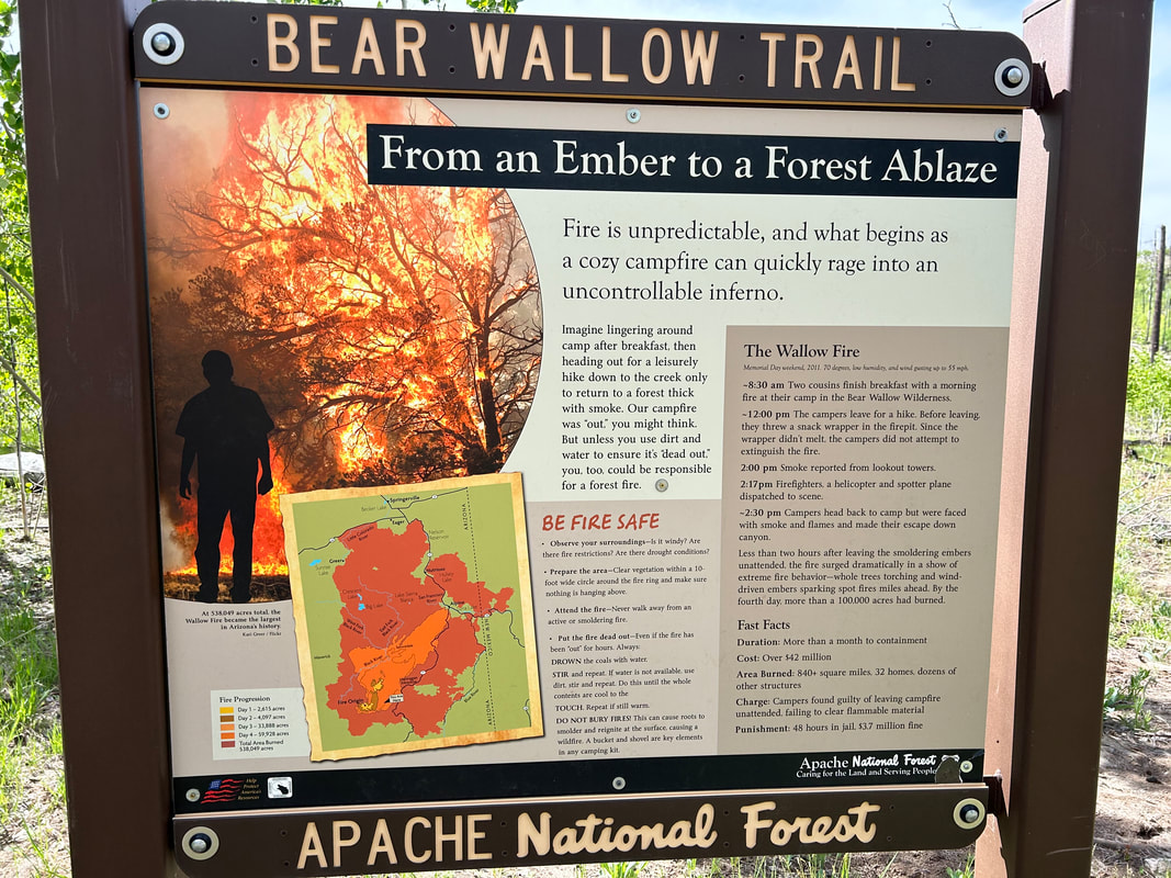
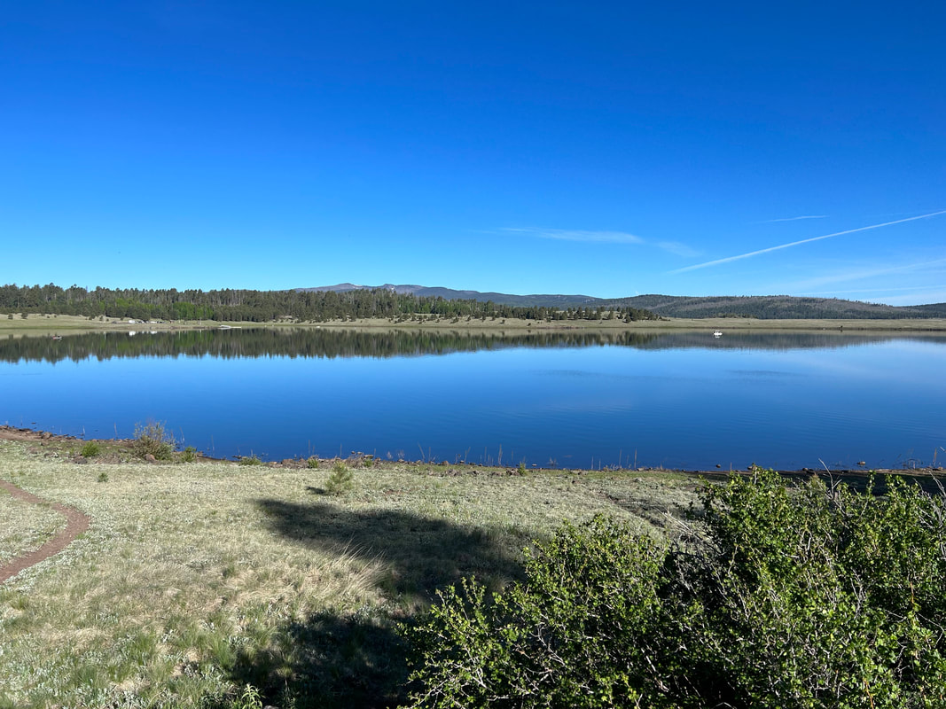
You'll begin descending and biking along the outer edge of the Bear Wallow Wilderness. This is the spot where two cousins infamously left a live campfire in 2011 that resulted in the largest wildfire in Arizona history. The burn scars are evident in a mosaic patchwork over the surrounding mountainsides. Descend a few thousand feet to another view of the East Fork of the Black River at Wildcat Crossing. Peer up the gorgeous river gorge on both sides of the bridge before beginning a long climb up and over some adjoining flanks that bring you to the West Fork of the Black River. This is a good spot for a reliable water refill before an even longer climb through another burn scar up to over 9,000 feet again. The burn scar will give way to mature montane groves as you reenter the subalpine grasslands surrounding popular Big Lake. Get camping reservations beforehand if you want to stay at its many campgrounds; it's also a popular fishing destination.
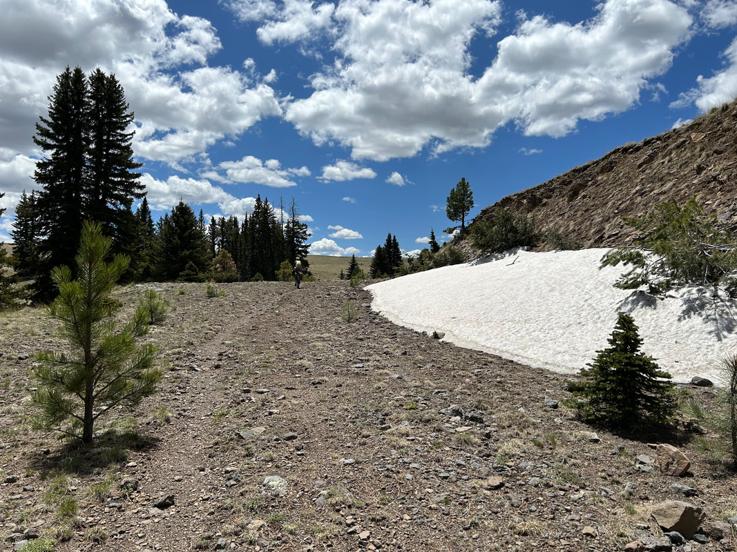
The route travels around Big Lake to the Apache Railroad Trail. Either take the often-grassy trail through meadows or take the paved highway alternate for smoother terrain. You'll eventually rejoin the highway regardless before heading back towards the flanks of Mount Baldy and crossing the Little Colorado River forks. Near the turn for Greer, you'll take the Apache Railroad Trail one last time across a scenic bridge, through aspen, and out towards Sunrise Lake. Here, you'll join FR 112 and head north across large meadows that often hold snow banks even into early summer. Be on the lookout for large herds of Elk. You'll reach the highway for a short spin before turning on FR 117 and heading towards Greens Peak. This is the second highest point on the route at 9,600 feet. This means that miles of descent lie ahead as you plunge into the lush montane forest and start a return to Show Low. The trees will change from aspen and spruce to ponderosa and finally pinyon-juniper grasslands as you pass through Pinetop, go around Porter Mountain once more, and finish the loop-us.
Head towards snow-capped 11,409 foot Mount Baldy before jumping on the Apache Railroad Trail that takes bikepackers down to the West Fork of the Little Colorado River. Its gushing headwaters originate here on flanks of the second highest peak in Arizona before flowing down the mountain through thickets of spruce, willow, and aspen. Beavers live in the river and regularly dam sections of it, so keep an eye out to spot one. For riders wanting to avoid the primitive singletrack of The Apache Railroad Trail, there are alternate options to stick to the highway. The Apache Railroad Trail carries riders further into the montane forests before spilling them out into subalpine meadows coursing with creeks coming from snowmelt. Head up dirt road FR 409 that winds well above 9000 feet across exposed highlands pocked with lakes, grasslands, and small peaks wrapped in trees. Stop at Point of the Mountain Overlook to gaze at the Springerville Volcanic Field before descending to Springerville proper. For riders interested in a shortcut, turn right on Water Canyon Road (removes about 28 miles but you miss out on a resupply in Springerville and seeing Sipe White Mountain Wildlife Area).
Springerville sits at 7000 feet in juniper-pinyon grasslands. It can get hot here so get an early start to ride out of the city up to Sipe White Mountain Wildlife Area. You'll bike along the roofs of savannah mesas, pass by the Visitor Center (make sure to stop and check out the excellent exhibits and lush picnic areas!), and start a long climb back up to 9000 feet via FR 85. You'll bike through the first of several burn scars from the 2011 Wallow Fire (more information below). Notice how dense groves of aspen are regrowing along the mountains as ecological succession occurs. A turn will bring you up FR 285 through ever-thickening groves of mature, unburnt spruce and firs before leading you back through successive waves of high-altitude grassland seas spotted with islands of lakes and peaks. You'll come to Williams Valley and the Three Forks area - these are favorite snow recreation areas in the winter and ecologically diverse spots. Keep an eye open for Big Horn Sheep here.
After a winding ride along the flanks of South Mountain, you will arrive in the town of Alpine, AZ at 8,000 feet. Resupply at the local general stores before starting a circumference ride around Escudilla Mountain. For riders interested in a shortcut, turn right on HWY 180 (removes about 53.5 miles, but you miss out on a ride around Escudilla Mountain as well as riding up to Terry Flat, the high point of the route). The beginning requires ascending up a large-shouldered highway to the Alpine Divide before descending down to the juniper-pinyon grasslands blanketing the feet of the mountain. Escudilla means "bowl" in Spanish - a reference to this volcanic cratered peak which is also Arizona's third tallest mountain at 10,916 feet. A side-ride will take you up a small loop at 10,000 feet along Terry Flat. It's a steep and tough ascent but absolutely worth it on top as you'll spin through dense aspen groves, burn scars, and along meadows filled with elk and home to wolves. This mountain was also where the last grizzly bear was killed in Arizona in the 1930s. A side-hike on Escudilla National Recreation Trail takes one to the mountain's namesake lookout where Aldo Leopold worked. Leopold is considered the father of wildlife ecology and his writings helped to inform the fledging land ethic and modern Wilderness designations. It was in his killing of a female lobo in the region that Leopold famously wrote, "We reached the old wolf in time to watch a fierce green fire dying in her eyes. I realized then and have known ever since that there was something new to me in those eyes, something known only to her and to the mountain. I was young then and full of trigger-itch; I thought that because fewer wolves meant more deer, that no wolves would mean hunters’ paradise. But after seeing the green fire die, I sensed that neither the wolf nor the mountain agreed with such a view.” (A Sand County Almanac).
After descending, you'll wrap around the mountain along smooth dirt roads and steep ascents back to the outskirts of Alpine. Resupply again as the next push requires several days riding before an opportunity for a store. Head back out of Alpine along the side of the highway briefly before turning towards the small Arizona community of Blue. Blue is located at the lowest point of the route at 5,800 feet, meaning a long gradual downhill off of the Mogollon Rim. As you descend, the vegetation will become more arid-adapted as the route travels along the outskirts of the Blue Range Primitive Area. The Blue Range Primitive Area is the last such designated Primitive Area in the United States, although it's managed similarly as federal Wilderness. This landscape is a crumpled mass of mountains spilling and sluicing downwards along valley drainages to an eventual meeting with the Gila River. It is a rugged, gorgeous land to look at. The Blue River will adjoin your ride downwards as riparian Cottonwoods spring up. Cross the Blue River at the bottom before beginning a steeper ascent back up to elevation through the Red Hills area. Vermilion spires and columns will stand starkly as iron-rich rock juts from the surrounding hills in formations similar to Sedona. Finally, at 8,000 feet, you'll return to the Mogollon Rim and enter thick ponderosa stands.
Ride along a ridge of Middle Mountain that heads through the heart of a burn scar from the Wallow Fire. The landscape will be exposed and filled with splintered trees along the horizon. However, the views are expansive and tremendous. You'll reenter thick forest and begin a sudden descent through lush foliage down to the East Fork of the Black River. The Black River is wide, clear, gushing, and reliable. You'll bike along its direct banks for several miles under the shade of trees in a notable canyon. Swim, relax, and camp; the Black River is famous for its trout fishing so bring a pole if can.
After several miles, you'll leave the Black River behind and climb up out of its canyon towards large ponderosa grasslands speckled with pronghorn. The trees will fade as you enter another Wallow Fire burn scar. Begin a steep, often rocky ascent up a mountain along a series of winding switchbacks that intermittently wander through new aspen growth and bare grassy flanks. Near the top, you'll reenter unburned forest thick with aspen and spruce at well over 9,000 feet. A dirt 4WD road will take you out out to the highway and Hannagan Meadow. Hannagan Meadow is a richly green, moisture-heavy meadow famous in Arizona for its lush colors, remoteness, beautiful campground, and Hannagan Meadow Lodge. Grab a meal here (there is no general store) before riding along the highway out to Blue Vista. Blue Vista provides an overlook out to the distant desert and Sky Islands region around Mt. Graham. Turn around and head into the forest once more.
You'll begin descending and biking along the outer edge of the Bear Wallow Wilderness. This is the spot where two cousins infamously left a live campfire in 2011 that resulted in the largest wildfire in Arizona history. The burn scars are evident in a mosaic patchwork over the surrounding mountainsides. Descend a few thousand feet to another view of the East Fork of the Black River at Wildcat Crossing. Peer up the gorgeous river gorge on both sides of the bridge before beginning a long climb up and over some adjoining flanks that bring you to the West Fork of the Black River. This is a good spot for a reliable water refill before an even longer climb through another burn scar up to over 9,000 feet again. The burn scar will give way to mature montane groves as you reenter the subalpine grasslands surrounding popular Big Lake. Get camping reservations beforehand if you want to stay at its many campgrounds; it's also a popular fishing destination.
The route travels around Big Lake to the Apache Railroad Trail. Either take the often-grassy trail through meadows or take the paved highway alternate for smoother terrain. You'll eventually rejoin the highway regardless before heading back towards the flanks of Mount Baldy and crossing the Little Colorado River forks. Near the turn for Greer, you'll take the Apache Railroad Trail one last time across a scenic bridge, through aspen, and out towards Sunrise Lake. Here, you'll join FR 112 and head north across large meadows that often hold snow banks even into early summer. Be on the lookout for large herds of Elk. You'll reach the highway for a short spin before turning on FR 117 and heading towards Greens Peak. This is the second highest point on the route at 9,600 feet. This means that miles of descent lie ahead as you plunge into the lush montane forest and start a return to Show Low. The trees will change from aspen and spruce to ponderosa and finally pinyon-juniper grasslands as you pass through Pinetop, go around Porter Mountain once more, and finish the loop-us.
|
|
|
|
|
|
7. Route Difficulty, Surface Conditions, and Direction to Ride
Route Difficulty |
Physical Difficulty = 6/10
Technical Difficulty = 5/10
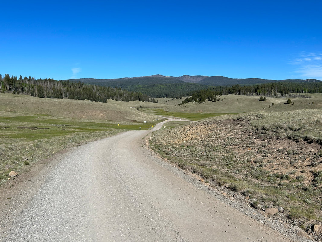
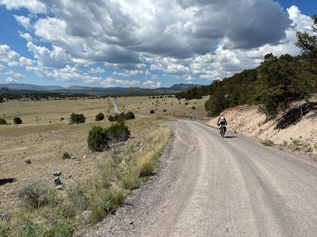
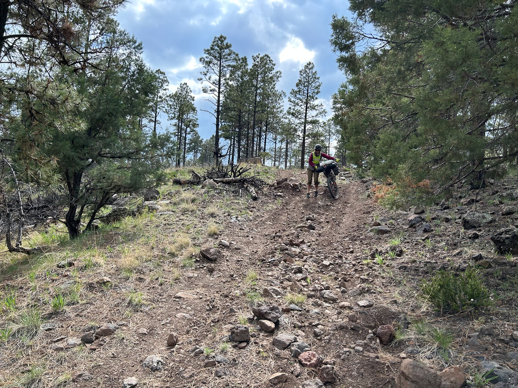
The technical difficulty of the route is due to the presence of sections of singletrack along the Apache Railroad Trail and several portions of the route that take rocky and steep 4x4 roads through burn scars up in the mountains. Luckily, these sections are infrequent and eclipsed by the common, broad, and well-maintained dirt roads that make up the majority of the route. These US Forest Service roads are typically in great shape and rarely rutted. Hero dirt and hard-packed smooth substrate make up a majority of the backroads that El Lobo Lupus sticks to.
The physical difficulty is mostly due to the amount of climbing on this route and some of the grades of the climbs - such is the payment for enjoying high-meadowed peaks and river-filled valleys. The White Mountains, Blue Range, and Mogollon Rim are high-elevation areas along a rugged mountainscape of crumpled land. Climbing long ascents each day is assured and should be expected. Some noteworthy climbs will take a good portion of the day to ascend and feature steep grades; these sharp inclines may warrant hike-a-bikes depending on your energy level.
Noteworthy Climbs
Lastly, there are conditions difficulties on this route. These include temperature, elevation, and exposure.
The difficulty ratings are based on Bikepacking Roots Route Rating Scale found below:
Technical Difficulty = 5/10
The technical difficulty of the route is due to the presence of sections of singletrack along the Apache Railroad Trail and several portions of the route that take rocky and steep 4x4 roads through burn scars up in the mountains. Luckily, these sections are infrequent and eclipsed by the common, broad, and well-maintained dirt roads that make up the majority of the route. These US Forest Service roads are typically in great shape and rarely rutted. Hero dirt and hard-packed smooth substrate make up a majority of the backroads that El Lobo Lupus sticks to.
The physical difficulty is mostly due to the amount of climbing on this route and some of the grades of the climbs - such is the payment for enjoying high-meadowed peaks and river-filled valleys. The White Mountains, Blue Range, and Mogollon Rim are high-elevation areas along a rugged mountainscape of crumpled land. Climbing long ascents each day is assured and should be expected. Some noteworthy climbs will take a good portion of the day to ascend and feature steep grades; these sharp inclines may warrant hike-a-bikes depending on your energy level.
Noteworthy Climbs
- Riding to the top of Escudilla Mountain and along Terry Flat
- The ascent out of Blue, AZ
- The rocky, steep climb up to Hannagan Meadow
- The climb from the Black River to Big Lake
Lastly, there are conditions difficulties on this route. These include temperature, elevation, and exposure.
- The high elevation gain and high altitude (10,000 feet) will challenge riders not acclimatized.
- High temperatures, exposed riding, and notable heat can be expected in the summer along the lower portions of the route that pass through Blue, Springerville, and Show Low.
- Burn scars present several long stretches where shade from the Sun and blockage from the wind can be rare.
The difficulty ratings are based on Bikepacking Roots Route Rating Scale found below:
Physical Difficulty |
Technical Difficulty |
5-6 – Rugged terrain with frequent climbs, some of which may be steep and unrelenting |
5-6 – Continuous sections of track may be rocky, loose, and steep; (e.g., 4×4 roads or singletrack in rugged/rocky terrain) suitable for riders with intermediate off-road experience |
Surface Conditions |
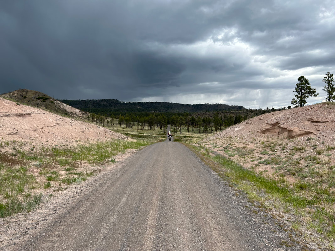
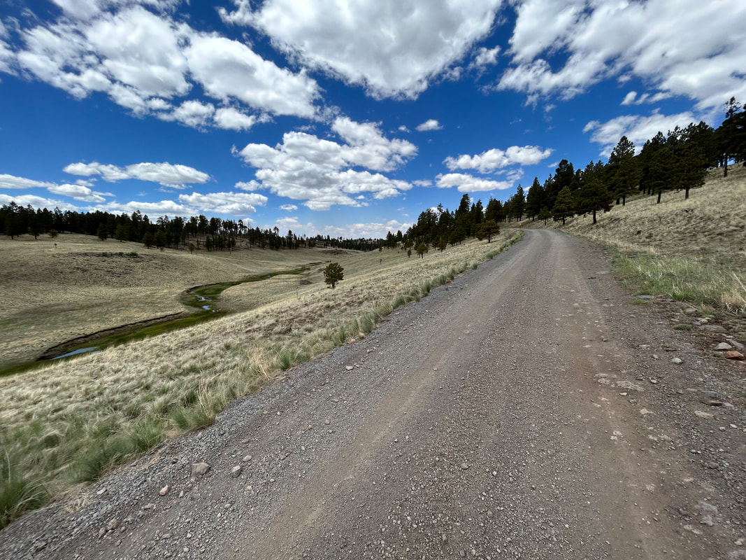
The White Mountains of the Apache-Sitgreaves National Forest have a network of broad, relatively smooth forest roads that El Lobo Lupus primarily follows. These roads are either hero dirt that is hard-packed and suitable for skinny tires or loosely graveled with little washboard. Most of the sections requiring pavement stick to roads and highways with broad shoulders or sidewalks. When shoulders are absent, paved roads tend to be in areas with fewer vehicles. Wear bright colors, use flashing lights, and ride defensively as proactive measures for safety along paved roads.
There are a few sections of rocky 4WD roads. They frequent the burn scars and lower elevations of the route, especially where ATVs are common. Expect long lengths of washboard, decaying road, and erosion. These will be bumpy but short-lived compared to the rest of the route.
If rain/snow are forecast, the lower elevation portions of the route may become peanut butter/death mud and impassable in places. This is especially true around Show Low, Pinetop, Vernon, Springerville, and Sipe White Mountain Wildlife Area. Leave No Trace and avoid riding at these times until the route dries out.
Noteworthy Primitive, Rocky Surfaces
Noteworthy Vehicular Pavement
There are a few sections of rocky 4WD roads. They frequent the burn scars and lower elevations of the route, especially where ATVs are common. Expect long lengths of washboard, decaying road, and erosion. These will be bumpy but short-lived compared to the rest of the route.
If rain/snow are forecast, the lower elevation portions of the route may become peanut butter/death mud and impassable in places. This is especially true around Show Low, Pinetop, Vernon, Springerville, and Sipe White Mountain Wildlife Area. Leave No Trace and avoid riding at these times until the route dries out.
Noteworthy Primitive, Rocky Surfaces
- The connector road between Point of the Mountain Overlook and Water Canyon Road on the way down to Springerville (The last bit of it is an ATV pumptrack that you may need to walk for how rutted, steep, and rocky it is; luckily it is a very short section).
- FR 403 that takes riders into Alpine is a 4WD road with some bumpier sections and some washboard.
- The climb up to Hannagan Meadow on FR 24 is especially rocky and eroded from its location in a burn scar.
- Some of the roads leading back to Show Low and Pinetop can be rutted out, especially where ATVs frequent.
- The Apache Railroad Trail is poorly maintained and little used singletrack, meaning it is often grassy and overgrown; its surface substrate is loose balls of cinder. Where it goes is beautiful, but if you want to skip it, I've included POIs on the RWGPS map indicating paved highway alternatives.
Noteworthy Vehicular Pavement
- The climb out of Springerville to Sipe White Mountain Wildlife Area: Although there is a guardrail and no shoulder, there is a passing lane allowing cars to safely get around you. The road is busy with cars and trucks. Climb early in the day to beat an increase in traffic.
- Porter Mountain Road outside of Pinetop: There are relatively good lines of sight. The road is busy. The further around Porter Mountain you get, the fewer the vehicles seem to become.
- Exiting and entering Show Low: Stick to the sidewalks while entering and leaving Show Low. The highway has a massive shoulder you can ride along.
- Vernon: This is a low-use road frequented by locals. It travels through small communities and along quiet backroads.
- HWY 373 into Greer: A high-use road off the highway for getting to Greer. Expect lots of traffic but a workable shoulder and good lines-of-sight.
- HWY 273 along the base of Mount Baldy: A workable shoulder, good lines-of-sight, but lots of vehicles including trucks and RVs. Absolutely gorgeous scenery.
- HWY 261 along Mexican Hay Lake: Low traffic and workable shoulders. Lots of places to pull off and take in the scenery along a quiet backroad highway.
- HWY 191 along the base of Escudilla: Lots of traffic but a fantastic shoulder.
- HWY 191 from Hannagan to Blue Vista: Small, but workable shoulder. Low traffic past Hannagan and great lines-of-sight.
|
|
|
|
|
|
|
|
Direction to Ride |
The route is intended to be ridden in a clockwise direction. The reasons for this include:
- A gradual opportunity to acclimatize to the altitude.
- More frequent resupplies and less big climbs in the beginning as strength is building. Less resupplies and bigger climbs at the end when the body is stronger.
- Saving Big Lake and some of the best meadows as a climax for the end.
8. When to Ride (Temperature + Climate)
When to Ride |
Time of Year |
Average Highs |
Average Lows |
Precipitation |
Snow |
Best Time |
Early Summer (Late May - Mid June) |
High Elevation (Alpine): 68 - 76 F Low Elevation (Blue): 78 - 88 F |
High Elevation (Alpine): 31 - 38 F Low Elevation (Blue): 37 - 45 F |
High Elevation (Alpine): 0.75 - 0.95" Low Elevation (Blue): 0.63 - 0.71" |
High Elevation (Alpine): 0.00 - 1.00" Low Elevation (Blue): N/A |
Best Time |
Fall (September - Early October) |
High Elevation (Alpine): 62 - 71 F Low Elevation (Blue): 72 - 81 F |
High Elevation (Alpine): 29 - 38 F Low Elevation (Blue): 35 - 45 F |
High Elevation (Alpine): 1.97 - 2.28" Low Elevation (Blue): 2.40 - 2.44" |
High Elevation (Alpine): 0.00 - 1.00" Low Elevation (Blue): N/A |
Doable |
Summer/Monsoon Season (Mid June - August) |
High Elevation (Alpine): 75 - 78 F Low Elevation (Blue): 85 - 88 F |
High Elevation (Alpine): 38 - 46 F Low Elevation (Blue): 45 - 52 F |
High Elevation (Alpine): 0.95 - 4.66" Low Elevation (Blue): 0.63 - 3.82" |
High Elevation (Alpine): 0.00" Low Elevation (Blue): N/A |
Not Recommended |
Winter (Late October - Mid May) |
High Elevation (Alpine): 45 - 65 F Low Elevation (Blue): 53 - 75 F |
High Elevation (Alpine): 14 - 30 F Low Elevation (Blue): 18 - 33 F |
High Elevation (Alpine): 0.74 - 1.97" Low Elevation (Blue): 0.63 - 2.40" |
High Elevation (Alpine): 1.00 - 10.00" Low Elevation (Blue): N/A |
All the data above are presented as ranges of monthly averages.
***Visit these links to view further climate information:
***Visit these links to view further climate information:
Time of Year |
Description of Conditions |
Early Summer (Late May - Mid June) |
|
Fall (September - Early October) |
|
Summer (Mid June - August) |
|
Winter (Late October - Mid May) |
|
9. Ecoregions and Landscape
|
|
|
El Lobo Lupus travels through and along three main regions of Arizona landscape: the White Mountains, the Mogollon Rim, and the Blue Range.
Conifer Woodlands and Savannas
Montane Conifer Forests
Arizona/New Mexico Subalpine Forests
Montane and Subalpine Grasslands
Semiarid Tablelands
Mogollon Transition Conifer Forests
Madrean Lower Montane Woodlands
Further Ecoregion Information: |
|
|
|
|
10. The Wallow Fire
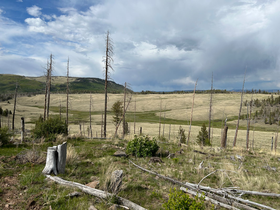
There is no escaping the large fire scars that will be visible on the route. For the most part, these are due to the 2011 Wallow Fire. The Wallow Fire cost $72 million to suppress and another $37 million to cleanup/rebuild. It is, to this day, the largest wildfire to occur in Arizona. By the end, the fire consumed numerous homes, structures, 841 square miles of land, 538,000 acres of the Apache-Sitgreaves National Forest, and forced the evacuation of thousands in both Arizona and New Mexico.
The fire started in the Bear Wallow Wilderness when two cousins left a supposedly-extinguished campfire. The strong winds that day whipped the campfire into an inferno that swept through the thick woodlands of the White Mountains. It had a severe economic impact on many of the towns. As you bike through this route, you will see remnants of the Wallow Fire in burn scars, littered trees, and stark mountainsides. But, you'll also see ecological succession at work: aspen is regaining footing as are grasses and young ponderosas. It's going to take decades more for the area to return to a strong canopy of well-seasoned trees, but there is beauty, vegetation, and growth even now in these areas. Wildlife is returning (I saw both bear tracks and wolf tracks along dirt roads in these burn scars).
The fire started in the Bear Wallow Wilderness when two cousins left a supposedly-extinguished campfire. The strong winds that day whipped the campfire into an inferno that swept through the thick woodlands of the White Mountains. It had a severe economic impact on many of the towns. As you bike through this route, you will see remnants of the Wallow Fire in burn scars, littered trees, and stark mountainsides. But, you'll also see ecological succession at work: aspen is regaining footing as are grasses and young ponderosas. It's going to take decades more for the area to return to a strong canopy of well-seasoned trees, but there is beauty, vegetation, and growth even now in these areas. Wildlife is returning (I saw both bear tracks and wolf tracks along dirt roads in these burn scars).
11. Where Bikes Are Allowed and Not Allowed
There are no specific restrictions for bicycles on this route. The Apache-Sitgreaves National Forest allows bicycles in most areas without limitation. The roads used on this route are open to most motorized vehicles. In sections where motorized vehicles are prohibited, bicycle-travel is permitted. There are four areas near the route (not on it) that are federally designated Wilderness - this means any travel in those areas must be non-mechanized (i.e. hiking or equestrian). They are:
The route does travel near the Fort Apache Reservation (home to the White Mountain Apache Tribe) and the San Carlos Reservation (home to the San Carlos Apache). There are many dirt roads that lead continuously from the Apache-Sitgreaves National Forest into both of these Tribal Lands. Respect Tribal Lands and do not ride without permission into these areas. There are permits available from the White Mountain Apache Tribe for boating, fishing, and camping on their land, but these must be obtained in advance.
- Mount Baldy Wilderness
- Escudilla Wilderness
- Bear Wallow Wilderness
- Blue Range Primitive Area (managed as Wilderness)
The route does travel near the Fort Apache Reservation (home to the White Mountain Apache Tribe) and the San Carlos Reservation (home to the San Carlos Apache). There are many dirt roads that lead continuously from the Apache-Sitgreaves National Forest into both of these Tribal Lands. Respect Tribal Lands and do not ride without permission into these areas. There are permits available from the White Mountain Apache Tribe for boating, fishing, and camping on their land, but these must be obtained in advance.
12. Native Nations and This Land
The White Mountains are the current and traditional home to several federally recognized tribes (as well as other non-federally recognized tribes), including the:
There are many different nations, communities, and sub-groups of the Western Apaches. This route predominately travels near the Reservation of the White Mountain Apache. Native people are absolutely still here in the area, and have been here for thousands of years.
As a bikepacker traveling across the landscape, make sure to (a) Recreate with Respect and (b) Act with care.
- White Mountain Apache
- San Carlos Apache
- Pueblo of Zuni
There are many different nations, communities, and sub-groups of the Western Apaches. This route predominately travels near the Reservation of the White Mountain Apache. Native people are absolutely still here in the area, and have been here for thousands of years.
As a bikepacker traveling across the landscape, make sure to (a) Recreate with Respect and (b) Act with care.
13. Leave No Trace and Bikepacking Ethics
Bikepackers, like all backcountry users, leave an impact on the land, vegetation, and wildlife of the places they travel through. Leave No Trace outlines specific actions that bikepackers can take to minimize their impact on the land. Below are some considerations I would urge bikepackers to consider that are specific to this area:
Avoid or Simply Don't Use Campfires
Climate change has been exasperating the aridity of the Southwest. Soils are drier, snowpack is lessening, air humidity is decreasing, and trees are dying from drought-associated stress. In foresummer (May/June) and windy days, conditions can be ripe for increasingly destructive wildfires. The largest wildfire in Arizona history was the Wallow Fire in 2011; it left a devestating outcome on both the landscape and the communities of the White Mountains. Enough negative consequences of human-caused wildfires from campfires has led me to almost entirely abandon the practice in the backcountry. I cook stoveless, I pack layers for the cold, and I bring food to build my metabolic heat when I know the temperature will drop. I urge other bikepackers to consider doing the same on this route. If you do want to cook with heat, avoid alcohol/cat stoves and use fuel-controlled stoves like Jetboils and Whisperlites.
Look but Don't Disturb or Photo-Geotag Cultural and Archeological Items
There are parts of this route that may pass by unmarked sensitive cultural/historical/archeological sites or items. If you see or stumble on something, look at it, enjoy it, and learn more about the item when back in the frontcountry. Leave it exactly where it is and do not collect it. DO NOT post locations, geotag photos, or post the items on social media.
Avoid touching these items as well. Remember that this place is a Living Landscape to many Native groups - this means all items contain a life force and are alive in some way that creates a balance of nature. Take on an approach that treats all things (animate, inanimate, natural, cultural, etc.) as deserving the respect, dignity, and privacy that we would want/expect for ourselves by others. Looking through this different "cultural lens" takes some work. Taking these actions are an opportunity to demonstrate respect and awareness of Indigenous perspectives of the world.
***Leave No Trace is much bigger than just these. Both Bikepacking Roots and Bikepacking.com have excellent resources on Leave No Trace for backcountry cyclists. These include:
Bikepacking Roots has the Love Where Your Ride Campaign where they partnered with the Leave No Trace Center for Outdoor Ethics to make bikepacking specific principles. Visit the site to see a breakdown of each principle listed above.
Backpacking.com has the Leave No Trace for Bikepackers: Ride. Camp. Respect principles where they outline many of the same items listed above but also include Know the Land and Represent the Community (both excellent inclusions). Visit their website to read more.
Avoid or Simply Don't Use Campfires
Climate change has been exasperating the aridity of the Southwest. Soils are drier, snowpack is lessening, air humidity is decreasing, and trees are dying from drought-associated stress. In foresummer (May/June) and windy days, conditions can be ripe for increasingly destructive wildfires. The largest wildfire in Arizona history was the Wallow Fire in 2011; it left a devestating outcome on both the landscape and the communities of the White Mountains. Enough negative consequences of human-caused wildfires from campfires has led me to almost entirely abandon the practice in the backcountry. I cook stoveless, I pack layers for the cold, and I bring food to build my metabolic heat when I know the temperature will drop. I urge other bikepackers to consider doing the same on this route. If you do want to cook with heat, avoid alcohol/cat stoves and use fuel-controlled stoves like Jetboils and Whisperlites.
Look but Don't Disturb or Photo-Geotag Cultural and Archeological Items
There are parts of this route that may pass by unmarked sensitive cultural/historical/archeological sites or items. If you see or stumble on something, look at it, enjoy it, and learn more about the item when back in the frontcountry. Leave it exactly where it is and do not collect it. DO NOT post locations, geotag photos, or post the items on social media.
Avoid touching these items as well. Remember that this place is a Living Landscape to many Native groups - this means all items contain a life force and are alive in some way that creates a balance of nature. Take on an approach that treats all things (animate, inanimate, natural, cultural, etc.) as deserving the respect, dignity, and privacy that we would want/expect for ourselves by others. Looking through this different "cultural lens" takes some work. Taking these actions are an opportunity to demonstrate respect and awareness of Indigenous perspectives of the world.
***Leave No Trace is much bigger than just these. Both Bikepacking Roots and Bikepacking.com have excellent resources on Leave No Trace for backcountry cyclists. These include:
- Plan Ahead + Prepare
- Travel + Camp on Durable Surfaces
- Dispose of Waste Properly
- Leave What You Find
- Minimize Campfire Impacts
- Respect Wildlife
- Be Considerate of Other Visitors
Bikepacking Roots has the Love Where Your Ride Campaign where they partnered with the Leave No Trace Center for Outdoor Ethics to make bikepacking specific principles. Visit the site to see a breakdown of each principle listed above.
Backpacking.com has the Leave No Trace for Bikepackers: Ride. Camp. Respect principles where they outline many of the same items listed above but also include Know the Land and Represent the Community (both excellent inclusions). Visit their website to read more.
14. Water Sources
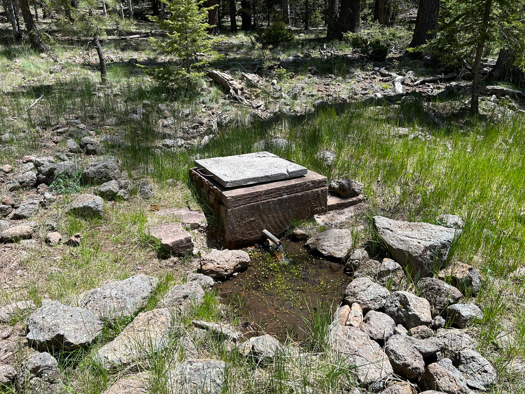
Due to their elevation and geological composition, the White Mountains are rich with water sources. There are numerous springs, ponds, lakes, rivers, creeks, and streams. Many are reliable or definite. This is still Arizona and the southwest though - it can get hot and exposed on a sunny day. Plus, there is lots of climbing. Make sure to carry a few liters at a time and plan ahead for how far it is to the next water source. Most of the seasonal water sources noted on the RWGPS map will run in early summer after a wet winter, but may be completely dry after a dry winter or further into the hot summer; don't rely on these too much.
You may see lakes, reservoirs, or streams that I haven't tagged with a POI on the map. That's often because these are more marsh-like with muddy/murky, plant-choked shores that would make obtaining water difficult. I avoided tagging these sources in lieu of clearer, more accessible sources.
***Water sources in the Southwest are often ephemeral or unreliable. To help give riders a sense of water availability, I've rated sources using the scale below.
Water Reliability Scale:
1 = unreliable; 2 = seasonal;
3 = mostly reliable; 4 = definite source
|
|
|
|
|
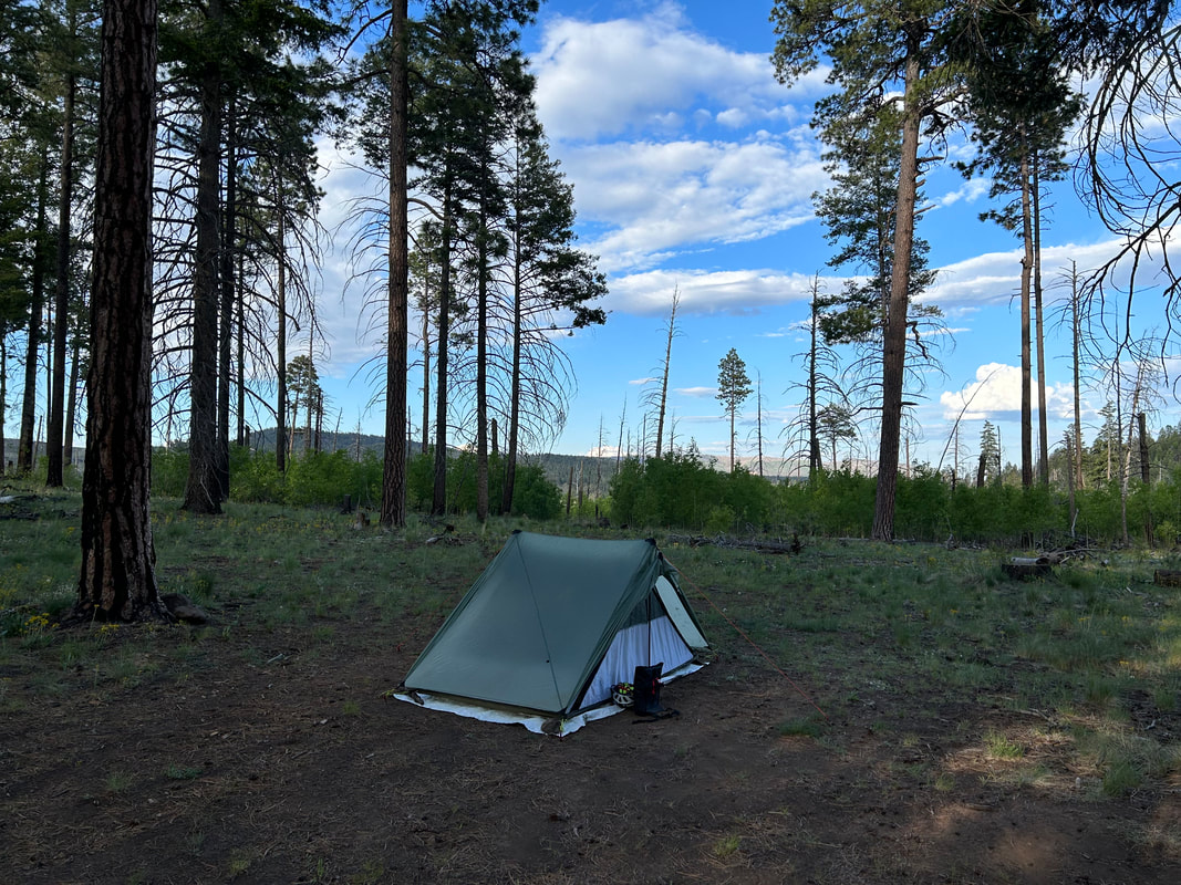
15. Camping
There are numerous awesome and free dispersed camping opportunities throughout this route. The Apache-Sitgreaves National Forest allows dispersed camping nearly everywhere. The only exceptions are the Mount Baldy/Lee Valley Recreation Area, the Greer Recreation Area, the Black River Recreation Area, and Sipe White Mountain Wildlife Area. There will be prominent signs delineating these boundaries; signs will indicate that camping is only allowed in designated sites. Don't dispersed camp in these zones.
Beyond that, there are copious free camping opportunities. I've put POIs on the map for noted USFS campgrounds that El Lobo Lupus passes. Some of these have a fee to stay in and others do not. There are a few lodging opportunities along the route at USFS cabins and motels in Springerville, Alpine, Greer, and Hannagan Meadow. Call ahead to make reservations because these fill up quick during the summer season.
Beyond that, there are copious free camping opportunities. I've put POIs on the map for noted USFS campgrounds that El Lobo Lupus passes. Some of these have a fee to stay in and others do not. There are a few lodging opportunities along the route at USFS cabins and motels in Springerville, Alpine, Greer, and Hannagan Meadow. Call ahead to make reservations because these fill up quick during the summer season.
16. Food and Resupplying
Most food resupplies on this route are only a few days apart. The largest resupply distance is during the last part between Alpine and Big Lake.
- Mile 63.2 - Greer, AZ: Lazy Trout Market, a few restaurants in the area
- Mile 102.5 - Eager, AZ: Bashas' Grocery, restaurants
- Mile 104.1 - Springerville, AZ: Safeway, many restaurants
- Mile 161.0 - Alpine, AZ: Alpine Country Store, Tackle Shop Gas Station, few restaurants
- Mile 214.3 - Alpine, AZ: A few miles off-route but a good chance to hit up the town again before the big stretch of no resupplies. Alpine Country Store, Tackle Shop Gas Station, few restaurants
- Mile 289.5 - Hannagan Meadow: Restaurant only - NO GROCERY
- Mile 335.9 - Big Lake: A mile or so off-route, but a solid connivence store selection at Big Lake General Store
- Mile 394.0 - Pinetop-Lakeside, AZ: Safeway, tons of restaurants
- Mile 411.0 - Show Low, AZ: Lots of grocery stores, lots of restaurants
17. Sample Route Itinerary
This is a sample itinerary of what I've done before when riding this route. Use it as a rough guide for your own planning purposes. Feel free to use it, adapt it, or don't use it all and make your own plans. Plan your trip on this route based on your own strengths, comfortabilities, experiences, wants, and needs.
Day |
Mileage |
Elevation Gain |
Route Description |
1 |
~40.5 Miles |
2970 ft. |
|
2 |
~25 Miles |
2420 ft. |
|
3 |
~43.5 Miles |
2670 ft. |
|
4 |
~43 Miles |
3750 ft. |
|
5 |
~38 Miles |
3600 ft. |
|
6 |
~40.5 Miles |
3050 ft. |
|
----- |
Optional: 0 Day |
----- |
|
7 |
~55 Miles |
5040 ft. |
|
8 |
~25 Miles |
2150 ft. |
|
9 |
~48 Miles |
3930 ft. |
|
10 |
~78 Miles |
3610 ft. |
|
18. Fees and Permits
There are no fees or permits to ride this route through the Apache-Sitgreaves National Forest.
19. Getting to the Start
There are several shuttle services that go between the Sky Harbor International Airport in Phoenix to Show Low. There are also many rental car companies in Phoenix, Greyhound provides a line between the cities, you can drive there with a personal vehicle, or you can you bike there!
20. Parking
I've secured permission from the Show Low Elks Lodge No. 2090 for bikepackers to park their cars on the premises. There is a $4 per night fee per vehicle for parking. Make sure to contact Catherine Cribbs via email ([email protected]) beforehand to secure permission and talk logistics; she'll be your point person. Let her know that you are a cyclist looking to ride/bikepack the El Lobo Lupus and the start/end dates for leaving your vehicle. However, this parking will be dependent on space. If there is a banquet hall rental or an event at the Elks, then cyclists will need to find another location to park.
A huge THANK YOU to the Show Low Elks for providing this parking!
A huge THANK YOU to the Show Low Elks for providing this parking!
21. Additional Important Information
- Hunting Season: Starts in September and goes through December. The White Mountains are a premier destination for big game hunting. Expect the forest in the autumn to be filled with hunters. You'll see more trucks, backcountry campers, ATVs, and individuals on foot. WEAR ORANGE and make yourself visible as you ride. Be smart and be seen during hunting season. Water sources and meadows may have more hunters scoping them out.
- Attitudes about Wolves: There are some real, open, hostile, and even aggressive sentiments against the Mexican Wolf in many places along this route. You'll routinely see signs posted by the Arizona Game and Fish Department offering $48,000 rewards for information leading to individuals illegally killing lobos (and these killings to do happen). You can expect to see posters, signs, banners, poems, and more reflecting some individuals' desires to exterminate or remove the wolves. There is also strong anti-US Forest Service and anti-government sentiment reflected in the decorum of some of the businesses of the towns you pass through. Make no mistake, livestock killings by wolves do happen and it impacts people's lives. Predator reintroduction is complex, difficult, and requires both science, politics, and relationship-building. Make sure to read the social situations you are in and judge how open you want to be about the wolves.
- Bears and Food Storage: Black bears are abundant throughout this entire route. Have a sure and proven method to safely secure and store your food each evening when you camp. This could be a bear hang, a bear canister, or an Ursack. All the campgrounds require food storage and have signs posted everywhere about being in "bear country."
22. Acknowledgements
I want to thank Darren and Janna for all the day rides we rode over the years in the White Mountains. I know they listened to me gush for hours about the possibilities of seeing wolves and what a bikepacking route could look like in the area. Those rides became the backbone scouting experiences that helped me put together this route. I want to thank the Show Low Elks Lodge #2090 and Catherine Cribbs for providing parking for riders on this route! I want to thank Mike and Annette Enfield in Show Low for providing me a base to ride and scout this route; their hospitality was simply amazing. I want to further thank Mike for (a) providing some excellent local's insight on best roads to take, navigating potential private property issues, and where best to find water in drier sections, as well as (b) agreeing to be co-steward of this route. Finally, I'd like to thank Bikepacking Roots for showcasing El Lobo Lupus under their Community Routes Project (CRoP).

23. Social Media and Route Updates
Route Updates:
Rider Feedback: Use the Comment box below or email me to give a trip report, list any concerns, or provide an update on the route. Make sure to give:
Rider Feedback: Use the Comment box below or email me to give a trip report, list any concerns, or provide an update on the route. Make sure to give:
- Date
- Location and Mile
- Feedback/Trip Report Details