|
0 Comments
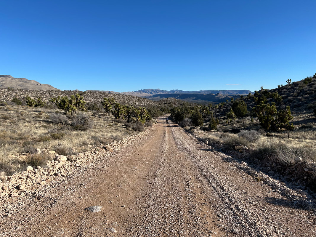
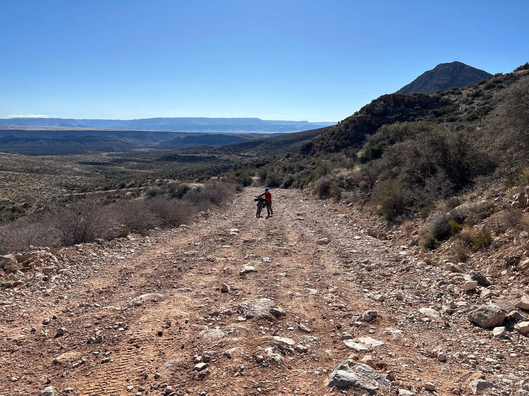
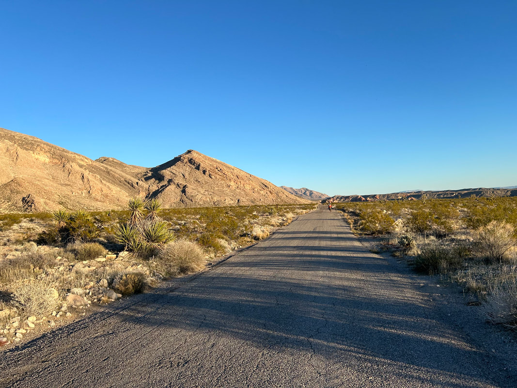
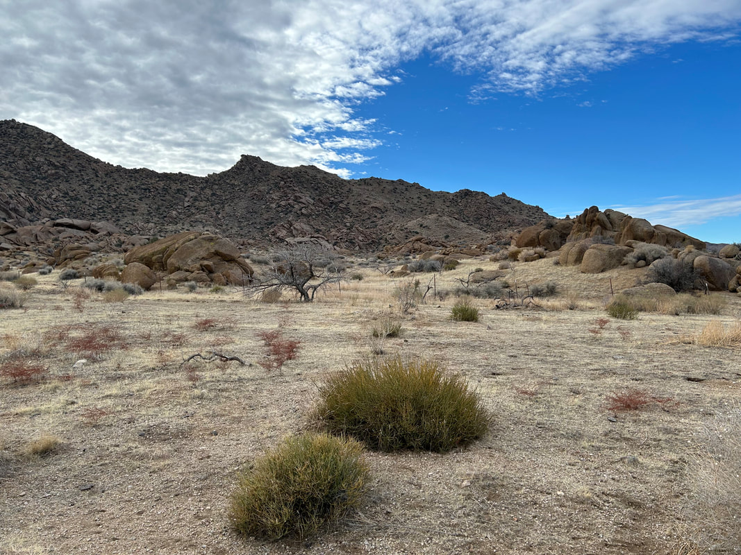
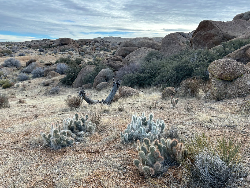
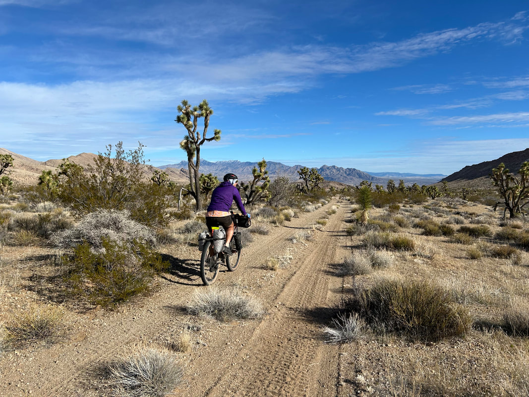
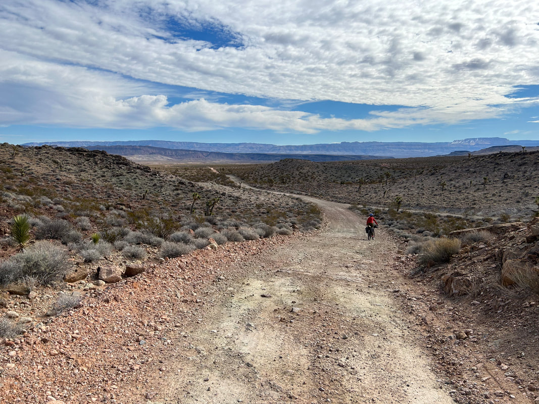
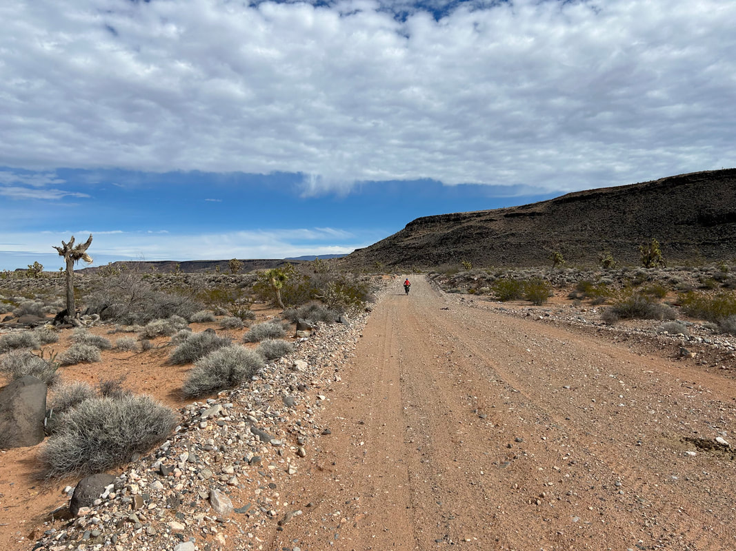
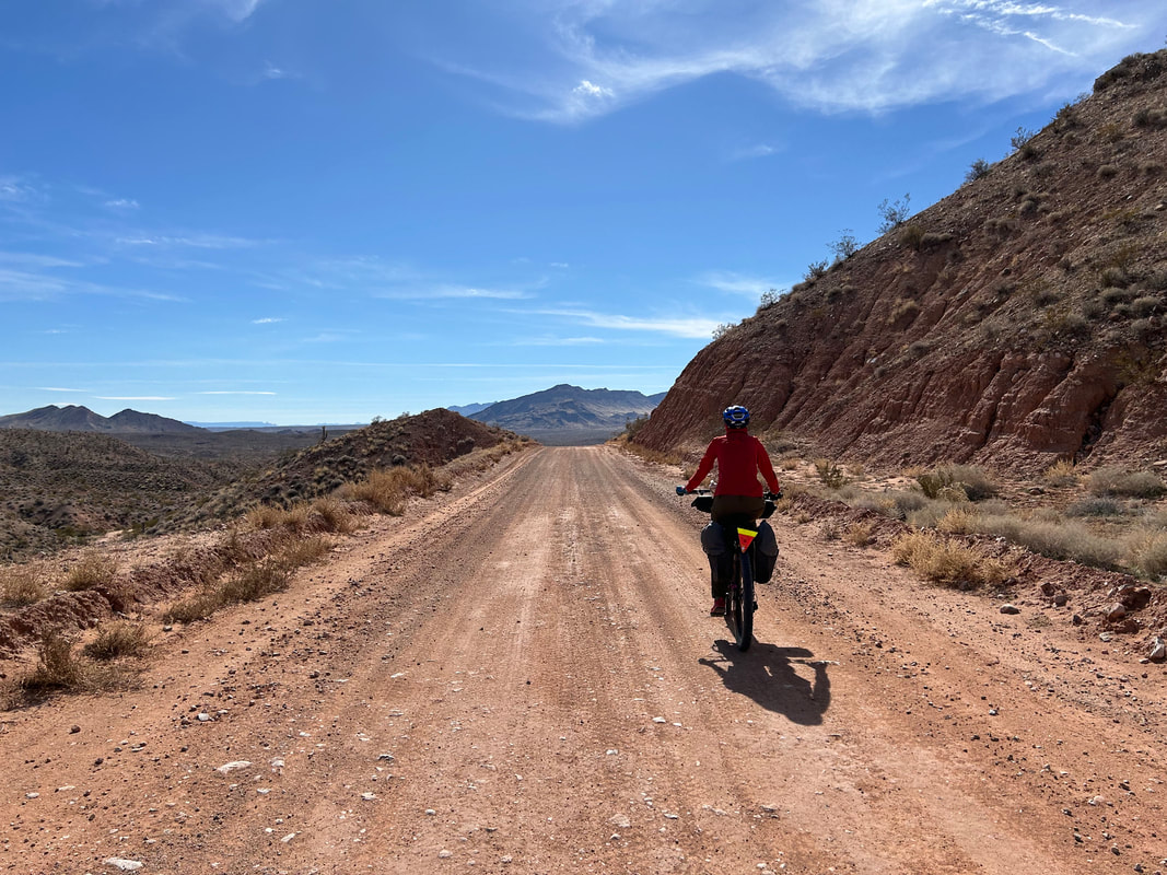
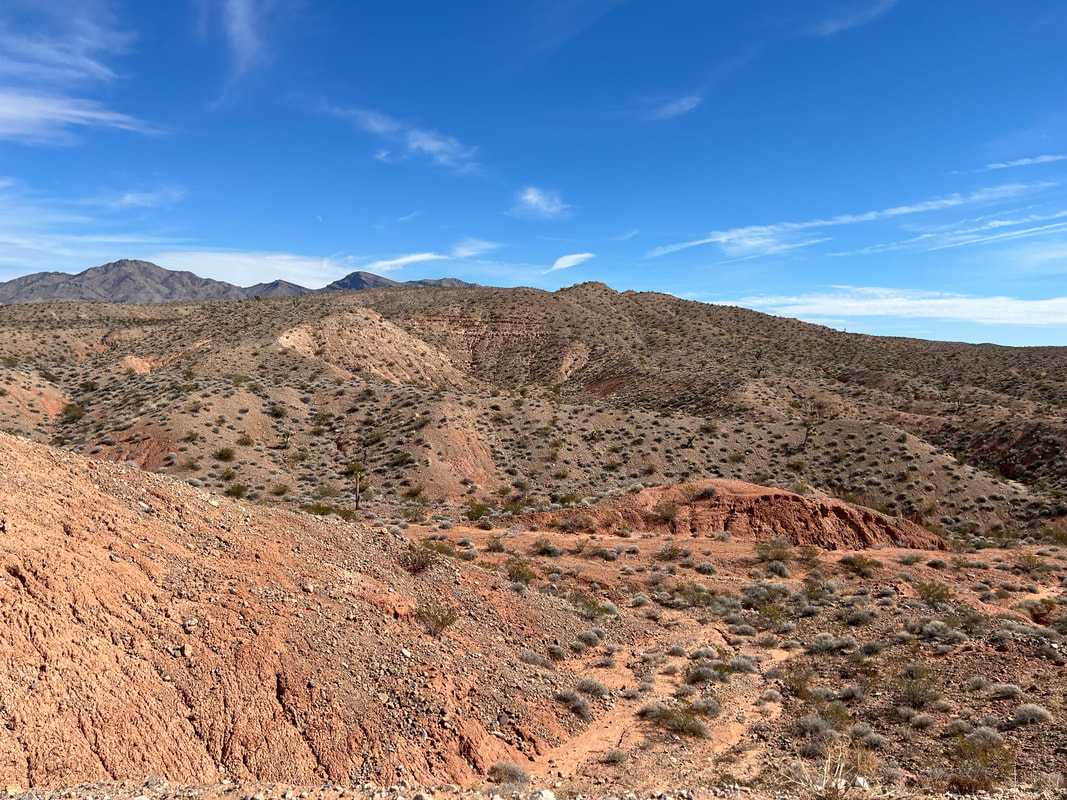
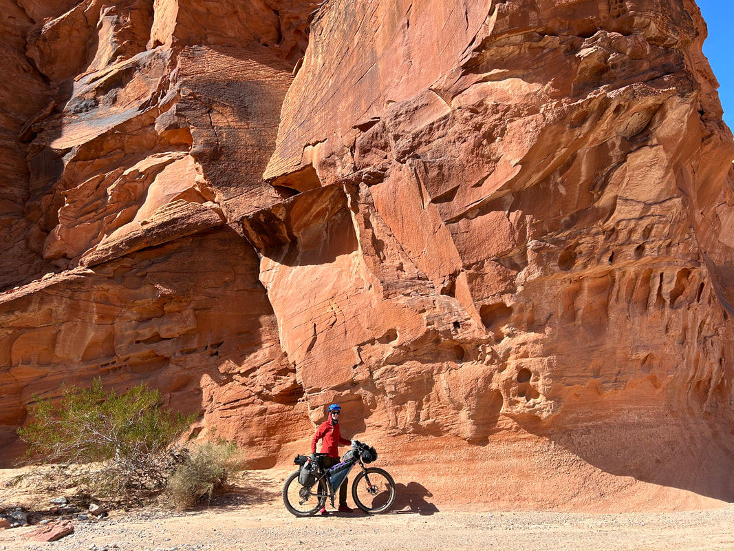
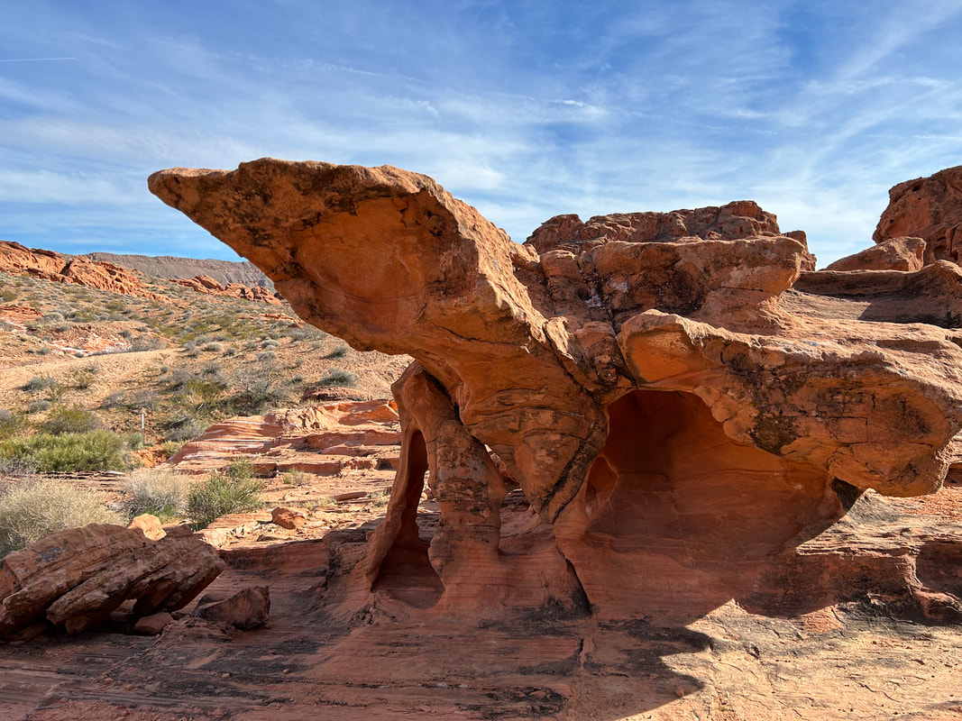
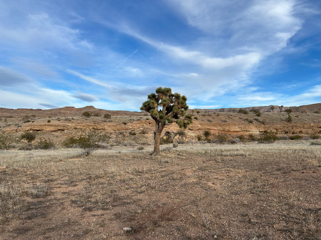
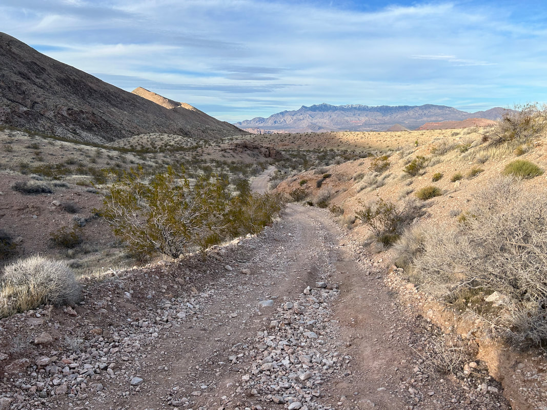
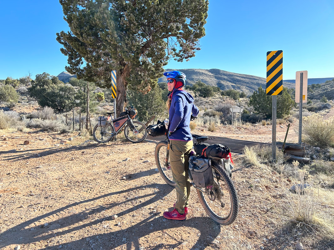
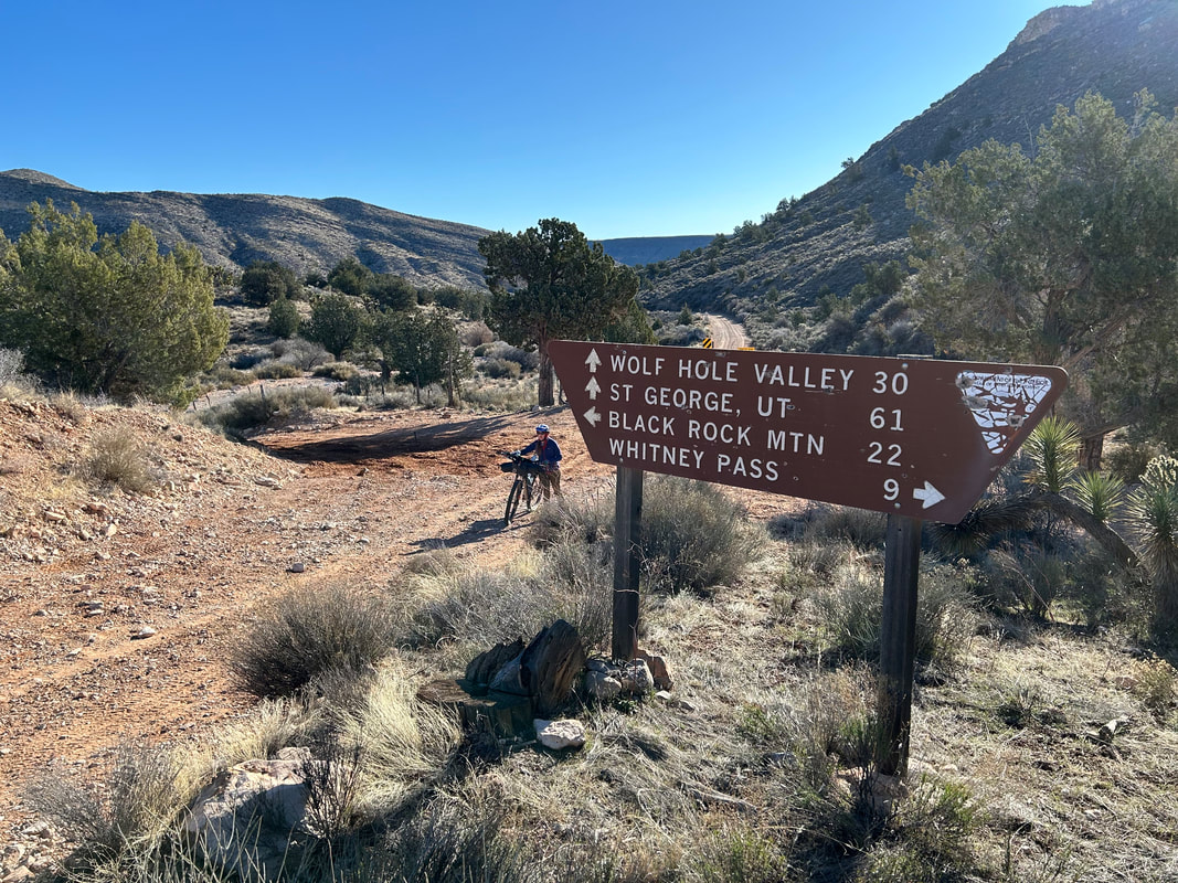
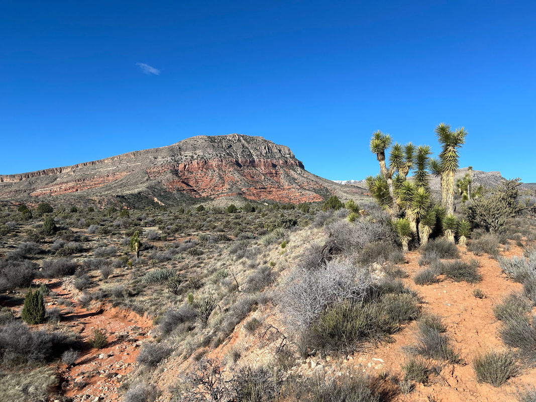
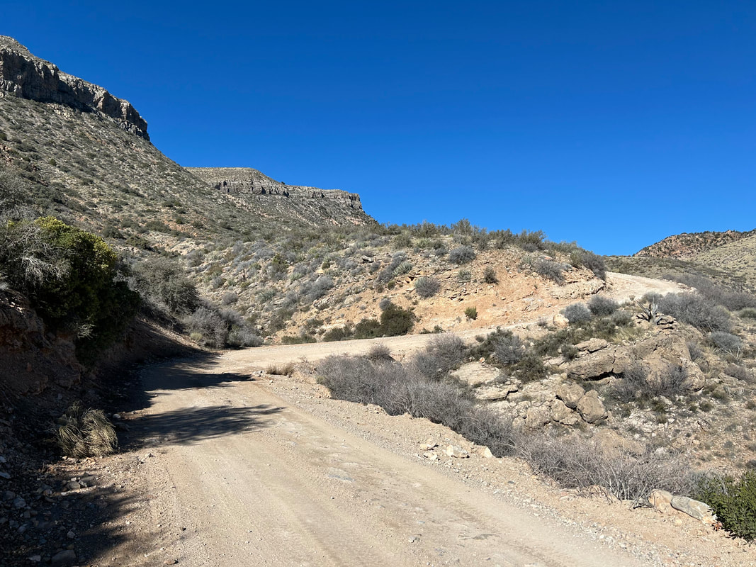
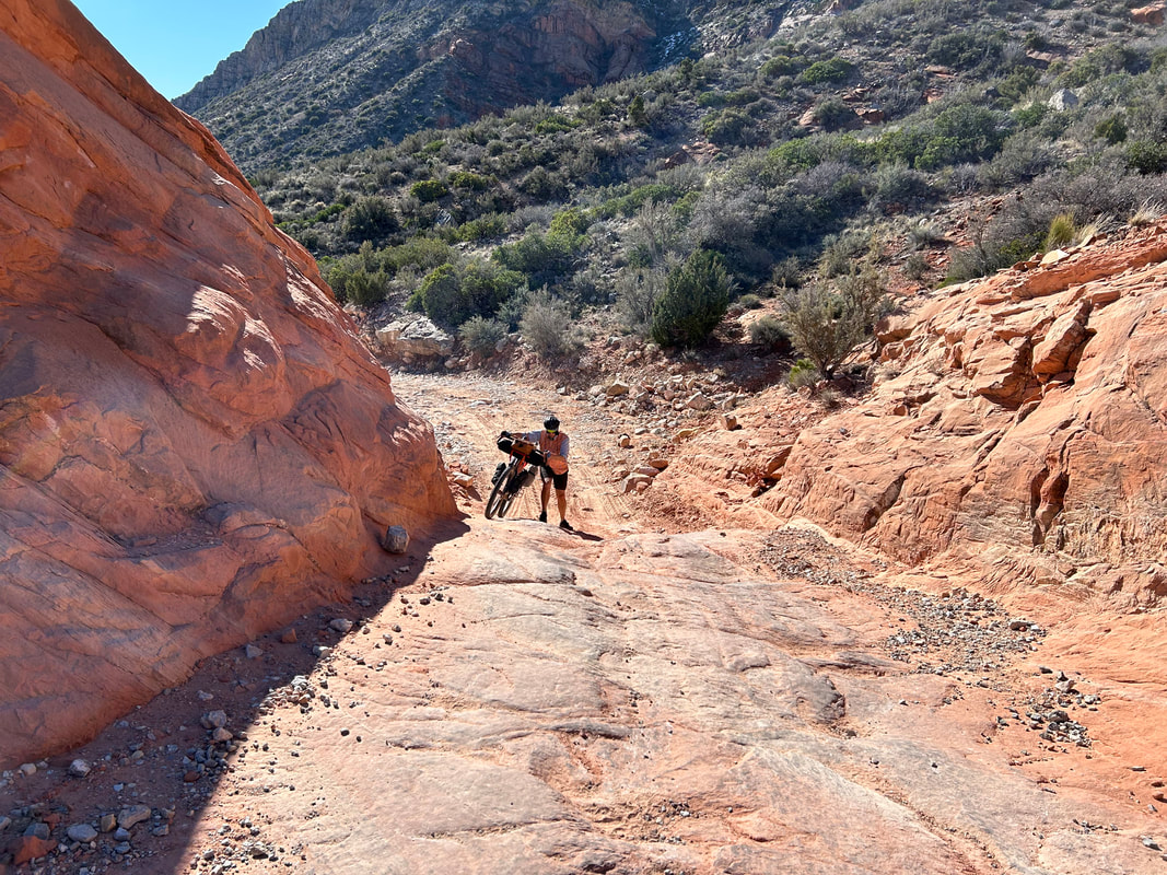
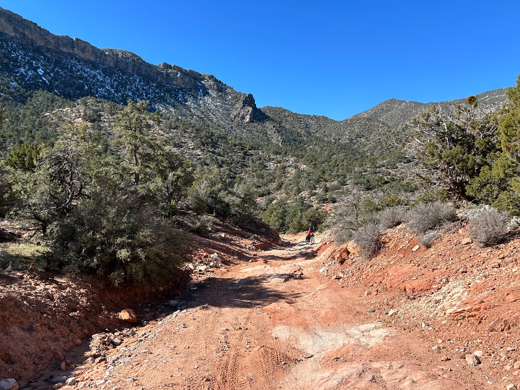
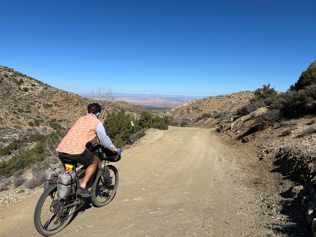
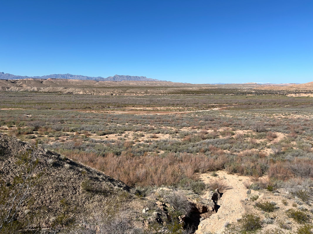
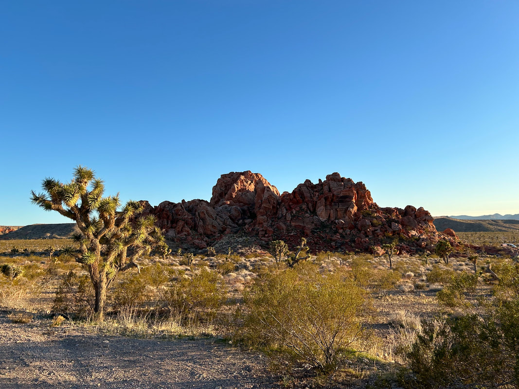
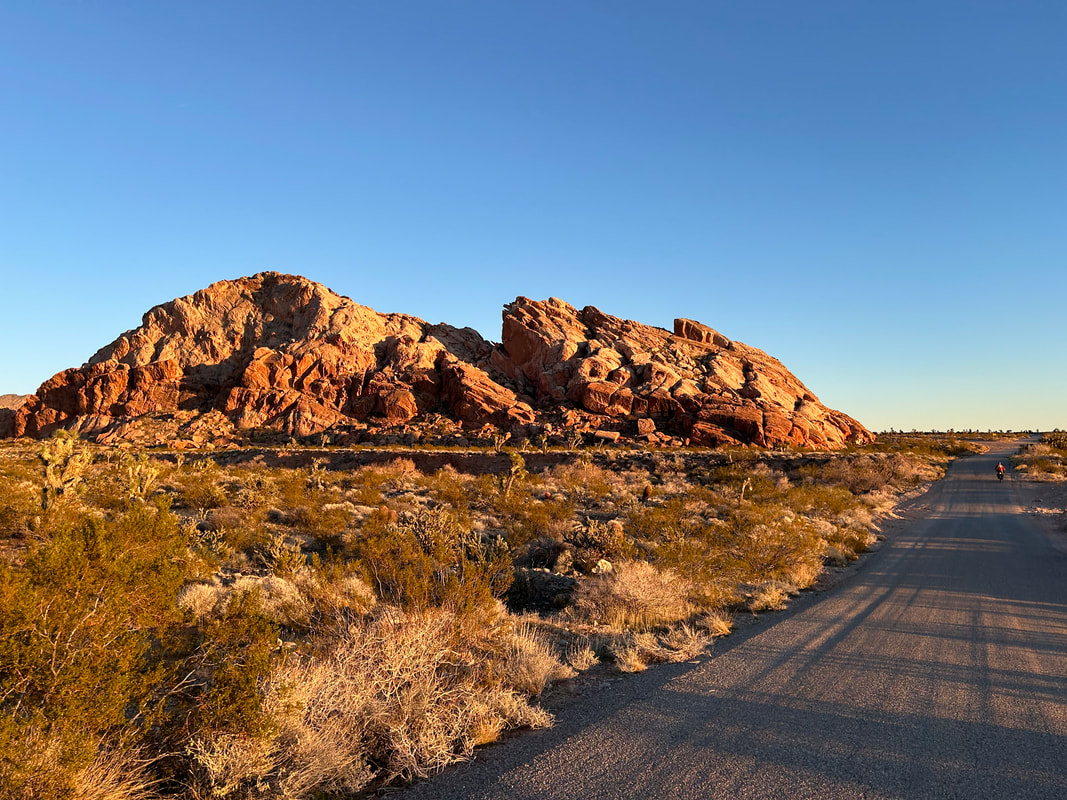
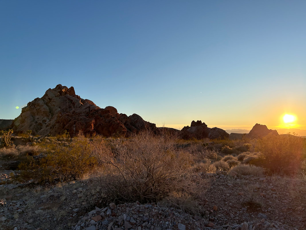
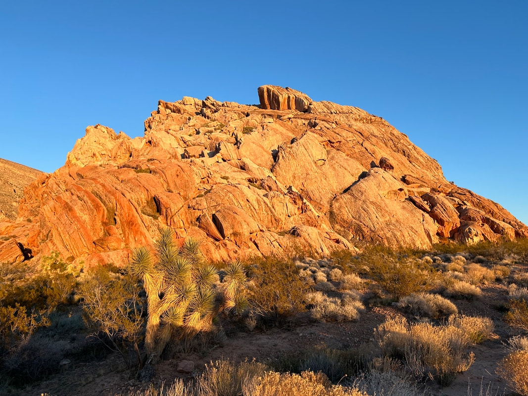
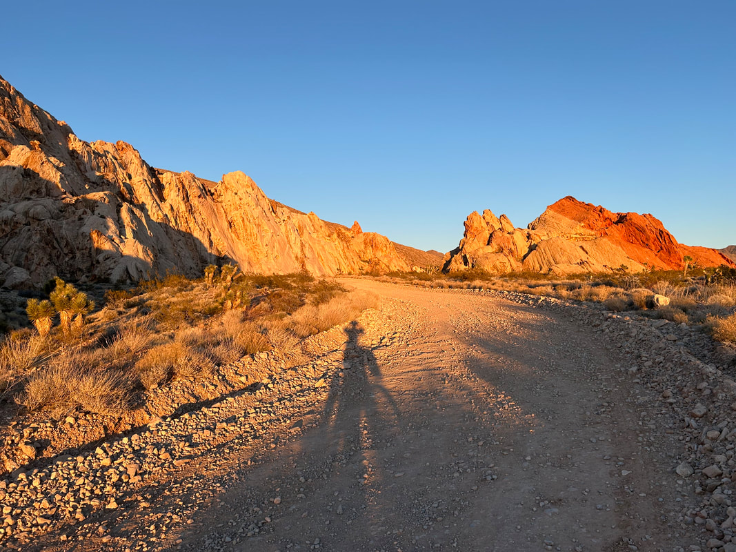
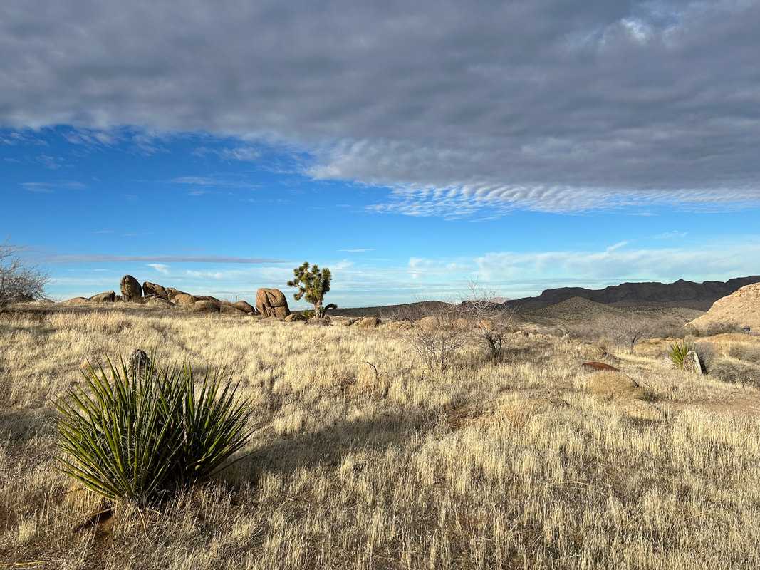
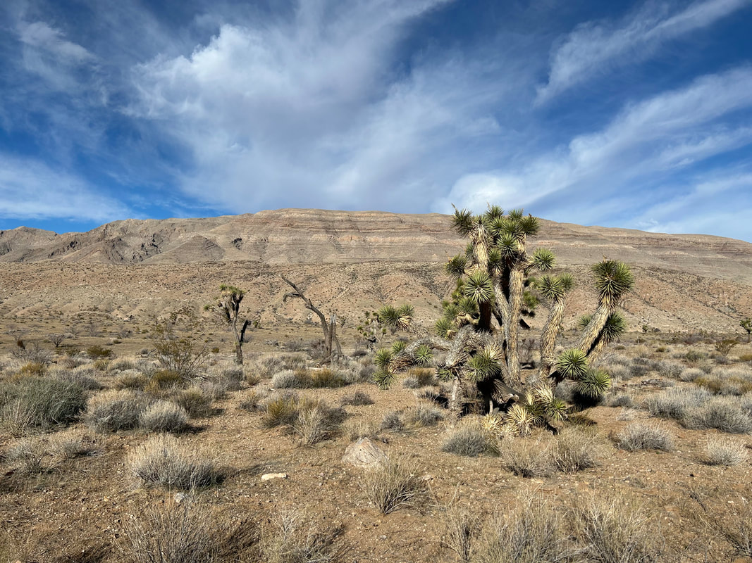
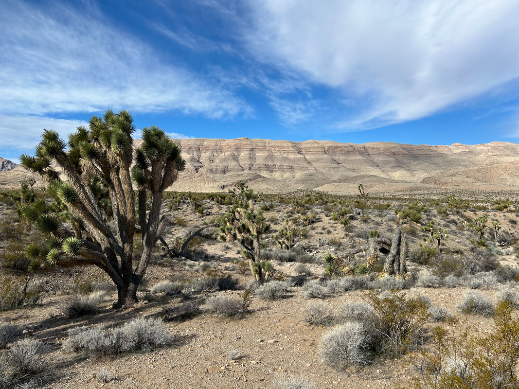
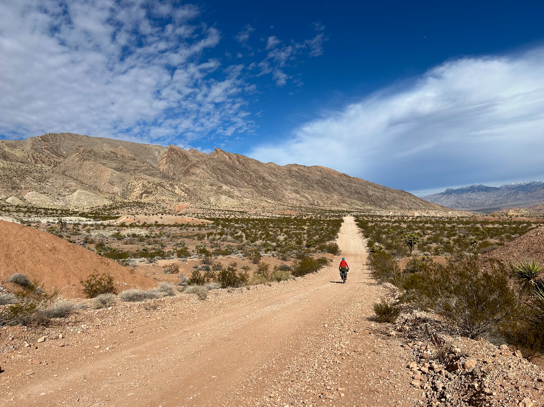
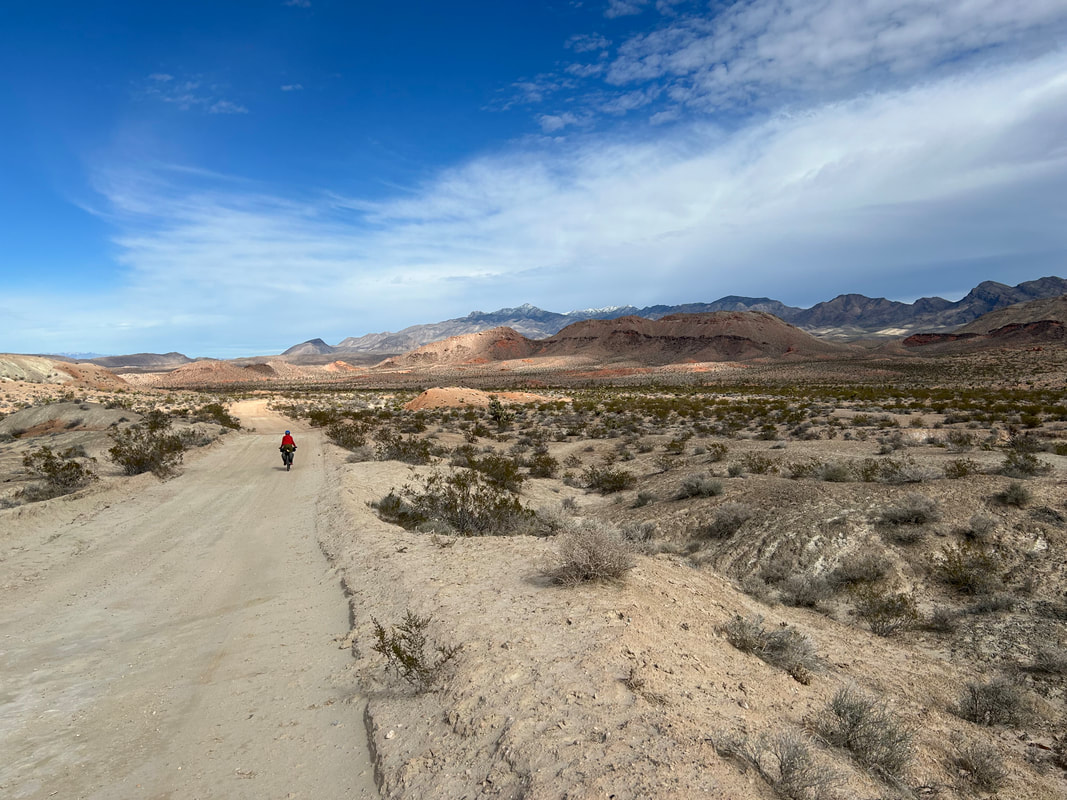
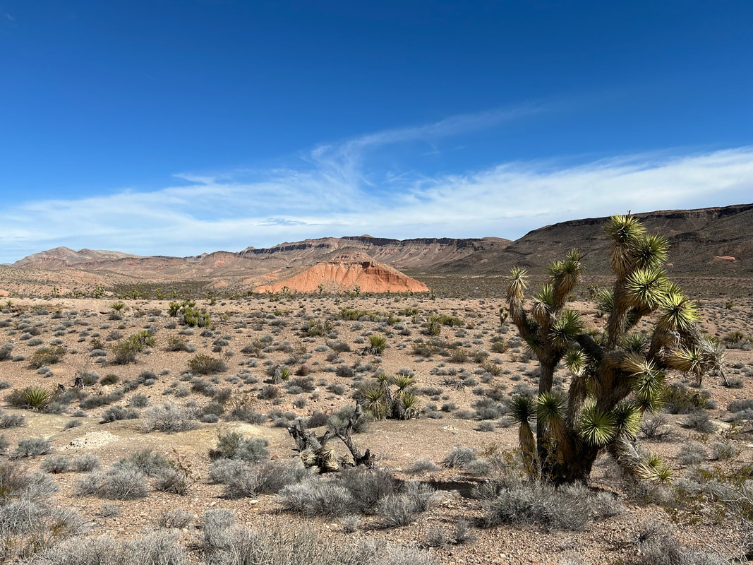
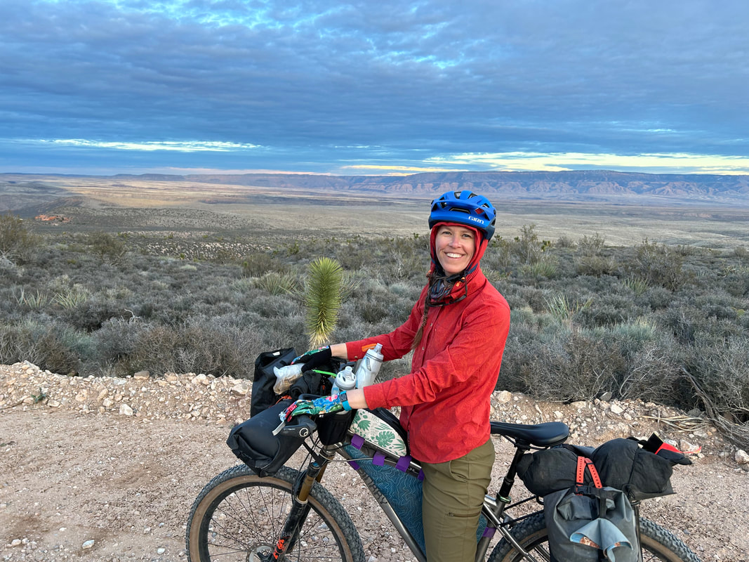
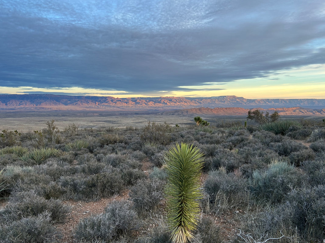
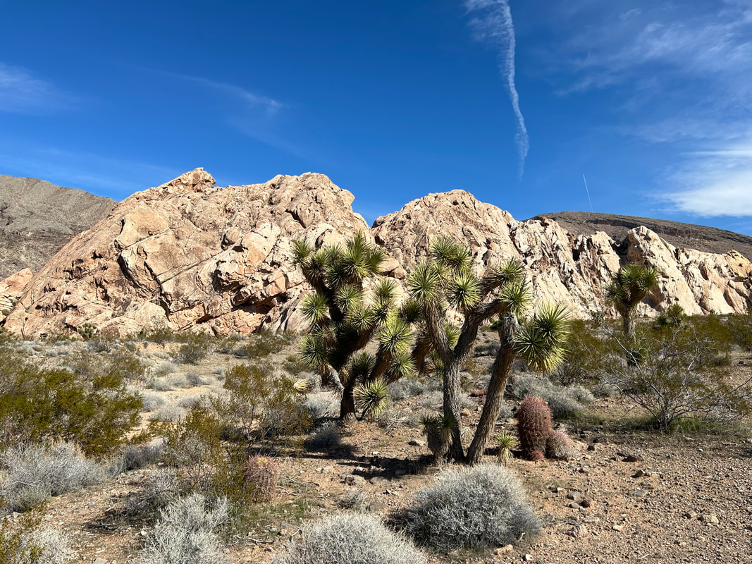
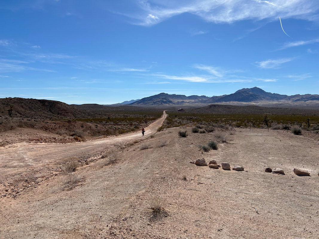
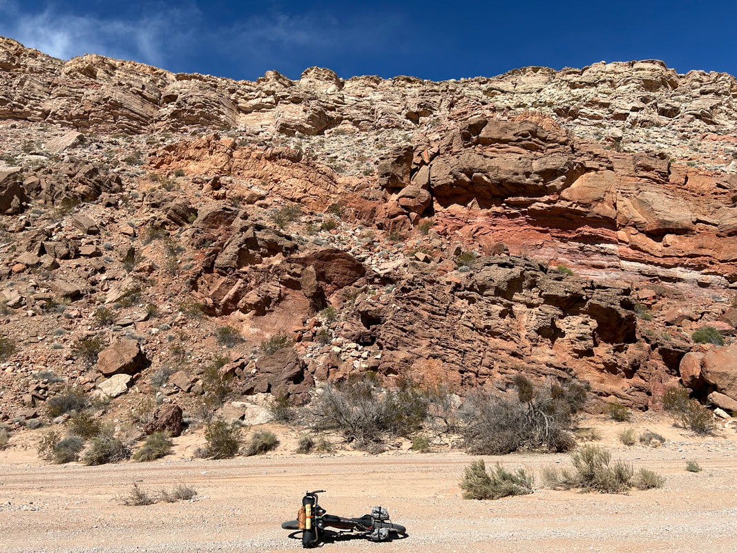
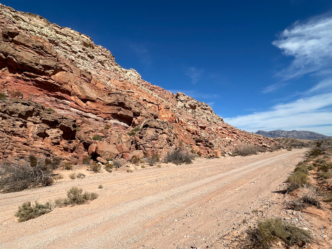
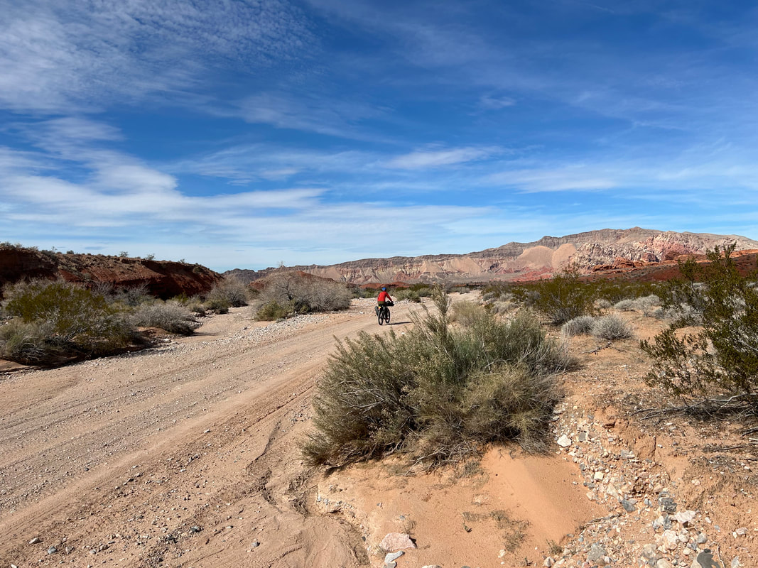
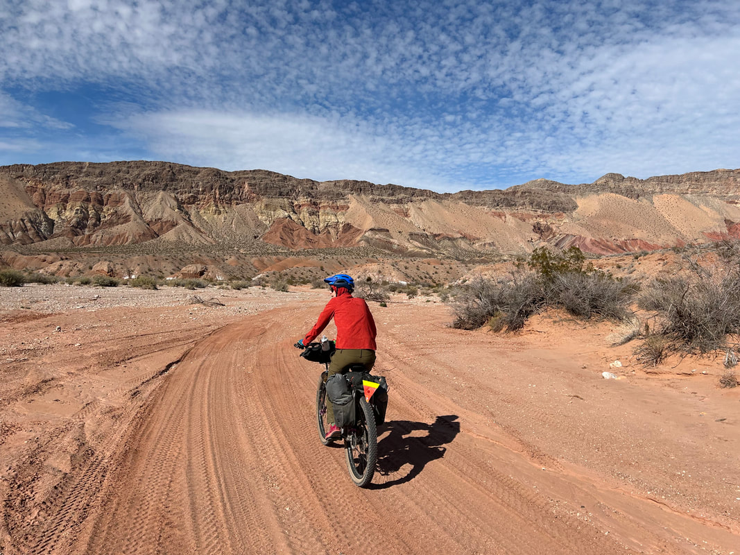
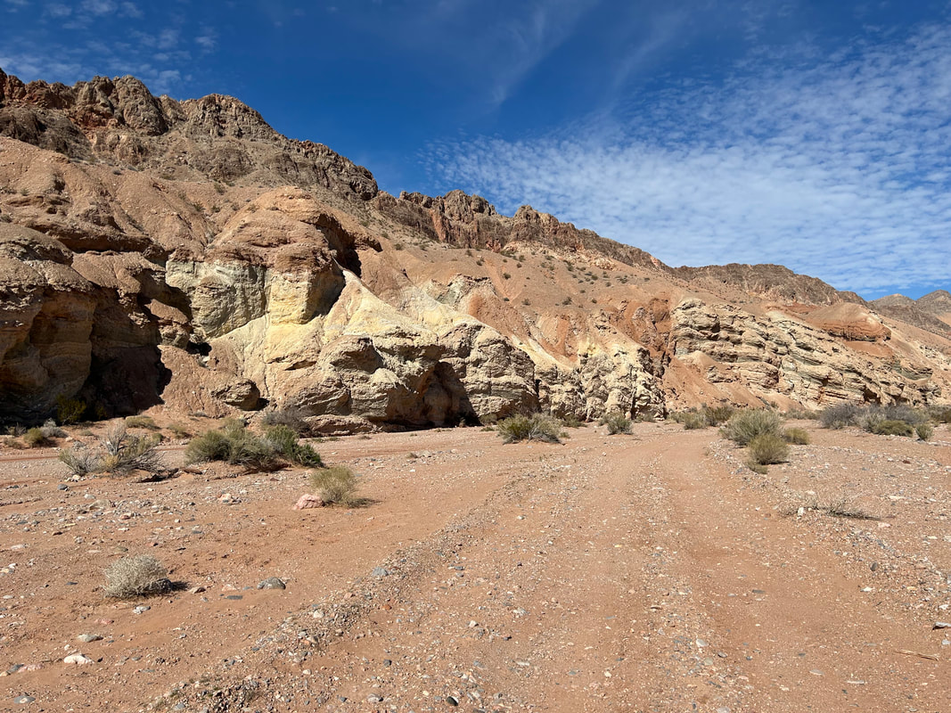
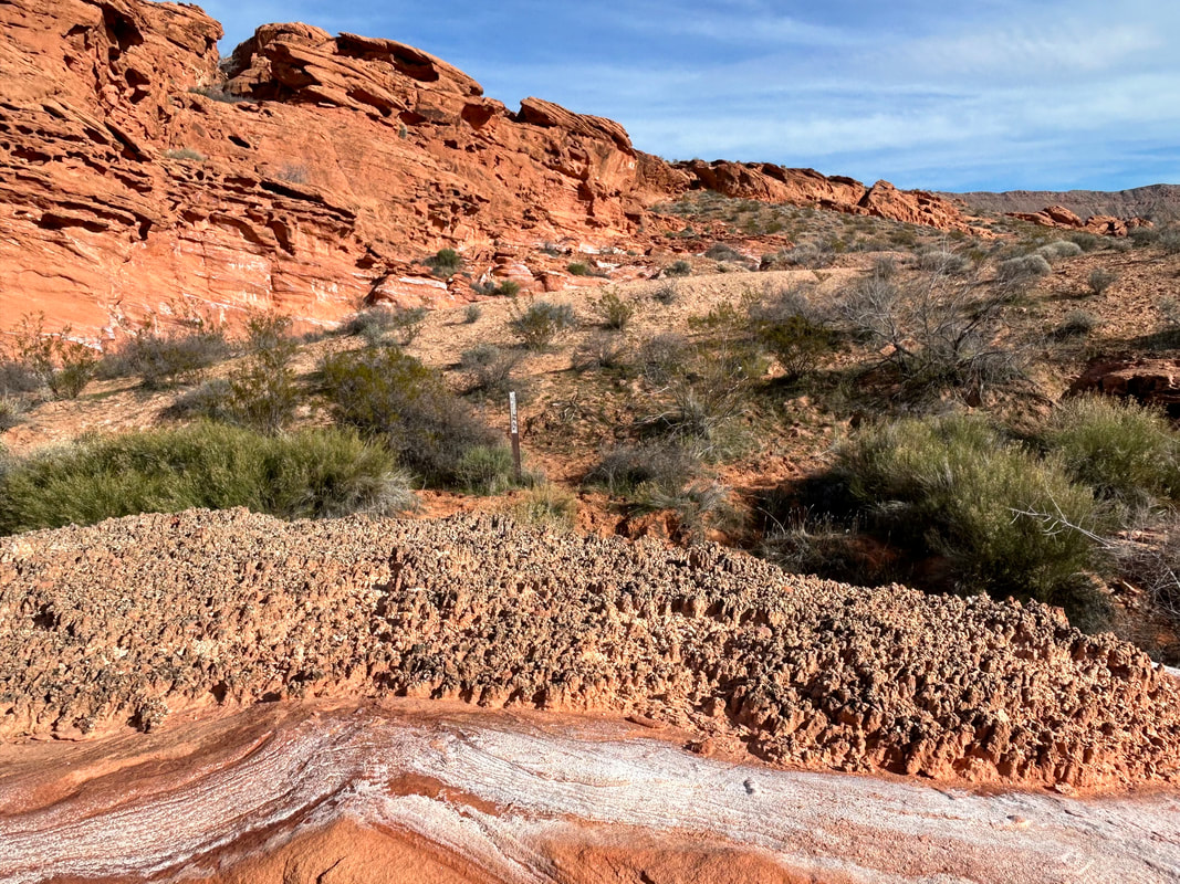
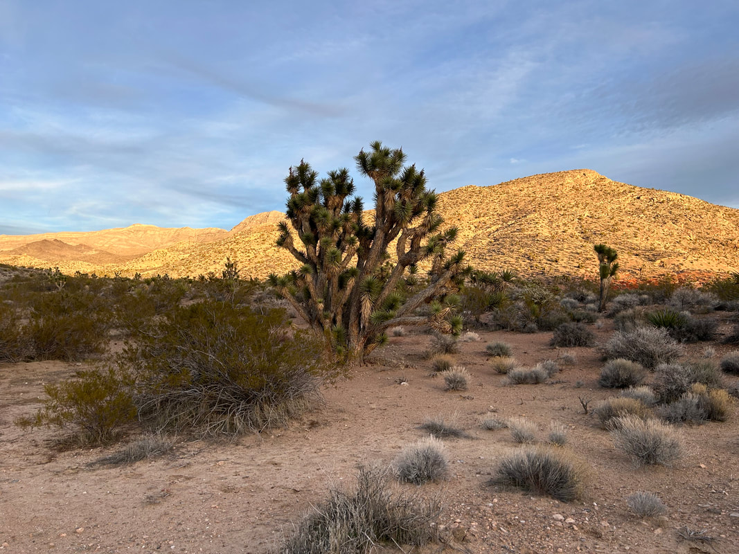
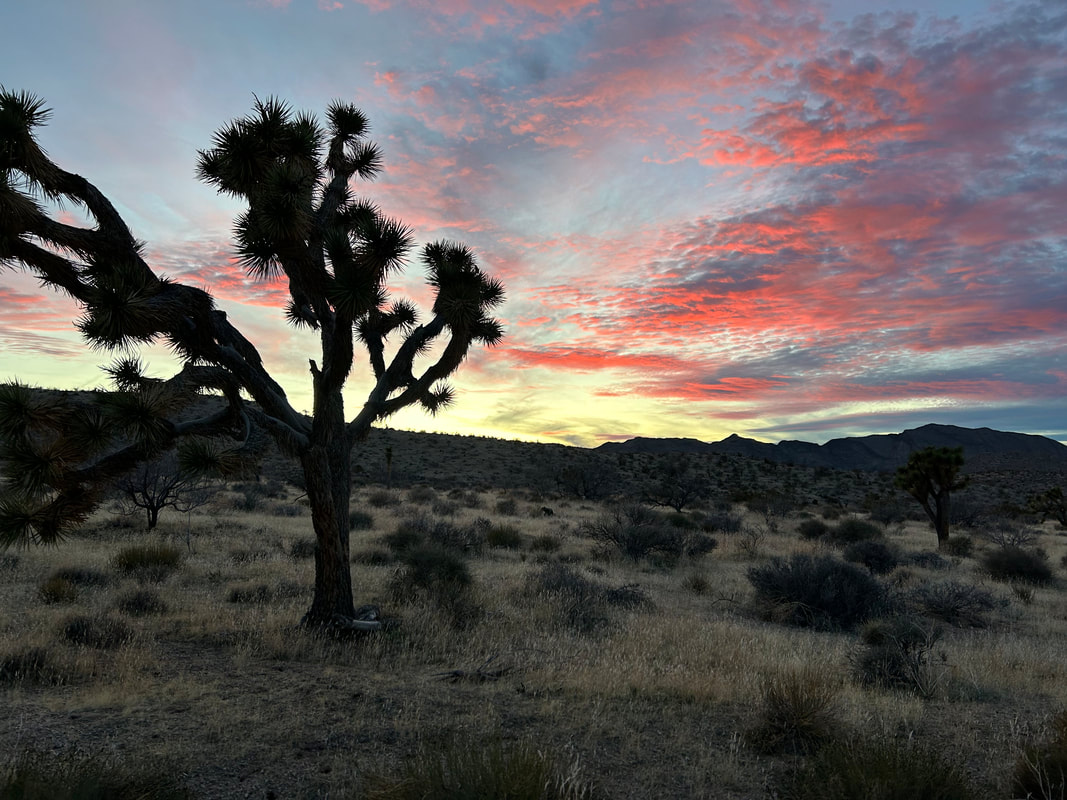
50.02 Miles; 4,623 Feet of Gain; Red Pockets Mountain to Whitney Pocket 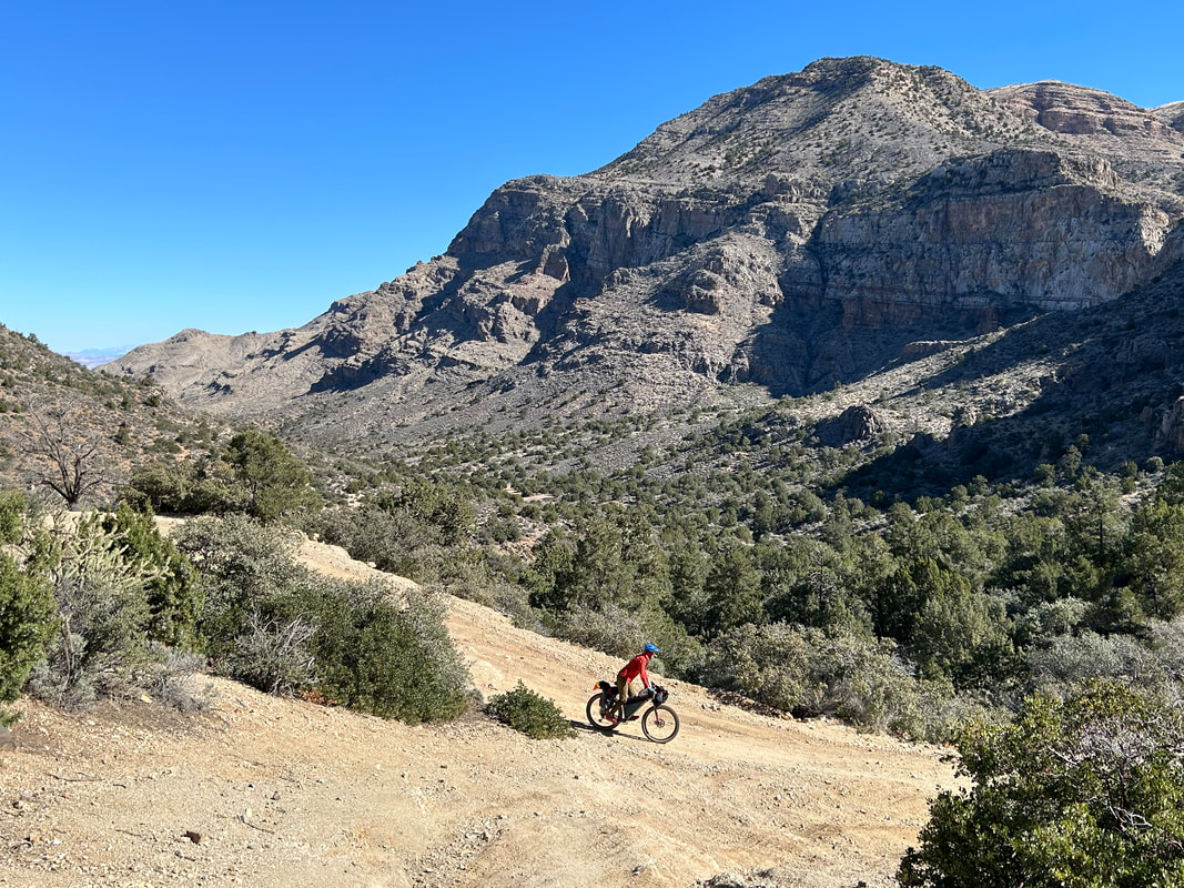 When we went to bed last night, both arrival at camp and laying down for sleep occurred well into the dark. I had a hard time visualizing where we were or what the area would look like. Waking up after such nights is always a moment of curiosity for me. I popped outside and looked around. We were camped on a little basin between an adjoining peak and the stunning snow-capped Virgin Mountains. A spill of juniper trees intermixed with Joshua trees. Janna and I sat in the sun eating breakfast while letting the sun crest over the landscape bringing its warmth. We knew the climb ahead was the crux, so we got going quickly. The road began with a short descent down to a four-way intersection. One road led deeper into the Grand Canyon-Parashant, one went to St. George, one led back the way we came, and one was the road where we were taking to head over Lime Kiln Pass. Some ATVers mentioned a pipe with water in the area, so I set myself to find it. I was unable to locate the pipe although there was clearly some irrigation here at one time. We were at the hulking base of the multi-colored Red Pockets Butte. The sun was shining amid the blue sky making the rouge-stone all the more impressive. We turned right and started the four mile climb up to the Pass. The Virgin Mountains peeked out from behind Red Pockets Butte all crusted with white and contrasting with the Mojave desert landscape below. We passed a valley of red buttes, hoodoos, and other interesting geological formations on our rights that were set back into a wash with verdant vegetation. 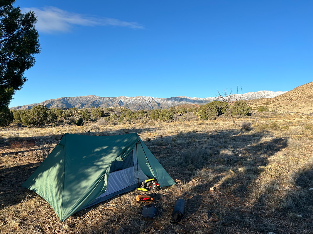
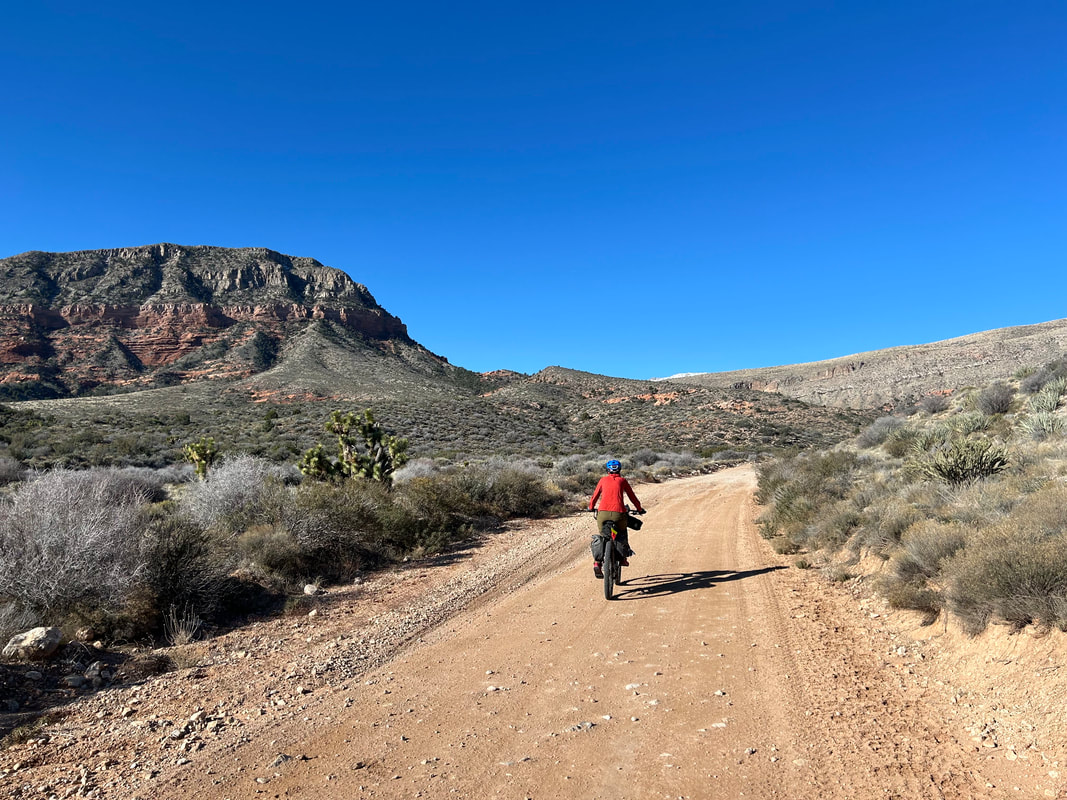
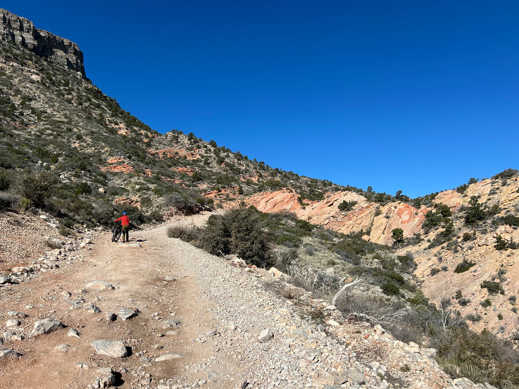
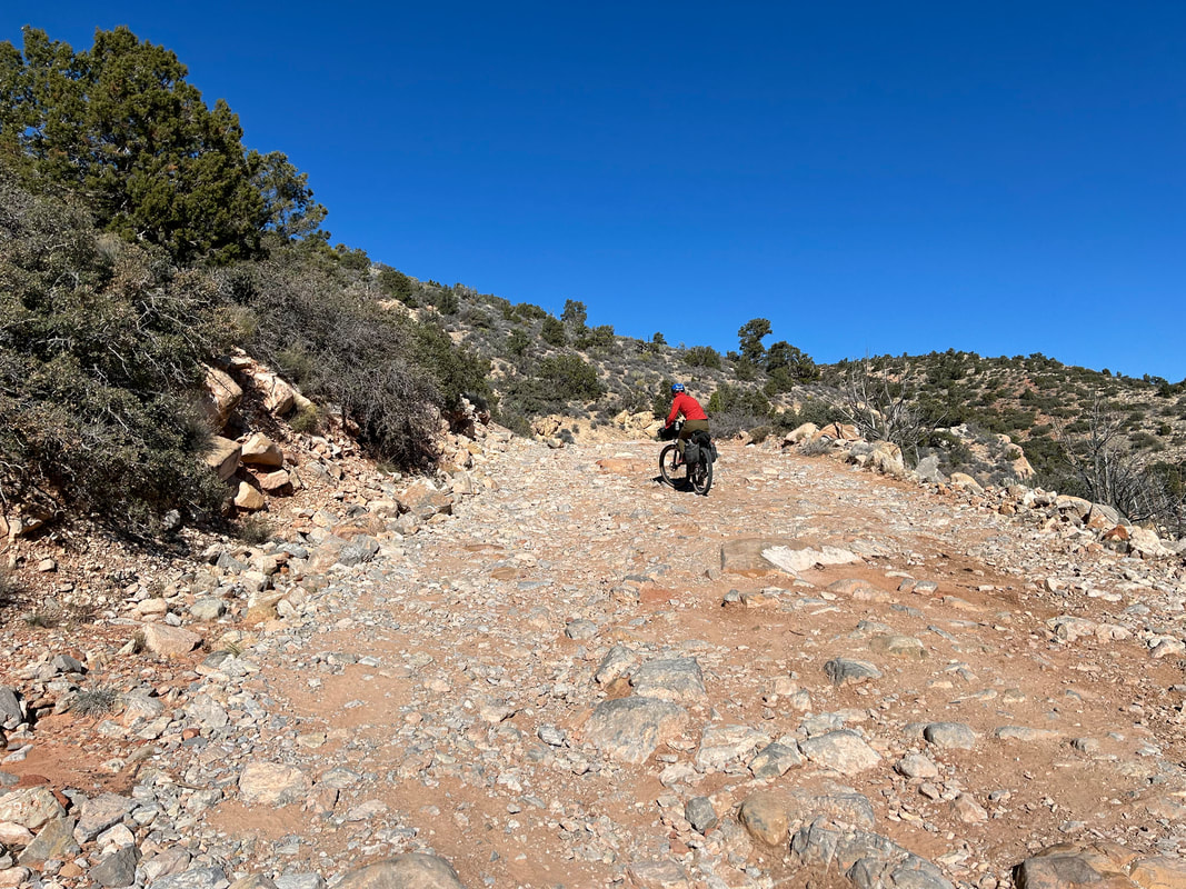
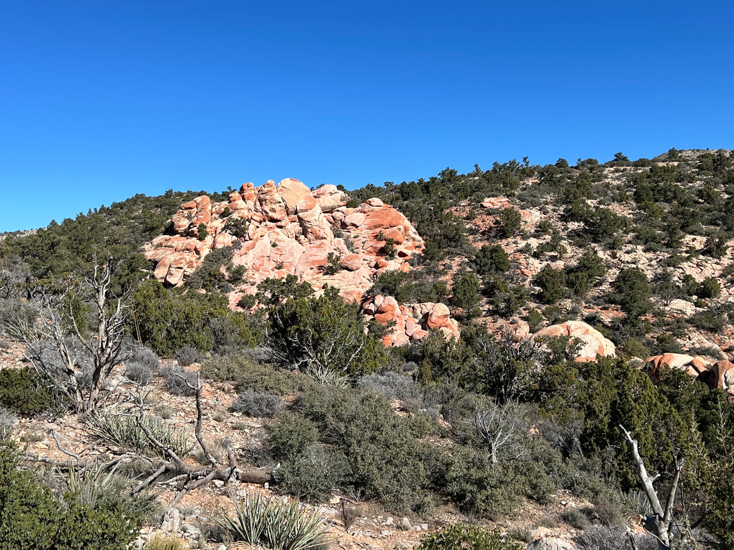
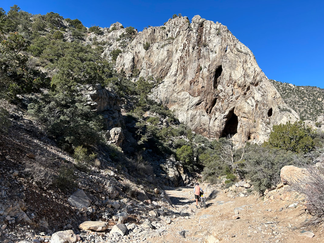
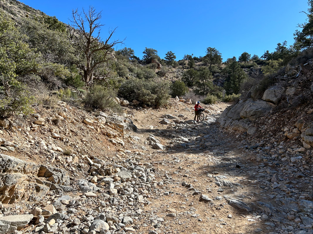
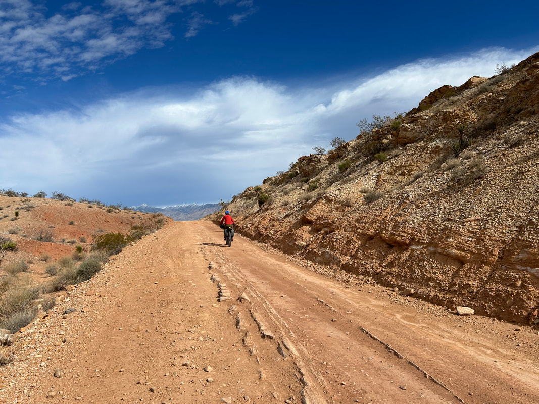
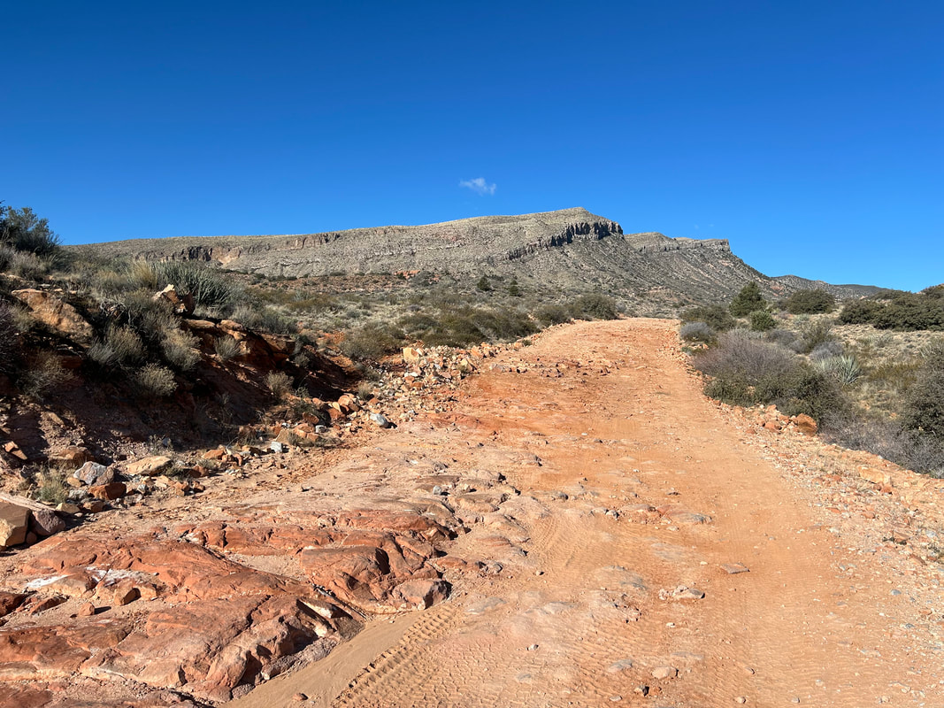
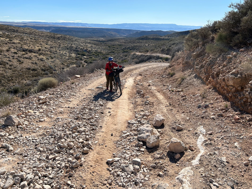
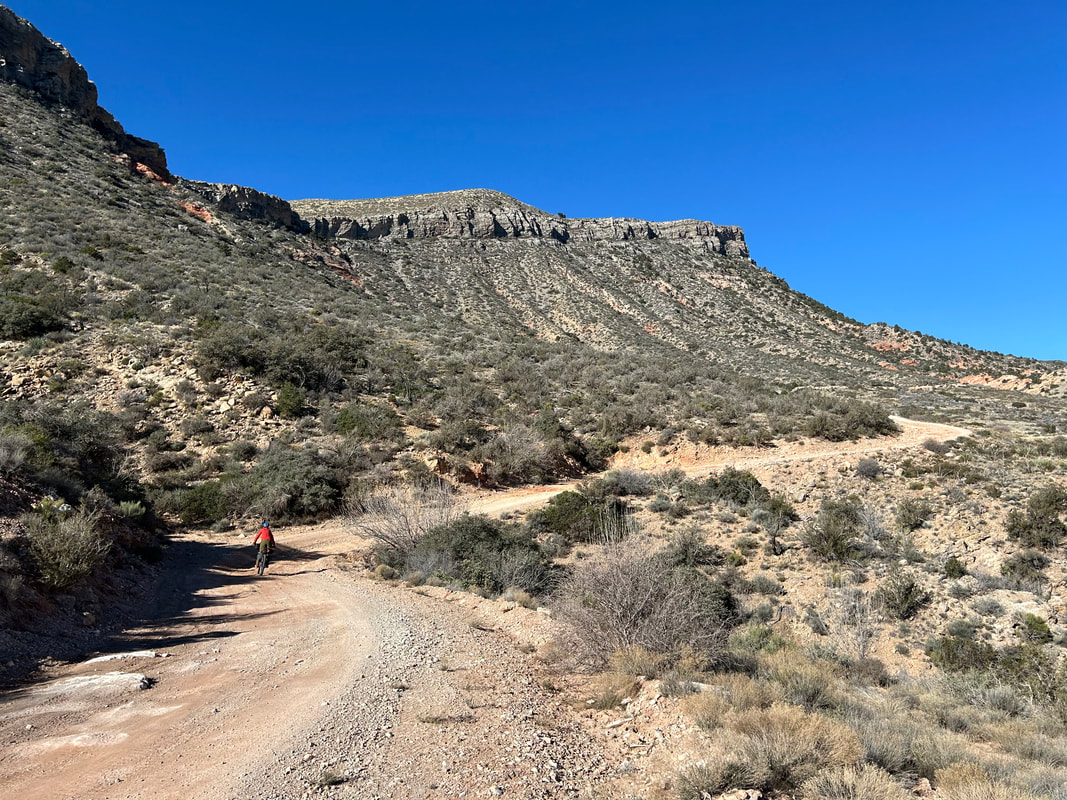
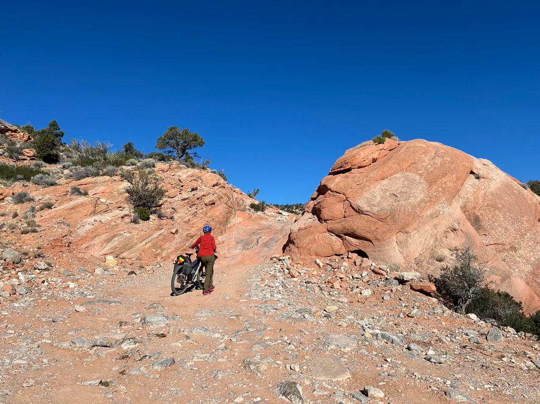
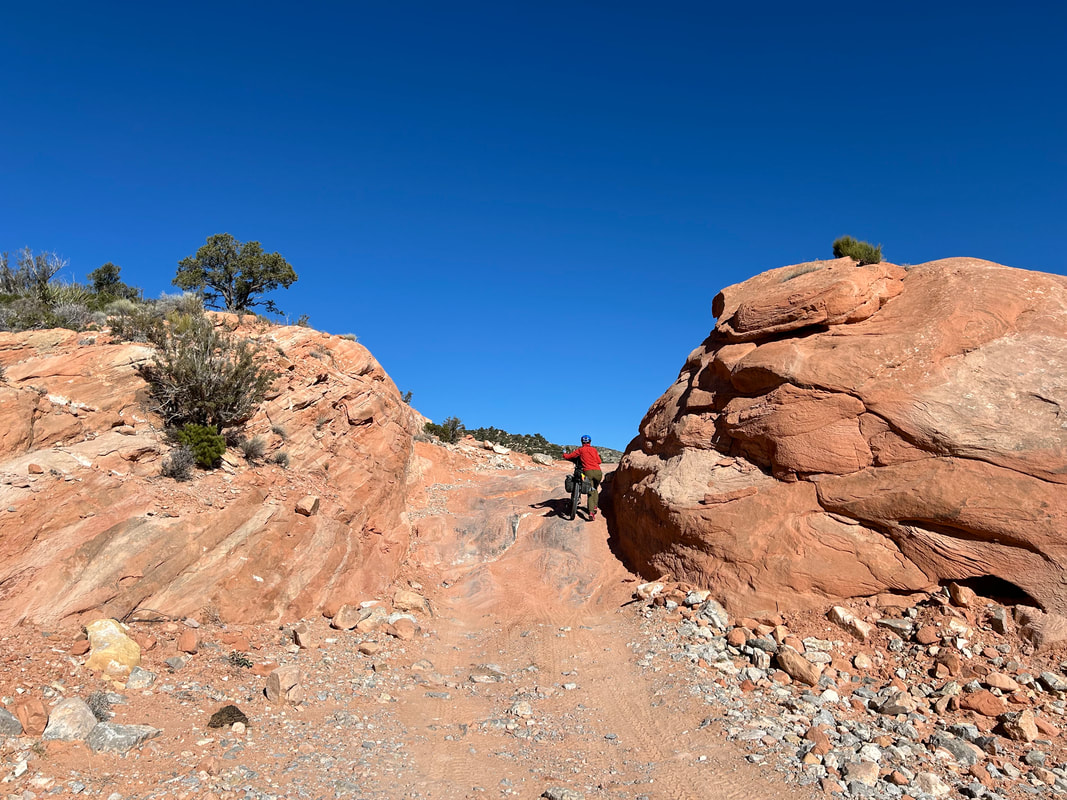
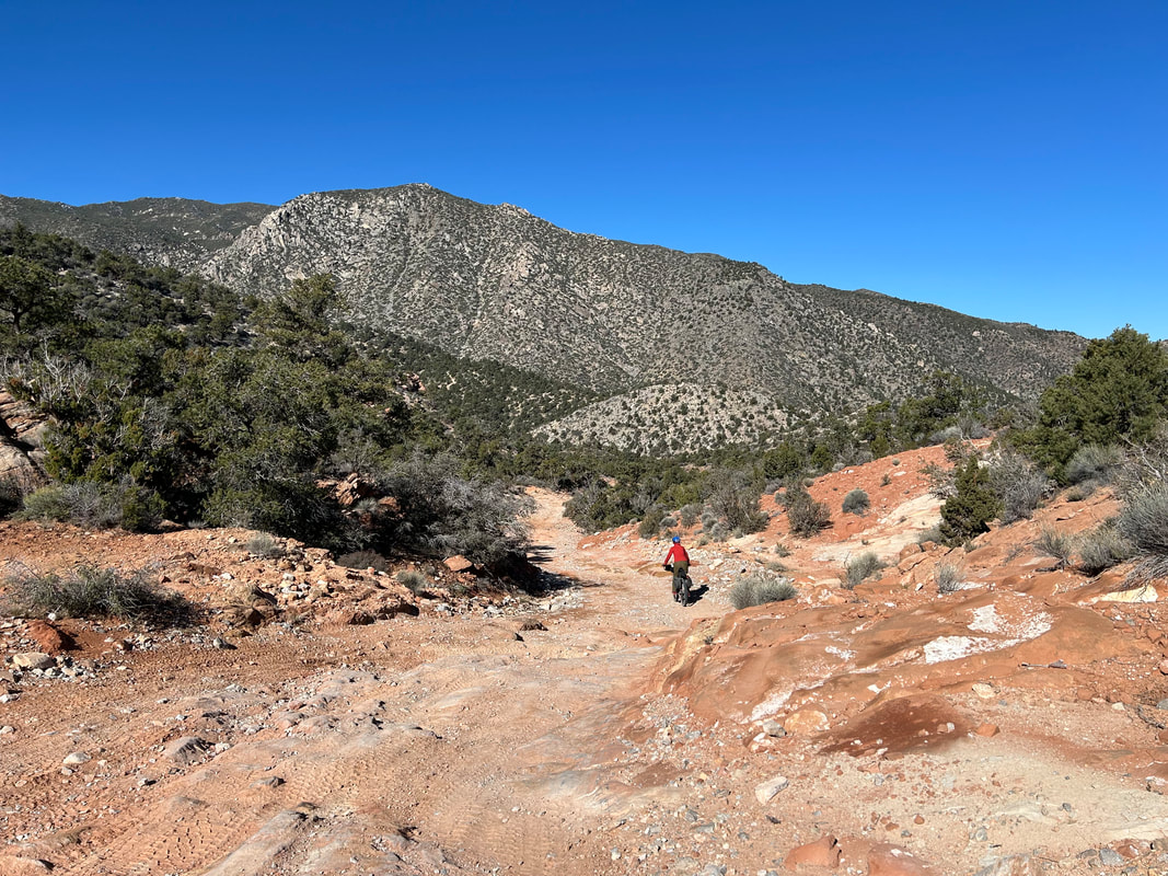
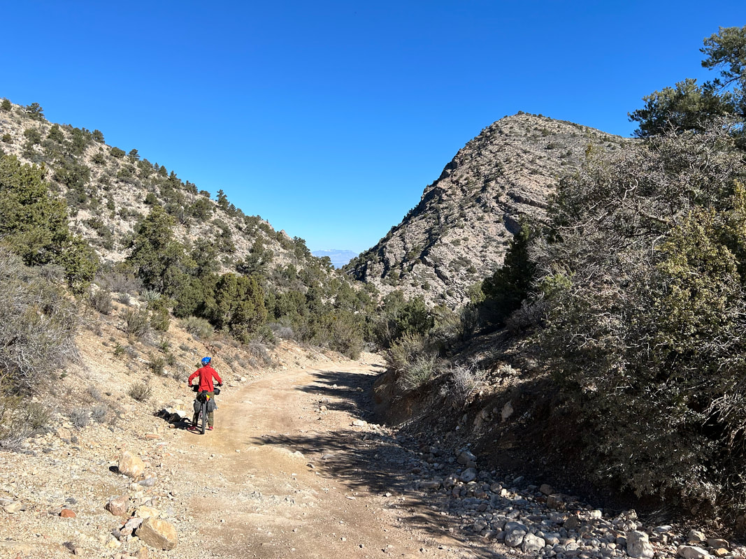
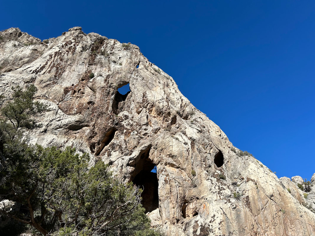
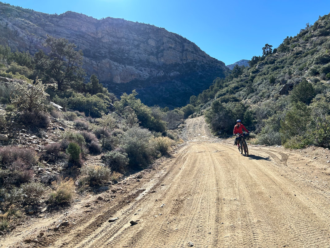
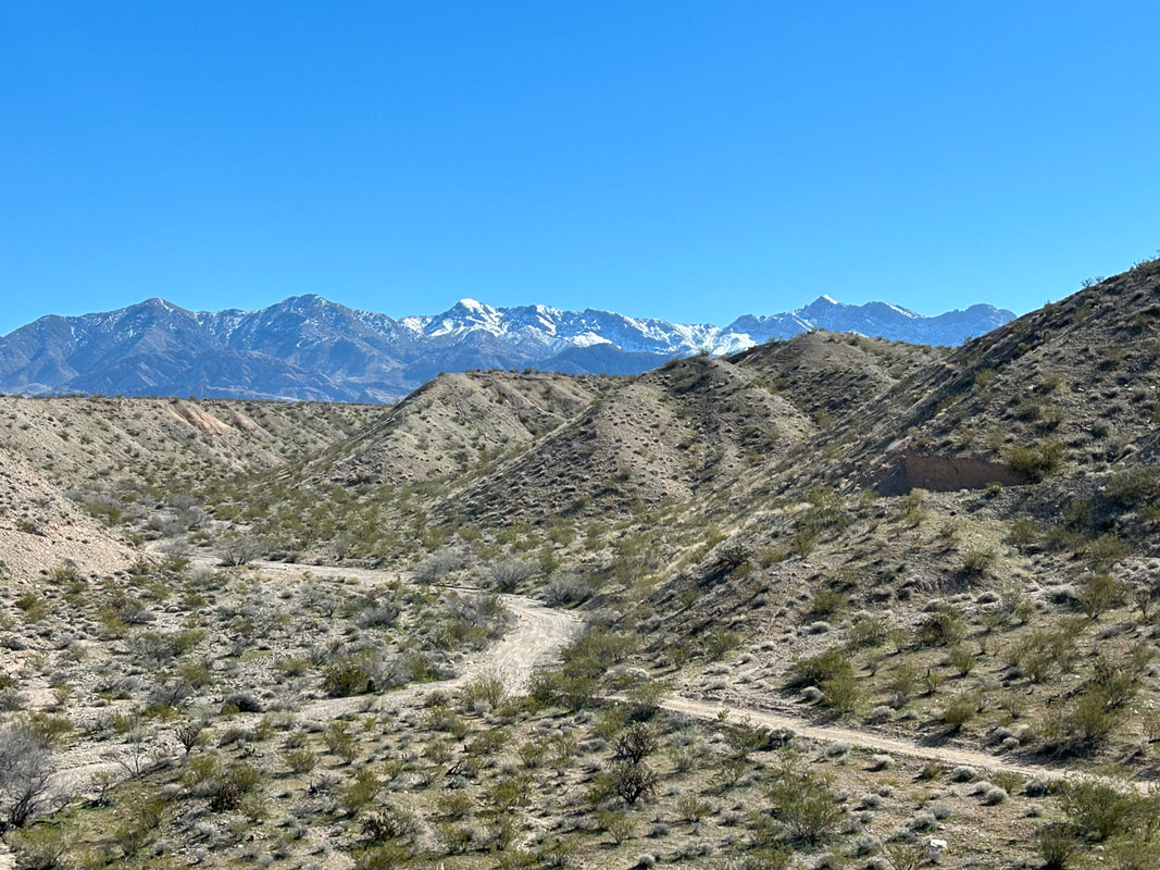
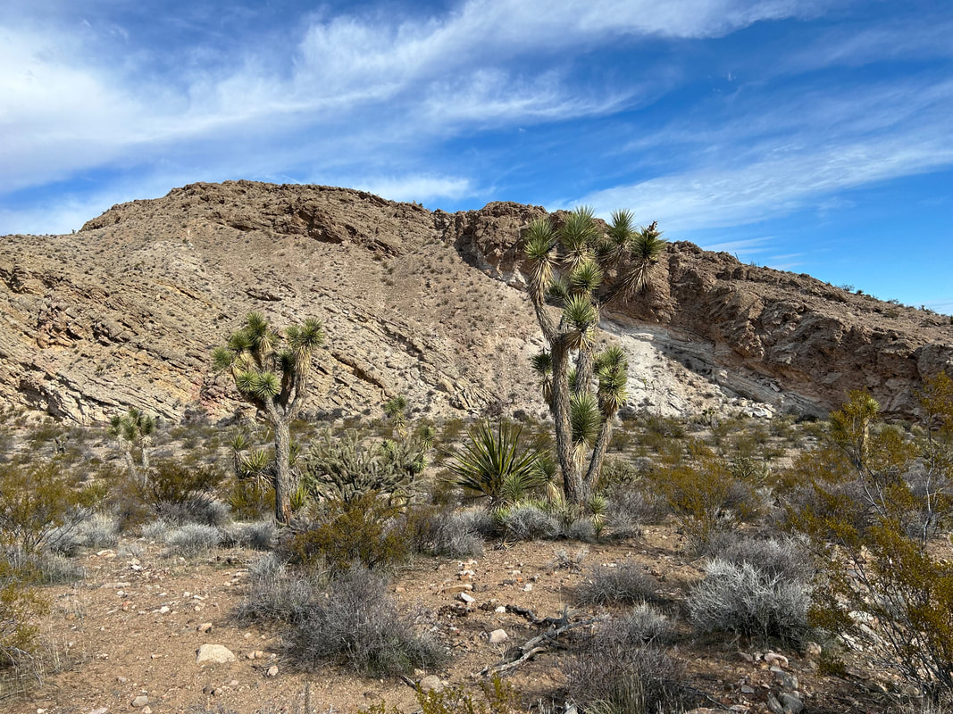
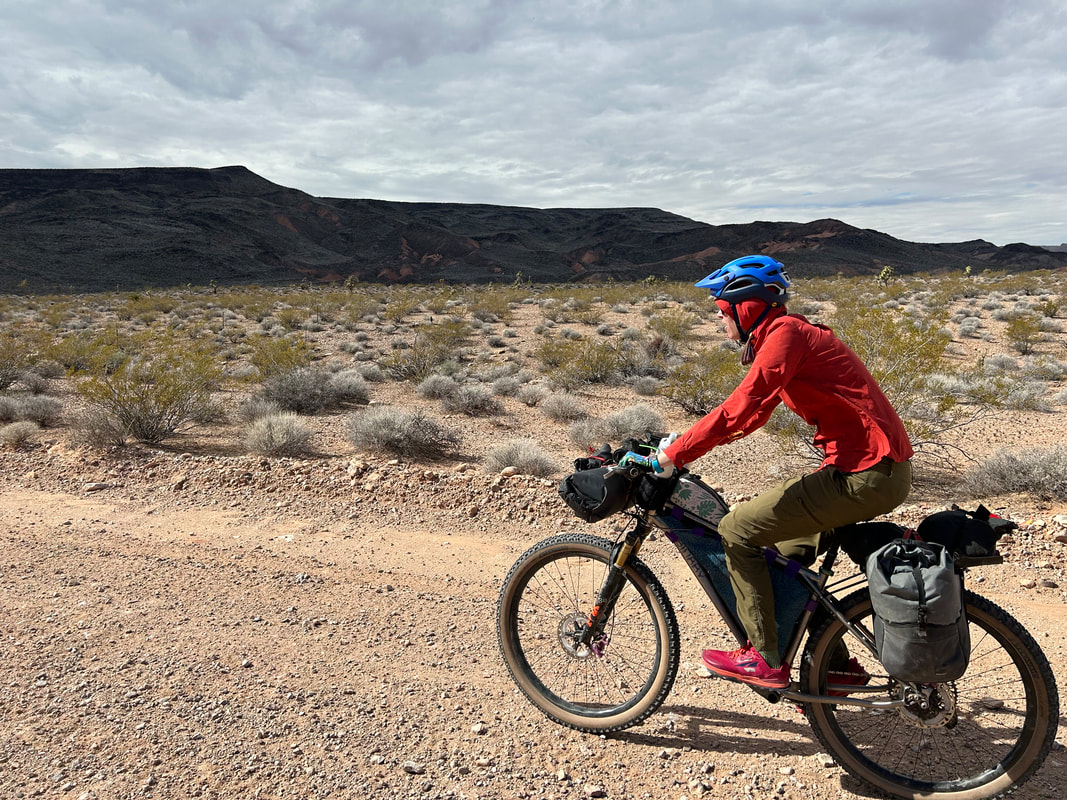
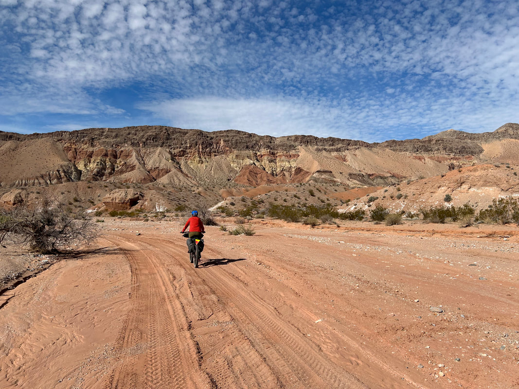
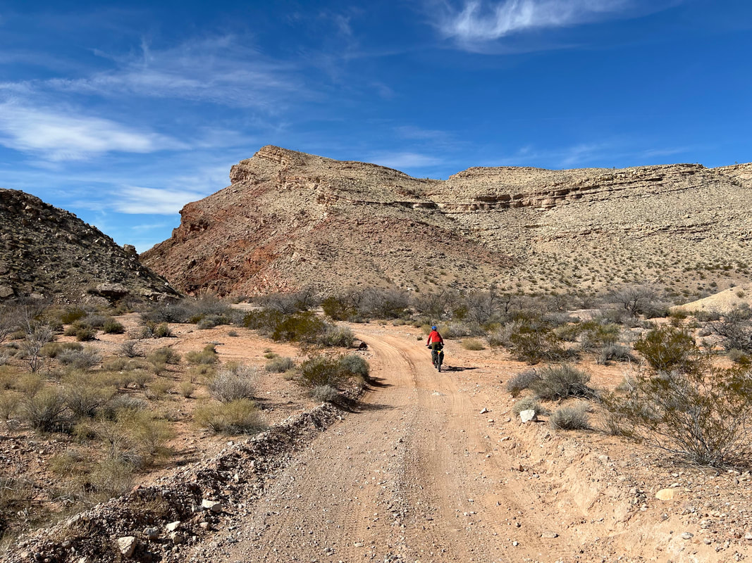
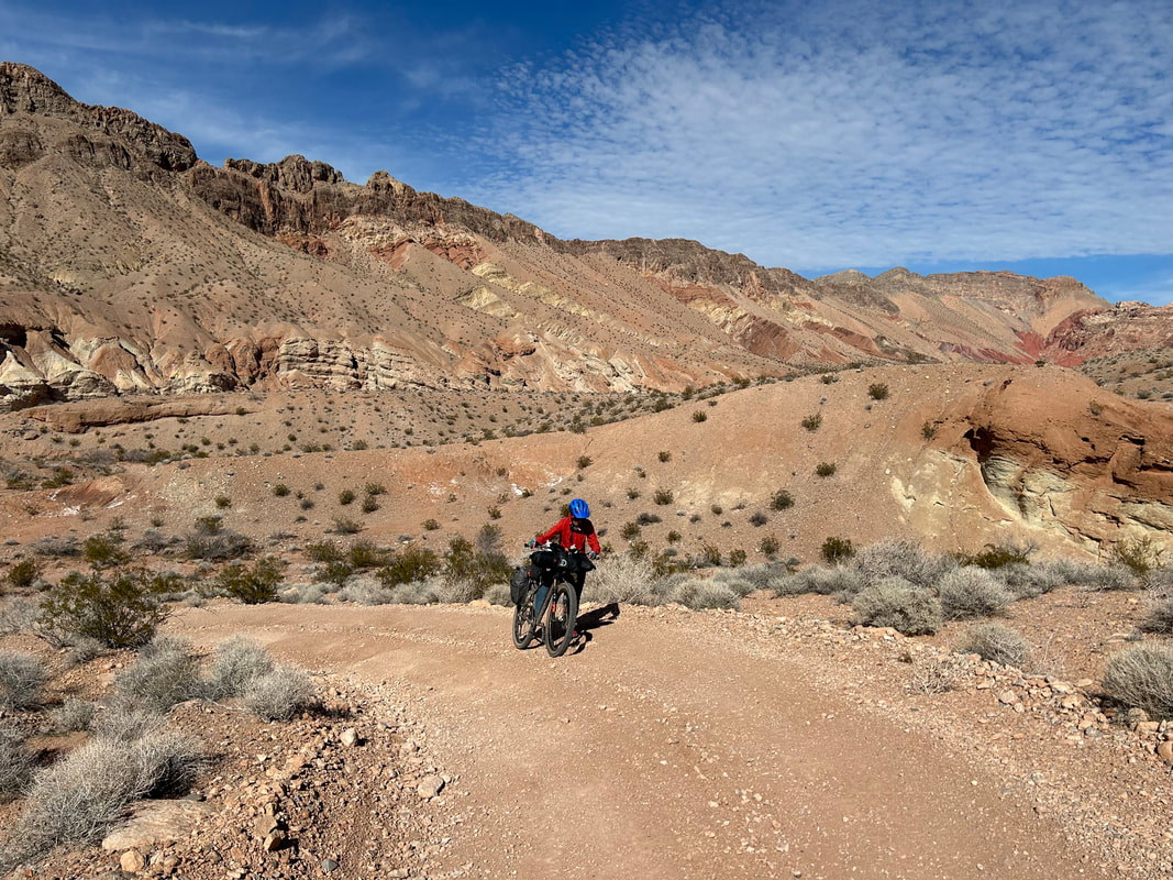
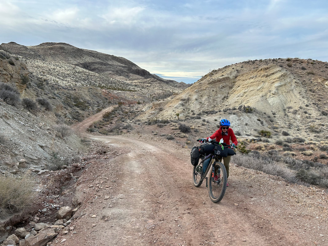
   The road was in great condition. The ATVers we spoke to yesterday said this climb up and over was very rocky. So far, it was smooth with some short interspersed sections of chunk and bedrock. We got probably a mile or two in before the road started to really get steep in grade and chunky to the point where hike-a-biking was the preferred choice over riding. We started pushing our bikes up the curves and turns of the dirt road that became littered with babyheads and small boulders. Despite the arduous pushing, the scenery was amazing. I kept looking back into the heart of the Parashant and forward up to the Pass. Even up here in the higher hills, Bundy's cows were grazing and looking at us. There was one last push to the top which carried us through a chiseled bottleneck of red swirling sandstone. It was so cool to see that crowning red rock on high that it made up for the rocky push to the pass. As chunky as the last 2 miles to the top were, an equally eroded and bustling section followed down the pass into Lime Kiln Canyon on the other side. But wow was it gorgeous. The north facing portions of the Virgin Mountains tucked into this canyon were packed with conifers and scrubby oaks. Sheer exposed limestone walls opened up all iced with snow. Even the portions we hike-a-biked down took us past interesting geological formations with chutes, pocks, and even arches. Janna and I reached Lime Kiln Canyon Climbing Area's parking lot. We pulled our bikes in and found it packed with climbers preparing for a day on the surrounding walls. We talked to a small group stretching on their bouldering pads before Janna and I got back on the road to descend the rest of the way to Mesquite. The road dramatically improved in quality from this point forward.
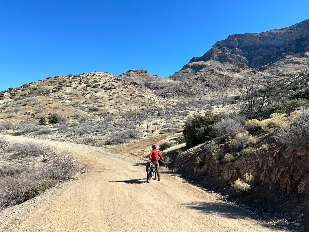
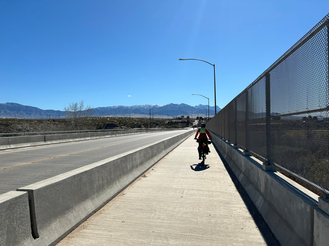
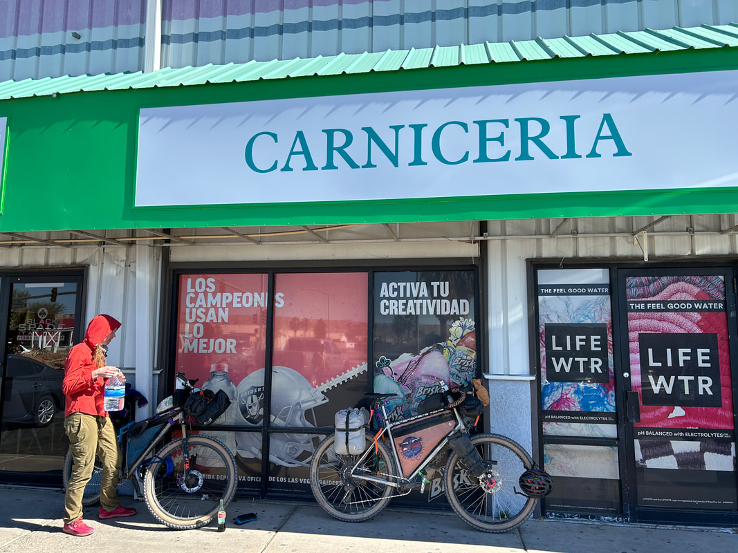
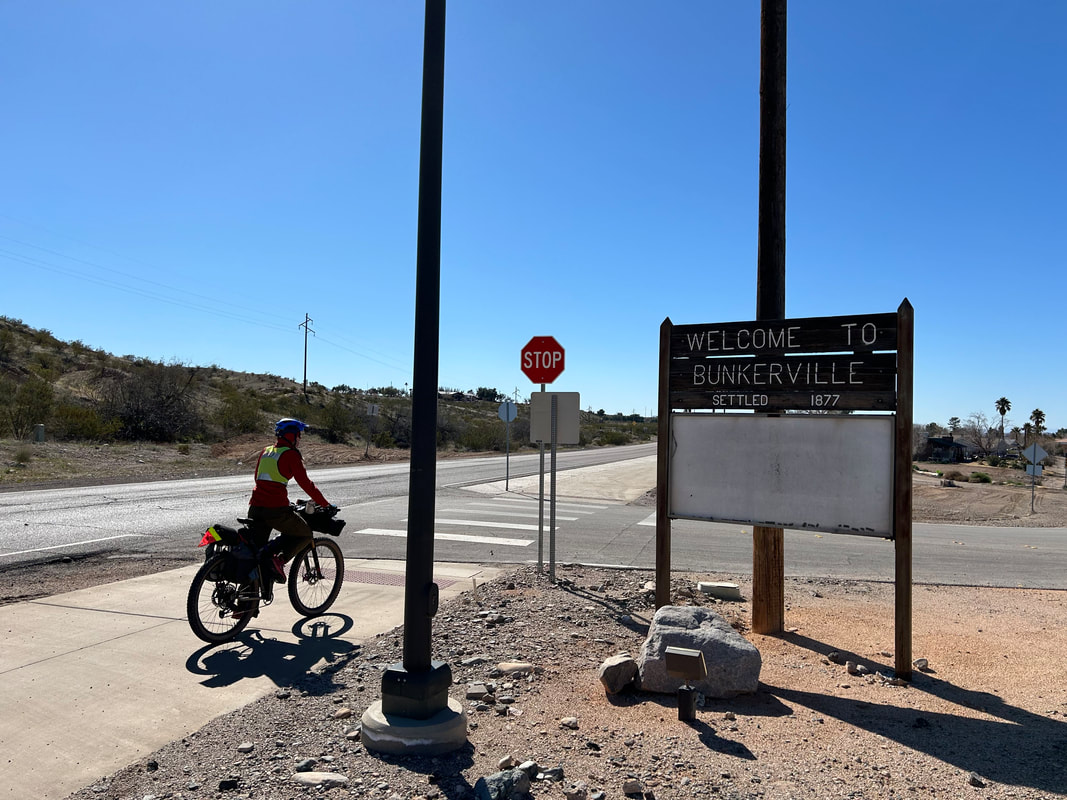
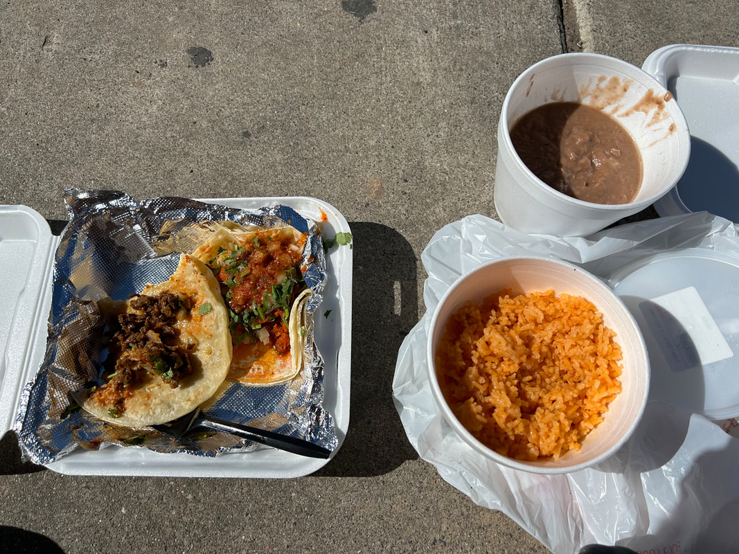
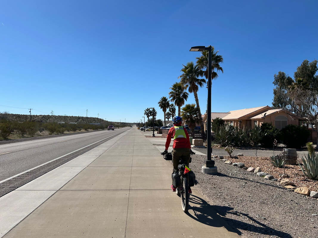
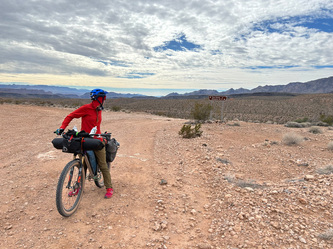
The distant mountains miles beyond Mesquite were all cut with ice tops while their bottoms were gray and rusted with reds. Some miles later, after a thrilling and easy downhill, we connected with pavement and turned right before quickly pulling up to La Mexicana Grocery Store Market in Mesquite, NV. Hungry after three days out in the desert, we went inside and found a great selection of snacks and drinks. We headed to the back of the store to the carniceria where we put in orders for tacos and burritos. Then, we swung by the store's panaderia to grab a baked good each. There is nothing like sitting on a sidewalk in the shade of a sunny day eating some delicious food after days in the backcountry. The tacos were exactly the food we needed to propel us along the last miles of the route. Janna and I cleaned up, used the restroom, and then jumped on the paved multi-use path that heads out of town and parallels the Virgin River for several miles. The Virgin River was flowing strongly after the recent winter storms. A brown gush of liquid filled the riverbed wash with froth and stream as it sped its way along the lowlands of its flow. The paved bikeway was smooth, wide, and safely off the road - all components I love for biking infrastructure. The route took us through Bunkerville - location for the armed standoff between the Bundys and the BLM over his illegal cattle grazing years before. A few miles later, the paved greenway ended as we joined the shoulder of Riverside Road. Fortunately, traffic was light and mostly consisted of ATVs heading into the foothills. They gave us a wide berth and were well-spaced apart. It made this section of road relatively stress-free-riding in terms of cars. Riverside Road eventually curved north while we took a turn left onto the semi-paved surface of Gold Butte Road. 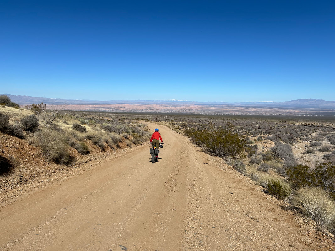
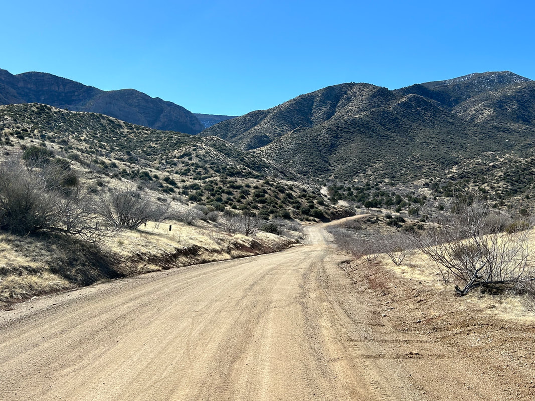
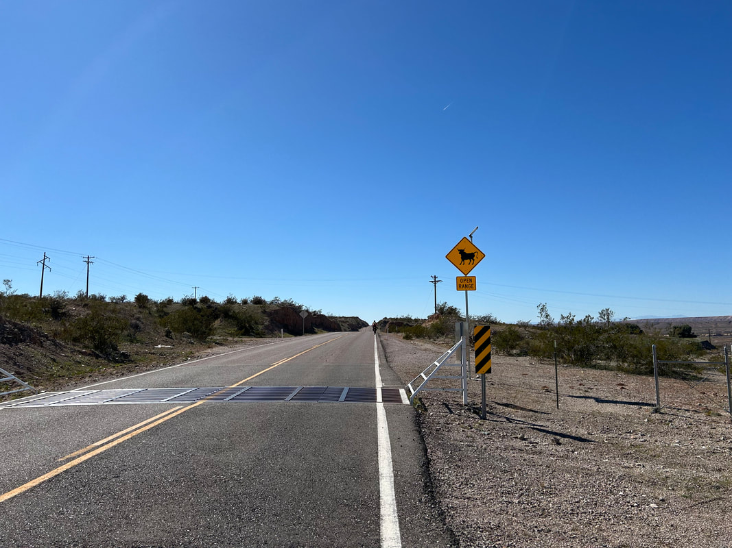
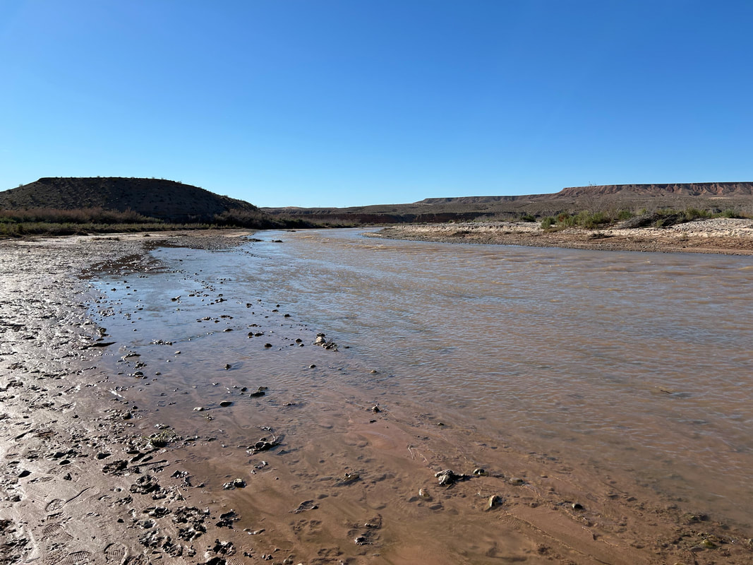
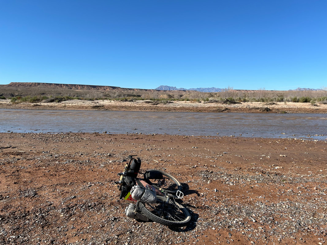
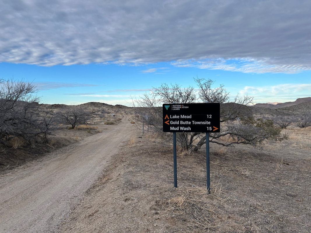
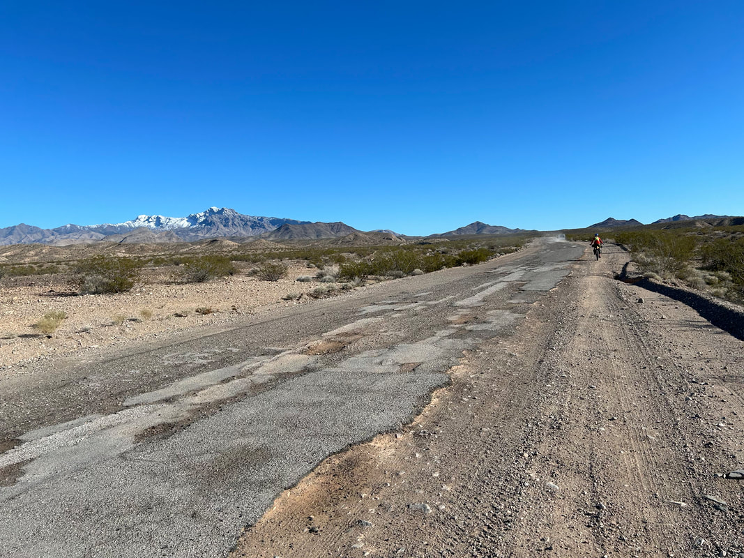
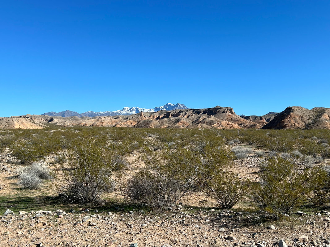
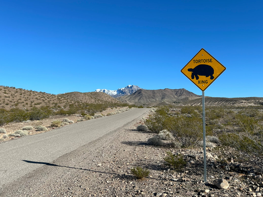
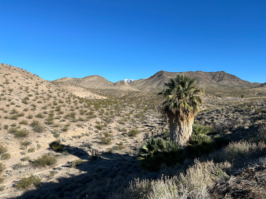
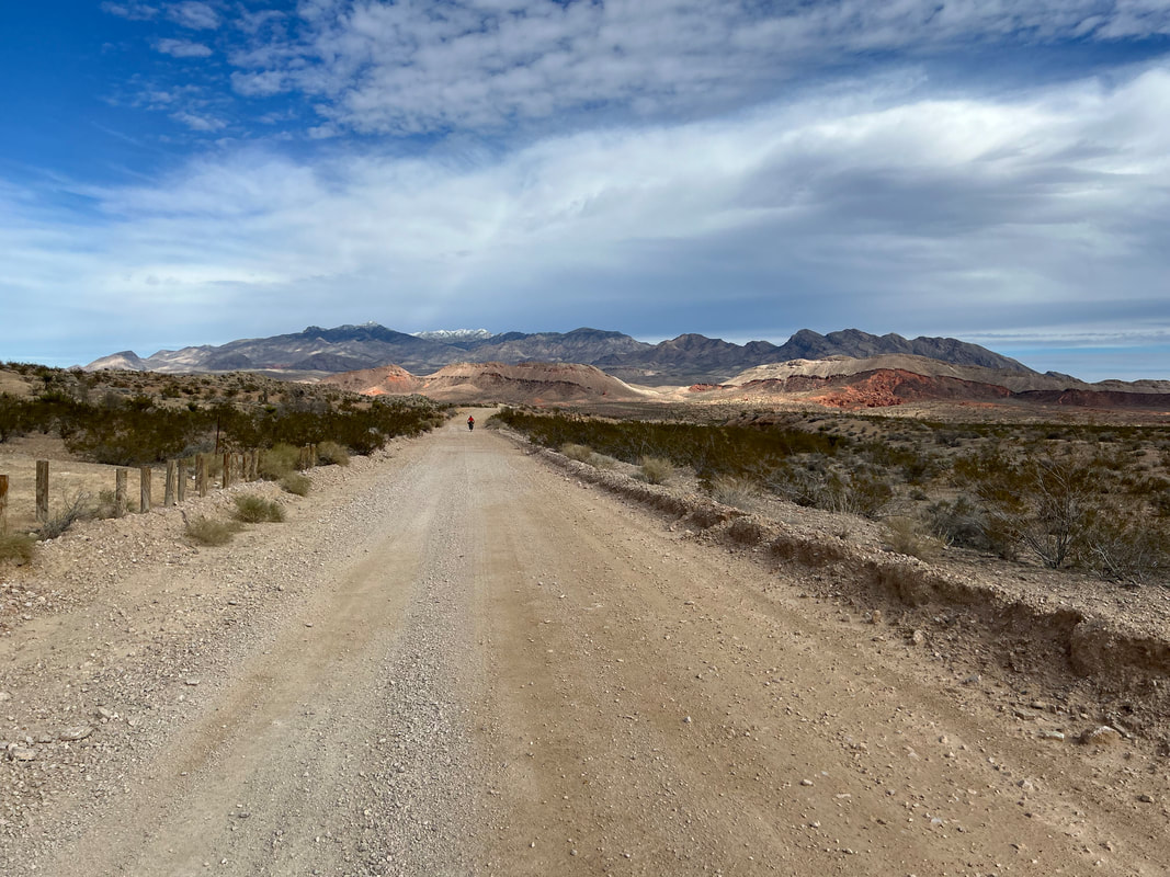
  This section of Gold Butte Road is the same section we drove in on. It's "semi-paved" meaning it consists of a patchwork of dirt and asphalt, with even the asphalt being a further quilt of potholes, gravel, and rugged blacktop. As a bike ride, it was surprisingly fresh and interesting. It always strikes me how the same experience driven by car feels so different and new when ridden by bike. We passed by the Bundy Ranch where I quickly snapped a photo before continuing along rolling terrain matching the direction of the Virgin River. One last dip brought us to a side-ride out to the banks of the Virgin River. Turning around provided a frame of dusty desert buttes with snowcapped mountains behind. The churn of water was beautiful behind me. Janna and I got back on our bikes and joined the road again as it turned inland away from the river and began a couple thousand food ascent. Gold Butte Road climbed up hillsides and shot right for the footbase of the Virgin Mountains. Signs appeared roadside warning of Mojave desert tortoise crossings. Large fan palms grew interspersed near springs in crevices of the land. The white-capped peaks rose in front of us, and we entered Gold Butte National Monument once more. The climbing continued on and on until it leveled out a bit as we came to the yawning basin beyond Little Virgin Peak. Here, Joshua trees and yuccas sprang once more from the land that stretched and tilted towards a very-easy-to-see Leak Mead. The slant of light at this time of day, at this time of year, made the sky all juxtaposed blue against a tawny tumble of earth. It became a race against the end of daylight to get to Whitney Pocket. The mountain's foothills closed rank to our lefts and suddenly pocked buttes came up on our rights. The Whitney Butte area was all red and golden from the setting Sun making for extraordinary shadows cutting among the rock. We pulled up to the parking lot where our car was parked absolutely stoked on an amazing sunset. And more-so, I was riveted by how good the riding and views along the route were. We finished satisfyingly eating snacks under a warm sinking sun in the heart of the desert in February. 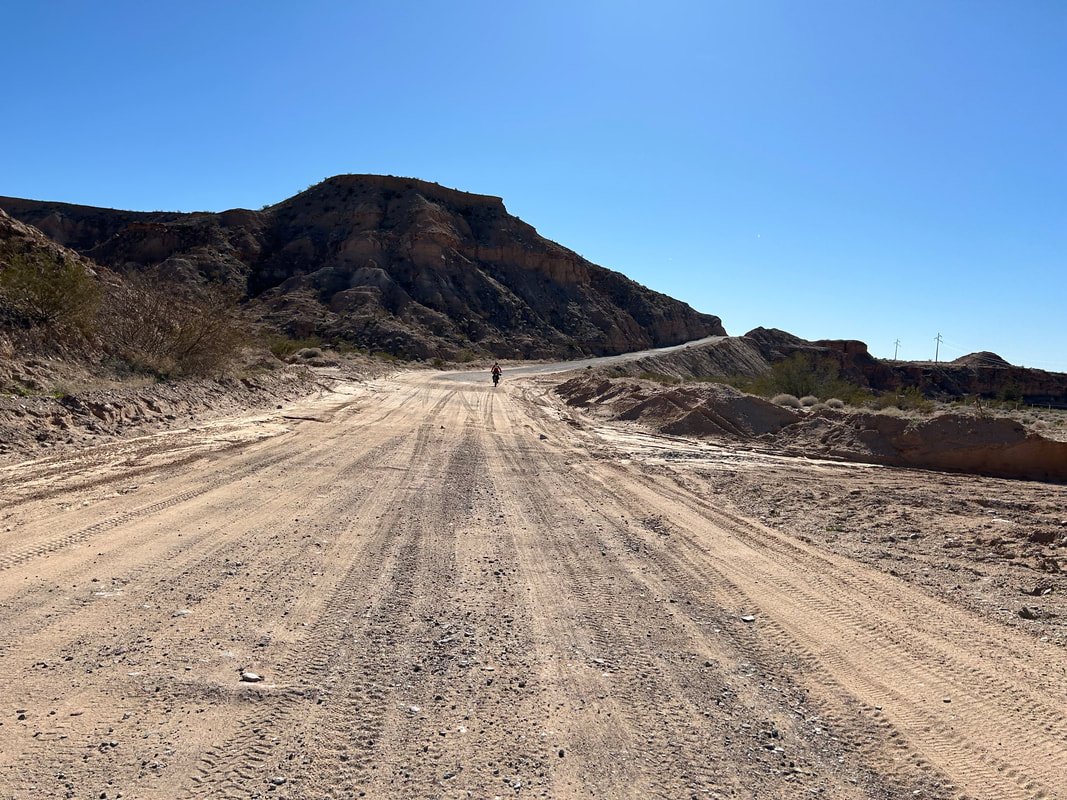  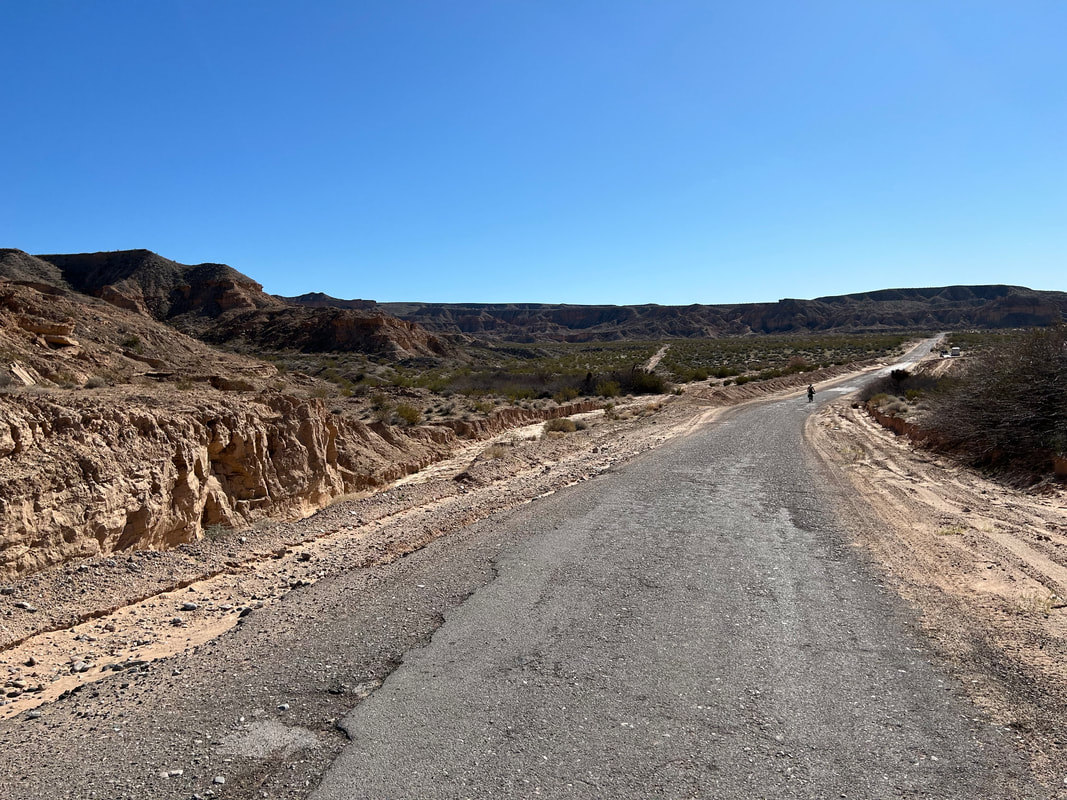
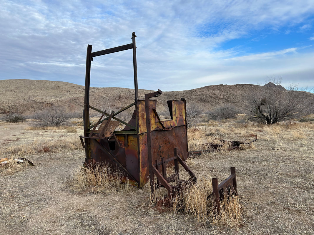
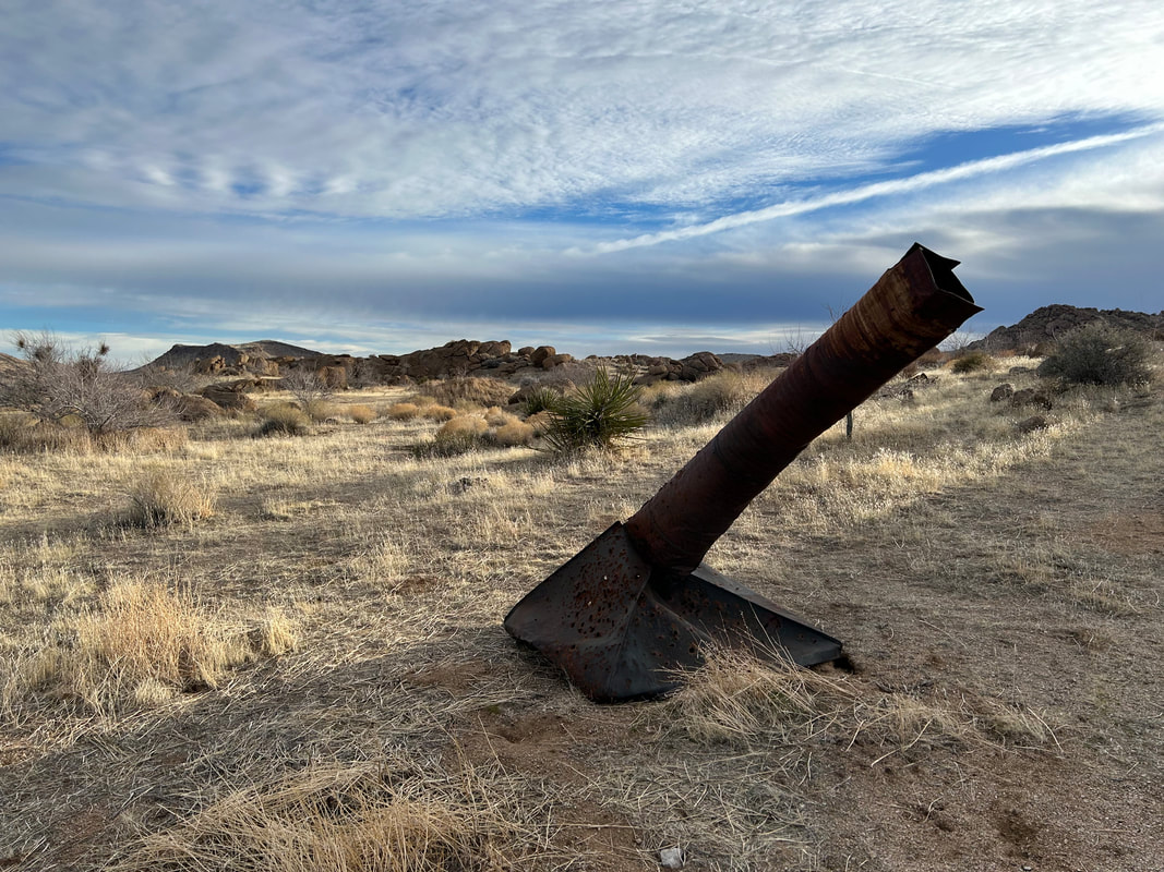
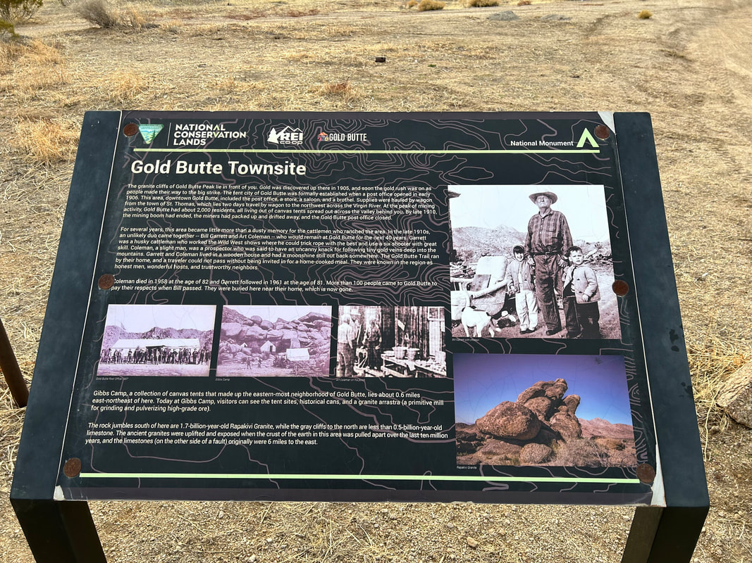
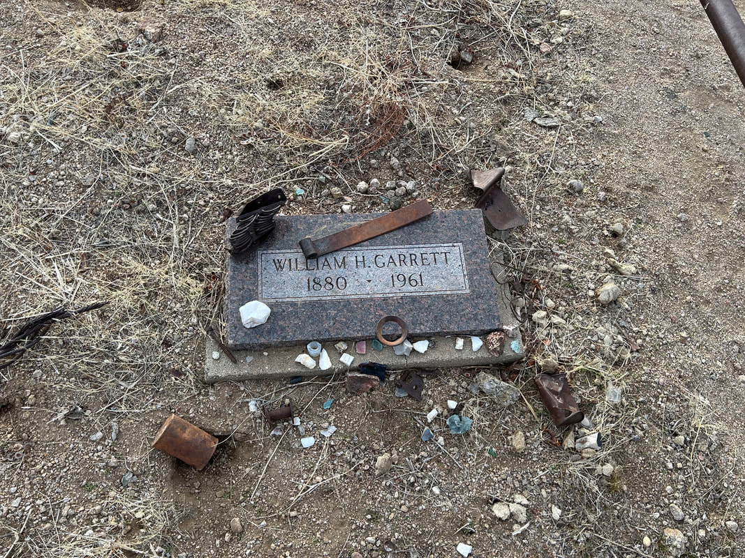
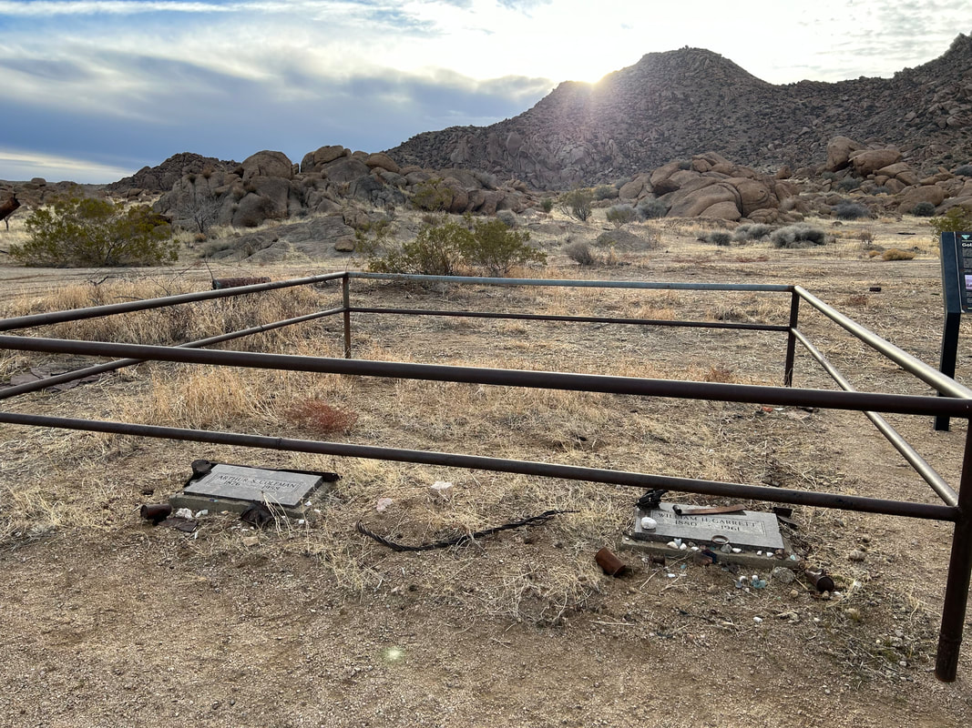
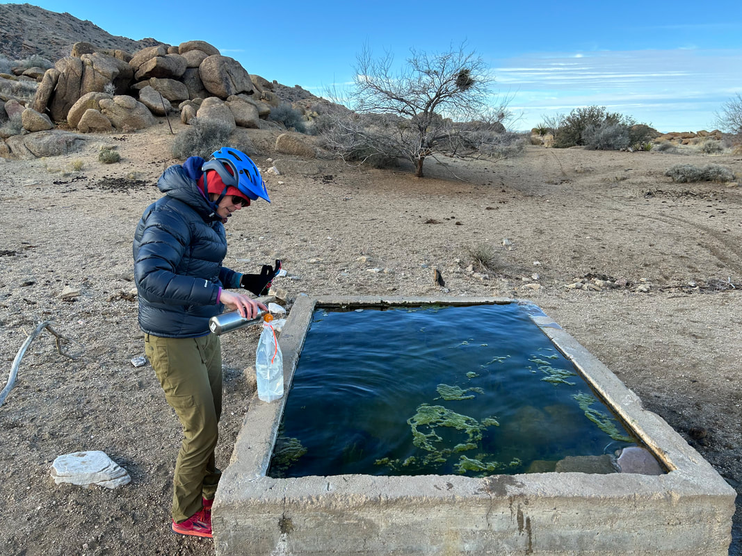
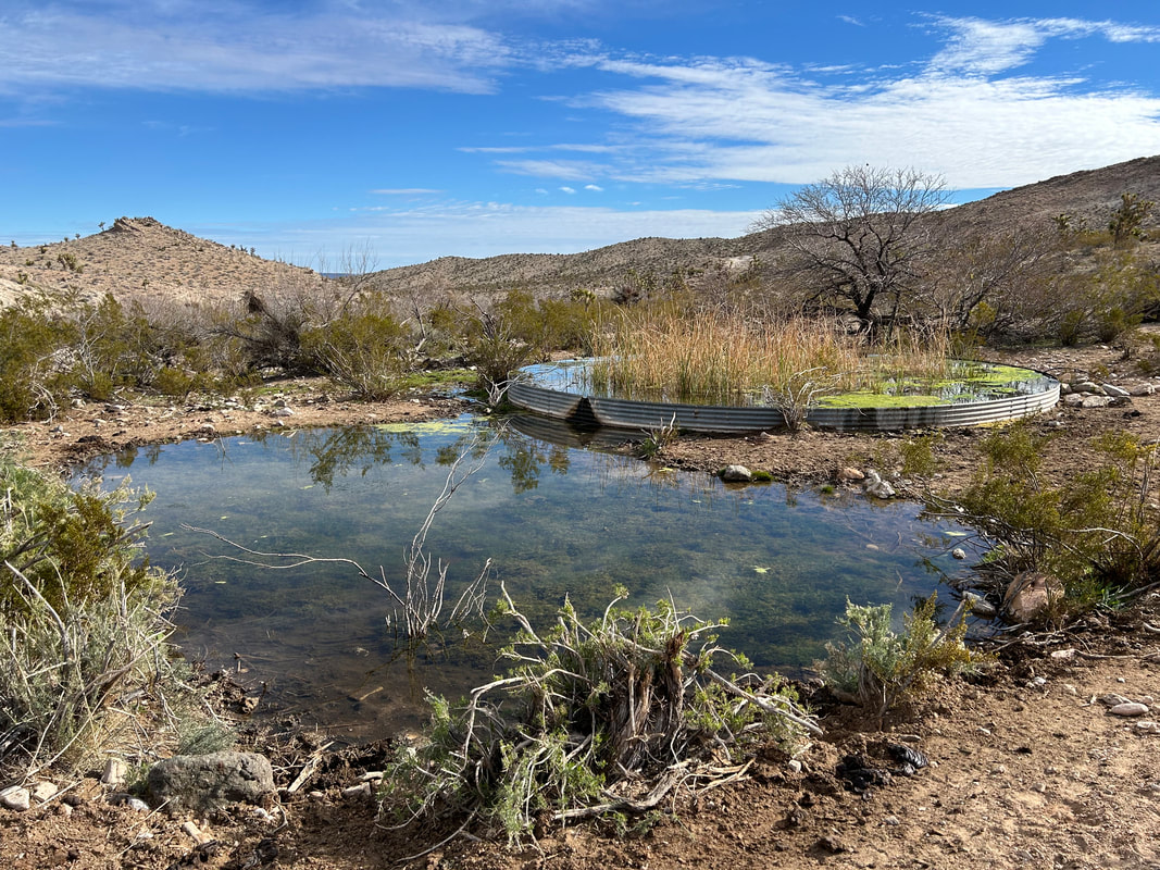
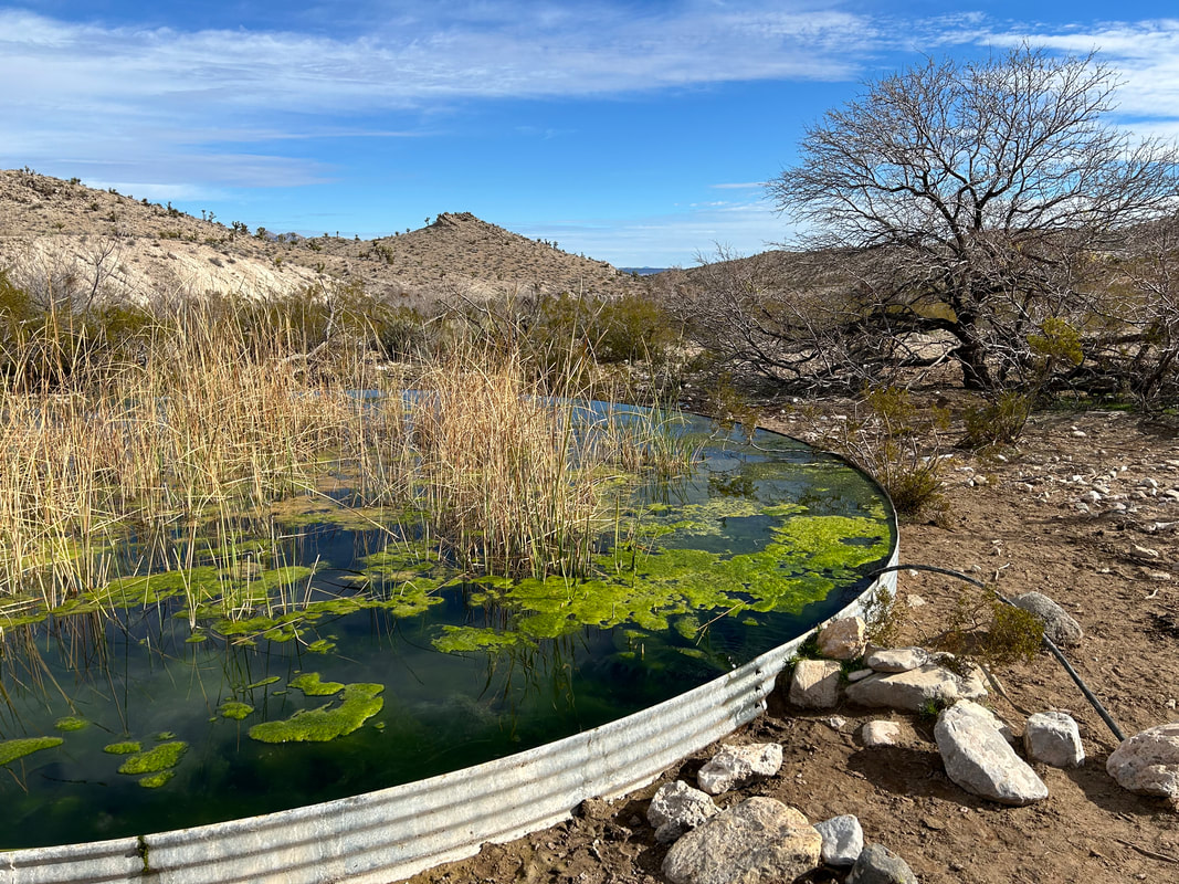
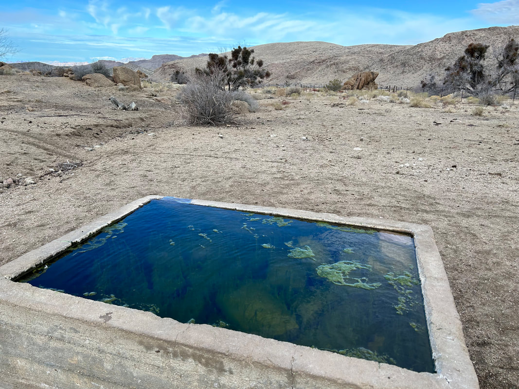
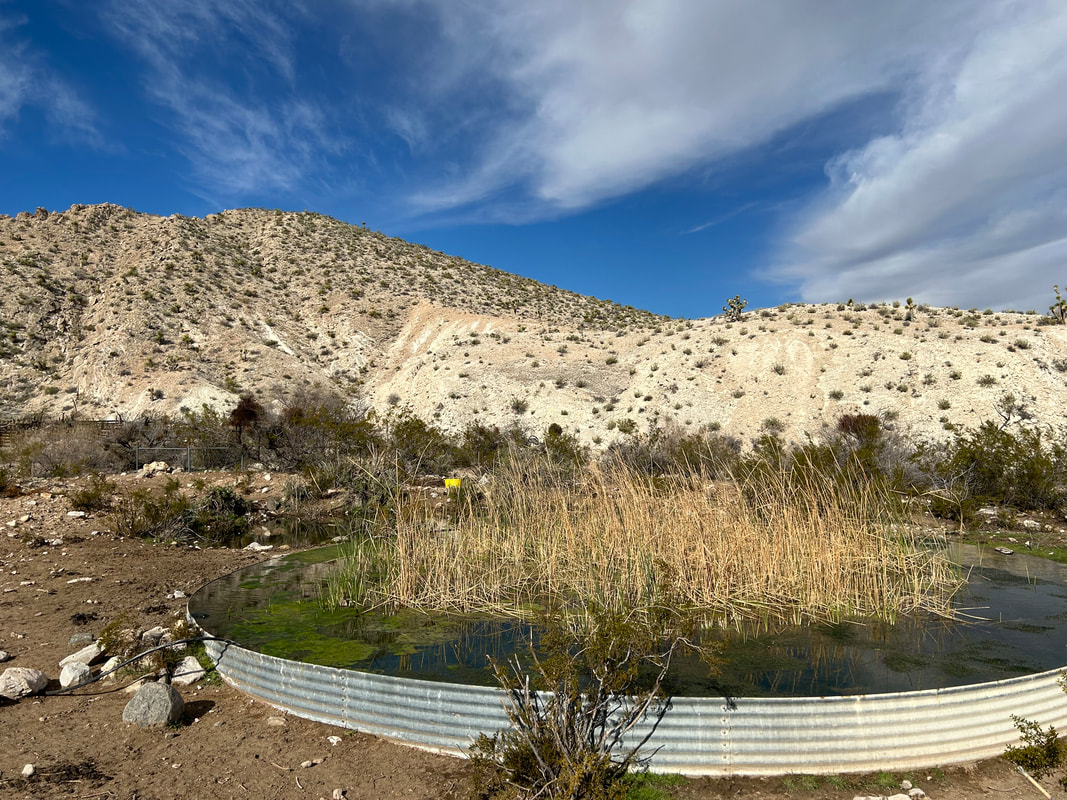
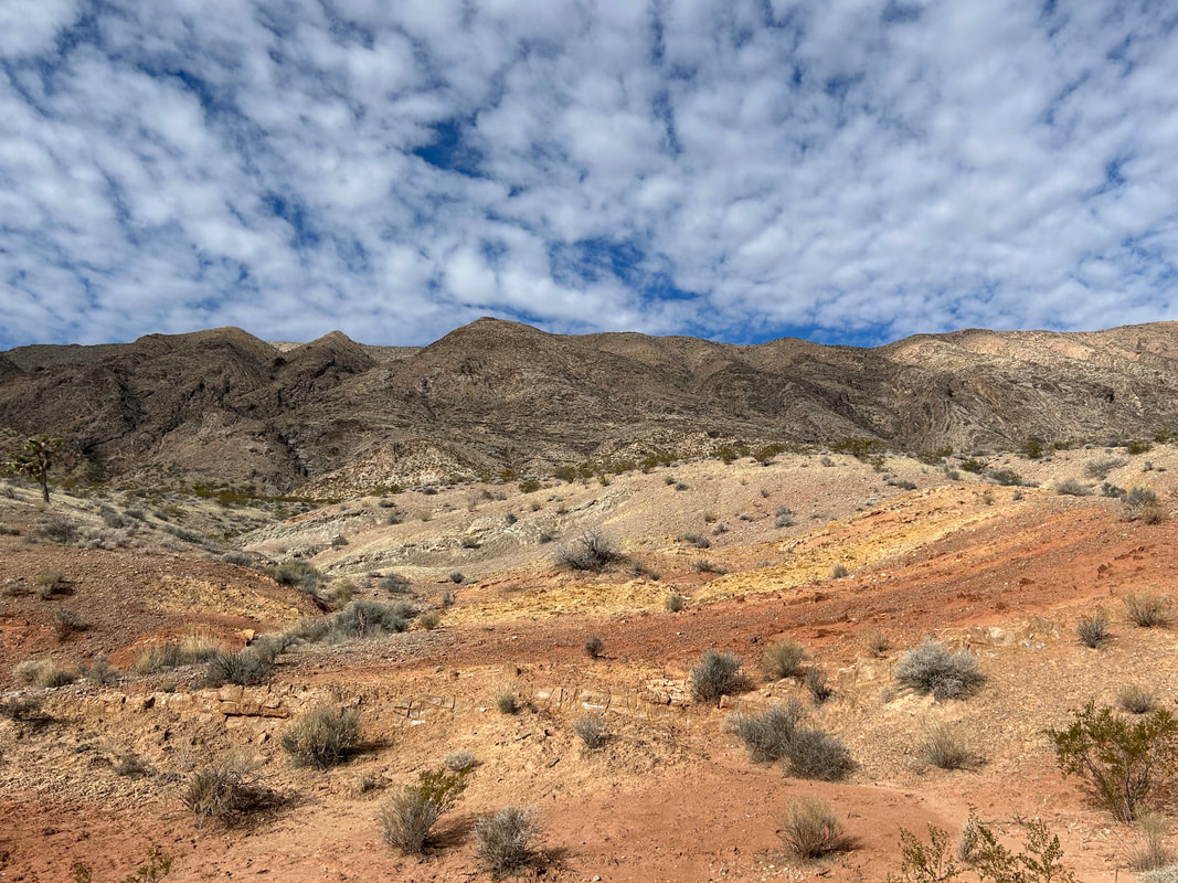
     47.78 Miles; 4,856 Feet of Gain; Gold Butte Townsite to Red Pockets Mountain in Grand Canyon-Parashant National Monument 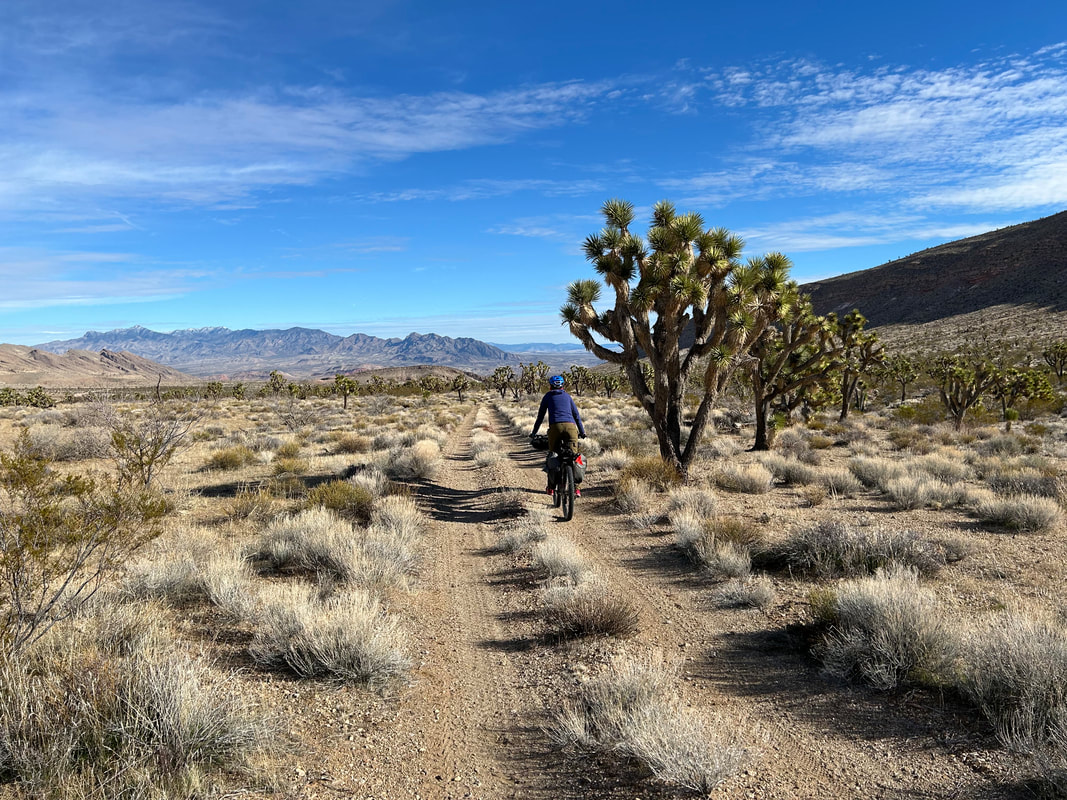 The night was calm, dark, and we slept hard. We awoke to one of those worlds where the desert sun angles its shine between muffles of cloud. Because we had arrived and biked after dark, I was curious to see what Gold Butte and its townsite looked like in the day. In the distance, far reaches of mountains many miles away stood incrusted in sheens of snow and ice over valleys of desert. We set up breakfast, feeling happy to be out here, followed by packing up our bikes. Then the two of us walked over to the actual Gold Butte Townsite. The area was littered with old mining equipment from a heyday of when a post office, lodging, saloon, brothel, and a city 2000 people living out of tents were found here in the 1800s during the height of a gold boom at Gold Butte. I found an old fenced mine shaft amid metal machinery. There was an old, but well-kept, cemetery for two men who had lived and died here in the middle of the 20th century. The sun continued to struggle with cloud amid bursts of blue sky that contrasted with the gray overhanging the golden-grass desert below. We hopped on our bikes and continued about a quarter mile down the road to where Granite Spring was. I had no hope for Granite Spring as it was commonly dry. But we pulled up to an overflowing and clear cement trough obviously piped from the spring-proper that was a hundred feet away. This was probably an illegally irrigated trough done by the Bundys sometime in the past several years; there were cows lounging nearby. But, it was a benefit to us (and future bikepackers on the route). I walked the spring back to its source using USGS maps and found some damp ground-substrate with shallow holes amid a tangle of plants. Nothing to rely on at the source, but that piped-trough was sure to be reliably-filled after winter storms. We filled up our reservoirs just in case Horse Springs was either dry or nasty. 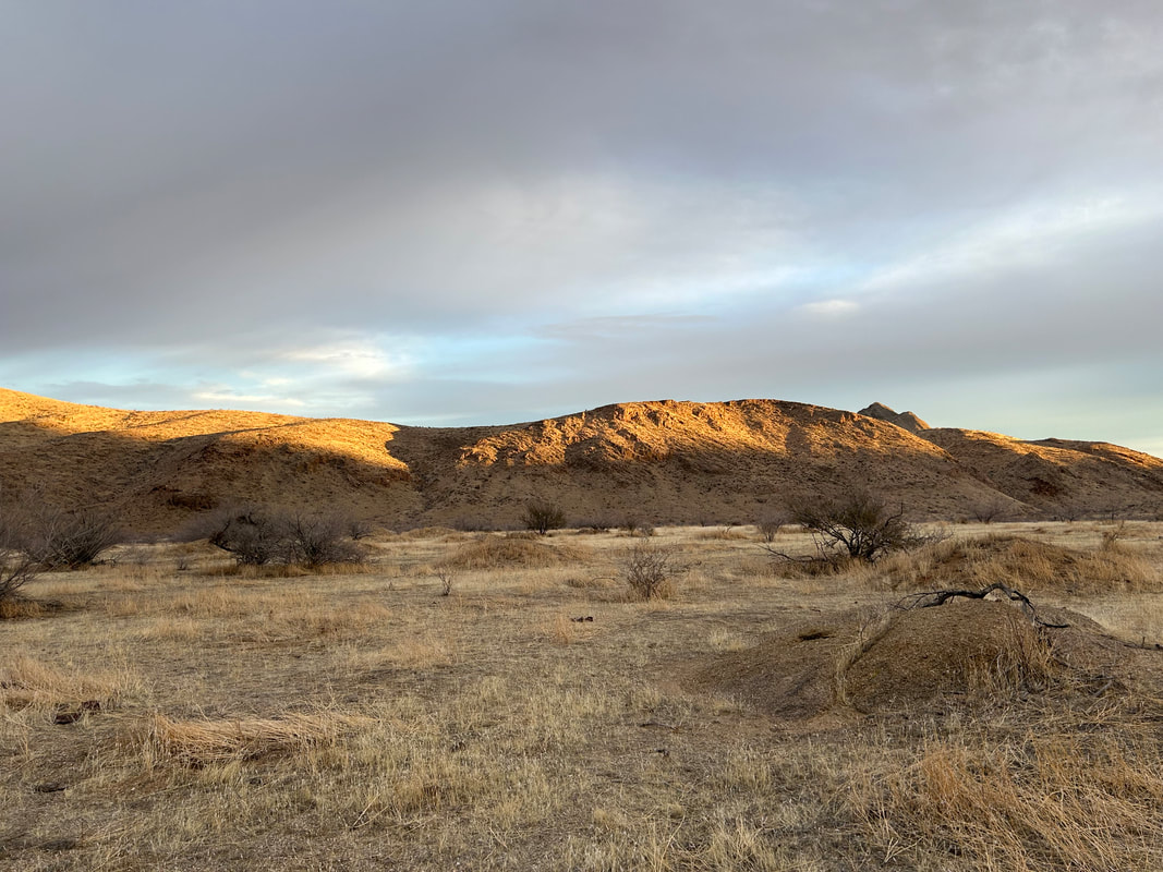
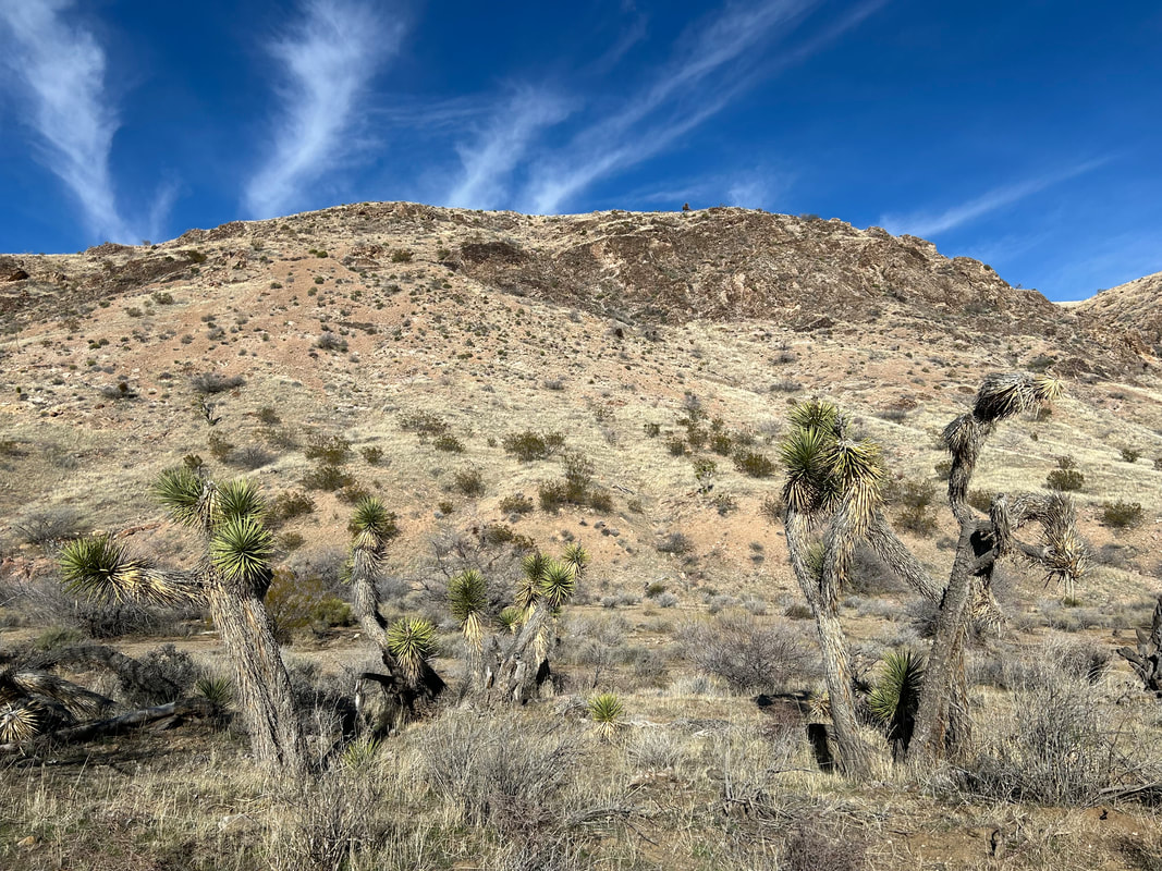
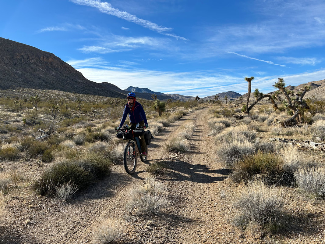
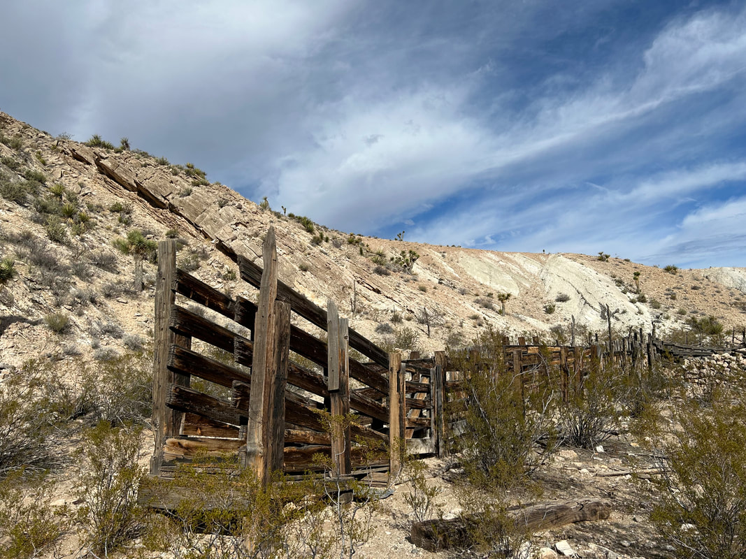
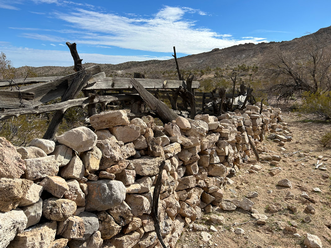
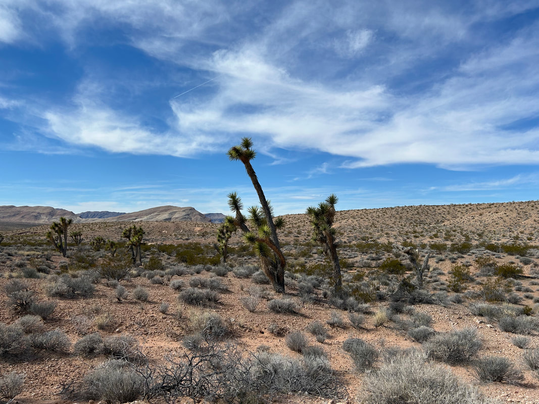
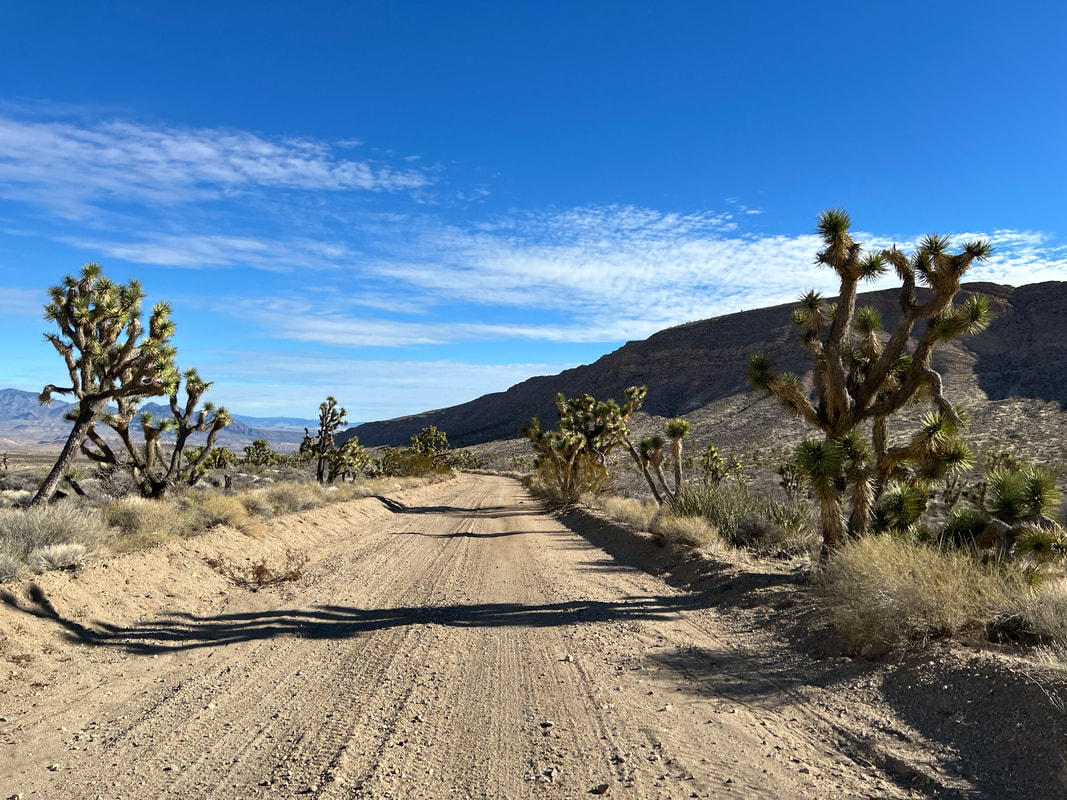
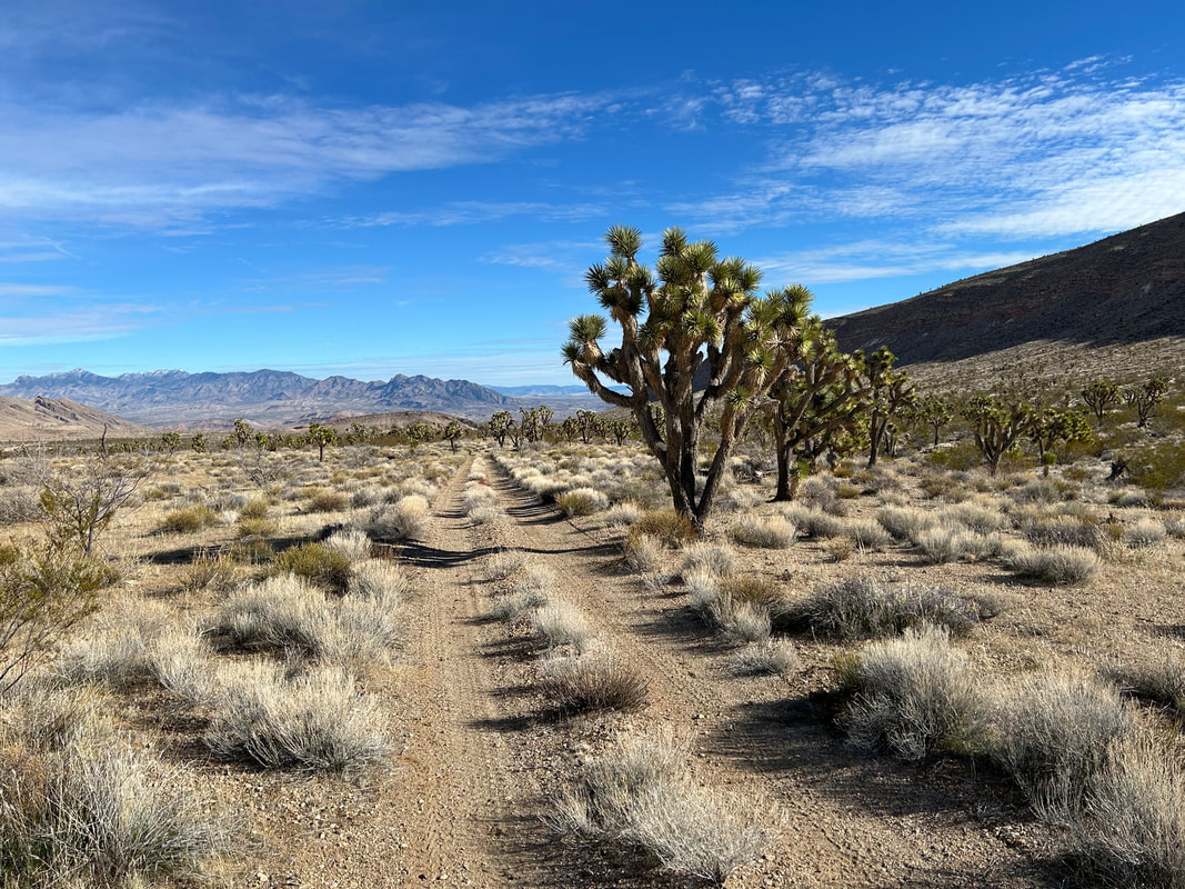
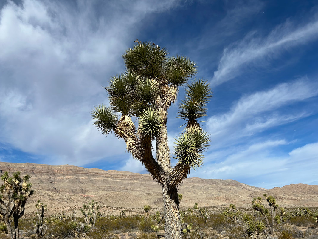
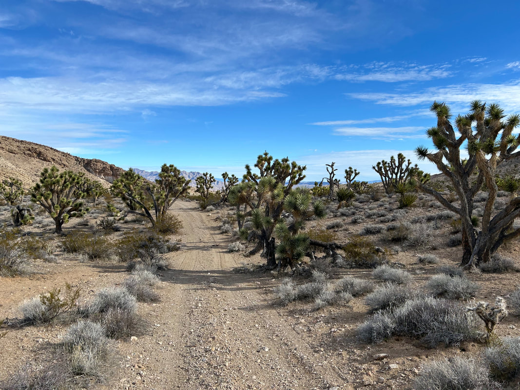
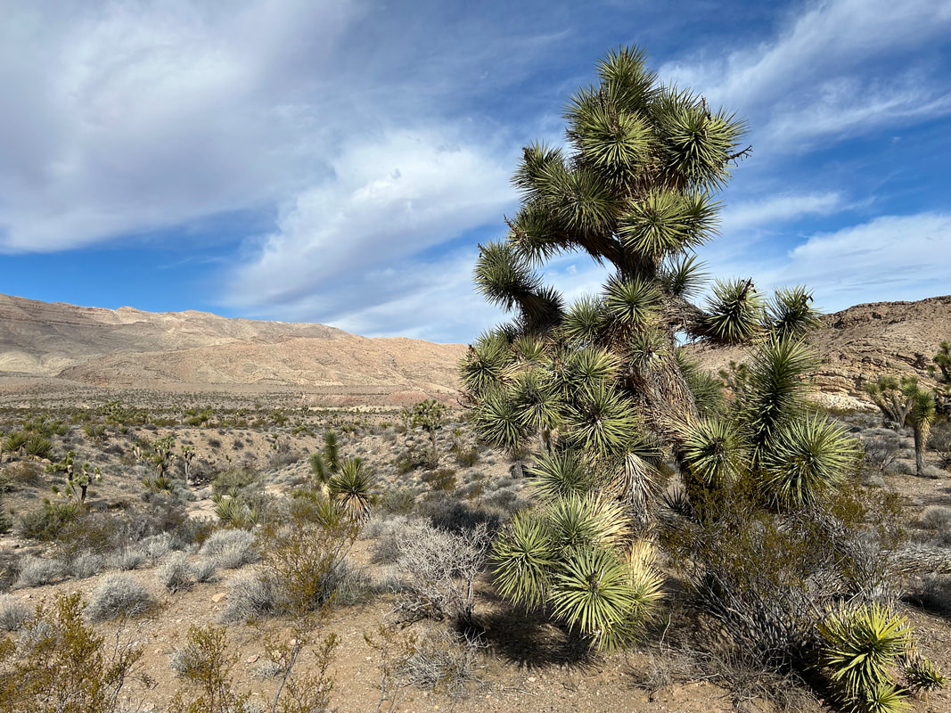
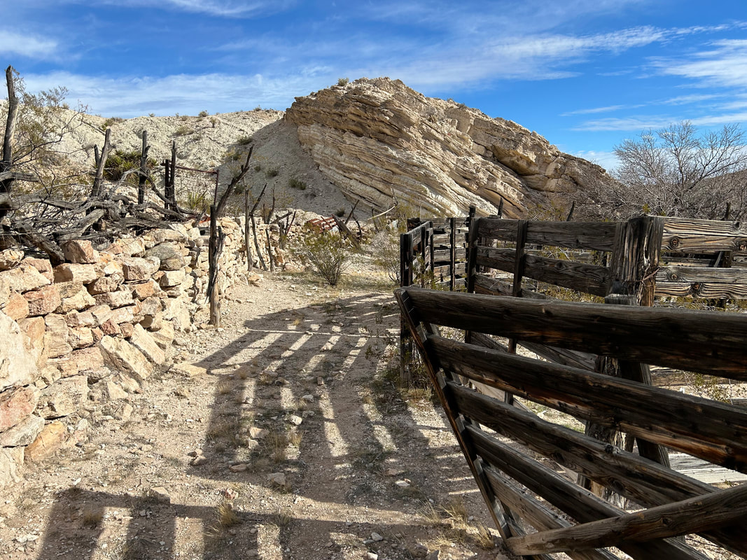
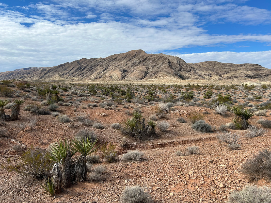
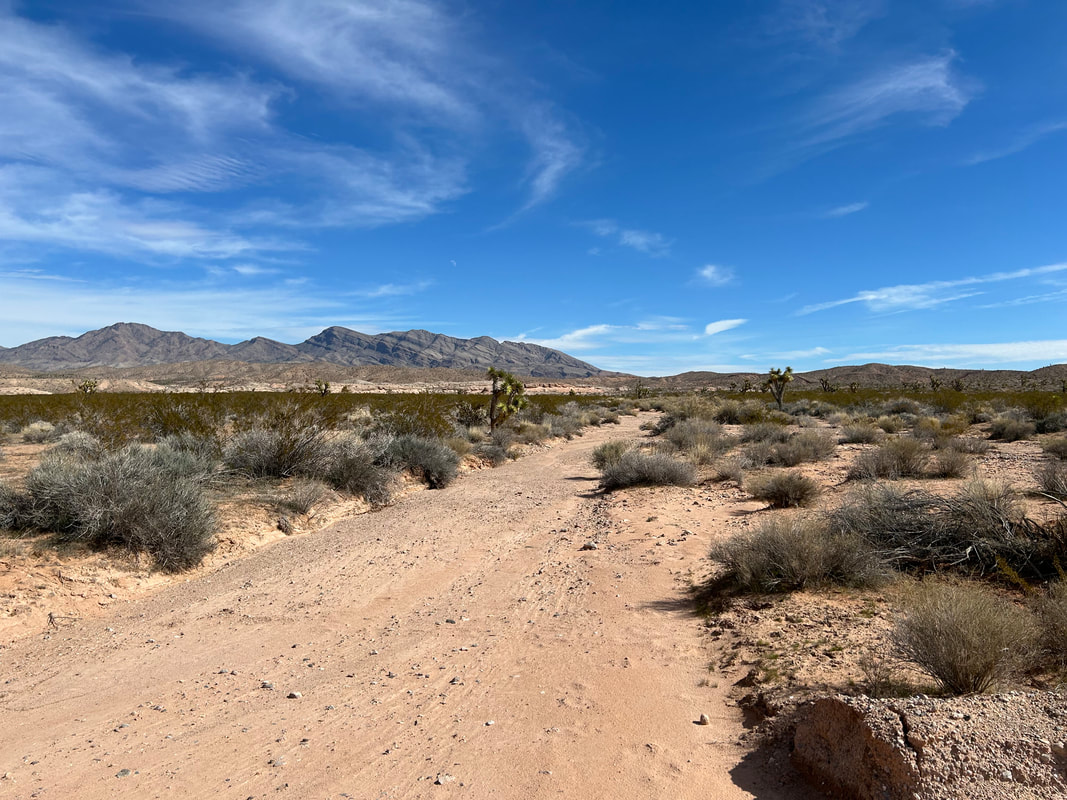
New Gold Butte Road was incredibly smooth and well-maintained after the townsite. We made miles quickly under an increasingly blue sky. Joshua trees started as isolated individuals that thickened into dense stands. Big, massive, and old, they gathered up along the sides of the road casting quirky shadows from the slant of morning sun. We crested the climb and started an awesome descent with sprawling views out to Greasewood Basin, St. Thomas Gap, and along Horse Spring Wash. Tramp Ridge rose up on our lefts as tawny substrate washed the land. A quick turn to the right on a road out to Horse Springs carried us on great doubletrack down through even more groves of Joshua trees and other yucca plants. I couldn’t' stop taking photos of the trees against the mountain backdrops. And quickly enough the road took us right into the heart of Horse Spring Wash. Here, under the gaze of an unnamed butte, we leaned our bikes in the sand to take a look around. Janna opted to rest in the shade of mesquites while I headed down the wash looking for the spring. I came upon an old corral made of sun-worn wood and old stone. Just across from it up an adjoining bank was the opening to a makeshift corral illegally crafted by the Bundys for cows. Horse Spring was previously a bit of a puddle seep, but the Bundys had dug up the source and installed a pipe to a metal trough that now resembled a verdant aquaculture setup out in the desert. I made a note of its good reliability. I made my way back to Janna where we got back on the bikes and pedaled along the primitive connector road back to well-maintained Gold Butte Road. The connector was sandy in spots and rocky in others, but was short in length. 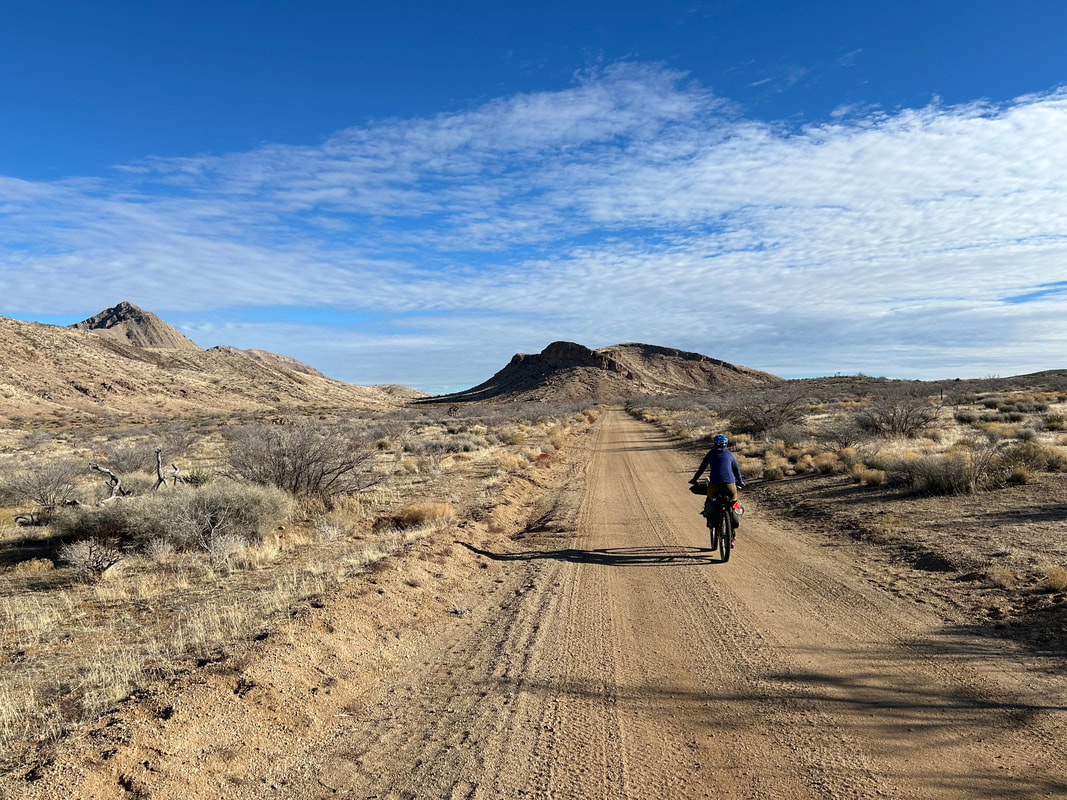 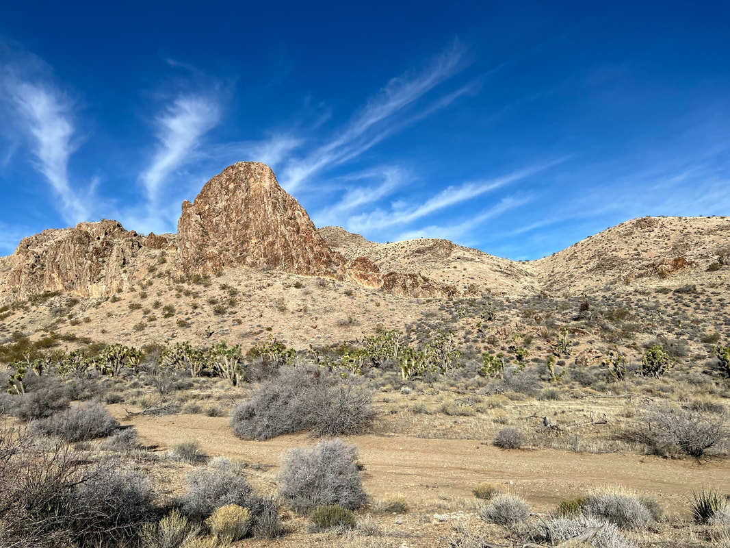 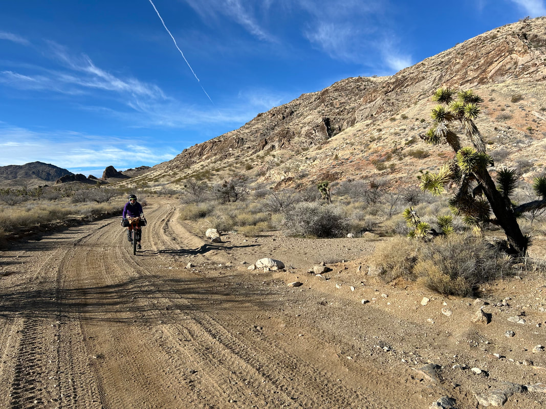 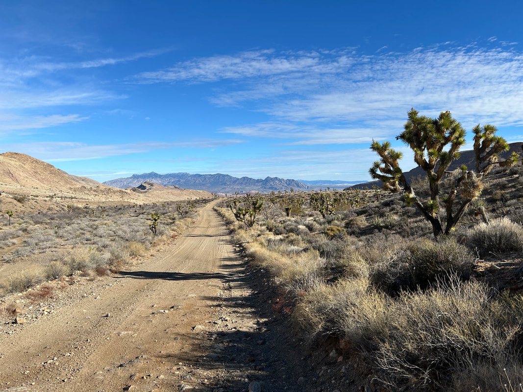
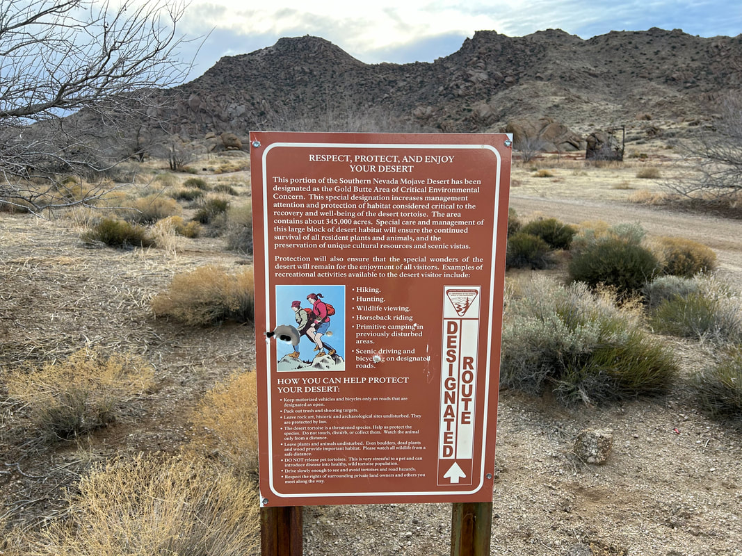
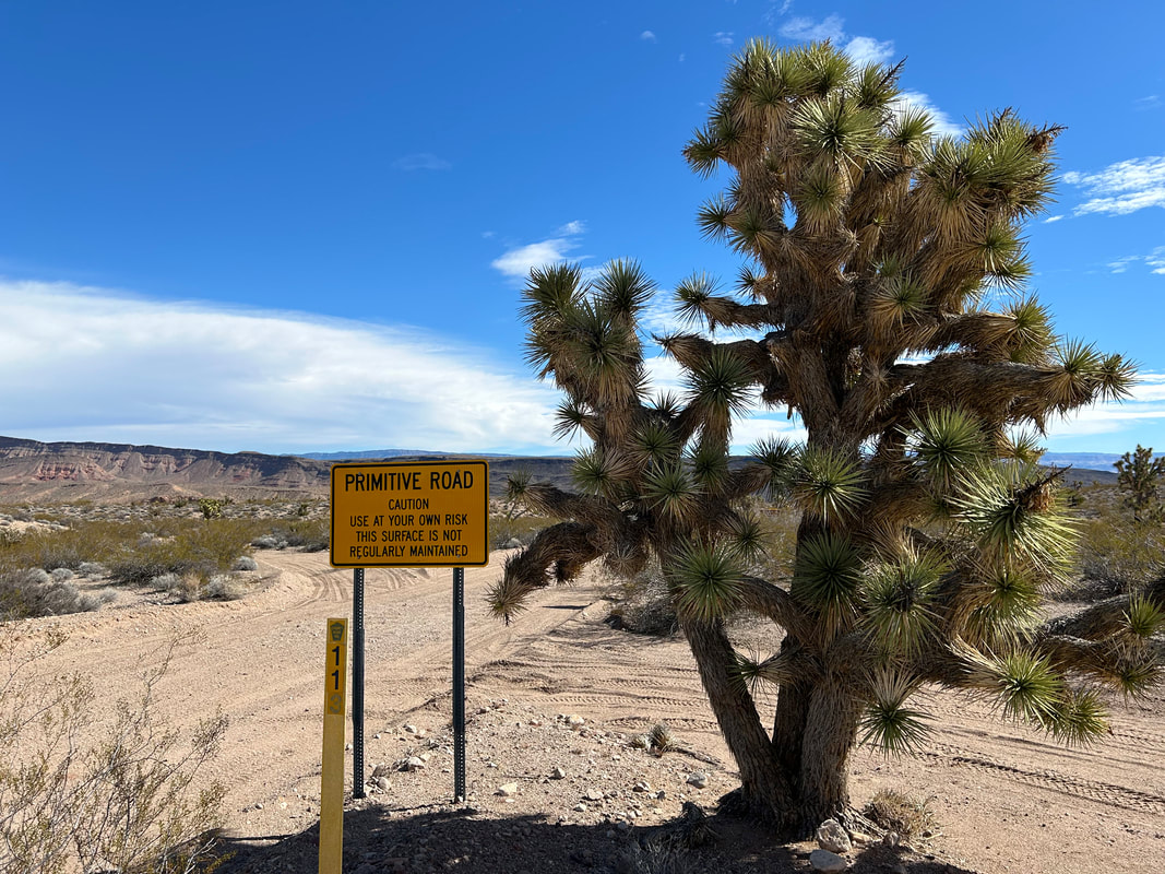
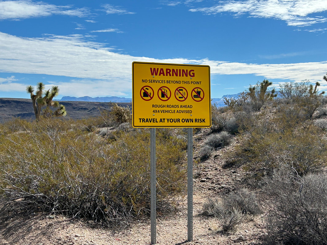
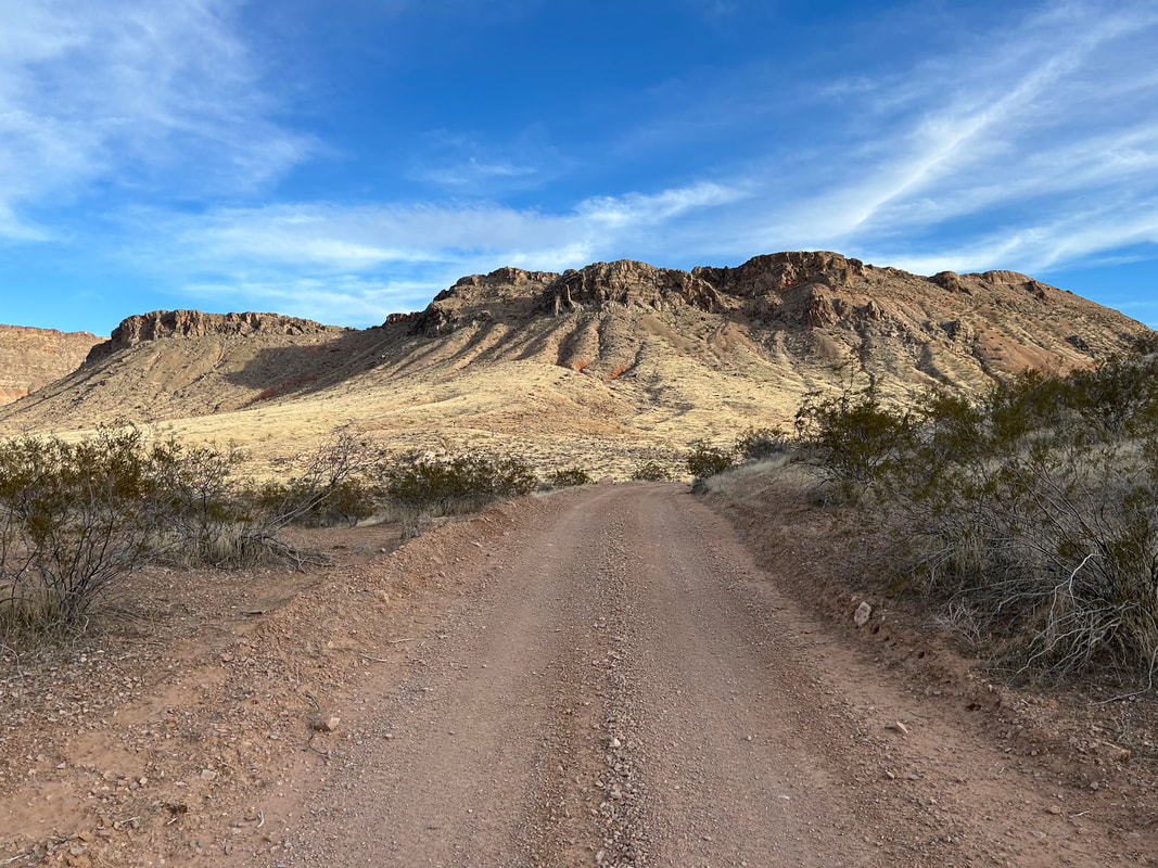
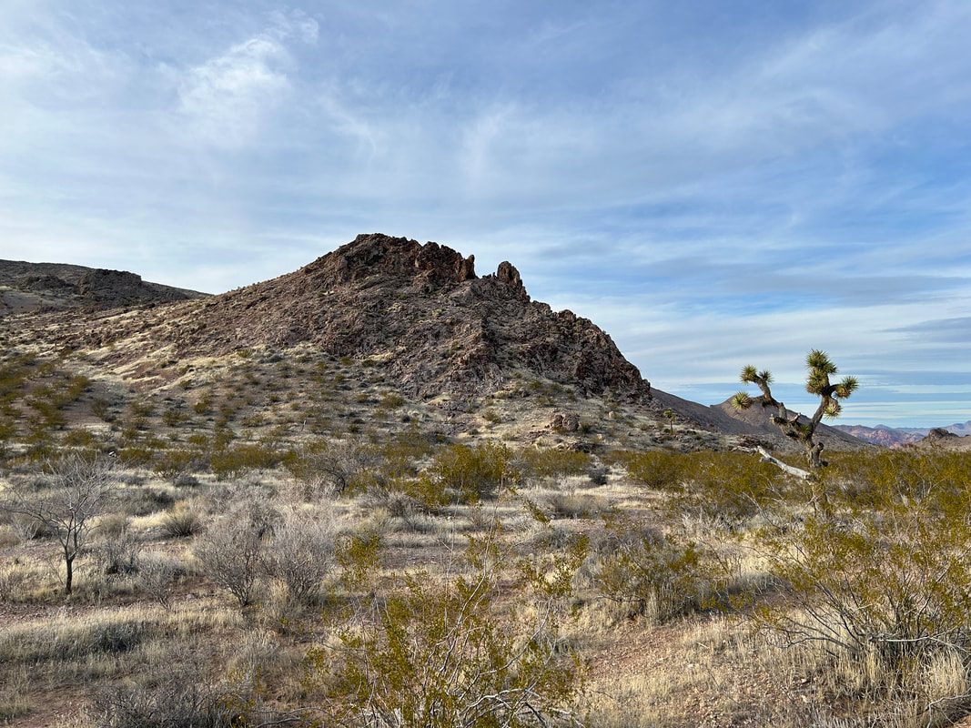
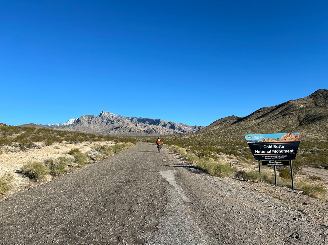
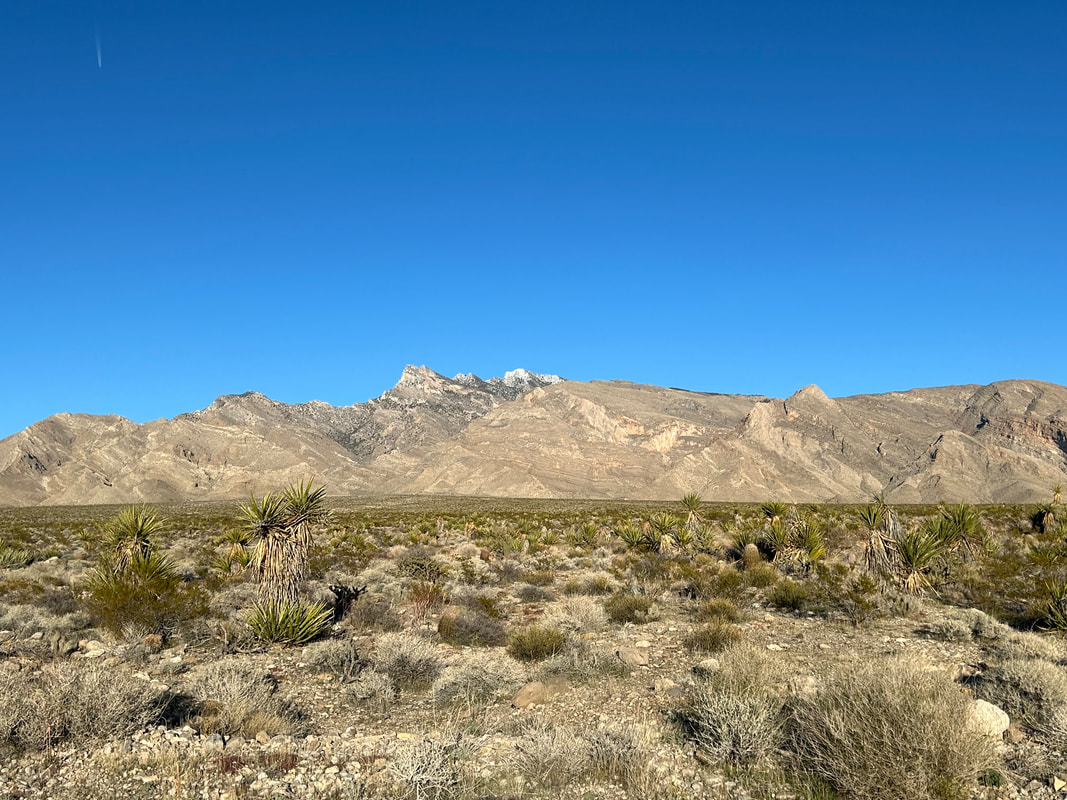
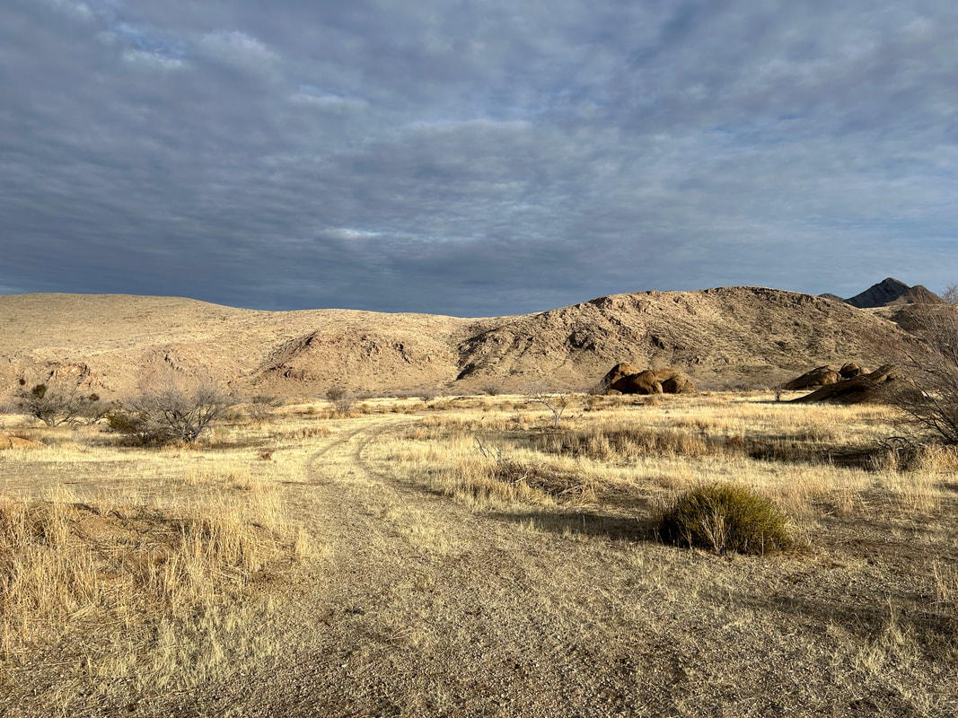
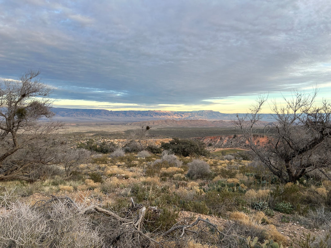
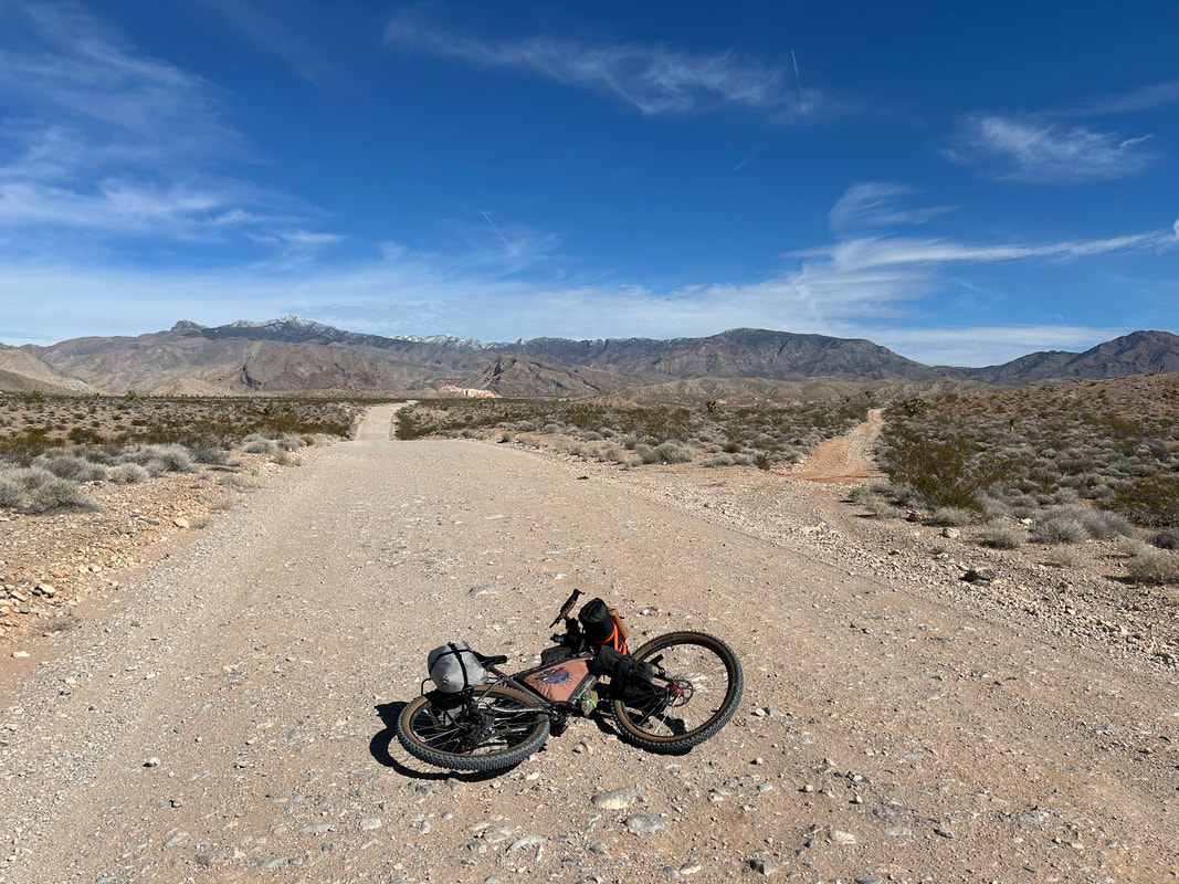
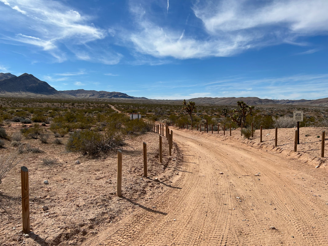
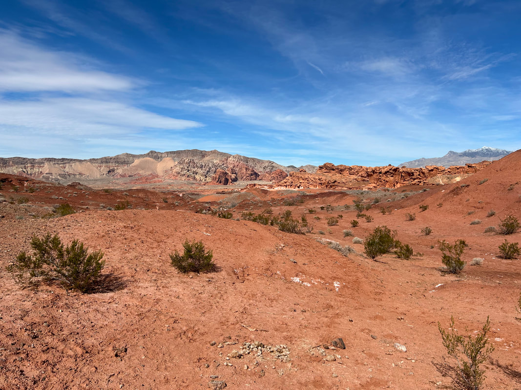
  Back on the main road, the surface continued to be excellent. We sailed down towards the increasingly widening basin. I could not get over the colors and spewing layers of rock just flowing out of the mountains. The distant Virgin Mountains with their white-coated tops just hung as a visual depth-cue over the red heart of the desert ahead. It was right at our arrival at St. Thomas Gap that the clouds shifted overhead, mottling the distant Mud Hills with light-interspersed that made us stop and just take it all in. At the junction, we swung right and started down a bit rougher road to the stateline between Arizona and Nevada. The NV/AZ stateline is also the division between Gold Butte National Monument and Grand Canyon-Parashant National Monument. Janna and I stopped to take requisite photos of the National Monument signs, noting the series of signs in tandem upon entrance into the Parashant that warned of no rangers, no services, no food, no cell phone signal, and no gas. Message received: it's remote and we travel at our own prepared risk. The road got a little sandy at this point and I was worried it might sand-up severely over the next several miles. Instead, it only lasted a few hundred feet before becoming glorious hard-pack again. Cloud-cover gathered in the west which was a welcome respite from the Sun. It wasn't too hot, but exertion always adds some warmth. Ahead the Grand Wash Cliffs stretched rim-like to a plunge out where distant Lake Mead must end; those cliffs mark the official end of the Grand Canyon. Ahead of us, they were all topped in snow. The road overlapped with Black Wash for a bit making it rocky from erosion/deposition in spurts, but a turn to our lefts taking us northeast carried us back up to better surface. 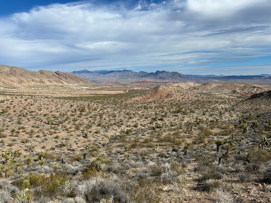 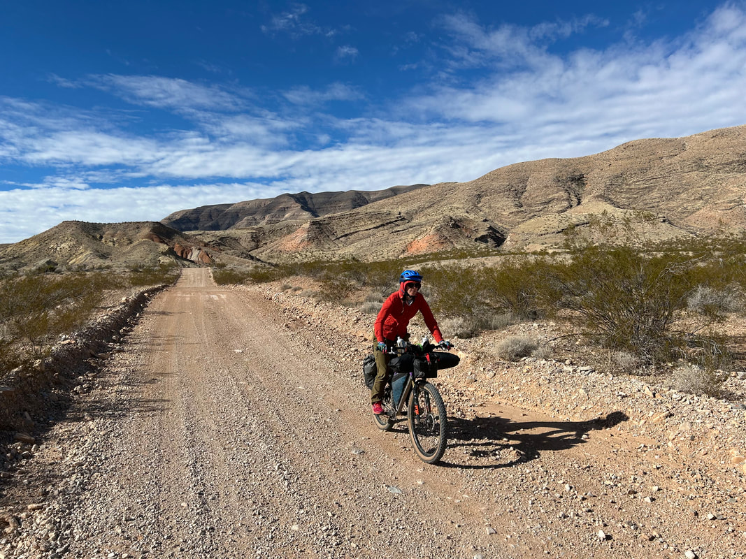
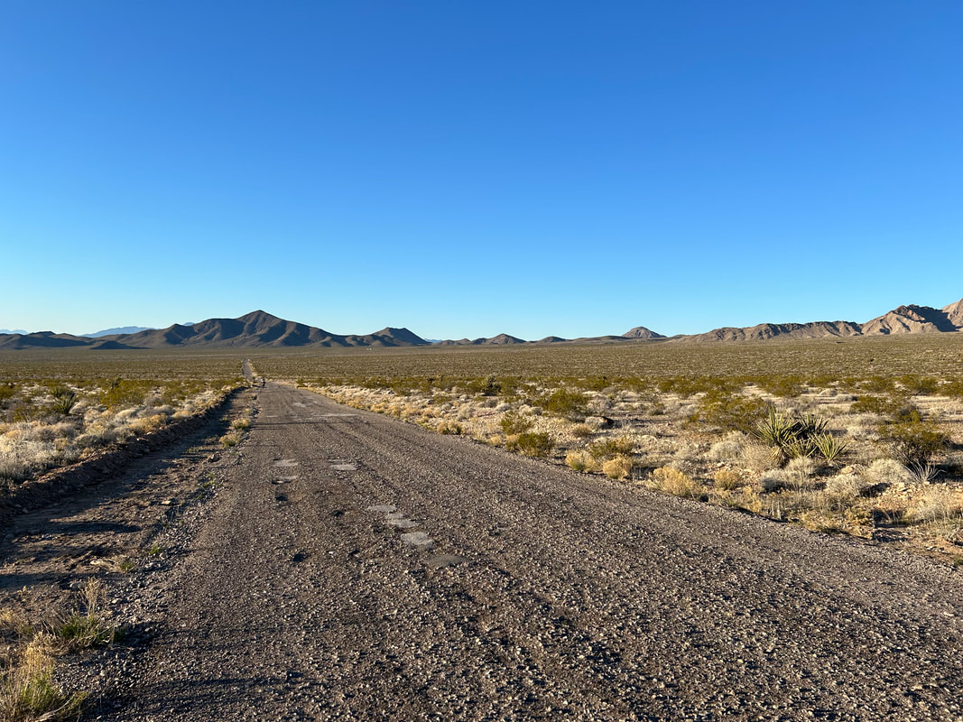
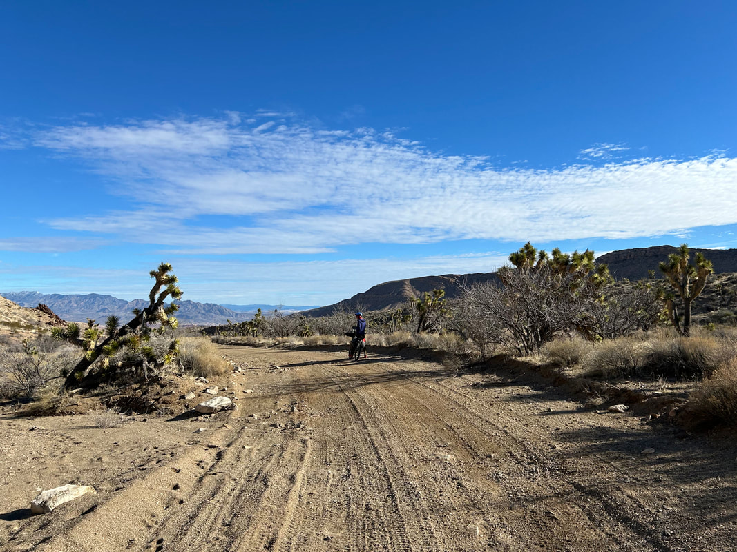
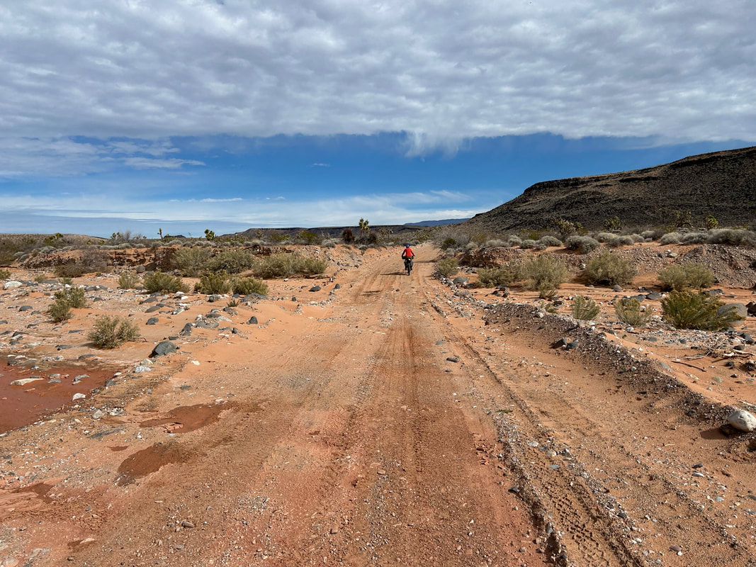
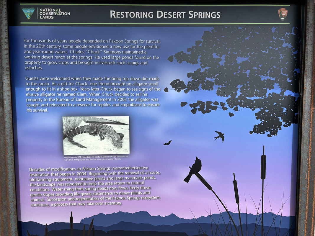
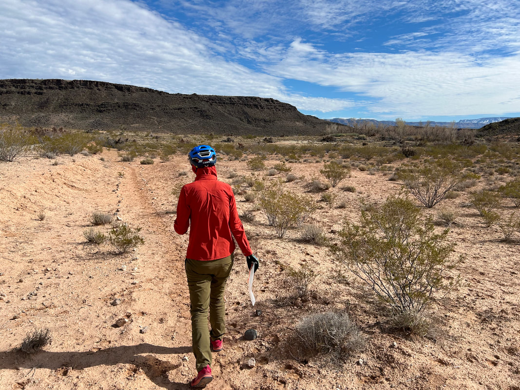
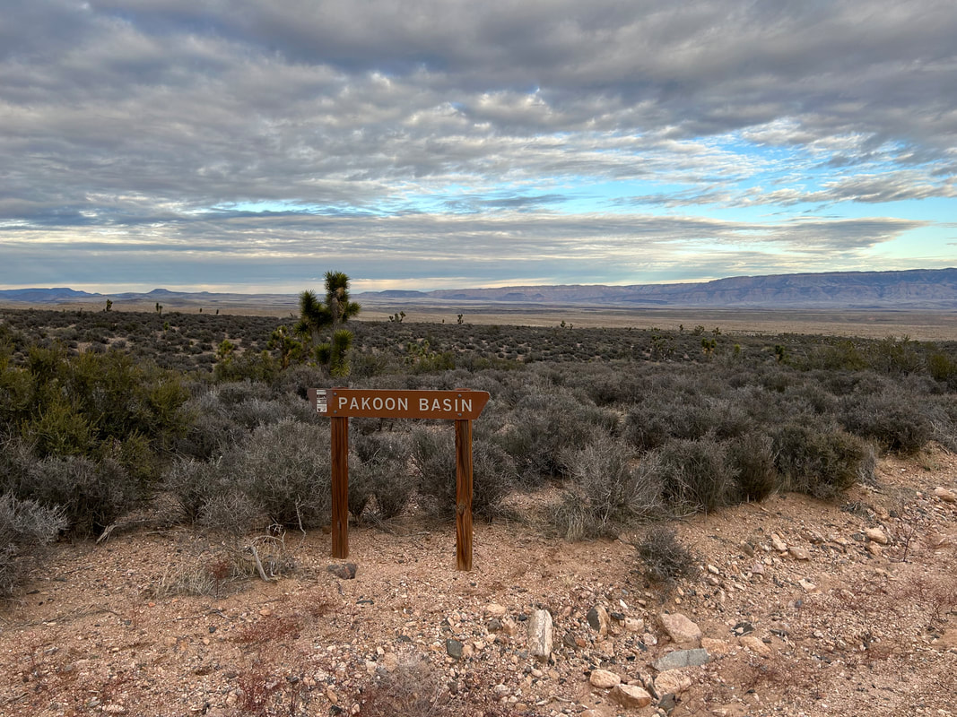
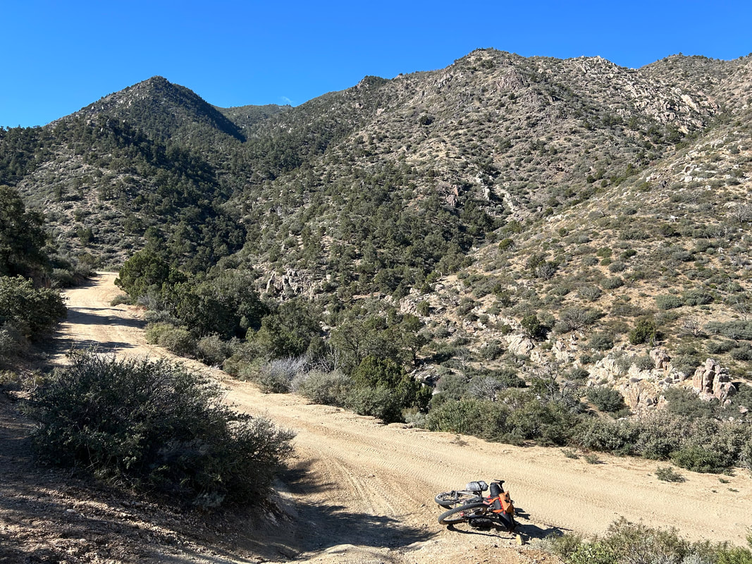
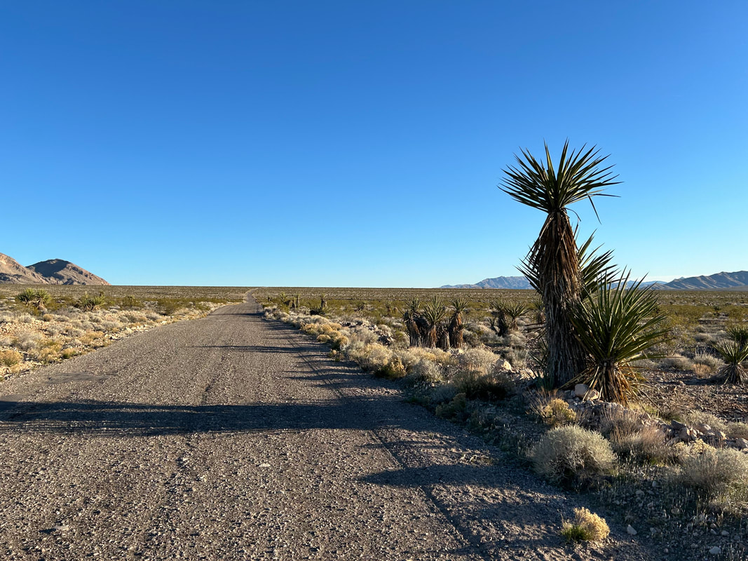
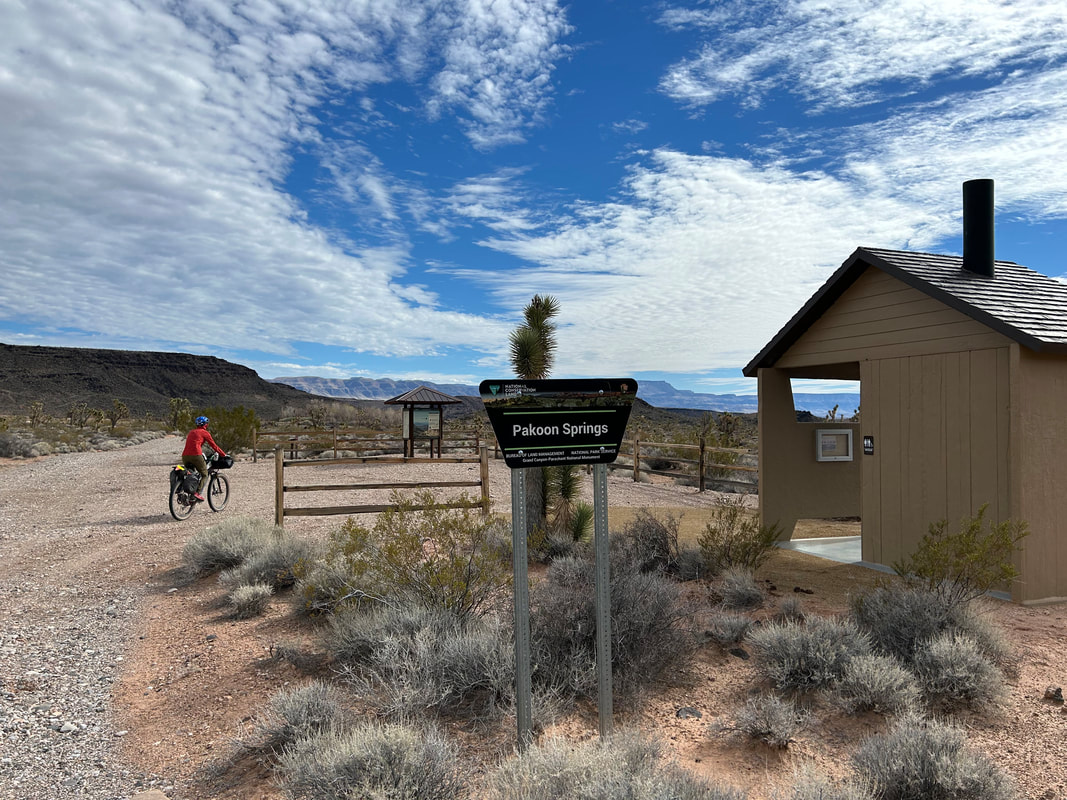
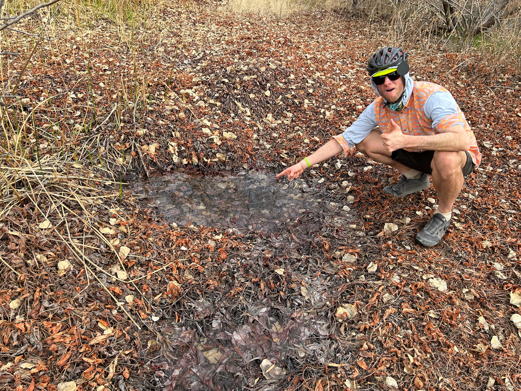
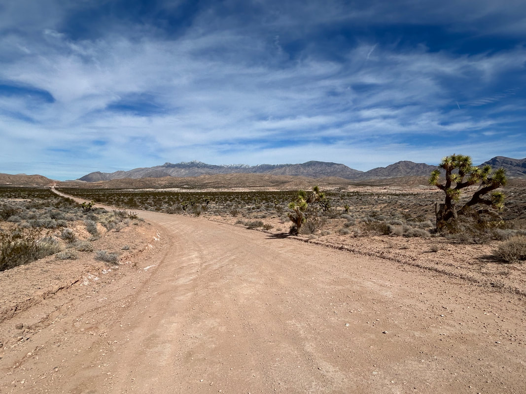
     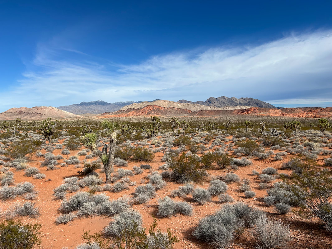 In fact, I couldn't believe how good the roads were out here in the Parashant so far. This area is notorious for eating car tires. But they were honestly really nice. Granted, this was probably the best time of year to ride the roads for their condition: early spring before monsoons and late enough after the fall that they've smoothed over. Consequently, we cranked out some good miles despite the gradual uphill. Even with small dips crossing gravel-washes, the road would rise up and settle into a solid surface once again. Eventually, the road carried us up and over the lip of a climb where old fencing gathered along the road-edge. Turns out we finally arrived at Pakoon Springs - a place I've wanted to see for years. Pakoon Springs has been undergoing some ecological rehabilitation for the last few years. Prior to this, it was a private parcel of ranching land own and operated by a rancher who famously kept ostriches out here in this remote part of the Arizona Strip. Not only that, but someone brought him a baby alligator that he put into Pakoon Springs (he terraced the spring into a series of ponds). When the ranch was sold to the BLM in 2002, Clem the alligator was still happily living in the spring. Scientists removed him, and he's alive and well to this day living in Phoenix. And with the sale of Pakoon Springs to the BLM, some significant work has been done to remove the large ponds the rancher built and encourage the spring's natural flow. Endangered relict leopard frogs have been reintroduced as well. The springs now stand as a lush oasis of vegetation and biodiversity (along with permanent water) out here in this remote section of the Arizona Strip. We were surprised to arrive and find a brand new and very clean pit toilet in a day-use parking area provided by the BLM. We leaned our bikes against a fence, read the kiosk distilling the history of the area, and then hiked the path down and into the fenced-off springs. It was definitely difficult to find the water but we eventually found a seep pooling near the surface in one area. Tip to future bikepackers on the route - water is here but it can be marshy and difficult to find. If you're worried about it, just carry enough from Horse Springs to get you to Aravada Springs. Janna and I walked back to our bikes in the parking area only to run into a bunch of ATVers who had driven in while we were down at the spring. A woman amongst them suddenly got very excited when she saw us. As we walked up, she started taking pictures and excitedly talking to us about who we were and what we were doing out here. Turns out she is one of the head land mangers for the BLM for Gold Butte and GC-Parashant. She was stoked that we were out here on bicycles and wanted to know all about bikepacking. In fact, she asked if she could take photos of us to post on the BLM page and use for future presentations about a new user group (bikepackers) out here. I was excited to talk to her and we ended up discussing the ecological, historical, and recreational aspects of the area for 30 minutes. We also exchanged numbers and got some good conditions updates on the route ahead. All the ATVers she was with were equally amazed we were on bicycles. Turns out they had made a joke about all the signs the BLM has posted in this remote area saying "Bicycles Cross with Caution." They laughed and said what bicycles? Only to run into us an hour later. 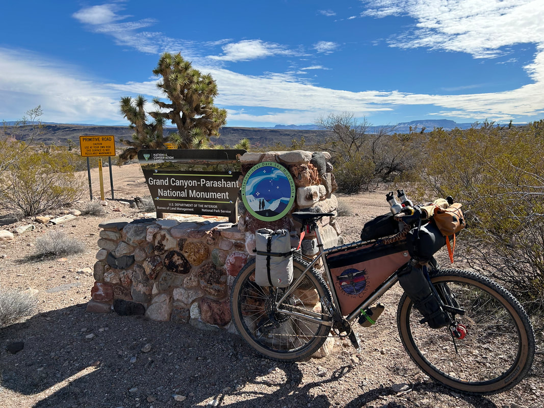
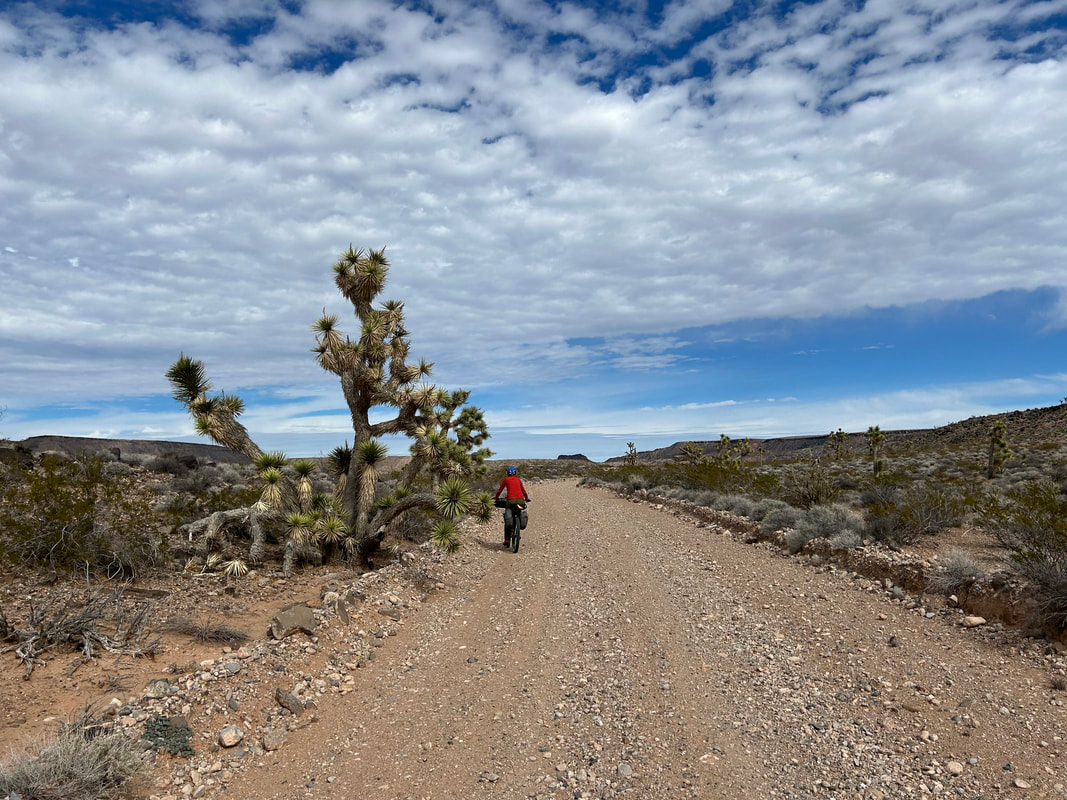  
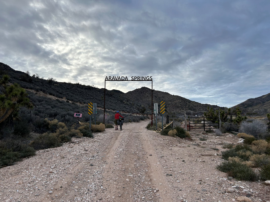
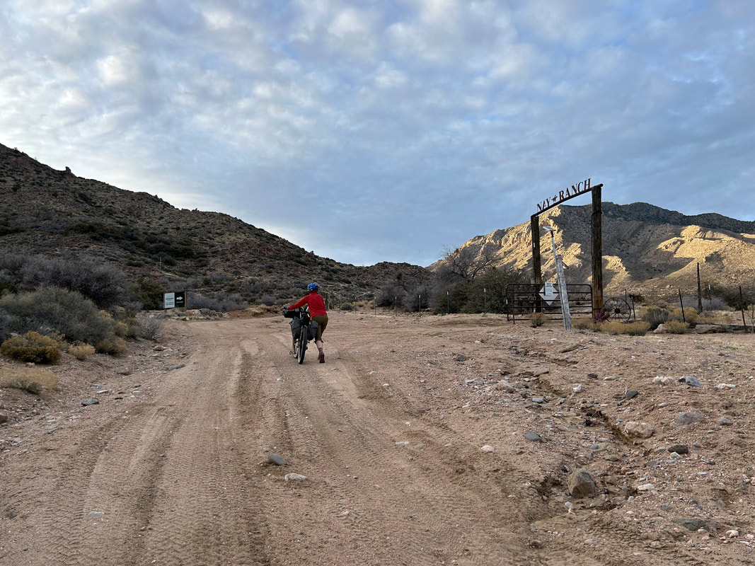
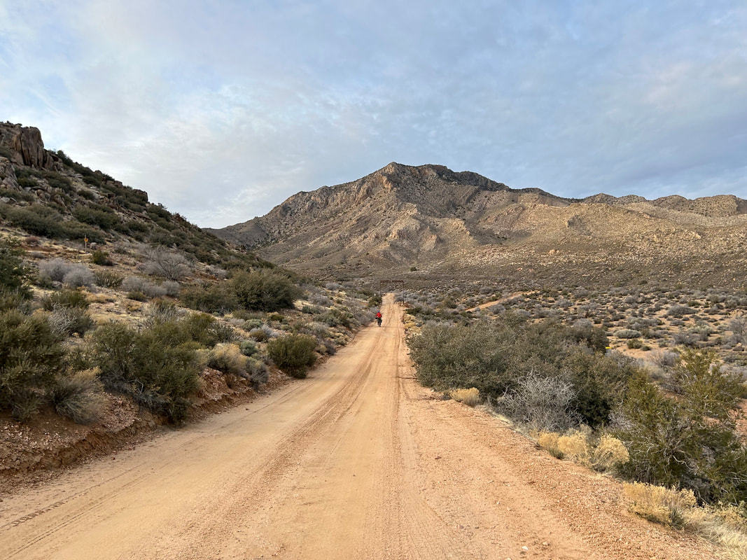
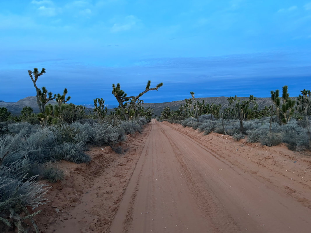
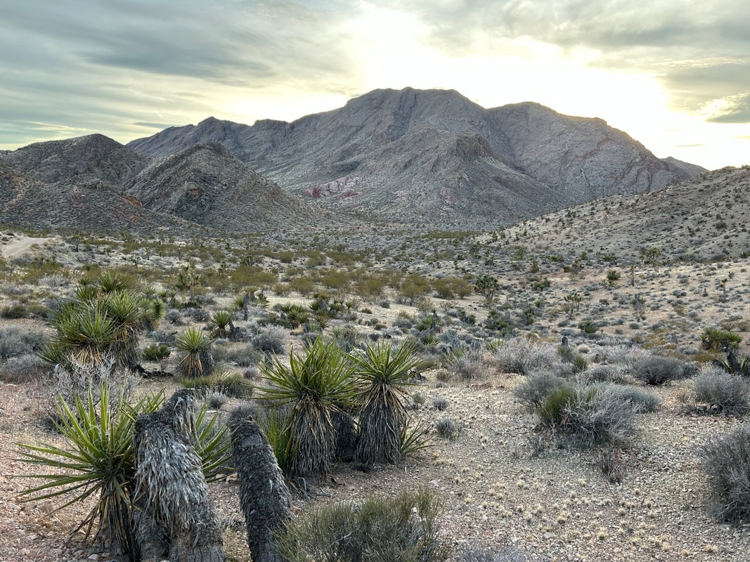
 We said goodbye and jumped on our bikes to start the gradually steeper climb to Aravada Springs. This portion of the route followed Pakoon Wash before making a climb and turn around the north face of The Cockscomb. I thought it was beautiful to see Joshua trees lining the route as the snowy peaks of the Virgin Mountain grew larger and closer in front of us. We rounded the curve and could distantly see the buildings of Aravada Springs against the forefront of Whitney Ridge - a foothill of the Virgin Mountains. It seemed so close but we knew we had well over a thousand feet climb to get there. I turned to look back at the Grand Wash Cliffs. From this view and angle, they really exemplified Grand Canyon's geology. Interesting cloud cover gathered overhead shifting the tone of light across the land. The climb exhausted me, and I walked the last bit of road up to Aravada Springs and Nay Ranch. This is a private parcel of land, but thru-access is granted on the road. Not only that, but it's a campground/resort in the open season with water, a small general store, and cabins. Janna and I agreed we had plenty of water and food, so we opted to continue riding through. Evening was coming on fast now, especially with the sun behind the peaks flanking our lefts. Janna and I agreed that we would bike into the night again to get us closer to the base of the pass we needed to cross tomorrow. The road carried us above Aravada Springs and traced the contour of the mountain side providing stellar views into the evening glow of Pakoon Basin and the Grand Wash Cliffs below us. We stopped to put on layers as the temperatures were rapidly dropping. In fact, the higher peaks around us were caked in snow. But the route ultimately took a descent down the southeast face of South Virgin Peak Ridge. The fast-approaching Hungry Valley rose up as the landscape became red sand around us. Luckily, the road was in great shape and sand stayed on the surrounding landscape as opposed to the surface beneath our tires. Glorious buttes jumbled red against green stood apart on the horizon. Dense groves of Joshua trees gathered around us. In the last tendrils of fading civil twilight, Janna pulled out her secret weapon of watermelon-flavored Sour Patch Kids. We both ate a handful that brought my legs back to life. And like that, we were pedaling into the full dark. Our lights came on, and we rode on gently flowing road in fantastic condition across the backroads of the Parashant. Several miles and an hour or so later, we both felt fatigue coming on so we started to scan the peripherals of our lights for a flat place to camp. We came upon two junipers near the road's edge with a clearing behind them. We hauled our bikes up and over the edge-dirt and setup camp near the base of Red Pockets Mountain. The night was calm, cold, but warmer than the previous night. 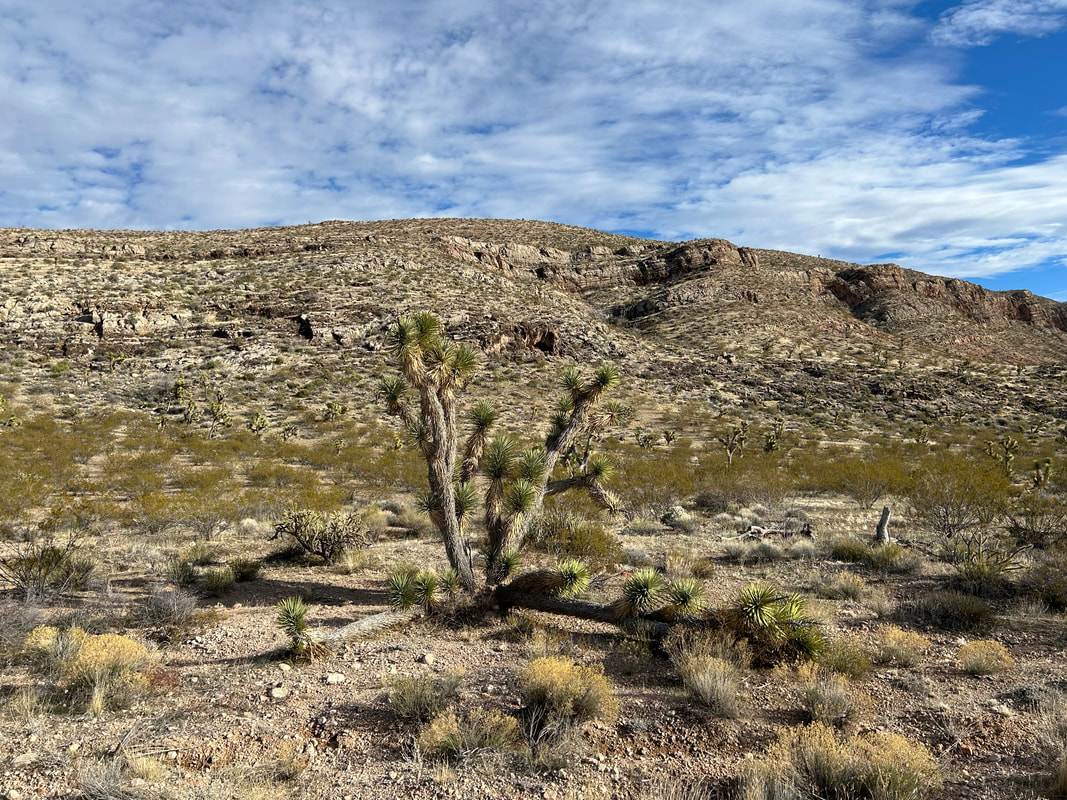 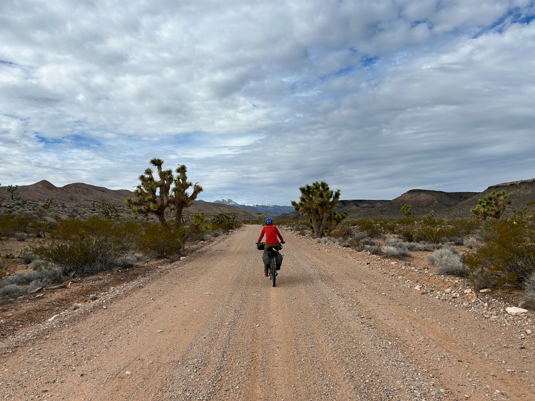 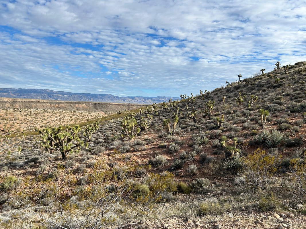 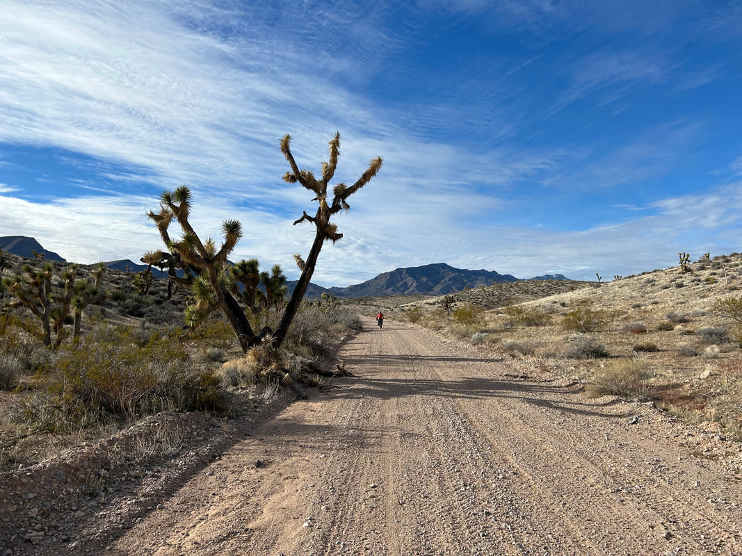 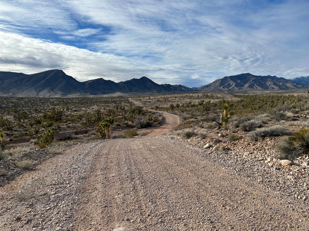  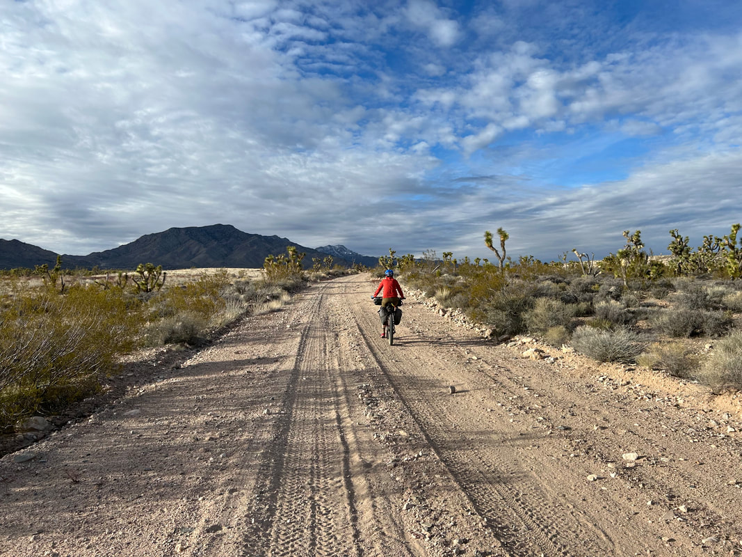
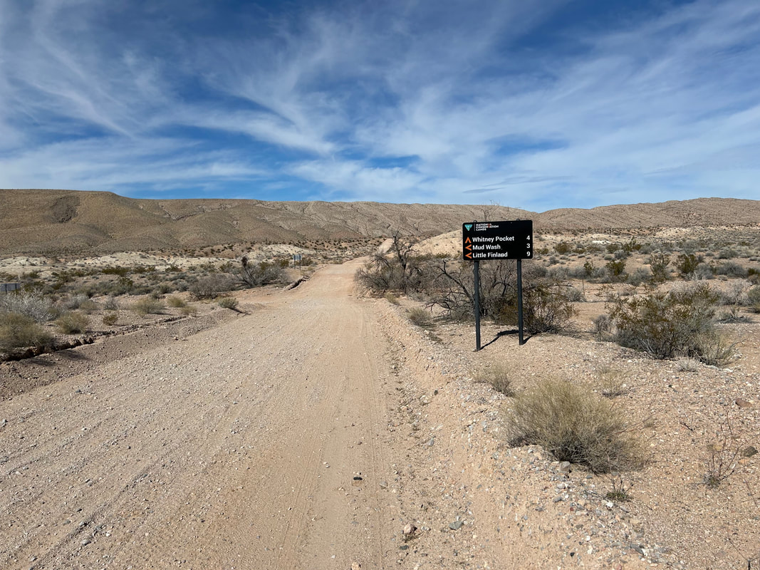
33.57 Miles; 3,084 Feet of Gain; Gold Butte National Monument: Whitney Pocket to Gold Butte Townsite
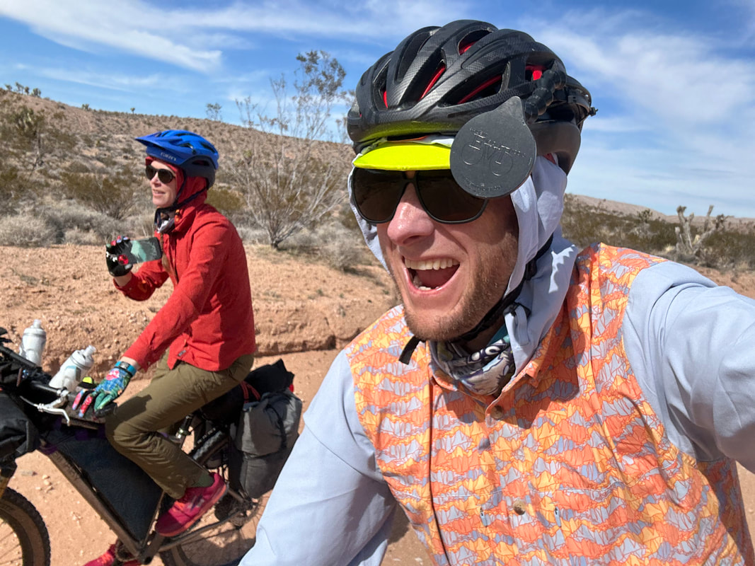
In early November, Kate and Dan let us know that they were going to be down in Arizona for Late-December/Early-January. They wanted to head out on a bikepacking trip with us over MLK, Jr. Day Weekend. Kate suggested Gold Butte National Monument based on its desert-enviros plus her experience rock climbing the Lime Kiln Canyon area there. Her impressions were super-positive of the place and she wanted to go back and see more. I had followed the events of Gold Butte National Monument for about a decade, ever since the Bundys had an armed standoff with BLM employees over illegal grazing in the area. That, and my friend Lara from college now worked in the place with her husband for the BLM, and I had impressions from them that corroborated Kate's thoughts. I started digging into research on bikepacking routes in Gold Butte. Beyond a few day gravel rides, it seemed no established route was in the area. I reached out to cyclists who had spent some time in Gold Butte, and they reported the lack of water as a driving reason for the lack of a serious overnight option.
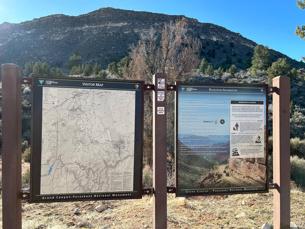
But the more I looked at pictures of the place, the more I became enthralled by the idea of seeing the area by bike. It looked geologically stunning, and road options seemed plentiful. Not only that, but Gold Butte sits right next to Grand Canyon-Parashant National Monument - an area I had been wanting to explore for years. GC-Parashant is about as large as the Grand Canyon in acreage (which tells you have massive it is), but only around 5% of its landscape has been surveyed; it's an area ripe for exploration. I started poking around on Ride with GPS to see if I could link up a solid 3-day route by overlapping the two areas. I laid out some good initial roads but kept coming back to water as the main hurdle. I started diving into internet forums by ATVers who had spent time out there and picked up some good ideas. But it was really when I found Jim Boone's (a local ecologist) website BirdandHike.com that I got some of the best information. That, and I started some correspondence with him about water sources, route logistics, and possible challenges. I reached out to my aforementioned friend Lara for more information. A route began to coalesce with real options for a multi-day overnight with workable and reliable water. I reached out to Friends of Gold Butte (the local nonprofit) and they confirmed my working-choices. I put together a proposed route. But by this time, Kate, Dan, Janna, and I had opted into another route for the January weekend. So Janna and I planned to make a go of the Gold to Grand Loop come February for President's Day Weekend.
As President's Day Weekend approached, I finished up Route Plan A along with some backups B and C based on how things might turn out when we got out there. As soon as school finished on Thursday, Janna and drove to Las Vegas and got a hotel just northeast of town for the night. We drove into Gold Butte the next day.
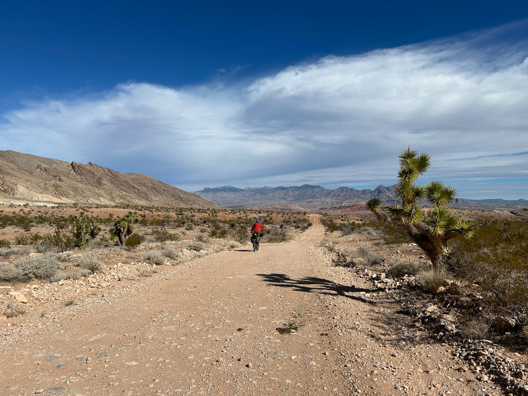
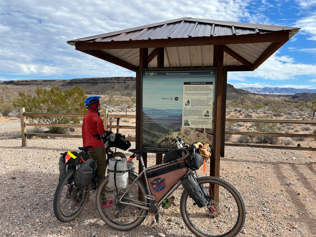
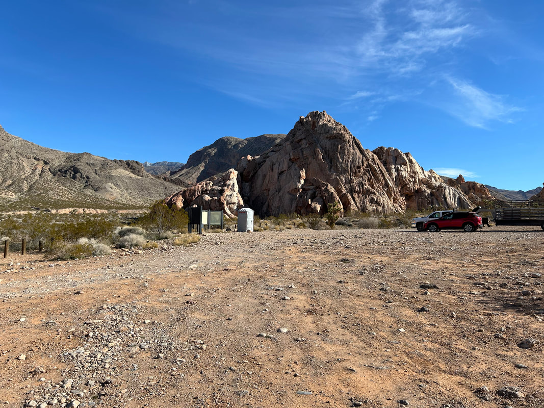
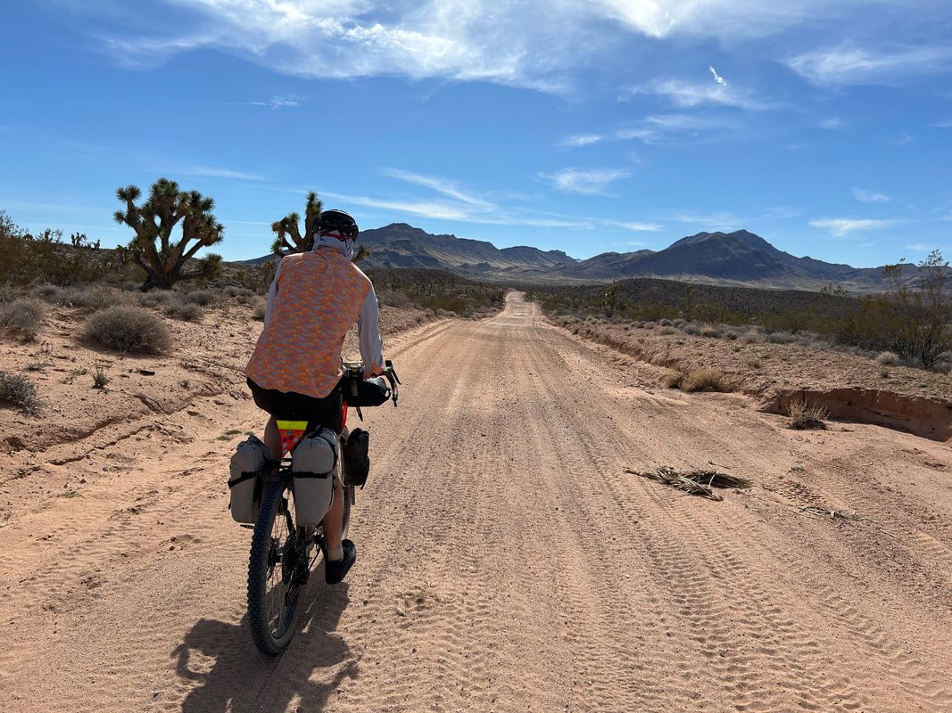
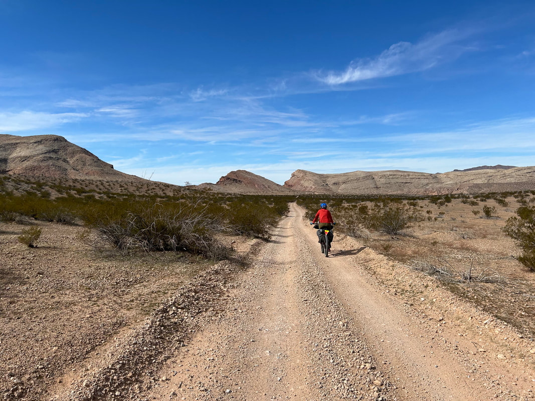
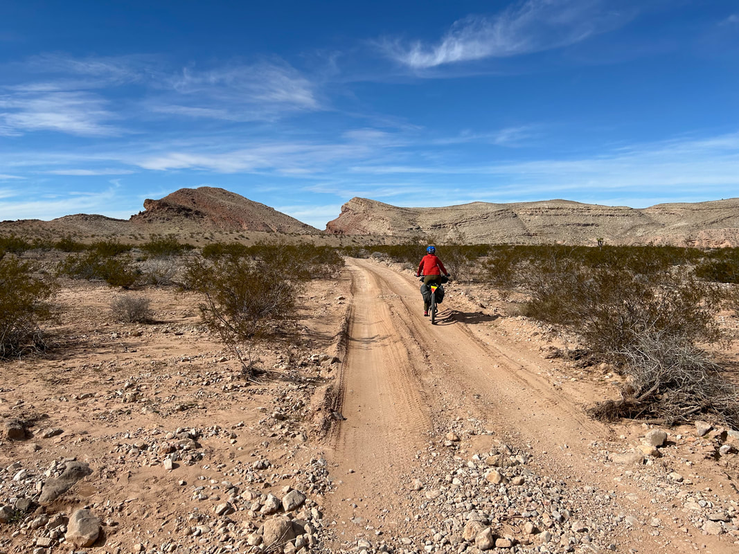
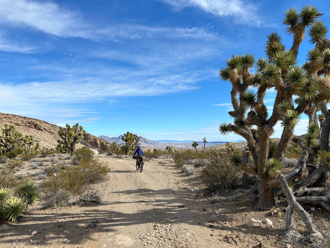
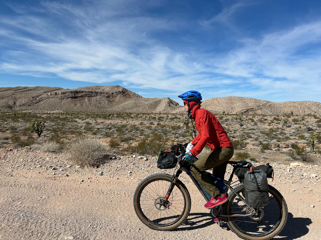
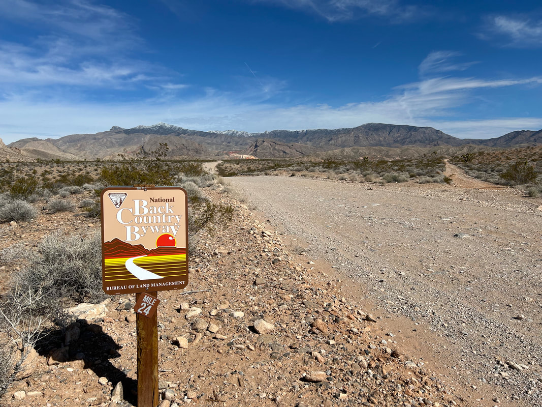
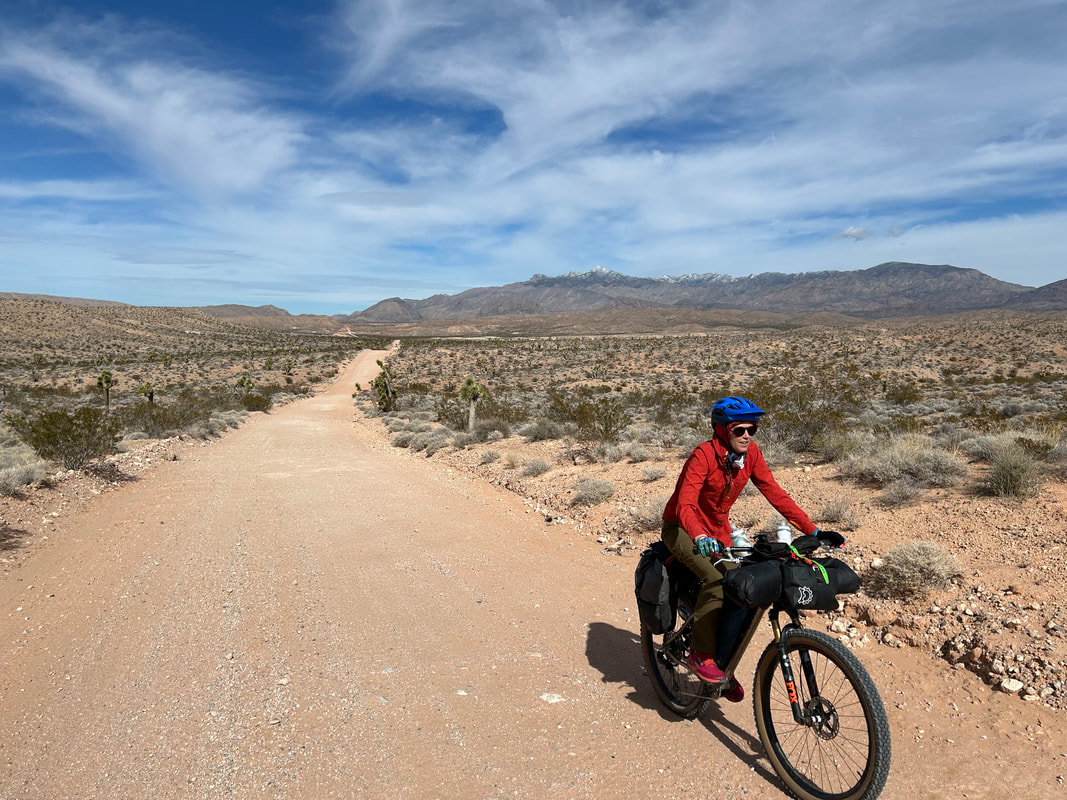
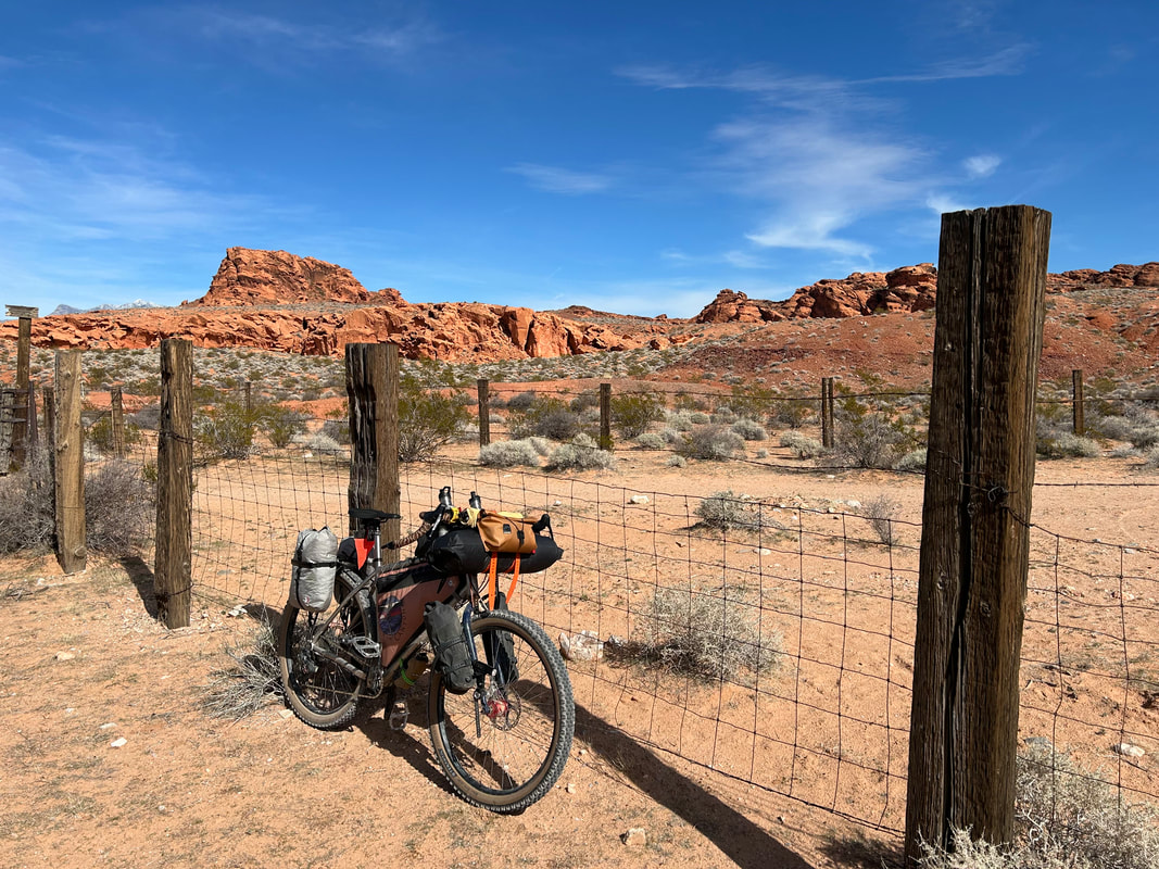
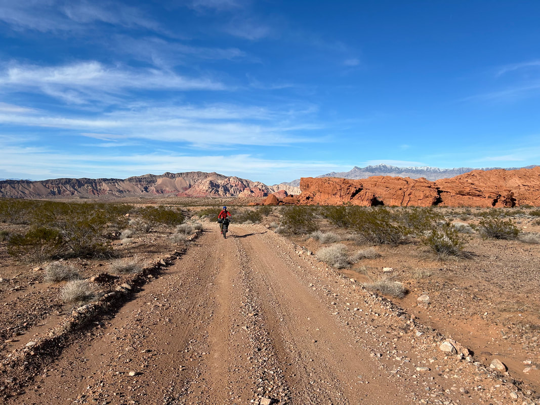
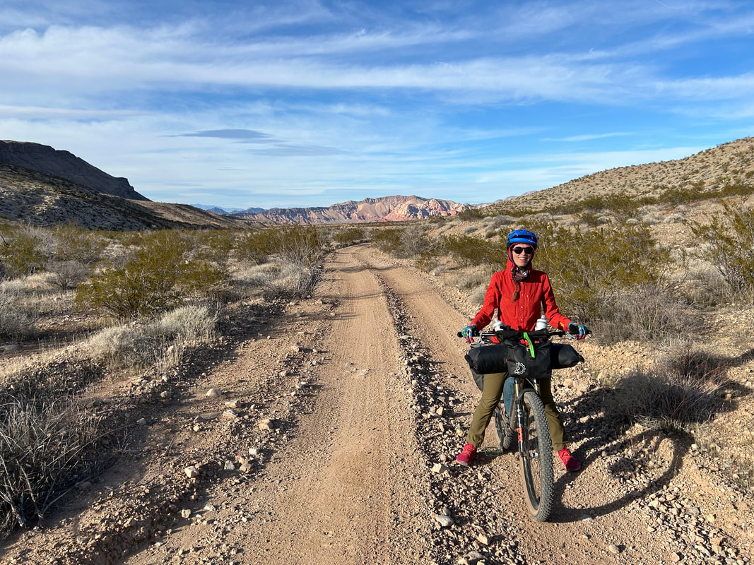
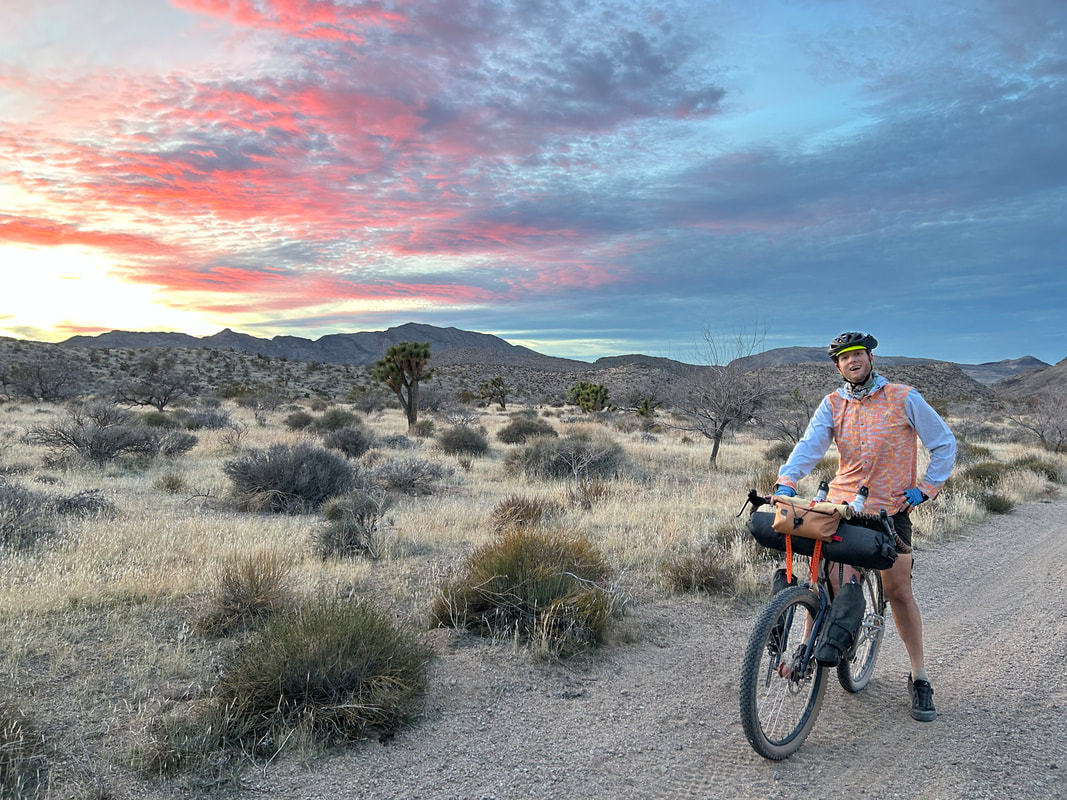
We were not disappointed. Arrival at Whitney Pocket was stunning. The rock formations are iconic for Gold Butte National Monument. They stand stark, jumbled, and multi-colored striated against the backdrop of the Virgin Mountains to their west. A huge snowstorm had moved into the area a week prior dropping feet of snow up high; the peaks were subsequently crisp white. The Parking Area was massive and perfect for leaving our car. The pre-spring sun was warm and inviting as we packed up our bikes. Janna has used bikepacking panniers for years, and this time around, I decided to give them a go with the V2 Revelate Designs Nano Panniers (as opposed to the usual saddle bag); I ended up loving them. But like anytime you use a new system, it took some initial time to set it up in the parking lot. By just after 10 am, we were ready to go. Janna and I did a small ride around the other buttes of Whitney Pocket first before starting an immediate descent into the heart of Gold Butte National Monument. But once the descent began, the basins and foothills of the Mojave desert opened up wide and spectacular. The road was wide and glorious. This initial portion of the G2G Loop follows the Gold Butte Backcountry Byway which is frequented by overlanders and ATVs. Both groups of motorists were polite when passing and most immediately pulled over to make sure we were okay and had plenty of water (with offers of more). Love that sense of community-care. 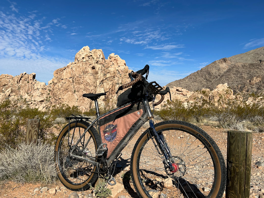

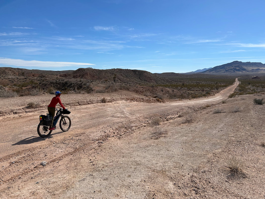
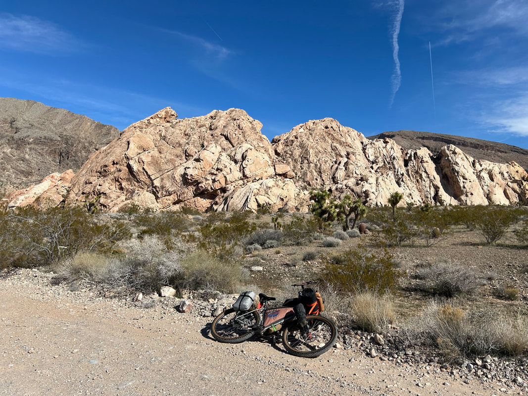
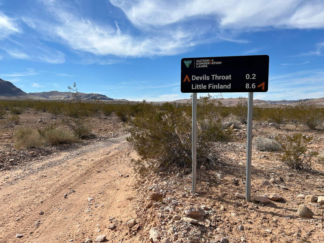
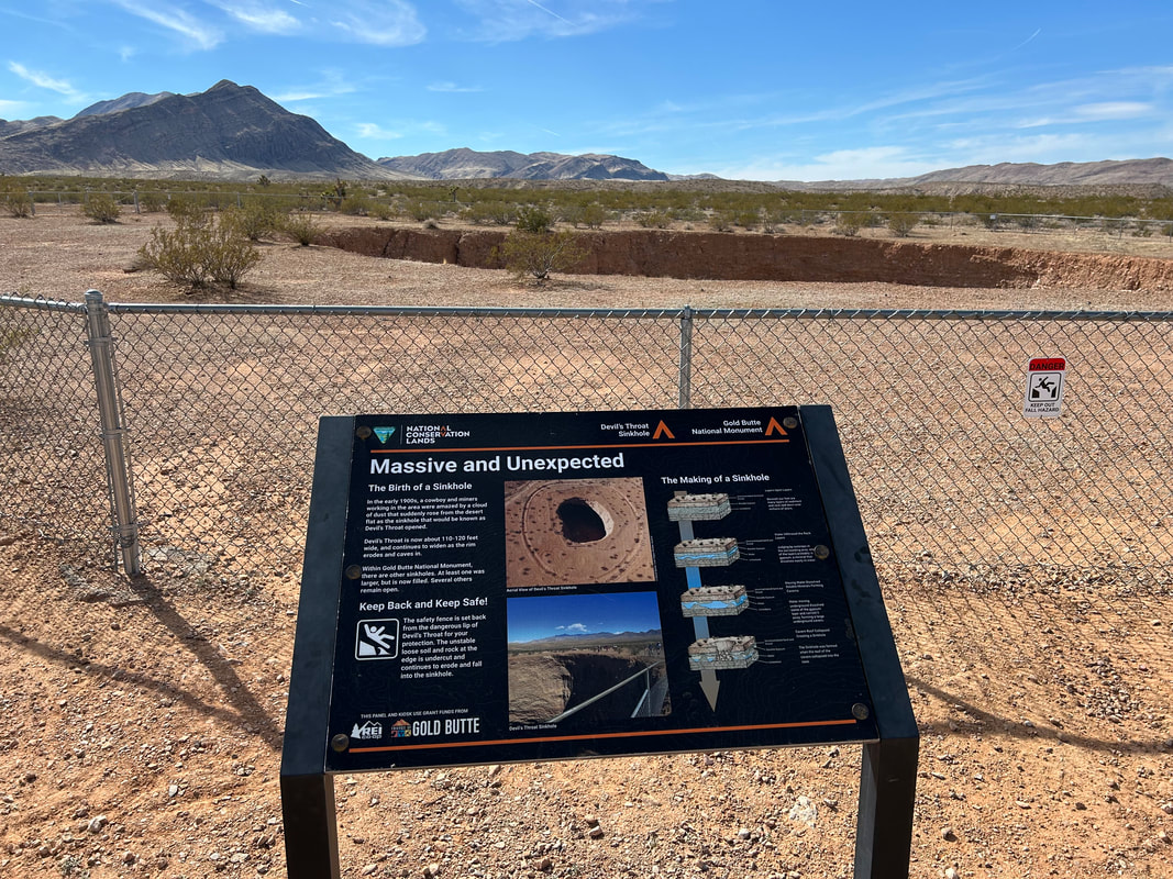
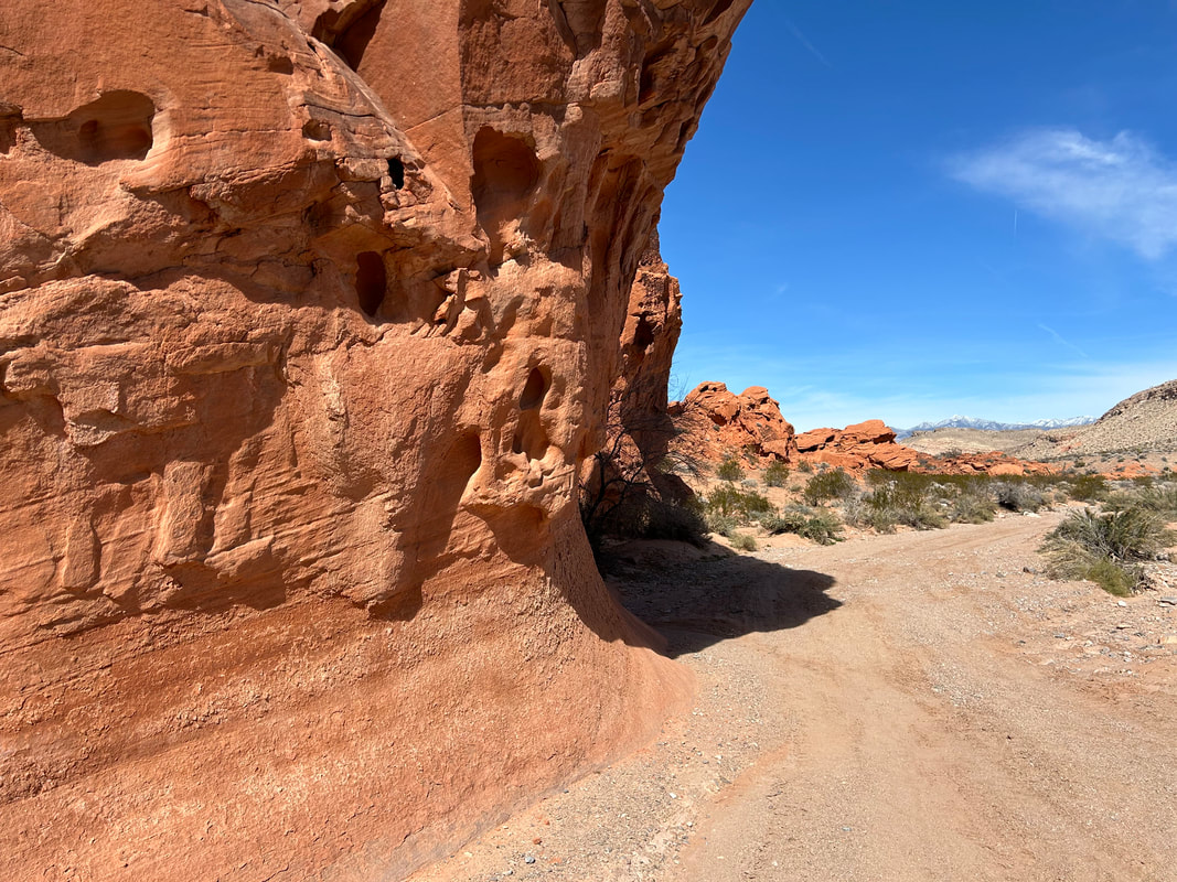
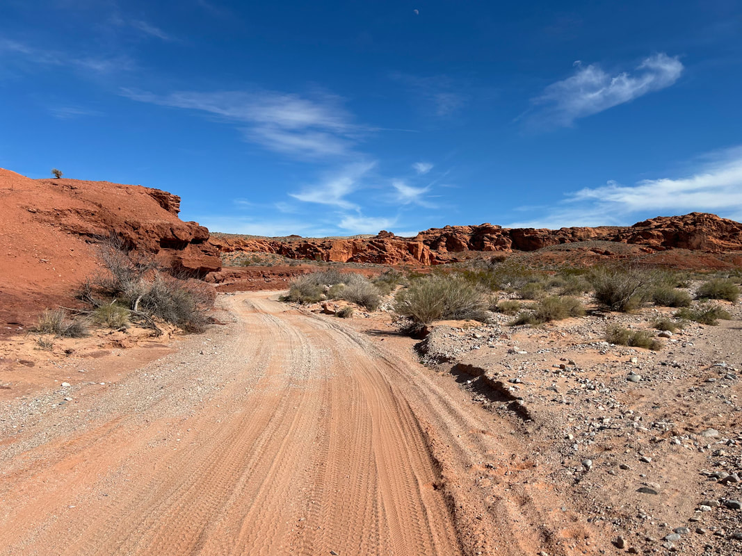
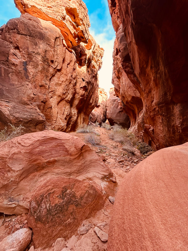
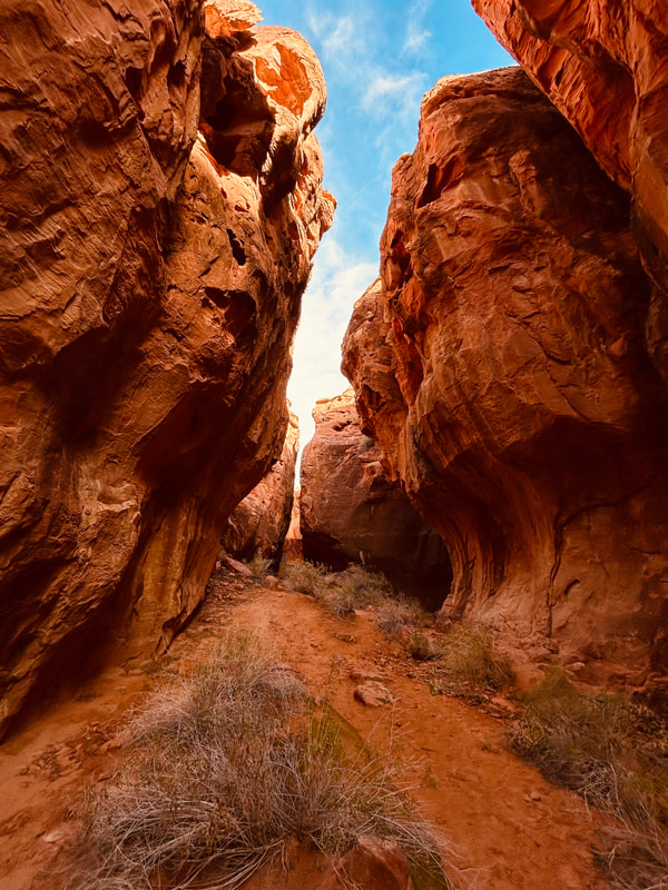
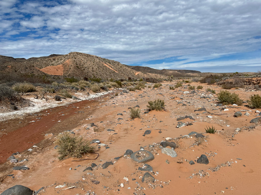
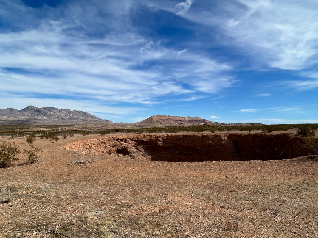
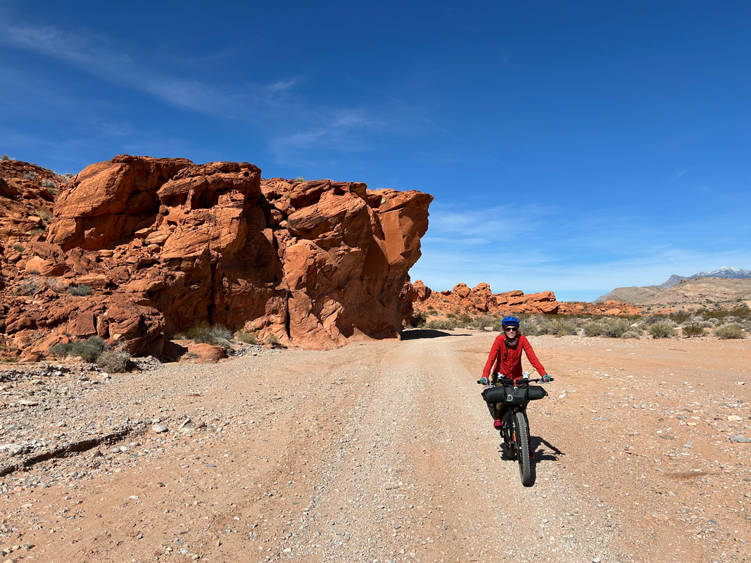
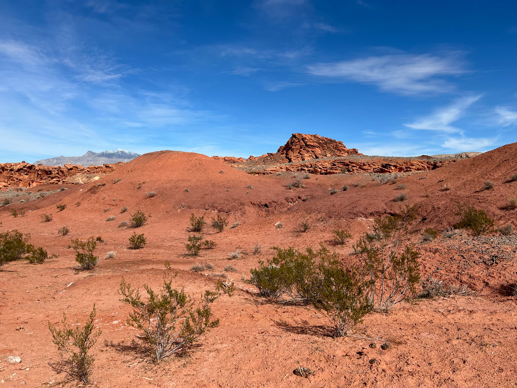
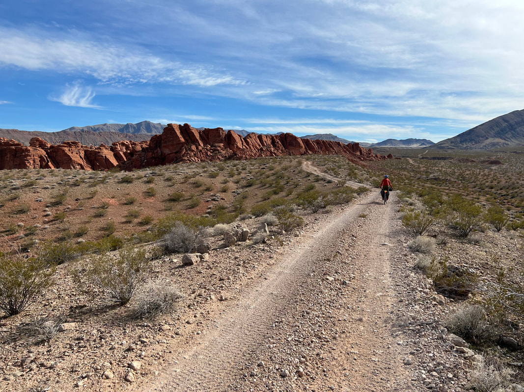
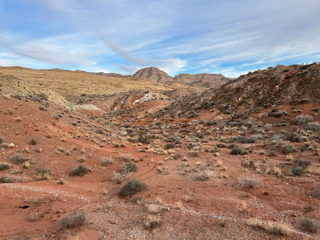
As the route dropped in elevation, we meandered along the excellent road through shores of color washing up across the topographic folds of basin and range. I couldn't believe how good the road conditions were - it was easy and blissful pedaling through stands of Joshua trees that wove by fields of creosote and stone. The route took us to Devil's Throat that expectantly sat as an open crater in the landscape. It's fenced off, so we took a circumference walk around the massive sinkhole so unique out here. G2G Loop took us across some foothills and down to the confluence with Mud Wash. The route took a bottleneck through a choke-point of two conjoined-buttes spewing out boulders and colors. It was freaking beautiful. Mud Wash was a little sandy, but nothing too bad and the road firmed up shortly thereafter.
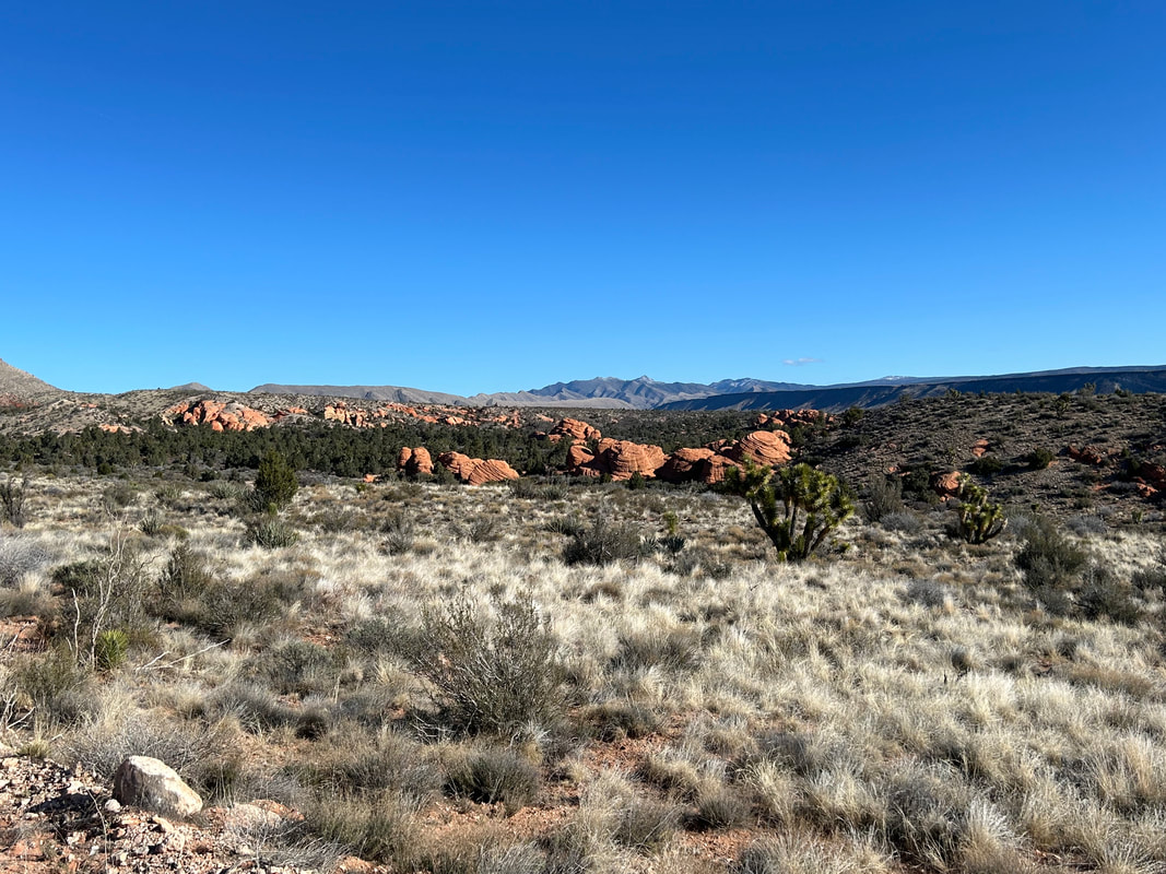
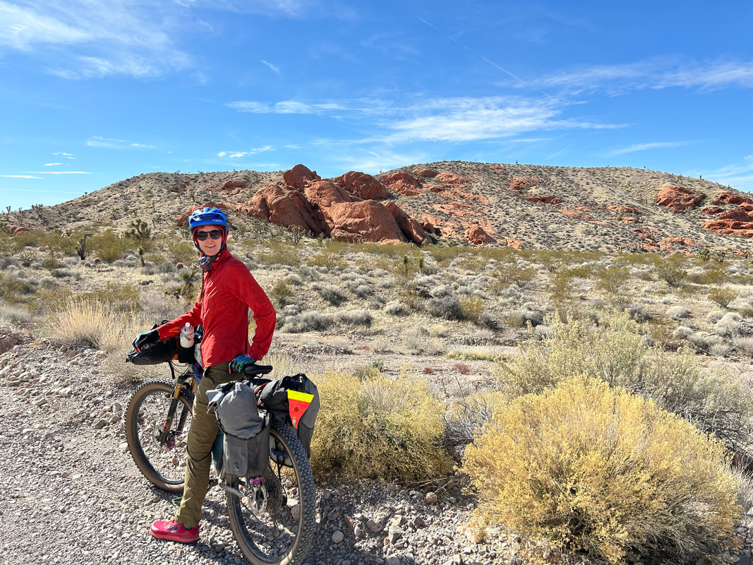
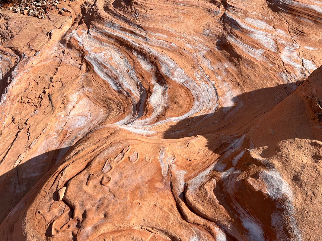
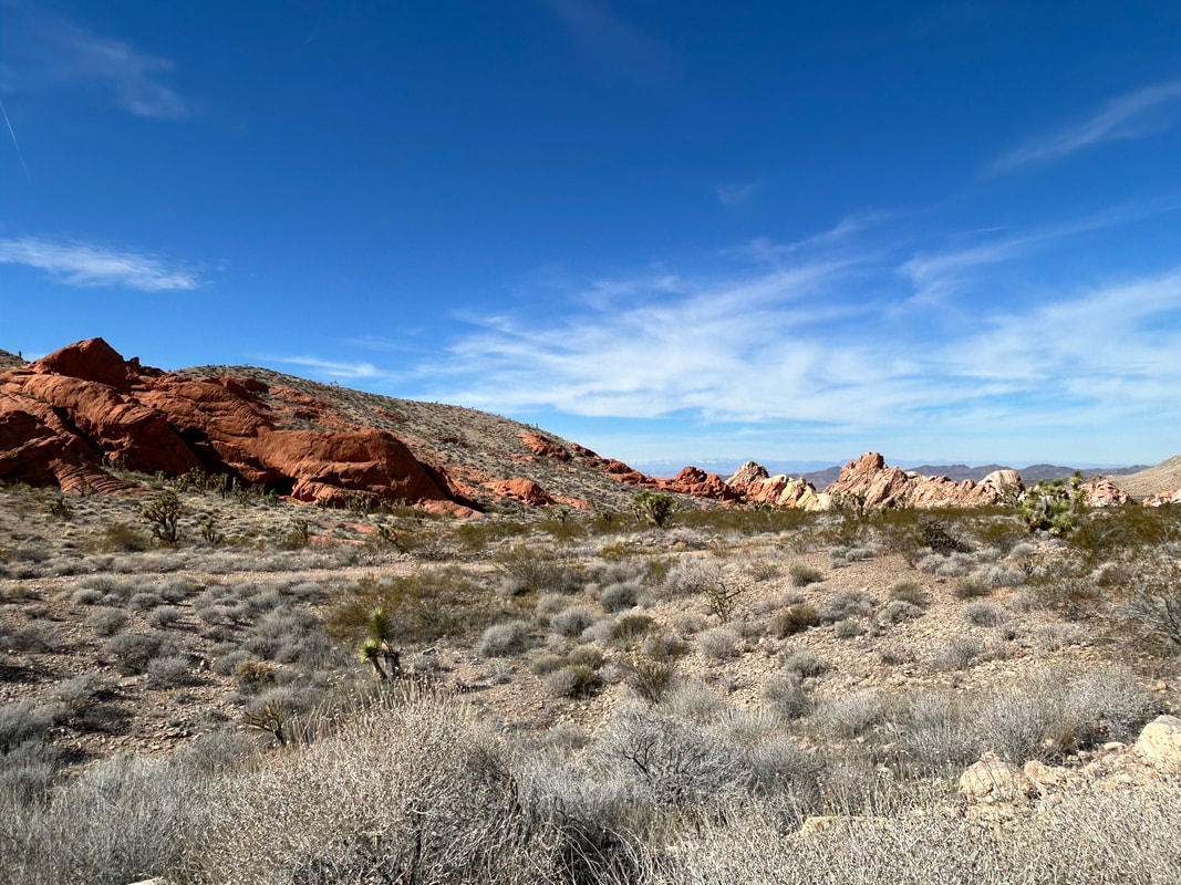
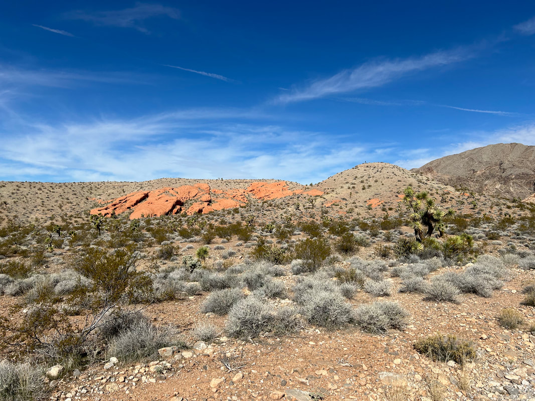
We followed it down to an outcrop of red sandstone abutments forming a lateral wall along the route. This rock outcropping was its own sort of beauty. Janna and I stopped to walk around, explore its nooks, and enjoy its colors. We pushed on and curved through the belly of more rock-boxes that framed up around Mud Wash. The sand continued to be intermittent and light. Another round in the bend brought us to an old corral set amid a sea of orange-red stone. We left our bikes by an old fence and hiked up a side trail for an unimpeded view. The sulfur-orange, tangerine, brick-red, and ochre layers swirled and crested in a series of studded hills with the distant white-capped Virgin Peaks providing the backdrop. It was the distant view of Little Finland.
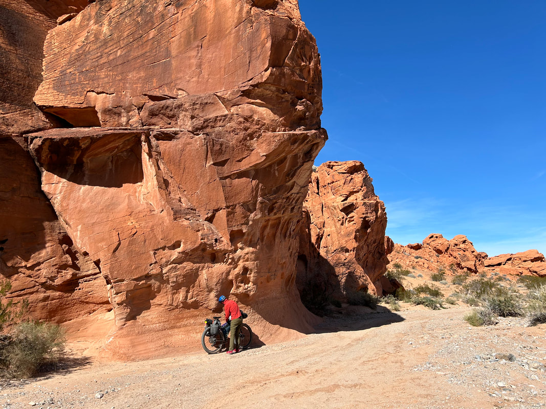
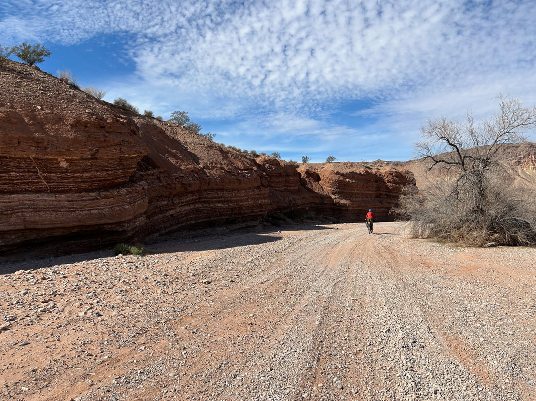
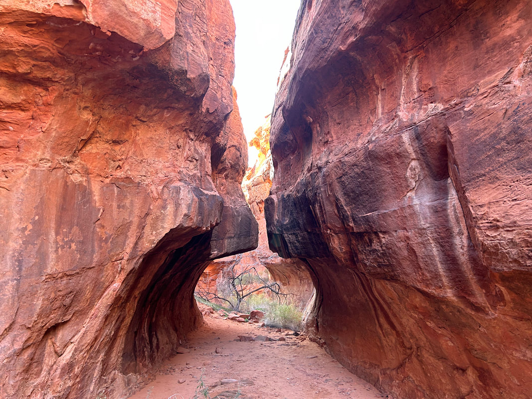
The route continued along Mud Wash where a few more turns brought us to the tumbling melting face of Bitter Ridge. The lateral broadside view was a beautiful display of Colorado Plateau geology complete with alluvial fans made of sand dunes and combined colors of chocolate, hazel, cream, and deep sandstone red. G2G Loop took a hairpin curve and then started an ascent up out of the wash on two track that went above and along Gold Butte Wash. A left turn took us on a side-ride out to the parking area for Seven Keyholes Slot Canyon. A bunch of ATVers were at the top. We talked to them briefly before leaving our bikes and hiking down the old dirt road into the red rocks. Petroglyphs dotted many rocks in the area, as they are present on many rocks along the length of the route. Part of the decision by President Barack Obama to designate Gold Butte a National Monument stemmed from the need to protect this Cultural Landscape; it was the Moapa Band of Paiutes who lobbied the administration for years to protect this area.
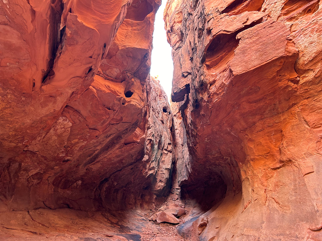
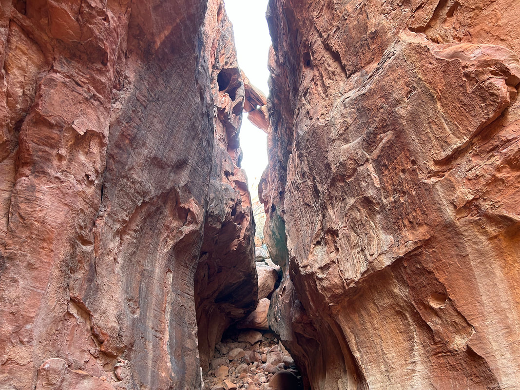
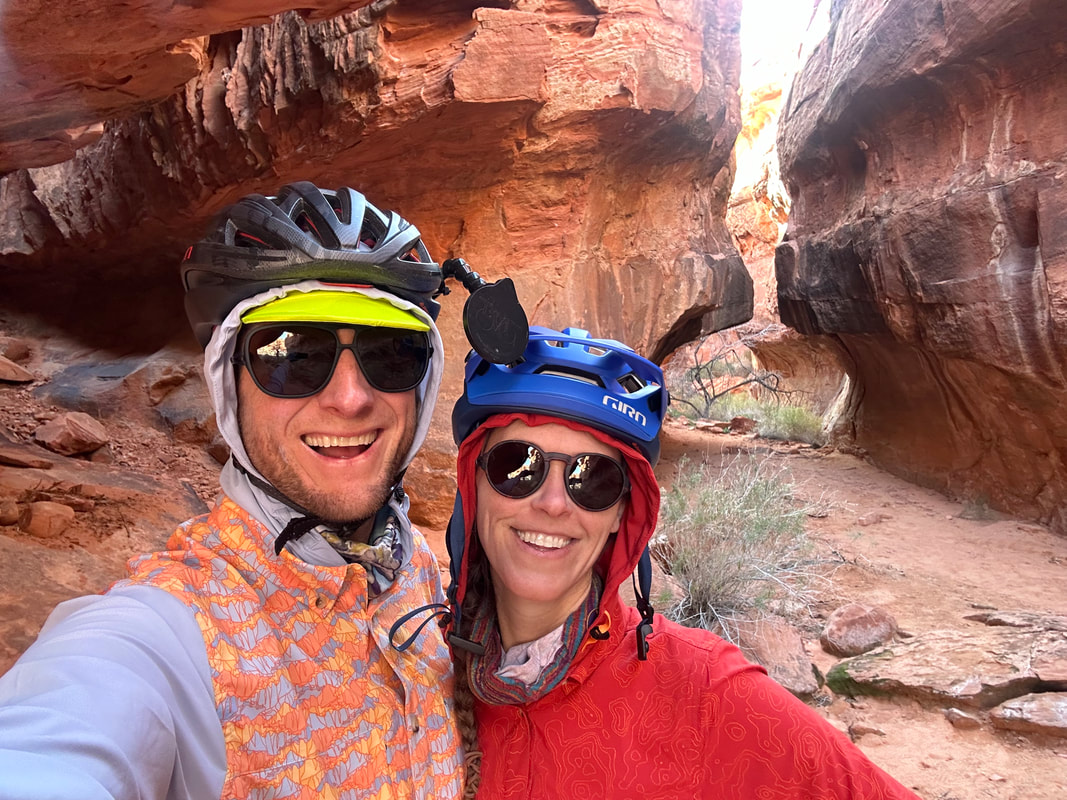
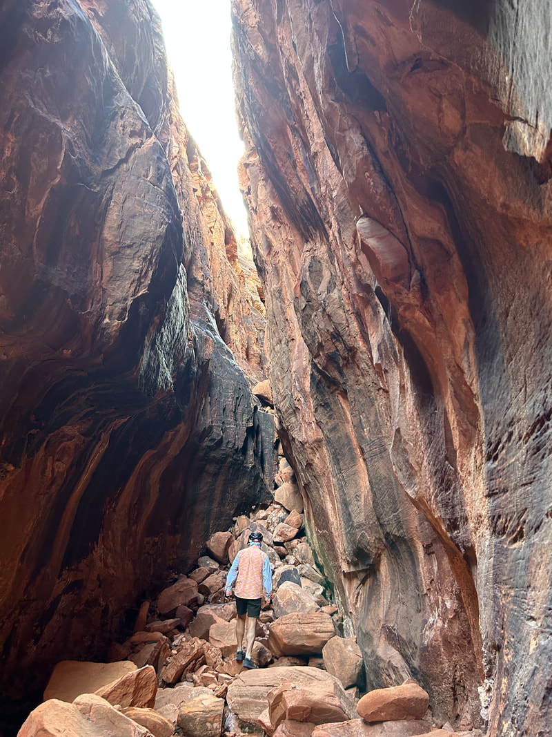
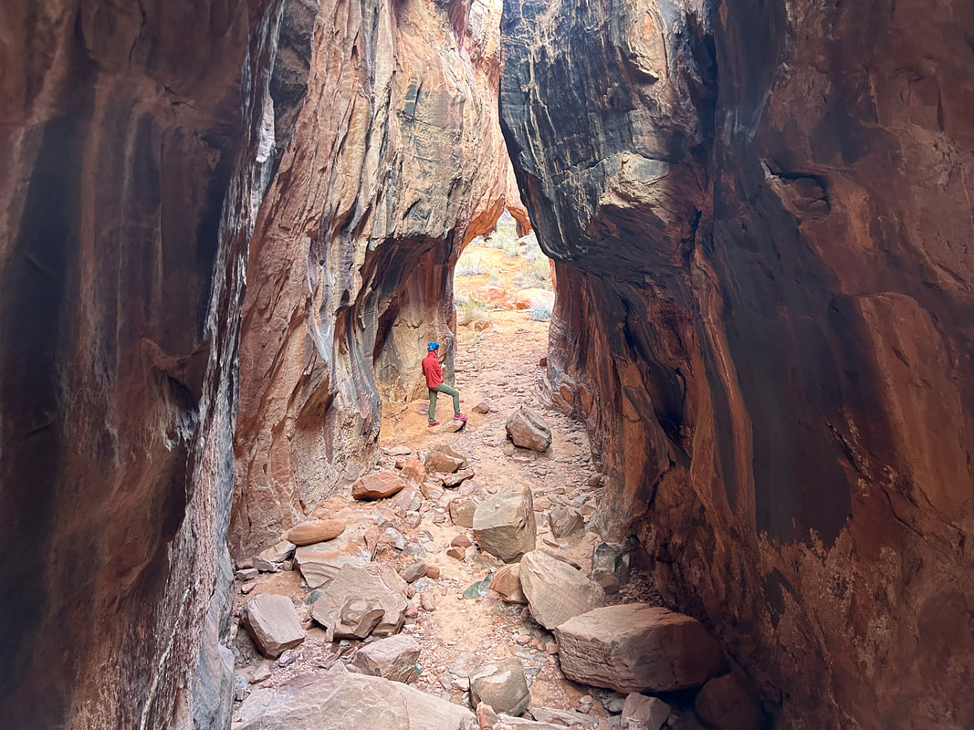
Janna and I saw a few of the Bundy's cows wandering the canyon. We took a sharp right under a tree and entered Seven Keyholes Slot Canyon. So-named for the unique repeating patterns of rounded and then narrowed slots, the trail extends back about a quarter mile into the heart of the red stone. We took some time to walk through the different hallways and admire the smooth water-eroded walls of rock. Even the outside of the slots had some great red rock swirls and awesome views spreading out into a crumbled world of vermillion buttes. We wrapped up, hiked back to our bikes, and pushed off to continue on with the route.

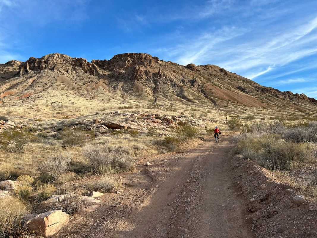
The arid footslope ecoregion swept up around us as we began an ascent. Lime Ridge and the Lime Canyon Wilderness met us on our rights. The next couple of hours of afternoon sun began to slant as we continued upwards through hillsides alongside Gold Butte Wash. The waning sun hit the slopes with a golden touch accentuating Joshua trees standing out. Overall, the road was in great shape. Evening came on and the sound of birds lit up the dusk - a sure sign of spring here and coming more. Janna and I stopped to gaze at the colors of the sky. But we agreed to continue riding past dark because we wanted to camp up by Gold Butte Townsite to take in the historical site in the morning. Into the dark we rode until the climbing seemed to ease and we were at the intersection of roads at the base of the actual formation known as Gold Butte. We found a nice flat dispersed area nearby for camping and setup in the pitch black. Beyond a truck and a ranger that drove by, the rest of the night was absolutely delightfully quiet.
|