|
2022 - Fall
2022 - Spring
2020
2019
2018
0 Comments
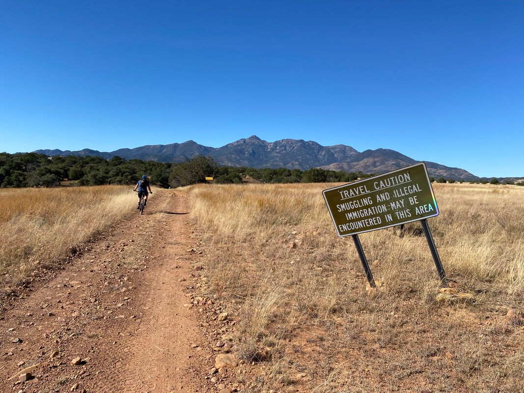
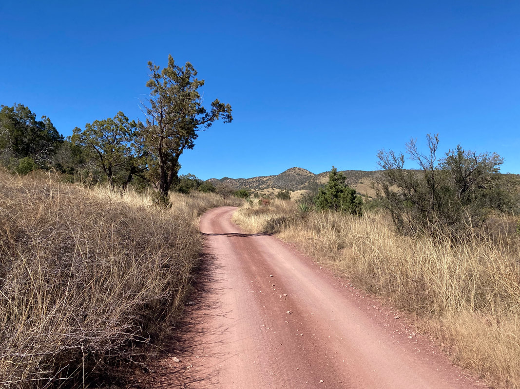
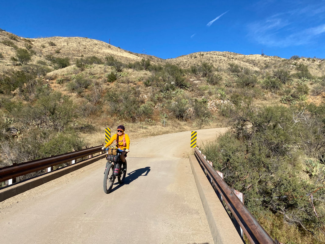
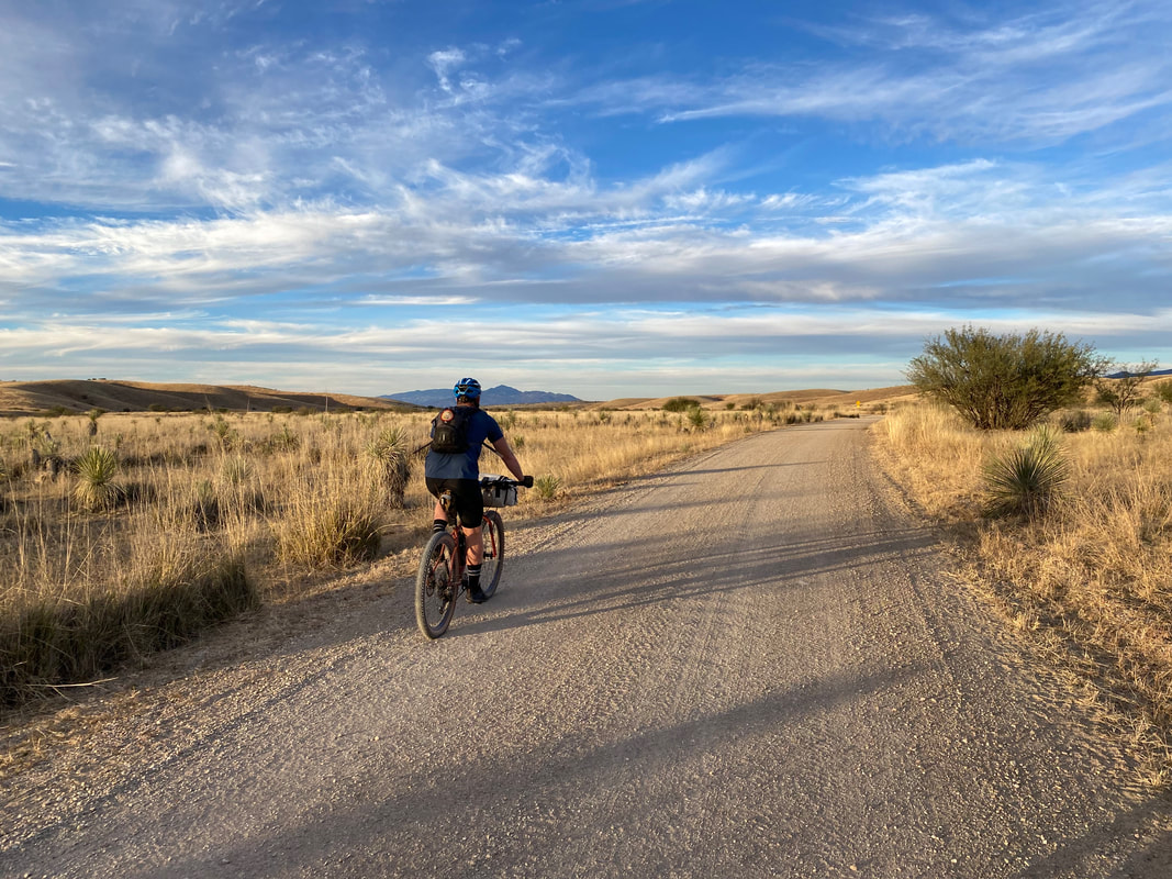
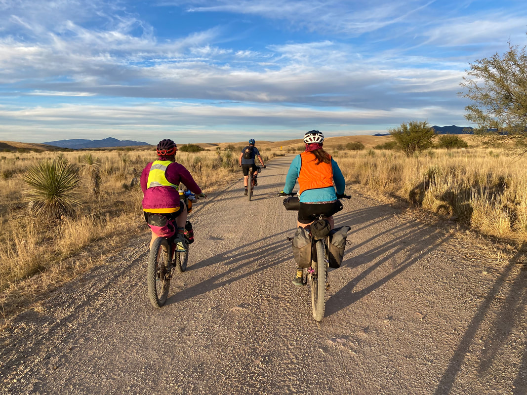
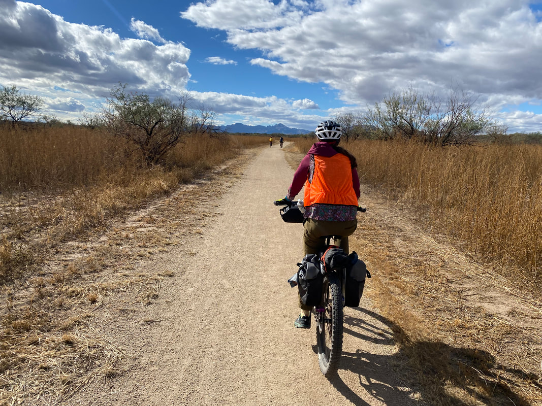
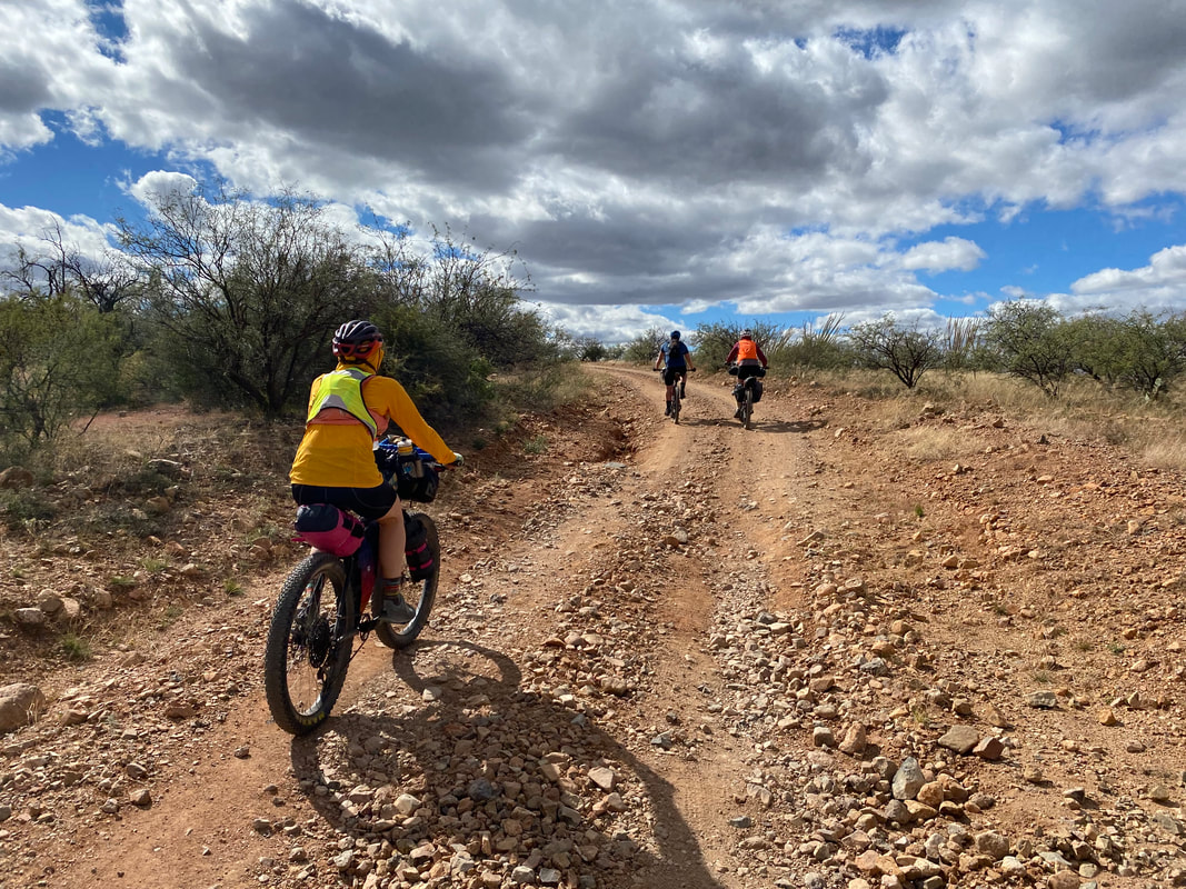
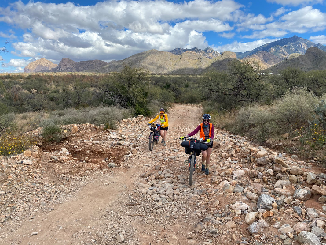
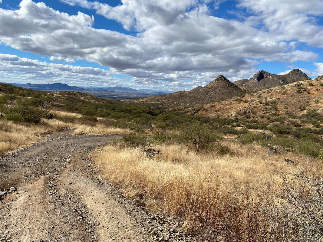
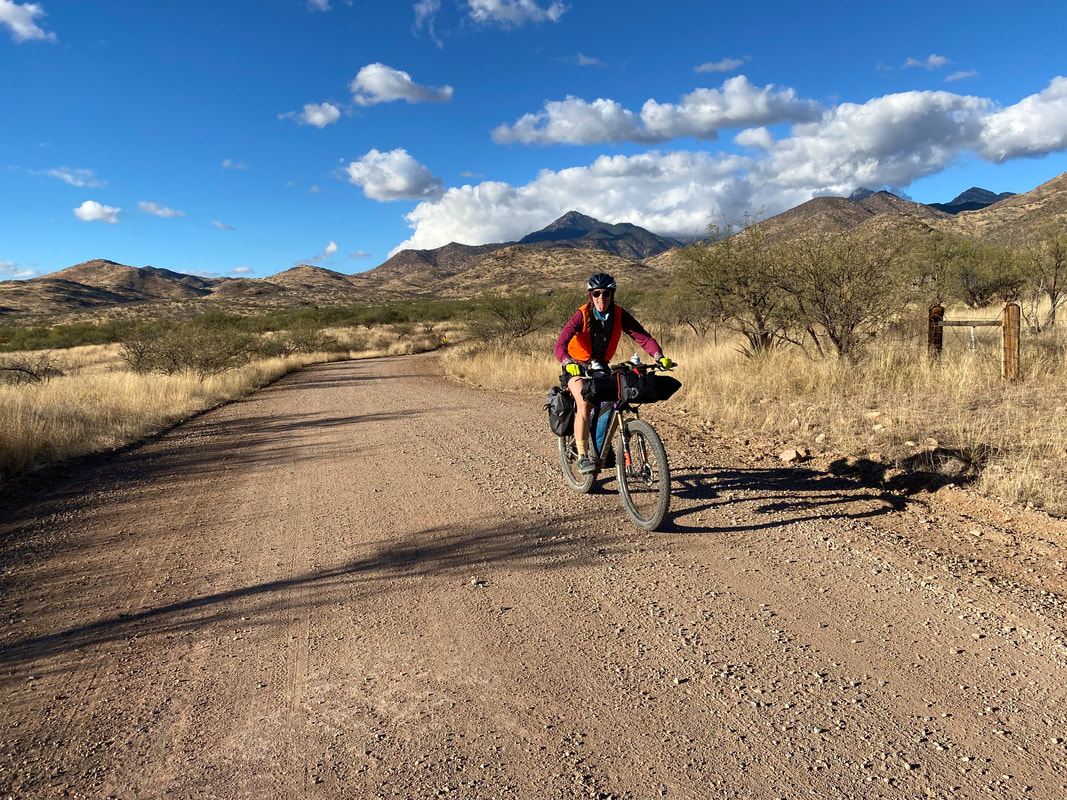
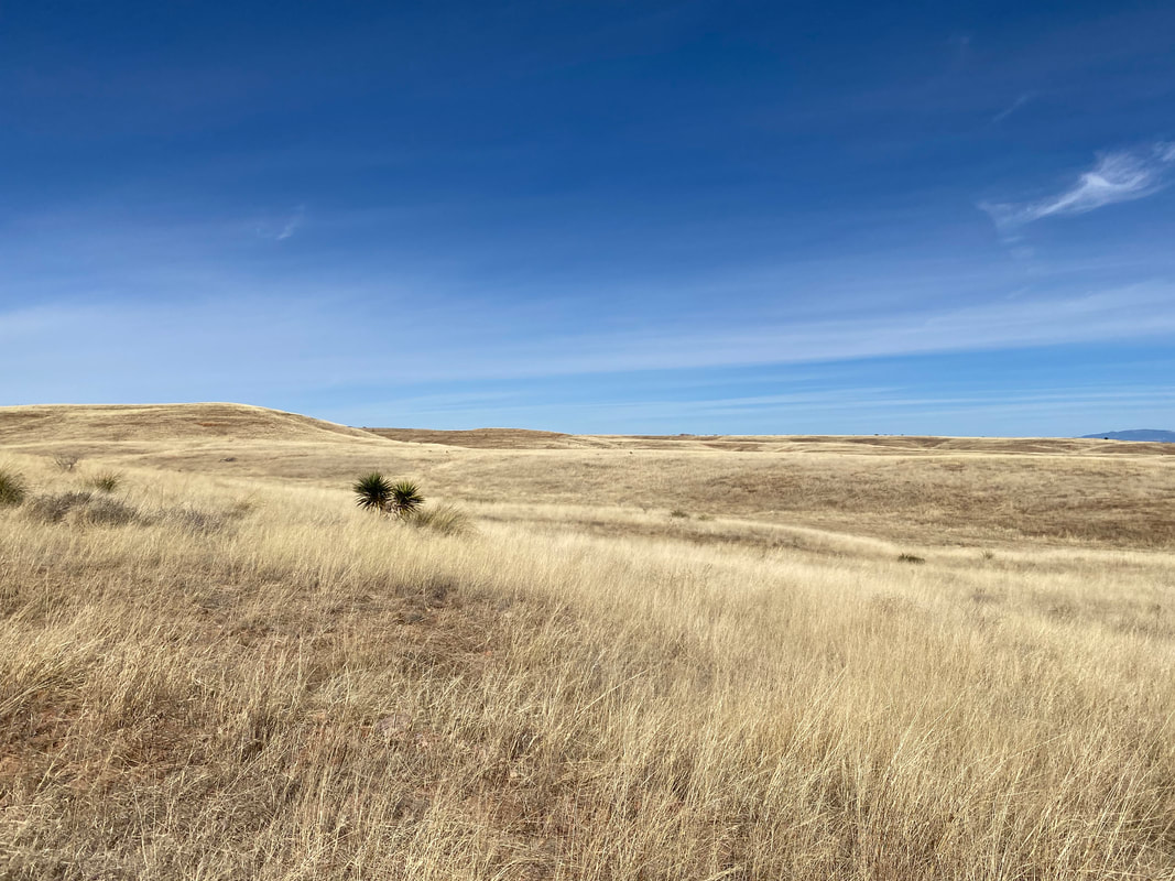
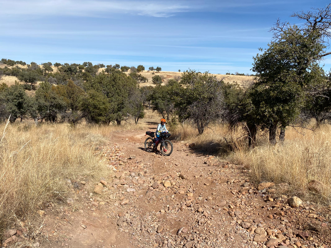
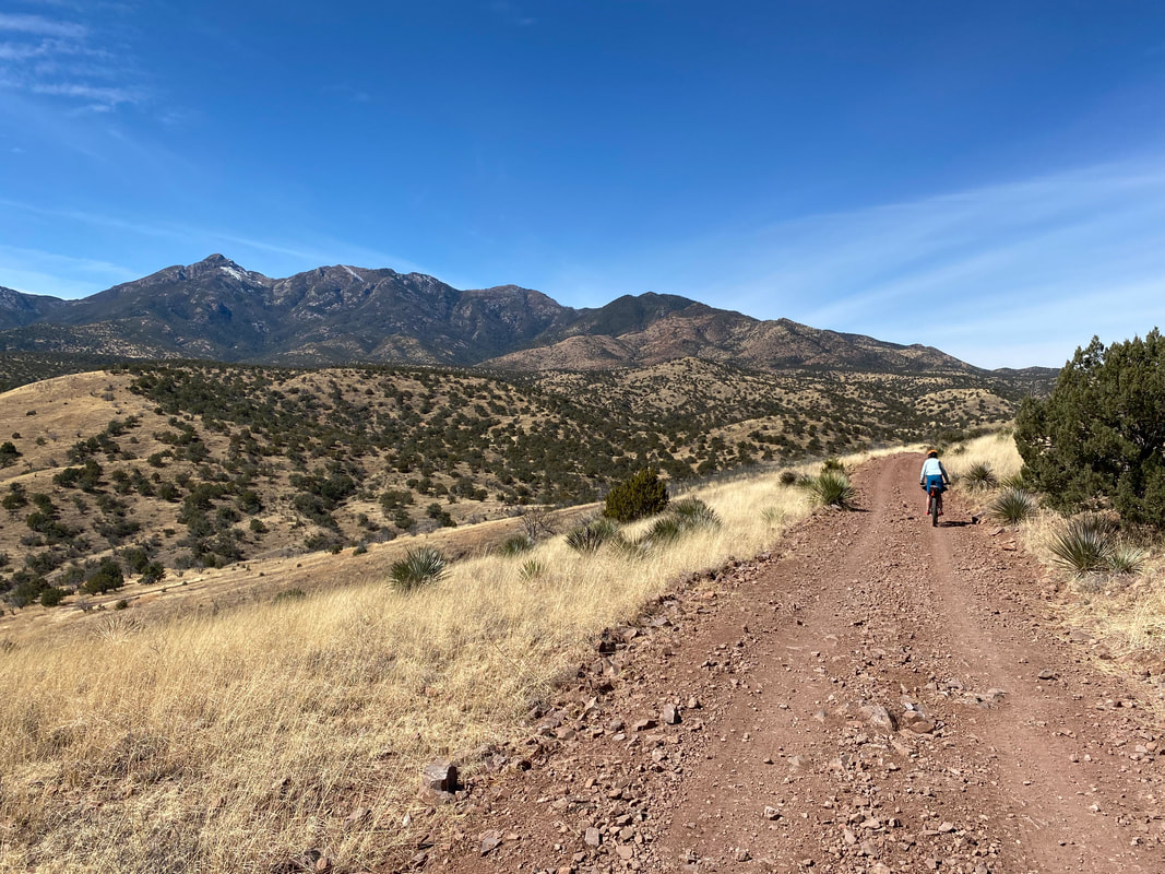
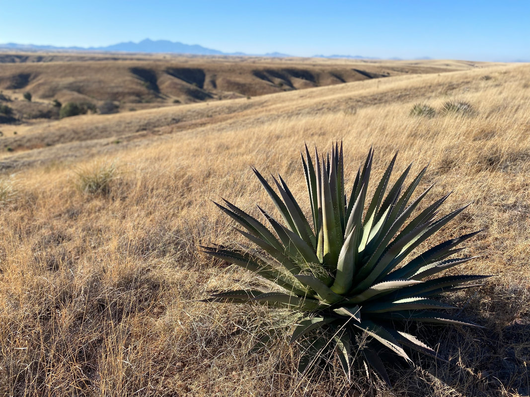
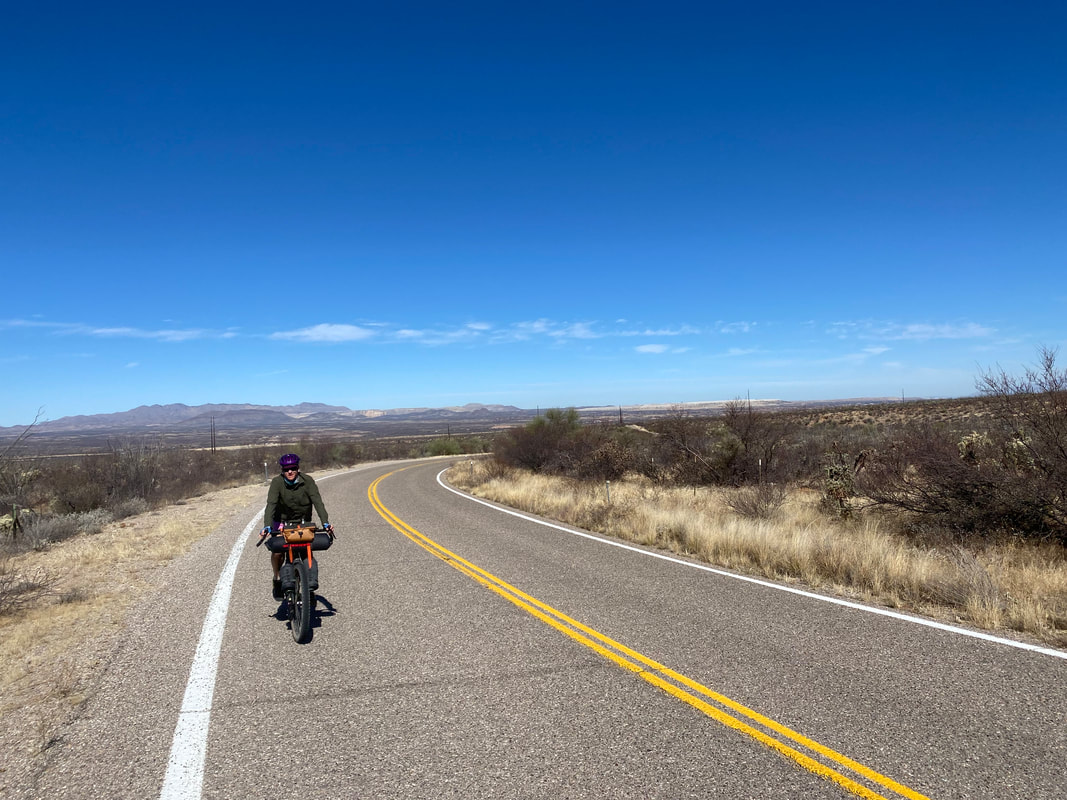
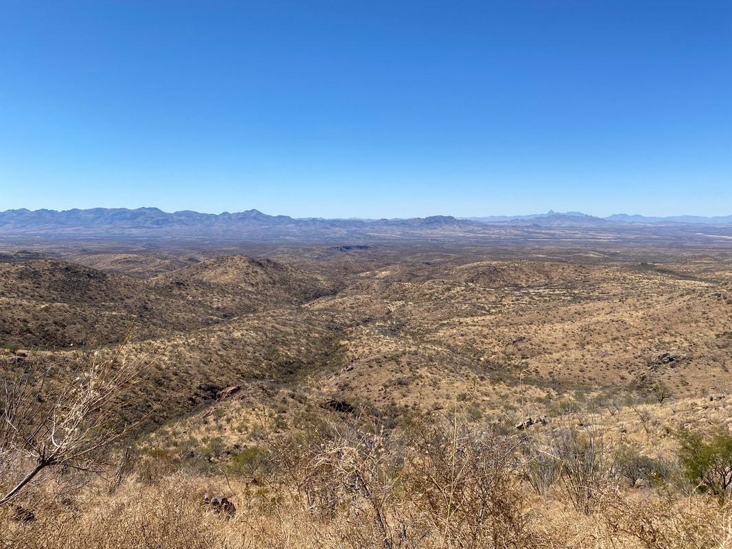
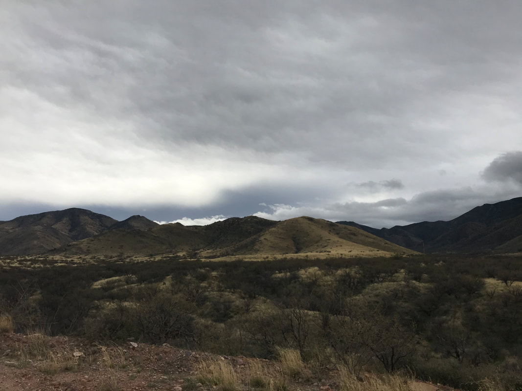
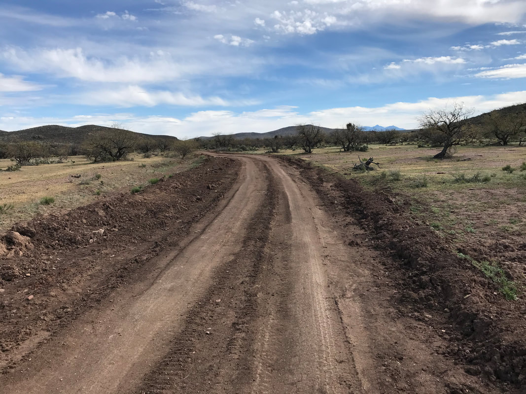
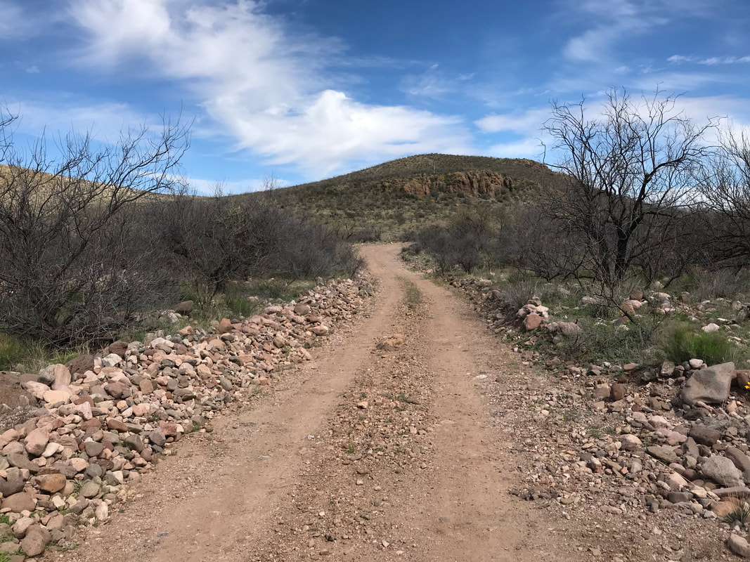
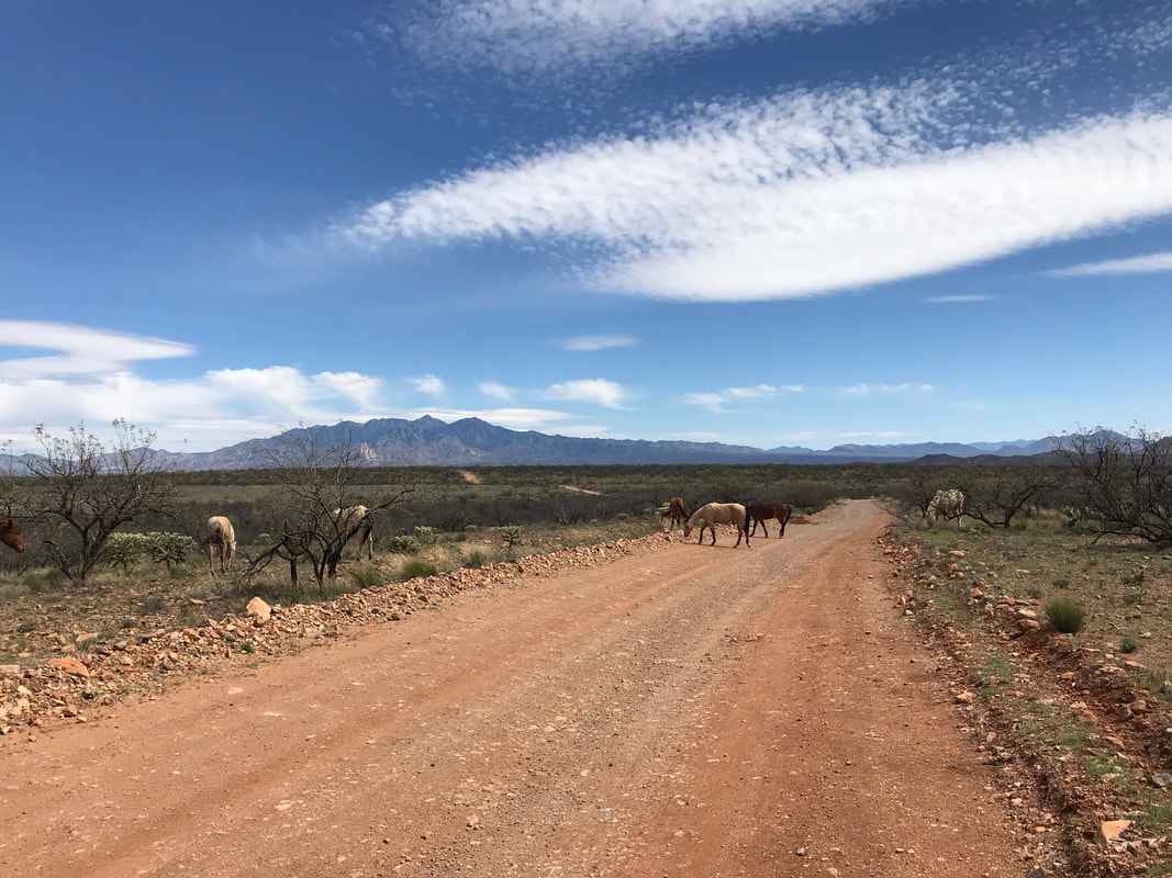
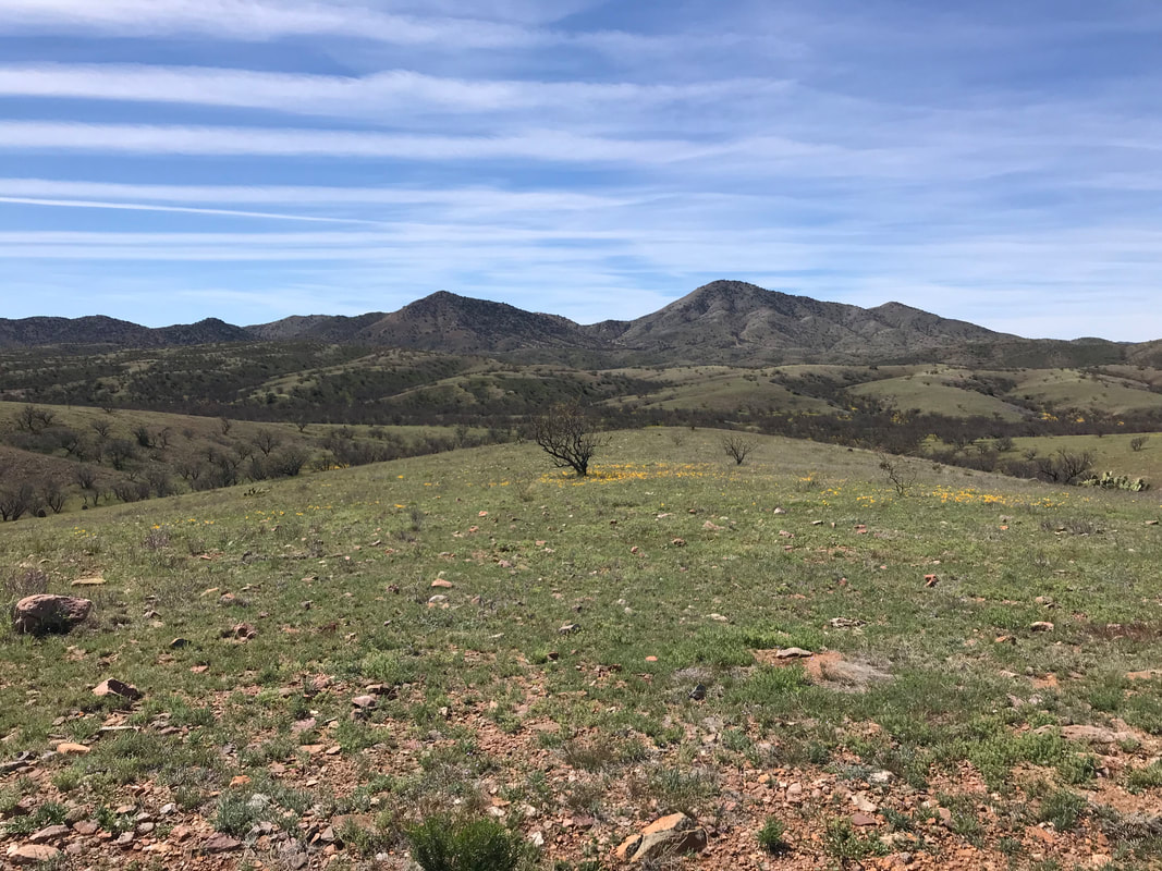
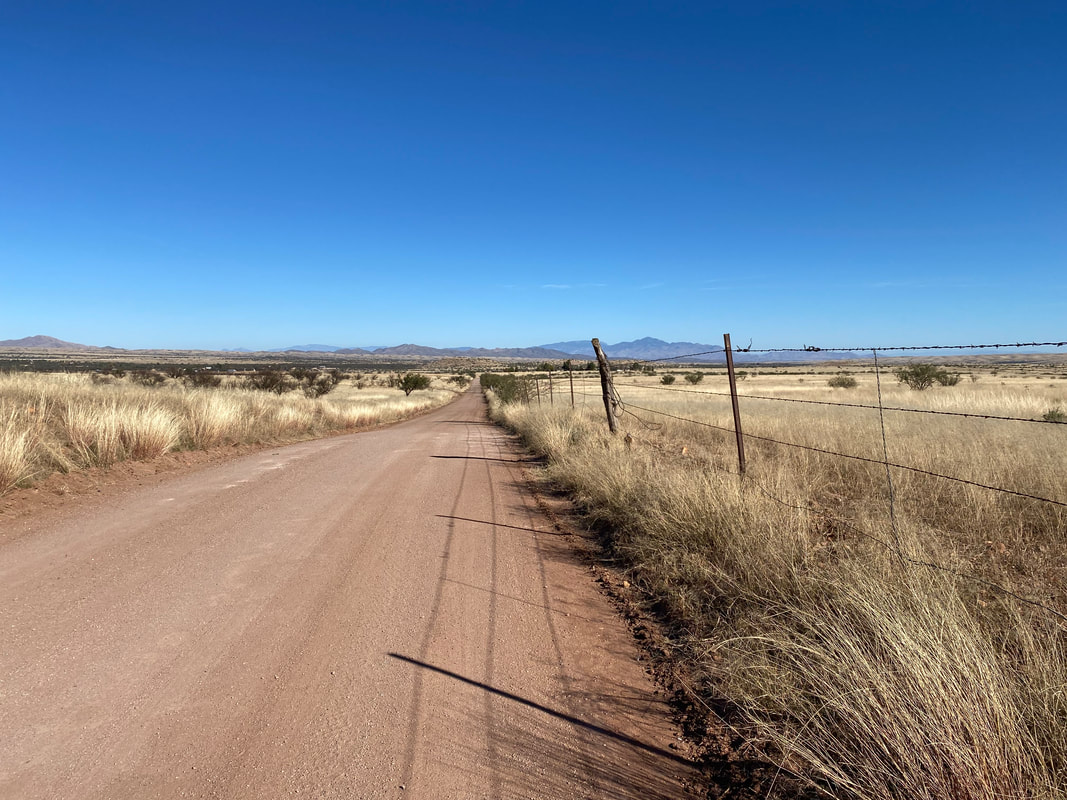
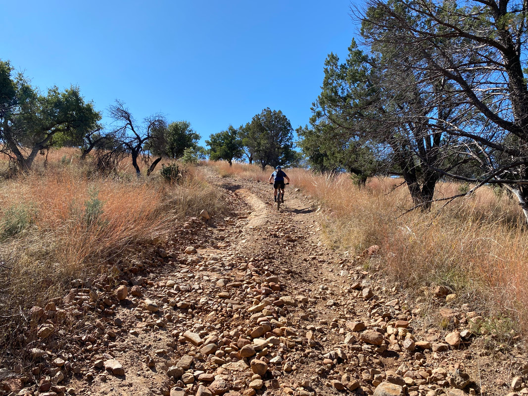
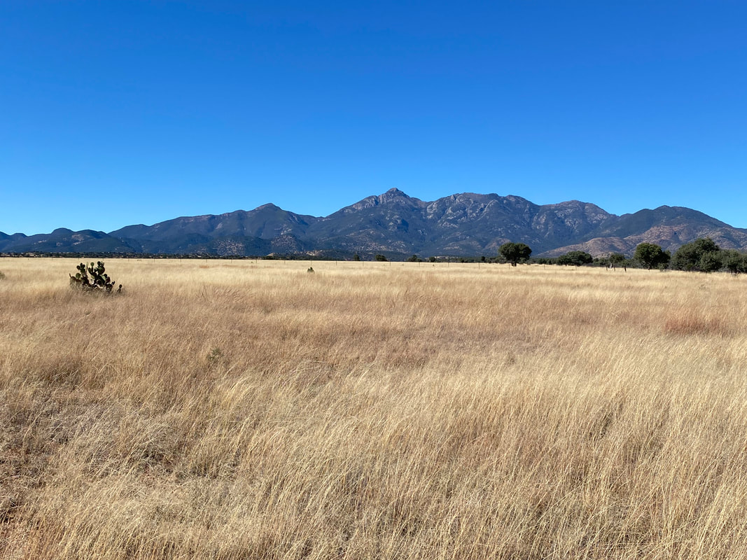
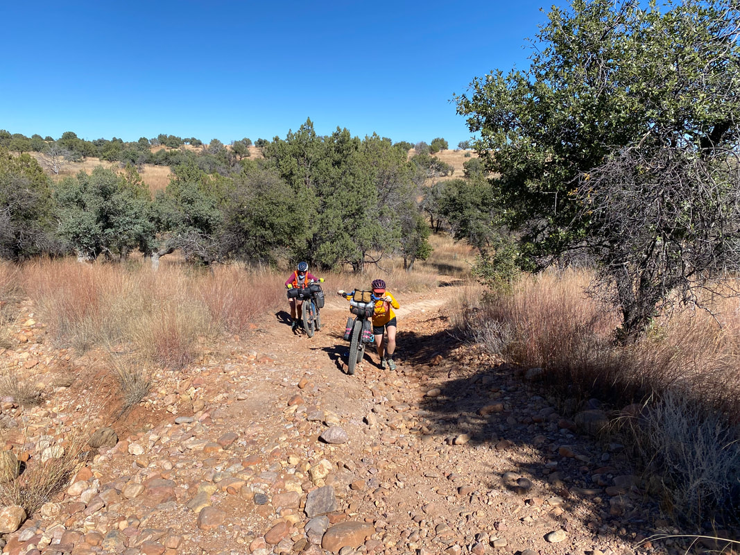
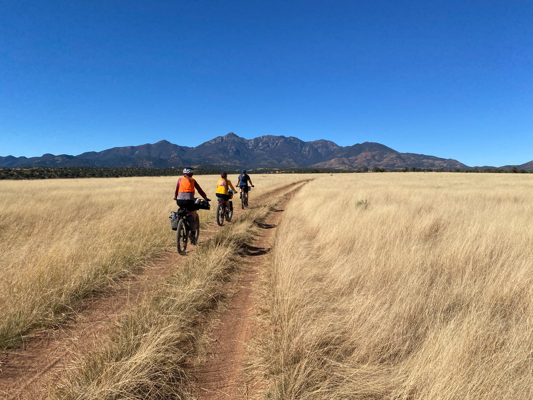
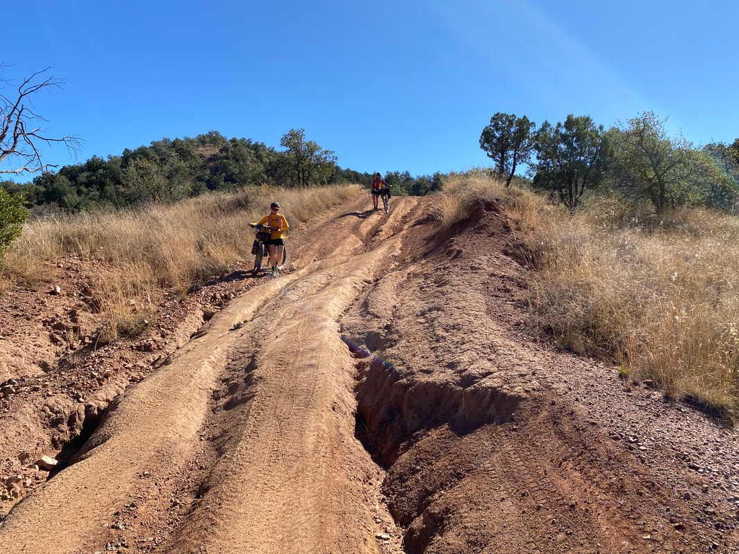
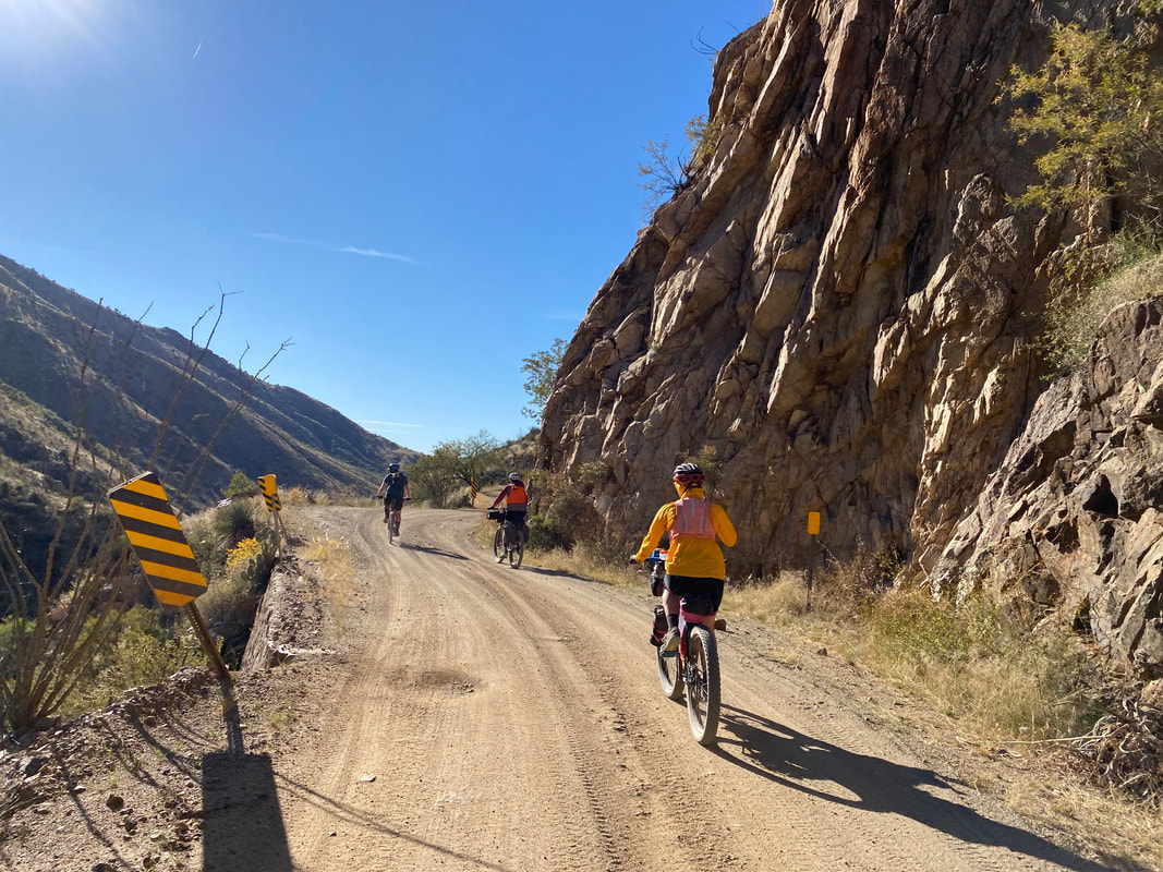
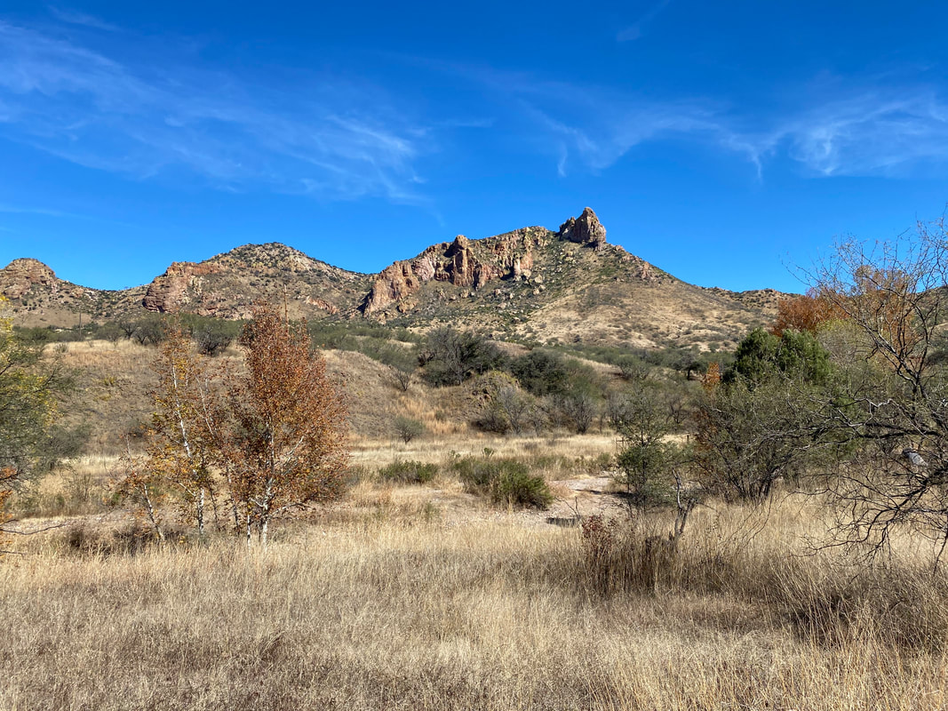
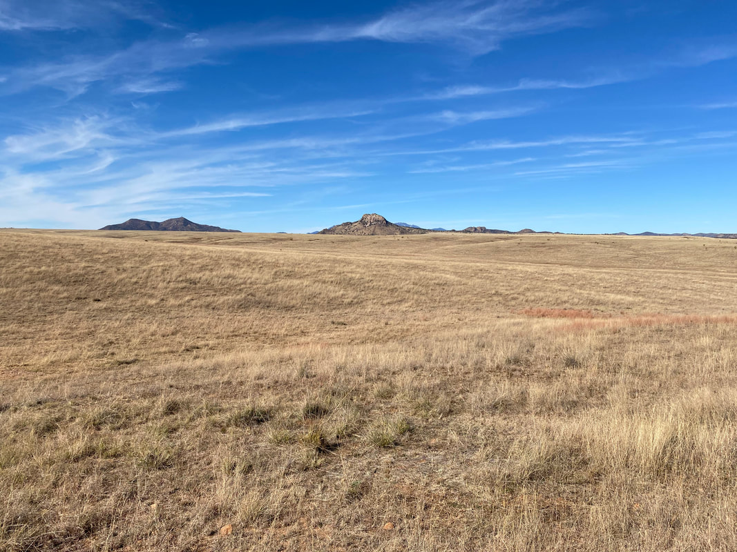
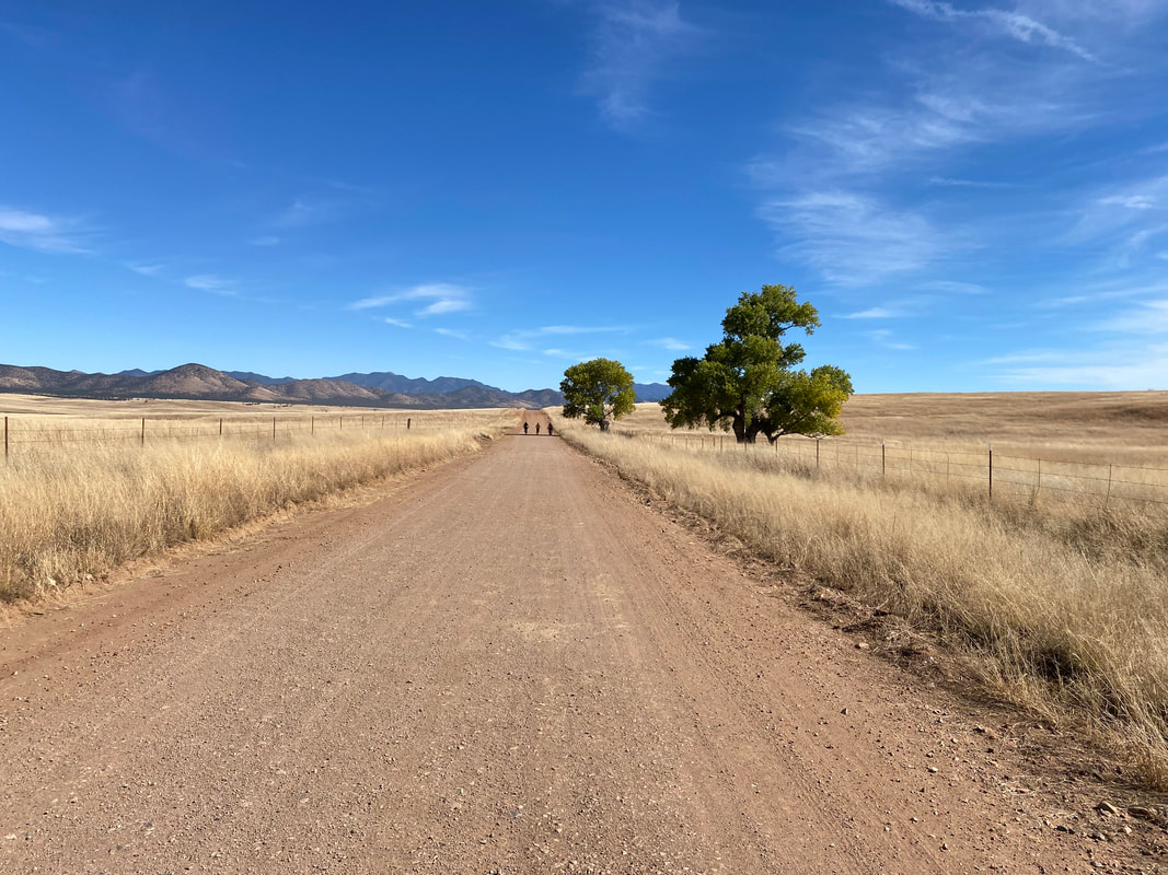
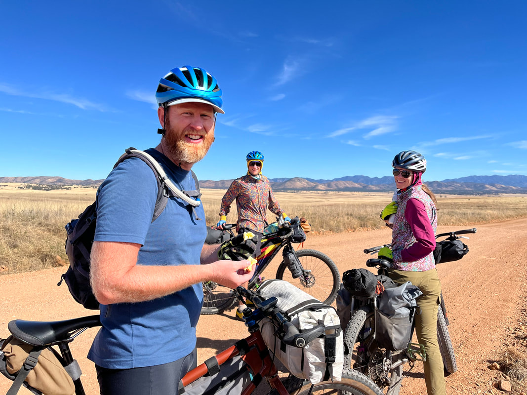
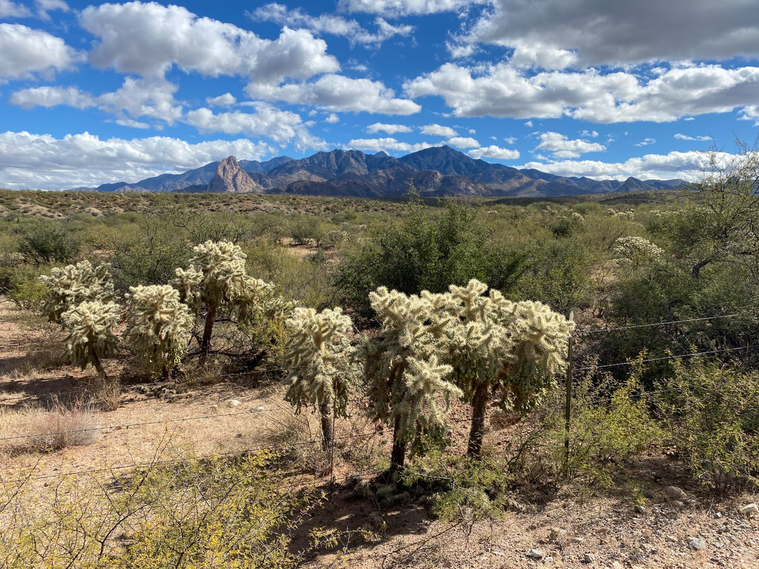
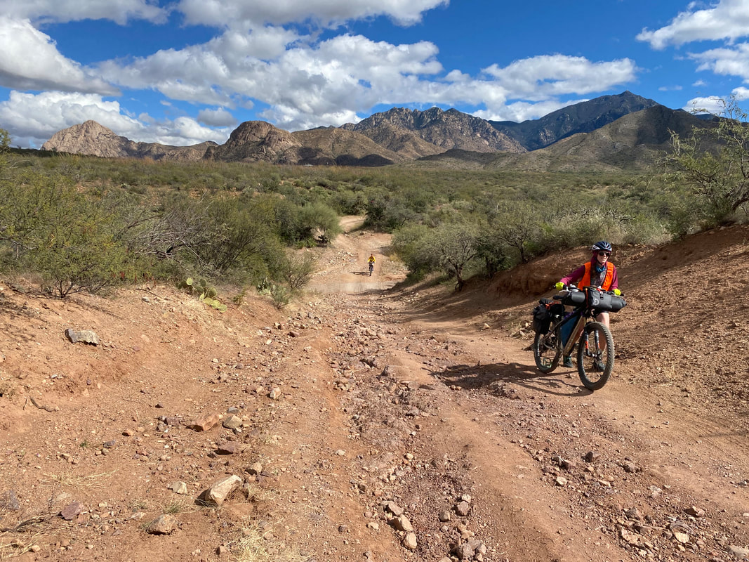
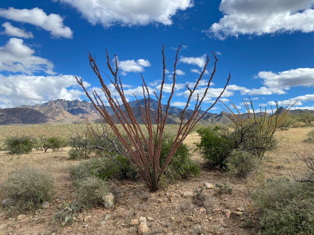
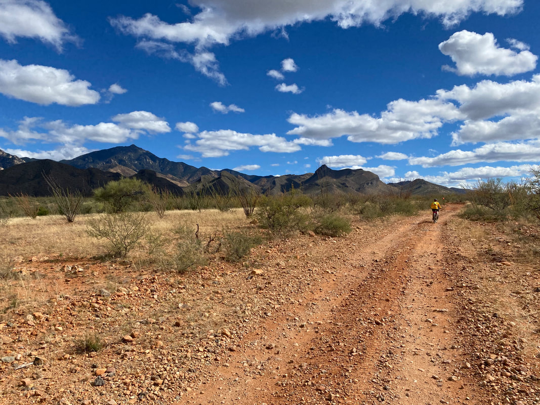
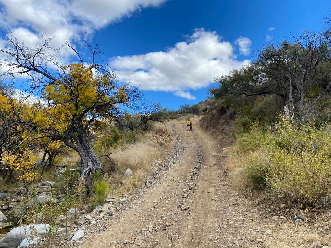
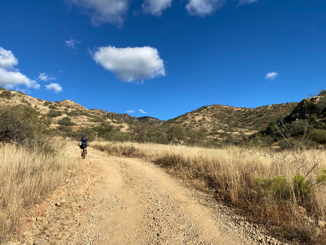
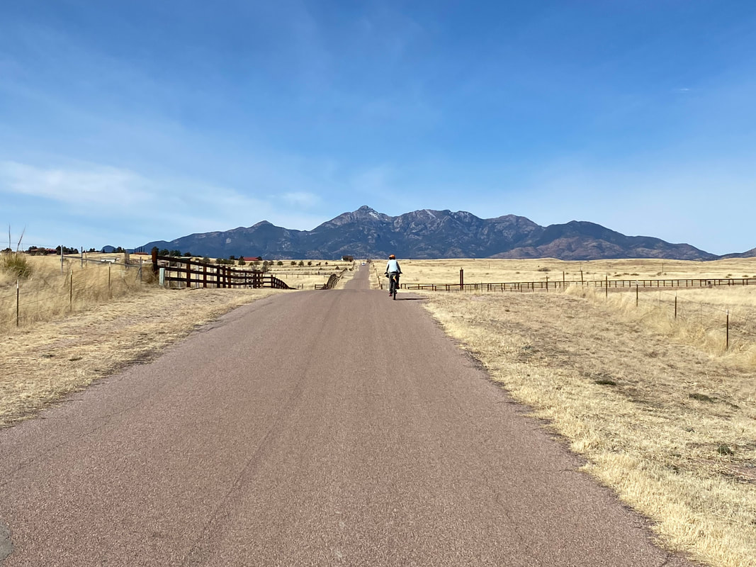
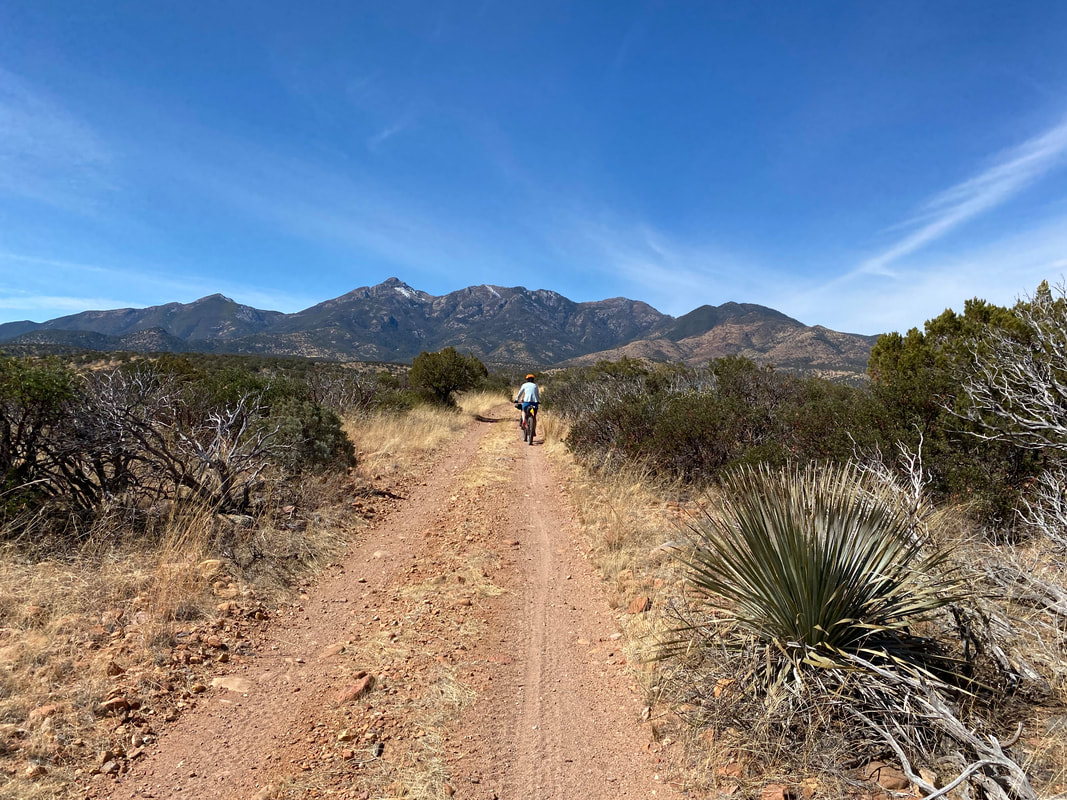
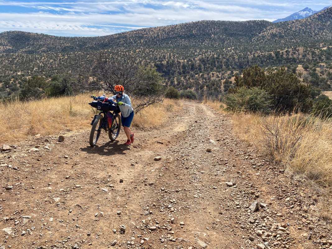
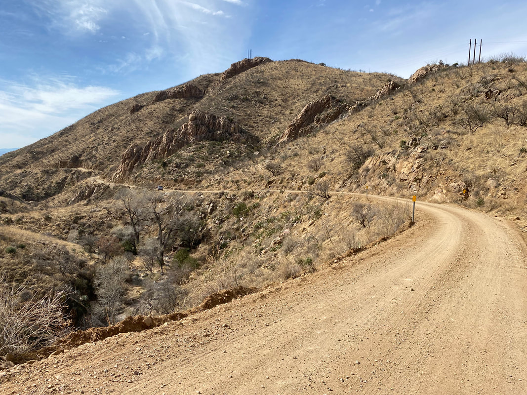
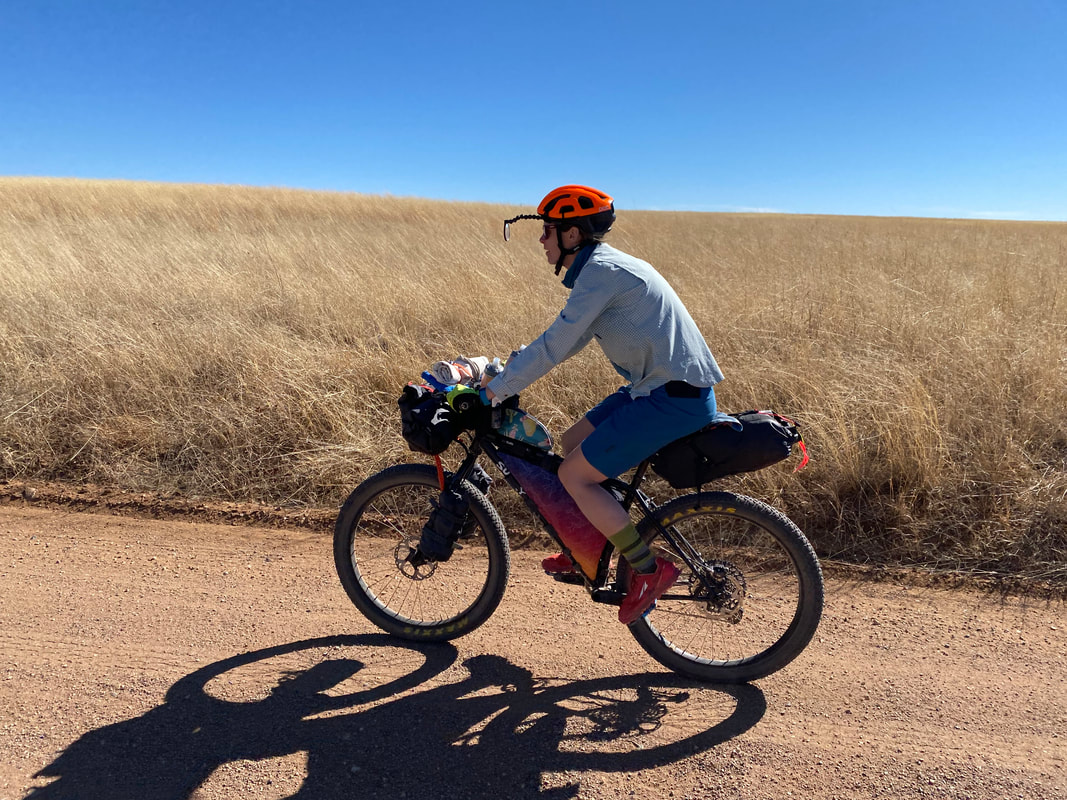
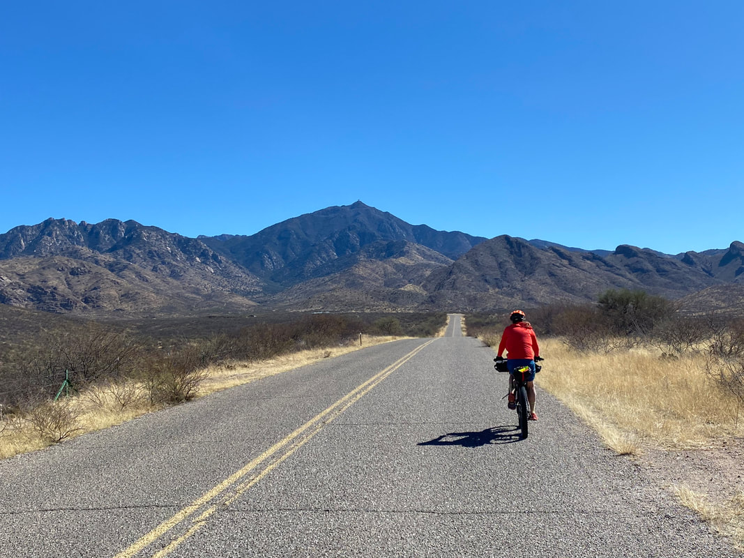
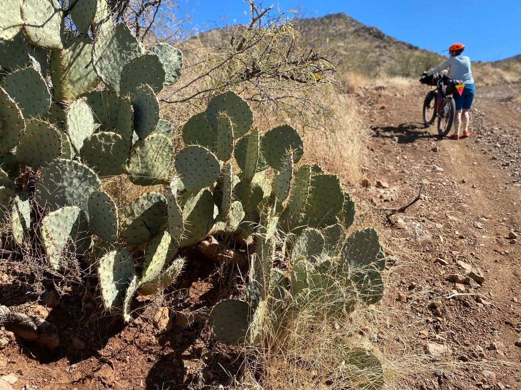
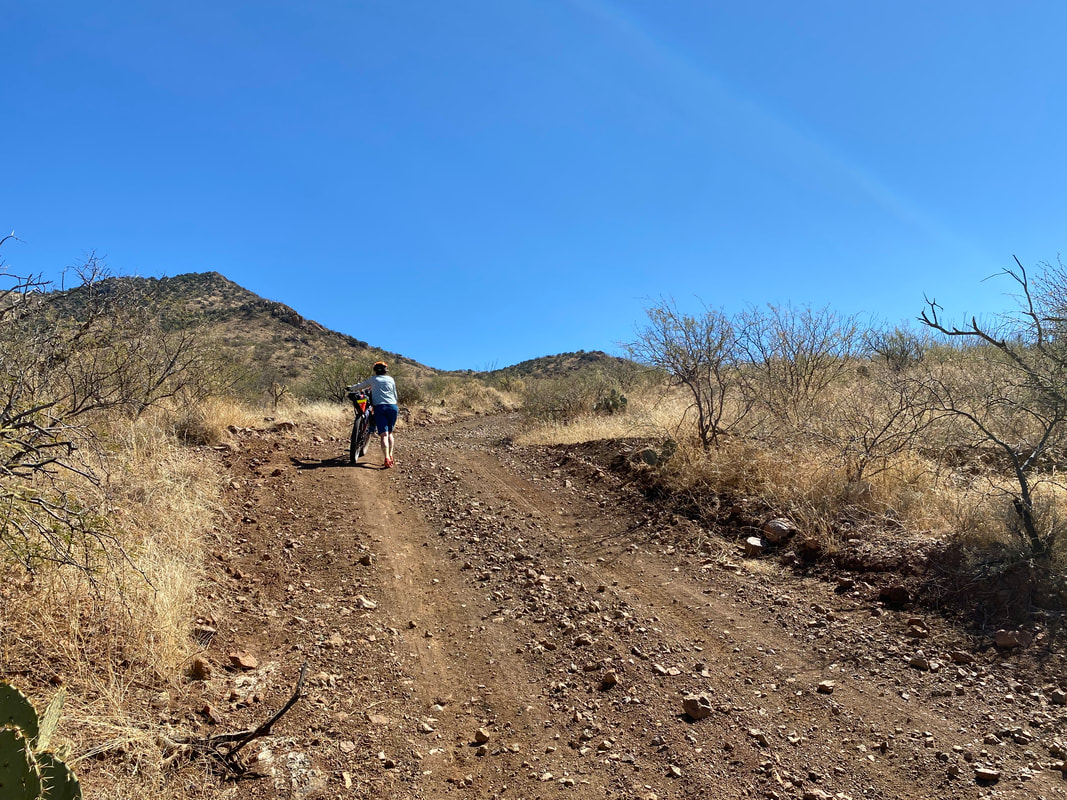
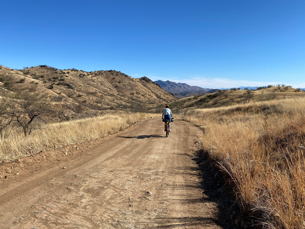
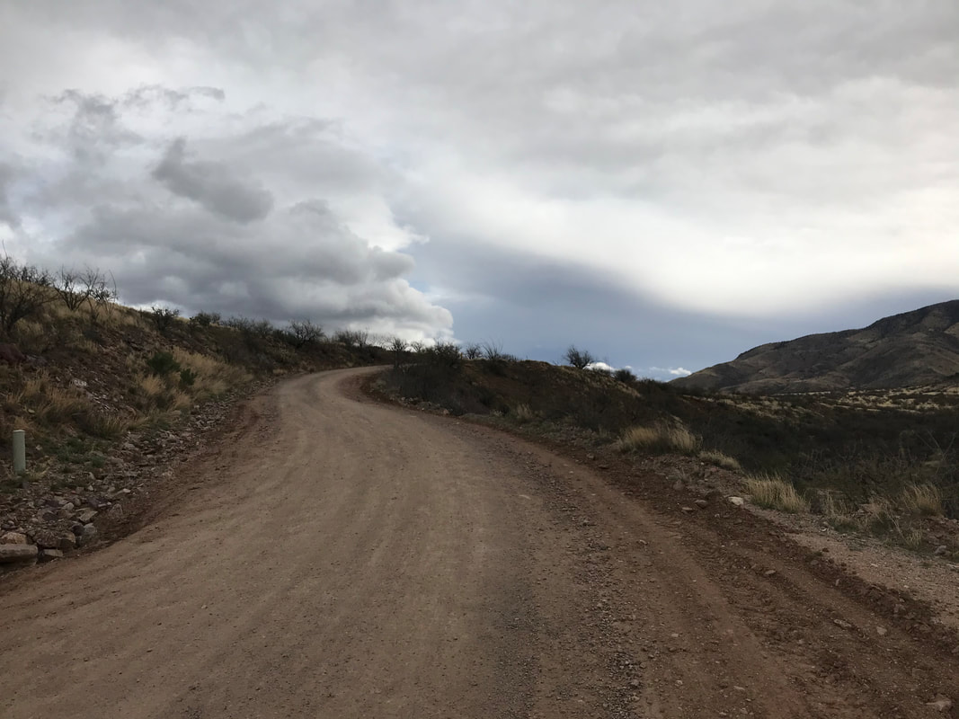
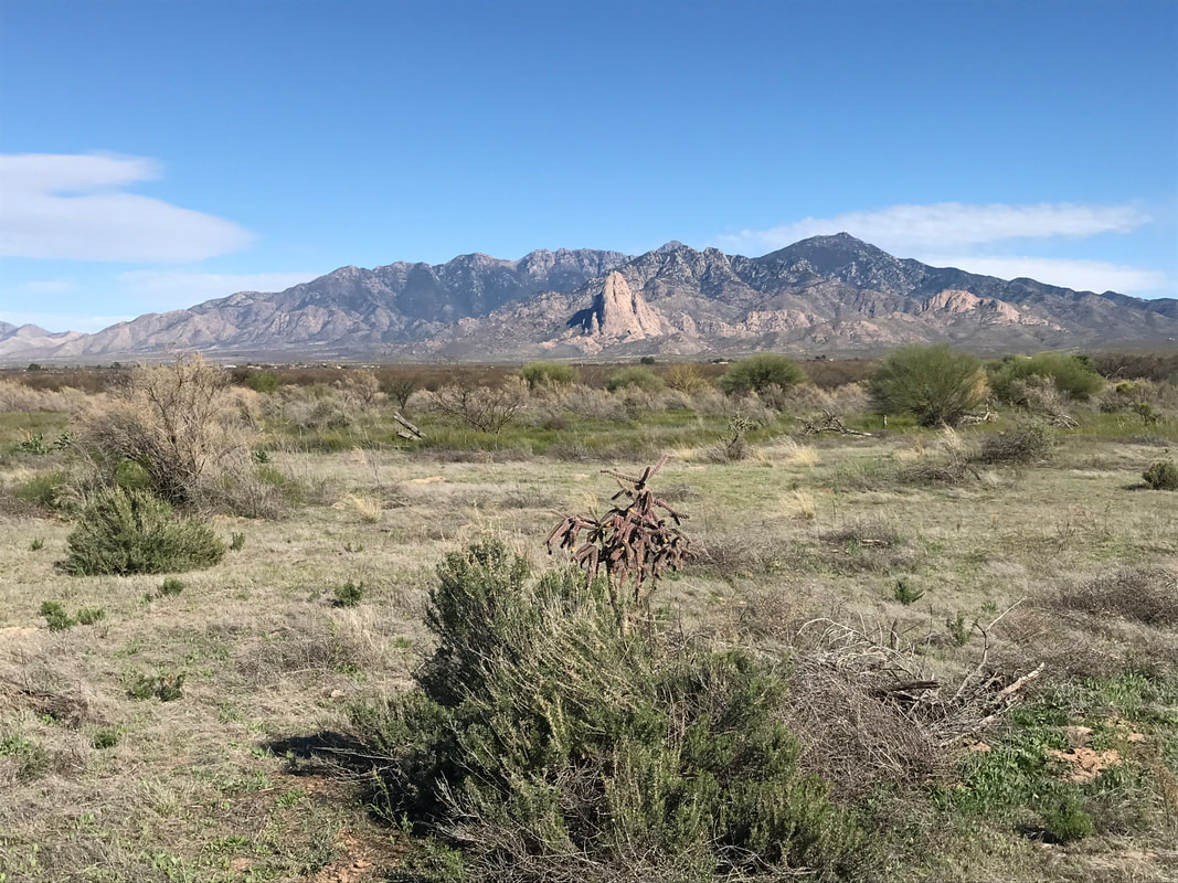
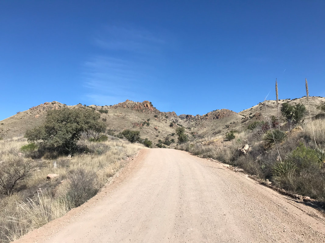
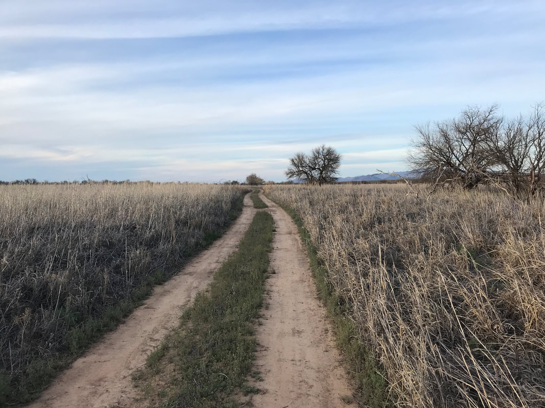
47.44 Miles; 2,684 Feet of Gain; Las Cienegas National Conservation Area to Green Valley, AZ 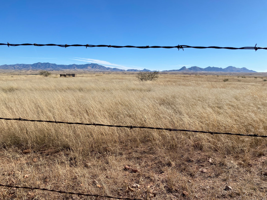 The night descended as cold as the night prior. In our shelter, Janna and I wrapped up and slept well. Kate and Sean cowboy camped and woke up to frost coating their bags and groundtarps. As soon as that sun hit the horizon, we all unzipped, climbed out, and got moving for warmth. A waning gibbous moon sat high in the sapphire blue sky as we pedaled across the golden grasslands. We sped along the dirt and pavement quickly, hitting pavement, passing through ranch-style homes, and then crossing the highway to head up Santa Rita Road. Ever since the route changed to take Santa Rita Road, I've absolutely loved this visual approach to the namesake range. The road is gorgeous and cut along the ridge of a foothill. The grasses are expansive, the range dark and stark against it all. We soon reached the rocky ascent into the scrubland of oak and wash-sycamore. Sean raced and rode up every babyhead-filled portion while Kate, Janna, and I took on the hike-a-bike approach. Yet, the temperatures were perfect so I enjoyed the time taken to seize in every view. 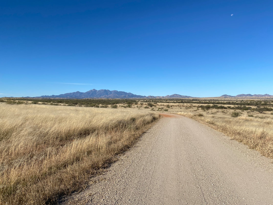
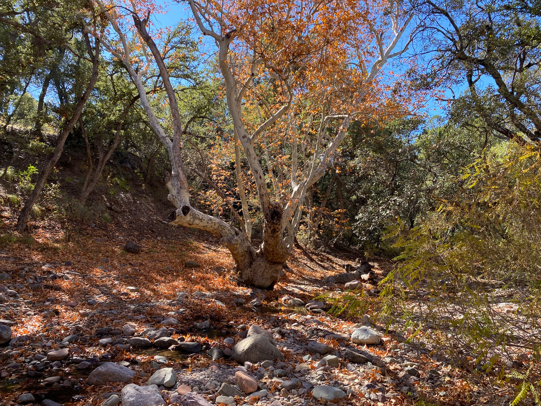
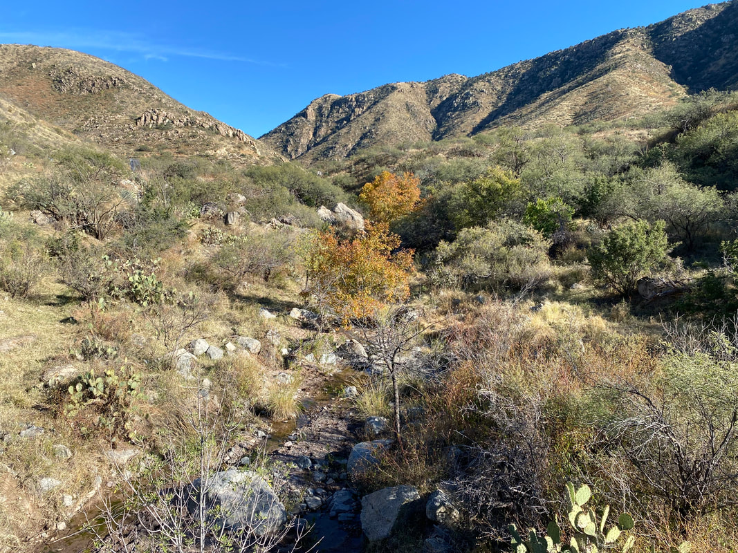
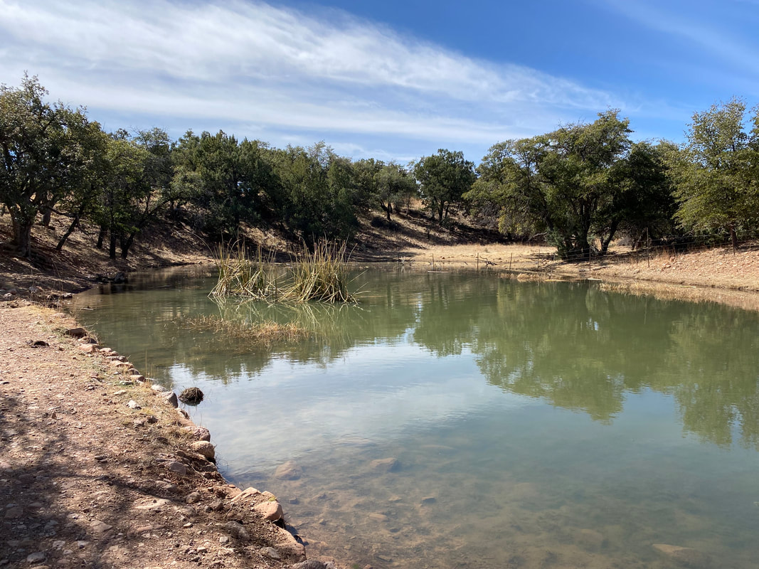
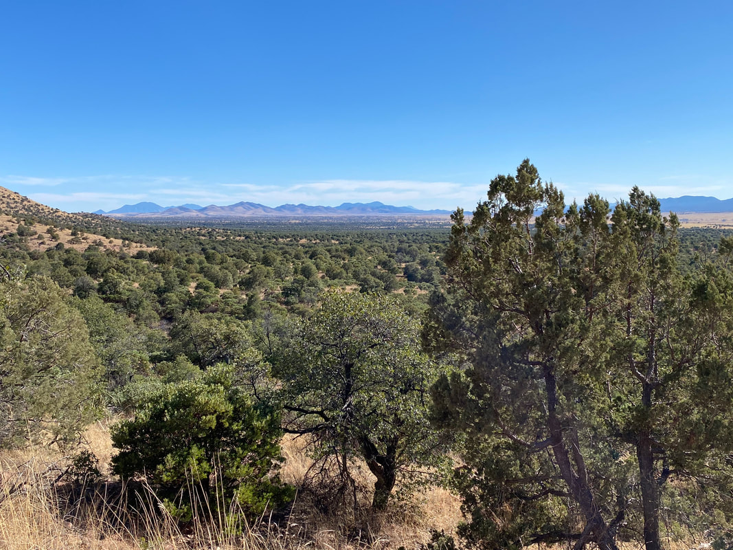
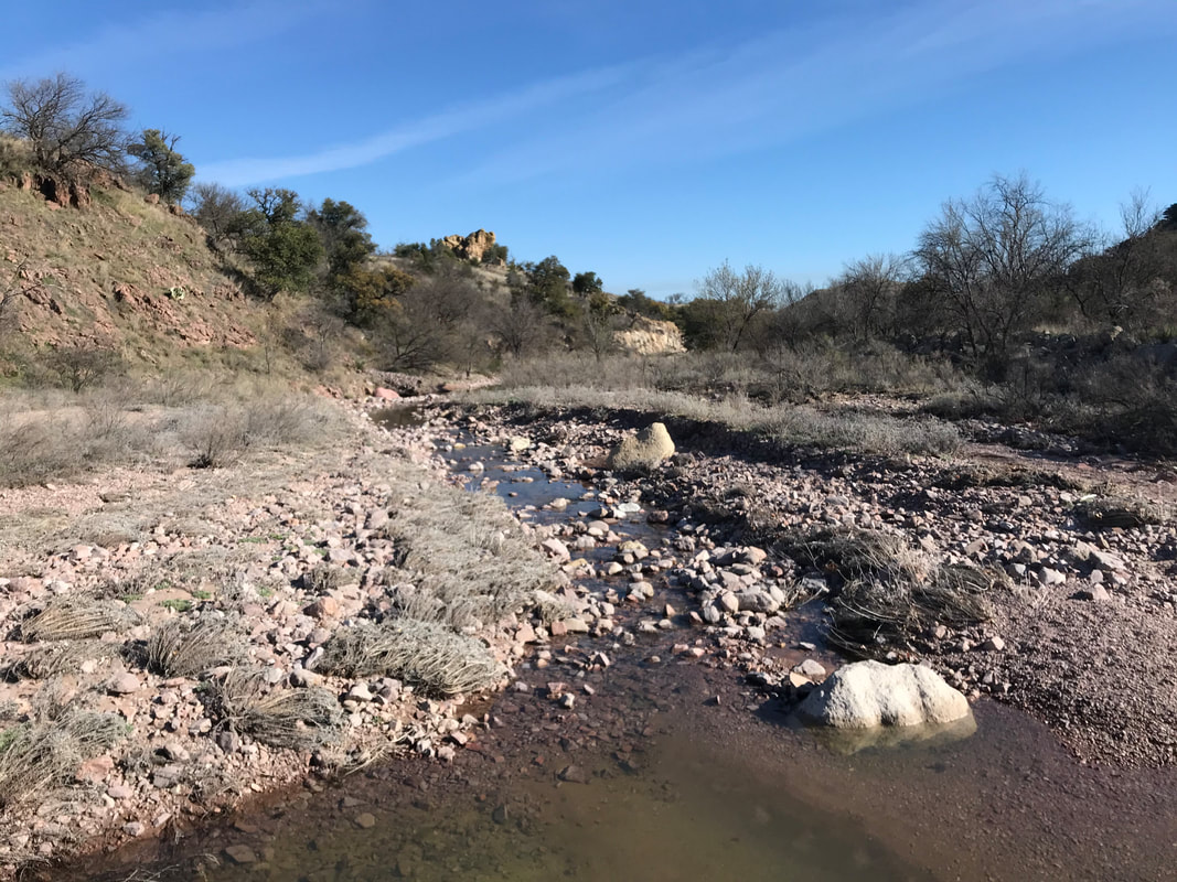
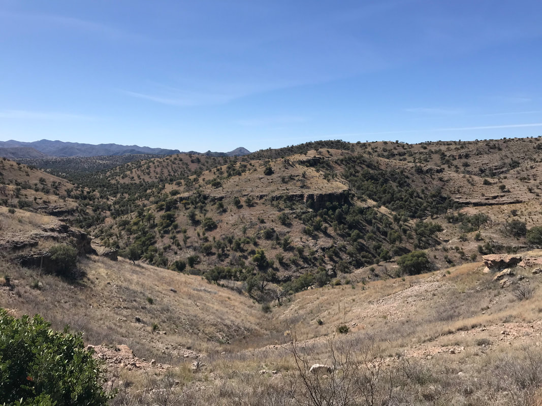
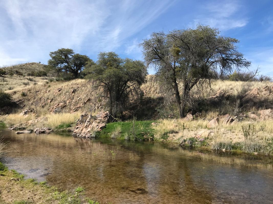
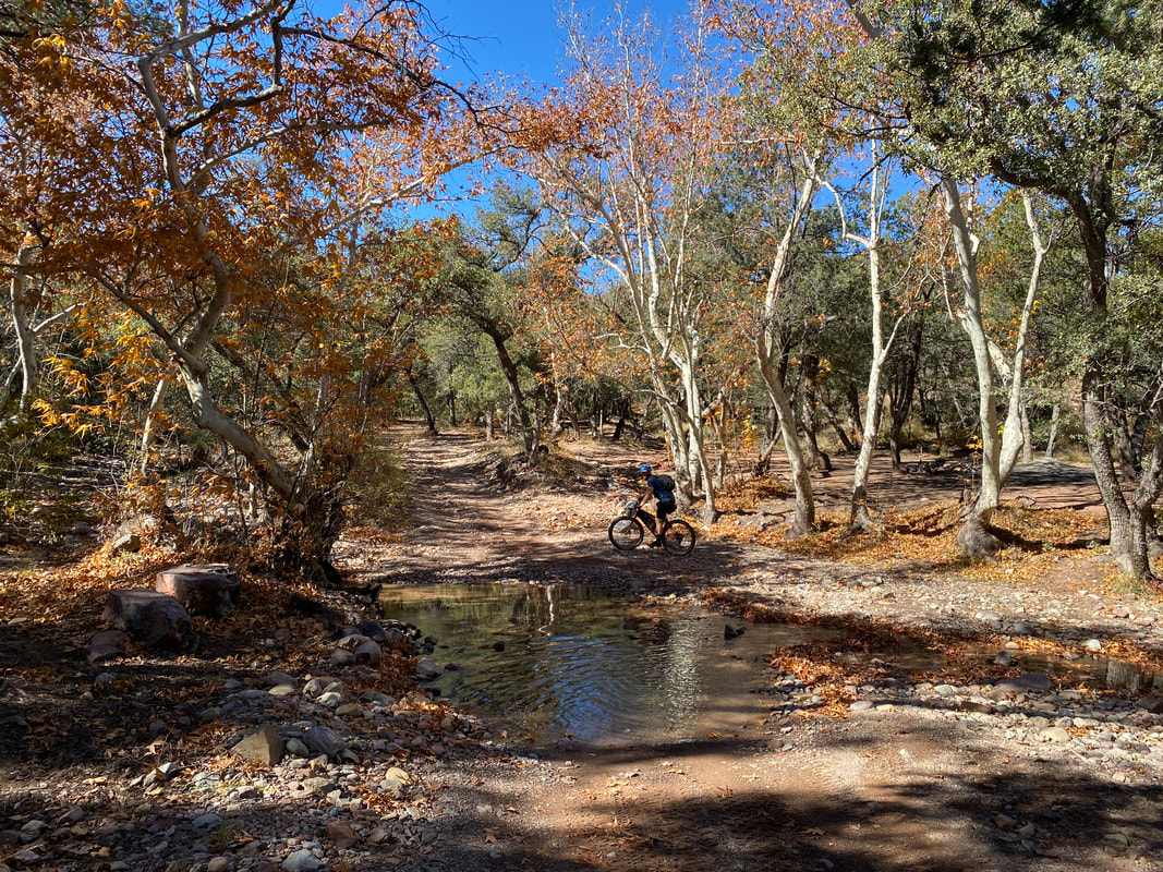
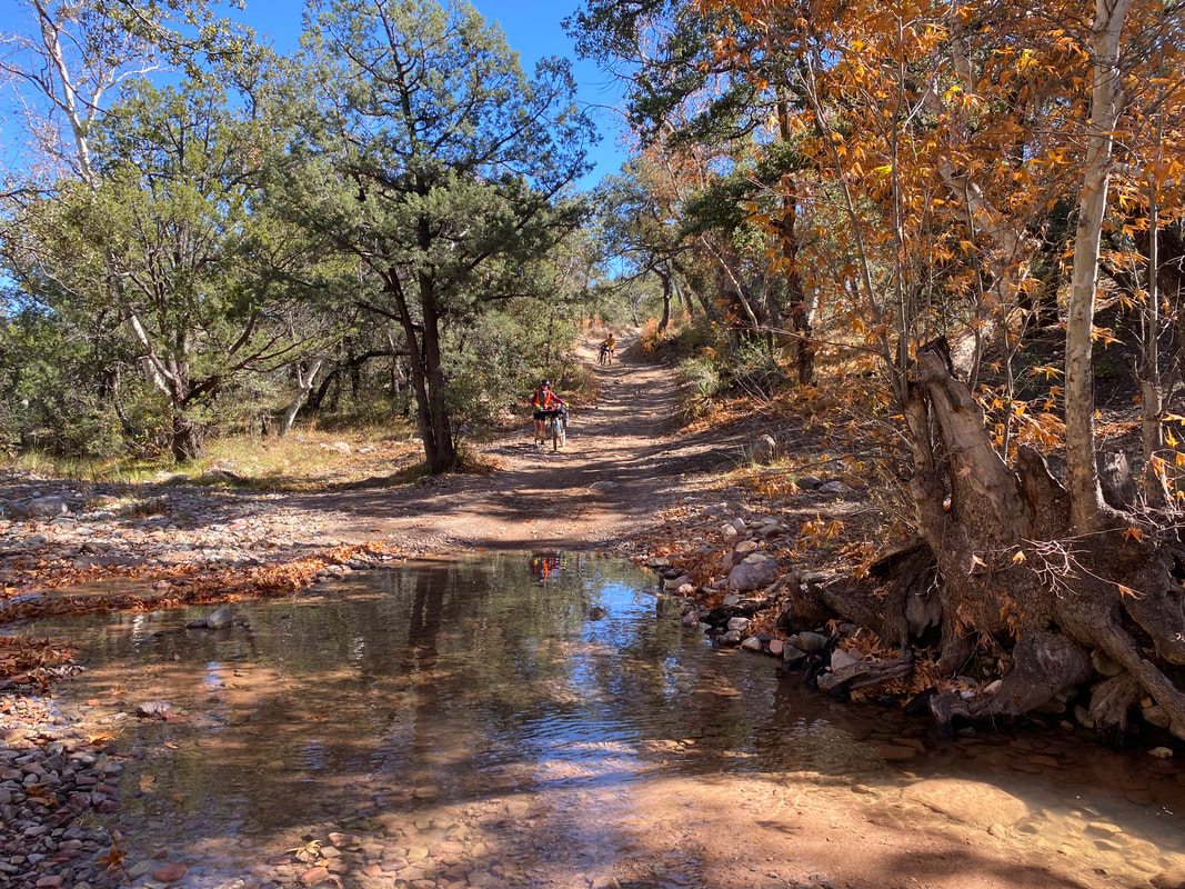
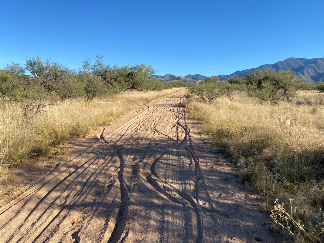
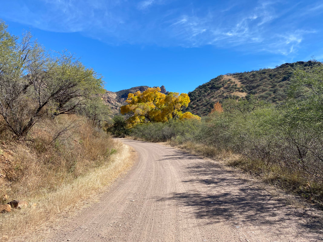
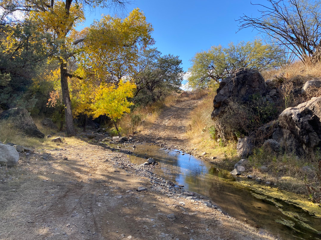
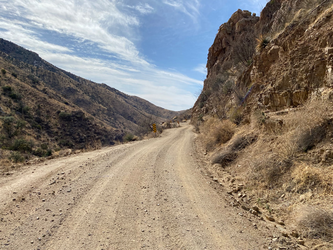
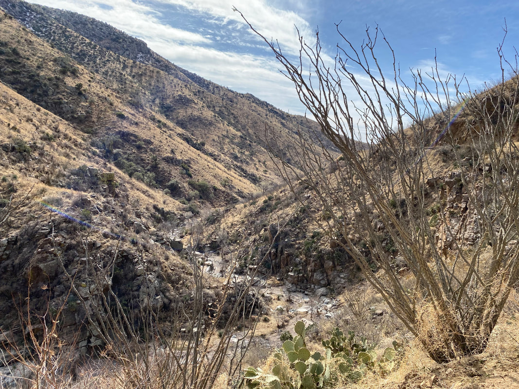
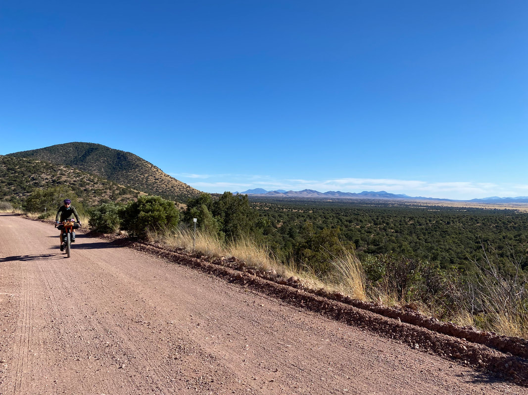
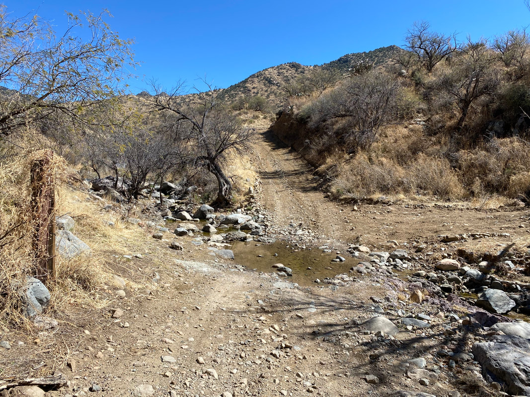
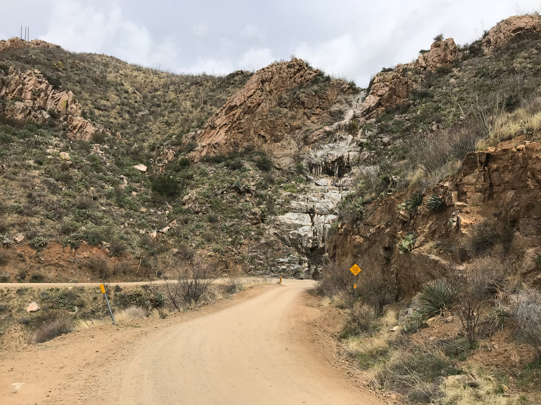
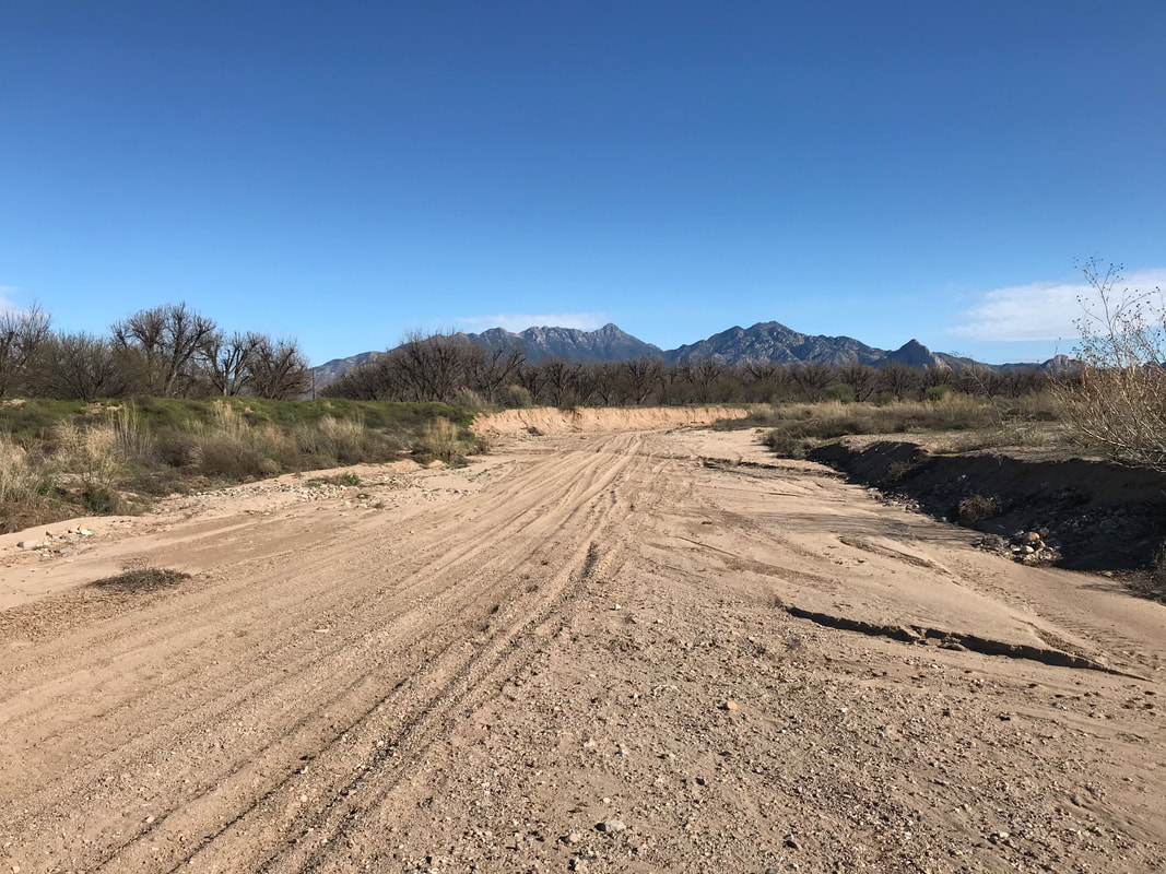
     We then began the roller coaster up-and-downs along a southern parallel with the Santa Ritas. Every wash was filled with water leaving me stunned compared to the dry conditions in the spring. At a particularly large creek crossing, sagging orange boughs of autumn sycamore leaves patterned the canopy while white bark starkly contrasted with striped shadow. Sean reported that he had never ridden all of this section, and he was stoked to see the beauty new-to-him. He gracefully sped down steep screen doubletrack and eroded dirt road that the rest of us three walked instead. By midday, we were pulling out into Box Canyon, which Sean said he had never ridden. As the gentle curves led to the penultimate downhill, Box Canyon opened up fully revealing the ecotome between the high desert grasslands and the lower Sonoran, complete with fall leaves colored and hanging from cottonwoods and sycamores along its wash. We sped down thrillingly into the canyon and back towards Green Valley. Once out of the Box, we jumped on the dirt roads riding through Arizona State Trust Land. The route expectedly decayed into sand that we all pedaled downhill through as fast as possible. The sand was in the best of conditions - shallow and well-packed. It didn't mean I didn't tumble once or twice while fishtailing through it all. We got back to our cars in Green Valley by late afternoon. Sean and Kate decided to go pickup Icees in Tucson, while Janna and I began the long drive back north to the Grand Canyon. 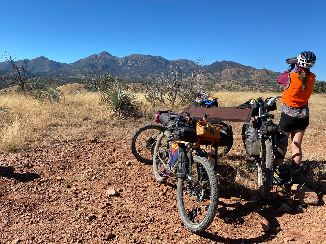
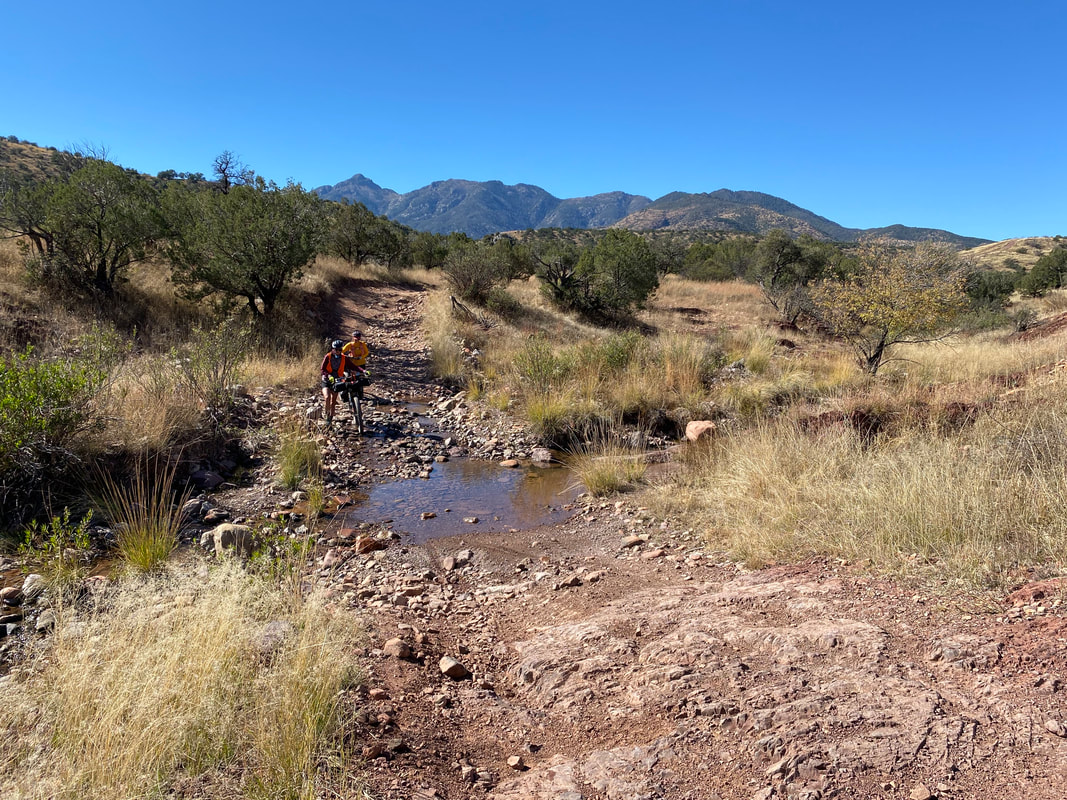     
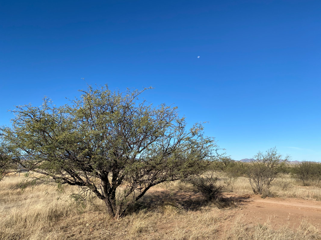
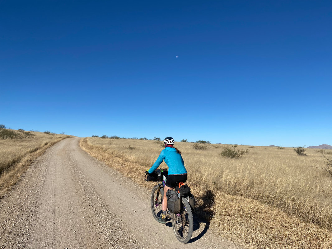
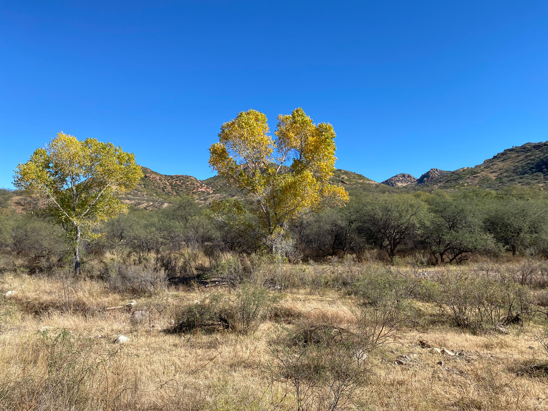
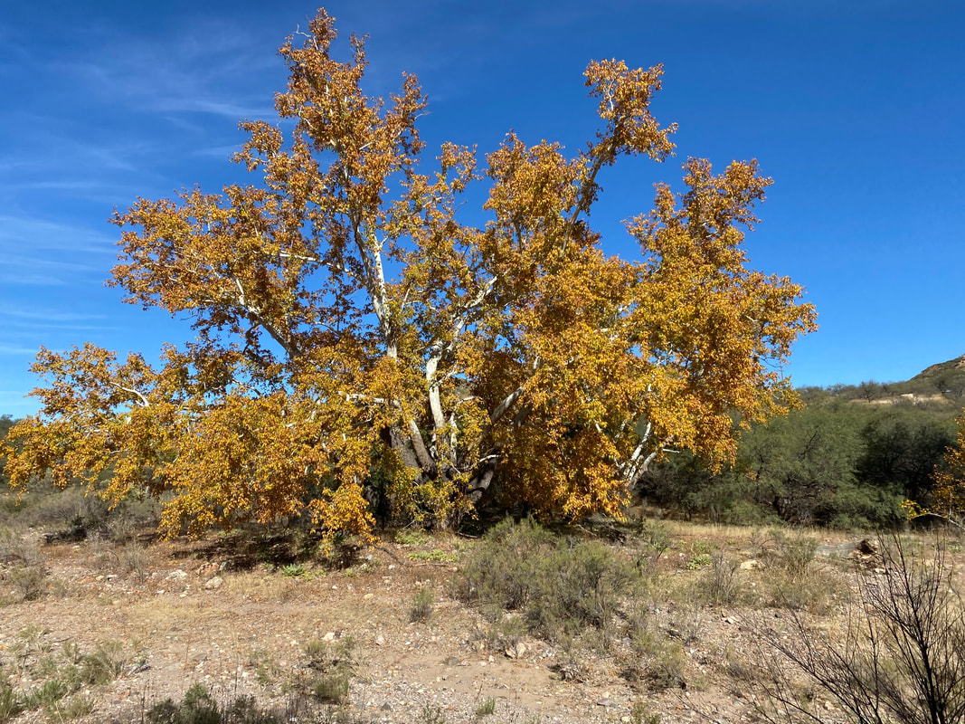
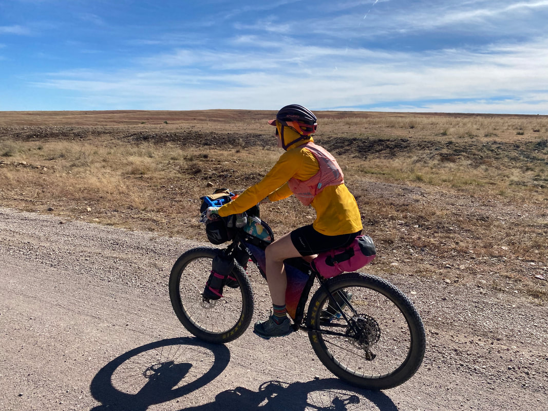
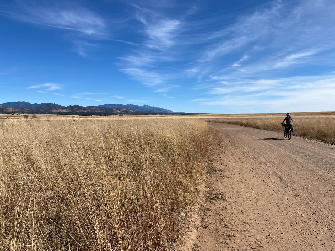
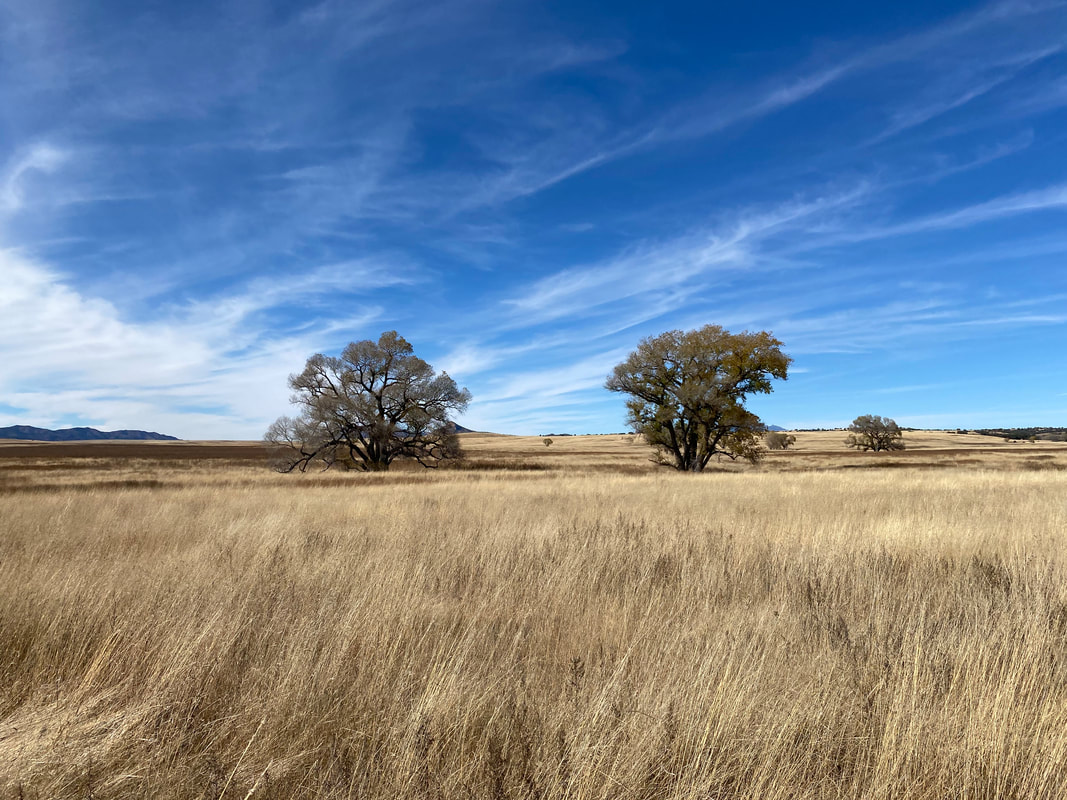
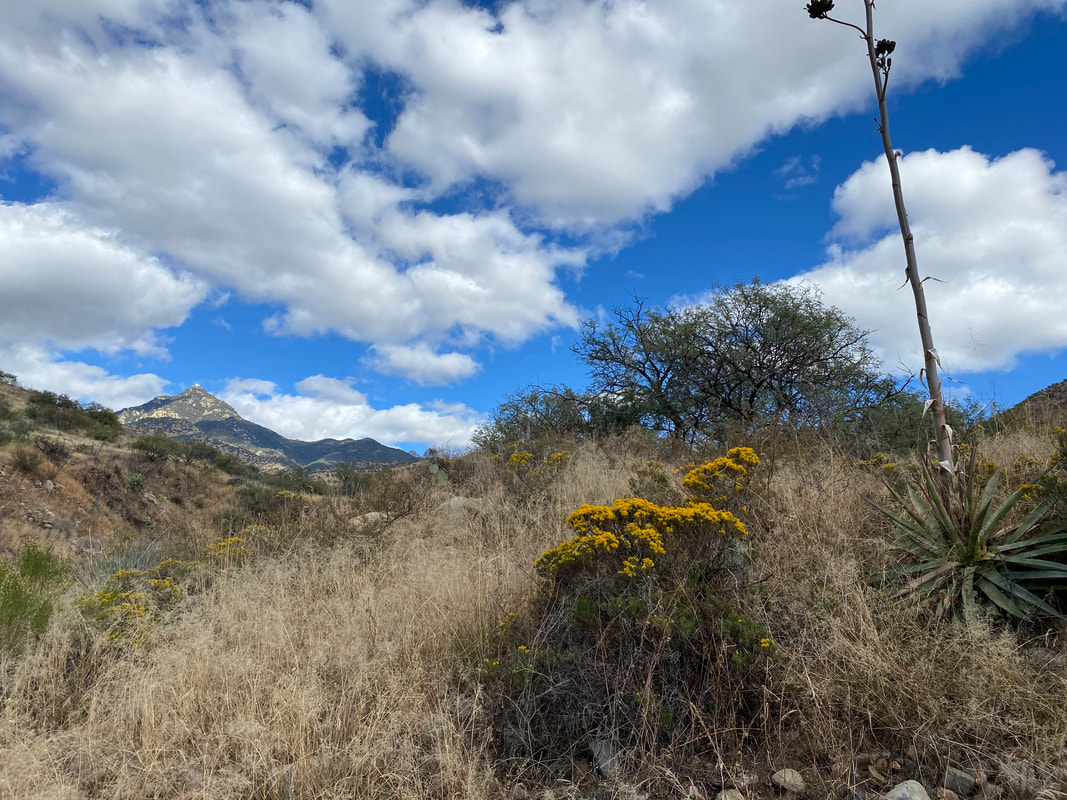
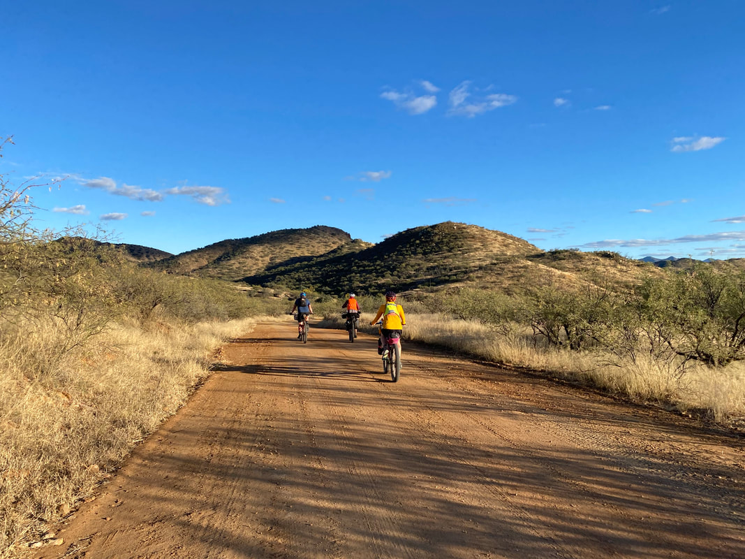
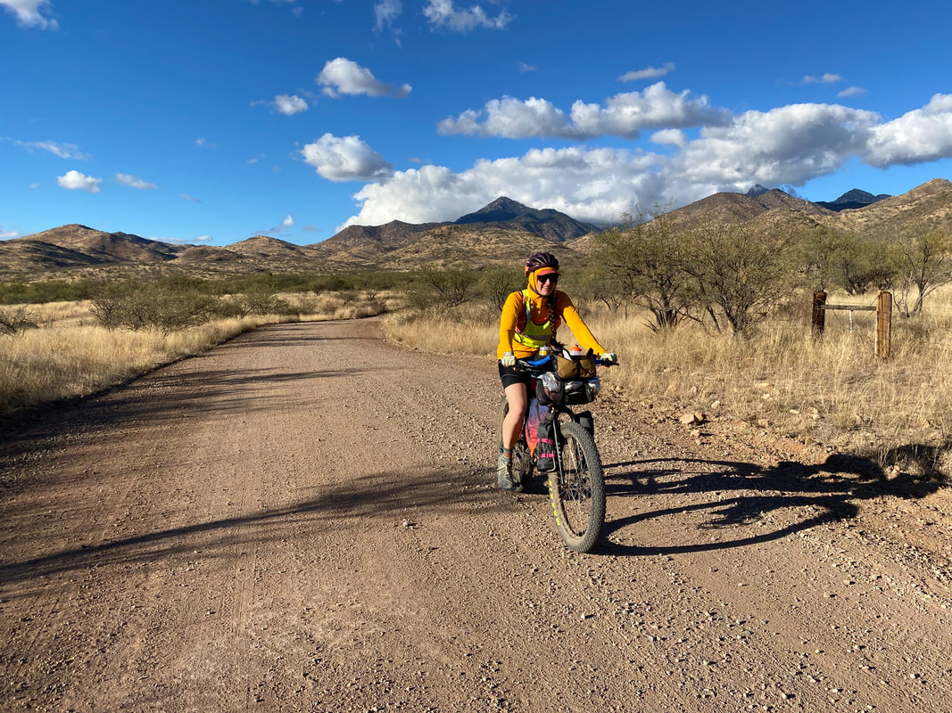
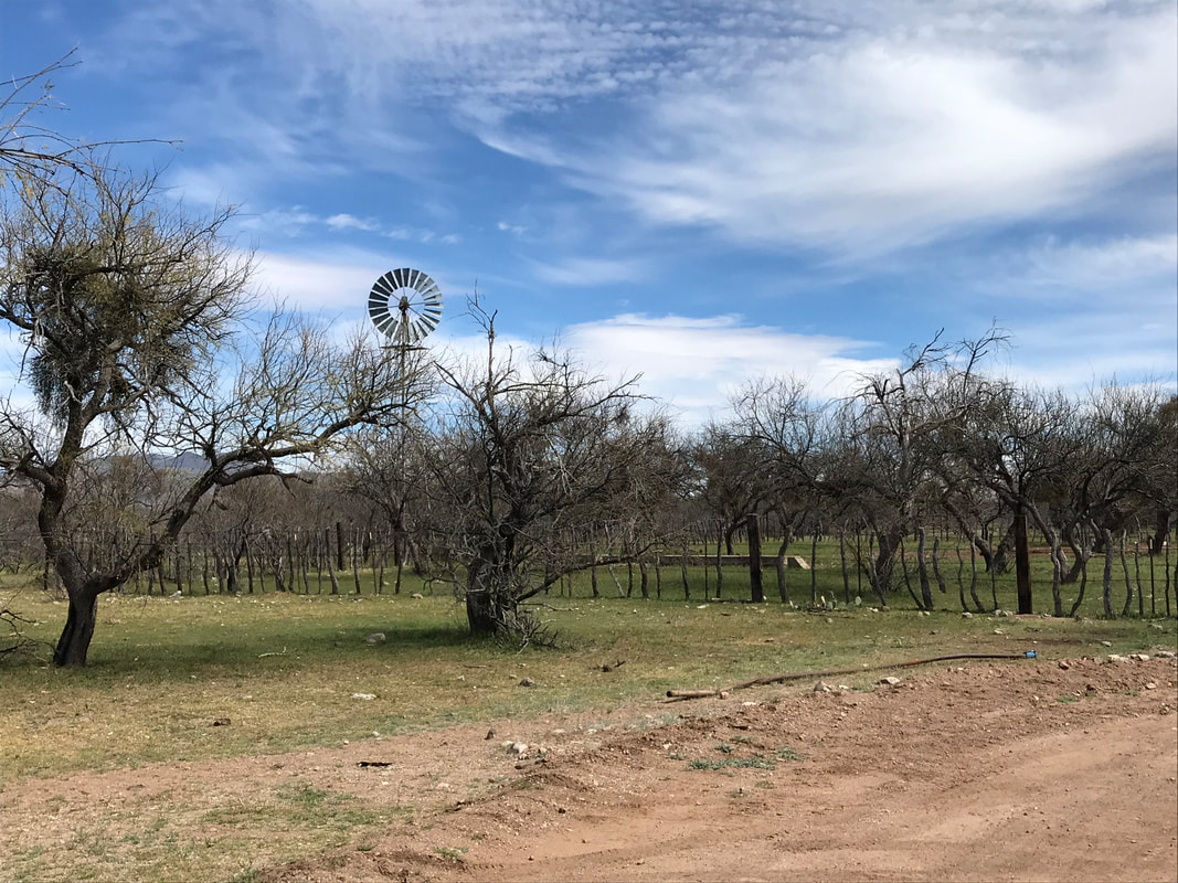
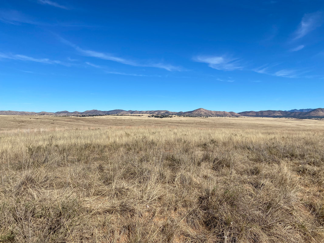
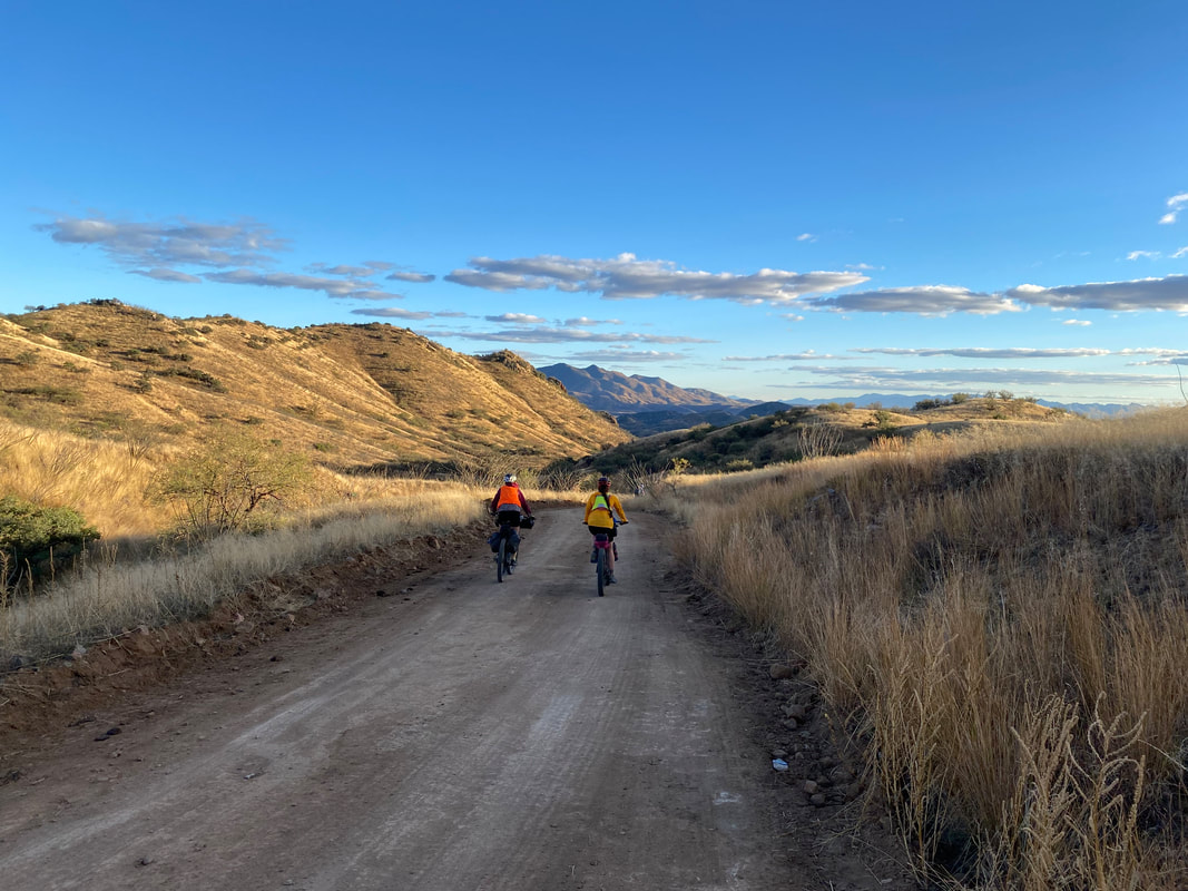
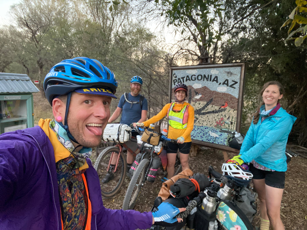
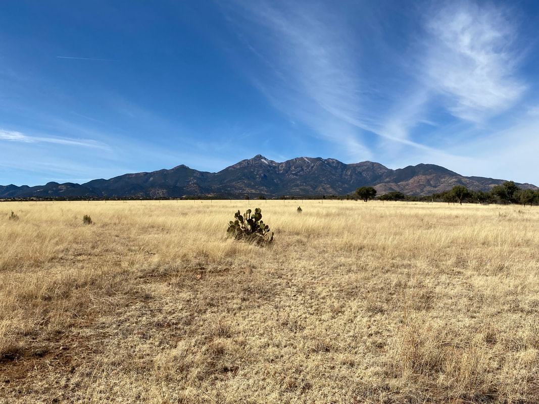
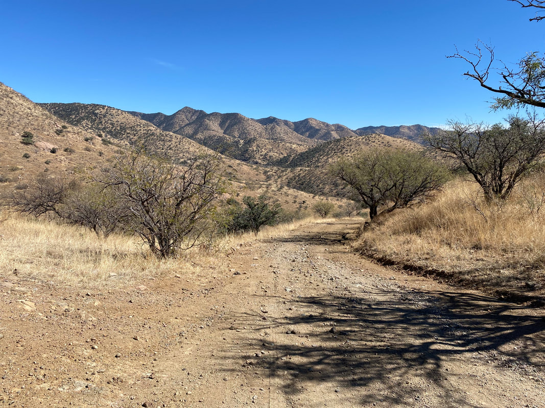
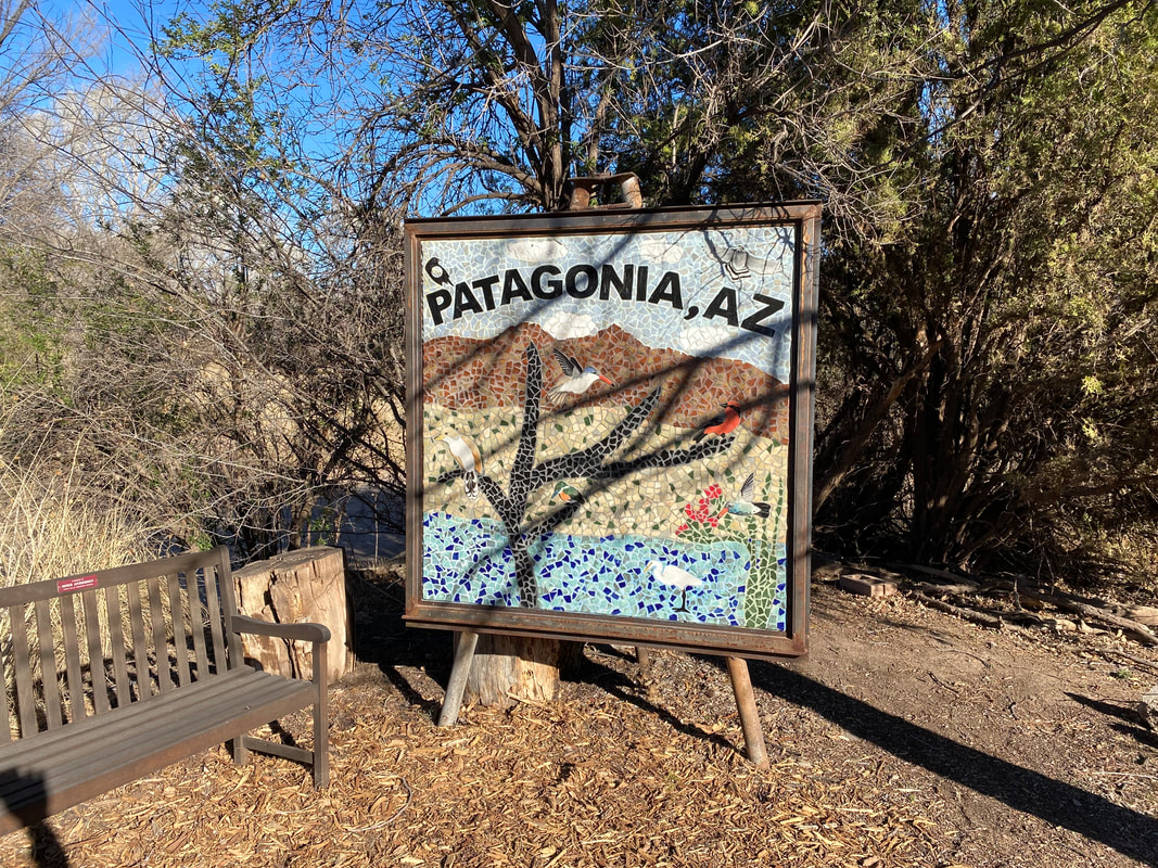
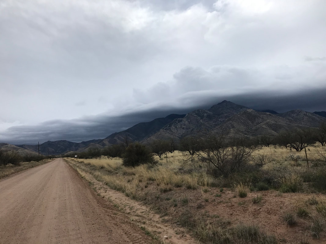
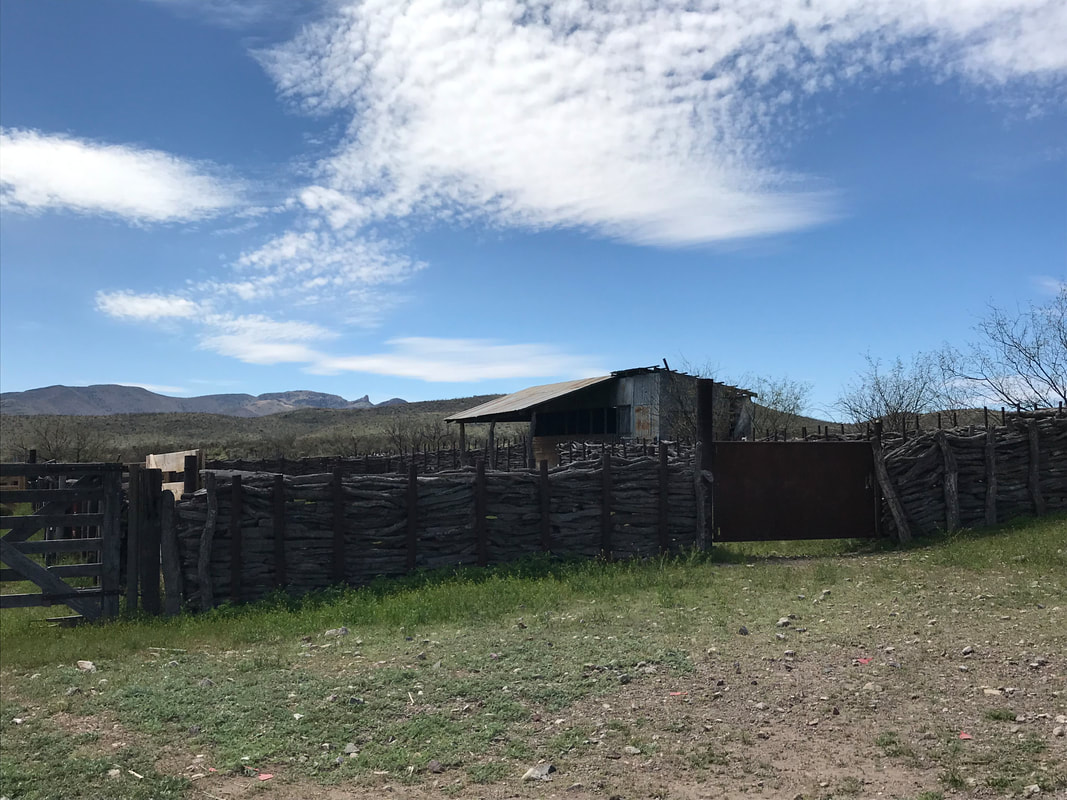
 46.40 Miles; 2,692 Feet of Gain; Patagonia, AZ to Las Cienegas National Conservation Area 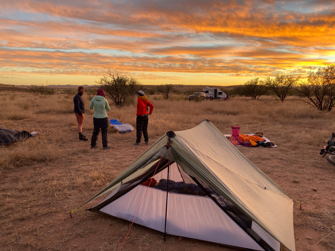 A cold night combined with condensation left us frost-born come morning. Javelina spent the night sniffing along our tent and digging around the area, so I was woken up several times. But at first light, I mustered the spirit to dawn some warm clothes and climb out of our the iced-interiored shelter into the day. The four of us had agreed to meet downtown early this morning for breakfast at Gatherin' Grounds before embarking out into the grasslands. I stashed the ice-crisp shelter quickly on the bike and we spun to the heart of Patagonia. The sun was now fully out, so I quickly unlashed the tent and draped it across wooden posts in the town center in an attempt to dry it while we waited for Sean and Kate. It turned out that their night was even colder, delaying their arrival to after Janna and I had placed our breakfast orders. After a lingering morning, we all stocked up on some supplies for the next two days and pushed out to Harshaw Road. Autumn was in full-swing, and every cottonwood along the washes and creeks was in full splendid yellow arrangements brushed with orange. The miles passed easily and we popped out into the golden yellow grasslands Janna and I love so much. Kate was impressed with the beauty of the grass ocean while Sean told us stories of bikepackers he had explored the area with. 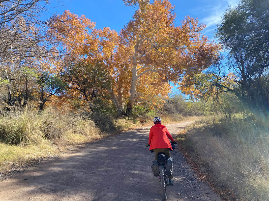
     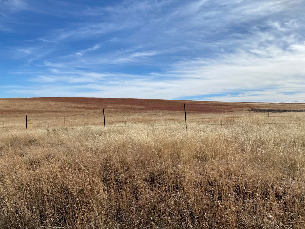
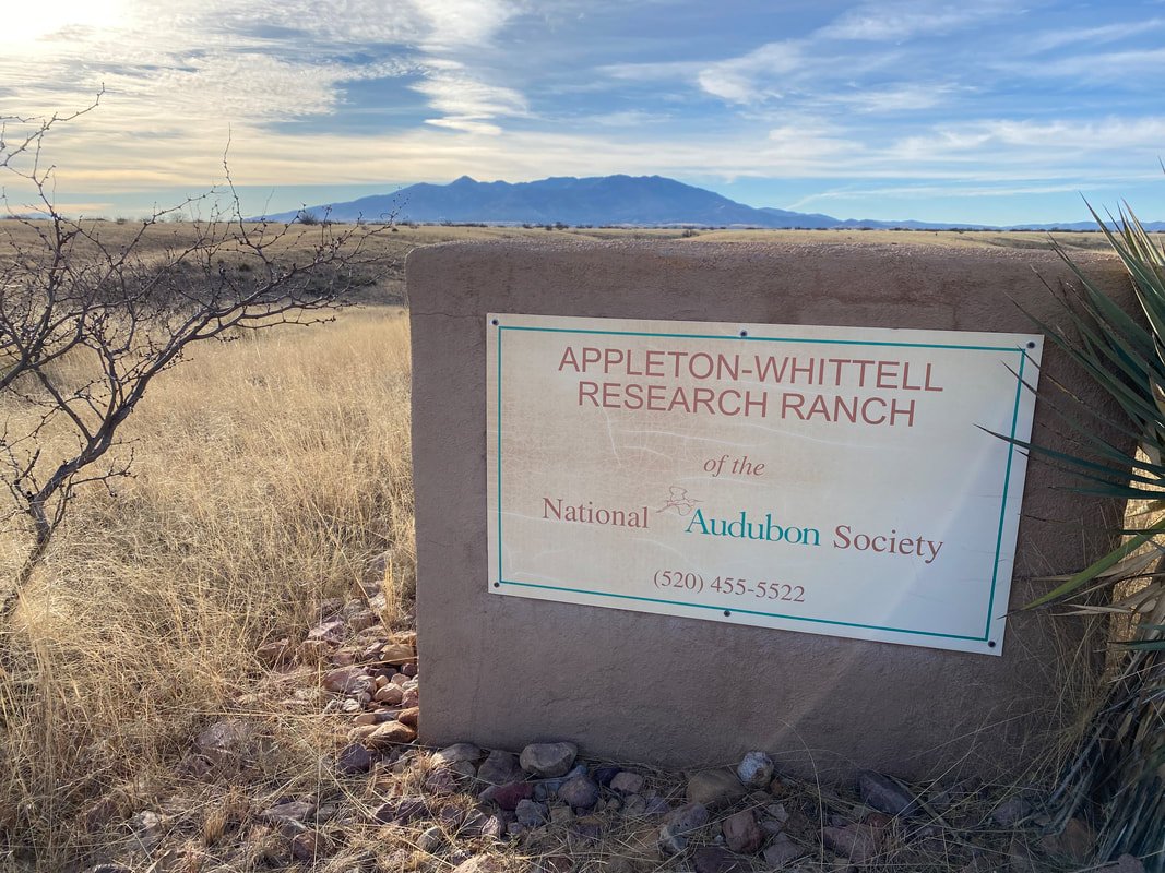
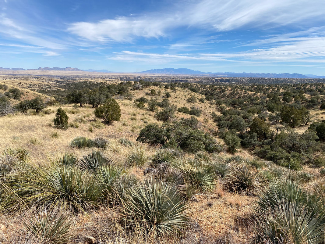
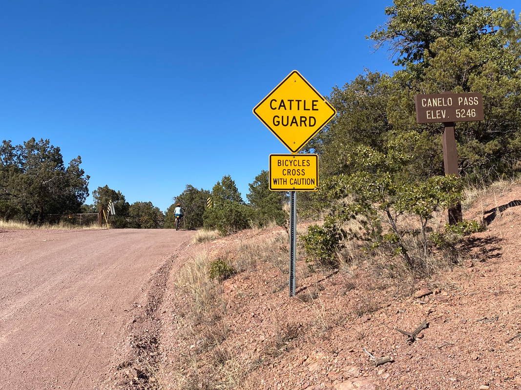
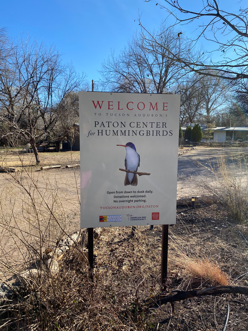
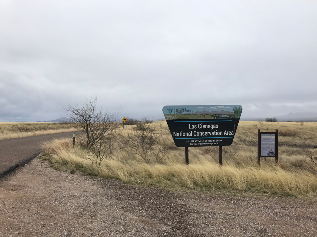
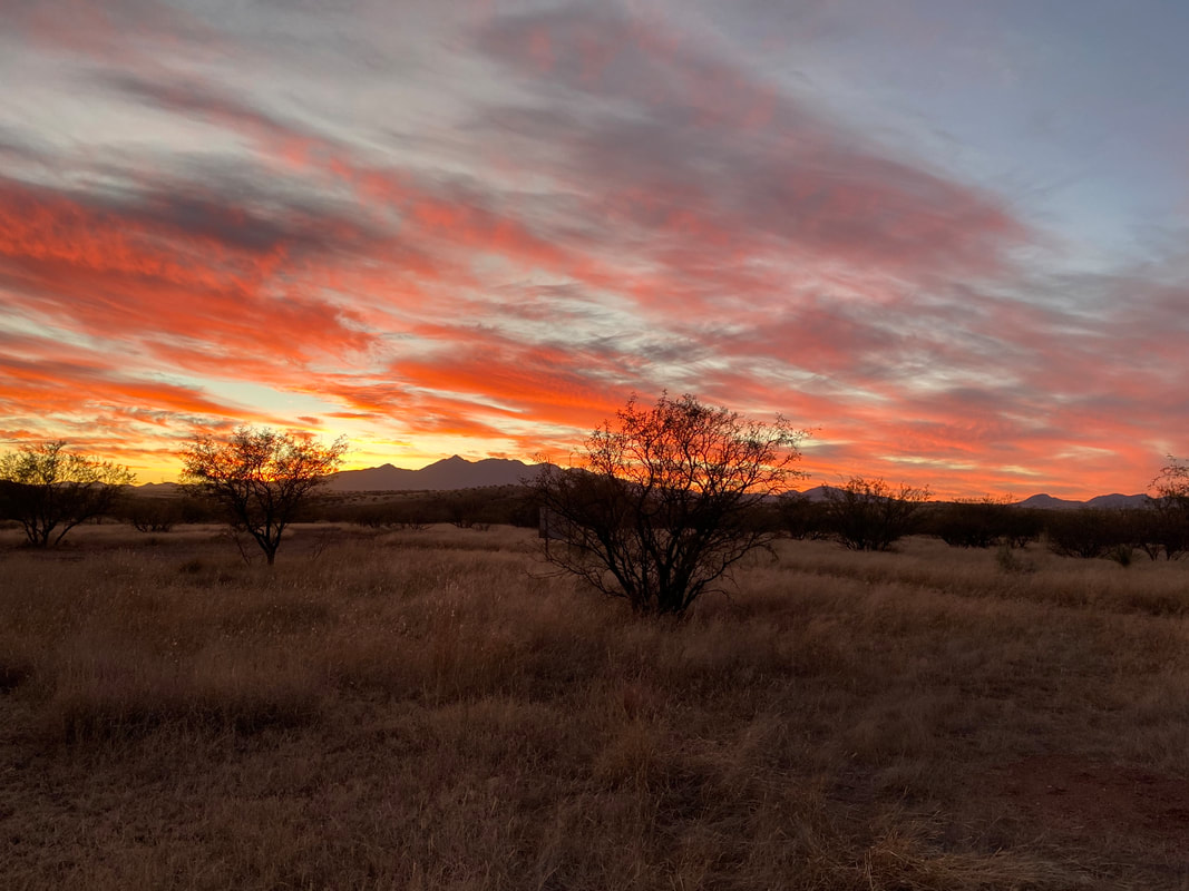
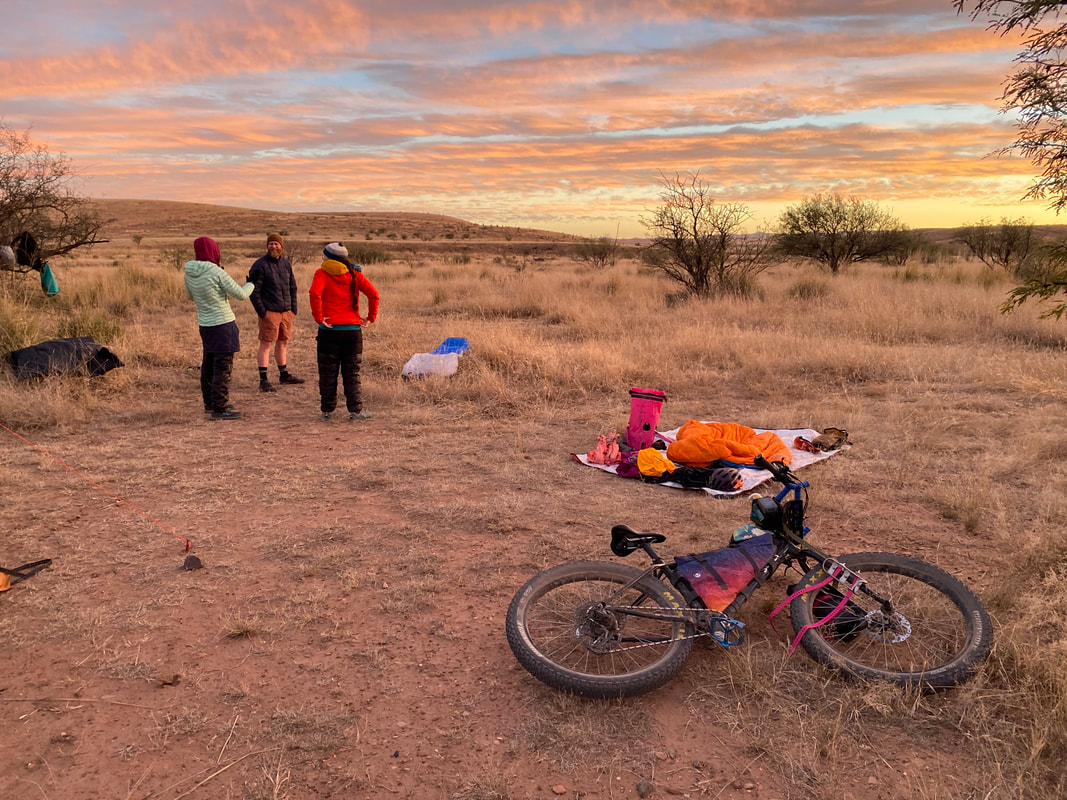
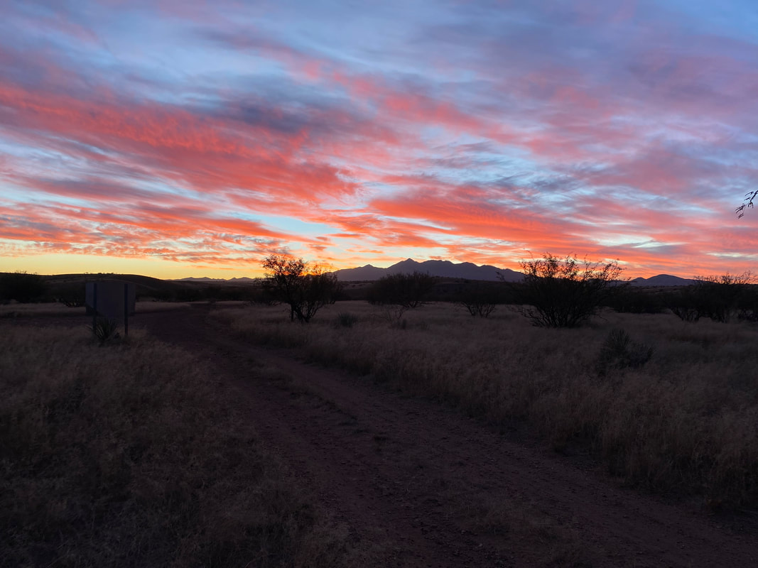
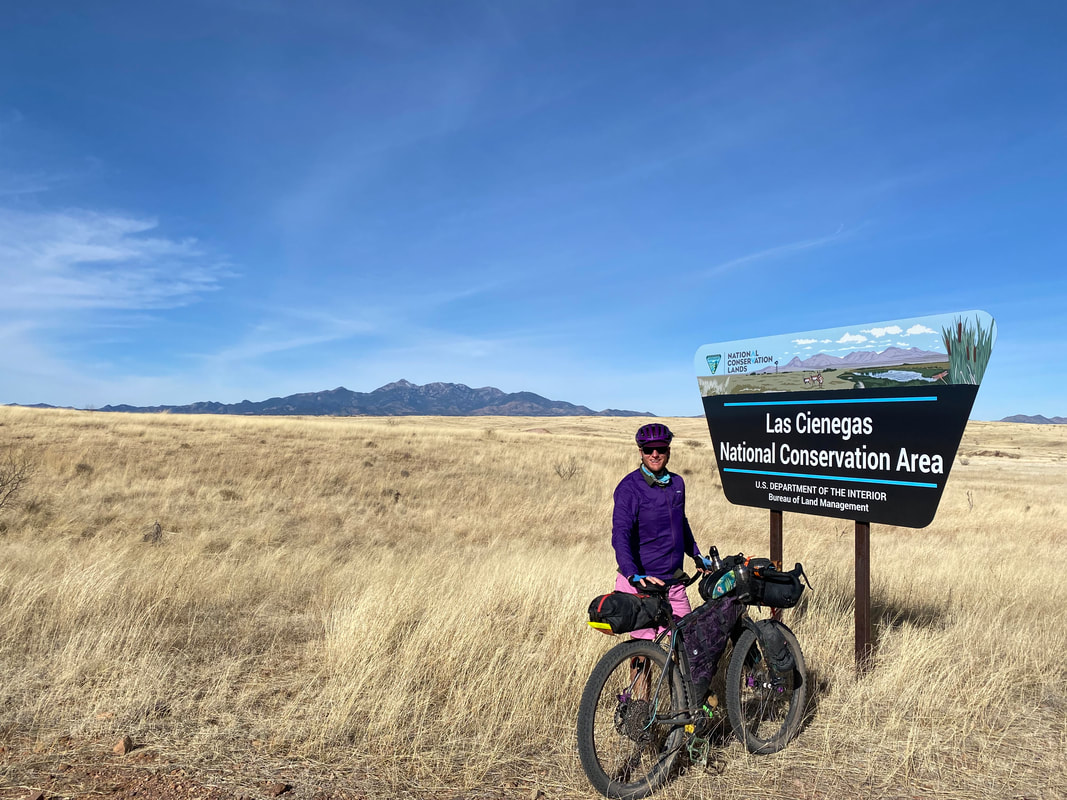
The four of us took our sweet times to soak up the sun and leisurely ride through the gramma-waves before climbing up and over Canelo Pass. Usually, Janna and I would head to the Audubon Society, but unfortunately, just a month before, the current director departed from the Appleton-Whittell Research Ranch, and the board/current acting director moved quickly to close the area to all bikepackers. It was a devasting loss, and I would argue, a terrible public-relations breakdown between diverse stakeholders groups commonly interested in the biodiversity of the area. Janna and I had stayed on that property for so many trips, it saddened us that one of the most gorgeous and iconic portions of the route was now off-limits. Instead, we took the paved alternate that carried us around the Audubon Ranch along an unshouldered highway into the center of Elgin. From here, we stayed on pavement to loop around the private ranches of the area before embarking across doubletrack stretching across the outer fringes of Las Cienegas National Conservation Area. With the afternoon light fading to early evening, the four of us rode into golden hour as sun slant lit up the grasslands. I had researched a designated camping area within the NCA which would serve as our stop for the day. We found the area stunning for views of the distant Santa Ritas, especially enhanced by the dripping glow of sunset embers lighting the sky's clouds into bands of reds, yellows, and blue hatching. It turned out to be one of the most beautiful sunsets and evenings I had ever experienced on the route. 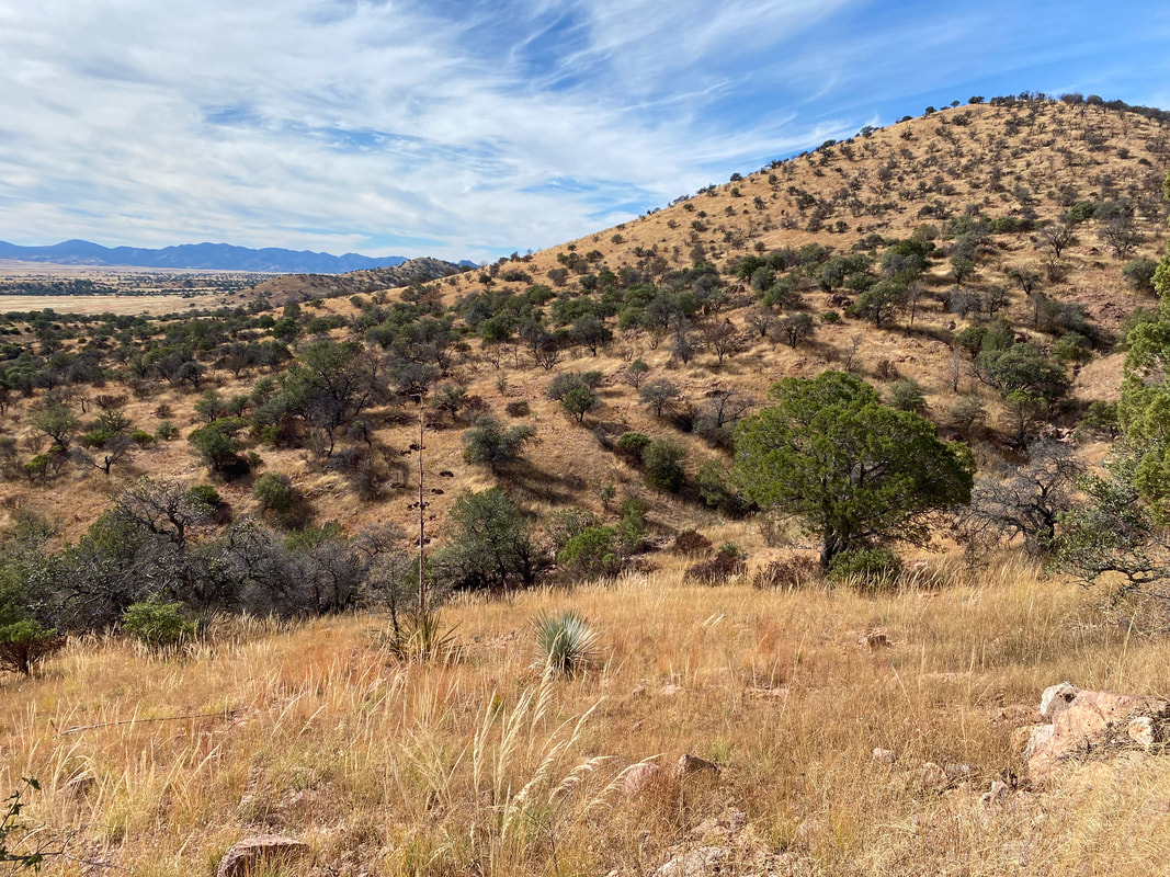
  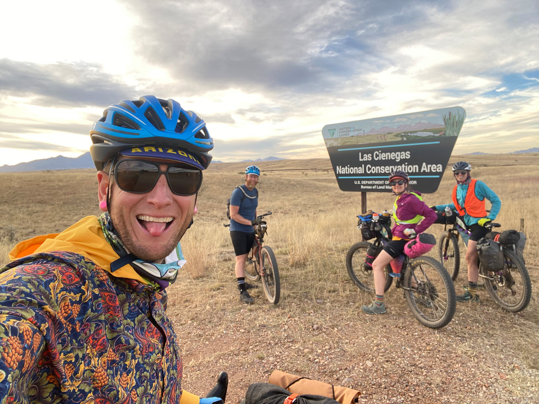
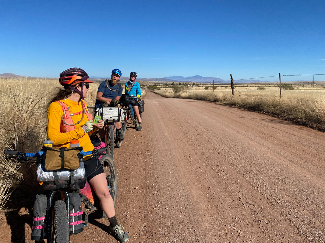
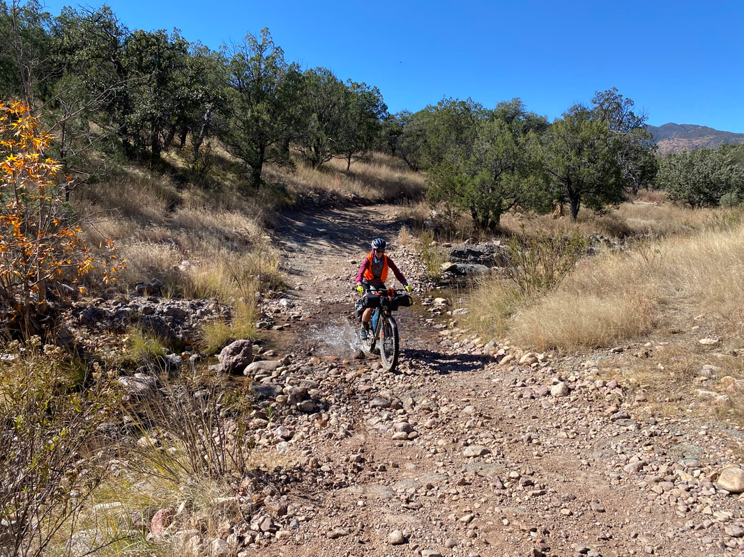
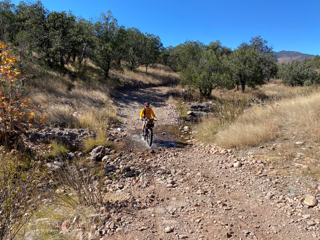
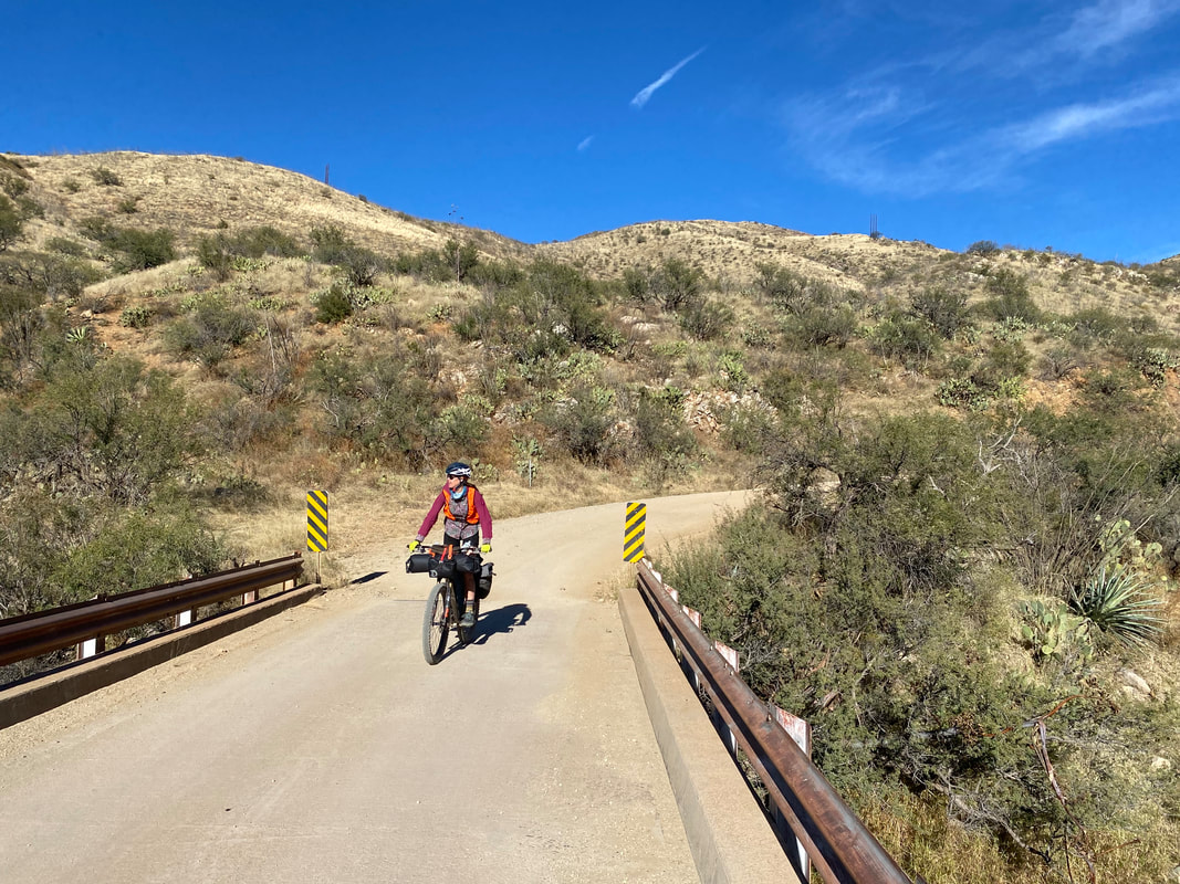
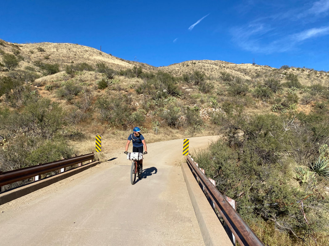
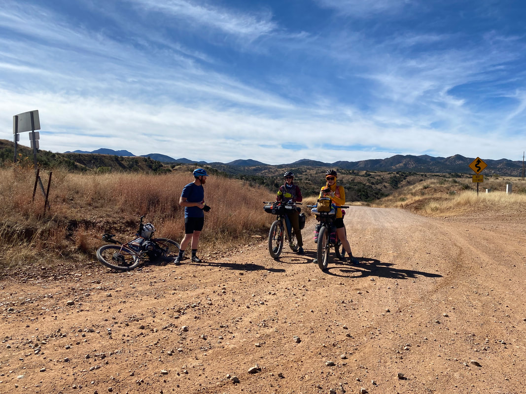
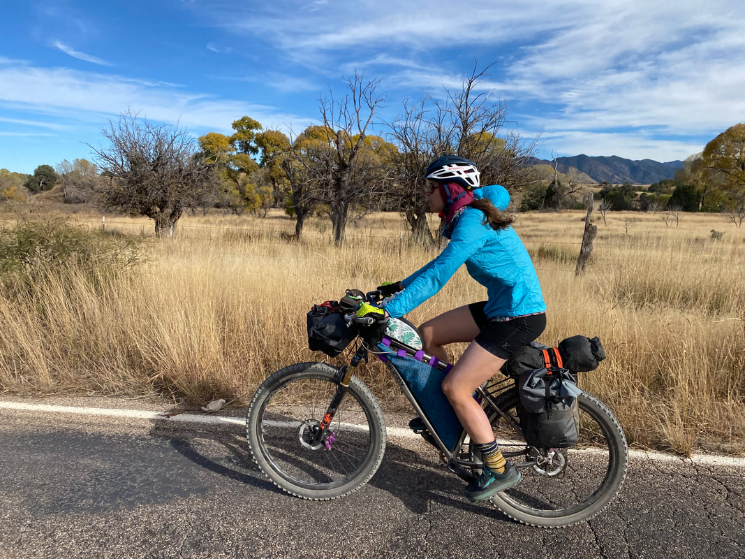
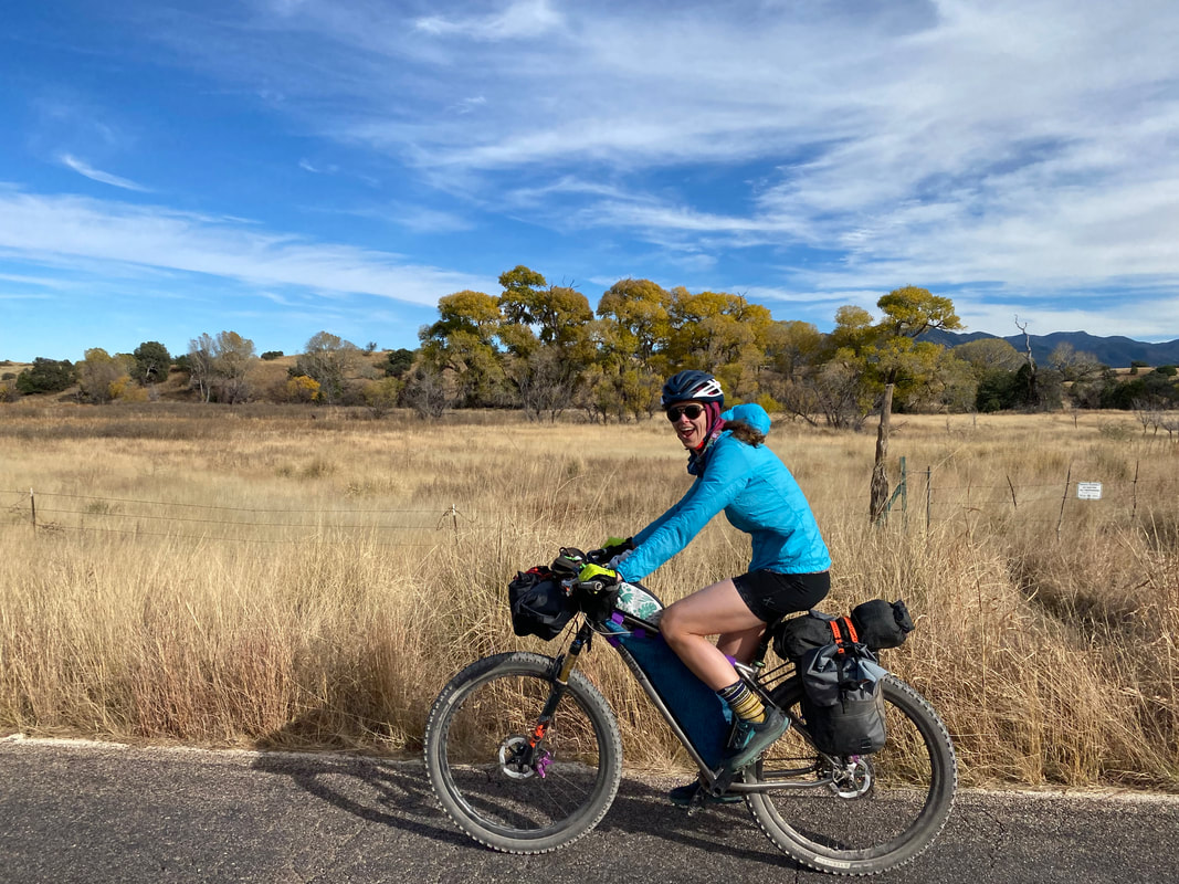
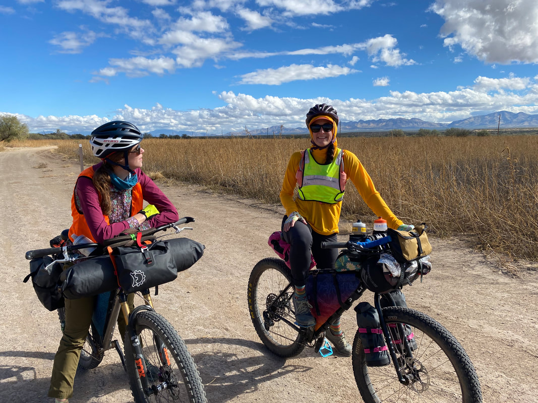
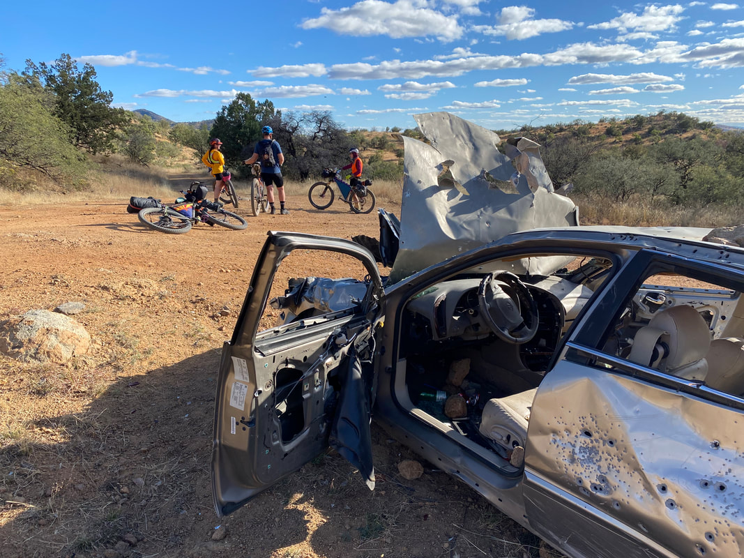
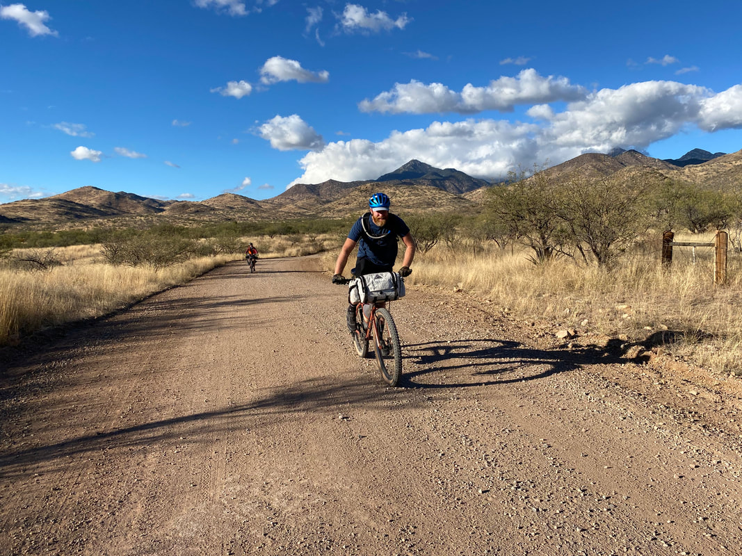
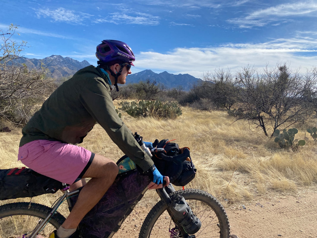
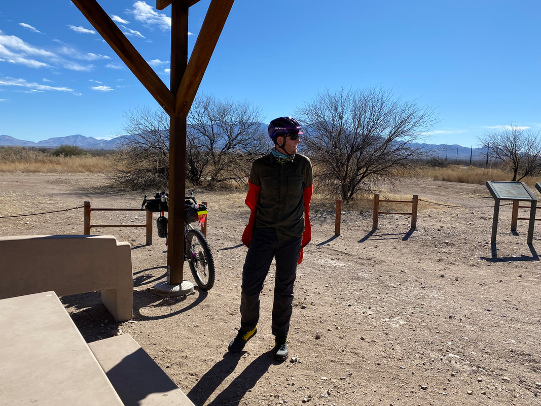
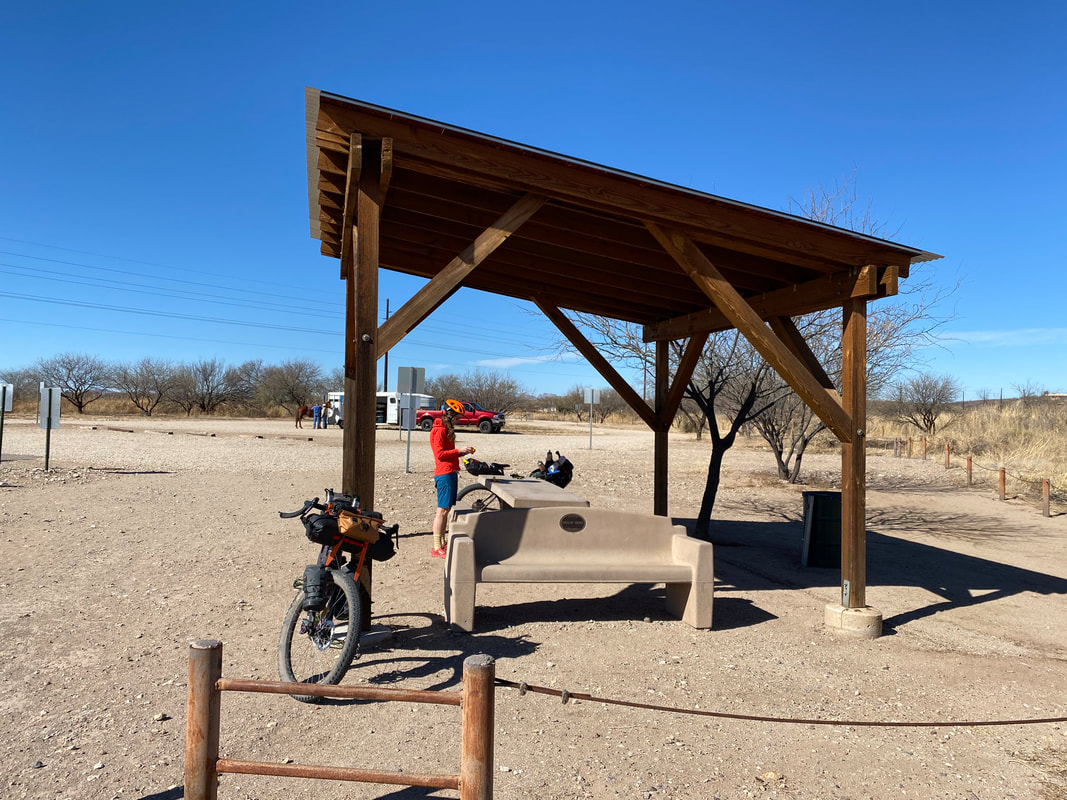
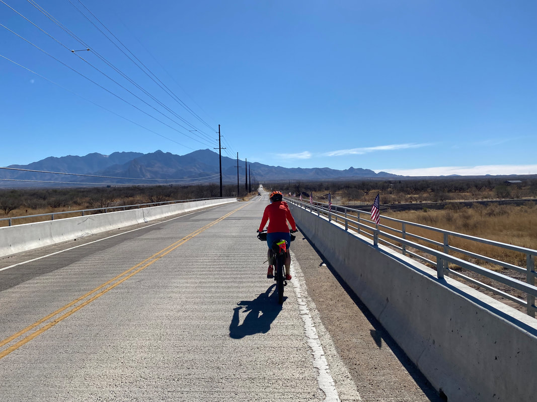
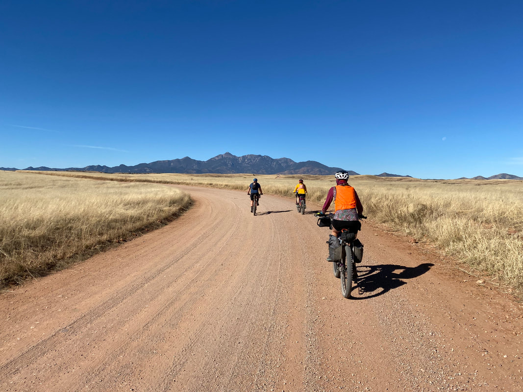
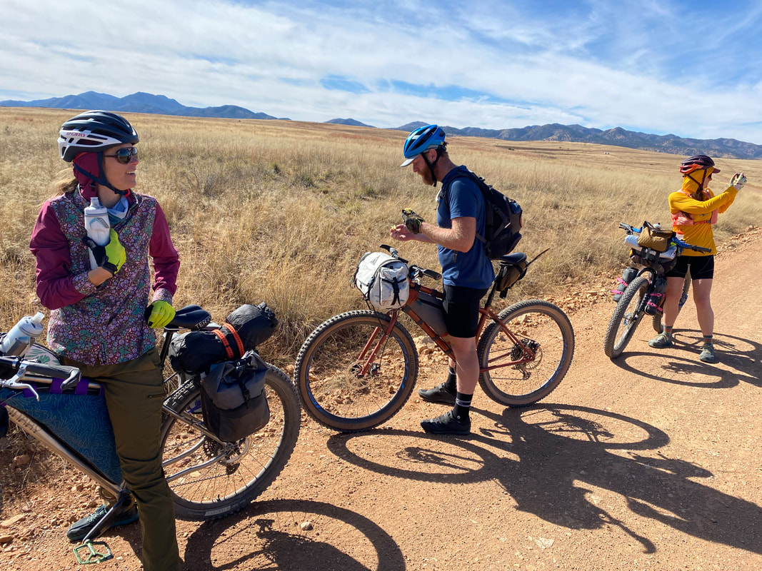
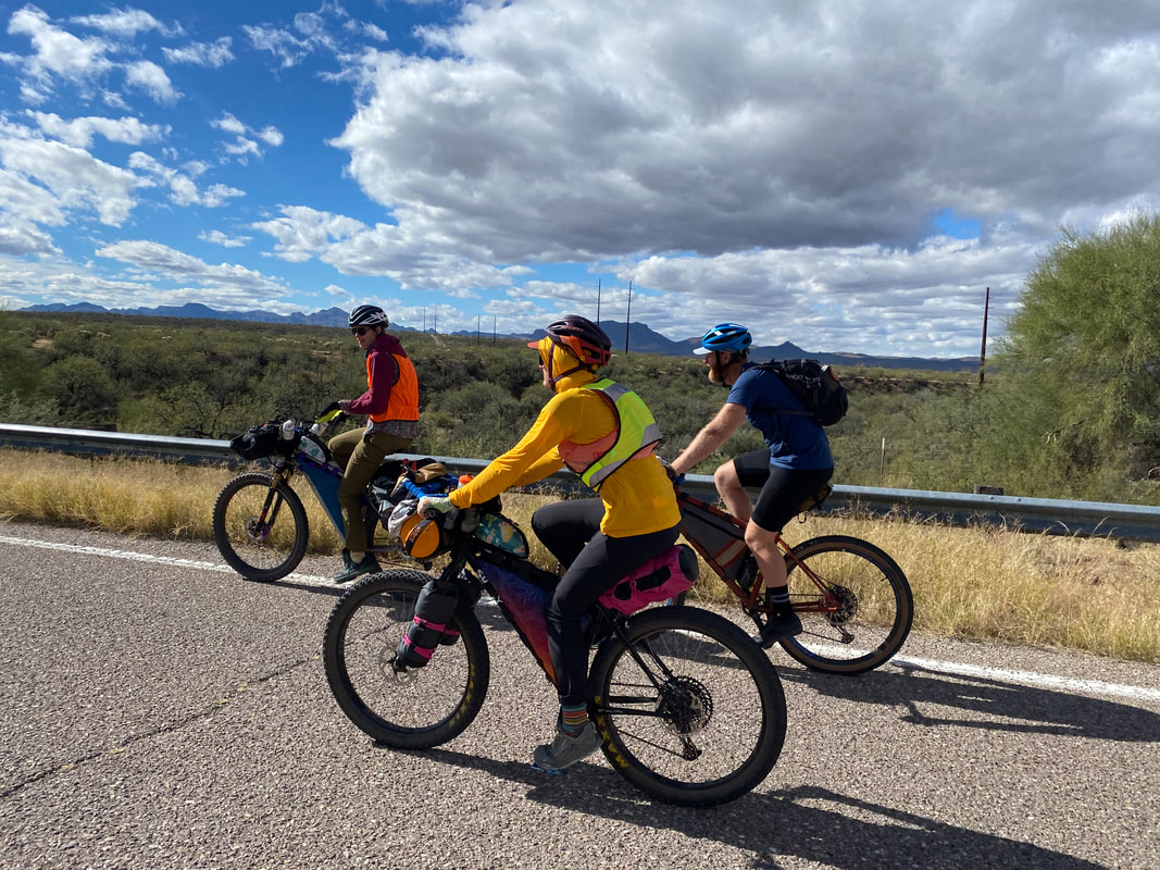
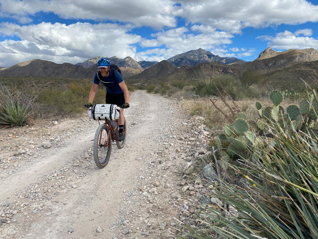
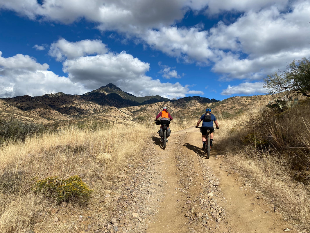
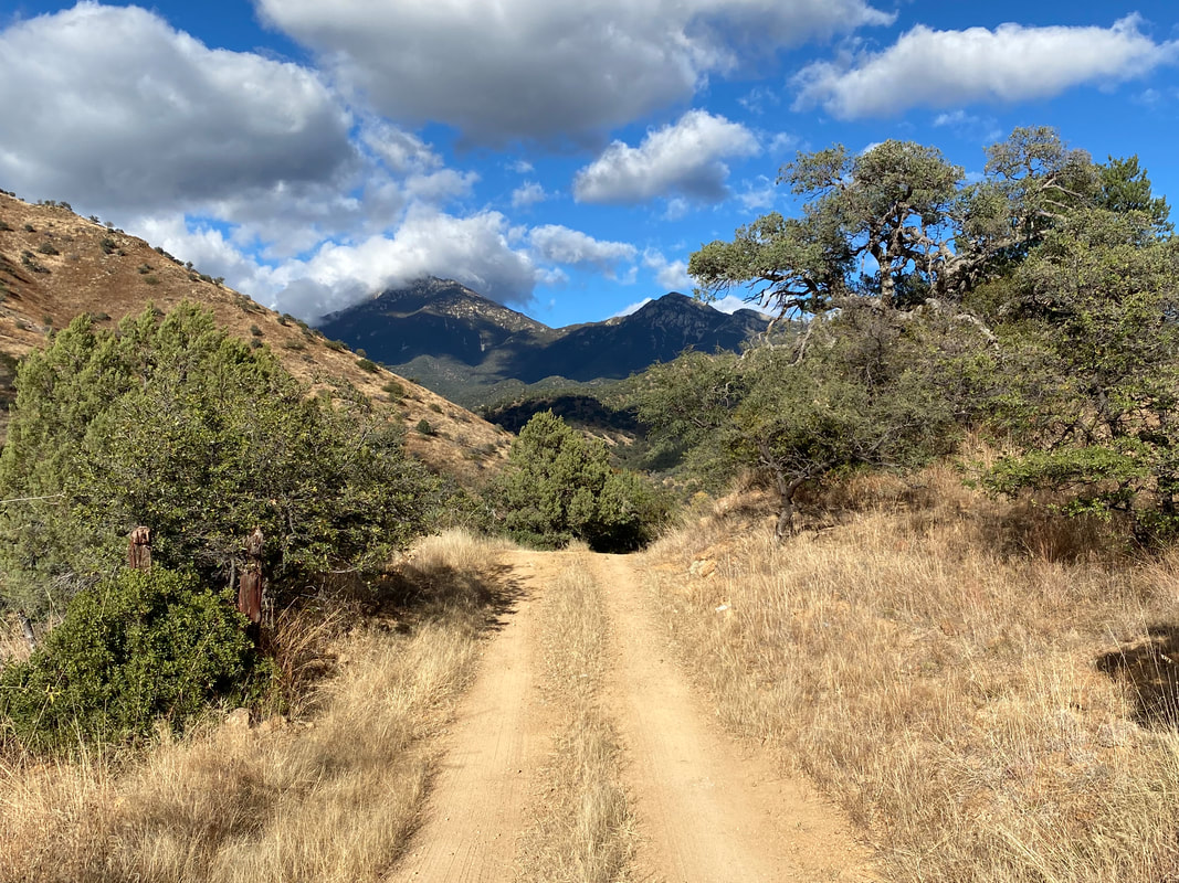
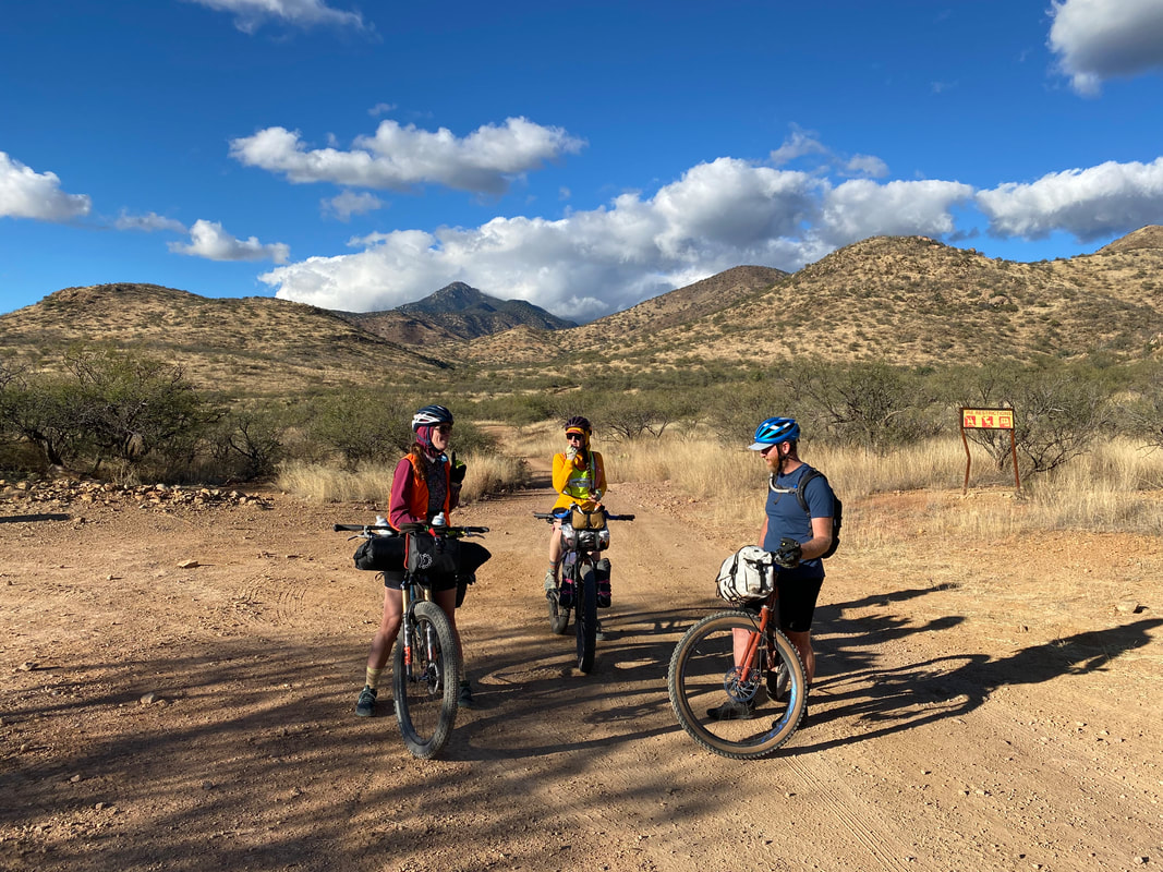
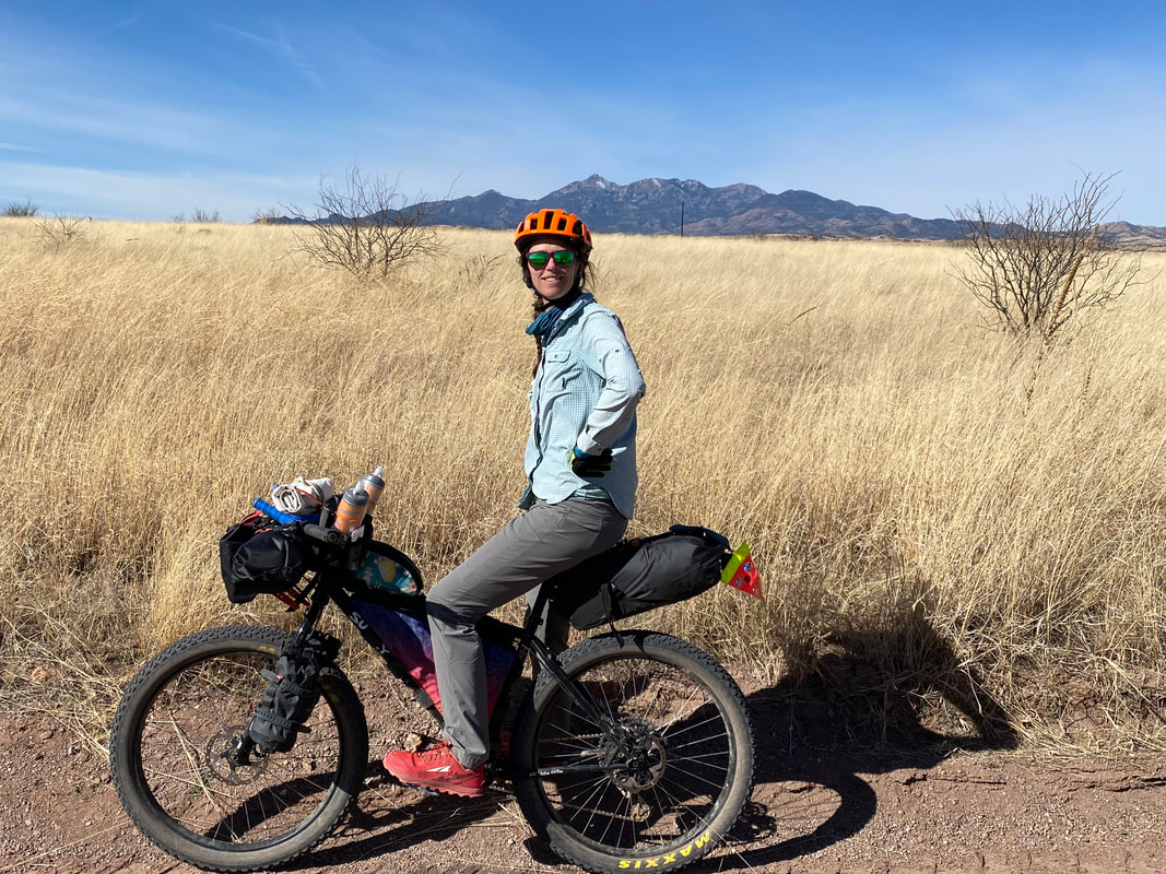
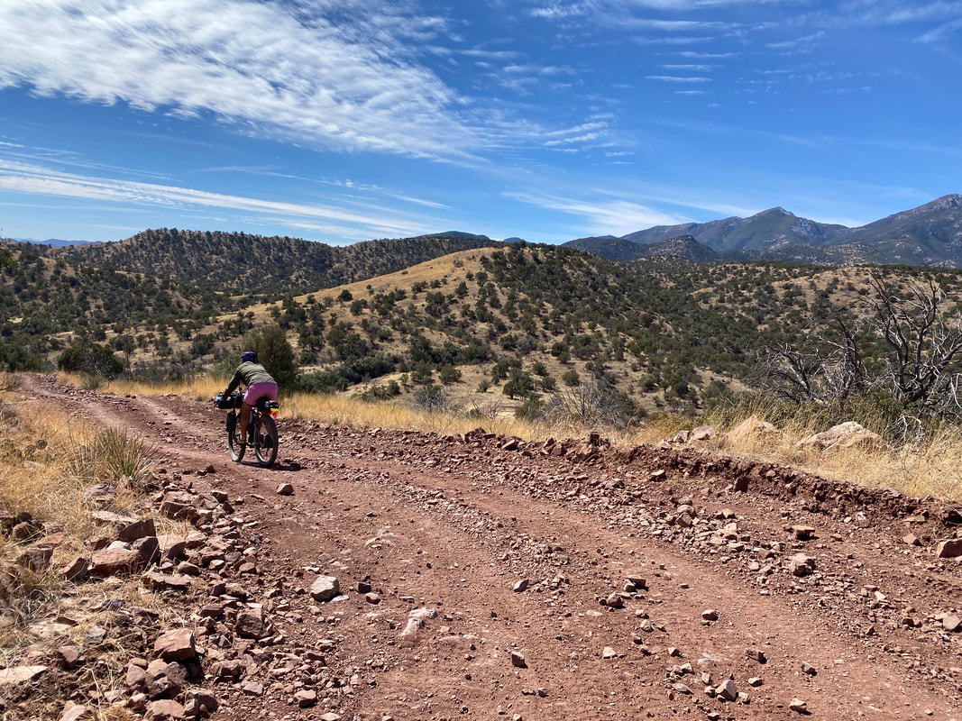
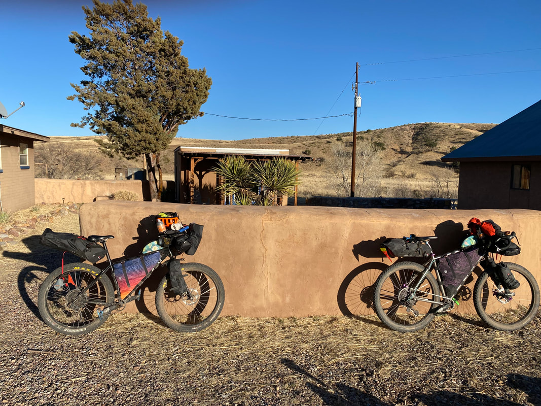
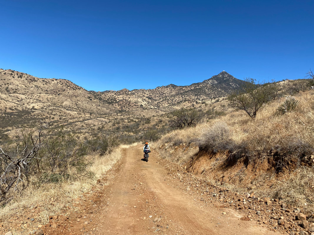
   44.52 Miles; 4,291 Feet of Gain; Green Valley to Patagonia, AZ 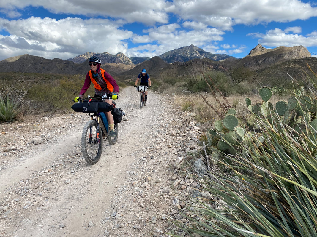 For all the times we've bikepacked, Janna and I have been unsuccessful at convincing friends or acquaintances to join us on some backcountry bike tours. That all changed this fall after Janna befriended Kate while Kate was shadowing at our school. Kate enthusiastically jumped on the offer to join us for a bikepacking trip come Veteran's Day for our annual circumference ride of the Santa Ritas in southeast Arizona on the Sky Islands Odyssey. As the weekend date approached, Kate asked us if her childhood friend Sean could also tag along. Janna and I were stoked to have two people finally ride with us, so we heartedly affirmed before beginning the long drive down to south of Tucson from the Grand Canyon. After arriving in Green Valley fairly late, we slept in a bit at the Best Western where we planned to park our car once more. Sean and Kate drove down, setup their rigs (Kate was borrowing Janna's Surly Karate Monkey), and the four of us headed down to the Juan Bautista de Anza Trail that parallels the Santa Cruz river via a packed-adobe trail meandering through thickets of grass. A front had just passed through the area, leaving in the aftermath a swath of low-slung cotton crusps of cloud that draped and dappled light everywhere. The temps were perfect - neither too hot nor cold. The miles passed easily as we started up pavement and then turned onto Forest Service roads to trace the base of the mountain range. Everything seemed especially lush after a bountiful monsoon-fall, and the ocotillos were uncharacteristically green (or even red and orange with the decay of their leaves!). Janna and I couldn't believe how absolutely excellent the roads still were from the spring, and how lush the vegetation seemed in early autumn. 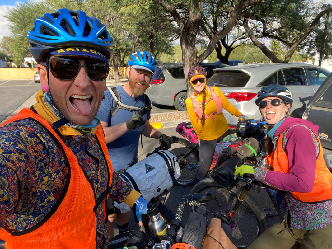
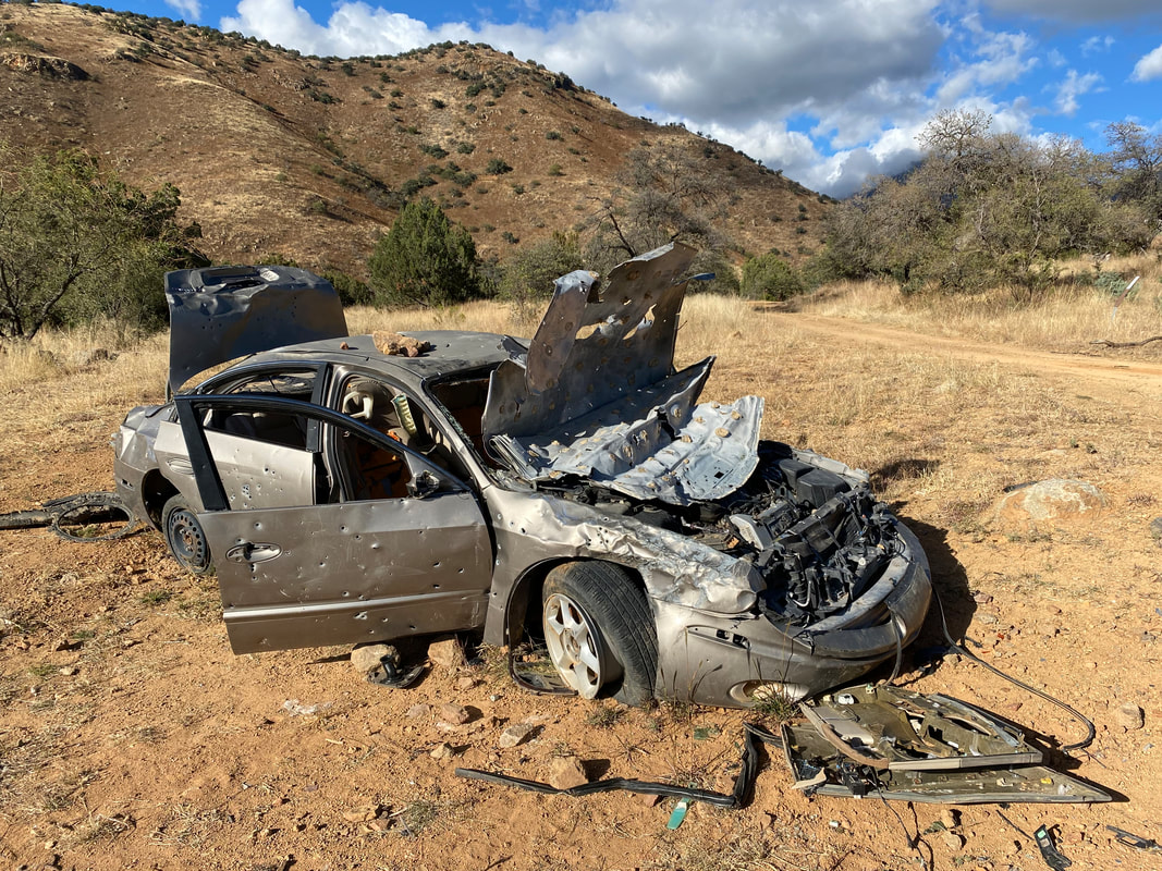
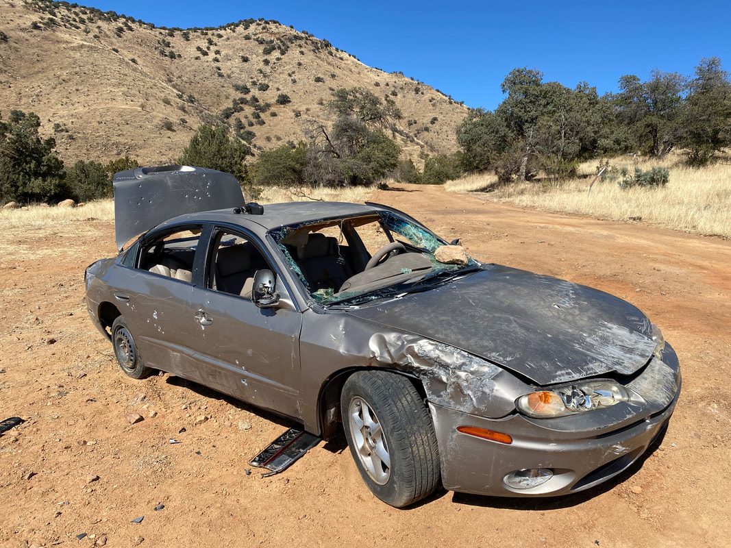
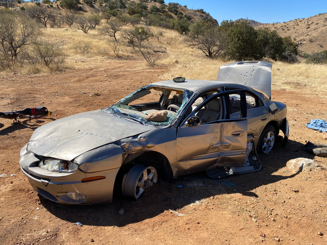
   Our party of four took a break midday at the creek crossing that tumbles down from the peaks. Sean and Kate ate full lunches, allowing us all an unhurried opportunity to absorb the views, enjoy the largest flow of water I had seen here, and some quintessential yellow foliage forming yellow on the cottonwood trees. Shadow and light continued to play across the landscape as escarpments of clouds shrouded Mount Wrightson from view. After some hike-a-bikes up to the saddle, we careened into the subsequent grass valleys. The drug-runner car from the spring trip still sat in the same spot. But now its exterior was riddled with bullets from target practice. We pressed on as late afternoon arrived with the golden slant of fall light. Kate, Janna, Sean, and I arrived in Patagonia as crisp evening air blossomed at the failing of day's light. We all immediately headed to Velvet Elvis, which now had moved to a new location across the town in the old historical church. I was blown away by the new food offerings and vibrant interior. We all ate a ton before exiting to the dark. Sean and Kate went to sleep at a location to the south of town while Janna and I went north to TerraSol. The place was even better than when we had visited in the spring. We setup in the dark as herds of javelina began rutting about in the dark around us. The night fell cold and thorough, but we slept well. 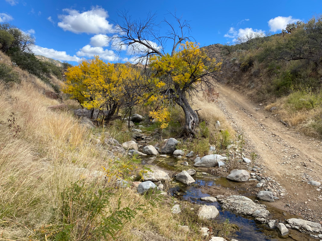 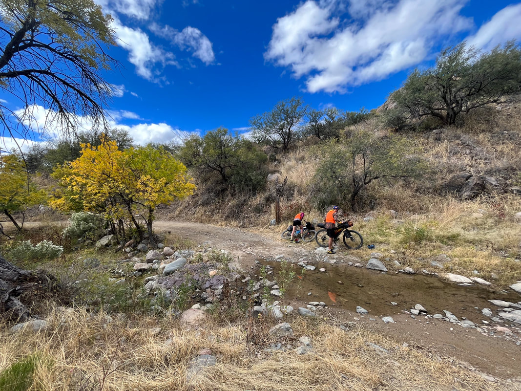
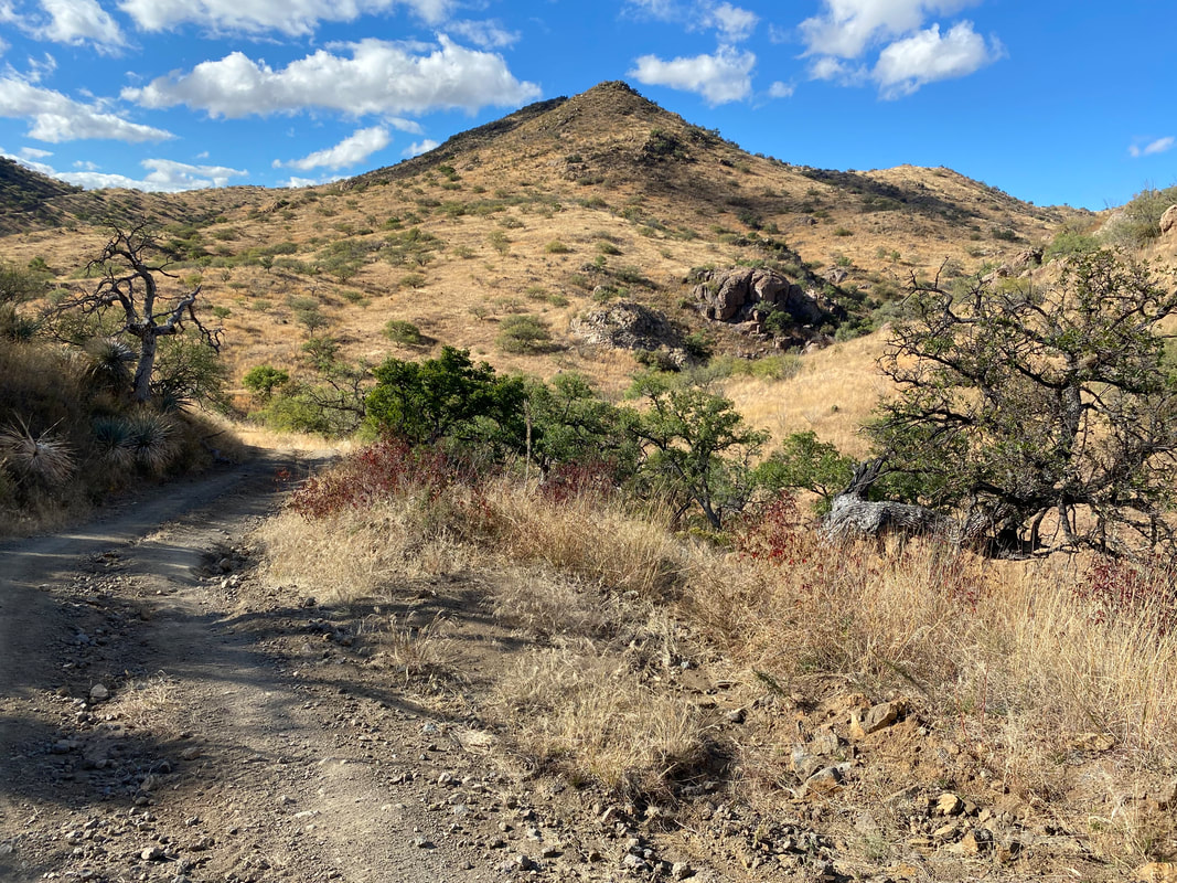   
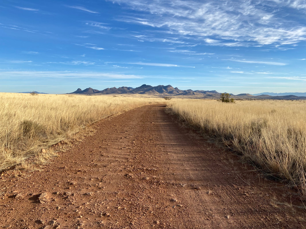
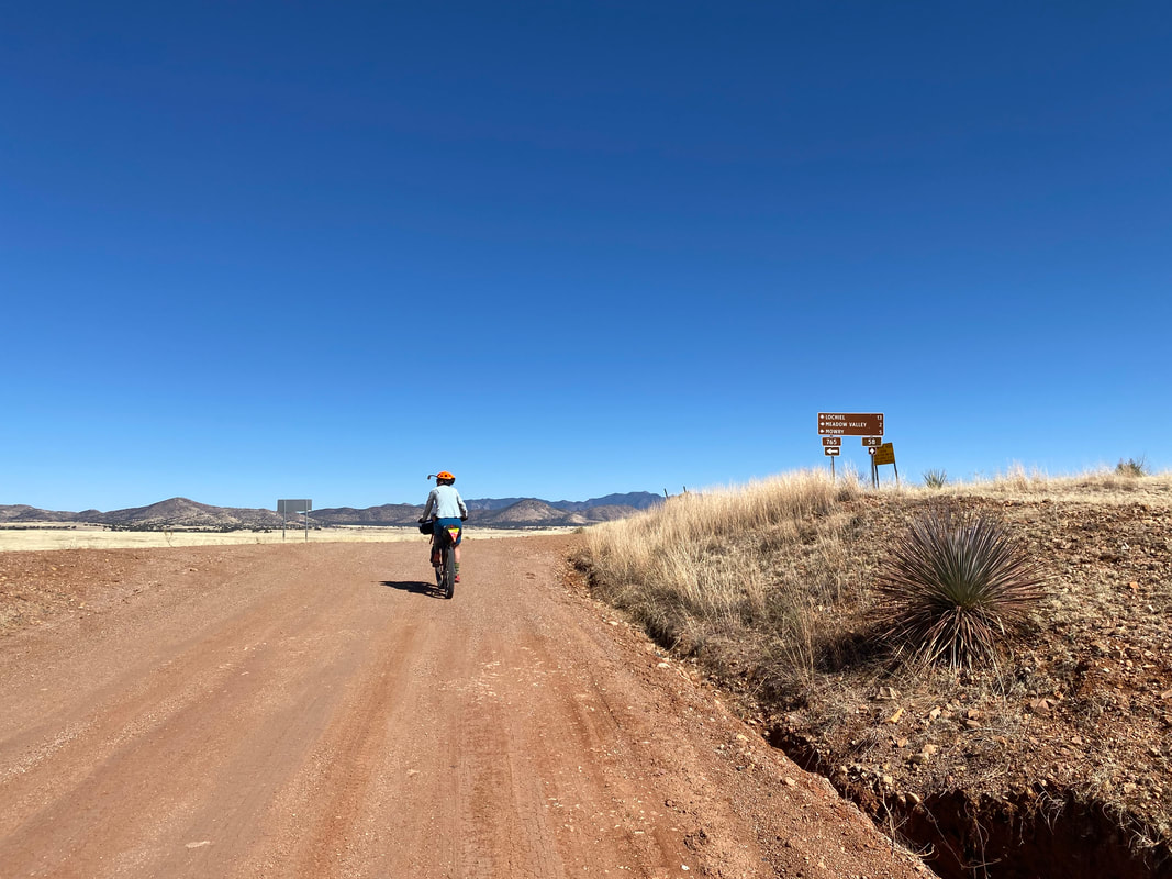
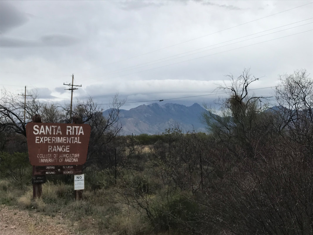
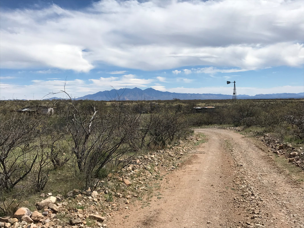
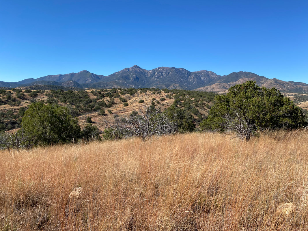
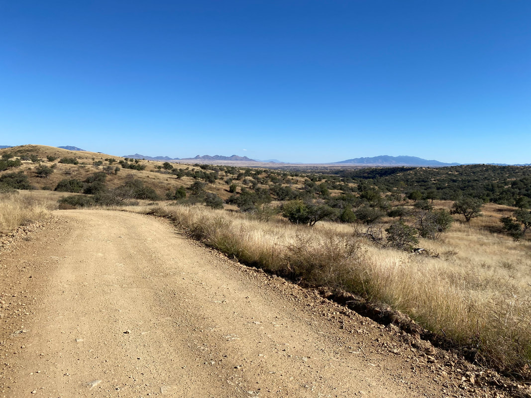
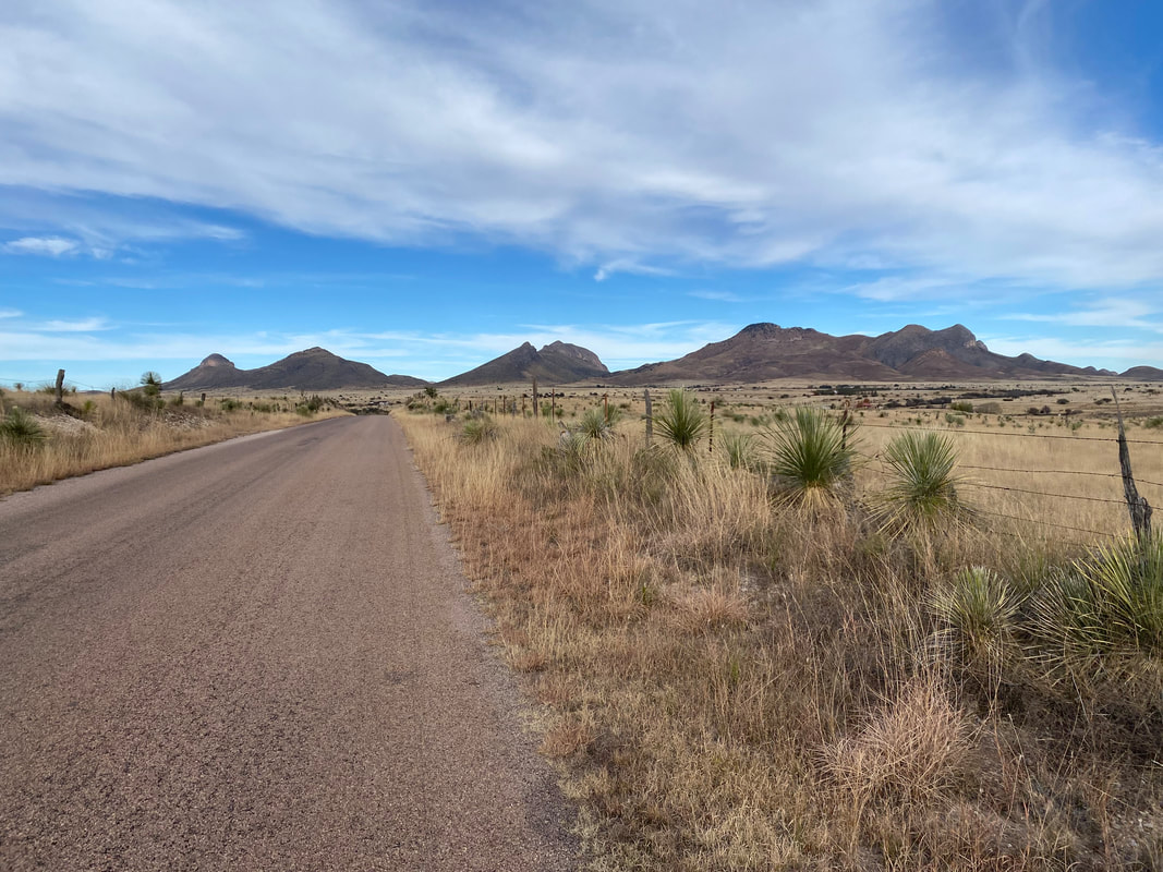
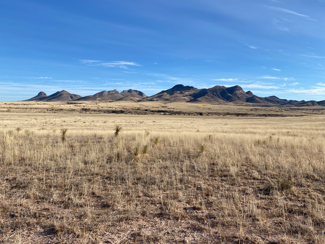
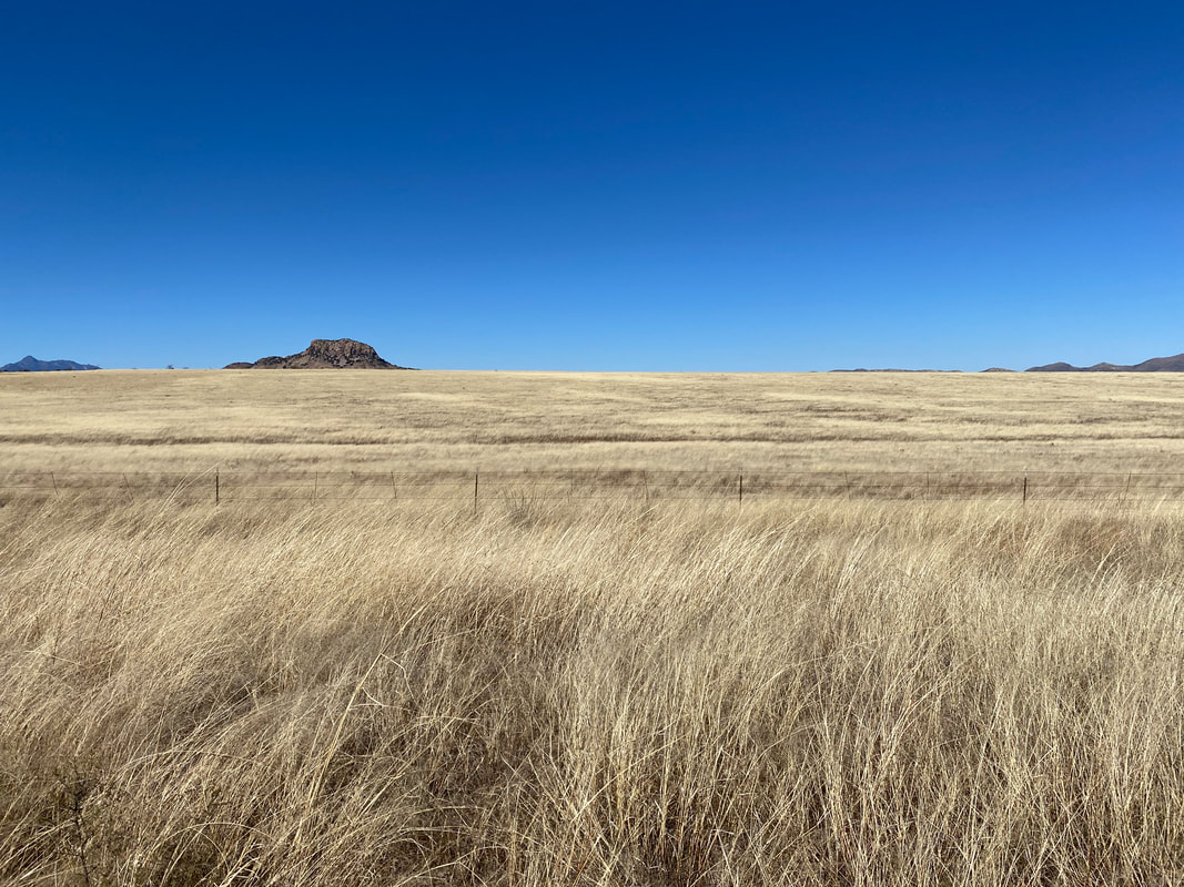
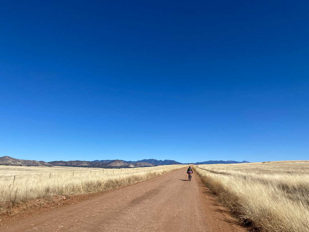
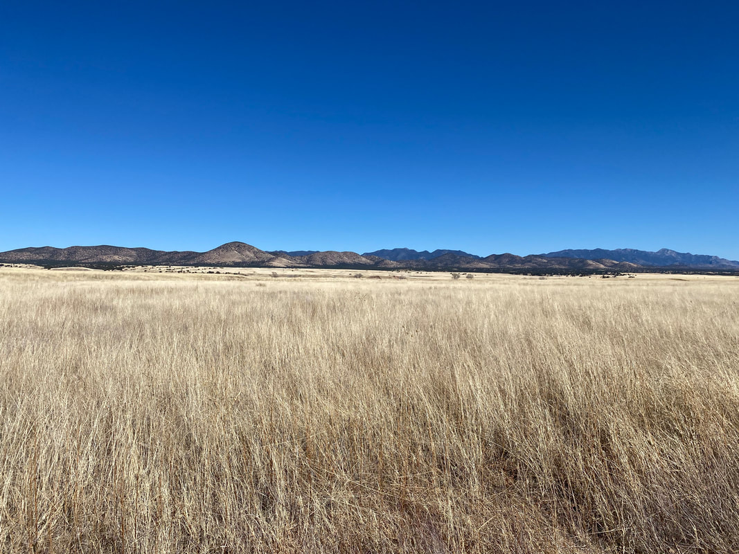
  64.75 Miles; 3,471 Feet of Gain; Appleton-Whittell Research Ranch of the National Audubon Society to Green Valley, AZ 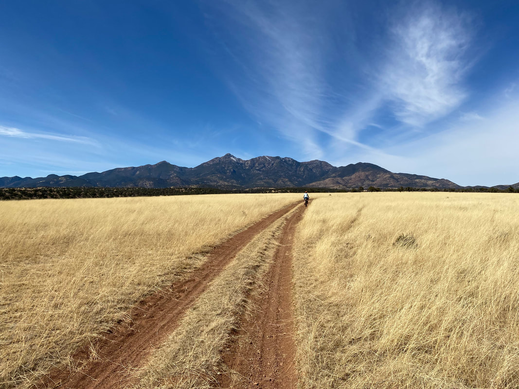 Morning arrived hard and frosty. The inside of the shelter was absolutely caked in layers of solid condensation. Janna and I knew the day would be the coldest of the three, with highs in the mid-50s only. Thus, we stumbled out of the shelter, sat in the casita making breakfast, and then rolled out as the Sun's weak rays spread across the grasslands. It was utterly cold as we pedaled towards the Whetstone Mountains and the town of Elgin. We reached Elgin and still found it too cold to shed much of any layer. Ahead, a pack of javelinas with their babies tarried along the roadside edge before leaping a small fence into adjoining golden grass fields. We reached the Las Cienegas National Conservation Area by mid0morning and took in the washed-out views of the distant Santa Ritas rising up the grassy plains. But this time, the route had changed. Sarah Swallow (route creator) had shifted the traverse of the area away from some private property and onto type-B paved backroads. We spun casually through the large ranches with expansive porches looking out over the landscape until we reached the highway.
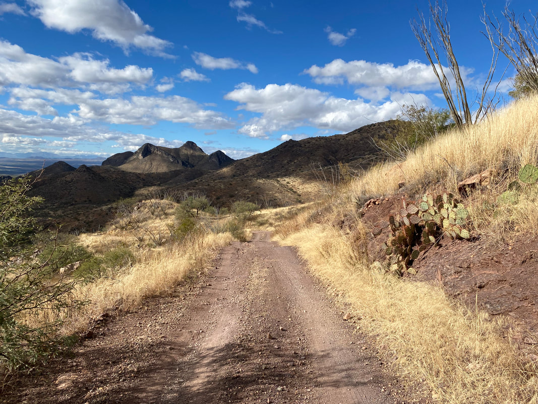
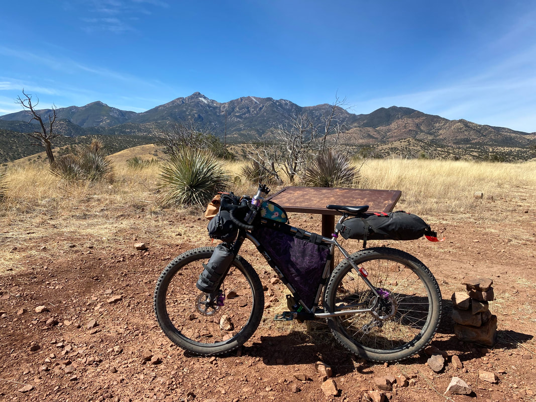
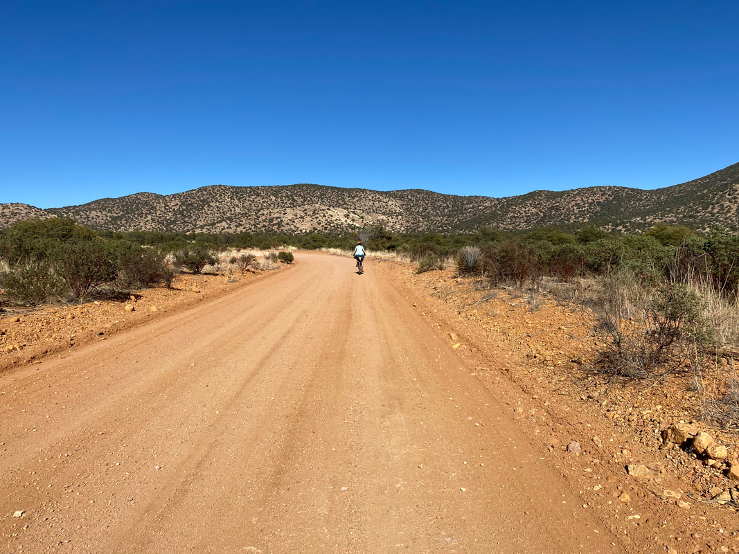
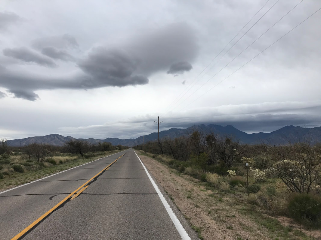
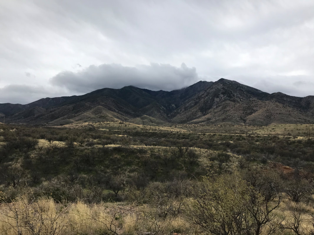
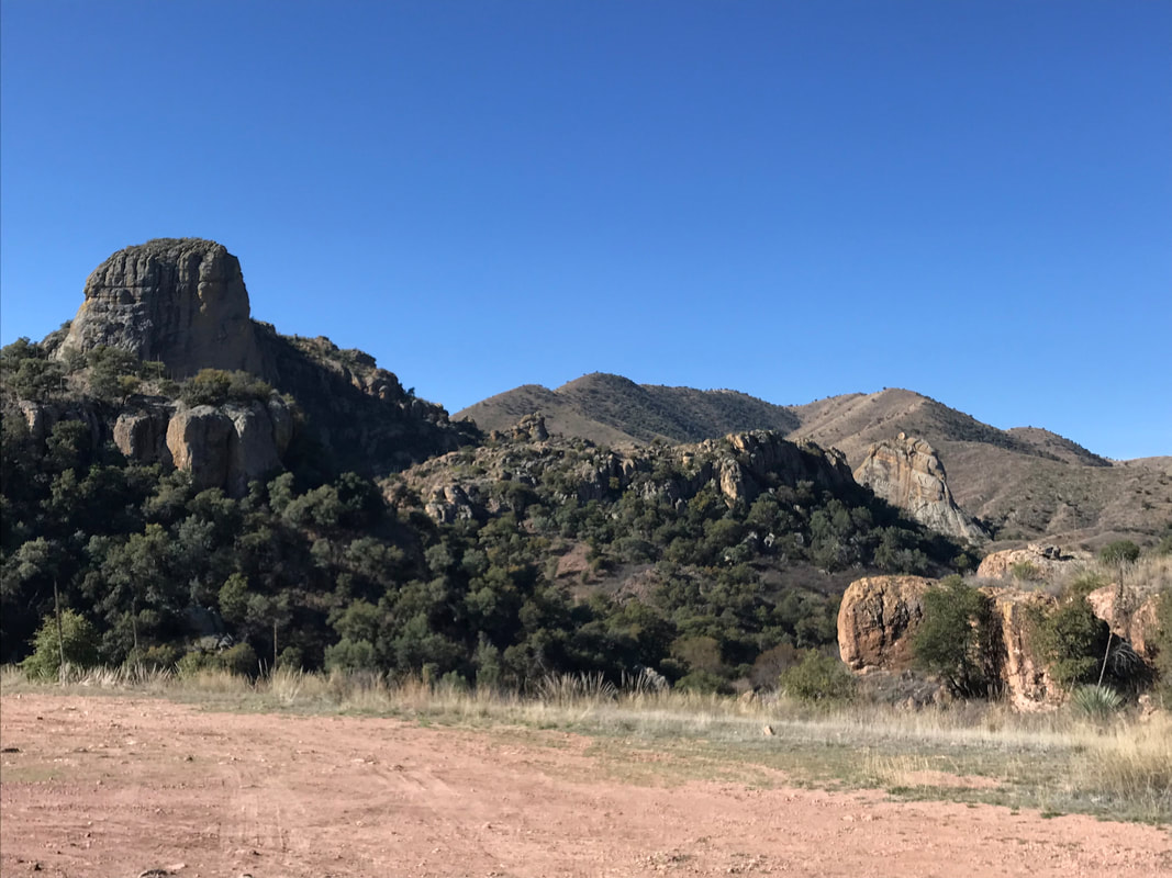
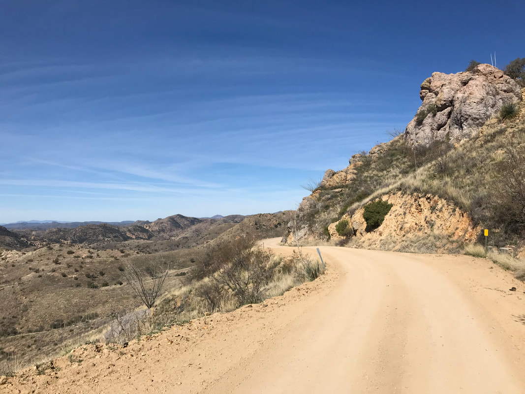
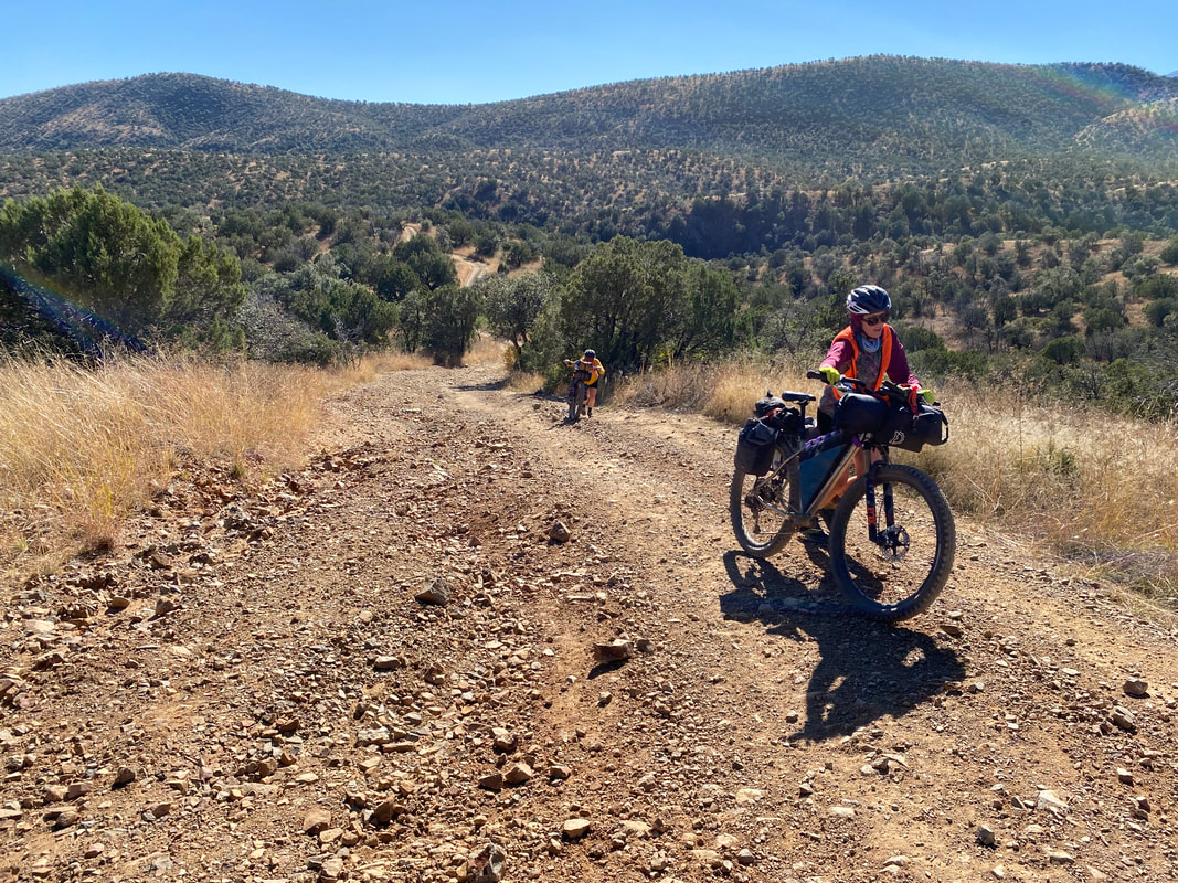
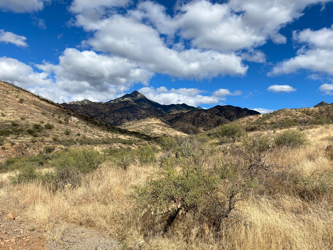
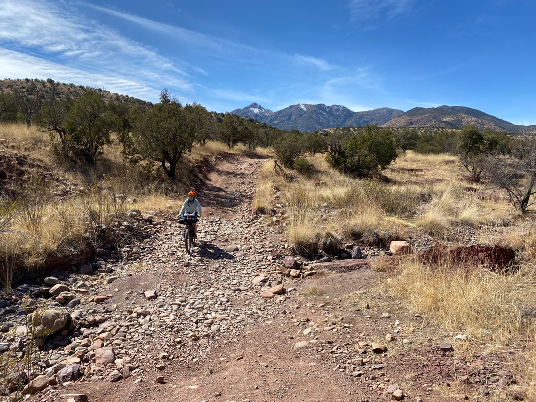
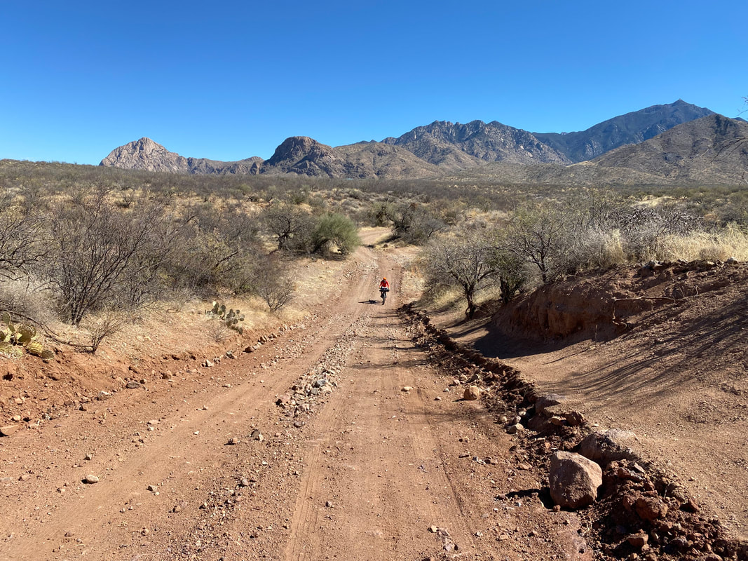
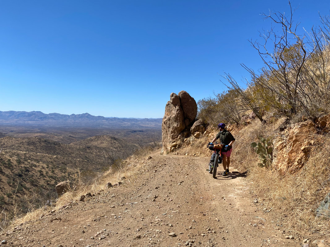
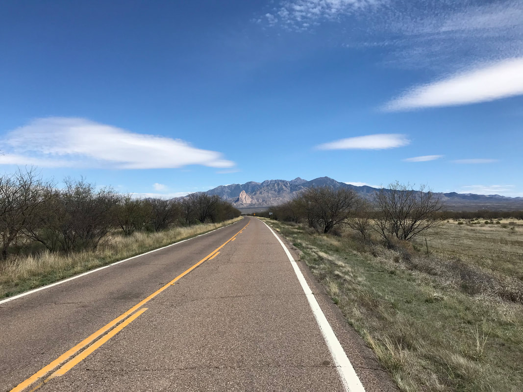
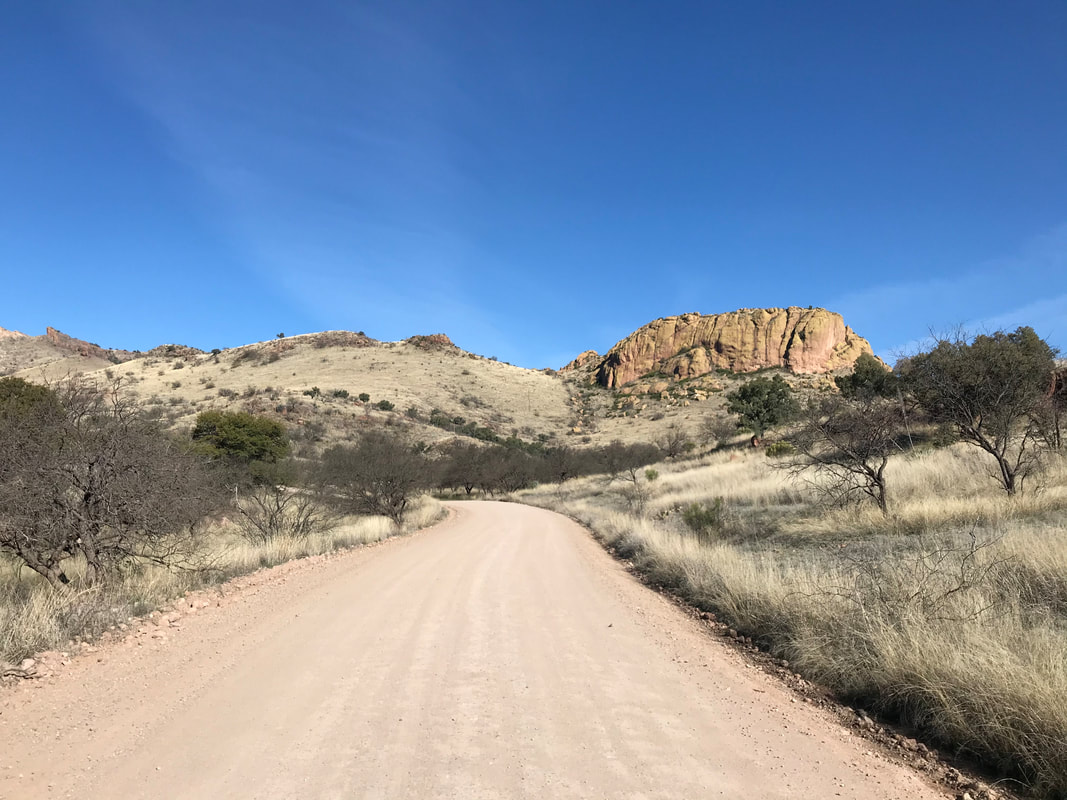
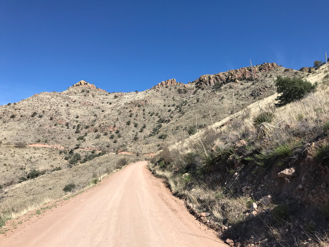
 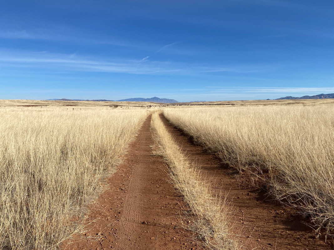    Here, the route took us up Santa Rita Road and along a beeline-direct path towards the mountains proper. The view was simply stunning with the snow-streaked peaks tumbling outstretched across grassy flanks. I kept stopping to take pictures; this new route direction was far more scenic then simply heading up towards Kentucky Camp as it used to. As we entered scrub-oak hills, the track began to get chunky and eroded. We did a few hike-a-bikes up to a scenic swath of doubletrack that nicely paralleled the distant peaks with red dirt under wheel and blue sky reaching above. From here, the 4WD road moved west to east along the feet of the mountain, dropping down quick and steep descents before crawling up adjoining hills on repeat. I absolutely loved this roller coast approach - it kept me attentive and looking everywhere at the new crevices of landscape that were new to me. We passed along several dry washes crowded with sycamore canopies before reaching the original route that wrapped towards Box Canyon. Box Canyon seemed dual-toned in yellow and tan. Spring had yet to provide any significant plant growth leaving the road dusty and beigy in appearance. We sped down Box Canyon and the sandy backroads through State Land. The roads were dramatically improved and the sand either packed or removed entirely. It was our fastest time down this section before we tumbled down into Green Valley back to our car. It was only mid-afternoon so we shouldered up the gear and drove to Tucson for an awesome meal at El Charro before driving back to the Grand Canyon.
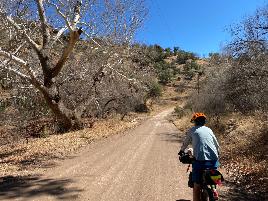
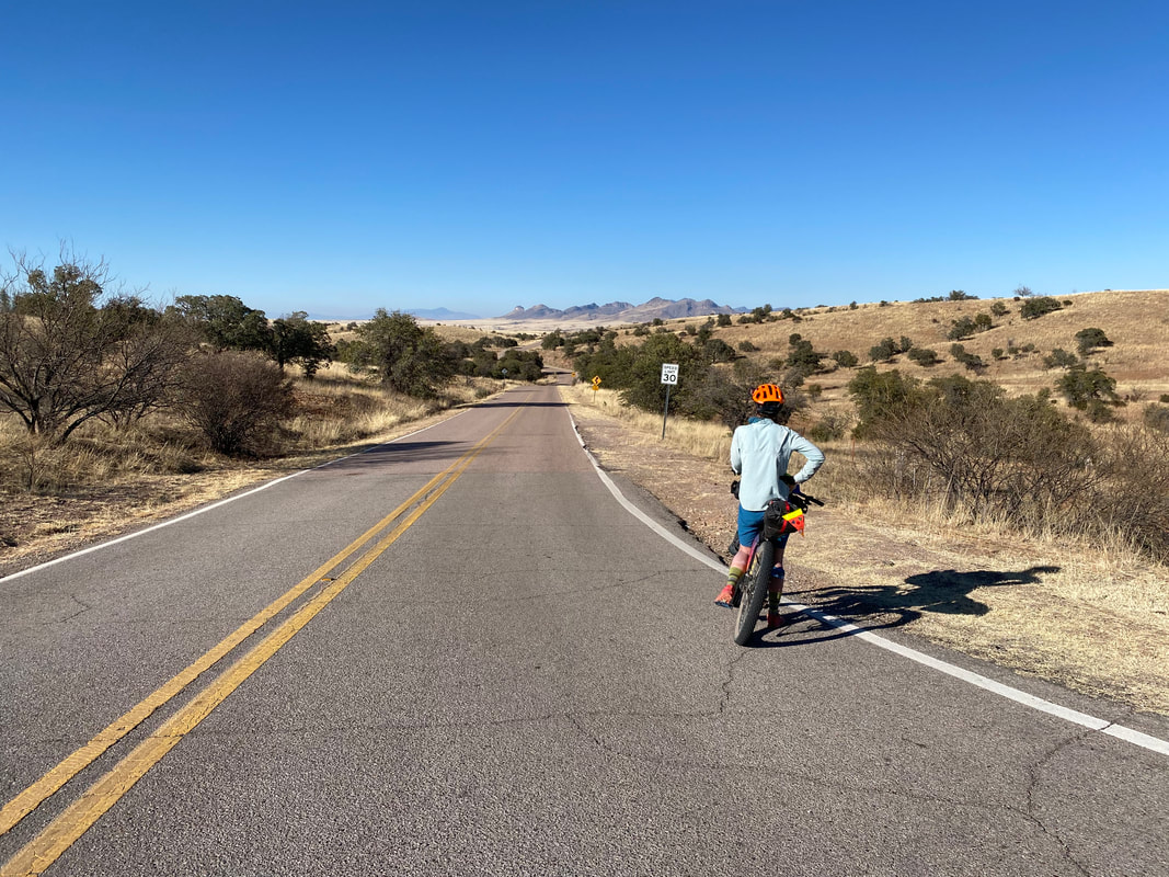
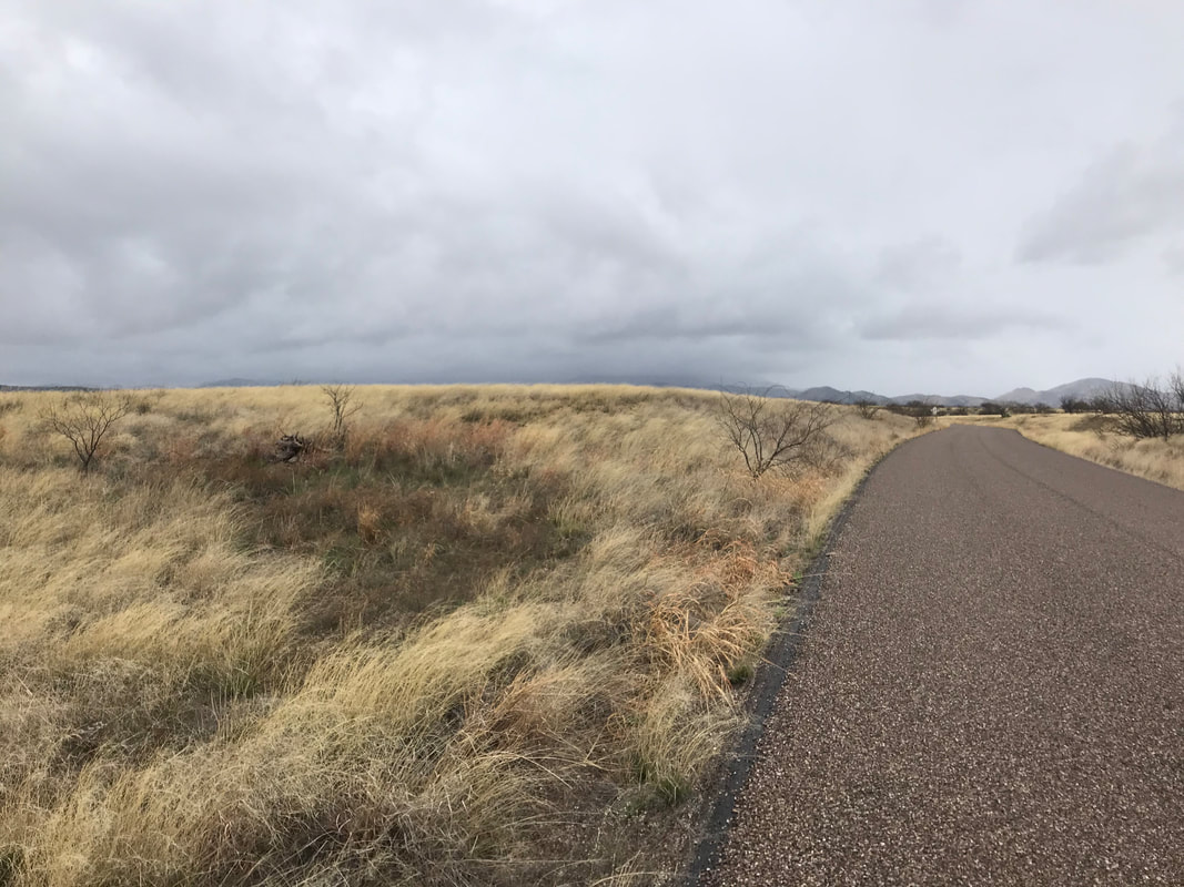
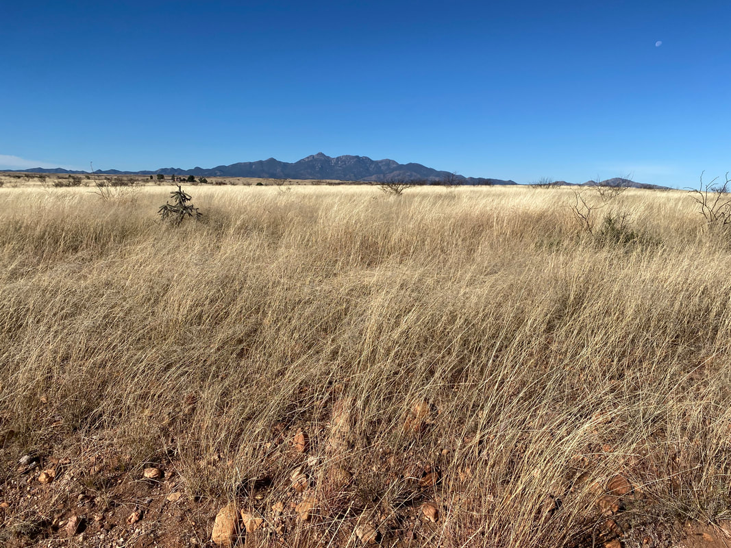
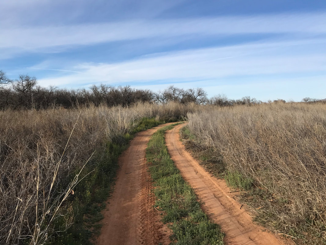
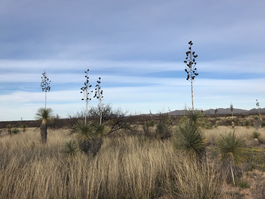
30.71 Miles; 2,249 Feet of Gain; Patagonia, AZ to the Appleton-Whittell Research Ranch of the National Audubon Society 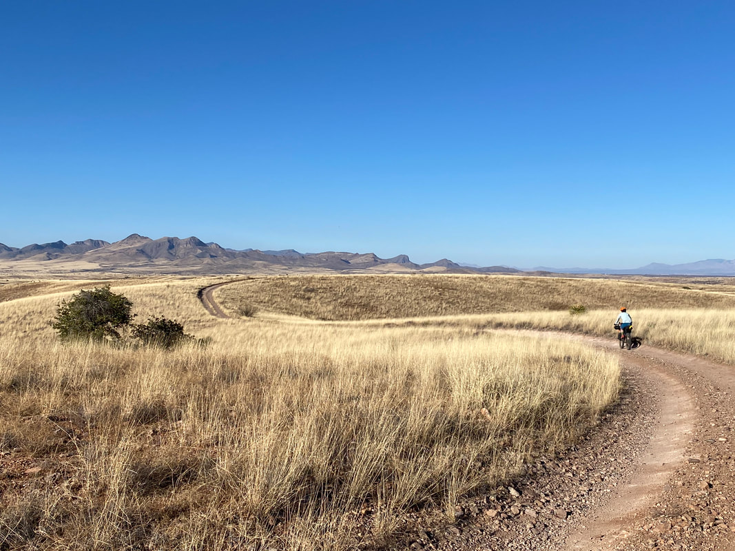 Morning arrived at TerraSol slowly and super cold. We took our time knowing that it was only some 30-odd miles to the Audubon Center for today. The sun crept in and set to crinkling warmth all the frost that covered everything. We walked downtown to grab some breakfast at the Gathering Grounds before walking back, packing up our bikes, and pushing off towards Harshaw Road. The roads continued to be gloriously smooth and freshly graded - we just sailed along. All the cottonwoods we swept under were barren with nary a bud in early February. This was in constant contrast to our autumnal rides which featured tree limbs heavy with gold and crimson. We rode up and spilled out onto the grasslands blanketing the landscape from here to the Canelo Hills and Huachuca Mountains. The sky was a blast of blue deeply in relief to the yellow-faded colors of the crisp grass. The temperatures felt just right; there was a small nip that kept sweat at bay. We biked up now-smooth Canelo Pass and dropped down the backside. 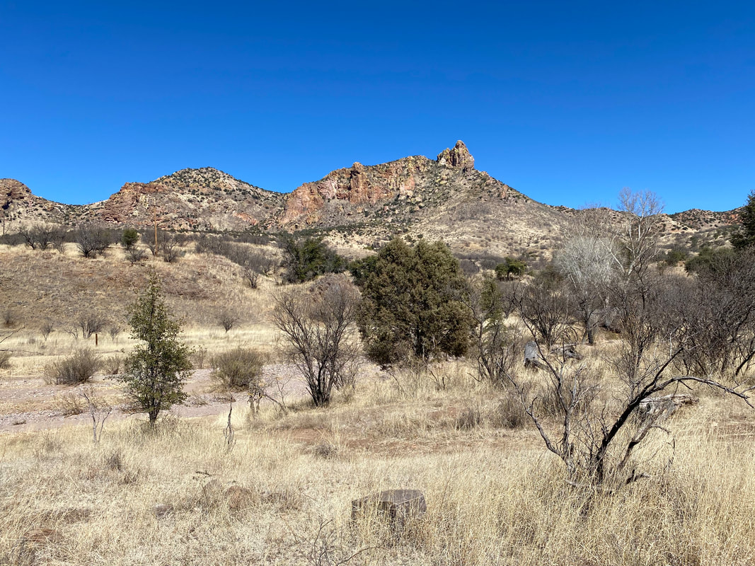
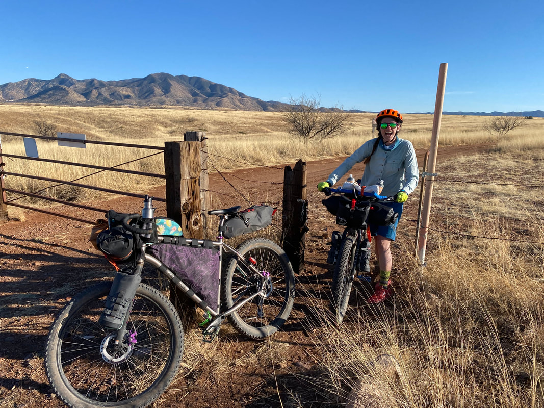
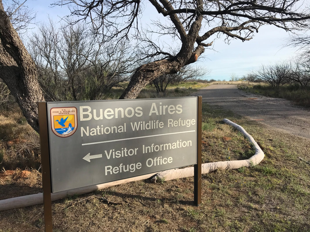
One of my favorite sections of the Sky Islands Odyssey is the dirt road that carries bikepackers off from paved Parker Lake Road out to the Audubon Center. It careens with stellar views over the far Whetstone Mountains through grassland sea. The rolls of the doubletrack stand out harmoniously with the studded yucca hills where bird calls and deer stares catch call at your senses. As before, we took a long, meandering time to pedal slowly and absolutely soak in the scenes before us. A few pedal strokes later and we were descending down to the ranch housing. We walked down to the main science building and met up with the husband of the then-current direction of the center. The ranch seemed ghostly empty and he relayed its near-constant closures from COVID. He showed us the new patches and shirts for the route, which we purchased before he relayed the importance of not bathing or sleeping in the casita for the COVID restrictions. He also walked us over to the casita and pointed out the best wind-protected spot for setting up camp for the night. Little did we know that this would be our final time crossing the Research Ranch. By fall, the Audubon Center would cut off ties with the Sky Islands Odyssey and at the time of this writing, bar bikepackers from crossing the Ranch. We sat outside for a while soaking in the sun and enjoying the last warmth. The weather forecast predicted a cold front to come in the night with tomorrow's highs being in the lower 50s/upper 40s. As evening came on, we sat in the casita making dinner and prolonging the now below-freezing temps that had settled outside. Janna and I then turned in to bed. We had perfect wind protection but man was that one of the coldest nights we slept outside during in a long time. 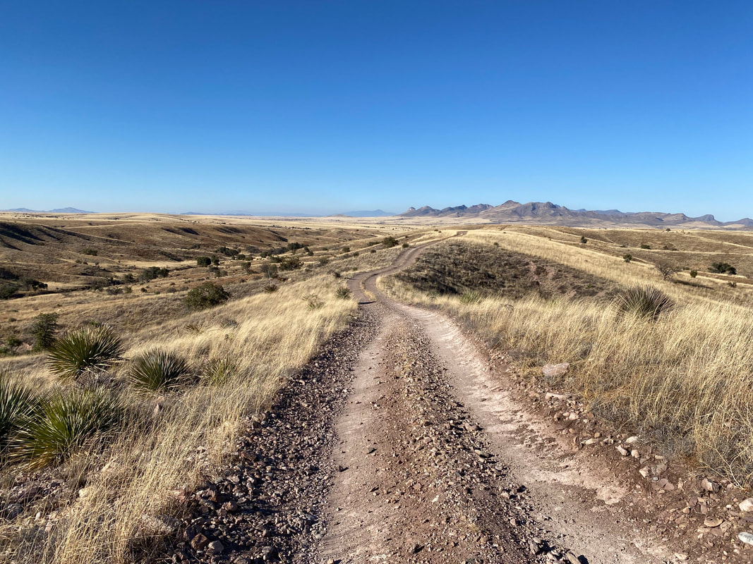 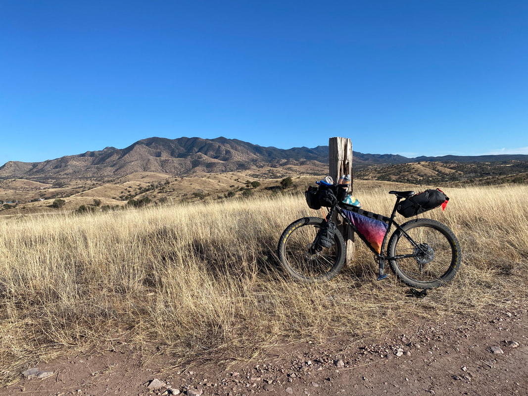 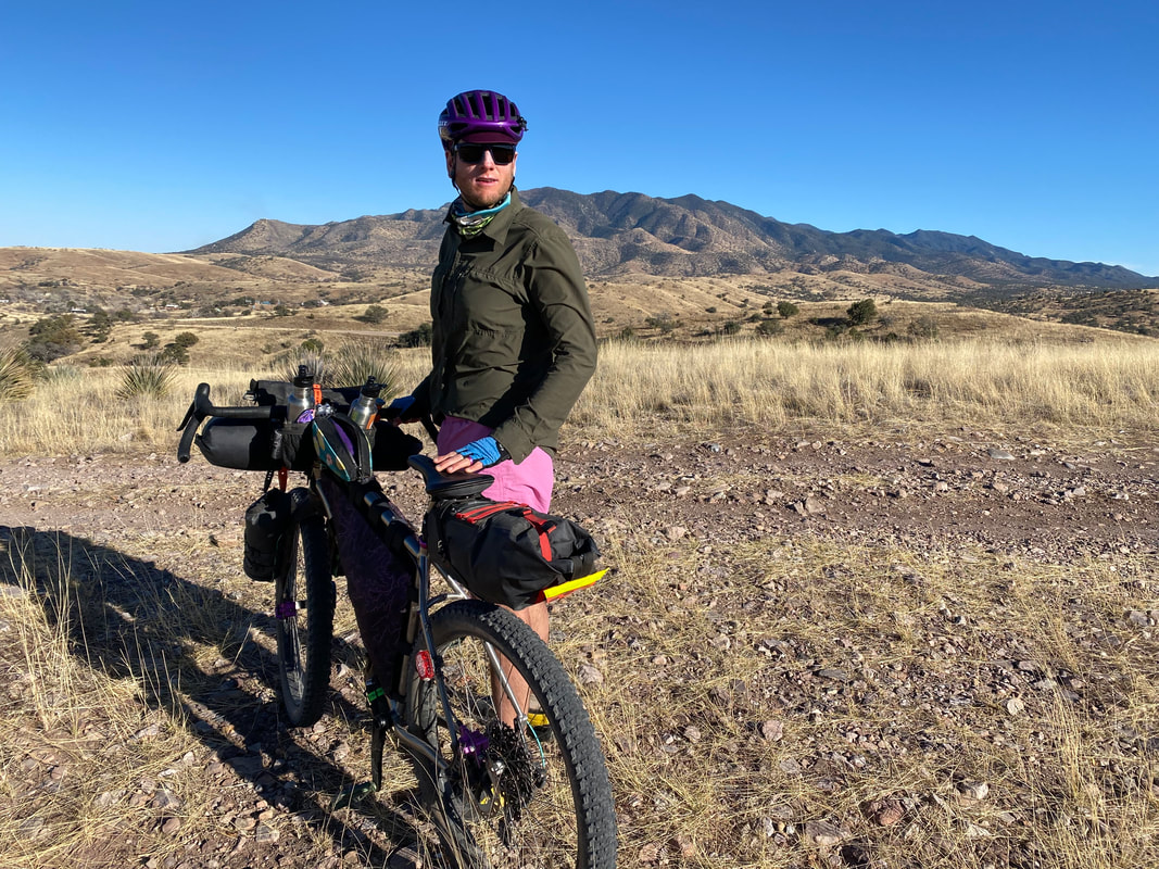 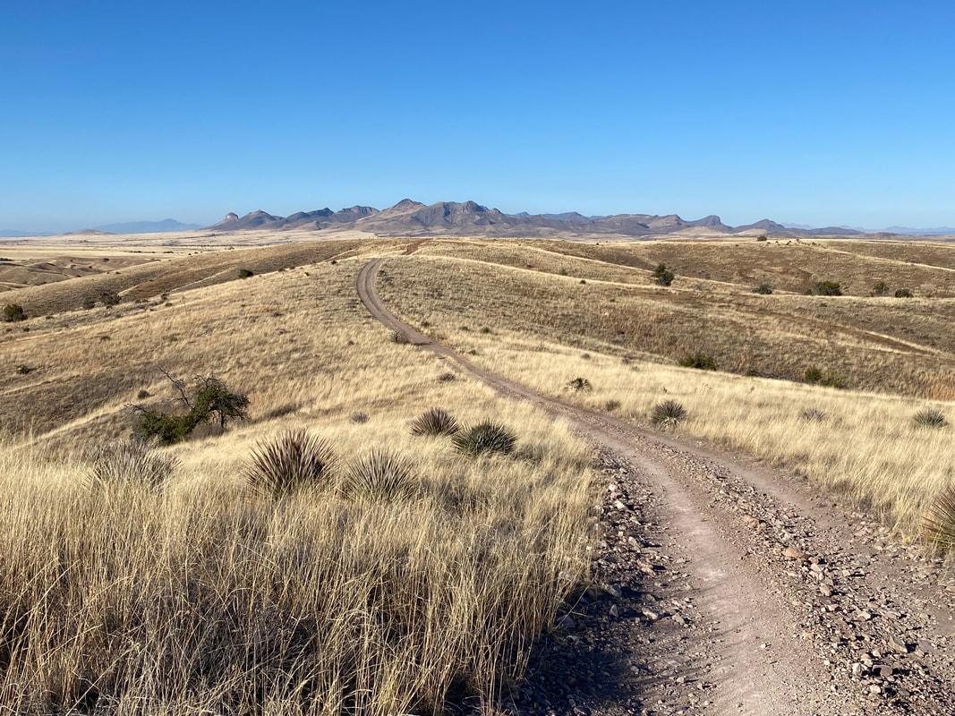 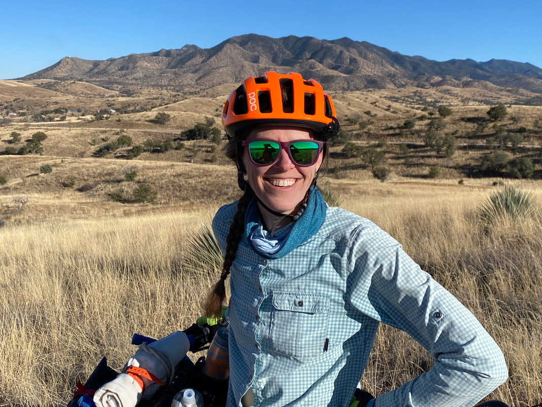 
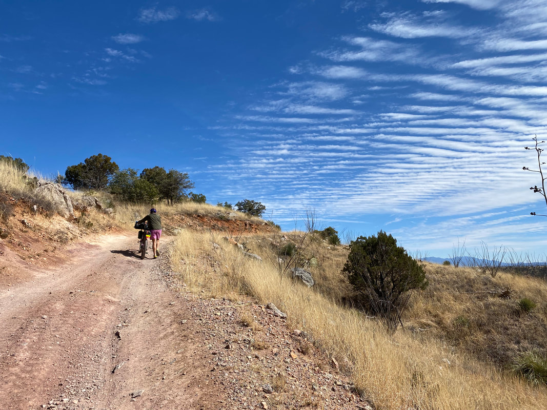
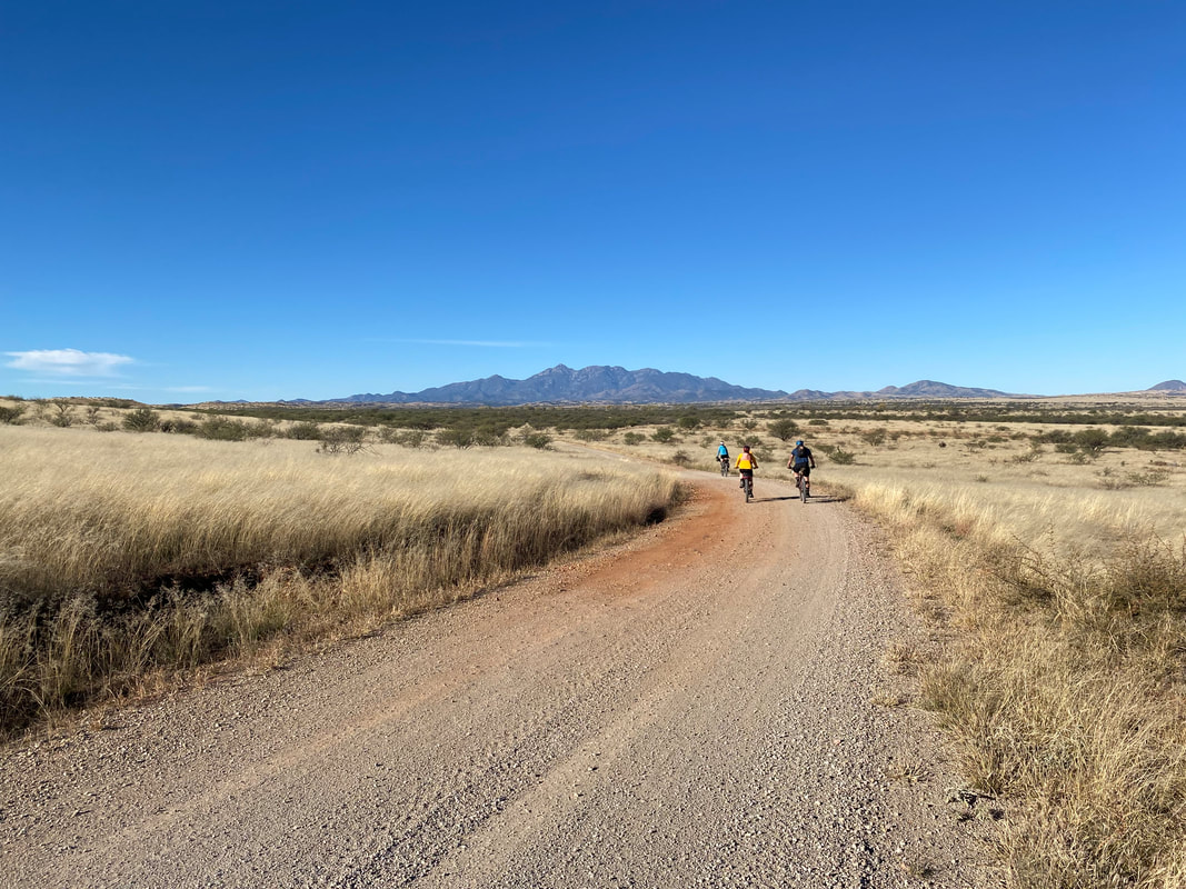
 44.98 Miles; 4,315 Feet of Gain; Green Valley to Patagonia, AZ 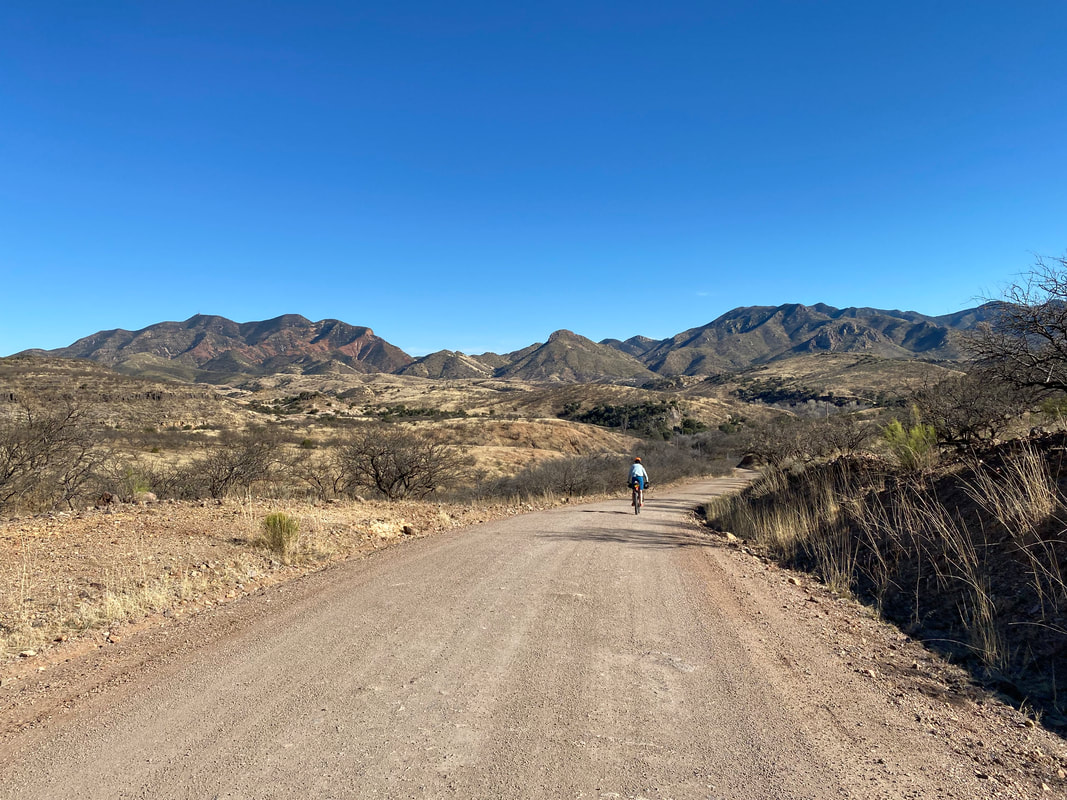 The Sky Islands Odyssey was our first off-pavement bikepacking route we ever did, way back in 2018. It has remained one of our favorites; as tradition, we bike it once a year during Veteran's Day weekend which always feels like the perfect temperature for the route along with the best fall colors touching the desert. But ever since COVID and its subsequent surges, we haven't had the opportunity to return. The Appleton-Whittell Research Ranch of the National Audubon Society to that point had remained impermanently closed to visitors. We tried to come fall of 2021 for a ride, but a surge in COVID forced us to cancel our plans as the Audubon Center confirmed the same. With President's Day weekend approaching, Janna and I were feeling the itch to get down to the desert off the cold and wintery Colorado Plateau. We wanted to stay relatively close for the weekend, so within Arizona. We looked at the temps around Patagonia and it seemed good. In addition, the Audubon Center gave us permission to camp on their property, along with usage of the kitchen/restrooms in their rental casita as long as we didn't eat or sleep in there (as a COVID precaution per their policies). We quickly put together an itinerary since this would be our fourth time riding the route and pointed the car south. The atmosphere warmed as passed through Phoenix and made our way down to Green Valley. We pulled up the Best Western late, checked in, and passed out. We rolled out of the bed after sleeping in to find the morning was COLD. Like upper 30s. We counted on the day warming up so we rode our bikes downtown and picked up the Juan Bautista de Anza National Historic Trail and started riding down the adobe dirt parallel to the Santa Cruz River. It warmed up ever so little and ever so slowly as mid-morning came on our climb up towards up the pavement towards the Santa Ritas. We turned to cruise down the dirt along the range's base and were AMAZED at the quality and smoothness of the dirt. For the last several years that we've ridden this section, it has proved to be typically rutted, washed out with severe erosion, and SUPER rocky. What we rode on now was evidence of recent road grading by the USFS. Elated, we spun easy miles on the unsullied dirt surfaces. Climbs that were once difficult by way of rock to the point of hike-a-bike became sufficient for remaining on the saddle. 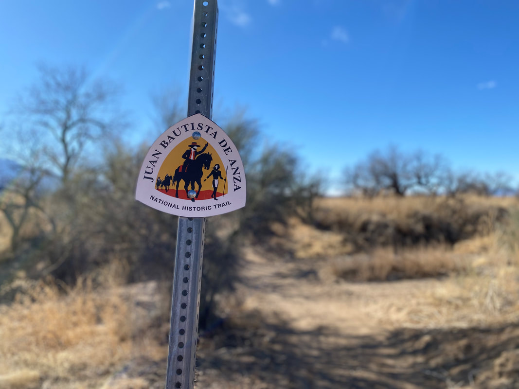 
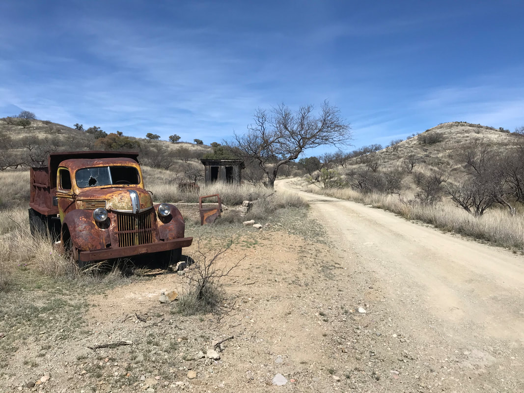
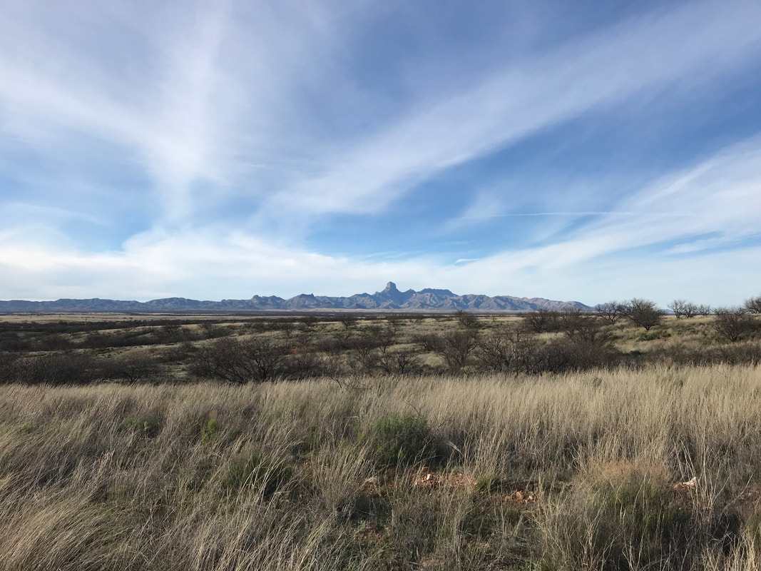
  In that way, we crossed over the pass and descended into the foothills around the Patagonia Mountains. Janna and I both remarked how dry and brown the scenery was. We were used to the November rides where cottonwood and deciduous plant put on autumnal color. Now February, the land had yet to grow from winter's sun. We eventually came to the top of another pass when I looked up and saw a sedan parked with a door open and an arm hanging out. Panicked someone was injured, I cried out shouts seeking their response. No response. I pedaled hard and yelled again. As I neared the pass with the vehicle I clearly saw bullet holes torn into the side of the vehicle. I slammed my brakes on in alarm. Something was not right. I called out again to a return of silence. I got off my bike, and approached the car. I took in more of the vehicle and realized it was absolutely beat up and the "arm" was a piece of fabric at an angle. The car was beat to shit, shot up, smashed in, and bizarrely abandoned here. I took a circumference walk around it. It was so atypical that someone would drive a sedan (2WD for sure) up and out here. I speculated this car must have been driven up here in an attempt to avoid the border patrol checkpoints that sat equidistant on the two highways flanking either side of the mountain range below. The car must have broken down and been abandoned by whoever was avoiding the feds. It was long enough go for others to shoot up the vehicle, but recent enough that the coat of the car was still in great condition. Wary of drug smugglers (the car's potential use) out here near the border, Janna and I agreed to get a move on from the area. We biked down the back of the Santa Ritas under beautiful mid-60s temps and gushing blue skies serving contrast to the tan brittle grasses of the landscape. We arrived in late afternoon to the town of Patagonia. For years we had camped at the RV park just outside of town (for both the Sky Islands Odyssey and when we thru-hiked the Arizona Trail in 2019). We learned quickly that the RV park was no longer allowing tent campers to stay. Luckily, someone pointed us in the way of TerraSol - a literally just-opened/new spot for bikepackers, backpackers, and van lifers. We rolled into TerraSol and met Mary. She had bought the purple house we rode/hiked past for years just outside of town and was in the process of converting into laudable camping for travelers like us. Her hospitality was fantastic and we were some of her first guests. I told her I was sure she was going to get a TON of AZTers in the spring and to be prepared for it. She had just cleared a space out back suitable for a tent where we could camp for the night. After setting up, we walked to downtown Patagonia to grab some pizza from the classic Velvet Elvis restaurant. As night came on, the cold came smashing down. We layered up and snuggled into our winter bags as temps dipped well-below freezing. 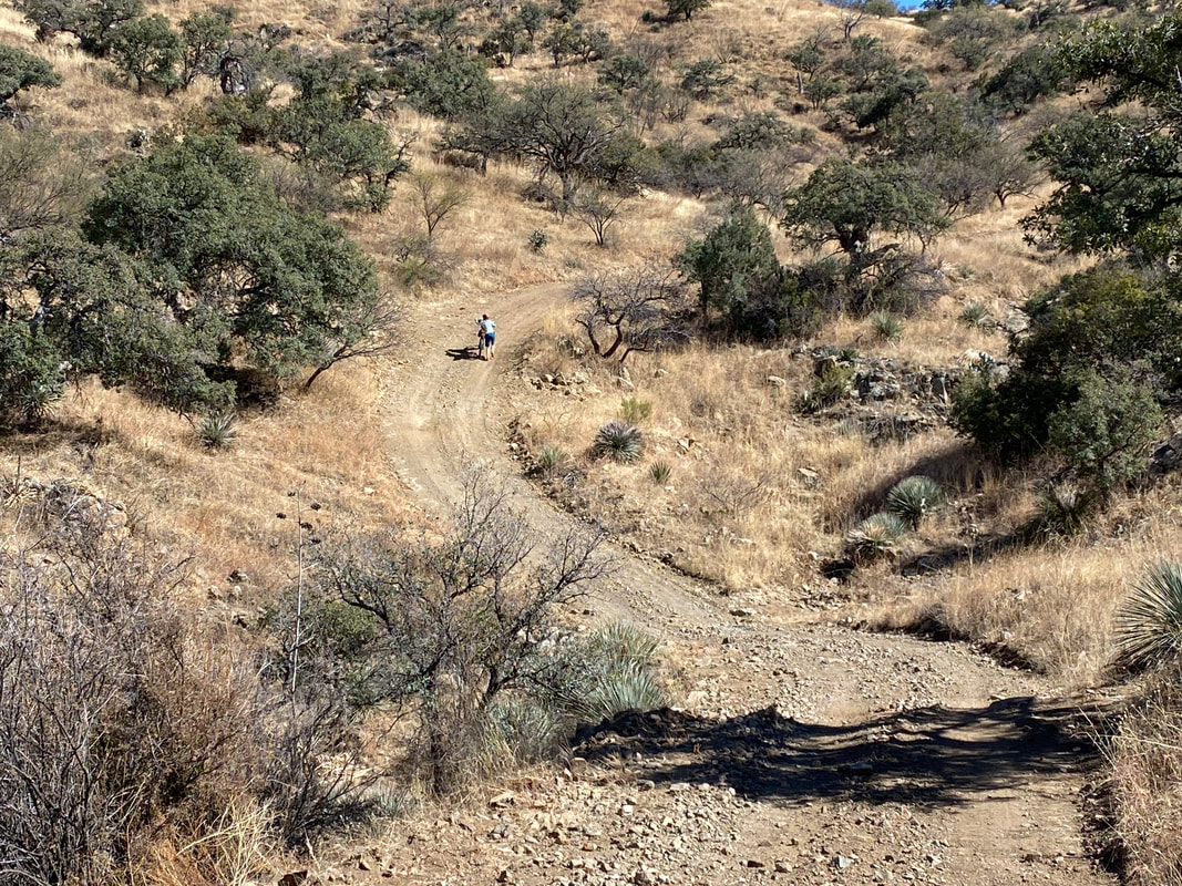 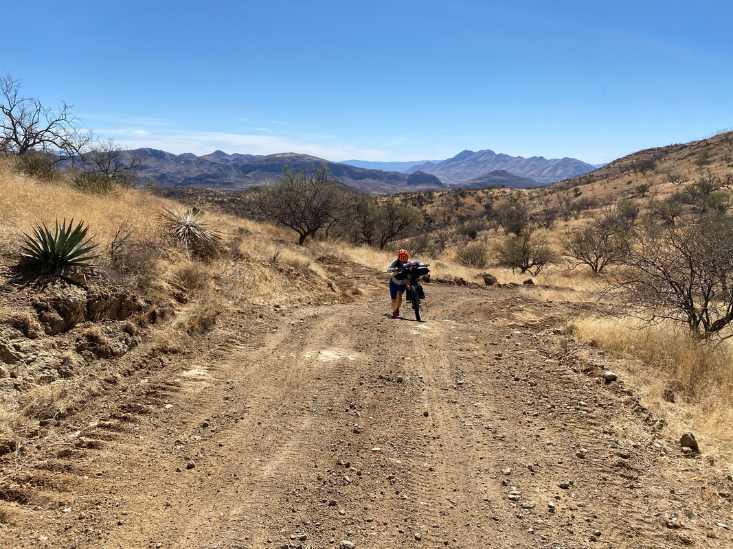
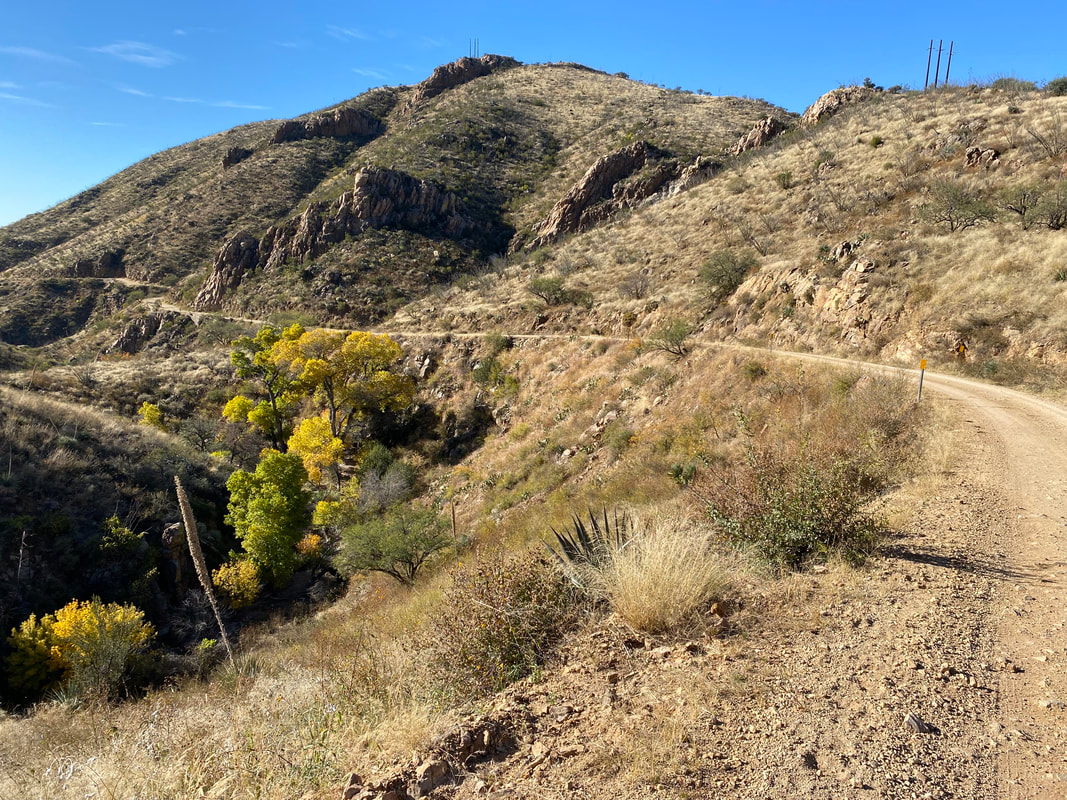
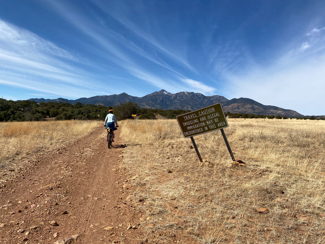
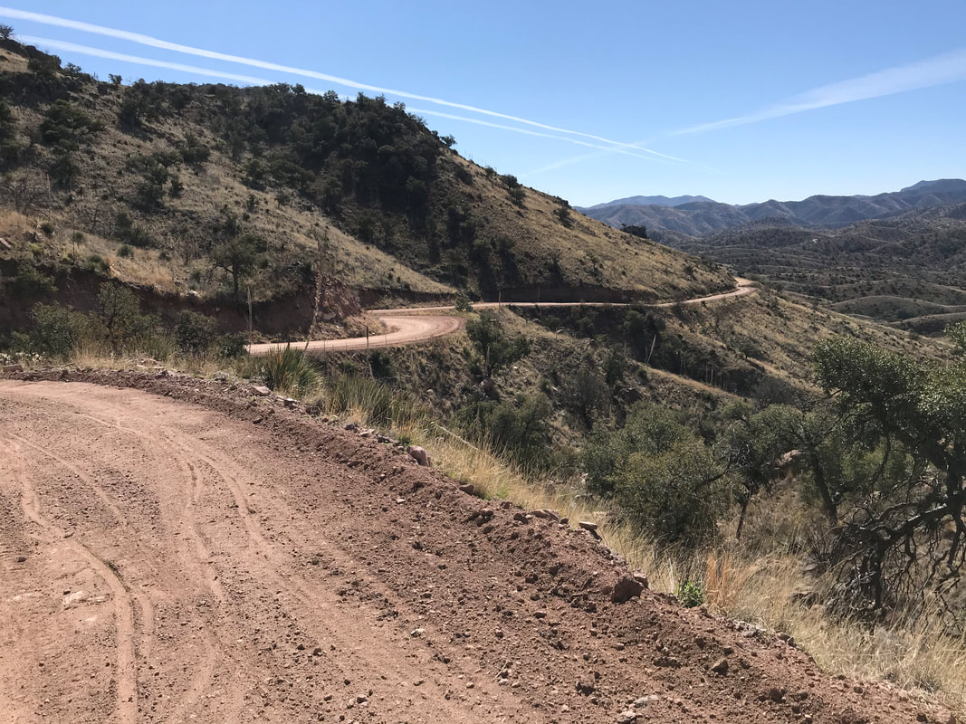
Sky Islands Odyssey (Full Loop) - Day 4 - Up Box Canyon and Into the Storm (Actual and COVID)3/18/2020 Trail Mile ~210; Patagonia, AZ 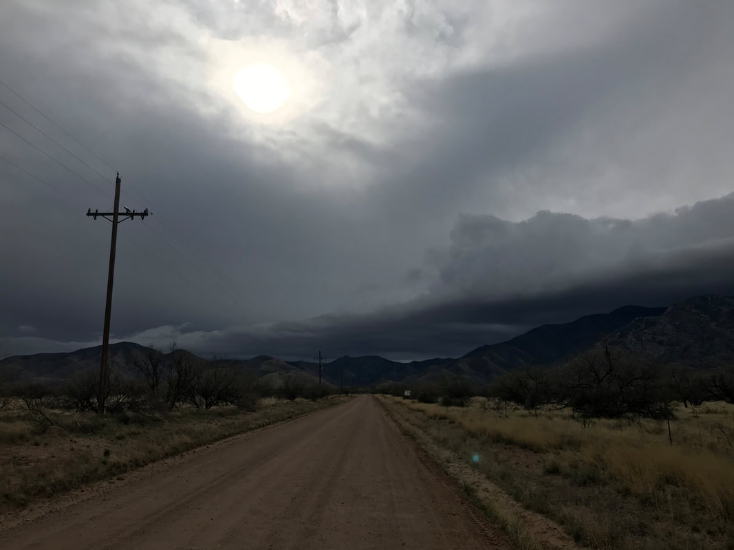 I awoke strong and refreshed, but early to get a move on. The storm that was to hit Thursday was now moved to today. And today’s route, as much of the whole, is not something to be ridden when raining. The dirt on many sections has a high clay content that will pack up on bike wheel and grind progress to a complete halt. My goal was to get up and over Box Canyon on the flanks of the Santa Ritas before the storm hit. I headed out into a morning light set washing out the desert. I crossed Green Valley and swung under the I-10 before heading up towards Madera Canyon. The route was all paved at this point but a solid 30 mph wind blew on me as it ran up and over the face of Mt. Wrightson before sweeping down unhindered grasslands hills. I stared at the summit on approach as dark clouds covered it in a shade of rain. At the fork for Box Canyon, I swung a left and left the paved for dirt road. All my past riding on Box Canyon has been downhill, so this would be my first ascent. Wind continued to push HARD against me. At times, I would pull over next to a mesquite for water little cover I could grab in order to pee or east some food without both items flying all over. To the south, a massive thunderstorm was sweeping the Mexico/Nogales area. I turned up the canyon and came to the official Coronado National Forest sign, whereupon an immediate blast of wind roaring down the canyon swept up a dirt into a spray of sandpaper that forced me to stop, cover my mouth and eyes, and wait for it to pass. Then, I would slowly hunker up the steep 4,000 ft. incline before I could see another sandpaper blast of dust approaching. I’d stop (no use biking into something that would blow me over) and the passing sediment felt like it was scraping all the hair from my legs. I continued at this pace for a couple of miles before running into someone out birding. He was in the air force, and due to the shut down from the coronavirus, was socially distancing by coming out here to find a recently reported sighting of a five-striped sparrow (VERY rare in the United States) found only in this canyon.
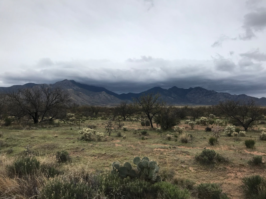  
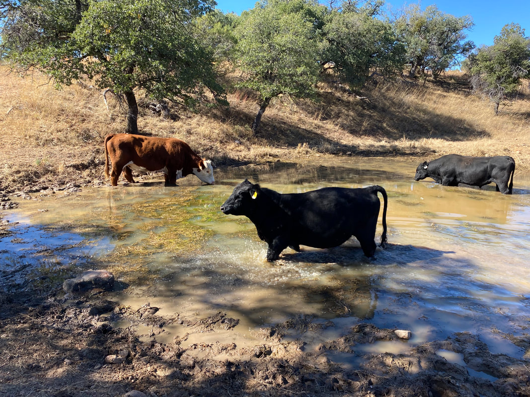
  I pushed on, turning the corner and seeing cows lounging in the sand of the canyon wash to my right. Another corner and suddenly three ultrarunning women and one guy on a gravel bike passed me all going downhill. As I peaked the canyon and the route began to soften its grade, I picked up speed now that I was back in the high grasslands of SE AZ. The storm clouds that had only covered the peaks before were now very low and covering most of the mountain to the base with me in the foothills. I came to the junction where the Sky Island Odyssey turns right up into the Coronado NF towards Kentucky Camp, but to my left was a paved road leading to the highway. I checked Komoot to see my distance to Patagonia by taking all-paved roads. While doing so, the group of runners/cyclist that had passed me going down had now come back up to where I was. The cyclist told me they had been in Patagonia all morning and it was getting slammed with rain. My decision was forced to avoid peanut butter mud: gotta stick to the paved roads. I called the Audubon Center and let them know I couldn’t take the route to their place and was instead cutting my trip a day short. They said it was bad there and had been worried about me making it. Decision made, I headed down the paved road towards 83. At the entrance to the highway, I put on my rain layers, fleece, and waterproof gloves. Before me, the sweeping grasslands of Las Cienegas National Conservation Area bore sweeping curtains of torrential downpour in sheets in all directions. I turned right onto the highway, lowered by head and prepared for several hours of soaking. No sooner had I passed through another Border Patrol checkpoint than a horizontal, face-first fist of sleet and freezing rain mixed with particulate hail. The wind slowed me to a ridiculous crawl on the highway edge. I made sure every bright light was shining while a thin sheet of ice frozen over my glasses and the pitter of ice granules knocking off my jacket chest rang. The grasslands gave me no wind shelter and I just froze and rode.  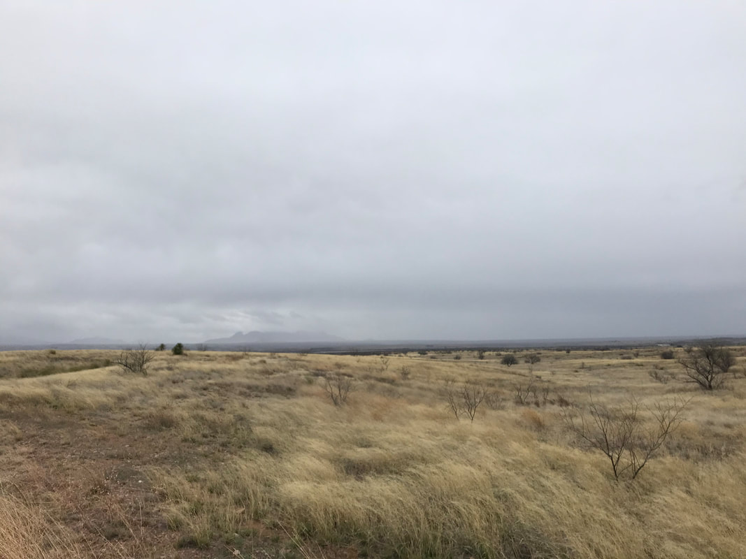
A couple of hours later, I pulled into Sonoita and made my way to the sole gas station/convenience store. I walked inside and was warmly greeted and well as invited to sit and dry as long as I wanted. I bought a massive cup of hot chocolate and the clerks gave me some chicken fingers and potato wedges to help warm me up. I sat and ate, drank a whole other cup of hot chocolate, and repeated for a good 1.5 hours while they told me they were not going to close for the virus and that the government would need to come physically force them to shut down. Once dry, I headed out into a slightly decreased rain and began the long descent into Patagonia. Halfway down, I ran into another bikepacker heading north. We talked for a bit and turned out he was doing the AZT but decided to forgo it due to the personal reasons; he was biking back to Tucson. I pushed on and right as I got into town, the rain began a torrential downpour again. I turned left up Harshaw Canyon road and passed a pair of miserable looking AZT thru-hikers both sporting trashbags as ponchos. I continued on for several miles before making my way back to my parked car. I tore everything as quick as possible off the bike and threw into into the car in the pouring rain. At this point, I still hadn't quite digested the possibility and reality of what the gas station clerk had told me about business shutdowns when I was in Sonoita. I turned the car towards Patagonia and decided to grab some more food before driving back to Phoenix. Patagonia was a ghost town. I walked up to the Stage Stop Inn and went into their restaurant. They promptly let me know there were closing in one hour for an indefinite time into the future. I was stunned. I turned on my phone. A torrent of voicemails and texts came pounding through. Multiple robo-calls from my school announced, with an hour-by-hour play, the mounting decision to forgo opening next week given COVID-19. At that time, little did I know that I would actually never teach in that school again because it would close for the length of the semester, and I would move to another school. COVID-19 reality was here. I quickly called Janna as my food was coming out. I was the sole customer in the restaurant. There was one employee. They told me every business in town was shutting down. People were staying indoors; people were closing up their businesses into the unforeseen future. I was reeling with this information after having just spent my Spring Break out in the backcountry. Janna told me on the phone that here school was closed for next week, that I should grab my food, and that I should head home immediately because the state was shutting down. My head was spinning as four Arizona Trail thru-hikers entered the restaurant. They sat down forelornly next to me, evaluated my dress, and struck up a conversation assuming I was on the AZT as well. After relaying my ride on the Sky Islands Odyssey, we all began an intense discussion about COVID-19 and the world shutting down (and so rapidly in our minds). They were from Washington, Virginia, Florida, and New Zealand. They had saved money, put away PTO, and now were on their multi-week trip. At this point, there were naught but a week in. They asked me what they should do: Continue hiking the AZT or head home? I opened the Instagram page for the Arizona Trail Association and saw they had put up a post just minutes before plying ALL trail users to immediately get off the trail and obey the stay-at-home order. I told them that if the ATA said that, that that was best. They seemed to want to negotiate with me, to negotiate with their circumstances. But we all knew. All I could think of was Jim, my science department head teacher, telling us the day before Spring Break, "They'll never close down places in America like they're doing in Europe. It just will never happen." Now, we sat here. Lone purveyors in a restaurant doling out our food while simultaneously shuttering its windows. I hastily consumed my food, told the AZTers that they trail would always be there, and walked out to the car. The evening was heady in Patagonia. There were no cars at the hotel. No cars at all to be seen in the parking spaces along the streets. Just mine. I climbed in the car, took one glance at Patagonia and the route, never realizing I wouldn't visit it again for two years. I drove into my future, like the rest of the world's: uncertain with the arrival of a now-brewing pandemic. 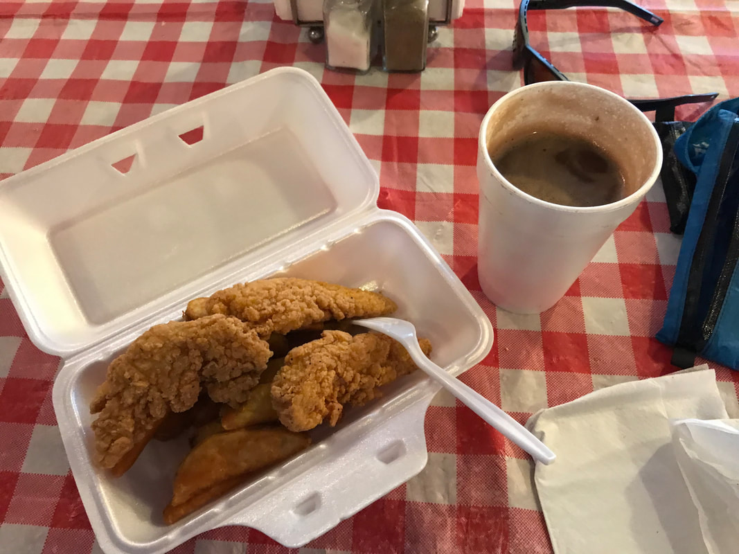 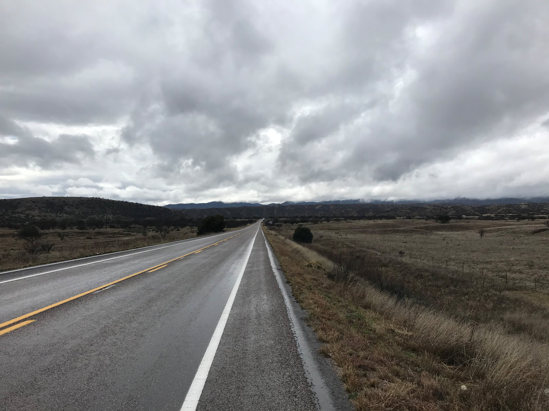 Trail Mile 146.0; Green Valley, AZ 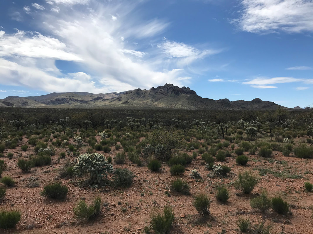 I slept a bit past dawn today, the previous night’s wear pulling on me. A slow-rousing start got me back on route and out and heading miles north away from the proximity of the border. To my left, the Baboquivaris stretched out and Kitt Peak with its observatory came into view. A few miles later, I curved right to stay on Poso Nuevo Ranch Road. I made a phone call to Janna (finally in reception) and we both laughed about the craziness of last night. A call to my family showed that my mom thought I had gotten swept up in an immigration raid and was taken to a detention center. Harrison for some reason thought I got shot. Awesome. I peeled eastward and passed the crumbling remains of an old ranch. A blue flag stripped and waving caught my eye and I made my way around back where a giant water tank with a spigot could be found. This was the humanitarian water station that No Mas Muertes ran. I topped off my supplies and explored around the building before heading off. The grasslands fell away as dry cholla-scrub replaced the scenery with red dirt and panned Earth I would not want to be stuck in during a rain. The ascent continued throughout most of the morning. Although rugged, the route became worthy dirt track and fairly easy to navigate, alleviating concerns I had from the agent’s responses to my route here. 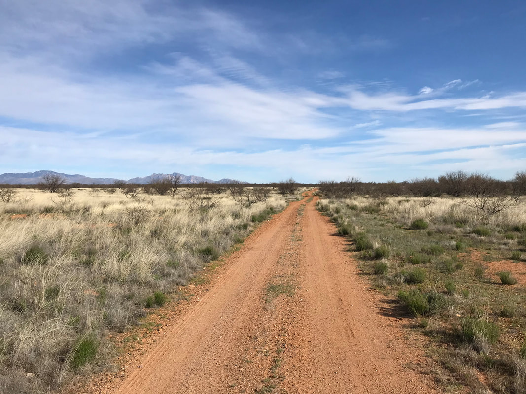 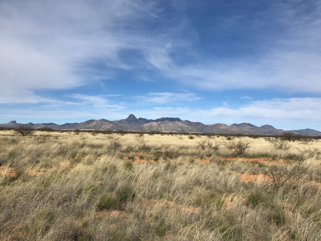 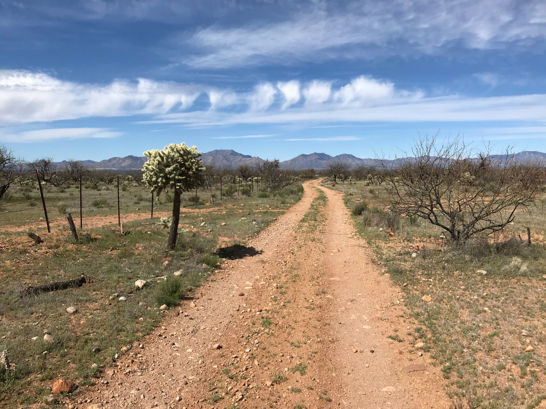 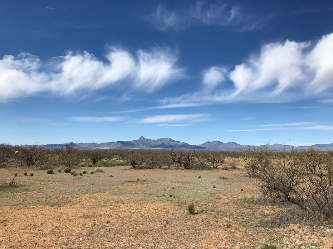

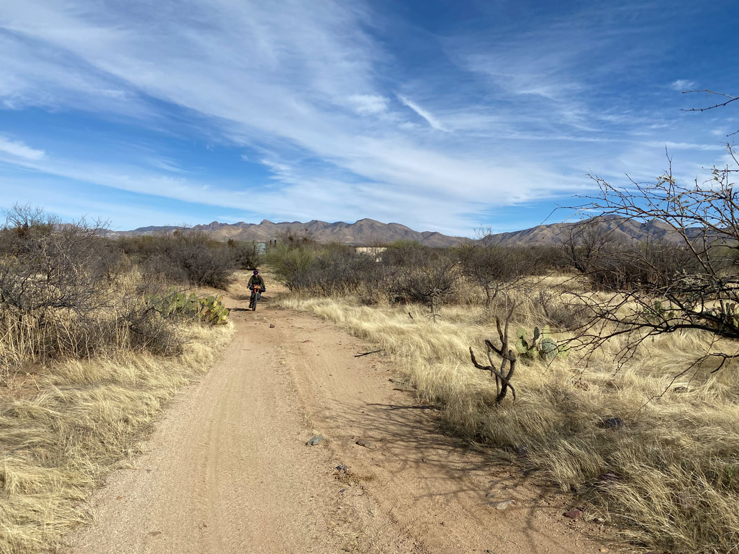
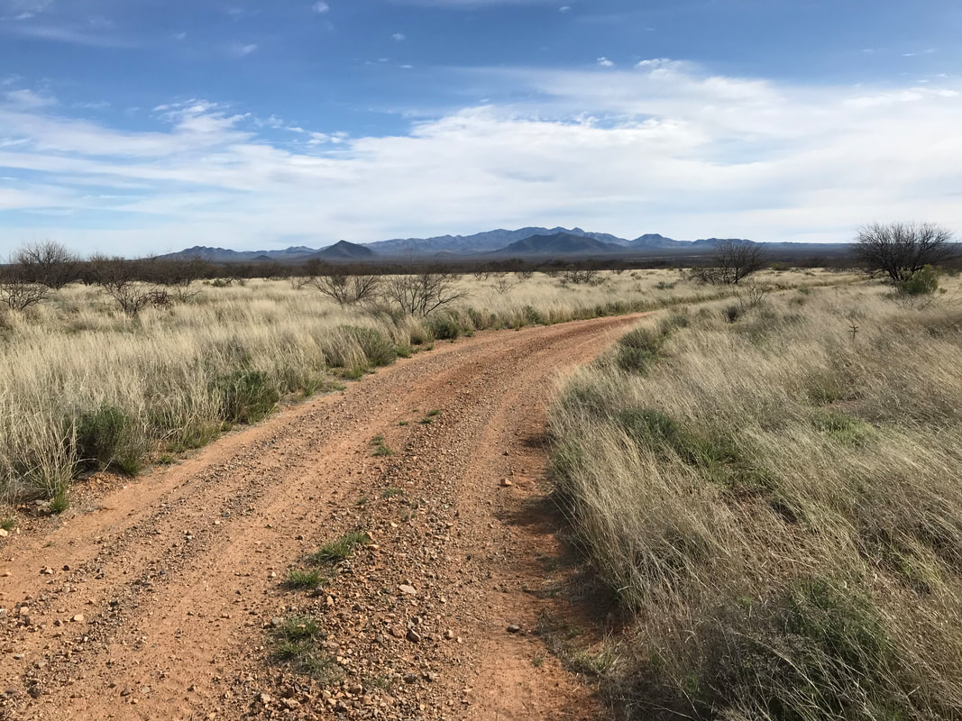
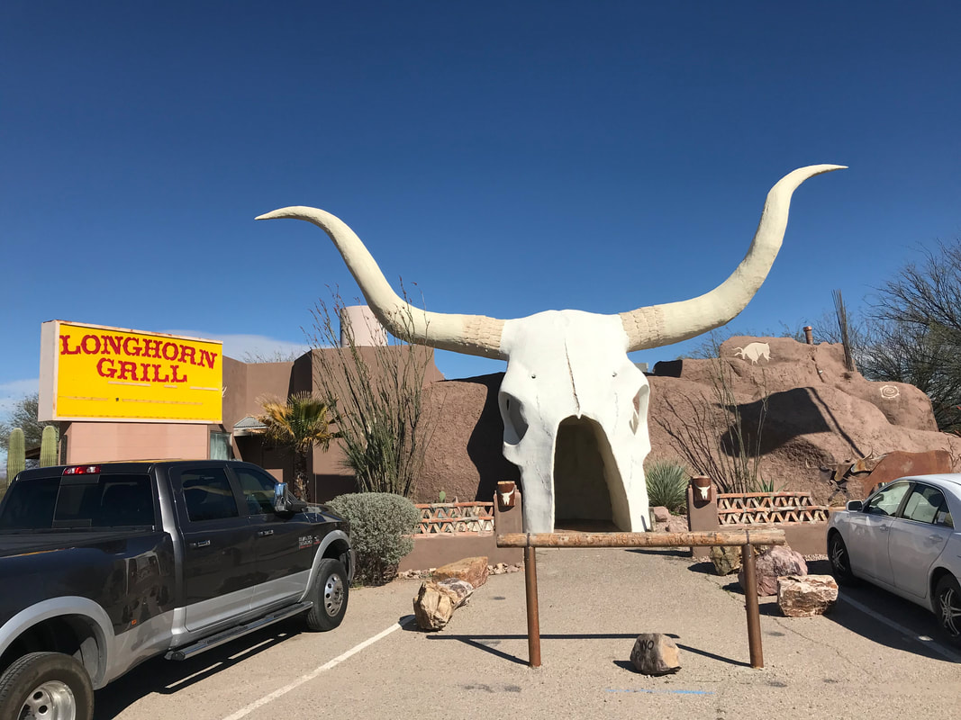
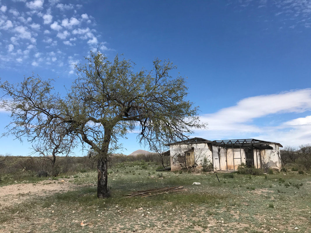  By noon, the road crested a massive and gradual saddle stretching between the awesome-looking Cerro Colorado Mountains on my right and the much taller Sierrita Mountains on my left. The saddle seemed like a massive high-elevation plain studded with prickly pear, yellow/red dust, and mesquite. To the far east rose the 9,000+ ft. Santa Ritas. The valley below held Green Valley and my stop for the day. I began drifting down the now well-graded dirt road, walked pushed open a gate through an abandoned ranch (but with a still-working trough of water(!) for future use), before lazily pedaling down miles and miles of gradual descent. At one point, I came upon a large herd of wild horses browsing vegetation and filling the road. A skinny stallion stood sentry. I talked to him and edged my bike slowly forward, hoping he would lead his herd away but he just stood his ground and stared, leaving me to wait them out. Eventually they moved into the brush and I continued my downhill for several miles until turning left at a parked Border Patrol car onto a paved road that I believe actually went out to Arivaca. I turned left, passed through a Border Patrol checkpoint, and finally came though a small unincorporated town that had a gas station/mercantile and a restaurant across the street. I stopped, went in, got two bottles of Gatorade Zero (now the day was fully heated up) before I made my across the street past a herd of quads parked out front to the Longhorn Grill. A super-cool iconic-looking cattle skull stood as the restaurant entrance. Inside, I got a bison burger and salad plus tons of ice water. Fed, I left and crossed under the I-10, joined a frontage road, and then jumped on the Juan Bautista de Anza singeltrack trail to head north along the floodplain/riverbed of the Santa Cruz River. 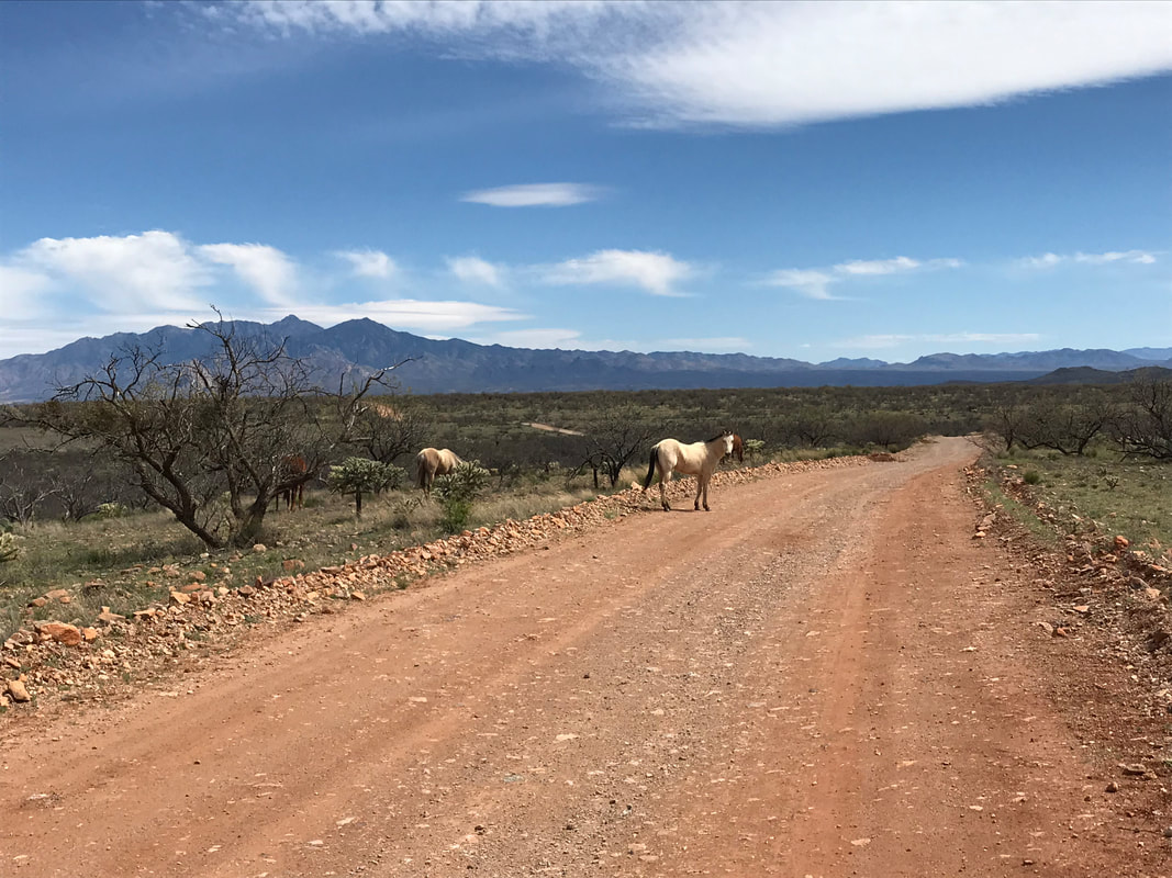
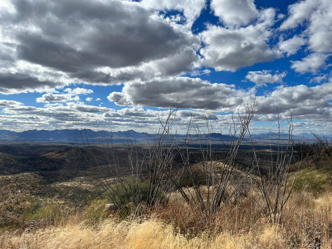
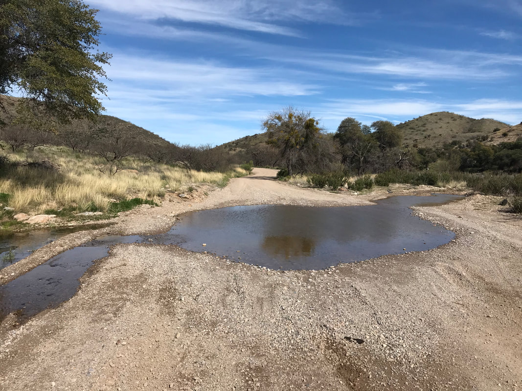
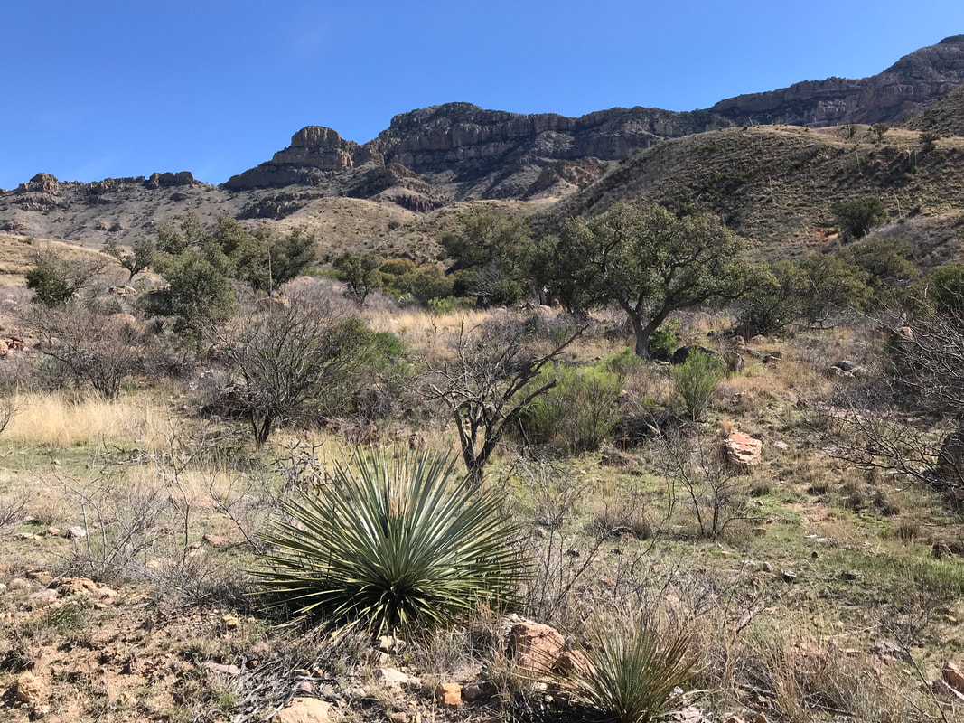
    The singletrack here is beautiful, smooth, and flat. It stretched between thickets of mesquite and open green grasslands filled with spring flowers. I passed several people out birding before I was fed into the bed of the Santa Cruz River and had to forcefully pedal/push the Karate Monkey through 2 miles of straight-up sand. By 5 pm, I exited the river, swung a left to connect to a frontage road, and picked my way through Green Valley. Exhausted after 2 nights of little sleep, I found the cheapest hotel and checked-in. Now, new of the coronavirus had really reached me. My email, texts, and phone calls revealed my school was closed for the immediate time and that states were closing restaurants. I was able to grab some food for the evening by walking across town before everything shut down. Back in the hotel, I took a long shower, drank tons of water and Gatorade Zero, reorganized gear, and passed out hard in bed. 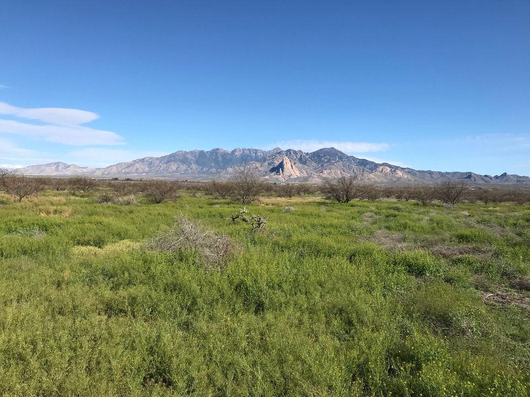 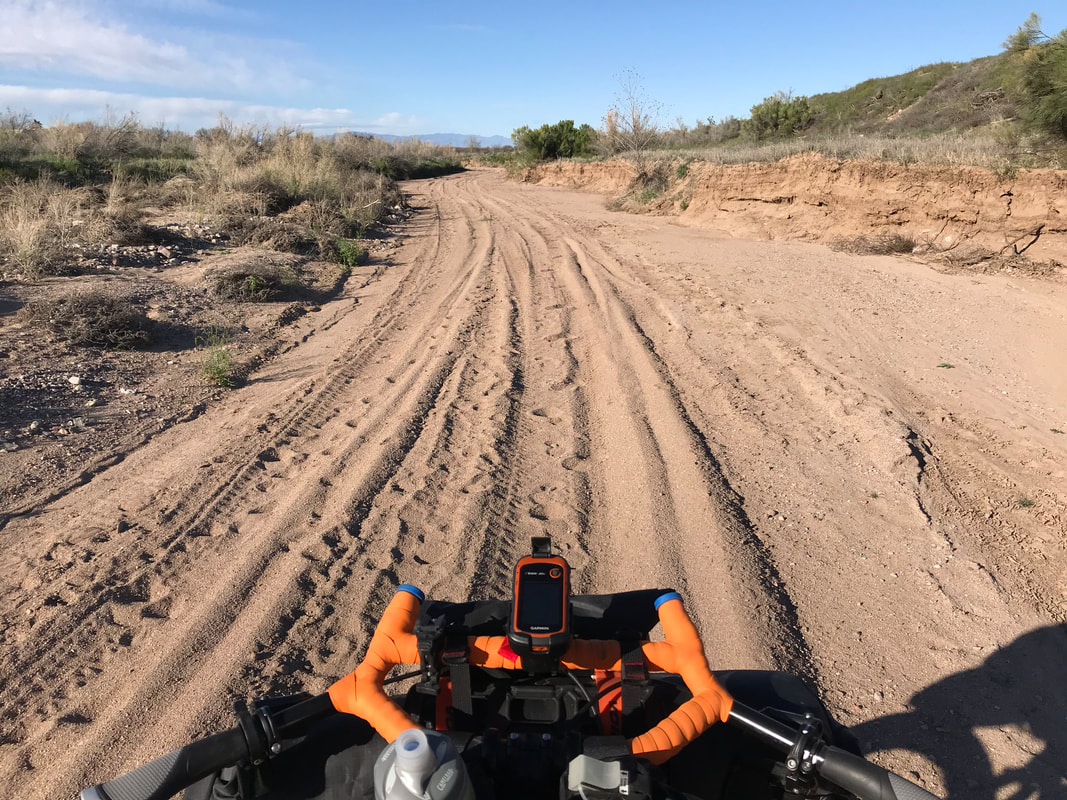 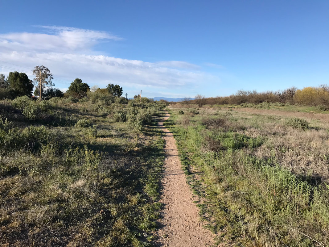 Trail Mile 105.5; Buenos Aires NWR 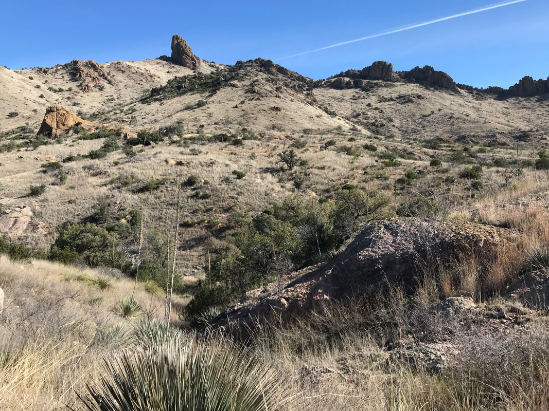 Morning speaks cold in the desert, wiping heat from the lips. I lay awake under a canopy of oak leaves to washed out light dimpling through the Duomid roof. I heard neighbors crushing old beer cans - me amazed they could get up after drinking so much. I roused and pushed flaps open to intoxicating air of mountain clarity. I breathed in, bent, put on hat and gloves, then hustled camp into morning routine. Arrival post-darkness meant I had no idea what the Pajarito Mountains looked like, nor the semblance of my campsite. It turned out I was in a sweet spot. Giant rhyolite buttes jutted skyward around me with a broad desert wash plain ahead. Rounded peaks perched golden, both rough and smooth, surrounding. Their feet sprouted oak, sycamore, and cottonwood. Freaking gorgeous. A forest service vehicle pulled up and its attendant began working the restrooms. He asked me if I knew the “geniuses” that left a full campfire going (Neighbors B) and abandoned it. I agreed with his claim they were toolbags of the highest order. A Border Patrol SUV pulled up and we all talked for a bit while I tore open my food to put back some dry cereal and peanut butter packets warmed in my underwear. I packed up, rolled up, built up the bike and pushed off down a gravel road sporting signs of the rugged nature ahead. It was cold in shadow but warmed perfectly in the sun now pushing rays past canyon shade. Half a mile later, Ruby Road crept over a wash wet with crystal flow from recent rains. I stopped to replenish my empty reservoirs and suck back some water. A massive butte stood solidly beckoning come hither so I got the bike back on route and obeyed. I believe its back flanks led to the Pajarito Wilderness complete with endemic botany found nowhere else on Earth; a journey and canyon to return and backpack. Border Patrol was out en masse. SUVs passed in either direction once every twenty minutes while a helicopter droned distantly. Interspersed peaks sported personal monitoring towers. The road began a long-winded ascent up and over the Pajaritos. Dried grasslands formed the base hue while agave, yucca, mesquite, and oak spit plants upward around rock outcroppings. I loved it. I settled into my pedaling rhythm but broke it frequently to take photo after photo. A couple of hours later found me riding a topographic line with views to embroiled canyons twisting rock and earth into calamity. The land crumples which affords it biodiversity - jaguar, trogons, coati, epiphytes, javelina, etc. I swept corner to a parked Border Patrol vehicle, released my brakes, and watched the world income on a descent. I crossed a dry wash with cholla stands before exiting up and over switchbacks. This dropped-hump-climb ensued in bouts of repeat over several miles as morning dripped closer to the midday. A ridge ride stretched for eternity, standing next to my bike to push that hike. I felt alone and far from settlements and it was lovely. The chunky mountains I had just crossed stood silhouetted behind while a rolling valley grassland with savannah trees swept to my right. I turned a corner, smiling, thinking of the geological similarities to sections of the Great Divide in New Mexico and pushed hard on a downhill that swept towards Montana Peak. 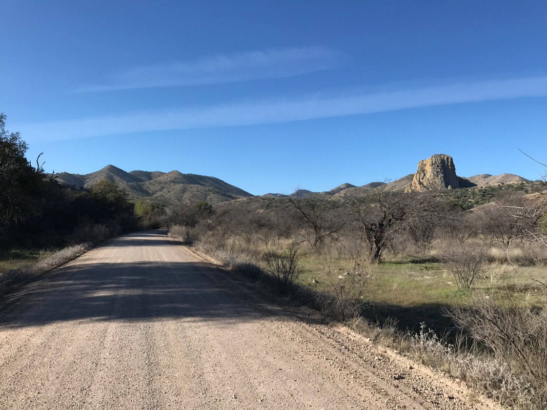
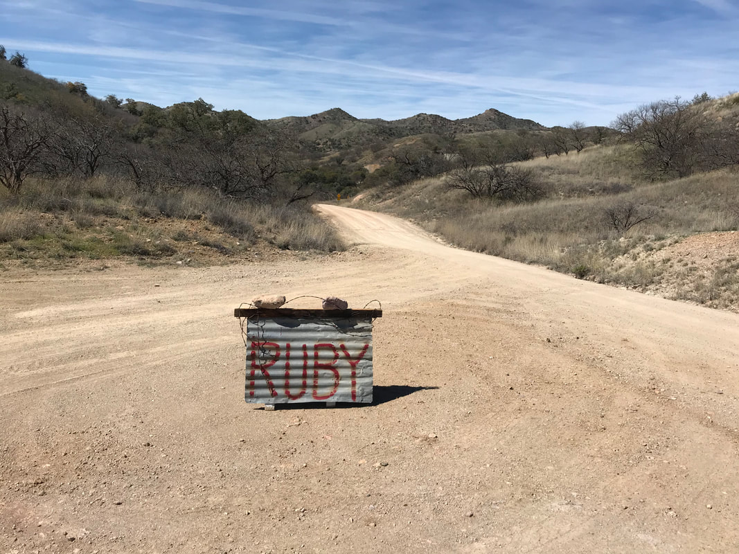
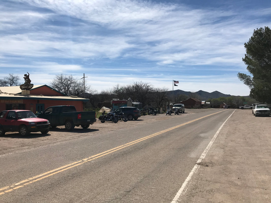
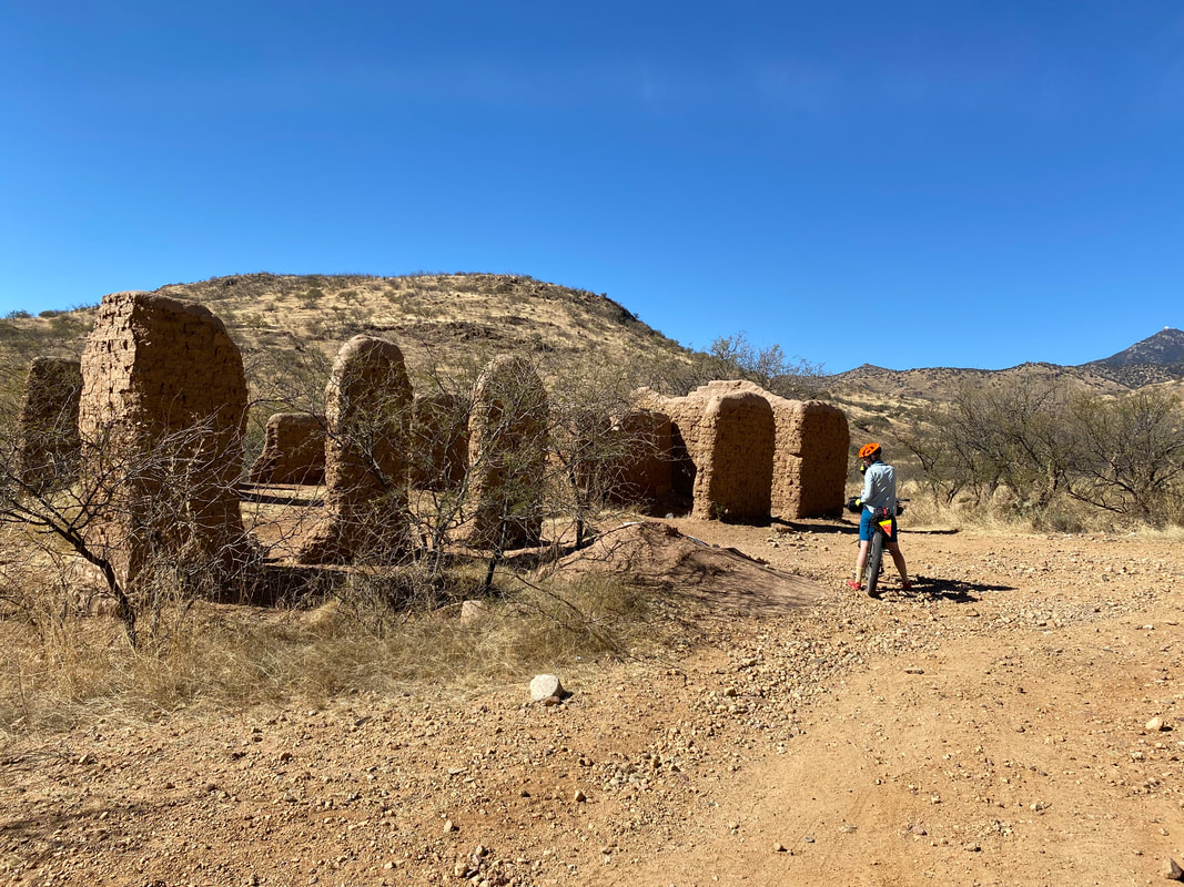
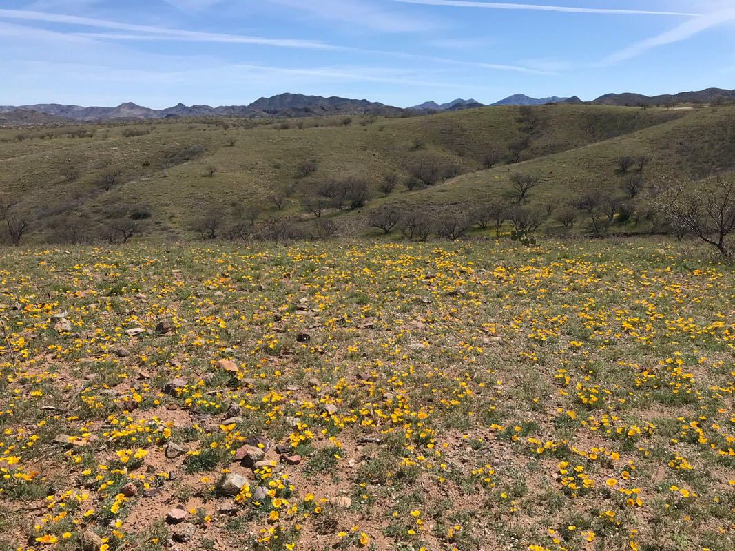
    A corrugated sign stood pronounced mid-road with red paint stating, “Ruby.” A rusted car from the early twentieth century hunkered soil onto its frame on my left. More formal looking signage denoted a side road leading to the historically preserved Ruby, a ghost mining town in a relatively preserved state. It contained machinery, homes, and a permanent Arizona Historical Society member lived on site as caretaker and protector. I wanted to visit but a full tour would cost more cash than I carried, so I vowed to return on a future bikepacking trip with intent and means to check it out. Past the sign, forest road conditions improved, and I passed at least ten cars spread out, making a day ride to check out the town of the past. My route junctioned right, passing a spring choked with green growth before moving up a hill. I crested and descended a few feet before I locked my brakes and skidded halt-stop in front of a coatimundi with its nose in the ground a few mere feet away. The sudden wheel-grind caught its attention. Head up, eyes locked, we both stood before it quickly jutted up an adjoining oak-filled hill where it wove between trees and brought itself parallel to me, continuing to stare and sniff before disappearing. Coatis are life here in the sky islands. I picked up speed and finally left the foothills of the Pajaritos, speeding into a valley dropping down with a spread of grass and a road with nearly 15 water crossings deep enough to submerge my feet on a downstroke of the pedal. Paradoxically wet and dusty, I kept up the speed to pass a cattle guard and hit some pavement that took a northward tangent towards the small border-town of Arivaca. Mexican gold poppies lined the route right into the small town of a couple hundred but sporting a main street with flare and fare. An art shop sat countercorner to a post office, No More Deaths/No Mas Muertes organization, mercantile, and restaurant. Food was priority, so I perched the Karate Monkey outside the restaurant and went inside to eat. I always smile when a small town has a place to eat with vegetarian food as an expectation and not a small typo on the menu. I placed my bets on some lentil soup, avocado/bean tacos, tortilla chips, and corn tortillas. The bartender let me charge my phone while I ate. She inquired about whether I was doing the Sky Island Odyssey; she reported a bikepacker about once a month on it. Food pushed down my throat, and I called to check with Janna and learn that schools and communities were beginning to close due to COVID-19. Meal finished, I rode down to the mercantile to acquire an ice cream sandwich, two Gatorade Zeros, and some fresh water to fill my bottles. 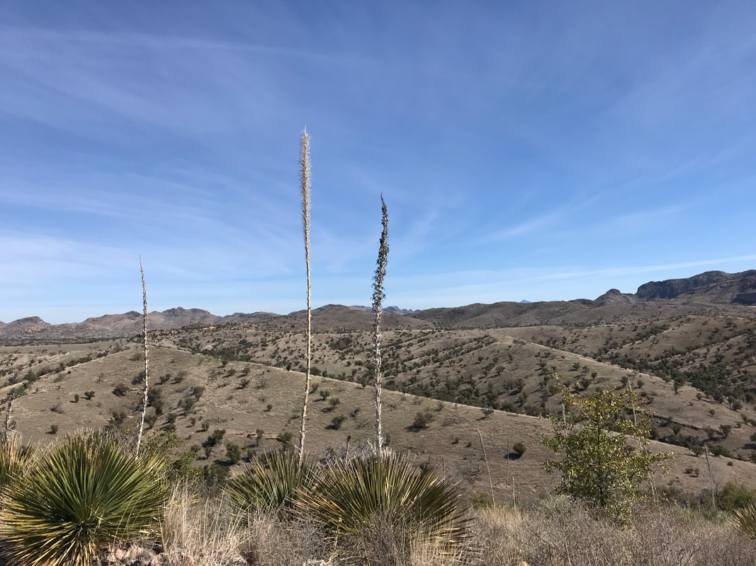
Rolling out of town around 2 pm, I retraced a mile of route and turned southwest to climb into the San Luis Mountains. Poppies and violet lupines gave beauty to a sudden headwind that reduced my speed already decreased by a deadpan road with rutted washboard. I didn’t want to roll into camp after dark again so I wanted to cover the next 20+ miles steadily. The road passed up and over mountainsides, passed old ranches, splashed through flowing washes, and eventually crested a rise beginning a long stretch of grassland ocean: Buenos Aires National Wildlife Refuge. A land of mesquite, short-brunch prairie, pronghorn, coyote, deer, and birds. My direction took me off the main dirt track and onto some old, rutted doubletrack flooded with repeated peanut-butter mudholes. Frankenmud smattered my back, calves, shoes, wheels, and bike frame. Acacias with overgrown thorny arms stretched and ripped my arms as I passed. The golden glow of late afternoon ripped up the horizon with a yellow filter making the grasslands even more stunning. Baboquivari Peak amid its namesake range filled the backdrop as I pedaled with speed down crumbling dirt track towards the Visitor Center. I pulled in at 4:45 pm. past the “Closed” sign to the back where open restrooms and a working drinking fountain were found. I filled up my MSR 4 L Dromedary and bike bottle completely as this would be my only reliable water-fill until tomorrow afternoon. Bursting with the weight and density of water, I pedaled of into the early sunset. The dirt track swung northward away from the border across the massive prairie with mountain walls. The terrain was smooth, flat, and simple; I flew. Time was made as I pumped out speed and passed a massive marsh with a few birders out in early evening. I moved deeper and more remotely into the larger National Wildlife Refuge, covering 10 miles quickly. As evening reveled in the fading light, I sped across the doubletrack. A herd of pronghorn burst from the grass running parallel to my direction a mere 30 feet away. Part of the group broke off and cut 15 feet in front of me. I was with mouth agape. The second half, now stranded, continued running parallel before sprinting in front of me, again 15 feet to my travel. Coyotes bayed in the tinted light. I reached a road bifurcation. Per National Wildlife Refuge rules, camping is regulated to specific dispersed camping sites numbered with small placards and findable only by GPS and map. With the gathering night, I swung right off of my designated course to a trio of sites, betting that at least one would be vacant. Luck would give me the three and the choice of my preferred.  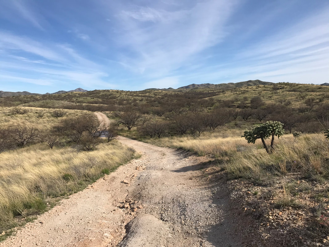 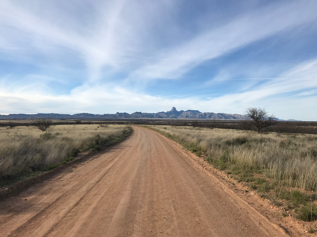
    The bike rested against a mesquite as the Baboquivaris were ripped with cooling slanted light. I setup the Duomid and committed to finishing bed items after dinner. I grabbed my headlamp and food bag before pushing into the bush. I always eat dinner away from camp to mislead mini-bears (rodents, etc.) from seeking crumbs from where I sleep. Chili cheese Fritos crunched into mouthfuls as I downed my cold-rehydrated taco meal. I chased it with chocolate almonds and large gulps of water to lessen my load to Green Valley tomorrow. Now in the thick of night, a spread of starlight dashed overhead while I sat illuminated in a half-circle of my headlamp beam. Coyotes rose in chorus throughout the grasslands smattered around. I cleaned up my dinner, stashed the food away from critters, and walked back enveloped in dark with my headlamp played low. I grabbed my sleeping pad and quilt and returned to the shelter where I squatted and sucked back air repeatedly to inflate my mattress. A few blows in, the sound of a helicopter punctuated the night, loudly. I froze and looked where I estimated the tree-line was in the dark with the inflation valve still in my mouth. The sound of the helicopter increased dramatically. It was flying low, fast, and direct. But I couldn’t see it in the dark. I thought, “Damn, it’s got to be right over me…” A large spotlight flashed from 30 - 40 feet overhead illuminating me and my shelter. I froze as one intense spotlight remained fixed on me and a second moved out concentrically from my exact location to illuminate the surrounding area before squarely returning directly on my body. I dropped my partially inflated mattress and slowly stood up. I raised my hands in the air and realized it was a Border Patrol helicopter. I must have lit up their infrared sensors in the dark, sending them flying across the desert grassland with lights off like Zero Dark Thirty to come to whom they must have thought to be an immigrant with a faint flashlight in the bushes. The ‘copter hovered overhead with the light still on me. Finally, the spotlight was turned off and the helicopter sped away into the darkness. I could hear it flitting nearby and then turning southward again. The night would be punctuated by these air surveillance noises, always with lights off and invisible in the dark. I must have stood there stunned for a few minutes before returning to inflating my now emptied air mattress. I couldn’t find tiredness after the encounter so I took plush time to setup bed, dry out my quilt, repack gear, reorganize where everything was, lube the bike drivetrain, and finally feel it was time to retire. My nighty rhythm-routine is to turn 360 before heading to bed with a headlamp blasting high. Light up the area, feel safe, go to bed. I turned into the surrounding black and 30 yards from me, a blue light lit up at eye level before extinguishing. It had been 35 minutes or so since the helicopter. This was something different. I turned my headlamp off. Light flared again but several feet further from the original. I could see a face lit up. Light turned off. I peered intently. A minute passed, the light lit up again, and unmistakably, a face was illuminated by what seemed a phone screen before turning off. I turned on my headlamp and the phone screen went dark. I speculated that someone was walking through the grass and trees in the dark, using a phone screen as minute illumination for moments before keeping the light off - maybe a an immigrant? I reminded myself there was a humanitarian water station several miles ahead that I was going to use for hydration tomorrow per the maps. Possibly, whoever was out there near me was needing the same. I decided to follow my general rule for camping along the borderlands: nobody wants to be found unless they need help. I shown my light over my camp and loudly made myself present as someone camping, caught up in my own intentions. The Duomid closed up, I hustled into my bivy wrapping my warm quilt around me before scanning everything I had brought in. I quickly sent a few messages via text using my Garmin inReach Mini to Janna and parents about the helicopter and those nearby. I lay down and listened intently in the pressing dark. A helicopter buzzed in the near-distance, its shrill igniting coyote wails from the grassland around me on all sides. Then hush and silence. My heart slowed from its rise after cumulative events. I slept. A couples of hours passed. From a reverie of awareness, my mind grasped a noise approaching, sounding vehicular. My eyes opened as two SUVs slammed into the spot next to my shelter, harshly braking and with sirens flashing. I froze as spotlights lit up the Duomid. The sound of footsteps hustling. “Is there anyone in there?” a commanding voice projected. “Sir, yes I am in here,” I groggily but firmly spoke. “Are you Forrest?” “Holy shit. Border Patrol sure does keep a close a close eye on everyone in their jurisdiction. How did they know who I was?” I thought only to myself as adrenaline now pumped me wide awake. “Please, exit the tent sir.” I grappled with the zipper overhead before half-rising to reach out and unzip the Duomid. “I’m unzipping my shelter,” I spoke out loud. I was unnerved but resolute to communicate my actions to diffuse whatever situation was happening. The flap pulled back and an agent stood flashing a bright beam in and around the inside of the shelter. I put on my sandals to step in the cold night. I followed the agent over to another group of three. They stared at me and began asking questions about a filed “missing person report.” I realized there must be someone else out here missing and they were wondering if I had seen them. Nope. They asked if I was lost. I responded definitely not. They asked me how I got here. I said by bike and they shined spotlights until an agent noticed the Karate Monkey leaning against the tree. Why was I camping here and had I gotten turned around because they could see tread marks going the other way? I said, “This is site 18 and I checked out the others before coming back and choosing this one.” The lead agent then asked if I had a “girlfriend, fiancée, or wife” who might have gotten the impression something was wrong and that I somehow needed help. My mind flashed back to the Garmin and I realized that the last message I had sent was about the helicopter hovering overhead and the face in the grass. SHIT. Janna must have sent something back but it was delayed because it was being sent by satellite. I apologized profusely to the agents saying that I was (1) definitely not lost, (2) safe, and (3) there must have been some miscommunication with my wife. With that, everyone loosened up. The head agent pulled out a cigarette and lit it up, looking at me and saying, “Listen, you gotta let your girl know where you are man. Everyone thinks something is wrong man! We’re looking for you, the FBI is looking for you, even Trump is worried about you man! She got the whole place lit up looking for you! Listen…even when I’m in the dirtiest, just back-hole bar drinking in Tucson, my girl will find me no matter what. Make it easy and let her know where you are.” With that, they asked again, what I was doing out here. I gestured to the bike. The four exchanged glances and stiffened up their talk again. “So you have no car…” “You’re out here alone. Here, right by the border. In the dark. There’s no way I would camp out here by myself…” “Make sure to lock up your shit. Keep your water and food close. This is a high trafficking corridor and there’s always people moving through here at night. They’ll take your stuff if you leave it out…” “Wait, you biked here?” This was followed by incredulous glances back and forth that conveyed one unspoken agreement: this was a terrible idea to them. Stiffer advice was given before they asked where I was heading tomorrow. When they learned Green Valley, they seemed to relax again. “So you’re going to jump on the paved highway out that way and take it in-” “Actually,” I interjected, “I’m taking Poso Nuevo Ranch Road up over the mountains.” “Wait.” They all stiffened up again. “So you’re just going to ride your bike…” ::incredulous glances back and forth:: “…all off-road on that rough and abandoned route over the mountains, all tomorrow?” It seemed clear this was a remarkably poor idea to them. This was followed by some considerate questions about whether I had enough food and water. Despite their disbelief that I was out here alone riding a bicycle through the backcountry, crossing mountains through the borderlands, they wanted to make sure I was alright. They insisted I take some water (which I chugged cause I’m not turning down water in a sparse area). They offered to drive me out until I got reception to call Janna. I told them I had no idea how far out I would need to ride for that. One of the agents took out his phone and said I could use it to call her. On the other end, Janna’s caring and desperate voice indicated her strong love and worry that something had happened to me when I didn’t follow-up. The situation assessed, they told me to be safe. Cars backed up. The bright lights receded and darkness enveloped me once more. I was shivering now from standing in 40 degree temps with no jacket so I climbed back into the Duomid, zipped it up, and found myself without-weary for sleep. Regardless, I bundled up in the quilt and wrestled with the night to shut my eyes and dream. What a crazy evening. 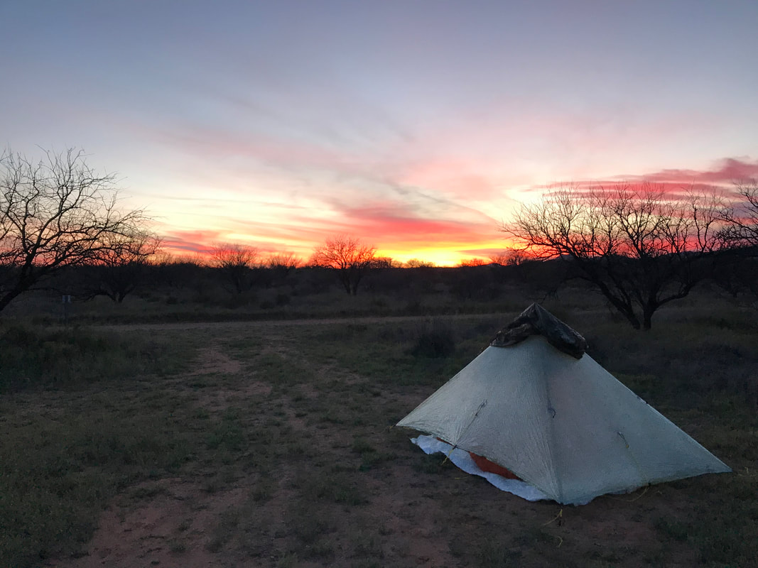 |