1. Route Stats
Location |
Days to Ride |
Length |
Elevation Gain |
|
3-4 Days |
129.4 Miles |
10,429 Feet |
Physical Difficulty* |
Technical Difficulty* |
Seasons |
Tire Size |
6/10 |
4.5/10 |
Best: Mid-Jan. - Early April Doable: Mid-Nov.-Early Jan. |
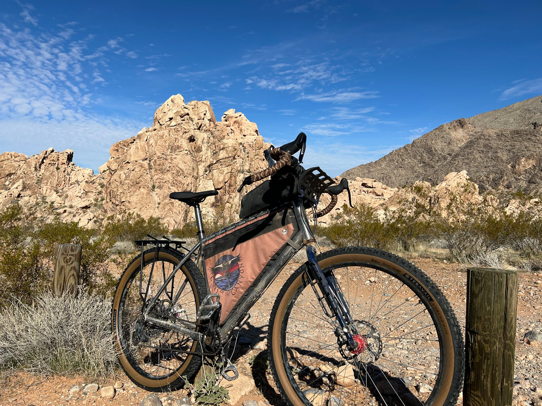
Recommended: 2.4"-2.6"; Minimum Tire Size: 2.3" |
*Based on Bikepacking Roots Route Rating Scale (More info found under "Route Difficulty, Surface Conditions, and Direction to Ride"
2. Gold to Grand Loop Overview
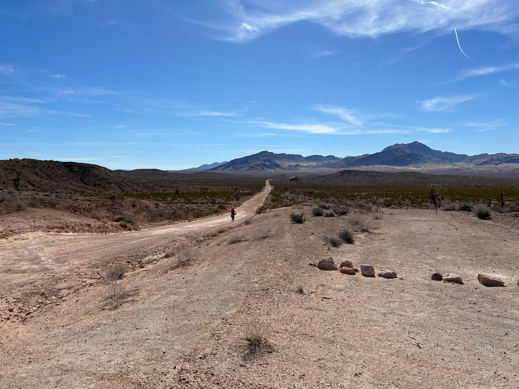
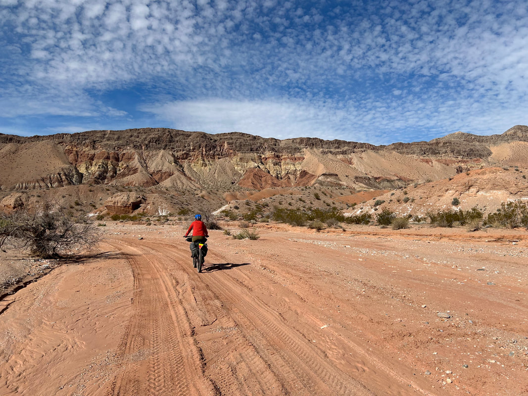
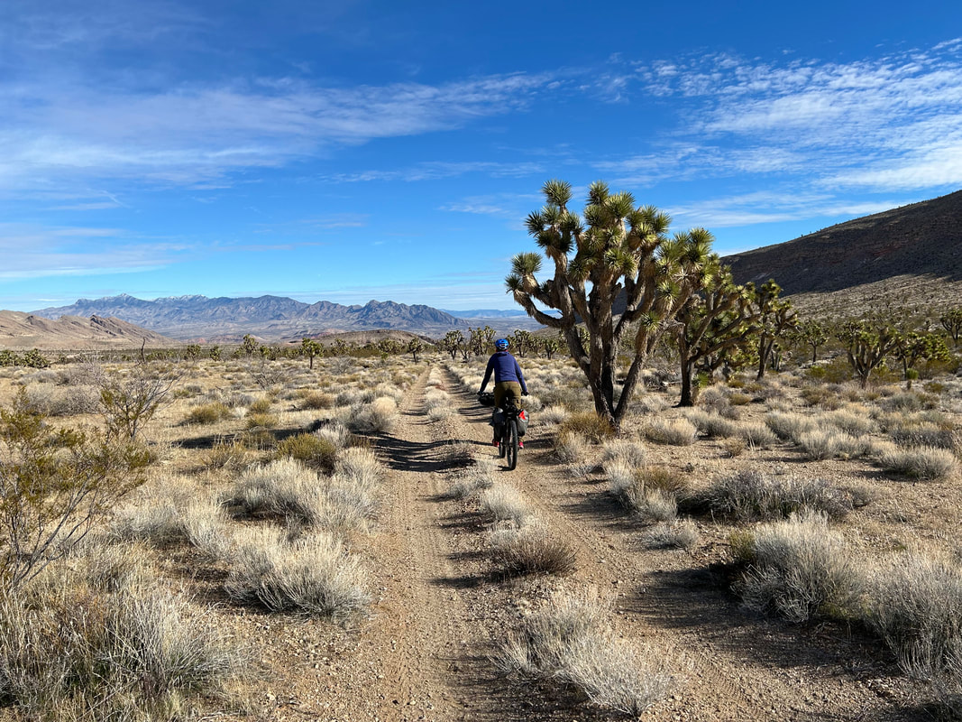
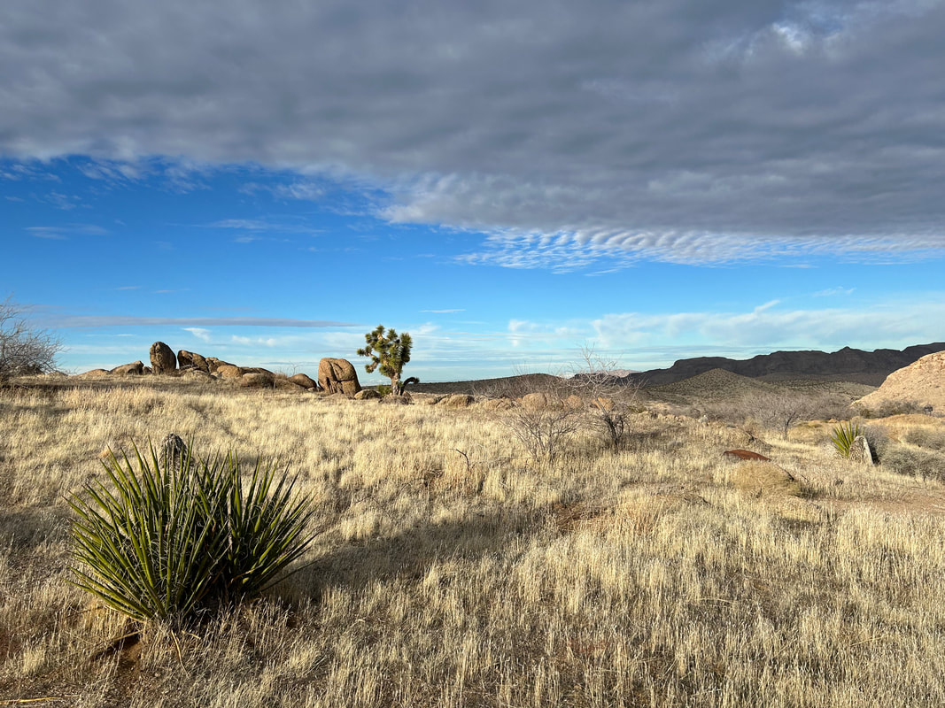
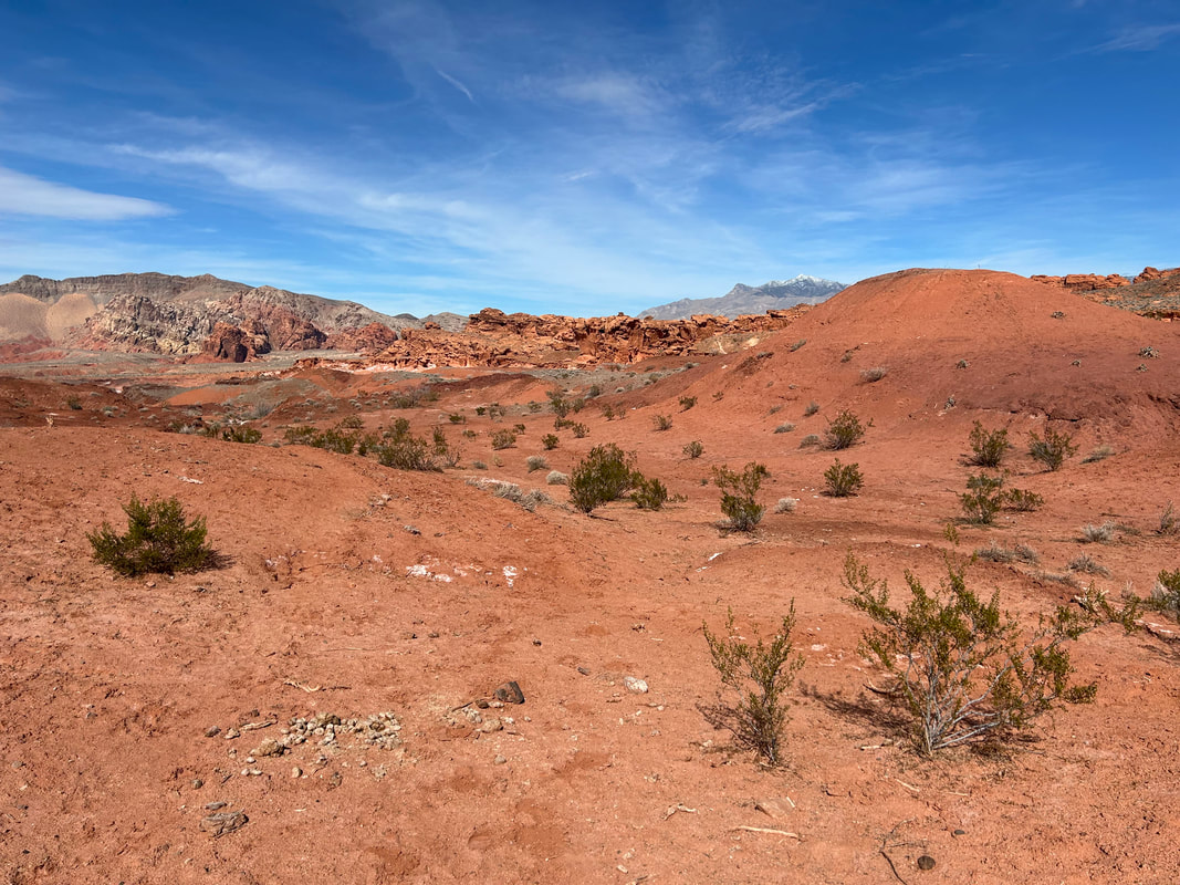
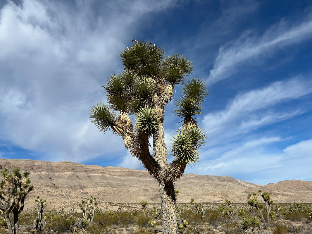
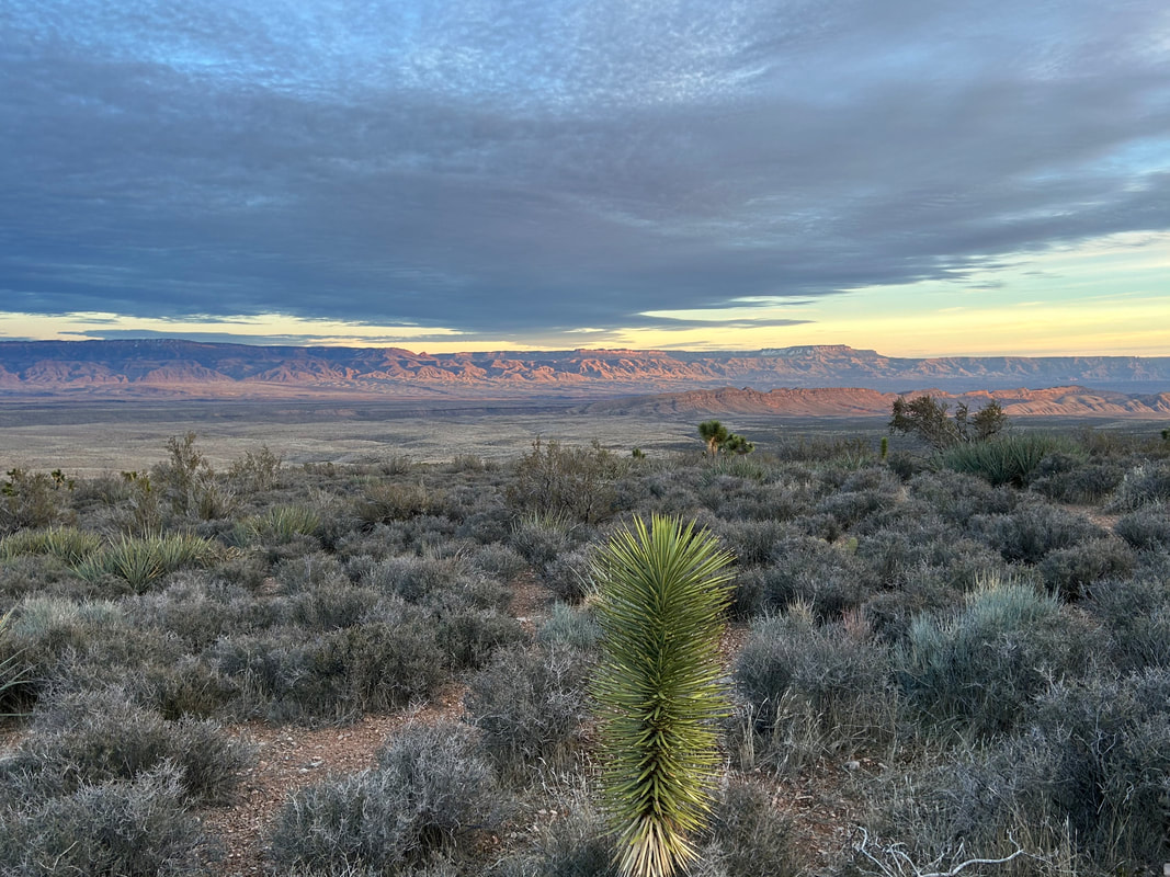
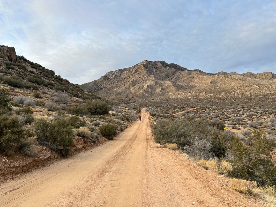
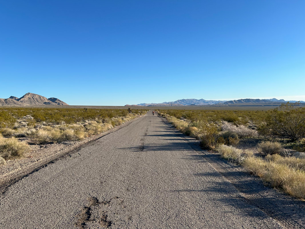
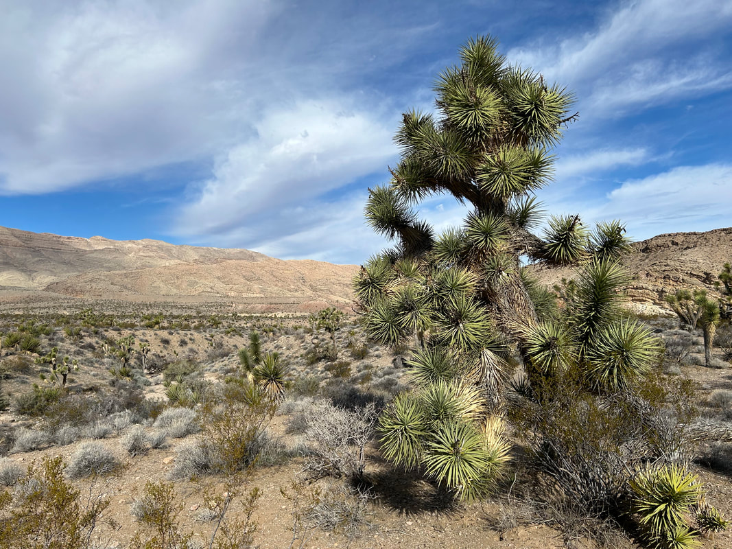
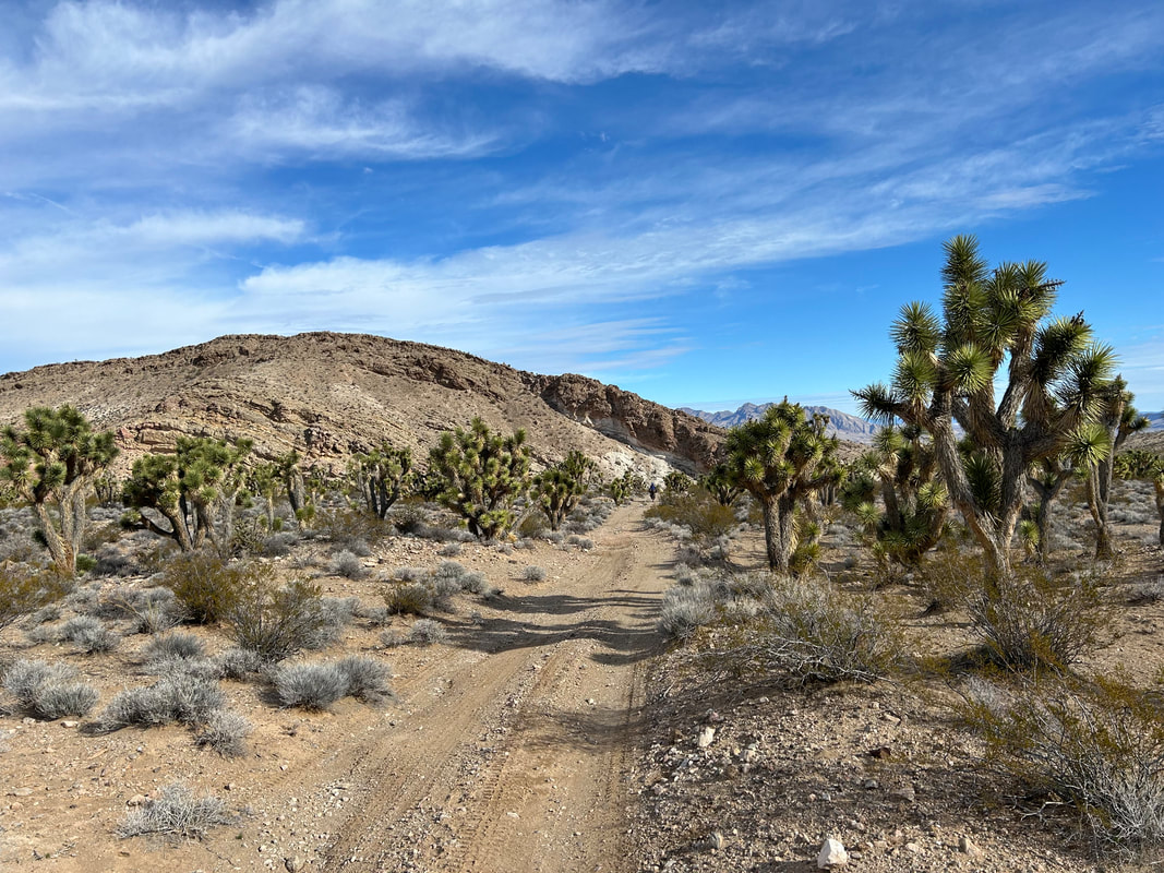
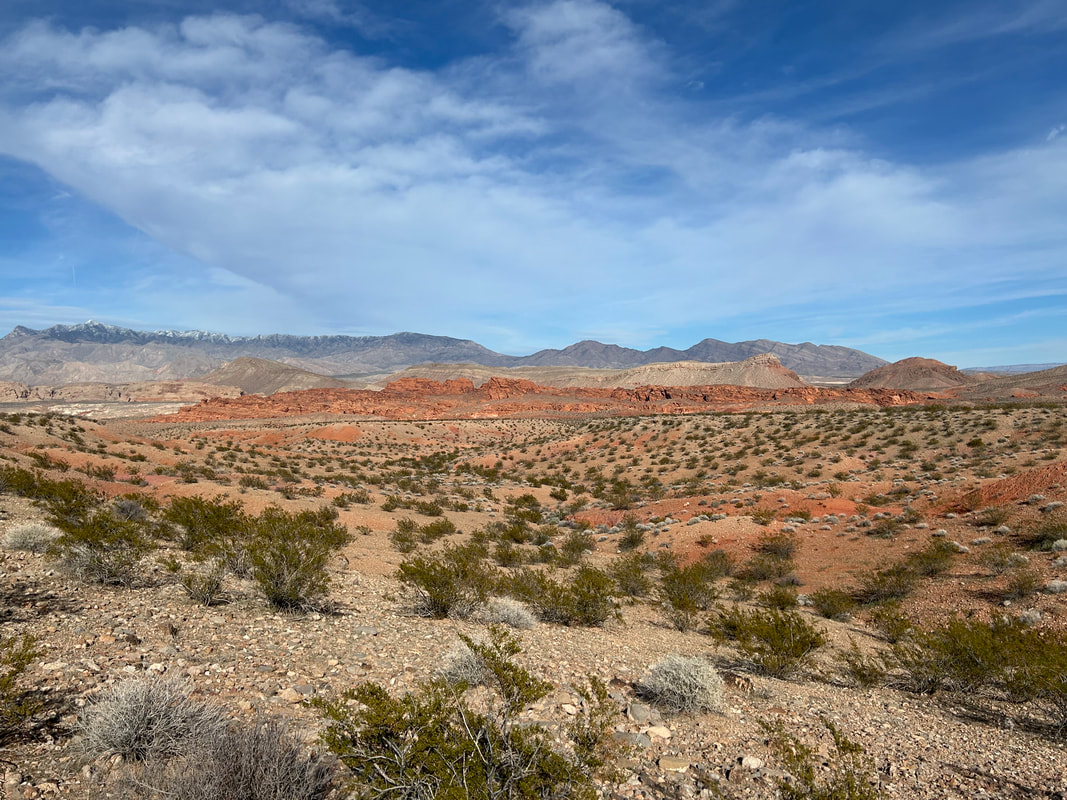
Gold to Grand Loop is a bikepacking route that travels through Gold Butte and Grand Canyon-Parashant National Monuments straddling the Nevada/Arizona border. It does a nearly full circumference ride of Gold Butte NM taking in opportunities for side hikes at Little Finland and Seven Keyholes Slot Canyon as well as cultural tours of the old Gold Butte Townsite. Take time to enjoy the dense Joshua Trees and exposed, vibrantly colorful geological formations along the route. From here, it's a big descent into the remote and little visited Grand Canyon-Parashant NM. You'll look at the distant Grand Wash Cliffs that officially mark the end of the Grand Canyon as the stratified layers dive into the Mojave Desert at Lake Mead. Stop at ecologically rich Pakoon Springs before a climb up and along the base of the Virgin Mountains. Then, climb up and over Lime Kiln Pass where an exhilarating descent carries you to the high desert town of Mesquite, NV. Eat some tacos and then finish the ride on the semi-paved Gold Butte Backcountry Byway that traces the banks of the Virgin River before ascending back up to Gold Butte NM and finishing the route at iconic Whitney Pocket.
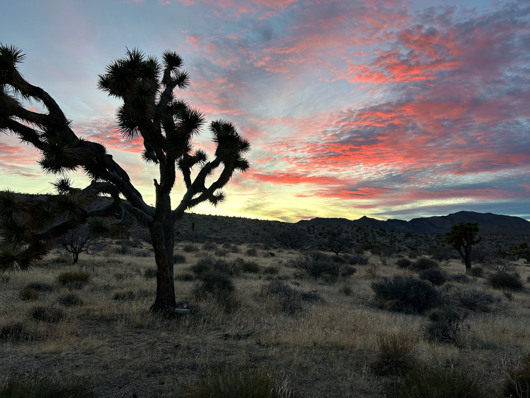
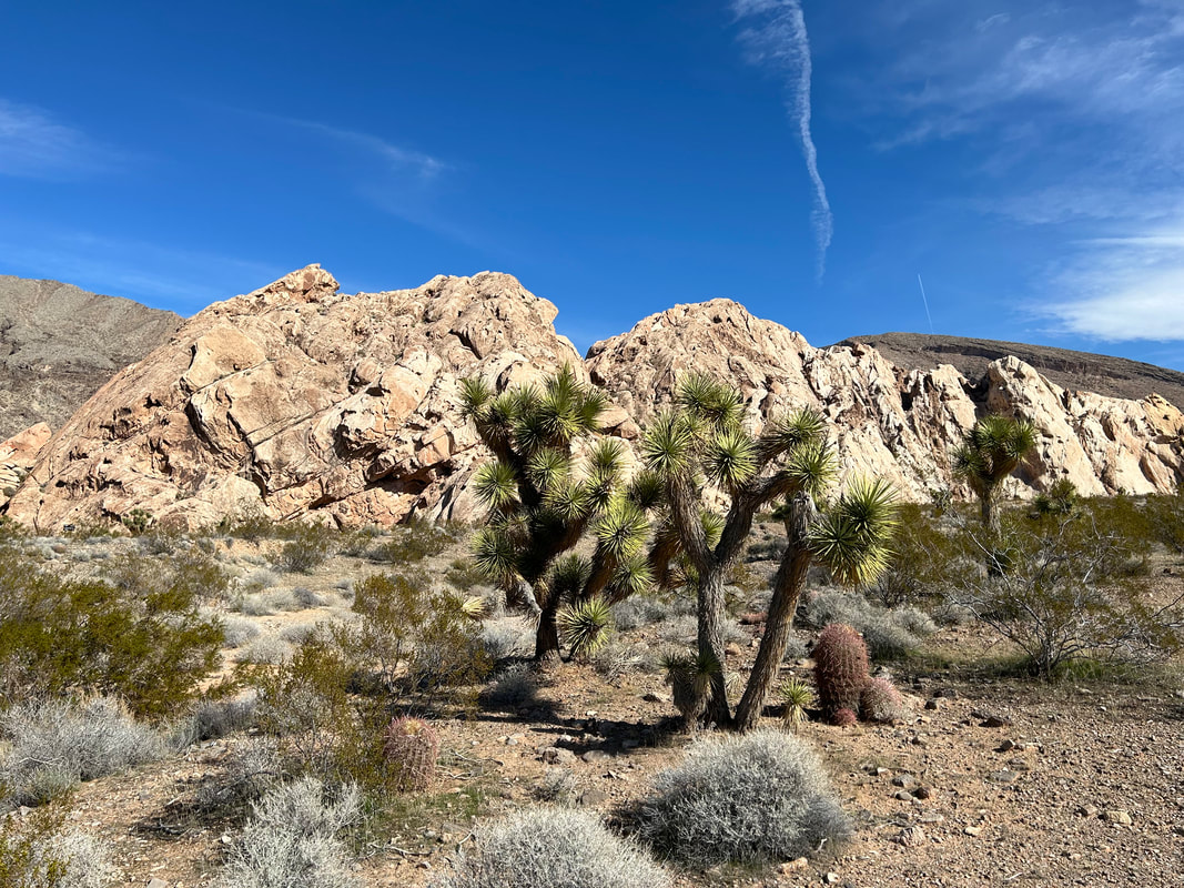
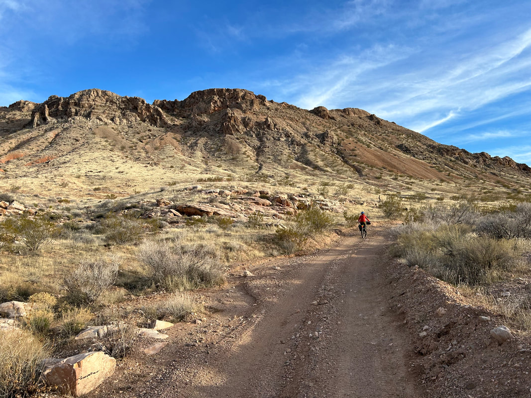
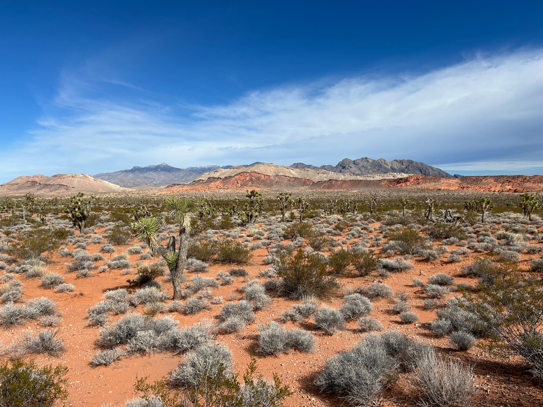
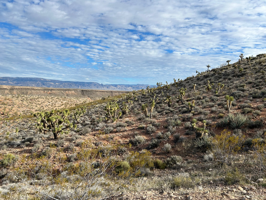
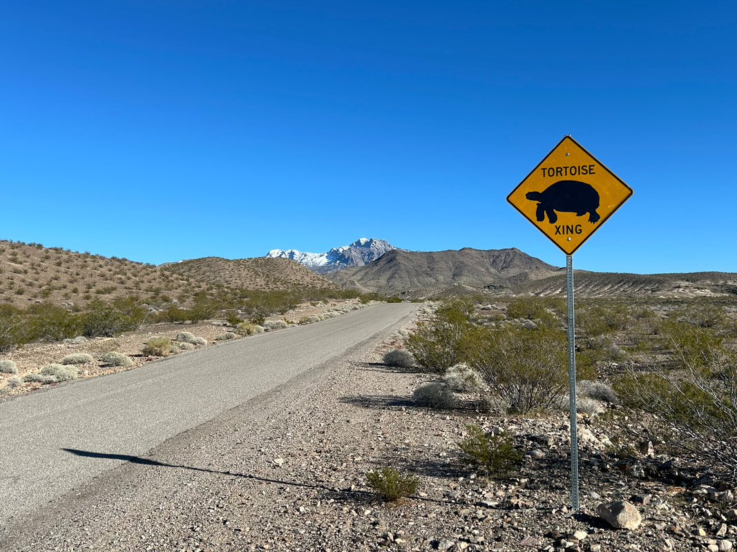
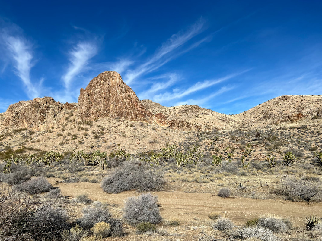
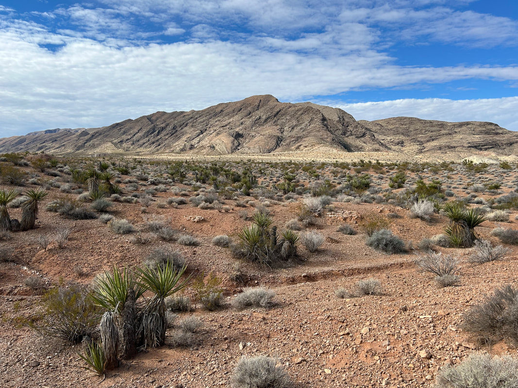
Gold to Grand Loop sticks to excellent backcountry dirt roads and features evenly-spaced reliable water sources. It travels through environmentally important habitat for the Mojave desert tortoise but mule deer and big horn sheep are out here too. Junipers and Joshua trees intermix along with creosote and yucca along terrain that ranges from 1400 to 4600 feet. This is a great 3-4 day winter bikepacking trip close to Las Vegas and through the heart of where the Colorado Plateau and Mojave Desert meet.
Gold to Grand Loop sticks to excellent backcountry dirt roads and features evenly-spaced reliable water sources. It travels through environmentally important habitat for the Mojave desert tortoise but mule deer and big horn sheep are out here too. Junipers and Joshua trees intermix along with creosote and yucca along terrain that ranges from 1400 to 4600 feet. This is a great 3-4 day winter bikepacking trip close to Las Vegas and through the heart of where the Colorado Plateau and Mojave Desert meet.
Blog Journal + Daily Photos of the Route
3. Map and GPX
Surface Color Guide
- Red = Dirt Surface (4WD, Smooth to Rough, Wide Roads to Doubletrack)
- Brown = Primitive Dirt Surface (Particularly Rocky, Rutted, and Eroded)
- Purple = Semi-Paved Road (2WD, Interspersed Pavement and Dirt, Questionable asphalt where the dirt shoulders are smoother than the pavement)
- Blue = Vehicular Pavement
- Green = Paved Bike Path
Route Guide Sections
- Route Stats
- Route Overview
- Map and GPX
- Alerts and Closures
- Route Design Philosophy and Vision
- Route Description
- Route Difficulty, Surface Conditions, and Direction to Ride
- When to Ride (Temperature + Climate)
- Ecoregions and Landscape
- The Bundys and Cows
- Where Bikes Are Allowed and Not Allowed
- Native Nations and This Land
- Leave No Trace and Bikepacking Ethics
- Water Sources
- Camping
- Food and Resupplying
- Sample Route Itinerary
- Fees and Permits
- Getting to the Start
- Parking
- Additional Important Information
- Acknowledgments
- Social Media and Route Updates
4. Alerts and Closures
This is desert country, which means the landscape is likely to experience oppressing heat during the warmer months. However, snow, monsoon storms, and flash floods are also possible on the route given the proper season and conditions. BEFORE you ride, make sure you CHECK the link below to see if important alerts or closures will affect your riding of the established route. Be prepared to use maps to find alternates should a sudden change in route conditions occur.
Good physical maps for the region can be accessed or purchased below:
- Gold Butte National Monument - Bureau of Land Management
- Grand Canyon-Parashant National Monument - Alerts
Good physical maps for the region can be accessed or purchased below:
5. Route Design Philosophy and Vision
The goals for the route are to:
When I was designing this route, it was really the water that proved the driving force behind which roads to take. Over 90% of springs have dried up in Gold Butte since the early 1900s. This area is also remote and resupplying options few. When looking at maps of the area, I realized a jaunt over to the Parashant from Gold Butte would make a nice loop and bring opportunities for water at Aravada and Pakoon Springs. The Arizona Strip always beckons for adventure, so I turned my eye to how I could incorporate more riding there while keeping the route to a suitable 3-day trip. The resulting route travels through both National Monuments, provides a ride over the Virgin Mountains, and gives a welcome resupply option at Mesquite, NV.
- Do a circumference ride of Gold Butte National Monument.
- Stick to well-maintained roads that also travel by the best sights of Gold Butte.
- Connect a series of decent backcountry water sources that make a multi-day trip tenable.
- Hit up ecologically-interesting Pakoon Springs in Grand-Canyon Parashant.
When I was designing this route, it was really the water that proved the driving force behind which roads to take. Over 90% of springs have dried up in Gold Butte since the early 1900s. This area is also remote and resupplying options few. When looking at maps of the area, I realized a jaunt over to the Parashant from Gold Butte would make a nice loop and bring opportunities for water at Aravada and Pakoon Springs. The Arizona Strip always beckons for adventure, so I turned my eye to how I could incorporate more riding there while keeping the route to a suitable 3-day trip. The resulting route travels through both National Monuments, provides a ride over the Virgin Mountains, and gives a welcome resupply option at Mesquite, NV.
6. Route Description
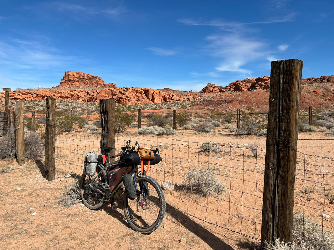
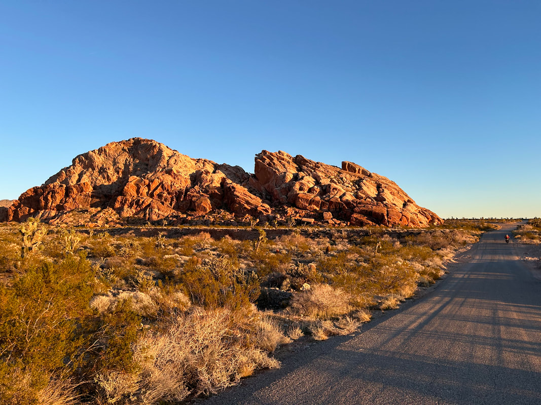
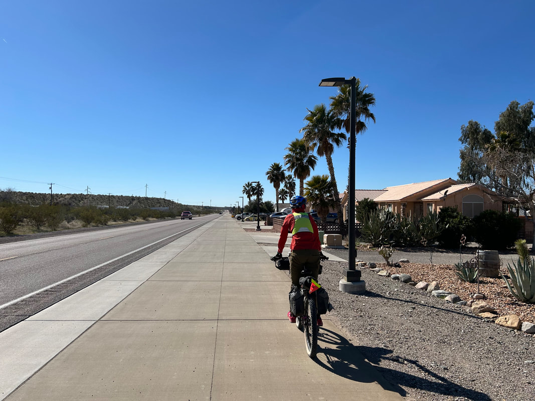
Start your ride from the large dirt parking lot at Whitney Pocket. In fact, camp here the night before and use the time to hike around and check out the geologically iconic butte formations in the area. There are copious Joshua trees and historical sites, including an old CCC dam. Leave your car parked tucked away in a corner of the parking area and push off for an immediate descent into Gold Butte National Monument on dirt.
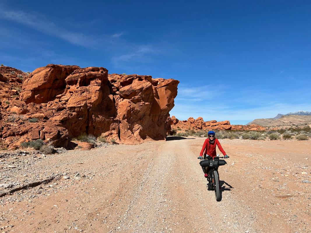
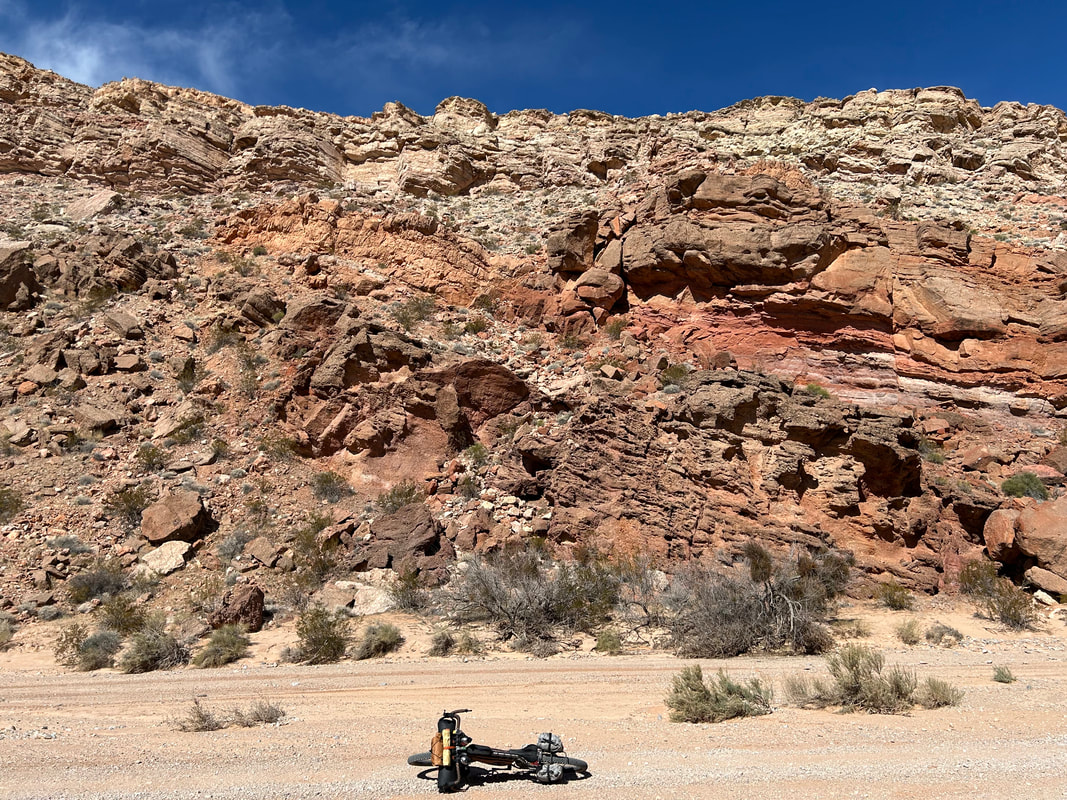
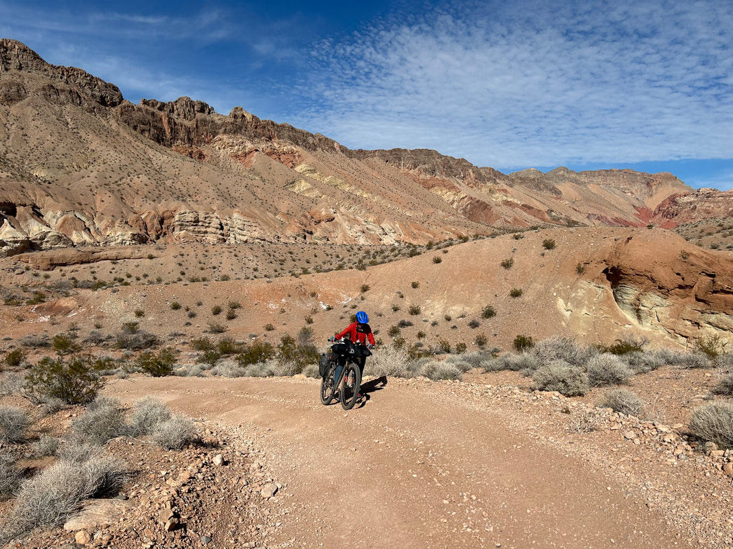
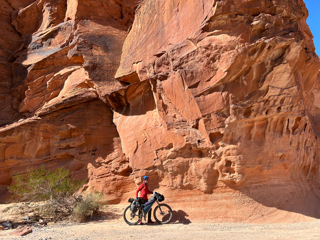
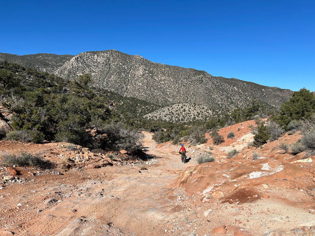
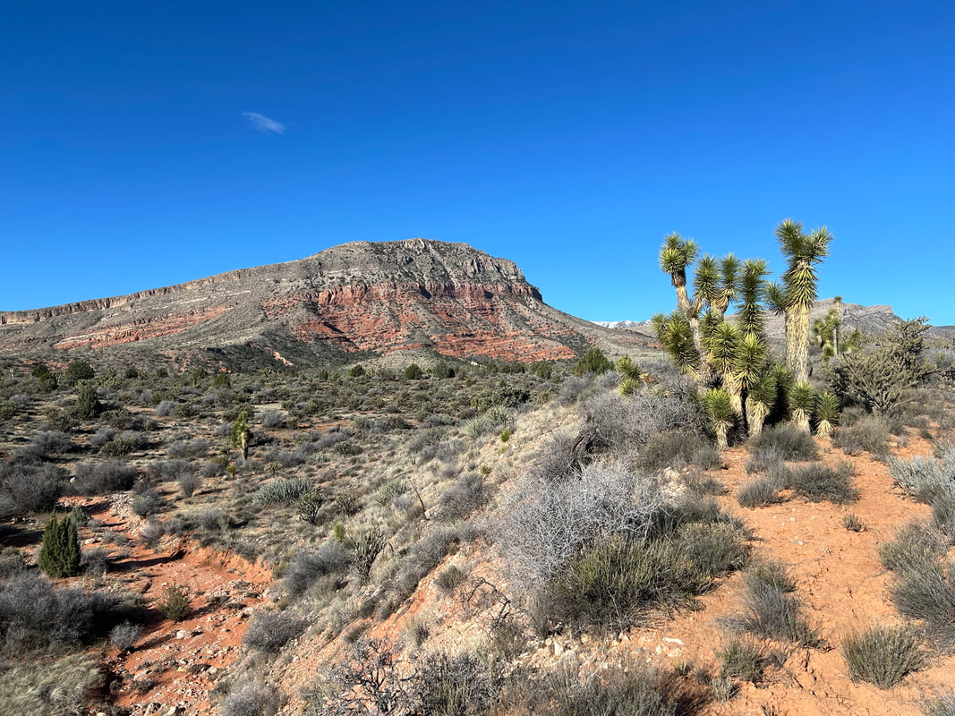
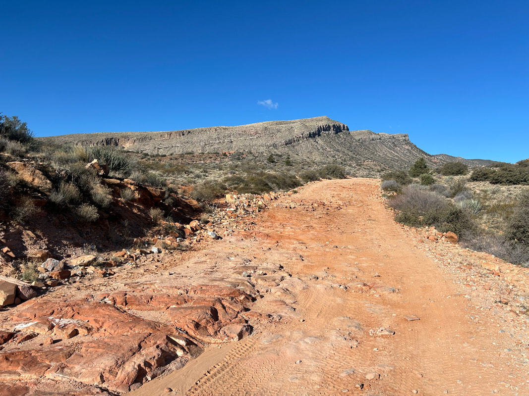
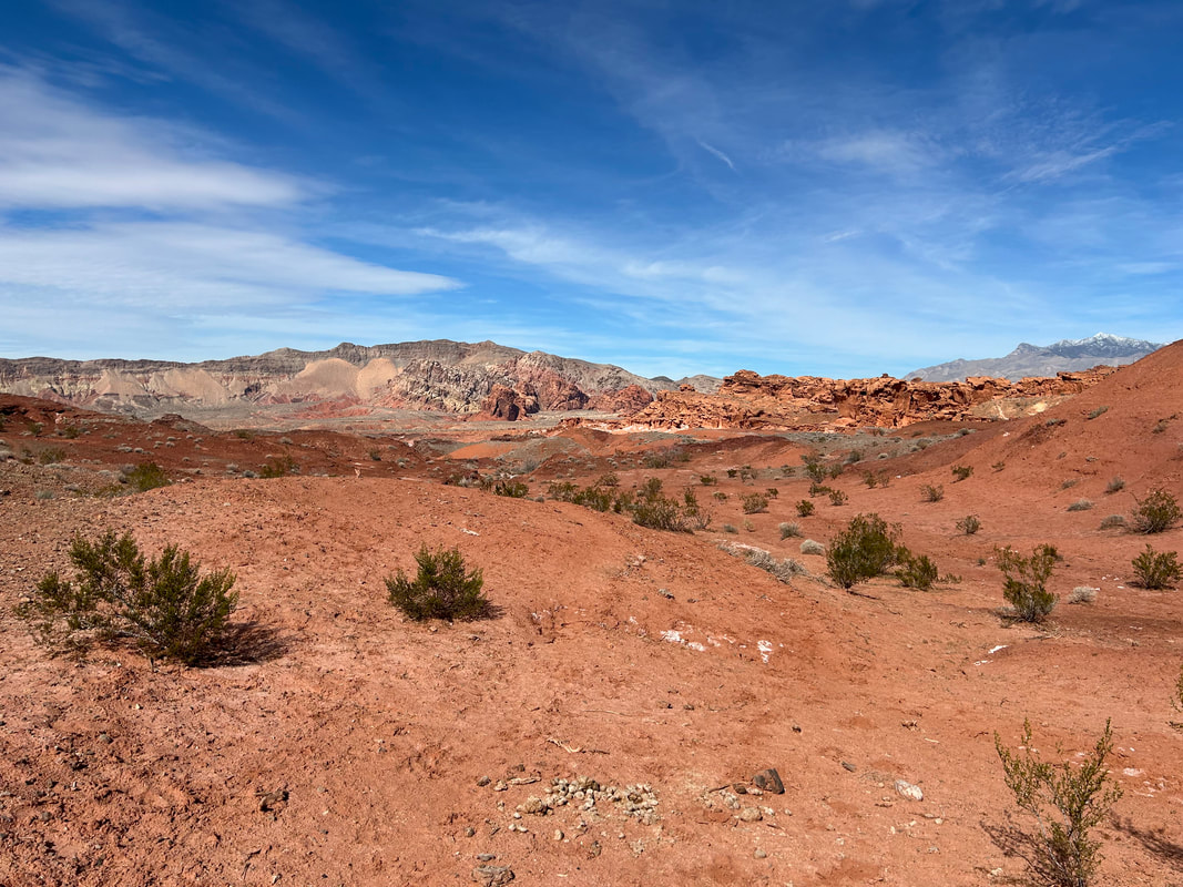
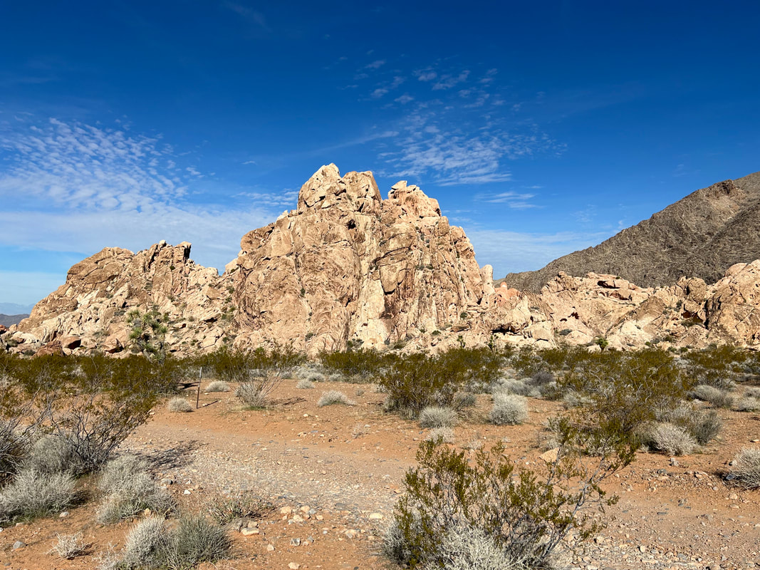
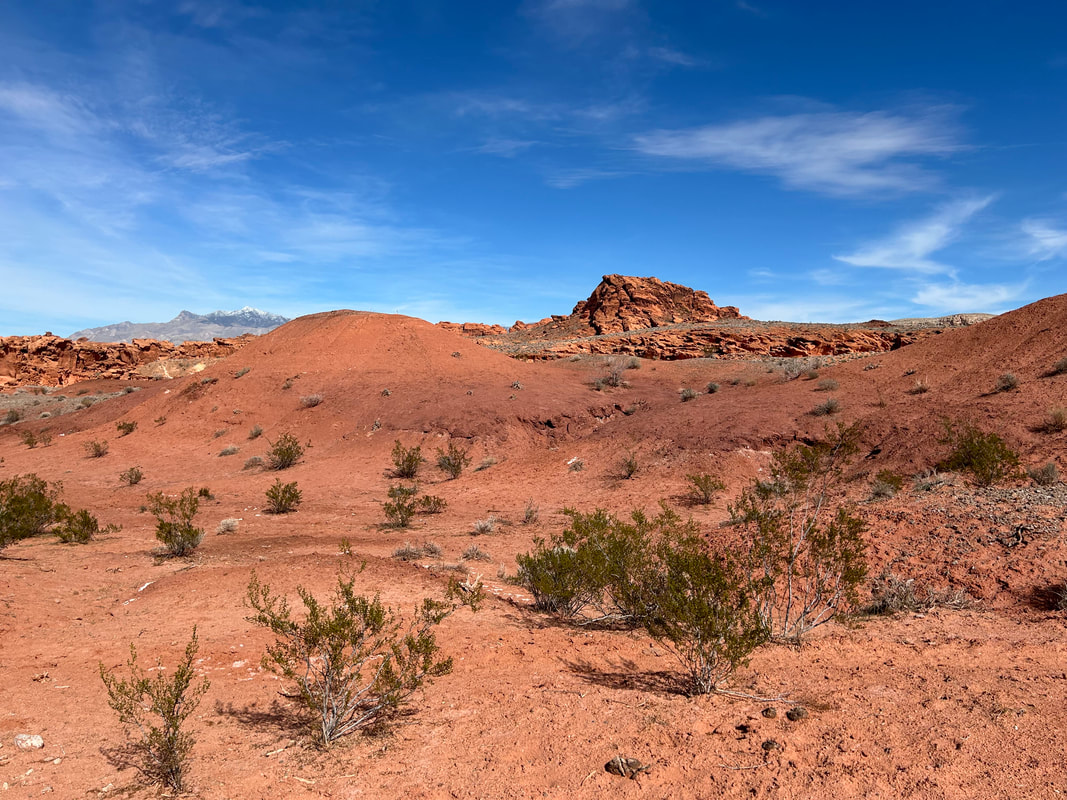
The land gives way to layers of stunning colorful rock. Make sure to stop and look behind you too to take it all in. This portion of the route follows the Gold Butte Backcountry Byway so expect some ATVs. Make your way to the Devil's Throat and walk the perimeter of the large sinkhole. Jump back on the bike and head west on Mud Wash Road. It undulates towards Mud Wash proper where you join the gravel streambed and course through a stunning bottleneck of adjoining buttes. The red rock formations get prominent and many feature petroglyphs. Continue through layers of Earth that box up around you until you see the rise of Bitter Ridge and its colorful cliffs ahead. Mud Wash Road begins a hairpin turn along the base of the cliffs. For an optional side-hike, take the turn to Little Finland for a slew of interesting red sandstone fins splayed about a large butte outcropping.
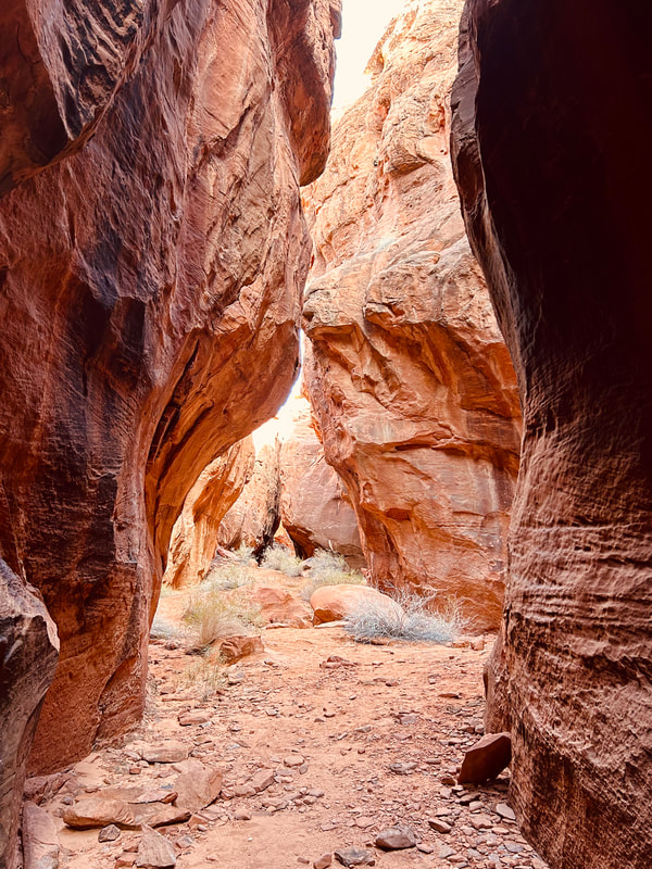
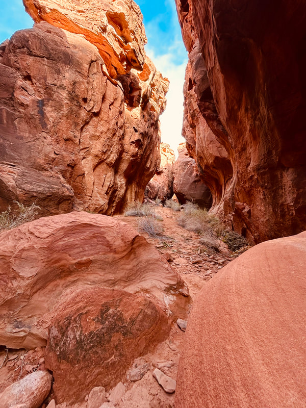
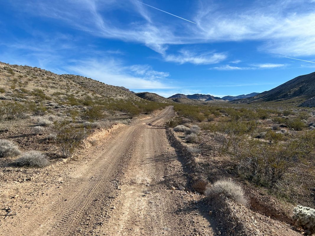
On the main route, head south doing a gradual ascent on Narrows Road that gains a hillside to provide some sweeping views. The road is in good shape and eventually takes you to the turnoff for Seven Keyholes Slot Canyon. Take the side-ride up a ridge and over to the day-use parking area. Leave your bike and take the short hike into the valley. The trailhead takes a sharp right into a short slot canyon that provides shade, beauty, and vegetation. The whole area has petroglyphs, so keep an eye open. Hike back to your bike and continue south on Red Bluff Spring Road. This is a long and gradual climb to Gold Butte Townsite, but the road is in good shape and the grades not too steep. Plus, abundant Joshua trees and mountains make the landscape beautiful.
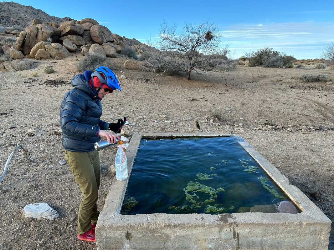
Arrive at historic Gold Butte Townsite where a now-abandoned city of a couple thousand people once lived at the height of its gold rush. The Townsite sits at the base of the Gold Butte mountain, proper. Now all that's left are old mining equipment and a cemetery. Make sure to grab some water from the cement trough at Granite Spring if the recent precipitation has been good (it might be dry otherwise). Gain the last climb on the pass and stare down Horse Creek Wash to the distant basins of Greasewood and Wechech punctuated by the Mud Hills. The Joshua trees will build up quickly into a dense canopy you'll bisect on a descent north through Paradise Valley. Take the turn onto Horse Spring Road for a ride through even denser Joshua tree groves as Tramp Ridge rises dramatically to your left. The doubletrack decays a bit before turning into a wash near Horse Spring. Get a good refill here as this is a quality source. Then, it's back towards Gold Butte Road on some chunky/primitive but short-lived doubletrack across desert scrub.
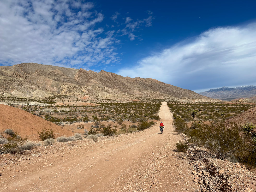
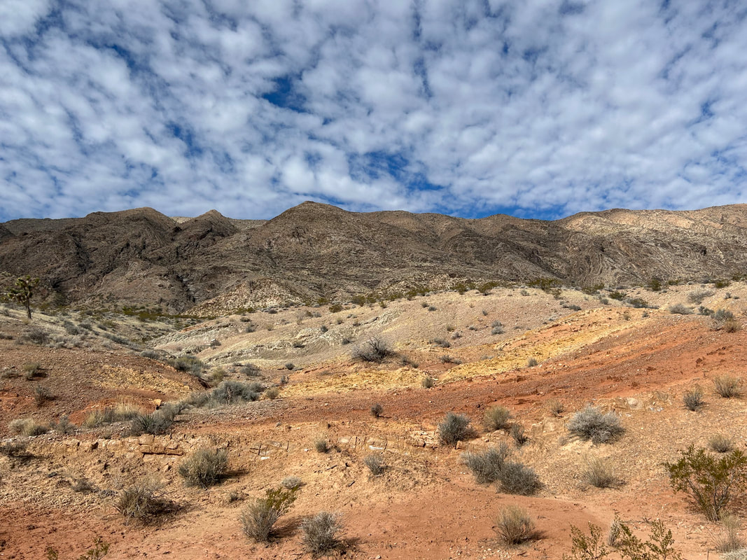
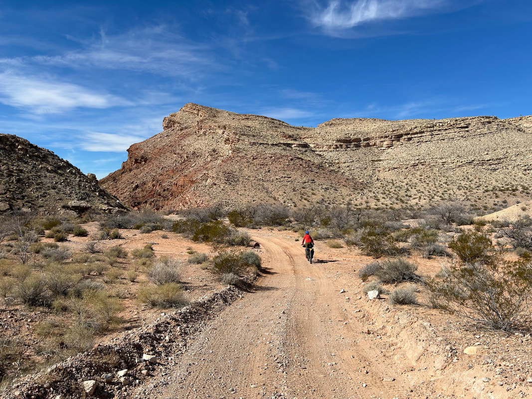
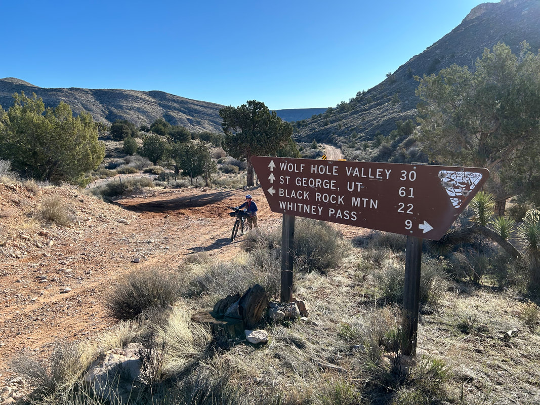
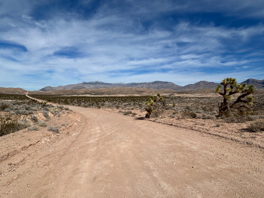
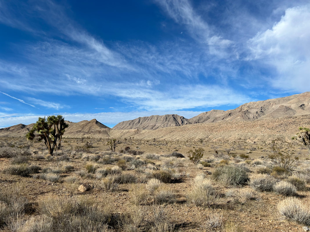
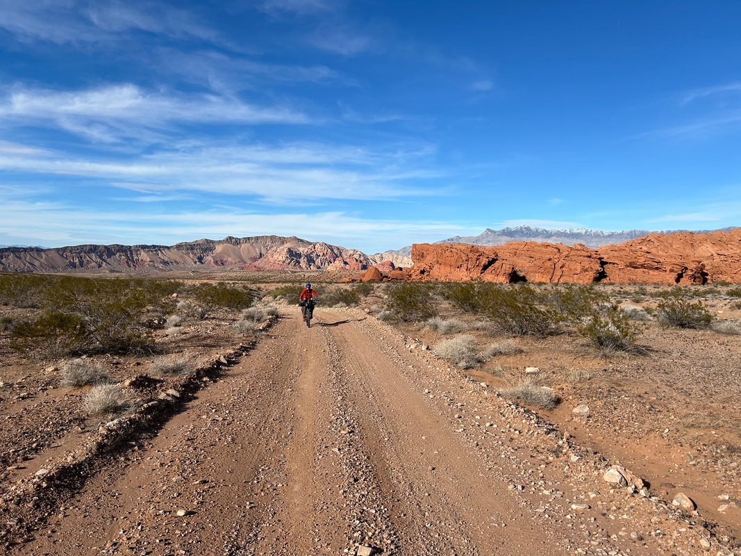
The rest of the ride down Gold Butte Road is pure bliss as parallel Tramp Ridge shoots up gorgeous layers of rock and the colorful pigments leach and coagulate in interesting folds and smears on the landscape around you. Arrive at St. Thomas Gap where a right begins to carry you away from Gold Butte. Make sure you're prepared for the next section and have plenty of water: it's incredibly remote and little-visited. Continue east on Grand Wash Road that descends several thousand feet. Cross into Arizona and into the Grand Canyon-Parashant National Monument. It's beautiful land out here and the distant walls of rock visible many miles away are the Grand Wash Cliffs. These are the gatekeepers for the end of the Grand Canyon; all that stratified rock will plunge into Lake Mead amongst the Mojave Desert officiating the terminus of Grand Canyon country. If you keep going on this road, you can end up descending to Lake Mead. Instead, you'll descend down the Black Wash lower and lower to 1800 feet before a turn northeast. Grand-Canyon Parashant can be utter glory, but the middle of its stomach can be deadfully hot - I wouldn't recommend riding past March in this area all low and buttressed up by rock wall radiating heat.
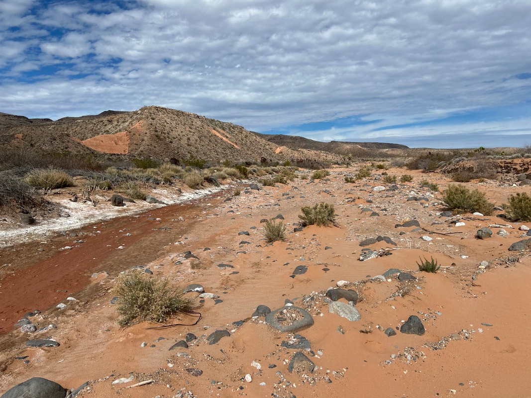
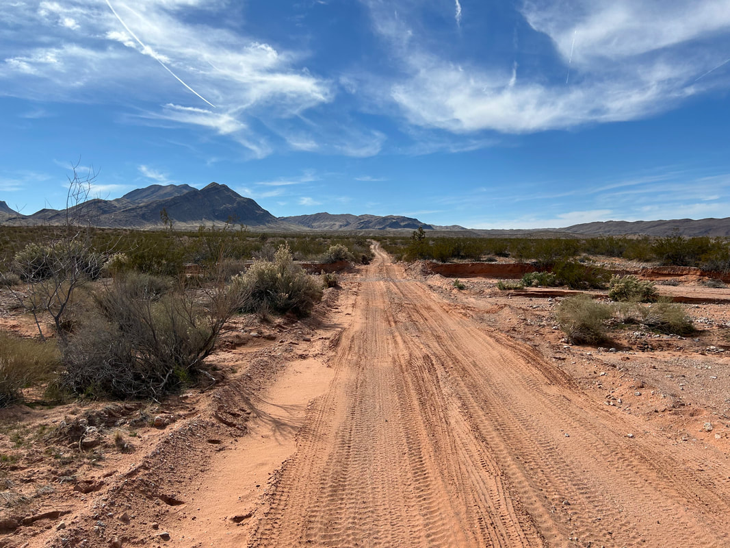
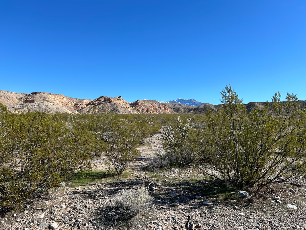
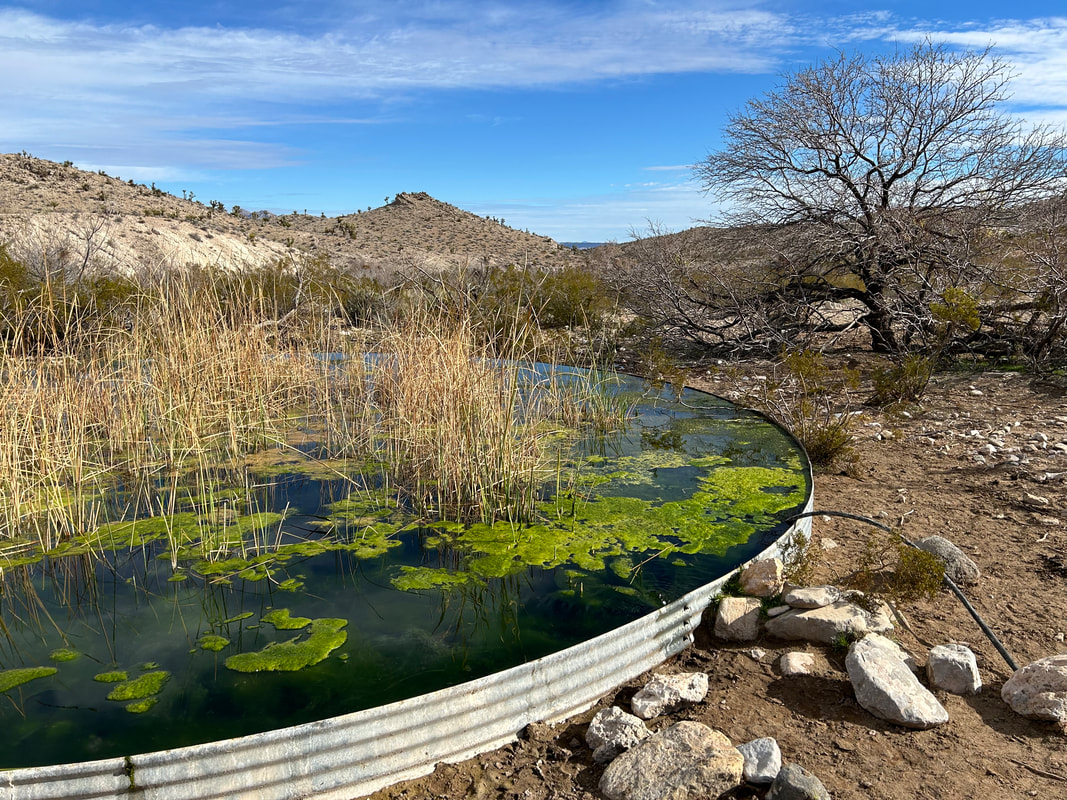
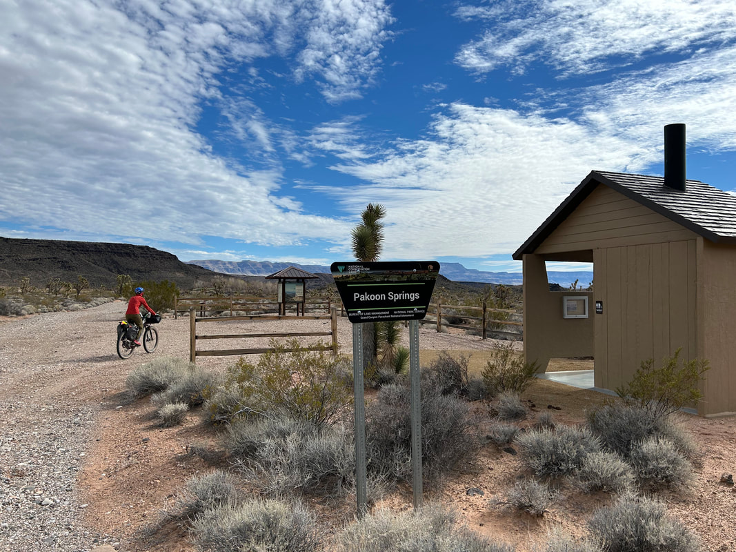
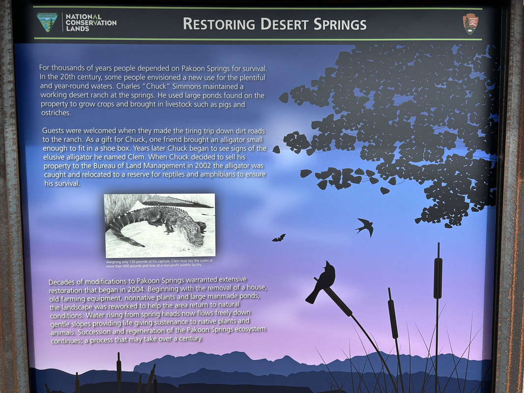
Carry on northeast up Cottonwood Wash on some great grade of road that weaves in and out of washes and past rock formations. You'll eventually arrive at Pakoon Springs. This is an ecologically important area for endangered relict leopard frogs. Until 2002, an alligator lived in the springs (introduced mid-century by a rancher) before being removed by the NPS. Pakoon Springs is being rehabilitated back to its natural beauty. You can get water here but it's not the best; the area is brushy and you must take care not to trample the wetlands for the leopard frogs. There are a few pools of water you can draw marshy water from if you look carefully. Past Pakoon Springs, serious climbing is required. Enjoy the views out towards Cottonwood Ridge in the east and the Cockscomb in the west. The climb continues steeply up to Aravada Springs near Whitney Pass.
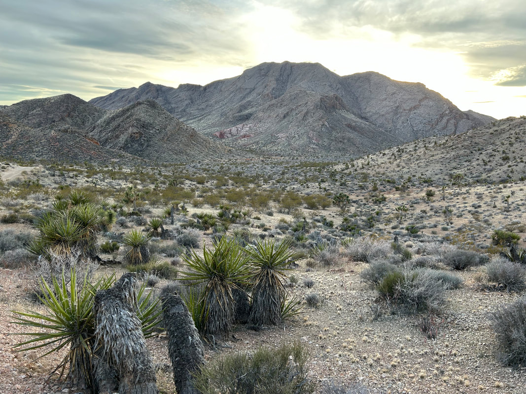
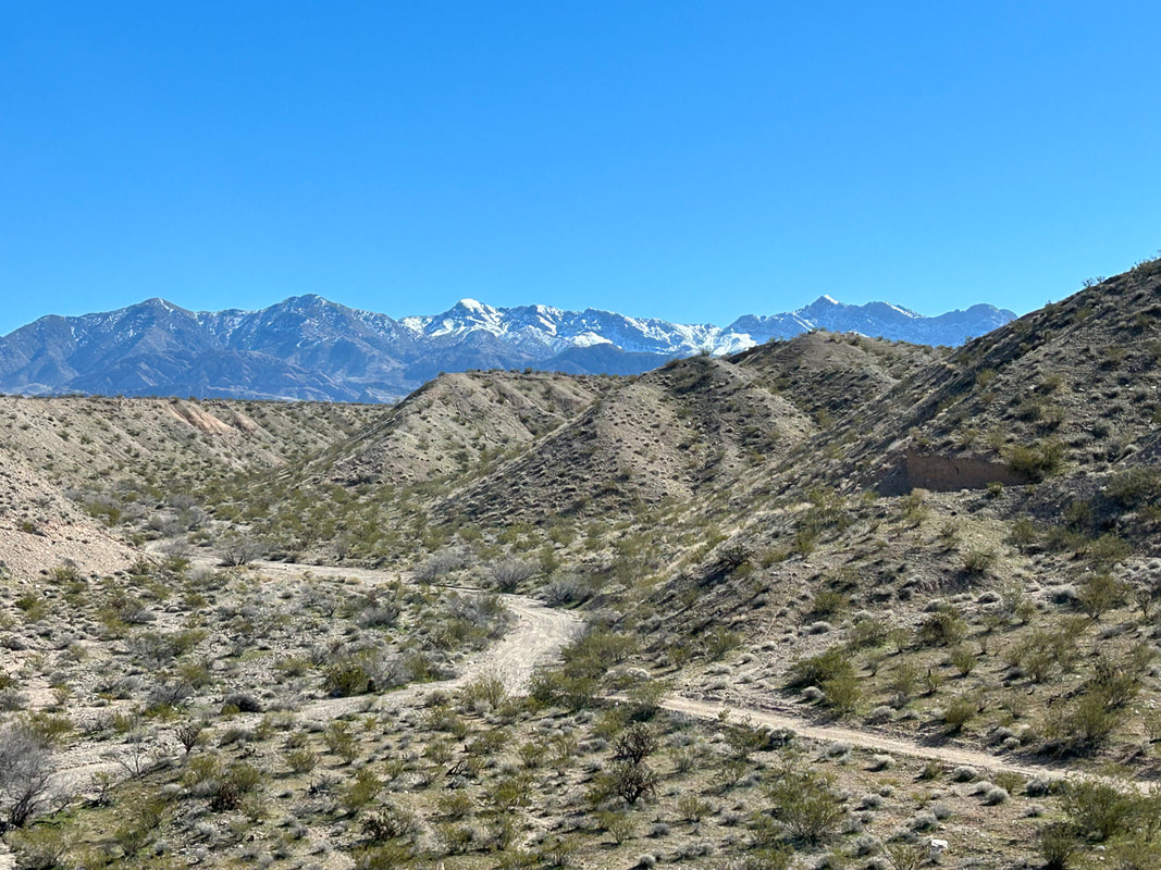
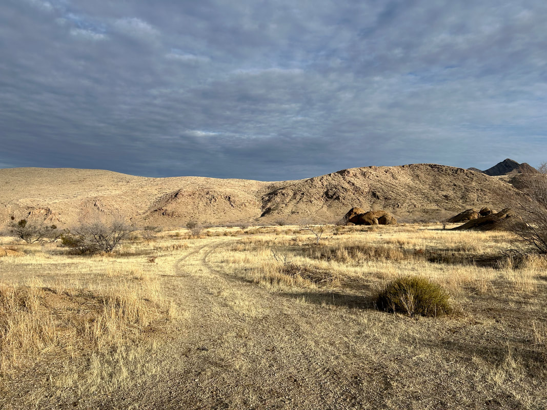
Aravada Springs is privately-owned resort/campground near Whitney Pass at the intersection of Whitney Ridge and South Virgin Peak Ridge. Camping, cabins, water, and a small general store are on the premises. It's only open March - November, so keep that in mind with your planning. Past here you'll keep to contour line before a rocky descent into Hungry Valley with red-sand terrain complete with Joshua trees. The road quickly improves and meanders along the base of the Virgin Mountains in the Parashant. The peaks will be encrusted with white snow set to contrast the desert biome you'll be riding through if there's been recent winter storms. Undulate across the landscape to the base of Red Pockets Mountain. Turn left to begin the climb up to Lime Kiln Pass.
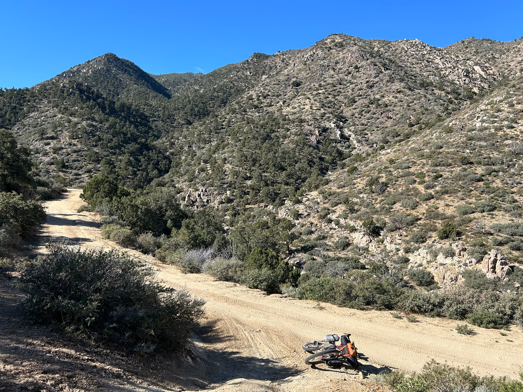
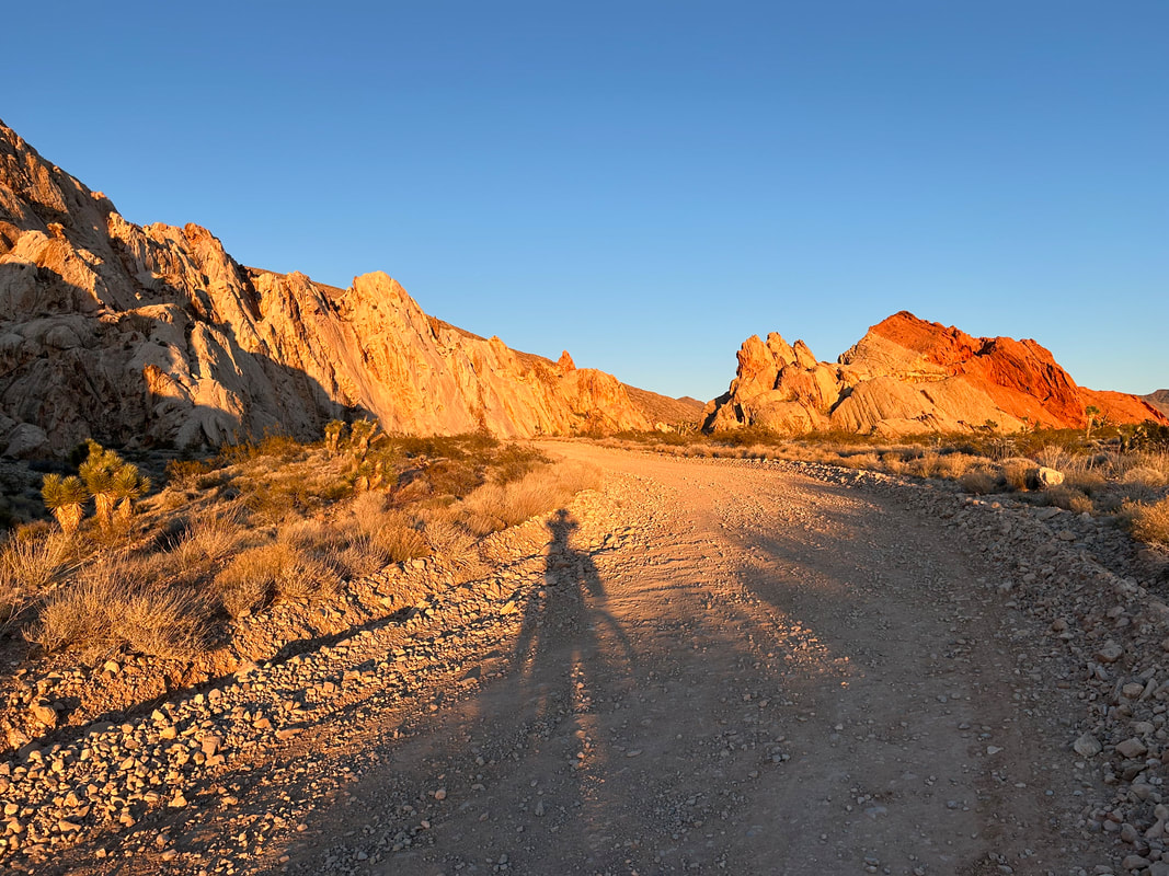
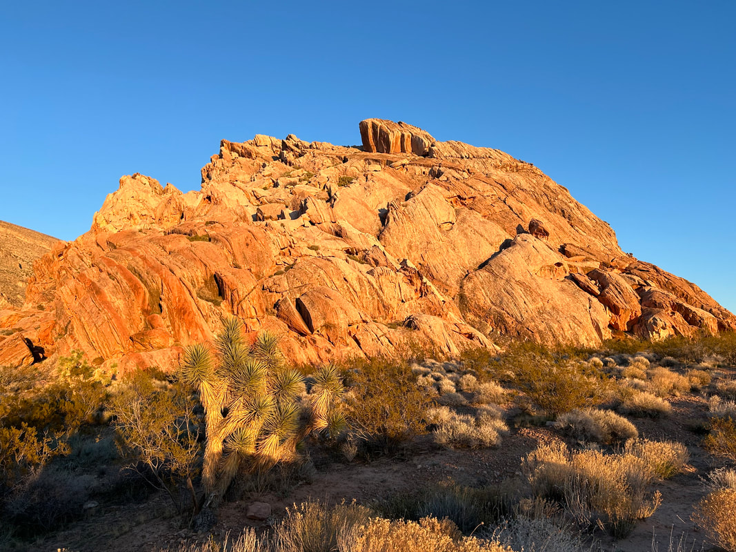
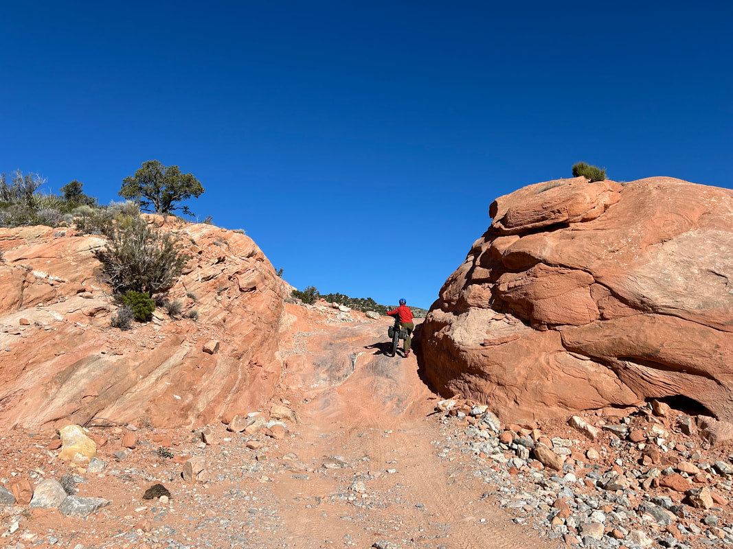
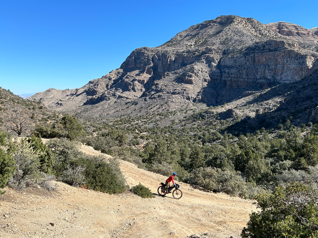
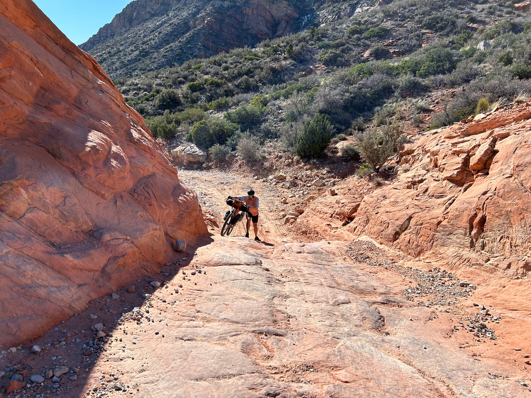
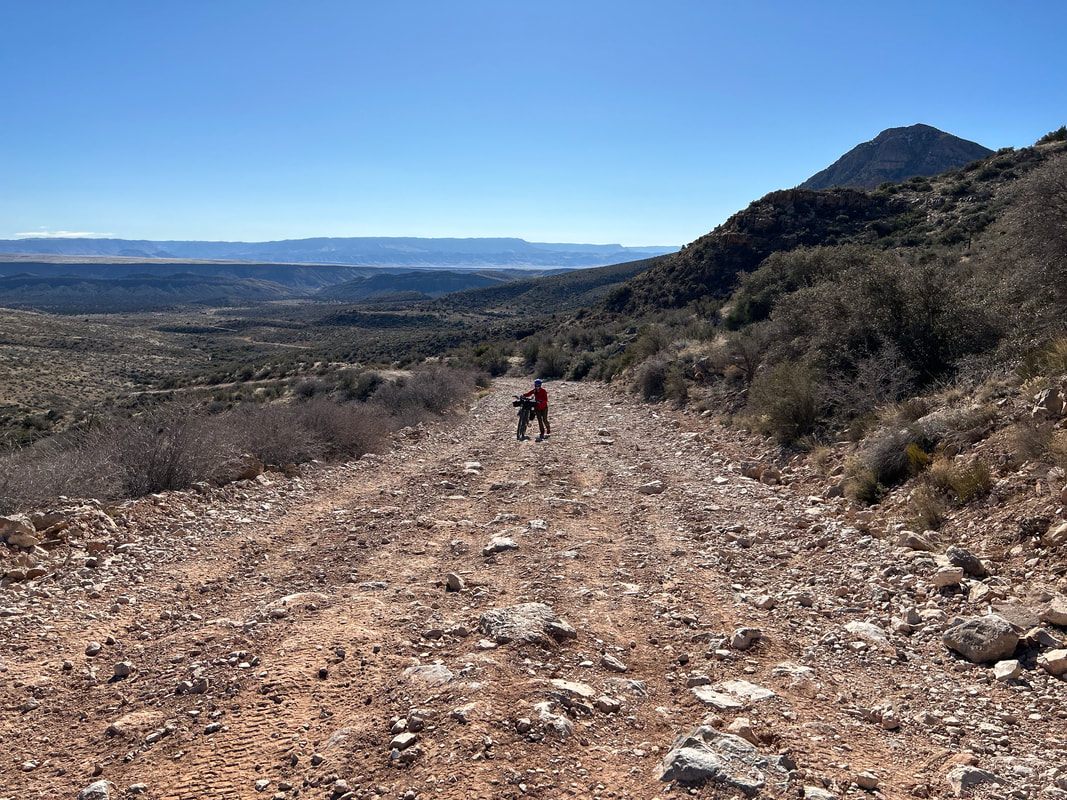
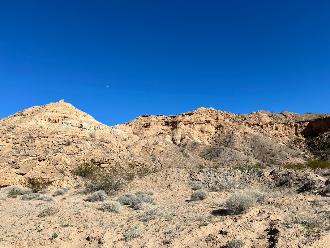
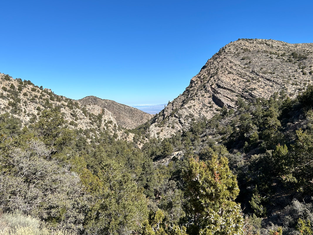
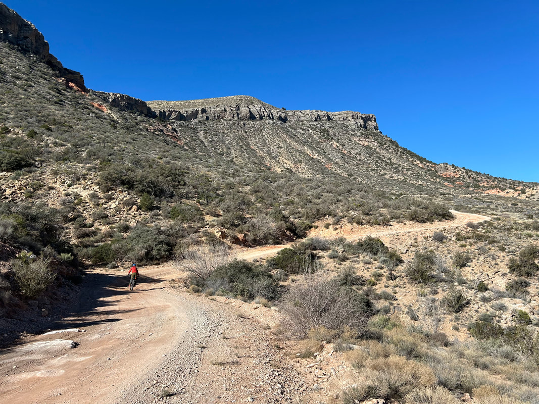
This section starts out with some easy climbing and pockets of interesting rock formations to explore nearby. But a few miles from the top of the pass, Lime Kiln Canyon Road decays into rocky splatter that will require a hike-a-bike for most. Keep pushing and take time to enjoy the dramatic views. You'll hit Lime Kiln Pass, enjoy some excellent red rock pockets, and then begin an equally rocky descent down - again, take care and you may need to walk some parts. As you enter Lime Kiln Canyon, the road improves and you can start an exhilarating downhill through groves of juniper. Look around on the stately rock walls as this is a popular rock climbing area. Dispersed camping also abounds. The descent continues swiftly back towards the high desert below as Lime Kiln Canyon gives way to the north foothills of the Virgin Mountains.
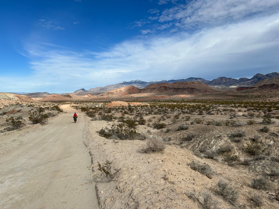
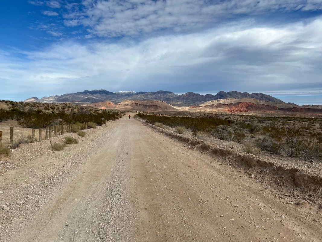
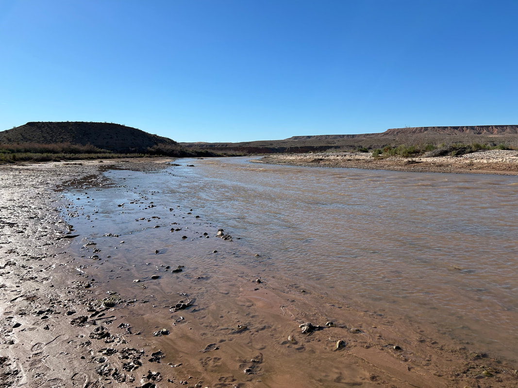
Arrive in Mesquite, NV for a water resupply at La Mexicana Grocery Store Market. Head to the back of the store for freshly baked goods from the panaderia or hit up its carniceria for excellent tacos. Or, simply grab some snacks and head on. There's a great paved multi-use greenway that carries bikepackers out of town for several miles parallel to the Virgin River. The paved path gives way to highway shoulder along the lightly trafficked Riverside Road. A few miles later, turn left onto Gold Butte Road which has even less traffic. Everyone driving this way is either heading to Gold Butte or a local rancher but they'll all give you space on your bike. The road is technically paved, but I think of it more as "semi-paved." It's a quilted patchwork of sealed cracks, pot holes, and a mosaic of decades of asphalt. There are some sections that are just plain unpaved dirt stretches. You might even find it easier (and watch vehicles do the same) to ride on the dirt shoulders.
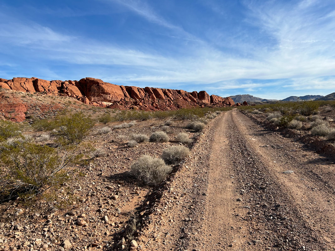
Ride this semi-paved surface parallel to the Virgin River; you can access the banks at several access points. The route will eventually turn away from the River and begin a couple thousand foot climb up into Gold Butte National Monument. Before you will be the stunning peaks of the Virgin Mountains. As you come around Little Virgin Peak, the hill sides will open before you into a dramatic spread of Joshua trees and high desert. Look to your right and you'll see the waters of Lake Mead coming up a side canyon in the distance. Finally, you'll arrive back at Whitney Pocket where you started along with its mash of rock buttes and colorful.
The land gives way to layers of stunning colorful rock. Make sure to stop and look behind you too to take it all in. This portion of the route follows the Gold Butte Backcountry Byway so expect some ATVs. Make your way to the Devil's Throat and walk the perimeter of the large sinkhole. Jump back on the bike and head west on Mud Wash Road. It undulates towards Mud Wash proper where you join the gravel streambed and course through a stunning bottleneck of adjoining buttes. The red rock formations get prominent and many feature petroglyphs. Continue through layers of Earth that box up around you until you see the rise of Bitter Ridge and its colorful cliffs ahead. Mud Wash Road begins a hairpin turn along the base of the cliffs. For an optional side-hike, take the turn to Little Finland for a slew of interesting red sandstone fins splayed about a large butte outcropping.
On the main route, head south doing a gradual ascent on Narrows Road that gains a hillside to provide some sweeping views. The road is in good shape and eventually takes you to the turnoff for Seven Keyholes Slot Canyon. Take the side-ride up a ridge and over to the day-use parking area. Leave your bike and take the short hike into the valley. The trailhead takes a sharp right into a short slot canyon that provides shade, beauty, and vegetation. The whole area has petroglyphs, so keep an eye open. Hike back to your bike and continue south on Red Bluff Spring Road. This is a long and gradual climb to Gold Butte Townsite, but the road is in good shape and the grades not too steep. Plus, abundant Joshua trees and mountains make the landscape beautiful.
Arrive at historic Gold Butte Townsite where a now-abandoned city of a couple thousand people once lived at the height of its gold rush. The Townsite sits at the base of the Gold Butte mountain, proper. Now all that's left are old mining equipment and a cemetery. Make sure to grab some water from the cement trough at Granite Spring if the recent precipitation has been good (it might be dry otherwise). Gain the last climb on the pass and stare down Horse Creek Wash to the distant basins of Greasewood and Wechech punctuated by the Mud Hills. The Joshua trees will build up quickly into a dense canopy you'll bisect on a descent north through Paradise Valley. Take the turn onto Horse Spring Road for a ride through even denser Joshua tree groves as Tramp Ridge rises dramatically to your left. The doubletrack decays a bit before turning into a wash near Horse Spring. Get a good refill here as this is a quality source. Then, it's back towards Gold Butte Road on some chunky/primitive but short-lived doubletrack across desert scrub.
The rest of the ride down Gold Butte Road is pure bliss as parallel Tramp Ridge shoots up gorgeous layers of rock and the colorful pigments leach and coagulate in interesting folds and smears on the landscape around you. Arrive at St. Thomas Gap where a right begins to carry you away from Gold Butte. Make sure you're prepared for the next section and have plenty of water: it's incredibly remote and little-visited. Continue east on Grand Wash Road that descends several thousand feet. Cross into Arizona and into the Grand Canyon-Parashant National Monument. It's beautiful land out here and the distant walls of rock visible many miles away are the Grand Wash Cliffs. These are the gatekeepers for the end of the Grand Canyon; all that stratified rock will plunge into Lake Mead amongst the Mojave Desert officiating the terminus of Grand Canyon country. If you keep going on this road, you can end up descending to Lake Mead. Instead, you'll descend down the Black Wash lower and lower to 1800 feet before a turn northeast. Grand-Canyon Parashant can be utter glory, but the middle of its stomach can be deadfully hot - I wouldn't recommend riding past March in this area all low and buttressed up by rock wall radiating heat.
Carry on northeast up Cottonwood Wash on some great grade of road that weaves in and out of washes and past rock formations. You'll eventually arrive at Pakoon Springs. This is an ecologically important area for endangered relict leopard frogs. Until 2002, an alligator lived in the springs (introduced mid-century by a rancher) before being removed by the NPS. Pakoon Springs is being rehabilitated back to its natural beauty. You can get water here but it's not the best; the area is brushy and you must take care not to trample the wetlands for the leopard frogs. There are a few pools of water you can draw marshy water from if you look carefully. Past Pakoon Springs, serious climbing is required. Enjoy the views out towards Cottonwood Ridge in the east and the Cockscomb in the west. The climb continues steeply up to Aravada Springs near Whitney Pass.
Aravada Springs is privately-owned resort/campground near Whitney Pass at the intersection of Whitney Ridge and South Virgin Peak Ridge. Camping, cabins, water, and a small general store are on the premises. It's only open March - November, so keep that in mind with your planning. Past here you'll keep to contour line before a rocky descent into Hungry Valley with red-sand terrain complete with Joshua trees. The road quickly improves and meanders along the base of the Virgin Mountains in the Parashant. The peaks will be encrusted with white snow set to contrast the desert biome you'll be riding through if there's been recent winter storms. Undulate across the landscape to the base of Red Pockets Mountain. Turn left to begin the climb up to Lime Kiln Pass.
This section starts out with some easy climbing and pockets of interesting rock formations to explore nearby. But a few miles from the top of the pass, Lime Kiln Canyon Road decays into rocky splatter that will require a hike-a-bike for most. Keep pushing and take time to enjoy the dramatic views. You'll hit Lime Kiln Pass, enjoy some excellent red rock pockets, and then begin an equally rocky descent down - again, take care and you may need to walk some parts. As you enter Lime Kiln Canyon, the road improves and you can start an exhilarating downhill through groves of juniper. Look around on the stately rock walls as this is a popular rock climbing area. Dispersed camping also abounds. The descent continues swiftly back towards the high desert below as Lime Kiln Canyon gives way to the north foothills of the Virgin Mountains.
Arrive in Mesquite, NV for a water resupply at La Mexicana Grocery Store Market. Head to the back of the store for freshly baked goods from the panaderia or hit up its carniceria for excellent tacos. Or, simply grab some snacks and head on. There's a great paved multi-use greenway that carries bikepackers out of town for several miles parallel to the Virgin River. The paved path gives way to highway shoulder along the lightly trafficked Riverside Road. A few miles later, turn left onto Gold Butte Road which has even less traffic. Everyone driving this way is either heading to Gold Butte or a local rancher but they'll all give you space on your bike. The road is technically paved, but I think of it more as "semi-paved." It's a quilted patchwork of sealed cracks, pot holes, and a mosaic of decades of asphalt. There are some sections that are just plain unpaved dirt stretches. You might even find it easier (and watch vehicles do the same) to ride on the dirt shoulders.
Ride this semi-paved surface parallel to the Virgin River; you can access the banks at several access points. The route will eventually turn away from the River and begin a couple thousand foot climb up into Gold Butte National Monument. Before you will be the stunning peaks of the Virgin Mountains. As you come around Little Virgin Peak, the hill sides will open before you into a dramatic spread of Joshua trees and high desert. Look to your right and you'll see the waters of Lake Mead coming up a side canyon in the distance. Finally, you'll arrive back at Whitney Pocket where you started along with its mash of rock buttes and colorful.
|
|
|
|
|
|
|
|
|
|
|
|
|
|
7. Route Difficulty, Surface Conditions, and Direction to Ride
Route Difficulty |
Physical Difficulty = 6/10
Technical Difficulty = 4.5/10
Technical Difficulty = 4.5/10
The technical difficulty is due to the occasional rocky sections and mild but short sandy sections. Most of this is concentrated near Lime Kiln Pass and riding down Mud Wash Road. There is one 3-4 mile section over Lime Kiln Pass this is particularly technical. But it is stands as an outlier from the rest of the route.
The physical difficulty is mostly due to climbing. There is most certainly some sustained ascending across many portions of this route. It's only in a few notable sections (see below) where the grades become steep and the climbing feels unrelenting.
Noteworthy Climbs
Lastly, there are conditions difficulties on this route. These include temperature, environment, and remoteness.
The difficulty ratings are based on Bikepacking Roots Route Rating Scale found below:
The physical difficulty is mostly due to climbing. There is most certainly some sustained ascending across many portions of this route. It's only in a few notable sections (see below) where the grades become steep and the climbing feels unrelenting.
Noteworthy Climbs
- Ascending to Lime Kiln Pass to get over the Virgin Mountains. Definitely the crux.
- The long climb from Pakoon Springs to Aravada Springs.
- Riding the Gold Butte Backcountry Byway from where it leaves the Virgin River up to Whitney Pocket.
- The climb up to Gold Butte Townsite from Mud Wash.
Lastly, there are conditions difficulties on this route. These include temperature, environment, and remoteness.
- During the months of April - early November, expect dangerous and deadly heat conditions. I advise against riding the route during that time.
- This is a desert biome. This means aridity and scarcity of water. Riders will need to carry several liters of water for their well-being.
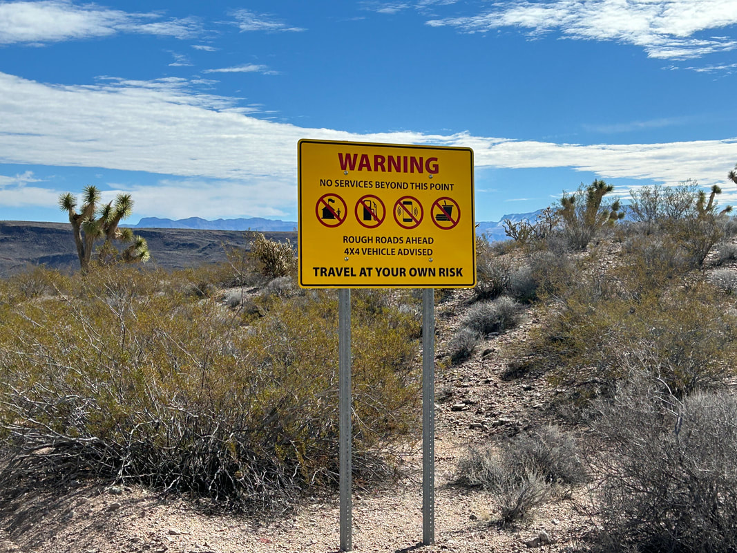
- Grand-Canyon Parashant in particular is extremely remote and little visited. There are no services, no cell phone service, and no ranger stations where this route goes. Be prepared to be self-sufficient.
The difficulty ratings are based on Bikepacking Roots Route Rating Scale found below:
Physical Difficulty |
Technical Difficulty |
5-6 – Rugged terrain with frequent climbs, some of which may be steep and unrelenting |
3-4 – Track has occasional obstacles and steep sections (e.g., maintained forest roads, mellow singletrack); suitable for beginner riders with some off-road experience 5-6 – Continuous sections of track may be rocky, loose, and steep; (e.g., 4×4 roads or singletrack in rugged/rocky terrain) suitable for riders with intermediate off-road experience |
|
|
Surface Conditions |
The Gold to Grand Loop mostly sticks to well-maintained dirt roads that course across the public lands of Gold Butte and GC-Parashant. The dirt roads run from smooth as silk and suitable for skinny tires to rocky in spurts and lightly sanded in areas. In all, the roads vacillate between intermittent ruggedness to long bouts of fast hardpack. Washboard is little, and the worst sections of sand/dirt are shortlived. On average, expect excellent road conditions. The exception to this is about four miles of dirt that climb up and over Lime Kiln Pass: this is really rocky, rutted, primitive, and will require most bikepackers to hike-a-bike. But the views are exceptional and abate the difficulty of this crux of the route.
In inclement weather, the southeast portions of the route around Grand Canyon-Parashant NM will become impassable, due either to washouts, flash flooding, or rare sections of peanut butter mud. Stay safe and stay out of washes or low areas at those times. During fall/early winter, most of the roads along the route may be more eroded and rocky due to the summer's monsoons. Expect the best road conditions in late winter/spring.
Noteworthy Primitive, Rocky Surfaces
Noteworthy Vehicular Pavement
In inclement weather, the southeast portions of the route around Grand Canyon-Parashant NM will become impassable, due either to washouts, flash flooding, or rare sections of peanut butter mud. Stay safe and stay out of washes or low areas at those times. During fall/early winter, most of the roads along the route may be more eroded and rocky due to the summer's monsoons. Expect the best road conditions in late winter/spring.
Noteworthy Primitive, Rocky Surfaces
- The climb up and over Lime Kiln Pass on either side of the saddle can be a mindfield of large rocks and decayed track.
- The connector from Horse Springs to Gold Butte Road is along a wash and then over lots of babyheads. It's a short connector though and that water is worth it.
Noteworthy Vehicular Pavement
- Riverside Road/170: Stretches from Bunkerville to the turn onto the Gold Butte Backcountry Byway. It's smooth pavement but with little shoulder. However, traffic is light and mostly involves ATVs heading into the hills from Mesquite.
- Gold Butte Backcountry Byway: Technically this is pavement, but I really think of it as semi-paved. A 2WD vehicle can travel down it, but the road is a patchwork of smooth alphalt, terrible quilted sealing/pothole patches, and decades of disrepair. In fact, sections of straight up dirt just happen for portions. There are vehicles/ATVs heading to Gold Butte, but they are polite and pass with room. Traffic is overall light.
|

|
|
|
|
|
|
|
Direction to Ride |
The route is intended to be ridden in a counterclockwise direction. The reasons for this include:
- A more advantageous climb and descent over Lime Kiln Pass in this direction.
- Spreading out springs.
- Hitting Aravada Springs at a point later in the trip where a resupply is valuable.
- Saving Mesquite, NV for the end as a well-placed resupply and reward after ascending/descending Lime Kiln Pass.
8. When to Ride (Temperature + Climate)
When to Ride |
Time of Year |
Average Highs |
Average Lows |
Precipitation |
Snow |
Best Time |
Late Winter/Early Spring (Mid-January - Early April) |
60 - 81 F |
34 - 51 F |
0.57 - 1.34" |
Possible at Higher Elevations |
Doable |
Late Fall/Winter (Mid-November - Early January) |
59 - 69 F |
33 - 43 F |
0.62 - 0.67" |
Possible at Higher Elevations |
NOT Recommended |
Summer/Mid-Fall (Late April - Early November) |
81 - 108 F |
55 - 77 F |
0.19 - 1.33" |
0.0" |
For each 1000 feet of gain in elevation, temperatures drop by about 3.3 degrees F. Keep in mind that the high points of the route at Gold Butte Townsite, Aravada Springs, and Lime Kiln Pass may be close to 11 degrees F coolor than in Mesquite, NV. As well, they may experience higher precipitation amounts (including infrequent/rare snow on Lime Kiln Pass).
All the data above are presented as ranges of monthly averages.
***Visit these links to view further climate information:
All the data above are presented as ranges of monthly averages.
***Visit these links to view further climate information:
Time of Year |
Description of Conditions |
Late Winter/Early Spring (Mid-January - Early April) |
|
Late Fall/Winter (Mid-November - Early January) |
|
Summer/Mid-Fall (Late April - Early November) |
|
9. Ecoregions and Landscape
|
|
|
|
|
The Gold to Grand Loop travels through several ecoregions highly influenced by elevation.
Creosote Bush-Dominated Basins
Arid Footslopes
Arid Valleys and Canyonlands
Middle Elevation Mountains
Further Ecoregion Information: |
|
|
|
|
10. The Bundys and Cows
Cows are a prevalent presence on the route and it seems a great deal of them are from the Bundys. For those unaware, Cliven Bundy and his family are local ranchers that have continued to illegally graze their cattle (nearly a thousand) in Gold Butte despite orders from judges and the Bureau of Land Management to remove them and pay over $1 million in unpaid grazing fees. The Bundys have steadfastly refused. The result in 2014 was an armed standoff between the BLM and the Bundys with their militia supporters when the BLM was tasked with rounding up the cattle.
The cattle remained.
For a few years after 2014, federal managers stayed away from the monument for their safety. The result was bullet-holes in important cultural sites and petroglyphs, illegal trenching for springs/irrigation, and chopped down Joshua trees. Sites important and sacred to several Paiute Tribes were damaged and disrespected. The Moapa Band of Paiutes and Friends of Gold Butte both began lobbying the government for National Monument status of the area. Notably, it was the ancestors of the Moapa Band of Paiutes who made those petroglyphs. Gold Butte was originally part of their reservation, let alone their rightful land prior to US government reservation lines in the 1800s. Even then, the land was later excised. The work of all these organizations resulted in the formation of Gold Butte National Monument by President Barack Obama in 2016.
Despite all this, Bundy's cattle remain. You'll see them out there on the route. They shouldn't be there for legal, ecological, and ethical reasons, but you'll see them. If you want to help the Gold Butte area out, make a donation and support Friends of Gold Butte whose goals include preserving a healthy landscape at the National Monument. More recent information on the Bundys and Gold Butte can be found in this recent article.
11. Where Bikes Are Allowed and Not Allowed
Bikes are allowed to travel on all established roads within the National Monuments. But please keep to the roads. Gold Butte is an environmentally significant area for Mojave desert tortoises and off-road travel tramples their habitat. In addition, cryptobiotic crust is found along the route. Don't trample it as it keeps the soil solid and resistant to erosion. Lastly, Gold Butte Road travels along the boundary of the Lime Canyon Wilderness; don't take your bike into the Wilderness Area.
12. Native Nations and This Land
Gold Butte and GC-Parashant are the current and traditional home to several federally recognized Tribes (as well as other non-federally recognized tribes), including the Moapa Band of Paiutes who are part of the Southern Paiutes. The Moapa River Indian Reservation is just northeast of the route, and it should be noted that Gold Butte was once a part of their reservation. More-so, this land is Their land, regardless of reservation boundaries. Know that Native people are absolutely still here in the area, and have been here for thousands of years. Much of the groundwork and vocal pushing for National Monument status was done by these Tribes to protect their ancestral heritage.
As a bikepacker traveling across the landscape, make sure to (a) Recreate with Respect and (b) Act with care.
As a bikepacker traveling across the landscape, make sure to (a) Recreate with Respect and (b) Act with care.
13. Leave No Trace and Bikepacking Ethics
Bikepackers, like all backcountry users, leave an impact on the land, vegetation, and wildlife of the places they travel through. Leave No Trace outlines specific actions that bikepackers can take to minimize their impact on the land. Below are some considerations I would urge bikepackers to consider that are specific to this area:
Look but Don't Disturb or Photo-Geotag Cultural and Archeological Items
There are parts of this route that may pass by unmarked sensitive cultural/historical/archeological sites or items. If you see or stumble on something, look at it, enjoy it, and learn more about the item when back in the frontcountry. Leave it exactly where it is and do not collect it. DO NOT post locations, geotag photos, or post the items on social media.
Avoid touching these items as well. Remember that this place is a Living Landscape to many Native groups - this means all items contain a life force and are alive in some way that creates a balance of nature. Take on an approach that treats all things (animate, inanimate, natural, cultural, etc.) as deserving the respect, dignity, and privacy that we would want/expect for ourselves by others. Looking through this different "cultural lens" takes some work. Taking these actions are an opportunity to demonstrate respect and awareness of Indigenous perspectives of the world.
Travel + Camp on Durable Surfaces
This is the desert, so life grows by the inch but dies by the foot and tire tread. Keep your riding to established roads to avoid trampling or disturbing cryptobiotic crust or habitat for arid vegetation and Mojave desert tortoises. If you happen to use the springs on route, make sure to avoid crushing delicate riparian vegetation and be aware of endangered species like relict leopard frogs that might be using that same water source.
***Leave No Trace is much bigger than just these. Both Bikepacking Roots and Bikepacking.com have excellent resources on Leave No Trace for backcountry cyclists. These include:
Bikepacking Roots has the Love Where Your Ride Campaign where they partnered with the Leave No Trace Center for Outdoor Ethics to make bikepacking specific principles. Visit the site to see a breakdown of each principle listed above.
Backpacking.com has the Leave No Trace for Bikepackers: Ride. Camp. Respect principles where they outline many of the same items listed above but also include Know the Land and Represent the Community (both excellent inclusions). Visit their website to read more.
Look but Don't Disturb or Photo-Geotag Cultural and Archeological Items
There are parts of this route that may pass by unmarked sensitive cultural/historical/archeological sites or items. If you see or stumble on something, look at it, enjoy it, and learn more about the item when back in the frontcountry. Leave it exactly where it is and do not collect it. DO NOT post locations, geotag photos, or post the items on social media.
Avoid touching these items as well. Remember that this place is a Living Landscape to many Native groups - this means all items contain a life force and are alive in some way that creates a balance of nature. Take on an approach that treats all things (animate, inanimate, natural, cultural, etc.) as deserving the respect, dignity, and privacy that we would want/expect for ourselves by others. Looking through this different "cultural lens" takes some work. Taking these actions are an opportunity to demonstrate respect and awareness of Indigenous perspectives of the world.
Travel + Camp on Durable Surfaces
This is the desert, so life grows by the inch but dies by the foot and tire tread. Keep your riding to established roads to avoid trampling or disturbing cryptobiotic crust or habitat for arid vegetation and Mojave desert tortoises. If you happen to use the springs on route, make sure to avoid crushing delicate riparian vegetation and be aware of endangered species like relict leopard frogs that might be using that same water source.
***Leave No Trace is much bigger than just these. Both Bikepacking Roots and Bikepacking.com have excellent resources on Leave No Trace for backcountry cyclists. These include:
- Plan Ahead + Prepare
- Travel + Camp on Durable Surfaces
- Dispose of Waste Properly
- Leave What You Find
- Minimize Campfire Impacts
- Respect Wildlife
- Be Considerate of Other Visitors
Bikepacking Roots has the Love Where Your Ride Campaign where they partnered with the Leave No Trace Center for Outdoor Ethics to make bikepacking specific principles. Visit the site to see a breakdown of each principle listed above.
Backpacking.com has the Leave No Trace for Bikepackers: Ride. Camp. Respect principles where they outline many of the same items listed above but also include Know the Land and Represent the Community (both excellent inclusions). Visit their website to read more.
14. Water Sources
This is a dry desert environment and very remote. Be smart about your water resupplying. The springs listed on the route are generally reliable, especially after some good winter precipitation. If it's been a dry winter or fall, some of these sources may be low or dry. Plan to carry several liters of water, sometimes enough to last at least 24 hours and more than you think you'll need should you arrive at a source and find it dry.
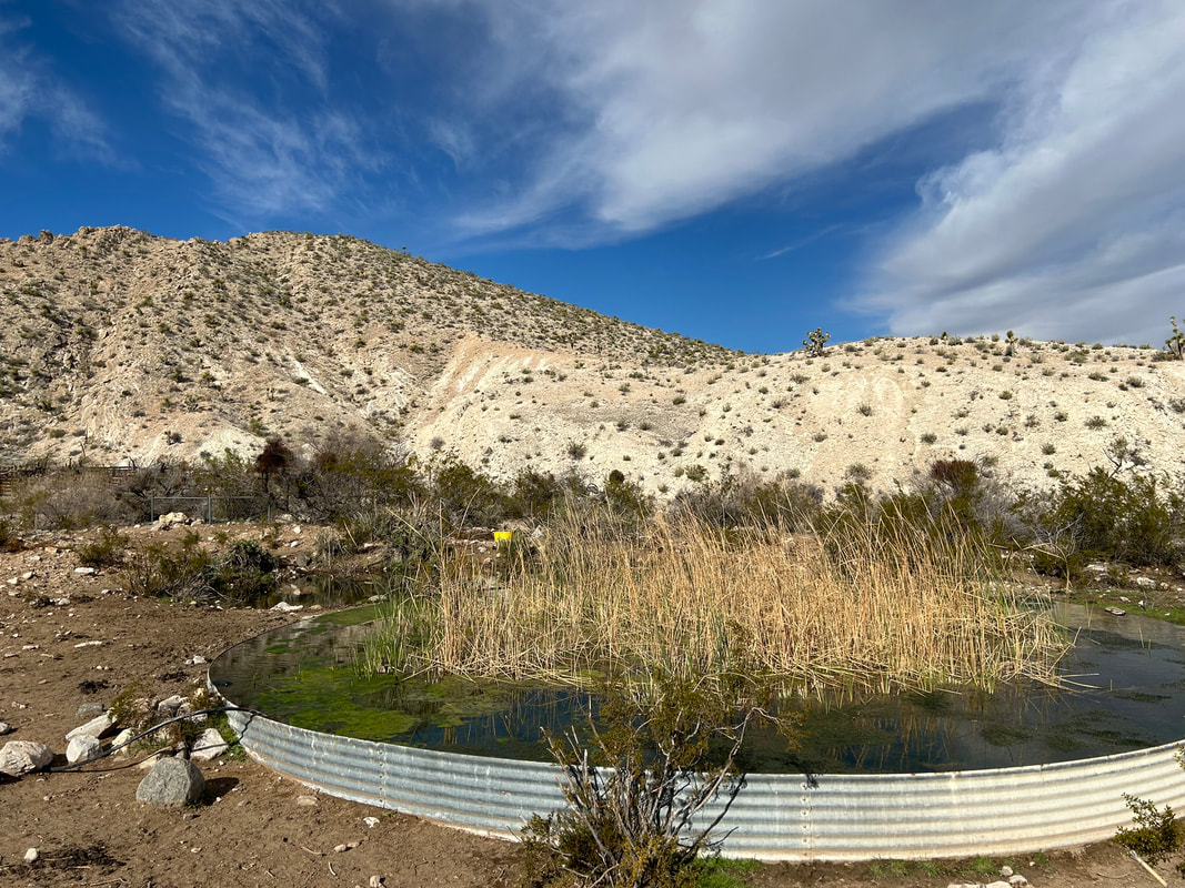
The best springs on-route are Granite, Horse, and Pakoon. Definite water can be found at Aravada Springs (there is a campground/resort) and Mesquite, NV. You may find a few other sources out there in dirt cattle ponds and old unmaintained pipes. Jim Boone, an ecologist in the area, told me that over 90% of the springs that used to run in Gold Butte from the early 1900s are now dry. The ones I listed are the ones he and others recommend - these are pretty solid. If you want a few more sources off-route (literally a couple thousand feet of elevation loss/gain and many miles), hit up Mockingbird and Agua Chiquita south of Gold Butte Townsite.
***Water sources in the Southwest are often ephemeral or unreliable. To help give riders a sense of water availability, I've rated sources using the scale below.
Water Reliability Scale:
1 = unreliable; 2 = seasonal;
3 = mostly reliable; 4 = definite source
|
|
|

|
|
|
15. Camping
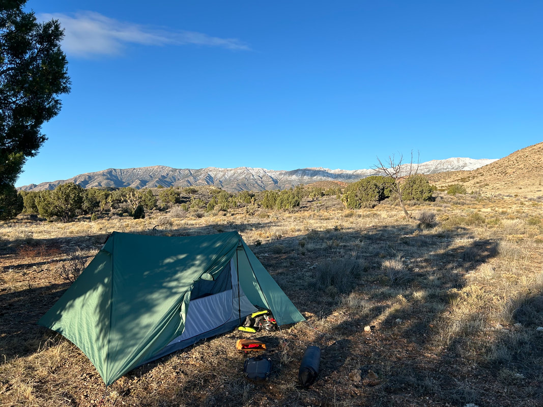
There is abundant dispersed camping across the public lands of Gold Butte and GC-Parashant National Monuments; both are managed by the Bureau of Land Management. Try to camp in already-impacted sites with durable surfaces. Always camp 0.25 miles or further from springs/water sources. I've noted a few great camping spots along the route for your consideration. If you want to stay at Aravada Springs Campground, make sure you get reservations by visiting their website. If you want to camp at the start and end of the route, Whitney Pocket has some epic dispersed sites set amid its excellent geological formations.
16. Food and Resupplying
Food can be purchased from the small (limited-selection) store at Aravada Springs and only when it is open for the season. A larger resupply with options for full meals and lodging can be found in Mesquite, NV. Overall, this means bikepackers should expect to carry several days of food at a time.
- Mile 72.7 - Aravada Springs: Small general store with a few food items. Only openly seasonally March - November.
- Mile 99.7 - Mesquite, NV: Full services, grocery stores, and restaurants. Grab food at La Mexicana Grocery Store Market neara the route or at the Family Dollar.
17. Sample Route Itinerary
This is a sample itinerary of what I've done before when riding this route. Use it as a rough guide for your own planning purposes. Feel free to use it, adapt it, or don't use it all and make your own plans. Plan your trip on this route based on your own strengths, comfortabilities, experiences, wants, and needs.
Day |
Mileage |
Elevation Gain |
Route Description |
1 |
~32.4 Miles |
2616 ft. |
|
2 |
~49.8 Miles |
3940 ft. |
|
3 |
~47.3 Miles |
4009 ft. |
|
18. Fees and Permits
- Gold Butte National Monument and Grand Canyon-Parashant National Monument have no fees or required permits.
- A Recreational Land Use Permit is required for any travel or camping on Arizona State Lands. Apply for and pay for one before you head out on the route. Carry it with you.
19. Getting to the Start
Las Vegas is about a 1-1.5 hour drive from the start of the route. This makes flying or driving to the route convenient. There are numerous car rental companies available in Las Vegas. The start of the route is a 2WD mostly-paved approach to Whitney Pocket making car rental feasible. In addition, the Salt Lake Express bus/shuttle line does a route that stops in Mesquite, NV along the northern part of the route. The company lists the following pertaining to bikes and Shuttle Luggage Space: "We plan on a reasonable amount of luggage on each shuttle. If you will have more than two (2) suitcases and a carry on, you need to call the office to make sure we will have room. If you show up with more than this, we will accept it on a space available basis. Also, you may be charged $10.00 per suitcase or box over the two (2) suitcases allowed. For example, if you would like to bring your bicycle, we just need a minimum of 24 hours advance notice and as mentioned previously, there will be an additional $10.00 fee."
20. Parking
Park your vehicle in the large dirt parking lot at Whitney Pocket at the end of the pavement in Gold Butte National Monument. Go find a back corner or side area to leave it for your duration of your ride. Parking is free and doesn't require a permit.
21. Additional Important Information
- Friends of Gold Butte: Consider supporting the local nonprofit looking to preserve and improve Gold Butte National Monument. They also put on volunteer events and work with various organizations in the region to protect and enhance Gold Butte National Monument. Check them out!
- Cows: As mentioned in the previous "The Bundys and Cows," cows illegally grazing are prevalent and widespread across Gold Butte. They'll leave you alone if you leave them alone.
- Pakoon Springs: This is a spring located in GC-Parashant. When you get here, read the kiosk, enjoy the hike/trail that loops the spring, and grab some water. If you do go looking for water, be aware that this is habitat for endangered relict leopard frogs. Don't trample the spring or vegetation. The water can be hard to find and marshy, so if this feels like too much work, make sure to carry enough from Horse Springs to get you to Aravada Springs.
- Dark Skies: Grand Canyon-Parashant National Monument is an International Dark Sky Province. This means that you can expect to have anywhere between Bortle Class 1 - 3 night skies overhead (even better night viewing during a new moon). The Bortle Class Scale is used to rate night skies on their clarity and lack of light pollution. A Bortle Class 1 is the darkest possible and there are several locations along these routes where, should you camp, you will have this level of darkness. Here, night skies will be virtually unimpeded by artificial light. You can use the following sites to explore more:
22. Acknowledgements
I want to thank Janna for always being my ride partner whenever we explore new areas, this route included. I'd also like to thank Kate who put the idea into my head that a winter bikepacking trip out to Gold Butte would be a great location. Major thanks go out to Lara Kobelt and Jimmy Linares who fielded my initial questions about water sources and access from their land management work in the area. A significant amount of gratitude is owed to ecologist Jim Boone who runs BirdandHike.com. First, his website was critical for helping me visualize the area as well on-the-ground photos of the terrain/track. Even more-so, he spent considerable time emailing with me back-and-forth about water sources, resupply points, conditions, weather, access, quality of springs, private land, and overnight parking. His knowledge of the area is incredible and helped me really nail down where to take the ride. Lastly, I wanted to thank Friends of Gold Butte who also corresponded with me pertaining to questions of parking and water sources. All the individuals listed above work hard for the preservation of this landscape; their passion for protection and education about these National Monuments helped make the route out here fantastic.
23. Social Media and Route Updates
Route Updates:
Rider Feedback: Use the Comment box below or email me to give a trip report, list any concerns, or provide an update on the route. Make sure to give:
- Instagram: --> Route updates/changes
Rider Feedback: Use the Comment box below or email me to give a trip report, list any concerns, or provide an update on the route. Make sure to give:
- Date
- Location and Mile
- Feedback/Trip Report Details