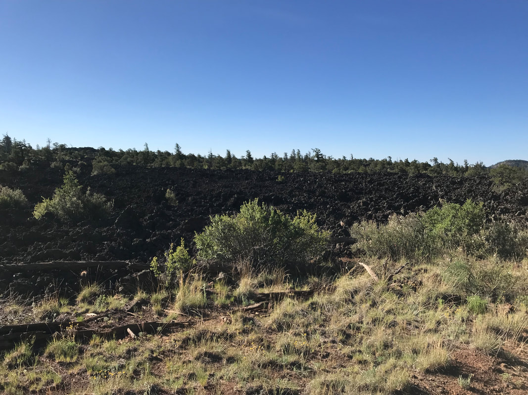
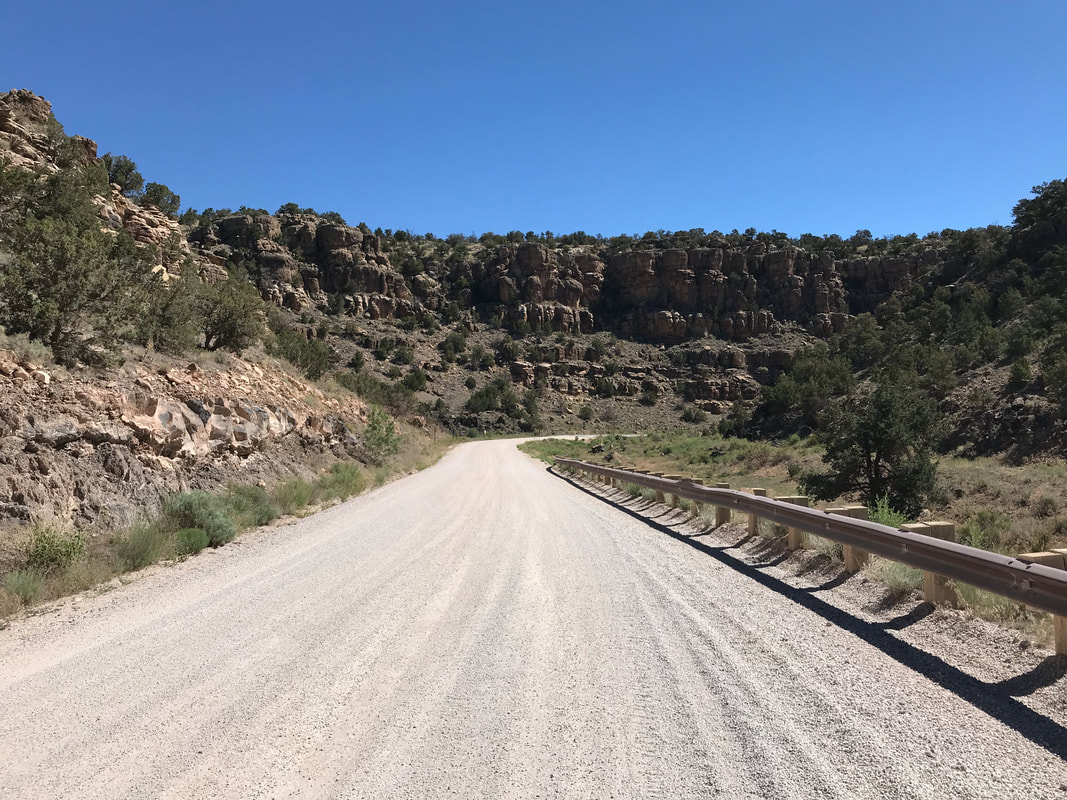
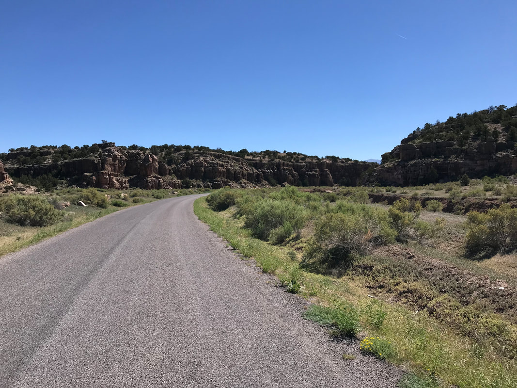
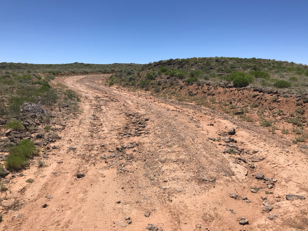
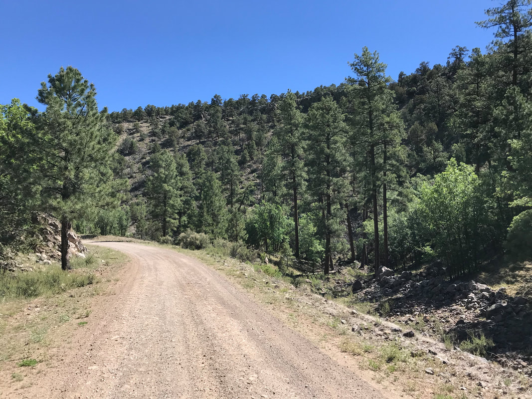
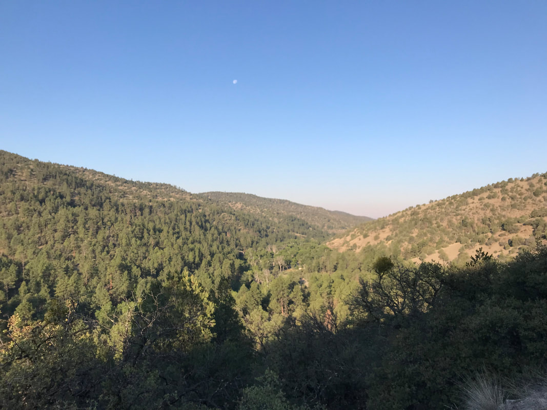
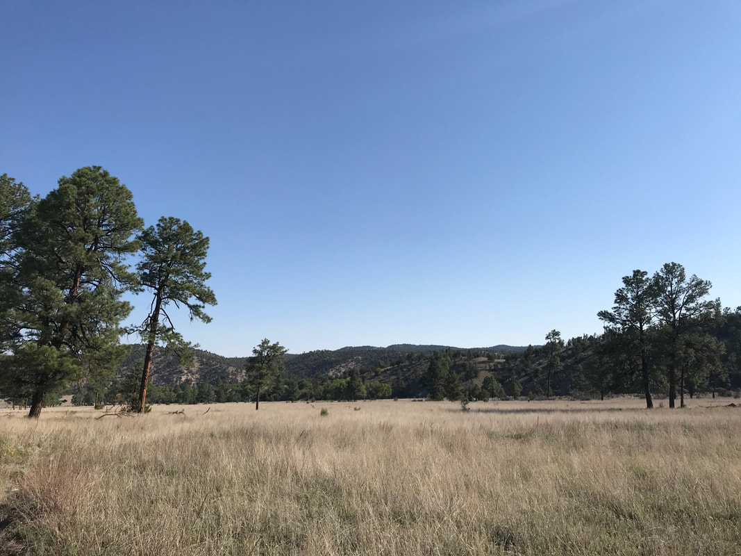
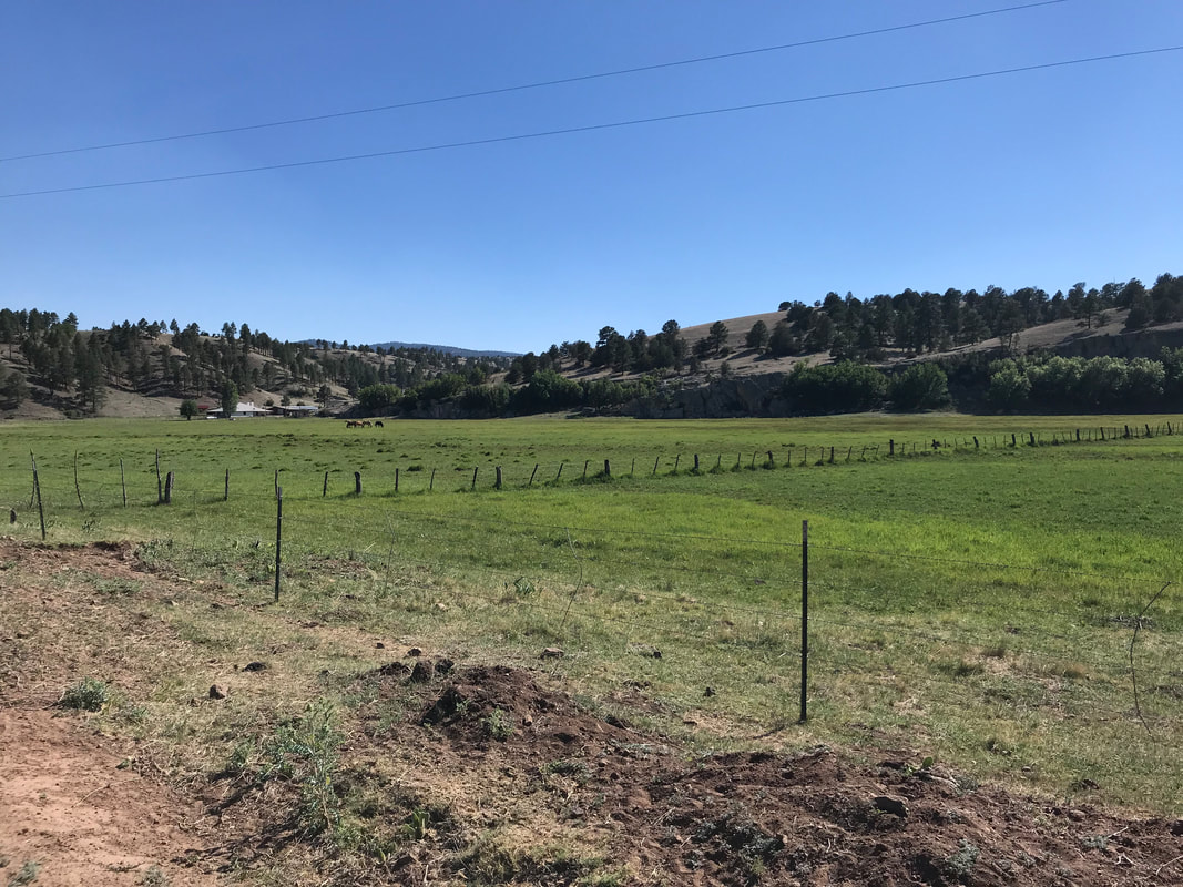
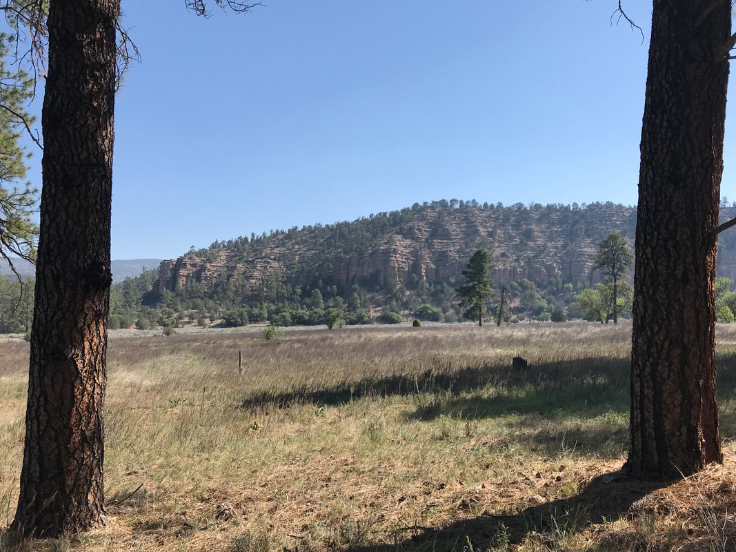
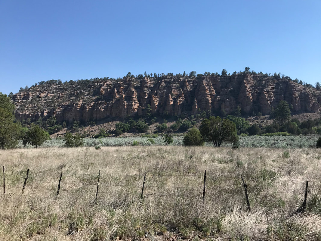
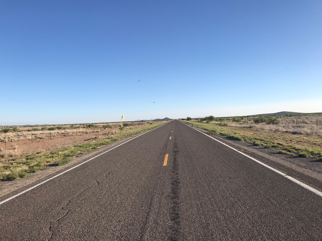
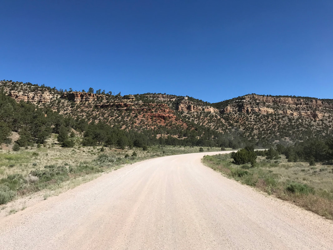
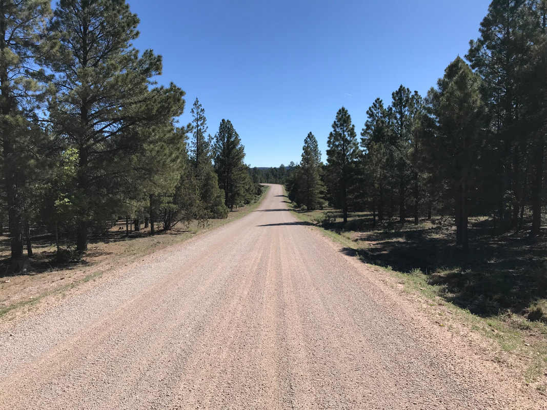
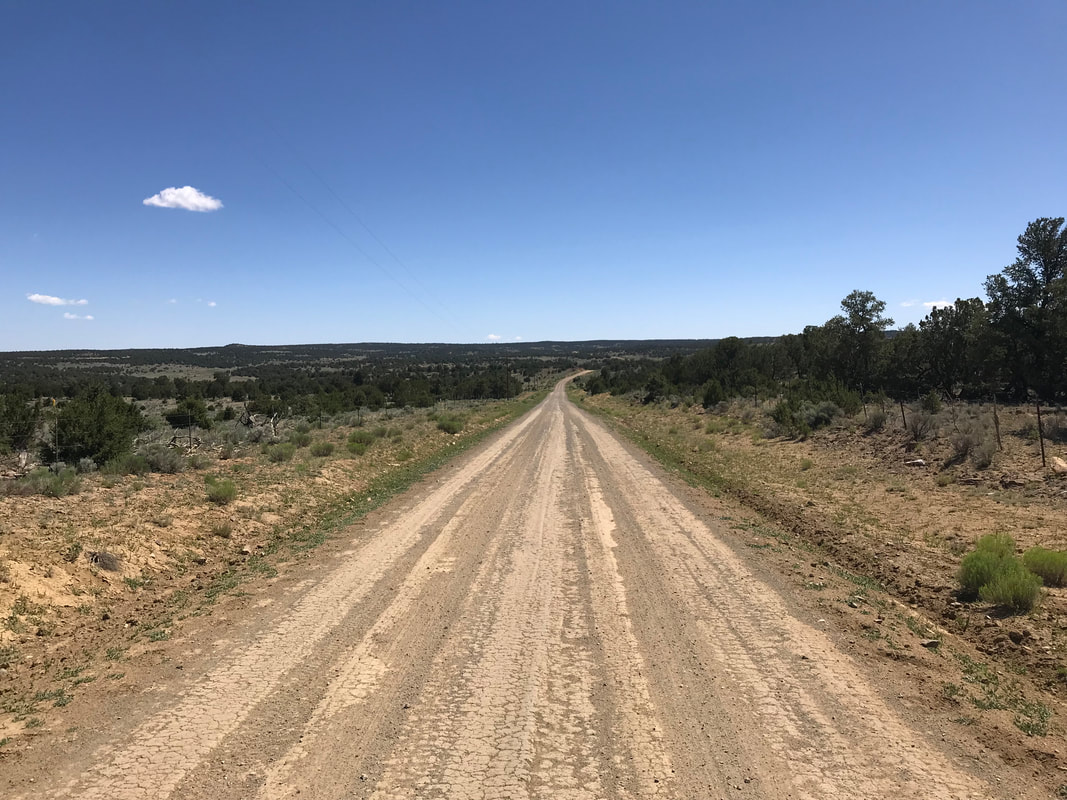
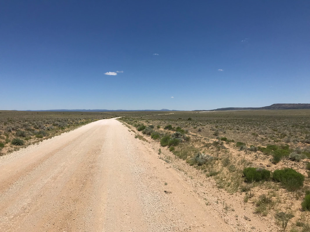
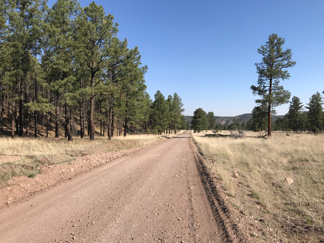
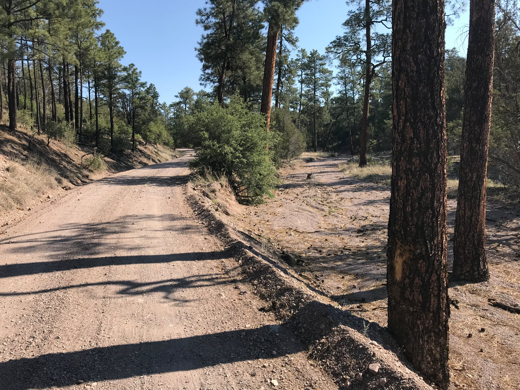
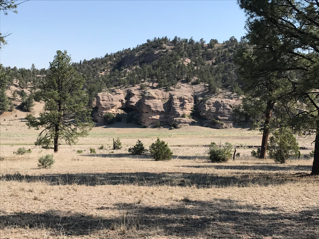
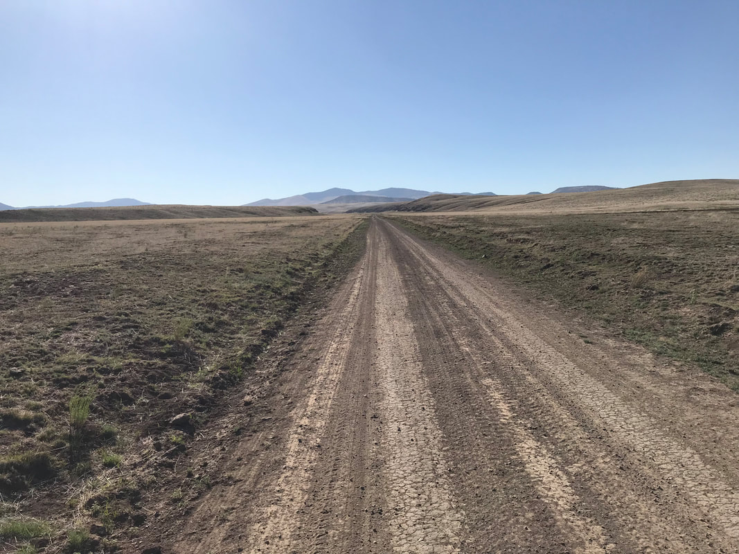
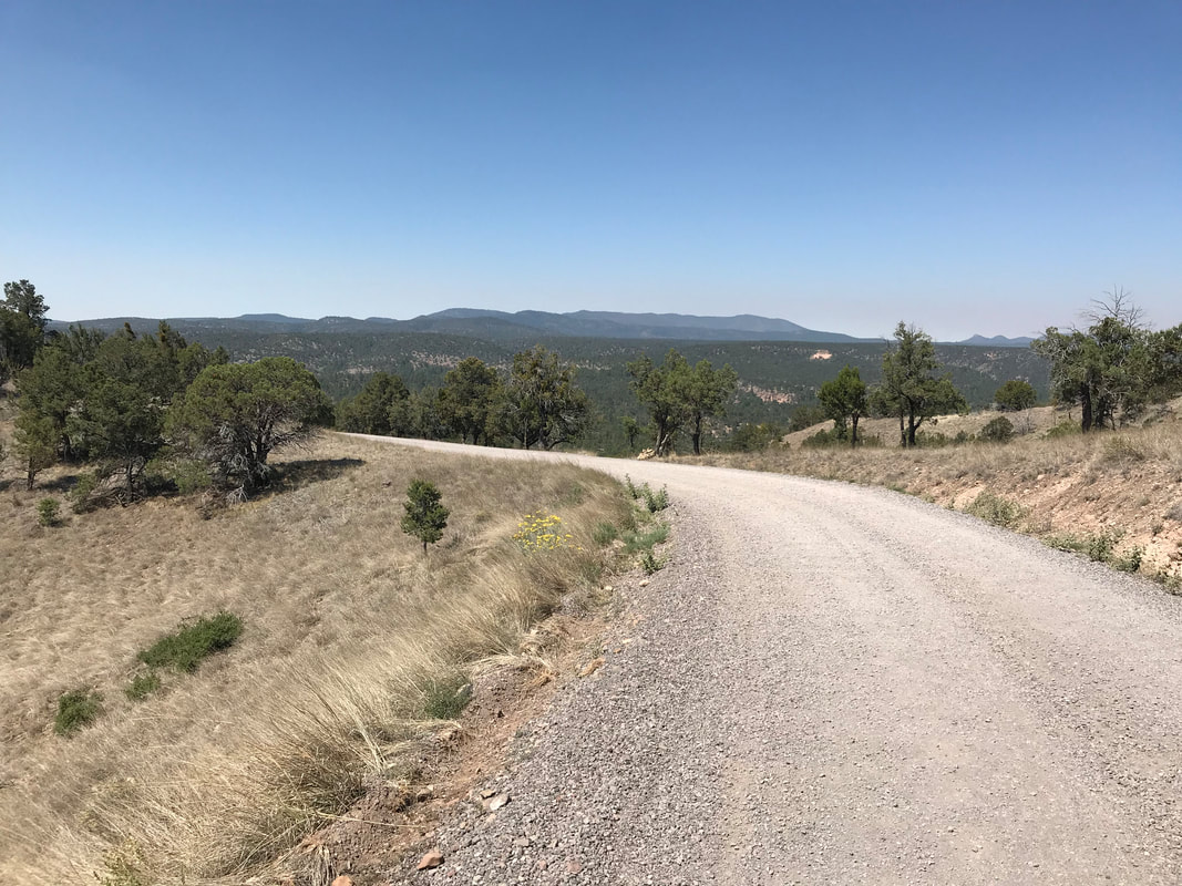
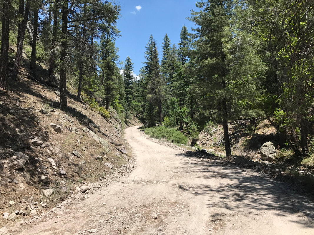
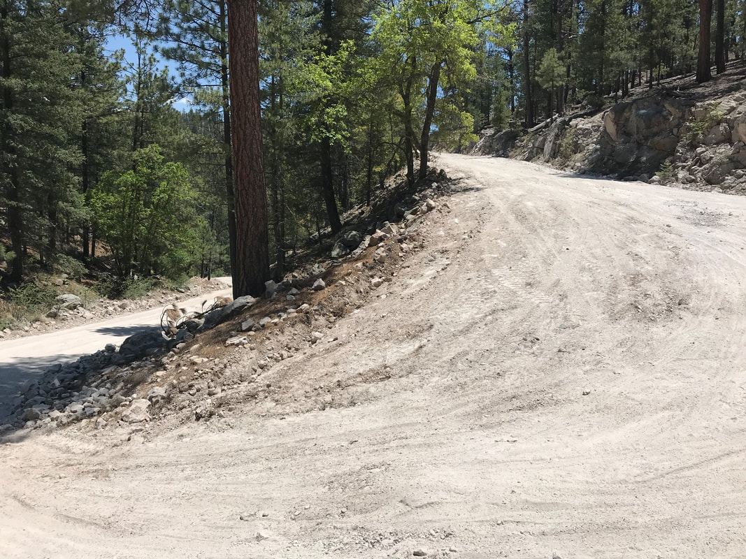
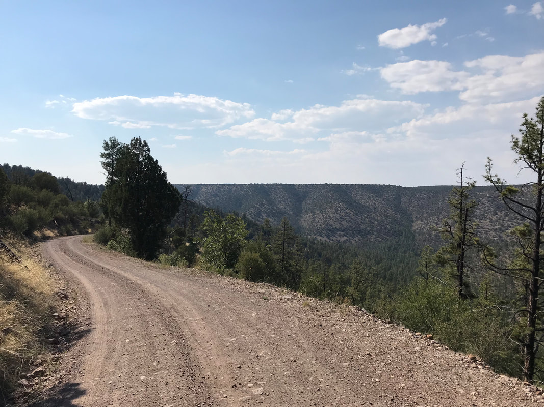
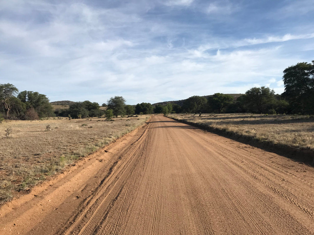
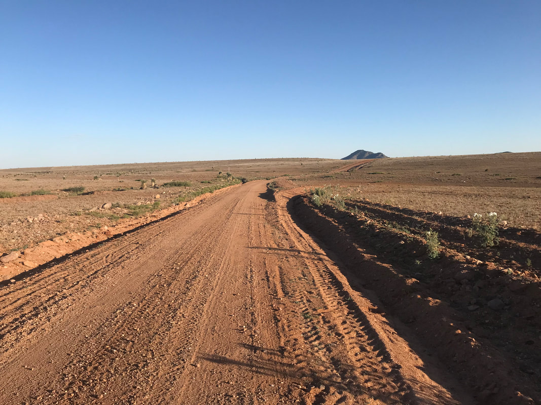
 A long night was met by the first streaks of dawn. At that first crack, I finished packing up amidst the receding smoke. Cattle mooed around me with the morning come. I jumped on my bike and pedaled past the CDT trailhead I had visited the evening before. I rounded the cinder cone adjoining my night's campsite and there, a smoldering mess of trees and landscape lay. I took one photo of it before pushing on. The photo of the morning's reveal of the previous night's fire looked SUPER LAME but definitely was one of those times when a photo just didn't capture the reality of a scene. I sped off and felt surprisingly strong. But I was mentally done. I wanted to do this route with a companion. I felt the tug of my slit foot from stitches in the deep wound just a few weeks before, I felt hiker-strong but my bike muscles felt weak, and I felt exhausted. The route led around gorgeous plains of black lava and gnarled pine. Elevation came and came until I was sweating so hard. I stopped, looked back on the El Malpais, and sped down through thick forests of ponderosa pine. Ranches became more frequent, and vacation homes started to pop up by late morning. The dirt road led down the most amazing descent ever. I let go of the brakes, didn’t pedal, and just absorbed the beautiful scenery as it came. The GDMBR wove through the bottom of a gathering canyon. Walls shot upward with reds, oranges, and evergreen pines. Flanks of black lava spilled to my right. I couldn’t believe the scene.   
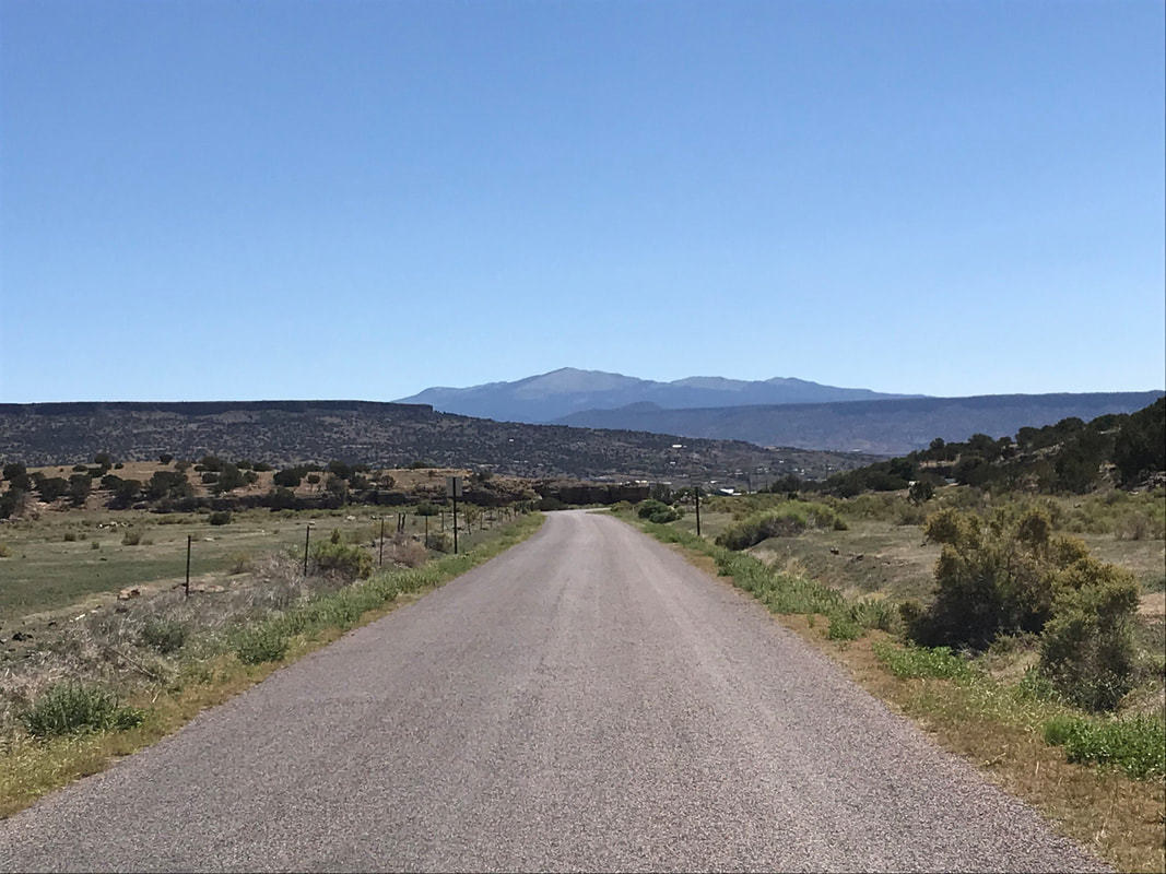
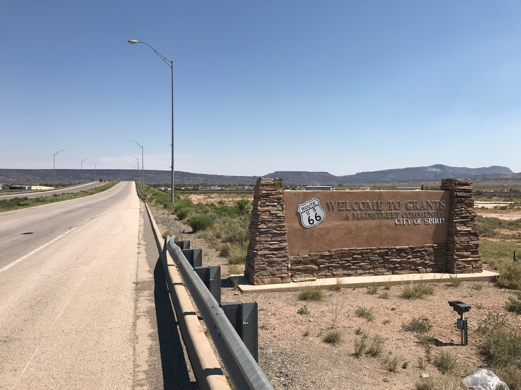
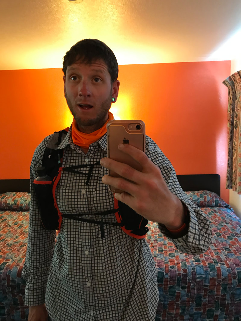
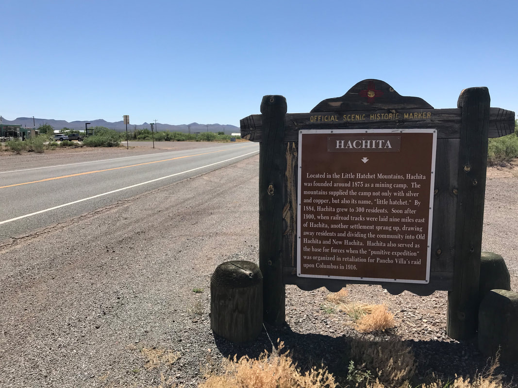
The descent continued for miles until the walls of the canyon lessened, views of mountains in the distance rose, and I found myself hitting pavement straight into the heart of Grants, NM. A former Route 66 highlight, the city now seemed less than what it once promised. I biked the length of town and found a Motel 6 at the other end. I walked into the front office. No matter the soot, ash, and smoke all over me, I wanted a room. They let me grab one by 10 am which made me ever grateful. I entered my room, took a photo of my disheveled appearance, and set to work washing and rewashing myself. I promised to come back and do this route again, but next time with more experience under my belt, a companion, and in better fitness. To get home, Melissa and Grecia agreed to grab my car, drive out to Grants, NM, and pick me up the next day. To those two, I am so indebted. There was a feeling of desire to push on the next day, especially when I saw a cyclist packing up at the Denny’s for breakfast. But leaving the route was a decision of confidence. A time to return to the Great Divide will come again. 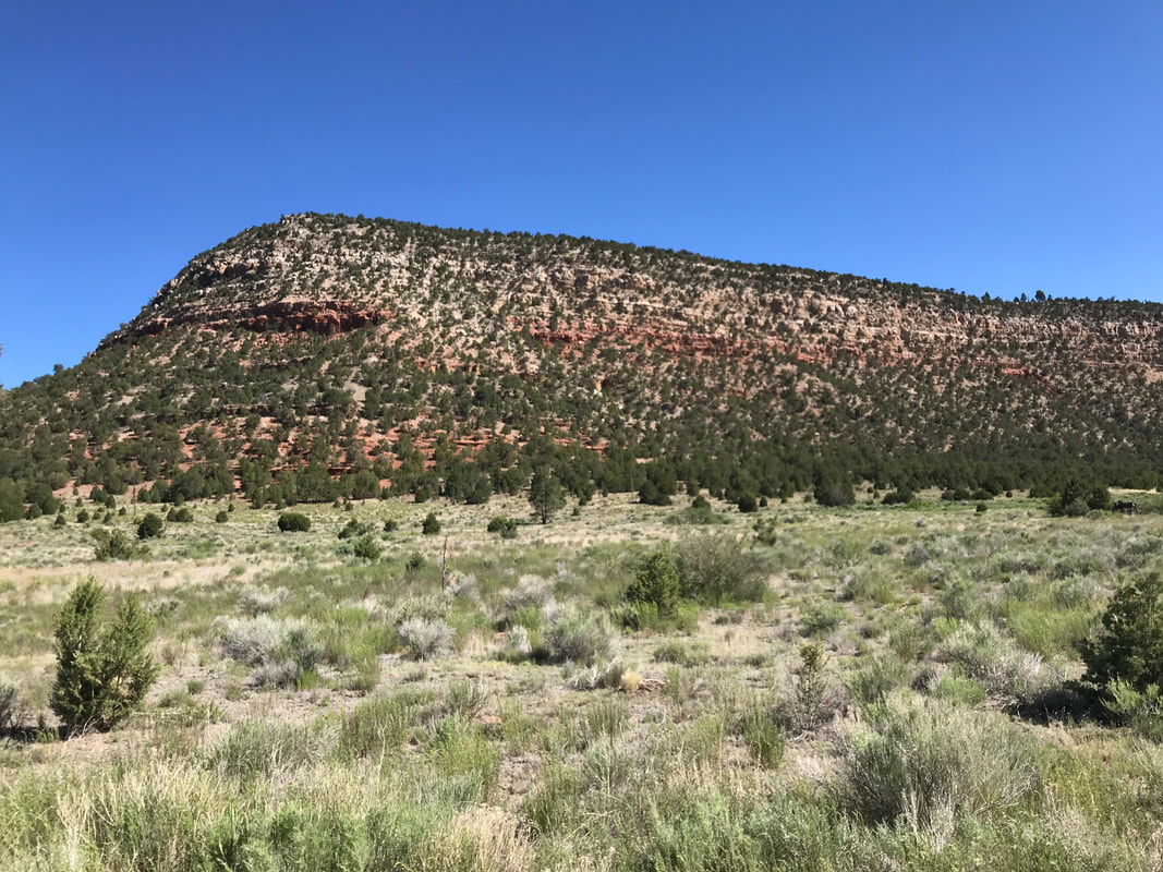 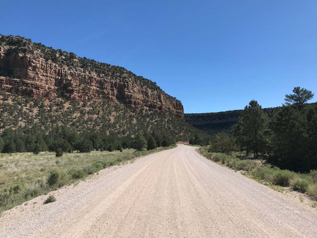 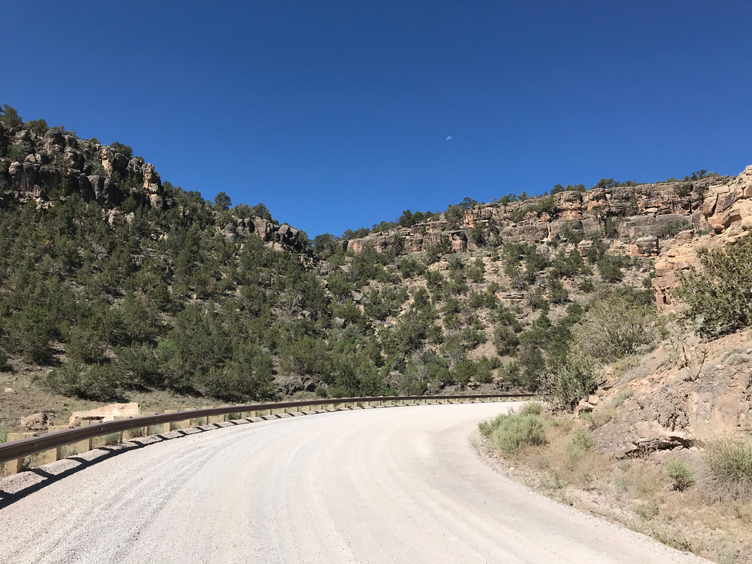
0 Comments
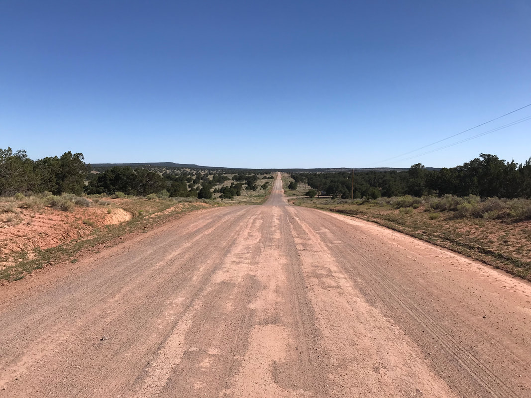
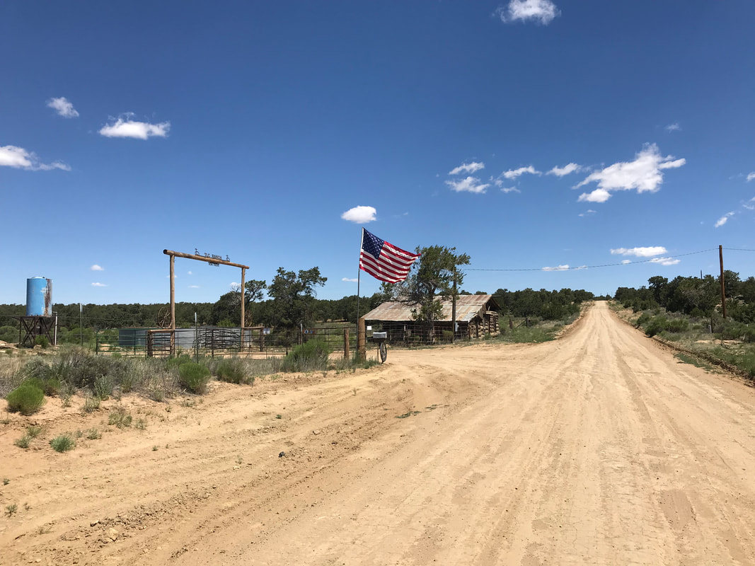
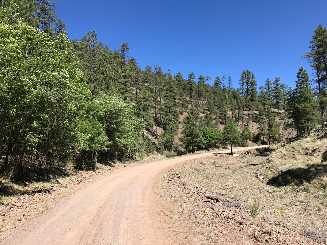
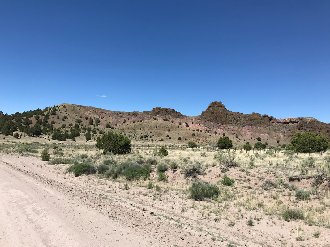
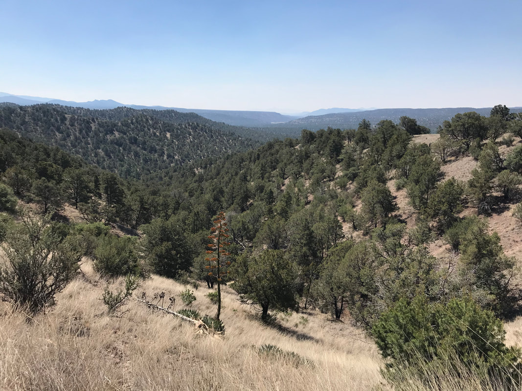
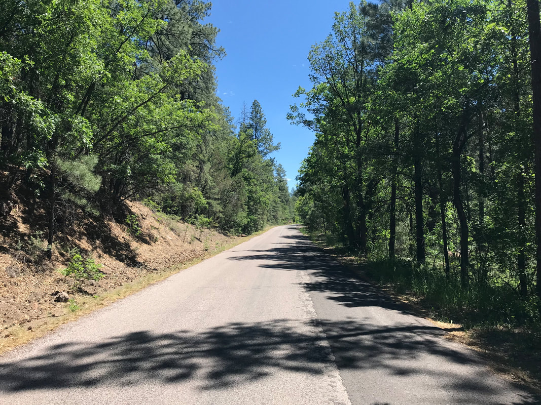
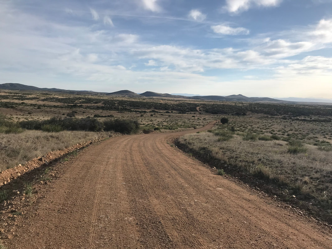
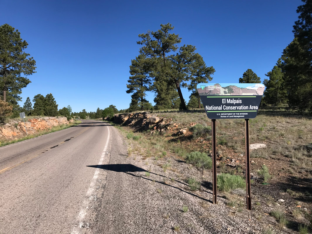
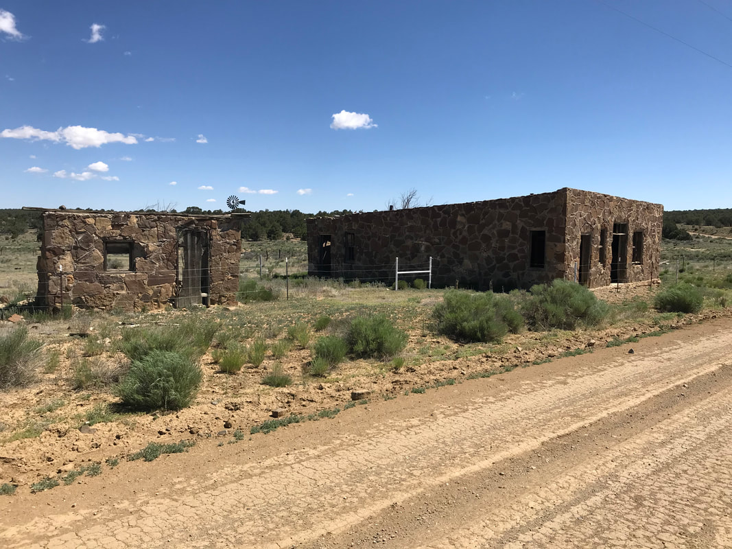
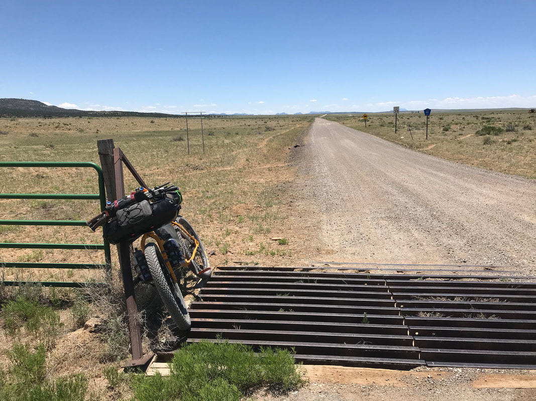
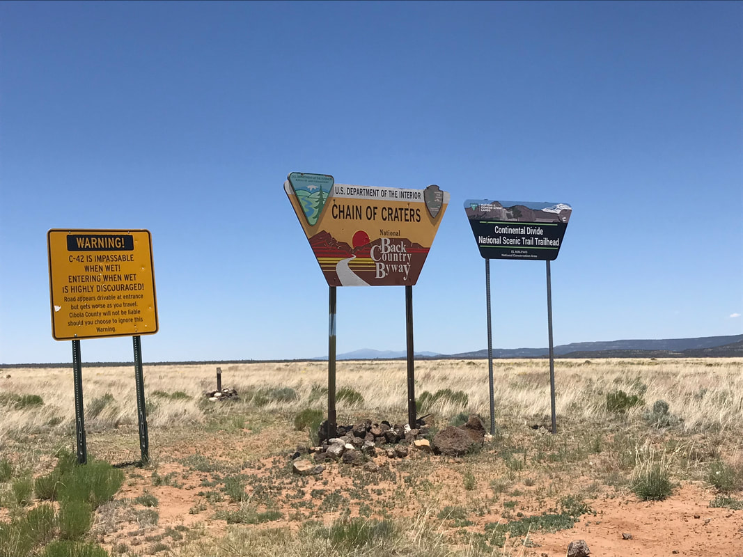
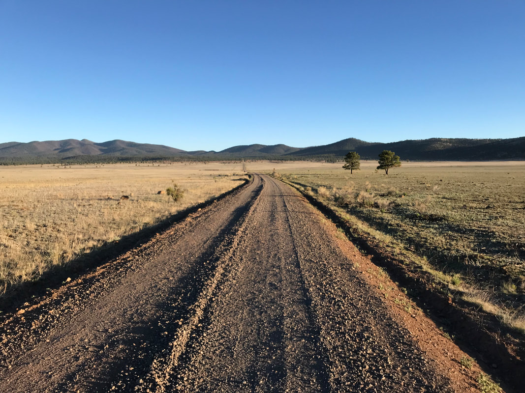
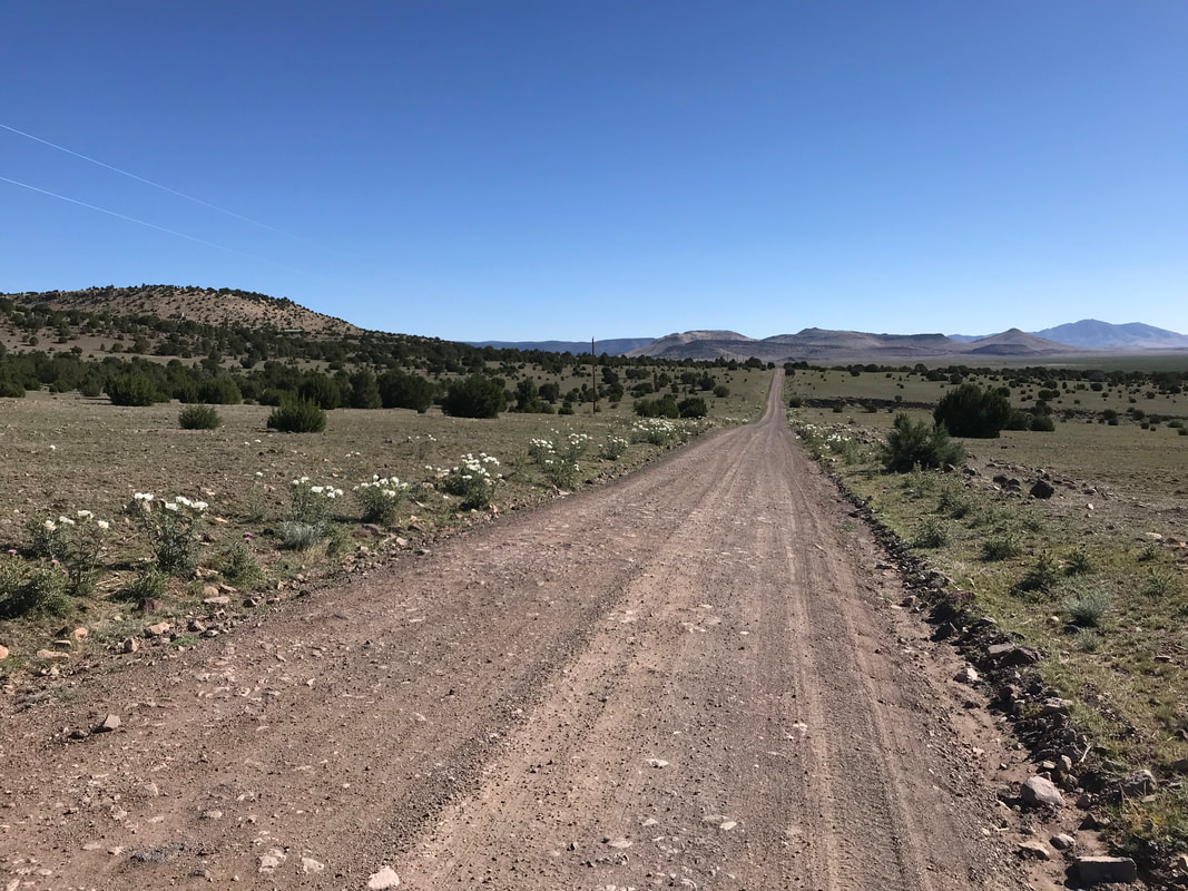
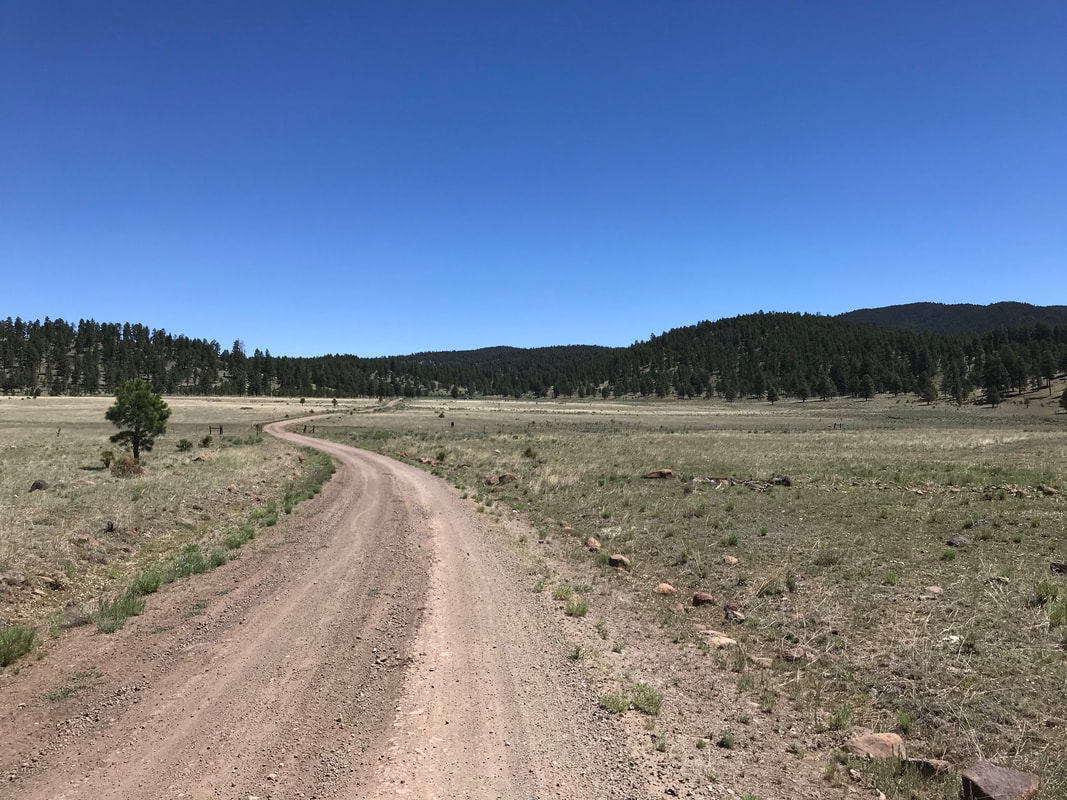
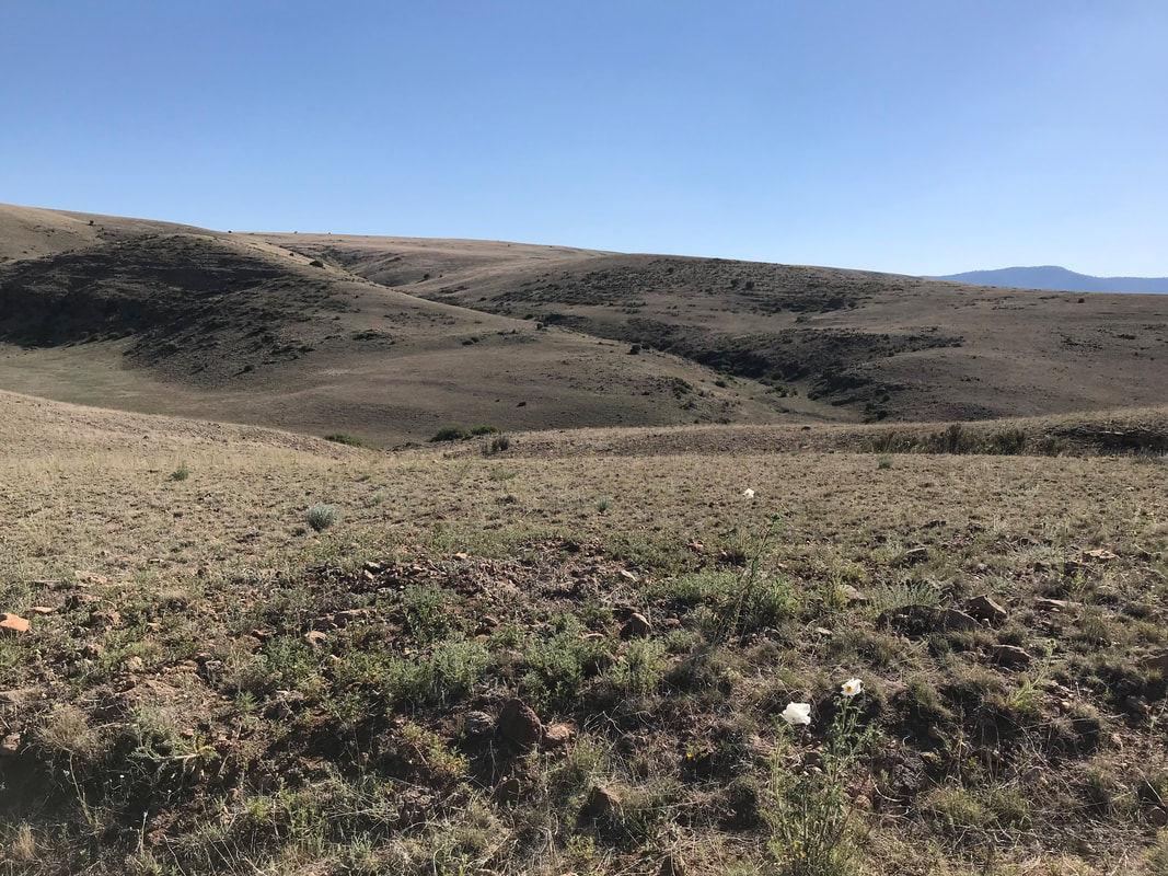
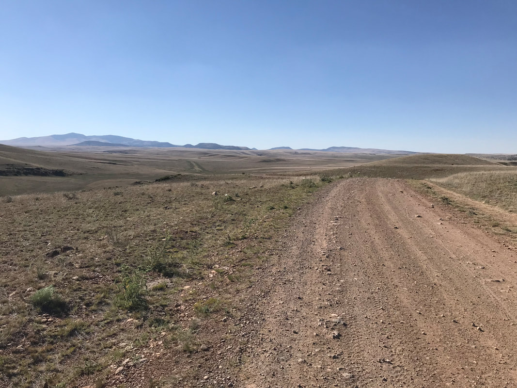
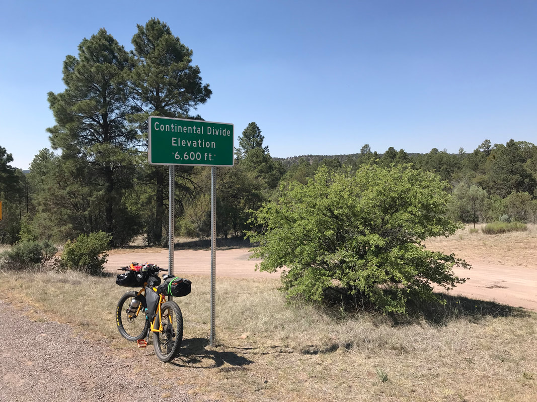
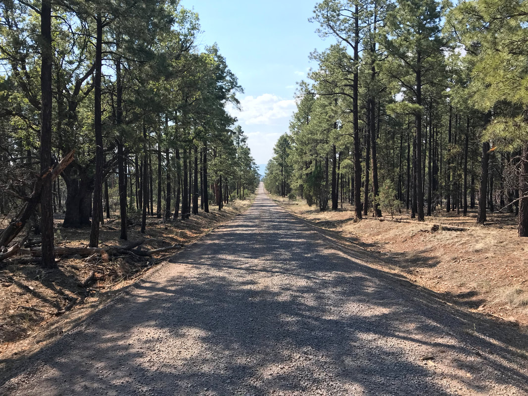
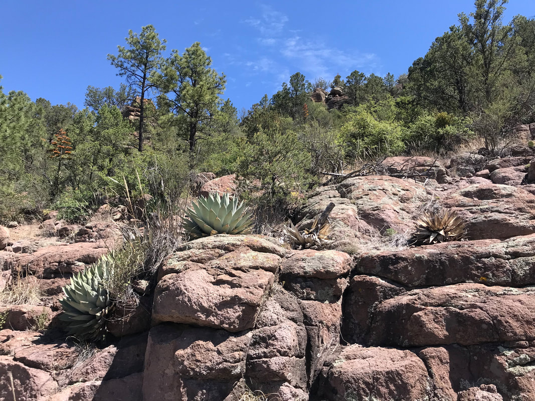
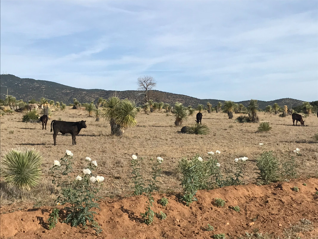
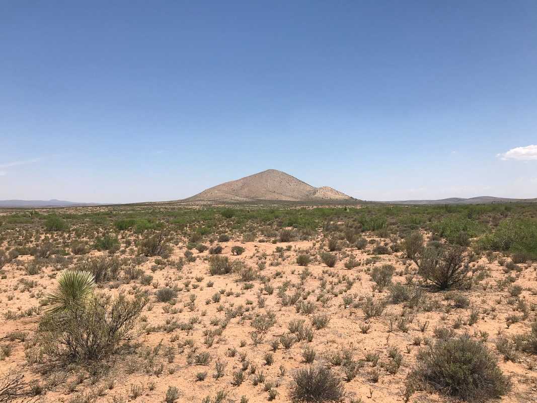
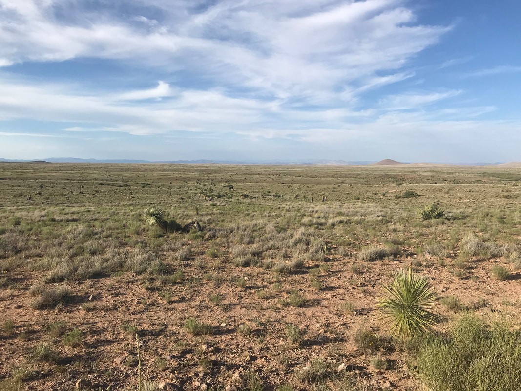
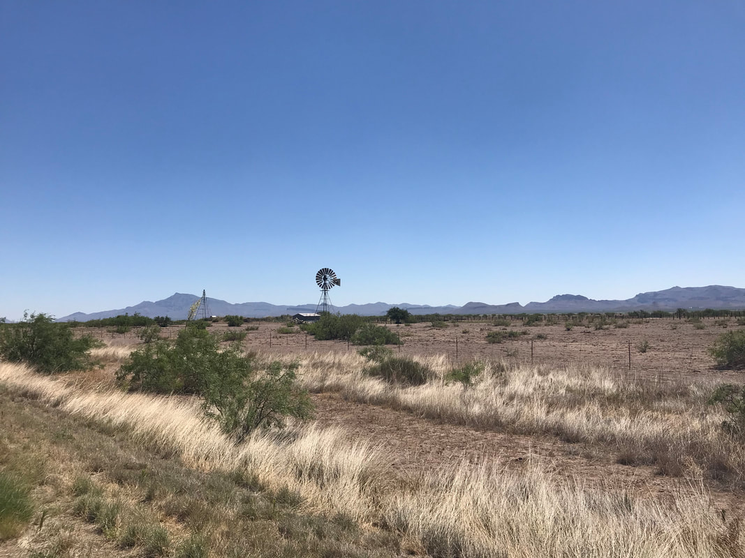
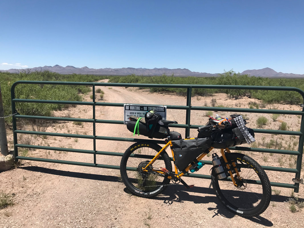
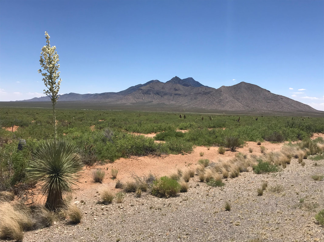
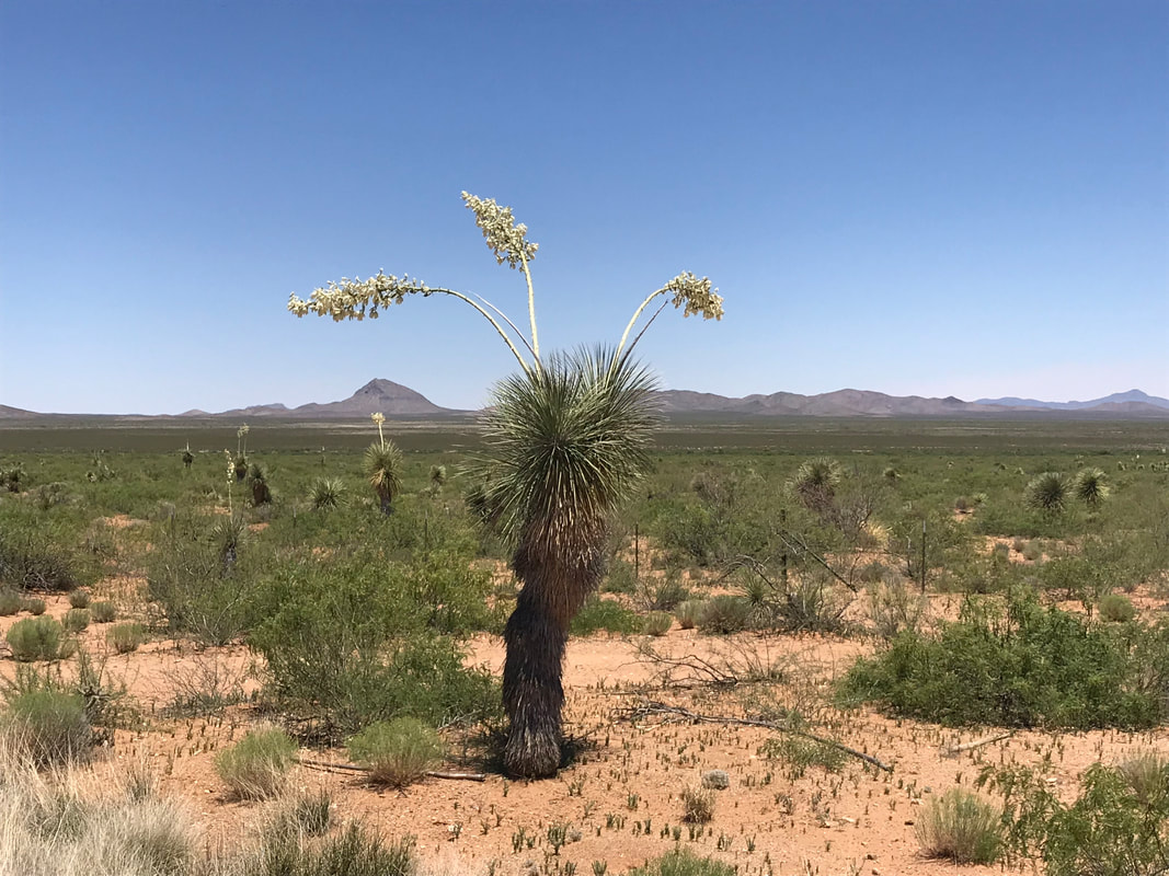
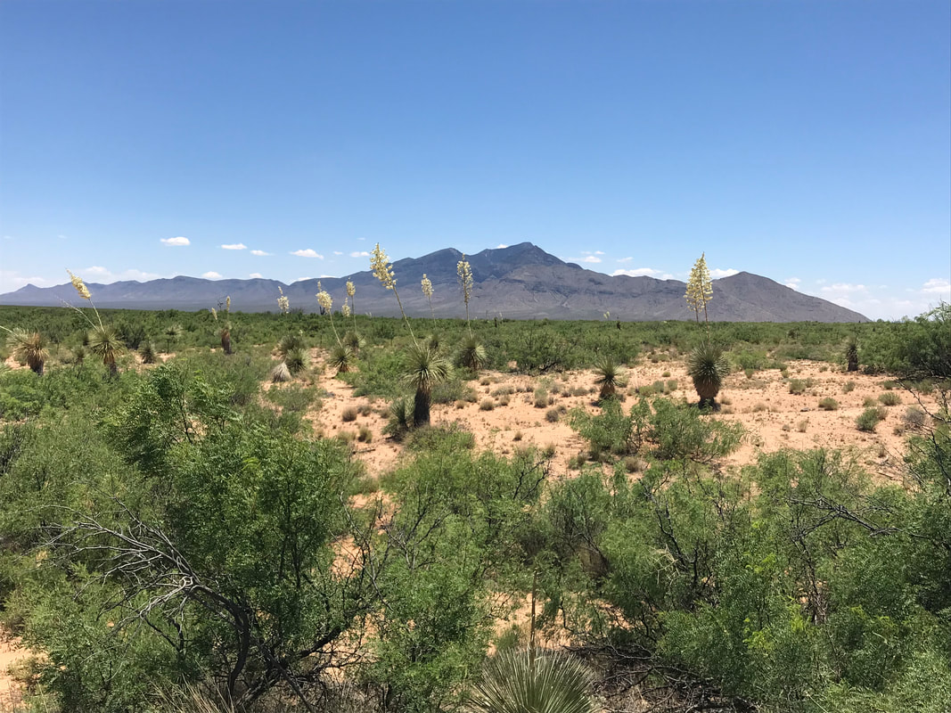
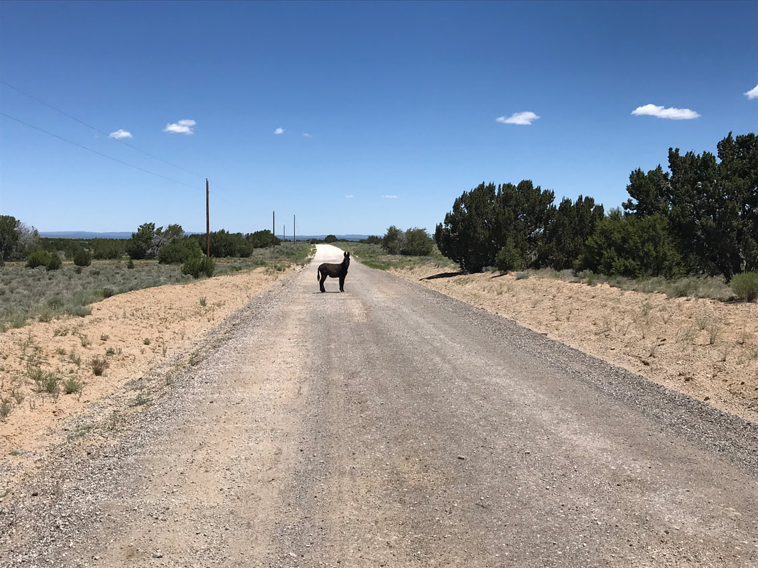 I slept well and woke up ready to take on the Great Divide. I packed up and left the Toaster House, stopped at The Gatherin’ Place for one last breakfast meal, and then pushed into lands north of Pie Town. The route was washboarded, not overly. I was able to weave around and through the many ridges making up the road. In the distance, the peaks of the GIla receded away. Distant peaks looked gorgeous, studded with juniper under the blue sky and red dirt road beneath me. I reached TLC Ranch by mid-morning. It’s a ranch with open access for CDT hikers and Great Divide riders to grab fresh water and even a place to camp. Under a canopy tent I stocked up on my water supplies and headed back out. The route led past distant ranches and abandoned buildings through an iconic view of western juniper-filled uplands. Slowly I descended into high desert grasslands. A wild burro ran ahead of me along the road for 10 minutes. Its speed matched my own, and I laughed as it ran forward while constantly looking back at me in bewilderment. The vast plains opened up and the road spread into the distance. The juniper fell away to be replaced by bunch-grass and cattle. Distant mesa edged the horizon along with the occasional presence of blooms. A massive herd of cattle trotted next to me, attempting to beat my speed and then cross in front. They were successful, so I slowed and then gunned it through a gap. The washboard lessened and the wideness of the views was impressionable. I neared the highway leading to a fork in the route around El Malpais National Monument. The highway to the right took a rider on pavement around the perimeter of the monument. A left turn led to a short pavement section before veering right onto the rutted and rugged Chain of Craters Route. If rain was in the forecast, take a right so that your wheels don’t get rolled into peanut butter mud. But my skies were clear so I headed left. There hadn’t been a storm here since several days before. 
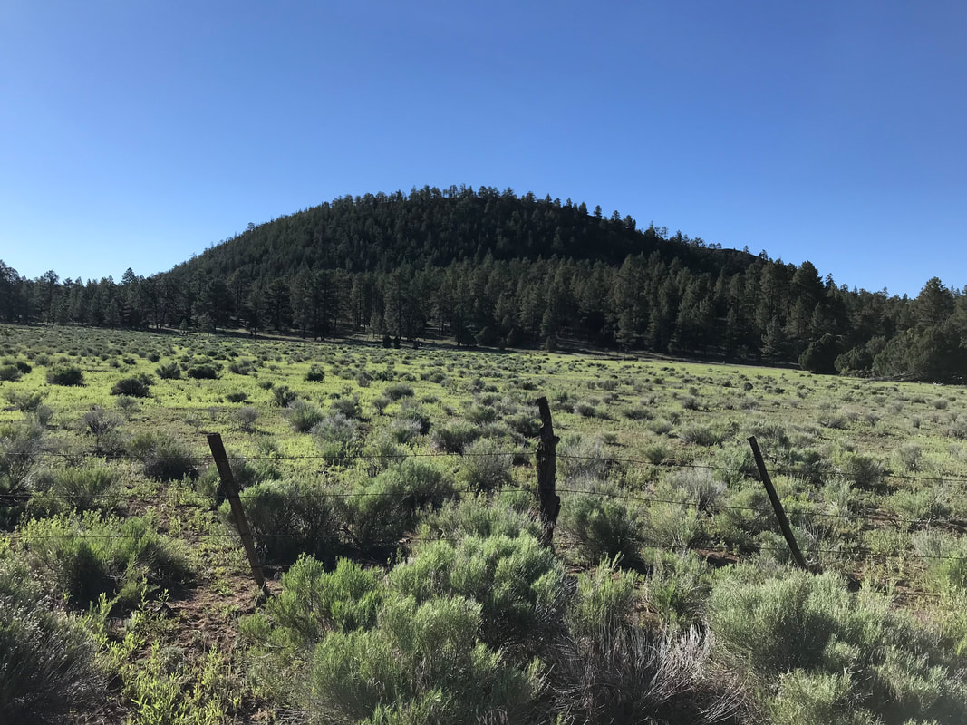
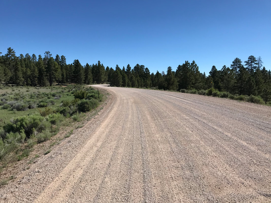
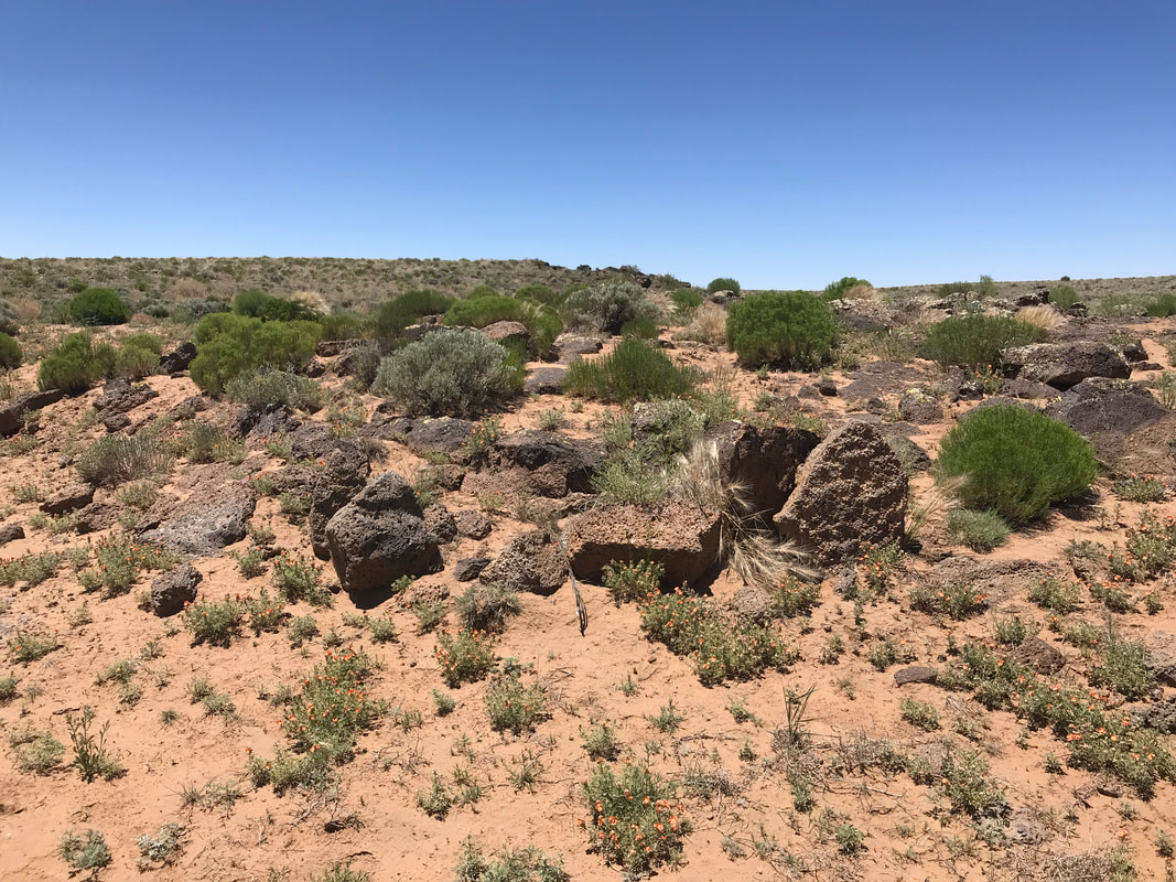
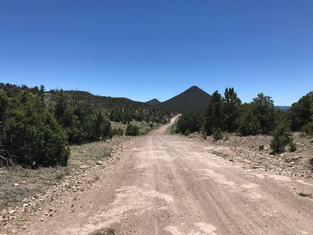
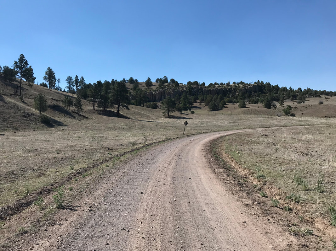
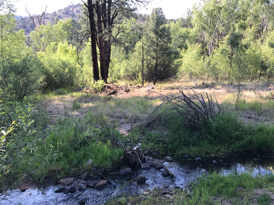
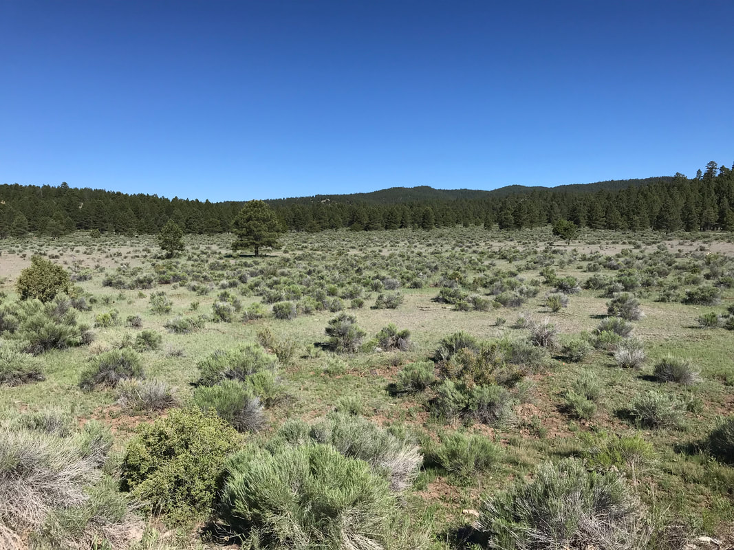
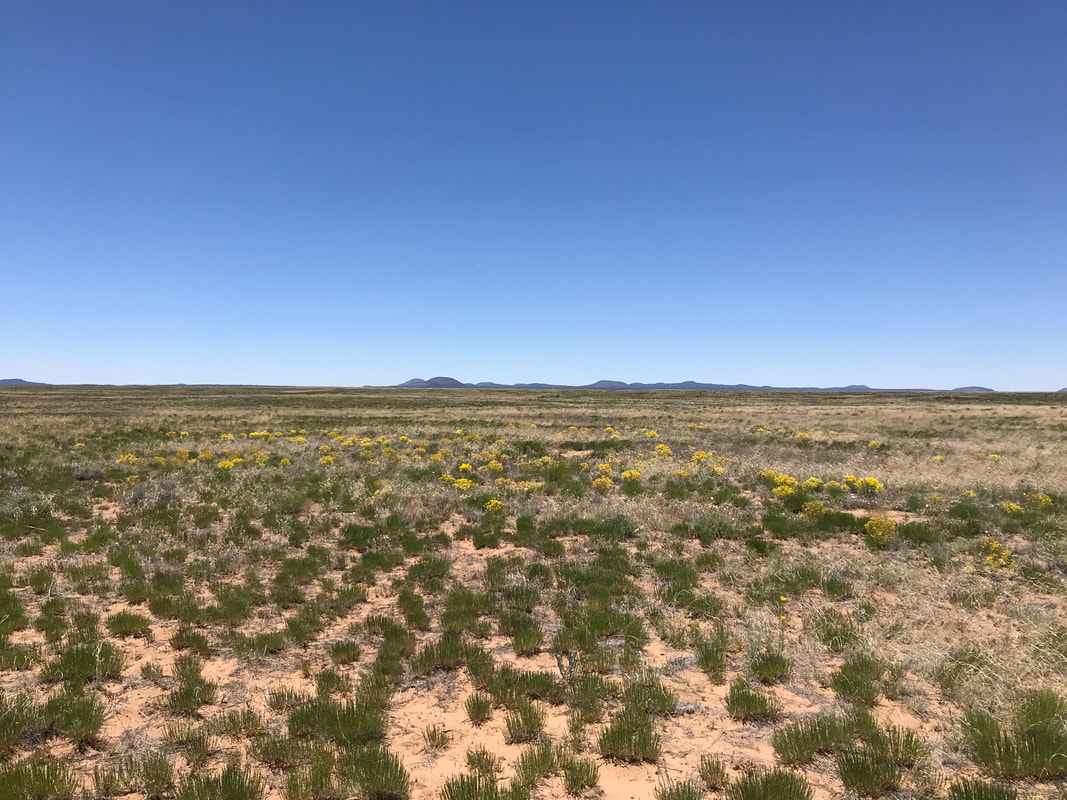
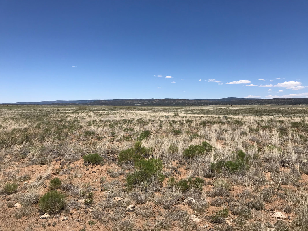
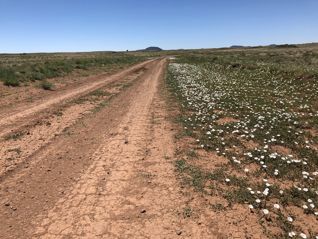
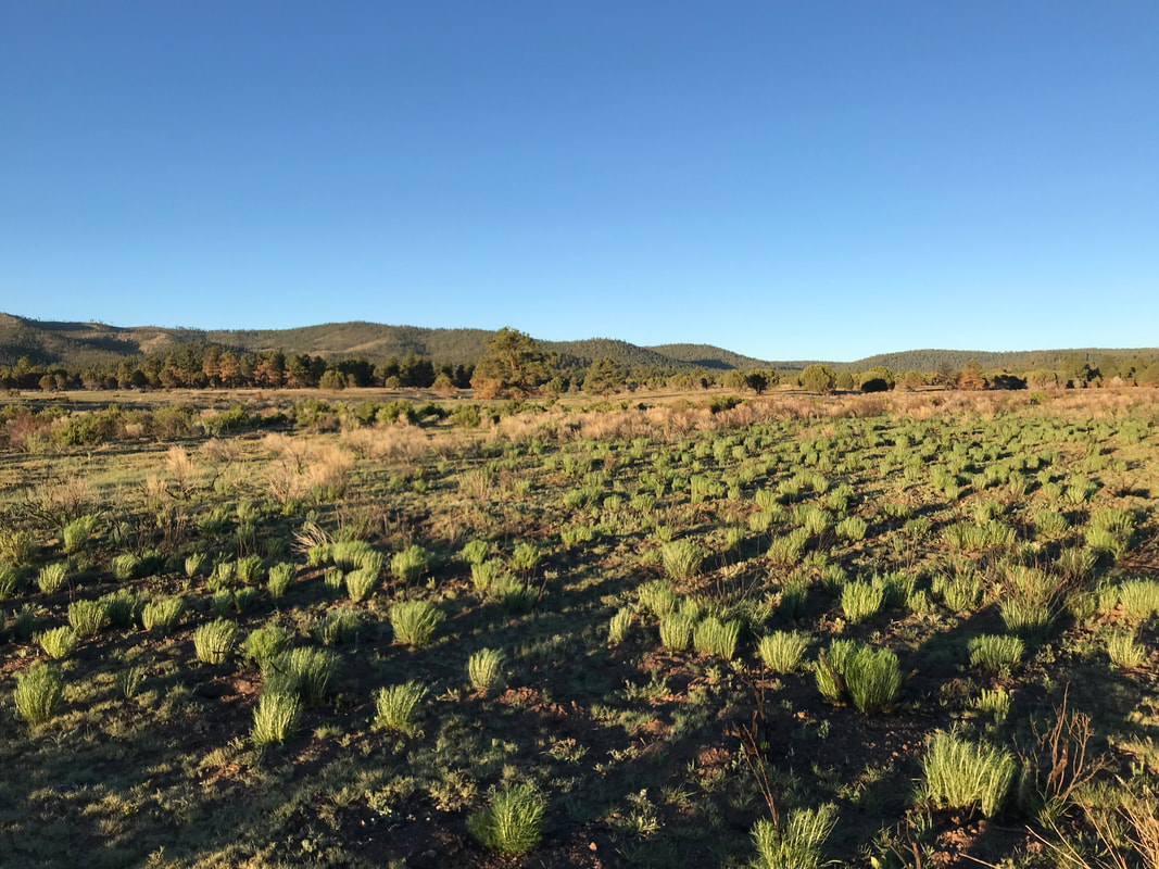
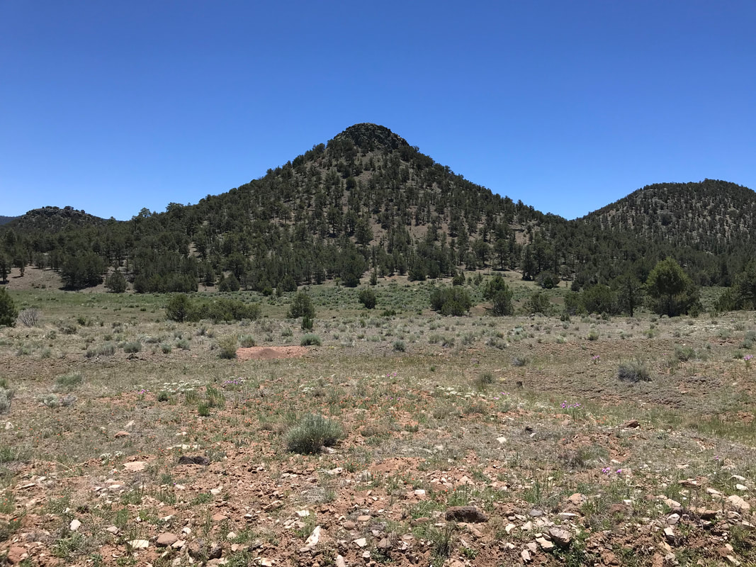
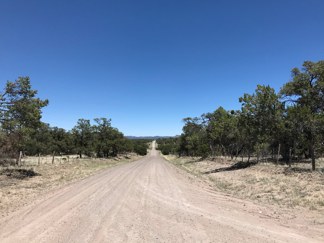
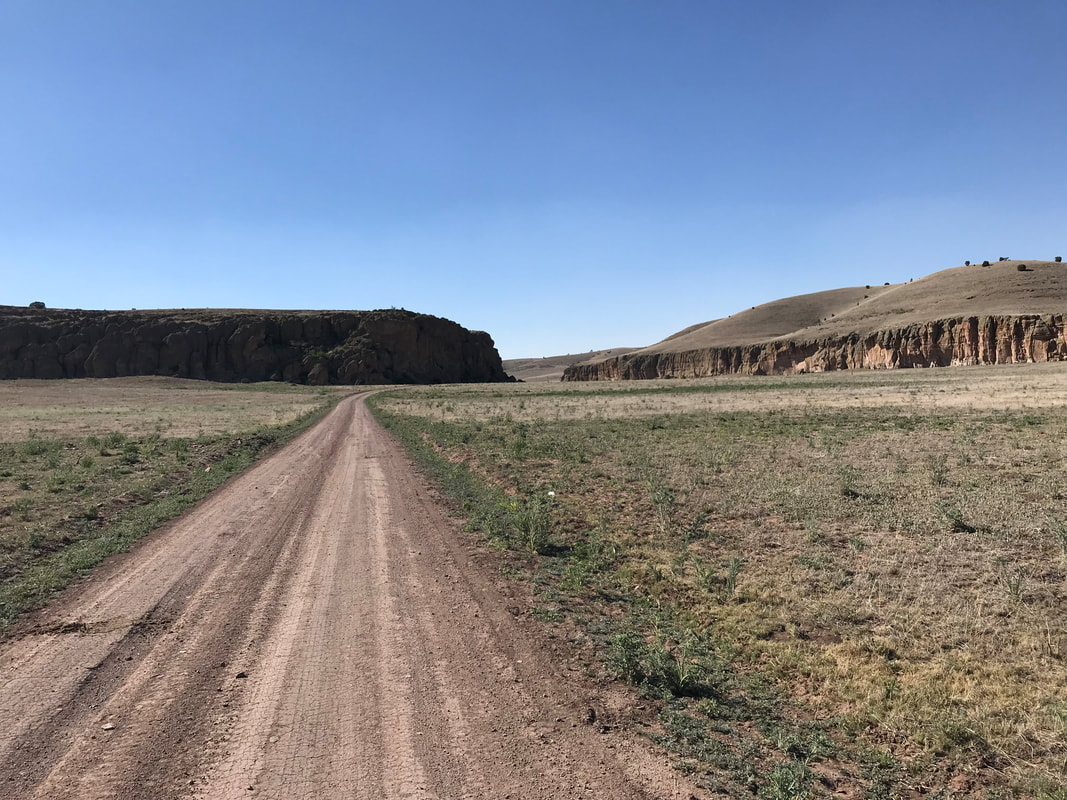
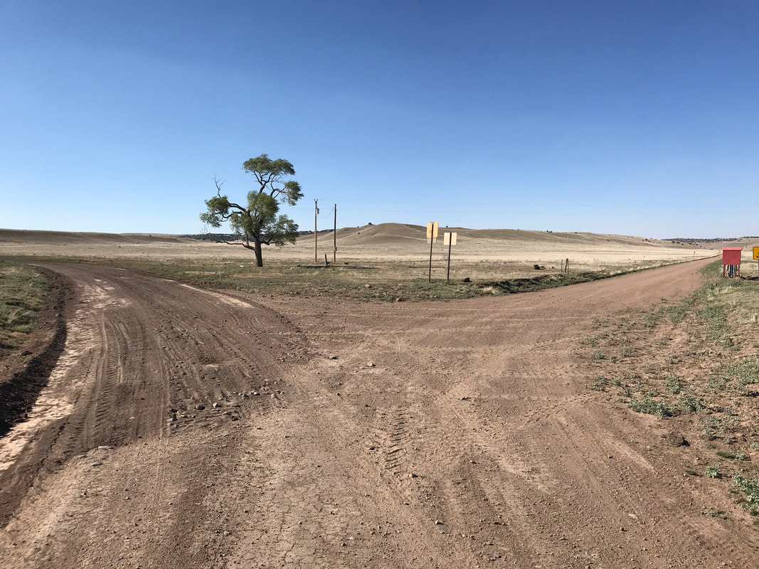
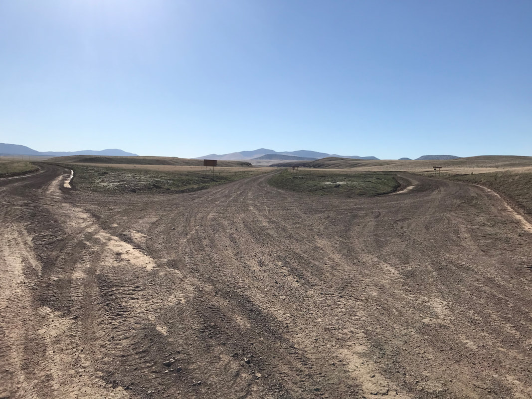
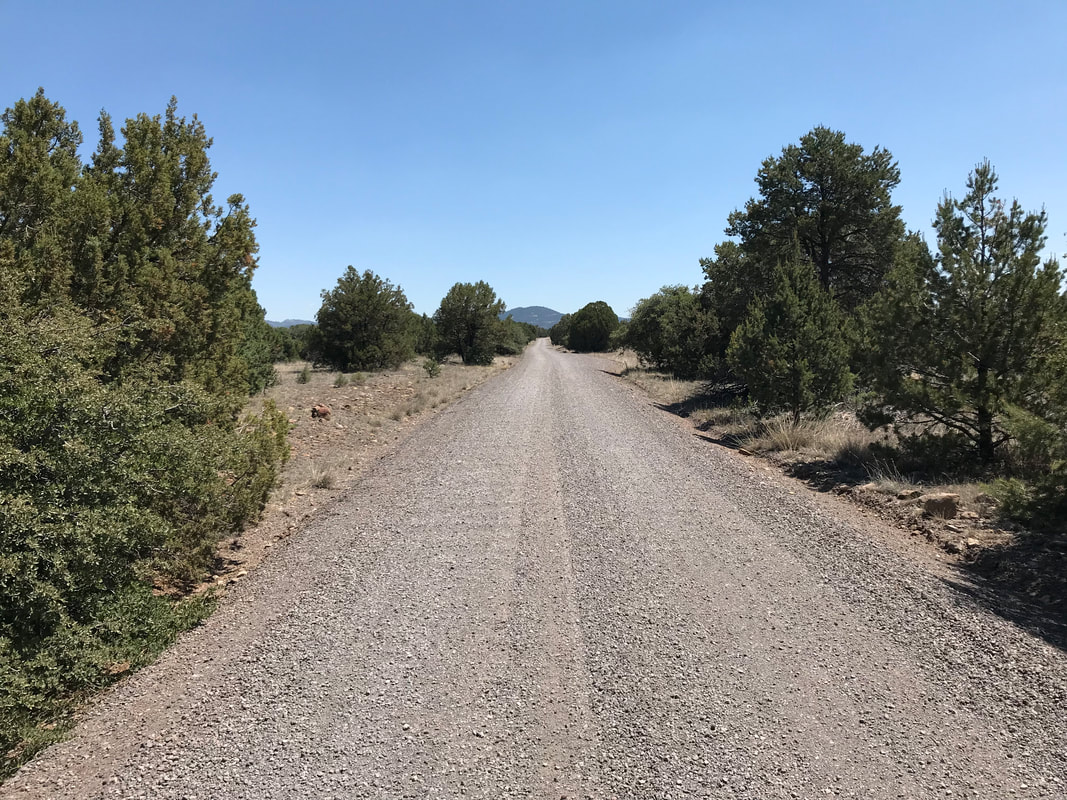
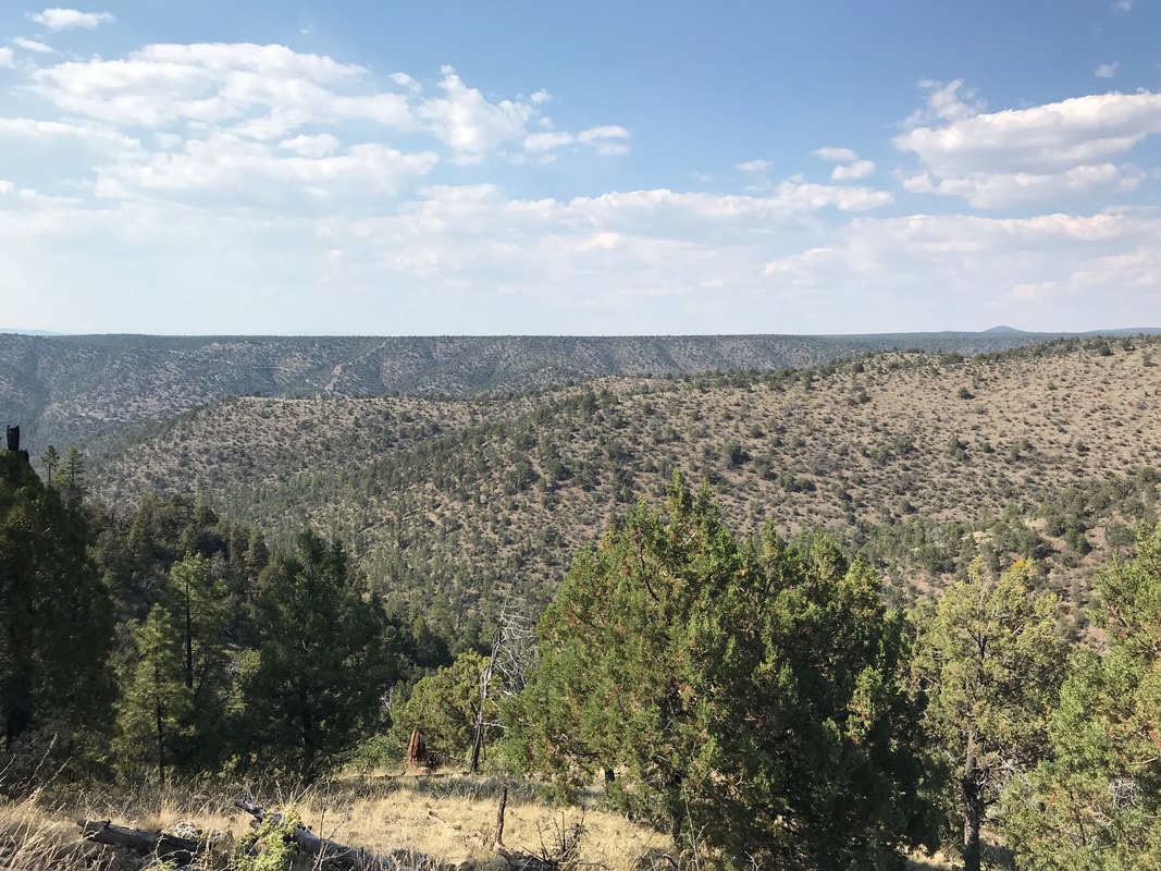
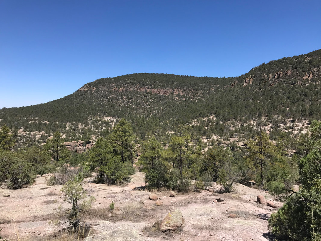
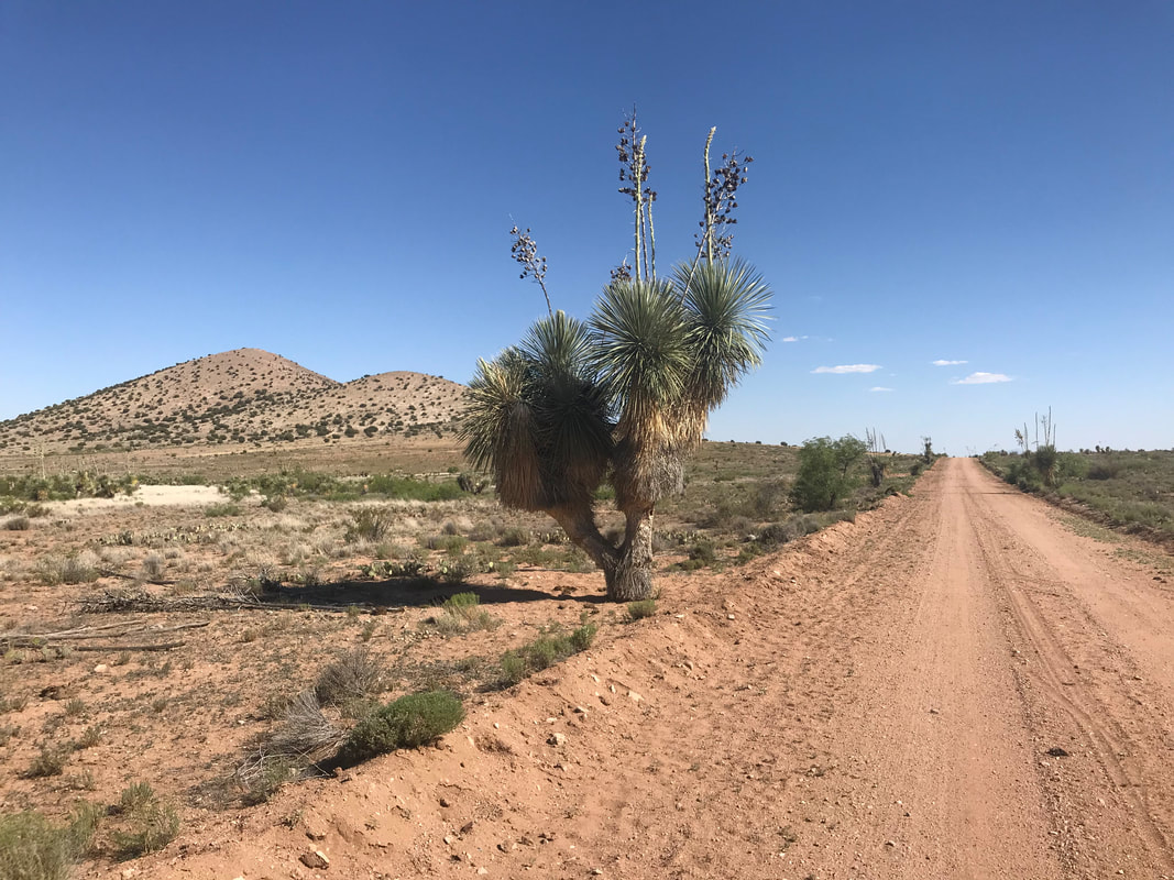
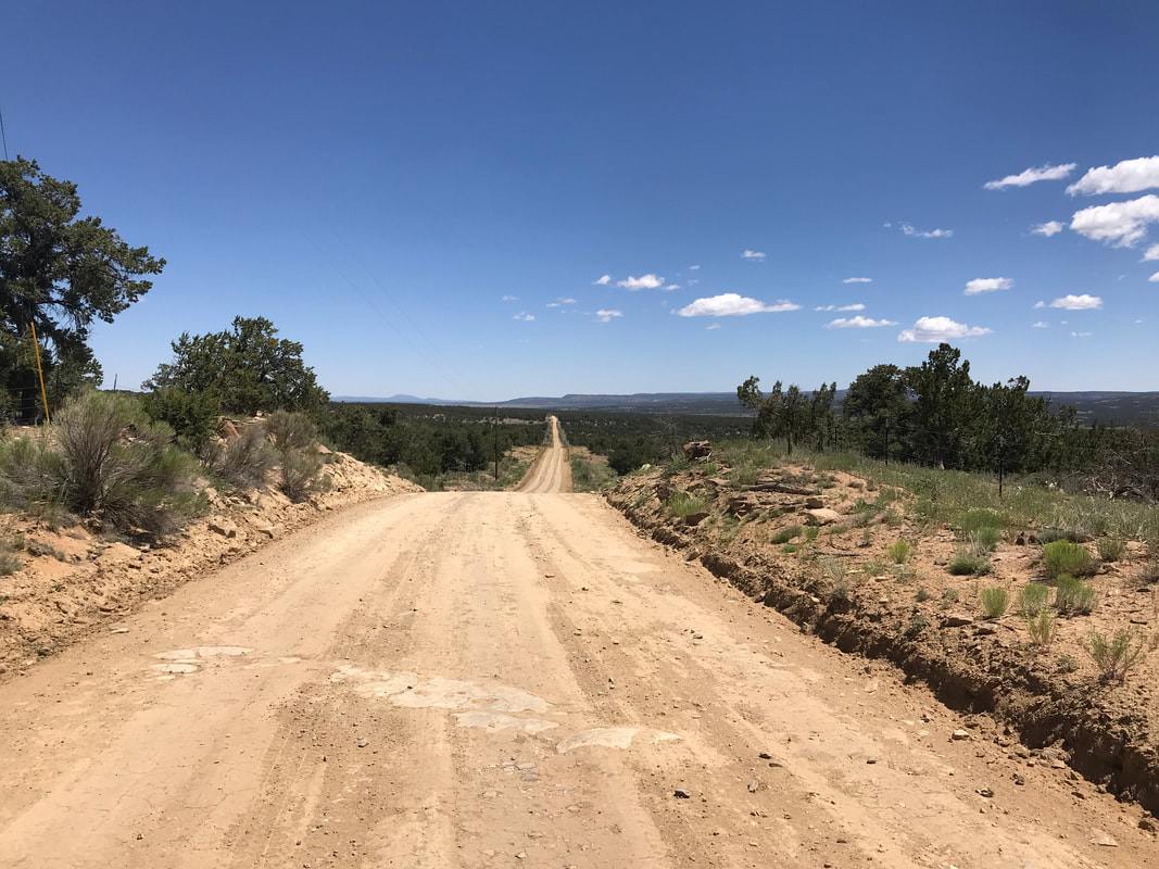   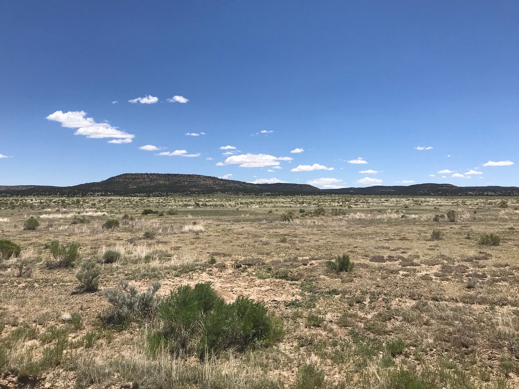   A lone tree stood next to the highway. And a few minutes later, I left the pavement again and turned onto the Chain of Craters Route. The Backcountry Byway sign was flanked by a CDT trailhead sign and a warning about entering the area if any rain was forecast. I felt confident, so I pushed on. The landscape began to change within a couple of miles of entering El Malpais National Monument. El Malpais is geologically interesting, born of many extinct cinder volcanoes that dot the land. Large black hardened lava flows flanked the road to my right. Small straggled junipers and ponderosa pines grew gnarled amongst the stone. The heat of the day wore on. Biting gnats and black flies went for my legs, pushing me to keep going. The road was washed out in areas. Deep tire ruts gouged sections. Although dry, I had to maneuver my bike around a rocky rut in many locations. I passed a cattle trough and windmill noted for water on my maps. The trough was bone dry. I was consequently grateful for fully filling up at the ranch. There was a slight upward climb most of the day. The dry expansive bunch-grass plains changed to juniper/pinion dotted mesas that slowly became mildly ponderosa-forested hills of ancient volcanic cones. The views were awesome. I was hot, but not overly so. A herd of wild horses stood to my left. I stopped to gaze. The leading stallion walked forward, stamped his front feet and then came galloping my way defensively. I spirited away in response. The road by now was sandy/silt but mild and weaving amongst the southwest evergreens. A few remote ranches popped up here and there. Signs posted at property driveways warned of well-armed owners who loved the Second Amendment. Message received. By late afternoon, I approached another cinder cone hill near the side-road to the Ice Caves. I had been scanning the terrain for an acceptable place to camp. Lots of the land paralleling the road was designated Wilderness, so no bikes allowed. Others were fenced off or private. And the remaining bits were chunky with volcanic pumice and rock. I found a notable flat area with a fire ring on public land. But I also knew a CDT trailhead was ahead that might be better. I biked up to the CDT trailhead which seemed more open and less sheltered. Back to the former to camp then. But first, I opened up my kit for dinner and sat in the silence of the craters. I noted a thin sliver of smoke rising distantly from the other side of the crater mountain. I had seen several ranches burning trash on their properties and assumed the same. The wind had really picked up by now. I pulled out my Garmin inReach Mini and used it to secure a satellite-retrieved weather report. It looked like the wind was going to get stronger all evening - 30 mph on average with stronger gusts before dying off into stillness in the middle of the night. The wind was blowing away from me, against the thin gray plume in the sky. After eating contently, I packed up my gear and biked back down to the former flat spot with the fire ring. I setup my tarp to block the prevailing wind. I stretched out, put my Ursack up, and enjoyed a quiet evening with beautiful colors.
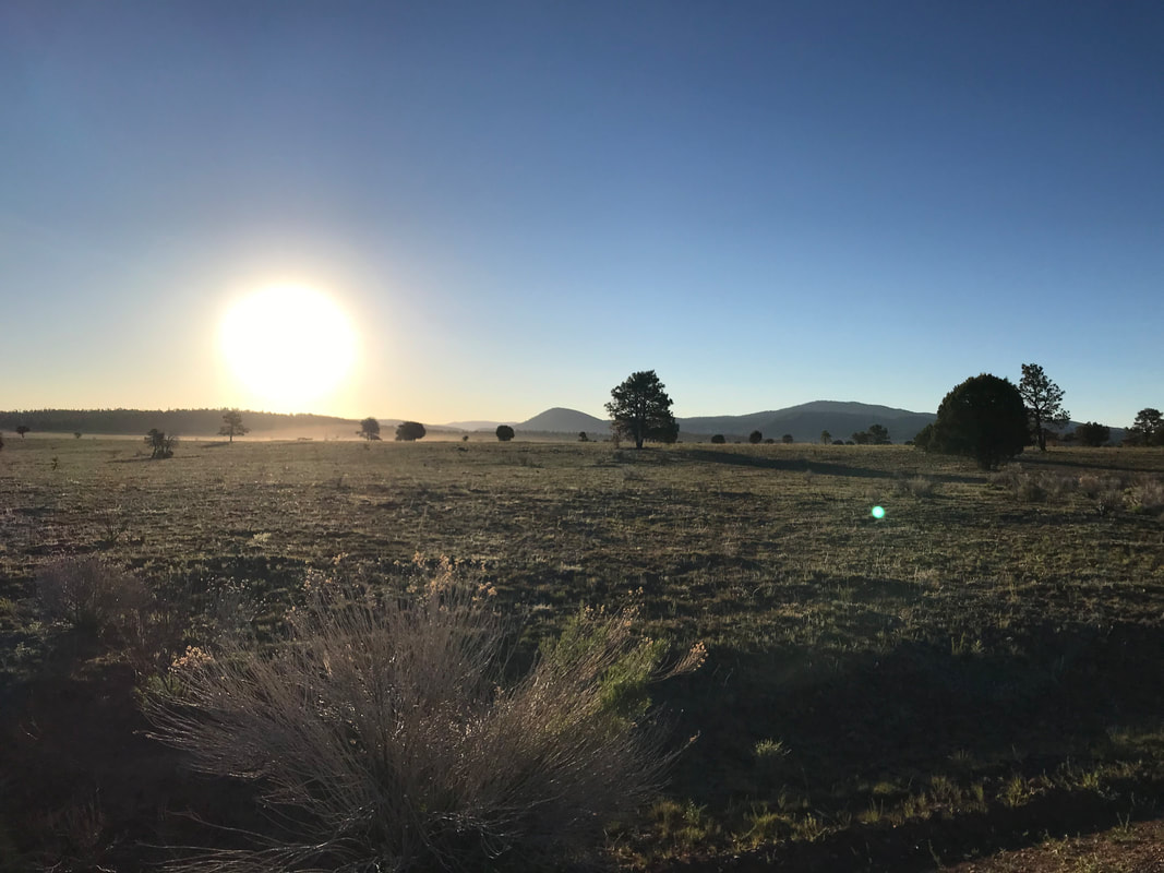
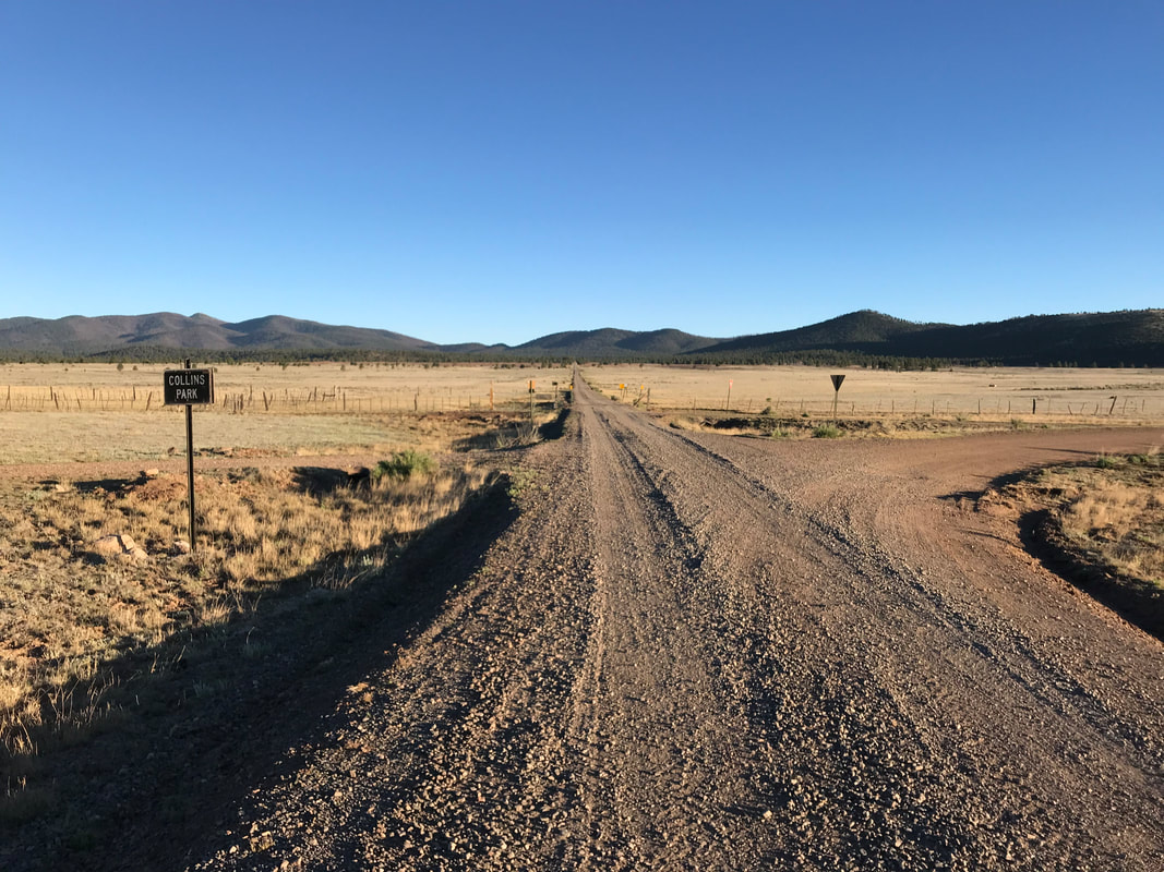
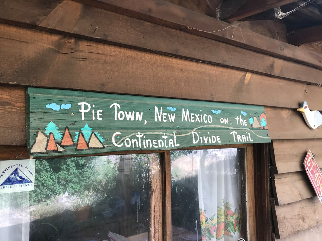
 I climbed into my bivy and went to sleep. Sometime, at a vague point in the night, I groggily awoke; I was annoyed by this persistent feeling that I couldn’t breathe. Have you ever been asleep and something is stimulating your body, not enough to wake you, but enough to generate an automatic response to lessen the stimulus? Like a feather tickling the nose of a sleeping person? For me, it was this feeling that my throat was burning. I was annoyed, woke sleepily, rolled over and felt relieved. Again, sometime later, the same stimulation. My throat was hot and I couldn’t breath. I slid my buff up over my mouth from my neck - it seemed to filter the air; I felt better and went back to sleep. Then, again. At some predawn hour in the morning I really woke up with a general feeling of suffocation, dryness of mouth, and burning throat. My weary eyes fluttered open and it seemed that, even in the black dark of the area, that a heavy layer of smog was above my face. I turned my head sleepily to the left and stared into the dark. Two spots of orange glowed. The first thought that came to my drowsy head was mountain lion eyes. My eyes flashed open. I felt revved. Awake fully, I sat up and scanned the area. What seemed like two orange spots began to blend into a line of orange spots (definitely not feline) stretched out in a line maybe 40 feet from me. Wildfire. Now I shot up to my feet. My mind was gathering the subconscious stimuli from my night’s sleep. There was a wildfire line burning. The smoke was incredibly thick in the area. So thick, I was having trouble breathing. That’s what had been waking me up. And now, it was close. Panic did a cold sweep over me. I began quickly dismantling my sleeping area. I started stuffing my quilt into a stuff sack but I was shaking and couldn’t do it well. I stopped. I needed to do a quick risk assessment and prioritize my actions. First, I assessed the flames. They were only a couple feet tall and didn’t seem to be advancing any closer. The wind that had blown hard all evening was dead gone, and if the former weather forecast was correct, wouldn’t return for days. Next, I used the InReach Mini to send a note of caution to my family to stay alert. Then, I thought about what was most important to grab: quilt for warmth, tarp for shelter, bike for movement. Everything else could be abandoned to the flames if they advanced. I packed up the quilt and tarp into my bike bags and pointed my bike into the dark. Now, I needed to assess the wind in case it did start back up - I didn’t want to bike towards a firefront changing direction. I felt no wind, the flames were not advancing, the smoke was awful and thick, but it was lessening. I used my InReach Mini to check the weather again - the same forecast showed: 0 - 1 mph average for next 24 hours. I calmed myself. I litany of messages were returning on the Garmin. Everyone was asking questions about what was happening. I took a breath for confidence and observed the flames. The flames were stock-still in position, lessening, evening smoldering in areas. This calmed me more. I stood there , watching as the flames grew low to the ground and then just smoldered thick smoke. No more orange. And it stayed that way. With time now passed and active flames gone (plus no wind present), I decided to pack up the rest of my gear properly and secure my belongings, plus make a plan. I was exhausted, covered in soot, reeking of smoke, but safe. I would ride to Grants and get a hotel room at the Motel 6 in town to wash up. Also, this fire was no fun and absolutely had freaked me out. I decided that Grants would be my endpoint to wrap up this trip. I contemplated where the fire had arisen. It had to have come from that distant plume on the other side of the cinder cone mountain. After falling asleep, the wind may have shifted direction, fanned the flames, and brought the burn to me, only to stop when the wind died out. I considered how a storm had occurred days prior and maybe a lightning strike had started embers that smoldered for days until the wind inflamed it. No matter, I pedaled on as dawn's light came wrapping over the land. 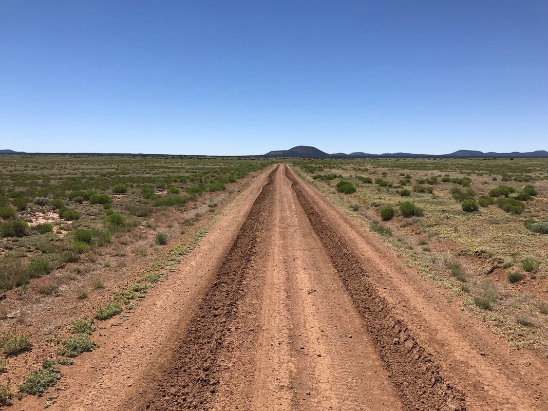 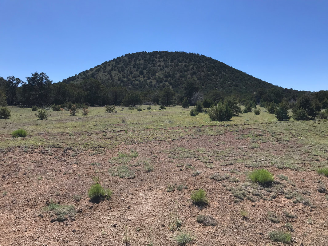 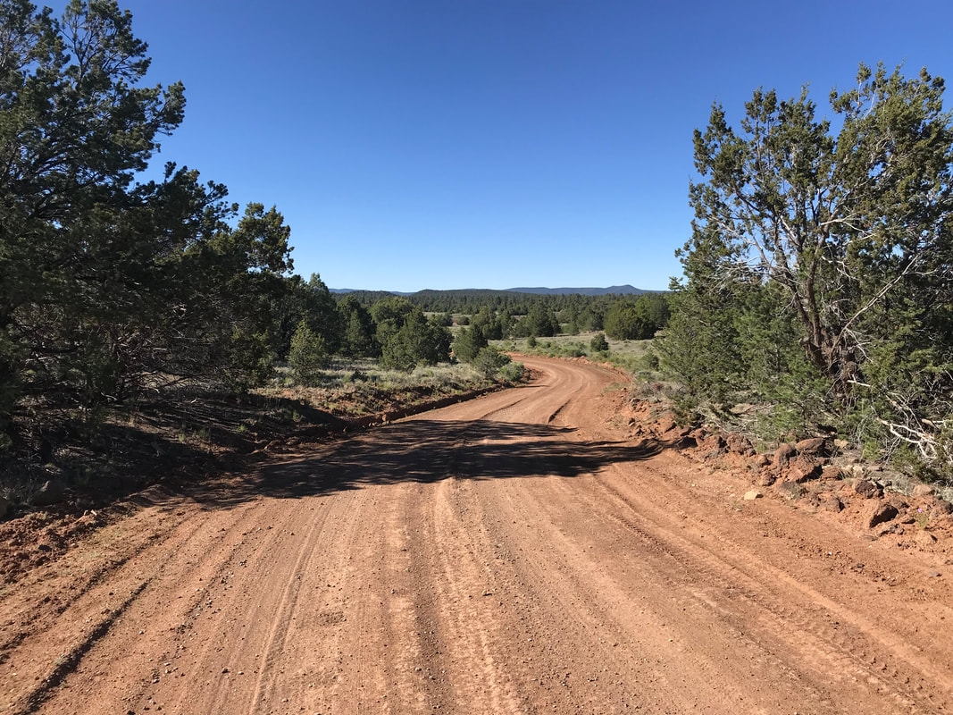 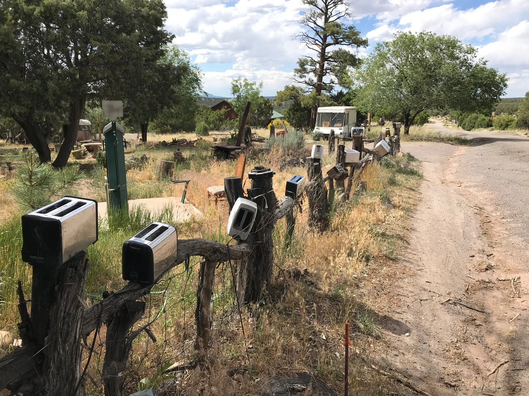 Pie Town, NM is an incredible place full of deeply kind people. After traversing the heat and remoteness of the Gila, it is the exact place to find some respite. After a long and deep night’s sleep, I hopped down to the local post office to pick up my package of dried beans for this next section, plus a new map section as well. I then stopped at the Gatherin Place where they served up some excellent pie and breakfast. Later, I biked to Top of the World, a small general store 3 miles outside of town. I picked up food to get me through Grants. On return, I cleaned my bike on the front lawn of the Toaster House, washed my clothes in the shower, and drank a ton of water + ate a ton of food. I also made some calls home to hear from others. I needed some conversational socializing as the Gila had proved its reputation for remote, hot, and dry. Everyone encouraged me to relax and keep pushing forward. As evening rolled around, I stopped back at the Gatherin Place for more dinner. I then turned off the lights and slept hard again. I kept thinking of that CDT hiker I had met the day before who said he was getting to Pie Town today. Never saw him. 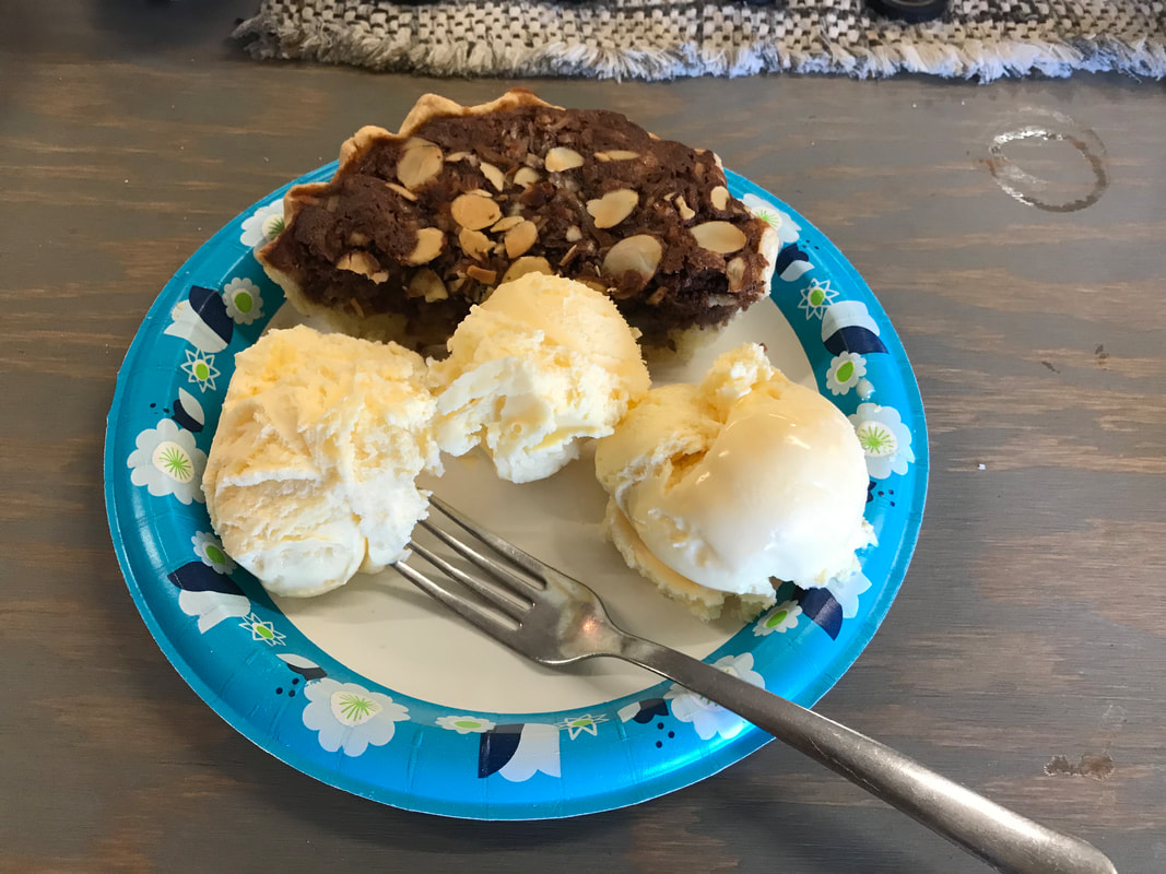 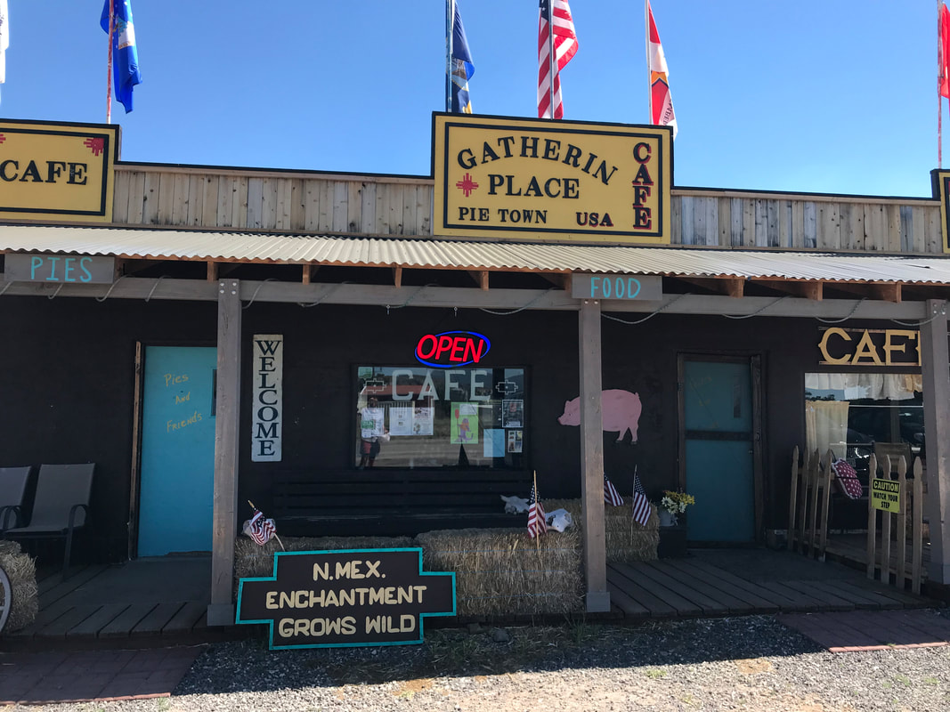 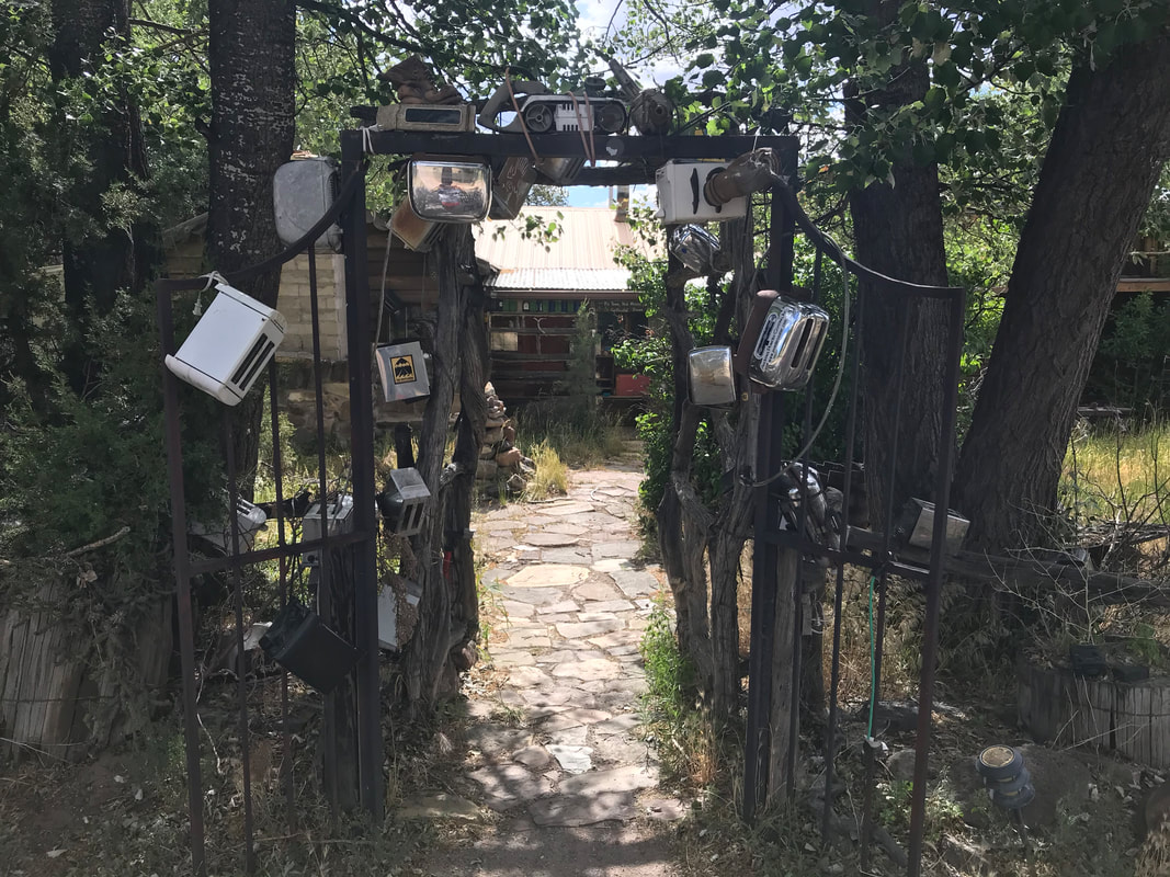  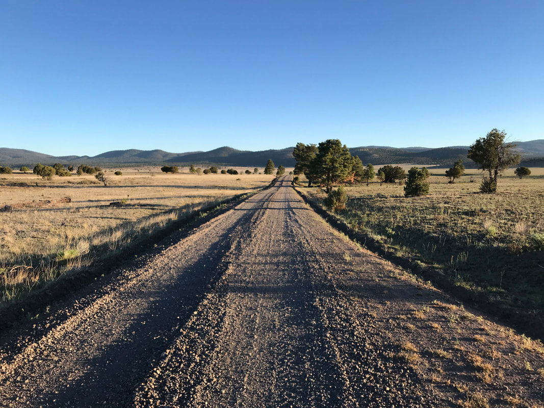 The morning came quickly after a night of quiet rest. I rose early again to beat the heat. This time, I awoke at 4 in the dark and was packed up and on the bike by the first rays of light. The morning was once again cold and crisp. I began pedaling through the ponderosa pine forest. Light filtered through the branches of the pines bringing streaks of gorgeous golden rays onto the dusty dirt track. The road rolled up and down hills and at the crest of one, a massive herd of 18 elk began running across the road as I approached. It was amazing to see the females and young stampede across. I left the shelter of the trees and entered the high and hot alpine plain of Collin’s Park. Immediately, I could hear the screaming bugle of male elk. I pedaled excitedly and came across the largest herd of elk I had ever seen - something like 40+ individuals running in unison, bugling, and kicking up dirt across the parkland plains as my bike approached. The sun crested the horizon directly on my right. It cast that rich golden color over everything. Gone were the feelings of heat and desiccation. They were replaced with crisp and temperate feelings of life. I turned right at an intersection and coursed parallel to the massive herd still running. Suddenly, a large canine seemed to rush out of nowhere towards the herd. I kept pedaling and stared intently at what I thought was the largest coyote I had seen in my life. It chased the herd directly. I sped up to keep up. We were all running in tandem, all in parallel. The elk far out, the canine ahead of me, and me sandwiching from the outside. The chase continued for a solid minute, and I couldn’t shake the fact that this coyote was the LARGEST with the longest and thickest fur I had ever seen on one in my life. It then dawned on me that this might be a Mexican gray wolf. With that knowledge primed, I pedaled faster to get a better view. The size, the speed, the fur length, the general movement all seemed entirely un-coyote and more likely wolf. I was elated. The wolf turned, saw me, and broke away from its chase into a run that continued for several hundred feet before veering into the woods. Incredible.
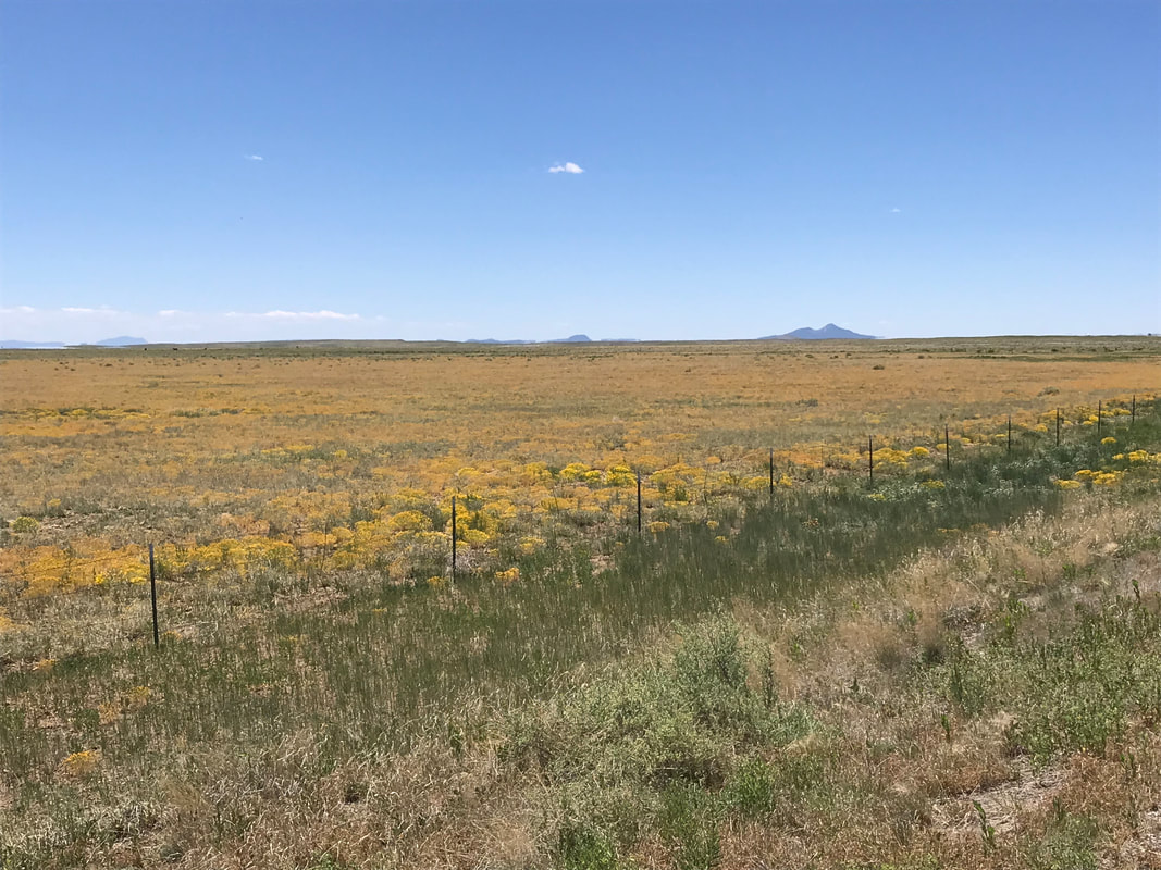
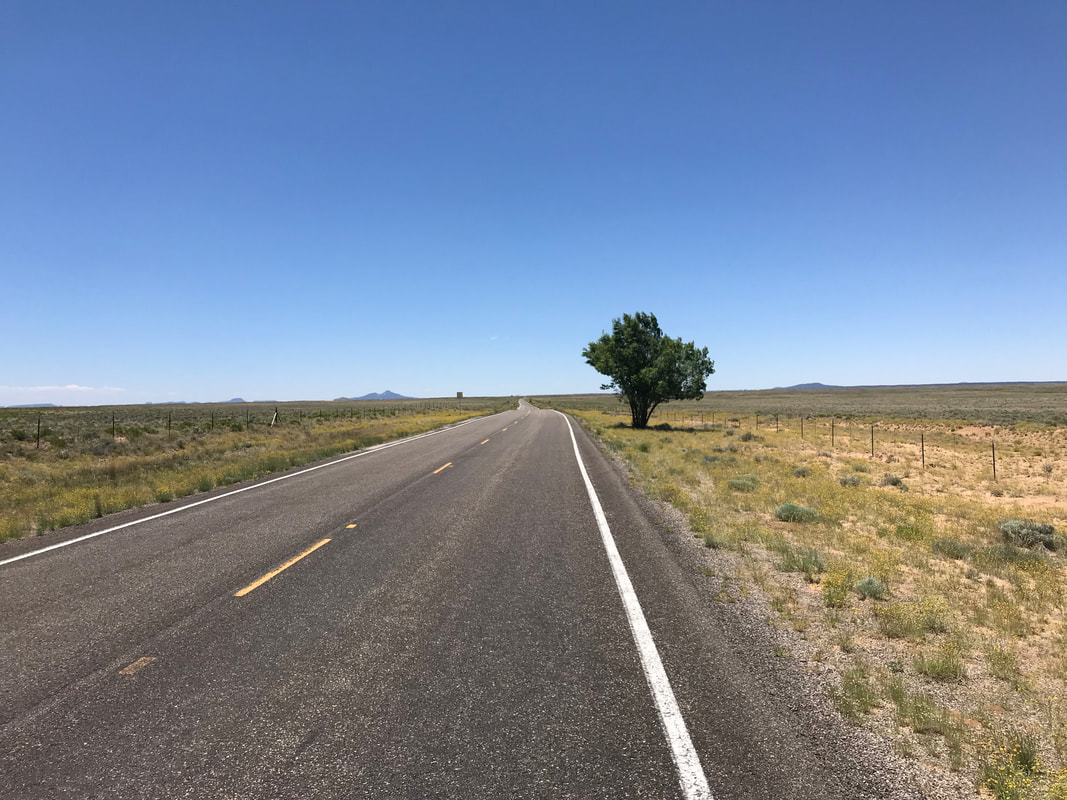
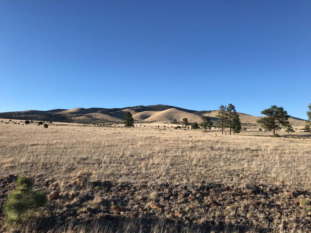
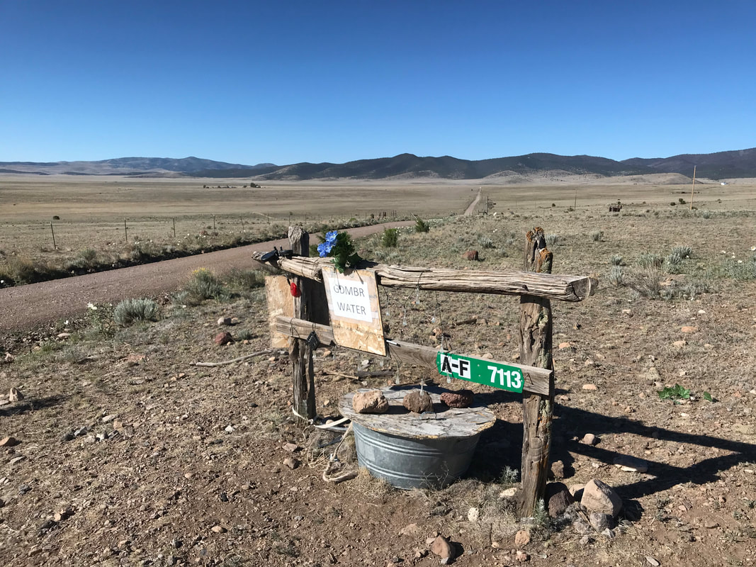
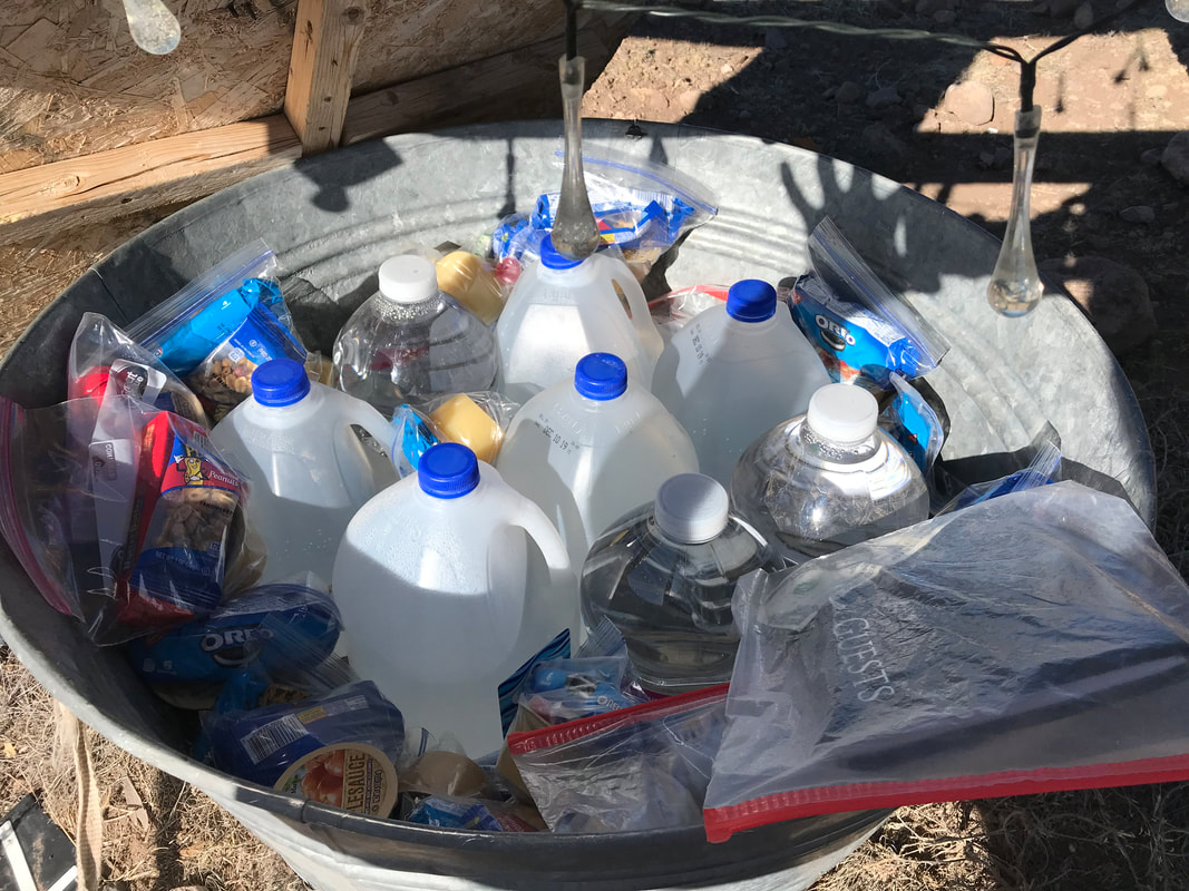
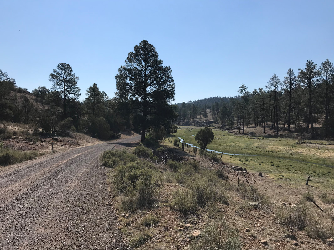
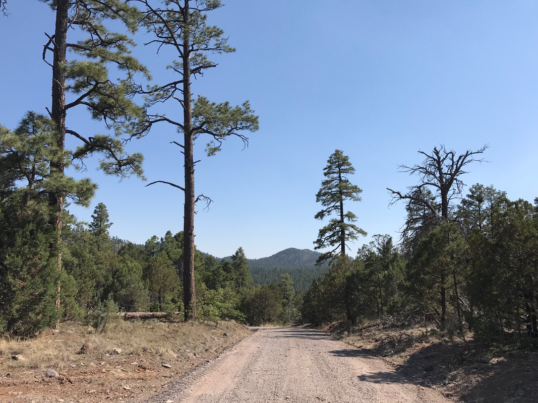
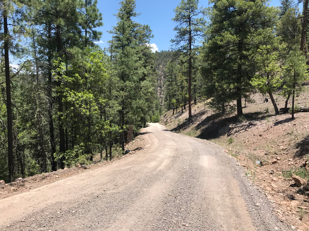
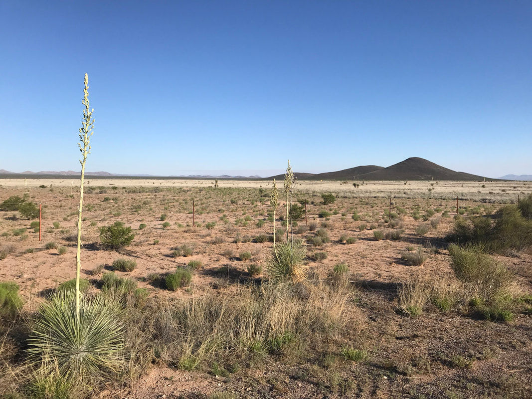
 Another Continental Divide crest and sign appeared. And then I started down a long and drawn out ride through canyons out of these mountains. I wound down and down, cold in the shade without sun. I ran into another cyclist ahead who was pulled off getting water from a cattle tank. He had started in Leadville, CO before heading south. We spoke about the terrain ahead and behind before I continued on. The woods receded to Juniper, which further receded to silt dust and dried ankle grass on the Plains of Augustin. Again, these plains seemed incredibly barren, exposed, waterless, and surreal looking. Another fire with smoke curdled in the distance away from my route. A few distant ranches appeared. As I passed by the half-mile gravel driveway of one, a sign at the edge caught my eye. It said “GDMBR Water.” I skidded to a halt and walked over to a plywood manhole cover over a sunken barrel. I removed it to find incredible trail magic. Inside were like 50 plastic bags. Each contained an applesauce packet, Oreos, peanuts, and peanut butter crackers. Several jugs of crisp and pure water gallons had also been stashed. I sat down and gorged myself on the treats and read from the trail register. This trail angel setup was provided by parents of a son who had ridden the route years before and then died after a mission with the military in the Middle East. He had always wanted to come back and ride again. In his memory, his parents kept this stocked as trail magic to fuel the riders on this remote and barren section. It was the sort of meaning and unforeseen beauty I loved being enriched by out here. I pushed on as the heat began to rise. I wanted to climb up in the last high forested peaks of the Gila National Forest. The route up was rugged with lots of washboard. I sat in my lowest gear and sweated all the salt and water out of my body. The second cyclist of the day came down the climb. We spoke for a few minutes and it turned out he was the companion of the guy I saw this morning. I continued up and he continued down. After a couple of hours, I made the top which dipped into a series of long and relatively level meadow/grasslands surrounded by woods. I spoke to a Continental Divide Trail thru-hiker. He was absolutely burnt out and demoralized - in fact, he told me as soon as he got to Pie Town tomorrow, he was going to quit. The rugged Gila and its waterless/exposed sections had wrung him out. I empathized deeply.  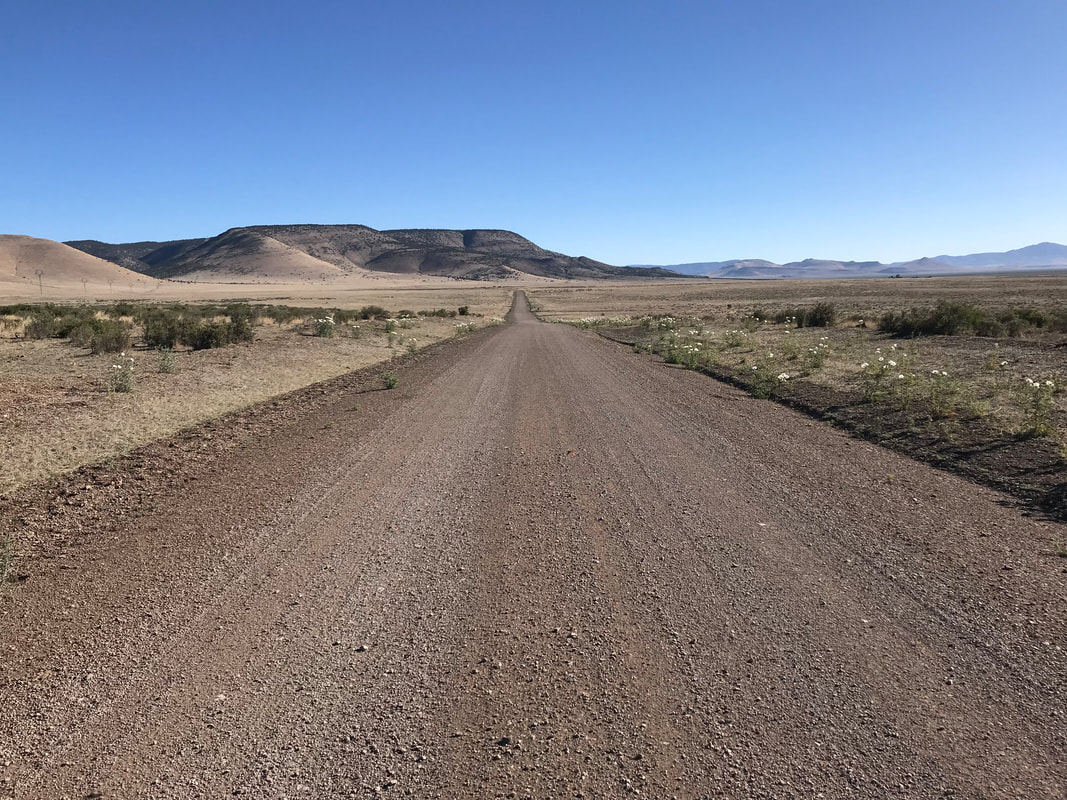
 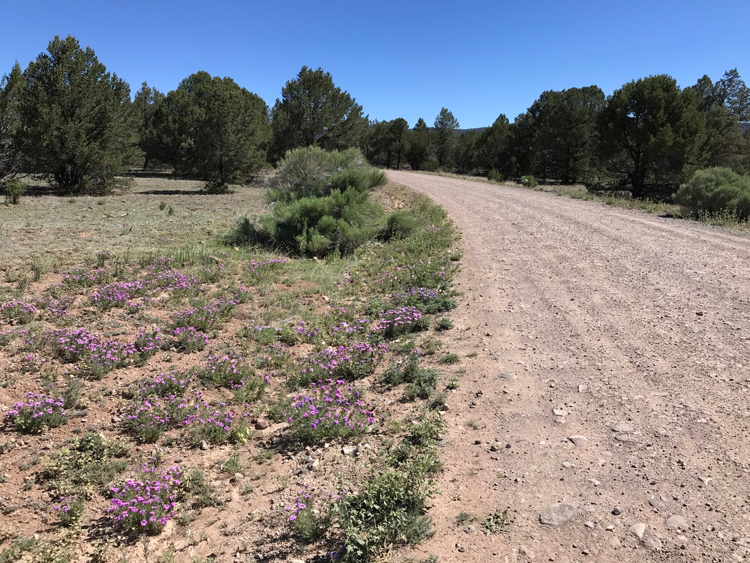
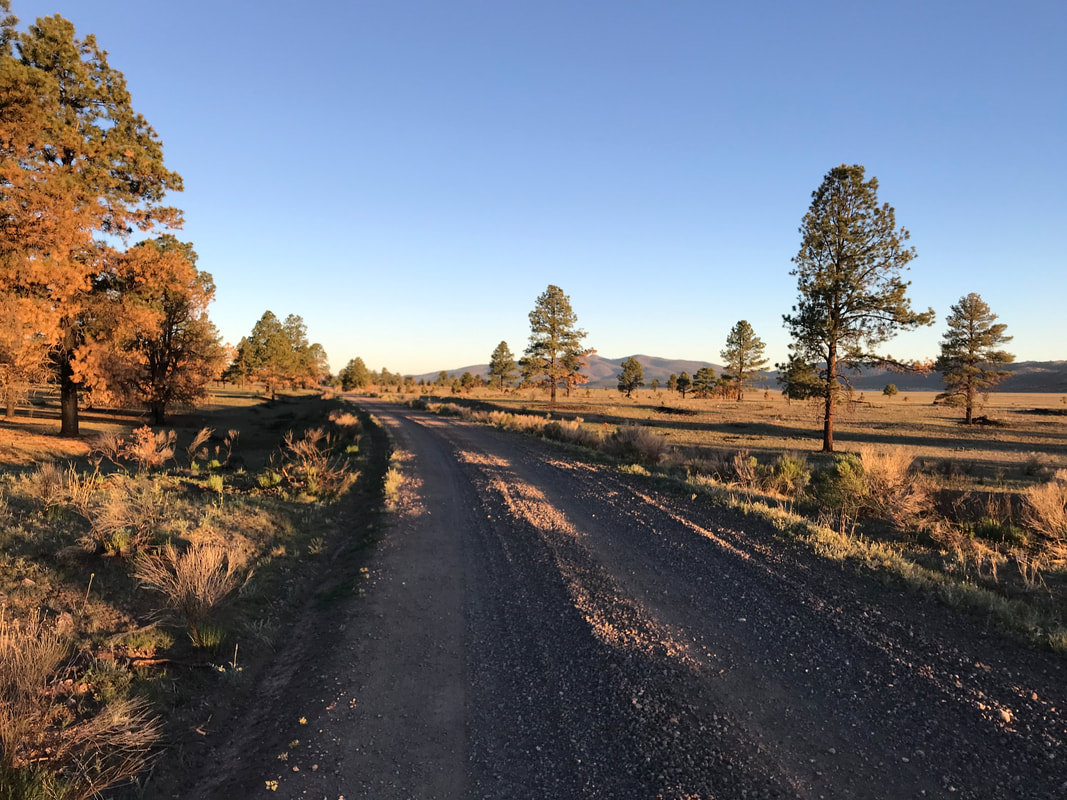
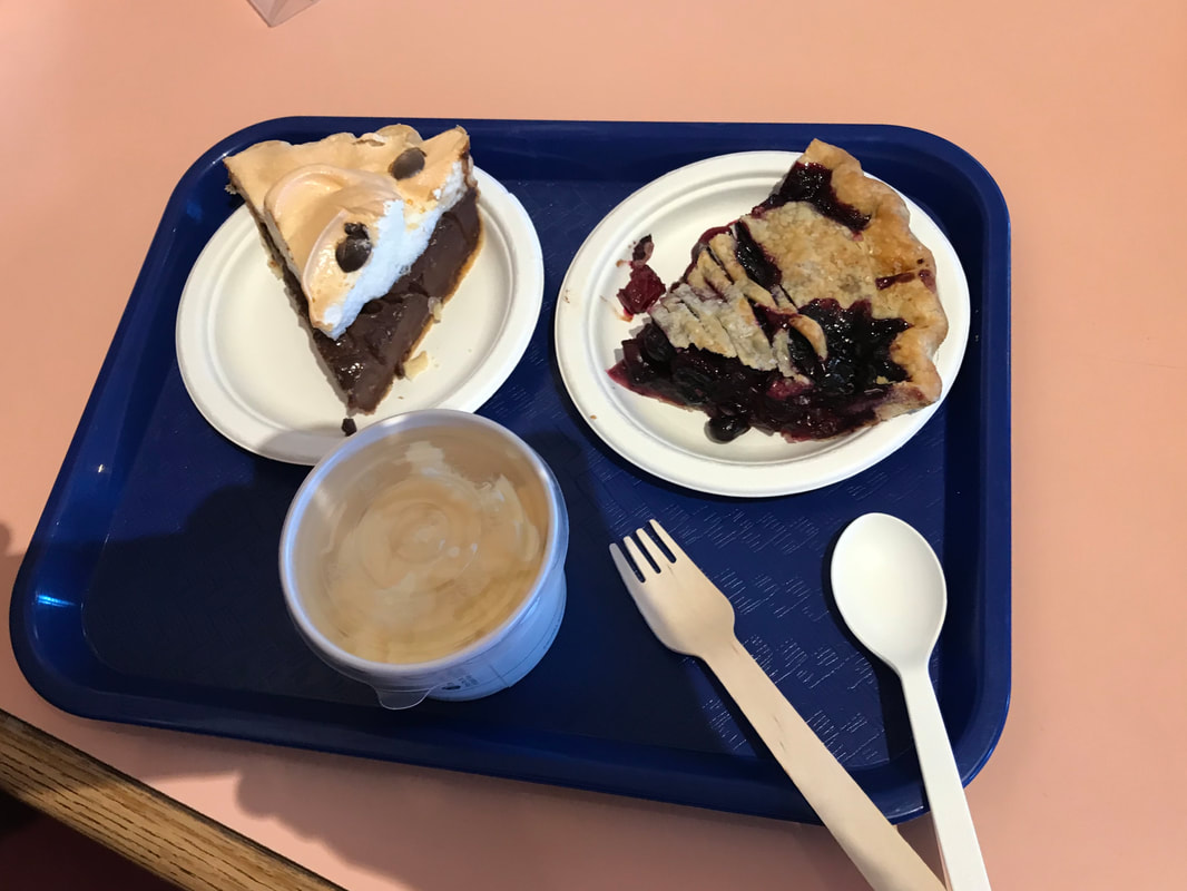
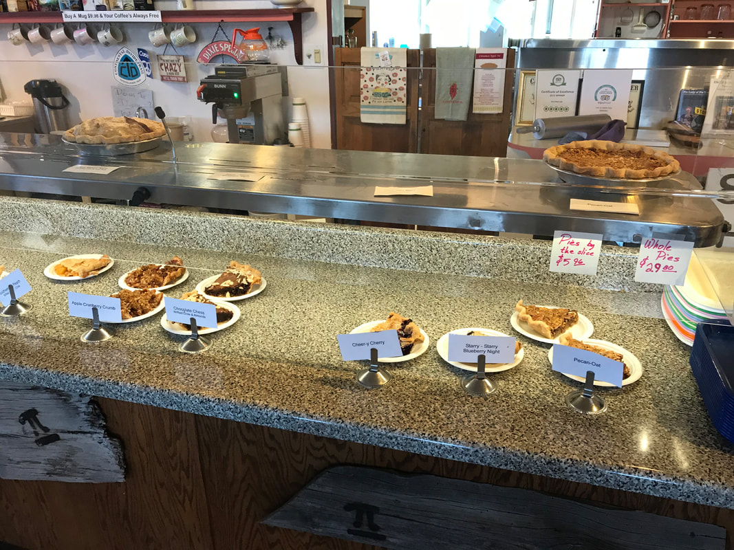
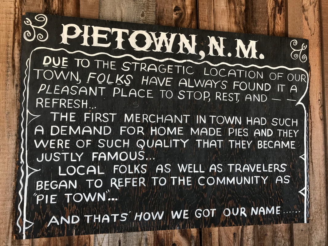
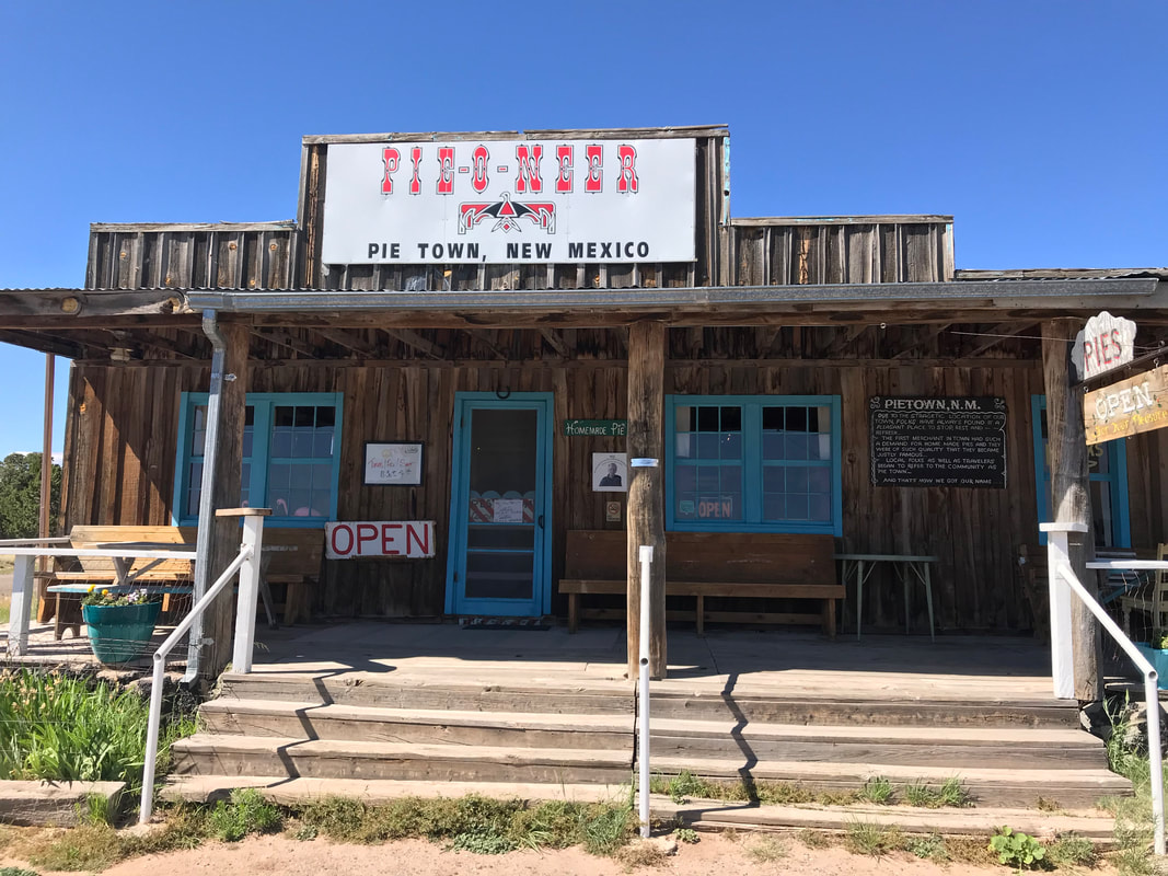
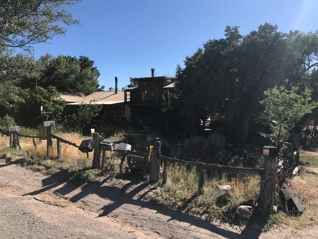
  My original itinerary had me camping up here at the Valle Tio Vinces Campground. It was cool and shaded in the aspen when I pulled into the almost completely deserted campground. There was a single van parked there. I got an uneasy feeling as the entire van was curtained, except for a door that was open with a PVC pipe poking through the curtains where a chemically smoke exited. I ate lunch on the other side at some picnic tables. I looked at my maps and realized I was only 20-30 miles from Pie Town and it was only noon. I looked at the van with residents that seemed to be cooking meth and decided I didn’t want to camp here. I pushed on and dropped out of the last of the Gila National Forest onto a series of expansive juniper highlands with cattle and ranches on my way to Pie Town. The road was in much better condition and despite incessant up and downs, I pulled an 80 mile day. I pulled into Pie Town around 3:30 pm and headed straight for the Pie-O-Neer Cafe. Fortuitously, it didn’t close until 4 pm so I walked in and got two delicious pies with some ice cream. The owners were super nice and told me all about the Tour Divide racers who stop here. They also indicated I could indeed stay at the Toaster House for free in town. I made my way over to the Toaster House, locked my bike up, and enjoyed the full spread of the place. The Toaster House is owned by someone who doesn’t really live there ever. Instead, they graciously keep it unlocked and usable 24/7 for any thru-hikers and thru-bikers out on the Continental Divide. There are obligatory rules of respect and maintenance. And lucky for me, I had it all to myself. I turned on the fans, grabbed some water from the sink, and read all the interesting notes left everywhere. I also brought in several packages dropped off by USPS as mail drops for CDT hikers and left them by the door. After a long dinner at the Pie Town Cafe (with endless parmesan-garlic fries for cyclists), I returned to the Toaster House and slept on the living room couch under the fan in the absolute darkness. I slept like a baby. 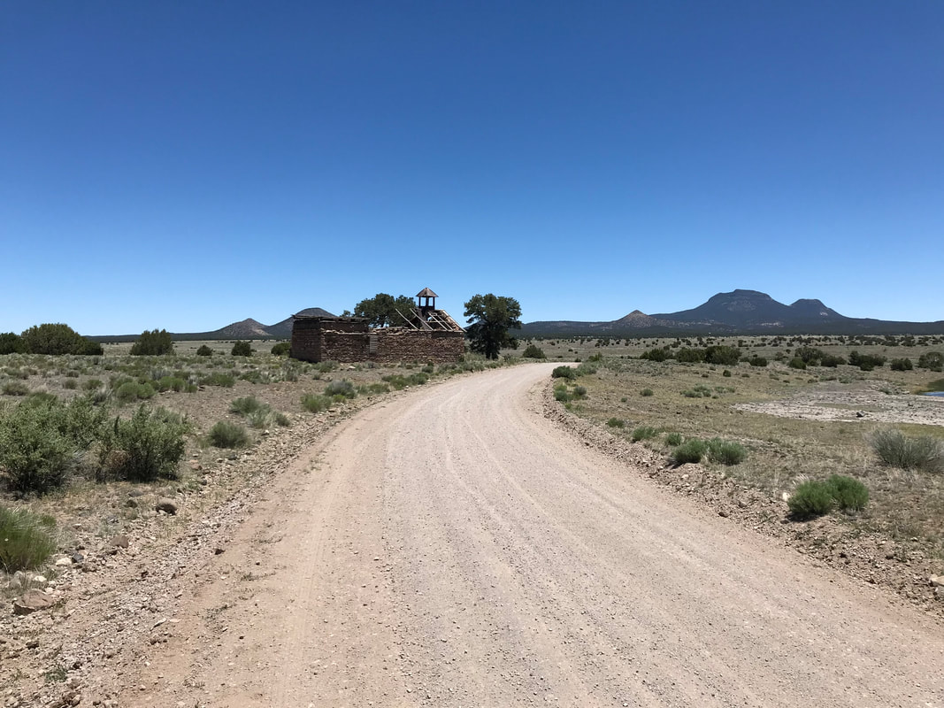
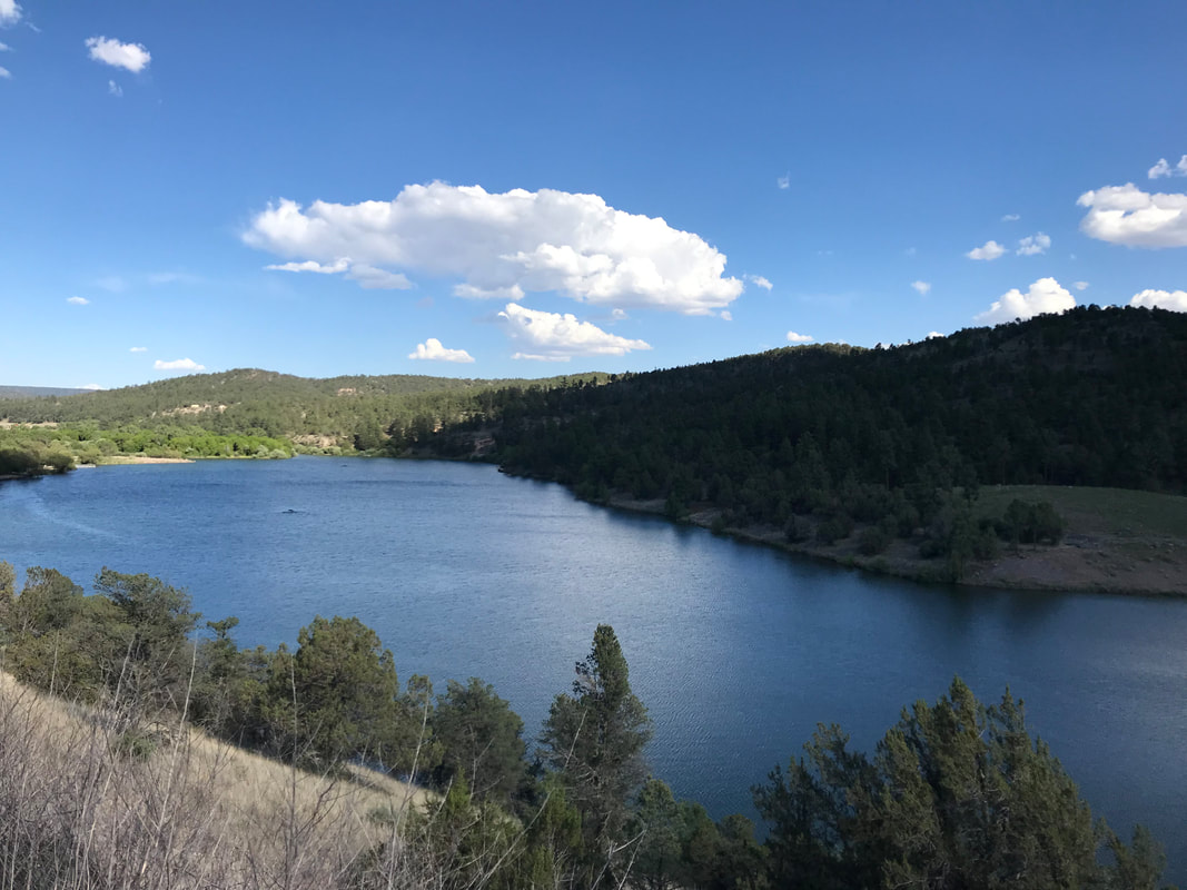
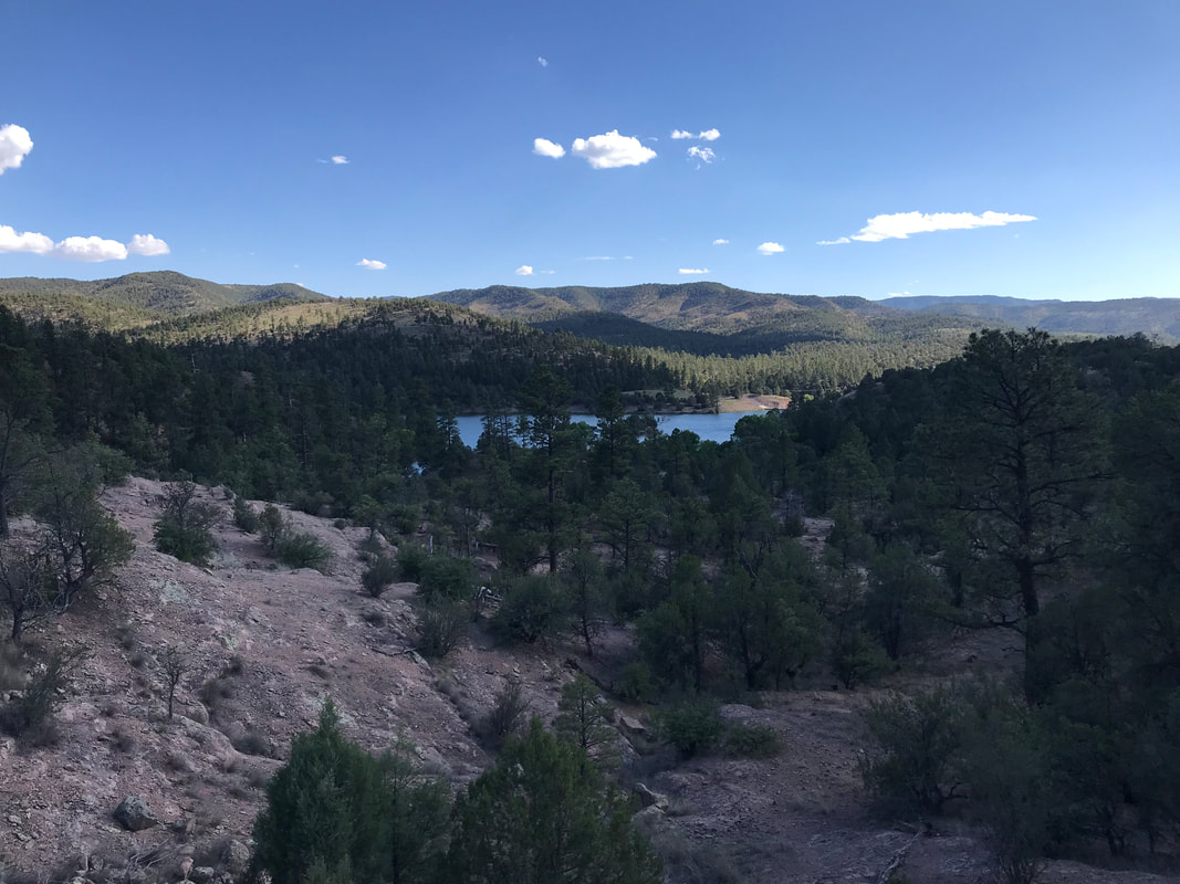
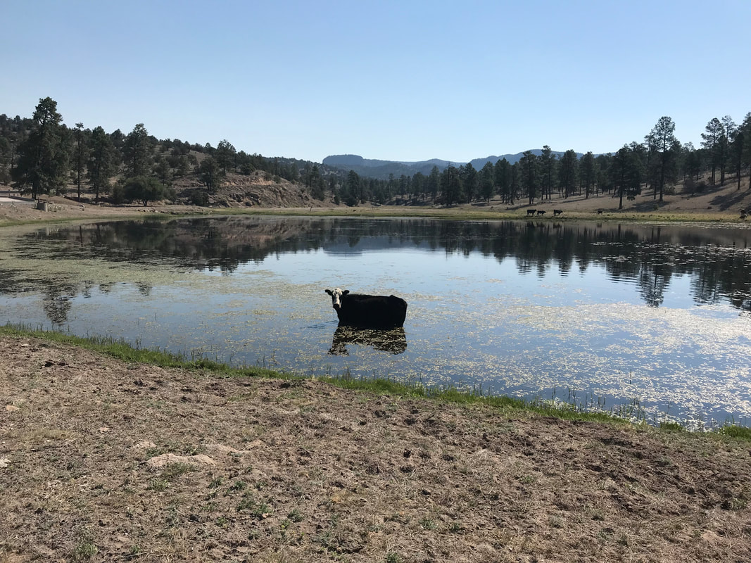
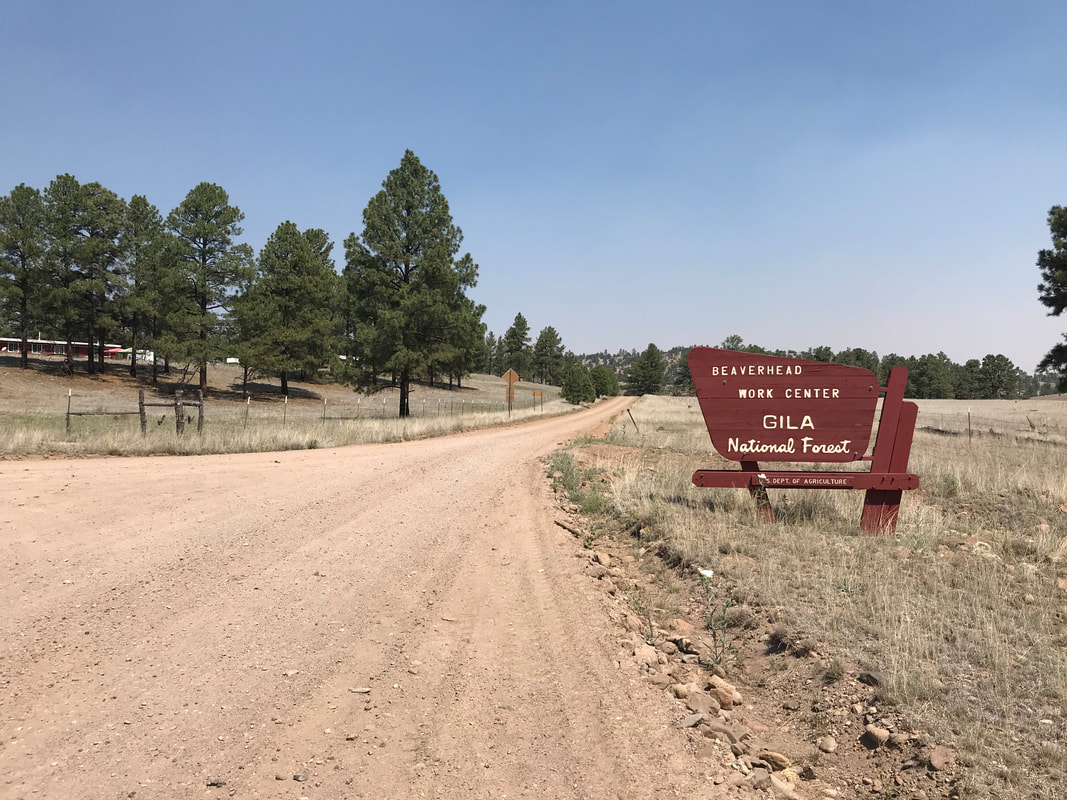
    After my self-imposed lack of night’s sleep, I let first light be my indicator to get moving. Surprisingly (or not), the canyon campground was cold enough that I put on warm gear to start riding. I zig-zagged up the other side of the route to exit the canyon. Looking back down from a ridge, I realized how far into the Gila I was now and how far I had yet to go. A brown haze sat thick on the horizon indicative of the fire brewing someplace. With little more thought, I set my mind to getting to Beaverhead Work Center as quickly as possible, preferably before the day’s heat started. Once on top of the canyon rim and back in the sun, I stripped off the warm clothing and flew down a large descent. I passed by Wall Lake, which turned out to be a large man-made cow pond (complete with a cow standing in it). I wasn’t sure there was going to be water there, so it was a surprise to see how large of a source was present. There was even a well-flowing creek entering the “lake” on the other side. The rocks near it provided beautiful cliffs to look at. On the other side of Wall Lake was another climb. This was steep enough that I had to walk for several sections. By now, I had that strong daily sweat going and the morning coolness was all lost to me. Thick washboard complimented the climb. I raced along a subsequent plateau top with grasslands and juniper for several miles. This was followed by a large meadow valley interspersed with old cottonwoods. Signs along the road warned that this area could become so flooded as to be hazardous in rain. My maps indicated the same - a passing cyclist might be stranded here to wait for waters to recede. For me, it was dry and dusty. I squared up and pushed on up an adjoining slope. By mid-morning, the cicadas started. These confirmed the rising temperatures and heightened my desire to reach my mid-day siesta spot. Up and up the route seemed to endlessly go. It twisted between shade-starved ponderosas until I crested a ridge and rode down a slight descent. I nervously watched my elevation drop (less elevation = more heat at lower altitudes) before the landscape became relatively flattened along a high and hot grassland dotted with pine trees. The Beaverhead Work Center came into sight near noon. Beaverhead Work Center is a hotshot training and staging facility. It features living quarters for crews and forest managers. Deliciously, it also has a vending machine for soda. The place was full of training crews and crowded tents from a visiting Boy Scout Troop. Some large oaks provided ample shade along a railing. I pulled my bike up and spoke to someone who exchanged my cash for an ice-cold Sprite from the machine. Best tasting soda I ever had at a single moment in my life. The woman who helped indicated I was welcome to wait out the heat of the midday under the shade of the trees in a cordoned area. I gratefully accepted. She also helped me find the water spigot where I refilled my reserves, drank deeply, and then completely soaked my body for evaporative cooling. 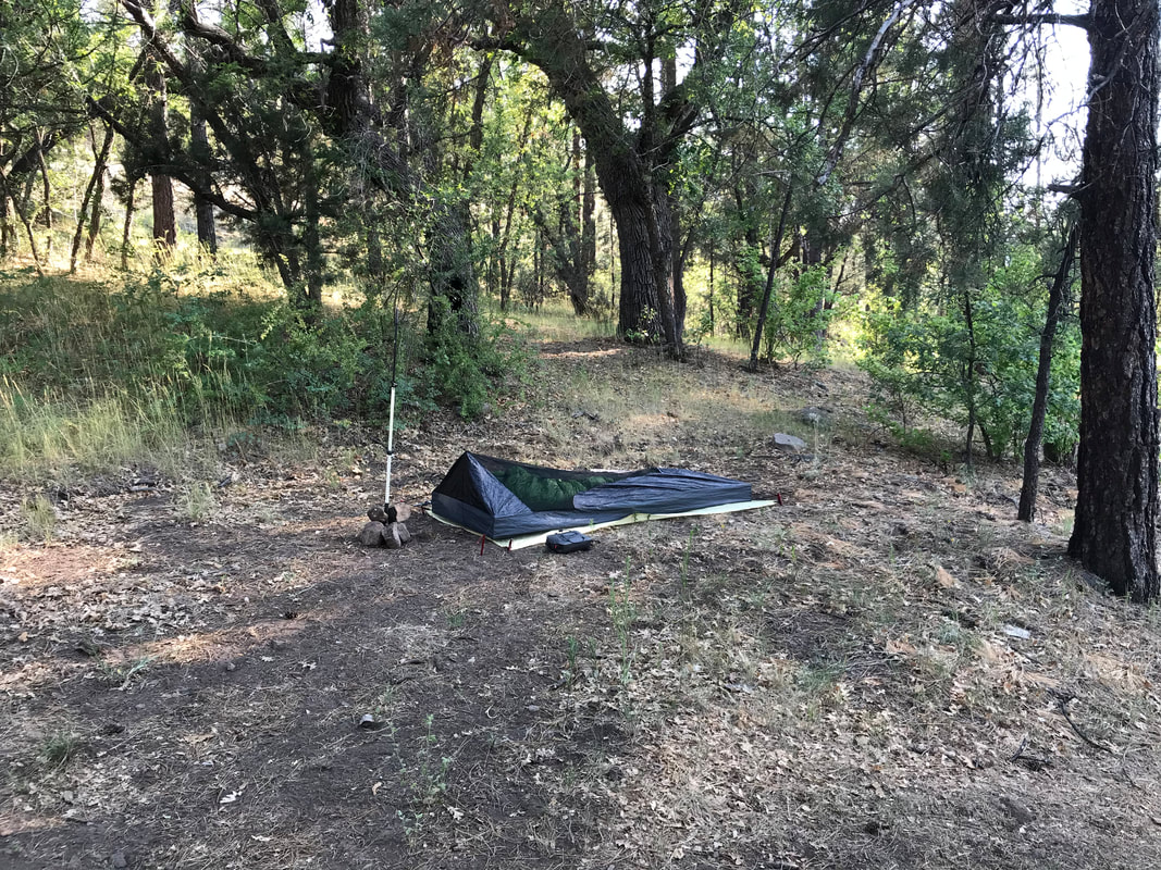
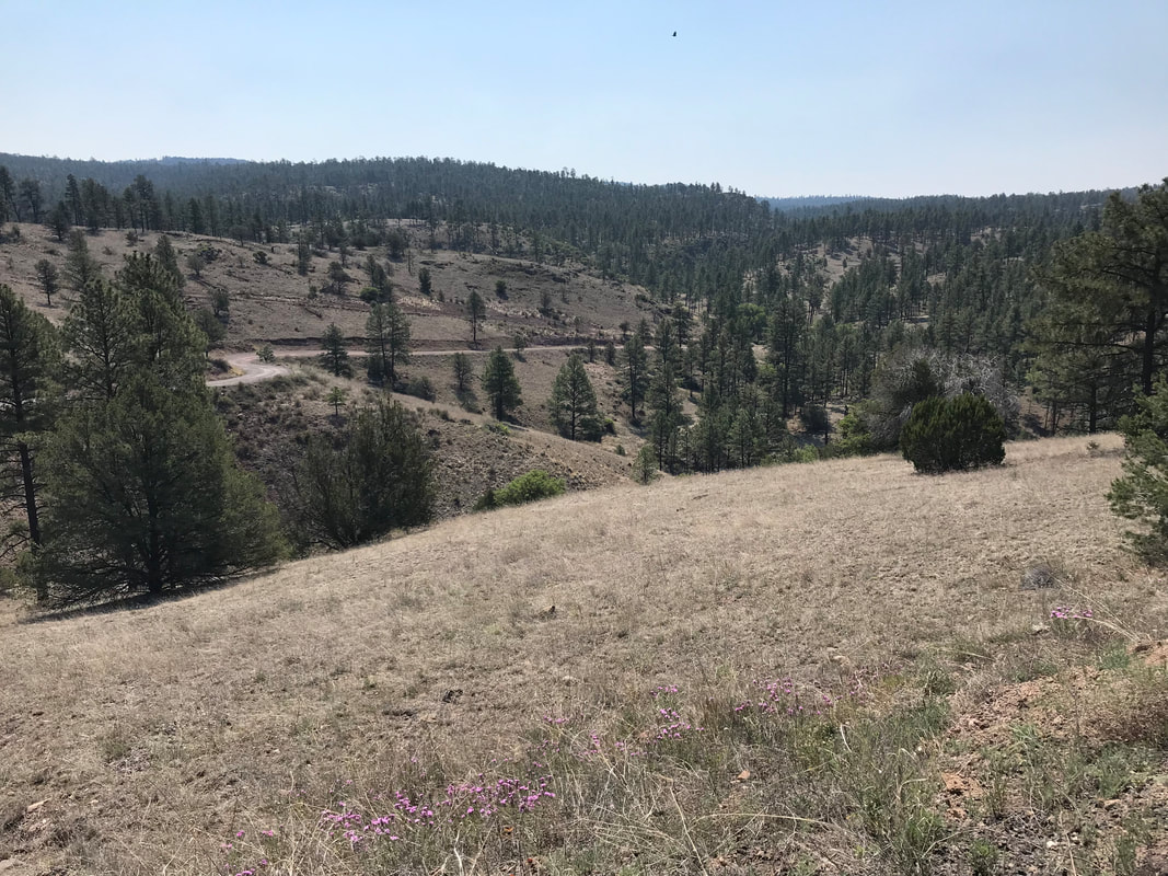
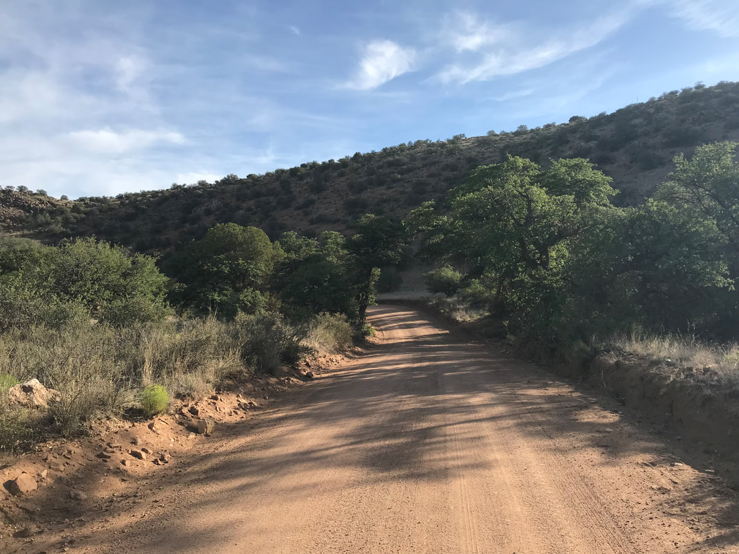
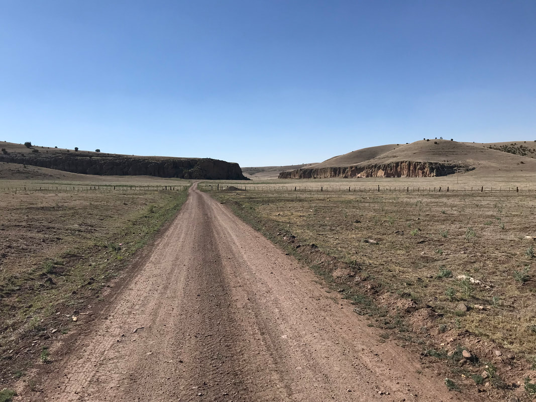
 Just as I was hunkering down for the midday heat siesta, the first cyclist I had seen on the route pulled up. He was riding an old 1980s steel Schwinn frame. He carried multiple milk jugs filled with water strapped to his frame and an old backpack portaged in a milk crate attached to a rack on the back of his bike. He and I talked for a long time about his journeys around the US and how he lived off his bike. He wasn’t riding the Great Divide proper, instead using the route and area to get through some of the southwest. He absolutely loved Silver City and the scenery around it. To add, he asked if I had camped down at Black Canyon Campground the night before. I affirmed and he said this morning, just as he was biking through that spot, he ran into a mountain lion crouched on the dirt road eating some roadkill. He had had a long staring contest with it, only broken by a pickup coming from the opposite direction. The lion skirted up a nearby ridge. And for the next couple of miles as the cyclist rode, he said he could see it following him. It basically confirmed my worst suspicions about last night. About 45 minutes later, a second cyclist coincidentally showed up. In opposite to the first, this guy sported a full-carbon Salsa Cutthroat frame and minimal baggage. He had been traveling nearly 100 miles a day and had only started just a day or two before. He was from Jackson Hole and his goal was to get back to the area by July 4 for a party his sister was throwing. Around 1-2 pm, during the absolute heat of the day, both of them decided to push-out. The Jackson Hole cyclist was aiming to get to Pie Town by tonight. He full on soaked his body in the spigot and pushed out into the midday heat. The former cyclist filled ever jug on his bike, got some route and map info from me, and then headed out. I declined leaving and instead made myself even more at home in the shade. My original plans were to camp nearby at a spot I had read about. It would give me easy access to water and I could chill here all afternoon. However, when I had ridden in, the spot I had planned to camp in contained the half-eaten carcass of an elk - probably a puma kill that it would surely return to. I weighed my options sitting at Beaverhead and decided I would push on another 10-20 miles by late afternoon. I sat at a picnic table and talked to some of the Forest crew for several hours in the shade while eating an early dinner with the easy-access water. I got some beta on the route ahead, conditions, the fire, and even the presence of Mexican gray wolves. At 4 pm, I doused my body in water from the spigot and jumped on my bike, pushing off into the 100 degree heat. I felt refreshed and replenished. The miles ticked by through the extraordinary landscape. The pines and grasslands morphed into geologically exposed cliffs and buttes with the dirt road passing through. And with this change, all plant-life and offers of shade completely disappeared until I was biking across a vast and seemingly endless plain of ankle-short desiccated grass and silt. It was mind-blowing to me to think that those two cyclists went through here in the early-afternoon sun and heat. The silt on the route gummed up my drivetrain and worked into every crack of my gear as well as my face. It was in such heaps on the road that it felt like pedaling through sand. There was no way I would want to be stuck out here in the rain as this would become the stuff of peanut-butter-mud-nightmares. The rolling high-desert plains stretched on and on. I reached one fork in the road with a single tree and took the left. I reached another fork that split into 3. The views were desolate but beautiful. I had never been someplace so seemingly empty. The wind picked up and did that hot hair dryer blow - all headwind as my route skirted west. I could see some pine-studded peaks in the far distance. But that riding was super difficult. The headwind, washboard, and silt slowed me to a literal 4 mph pace. The afternoon sun was straight in my eyes from my westward direction. I was hot, thirsty, and definitely feeling exhausted. Several hours and many miles later, the sun began to fall behind distant peaks that I had now biked close to. Pines began to rise again and I entered a beautiful forest. I passed by some ranch homes and eventually found a place in the forest to camp. I setup my tarp in the late-evening civil twilight, climbed in, and fell deeply asleep. 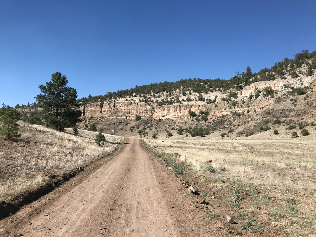
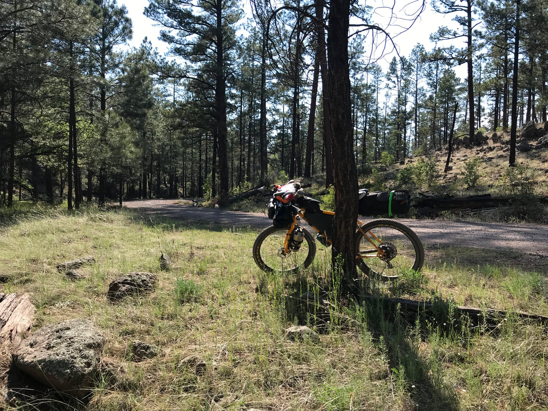
      Great Divide MTB Route - Day 5 - “No Services Next 120 Miles” - Into the Gila National Forest6/19/2019 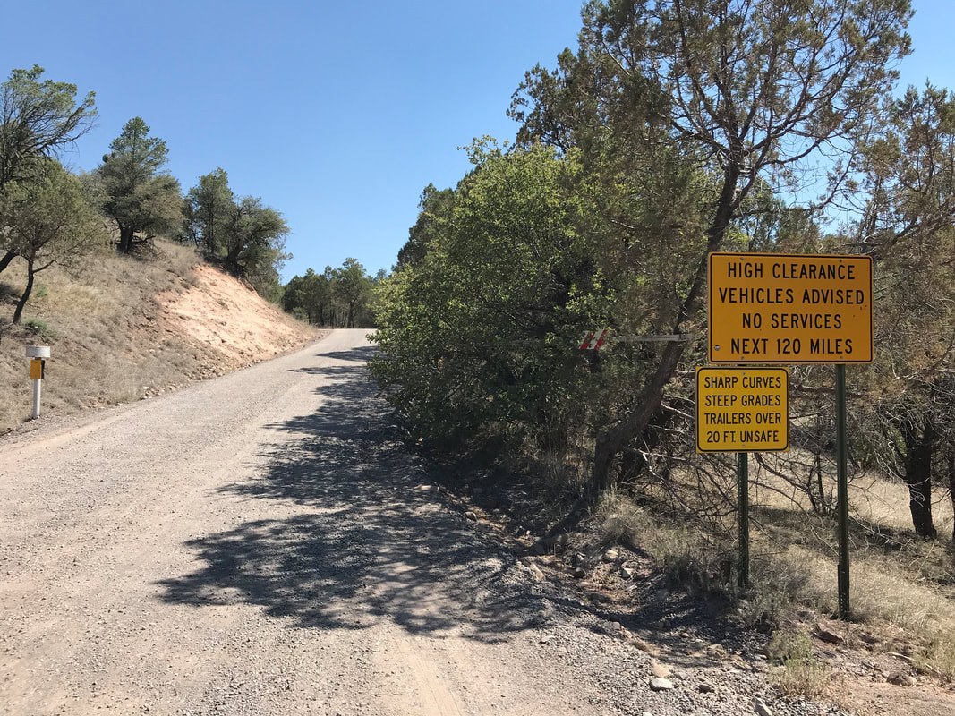 I woke up early after a great night’s sleep at Mesa Campground right above Lake Roberts. I was determined to get my food and start early on the route. Today would mark me completely leaving pavement behind as I headed into the Gila. I got down to the Lake Roberts General Store right at 8 am, just as the handwritten sign had said. However, it still was not open yet. I sat around stretching, charging my electronics, and repeatedly checking my watch. Sometime near 9 am, someone finally opened up the shop. The selection was narrow, but I found all I needed. I was going to make due with salty pretzels, tortillas, and buttloads of cheese. I immediately jumped on the pavement and continued along the Trail of the Mountain Spirits. The land seemed harmonious in the morning cool. The end of the scenic run arrived and the route became more traveled with vehicles. I talked to a construction crew who mentioned a fire somewhere in the Gila that I needed to be careful of. They pointed to the faint brown haze on the horizon as evidence. I kept that in mind. A few minutes later, the route officially and poignantly left the paved world behind for a more permanent basis. My GPS told me to turn left. I looked up at a gravel hill climbing into dusty ponderosas and junipers. This was it. This was my entrance into the more remote portions of the Gila National Forest. A double decker sign prominently stood like a gatekeeper, warning of steep grades, sharp curves, and the unsafe passage of trailers. The sign also said, “No Services Next 120 Miles.” The Great Divide Route was more like 140 as it would leave the main gravel crossing. In all, I only allowed myself to stare and contemplate the contents of that sign for 30 seconds. A wave of fear and uncertainty rolled over me followed by casting doubt aside and saying to myself, “GO! MOVE!” I thought no more about the sign or how it would make me reconsider my direction in a car, let alone a bike. I start grinding my gears on a grade ascending me up onto a broad juniper filled mesa. A pickup comes bouncing down the washboard and potholes. They skid to a stop before me, lean out, and ask if I need water. I thank them and decline as I have plenty. As far as I know, the next water wouldn’t be for over 50 miles at Beaverhead Work Station, so I made sure to fill my every container before leaving Mesa Campground. On top of the mesa, I start really covering miles along the relatively flat crest of the Continental Divide. Like clockwork, cicadas start drumming around 10 am, my signal that the day’s heat is here. It’s like the louder they buzz, the hotter it gets. Around noon, and already several liters into my reserves, a truck pulls over. It turns out to be a scientist who tells me all about the insects in the area. He talks passionately about the great biodiversity in the Gila, how he used sheet lighting last night at the Black Canyon Campground ahead to attract night insects, and that there is water flowing there! I thank him and he offers to top off my reserves, which I oblige. The route ascends all day through the drumming heat that seems little abated by my gain in elevation. The juniper fall away as ponderosa pine come to dominate. The route becomes steeper and steeper. The road switchbacks 180s repeatedly to gain the top of crests. The route substrate is dried silt and clay - I can only imagine how terrible it would be to bike through here in the rain; one would truly get hammered by peanut butter bike-stopping mud. Sometime in the afternoon I summit out at 8,000 feet, completely drenched in my own sweat. I pull my bike off the road, crouch in the pencil shade of a ponderosa pine, pull out my sun umbrella, and decide to kick back in siesta to let the worst heat of the day pass at this high point. Black flies had plagued me all morning, biting and landing whenever my pace slowed on a hike-a-bike (surely a product of the multitudes of cattle grazing in the forest). I put on a bug head net and read before napping. Around 4 pm, I decide to get going. From my siesta point, the route plunges down towards the Black Canyon. I see multiple cattle troughs filled with water, and I regret having the extra weight of water on me when it’s available. My brakes heat up hard, squealing on the sharp and steep descent. I pull off in Upper Black Canyon Campground where a seemingly permanent stream beautifully flows and an abundance of shade-producing cottonwoods stand. I decide to camp here. The water is abundant, I drink as much as I please, and the scenery is beautiful. There are no other campers on site. Near dusk, I decide to walk the length of the stream by following the road that led me in. I’m probably 50 feet from where my bivy is setup when the road turns to dust/sand and crosses the stream and exits on the other side. I look down in the sand and see dozens of massive footprints that are unmistakably from a mountain lion. I realize this is probably an attractive water source and that I’m alone here. I head back to my bivy where as I climb inside as the canyon plunges into dark and solitude. The footprints keep playing in my mind, I get paranoid, and then I hear something walking around near me. My brain argues with itself: (A) It’s a mountain lion and you need to check - (B) There is no mountain lion and you are irrationally spooking yourself. The urge to check wins. I grab my headlamp, swivel around in the lonely dark and illuminate a pair of eyes just as my headlamp rapidly fades and dies. SHIT! I hadn’t replaced the batteries since the Arizona Trail and it was already dying by the end! Now, I’m standing in the dark, freaked out by my own mind with some sort of definite animal. I realize my bike light is fully charged. I stumble in the dark to my bike and flick on the 1200 lumen light that turns the campground day. About 20 feet from me is a gray fox running around. Relieved, I climb back into my bivy. Unfortunately, my brain is still on “sentinel mode,” no matter how irrational or how much I factually tell myself mountain lion attacks are improbably rare, my heart still pumps that adrenaline. Thus, what should have rightfully been a gorgeous and cool night in a perfect campground is a long, restless, sleepless one, self-imposed by my stubborn sympathetic nervous system. And obviously from the presence of this post, I ended up perfectly fine. 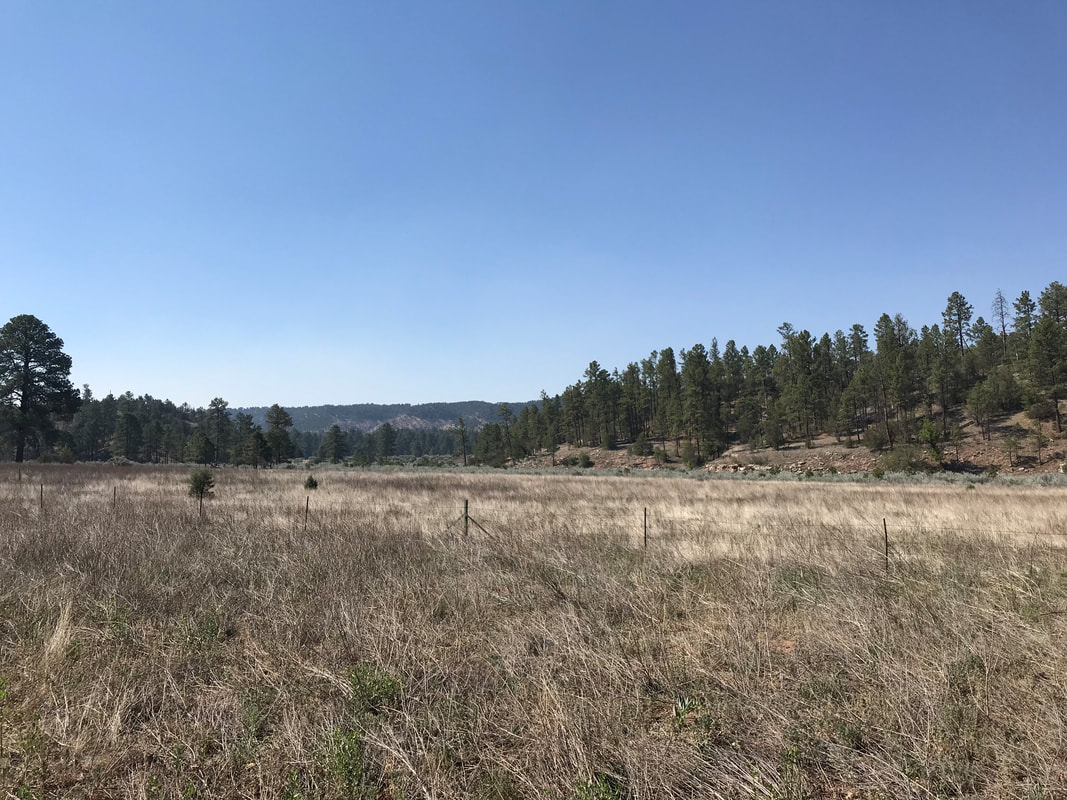 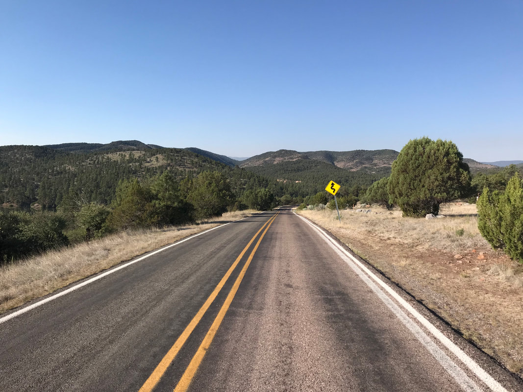
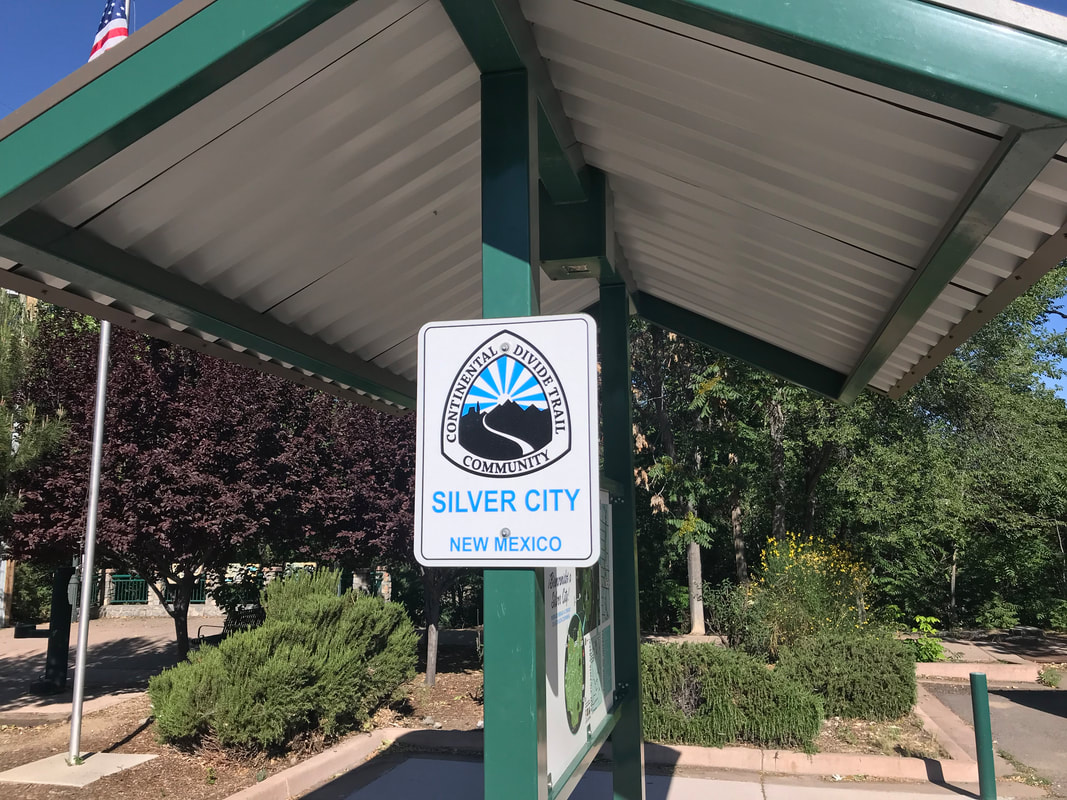
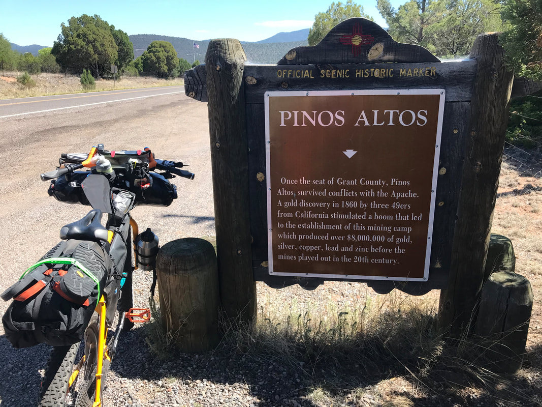
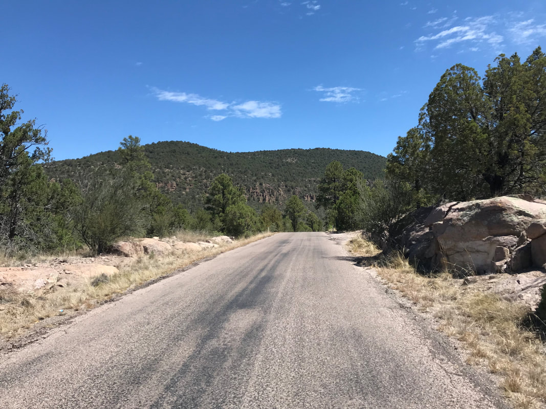
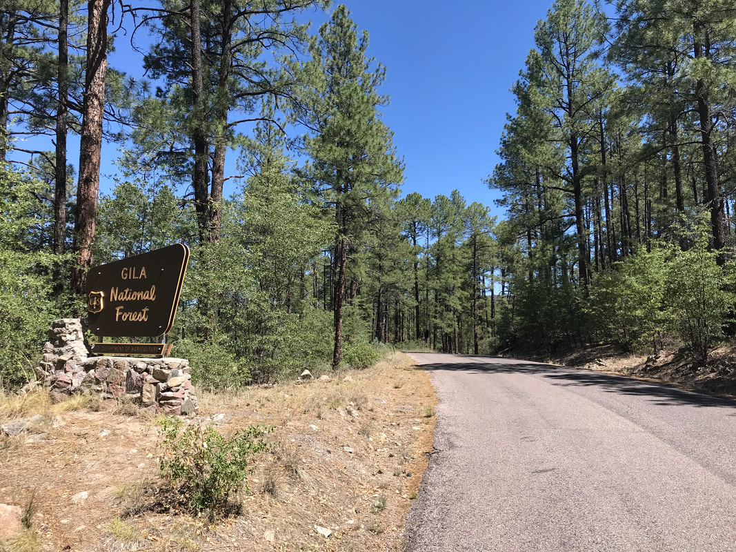
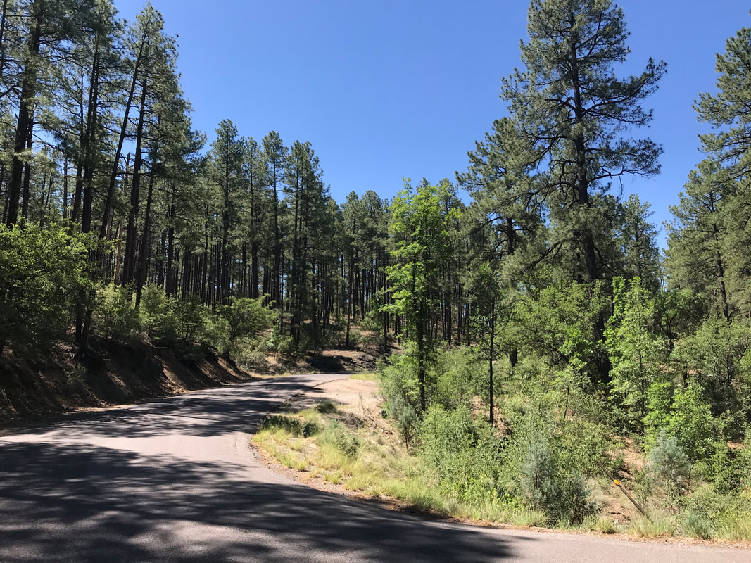
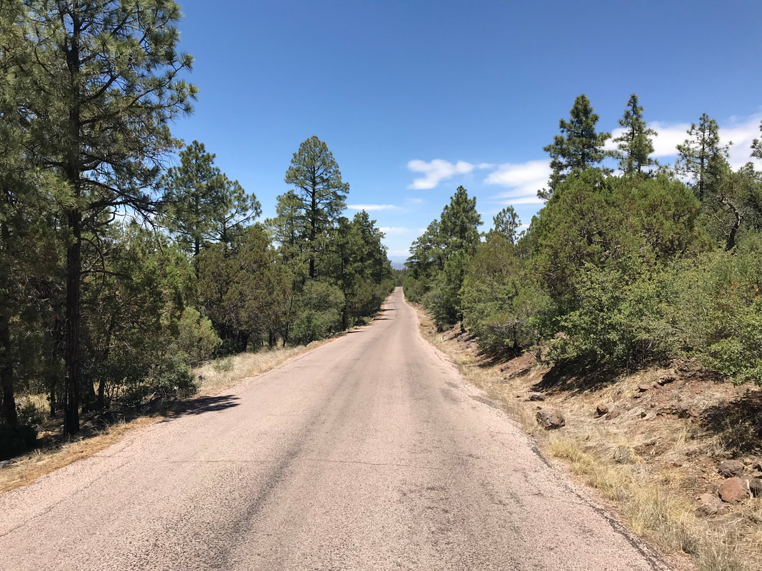
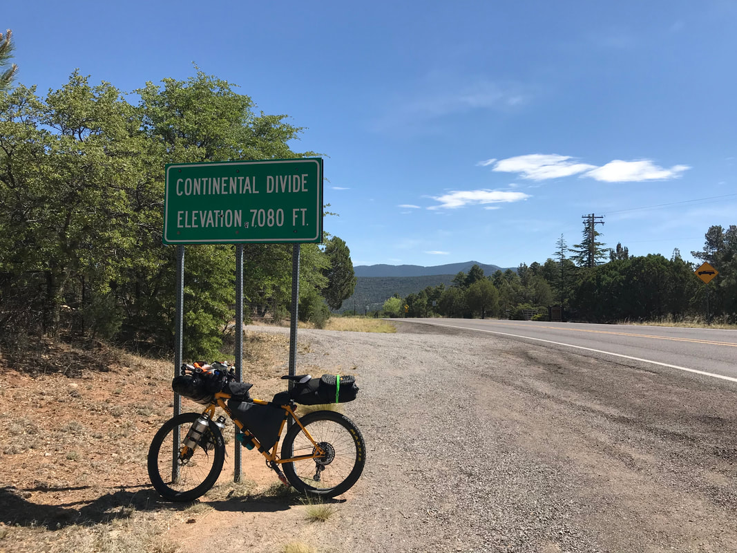 I woke up and sucked the last enjoyment of my air conditioned room from my hotel room before biking to the Silver City Post Office to mail some gear home, which meant I left Silver City properly around 9:20 am. The route today would be all-paved, some of the last major paved portions for the entire Great Divide Route. The highway here is an officially scenic one named the Trail of the Mountain Spirits. With it, I officially climbed into the Gila National Forest and crossed the Continental Divide at 7,000 feet. The beautiful scenery of the dry ponderosa pine-studded mesas and mountains reminded me greatly of Arizona. But the heat today was still killer. Less so than the desert, but the elevation gain compounded temperature and exertion. I stopped at Pinos Altos for a noted water stop to fill up my bottles north of Silver City and found a permanent RV park where a local let me fill my bottles from his sink. I then rode down and around shady, but hot, roadway through cliff-lined highway and then back up into ponderosa pine hills. I passed a hot shot forest crew out cutting trees and piling branches along one ridge before I stopped at a pullout with an overlook into the dry southwest forest mesas stretching out before me.
  I descended down to an intersection where I stopped and considered my options. At first, I opted to take a side route up to Gila Cliffs National Monument. I couldn’t see the elevation profile but I noted from previous reading that it was substantial. After several miles of granny gear riding, I pulled off the road to sit under the shade of a ponderosa pine and pant from the heat. After sitting for about 40 minutes, I decided to forgo this optional side route and head back on the route proper to Lake Roberts. I had planned on getting my real food resupply here from the small general store for the duration of my Gila National Forest crossing. However, as I arrived, the general store’s posted hours were different than their website. It was closed today via a handwritten note and wouldn’t open until tomorrow. This forced a change in my plans. I couldn’t continue forward without food because my next resupply wasn’t for 3 - 4 more days. I looked ahead on my maps and noted that Mesa Campground was nearby. My plan was now be to stay at Mesa Campground for the night, get up early and hit Lake Roberts General Store immediately when it opened the next morning, and finally bike as fast as possible to even higher elevation in the Gila NF in order to beat the heat. But for now, the front porch was vast and empty except for a bench next to an outlet. I sat down, weary from the heat, plugged my no-service cell phone in to charge, and sat. I don’t know what was going on with me, but I must have been on the edge of heat sickness. I sweated in the shade of the porch, not moving, staring into space for nearly 4 hours, completely lethargic and unresponsive to do anything else. I remember a van pulling up, a guy popping out, running up and seeing the “Closed” sign before he started cursing. Turning, he said, “I think you need this.” He handed me a small purple Crown Royale bag. I opened it as he pulled away and listlessly pulled out a small bundle of marijuana. I placed it back into the bag and left it next to the side of the bench. Around 5 pm, still hot out, I mustered motivation, despite how awful I felt from the heat, to get on my bike and make my way to the campground to claim a spot. I switchbacked up the steep hill and came to Mesa Campground. It turned out to be a beautiful campground located high above Lake Roberts Reservoir. It had running and cold water so I walked over and began repeatedly dousing my head and neck in it to cool my core temps. After setting up my bivy in the shade of a juniper, a couple walked by and talked to me. They said they saw someone else touring here last night, but that he seemed to be struggling hard. I could relate. They also said they had driven up to Gila Cliffs NM earlier and they had seen me cycling that way. They said the route was crazy hilly with lots of elevation and that it was a smart choice that I had turned around. The day began to cool finally as the sun slipped behind the tops of the surrounding peaks. I found myself nourished by the growing dark, feeling better, more clear headed, and refreshed from cold water on my warm body. I ate the dinner I had planned for tonight, my only food, and headed to bed early to get up early to get food at the store. 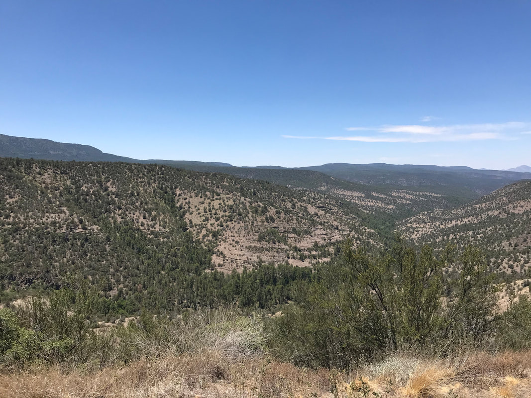 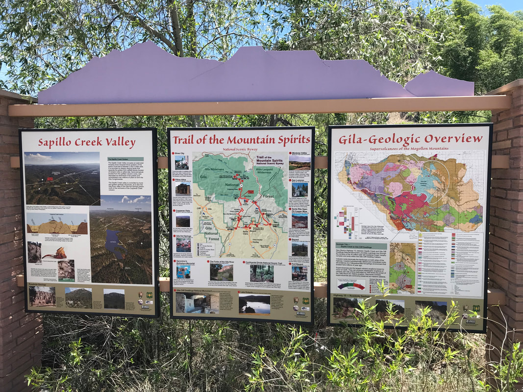 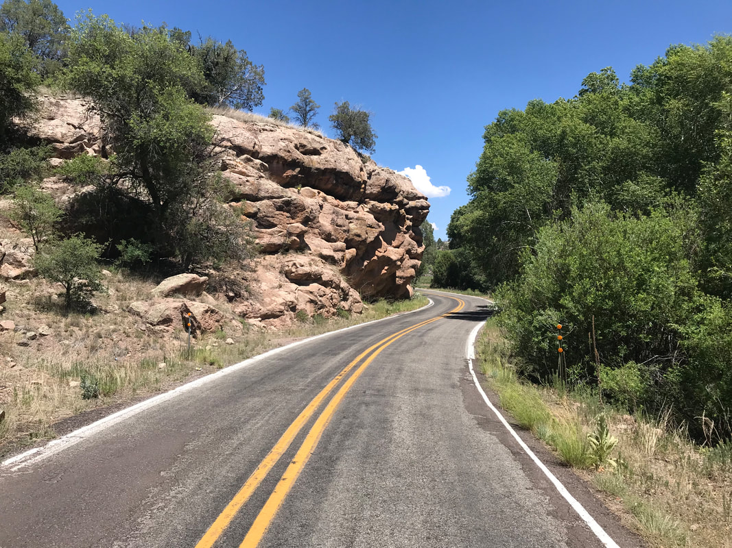
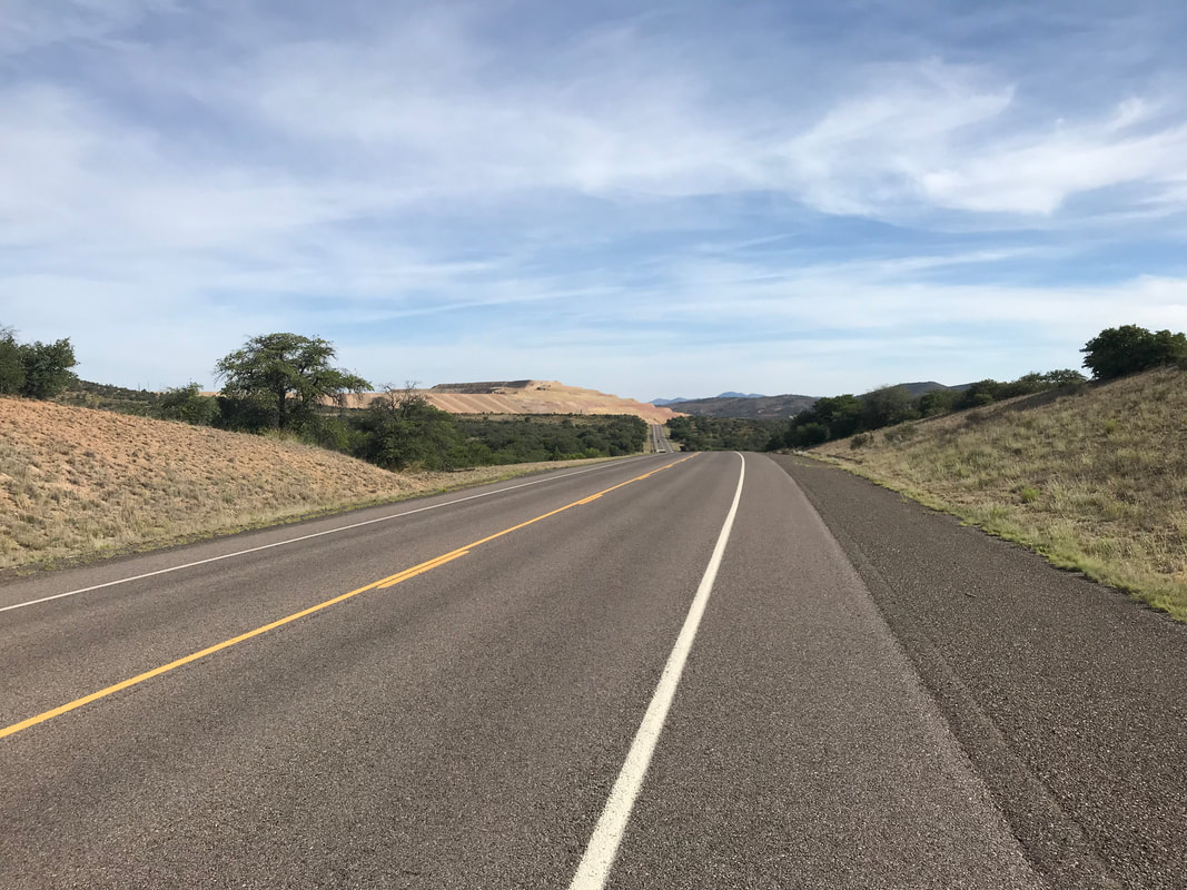
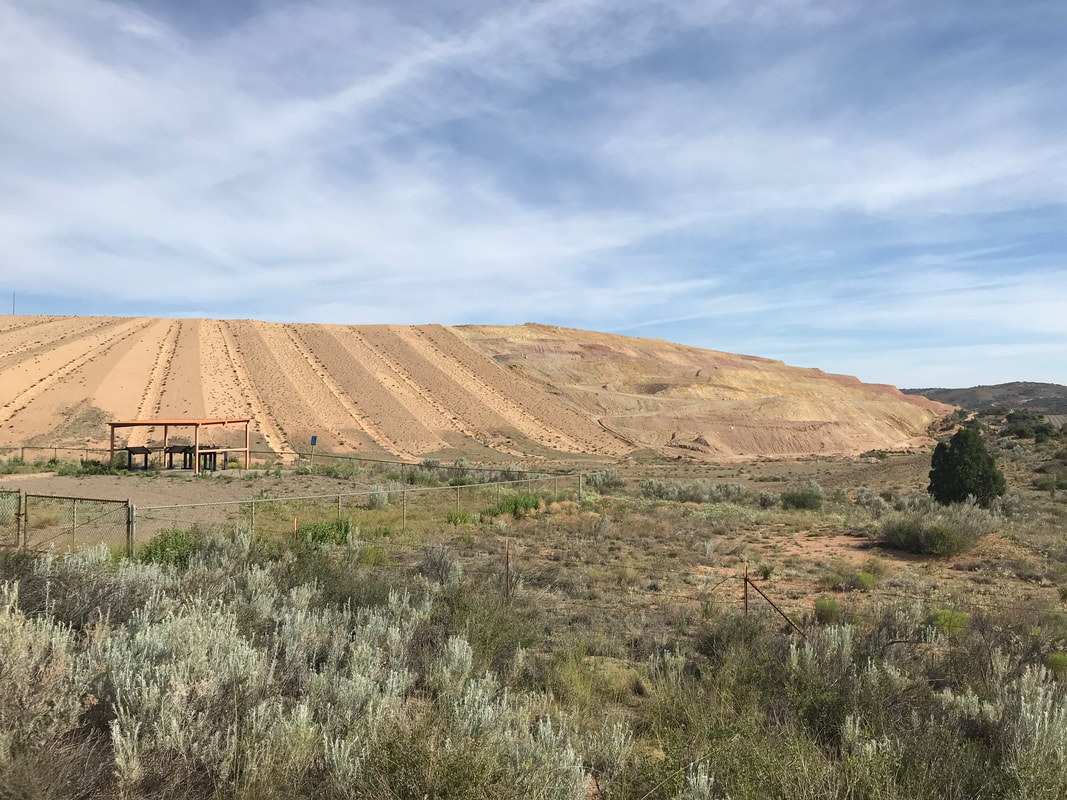
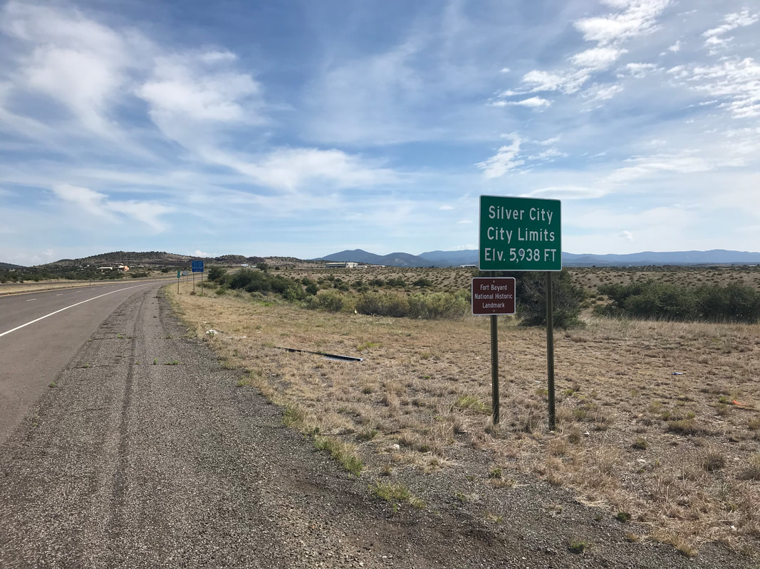
 I woke up at the crack of dawn to make sure temperatures were cool as I made my way to Silver City. The morning was beautiful and I could feel that I had gained a couple thousand feet of elevation from the start of the ride. Hilly desert landscape fell out behind me as I crossed the Continental Divide several times keeping to a gentle ridgeline. I dropped into washes and passed by loads of open range cattle before hitting the pavement of a highway leading into Silver City. The road climbed up and down steady hills, each successive downhill less low than the previous. I passed a massive mine and then found myself rolling into Silver City at nearly 6,000 feet by 11 am. The heat was on so I passed up the local campground/RV park and headed to get a hiker/biker discounted room at a cheap hotel. I stripped off everything, took the coldest shower I could muster, and drank some Gatorade Zeros I bought on the way in. Dried and cleaned, I climbed aboard the unloaded bike and rode downtown for some solid recommended New Mexican food. I also stopped by the Gila Hike and Bike to pickup a cycling cap and have a quick look over my drivetrain. I headed back to the hotel, drank more Gatorades, and passed out for a few hours. After, I walked to the local grocery and got a day’s worth of food for tomorrow. I spent the evening watching “The Purge: Anarchy” on TV and talking to Janna on the phone before sleeping in the AC of the room. 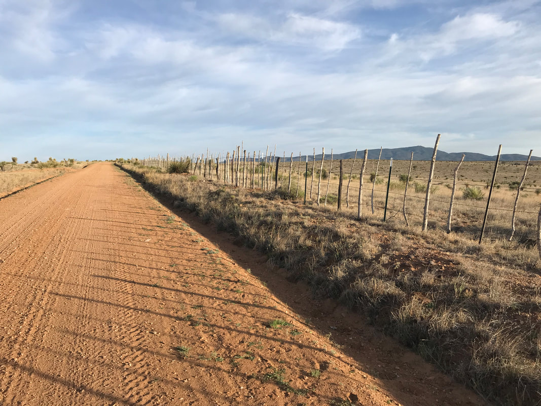 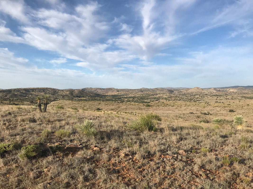 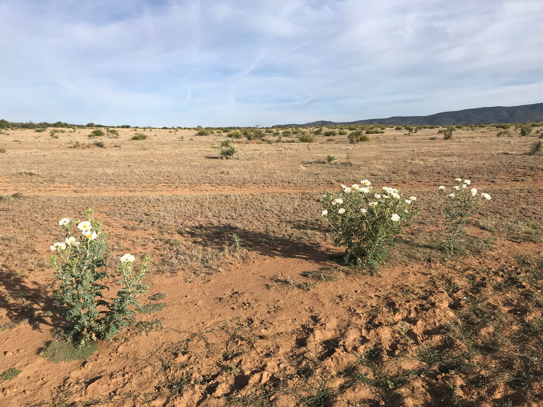
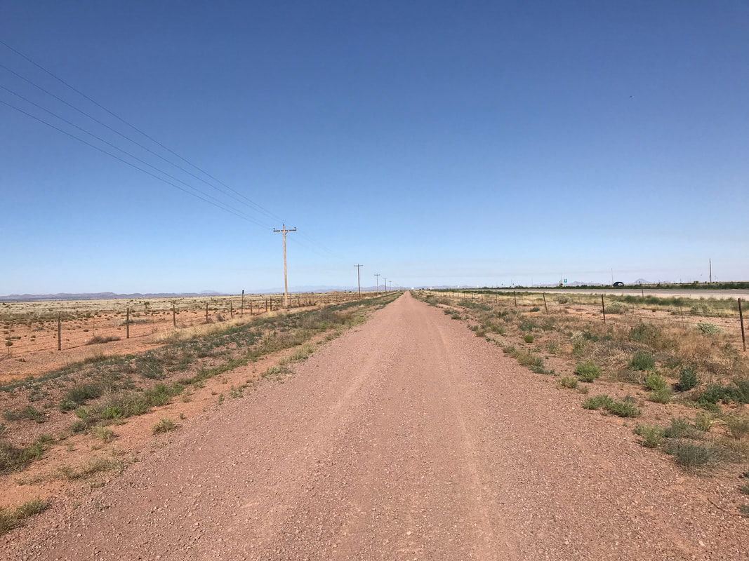
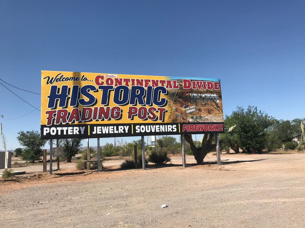
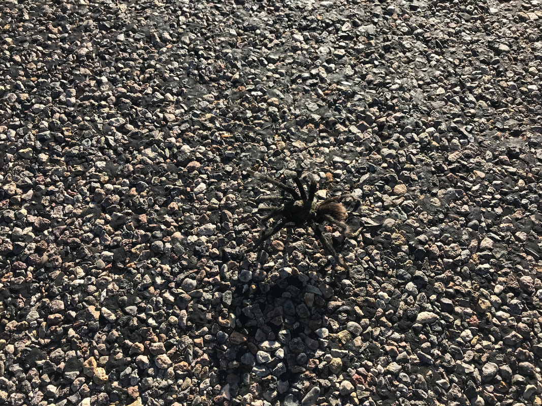
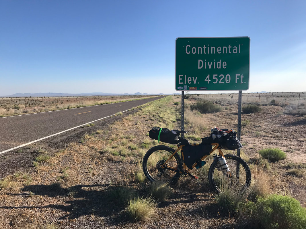
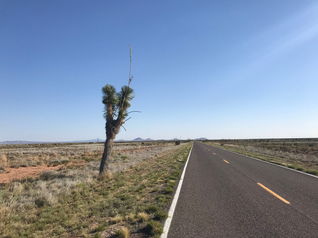
  I awoke early in the morning to beat the heat with the rising day. Jeffrey was up when I got up and filled me in with updates on the whereabouts of the Tour Divide racers from Dot Watchers. He cooked me a massive breakfast of scrambled eggs and toast which I downed given my sparse appetite from the night before from the combination of heat and headache. As he saw me off, he took a photo for his own archives of riders who pass through. With that, I was off along the pavement heading to my first unpaved sections of the route. The air was temperate in the morning and I sailed along easily. Flowering yuccas lined the highway and the flat basins stretched across the Chihuahua landscape. I was pedaling hard to make it as far north and concurrently higher in elevation as I could as the day’s temperatures equally rose. I saw more pronghorn herds running across the desert on both my right and left, and I found a tarantula crossing the road. I also hit my first Continental Divide crossing at 4,520 feet - inconspicuous from the seemingly horizontal land and noted only by a marked sign. I reached Separ after turning onto my first unpaved surface, a dirt road that ran parallel to the highway and train tracks. At 10 am, I went into the Continental Divide Trading Post to get some cold Gatorade and ice cream to relent the rising heat. Everyone was super nice to me and wanted to make sure I was well hydrated before I firmly left this last outpost and headed onto dirt roads across a large swath of desert ahead. 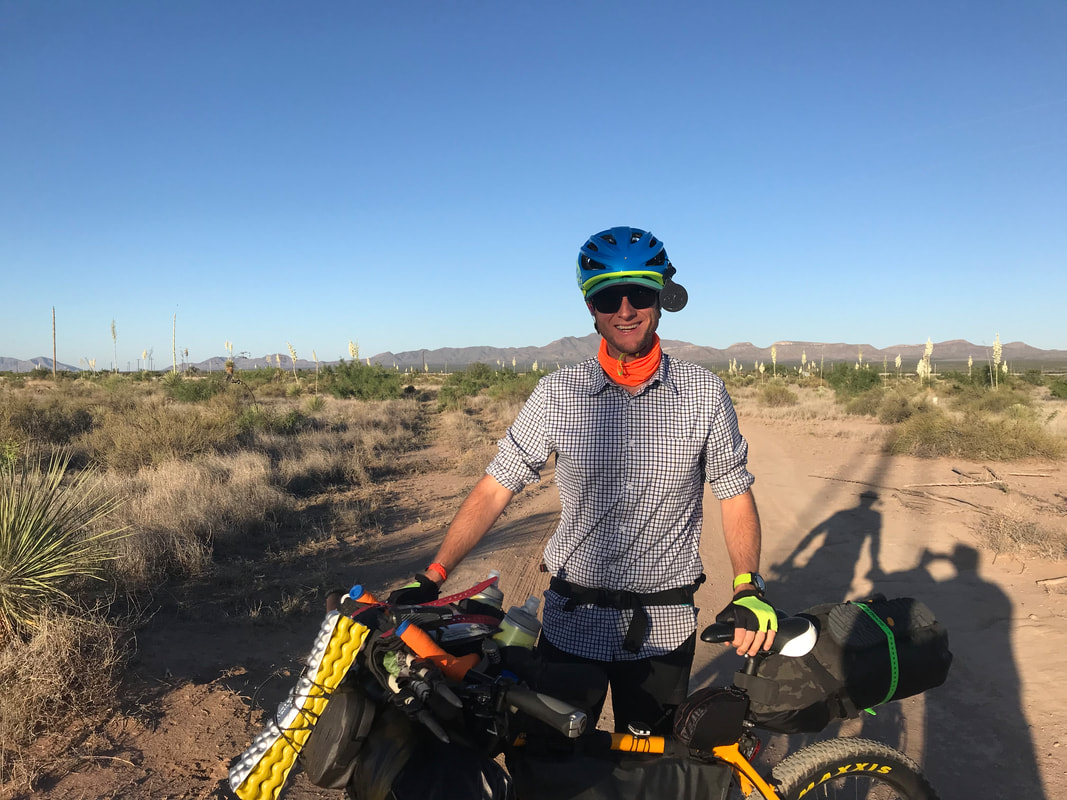
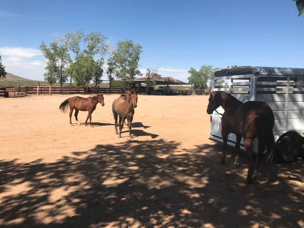
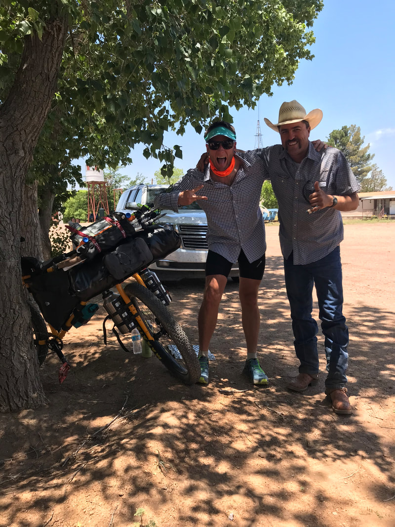
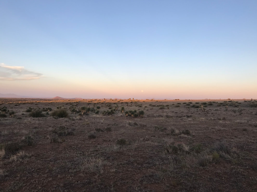
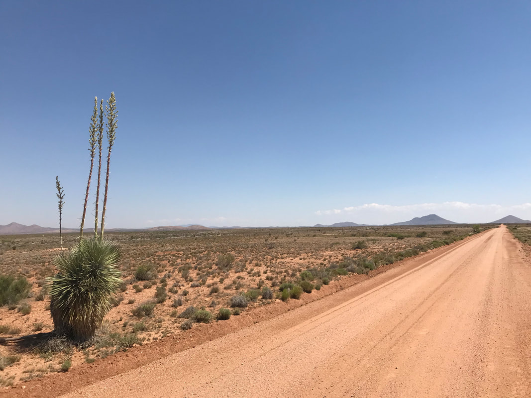   Leaving, the route passed under the highway and train tracks and abruptly ended in a beige unpaved road that stretched into the distance as far as I could see. I was felt exhilarated to be on dirt proper and away from pavement. Equally, it felt intimidating to be crossing the desert as the noon hour approached and no shade was in sight. I kept a positive attitude, but as soon as temps began reaching and then crossing 100 degrees F, I began looking for a place to sit and pant in the shade for a few hours until the midday heat lessened. I continued biking towards distant desert hill peaks when some cottonwood trees came into view. I saw it was Thorn Ranch. Now, feeling overheated, I took the risk of politely walking into the ranch/homesteads to ask for the chance to merely sit in the shade. Farm dogs came running out to me. The woman from the door I knocked at knew a little English and indicated that it was okay for me to sit in the shade. I grabbed my sit pad and sat down, grateful for some protection from exposure. An hour later, an entire crew of cowboys pulled in on horses and in trucks. They came up, started handing me cold beers and Mexican cokes and invited me to sit with them. It turns out this was a roundup day for the cattle. The family and friends here lived in Mexico but had this property over in New Mexico that they tended. This was like the one time of year they get together to do this cattle drive; normally, the ranch is quiet and relatively empty. They invited me to stay, relax, and eat. With that, the whole family/friends got together and made a huge cookout with chips, beer, Mexican cokes, carne asada grilled on the spot from a freshly slaughtered cow, homemade tortillas, potatoes, guacamole, homemade salsa, frijoles, etc. Then, they passed around bag after bag of chocolates. Their kindness was incredible and I told them how much I appreciated being invited into this moment with them. They, equally, kept shoving more and more food and drinks at me until I was bursting. I helped to clean up and we all sat round enjoying the afternoon now cooling in after a cloudburst of heat. They equally seemed amazed I was biking this route that they seemed relatively unaware of that passed by their property. They wanted photos with me (see below) and we sat around talking about life. Around 4:30 pm, I decided to get a move on, wanting to cross more of the desert and get onto some public land for camping. It was still HOT, hovering near 100. But beautiful yuccas lined the route, some flowering still. The wind had really picked up at this point. It was blowing hard and low to the ground in that horizontal fashion that staggers walking. On a bike, it meant crosswinds. However, this wind was hot and dry, not relieving; kind of a like a blow-dryer in the oven. The water began sucking from me as evening wore on. I got to a cattle tank, only to find it dry. The land across the dirt track was public. I walked my bike several hundred feet down a hill and saddled up behind a few knee-high yucca with a relatively flat spot providing a windblock and viewblock from the road. It was an extraordinarily remote spot. With the moon rising and the land turning red from the sun’s angle, I marveled at being alone in this large spread of Chihuahua Desert. The full moon rose, the sun receded, and I settled into a warm night inside my bivy.
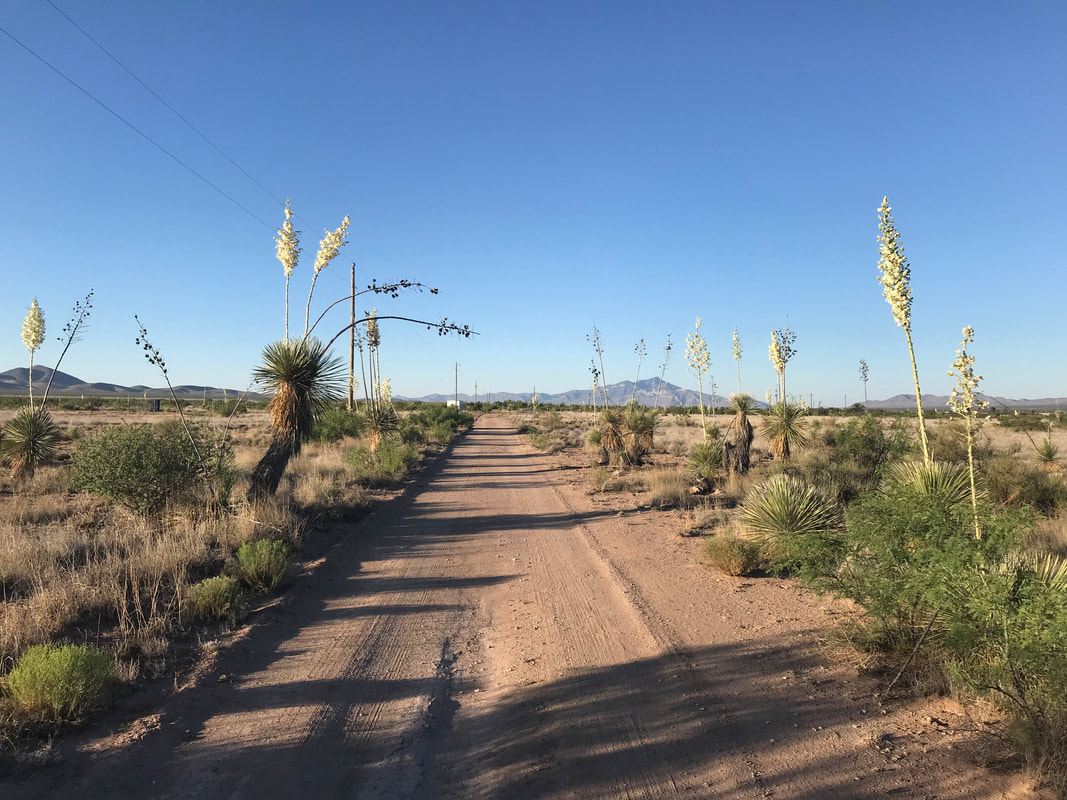
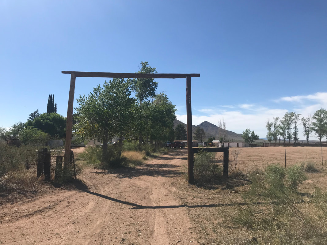
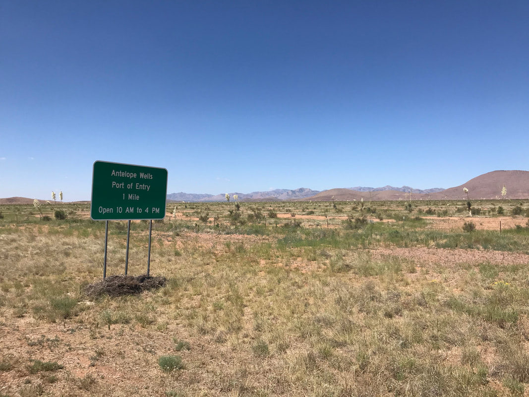
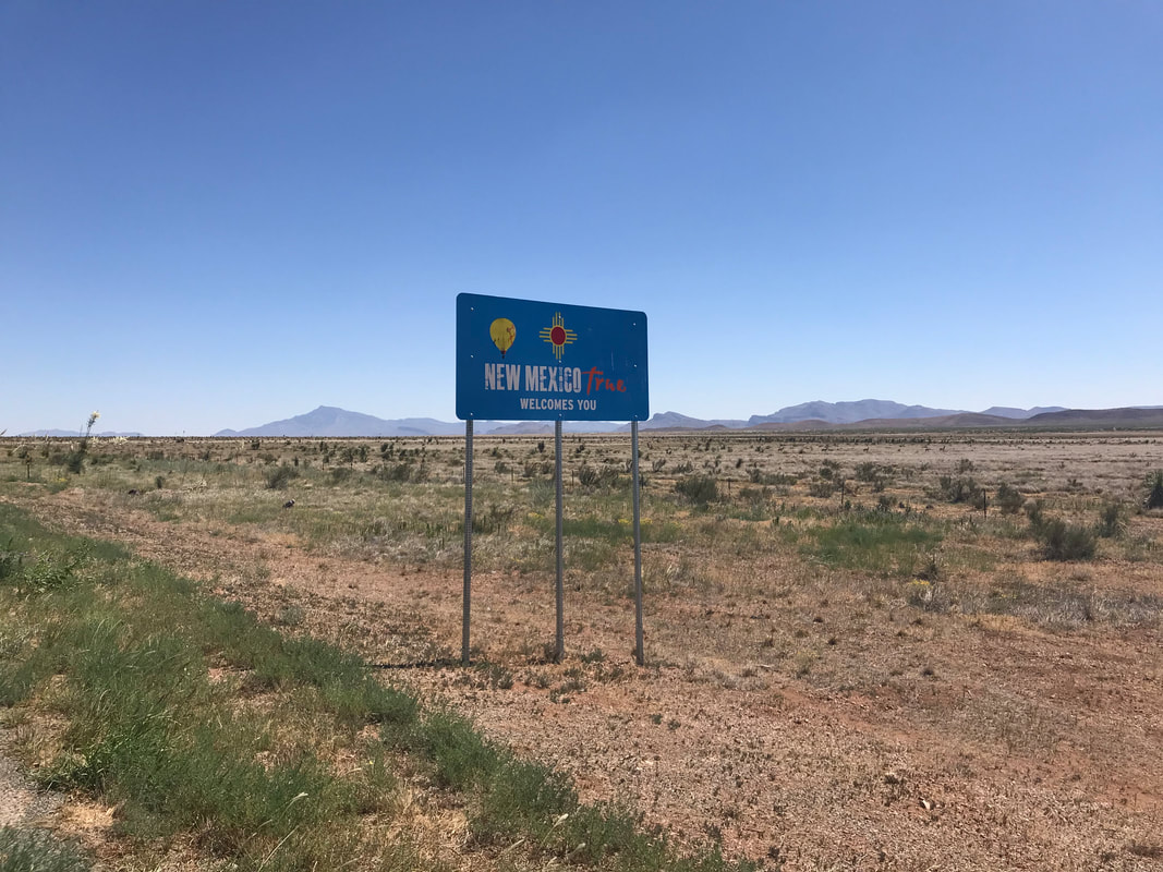
     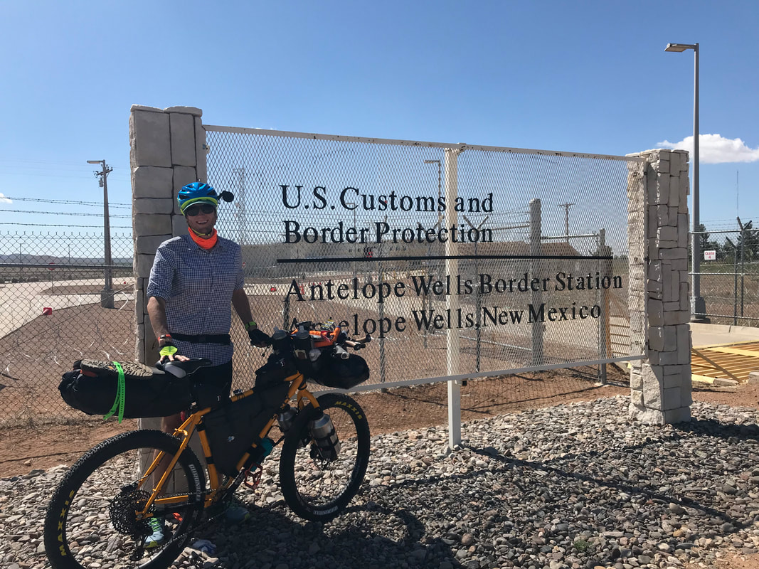 After finishing the AZT, I slit my foot open on a piece of glass in such a way as to remove any chance of starting on the Great Divide on my designated date. Instead, I went to Colorado with my family for a couple of weeks and took nearly a month to ensure no infection would ensue. I reached out for help getting to the border and my former students Emanuel and Sierra volunteered. I was SUPER grateful that they were willing to drive with my down to Lordstown, NM the night before and then return my car to Phoenix the next day. The morning of the first day, the three of us got our free continental breakfast from the Days Inn and started an early morning drive to hit the Border Patrol station as soon as it opened. My goal was to be on the route early before the day’s heat set in. Driving towards the starting terminus, the terrain formerly undulating became increasingly flat, lowlands with creosote and little else. Cell reception receded as we turned onto “The Loneliest Highway in America” and headed towards the border in the boot-heel of New Mexico. Their eyes were wide with imagination as they considered what the riding would be to me. Emanuel asked if I was really going to get to Hachita, NM in a day. I responded positively. Both seemed unsure of how I would take that happen. As well pulled into the Border Patrol Station, a father and daughter migrant duo sat against the fence. I gave them some food while Sierra and Emanuel then helped me construct my bike. I entered the Border Patrol station as soon as it opened for a commemorating stamp in my passport. The officer on call gave me free ice cream for being a Great Divide rider. He said most racers get the ice cream when they finish here at the end, but since I was going northbound, he saw it equally fit. I headed outside and took photos by the Antelope Wells Station sign both solo and with Emanuel and Sierra. Then, I began pedaling north along the shoulder of the highway. The two passed me in my vehicle and sped off into the horizon leaving me alone in the desert. 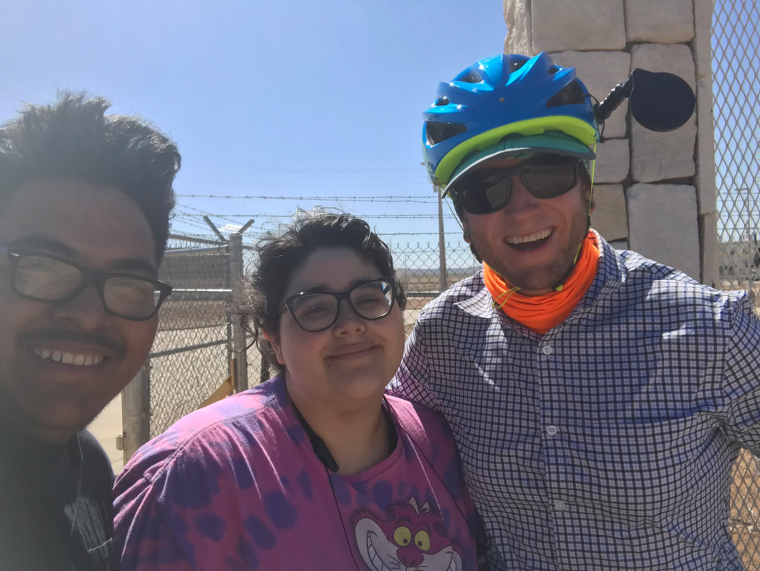
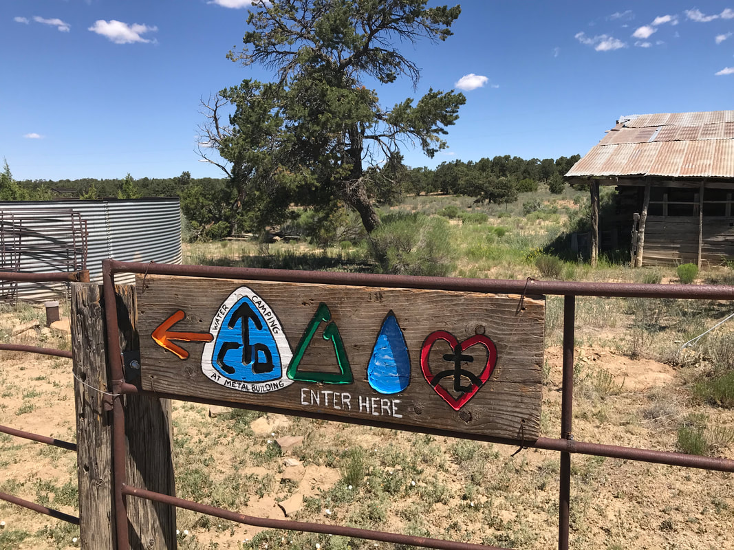
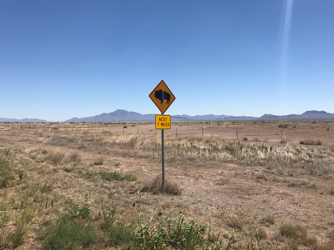
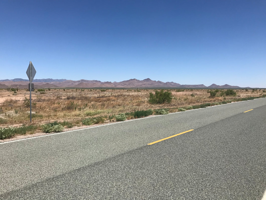
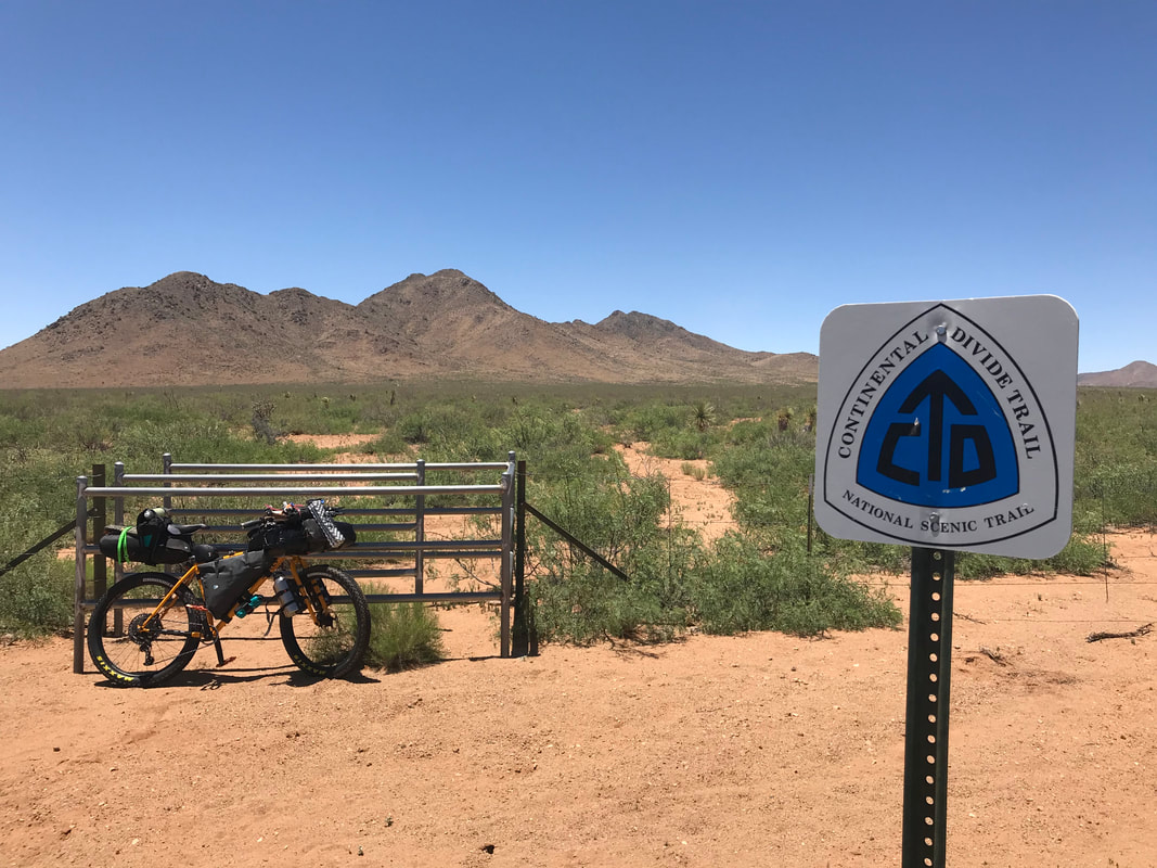
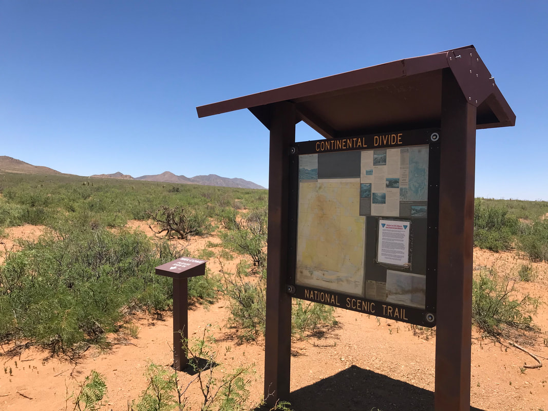
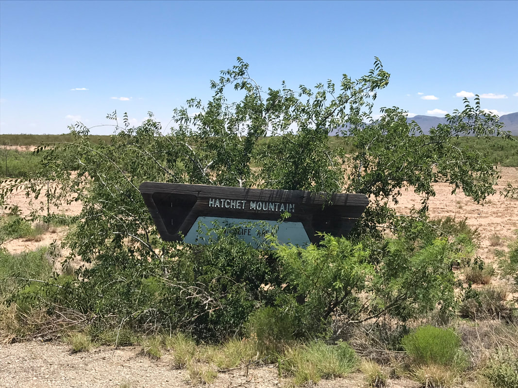
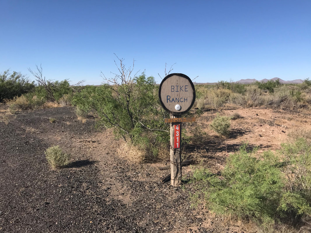
 I had spent relatively little time in the Chihuahua Desert. I spent most of my ride really soaking in the scenery. This was one of the lowest parts of the Continental Divide and I would be gaining elevation slowly from here on out. The flat and vast basins were punctuated by the desert Big Hatchet Mountains in front of me. The heat built up quickly as I began to sweat hard in the mid-morning temperatures. To my right, pronghorn herds ran across the desert grasslands. It was truly summer; all plant life seemed brown and brittle, in the distant sort of torpor. The Big Hatchet Mountains ahead of me were noticeably green with plant life from a recent rain. As the highway wound around to their north side, I saw a kiosk for the Continental Divide Trail. I pulled off and walked up the trail a bit. Back on the side of the highway, a vehicle slowed down parallel to me. The couple inside talked to me for a few minutes saying they were getting ready to begin their northbound CDT thru-hike. This blew my mind for the prolonged heat they were about to walk into. It’s mid-June in the Chihuahua Desert, some of the driest and hottest months here in foresummer before monsoon season. I was already questioning biking solo across here at this time of year but they were going to hike it far slower than me who would exit this desert in a few day’s time. I wished them good luck and they sped on. Around 3 pm, I was feeling really shitty. I checked the temperature and saw it was 103 °F, which caught me off guard because the day’s forecast high was supposed to be 95° F. A local rancher pulled his truck over and asked if I was okay, saying that he couldn’t believe I was out here riding at this time of year/day. He pulled on and I kept on riding until I reached Hachita, NM. I immediately beelined it to the small mini-mart/gas station for COLD Gatorade and some AC. Refreshed inside, I used their wifi (no cell service) to get in touch with Jeffrey Sharpe, a local known for his hospitality towards Great Divide riders and CDT hikers alike. The town provided it’s local community center as a place for riders/hikers to spend the night before continuing on. He picked me, bought me ice cream (a tradition of his), before dropping me at the community center and giving me the tour. I was super grateful and took the time to use wifi to catch up with Janna. A couple hours later, he texted me to forgo the night at the center and stay at his place at the The Bike Ranch. I pedaled outside of town and up an unaddressed dirt lane to his spread. It was super nice of him to let me stay in his guest rooms and place. He had open Dot Watcher and was tracking the southbound progress of the Tour Divide racers who had just recently done the Grand Depart from Banff, Alberta. As the evening wore on, a local friend of his came by to drink beers and talk. We all watched the movie Vice while Jeffrey prepared some chicken and rice for dinner. After several beers and food, the three of us retired where I passed out deeply in a bed along with a shadow headache from the day’s heat. I slept hard though and woke up energized the next day. 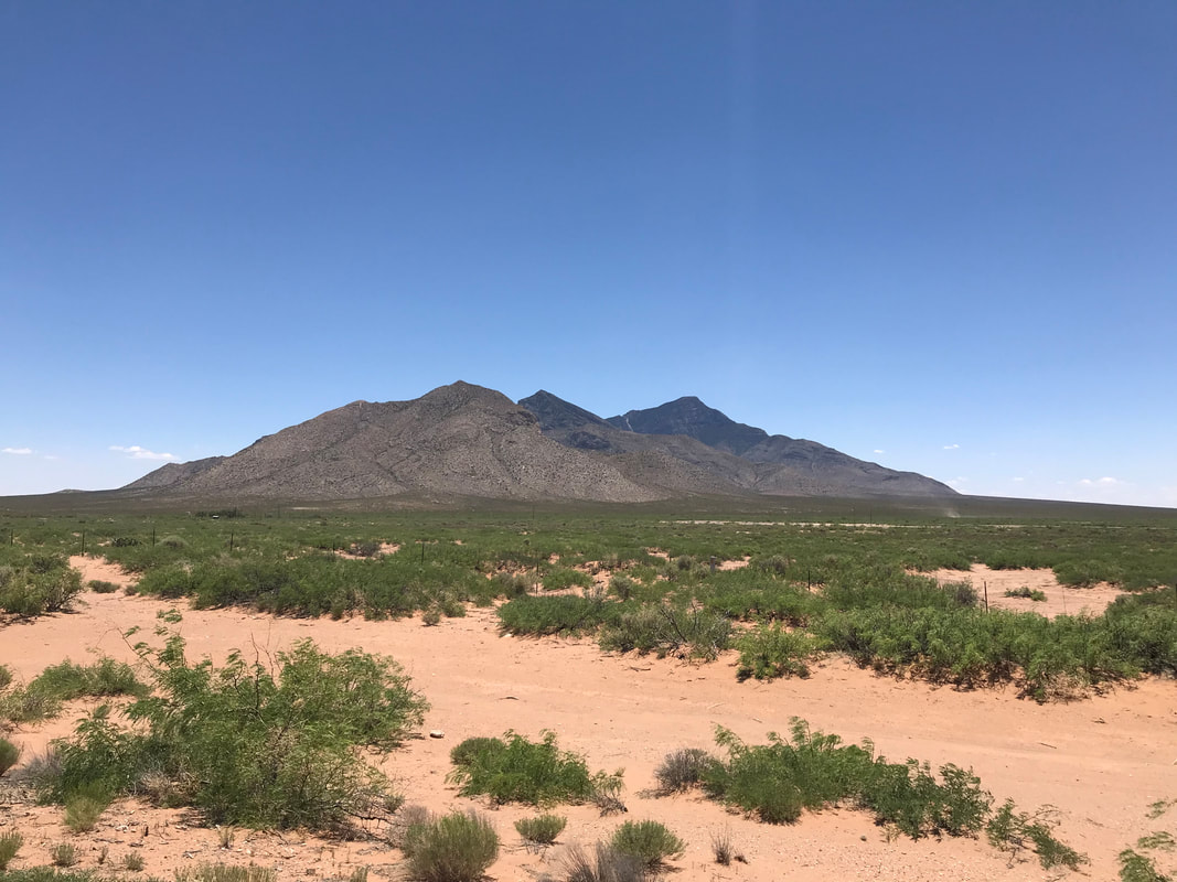 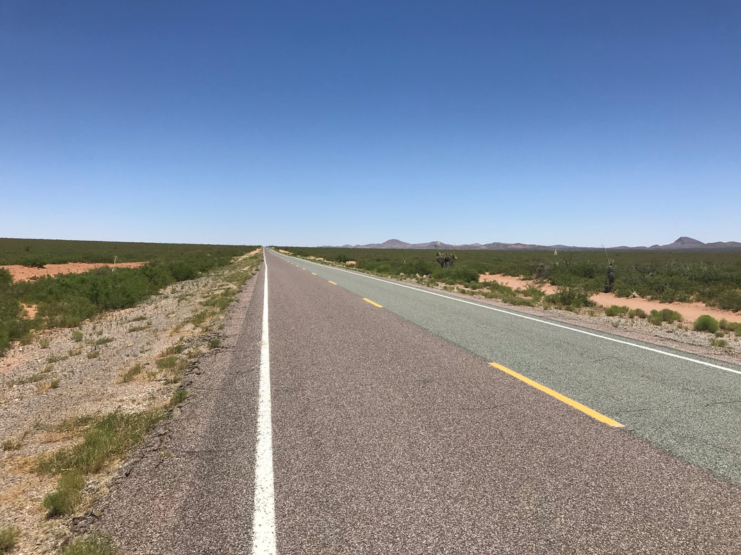
  |