 The school year ended after an extension to June given the postponed start due to COVID-19. And with it came the close on my first year working and living at the Grand Canyon. It felt a little off-kiltering to realize the year had come-and-gone all while COVID-19 continued to press down on the world sizably. With summer break nearing, Janna and I fleshed out our adventure plans. We settled on the Sierra Cascades Bicycling Route by the Adventure Cycling Association. The route is a road/pavement-based tour that acts as the bicycle equivalent of the Pacific Crest Trail. It starts in the mountains along the US/Mexico Border and continues across the crest of the western-coast states all the way to Canada. We had eyed the route several years ago when deciding our first tour and wisely thought it too difficult to start with. Our original plans for this summer were to bike the Great Divide Mountain Bike Route. However, an injury I sustained in February resulted in medical advice to avoid jostling rock/dirt surface for pavement...
0 Comments
 After yesterday's big miles and elevation gain, I awoke today to find (rather unsurprisingly) that my hip was in some pain. Little did I know that a few days later I would find out I had a pelvic fracture. But for moment, all I knew was that it was throbbing. I had two days left on the route, but given the pain, I decided to do one last day shortly looped through the woods to retrieve my car in Tusayan...
 Somehow the night was warmer than the evening. Whether it was the storm passing and taking its gale or a warm front slightly moved in, but the dawn broke even and comfortable. Today was planned to be a big day. My pelvis was doing well, so I planned to make up some distance/time by hitting up all the capes and making it to the South Rim Village for the night. No rain was forecast, so I didn't feel compelled to hurry my morning too quickly. Instead, I used the latrines over by Grandview Tower, enjoyed a long breakfast, and then got comfortably going for a big descent off the Coconino Rim down to the Upper Basin...
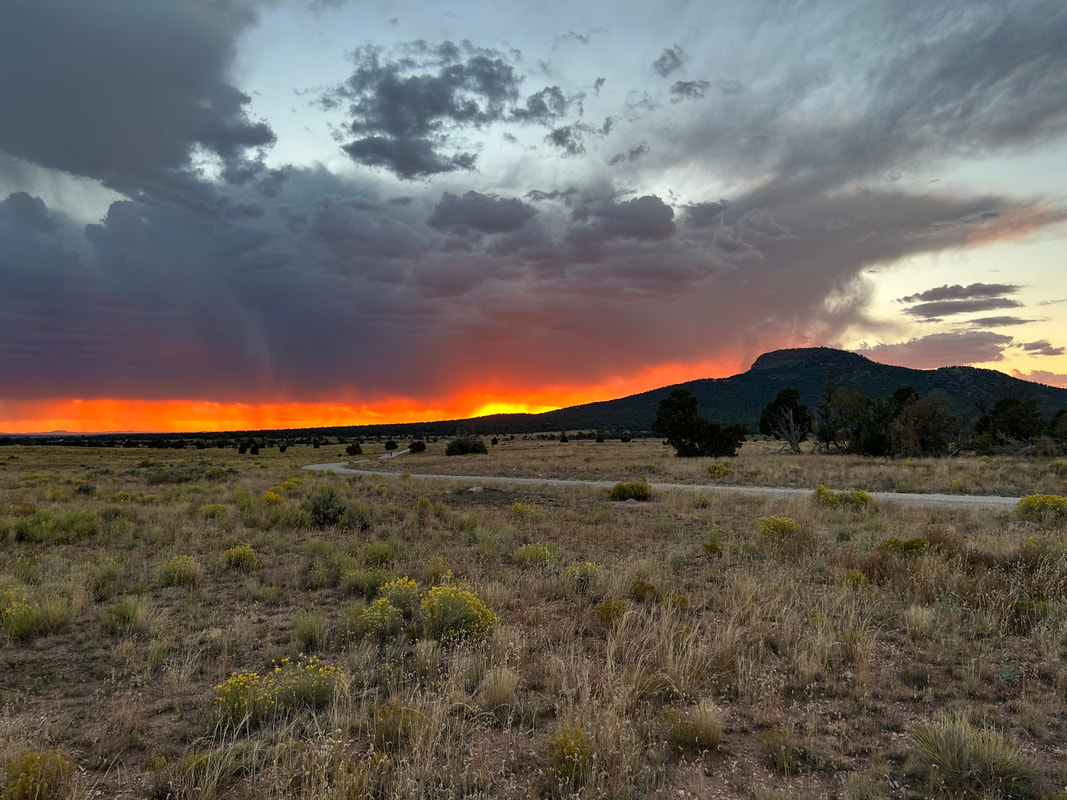
 The bugling elk persisted into the early hours of the morning, whereby I got some sleep when I finally put earplugs in. Usually, October mornings have a bite of cold that gets chased by sun in the middle of the day. But as soon as the sun crested the horizon, it felt like a warm summer morning. I exited my shelter into dawn light calm and smooth. I packed up quickly knowing that today was forecast to have even more storms than yesterday. I wanted to make sure I didn't get caught in caliche substrate when the rain came. As I was eating breakfast, a bunch of USFS Hot Shot vehicles and fire trucks flew down the road I was camped next to. I noted that possibility of a fresh fire after last night's lightning show...
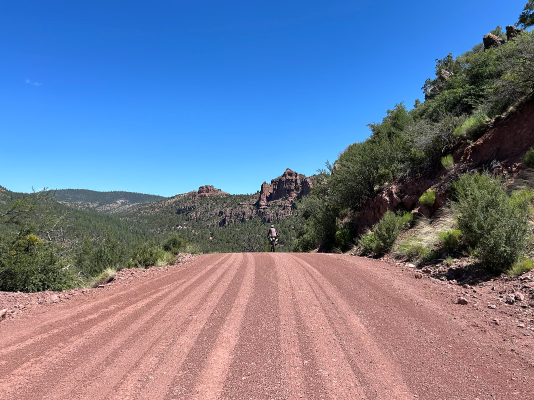
 The monsoon season this year proved to be above average. Notably, Tusayan (as a sample of the region) received an afternoon storm in mid-August that dumped more than 3 inches of rain around the washes of the town perimeter in about 45 minutes. A subsequent flood gushed into town permeating buildings/businesses. That surge of water also ended up being a harbinger of erosion; many parts of the South Rim region's lesser-used dirt roads were infiltrated with debris flows, flash flooding, and deep rocky ruts. I spent late-August through September riding portions of the COTC that I suspected were deeply impacted by the above-average moisture. And man, the roads were destroyed. I rode out to several remote areas on the route that had miles of debris overlaying the route or were rideable but completely jolting from the major rock beds now making the majority of the surfaces. I poured over maps, rode out to new areas, and ultimately ended up completely regrafting big chunks of the southwest and southeast passages of the COTC onto more suitable roads for riders. The result had some trade-offs, exchanging quality road for loss of unique scenery...
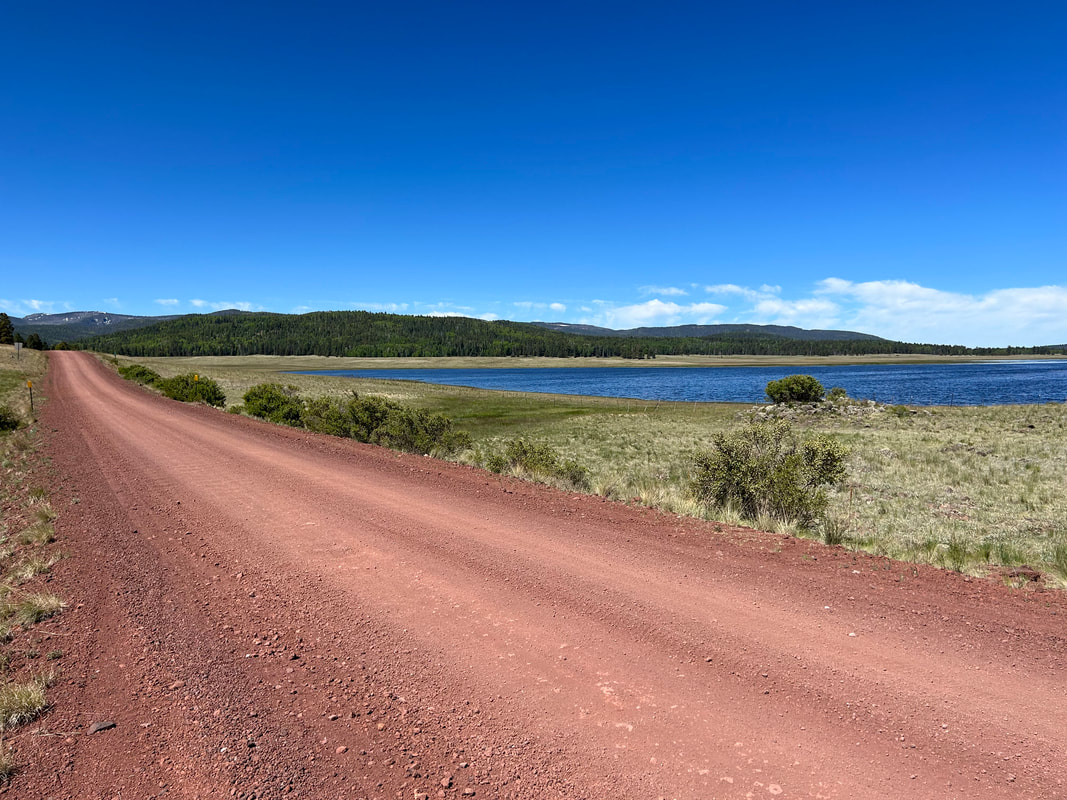 Janna and slept intermittently. The campsite next to us arrived near midnight and spent an hour or so loudly debating how to setup their tents. Once it quieted down, I slept well. But Janna and I had discussed, and after looking over the next two days, we decided that we could easily finish in one long day given that the majority of the route was downhill. Early summer dawn hit us, and we quickly got up and packed up our camp in the near-frost chill of morning's light. The water of Big Lake was a sapphire blue, and the distant summit of Mount Baldy was now mostly snow-free save for a few spots...
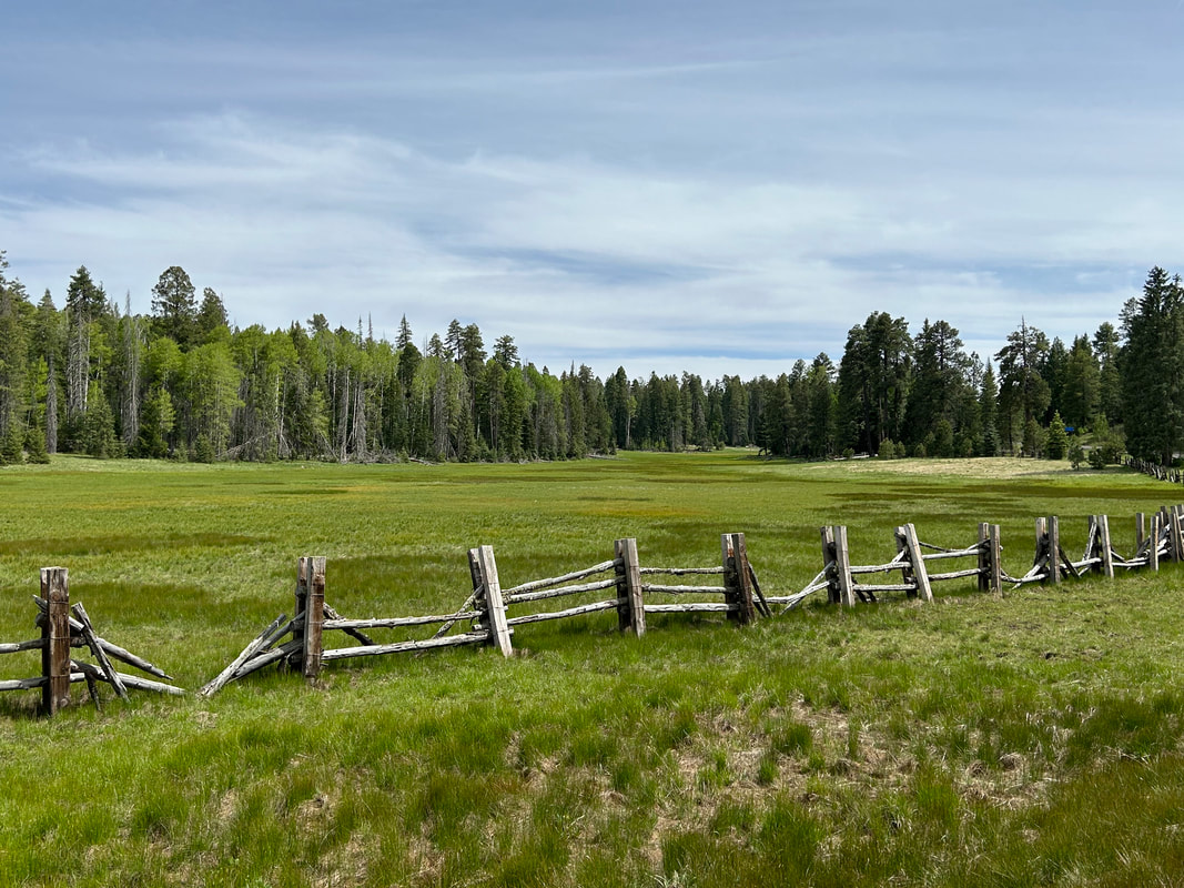
 Night was utterly quiet. We awoke at the first tendrils of cold dawn. Summer light entered the shelter, but the temps were easily in the upper 30s. We had a big day of climbing ahead of us to cover the distance to Big Lake. Nick came out of his woodland camp while holding a large air rifle he carried for, per his description, the large predators in the area. Hannagan Meadow Lodge wouldn’t open for breakfast for a while, so we ate our own breakfast and joined the shoulder of the highway. Highway 666, aka the Coronado Highway, undulated along a series of gradually rising hills to nearly 9300 feet. Thick aspen, large spruce, and a mix of semi-burned woodlands made up the corridor. The shoulder was decent and the traffic almost non-existent along the paved stretch...
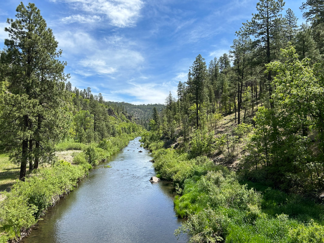
 I slept soundly in that deep peace that comes from the sound of rushing water nearby. The morning was cold as sunk air densely packed down in the gorge next to the Black River. We knew we had a short day today (purposely planned after yesterday's big day), so we languidly arose only after the Sun nearly crested the walls of canyon. I exited the tent and immediately deposited myself in a seat in a patch of Sun working its way to warm the area. Satiated with light, I immediately went back down to walk along the banks of the Black River. Great blue herons stalked for fish or flew overhead. I walked the banks for 40 minutes taking in the curves and riffles of the water before heading back to camp to make some breakfast. After, I walked down to the Camp Host to confirm our payment. Once he realized we biked here and that we didn't have a campfire, he immediately rejected our payment and said we earned our campsite. He also told me to go find Upper Diamond Spring located in our campground within a fence. I moseyed my way back, searched the area, and easily found it. I made a note to grab water from here next time we biked through...
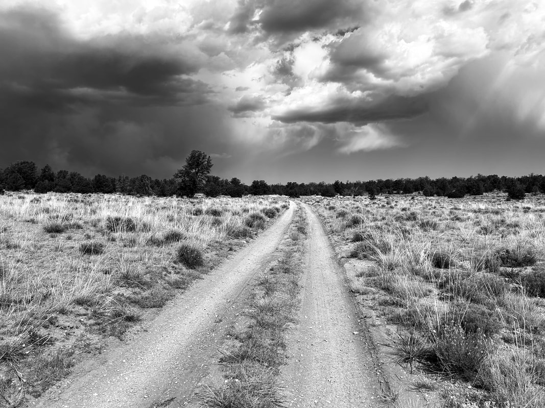
 After a good night's sleep, we woke up ready to take on the crux of the route: a descent to the low point of the route at Blue, AZ off the Mogollon Rim followed by an ascent back up the same rim, a further climb up Middle Mountain, and a long contoured traverse to the Black River. The worst of the storm system that had hit us for days was now over with yesterday's thunderclaps. Instead, heat and sun would be our main concern as we lost thousands of feet of elevation before regaining the same and more.
The morning's blue sky beckoned, so we checked out of our room and starting speeding down the dirt road with crystalline sun shafts catching tree boughs. It was crisp enough we wore wind jackets to start. A waning gibbous moon sat high above Alpine's valley. We road along the highway shoulder before reaching Luna Lake and the turn to Blue. Yesterday, when we had bought groceries from the gas station, the clerk had turned out to be a newly-graduated senior from the small schoolhouse down in Blue. She said she had loved growing up in the village, the Blue River, the dirt roads, and the terrain. I definitely was curious to see what the school there looked like...  Janna and I both love the rest and recharge that comes with Zero Days. Especially when we can get to see a local area better. We awoke after a solid's night sleep to what was forecast to be a tempestuous day based on the weather forecast - lots of rain and significant thunderheads. We were grateful to have some indoors to relax in...
|