0 Comments
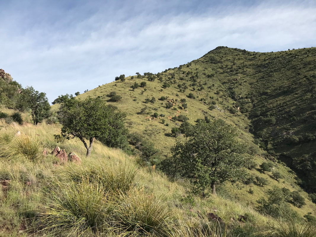
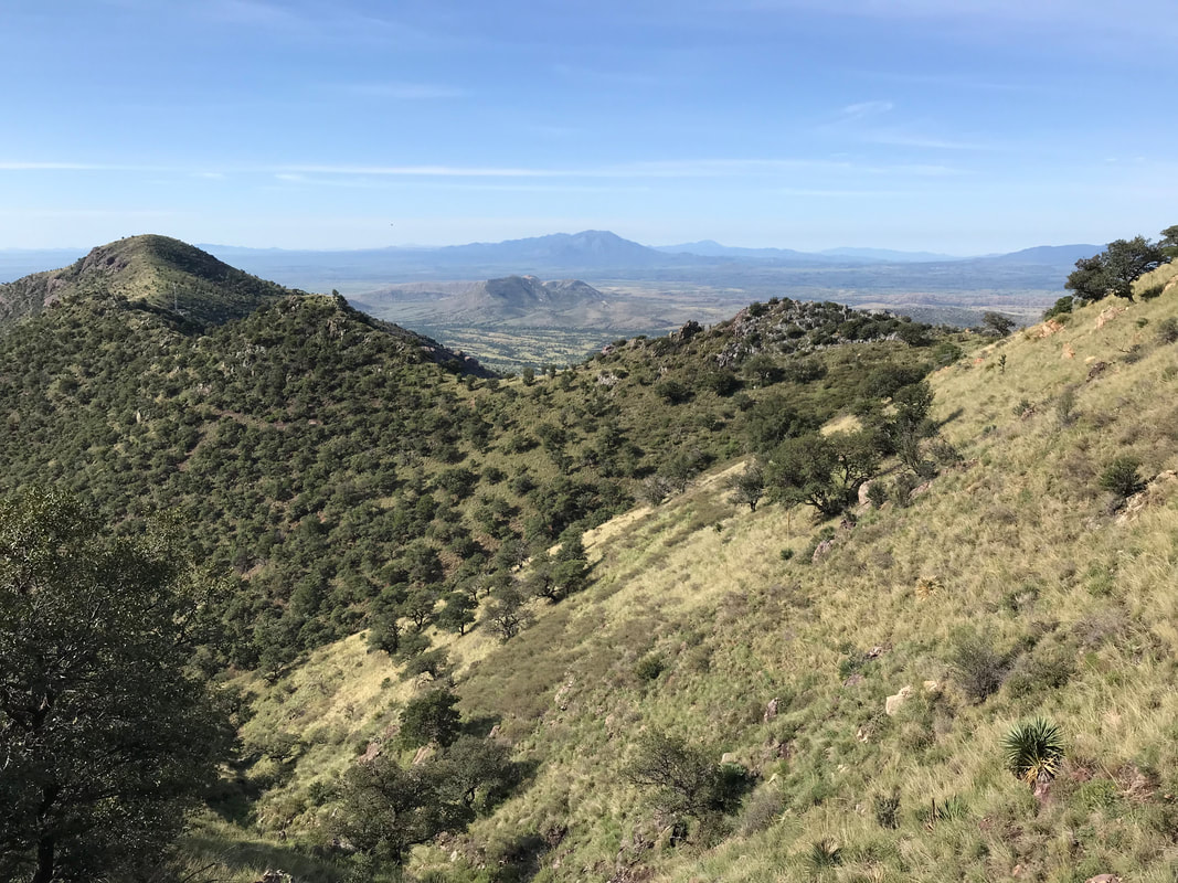
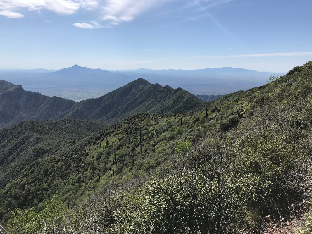
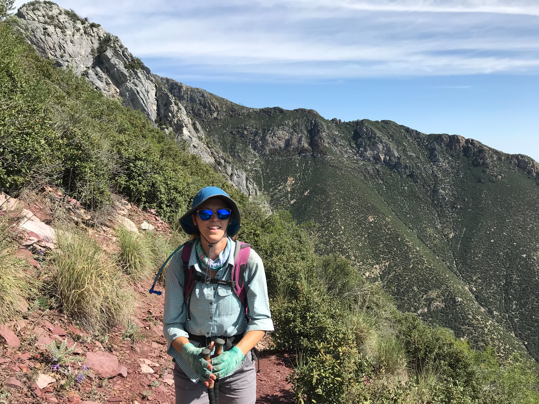
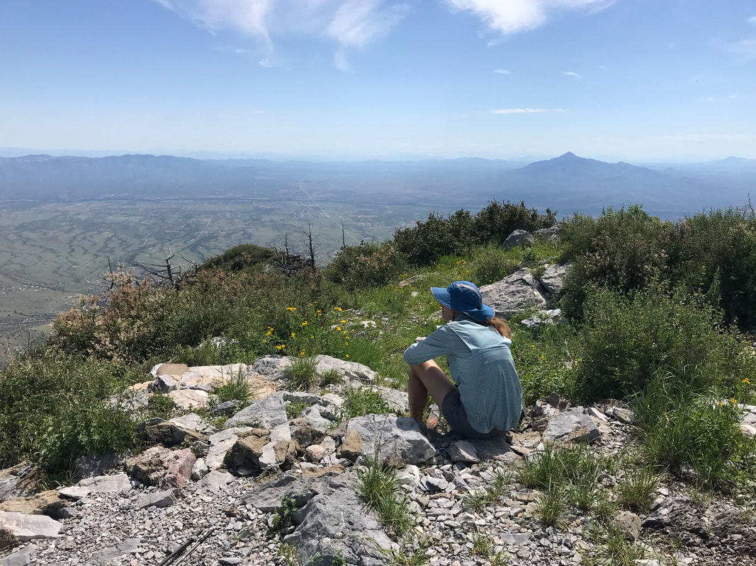
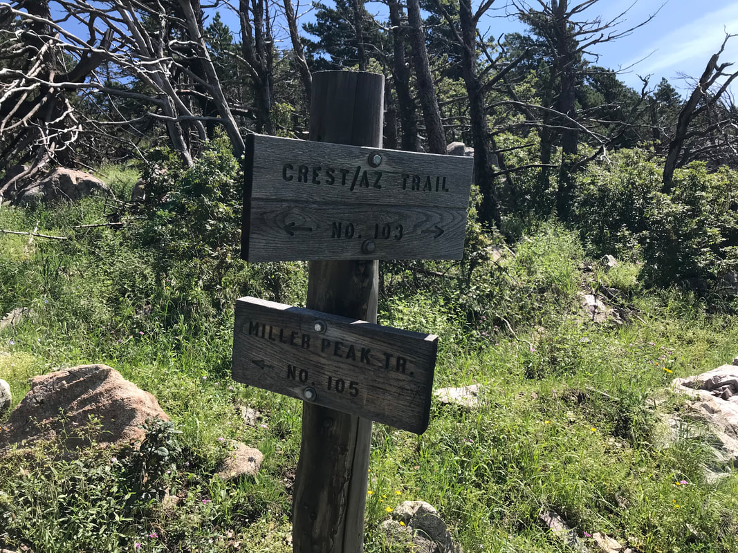
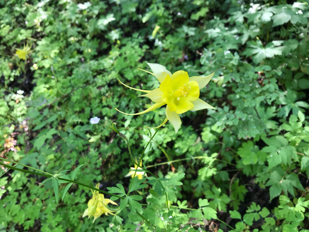
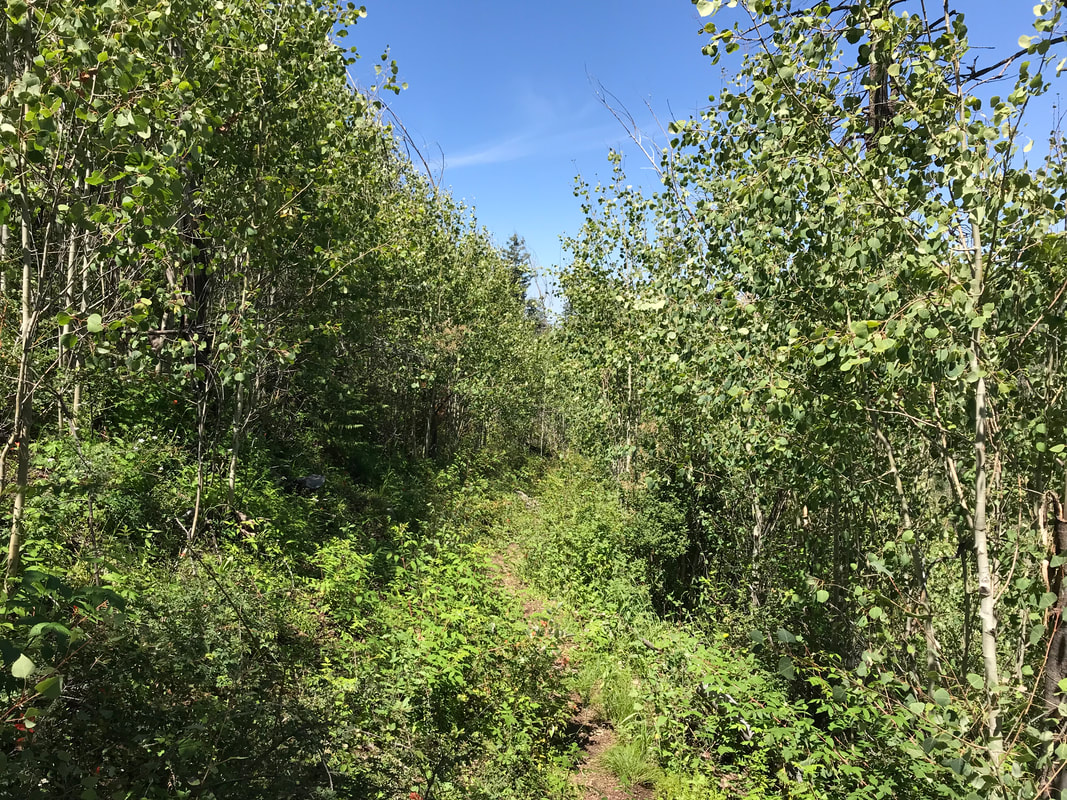
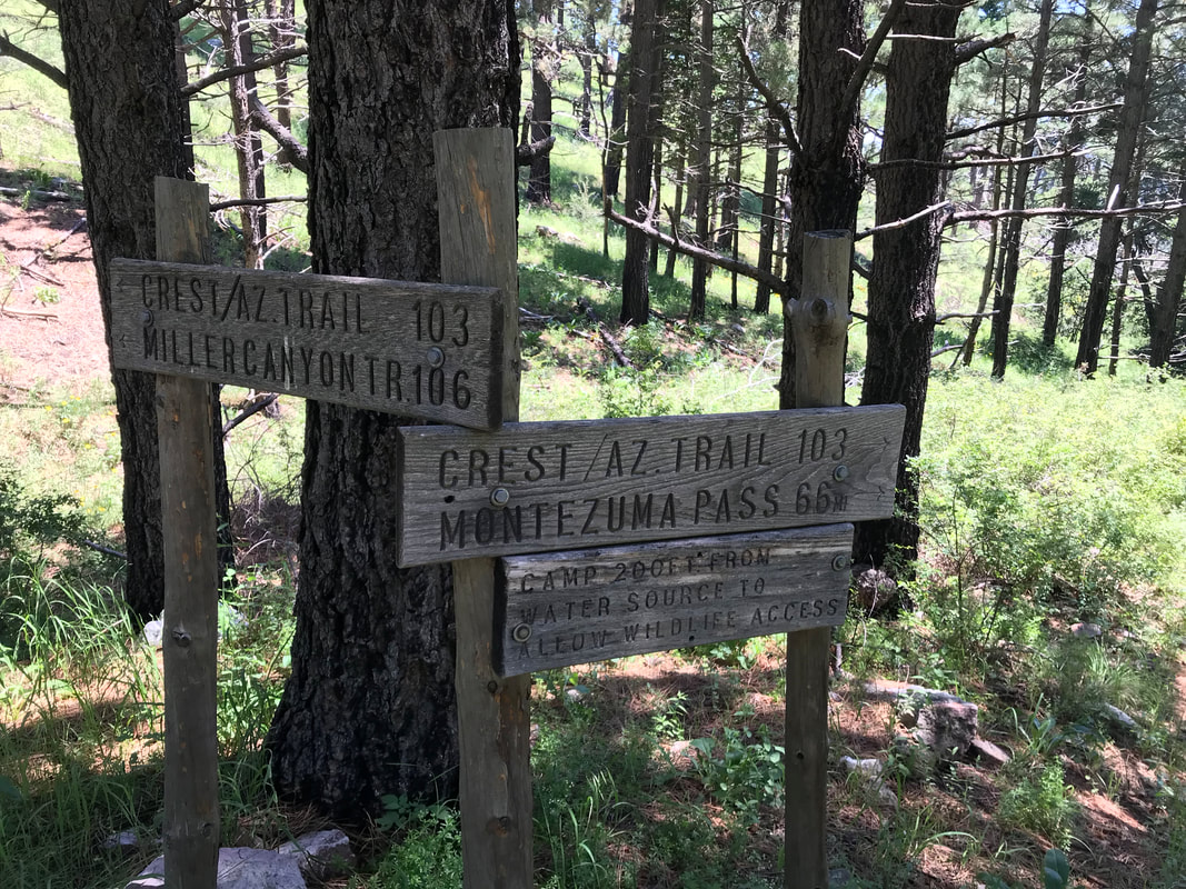
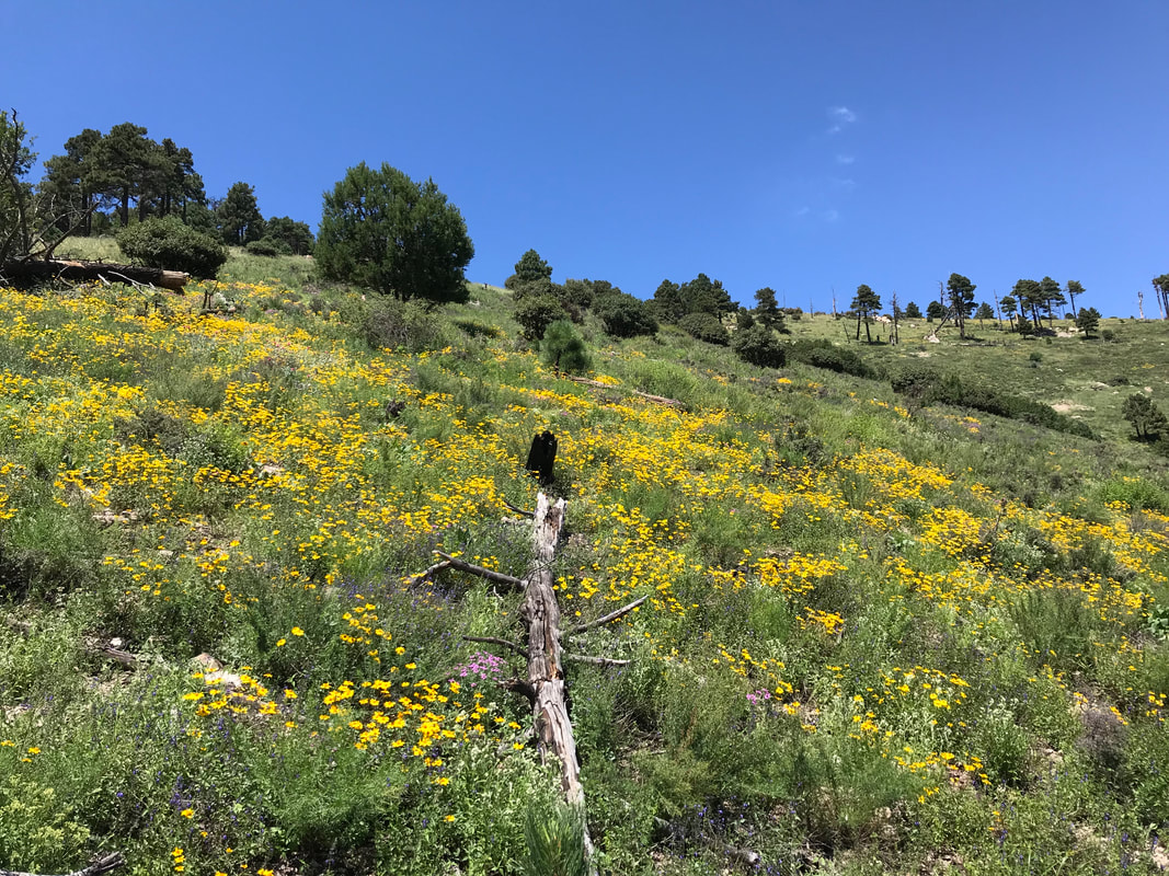
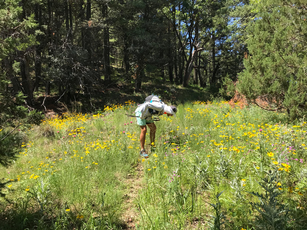
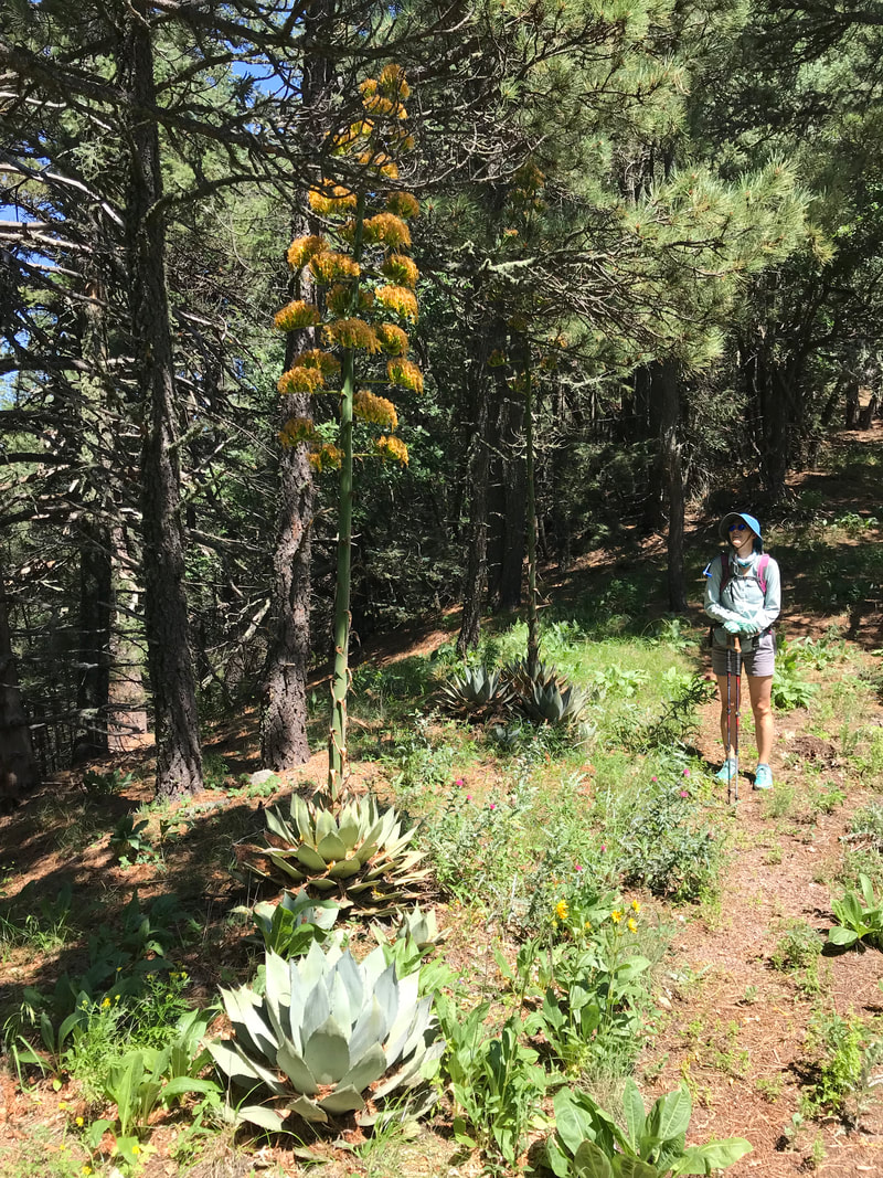
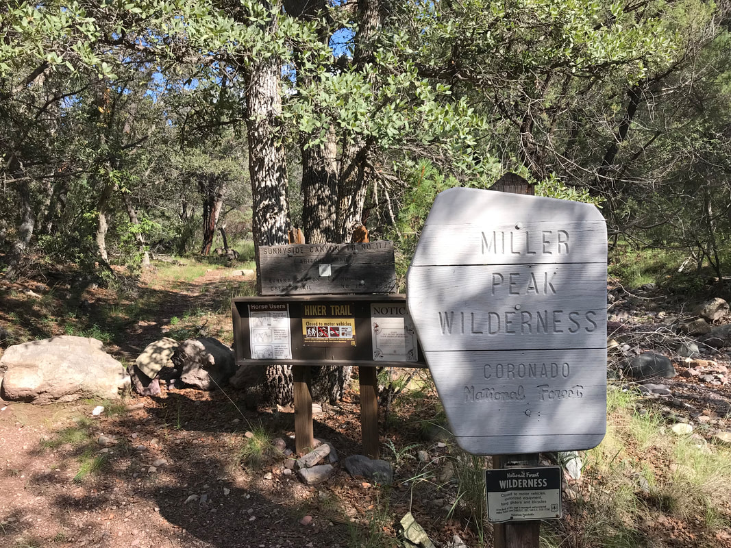
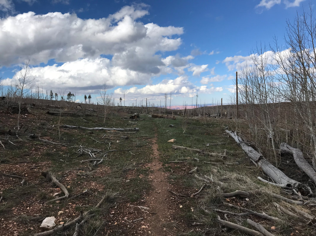
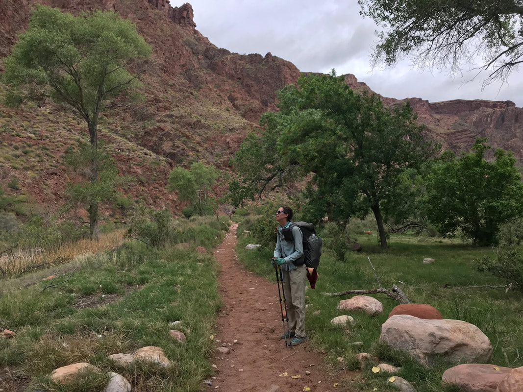
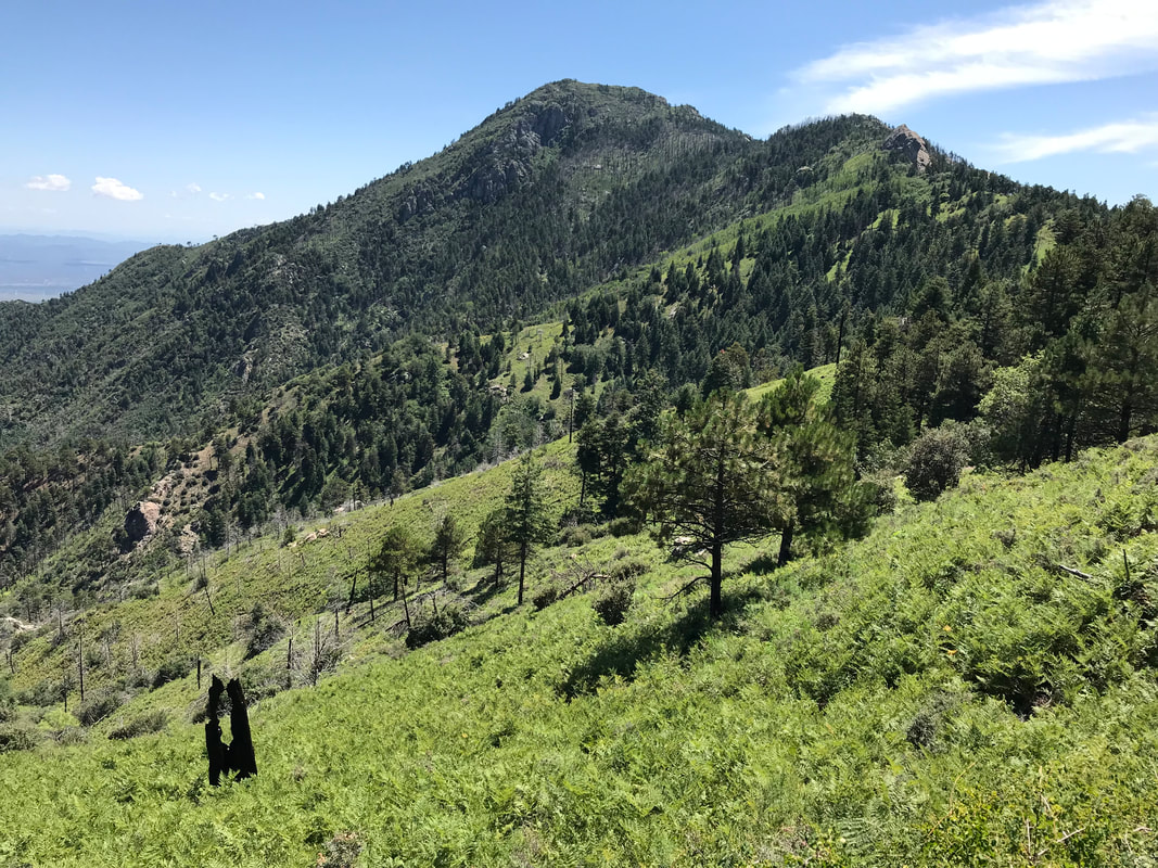
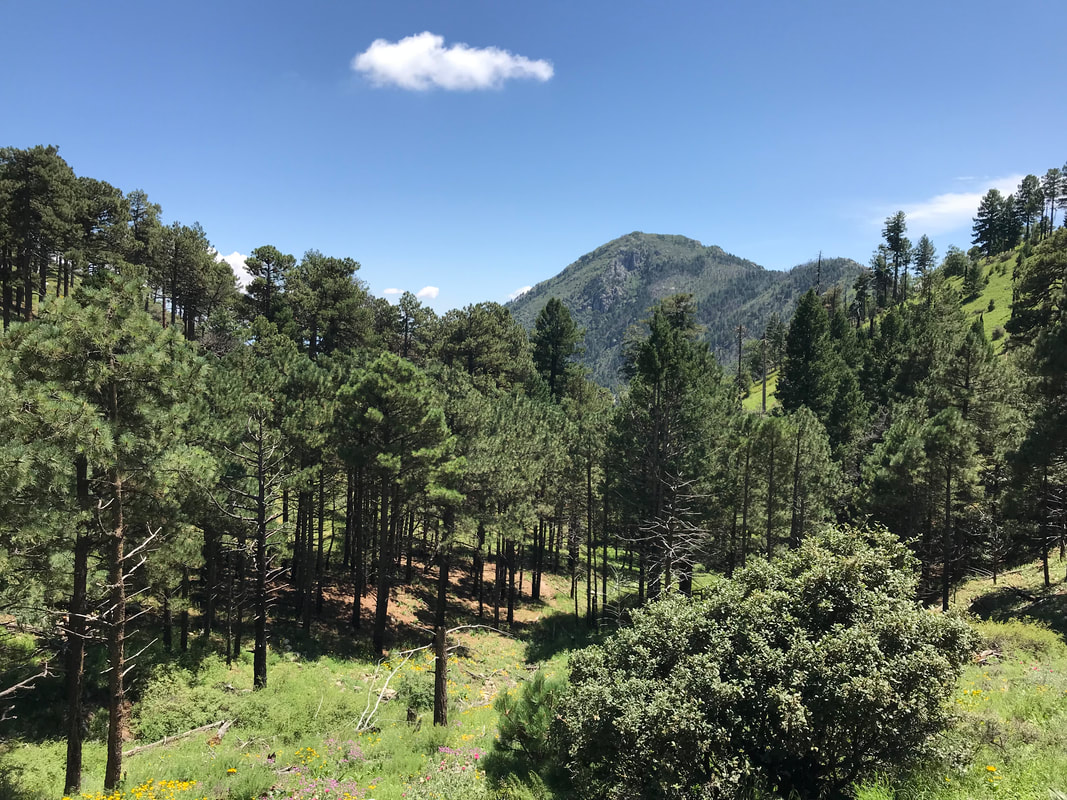
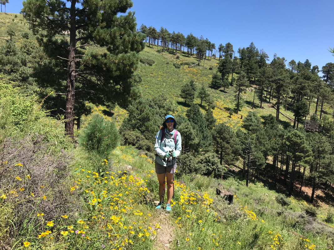
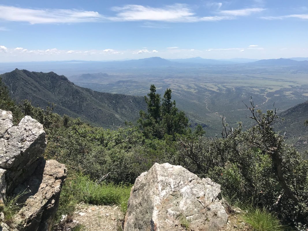
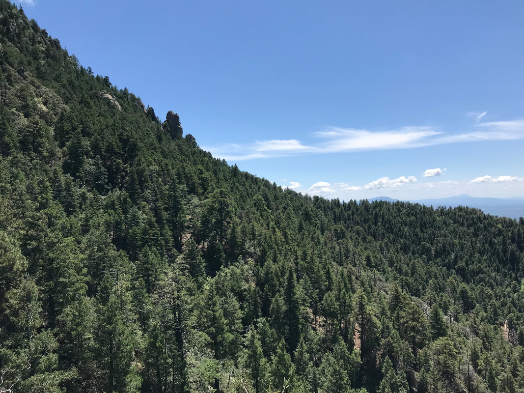
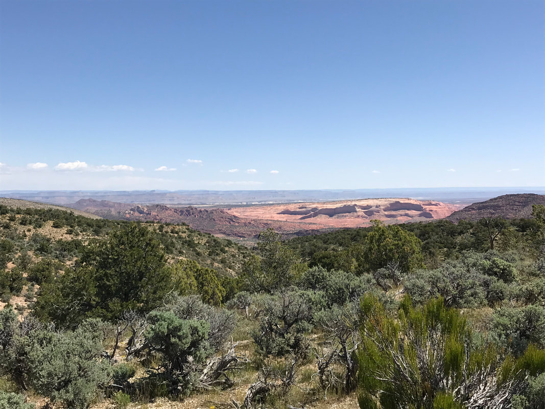
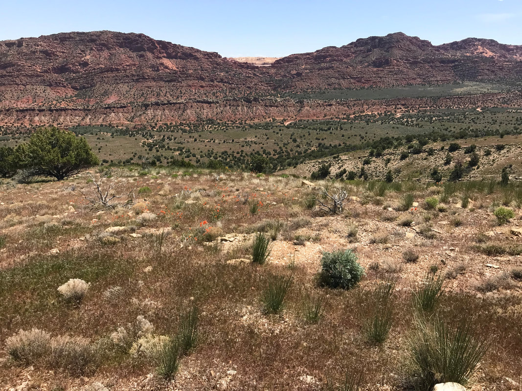
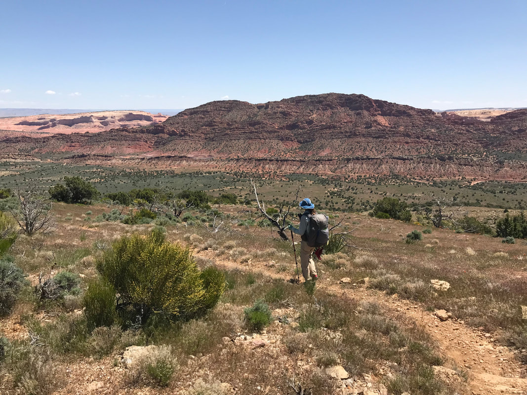
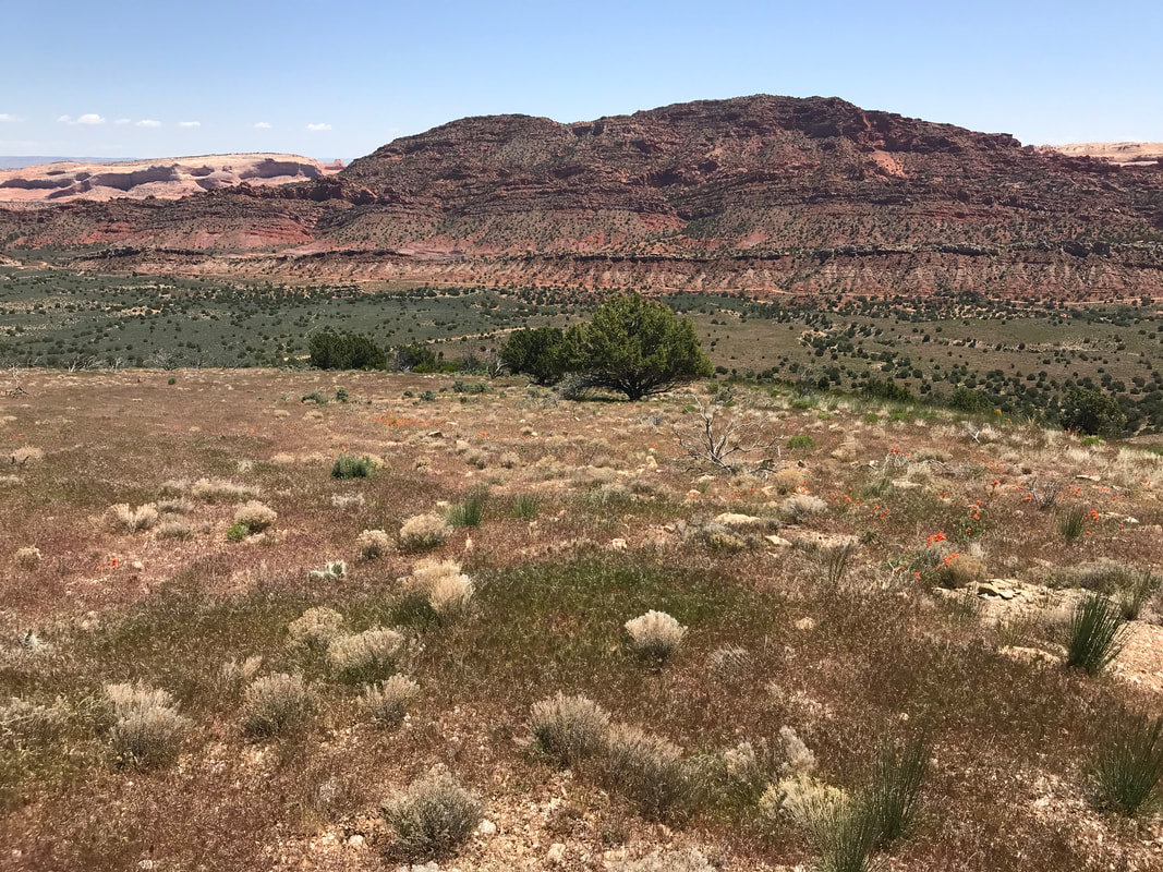
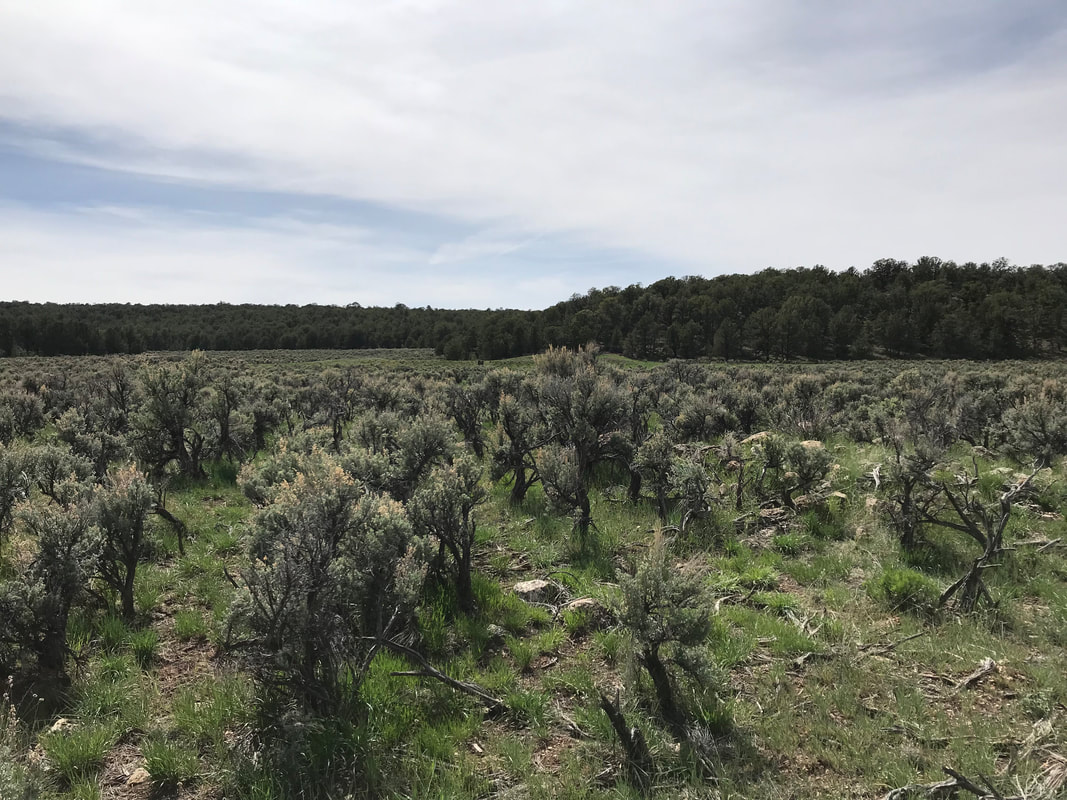
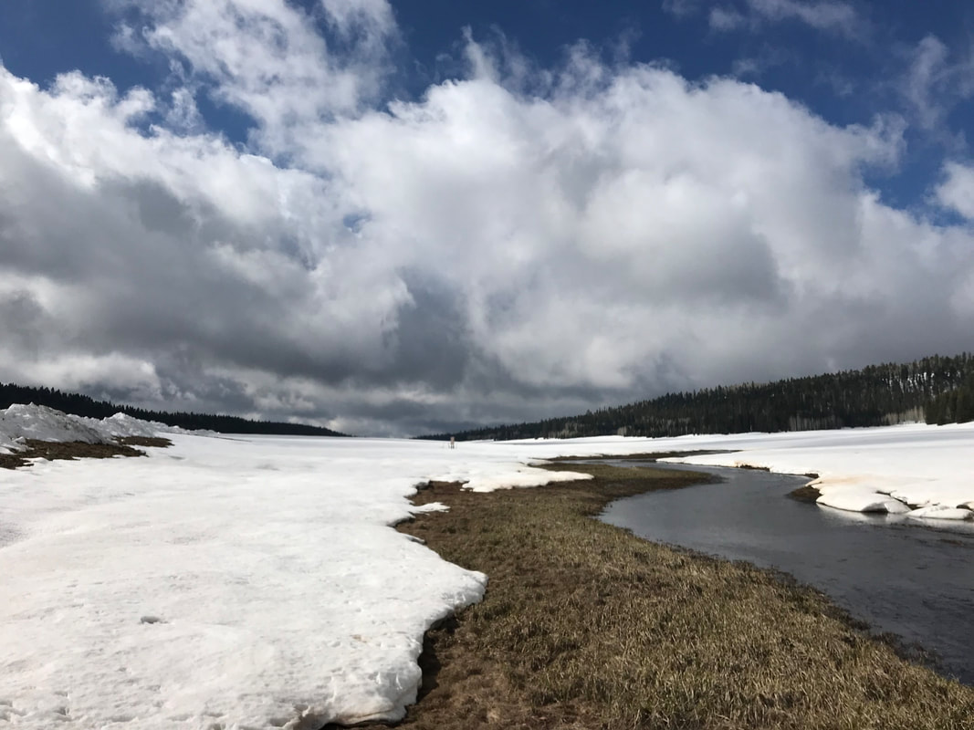
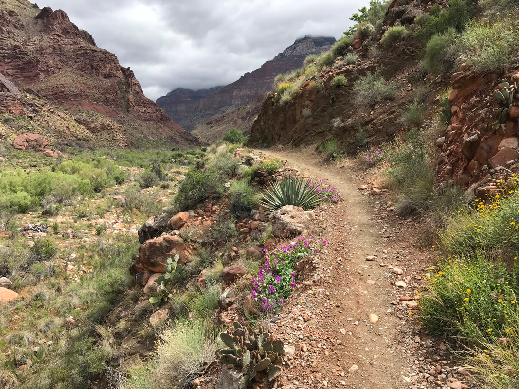
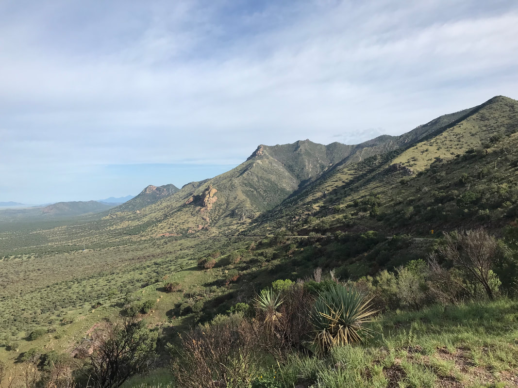 When we finished the AZT in the Spring, there were two notable areas we had to skip due to snow/weather: Passages 39/40 on the North Rim and Passage 1 in the Huachucas. A spring storm dumped three feet on top the day were scheduled to begin which resulted in a day’s delay. But even with the storm passed, the route was pure posthole along an unmarked ridge. We took the MTB alternate down the forest road over to Parker Canyon Lake. At the time, Janna and I promised we would come back over Labor Day Weekend in the fall to complete this section. And so we found ourselves back at Montezuma’s Pass. After parking the car down a rutted dirt road next to Parker Canyon Lake, we got picked up for a local guy who drops hikers as a shuttle. We drove up the backside of the range, shocking us at how fast we covered in 45 minutes what had taken two days in the Spring. Up on the pass, the temperatures were rising already at 8 am. We waved him goodbye and started up Crest Trail. The mountain range was incredibly lush from the summer monsoon rains. It was obvious the trail was little-used outside of the concentrated windows of AZT thru-hiker use, of which were firmly not in. Catclaw, grasses, and shrubs shot out branches and leaves over the trail to maximize photosynthesis. We scratched ourselves upward in the walk, pausing to look back and take in the dramatic views of the borderlands of Mexico. By mid-morning, we hit a small saddle chock full of pine trees and columbines where we took a break. I was sweating profusely from the combination of heat and humidity rising from the dense plant life. We pushed upwards to a split in the trail leading to Miller Peak. We took the side-hike and summited the highest point in the range at well over 9,000 feet. It was a rocky grass knoll on top that afforded stunning views of the mountains in Mexico and the grasslands of southern Arizona. 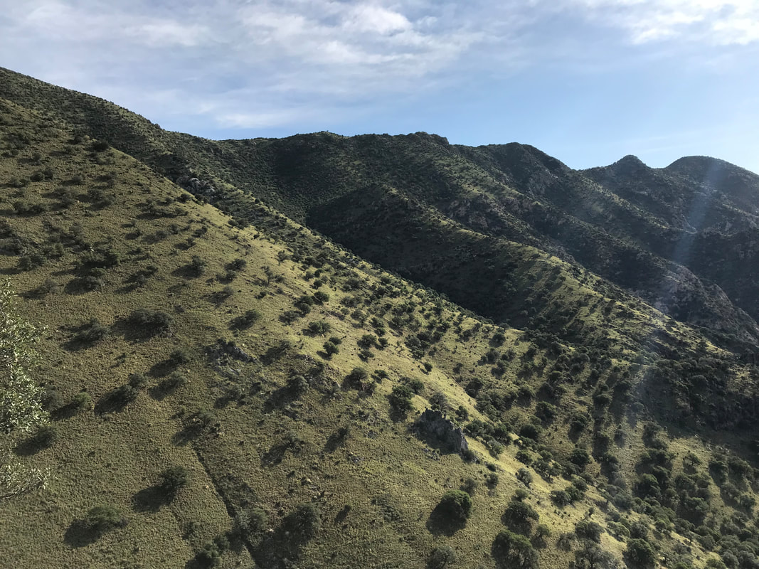
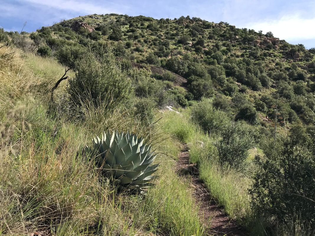 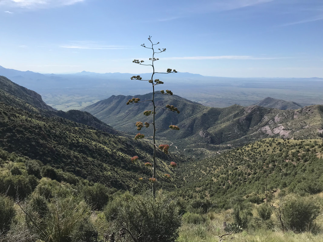 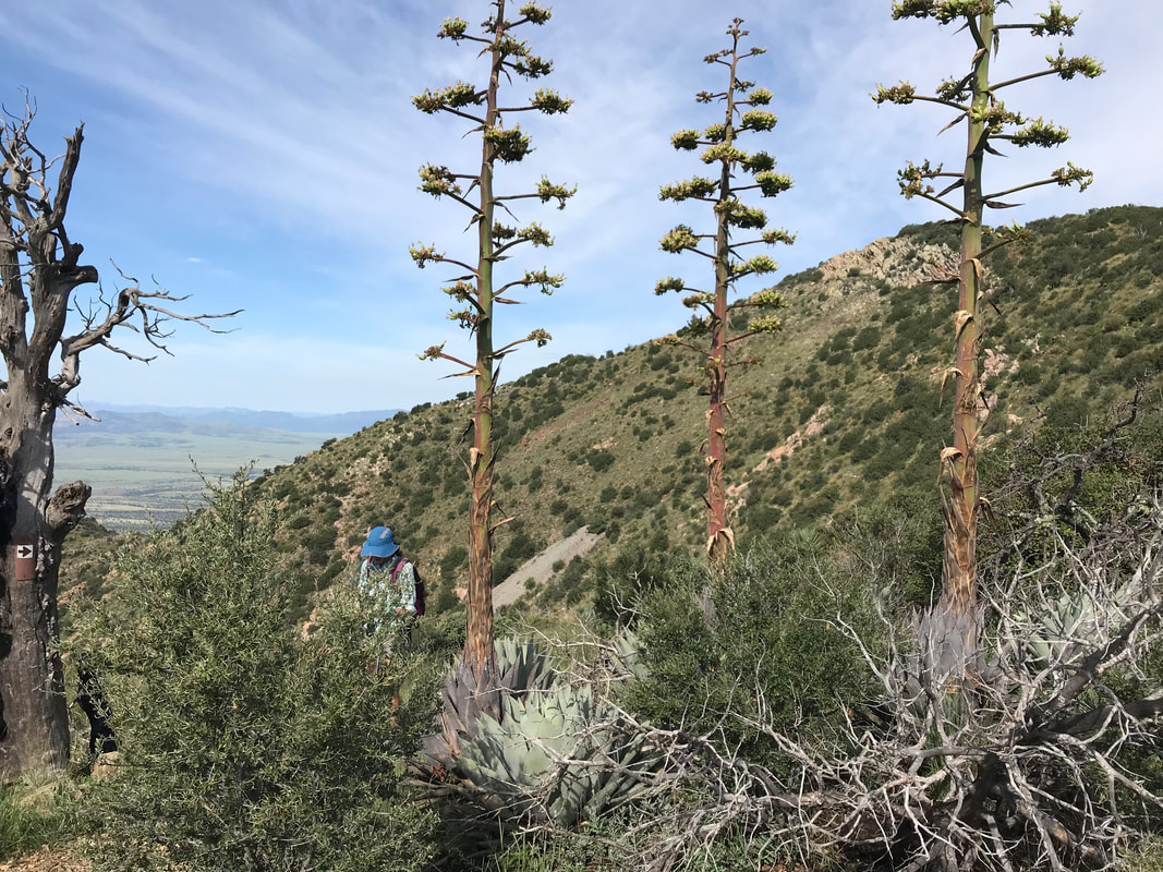
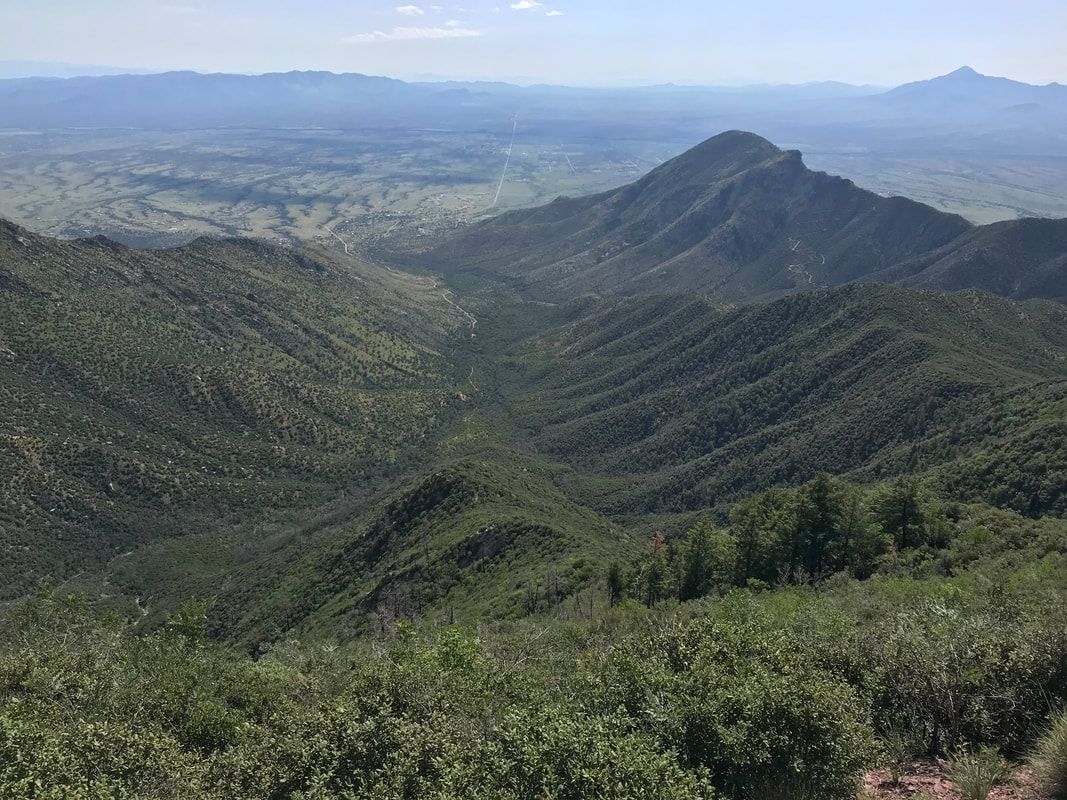
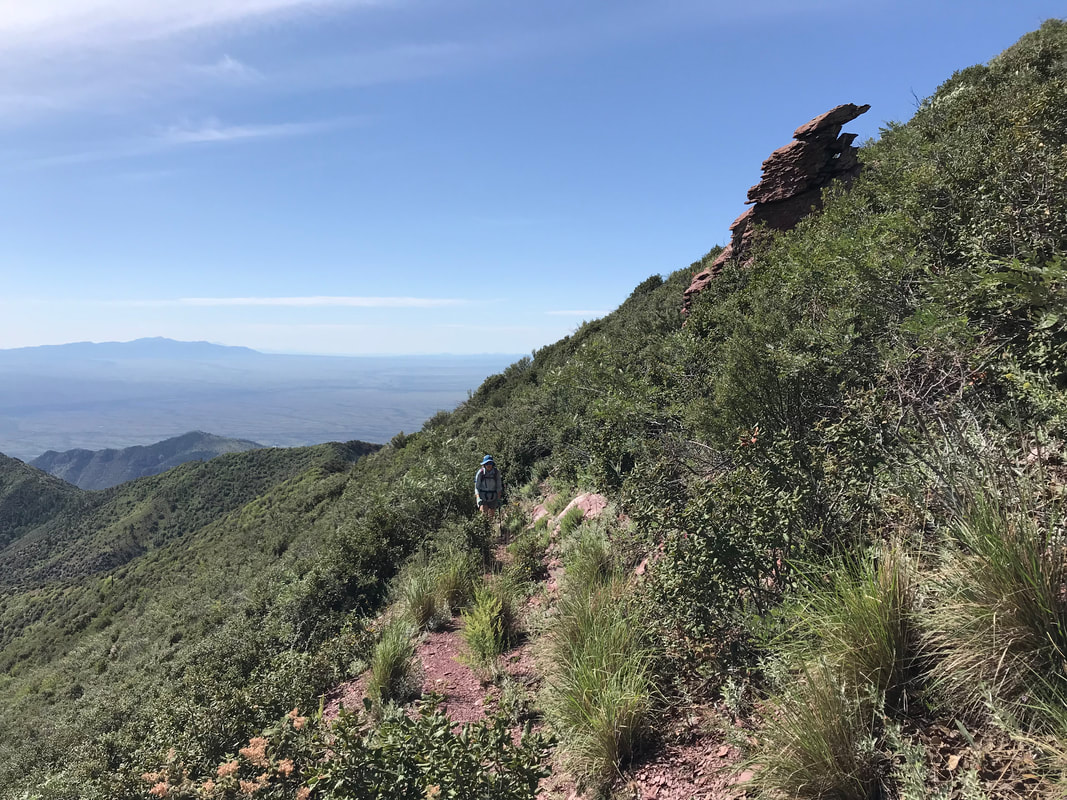 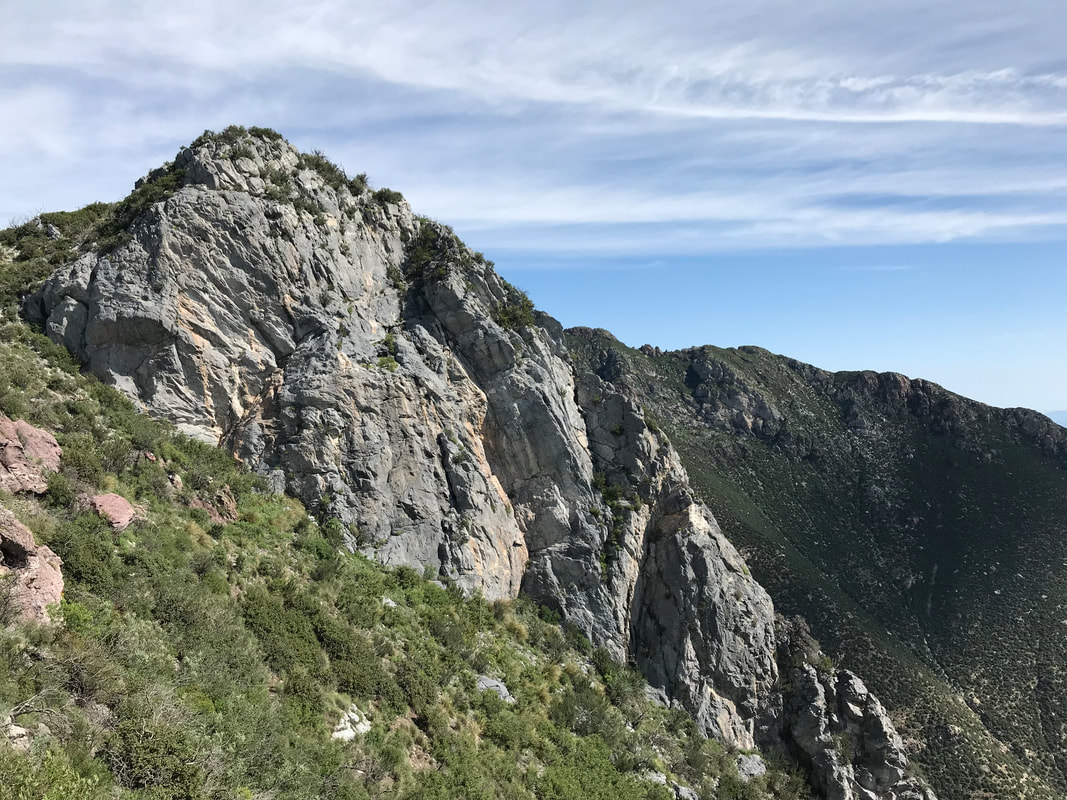 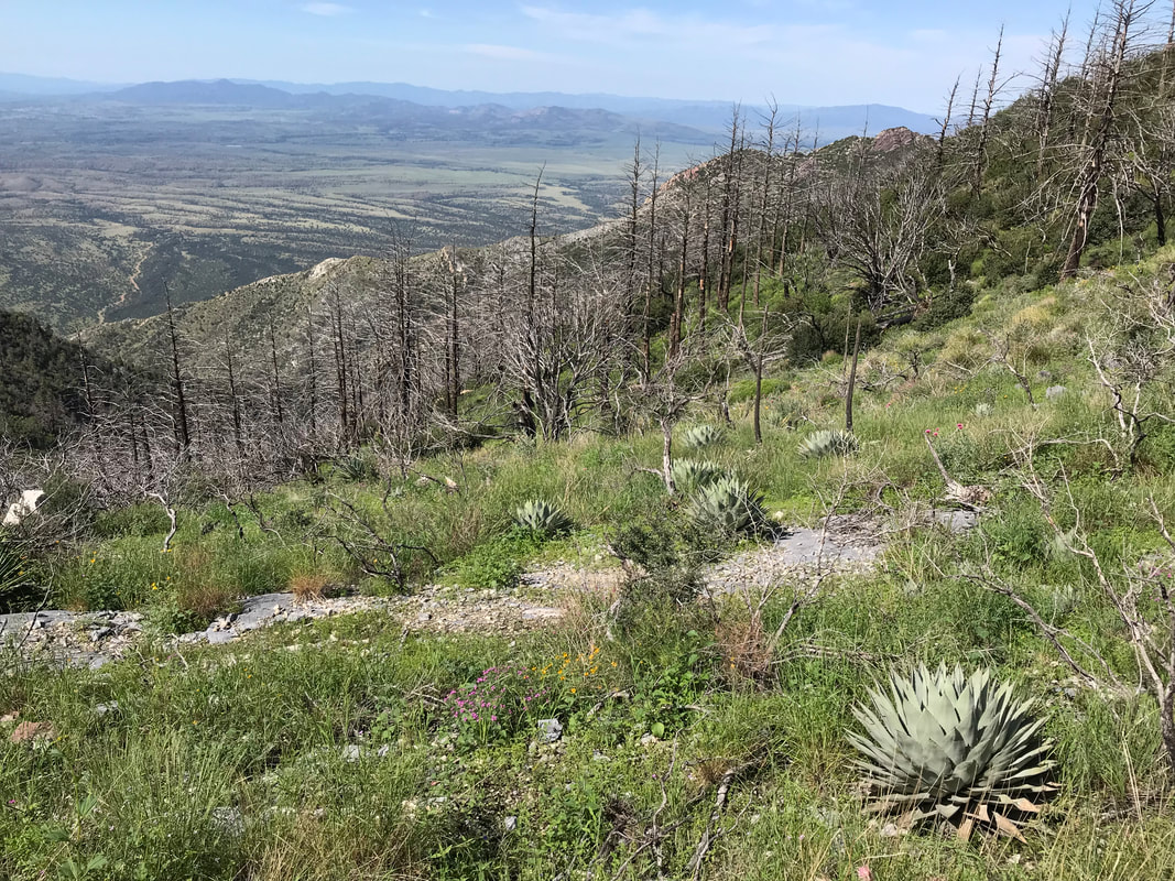 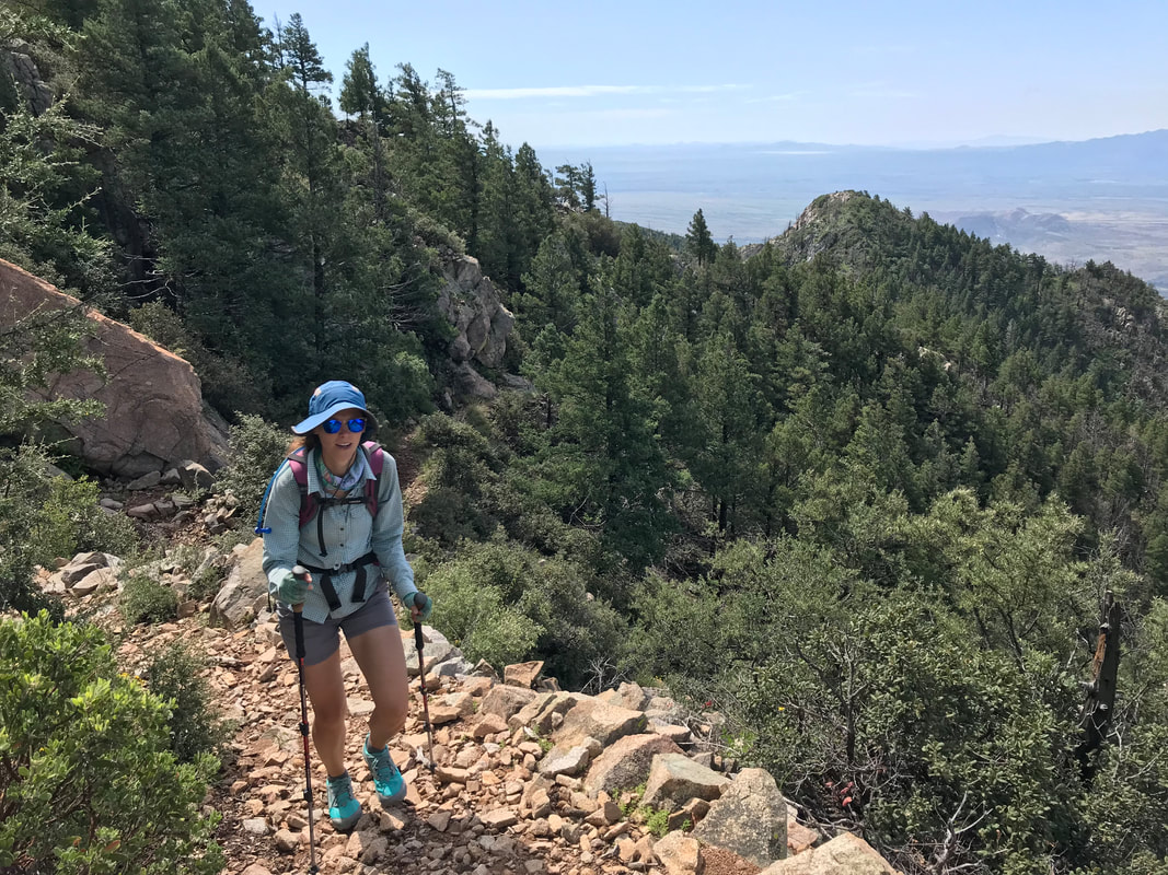
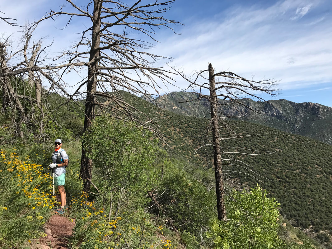
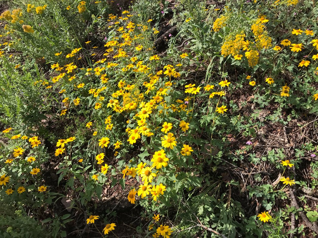
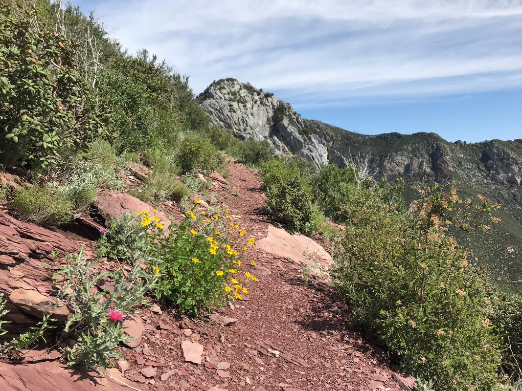
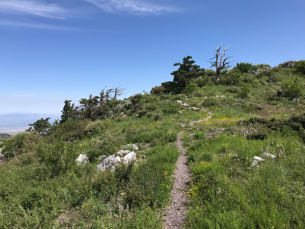
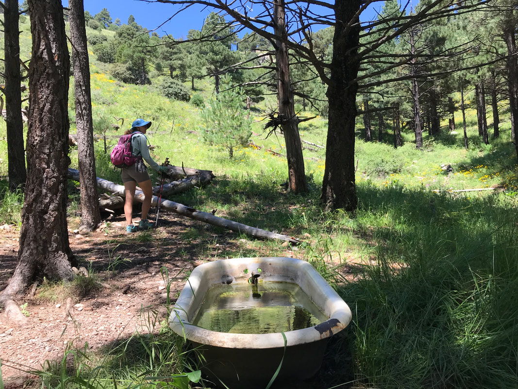
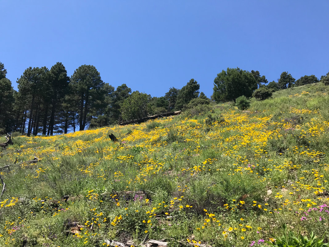
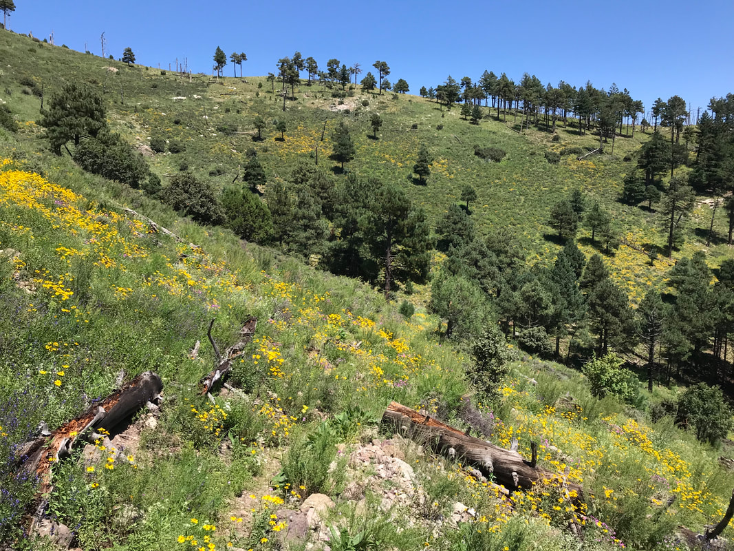
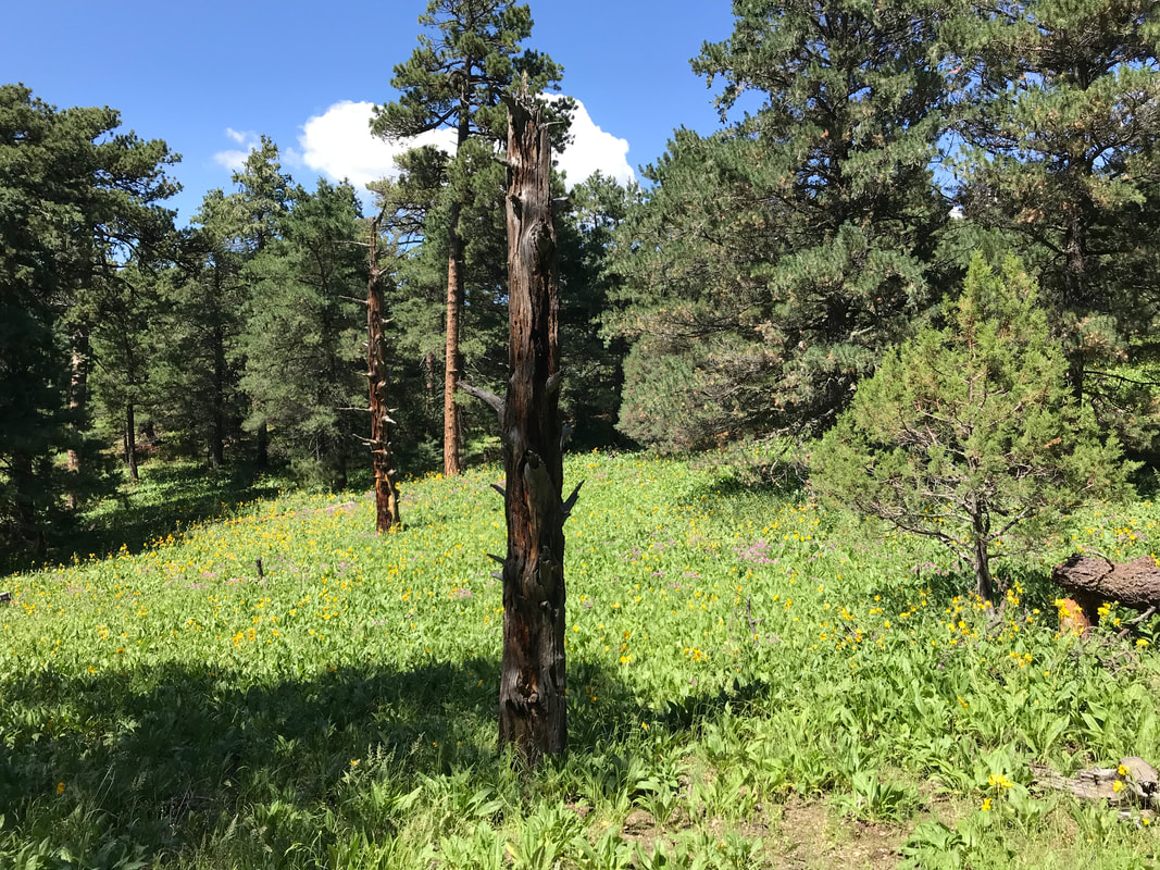
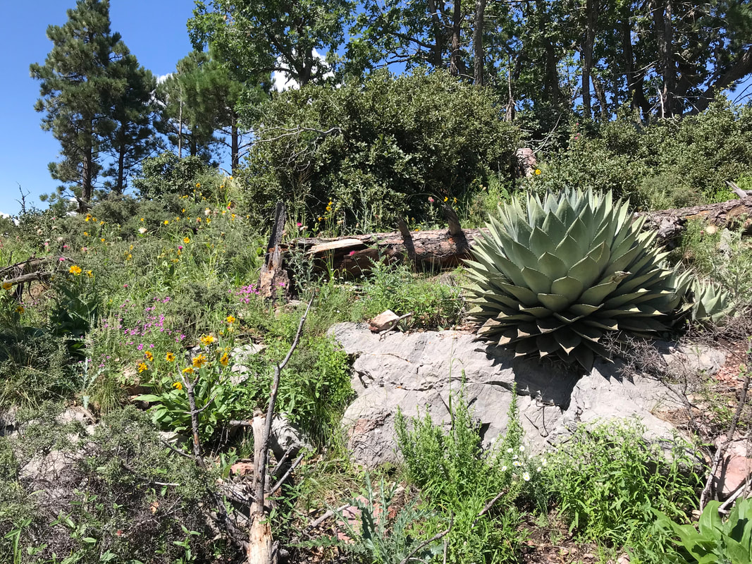
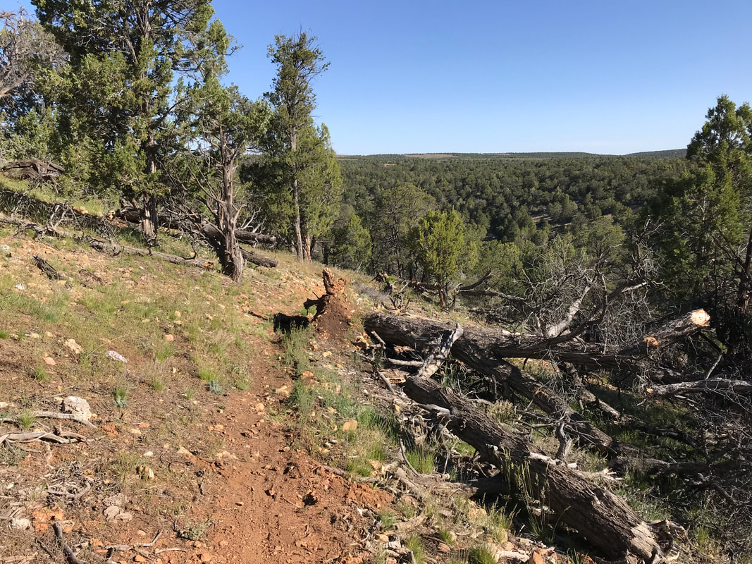
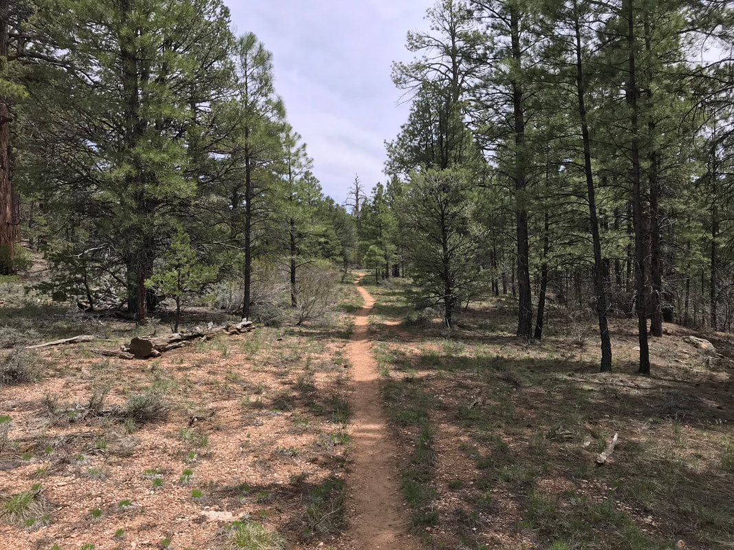
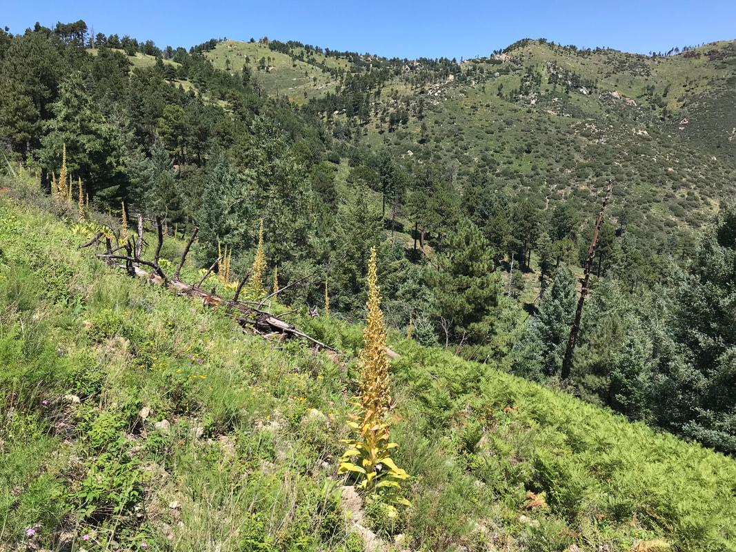
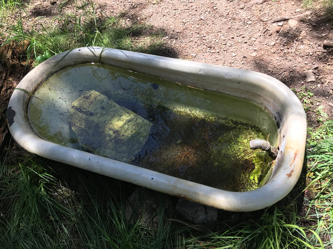
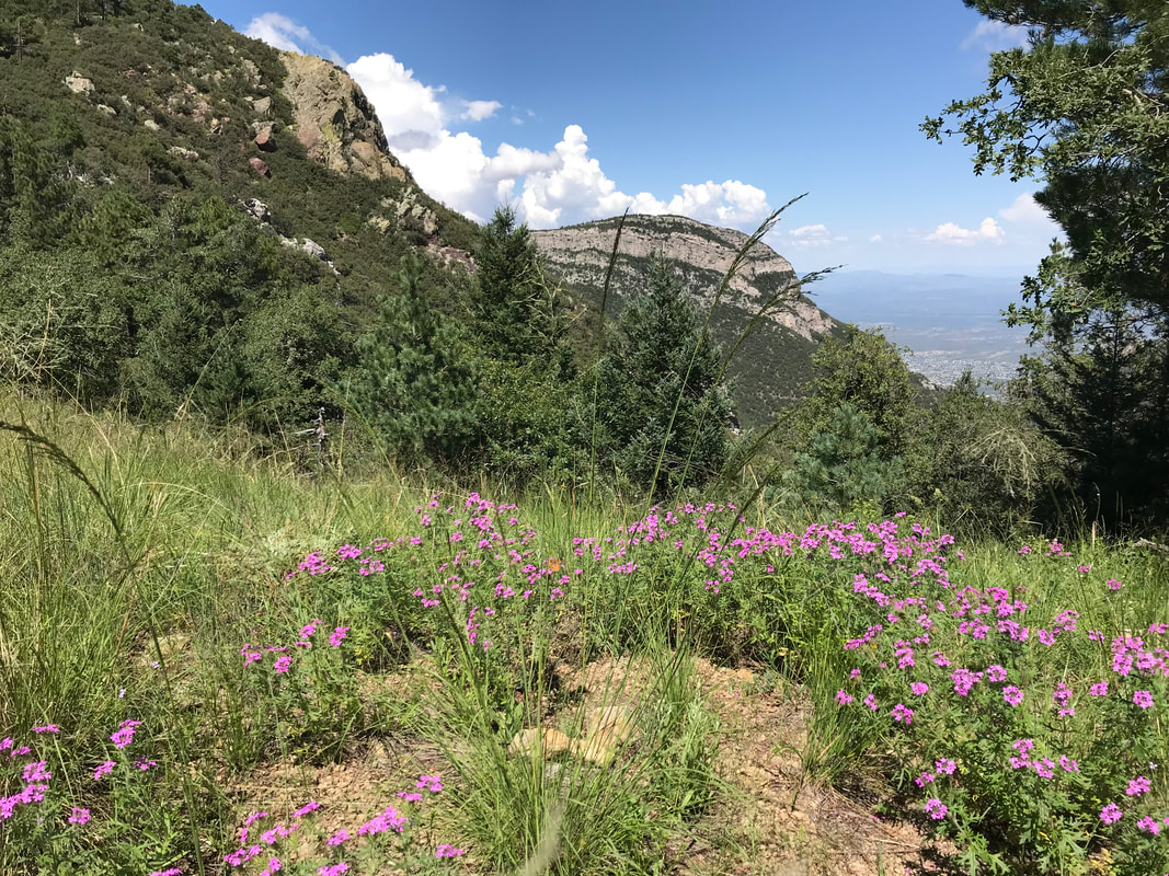
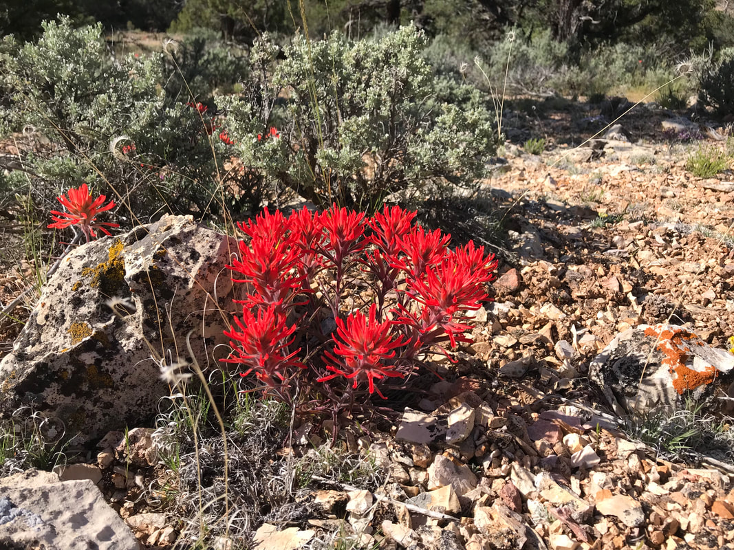
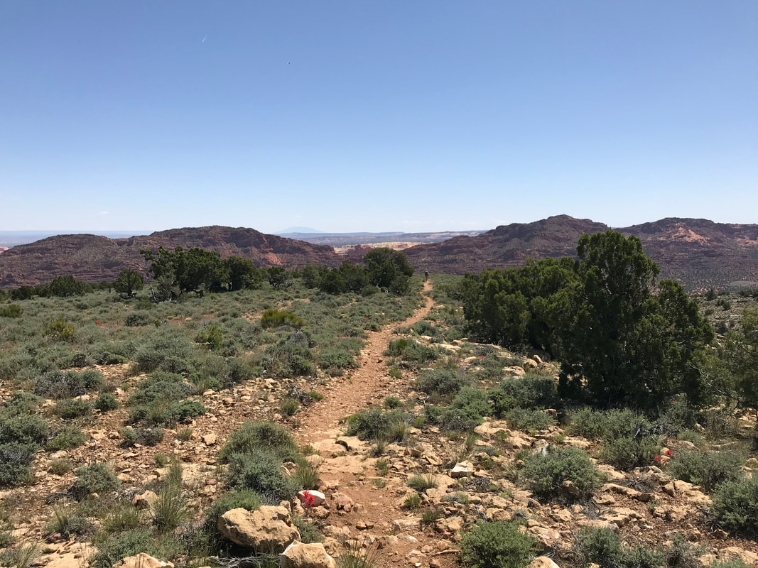
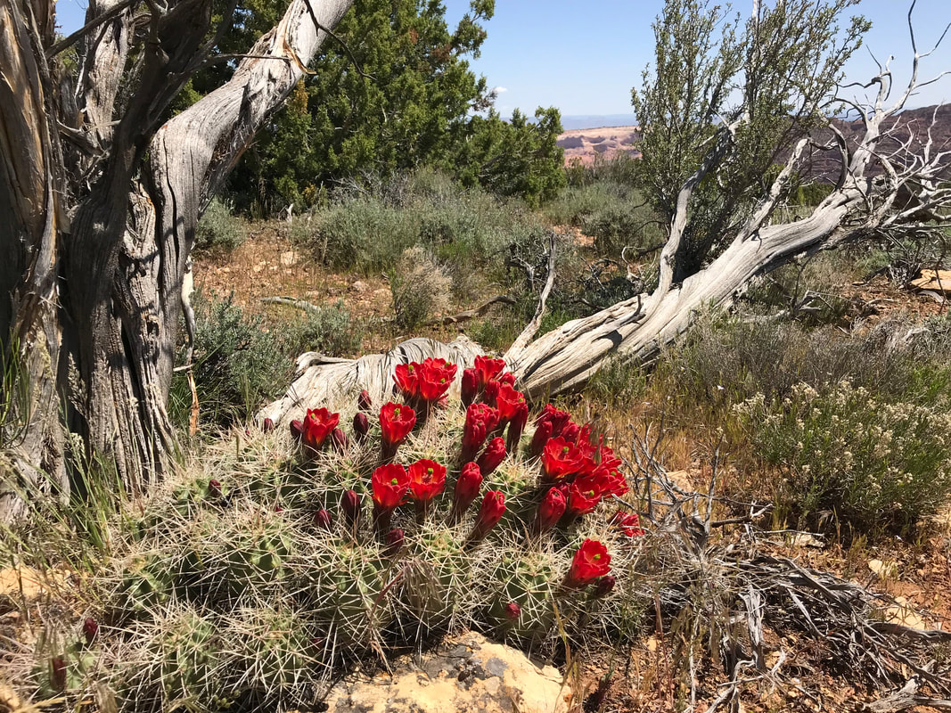
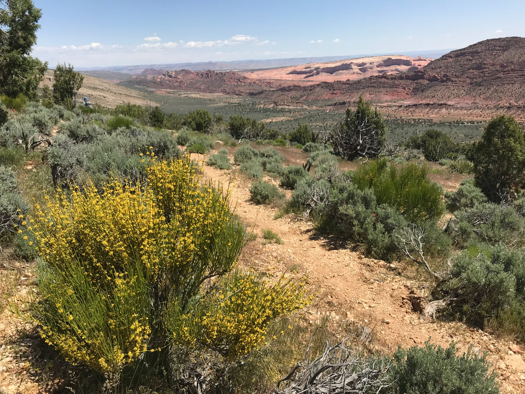
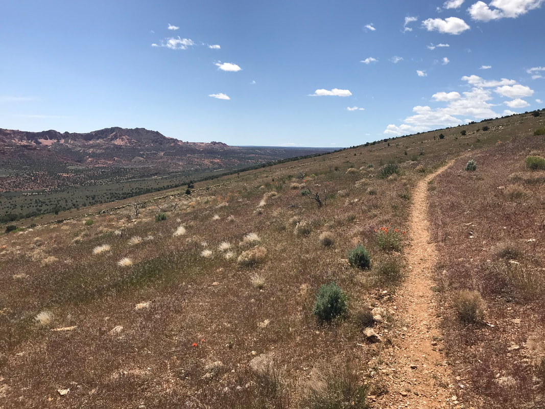
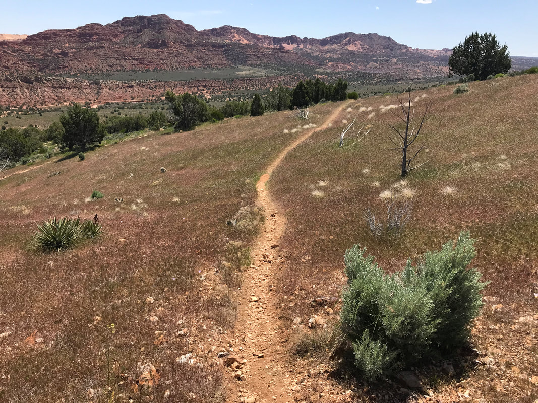
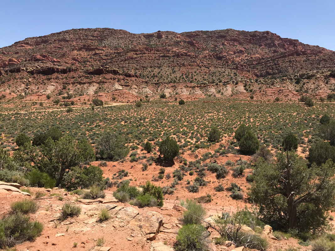
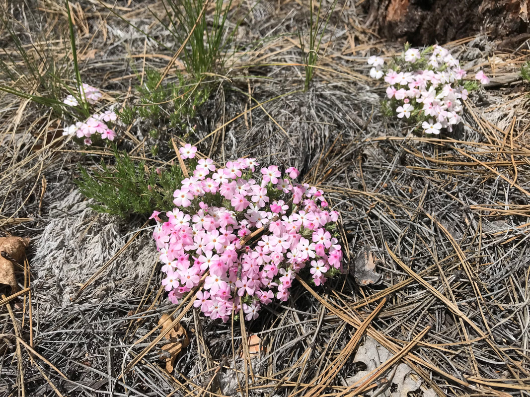
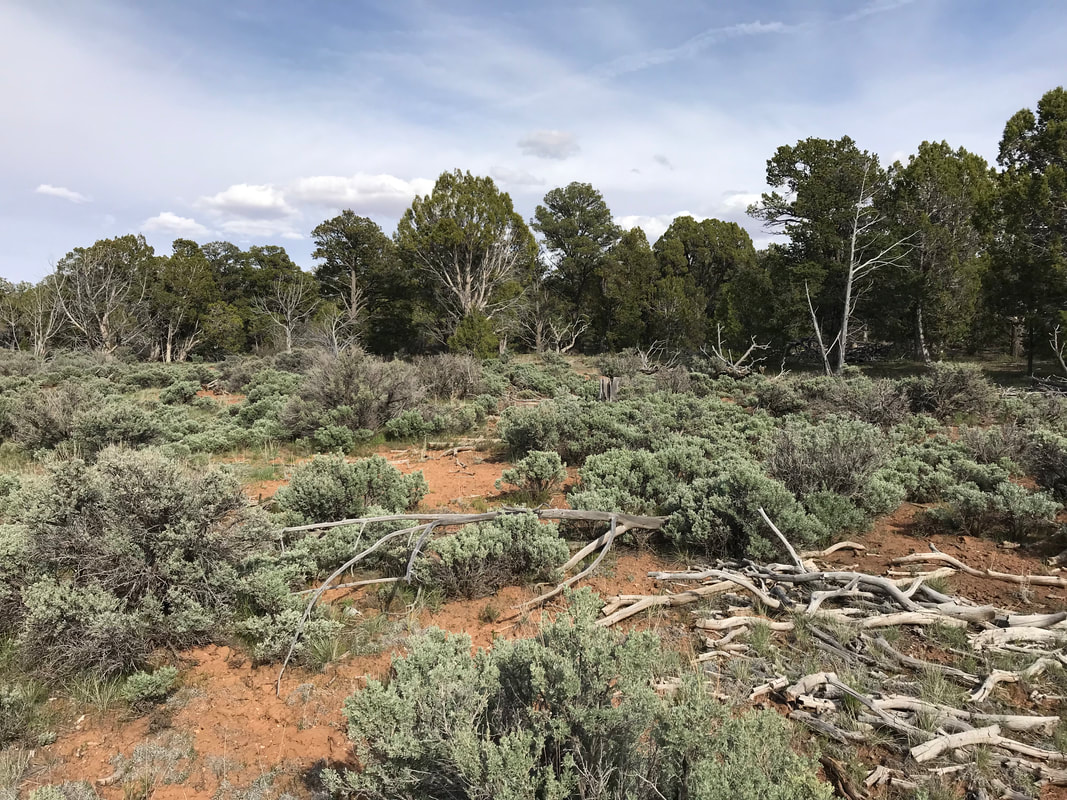
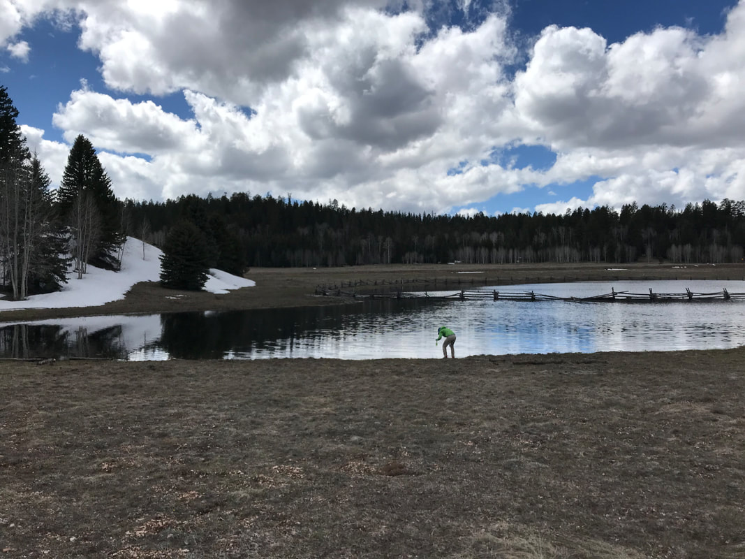
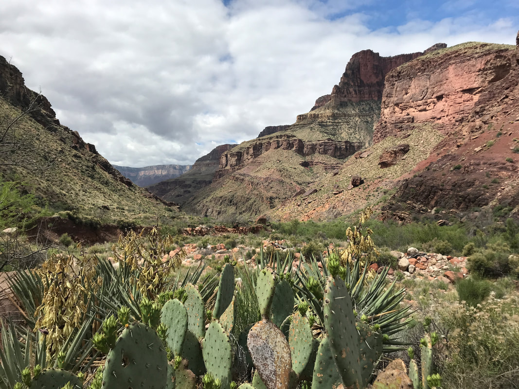
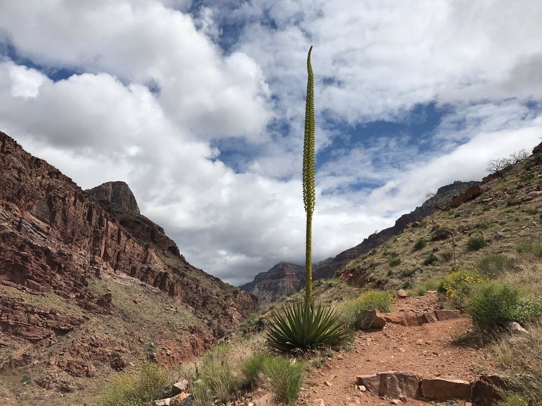
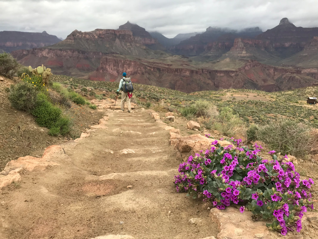
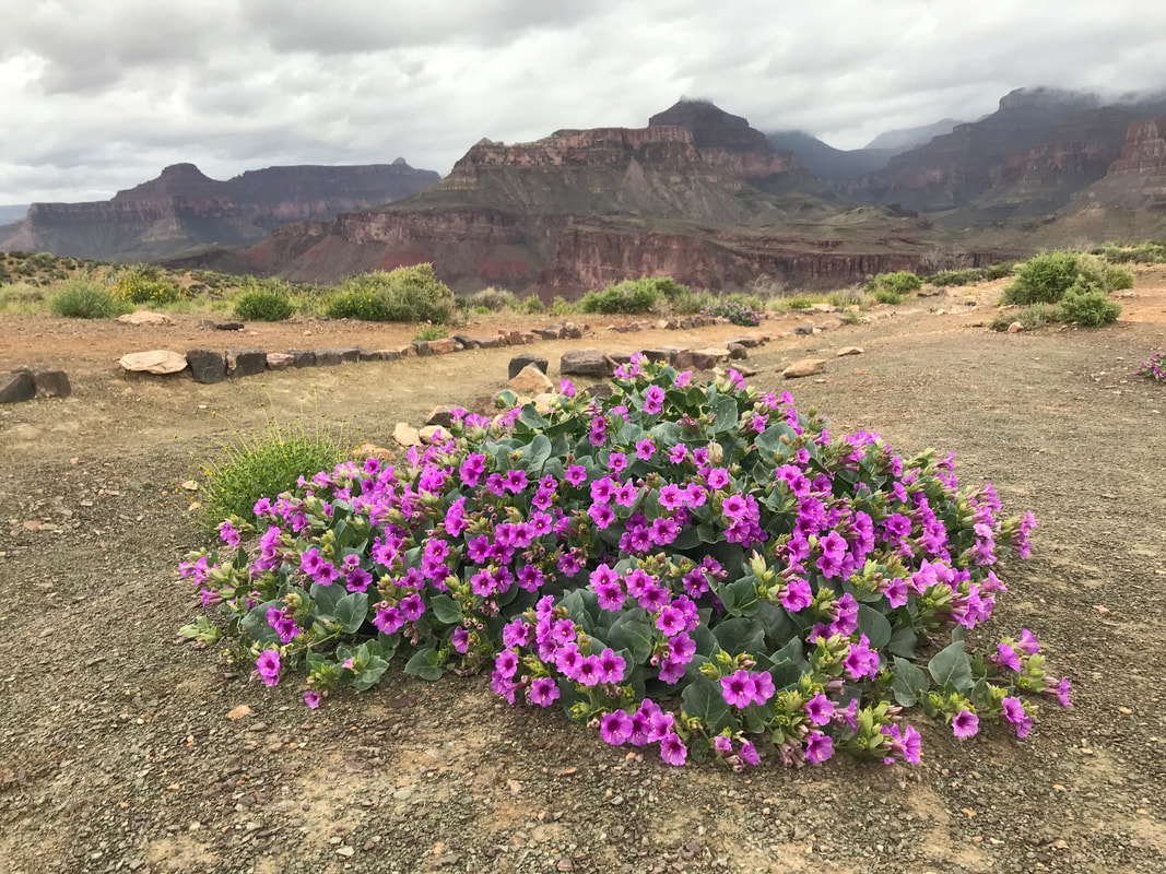
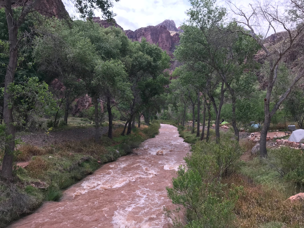
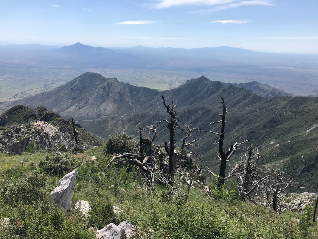 We descended the summit after a solid 45 minute relaxation. From there, the trail quality disappeared dramatically into plant life and erosion. If few people come up the peak outside of AZT-season, then even fewer continued along the Crest Trail after the highest point in the range. We studied the landscape for cairns and looked for faint remnants of foot-use. The trail came off the ridgeline proper and dipped slightly to the eastern side where buckets of aspen trees grew from a burn in the past. We passed through rows of ripening blackberry bushes and spots of Indian paintbrush. Curving along the curvy contour line of a couloir brought us to thickets of spruce, aspen, and pine. I was struck by the tree and plant diversity up here - a true testament to the lush growth of elevation above the high desert summer floor below. By noonish, we hit Bathtub Spring. An old bathtub was sunk into the ground and its namesake spring piped into it at a constant flow. This was our only water source for the day, so we chilled out under the trees and drank the cold and clear water. I could tell people had used the area for camping, and I thought about those AZTers we met Day 1 of our thru-hike who huddled in 3 foot snow during a 15 degree night up here at this very spot. A couple of hikers coming from a spur trail approached having visited the Nature Conservancy plot down below. Janna and I pushed on with the AZT/Crest Trail which dipped back up to the ridgeline proper. Behind us, large cumulonimbus clouds rose and formed with the early afternoon monsoon sun. We could see the rain hitting the peaks to our east as we continued on the ridgeline westwards. There were tons of gorgeous camp sites located on piles of pine needles and mixed with ferns. The conifers up here with dense, mature, old-growth looking and relatively unscathed by forest fires of recent. After hours along the ridgeline, the AZT split from the crest trail and began a steep and crumbly descent along the northwest flanks of the range. Here, the more north-facing slopes were dense with a canopy of trees. I could see how jaguars, mountain lions, ocelots, and bears could all live here at the same time (which they do!).
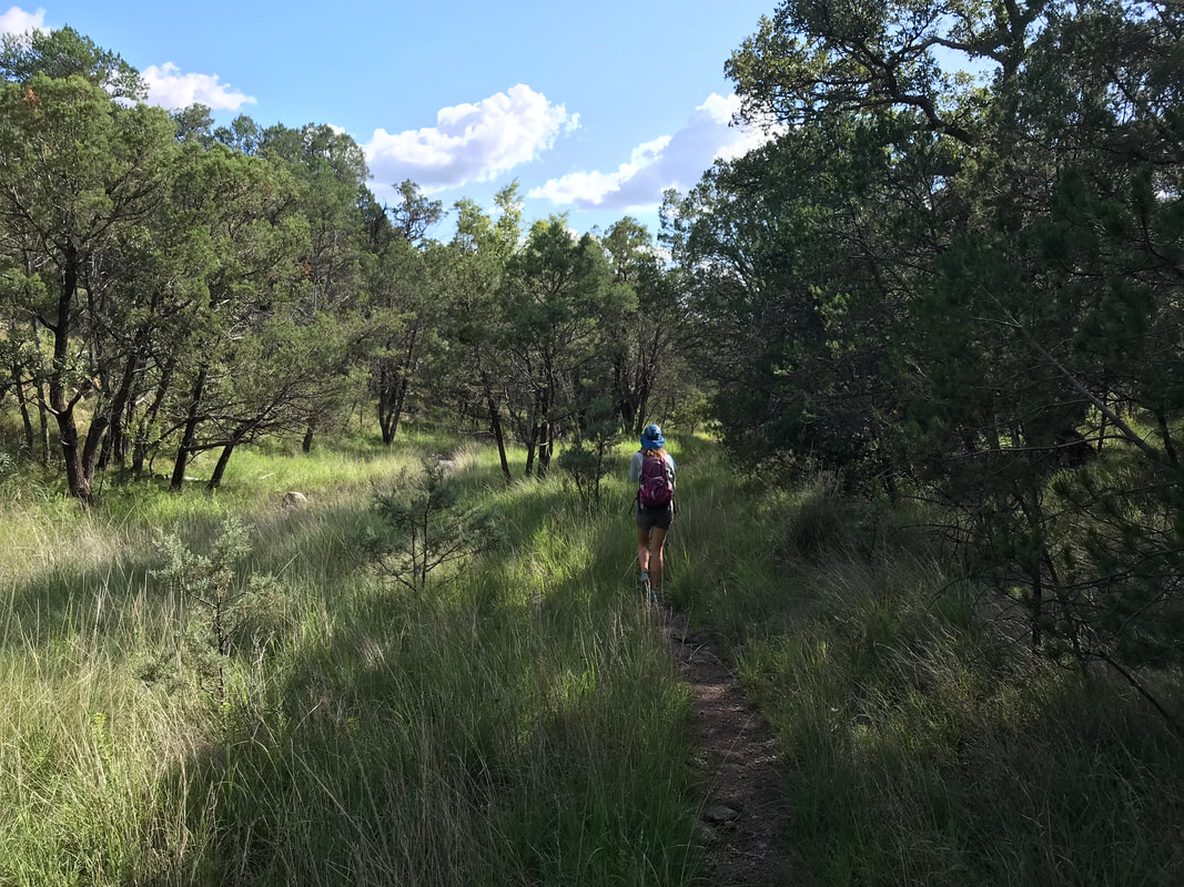
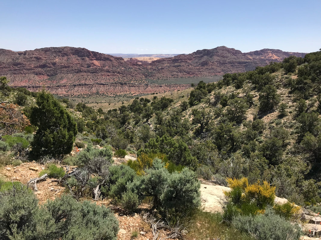
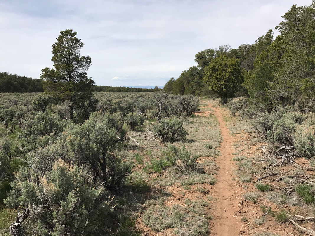
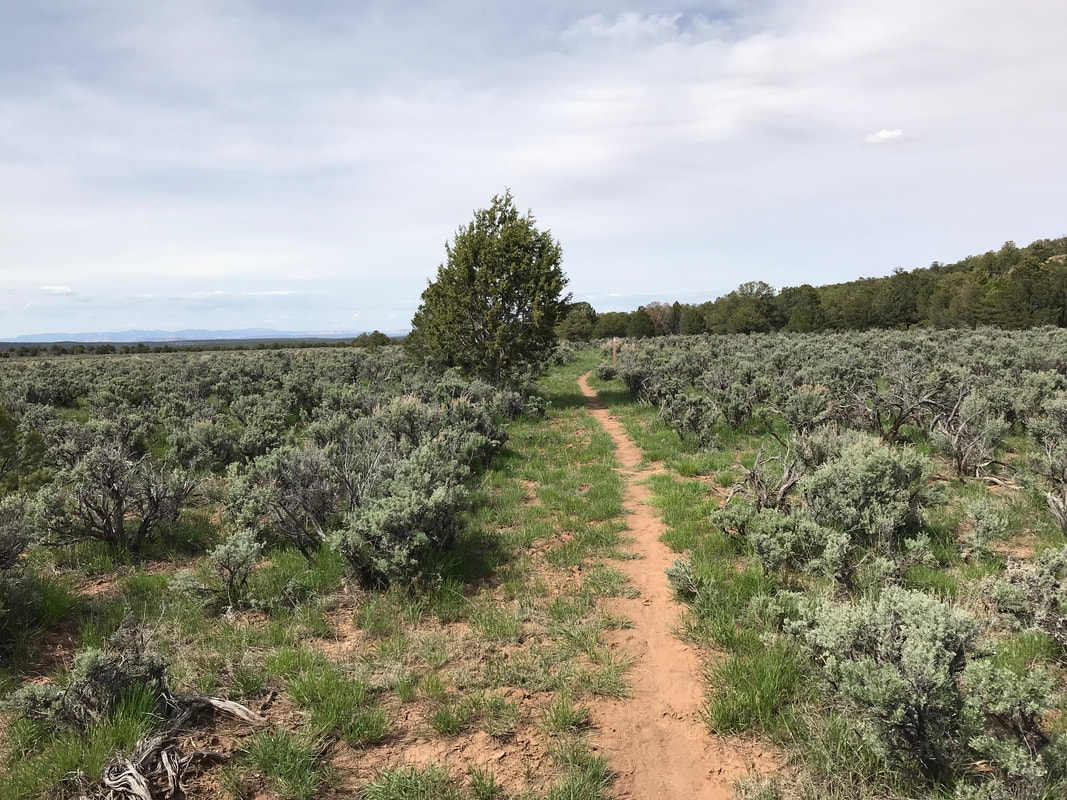
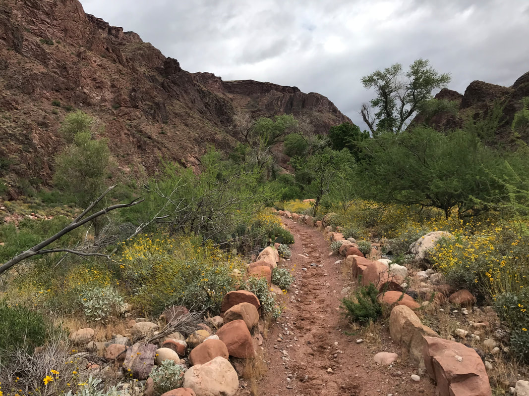
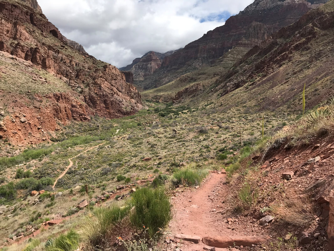
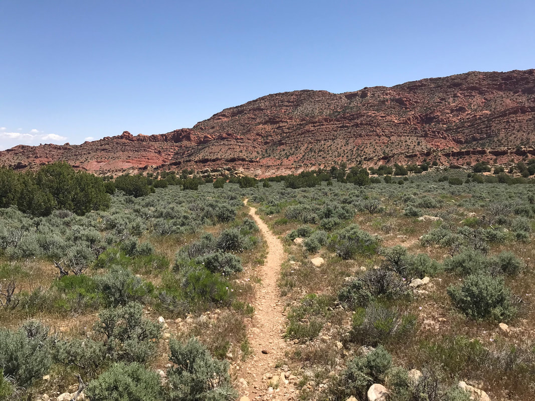
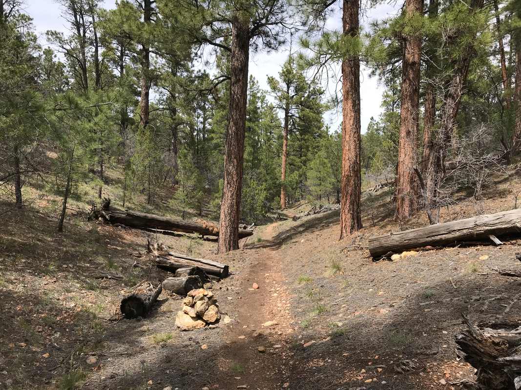
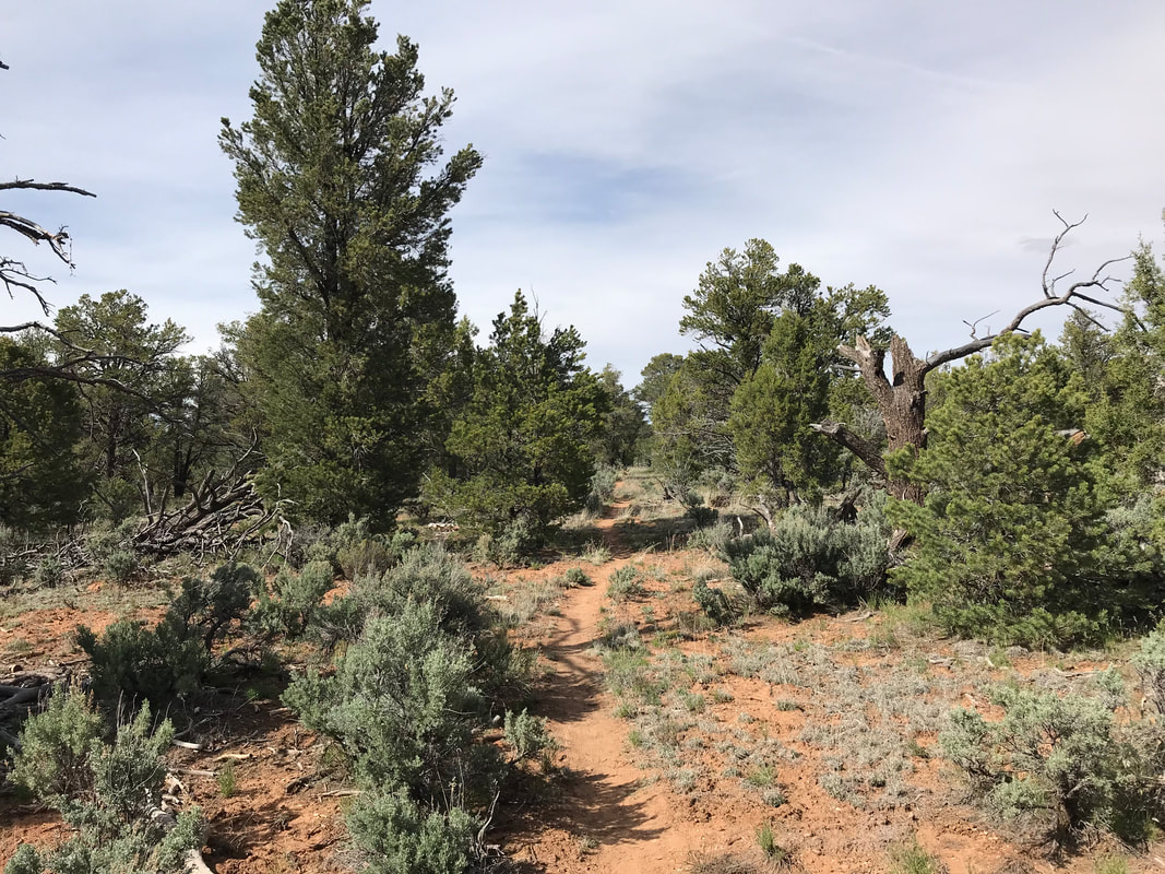
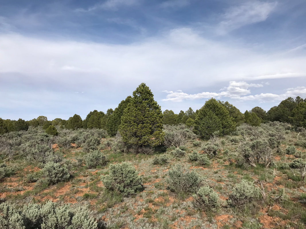
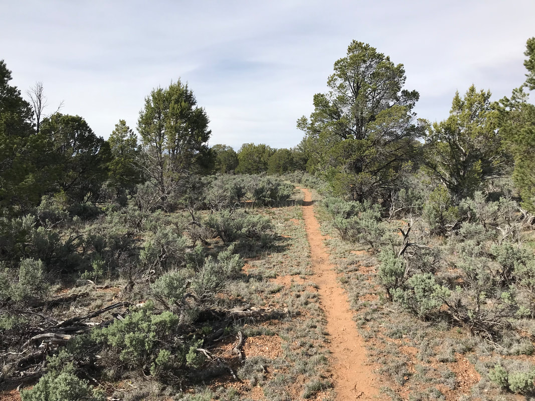
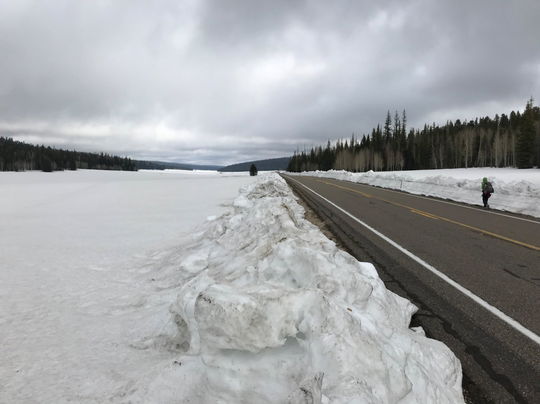
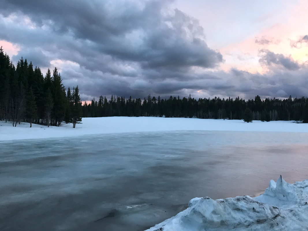
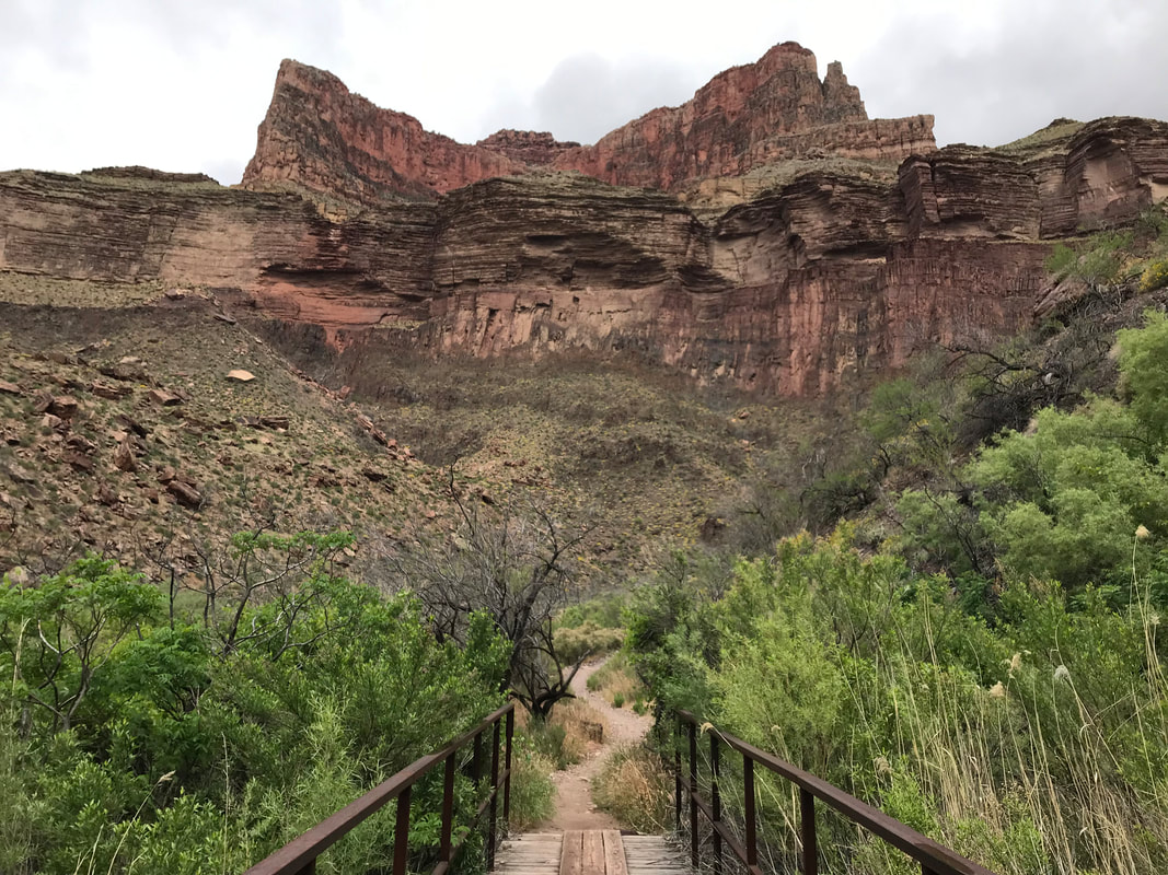
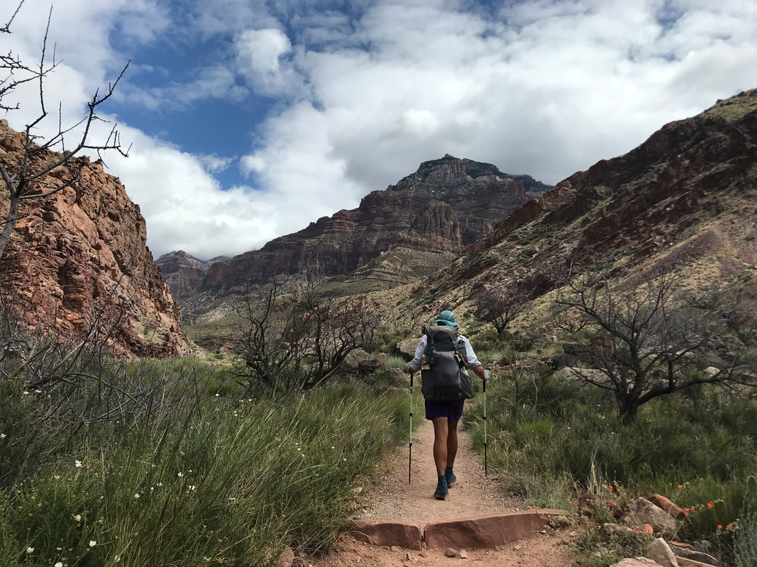
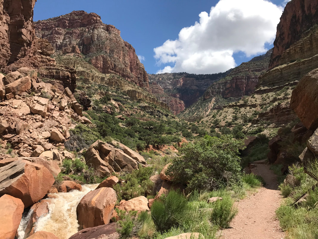
The sun was now intense in the sky and both Janna and were sweating hard. We carefully descended miles of switchbacks that became more and more exposed while the route had many sections that were washed out by monsoons or overgrown by plant life. Finally, the trail began to decrease its sharp grade and we entered Sycamore Canyon. The creek bed was interspersed between dry and good flow. Deciduous trees grew old and large all around us, providing cooling shade in the afternoon. And just like that, we crossed a road we realized we had walked up to meet the AZT back in spring. Janna and I excitedly recalled sections of the hike from this portion forward. We meandered past old windmills, cattle corrals, and kept following the gorgeous cottonwood/oak/sycamore-lined creek before we split into the grasslands once more. As late afternoon turned to evening, we wove in and our of juniper-grasslands and walked up a hill with overgrown grass where a rattlesnake made its rattle known inches from my feet. By dusk, we hit the dirt road parallel to Parker Canyon Lake. Can’t believe we were just camping here a few short months ago. We walked up the dirt road to the car and jumped in just as a spectacle of cloud and lightning let loose above the whole range we had just walked over 20 miles. 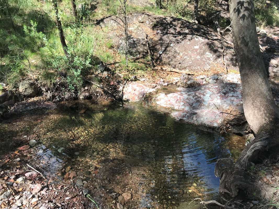 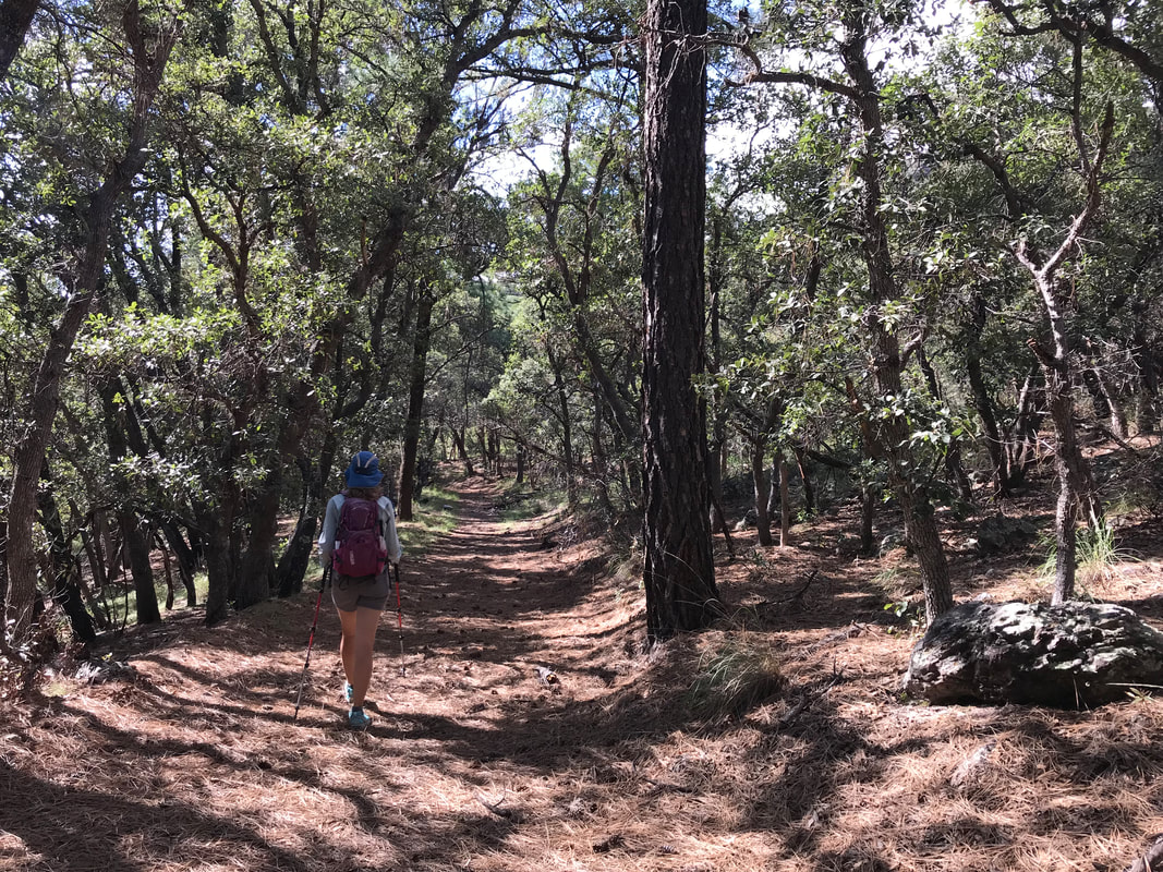 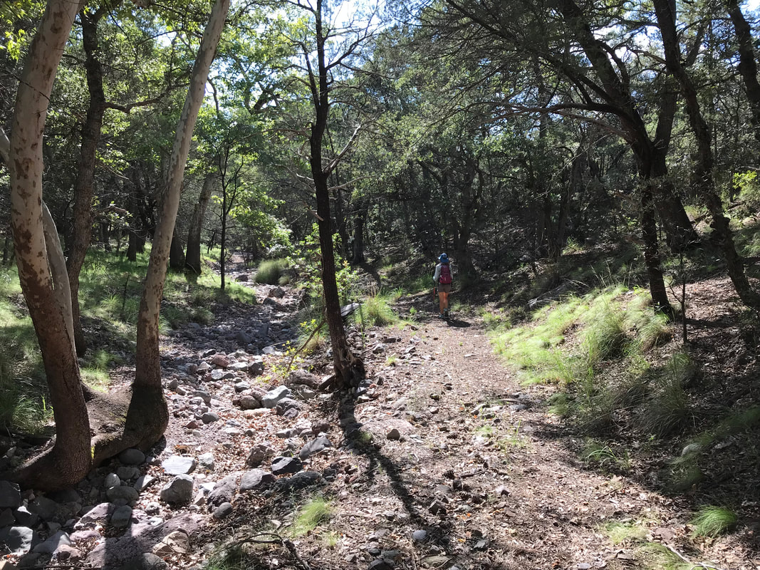 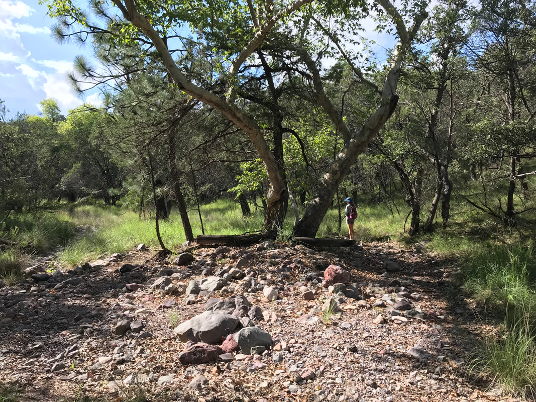
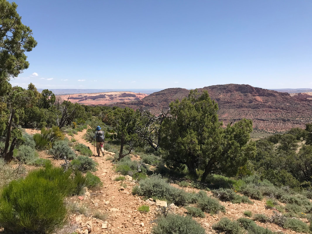
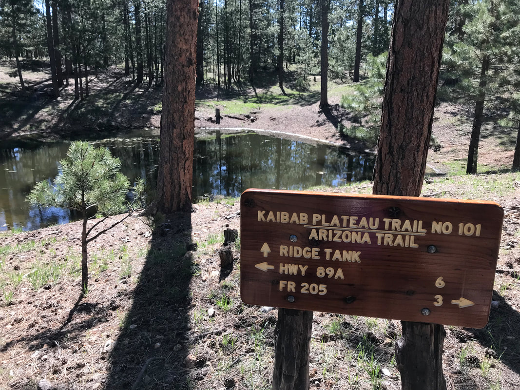
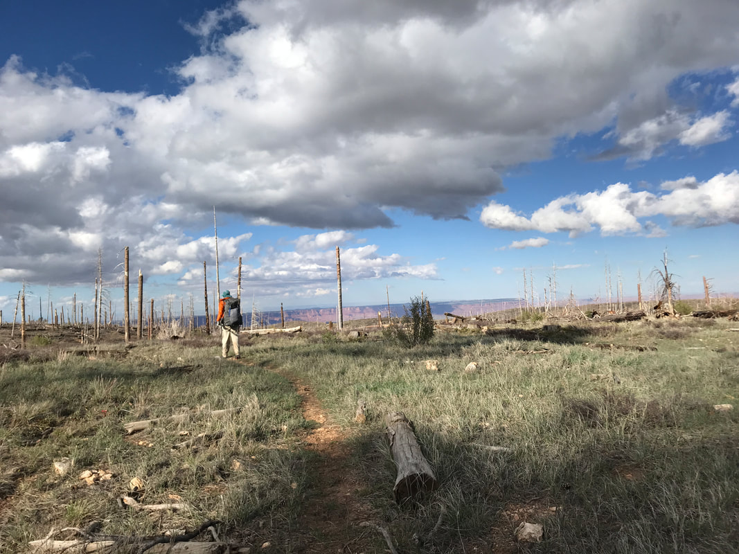
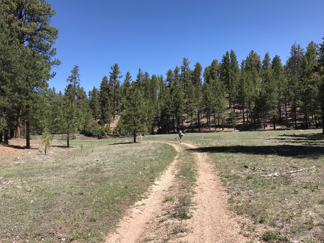
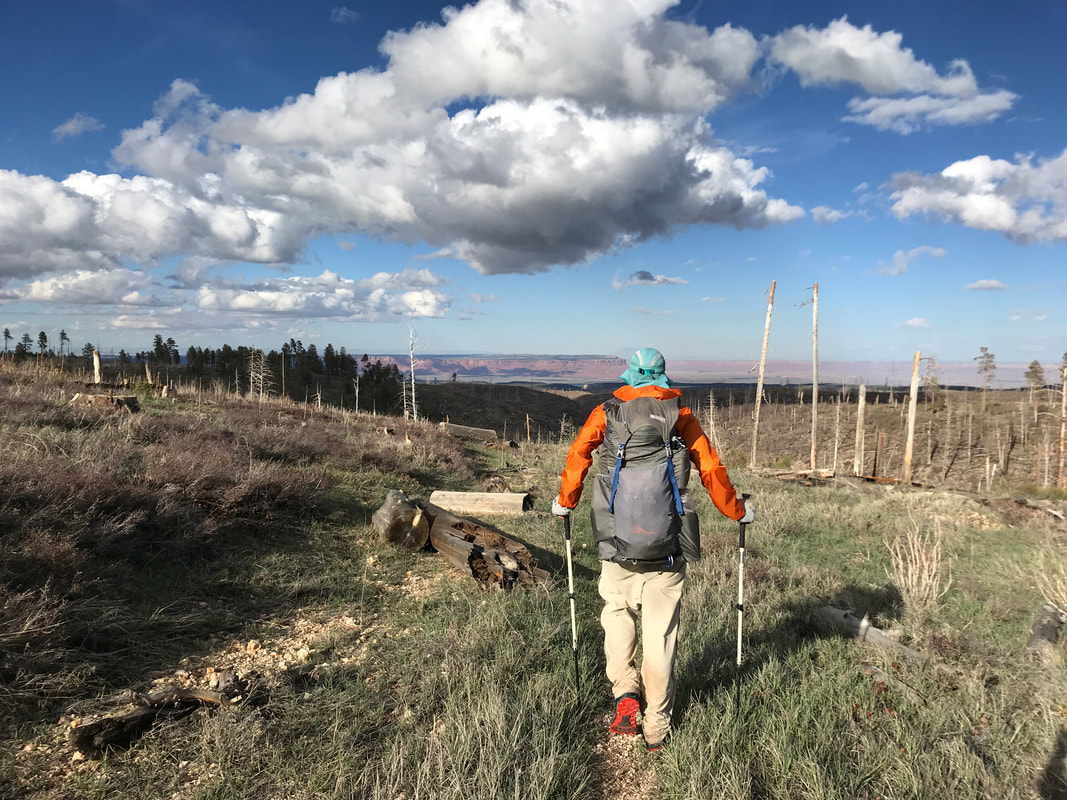
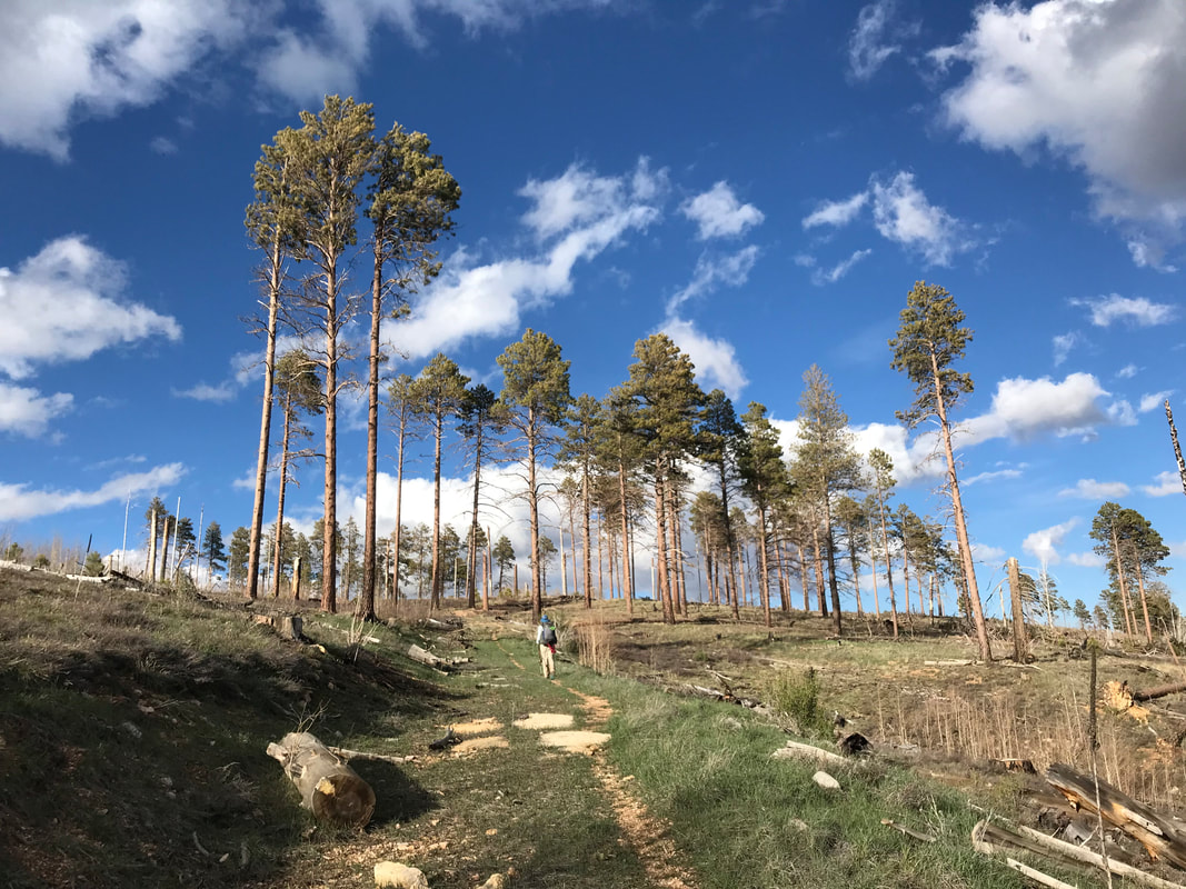
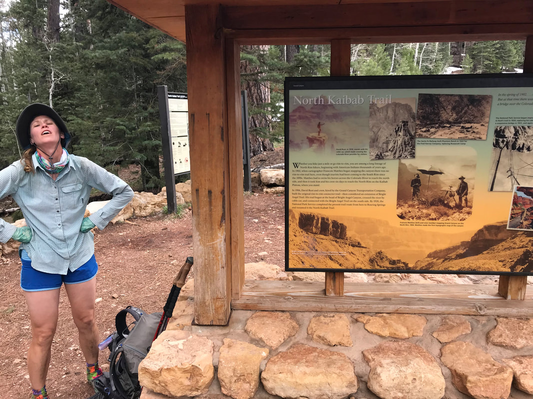
 I achieved a childhood dream. Ever since I was 7, I have wanted to do a thru-hike. Enraptured by sight of others doing it, inspired by the stories I heard, matched with own love for being in the outdoors. Today, I finished crossing the grand state of Arizona, my home this past decade, and completed a thru-hike. The day began when we woke up in a dry tent and a warm morning. This was one of the few times of the entire trip. I went and took an excellent bowel movement in a grove of junipers scented of the high desert. After a lazy start, we began descending off this high Kaibab Plateau towards Utah. We met up with Tyson and Barrel, hiking with them both. The trail opened up with stunning view of the Vermillion Cliff plateau backside eroding to the equally glorious Coyote Buttes, the Paria Wilderness, and parts of the Cockscomb plus Navajo Mountain and the Grand Staircase. I could not think of a more epic set of beautiful views to finish a trail with. The trail switchbacked back and forth slowly down the side of the a series of cliffs. Juniper gave way to sage and creosote until giant fields of high desert grass interspersed with radiant fireweed, mallows, poppies, and flowering cacti made up the surrounding ground. I walked slowly, drinking in the views, smelling every flower. I stopped to take photos, to revel in the fact that I could see House Rock Valley Road below where our pickup was and where I had been gravel grinding before. Everything needed savoring.
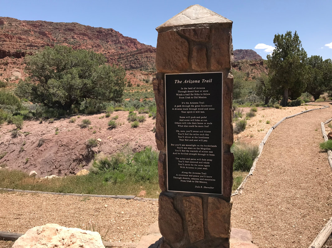
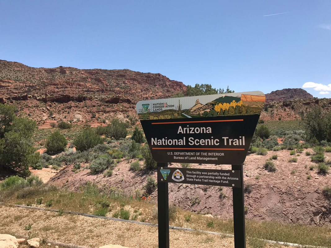
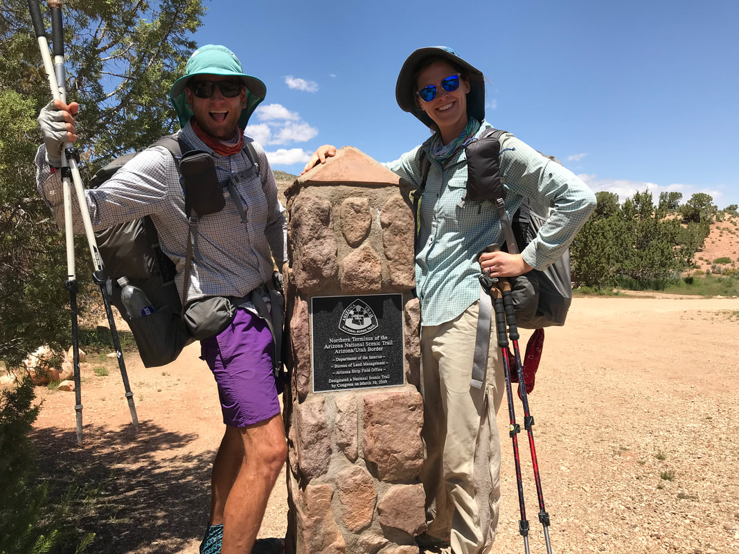
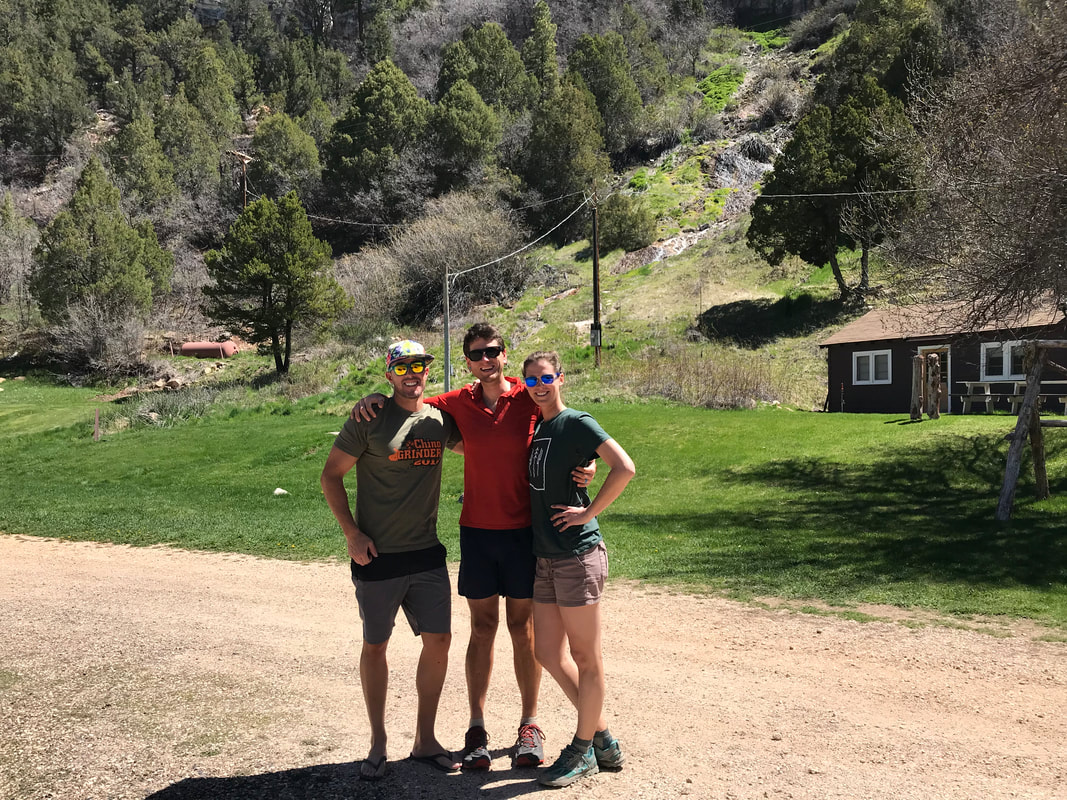
         Nearing the end of the trail, we crossed a large field of sage and ascended a small hill where Darren suddenly was, riding his mountain bike up to us! It was completely surreal. He congratulated us, we hugged, told us how epic the mountain bike riding in the area was, and the three of continued down to the trailhead. Coming down from the hill was Stateline Campground and the well-maintained gentle path the AZT was here. A small gazebo with a group of finished thru-hikers greeted us, passing us the official finisher’s log of the Arizona Trail. We approached the terminus moment. We took a series of photos, feeling in awe. The front of the moment commemorated its placement while the back was a poem from the David Shewalter, the teacher who dreamed up the Arizona Trail in the 80s and 90s. Darren hooked up his bike, we said goodbye to everyone, and we were whisked along. Being back in a motorized vehicle seemed surreal, as if making me question whether the trail had even happened. We passed by Wire Pass Trailhead where years ago Harrison and I had been dropped off to begin our pass of the Paria Canyon and the Buckskin Gulch slot canyon. We rejoined a highway in Utah and went to Kanab where I promptly bought Gatorade and numerous Drumstick ice cream cones to eat. From there, Darren drove us to our secret adventure cabin south on the Kaibab Plateau/North Rim back in Arizona where we took a day to absorb the surroundings, eat good cooked food, share stories, and appreciate the community. 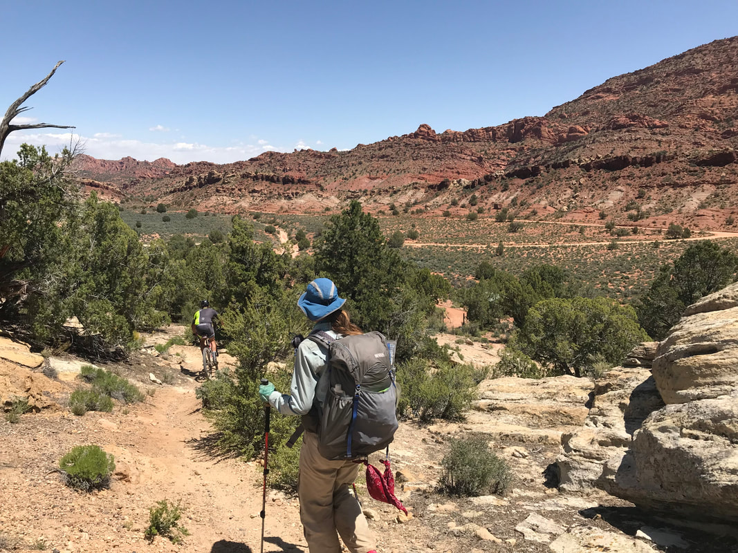 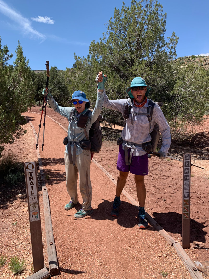 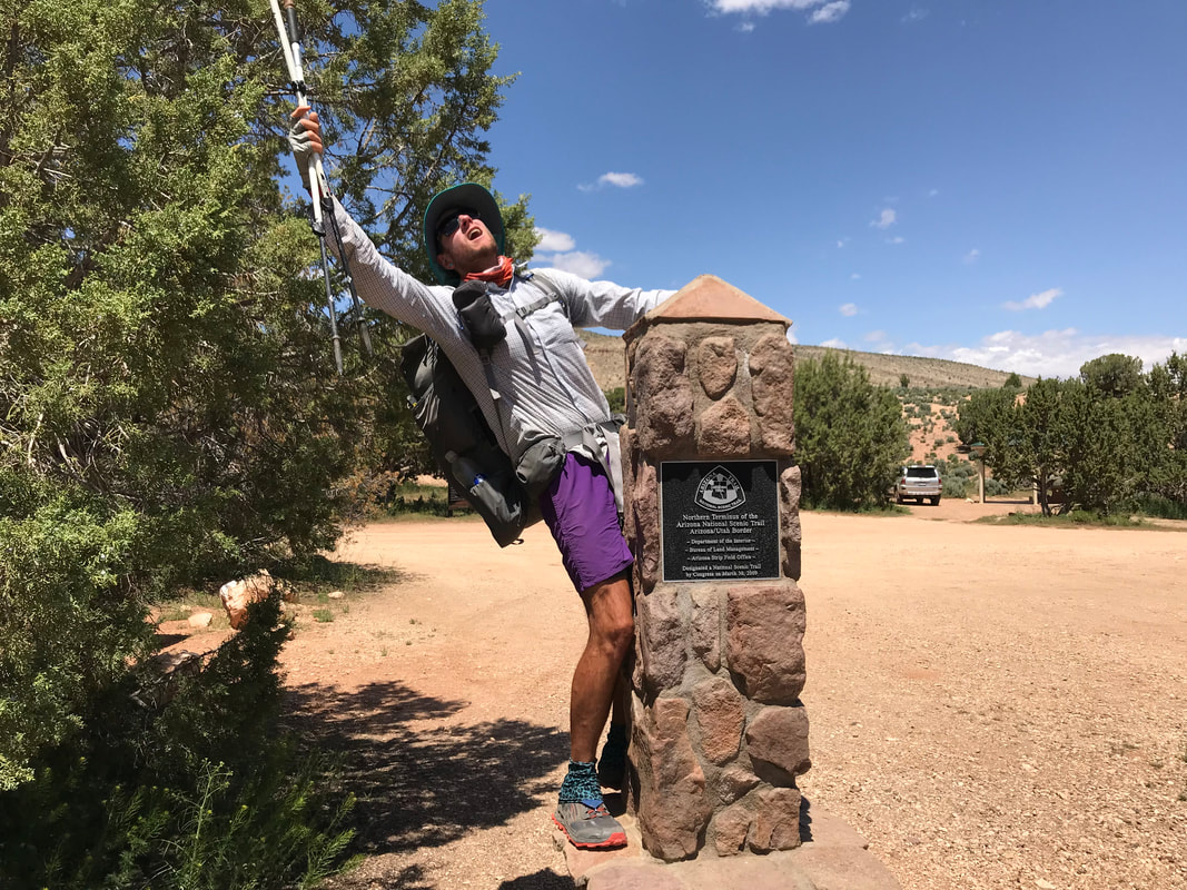 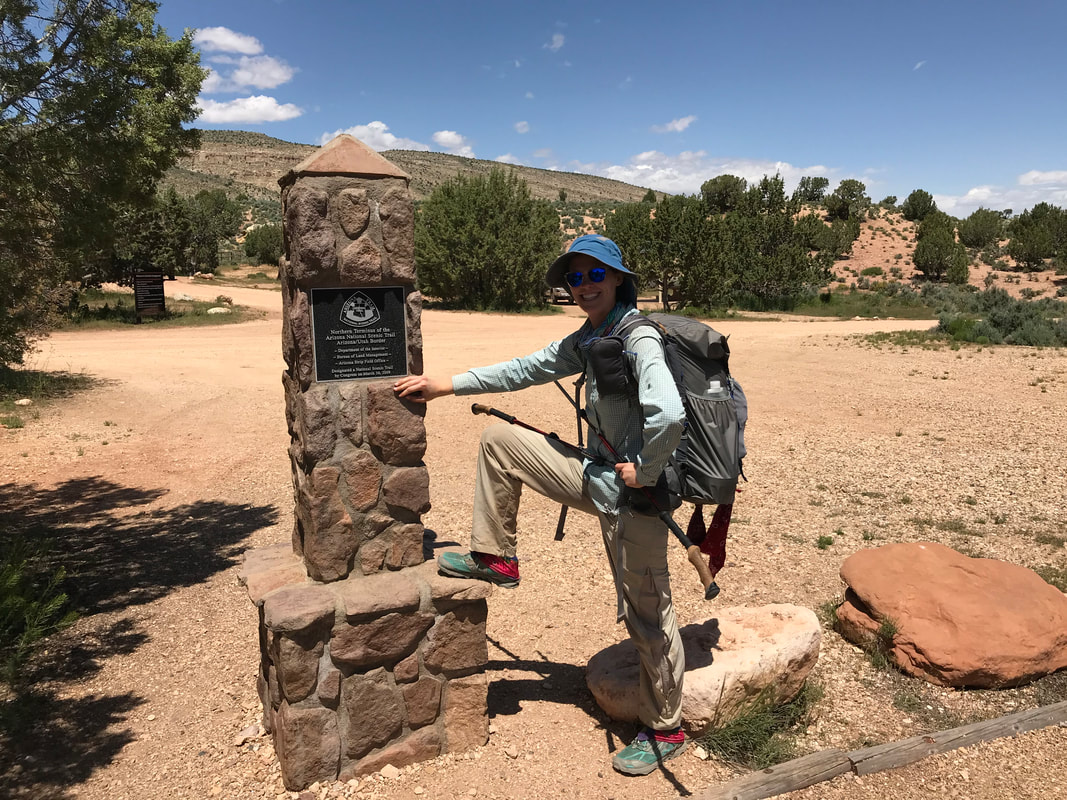 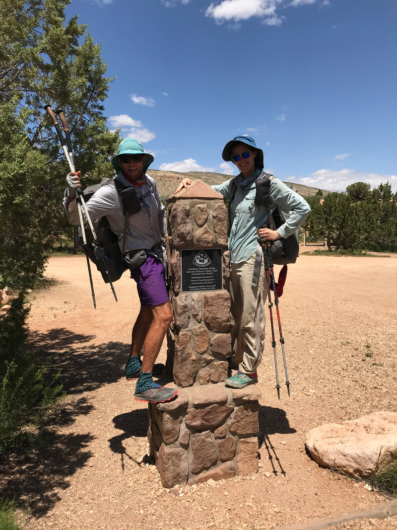
    Arizona is unique for being the only state having all four different desert ecoregions present in the United States. In the northwest is the Mohave, in the southeast is the Chihuahua, in the south central and western is the Sonoran, and now we were finally entering the fourth one in the north: the Great Basin. A land of the sagebrush sea, some of which we would begin moving through later this day. We slept in the bed late and got to breakfast after watching a morning binge of a Harry Potter movie marathon. When we walked in Stubbs and Frisbee were there and amazed to see us! They had secured a permit to camp in the Canyon and has presumed we had also done the same. They were confused when we didn’t show up at camp that night (by the time they got to camp in the Grand Canyon, we were still hiking into that winter storm on top). They decided we must be behind them until they saw the Trail Register and our names. Frisbee was like, “How the heck did they pass us!?” We all laughed and caught up on events since we last hung out in Oracle, AZ. Another thru-hiker was sitting at the counter eating and joined in on the conversation. His name was One Gallon and he was doing the Hayduke Trail. He acknowledged the snow but seemed seasoned and comfortable with it all. As we’re all talking, Frisbee leans over and asks me if I know who he is. I reply no and Frisbee starts swiping through his personal Instagram account until a photo comes up of three hikers. We look down at the phone and up. It turns out One Gallon is a legendary backpacker - one of only like 4 people who are Triple Triple Crowners, meaning he has thru-hiked the Appalachian Trail, Pacific Crest Trail, and the Continental Divide Trail three times EACH. We both were in awe. Amazed, we listened to his stories, his advice, and his wisdom. We all 5 take a photo together (I think I posted it yesterday instead) and each say our goodbyes. Frisbee and Stubbs are finishing today. One Gallon is heading out to Kanab Creek Wilderness and into the snow and desert. As I’m writing this, I happen upon this article about One Gallon: he is now the first hiker to finish the Triple Crown four times becoming the first ever Quadruple Triple Crowner. He went back out and did the PCT last summer as well. Janna and I head back to the room where we pack up and head back out to the trail.
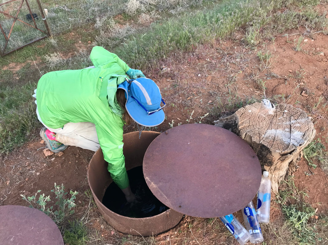
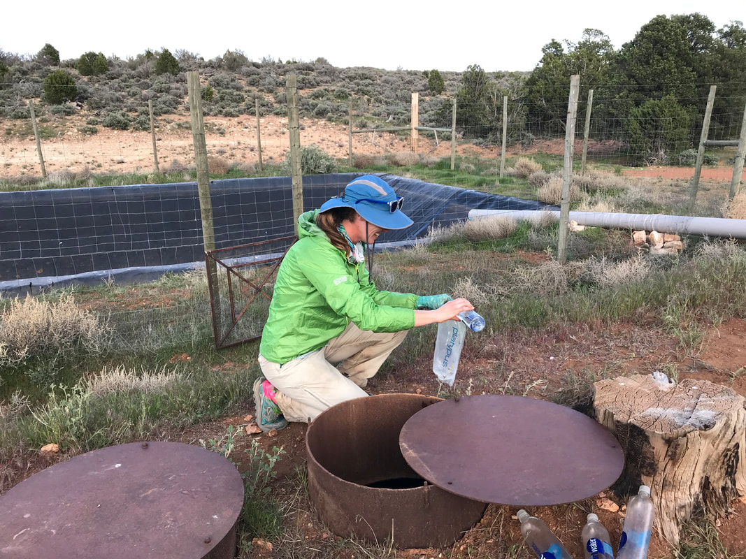
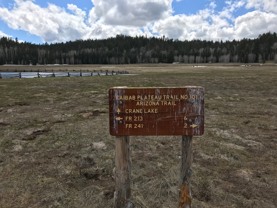
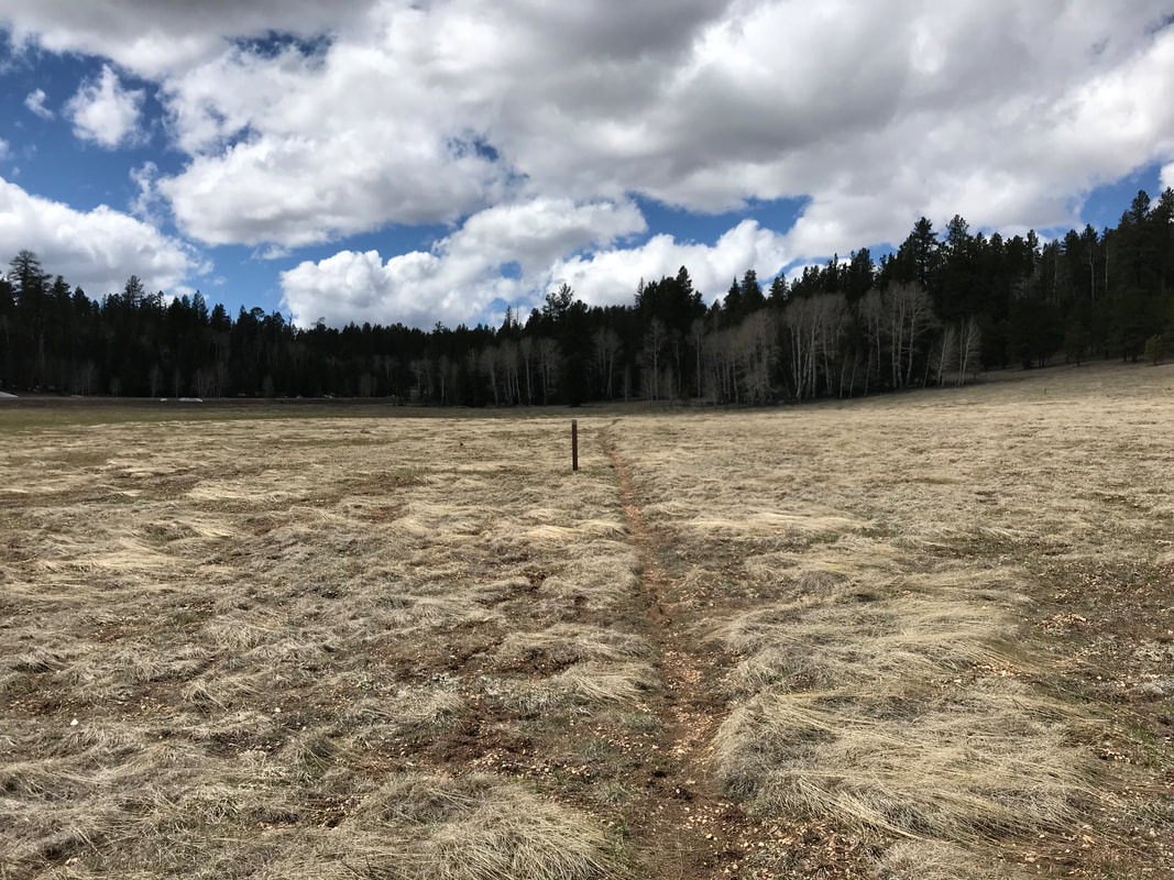
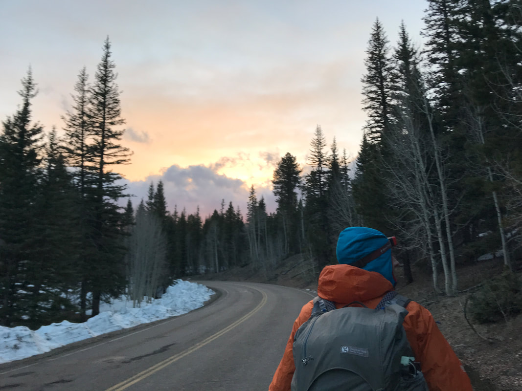
    Tonight will be our last night on the Arizona Trail. As we hike down to the highway and meet back up with the AZT, we run into Tyson and Barrel. We first and last met Tyson when he had dinner in the woods with Janna, Bilbo, and I just south of Tusayan. We join the two for a bit, hiking through the woods and just soaking it up. The AZT began descending over the miles. The dirt became drier, the heat hotter, and the vegetation became juniper and sage. We were leaving the extensive conifers behind for one last plunge into the desert. Giant sagebrush meadows ringed with junipers became our day. At once, the expansive views of Grand Staircase-Escalante National Monument opened before us. The steps of Utah. Canyon country. We finished up today’s 18 miles by camping in a vast sweep of junipers. We got our last water source from a manhole cover next to a wildlife tank. Tyson’s wife was driving their #vanlife vehicle to meet him and the whole group of a us made a giant campfire and ate tons of food under the stars. Only 10 miles left. A fitting community for this last night on the AZT.
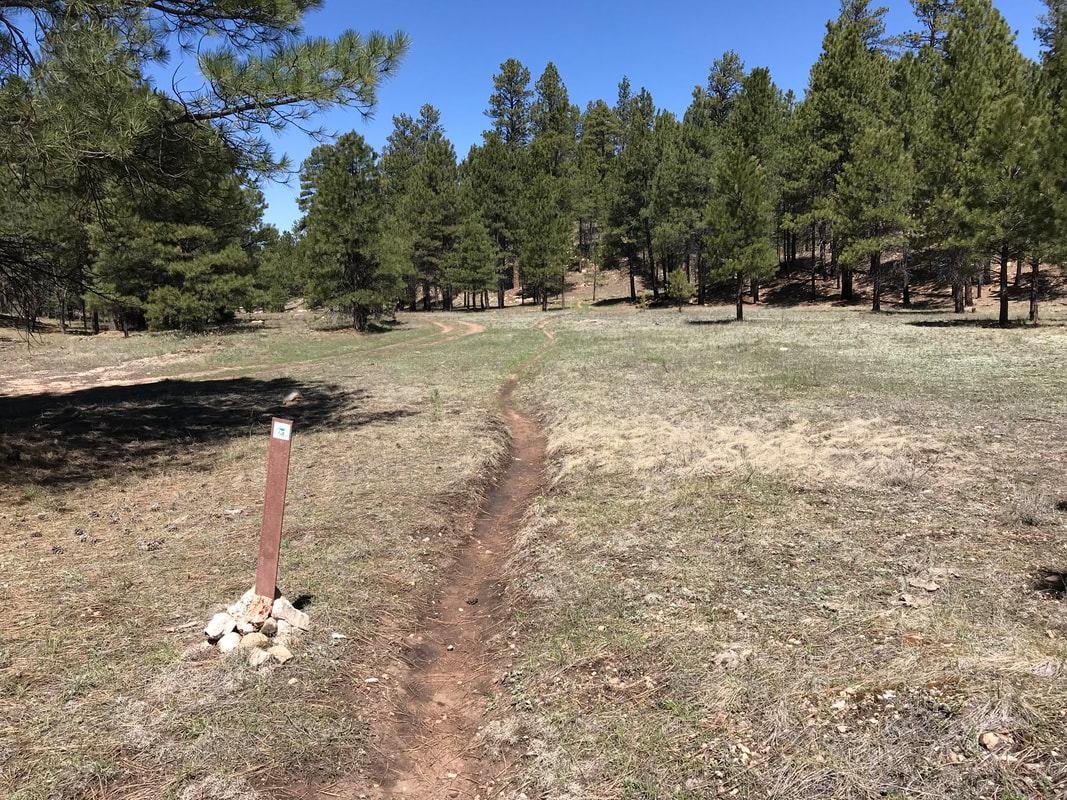
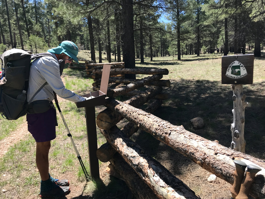
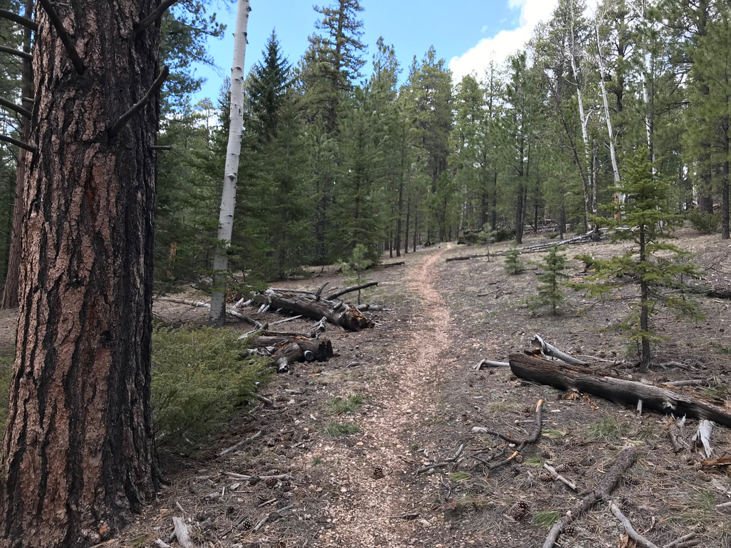
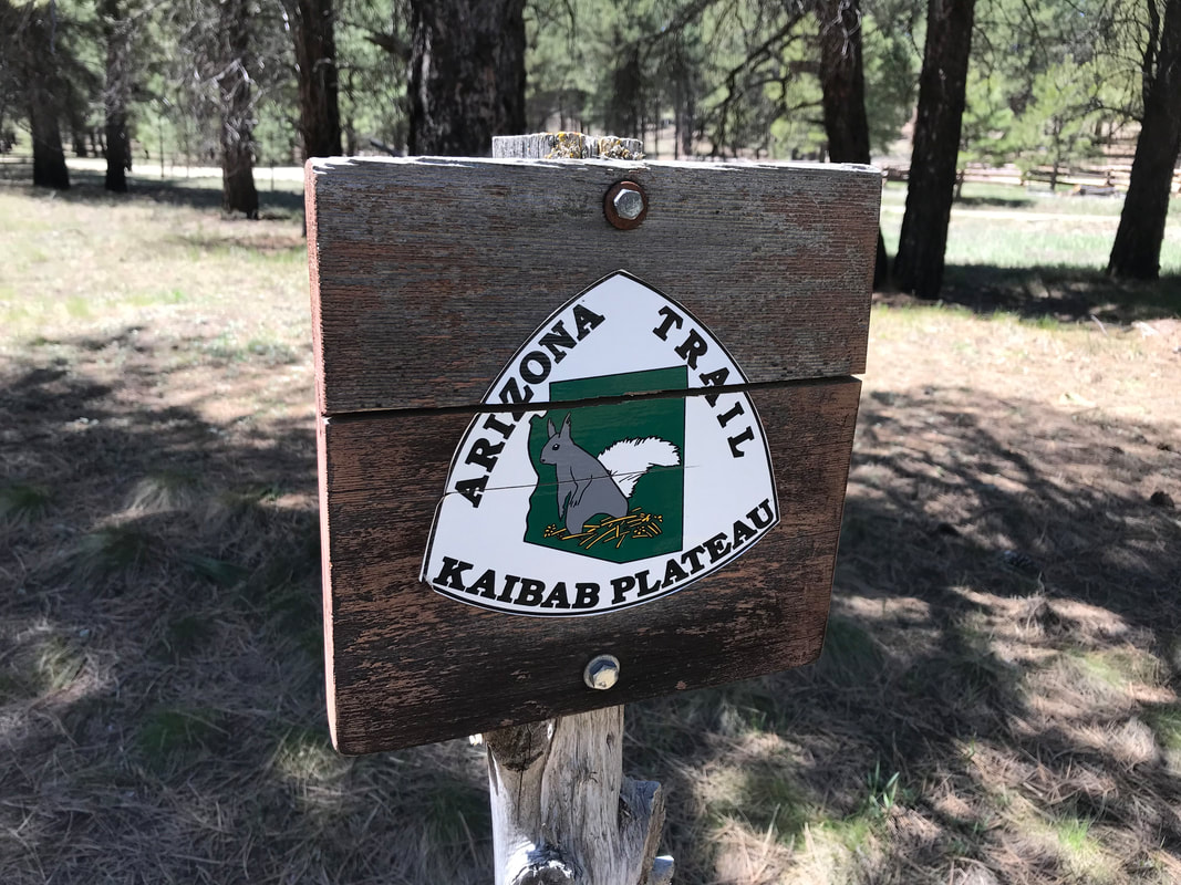 After such a peaceful night’s sleep, I felt incredible. Now, we only had 12 miles to get to Jacob Lake with the promise of a hot meal and some small resupply options at the small store at the Inn. Our only problem now was that we were a day ahead of schedule as we had not taken a Zero Day at the Grand Canyon. Knowing that Jacob Lake Inn had cabins and rentals, we decided to secure a room for tonight. That way, we could recover this afternoon and leave by late day tomorrow to get to our last campsite before finishing. The morning was equally sublime. We walked through beautiful ponderosa pine with no snow while green grass spread new growth on the forest floor. We passed several filled tanks and saw several Kaibab Squirrels, the iconic species of the northern Kaibab Plateau/Arizona Strip. By late morning, we hit the trailhead adjacent to Highway 89A and signed the trail register. Turning left, we walked up the highway for two miles to Jacob Lake where we promptly grabbed two seats at the restaurant and put back from burgers, fries, and some pastries. The room was available for a little bit still so we sat outside the Kaibab National Forest Ranger Station on picnic tables, soaking up the glorious warmth and blue sky while charging electronics and making phone calls.
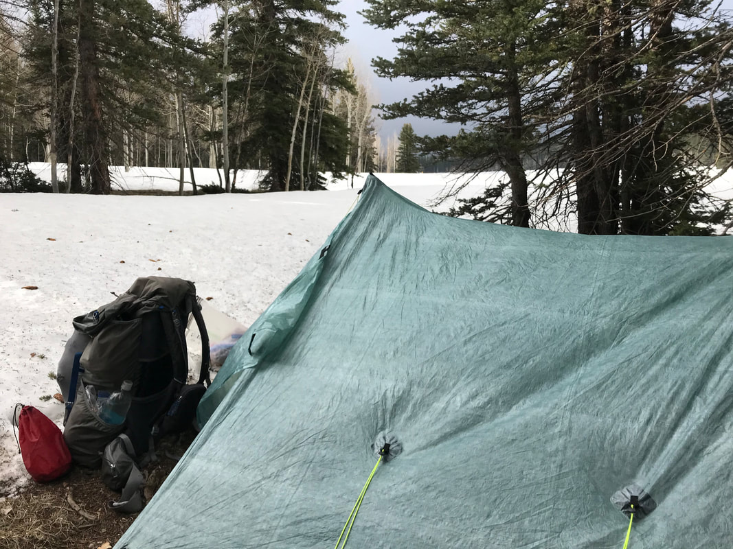
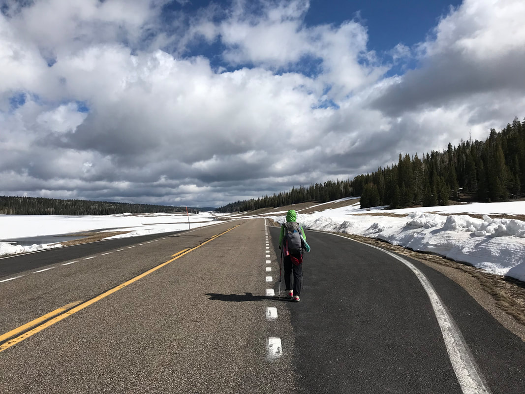
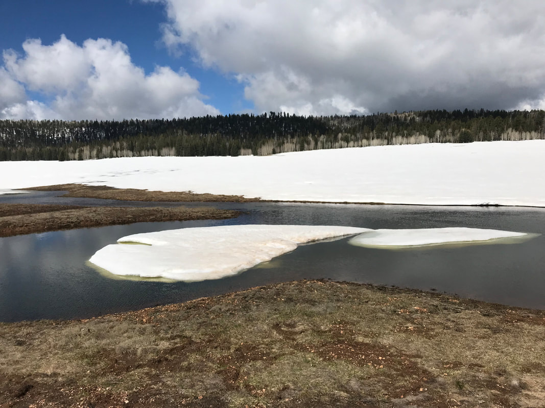
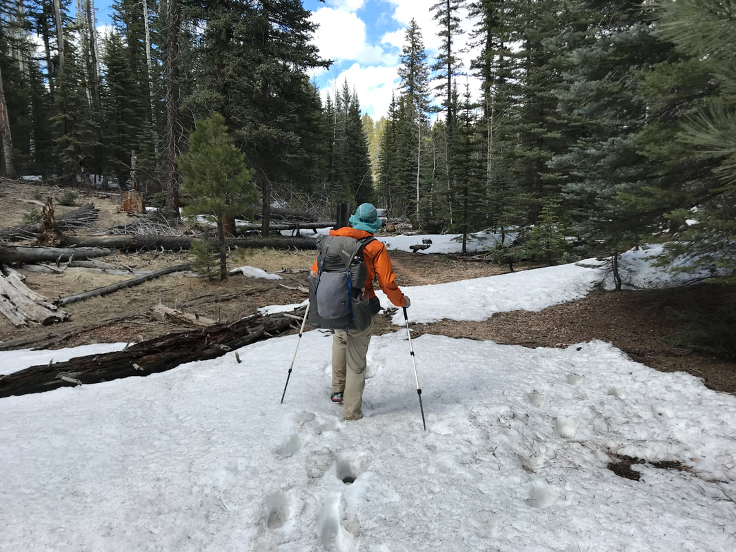
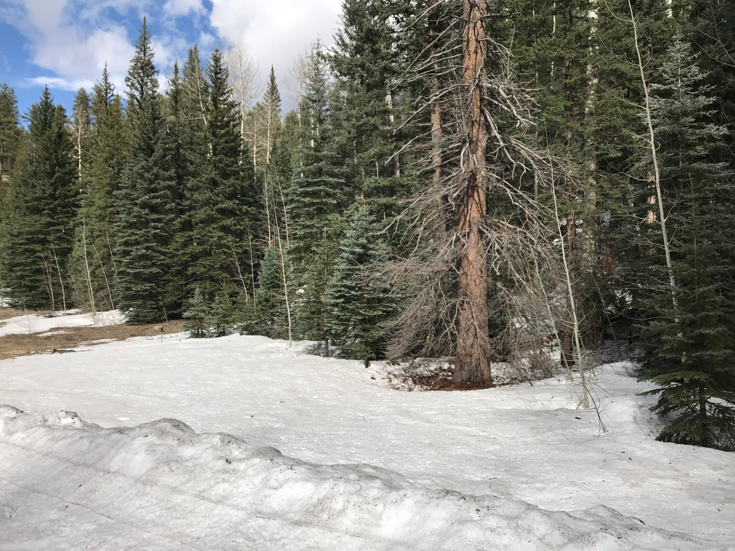
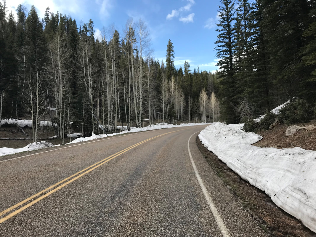
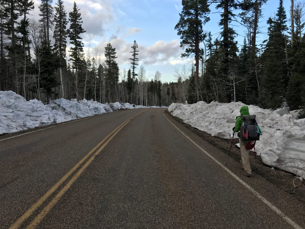
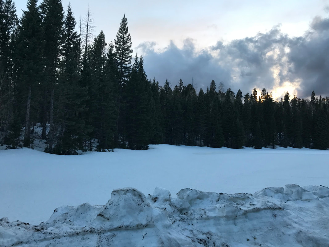
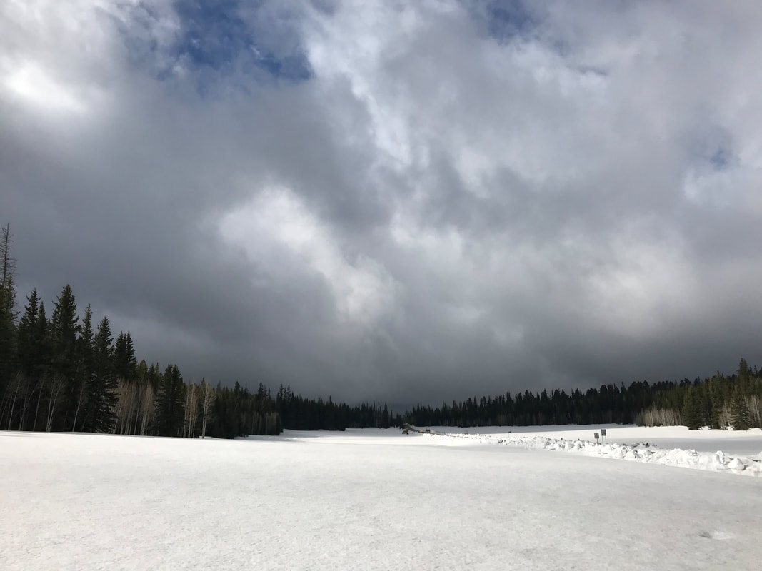
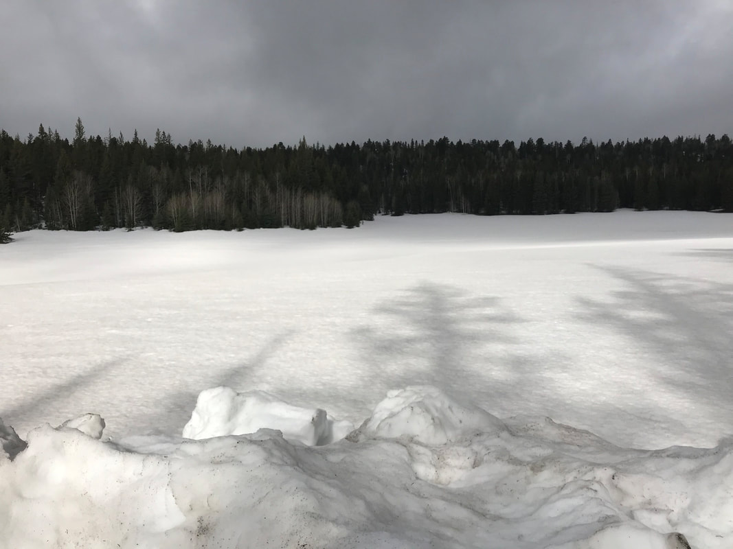
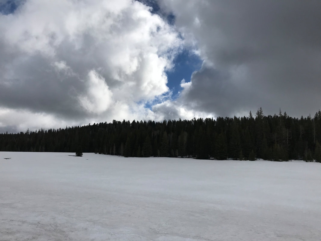
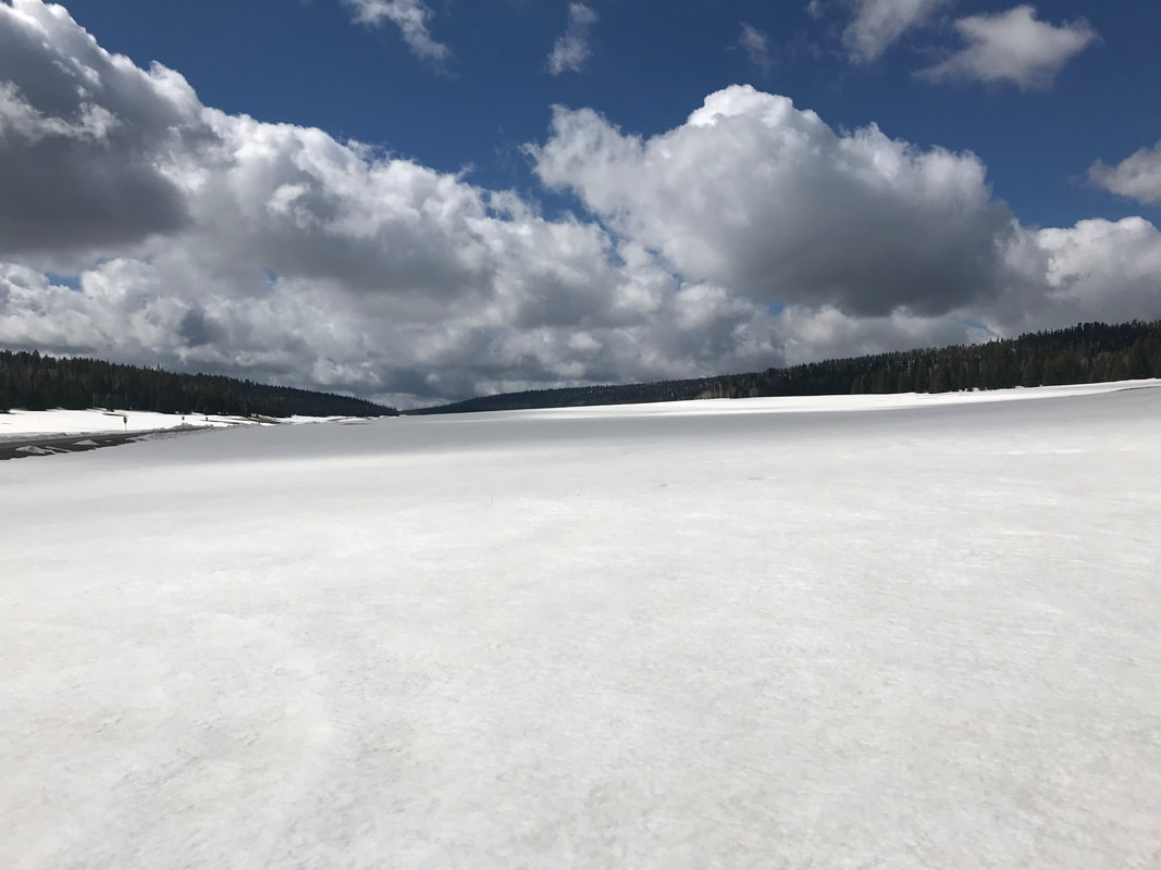
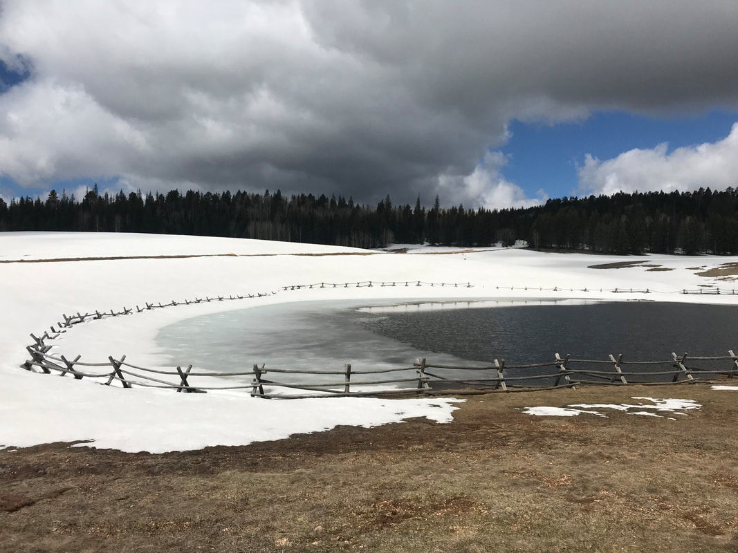
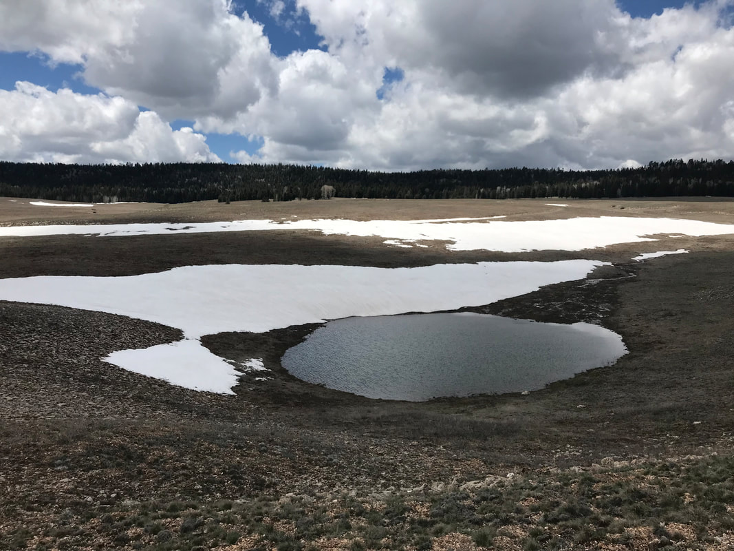
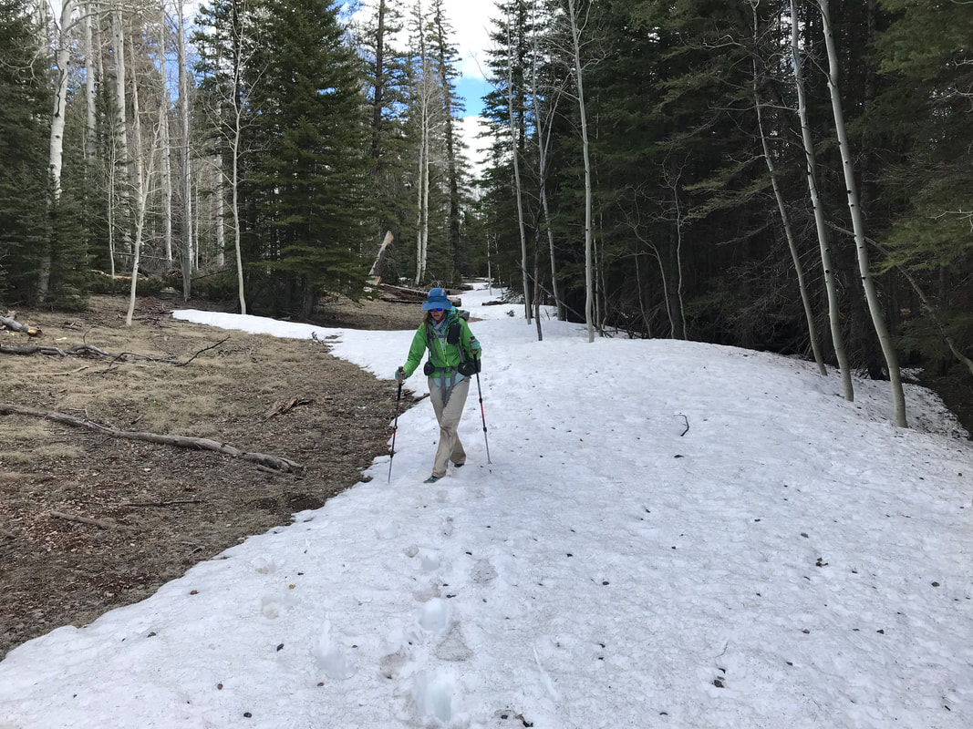
   Once our room was ready, we were stunned to find truly awesome lodging. For all our times being in this area, I had NO idea how nice the Inn rooms were. Immediately, we grabbed hot showers - our first since Flagstaff. It was fucking amazing to relax. Plus, I knew we would finish. For all the uncertainties about my knee, we were a mere day’s hike (that we were going to break into 2 days to meet Darren on schedule) from the end. Now, we had time to digest where we had been, what we had seen, and what we had thought. By dinner, we headed back over to the restaurant and ate equally enormous meals, chatting with staff and talking to some local hunters. Back in the hotel room we got to work doing one more cleaning of gear and clothing, plus repackaging food from the store for one last time. Afterwards, we sprawled on the beds and enjoyed watching a few hours of movies. I was totally relaxed. 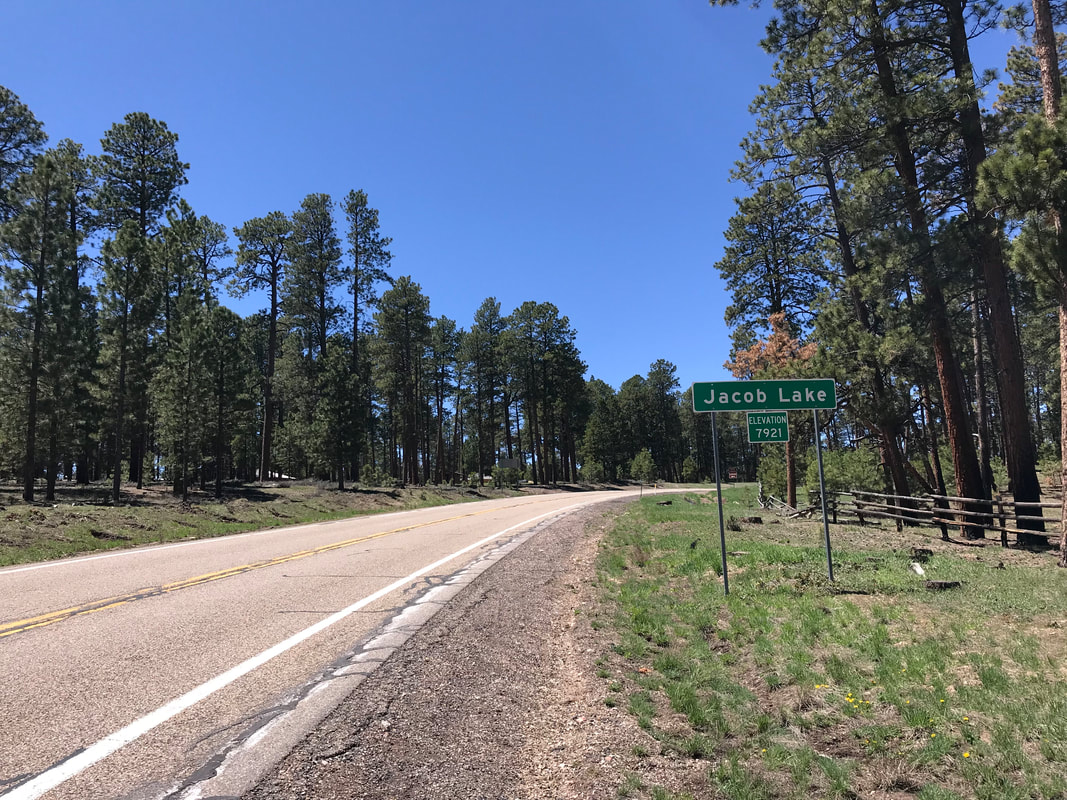 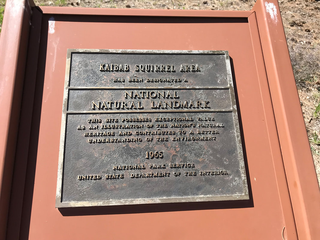 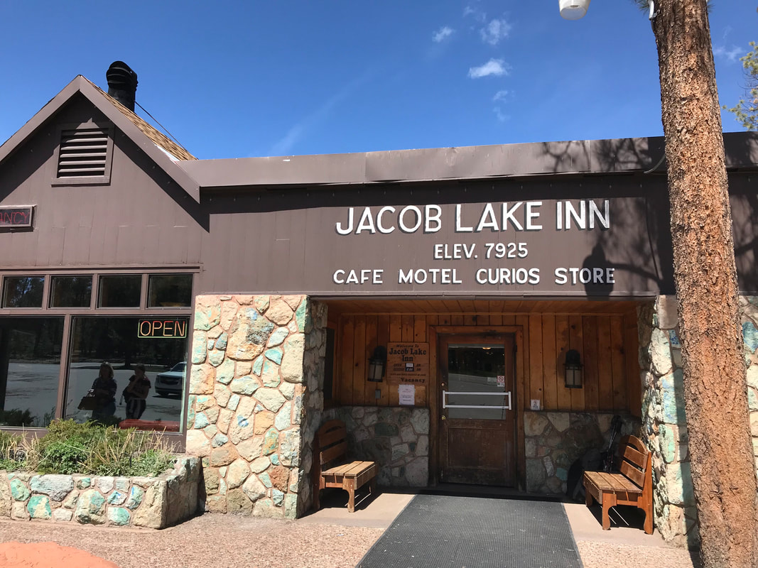 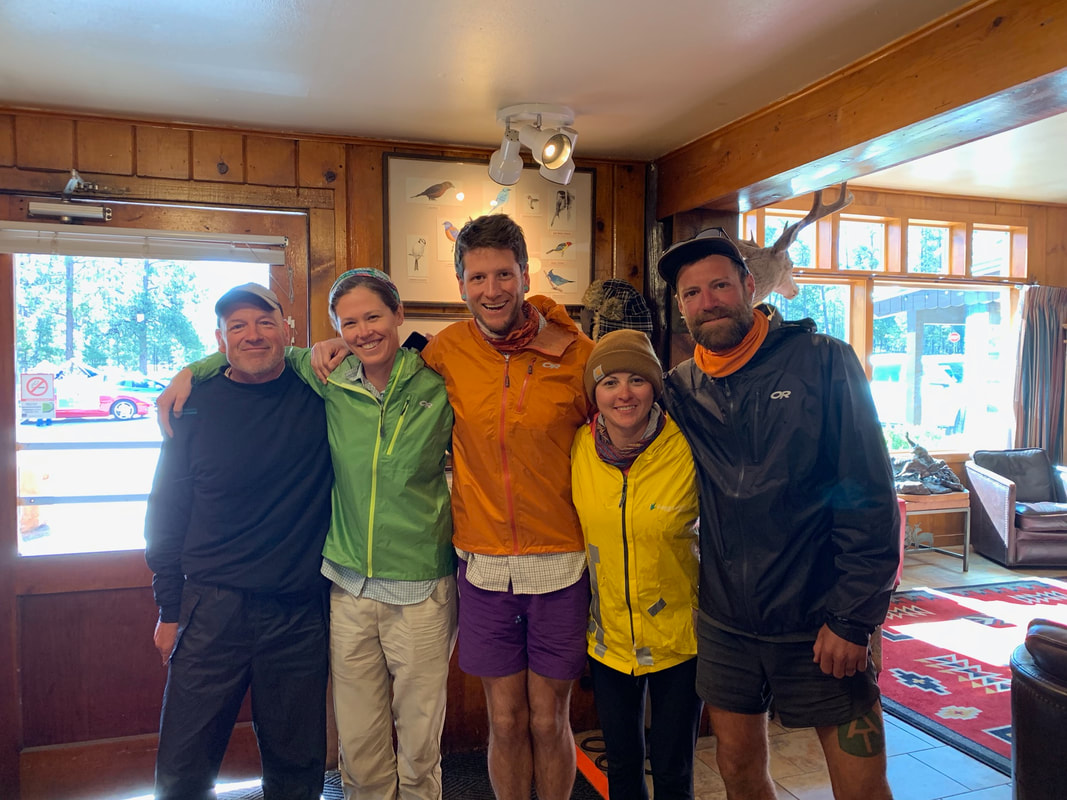 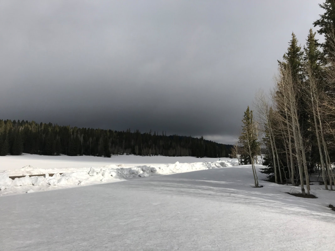 A calm morning greeted us with the light of day. Outside, low hung snow clouds kissed the upper tips of the trees. The wind was calm, and we felt exhausted. The shadows of trees cast long across the frosted white blanket around us, the length of their umbras accentuating a silent buzz. I gathered a weather report from the Garmin InReach mini that said storms on the North Rim would dissipate early today and completely disappear, but there was still a chance of snow in our location. Regardless, we ate breakfast slowly wrapped in our quilts in the Triplex. As soon as it was done, Janna and I agreed to get the fuck out of there. The field was easier to navigate and avoid ice water sinks than it had been in the dark. Around us, the world was silent, snow muffling sound. It was starkly beautiful. The spruce and firs stood sentinel on all horizon edges while the snow lay untarnished in all directions with the gray slag of clouds above. We climbed down the snow embankment and rejoined the road. Snowfields stretched for miles in front and behind us. We continued our road walk north. It was easy going now that the day was new and the wind had died. For water, it was a simple matter of using snowmelt streams roadside. Due to the fact that little to no traffic was up here, road effluent contamination seemed little. The miles continued and the high point on the plateau finally began to slightly dip. The elevation gradually dropped and as it did, the snow levels began to decrease. The pack went from my eye level to only a few feet deep. The earth began to appear as dully green/brown patches. By the time we hit 8,500 feet in elevation, most of the meadows emerged, waterlogged with numerous alpine ponds and lakes. Truly gorgeous. We passed by lakes half frozen and half melted. Roads lay partially unburied and signs for the AZT plunged into the white.
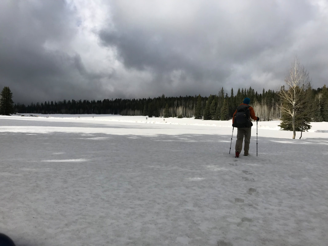 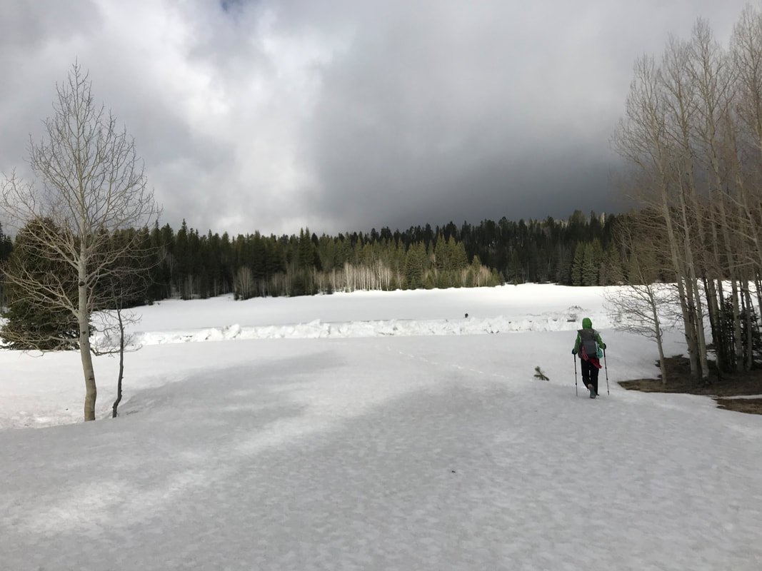 
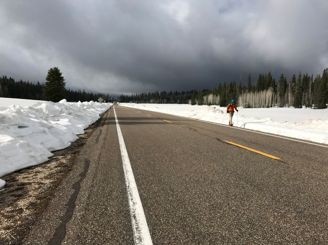  
 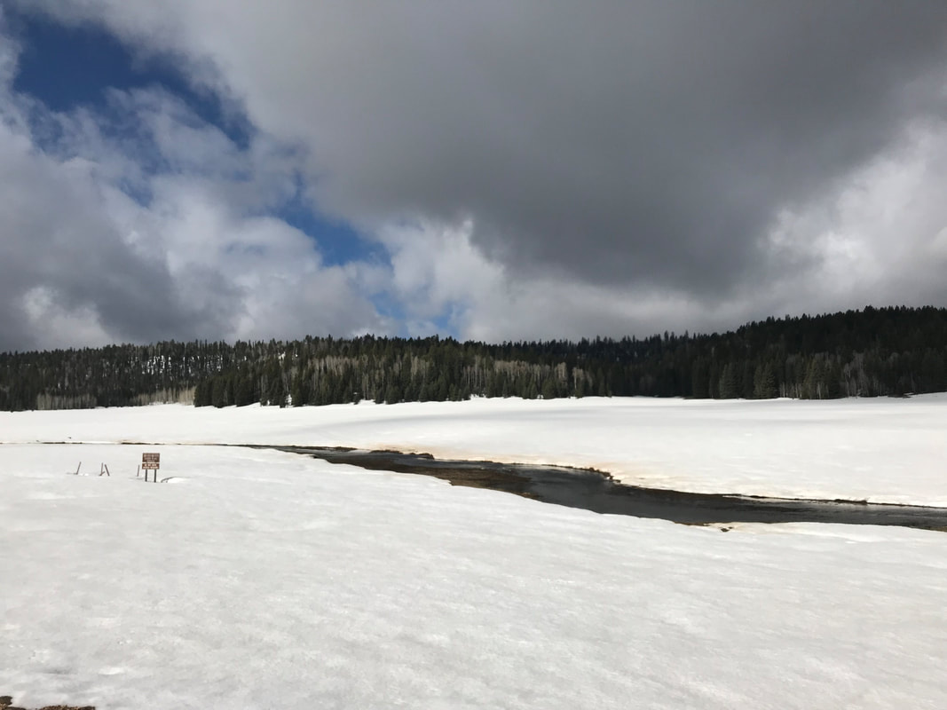  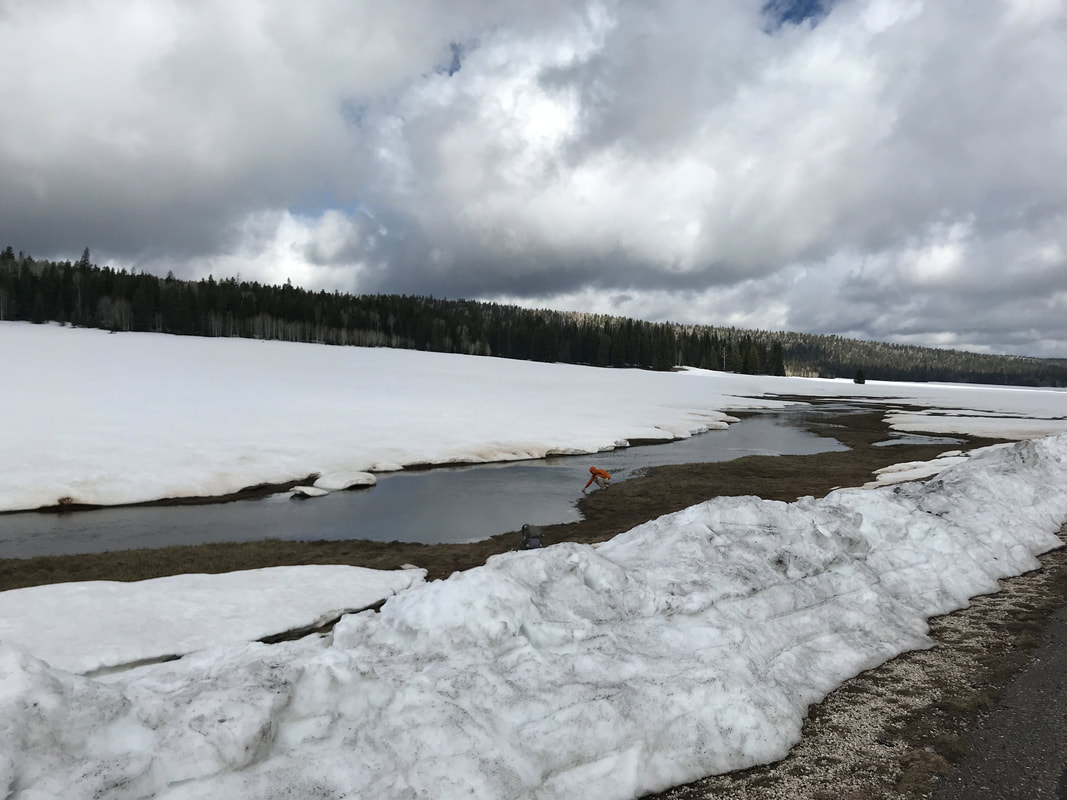  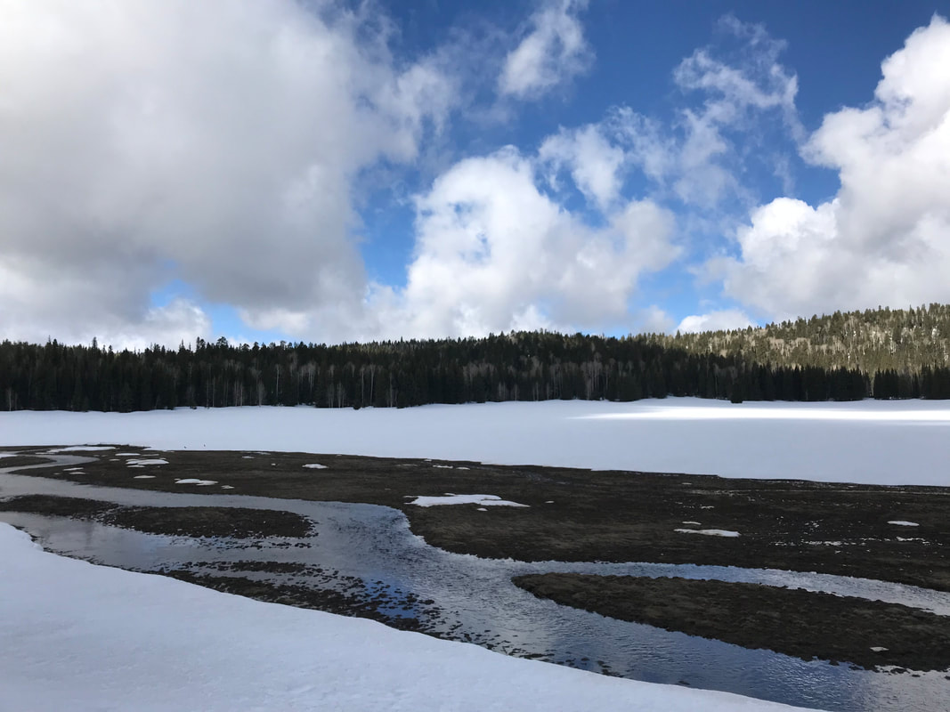
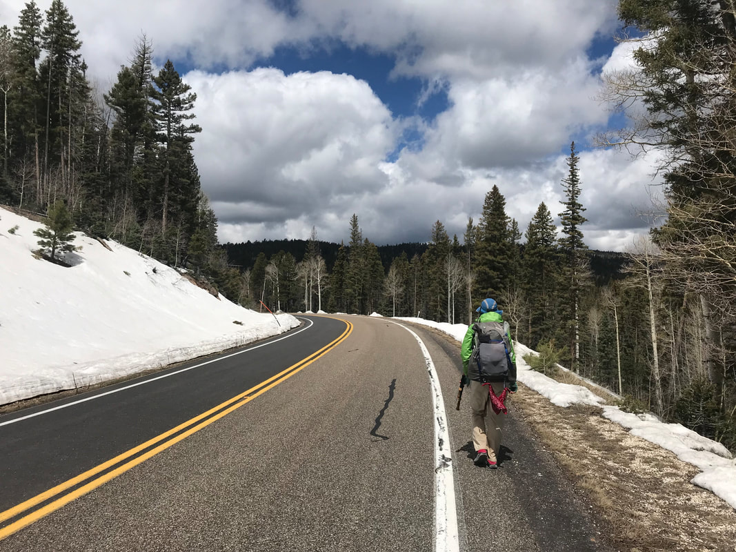
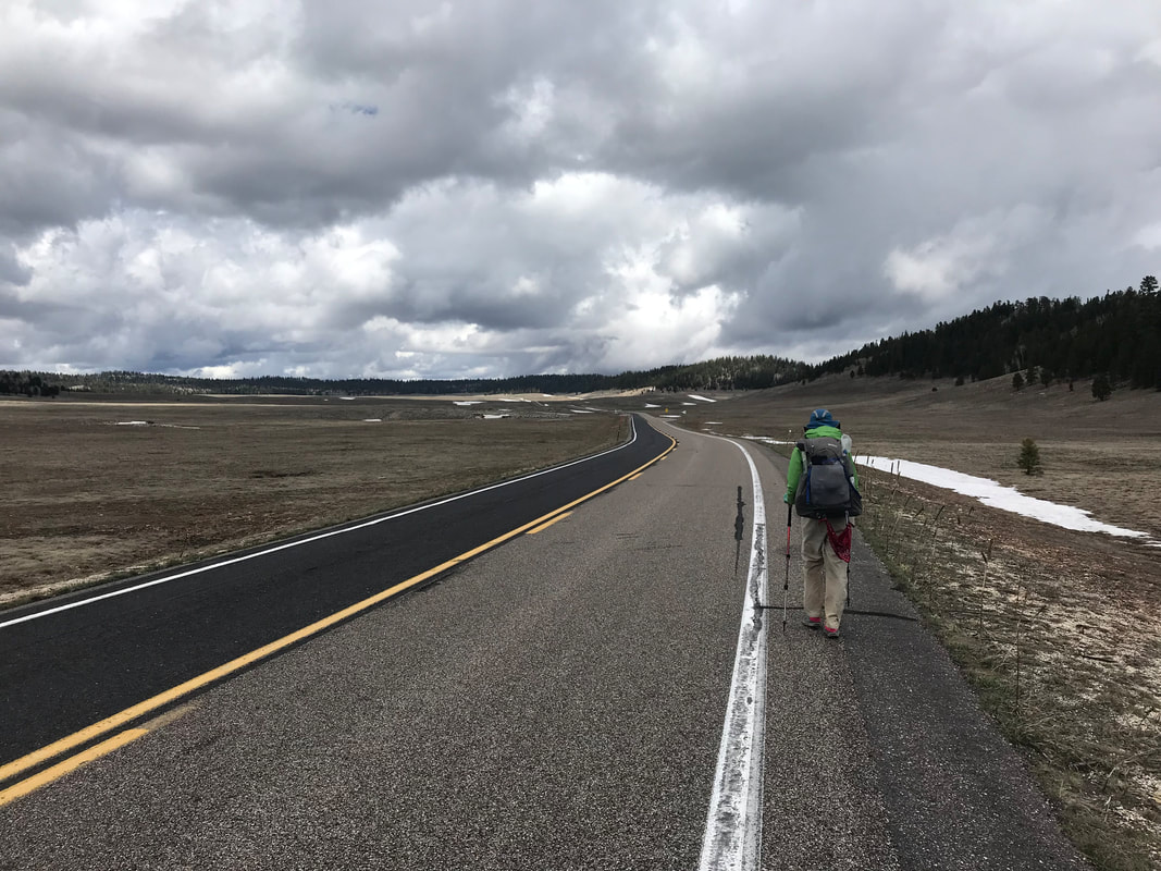
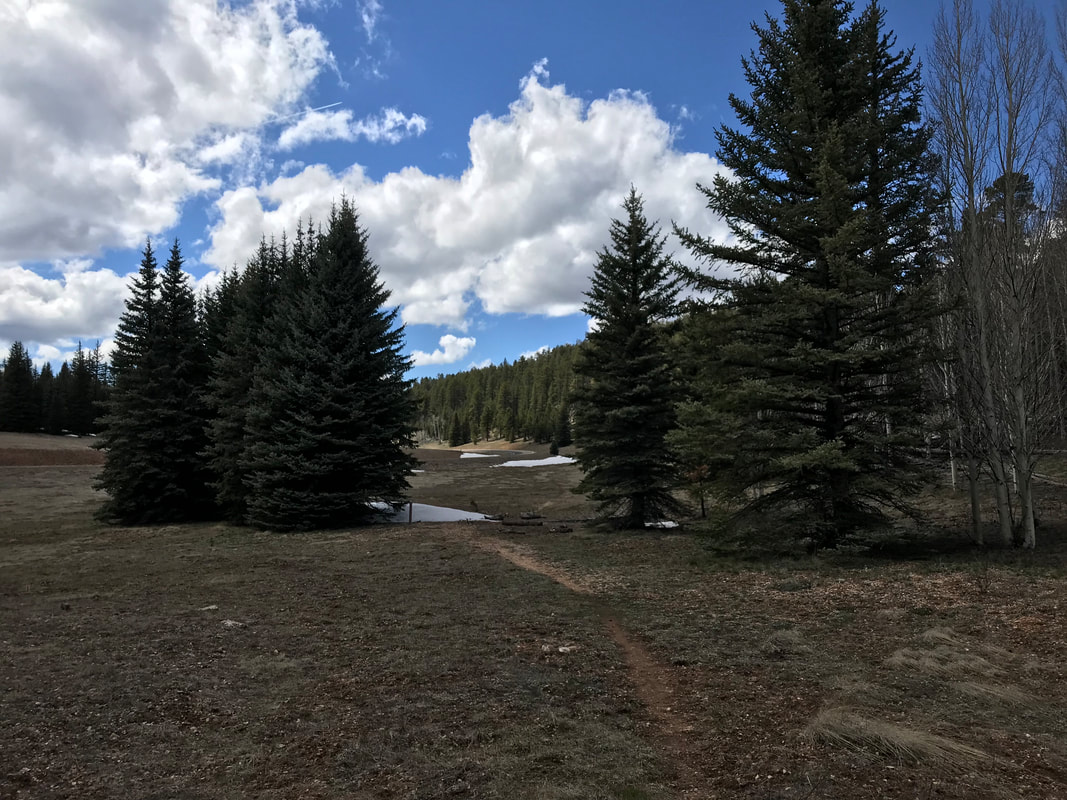
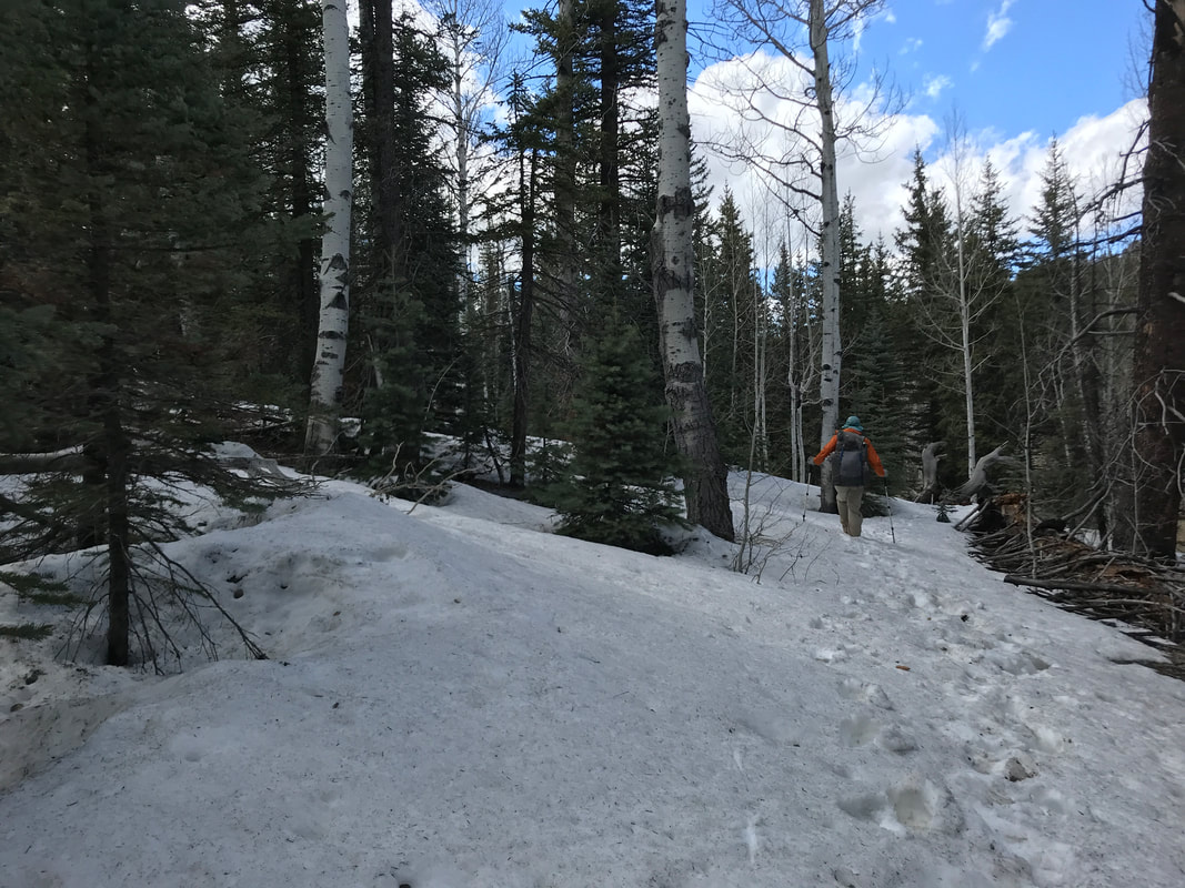
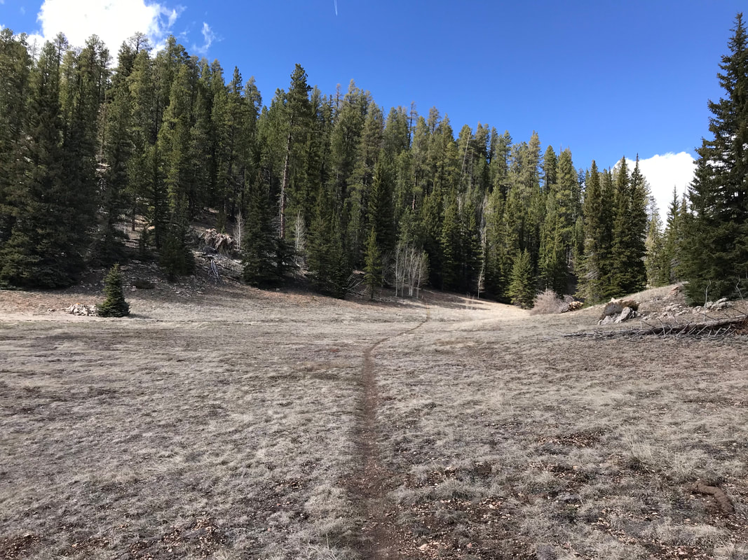
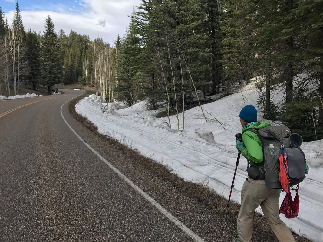
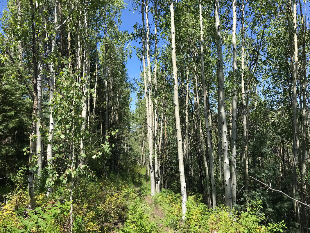
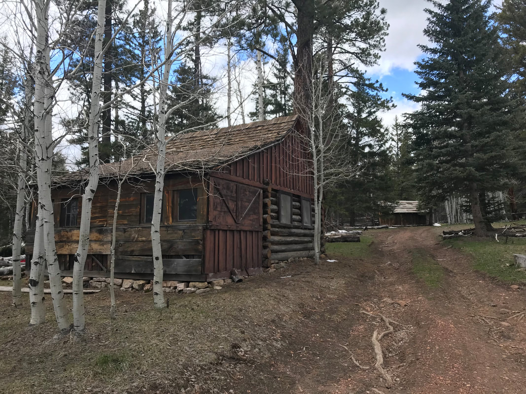
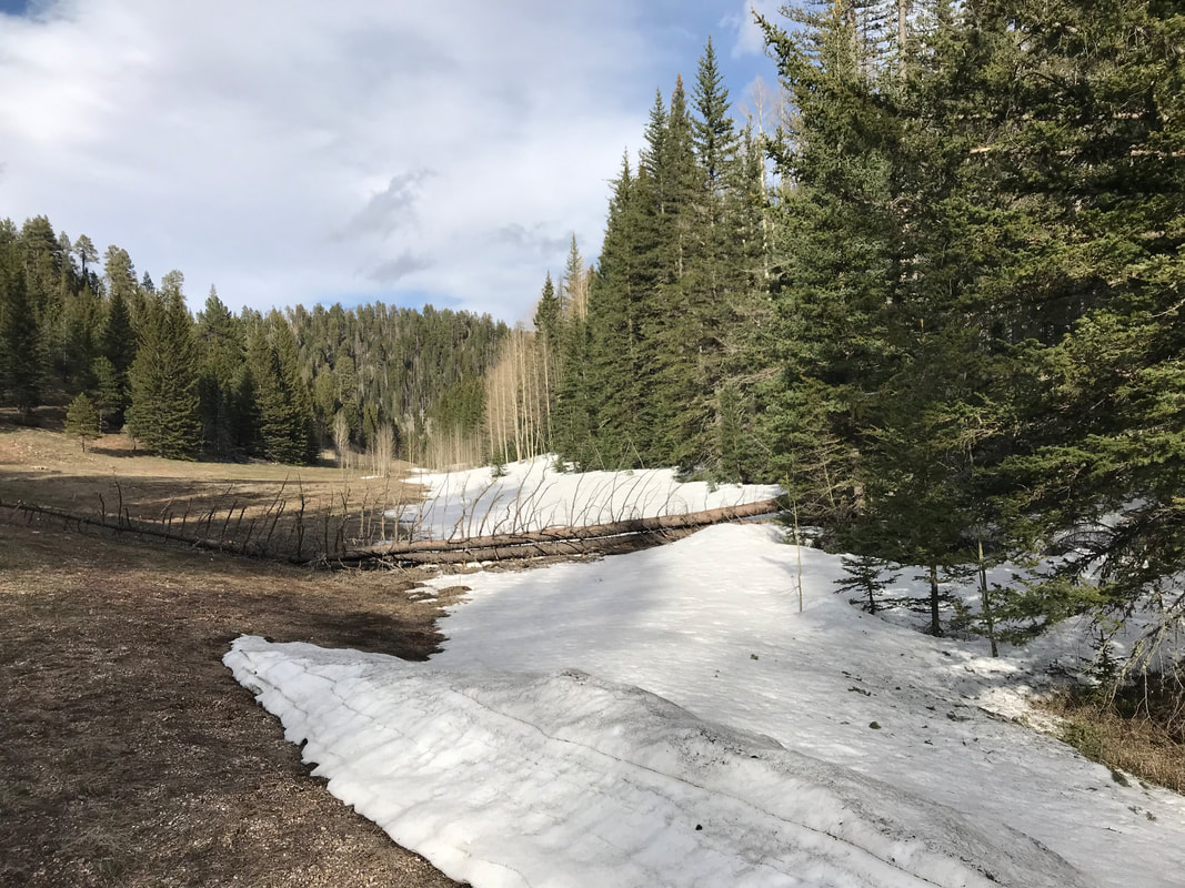
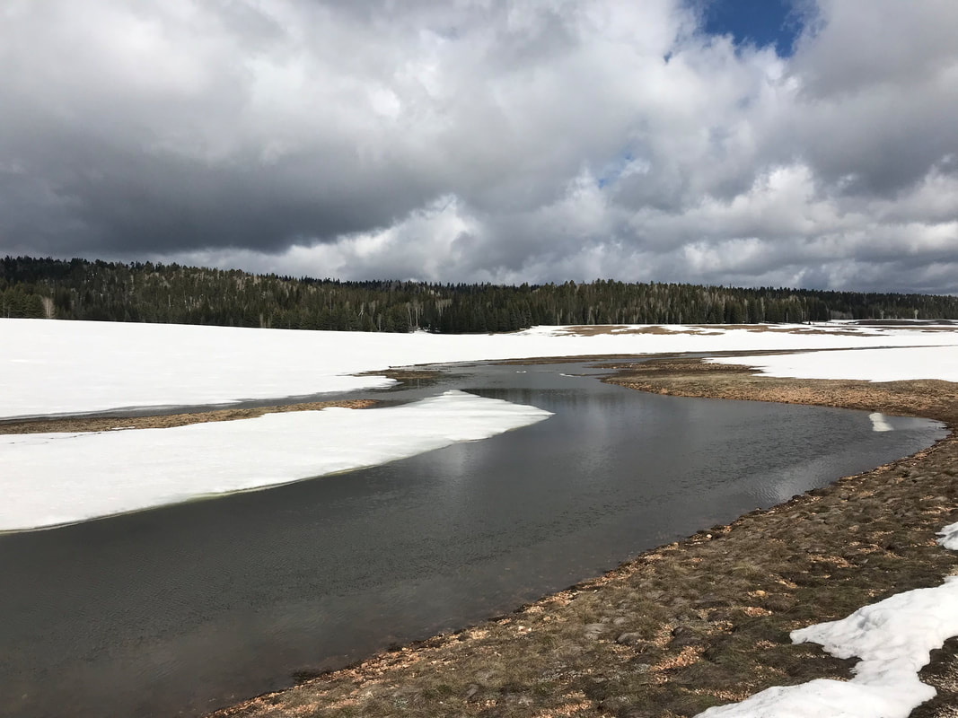 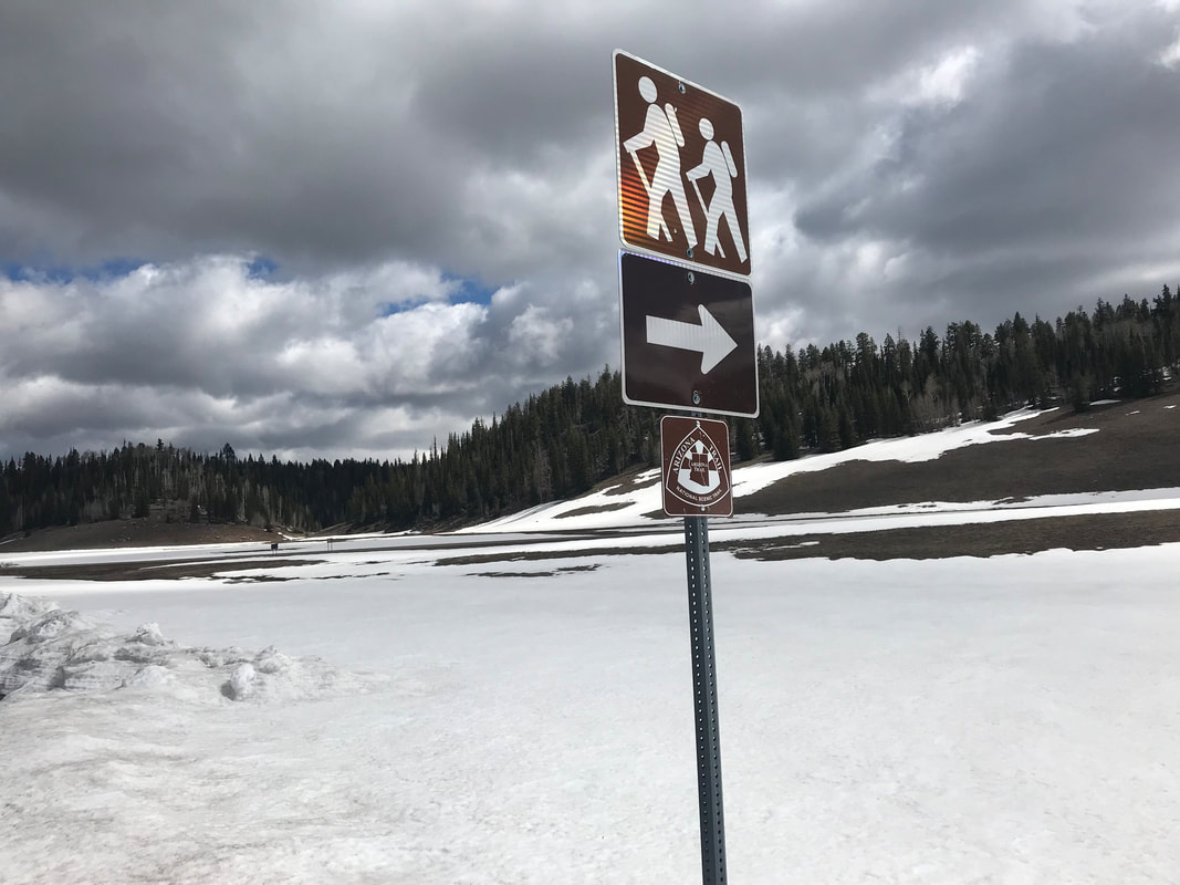   The long road walk for 20 miles on a paved surface began to irritate Janna’s plantar fasciitis. By mid-morning, having easily logged 15 miles, the road bisected a particularly large alpine meadow and the absent wind returned. It blew hard and bitter against our faces. Upon reentry into the woods, a small hunter’s and cross country ski hut stood up an adjoining lane. We walked up to it and took a break from the cold wind and put our feet up. There were old tables, chairs, and a few rooms inside the public cabin. We sat down and took a long break, eating food, and dreaming of warmth. Back out on the road, we saw a thru-hiker approaching. It was Rambler, an old retiree who had stealth camped in lower elevations than us the night before. We walked and talked with him for a bit as the road definitively took a much steeper dive into lower elevations, leaving most of the snowpack behind. I checked Guthook and saw the road and AZT nearly reconvene, so we left the road and jumped back onto the gorgeous alpine singletrack. The Arizona Trail wound its way through the thick woods, leaving the road behind. We hiked up and over large patches of snow and crisscrossed meadows of snowmelt and aspen stands. Rambler stopped to take a break and we bit him goodbye. Traces of snowshoes prints lay in front of us. We crossed out of spruce, pine, and firs into a large meadow where Janna got water from a small lake/tank. From there, the AZT ascended a neighboring hill. The cold had taken a back seat while the sun came out more forcefully. It was filling great. After a mile or two, the trail made a climb up onto a large plateau where a massive burn area lay. The burn was from years ago, but the totality of it made the next 10 miles exposed.
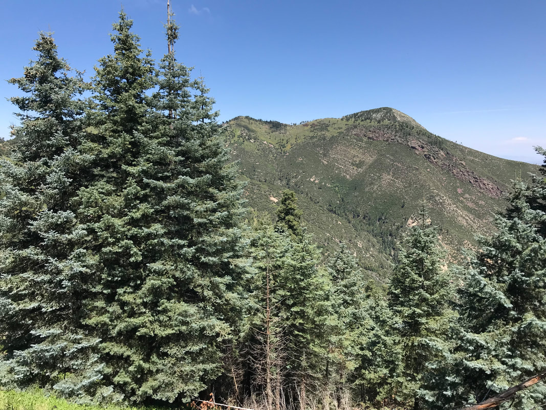
Small aspen, a fire-loving species, grew in tremendous numbers at shoulder height everywhere. I remarked how in 50 years this would be an amazing forest to come walk through in the autumn for fall colors. The sun arched the sky as we walked through the charred and fire-stunted landscape. Grasses and other pioneer species were growing rapidly everywhere, replenishing the vegetative spread. But man did that burn area feel like forever. Deer flitted in and out, browsing on the new buds of life. There were sections where large snow patches required careful navigation on steep slopes and fallen trees. We descended a large hill and found unburned section with beautiful massive ponderosa pines. The ponderosas became the dominant plant type again as the spruce and firs kept to the higher elevations. Suddenly, the clearing of burned trees allowed a long-distance view into the Vermillion Cliffs. One of my favorite places on Earth, the Vermillion Cliffs are remote and STUNNING. They hold one of the longest and deepest slot canyons on Earth along with an excellent gravel grinding route along House Rock Valley Road. To see the red cliffs, the finale at the Utah border ahead of us, made the reality of the Arizona Trail ending more real. As evening approached, we hit a cement wildlife tank where we refilled water. Pushing on in the slant of dark, we exited the burn area into a small wooded grove of trees untouched by fire. Excellent camping abounded and we setup the Triplex in the gathering dark. THIS felt protected from the wind. The temperatures were amiable and the wind was nearly absent. A spread of soft pine needles provided my ideal floor for camping. We ate dinner on old fallen logs and laughed about the insane past few days we have had. We had hiked 60 miles in two days, left rain on the South Rim, traversed the Grand Canyon, slept through a winter storm on the North Rim, and found ourselves in a gorgeous grove on a soft evening. As ate heartily, my appetite fully returned. Rambler camped across from us, echoing a “Hello!” in the dark. We climbed into the Triplex and slept fitfully and deeply. 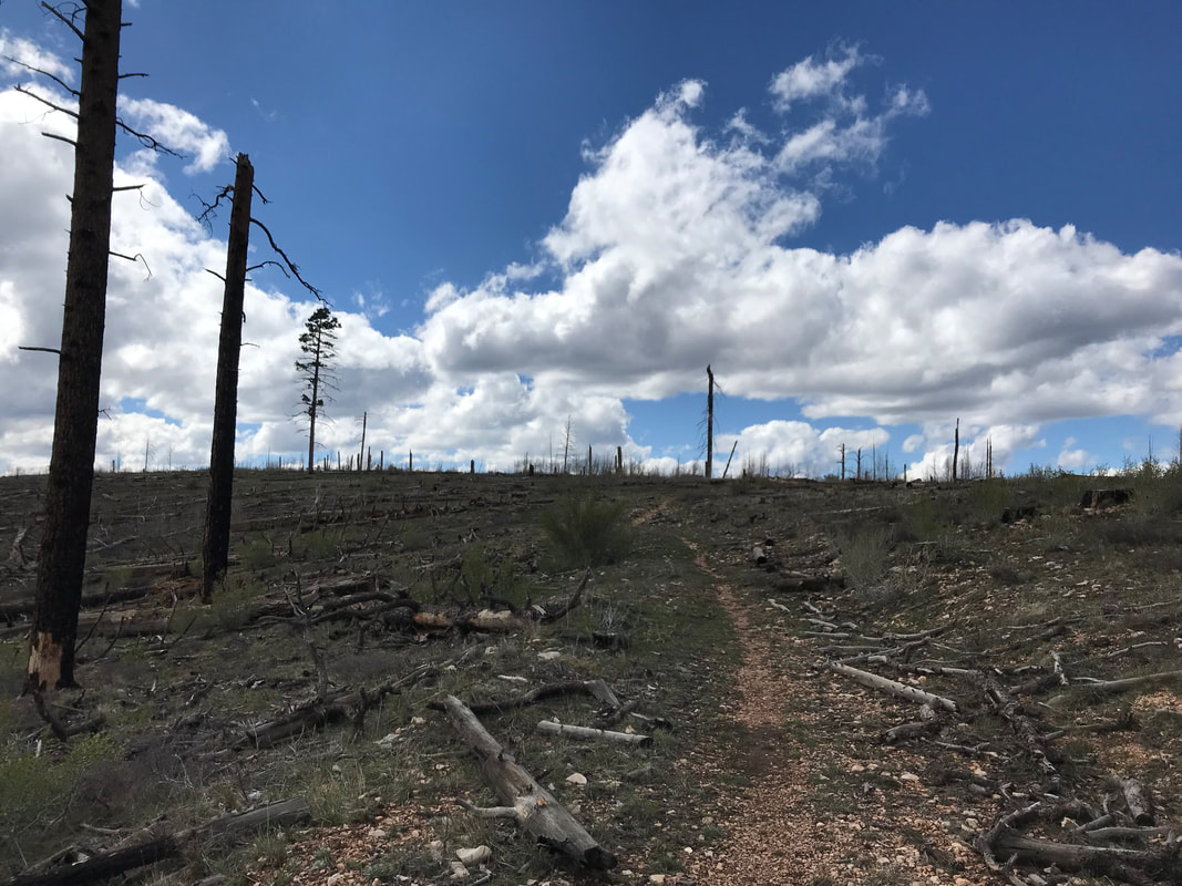 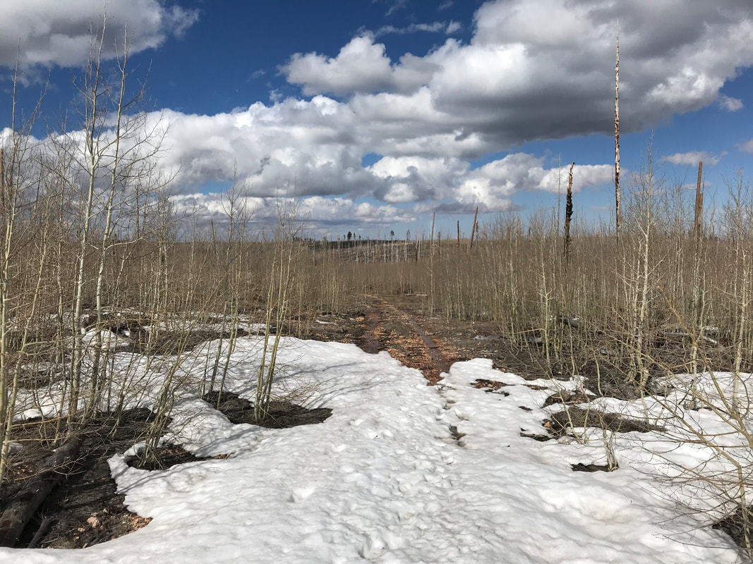
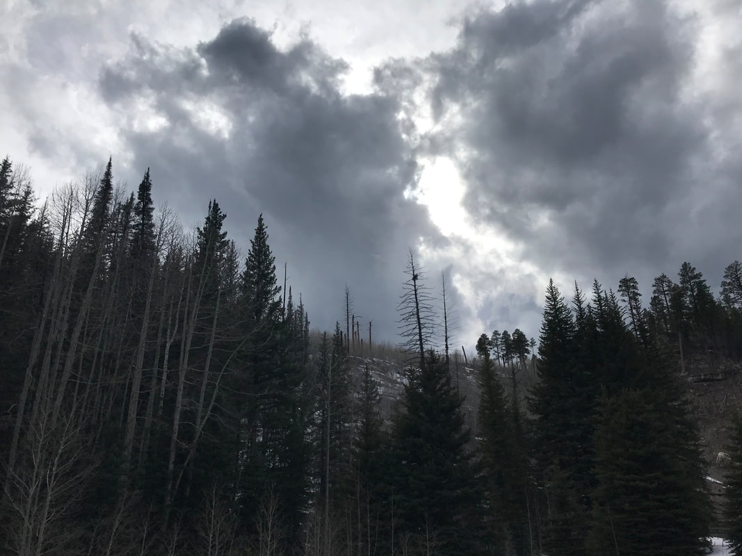
   Part 3: Into the Winter on the North Rim 10 more miles was also that separated this long day from sleep and relaxation. We pivoted immediately from the North Rim trailhead towards the AZT across the clear highway. Snow lay in small patches here and there, but nothing intimidating. Overhead, blankets of blue sky spread out from the mountain clouds. Things looked great. As we crossed the highway towards the AZT, we peered down the trail into the thick woods which lay sliced and lashed with snow embankments that we knew would take time to climb up and over. Plus, we read that someone had done the trail proper in this area only a few days before and used snowshoes for a good portion. Given that beta, and the late afternoon chasing us, we decided to hike the snow-free highway out of the park. Man was I feeling good. It was even mildly sunny now. I felt that hardest part was behind us. This was nothing. This was merely a road walk on with a slight uphill and then we would descend. The snow wasn’t even that bad! We’d easily find a place to camp tonight, even after dark. The storm looked like it was giving in. A mile or two in and keeping a good 3 mph pace, the bikepacker we had passed up the Canyon passed us on his now reassembled bike. He was starving, out of food, and going to bike the 40 mile to Jacob Lake Inn tonight to catch a hot meal before the last push to finish the race. We bid him goodbye has he pushed ahead. The daylight was fading, but we had a solid 4 hours left until total darkness. What we didn’t plan on, and what I had totally forgotten, was that the North Rim sits at 8,000 feet but rises as your move inland on the Kaibab Plateau, rising to over 9,000 feet. As we walked, I began to realize our pace was slowing from going uphill combined with our fatigue. As we gained elevation slowly, the tree diversity was awesome: firs, spruce, aspen, pine, and more. But the snow that started patchy and uneven became an even, constant carpet. There was a direct relationship between the further we walked, the higher the elevation we gained, and the thickness and spread of snow around us. Plus, the innocuous clouds I had thought away were thicker here as we were truly in the alpine. They moved fast and low, leaping overhead and smashing into each other. The threat of a storm in the late hour became real. The temperatures were also starting to drop, both from the elevation and the setting sun. 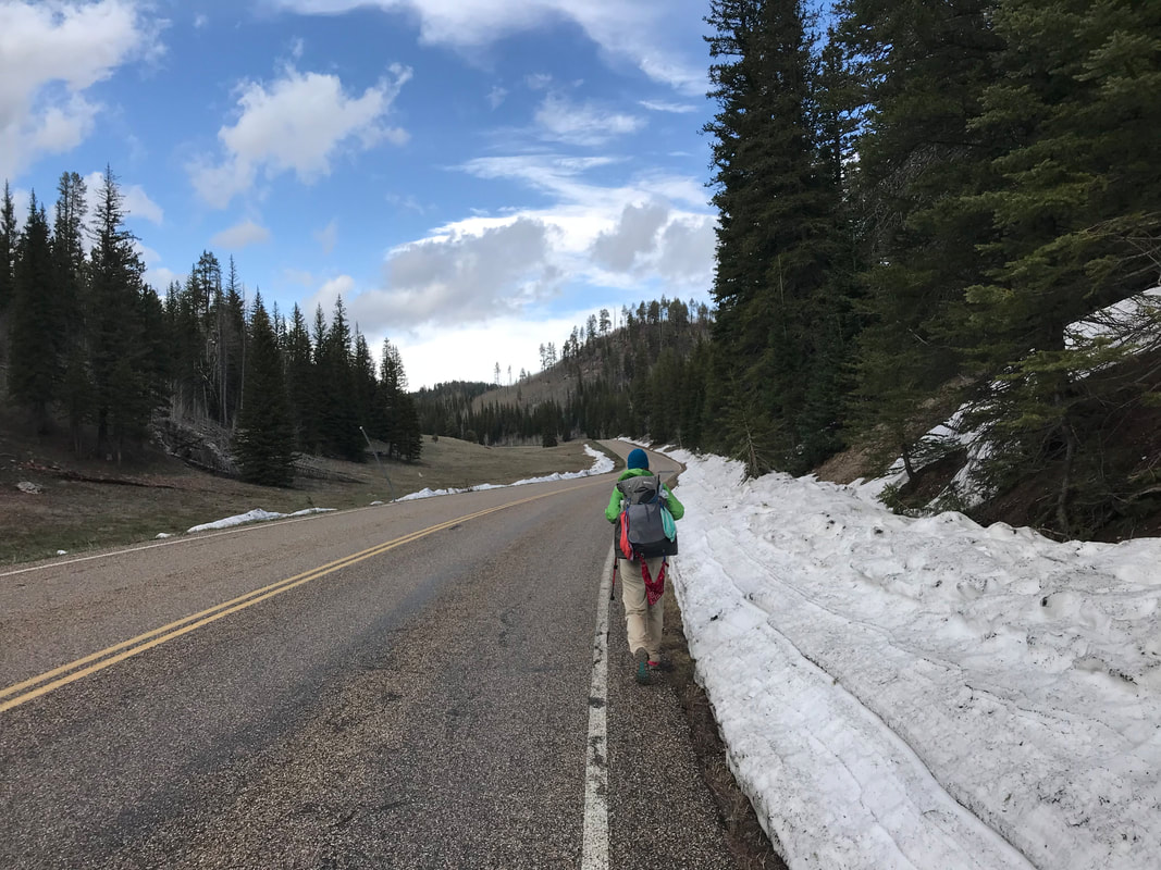

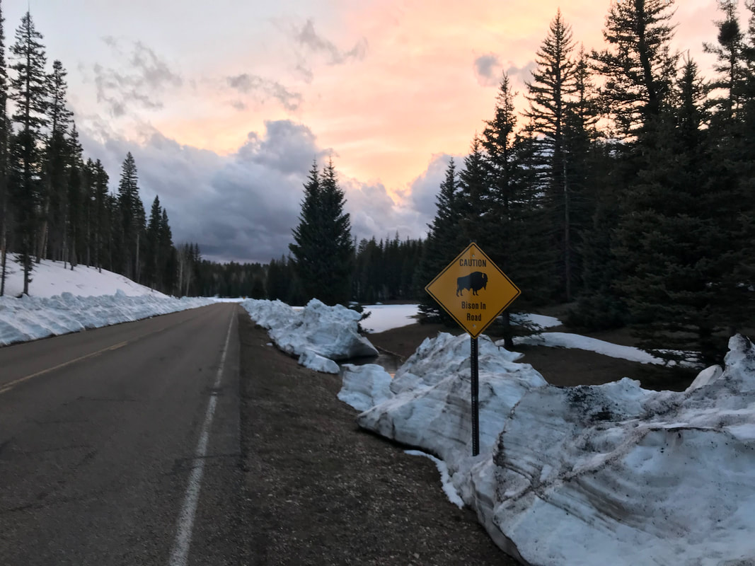
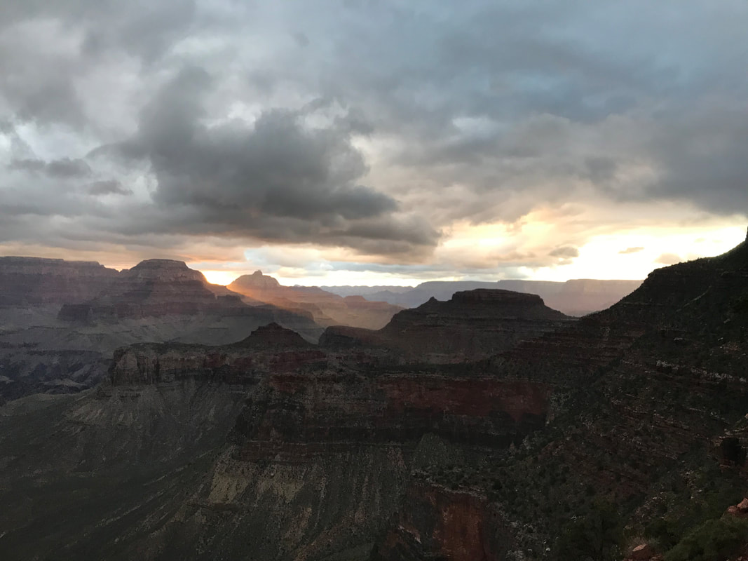
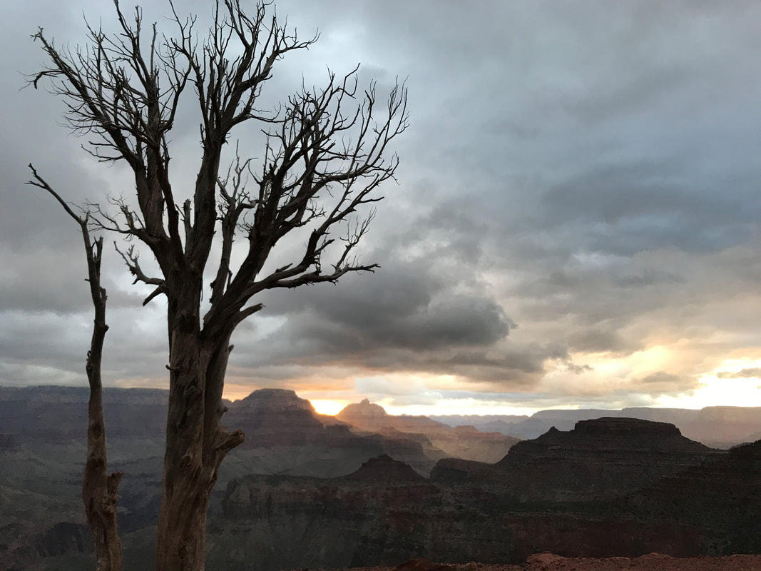
 By 6 pm, the reality of the snow set a slow anxiety in me. We were walking a paved road through a corridor of 6 foot deep snowpack. It was clearly at my body height and only seemed to be rising next to us the further we walked. I realized we were going to have to climb the 6 foot side drifts to even walk on top, let alone find a place to camp. I was prepared for snow camping, but the thought of constructing snow anchors after this long day was a major turn-off. Nearing 9,000 feet in elevation, the road had a pull-off complete with trashcans. Janna and I sat down on the wet pavement and ate a cold-soaked dinner. A porta potty sat behind us, its roofs and walls collapsed and crushed by the monstrous weight of deep snowpack here on the remote Arizona Strip. We ate quickly, steadily, if only to gain calories and get moving again. I found myself not hungry again. My appetite had waned as the snow drifts grew. After 20 minutes, we were back on the road. Now, splintered fallen trees lay wedged horizontal in the snow. What low and flat ground was available had pooled slight snowmelt into ribbons of ponds and streams. Everything else was snowcapped and vertical. The choice in campsites was becoming equally thin and we were still four miles from the park boundary. The North Rim is composed of vast, thick, and remote alpine woodlands interspersed with massive high-altitude meadows. I was planning on crossing these meadows at the park boundary to make the woods and secure some wind blockage as it looked like a winter storm was building up for the night. We pushed on, racing the clock and loss of sunlight. A sign appeared warning of bison. I thought, “Dammit. I don’t want to run into a massive herd of cold-stressed bison in the dark alone.” We kept moving, the snowpack grew thicker and deeper. Janna and I grew quieter and quieter. A blazing sunset lit the plumy clouds in front of us in an orange sulfur glow as evening approached. It was beautiful and we stopped for a few quick photos. We were so close to the park boundary, but we were wedged in on both sides of the road by a nearly 8 foot snowpack in places. 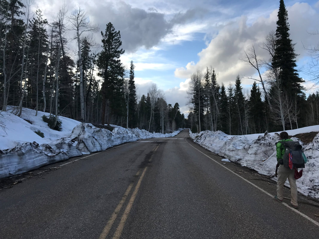 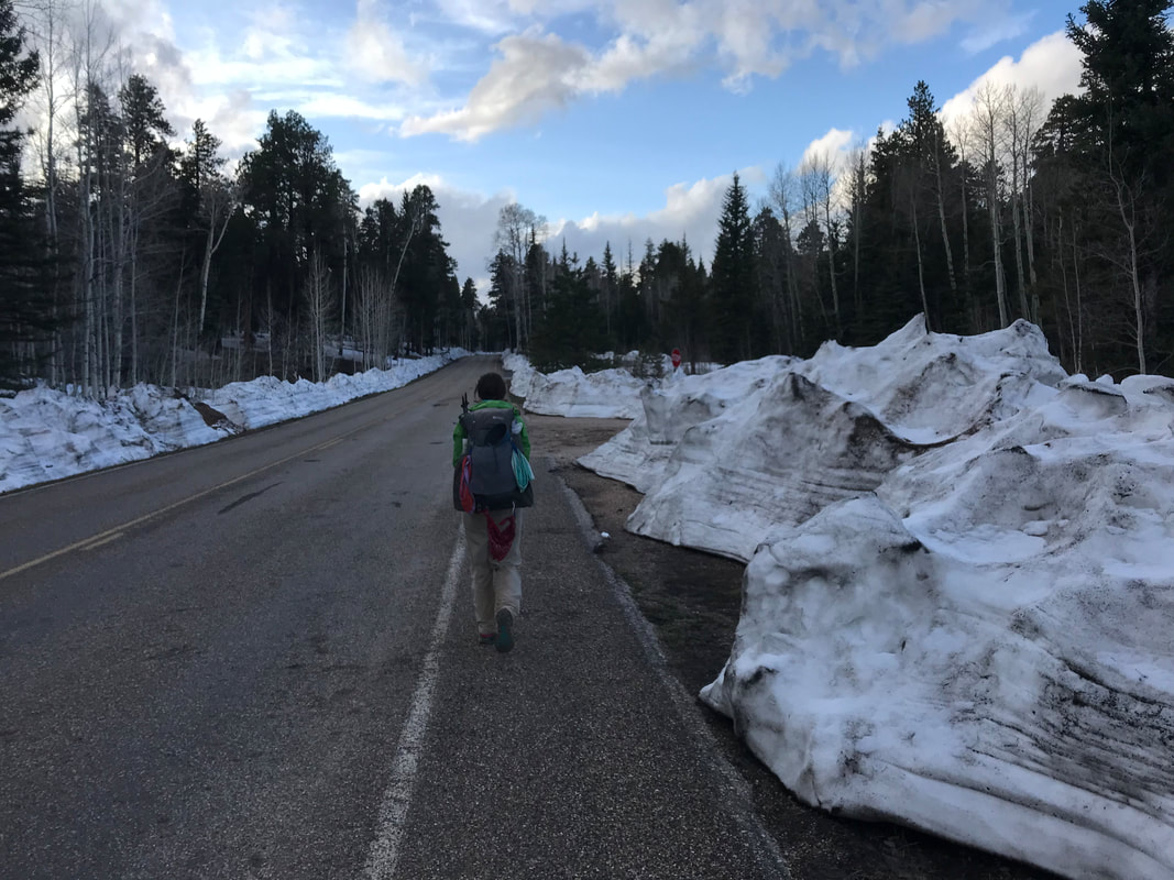 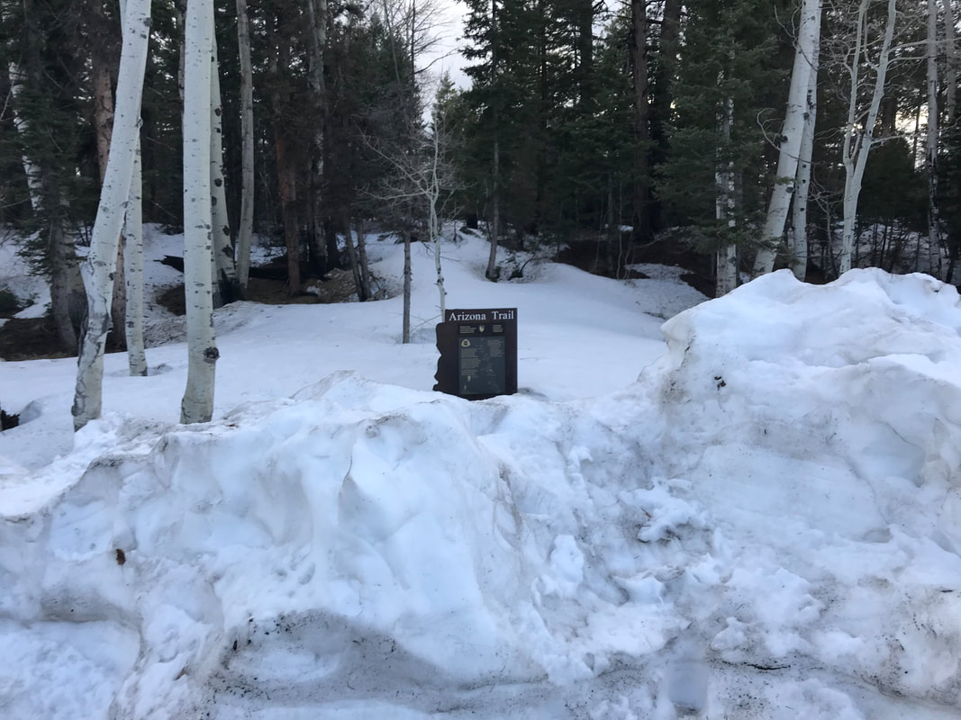 
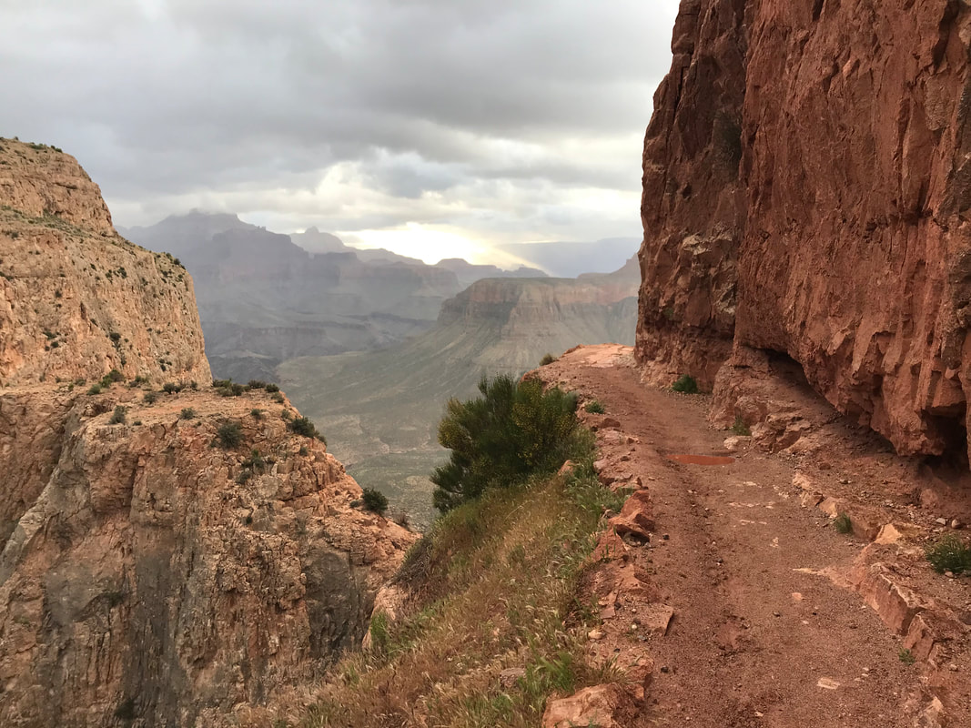
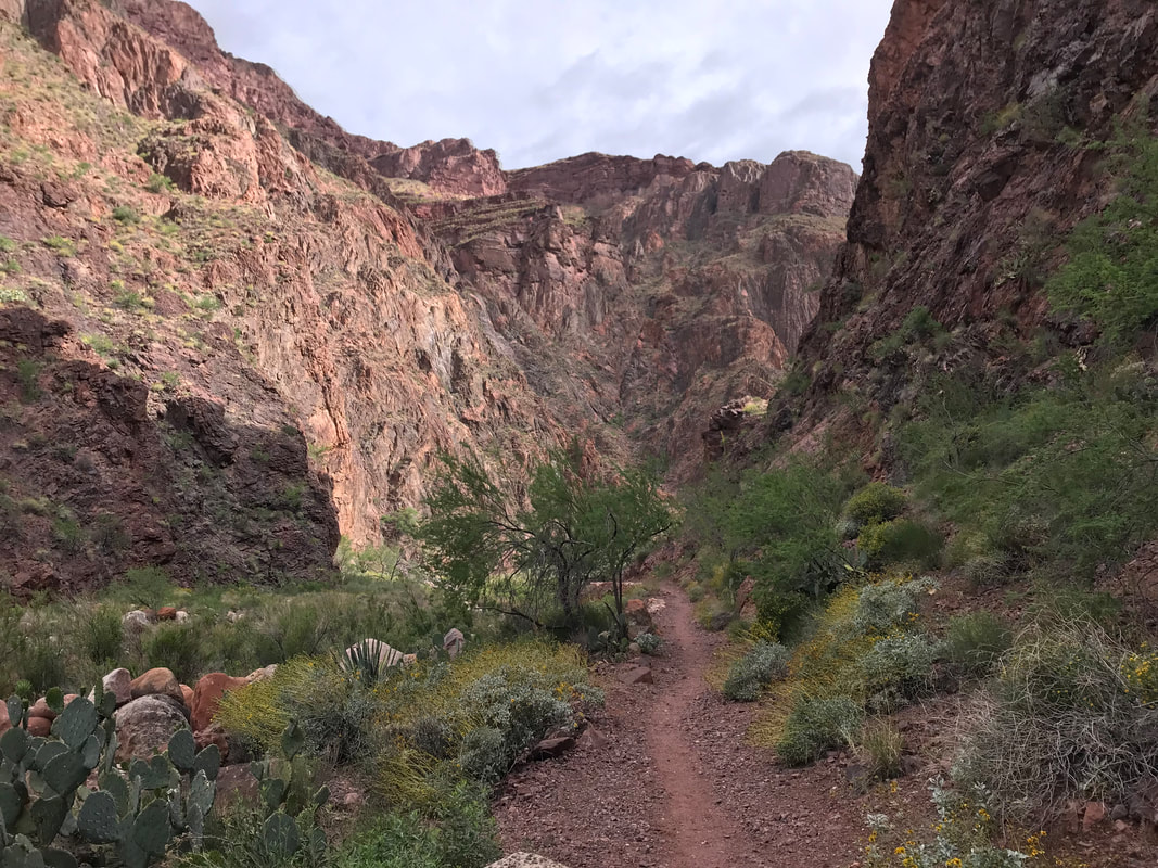
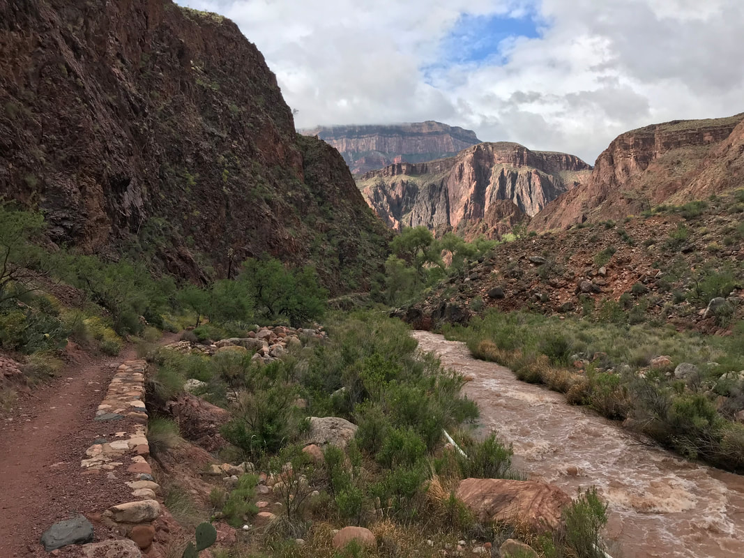
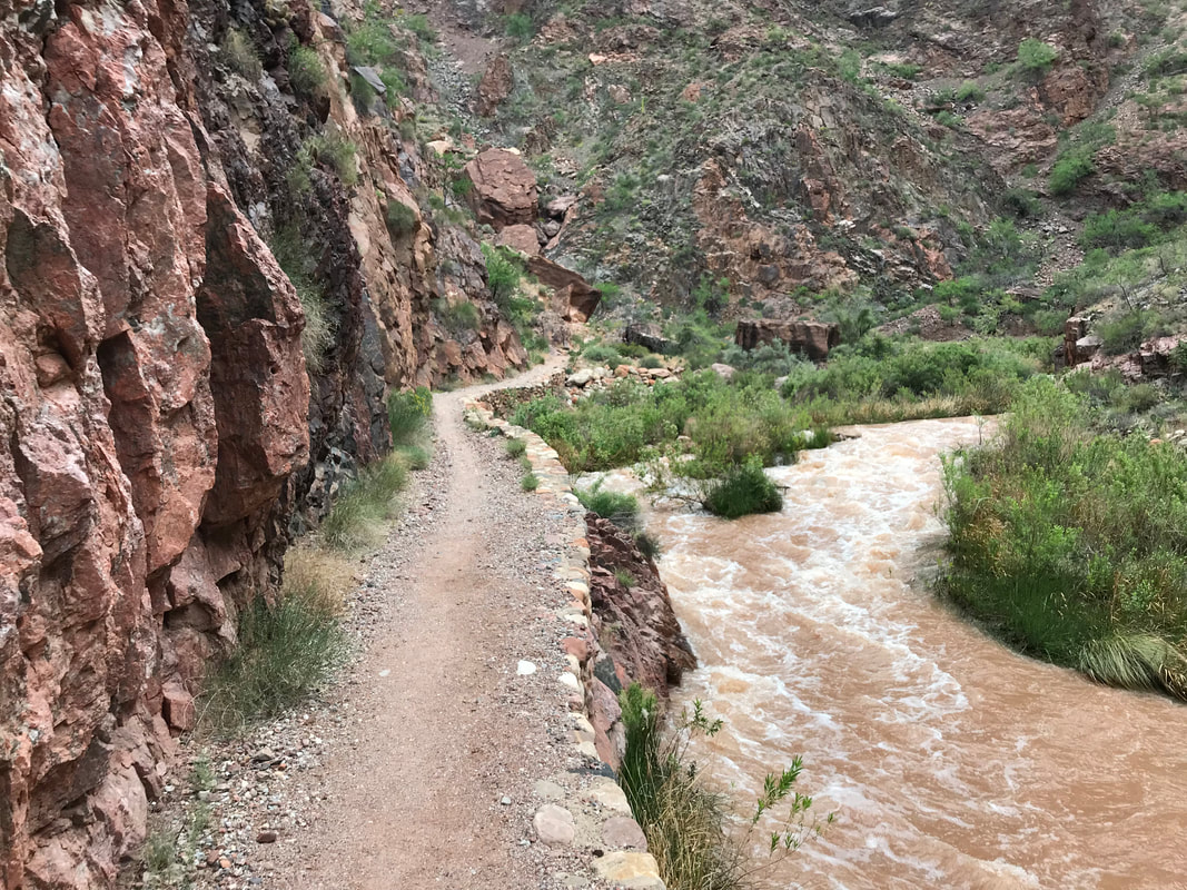
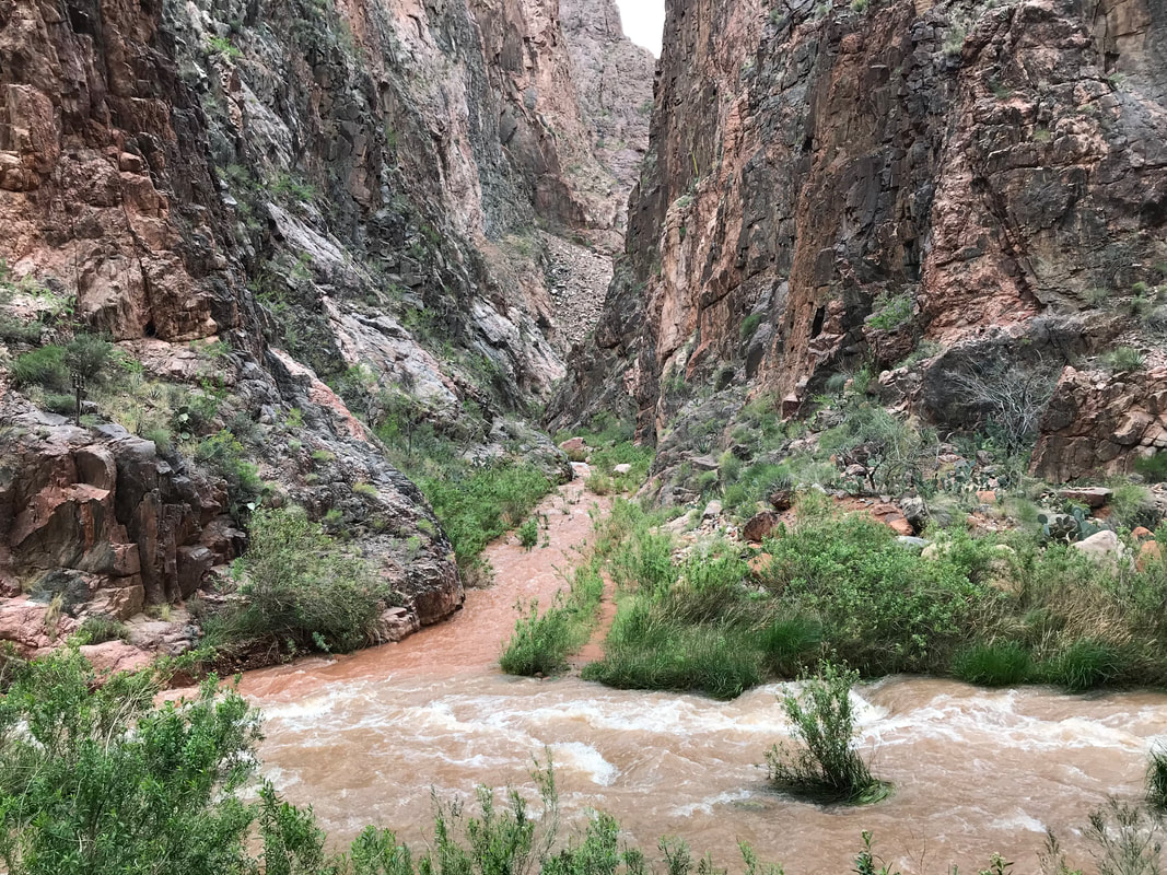
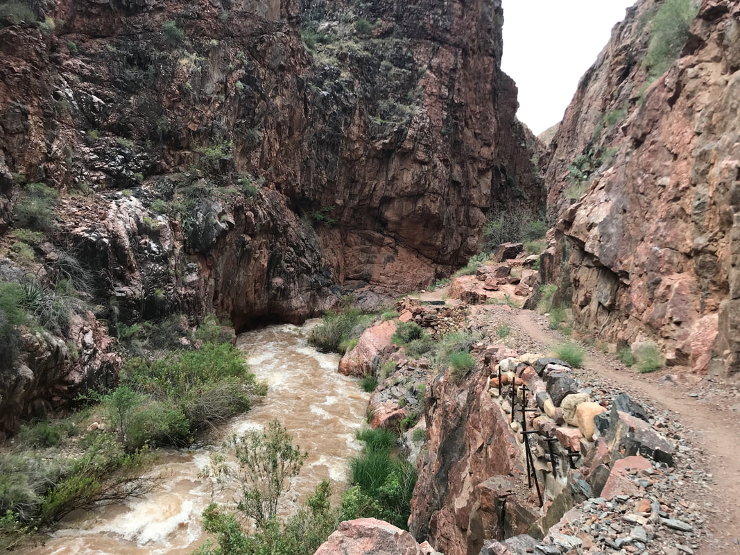
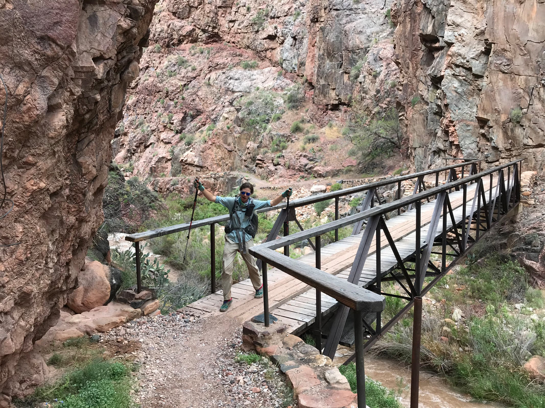
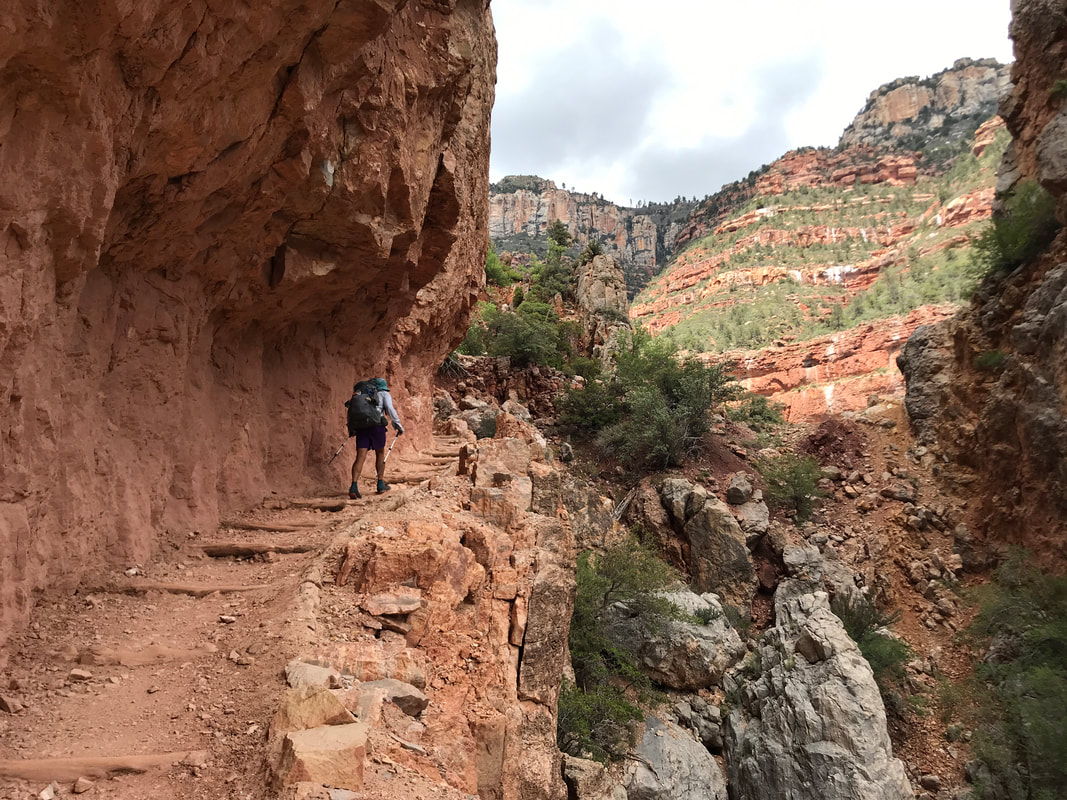
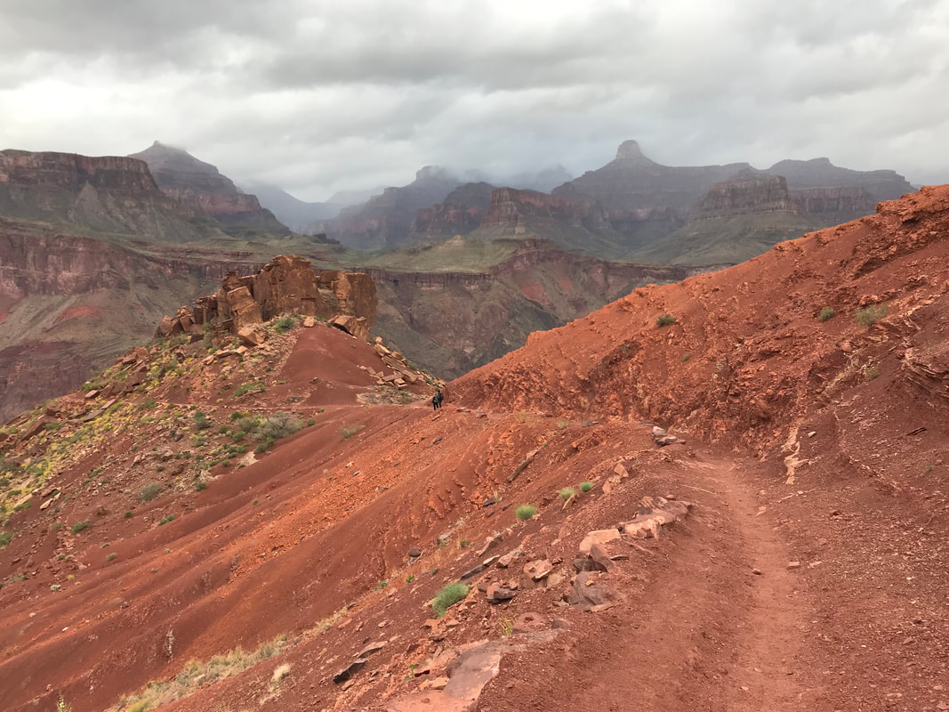
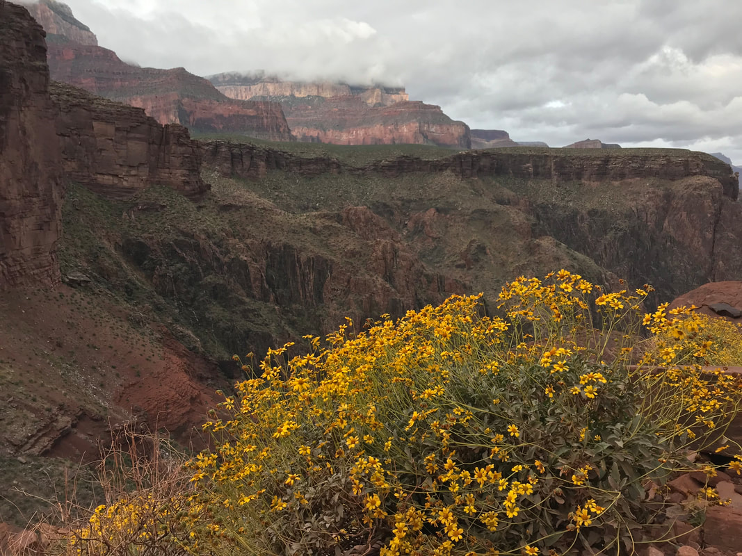
  At 8 pm, we finally reached the park border. A single ranger booth blockaded with plywood and sealed tight for the abandoned winter months stood stoically in the magenta glow of dying light. I noted on a sign that one could break in for emergencies in the winter, but would definitely face a federal charge. A massive locked gate stretched across the road. In the last vestiges of light, we climbed through gaps and stood on the park boundary. A massive winter scene and impending blizzard lay before us. The temperature was now firmly in the upper teens as the clouds unleashed by the absence of the sun billowed 20 - 30 mph constant wind across the open alpine snow. On either side of the road a 6-8 foot snowpack stretched for hundreds of meters to a distant treeline. The beautiful meadows of summer were now frozen lakes and streams. Literally. A veneer of ice indicated that most of what were looking at were snowbridges that could punch through to frigid water of unknown depths. There was no way we would walk across the ice to the treeline - it was a terrible risk. Janna pulled out her headlamp and found the batteries completely dead. The prospect of navigating these snow fields in the dark with a single headlamp while avoiding plunging into water and potential frostbite hit me hard. I started to panic and felt warm despite the temperatures. Janna kept coolheaded and reminded me we could keep walking. We had food, we had water, we had all our winter clothing on. If it meant doing over 40 miles, we would do it until we found a safe place. But still, that thought fucking SUCKED. The wind began to pelt us with snow as we walked quickly in twilight. The winter storm began to snow heavily on us. The temperature was now in the lower teens. Another mile or so and Janna saw that the treeline seemed to grow closer to the road. We could just make it out with my headlamp in the dim and flurries. I carefully ascended the adjacent snowpack and began to carefully navigate across the snowy meadows. I used by trekking poles to prod the space ahead of every step I took for weakness indicating I could posthole or plunge into water lying below. After 10 minutes, we made it to a thick pine and aspen grove. We began walking up and down uneven mounds of packed snow in the trees, searching, searching, searching for a spot to camp. Then, there! Behind a thick stand of aspen densely packed together was a completely flat and snowless spot in a size manageable for the Triplex. The constant barrage of wind had piled snow on the windward side of the trees leaving the lee essentially barren. It was perfect. I cannot express how FREAKING HAPPY we both were to have found this spot. Quickly, but with attention to detail, I began setting up the Triplex in storm mode, using every tie-out, grommet, and guy-line to secure it to the earth and prepare it for a snowstorm of unknown length now hitting us. It was fucking COLD. My hands were freezing. The shelter now standing, we climbed inside and blew up our Neoairs that were already frosted over from what little condensation had been in our breath. I put on every article of clothing I had, shells and rain-gear included, and placed my pack under my pad for additional warmth. The shelter sealed up tight, massive gusts of wind began wracking the shelter, bringing bursts of cold and spindrift inside. Out loud, I said, “Did you check for widowmakers or dead branches near us?” Almost immediately, a gust hit us followed by a tree groan and the smashing sound of splintered wood as a branch landed on top of us. We were fine but it scared the shit out us both. Quickly, I went back outside into the snowstorm and wind, my headlamp on high beam to examine every tree nearby. The trees were solid and that seemed to be the only branch over us that was dead. I scampered back inside and bundled up again. The storm would whip us back and forth for several hours throughout the night before dying out in the early morning in a total silence. We had hiked 36 miles and nearly 8,000 feet of gain. None of that helped me to sleep as the bitter cold and adrenaline-pumping of the wind/storm made for a sleepless night. Hail, sleet, and snow pelted us in waves. I did sleep some, but found myself shivering and doing sit-ups several times that night to keep warm before a calm dawn broke with dark snow clouds looming over everything. 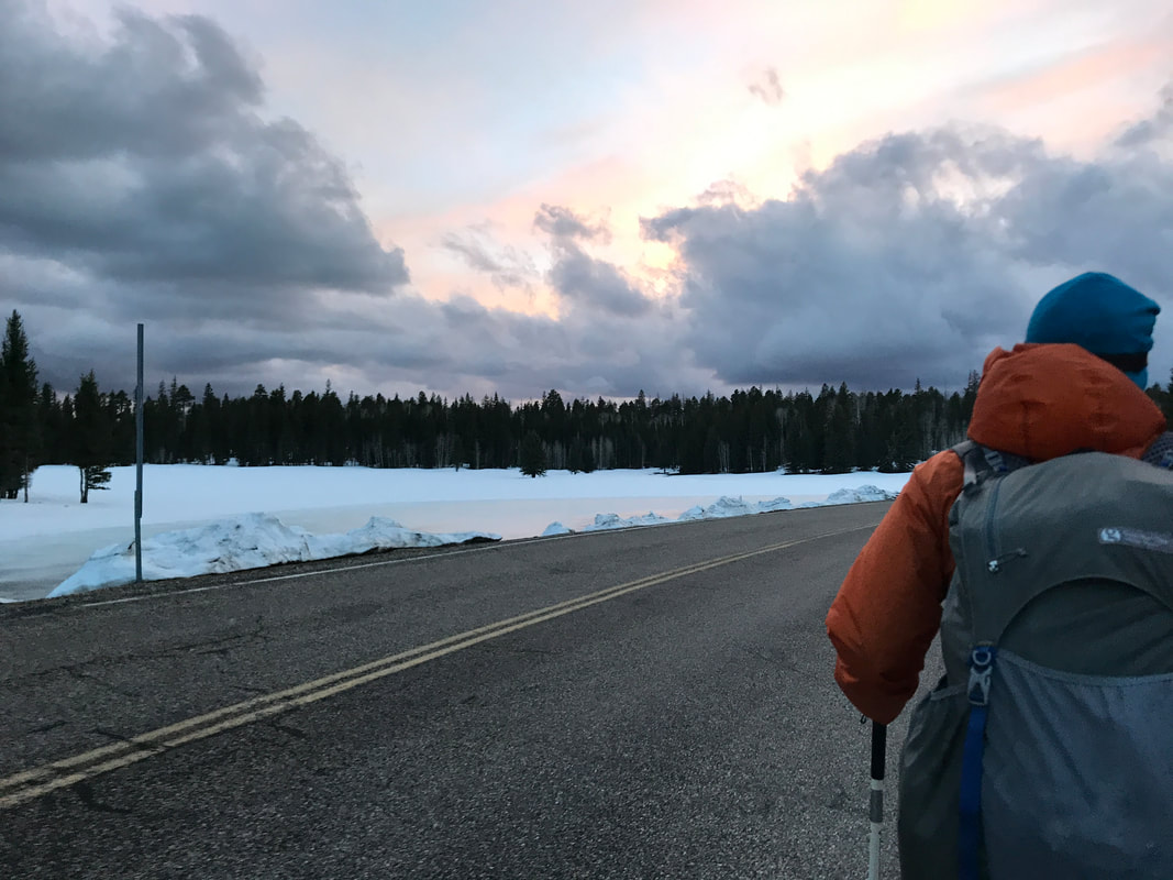 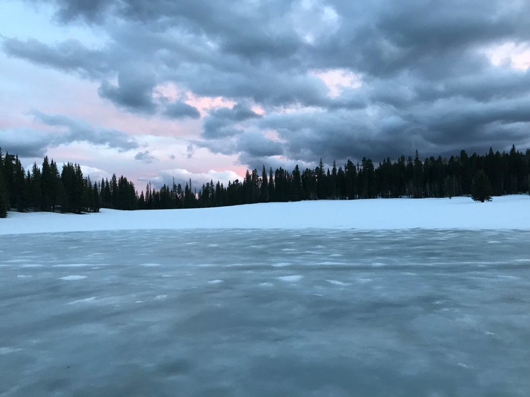 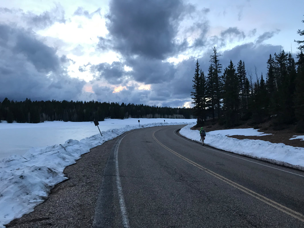 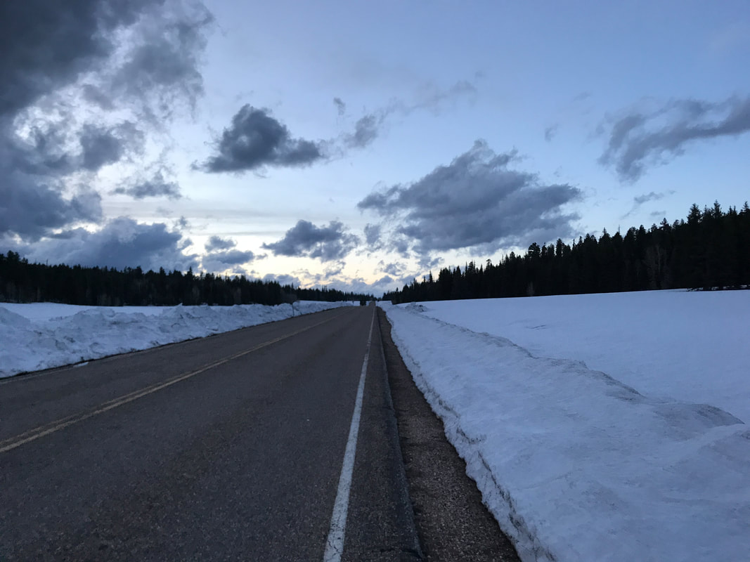 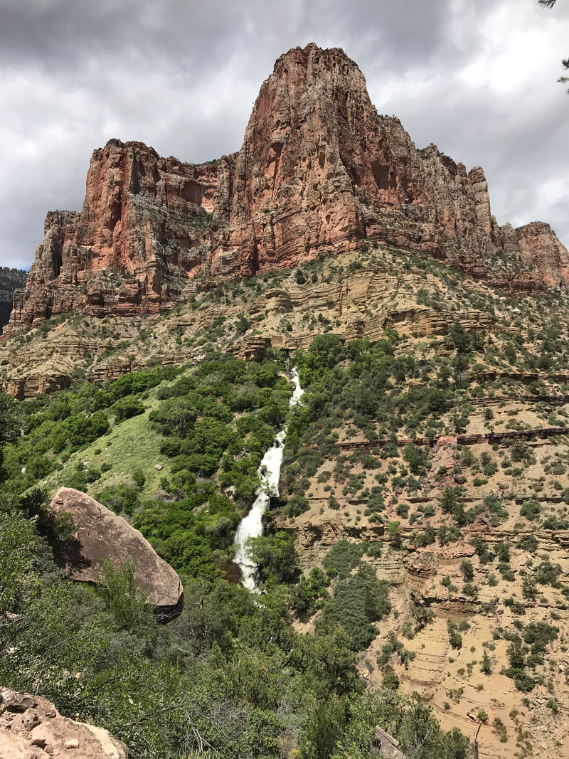 Part 2: Up the North Rim of the Grand Canyon The Grand Canyon can be a place of extremes. Cold and pine on the rims transition to hot desert within. After standing in front of the north/south rim junction sign at Phantom Ranch, we marched our way north on the skinny singletrack parallel to Bright Angel Creek. For all of our adventuring in the canyon, both below and above, we had never actually hiked the North Kaibab Trail. Thus, I was excited. Proud to hit our time interval, but nervous and excited. The trail immediately was boxed up by narrow canyon walls while turbid Bright Angel Creek raged next to us, fed by tributaries gushing from springs in canyon cracks fed by a deliciously solid snowpack on high. The cloud cover which brought rain and cold was finally beginning to dissipate to our south. Ceiling cracks of blue sky fed a rising temperature down below. It was then I realized how grateful I was for cloud cover while traversing the canyon on the cusp of May and foresummer. As we hiked, that old biological urge hit: pooping. In all my anxiousness in the 24 hours prior, I had not found myself relaxed enough to do a proper bowel movement. Now, miles into a long day and exercise coupling the massive meals I had consumed pushed my internal maintenance to scream STOP. But I couldn’t. You simply don’t poop in the heavily traveled corridor of the North and South Kaibab Trails. I held onto the urge like a boiling fire inside me, urging myself to get to Cottonwood Campground where privies could be found. But first, I had to hike 8 miles uphill while desperately needing to defecate. I consider this the second worst time I have ever had to poop in my entire life. I was in a full sweat between the heat and my needs. My eyes kept registering the shear beauty of the trail and blooming plant life around me. And then my need grew so bad I began to dry heave. But like a boss, I still did not go. Somehow, over 8 miles, I made it to Cottonwood Camp at 11:15 am. Whereby I flung open a bathroom stall and destroyed it. There is nothing more to say than backpacking allows such things to be spoken of. We took a 15 min. break at Cottonwood Campground which was entirely deserted save for us. We had seen nearly no one on the South Rim descent, a gift for early task. Now, no one was on the north side either probably due to the fact that the North Rim proper wasn’t yet open for the season and stood gated and chained on top. Any hikers heading this way were merely on day trips save for AZTers. Pushing on, then trail skirted cacti, amazing geological mounds, buttes, and house-sized boulders. We crossed several small bridges as the trail laced back and forth over Bring Angel Creek. It was extraordinarily beautiful. Another hour or so later found us at the Pumphouse - the last easy water before the push to the top. Feeling strong, awake, and good in temperature, we took a slightly longer break before filling 3 L each and eating some chocolate. We plunged on northward.
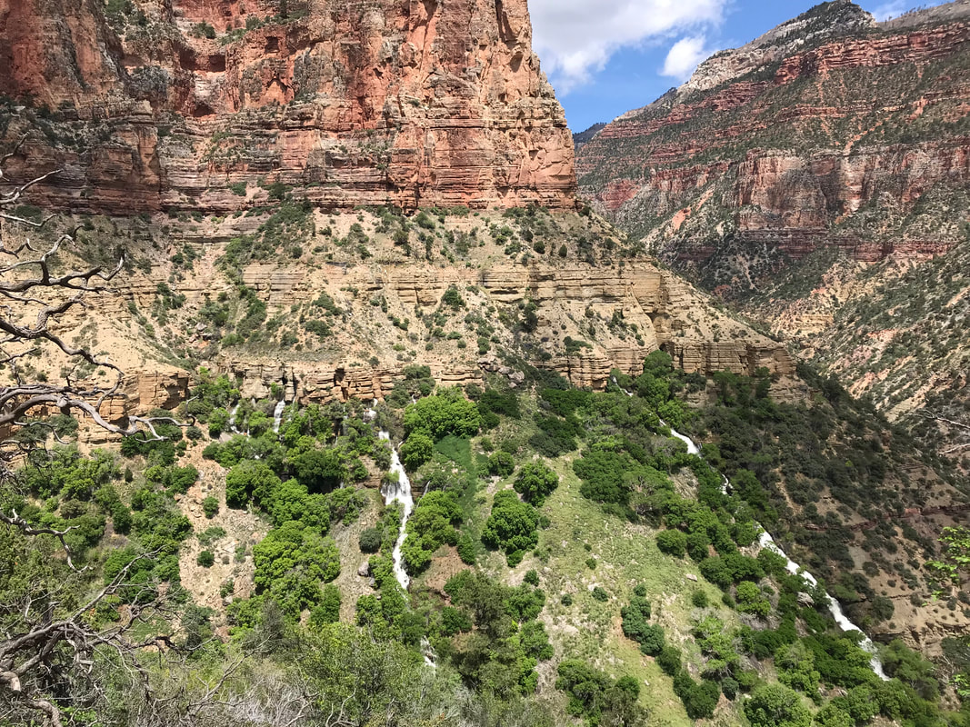
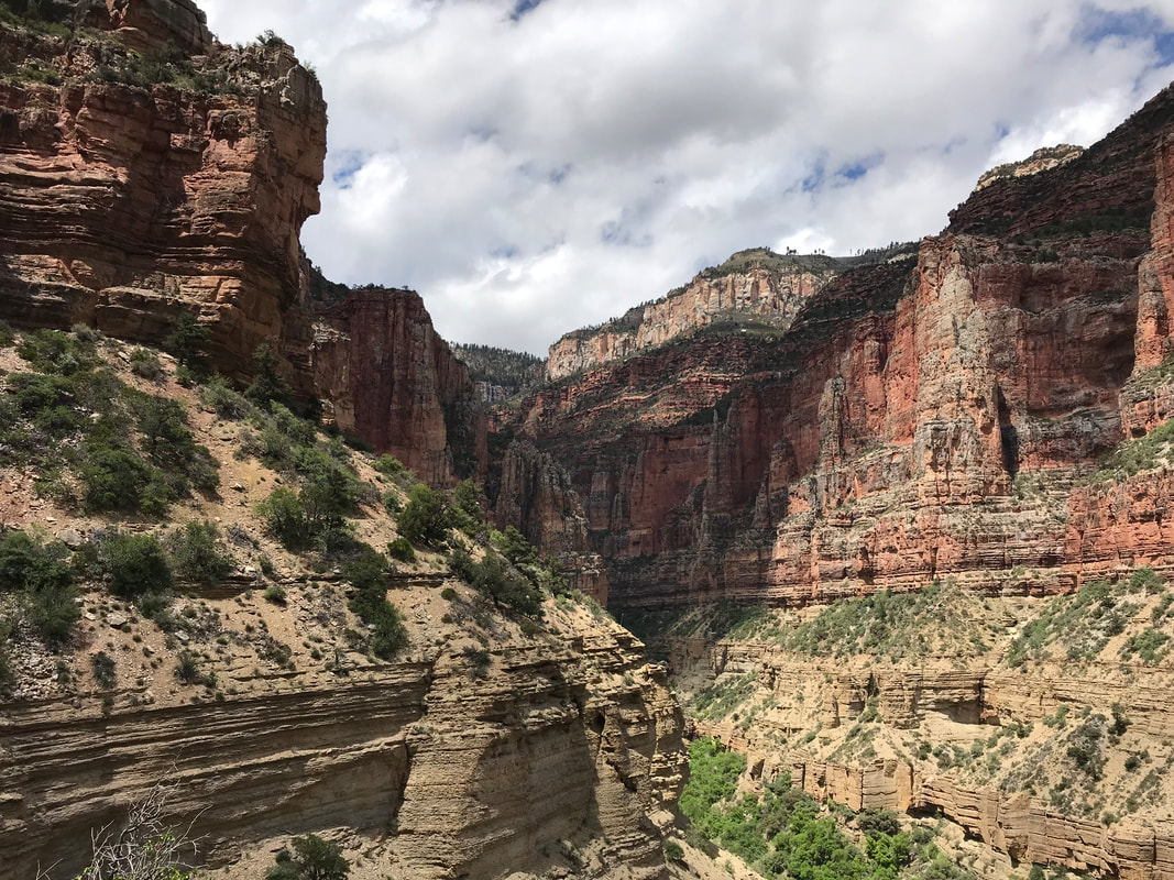
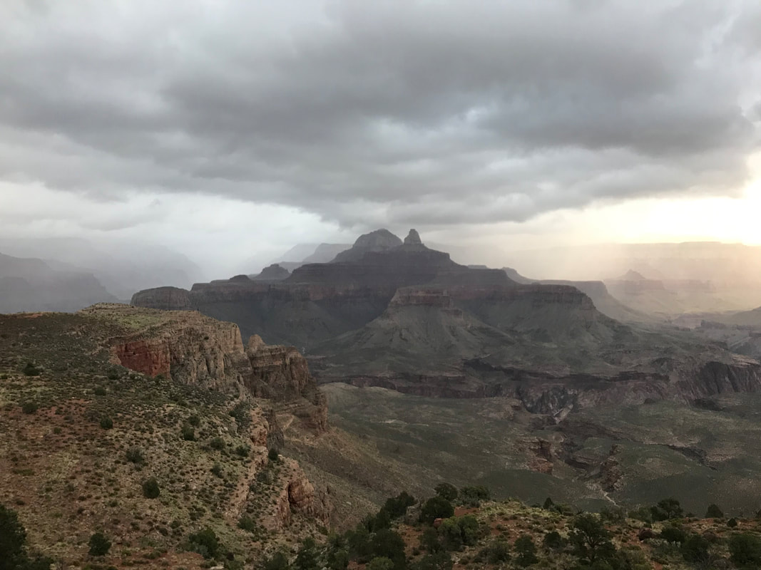
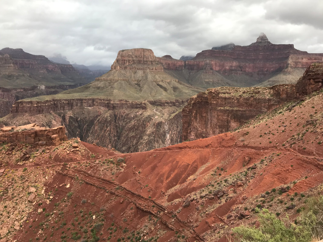
       The clouds continued to dissolve in the south so that the full desert Sun was on us. Ominously, the cloud cover stayed hushed and full on the North Rim, belying the conditions in wait. As the trail moved up the canyon, it began to ascend up switchbacks before making a sudden and defining left and moving up a massive butte. To our rights, a large butte across the way stood with a green tropical mass of plants on its flanks. From high up, a gnash in the solid rock gushed out Roaring Springs. I had no idea what Roaring Springs would look like and it was stunning. I felt like I was in South America as the spring water fell in multiple waterfall rivulets vertically down the face of the butte, threading through and feeding the lush vegetation below. Simply incredible. We stood to admire the scene. The power of this single spring fed not only Bright Angel Creek below but also the entire infrastructure of the South Rim as a water pipeline carried all that water across the Colorado and up from river to the park buildings above. The Grand Canyon always amazes me. We now picked up the pace, trying to get to the top by 3 pm. We sweated hard with the soaring sun, but it felt good to be warm and dry after so many days and nights of damp cold. The sweat began to drip off me and I rolled up sleeves and unbuttoned my shirt to encourage evaporative cooling. By 2 pm we had run into two small groups, both of which were out for day hikes having camped at Cottonwood Campground the night before. We also ran into Ohm Boy, one of the hikers we had spent a dinner and night with at East Cedar Tank back out of Babbitt Ranch a few days prior. He had already gone up to the top, was heading back across to meet a friend, and then would turn around to head all the way back across with them. Truly a badass. Lone stands of pine began to grow trailside as we neared the top. The air became a little chilled as we were approaching the cloud cover brooding on top. 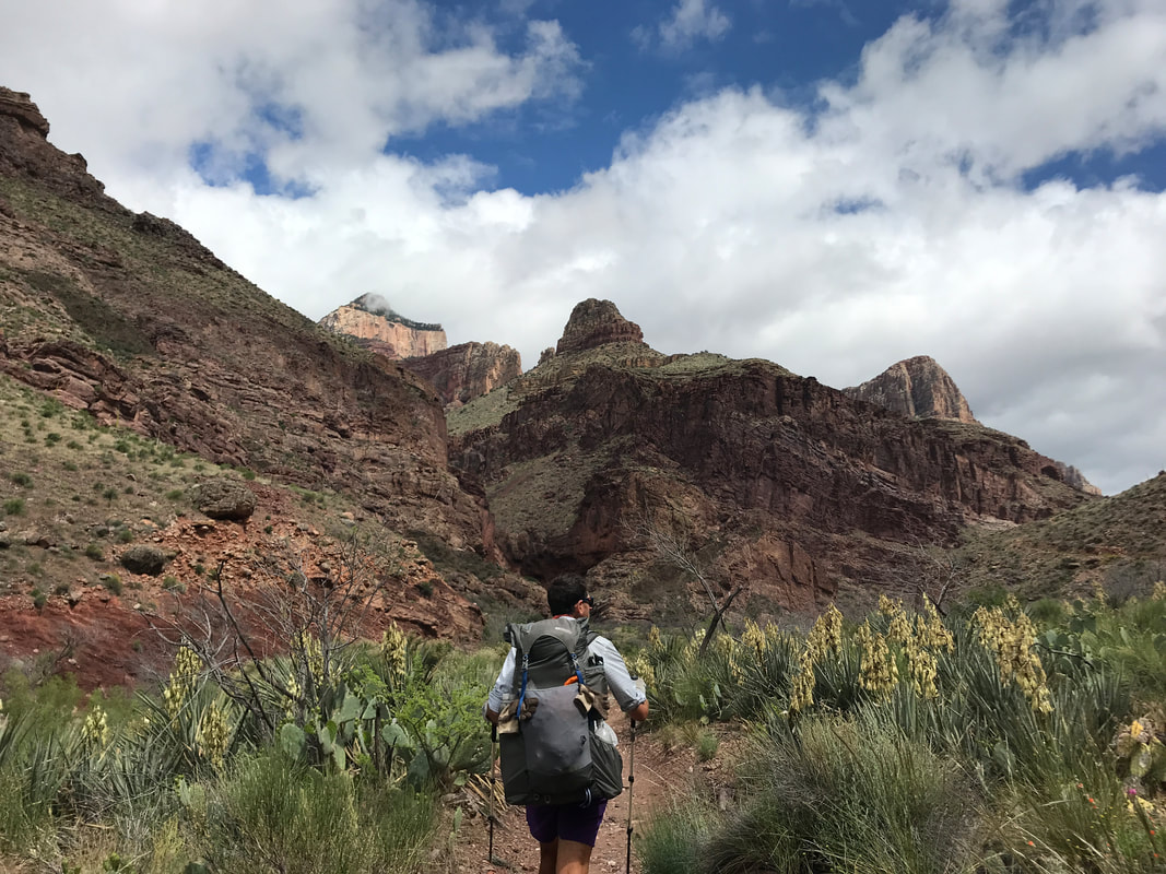
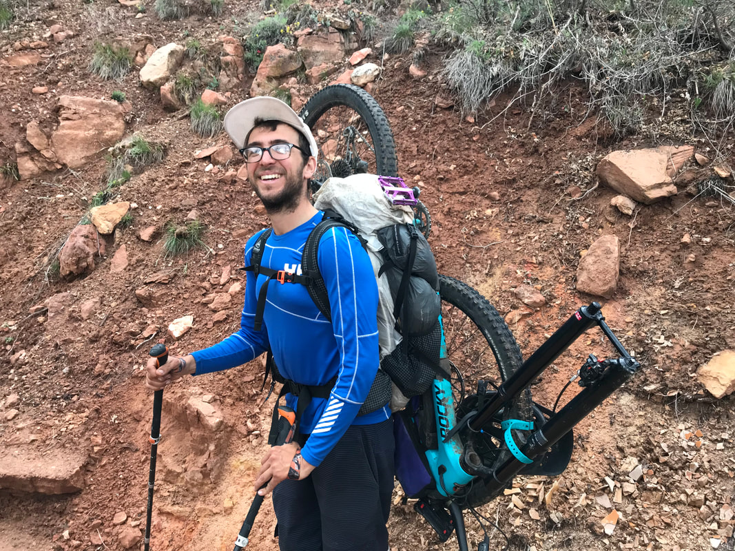
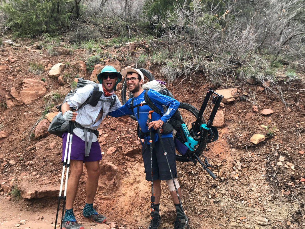
  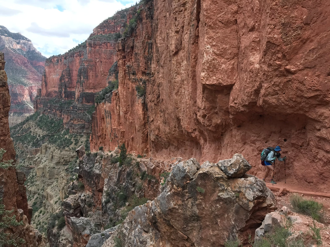 I could hear someone hiking ahead of us with great exertion. Rounding a corner Janna and I ran into an AZT 750 bikepacking racer. Definitely near the back of the racers, he was dedicated and finishing his competition. One of the challenging aspects of bikepacking the AZT is that Grand Canyon National Park does not allow any bikes on the trails. Therefore, all bikepackers have to dismantle their bikes, strap them to their bikes, hike down and across the Grand Canyon, reassemble the bike on the other side, and then ride to the finish. This dude was hurting pretty bad as the hike and weight of the mountain bike (plus gear!) on his back had stressed his knee. We gave him big credit and passed him as he slowly and methodically made his way towards the top. Nearing the top, our speed built as it was pass 3 pm and moving on. We were anxious to see if the faucet on the North Rim was turned on for easy water, If not, we were going to have to hike into the park to an old cabin that had a pump out back - these additional miles were NOT appealing to me at the moment. At 3:30 pm on the dot, we summited the Grand Canyon and looked back across the way, realizing we had covered those 26 some miles in nearly 12 hours with around 7,000 feet of gain since this morning. As our luck, a Park Service employee who had just arrived on the North Rim was literally turning on the faucet for the season. We were the first hikers to catch a drink from it for 2019, so we absolutely made sure to purify it from the winter sit. The ultrarunners we had chased down the Canyon this morning were sitting nearby and they congratulated on us for our speed as we had summited only shortly after they had and they were running with tiny packs. We all sat and drank loads of water while consuming tons of calories. They left shortly before we did as they didn’t planned to be finished into nearly midnight tonight. The cloud cover overhead, that brooding parent, began to settle down closer to the tree tops. The climate here at 8000 feet, nearly 1000 feet above the South Rim elevation, had maintained a storm status that had vacated the South Rim. Now, 3:45 pm, we had allowed ourselves a 15 min break. We had taken 4 breaks, totaling 10-15 min. each in sum today. We were tired but still needed to hike the 10 additional miles to get to the park boundary where we could legally disperse camp. As the North Rim had not yet officially been unlocked for the season, we were told we could not camp in the campground. Now, the last push to the end. To be continued in Part 3… 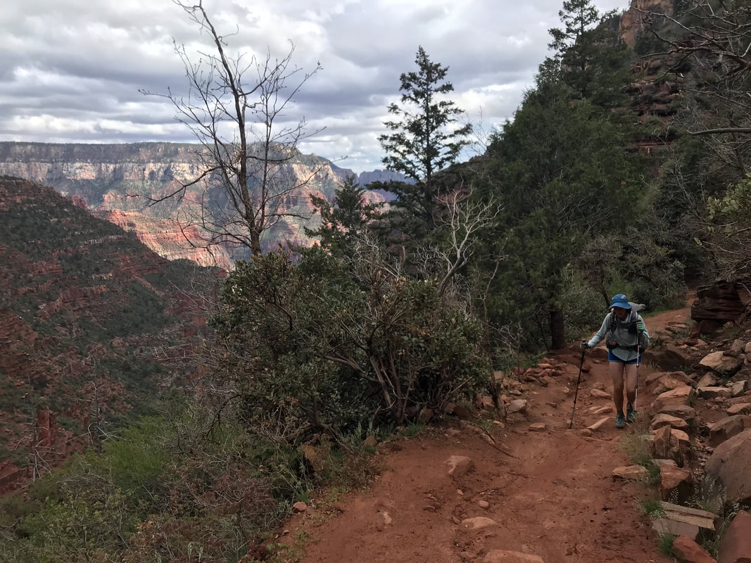
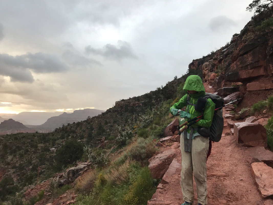
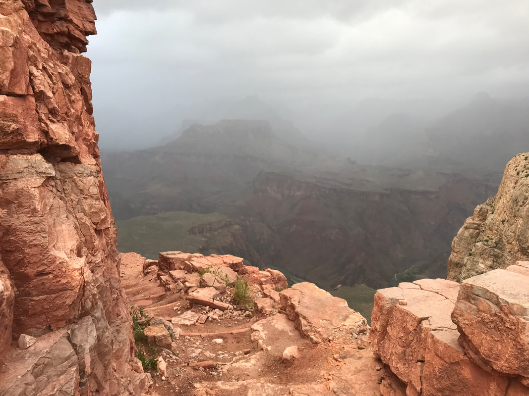
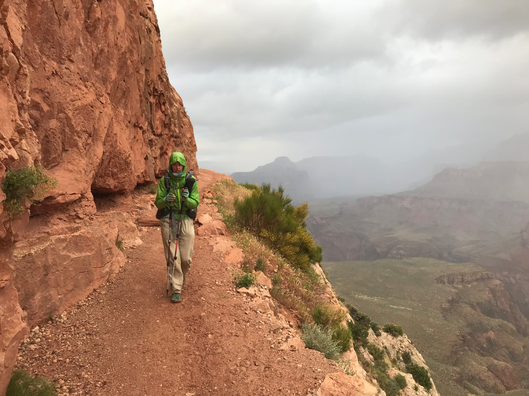
 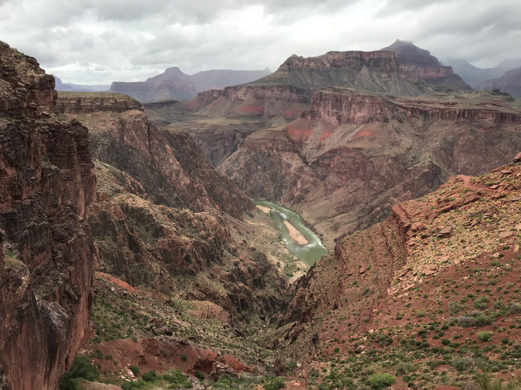 A day where life stretches and feels like more than one. Although this was all a single day, the events are stretched over three posts, easily three chapters of experiences somehow all placed in a single rise to set. Part 1: Into the Grand Canyon from the South Rim The night was fierce with thought. I struggled to find a place for my thoughts amidst the growing concern for how we were going to accomplish tomorrow. Night noises of campers and dogs spiked my blood pressure. I was aware of how little I was sleeping before the monstrous push to come. The storm curled up over the South Rim and pecked the shelter with rain that raced into sleet and hail. Thunder clapped overhead. Night became as restless as me. The temperature plummeted below freezing. At 2:30 am I stared up into the rustling shelter cloth. At 2:50 am I turned to my right. My open eyes met Janna’s own. “Let’s go,” was all I said. We both sat up. Donning puffies as breath condensed into frost, we packed hurriedly and quietly in the belly of dark as commitment boiled in my heart. We exited the Triplex now thoroughly coated with ice and a film of wetness. I dismantled what I could and forced my numb fingers to push it into my pack. We pulled food out of the canister and ate not of hunger but of preparation for what we were going to ask of our bodies. Frosted mini-wheats and peanut butter. A handful of trail mix for taste diversity. Both standing in still air as a lull in the storm bore no precipitation. Shivering and avoiding shining light on the shelters of others wrapped in down waiting for a warm and dry dawn to camp below the rim. “Let’s go,” was all I said. And we soldiered into the night. What little grace in the storm elapsed into a slow flurry of snow that evidenced the cold. We walked down the empty paved campground road that intersected with the bikeway, which we took north. The wind curdled ice against our cheeks as the snow picked up. The AZT veered off the paved bikeway onto a rocky jeep road I didn’t know existed in the park. We passed silently between shadows of junipers and pines. It just snowed. A few miles later, the AZT crept out onto the South Rim path and we caught our first view of the deep dark behemoth of sleeping canyon below. Sulfur lights sucked color from adjacent parking lots and the depth of the North Rim was lost in the mixture of black and cloud. We walked until the illuminated “Kaibab Trail” appeared. I took one photo using the available light to capture the 3 am cold. Janna and I both used the restrooms one last time, deposited the few ounces of trash we didn’t want to add to our loads, and filled up 2 L of water. We replaced puffies with fleece as sweat was sure to come. At some point, a car quickly pulled up and dropped off a number of individuals equally gasping in the dark and preparing for what I imagined was a day as long as ours. They descended. I visit the Grand Canyon several times a year, a joy I don’t overlook by living in Arizona. This brought some relief and a sense that I had done this many times previous. But this was still unique. It was the AZT. Before I set foot in the Grand Canyon, I made mental goals of reaching the bottom in 2-2.5 hours. Invisible, arbitrary hourly goals were laced in my head for me to compete against to ensure we found ourselves again this evening to come safely in our tent. And we slipped below the rim, descending in the full dark. The straight-edged cliff walls next to us bounced back our headlamp beams as the snow sputtered. We were hyper-aware of our footing. No need to twist an ankle in the dark or saunter with the wind off an edge. Back and forth, the constant pattern of switchbacks. It was INSANE how windy it was. Like the storm was rolling below and coming up from the Earth. Dawn swept gingerly into the color of the sky. An hour in and the fullness of the world around us was revealed as red rock and gray sky. To be honest, it was spectacular. I’ve seen the Grand Canyon many times in all the sun and blue skies and even storms from above. But from below with the earth shrouded in the cloth of mist while dawn pierced a hole? It made for memorable views of depth, color, hue, texture, and adrenaline. Turn a corner and be blasted by wind and rain. Turn another corner and be still with warm sun orange and rose in the fog. Low slung blankets sweeping the rim roof above. Vermilion rock cleaned by rain and stark to the shadows. Truly, truly incredible.
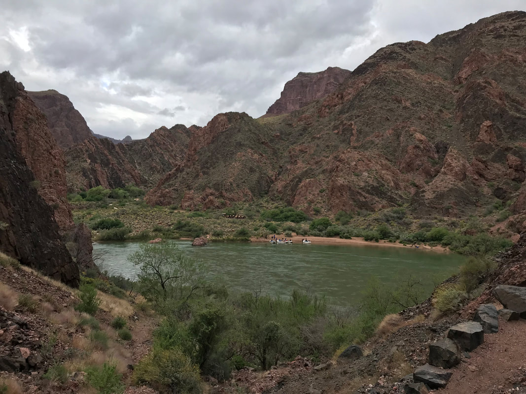
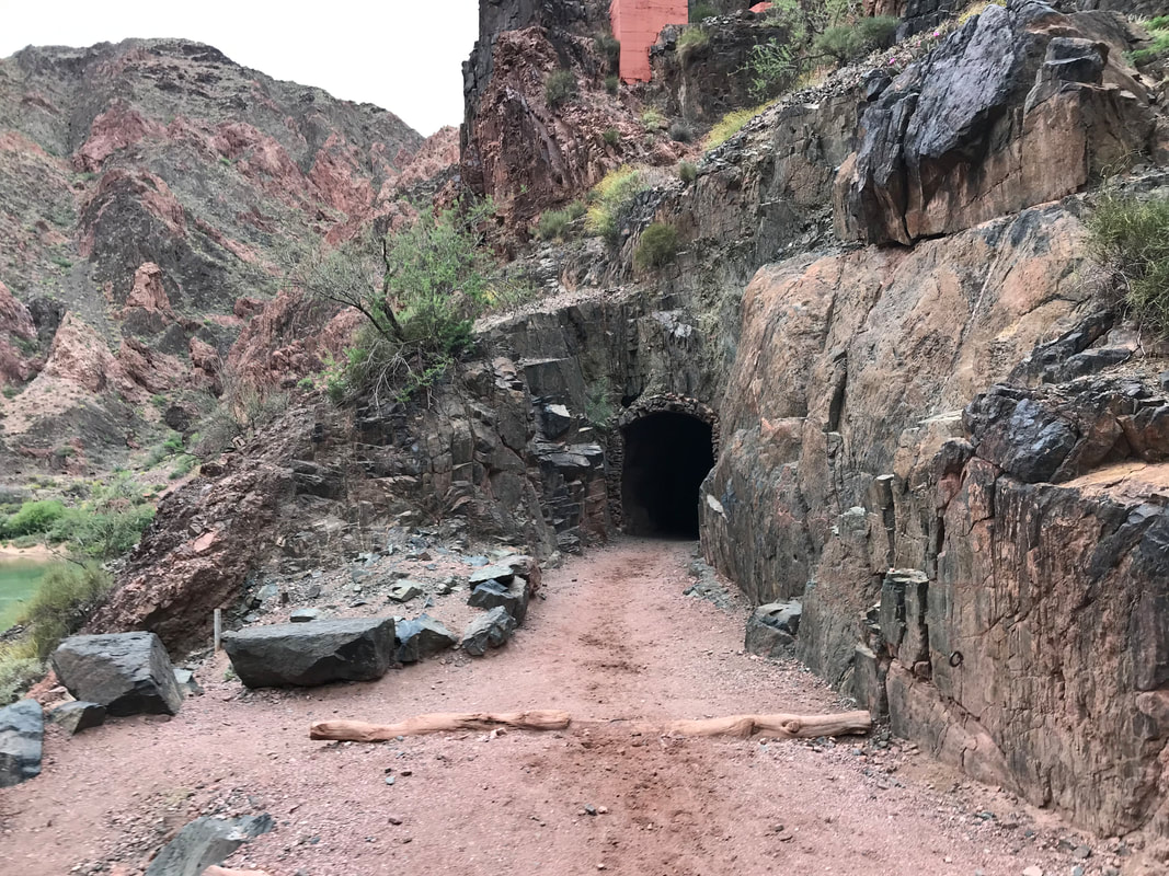
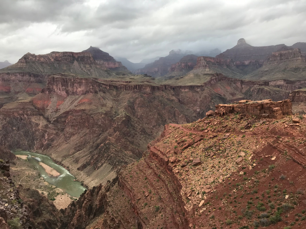
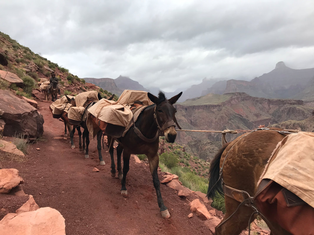
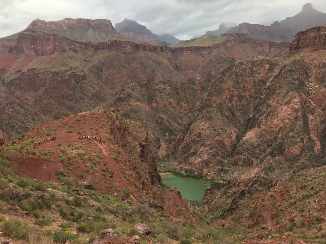
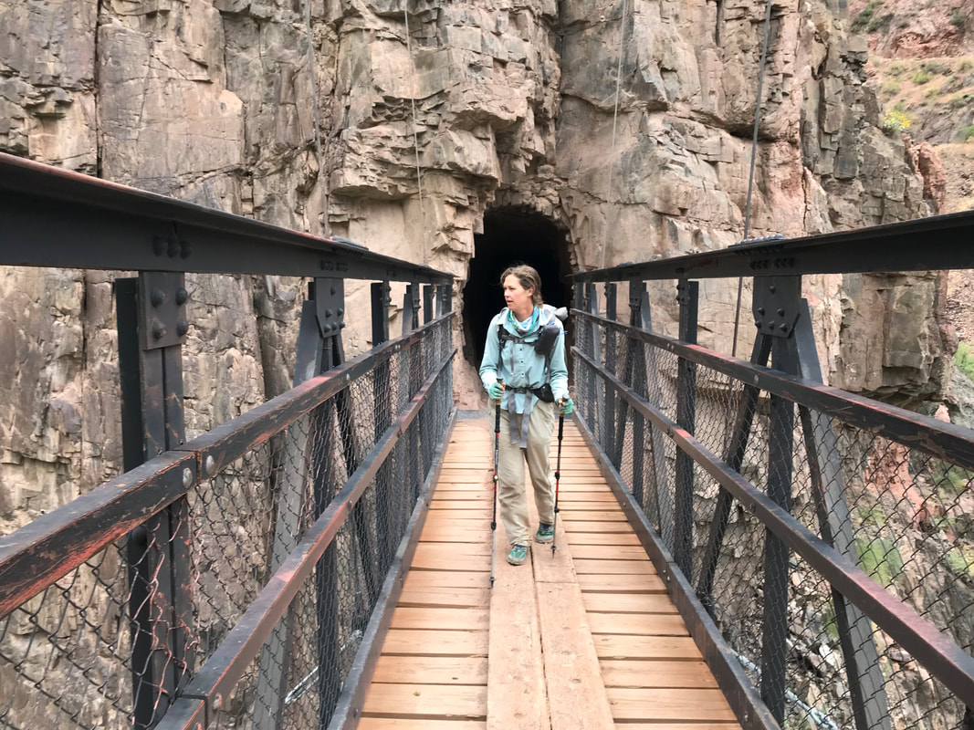
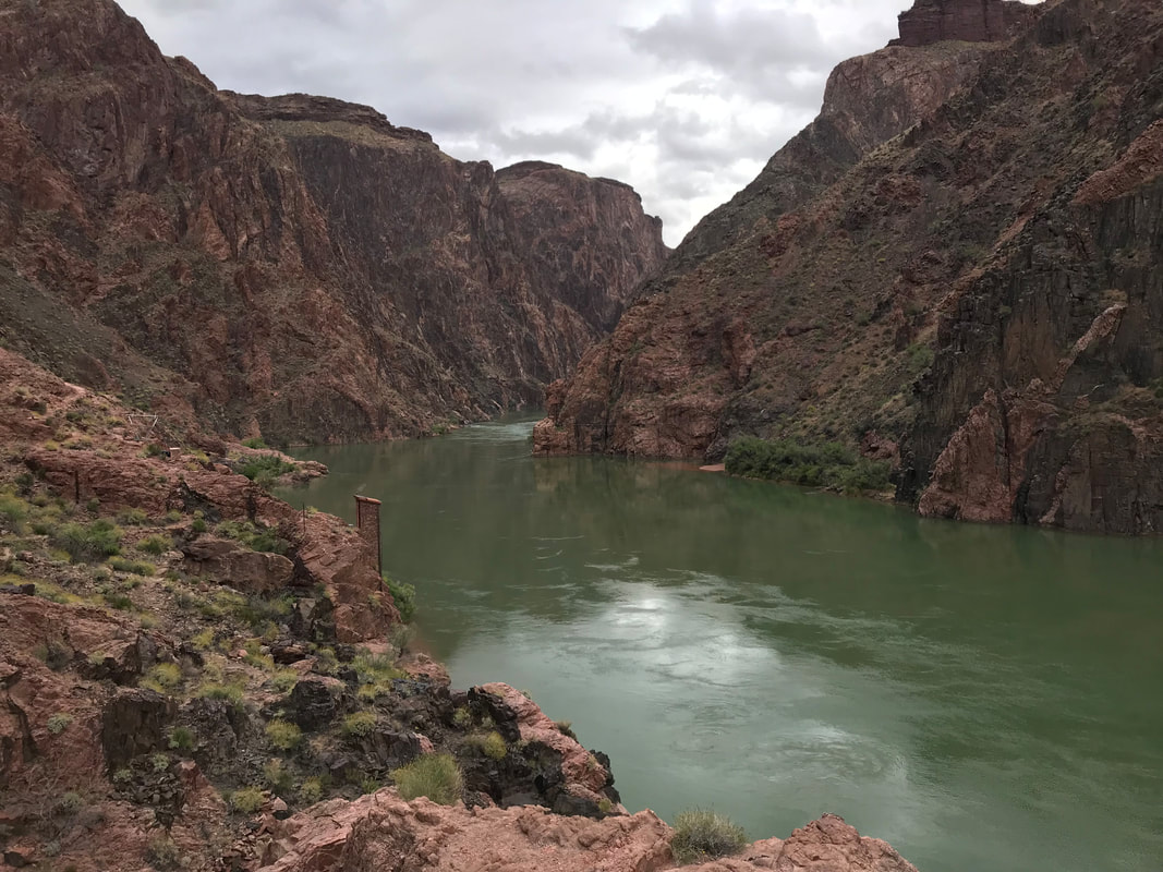
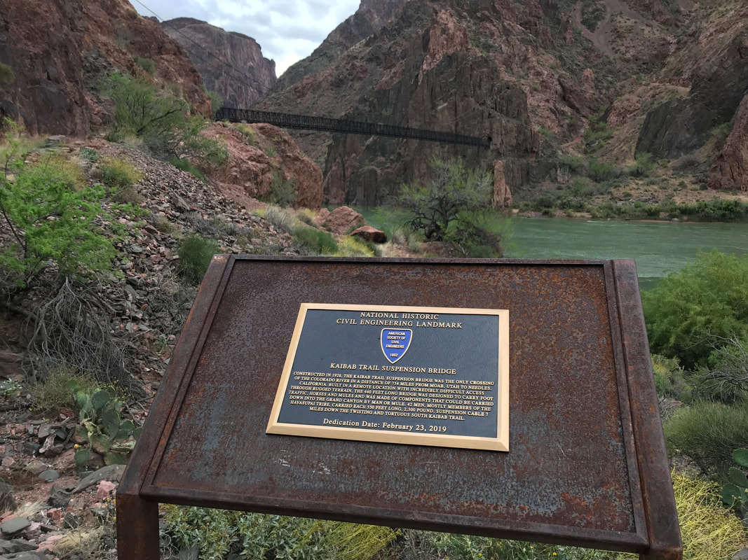
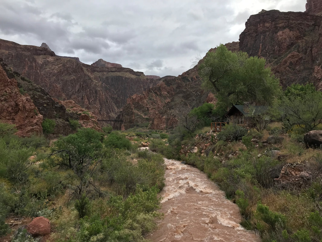
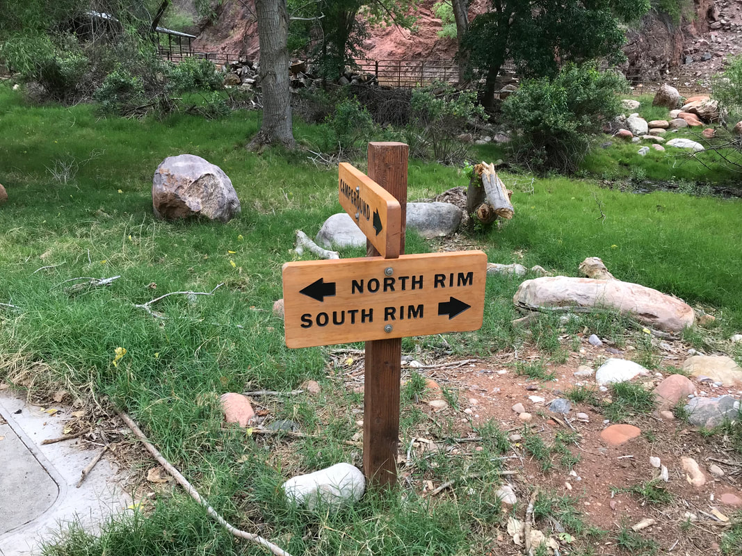
 An hour in and we had made the first round of bathrooms, packed jackets away, and the rain had lessened as the climate of the inner canyon claimed its place. Greater warmth and a dryness denying the storms on alpine cliffs on the south. To the north though…another story. Our path lay in the path of a mighty snowy and rainy storm letting loose on the higher North Rim. Views continued to be epic. Rain falling below and ending just as dramatically. Every space held breath. We caught up near the individuals who started the morning right before us. They were a group of ultrarunners doing a rim-to-rim-to-rim in a day. A surge of joy hit me to think we were keeping pace with them with full backpacking loads. Behind us, the daily train of mules and park rangers came up on us. We stepped to the side as the linked mules took priority and descended in front, carrying loads of supplies down to Phantom Ranch and Bright Angel Campground in the heart of the Canyon. Nearing hour 2, we caught our first views of the absolutely legendary Colorado River below. Although not its natural silt brown, the vivid blue-green still brought a sense of reverence that always occurs when I approach the arterial vein of the Southwest. Two and a half hours in found Janna and I passing through the tunnel where the South Kaibab Trail passes through the rock earth to exit at a suspension bridge providing one of the few crossings of the Colorado. The turquoise water ran powerful, swift, and beautiful below as we made bottom, passed by several ancient Native American structures, and wove our way to the Bright Angel Creek. Here, we made a sharp right, paralleling the creek lined with verdant green cottonwoods while Bright Angel raged with snowmelt below. In track with the times I had set, we entered the campground at 8:15 am. There was time for a 10 minute rest, a quick use of restrooms where sleepy campers were waking at the bottom while we were already 1/3 of the way through our day. We filled up with 1 L each of water. Although it had been cold on top, the canyon bottom was warm. The clouds were abating the heady heat for the moment and we took that climatic advantage to carry a little less water weight on our initial ascent. We stood in front of the Phantom Ranch cabins, and took a single picture of the South and North Kaibab Trail interaction before we faced north to begin our climb. To be continued in Part 2… 
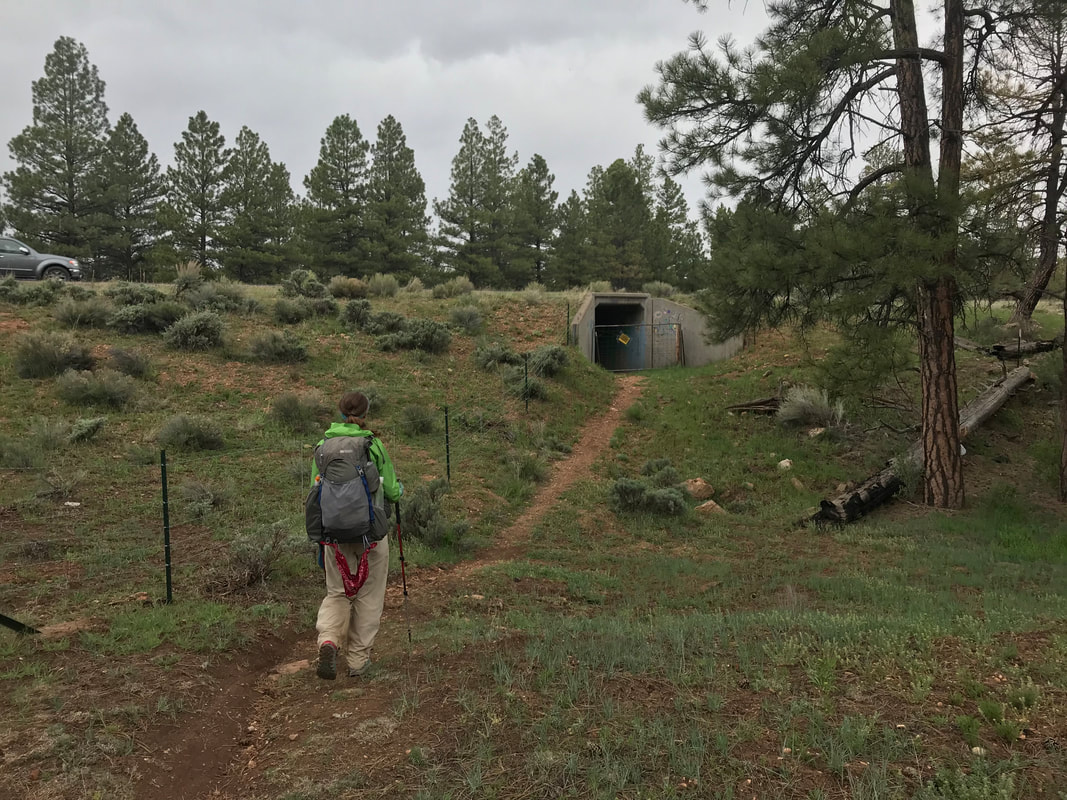
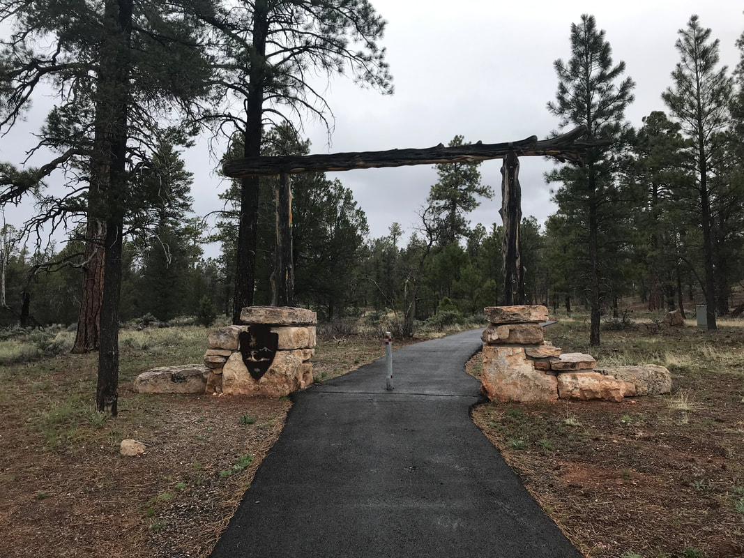
      AZT - Day 47 - Grand Canyon National Park - South Rim at Mather Campground (Trail Mile 688.4)4/29/2019 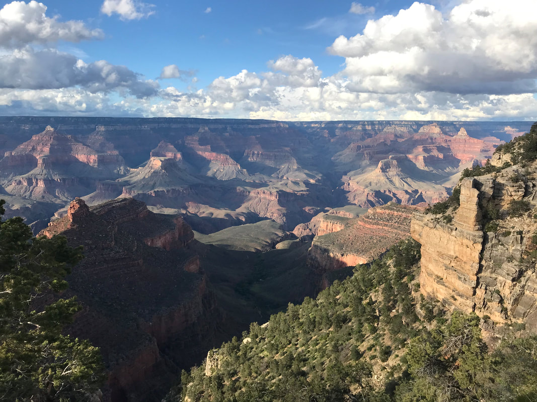 Today would mark the beginning of the most insane physical and mental 48 hours of the entire AZT. Waking up, I had no idea what would happen. ———————————————- Janna and I were up at dawn, ready to high-tail it to Tusayan in order to get some hot breakfast. It had rained pretty much all night so the earth outside the Triplex was soaking. We managed to pack up in a 15 minute span where no rain fell, immediately followed by a drizzle the moment packs were on. We jumped back on the dirt forest roads crisscrossing the southern Kaibab National Forest. Not 0.5 later and we began to sniff the distinct odor of woodsmoke. Suddenly, we the road we were walking on was flanked on both sides by charred and actively smoking trees from a controlled burn. Flames still shot up in places spooking us into how close we had unknowingly slept to this controlled fire last night. Thick blankets of clouds hung low drifting among the tops of the ponderosa pines making up the forest around us. The temperature hovered in the mid-40s as mist and rain fell on concurrently. We walked through the woods, soaked, cold, and eager for the promise of an all-you-can-eat breakfast buffet. At some point, I picked up reception and talked to Harrison, filling him in on our location as we crossed a field of sage. Several miles later the sound of distant cars heralded the town as the double-track opened up into a larger road. We walked slowly and carefully next to several large male elk laying next to the trail, all slowly chewing plants, watching us intensely but unwilling to budge when they had become so accustomed to gawking tourists. With that, a spread of barbed wire fence appeared in front of us leading into the back area of a large RV park. We carefully opened the barbed-wire fence and as I scooted through, a barb caught on the front mesh of my bag and completely disgorged the contents as a full rip seared across. My water filter and empty Platypus bottle fell out. I quickly placed them back in, grabbed some Tenacious Tape, and attempted to secure the ripped mesh closed again. That task accomplished, we walked quietly through the sleeping RV park, past the behinds of several large buildings, and spilled into the street of downtown Tusayan. Tusayan is a very small, but real gateway/tourist trap town just outside the boundaries of Grand Canyon National Park. Charter buses, throngs of cars, and a large number of people all made their way towards the park entrance just north of the traffic circles in town. Amid the hotels and gift shops lay a number of restaurants, including a Mexican one that fellow hikers has recommended as having the BEST all-you-can-eat breakfast buffet. Chilled from freezing cold and rain, we entered the restaurant and saw the most INCREDIBLE spread of food I could possibly imagine. We paid the very reasonable price and began stacking up multiple plates of pastries, toast, jams, sausages, bacon, pancakes, fruit, eggs, yogurt, and multiple cups of hot chocolate to warm the body and provide even more calories. To this day, I consider that one of the best breakfasts I have ever eaten in my life. Hunger truly is the best seasoning. We consumed plate after plate of steaming hot breakfast food, putting back the calories and macronutrients; my legs soaked up the energy and protein, urging even more consumption. I took a picture of myself per Harrison’s request right before I ate. The selfie is below to which Harrison described myself as a “Sad Aging Vampire.” After consuming several plates of food, Rand and his friend happened to walk in and we laughed and caught up with him. He assured us the easy opportunity of getting a permit in the Grand Canyon as AZT hikers. Several other thru-hikers we had talked to occasionally also entered, some indicating they were taking a Zero Day here to stay in a hotel before the push to the end. Janna and I played with the idea, but decided to keep our schedule of hiking into/sleeping in the Grand Canyon tonight, exiting onto the north rim tomorrow, and making 18-20 mile days to meet our ride with Darren on the following weekend. Filled with food, completely dry and warm, I felt a resistance to leave the welcoming restaurant and plunge back into the rain. But we had to get to the Backcountry Permit Office to see what we could grab. The rain had abated while we ate, but now it was more cold and raining steadily as we exited. We crossed back over the road, carefully returned to the AZT via the barbed-wire fence, passed several lounging elk, and found ourselves paralleling the highway of cars steadily heading into the park. The AZT passed through a culvert under the cars and joined a paved bike path on the other side. 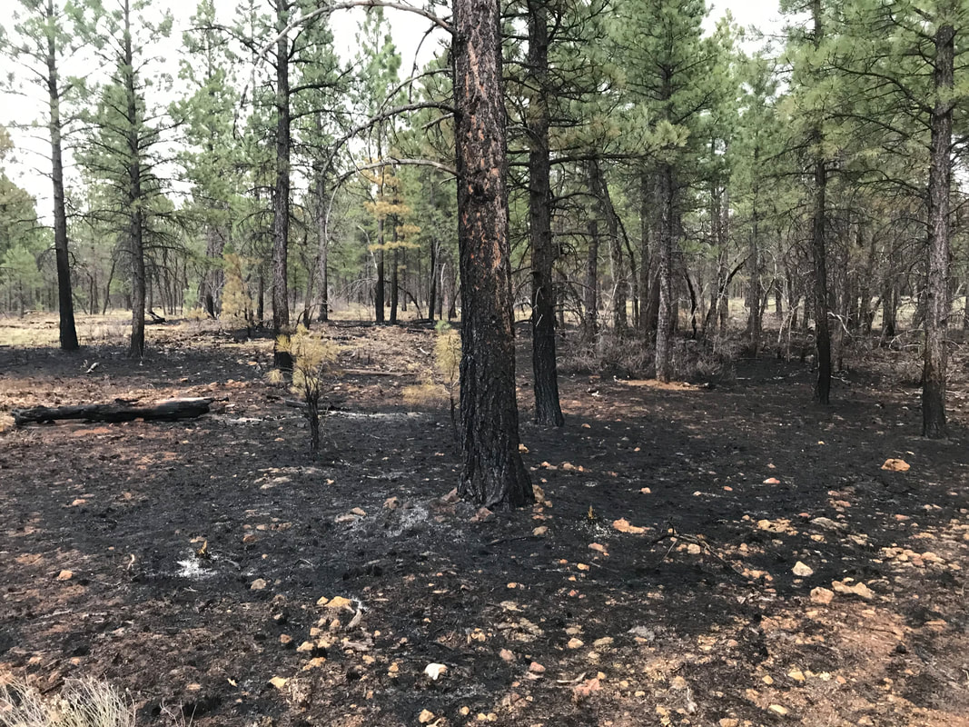 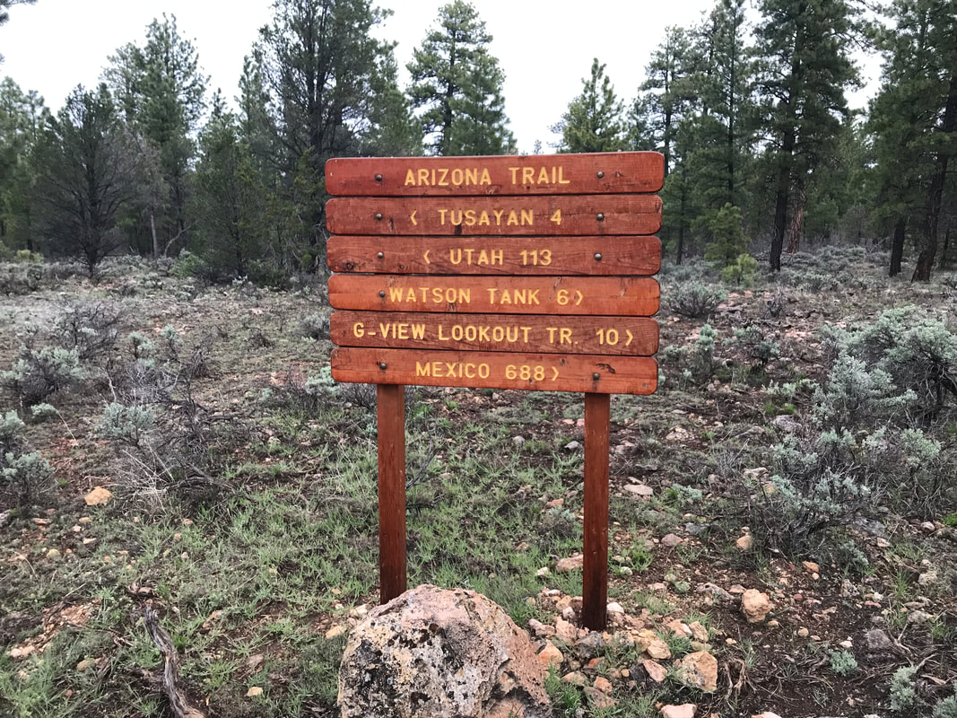   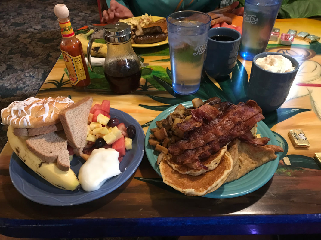 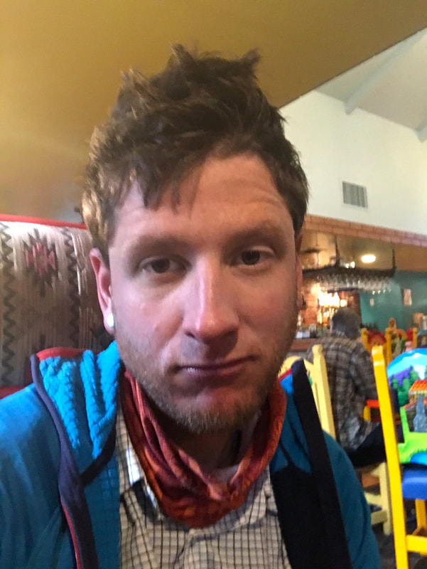 We felt relaxed, moving lazily along the paved path, feeling secure and dreaming of the first views of the Grand Canyon to come. Janna was walking ahead of me on the path when she suddenly stopped, turned and faced me, blood running down her face. Her nose began gushing a severe nosebleed - the worst I had ever seen in my life. Blood didn’t lightly trickle, it kept a stunning and worrisome flow. I had her sit down on a boulder adjoining the Tusayan Bikeway, her head cocked slightly with a hand applying pressure across the nasal ridge. Even then, it seemed to do little to abatement. After 10 minutes of holding, she released the pressure and a massive blood clot exited, smacked the ground, and a flush of new blood began anew. I retrieved gauze from the first aid kit which we used to plug her nose while she applied pressure again. I was getting a bit worried as we were now approaching 20 minutes into the nosebleed. Thankfully, the clot kept this time. When she removed the pressure, it held and we began cleaning up the blood that covered our feet and clothing. While we had been trying to control the nosebleed, I had kept a watch on the sky as a swath of grizzled clouds began to swirl and move quickly overhead. One cloud after another moved so fast overhead, that I knew a storm was boiling on top of us. As soon as the last blood was wiped, I whipped out my phone and accessed the weather app only to have the weather warning go audibly sound as a severe thunderstorm warning shaded our area. Within two minutes of the end of the nosebleed, loud thunder clapped from afar. We quickly pulled on rain layers and began to walk. The speed of clouds flying overhead made me very alarmed and want to walk faster. We were so close to the Grand Canyon, yet it felt like obstacles were being thrown left and right at us. With that, a volley of lightning strikes and reverberating thunder began to strike around us turning the drizzle into a torrential downpour as temperatures plummeted. The nearness of lightning strikes was so bad that we ditched our packs, separated from one another, and found uniform groups of trees to stand near. The thunder roared, the freezing rain completely soaked us, and adrenaline pumped for the worst storm we had been through yet. After 10 minutes of razor intensity, the storm that rolled in quickly now ran out just as fast. The torrential rain sizzled into drizzle. The thunderclaps and strikes gained distance from us. Cold and wet, we gathered our items and now made time to the Grand Canyon. We were hoping to get to the Backcountry Permit Office earlier than later, but now it was becoming early afternoon. The bikeway passed through an old stone and metal arch signifying the boundary line for Grand Canyon National Park. This simple archway was actually the original entrance into the park, now replaced by the car-friendly one. A few miles later, and we came into the outskirts of Grand Canyon Village. Given the time, we decided to forgo grabbing a spot at the hiker/biker sites and immediately head for the permit office. We jumped on a park bus and recognized some fellow thru-hikers. One turned out to be a girl we had lounged with on the Gila River way back in central Arizona. We caught up and it turned out she worked for a summer at Denali and knew a common friend. She was actually skipping the Canyon and returning to Phoenix as she her trip’s time was up, and she needed to return to work. As we jumped off the bus at the Backcountry Permit Office, Bilbo jumped on, literally at the same time. We laughed, hugged him, and told him we hoped to see him later in the day. We walked the half-mile or so over to the office and entered the warm climate-controlled room. Two lines of hikers deep with AZTers stood in front of us. I was rather shocked. It turns out that the storm and rain we had been stuck in for the past two days had led to an inversion at the Grand Canyon. This meant the cloud layers had stayed below the rim walls, filling it like a fog sea. In an effort to prevent accidental death from walking off a ledge, the park service had prevented hikers from heading down. This, combined with the desire for AZTers not to hike down in the proceeding days’ storms, meant a large bottleneck of AZTers had built up. Now, everyone was making a go of it, looking to head down into the Canyon tomorrow. Inside we saw Frisbee and Stubs again! We hadn’t seen them since Oracle and were surprised we had caught them as they had been covering 20 - 30 miles a day for weeks. It turns out Stubs had gotten sick and they had taken two weeks off in Flagstaff to recover. It was great to see them. However, the line of AZT 750 bikepacking racers and AZT thru-hikers suggested permits were going to be tight. Instantly, I had a feeling of unease about our ability to acquire one. What happened next is something I didn’t see coming. I’ll avoid detail here as there is little constructivism that will come from posting it. There were some unpleasant interactions with another individual that lacked respect and left me feeling belittled. The consequences of this interaction were hotly digested and dissected between the two of us over the next few days. Regardless, I’ll fast-forward and say that by the time we walked out of the Backcountry Permit Office an hour later, we and the other AZTers behind us found ourselves permit-less and facing a gauntlet day tomorrow that would require a cumulative 36 mile descent and ascent into and out of the Grand Canyon in a day followed by a 10 mile hike outside park boundaries to disperse camp. This stressed me out big fucking time. No camping permit achieved, we now found ourselves in hardcore adrenaline-planning-mode. Our original plan of taking the afternoon off to relax, sleep in, and do a leisurely hike down was replaced by a need to cover 36 miles beginning in the middle of the night. My mind became a checklist:
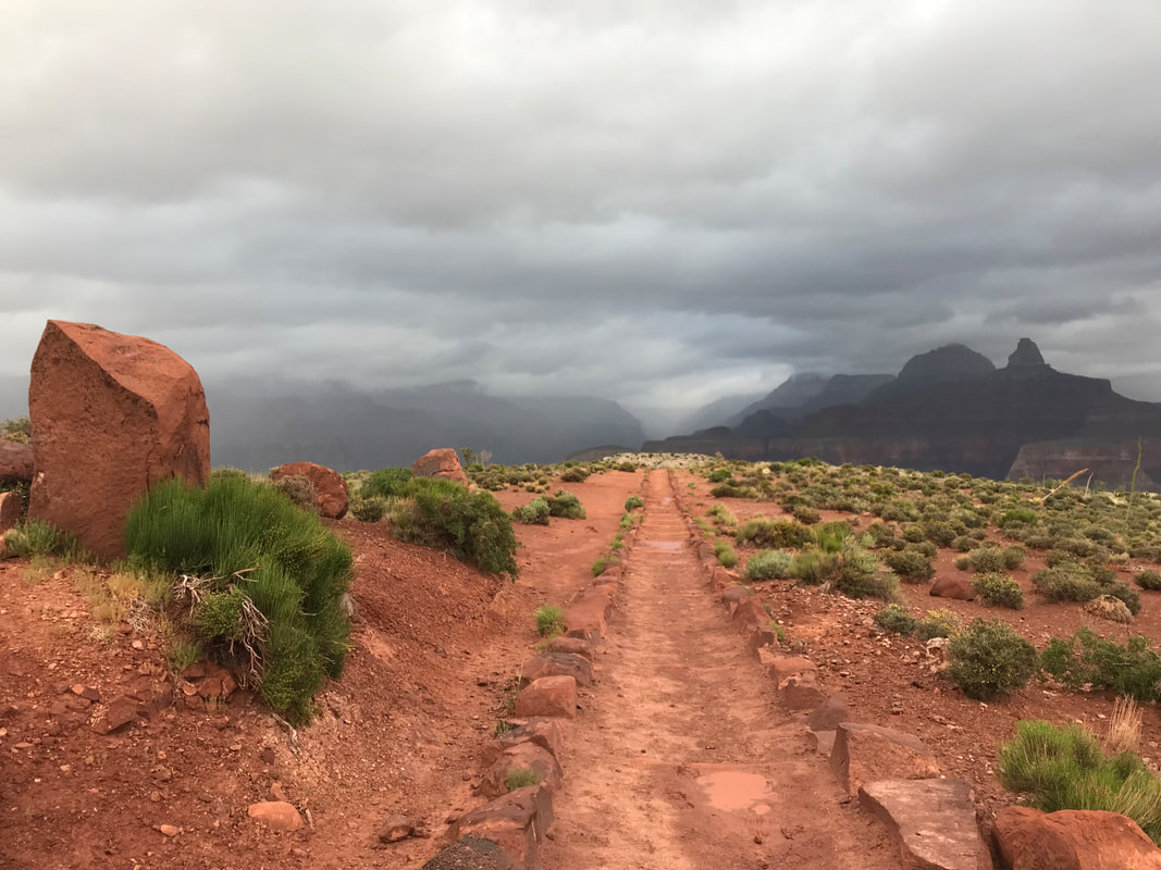
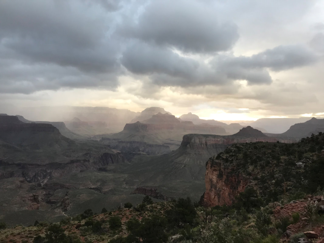
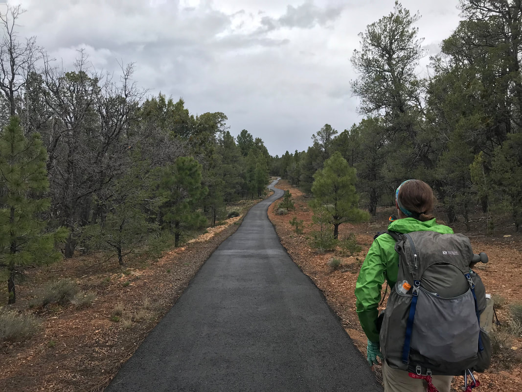
I felt like a bee racing this way and that. Bilbo entered the Backcountry Permit Office as we left and we gave him the bad news. He luckily had time to spare and adjust his schedule. We shared our itinerary with him and made plans for Janna to see him this summer when she headed to Washington D.C. It was to be our last time seeing him. We exited the office and the rain began to fall almost dramatically. The wind and cold kept the temperature hovering in the lower 50s as a high and we jumped on a bus to head to the post office and general store. Once out, I was pacing back and forth frothing with thoughts. Janna calmed me down and said we had this: we just needed to get done what needed to be done - go stepwise. First, we got our boxes from the Post Office. Our last bags of dehydrated beans - it felt monumental. Next, we went into the general store where we ordered hot chocolate and took turns shopping around the store grabbing what we needed for the next several days. The store let us use some indoor chairs and a table to unpack and repack food. All the while, we continued to eat. Unfortunately, my appetite began to wane hard as my thoughts became clouded with the reality of what tomorrow would require. We finished, went outside into the blowing cold and caught a bus over to Mather Campground again. We got approved for a hiker/biker site and went to go setup in a large group of bike tourists, backpackers, and bikepackers. The storm that had hit us earlier in the day had ripped a massive limb off a pine nearby that crushed a building and crews were at work chainsawing it apart. Food secured in animal-proof bins and the shelter setup in storm mode for a long night of promised rain and cold, we caught another bus to the South Rim. From there we caught our first glance of the Grand Canyon on this trip (see photo above). As evening approached, and with it more drizzle and cold, we grabbed dinner at a restaurant overlooking the Canyon. Had it been any other time, I would have relished the superb eating views. However, I could barely stomach dinner as my appetite was flat gone. Janna, having accepted the inevitable tomorrow more-so than I, ate heartily. I was freaking jealous. Post dinner and a meal I barely ate two bites from, we exited the restaurant into the deep dark of twilight. Massive storm clouds had blown in all evening. In the dying light, we caught a glimpse of a winter storm pummeling the North Rim across the chasm. On the slightly lower South Rim, we found ourselves on the bus back to the campground, heading immediately to bed. Once in the Triplex, a series of sleet and thunder continued to hit us until I restlessly drifted into the shallow sleep of stress to come.
  |