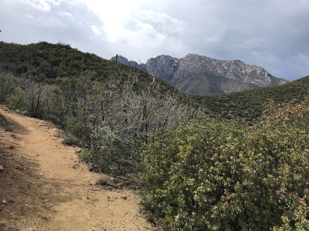
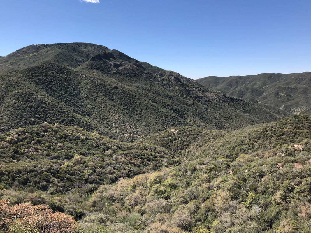
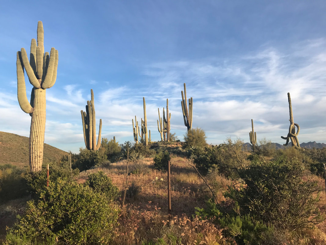
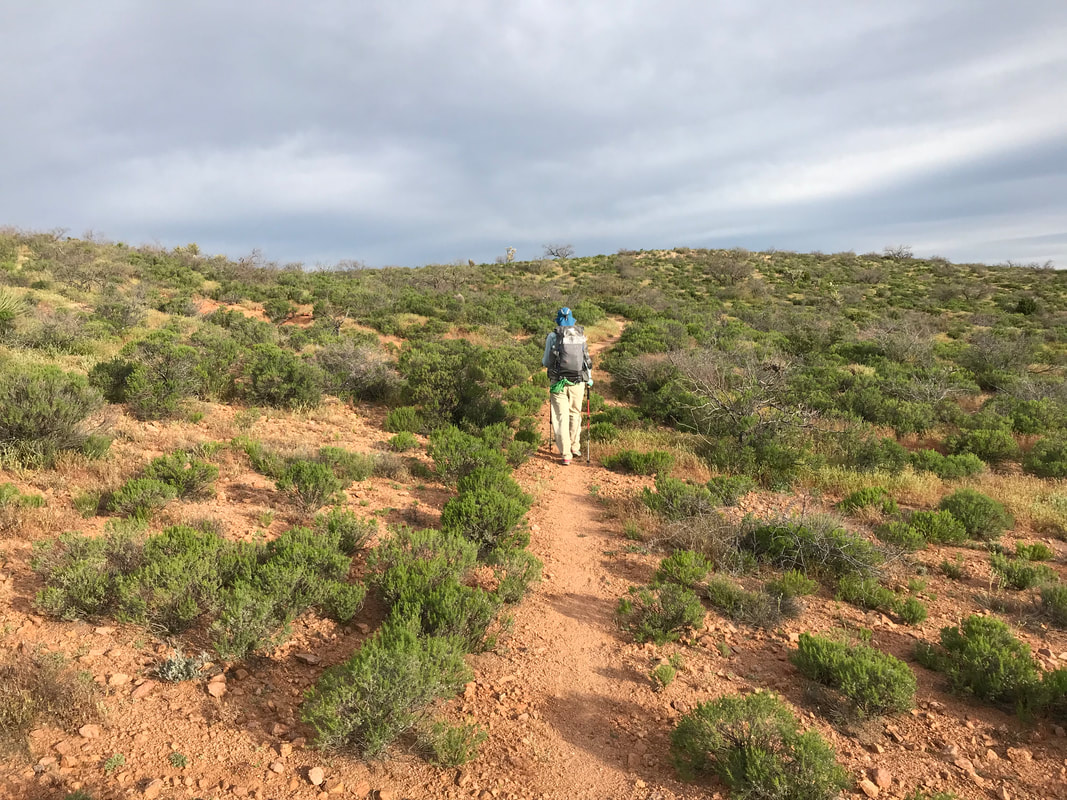
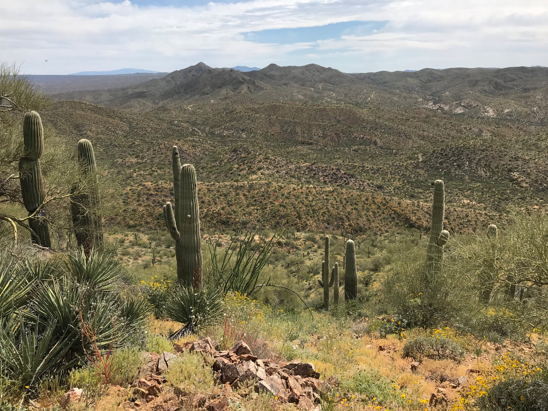
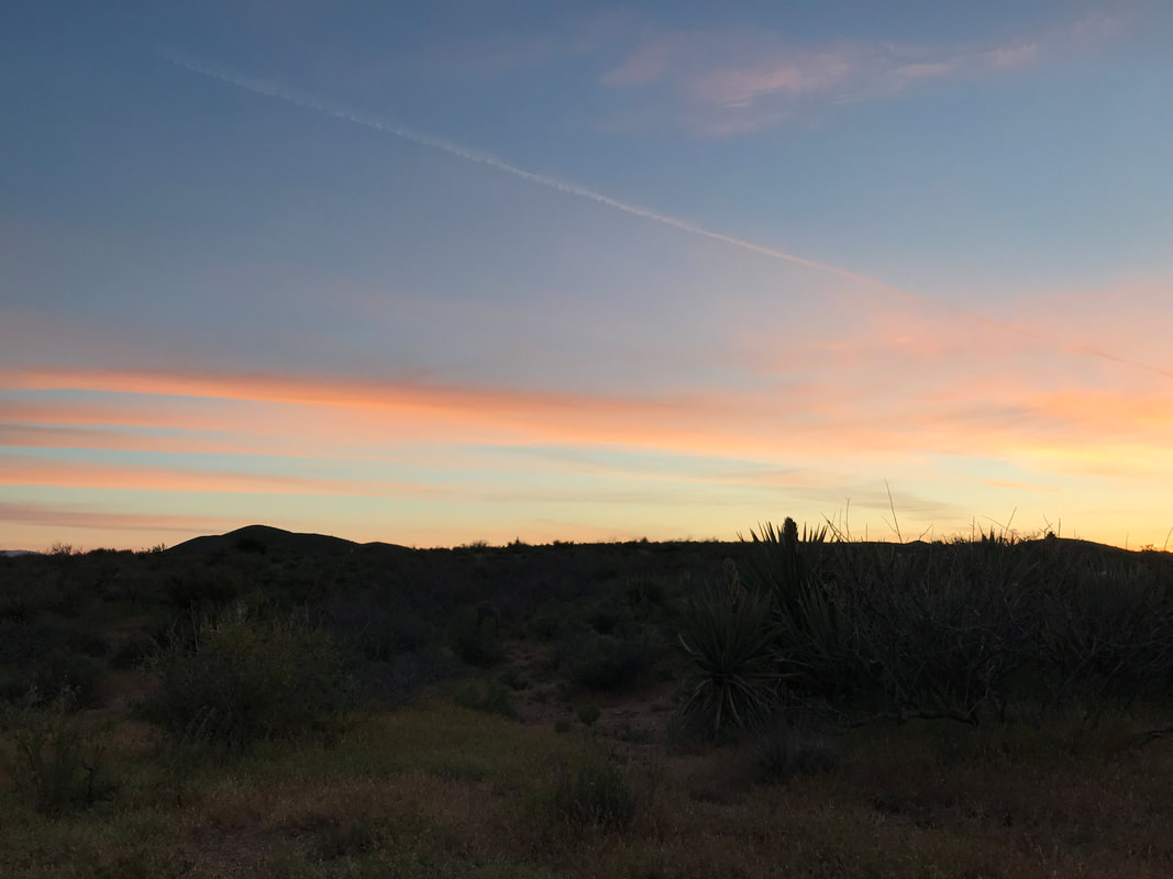
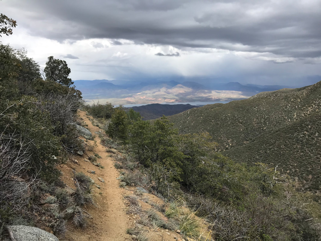
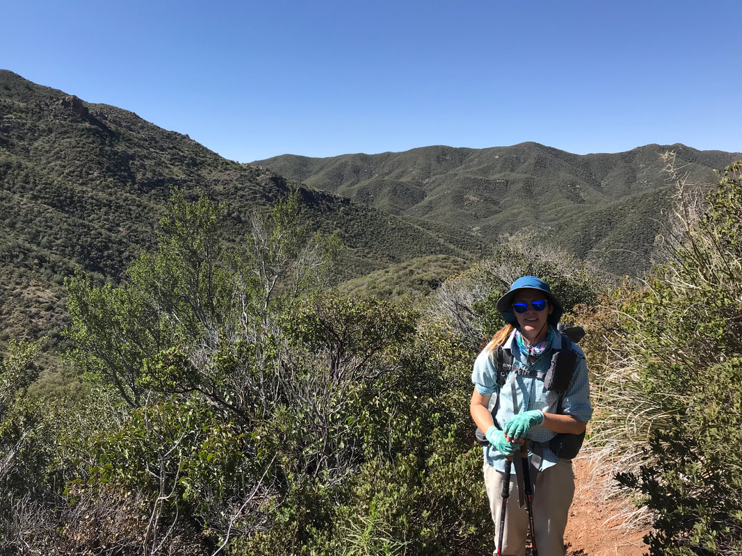
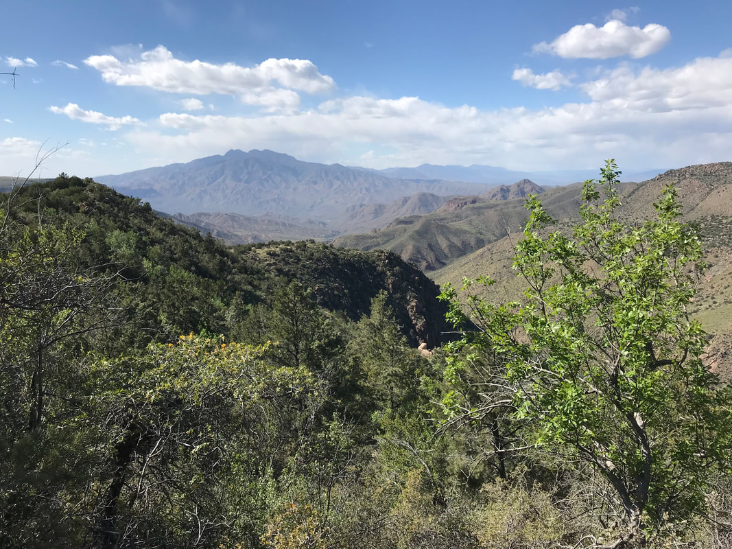
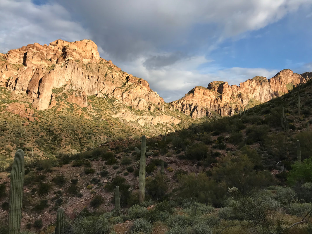
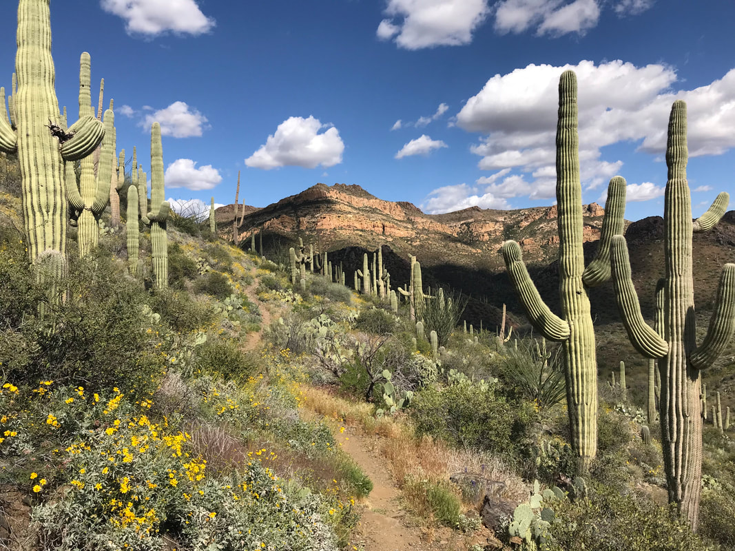
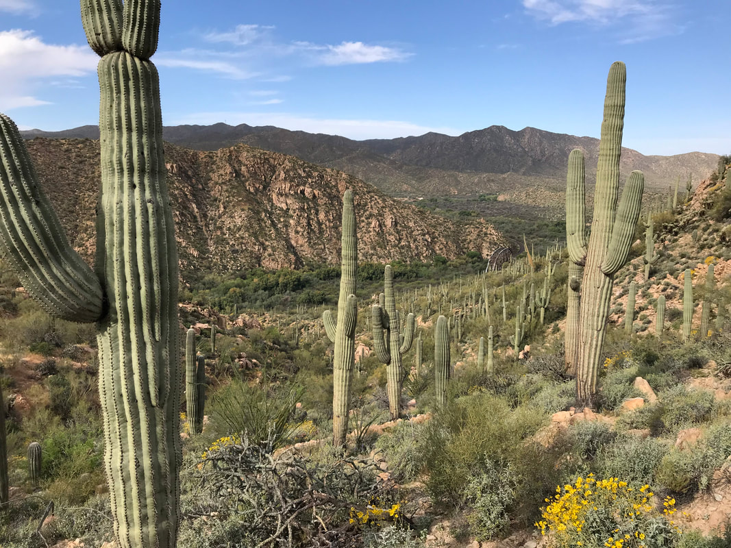
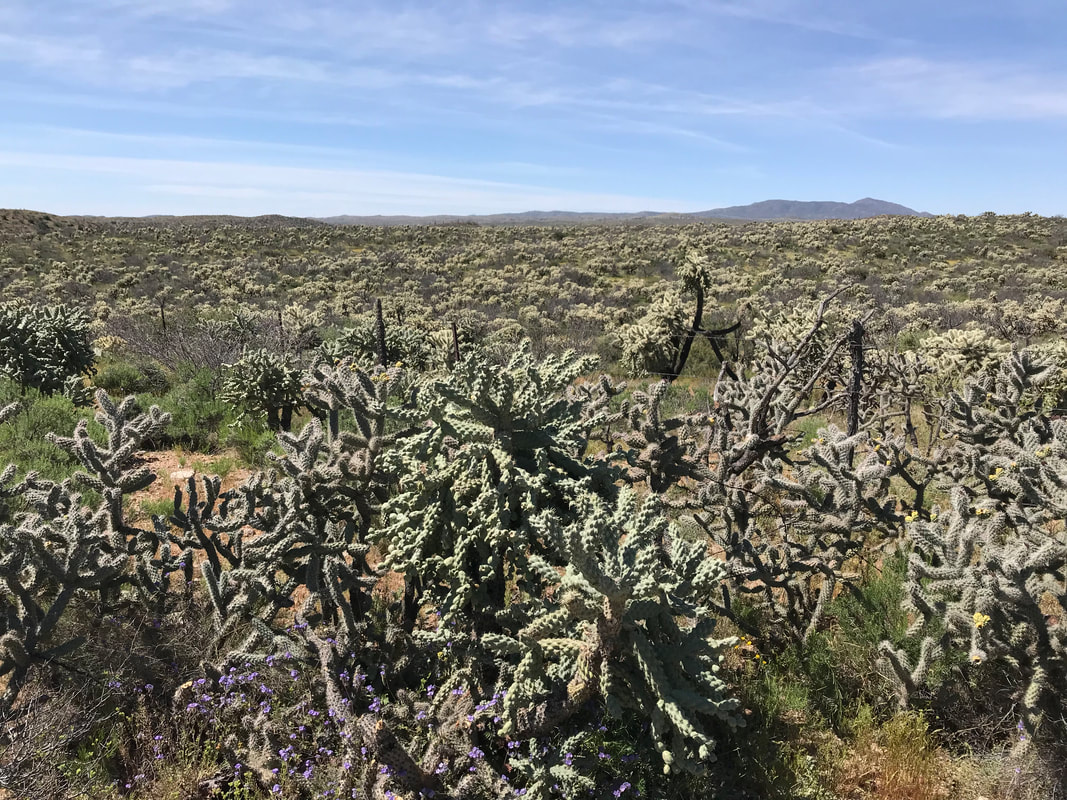
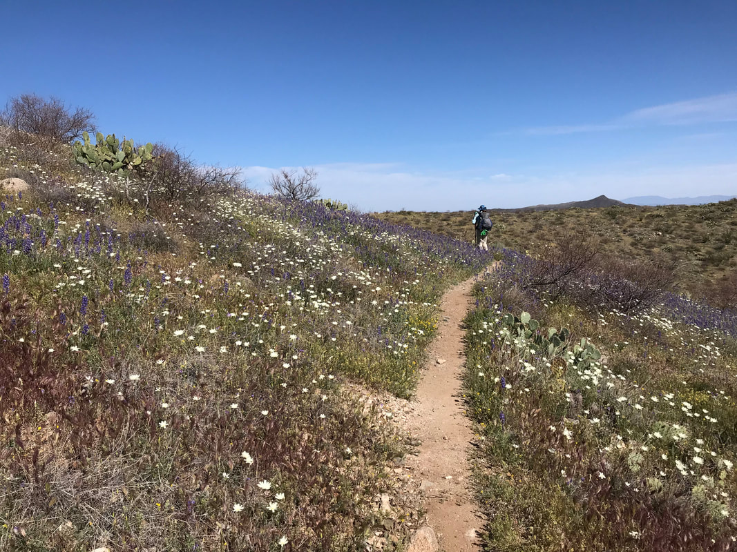
 Click here to read Part 1. Rounding the eastern flank, the grizzled and scored tops of the Four Peaks came into view. Plus a massive storm hitting from the northeast. The sweep around the mountain made us realize how we were really paralleling Lake Roosevelt, almost hiking its length from afar. Jagged burnt trunks of lumbering old growth Ponderosa Pine appeared trailside, victims of prior wildfires. The AZT curved to our left into a massive inward valley. I was more stoked than anything to be so up near the Four Peaks. I knew we would get near them, but not nearly right below their exposed granite summits. We turned back to look at where we had come only to see a swirl of rain and light indicate a storm chasing our direction. We put a move on as the AZT finally entered unbroken ponderosa pines. My knees at this point were feeling pretty cooked. We had thousands of feet of elevation gain and our current elevation put us well over 6,000 feet. Janna wasn’t feeling well and went trailside to deal with her stomach. I sat down and for the first time that day, the chill of the wind and sputtering rain hit me. The constant upward exertion, elevation, and cold temperatures suddenly made me completely bonk. Had I been eating enough? Damn. I was so set on motion and making pace with the storms that I had dipped low with my food consumption. I hustled out some Cliff Builder Bars. Janna rejoined me, feeling much better, and now I was the one feeling terrible. We continued on, dipping into a wash and meeting a trail intersection where we stopped next to a sign. At this point, we both took a long rest and looked at the scattered pottery shards. We refilled water, put on some layers, and prepared to exit the pines as we came through the inner curve of the valley and shot right back out along a new flank of the eastern mountainside. The trail was marked as a straight rip into the slanted slab of land. It was almost dizzying to look at. Right above us, the hulking masses of the Four Peaks stood. 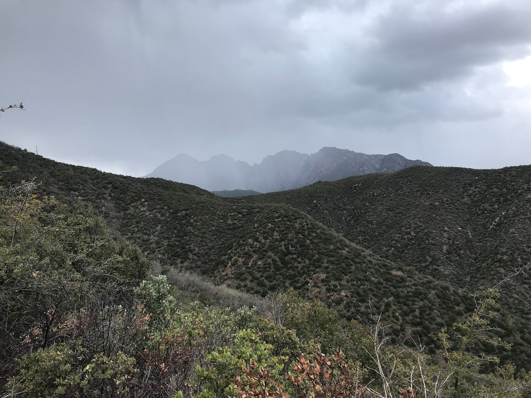 
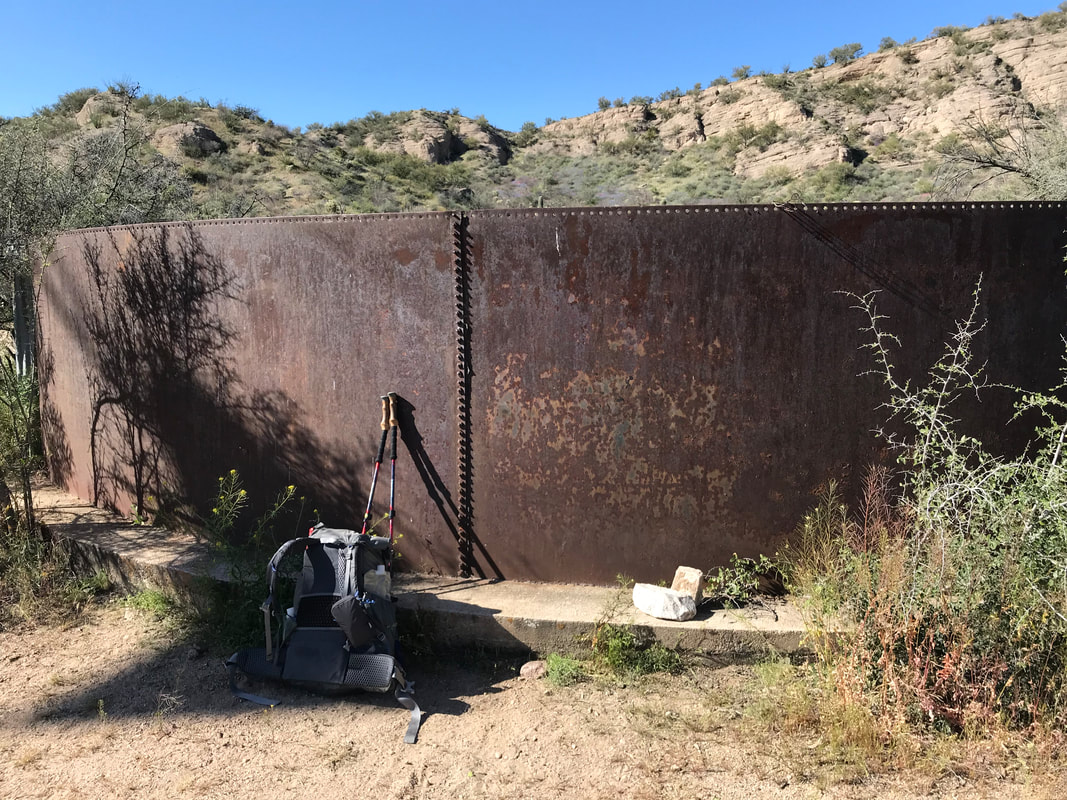
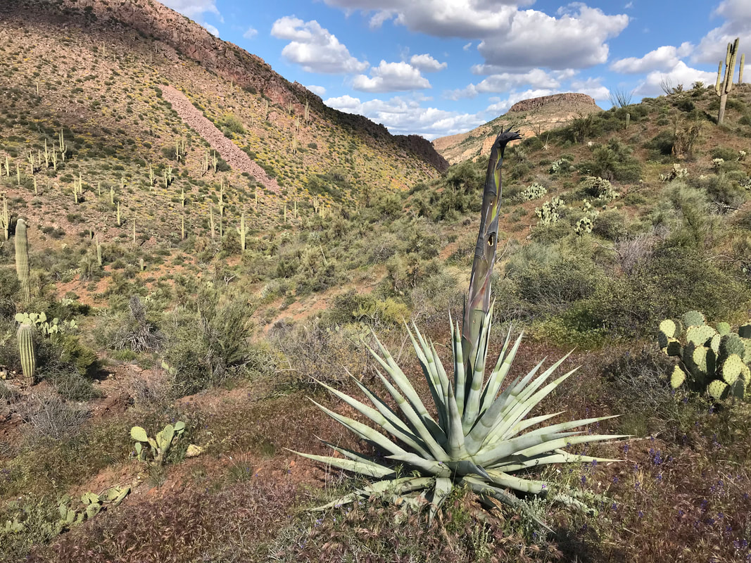
We moved on as late afternoon/early evening approached. The trees immediately disappeared as we were on the south-facing slope of the eastern flank. The wind hit us, chilling us greatly. We reached the outer edge and found it switchbacking down an INSANELY cornered, steep, and chunky descent; we each went one of the time so that if one fell, the other would not get knocked off the mountain. We stopped again when we could plainly see the Mogollon Rim rising up in the northern distance. It was like a massive sentinel of wall delineating the lower half the state from the northern. Before it stood the rugged and jagged land of the Tonto. Once we ascended it in a few days time, we would be in the high elevation thick forests of northern Arizona. I took some photos of alien-looking succulents sprouting blooms from granite before moving on. As evening approached, we now came around the flank and were suddenly on the north side of the Four Peaks. The north-face of one held chunks of snow and ice still. We walked through burnt logs and standing pines until the sound of a rushing steam caught our ears. We arrived at Shake Spring which was more waterfall and smashing rapids than a spring. Up the hill, we found a series of awesome campsites shielded from the elements by a thick grove of pines and chaparral in the understory, plus some good logs to sit on. We made sure to set our Ursacks well as the northern portions of the Four Peaks contain the largest populations of black bears in the entire southwestern United States. The cold came dramatically and we could see campfire smoke in the distance, someone up near the pass where Four Peaks road is. We climbed into our Triplex not a moment too soon before sleet came down on us, dropping the temperatures. I always sleep well in these conditions though: the sound of a nearby stream, raining pelting my shelter. I always get snuggy and pass out, a feeling of safety from the elements. 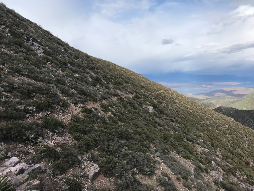  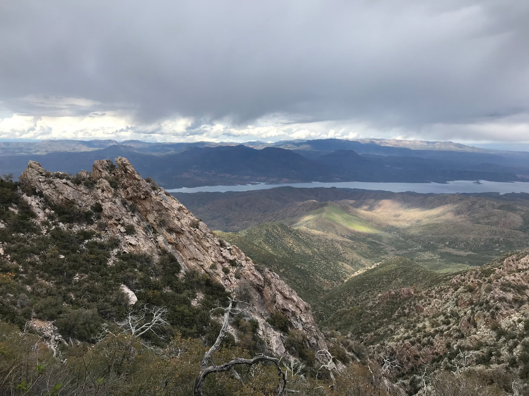 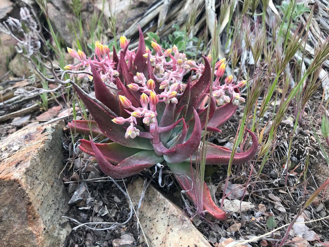 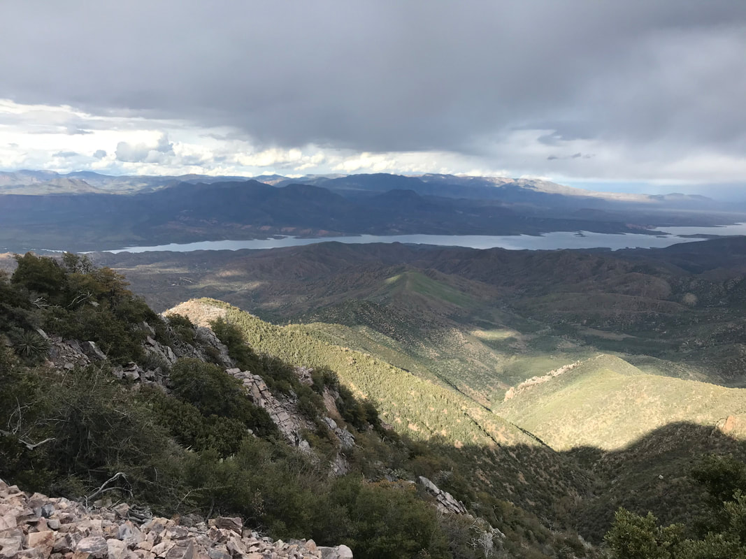 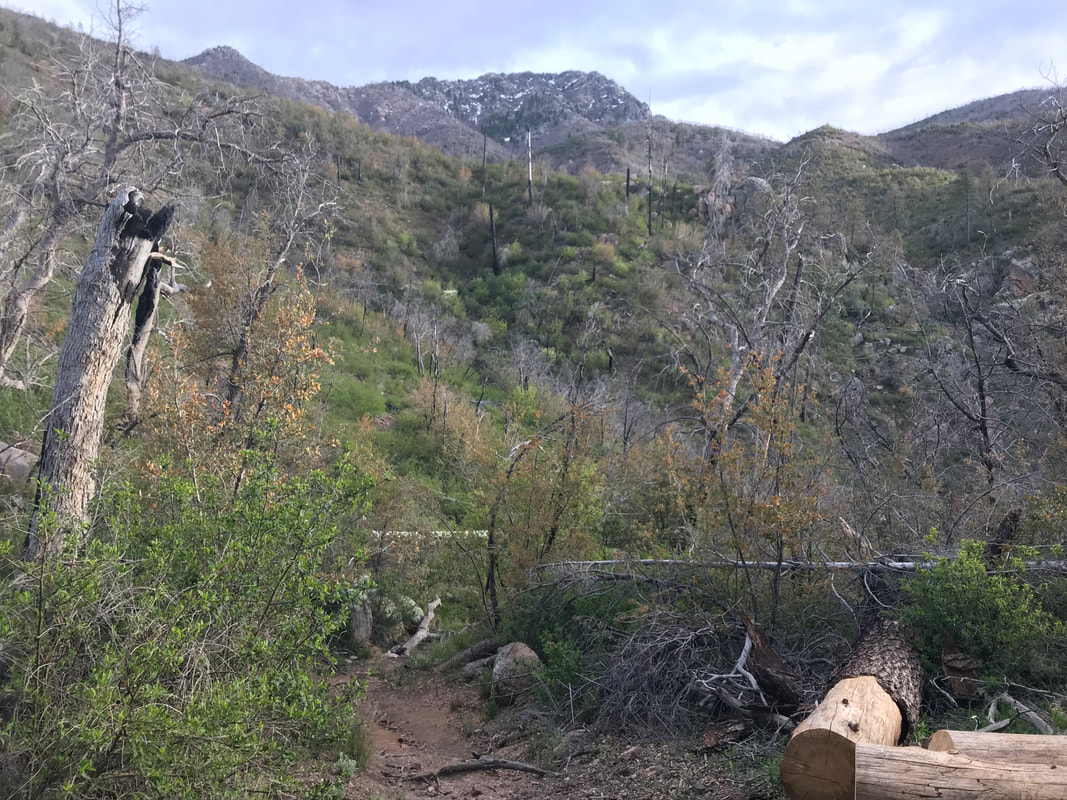
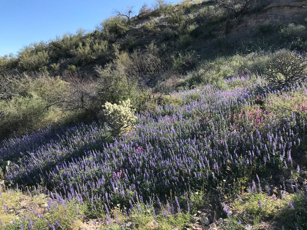
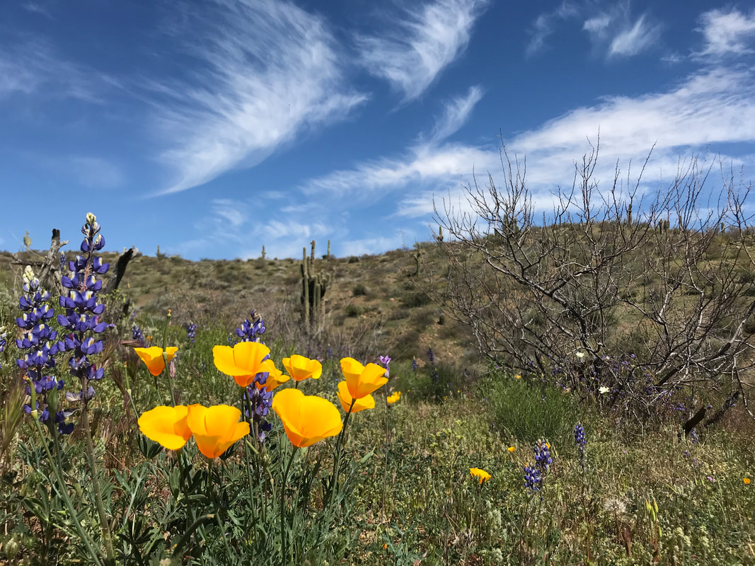
0 Comments
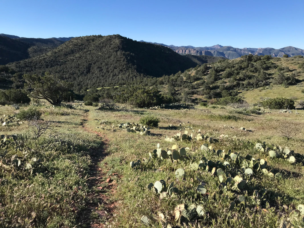
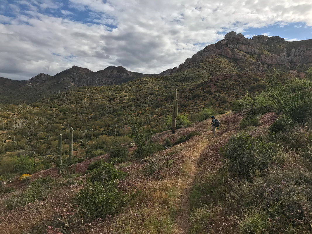
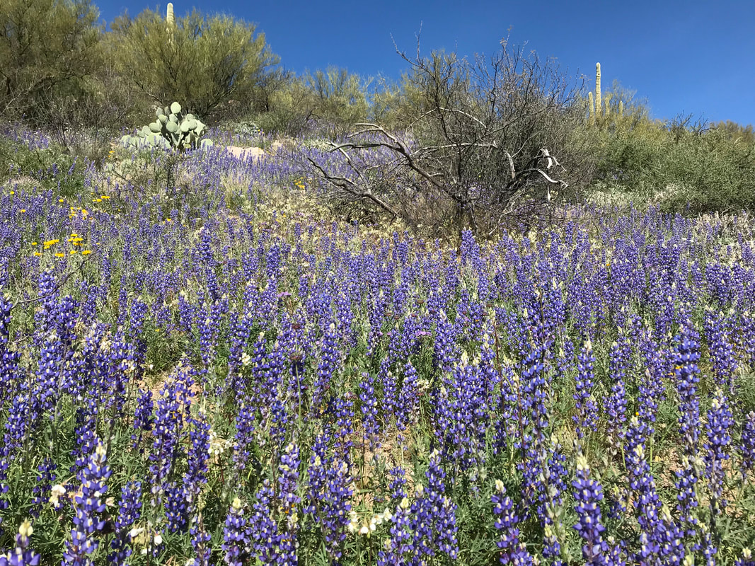
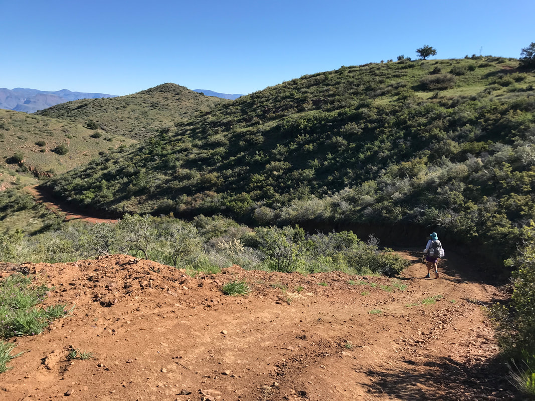
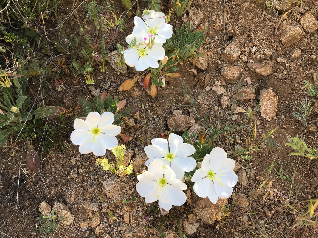
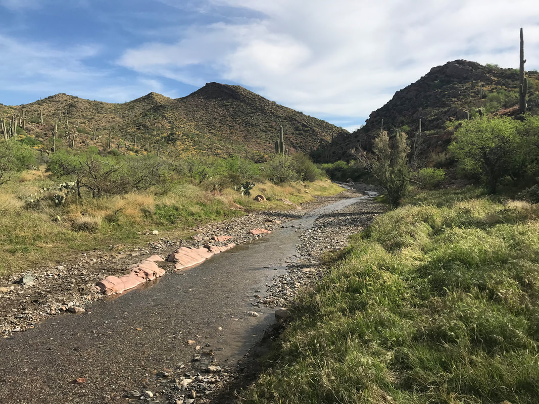
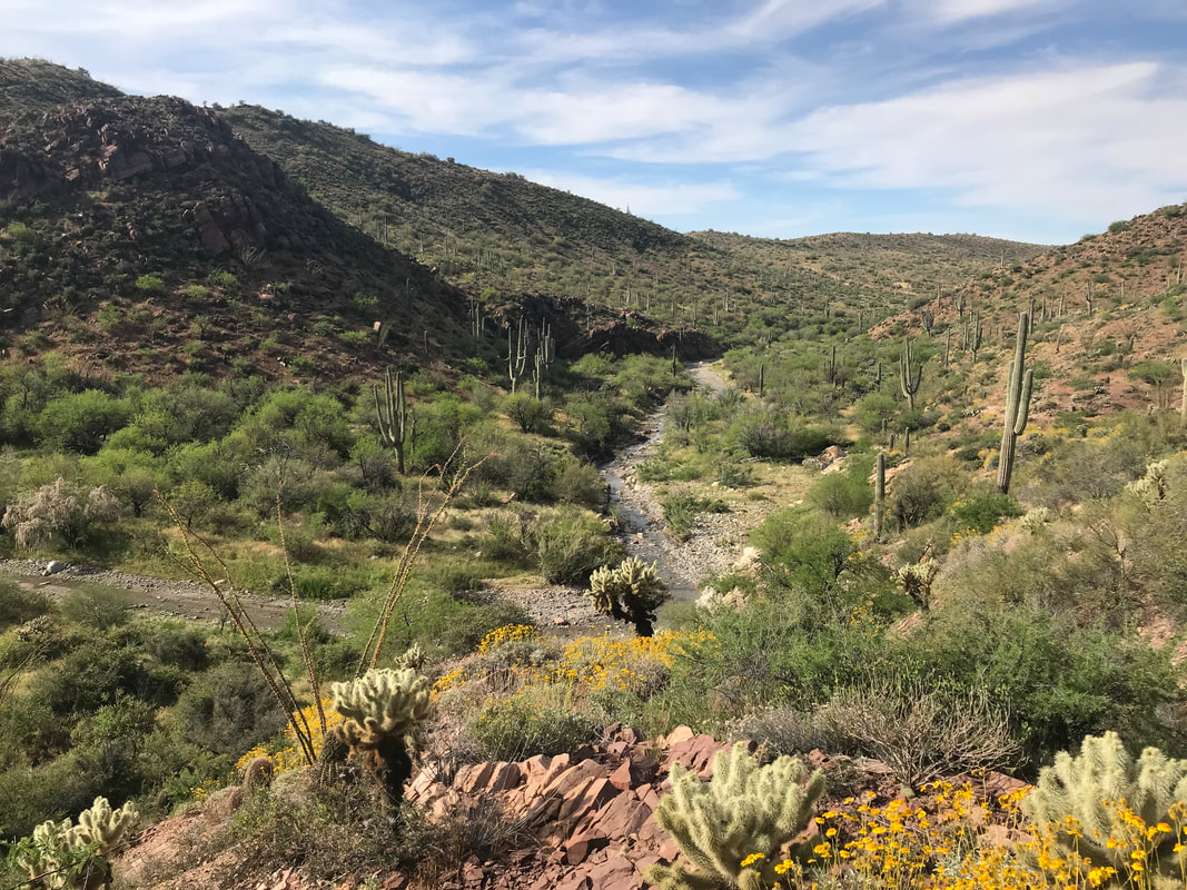
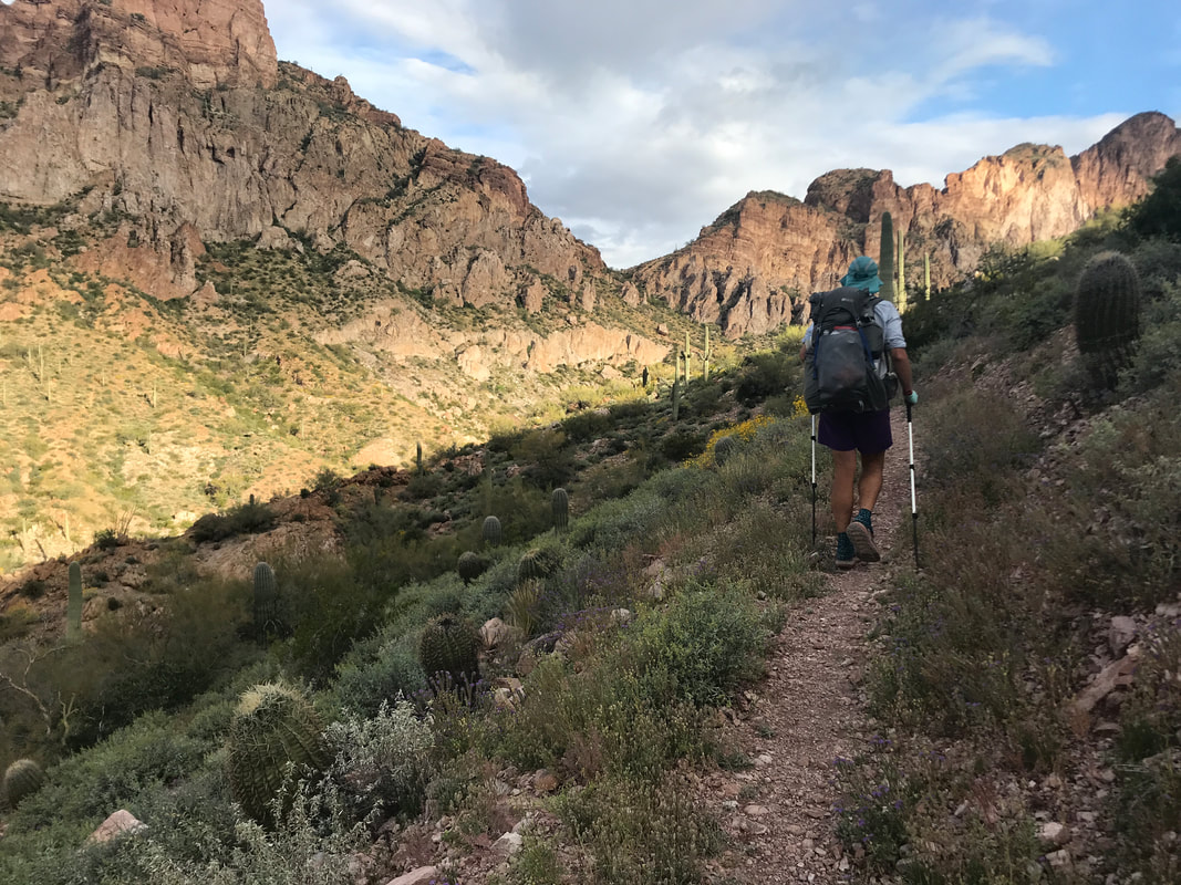
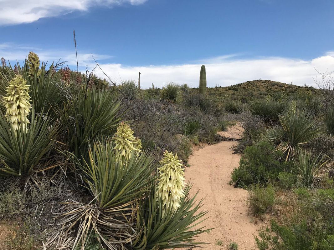
 I slept excellent last night due to the well-protected spot. The wind barely made it into the trees where we camped and it was nice and silent. Two days back on and my trail legs are back. We packed up, headed out, rounded a corner, went up a small climb back the ridge again and were afforded awesome views of the descending ranges leading to Roosevelt, a 10 mile and 3000 ft. loss section. Bluebird skies ranged overhead while every plant seemed more vibrant from the sputtering rain. Looking back at where we had walked yesterday, the Superstitions seemed just as rough and rugged. After a few miles, the AZT left the Superstition Wilderness and joined a double track road. Curving round and down, it came to a small hill with a single tree. There was an old plywood bench, empty cattle trough, but some decent campsites had wind not been bad. There was also a large rock sitting on a notebook in a plastic bag. We opened it up to find a trail register from an individual assigned as Section Leader for this part of the AZT. He was looking for feedback from AZTers for blowdowns, crumbling trail, etc. that needed dealt with. Unanimously, all previous AZTers said the Super V was ridiculous, encouraging rampant erosion, and could be remedied with switchbacks or simply a trail that kept to the contour line and circled the valley. The Section Leader wrote a big response to everyone that the USFS, due to the Wilderness Designation, refused to further impact that portion of the ecosystem to move or reroute the trail. We replaced the notebook and continued down a wide dirt road that went by a muddy cow tank. We still had some water so we opted to skip the refill. And just when I thought my mind could relax from snakes, I inadvertently stepped right next to a big western diamondback curled up on the road in the sun, which rattled as I jumped. The AZT led off the forest road and continued down into some thick/overgrown singletrack that weaved in and out of a boulder-strewn sandy wash. Our progress slowed massively. It seemed that game trails split with the AZT here and there; it was not clear which was the true trail. In an urge to avoid the slow slog in the sand, I walked up a hill through some beautiful desert lupine but eventually got caught in a bunch of acacia trees. I retraced my steps, pulled out my maps, and saw that the AZT basically stuck to the wash. Sand it is. We continued down through a increasingly warm canyon as the sun rose further in the sky. Around noon, we arrived at a beautiful spring/seep that filled the wash below with water. Ferns, moss, and water plants grew along the flow while shade was given by unbudded sycamore overhead. We drank some cold and clear water before passing through a burn area. The AZT wound up and over the massive fallen trunks of old cottonwoods and sycamores as the water-fed wash expanded into a true riparian strip.   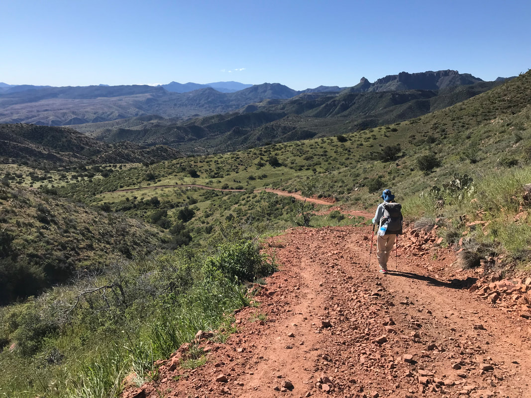
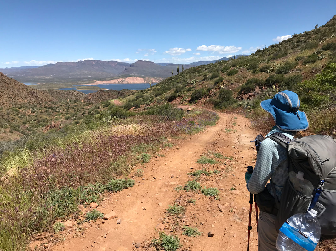
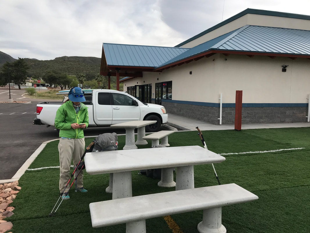
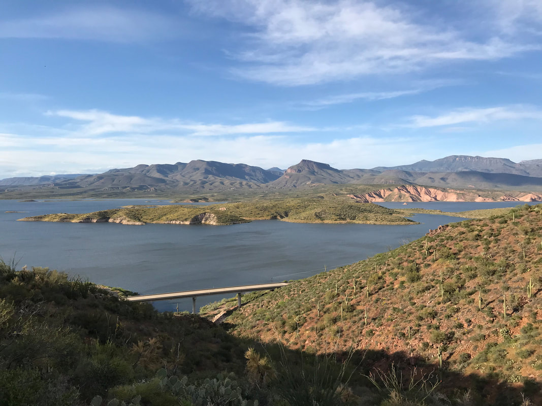
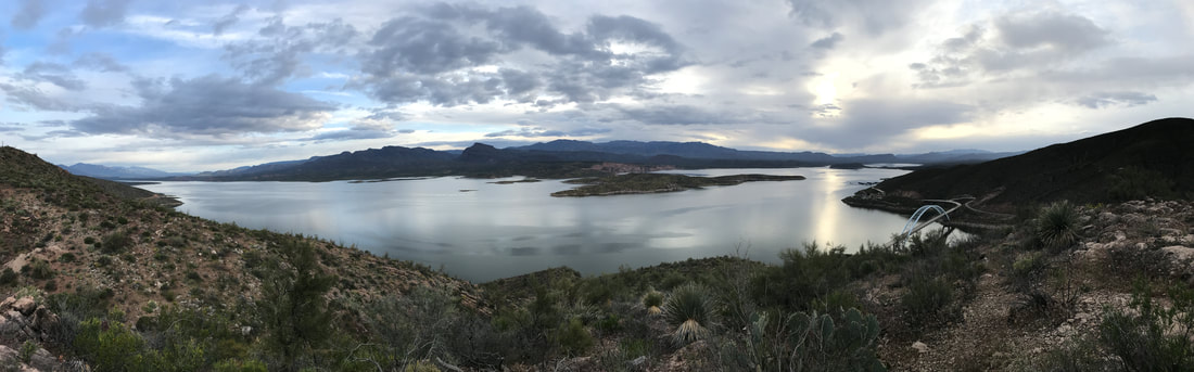
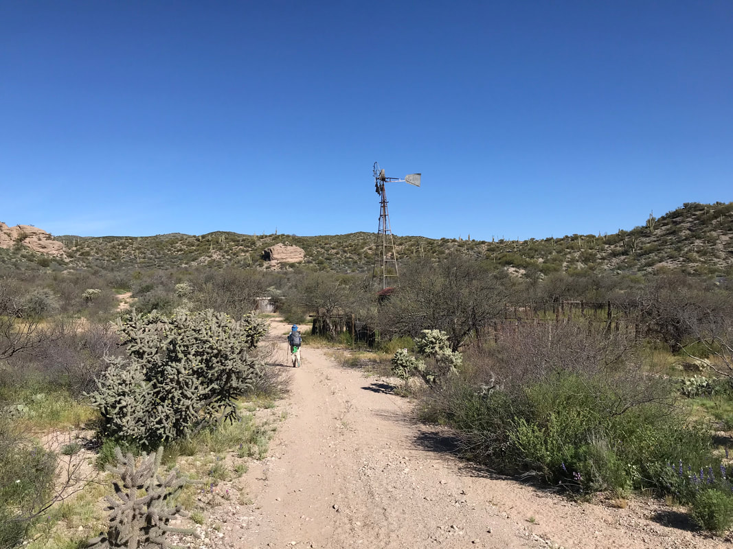
 And then the AZT dumped out again onto another dirt forest road. It continued to descend past two algae-growing metal cattle tanks (we had enough water) and bobbed up and down a series of hills. Nearing town, the massive spread of Roosevelt Lake loomed. Roosevelt Lake is one of the biggest reservoirs in Arizona, a result of early 20th century damming of the Salt River by the Roosevelt Dam. At one point, the dam was the largest in the country until the Hoover Dam replaced it. The resulting flood filled up this large Sonoran valley and sprouted several small towns along its massive length. Boating is now a main recreational attraction, in addition to fishing and the Tonto National Monument cliff dwelling ruins. Descent also brought higher temperatures. As early afternoon came, we came down a ridge and the mobile home park and factory homes of Roosevelt came into view along the edge of the lake. The true AZT continued to the north but we took a spur trail through an old cemetery, crossed the highway, and ended up at the Lake Roosevelt Marina and General Store. We had sent a resupply box here with food all the way through Sunflower as we heard the food choices were slim inside. At a picnic table sat the senior couple we had been trailing for days. And we finally got to talk to them. Their names were No Butt and Yeah But. They were 80 years old and doing the entire Arizona Trail again for the fourth time. They were incredibly fit and I would have thought 60s for age. I WAS FREAKING INSPIRED. This was an 80-year old couple through hiking this remote desert trail for a fourth time…and kicking our asses with their speed. They had done many of the big long-distance trails but lived in Arizona, and had a particular love for the AZT. They had even done a third thru-hike last year. But when they realized the epic El Nino winter rains would mean a stellar water and flower bloom year, they decided to come out and do the whole thing again this year. They had also completed the AZT back before it was even finished! This was a lesson I learned: Moving water don’t freeze. At any age can a person do an epic hike. The Butts had parked their main resupply at a car another day’s journey out, so they said their goodbyes and let us know they’d leave some water for us there. Janna and I got a text from Chris, who we hadn’t seen since Oracle. He said that he had quit the trail the when heading up Montana Mountain. He suffered from bad plantar fasciitis and needed some long rest. I was saddened to hear this as we hoped to catch up to him again. We headed into the store, buying microwave pizzas and ice cream. Taking advantage of trash cans to dump refuse, we then headed over to the ranger station at the lake to charge electronics and clean up in the bathrooms. I took a tour of the inside museum, reading about the history of the lake and area. We relaxed there for several hours. Electronics charged, clouds had begun to move in with late afternoon, bringing a cool breeze that chased away the heat of the day. We went back over to the store and caught one more round of ice cream and food before it closed. A few other thru-hikers we met said to avoid hiking the AZT out of town and just take the highway shoulder instead. Janna and I both knew this would kill my soul so we went back up to the AZT through the cemetery and did the true route. To quote Janna: “We didn’t come here to do easy.” 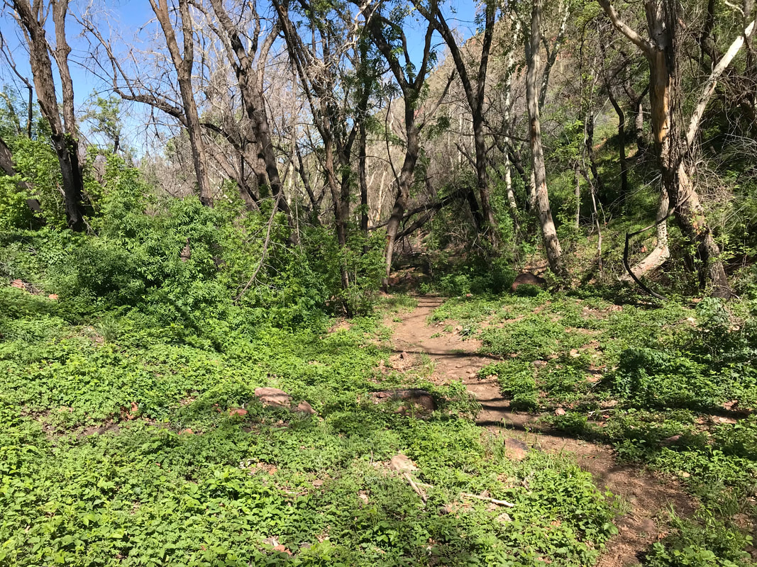
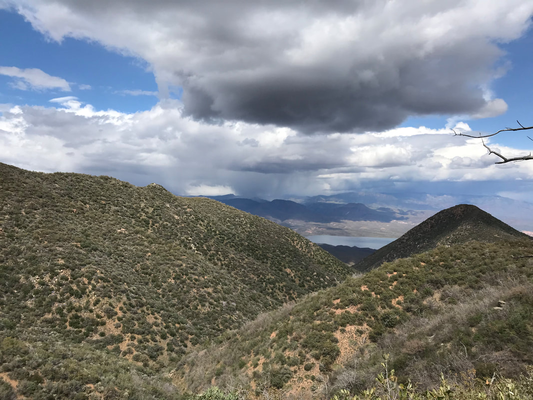
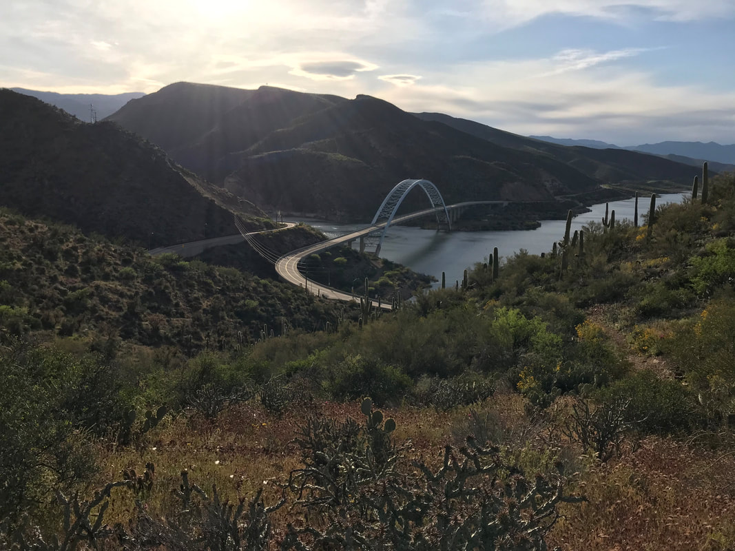
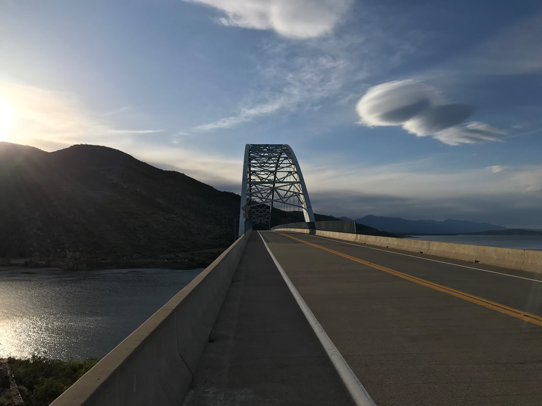
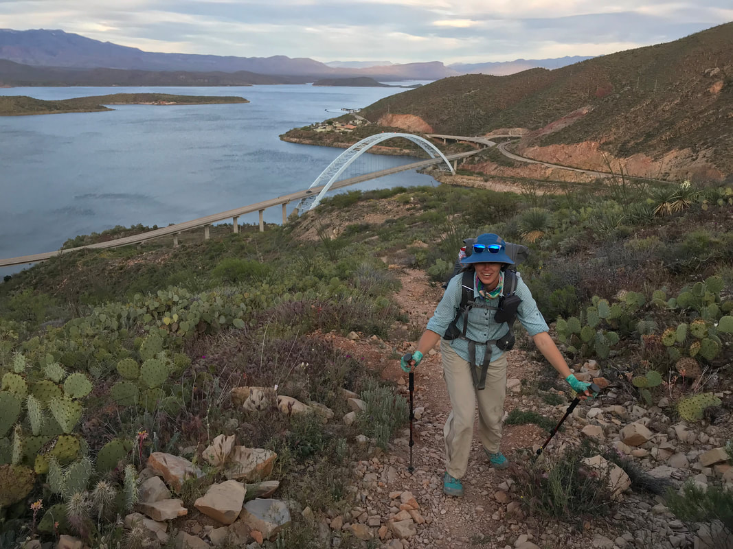
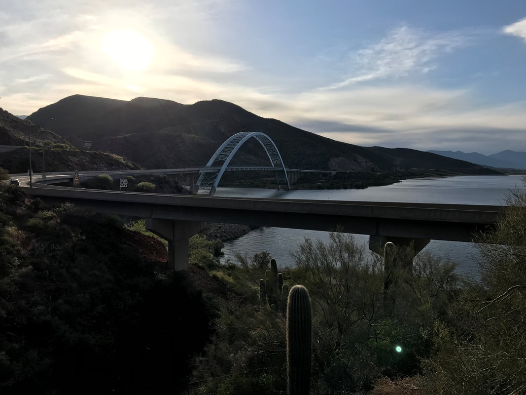
Weather checks revealed another storm system was moving in with evening, so we picked up the pace. The AZT paralleled the highway for several miles, weaving in and out of contours of the land. But the views of the lake were gorgeous from on high. Plus, a massive javelina ran up the trail in front of us - scared the shit out of me before I saw what it was. The trail went through dark and orange sand before descending a ridge overlooking Roosevelt Dam. Again, an epic feeling as we had been to the dam several times before. Now, we had walked here. The trail deposited us onto the highway where all hikers can only cross the dam by walking the road shoulder on the bridge. Small lenticular clouds hung overhead, further indicating atmospheric instability. The AZT trailhead was on the other side of the bridge. Just as we had descended all the way down to Roosevelt, we now had to spend the next two days climbing all the way up to upper reaches of the Four Peaks, our next destination. As overcast skies hung, Janna and I decided not to climb too much higher as we would be exposed on a ridge again. We found a flat spot overlooking the dam and lake to camp for the night. After battening down the Triplex with rocks in the thin/rocky soil, we sat on overlook ledge to enjoy the lake’s reflection in the evening. The night brought a bit of rain but nothing too bad and we slept well. 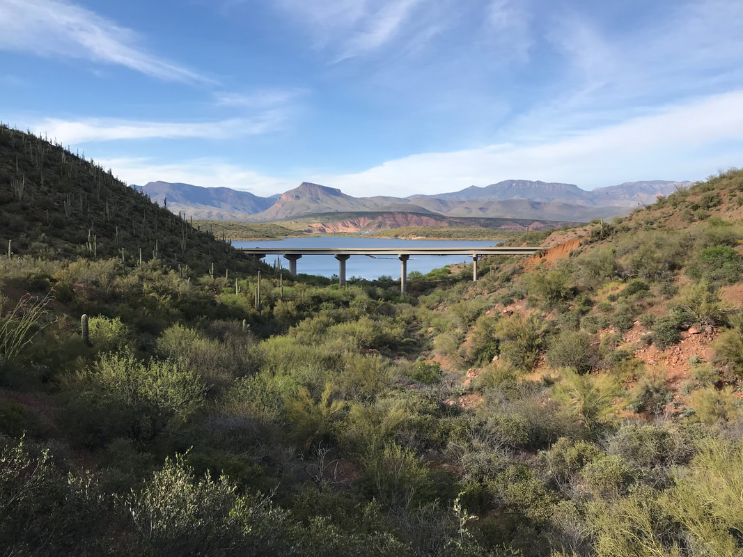 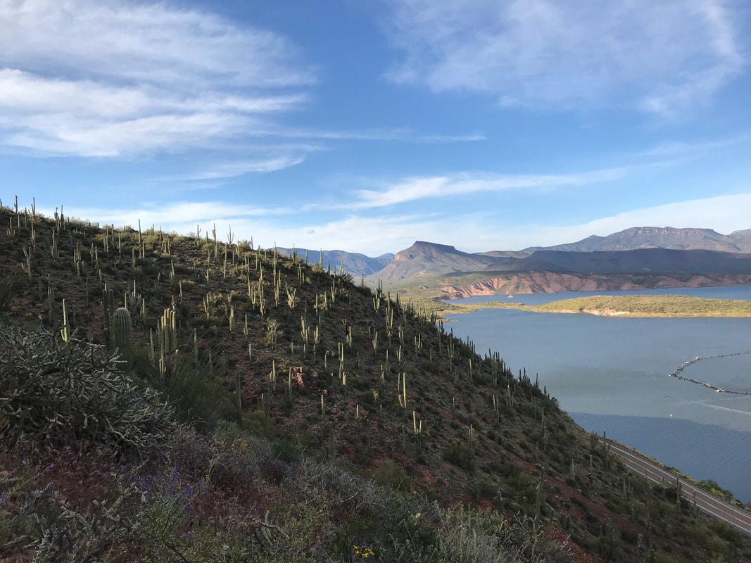
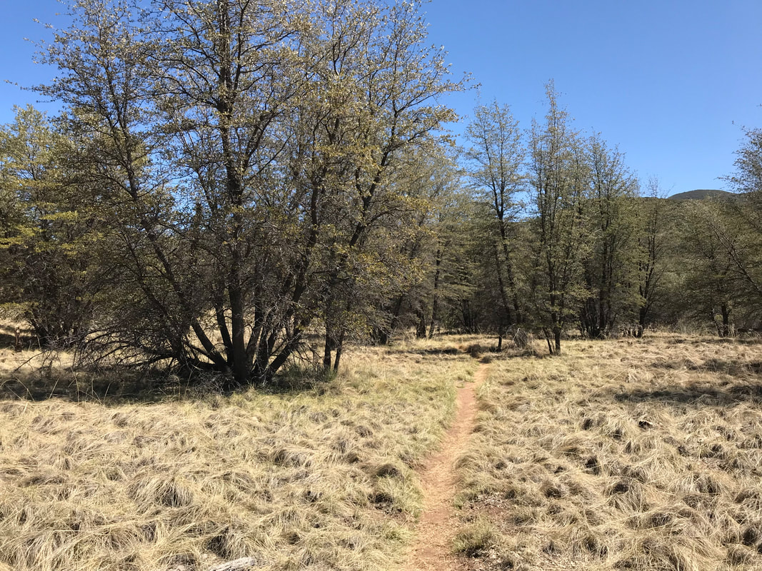
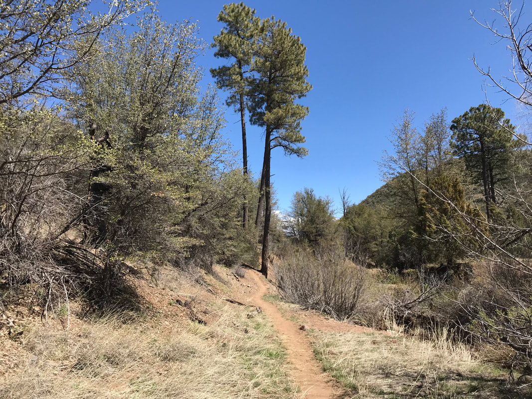
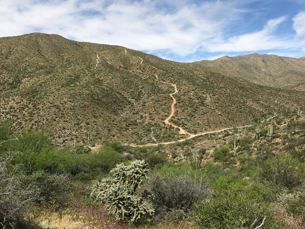
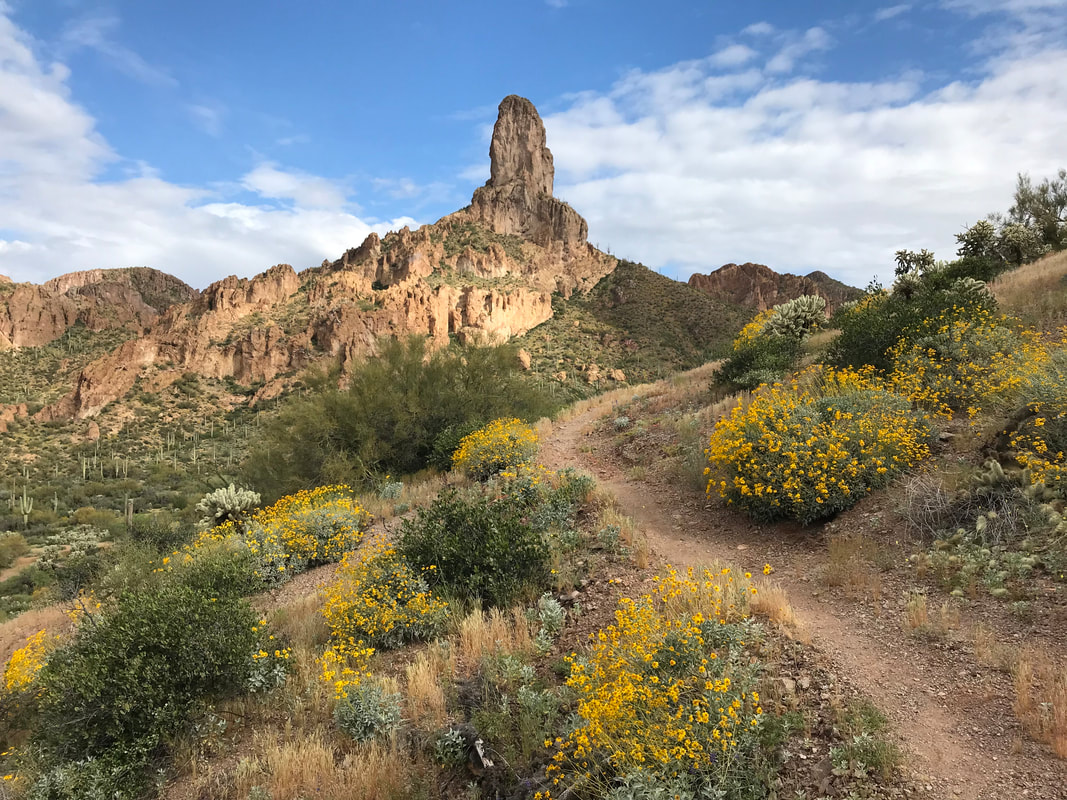
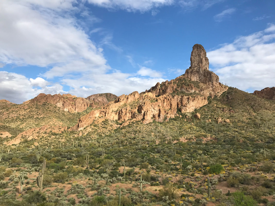
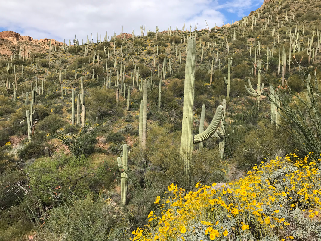
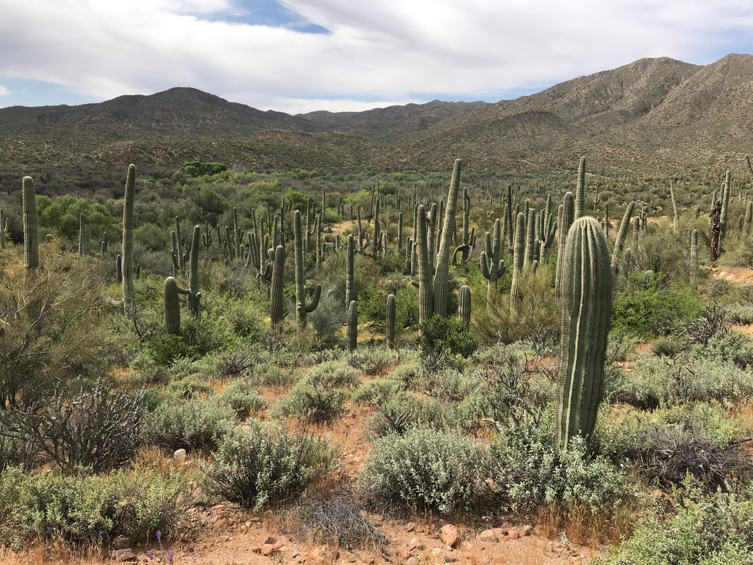
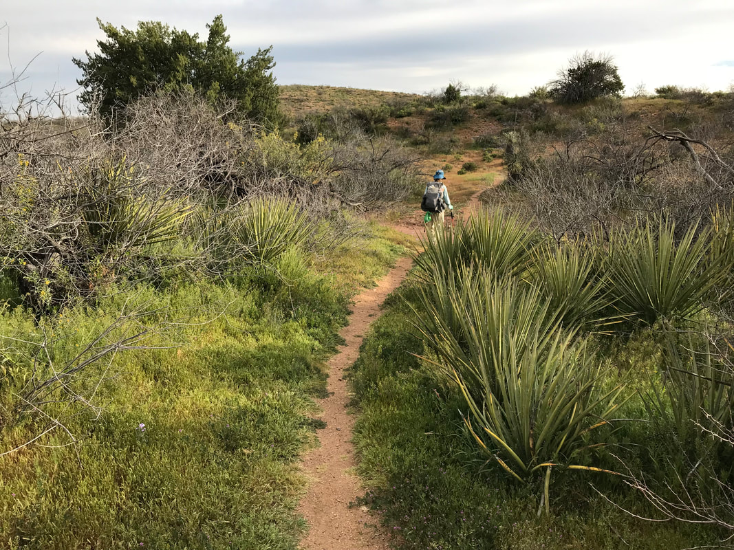
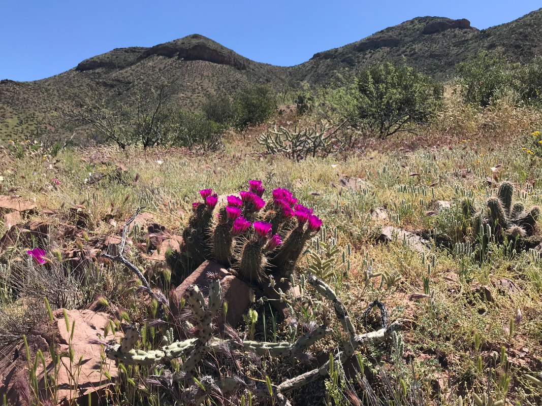
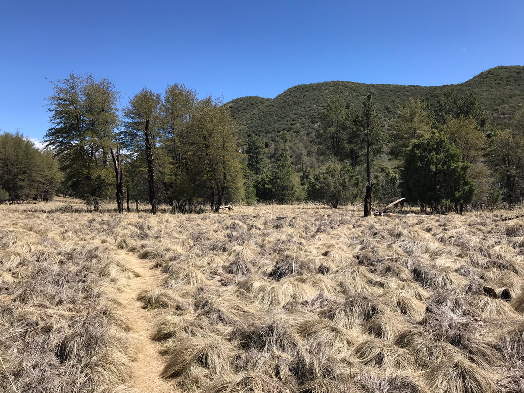
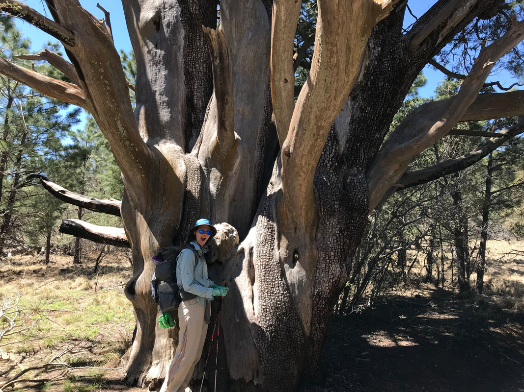
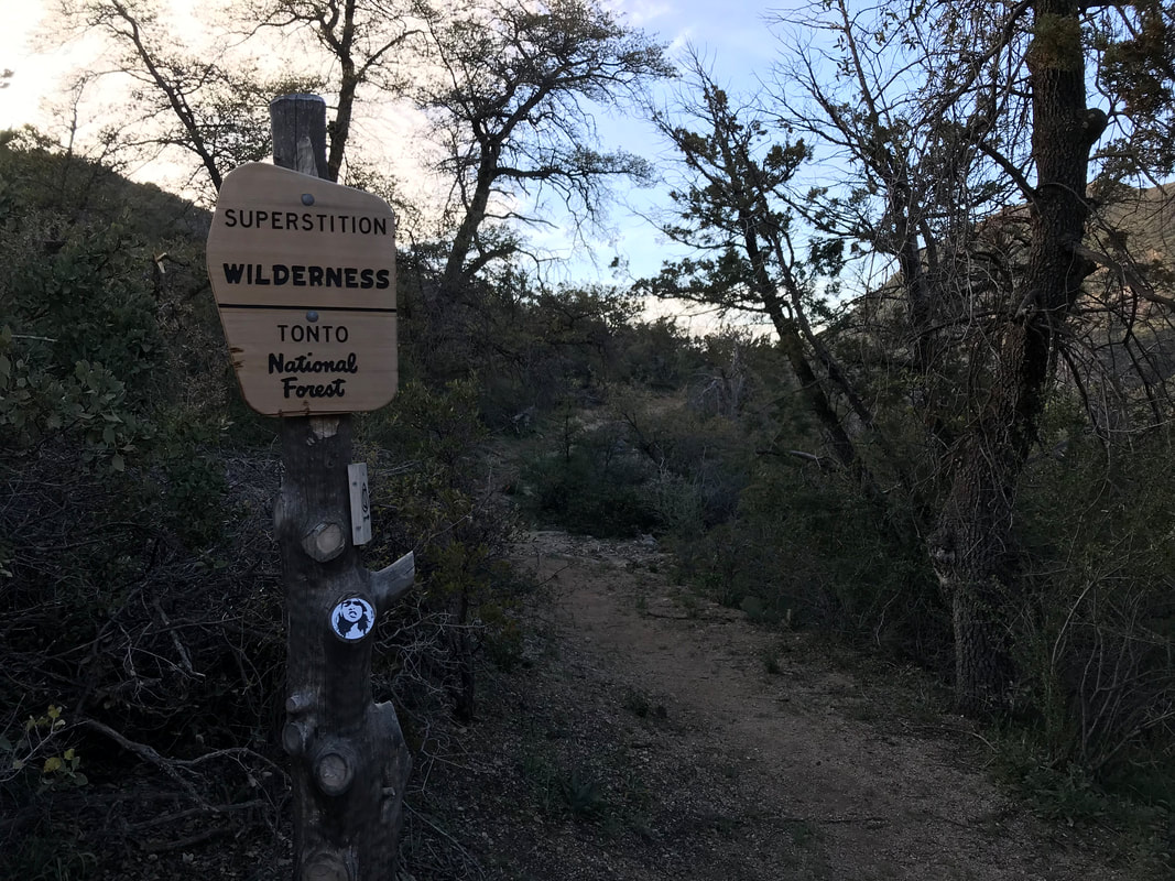
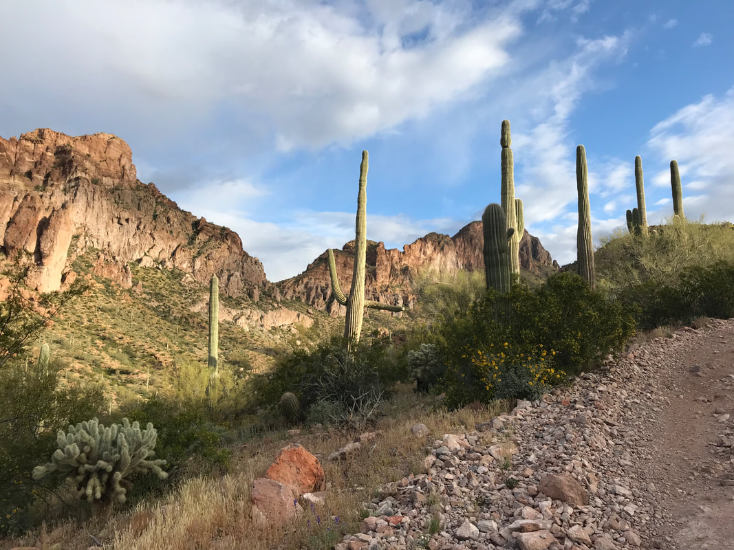
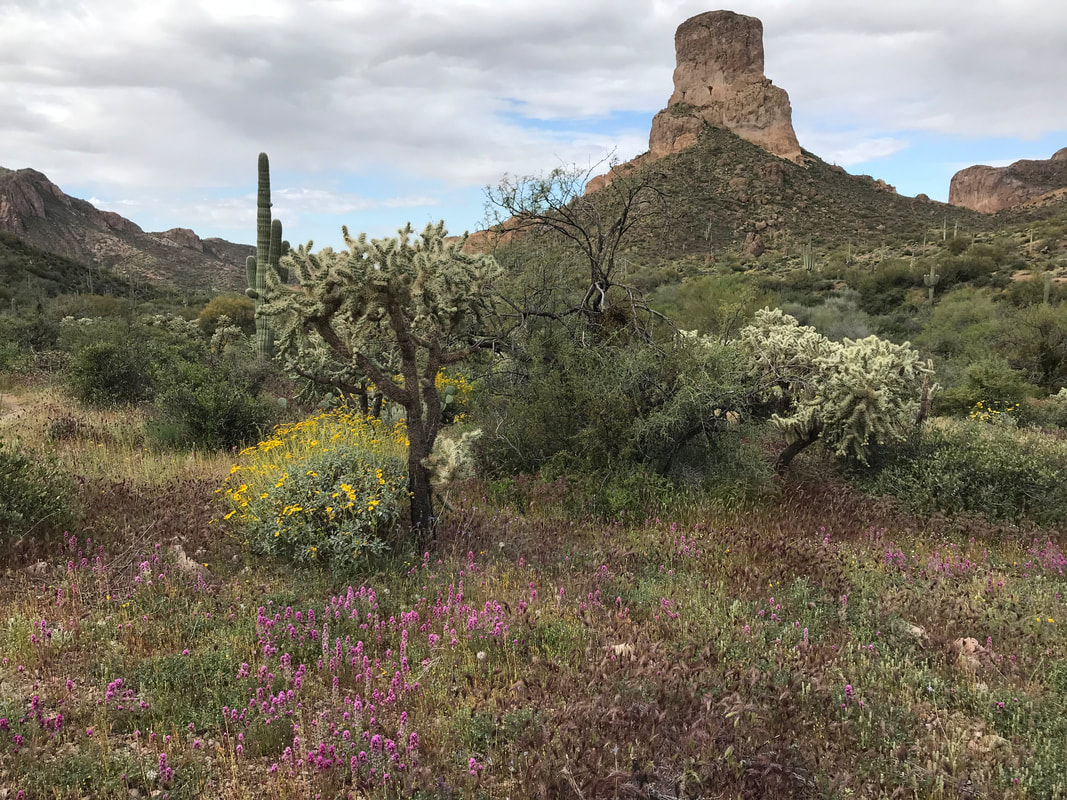
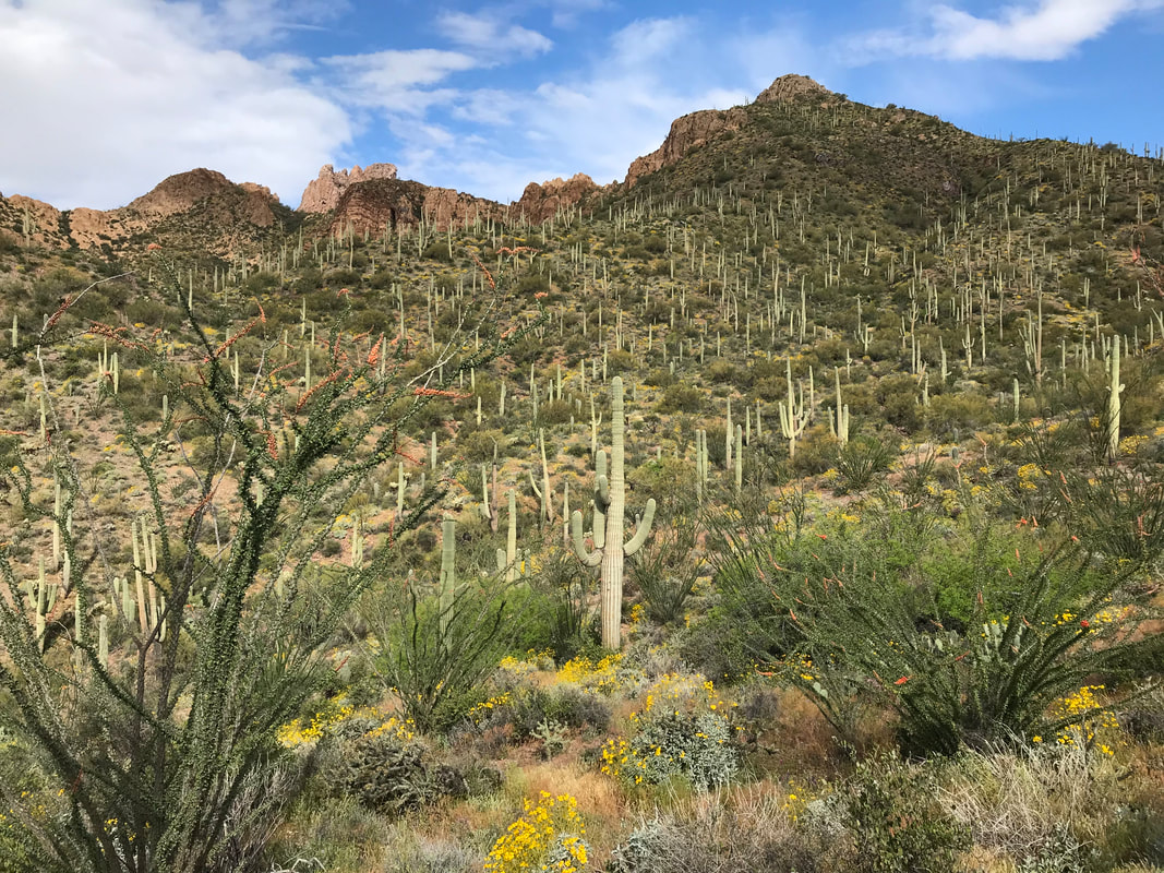
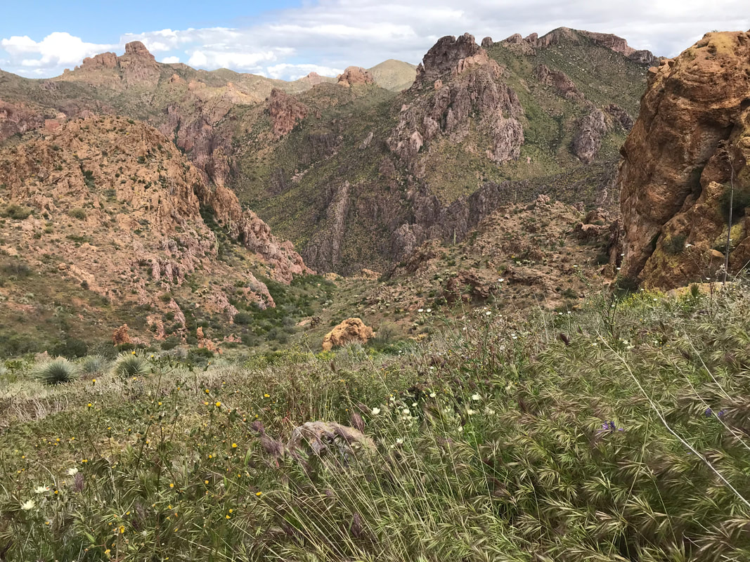
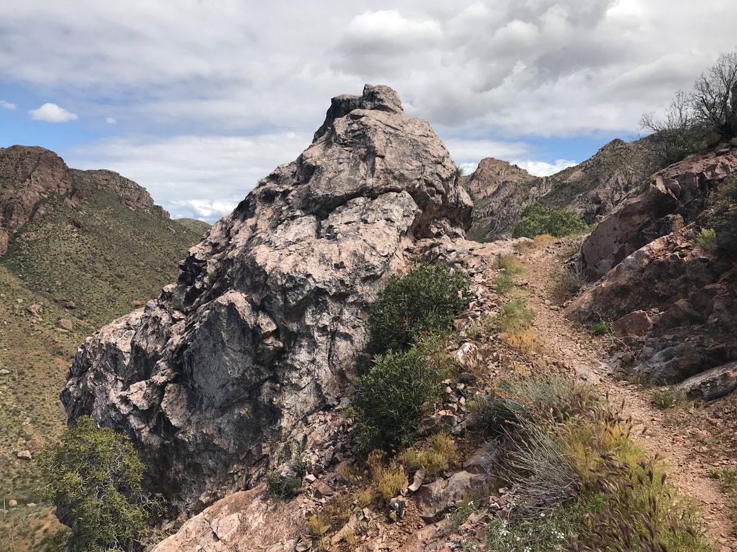
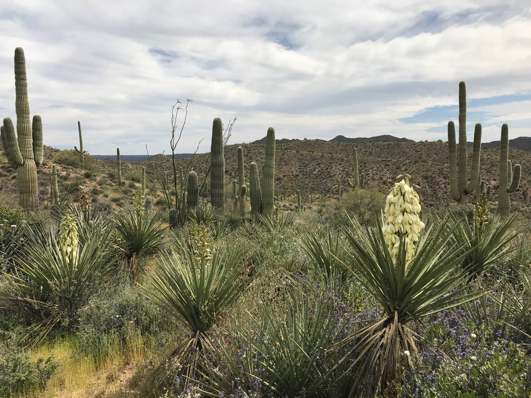
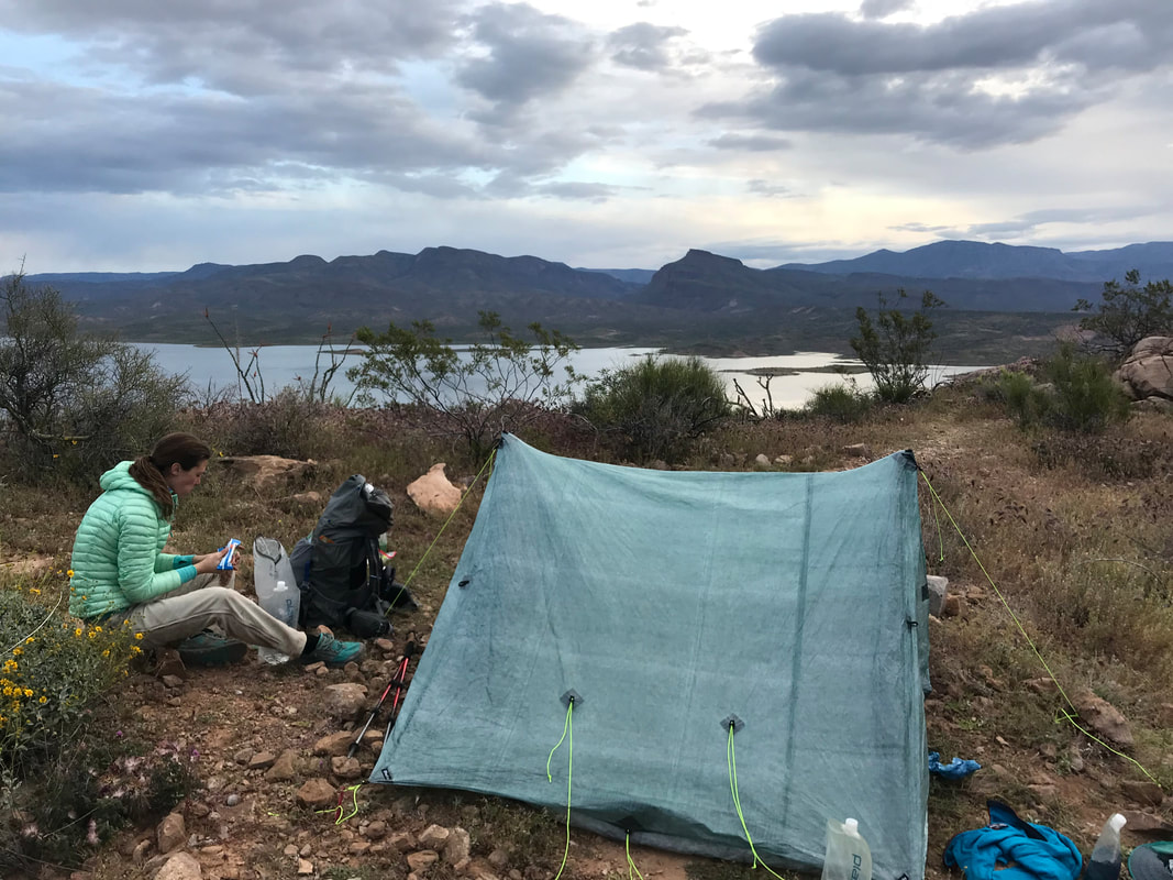  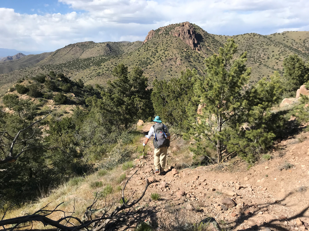 THE SUPER V! Today would prove to be the hardest day both mentally and physically yet. What a terrible night’s sleep last night was. A windstorm swept over the mountains in the night, pummeling our exposed (my fault) shelter with constant 10 - 20 mph wind and gusts reaching 35 - 40 mph. Those gusts happened about twice a minute all night. The Triplex (being made of Dyneema) would swell at the seams, bend, and bellow this horrible noise that made it seem the sky was falling. Dyneema (cuben fiber) is awesome for its waterproofness, but its bellowing in wind is unmatched. I slammed earplugs in my ears to drown out the explosive shaking. That taken care of, the wind began gusting horizontally bringing a hoard of fine silt dust through the netting. All of it settled on my face and body since I was sleeping on the windward side. I felt like I woke up once an hour, my face and body caked with dust. Again, my fault for campsite selection. That was coupled with an intense cold brought in by the approaching front. At some point in the early hours of the morning, after feeling like we would blow away, the winds died down. Consequently, we could finally sleep. We woke up later than normal, drowsy, drunk on the physical exertion of the day before and the poor sleep. It took us longer to pack up this morning because dust permeated all my clothing, the inside and outside of my quilt, and most of our items. The older couple were gone from their site. It looks like we made a good call sleeping out in the open because massive tree branches had broken off in the night and laid everywhere. Packed up, we crossed the creek nearby and descended into a gorgeous riparian valley. Conifers mingled with deciduous. Plant diversity abounded. It was nice and cold, so no sweating. In fact, I shivered for the first hour. It was beautiful, peaceful, and the trail crisscrossed back and forth across the stream. In the distance, I could just made out the distant edge of the Four Peaks. The AZT left Reavis Ranch Trail at a junction and became steep and overgrown. It crawled under low hanging branches of trees, shimmied up narrow rock washes, and quickly jolted upwards into thickly overgrown manzanita. All of which scraped, scratched, whacked, and stumbled our walking bodies. The easy morning quickly turned to hard work as the trail became a skinny singletrack shooting skywards along steep cliff edges with tangled and sharp manzanita stems to break one’s fall. A couple hours later, the manzanita became pine as the trail reached a saddle and afforded views of the creek valley below. From here, the AZT became more gentle in grade. A surprising thick ponderosa pine forest greeted us. The trail sloped down through this large pine forest for several miles. It swept across large, beautiful grassy meadows (completely shocked by these being up here) and meandered through streams (some dry and some deep with spring water). One portion had us walking in the water and under jumbled secondary growth branches. We passed a large meadow filled with grassy tussocks with some large spruce and the biggest juniper trunk I had ever seen in my life. 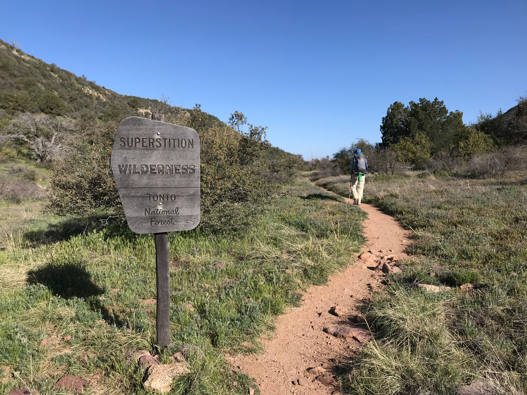
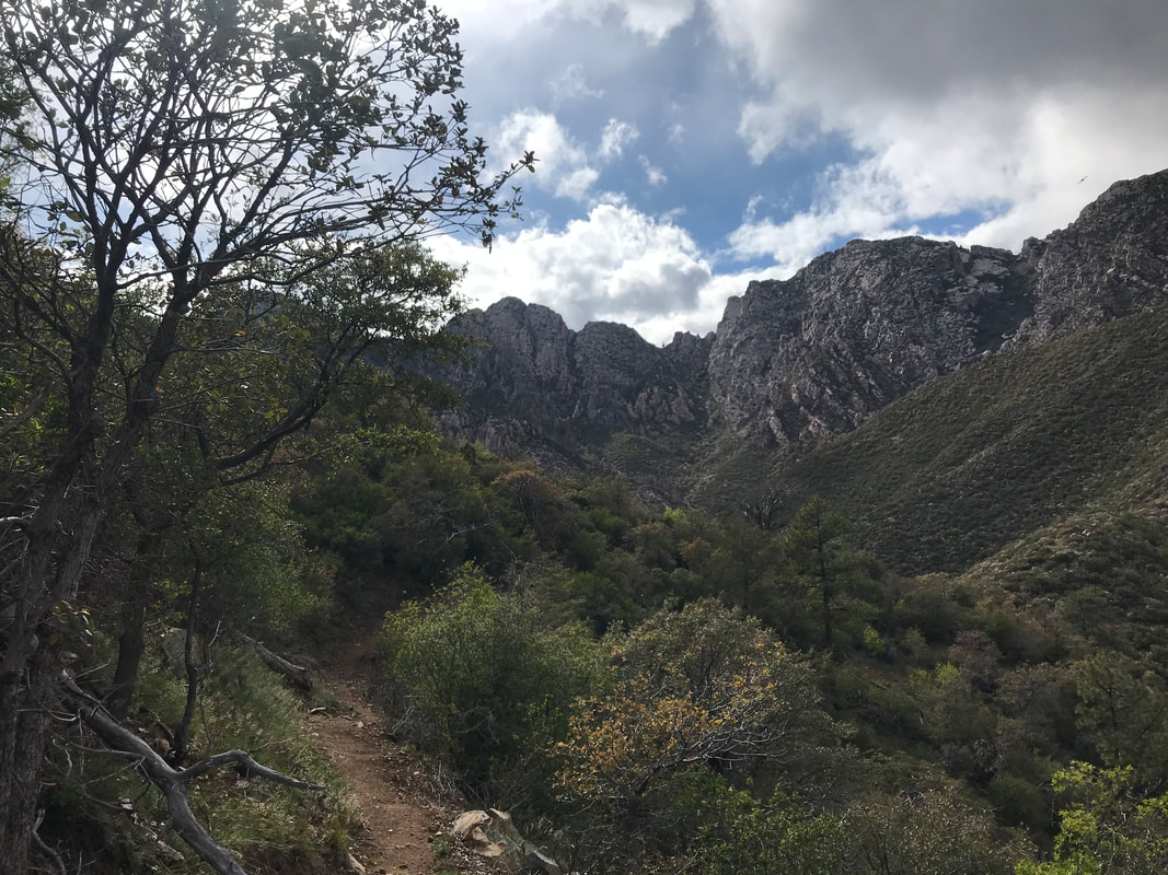
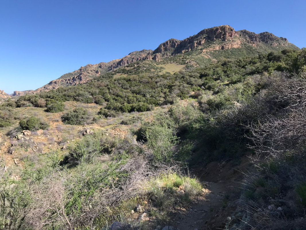
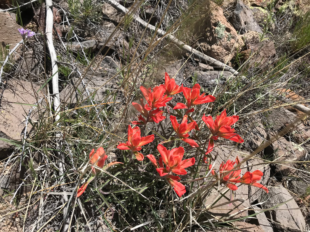
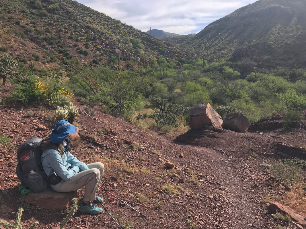
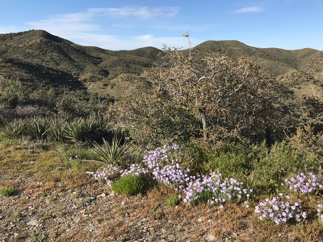
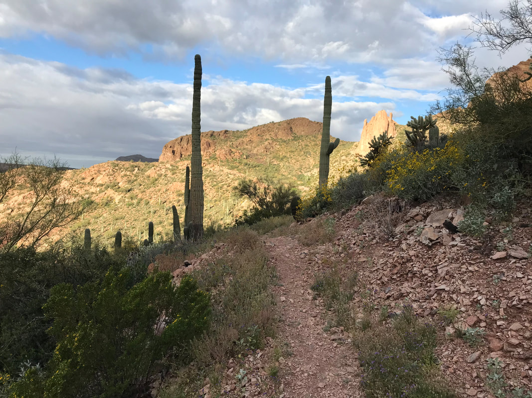
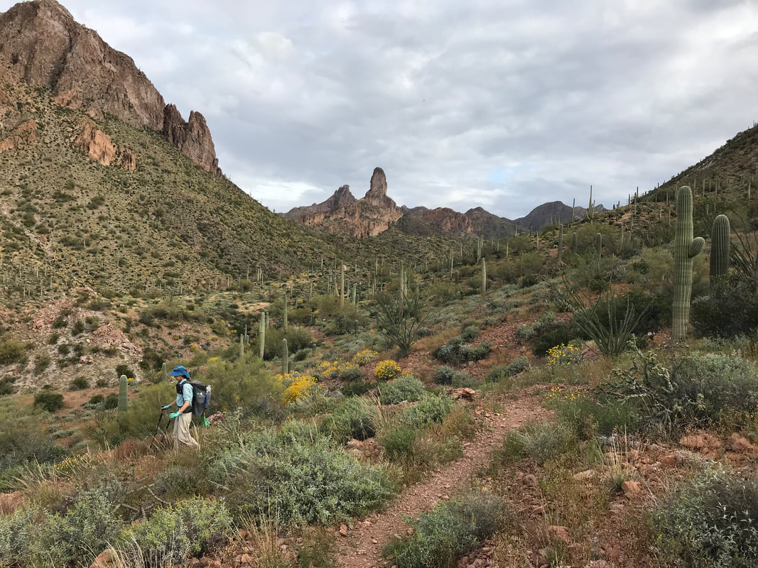
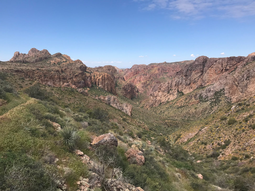
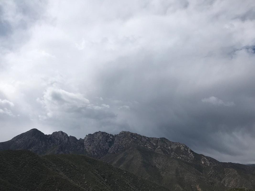
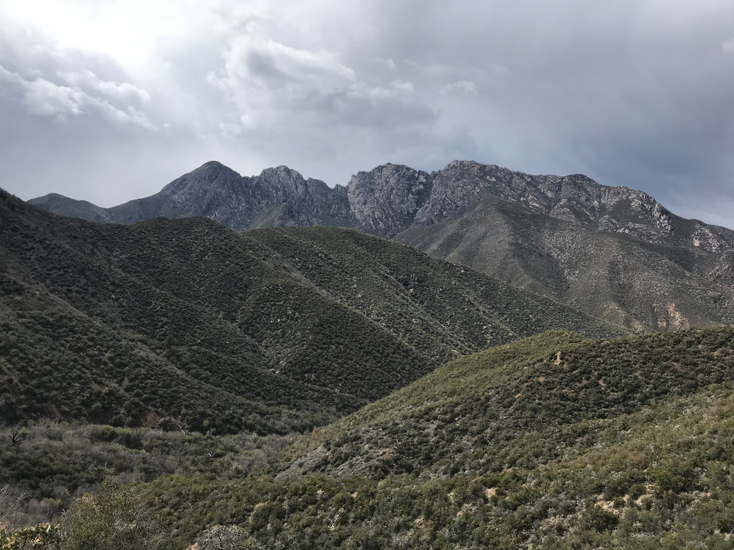
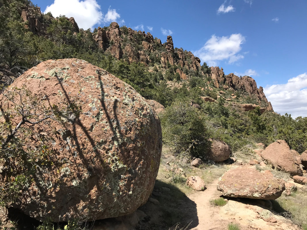
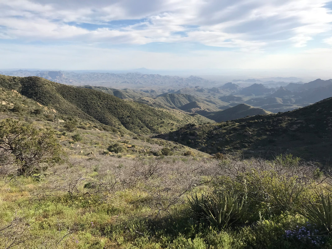
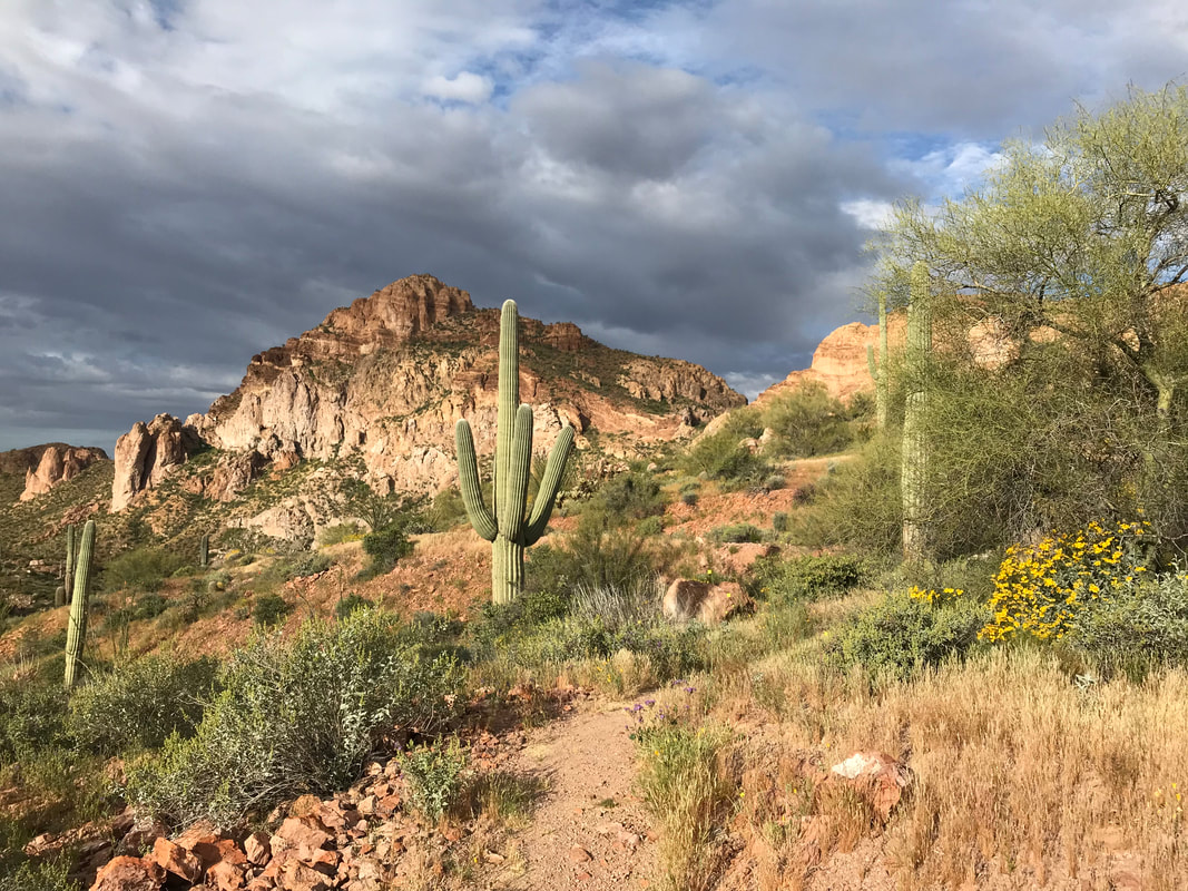
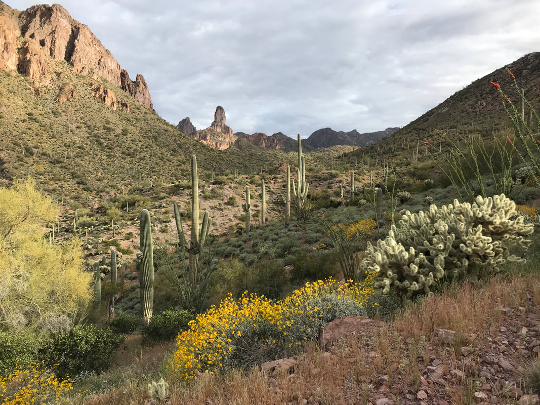
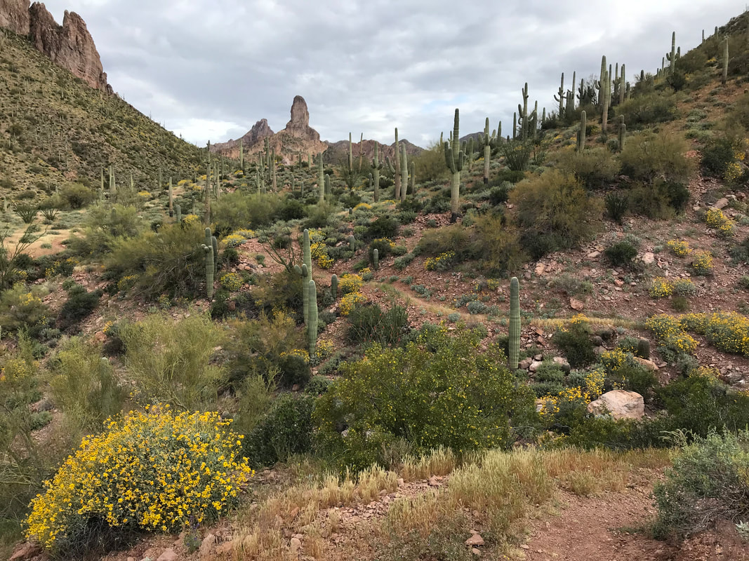
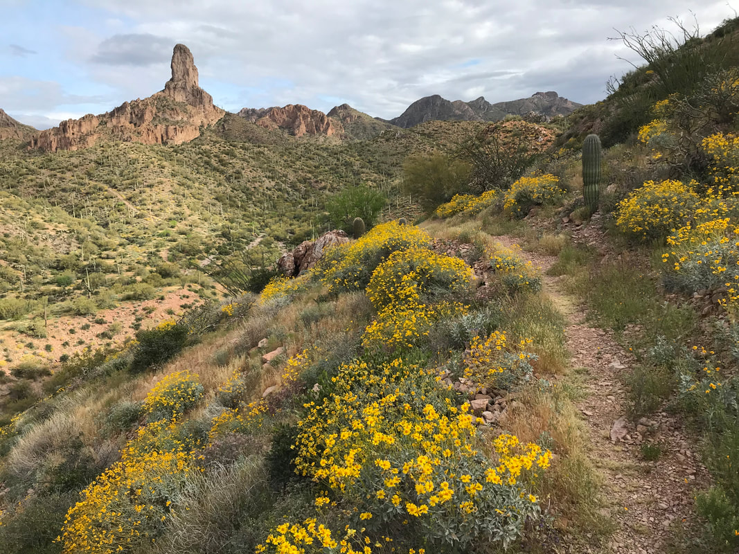
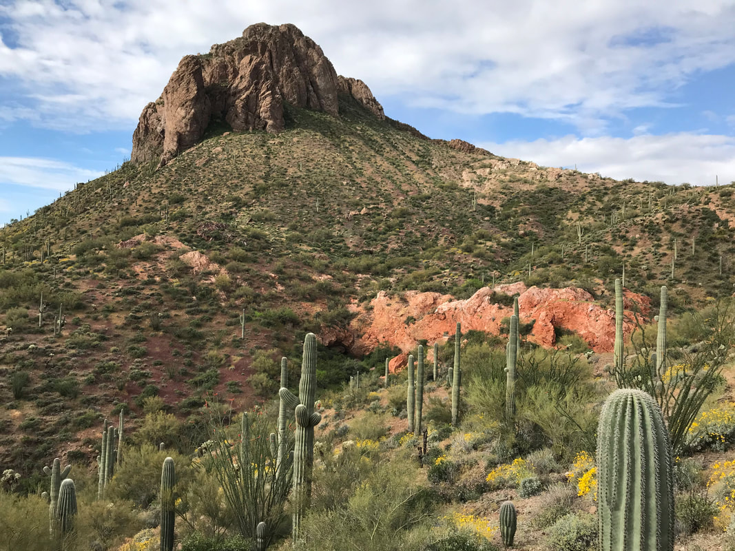
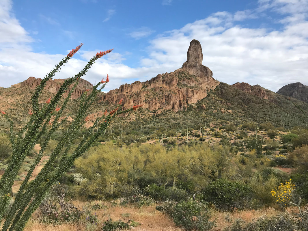
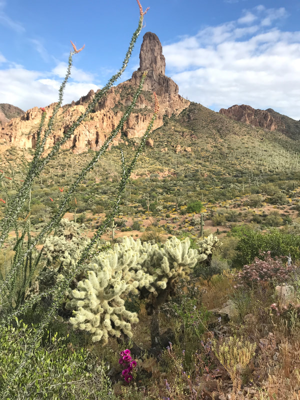
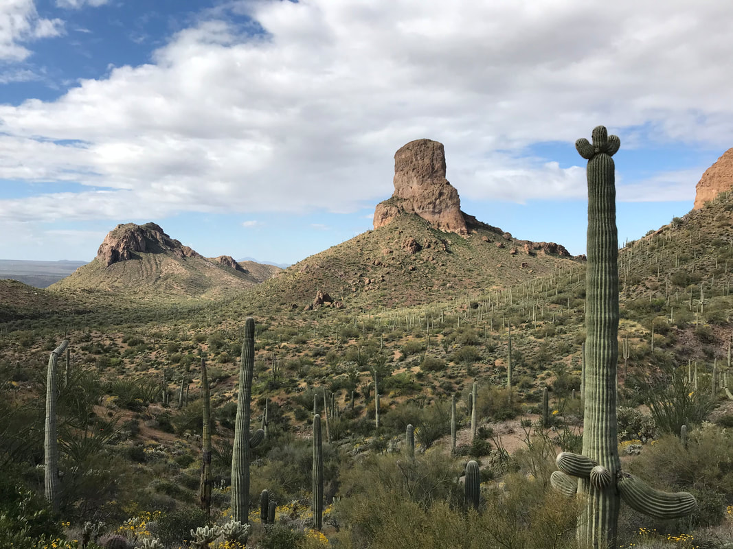
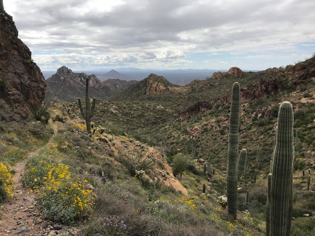
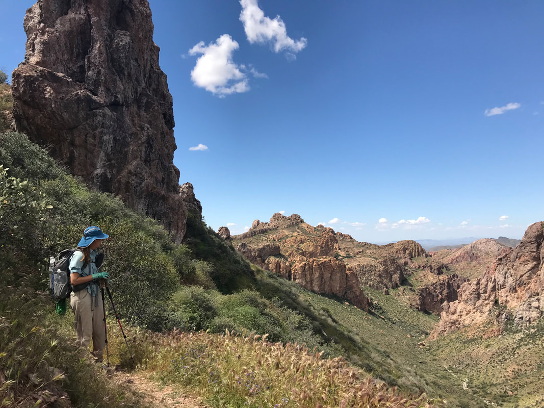
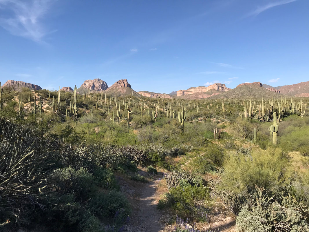
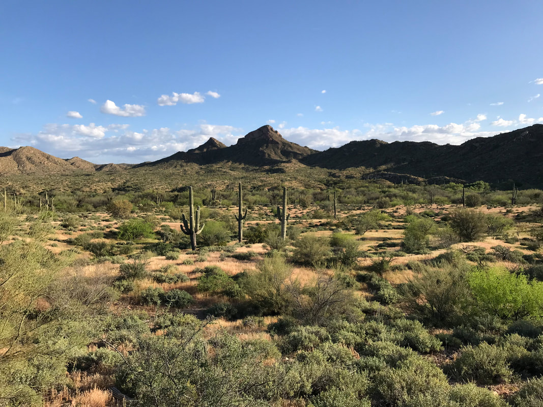
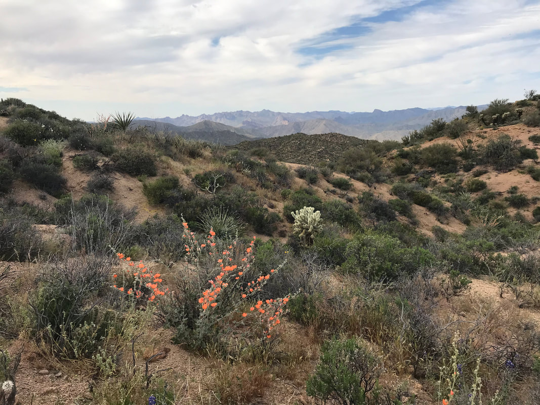
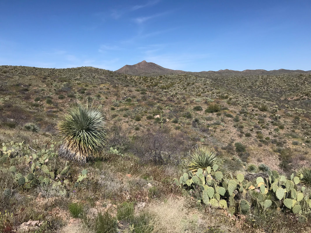
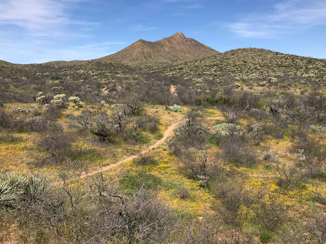
  By noon, the AZT crossed out of the thick forest and entered Reavis Ranch. Reavis Ranch is old homestead, now abandoned. What remains is a large flat valley walled in by desert peaks. But this valley is filled with lush green grass, multiple streams, and a huge apple orchard left by the former white settlers. The apple trees were in bloom now for the spring. In the autumn, backpackers come up here to get the free fruit. Deer also loved this area and we passed a herd spread about the meadows, eating grass and resting in the shade of ponderosas and spruce. Janna and I went and looked at the foundation of the old homestead, its abandoned ground cellar, and the old fenced fields nearby. Obviously a popular camping spot, several well-used campfire rings lined different areas of the field. We sat in the shade of a large oak, eating lunch and getting some spring water. By early afternoon, the AZT left the protective valley with its grass and water to head back up over the dry surrounding desert peaks. The trail came rocky with babyheads and small boulders. Fireweed (the first seen this season) grew trailside in places, the red starkly catching my eyes. Large round boulders and geological spires stood out from the land. In the distance, large clouds began building. We kept an eye on these as we knew a cold front had come during the night before. The trail was washed out in several areas, but we successfully got several miles under us before we hit Pine Creek. This was the last reliable water source for the day so we carried 4 L out each. The trail ran up a ridge and hit a high elevation mesa where the gathering clouds to the north now sent an unobstructed wind right at us. Four Peaks was clearly visible. I had climbed Brown’s Peak (the highest of the four) several years ago with Reed and I had been itching to return. 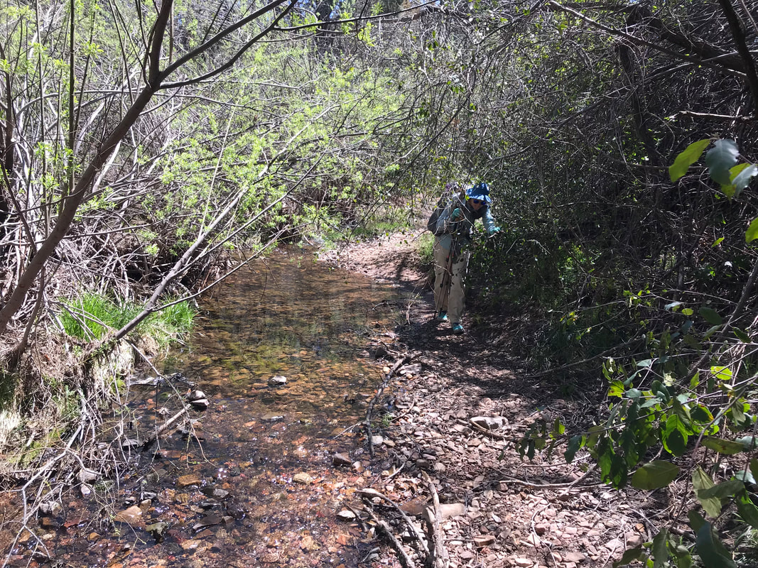 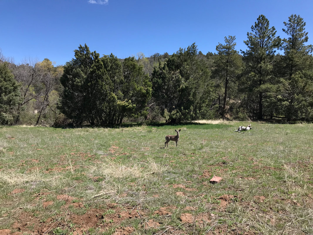
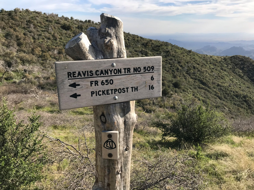
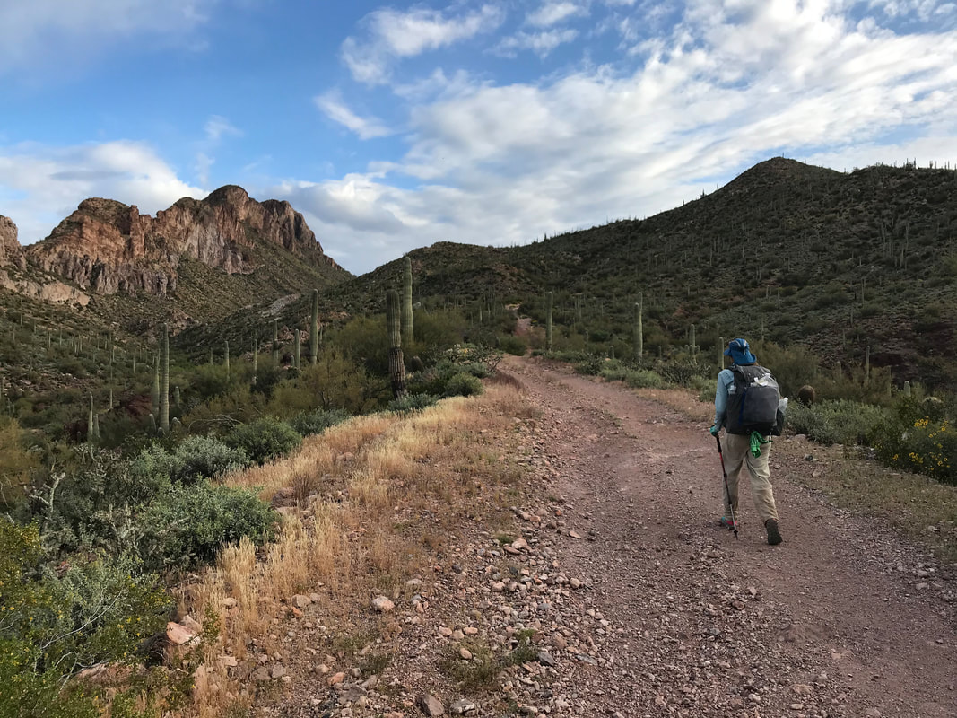
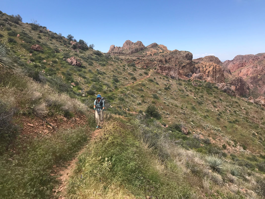
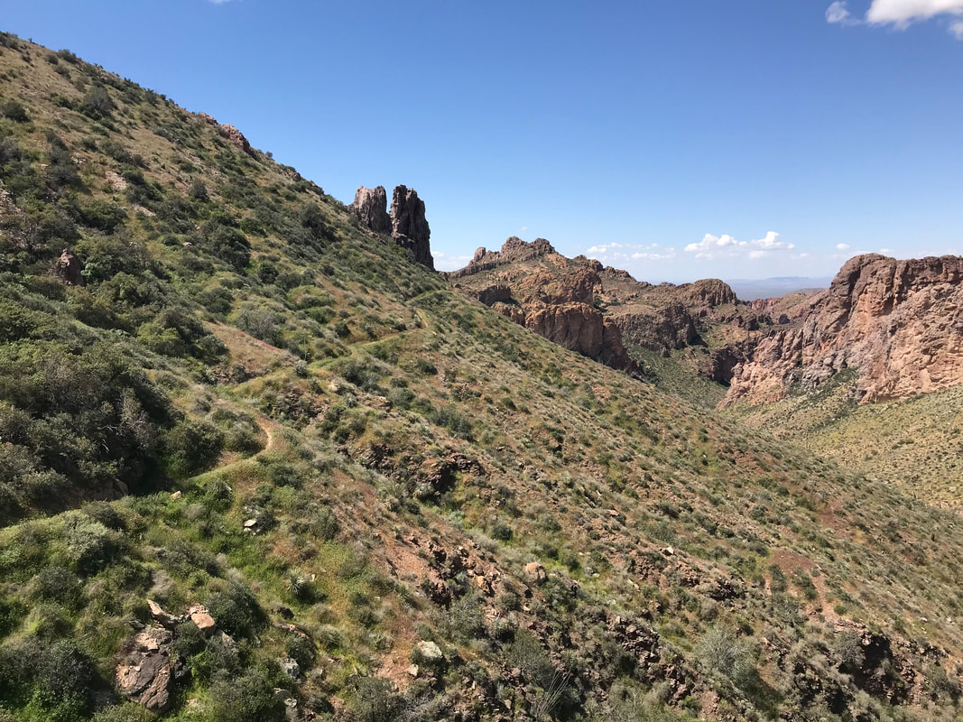
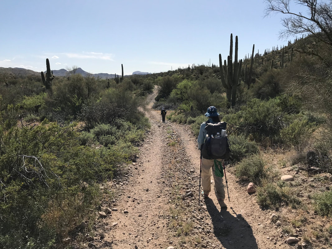
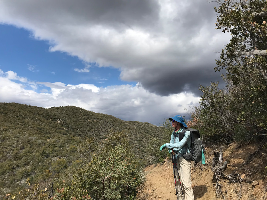
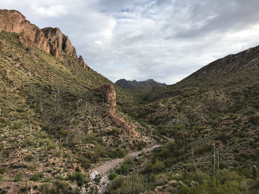
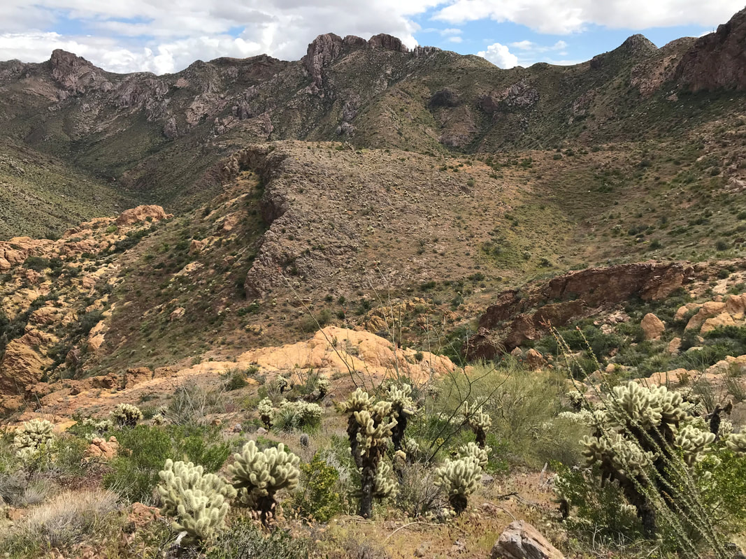
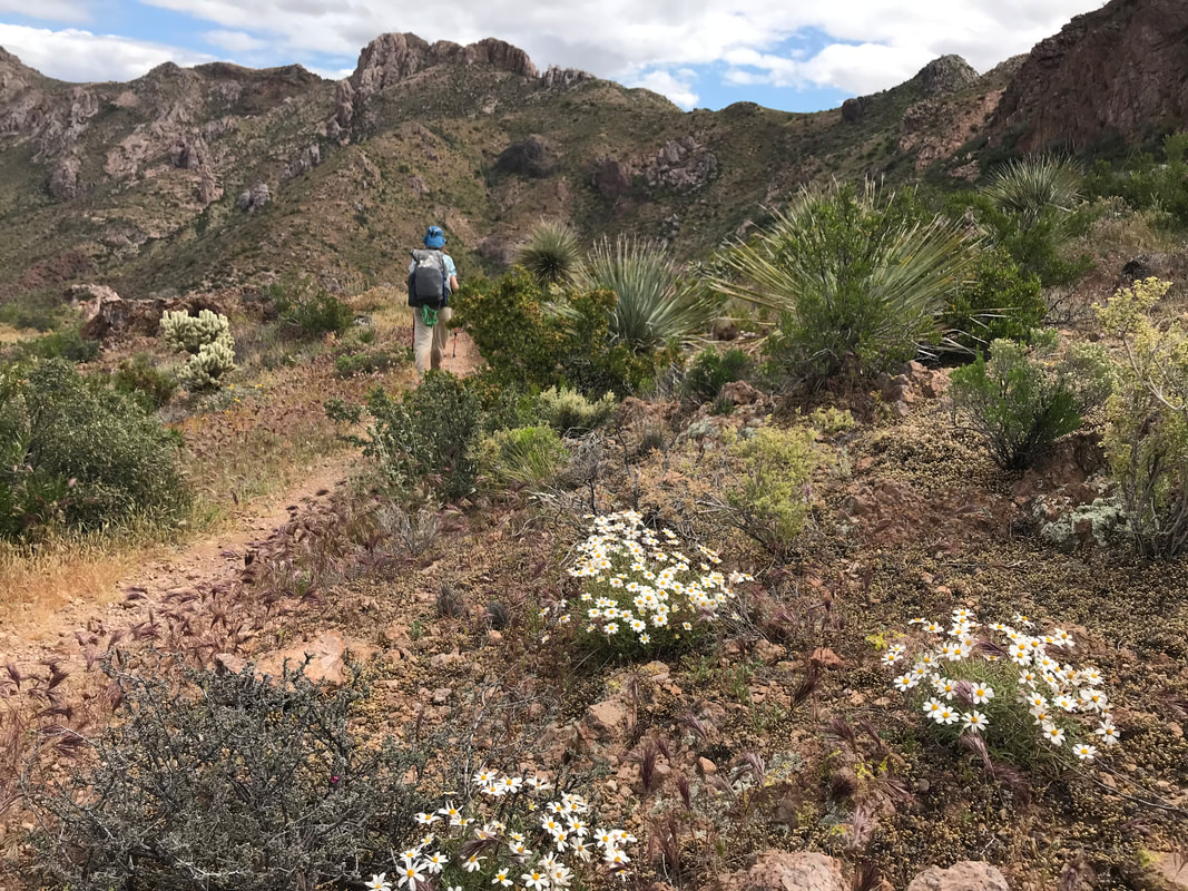
  Now the wind blew at 30 - 40 mph consistently. We leaned into it and felt a sudden chill chase away any heat from the day. I had an urge to poop and ran up a hillside and crouched behind a single windblocking bush to do my business. An unsaid sense of urgency began to settle in both Janna and I’s minds. A storm was gathering and we were well over 5,000 feet in elevation on an exposed high desert mountainside with little vegetation for cover. The name of the game was movement. We switchback higher up a hill and hit a saddle where the most INSANE descent and ascent (literally top 3 in my life) awaited. “WTF is this??” we both thought as we looked at a section we would later call “The Super V.” Just like a V, the trail descended straight down the side of a mountain, no switchbacks at all. The entirety of it was scree that provided ill-secure footing. It was narrow, cliffs were abundant, and the steepness only seemed to get worse when approaching the crook of the V at the bottom where a dry creek-bed lay. We ended up losing 1,000 ft. in a mile to the bottom, all with the accompanying wind blowing sideways on us. I had to carefully place each step because my knee was now screaming. Janna started descending on her butt at one point. Near the bottom, the steepest portion, I stepped on some scree, my legs slipped out from under me, and I fell backwards smashing my back into a pointed boulder right where my spine was. Janna yelled and came to me. I got up, feeling the impact and looked at my pack. The pointed boulder had ripped a massive hold in the outer mesh pocket and taken most of impact. Thankful I could fix it and that my back was sore but okay, we hit the bottom of valley and looked up. Dark, black clouds wisped up along the upper edges of the opposing valley wall. There was nowhere to take shelter down here in case of lightning; it was exposed and probably would flood anyways. Now the rush was on to reach the opposing top of the Super V, get on the saddle, descend the other side, and find some shelter before a lightning storm potentially unleashed. The opposite side of the Super V required gaining 1,200 ft. in 1 mile - also all vertical straight-up with scree as the substrate. Every step up stretched the Achilles acutely and was joined by a backwards sliding motion eliminating a good chunk of my effort. Double work was the sacrifice required to reach the top. The whole time, my eyes kept staring as the black clouds advanced from the north towards us in the south. “Just got to reach that ridgeline before they are on us. Just got to reach that ridgeline,” I thought over and over in my head. Near the top of the ascent, the clouds arrived but moved not just south, but easterly as well. A rush of relief hit Janna and I. We were literally climbing on the edge between blue sky and black walls and the walls were moving away from us. Rain sputtered only lightly on us. We were near the top saddle when we saw a large juniper. Anxious to get out of the unrelenting wind, we huddled and felt afforded an opportunity to eat a snack and drink some water. I mean, we earned it with the storm moving away, right? Fed and watered, we left the wind-block and made it to the saddle. Dear god. The storm was waiting here for us. The AZT didn’t leave the ridgeline. It WAS the ridgeline. A ridgeline right into the massive billowing clouds growing on Four Peaks and streaking across the heavens to here. There was no avoiding it. There was no shelter behind, just shelter ahead…or so we hoped. Nothing blocked the wind. It was so intense that Janna’s bandana immediately flew off into the distance, never to be seen again. Later, the two senior hikers before us would agree that the wind was a constant 40 mph with 50/55 mph gusts. Literally knocking us off our feet. Three miles of this awaited. We stumbled along and I attempted to take 3 photos of the storm that did NOTHING to capture how crazy it looked in real life (see my poor attempts below). Wind rocked us sideways. My hat was cinched to my head. We had our rain-gear on but it only sprinkled. The layers kept us warm. My fingers numbed in the cold and I just kept cranking out speed. Finally, an hour or so later, the AZT crept off the ridge and went to the leeward side of the mountain. It was amazing how we went from being blasted to still in a few footsteps. A small valley appeared with low-growing juniper and pine. As we passed into it, a series of small campsites appeared. I was so thankful. We setup camp in the dying light, the sound of wind on the ridge above us still there. And yet, with evening, the storm blew out as if never there. I walked down the trail a bit and found the senior hiker couple already camping and asleep. I returned to the Triplex and carefully crawled inside. Mentally taxed from the storm. Physically taxed from poor sleep, crazy ascents/descents, cold, heat, and wind. Just so incredibly HAPPY that we found this great campsite. Safe in the Triplex, I knocked out. 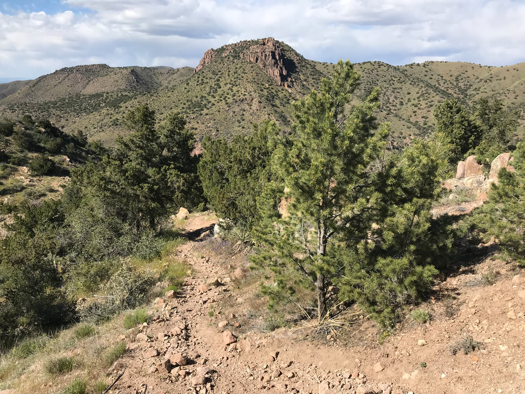 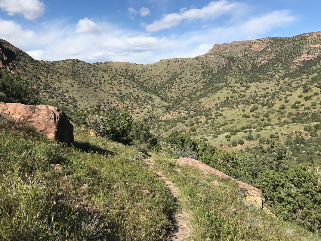 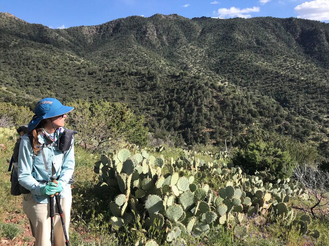 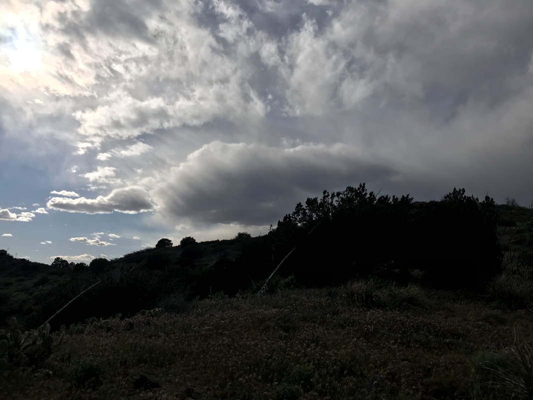 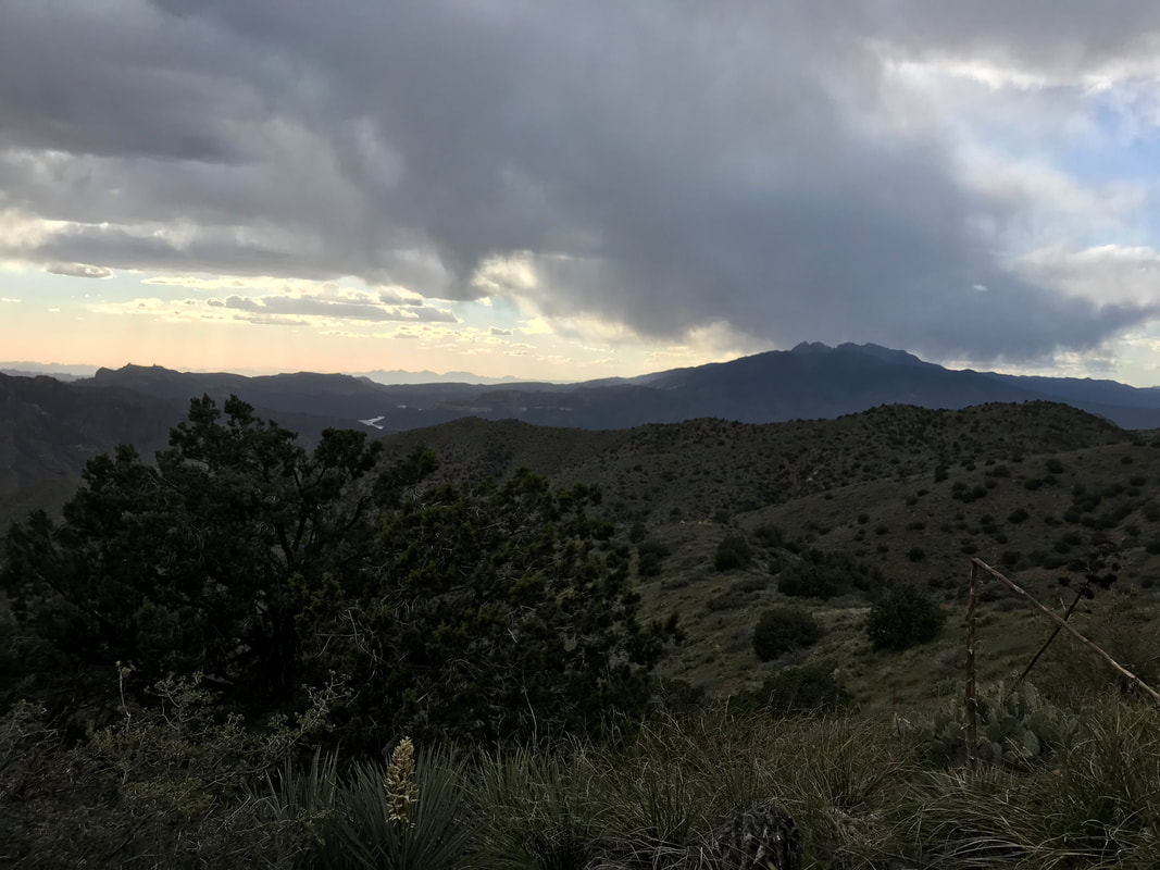 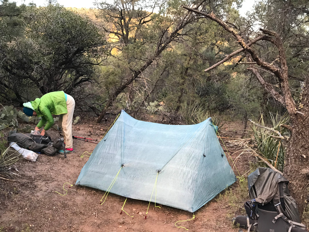  Morning arrived quickly to the tune of 4 am. Janna’s teammate Tony, from her school, was graciously picking us up at 5 am, dropping us back at the Picketpost Mountain Trailhead where we had stopped several days before, before he turned around and made it to school to teach all day. At 6 am, we rolled into the parking lot, just as the cusp of the sun hit the horizon. We were also eager to get going to avoid getting cooked in the low country. A second older couple stood in the parking, also getting ready to embark. They were definitely seniors and the look of their gear indicated high experience. We talked to them briefly before they took off. Faster than us, we wouldn’t see them again until the end of the day. I felt exhausted and slightly off-camber, as if I’d been gone from the trail for months. The morning was warming already and I felt like I had to regrow my trail legs. The Arizona Trail went through a culvert beneath the 60, and moved across this vast basin area with the Superstitions and rugged peaks of the Tonto National Forest rising before us. Brittlebush blooms carpeted the desert floor beneath the spires of saguaros. We moved quickly, hitting a wash with a solid flow of unexpected water that we topped off our supplies with. The trail began to parallel the flowing wash for several miles, banking next to wall of red rock. The small rises around us grew into peaks, us gaining elevation as we followed the flow uphill. The whole time, a thick spread of grasses grew right up to the trail, obscuring the path in front of us at times - I had never seen anything like it in the desert before. There were even some parts where the grass was so thick that a passing equestrian had smashed the stalks across the trail.
 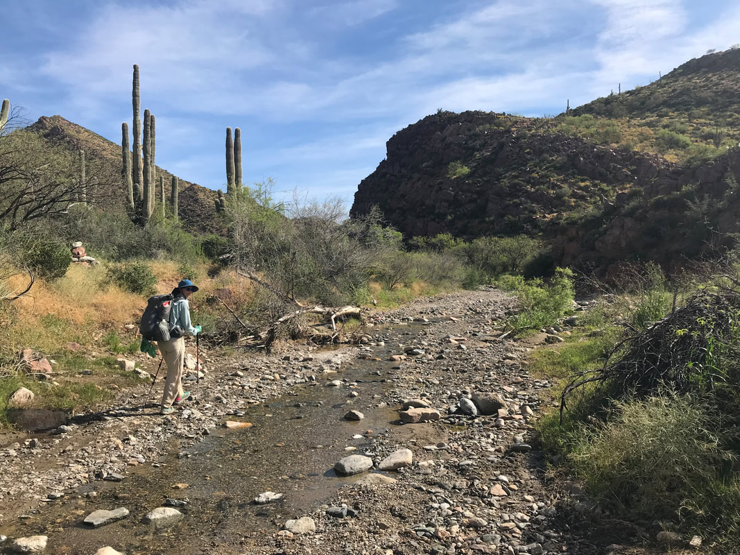  Carefully I walked in front of Janna, slowly placing my feet where I couldn’t see them into the thick mat below. Every step submerged my legs up to my knees, and I knocked hard with my trekking poles the crisscrossed grass folded in front of my next foot placement. Then, boom! A rattlesnake head darted out next to my pole while it sent its tail shaking. The buzz filled the air and I led us through the brush around it. This dance of rattlesnake buzz, sightings, and wading through deep grass continued for several hours. It was mentally taxing. I spent more time staring straight down than at the views around me. My ears strained for noise. My eyes scanned for the shape of snake heads. Brush of trekking pole tip, BUZZZZZ, rattlesnake coiled, us cautiously moving around it. The dance of precision and care. A few miles later, the grasses receded and we walked along a spent wash. We hit a cattle tank with a float valve outside of a nearly abandoned corral in early morning. We sat in the shade of a building which obviously had been used recently for target practice. We pressed on. Around 1 pm and well into the mid-upper 90s F, we reached Mud Spring, which had a singular large cypress providing shade. We dropped packs and crouched in the shade. Small midges from spring flew about, dying in the heat and desperate for water. They dive-bombed my tear ducts so I threw some head netting one and took a long 2 hour siesta.  
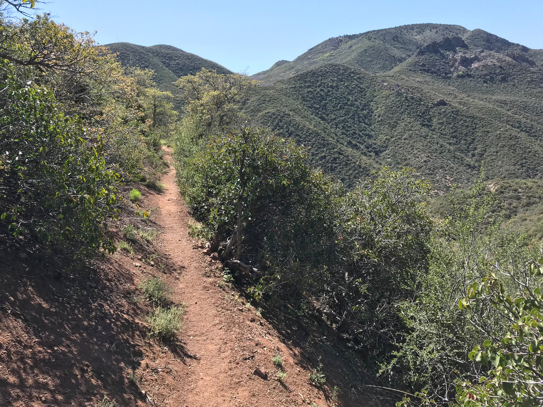
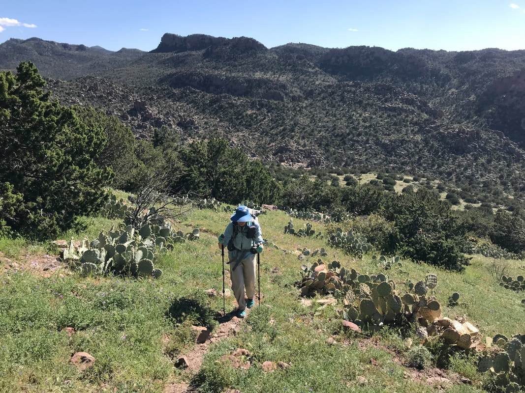
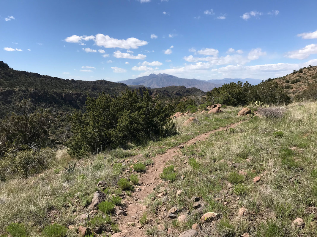
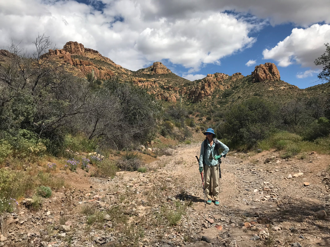
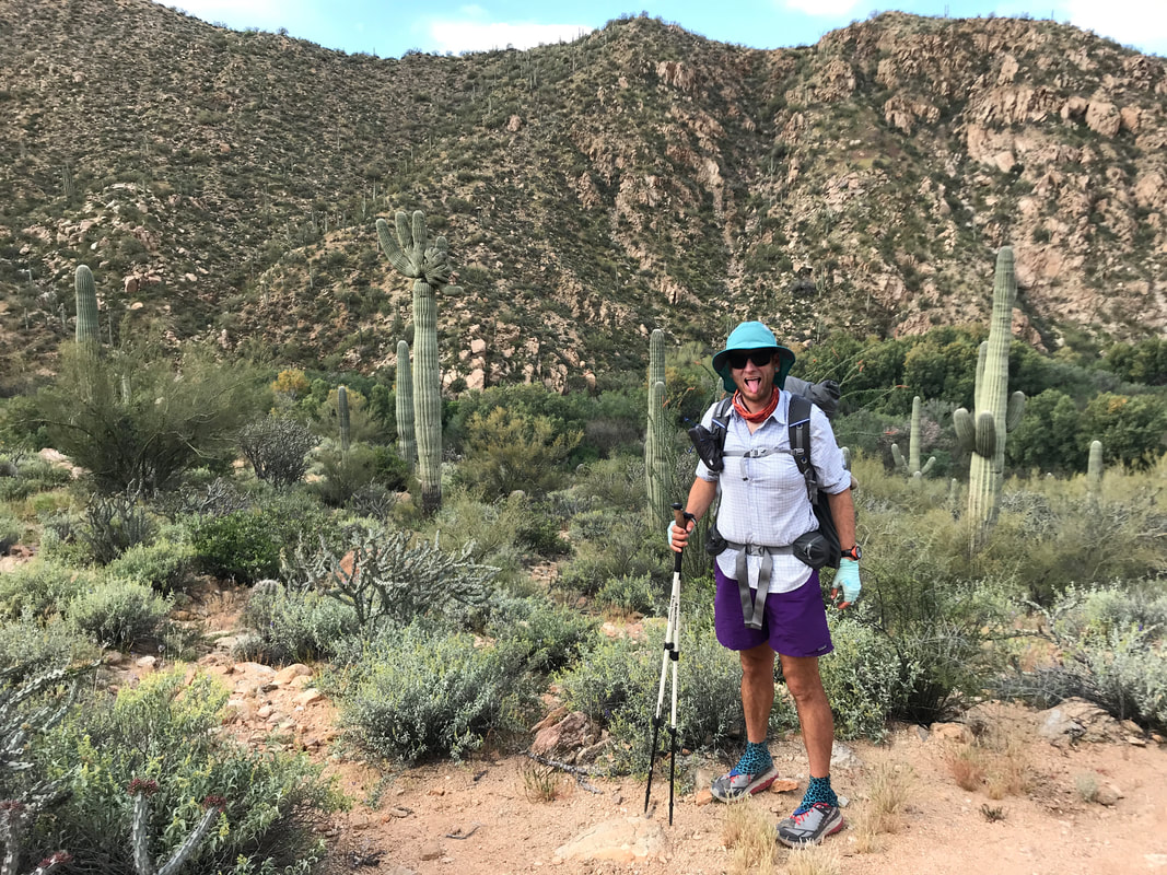
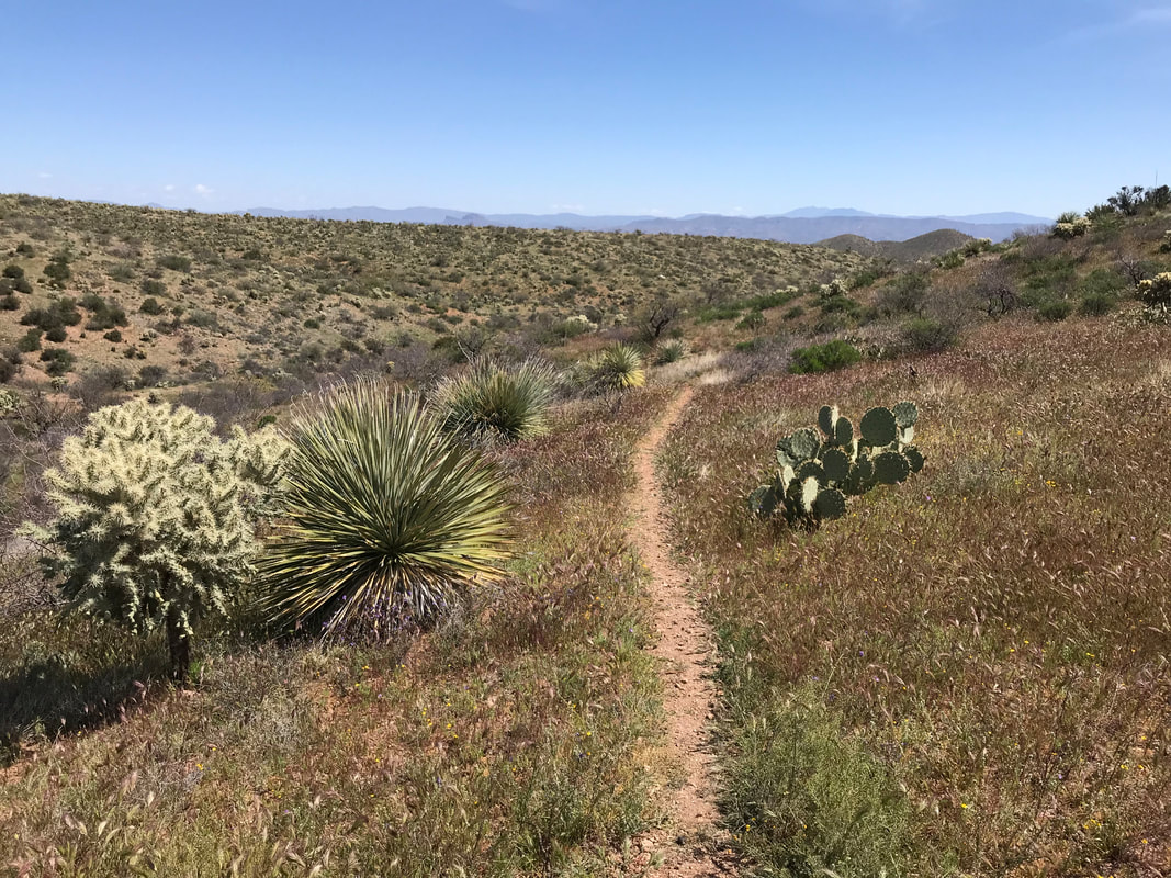
 Around 3 pm, we decided to get a move on as we still had a 3,000 ft. ascent up Montana Mountain before we would arrive near where we hoped to camp that night. Now, the trail wove in and out of the wash as we moved steadily uphill. Saguaros began to fade away with the gain in elevation. We passed the ruins of an old ranch and its crumbling walls. The AZT began to weave away from the wash and starting switchbacking up the south flank of Montana Mountain. Suddenly, a rapid botany change occurred as low desert plants were all replaced with a stunning green grassland. These grasses were 3 - 5 ft. tall, vibrant, and made me feel like I was walking through a savannah in the rainy season. I could barely see the trail weaving through the swaying stems. Some were even as tall as me! The trail wove back and forth and the entire canyon we had walked up fell away below us as we took our first extended glances at the distant ranges from this height. Picketpost Mountain and the entire Gila Canyon range stood at some distance to our south. The grasses wove back and forth until, near the top, and drenched with sweat, we began stumbling through chaparral at 5,000 ft. in elevation. The AZT peaked out at a saddle where we could now look over the other side. There it was! Phoenix in its metropolitan sprawl far out to the west with Mesa homes in view. The Superstition Ridgeline prominently separated city from wilderness. Large cut valleys filled with pines and junipers lay below. A group of 3 thru-hikers just heading out on the Grand Enchantment Trail met us (the GET has a western terminus in Phoenix with the eastern terminus in Albuquerque). They reported seeing a black bear nearby, not surprising as they are relatively common in these desert mountains. Now the AZT traced a ridgeline along the easternmost portion of the Superstition Wilderness. The AZT dumped us onto a dirt forest road outside the wilderness zone where we road walked with awesome views on either side. Violet flowers grew in clumps beneath agave plants. Manzanita, juniper, and pine began to fill up around us. After the significant climbing of the day, both Janna and I had pain in our plantar fasciitis. The dirt road was pleasant and gentle in grade. It slowly entered a pine forest with beautiful creeks and washes filled with water. And then, we were at Roger’s Trough trailhead. We headed over to some good camping but found the area taken by that senior couple. Everything else was slanted or rocky. We settled on camping in the parking lot in the dust. A creek flowed several hundred feet away that gave us a resupply of water. We felt beat by today. It was beautiful but harsh. However, we were up in elevation in the cooler temps now. We only had two other descents to the low Sonoran desert between us and the Mogollon Rim high country - two more times for heat as spring advanced towards summer. After a dinner of pizza tortillas (tortillas, pepperoni, and cheese), we climbed in for the night.  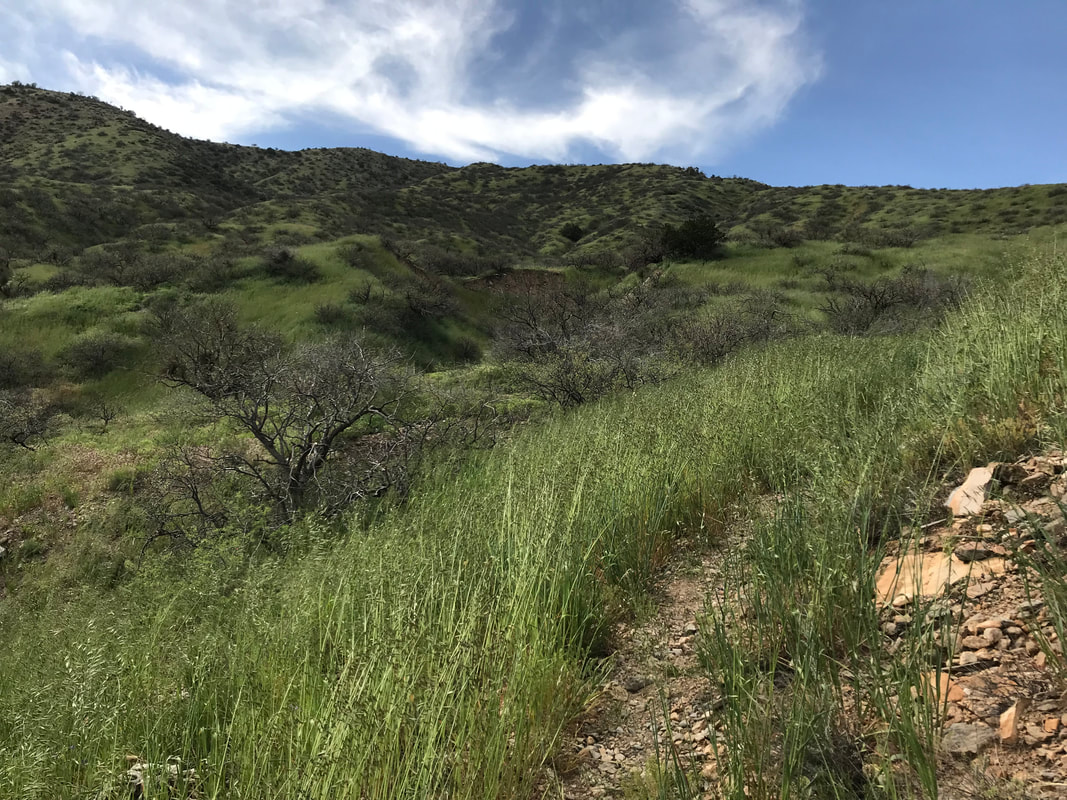 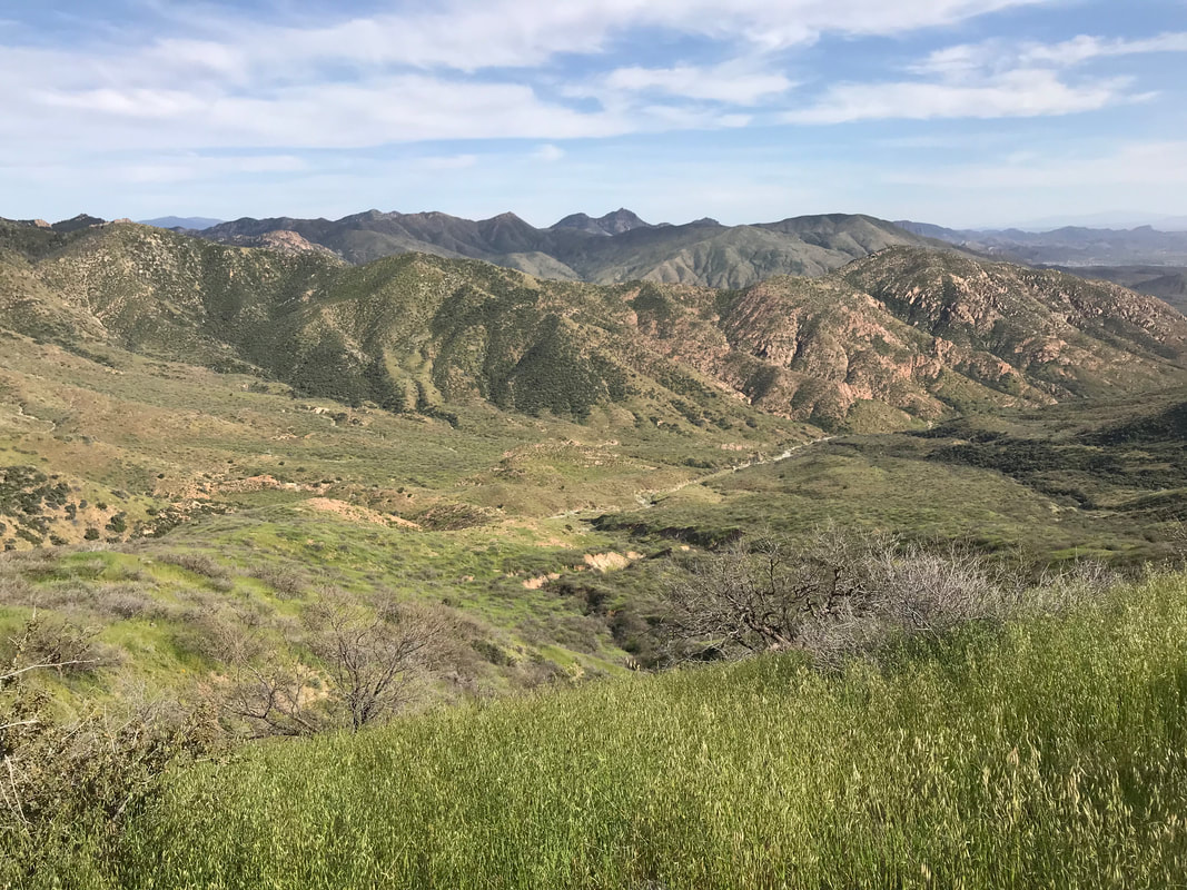 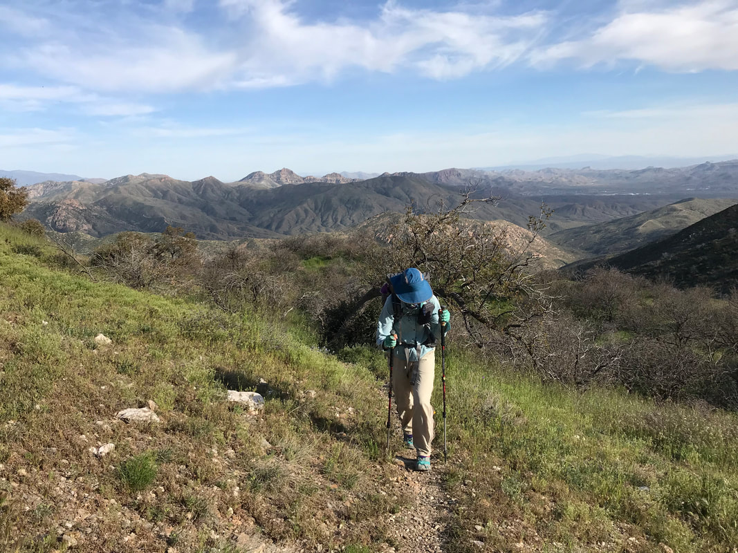 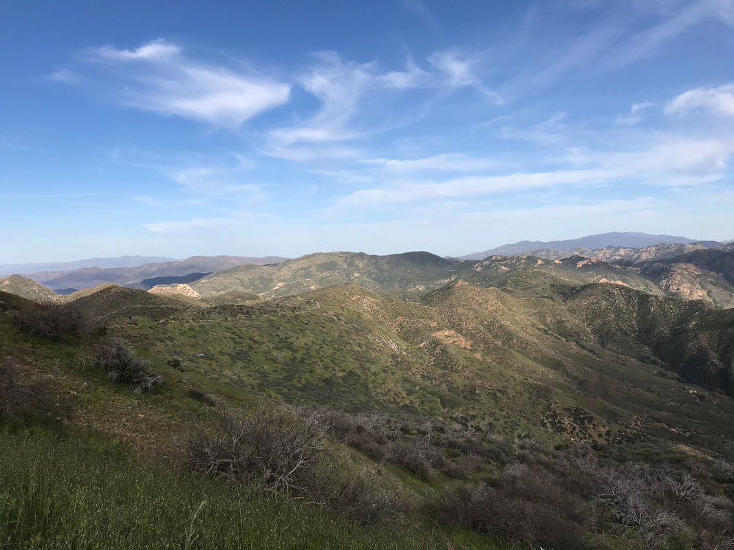 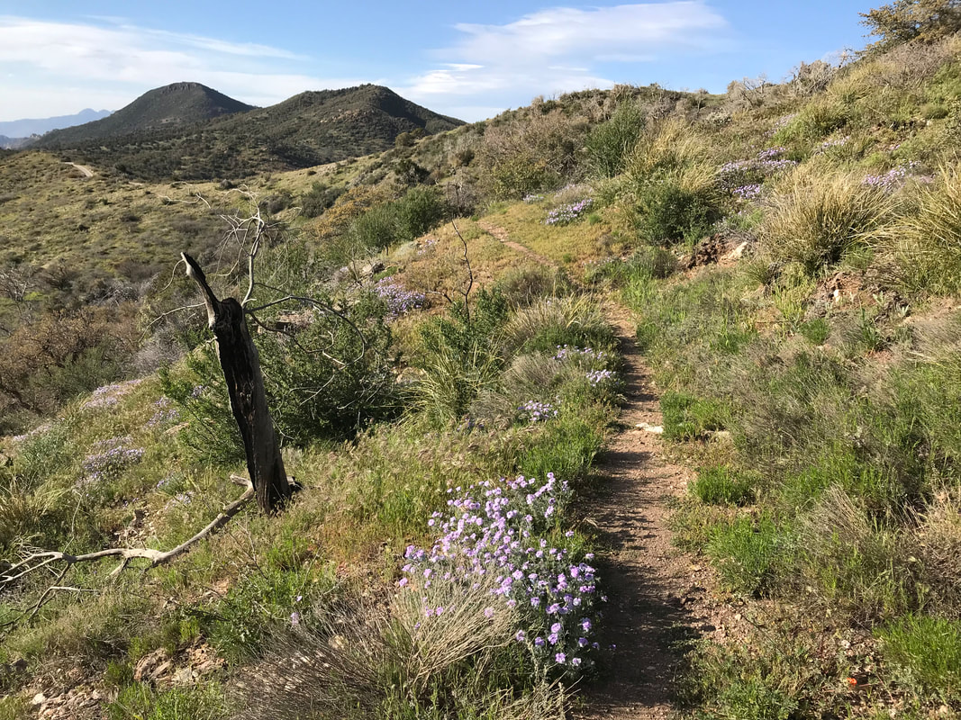
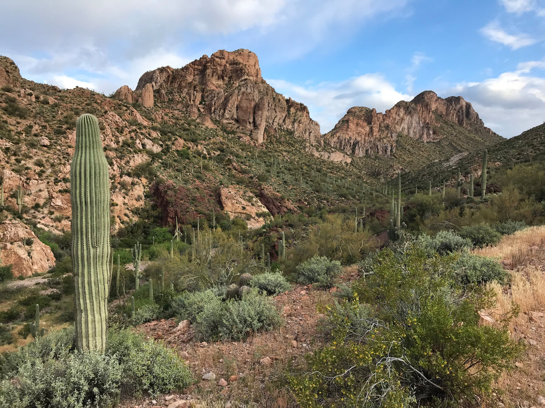
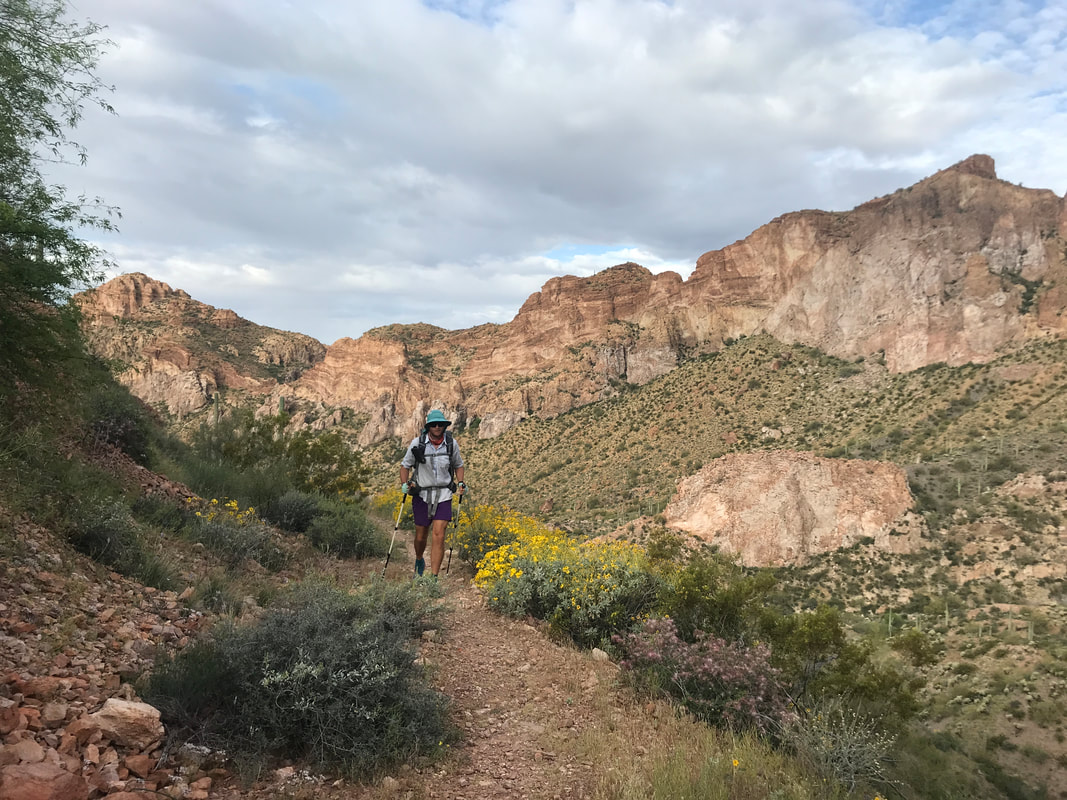
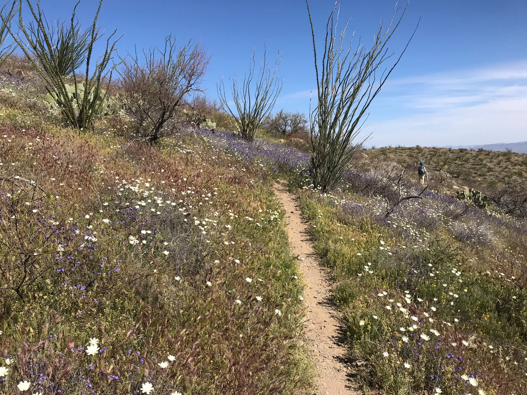
   Sleeping hard in our own bed in Phoenix was the relaxation I needed. All four of slept in and woke to the warm glow of spring in the desert, doors thrown open in the apartment. We decided that we would take two zero days here for the reasons (a) it was our apartment so it didn’t cost us extra to stay, (b) we wanted to spend some time with Taylor, (c) we were ahead of schedule due to our faster hiking pace than expected, (d) because we could. We got breakfast and dinner with Taylor and Ashley, enjoying a day lounging around, swimming in the pool, and completely unwinding. The next morning, Janna and I said adieu to Taylor and Ashley as we dropped them at the airport. Then, it was a whirlwind of activity. We went through the mail on hold, returned gear that wasn’t working, purchased food for the next section, washed gear, repaired gear, and assembled some mail drops (plus mailing them!). We had only assembled mail drops up to Phoenix previously as we didn’t want to over-hedge our bets on how far we would travel on the trail given my knee. Now that we were here, we felt more confident we could finish. We spent hours assembling everything until the end and ran to the post office at 9 pm to drop it all off. We got back home and passed out, knowing we had to get up early to get dropped back at Picketpost Mountain. 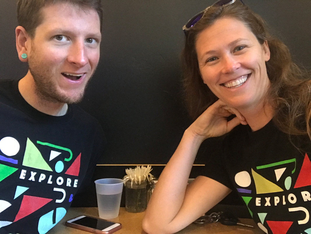  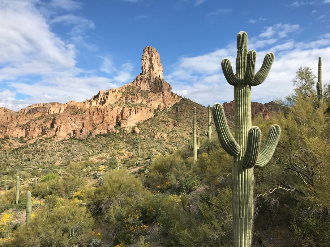 Photos galore follow as can only be expected when you hike through one of the most beautiful places you have ever seen. My respect to you, Alamo Canyon, one of the absolute highlights for scenery on the AZT out of all sections. If you wanted to do only one section of the Arizona Trail and see the Sonoran desert in its prime glory, this would be it. After the rainy night, a cool morning dawned. Today was an undertaking day. The longest waterless stretch yet, we planned on no reliable sources to occur between our campsite on the Gila River and our pickup at Picketpost Mountain 22 miles away. We would also be covering completely exposed Sonoran desert mountainscape with little chance for shade, a canyon for heat concentration, and the sure temperatures of the previous two days. With that, we got up early, only to watch Rosey leave even before we did. He said goodbye and it would be the last time we would see him, although we maintained text contact throughout the rest of the trail. Time to beat the heat in the morning with a 2,000 ft. ascent. 4 L strapped to each of our backs and almost no food left, we had a timetable to catch a ride from Taylor (Harrison’s fiancée) who was picking us up. We hiked up into Alamo Canyon at the same moment the retirees headed out. We all acknowledged our good luck with the cloudy morning and storm to cool everything temporarily. The AZT was a rutted jeep road at this point. The peaks rising in front of us rose above the valley like volcanic hearts - all neon green lichen on rich rosette-earthen-golden rock. The stuff of the Superstitions. The sun began to break through the clouds, giving that splay of shadow and light bringing sharp relief in hue and tone to the world around us. The canyon was soon filled with spires, columns, buttes, hoodoos, and amazing mountains. One of the best sections of the trail. Janna and I stopped every 5 - 10 minutes to take photos. The play of light and shadow from sun and shade made everything even more visual. As the AZT continued up the canyon, tracing the contours of mountainside, the iconic butte notable in this section reared. Saguaros dotted the rises and an abundance of brittlebrush more vibrant from the gift of recent water, dashed their yellow thickly along the trail.
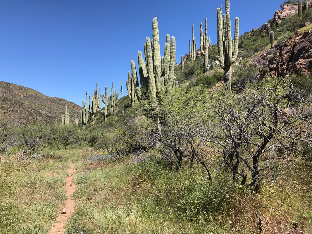
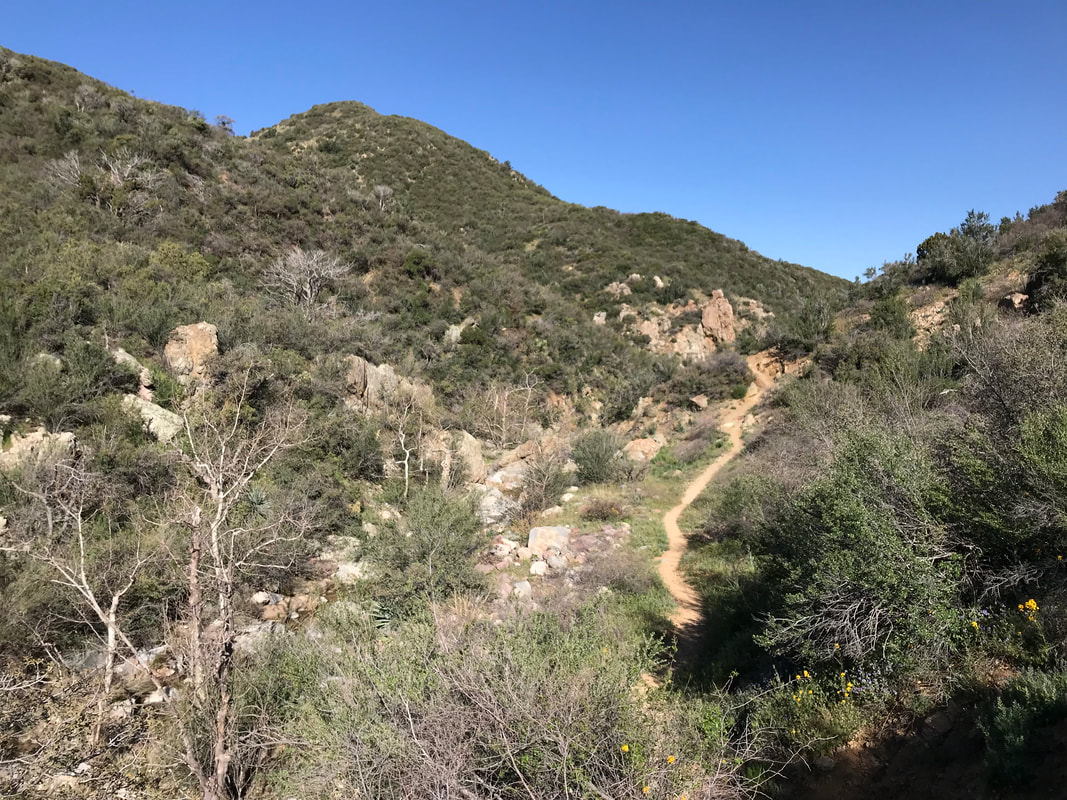
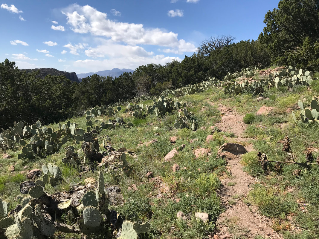
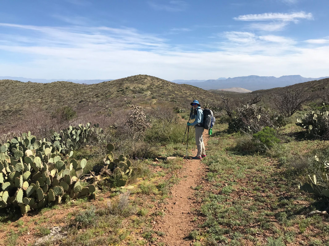
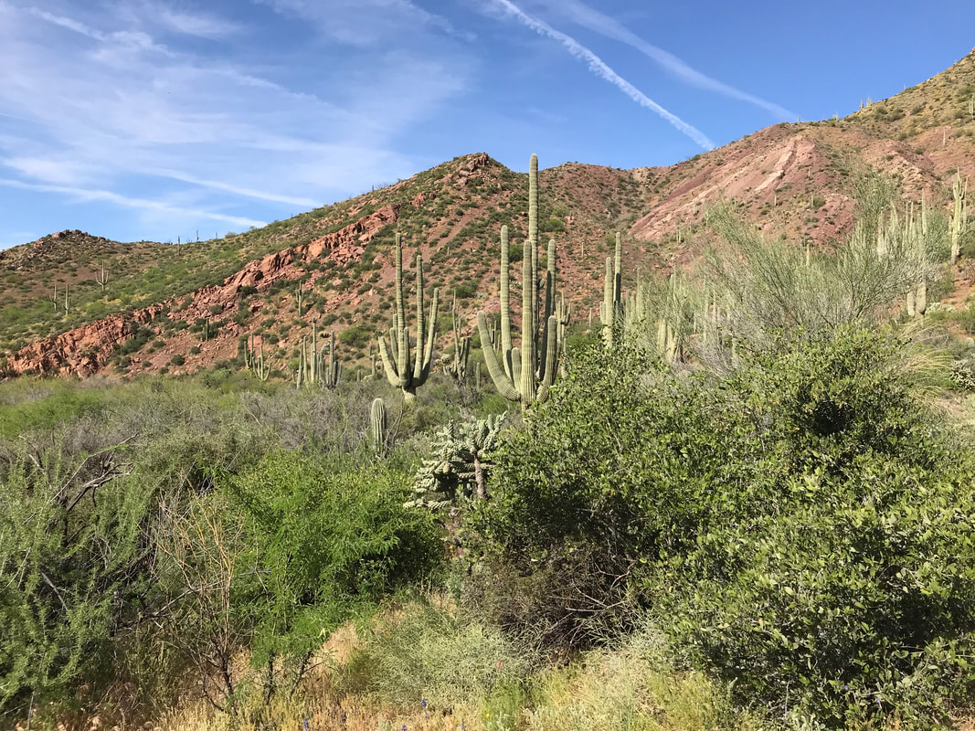
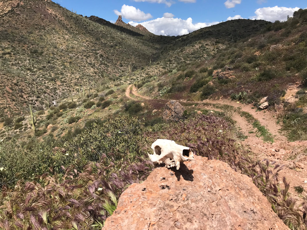
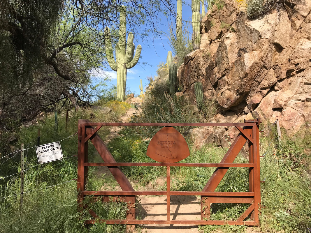
 Although we used Guthook, the app played a secondary role most times to the use of topographic maps I had for the Arizona Trail. Ever since getting trained in off-trail orienteering on my NOLS course, I’ve really enjoyed and had far more trust in physical maps. The striking terrain here was great for predicting what lay ahead based on contour lines and matching them up to reality. Slowly, the AZT led us up switchbacks from the canyon floor towards the textured and hollowed rock outcroppings lining the top of the surrounding peaks. The heat was on, but very manageable given the generous cloud cover. The AZT reached a small saddle and we could see over the side of the natural amphitheater out towards Queen Valley and Highway 60 in the distance. Cholla dotted the trail. It snaked passed some tight rock outcropping and settled at a higher saddle. There, an INCREDIBLE view of a massive valley/chasm and tight desert walls lay before us. Uplifted stone and broken stratigraphy framed the view. Abundant bunched flowers completed it. My breath was taken. Freaking incredible. We could see the trail tracing northwards along the contours of the advancing canyon sides. A singletrack blurred by lush vegetation. I felt like I was walking in another biome, not the Sonoran Desert. The wet winter and recent periodic rain had rushed forth from the Earth all forms of plant life. Green grass with fertile purple seed-heads packed densely down the hillsides, even growing over the trail. Every time the trail curved at a natural bend, the corresponding washes it crossed were draped with ivy and ferns. Pools of water pocked places where water rarely stood. We definitely had to be more alert because rattlesnakes were out in abundance. I kept my trekking poles ahead of me, elevated a few inches off the ground, knocked the sides of the grass. More than a few times we stopped by a sudden rattle elicited from a rattlesnake coiled trailside, disturbed by my pole tips. That’s what I wanted. Let me know where you are so I don’t get bit by you. One rattlesnake perched on a rock elevated next to the trail rattled loudly but let me pass only to decide “fuck it” and slither onto the trail, still rattling, cutting off a path for Janna. It took that one a bunch of time to decide to move on. I knew we were getting closer to civilization again when a troop of mountain bikers came down the trail, all on day-rides out of Phoenix. They seemed equally impassioned with the views and extraordinary spring growing conditions. Janna and I passed by several rock outcrops, old volcanic veins that pimpled the trailside. The singletrack AZT crossed a gate and hit up some double track that spewed in several different directions, a bleached animal skull sitting on a rock. No water so far, we kept hiking and found a cattle shit-pond full of scum and turds. We still had 2 L each and decided to skip it. The double track moved down a valley where the Tonto National Forest showed mountain-upon-convoluted mountain into the distance. We were excited. Both of us kept looking at distant rock buttes thinking we were looking at the backside of Picketpost Mountain.
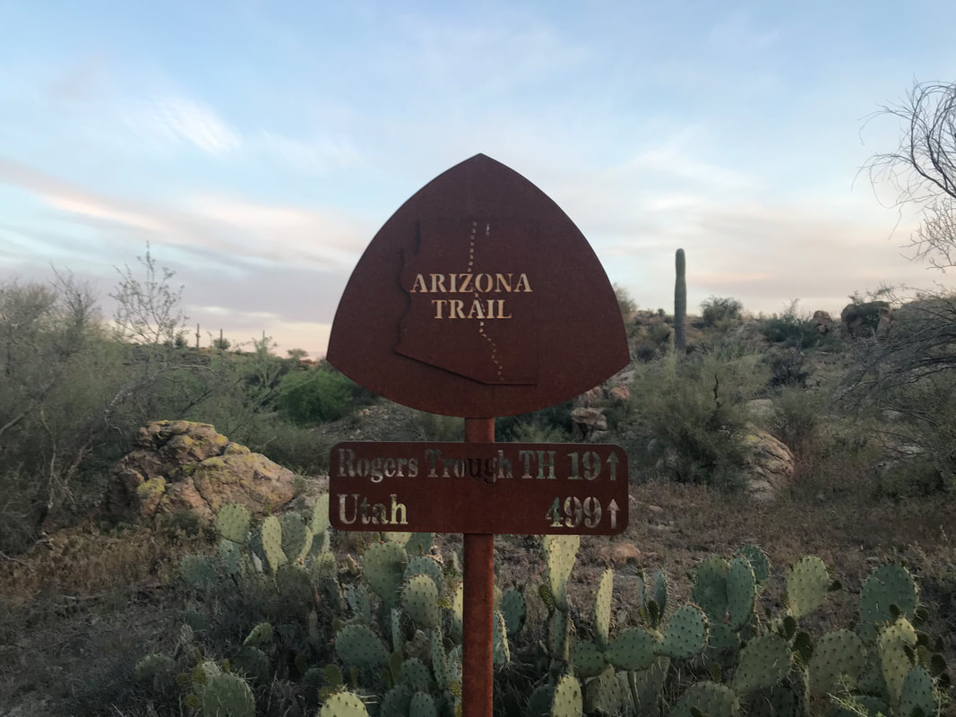
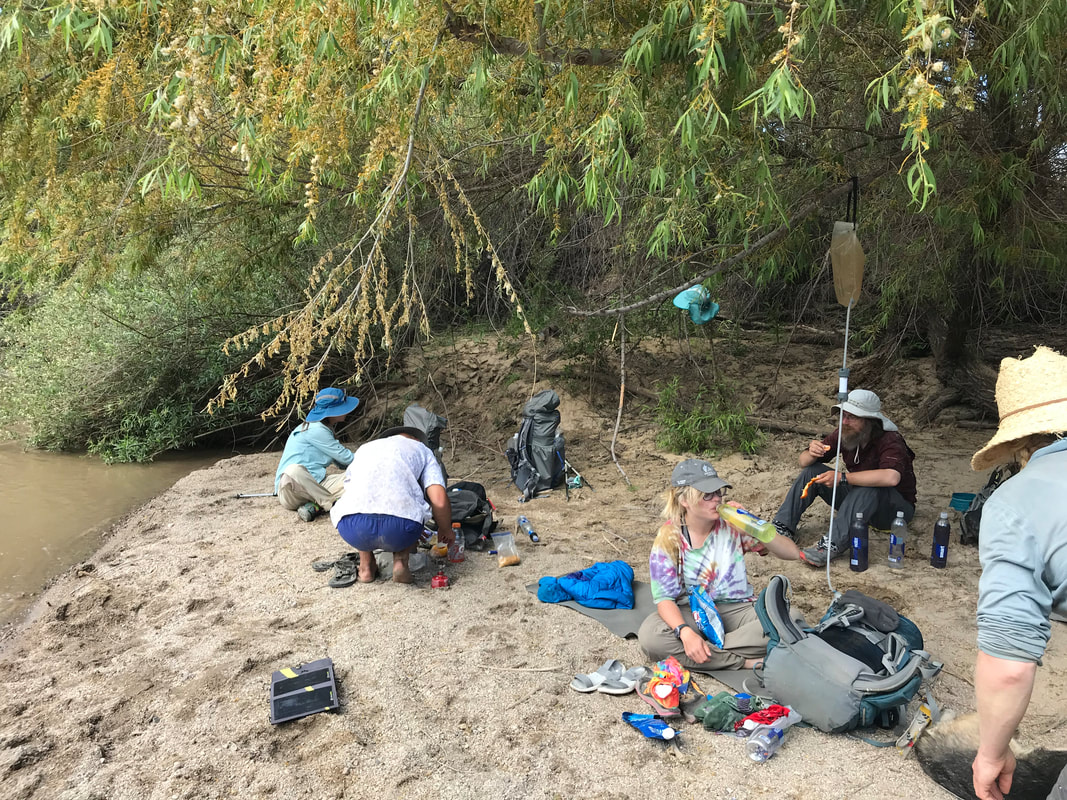
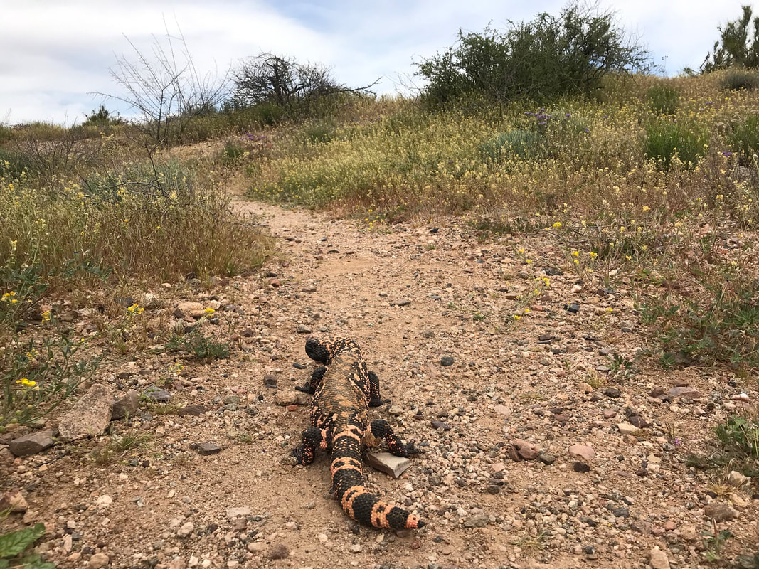
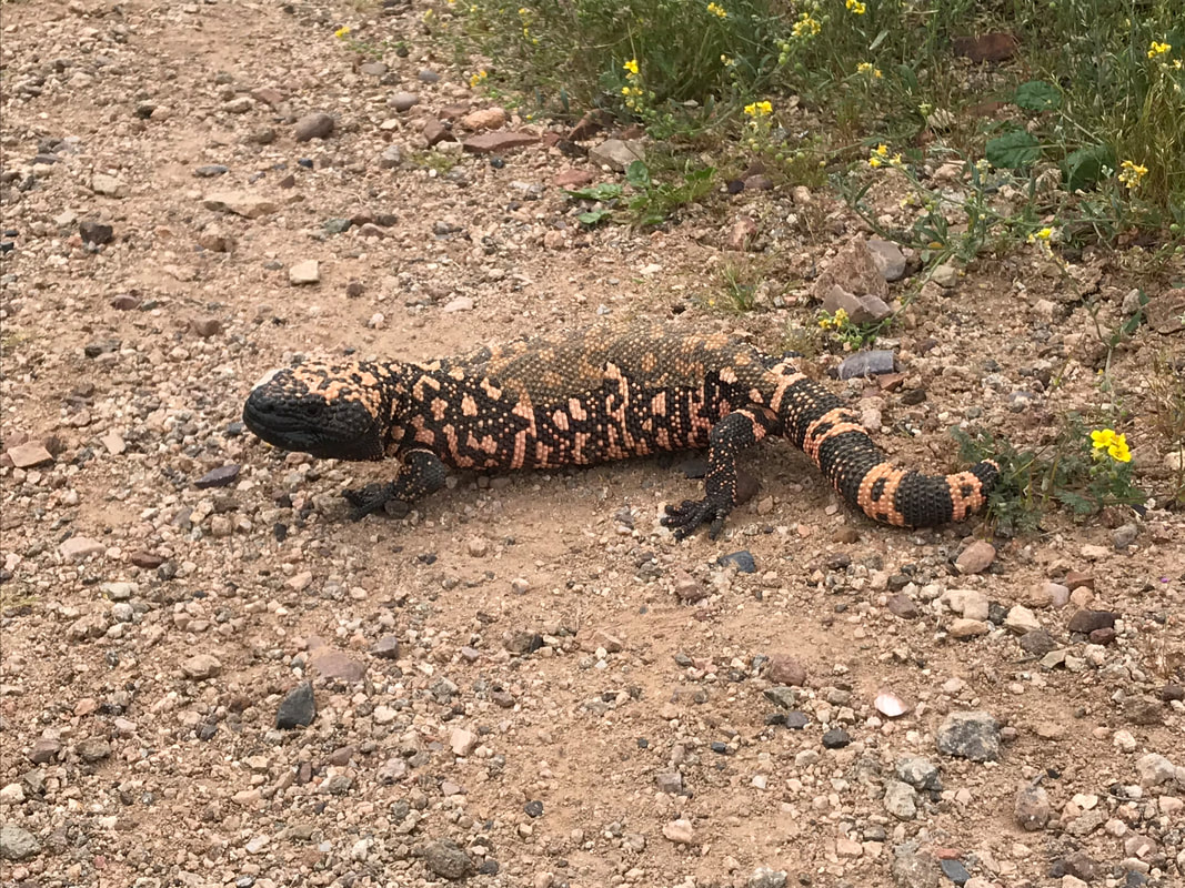
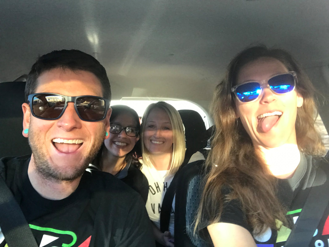
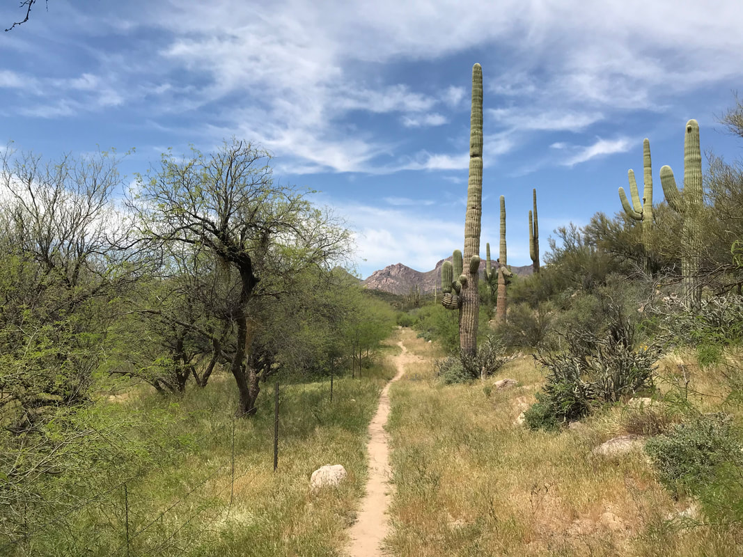
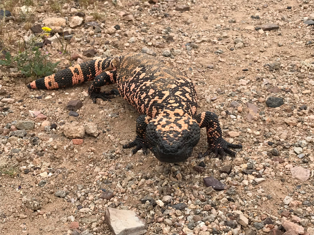
     Picketpost Mountain is a giant peak iconically visible from the east side of Phoenix. We both had climbed it several times, and I used to (insanely) use it as a training run for elevation, even though the there is almost no trail for the last 1500 feet of gain and 1.5 miles to the top. But the top…man does it provide epic views into the sweeping studded hills below. The Tonto National Forest as a whole is like god took up the earth and smashed it together, letting the maze of canyons and ridges lay as they fell. Great for exploration, full of myths and legends of gold, drawing people into its maze each year (sometimes lost and never returning), and one of the largest national forests in the USFS system. The day was getting hotter and the last 2 L in our packs began shrinking, the water getting as hot as the surrounding 90 degree F conditions. The AZT became singletrack again and entered rougher land as it sidled a wash for miles. The abundance of flowers also brought out bees. Ever since that swarm the other day, whenever I heard a swarm nearby, I took off. It’s the only thing to do, the only remedy. More washes, rising temps, and saguaro-pocked mountainsides led us to a completely unexpected trail angel water cache midday. Similar to the one at the Freeman TH just south of Tucson, this metal box was next to terrible jeep track someone had coaxed their car up. I opened it to find it completely restocked with probably 40 gallons of fresh water. Janna and I pulled two gallons out, crouched our bodies under the tiny shade of some shrubs, and drank to contentment. YES FOR WATER. Rehydrated and refilled, Janna and I continued on, the anticipation of knowing we were going to be picked up driving us on. We stopped at a wash an hour later for a break in the shade of some overhanding mesquite. I walked down the wash, randomly exploring and found a Gila Monster! The third one in four days! What awesome luck! This one was a different color morph (as you can see in the pictures below). Unlike the hissing one, this one scurried away slowly. It turned and futilely attempted to climb the steep banks of the wash. Basically, it just climbed/ran in place. I stepped back and it turned to look at me before attempting to scamper again. This time, it got leverage on a rock and disappeared into some thick grass above. Down the trail, Picketpost finally appeared in the early evening, a hulking and unmistakable mountain. Janna laughed, pointing out our ridiculous earlier guesses when this was so clearly it. A sketch moon clocked in above the peak as we passed to its western flank. With that, we officially passed mile 300. That, again, felt like a massive accomplishment. Evening brought a cool to the hot swell. We passed down the front of mountain and saw the split for the summit trail - we were close to the parking lot now. And then suddenly, Taylor and her friend Ashley were ahead of us, taking pictures of the desert. Both groups saw each other and ran to meet. I felt like I was passing through a time-warp. Somehow, nearly a month on the trail, and now we had walked from the US/Mexico border to Phoenix. Taylor was here to take us to our apartment, to return us quickly to civilization. How did we get here? Our feet of course, but the question was more a testament to the motion of time. Ashley had us take a picture at the official AZT sign at the Picketpost trailhead parking lot. The iconic sign stood emblematic of this nearest proximity to the state’s capital. The sign is meant to inspire and inform. Back in November, when my parents had visited for Thanksgiving, my mom had me take a picture there. Now, I had returned. Time unending. Time is motion. Taylor and Ashley had snacks, Gatorade, salty food, and more in the car. We climbed in and Ashley sped us back to the city for a few days of rest before returning to the trail. Numbers texted and said he was taking two days to cover the section we just finished. Rosey had finished before us and was already moving on. Taylor and Ashley had spent the morning catching the sunrise at the Grand Canyon and had basically driven straight here to pick us up. They had been staying at our place while we were gone. Now, we were all piled in the car and racing to the desert sprawl. Janna and I entered the apartment, grateful for some air conditioning, easy/clean water, copious amounts of Indian food, snacks on end, the caring generosity of Taylor and Ashley to come get us, and the epic feeling of accomplishment for walking here.     The heart of the Gila River Canyon is an epic showcase of Sonoran desert botany. Less canyon than its name conjures, the topography of the place is a great riparian valley/floodplain with mountains rising off the side. Coursing its way through the middle of this floodplain is the great muddy beast, swollen with snowmelt and recent rain. We woke up late to enjoy the cool morning, knowing that despite a hot day in the canyon ahead of us, that we would be tracing the river and have some opportunities to cool in it. We ate a late breakfast with Numbers. Soon after everyone had left, we packed up our gear, crossed an AZT gate, and officially entered the Gila River Canyon. Within a few miles we ran into a thru-hiker heading southbound. But instead of doing the AZT, he was actually heading east on the Grand Enchantment Trail. It was cool to meet someone overlapping on this section in their trek. Saying goodbye, the AZT rose above the rushing silt river below, curving in and out of bends in the hillside. At this point in the spring, I was a bit sad because I thought I had missed the peak time for brittlebush blooms. What few brittlebush we had seen featured flowers past their peak brightness, all somewhat wilted. This fear was destroyed by the crazy abundance of absolutely brilliant blooms all along this section of the AZT (in addition to tons of flowering cacti). Janna and I crushed 10 miles by noon, arriving a bit inland at a wash running perpendicular to the trail. Taking a look at the maps, we high-tailed it down the wash for 0.25 miles and found a cool bank of the Gila River.
 Not the only ones thinking this, a group of ATVs was parked in the thick shade of mesquite. Janna and I talked to the riders for a while, most apparently locals who frequented the old doubletrack, jeep roads, and sandy washes with ORVs. With great generosity, one guy offered us some homemade cured jerky and a bunch of fresh apple/orange slices. We definitely ate all that. The early afternoon heat now in full swing (again in the mid-upper 90s F), we walked down to the beach where the Gila River flowed. Looking to our right, we saw that group of thru-hikers/dog from the previous night downstream on a sandy beach beneath a stand of mesquite. Janna and I walked over, and introduced ourselves again. By 1 pm, Rosey (we happened to catch up to him again!) and Numbers had turned up, making us a total crowd of 12 AZTers all escaping the worst of the heat by taking to the shade and water. The water was very hard to filter, the silt clogging up the Sawyer Squeeze per every quarter liter filled. This required using precious clear water to backflow through the filter. The hard work paid off and we all ate snacks, smelled of sunscreen, and sweated in the sand. The heat was so bad at one point that I stood up to go poop and Rosey looked at me, scoffingly saying, “Dude, are you serious? You CAN’T be serious,” when he thought I was going to continue hiking –> No man, just taking a poop in the heat of the midday sun –> also a sweaty mess. By 3 pm, I began getting a massive headache from the heat that eventually led to nausea. I ended up battling it the rest of the day straight into evening. Around 3:30, I thought the heat was not going to get better, so we might as well move on. Janna, Rosey, and I headed out from the beach and began the last stretch of the river with Numbers close behind. Rosey stopped and ran into the desert to poop - also feeling the heat.
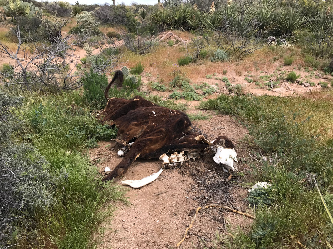
  But damn, those last 6 miles of the day were just spectacular. The AZT rose above the river again, giving a direct view of the floodplain filled with thickets of cottonwood, Arizona oak, sycamore, maple, palo verde, saguaro, mesquite, and more. The hills in the distance cast shade as evening approached, just lighting up in that perfect gold color. The four of us would hike for 10 minutes, then just stop and stare at the vast beauty around us. Every scene was iconic and breathtaking. Eventually, we hit the end of the AZT section of the Gila River, right where it peels off and heads north up Alamo Canyon. We all decided to camp where the AZT splits, taking the evening to have one last opportunity for plentiful water from the Gila before the long, potentially 22 mile dry section tomorrow. Rosey and Numbers setup to cowboy camp while Janna headed to the river. After setting up camp, the three of us went down to join Janna, only to find her enjoying some Fireball and wine with a bunch of recent retirees camping on the bank. After retiring this past week, they decided to do a big section-hike of the AZT and brought all the caloric goodies to enjoy - all of which they now shared. Eating dinner together, the light faded fast, and cows gathered on the opposite bank to drink for the evening. The four of us hit up our shelters just as an unexpected storm moved in and began to rain. Numbers and Rosey got soaked as they were cowboy camping. I heard them tear open their packs in the dark to drape Tyvek and tarps over their bodies. Meanwhile, a cow on the opposite bank had a big Swiss bell on its neck, which it just clanged back and forth literally ALL night long, keeping everyone awake. But given the noise and the wetness, we all laughed and enjoyed the beauty combined with the momentary hiker-community around us. 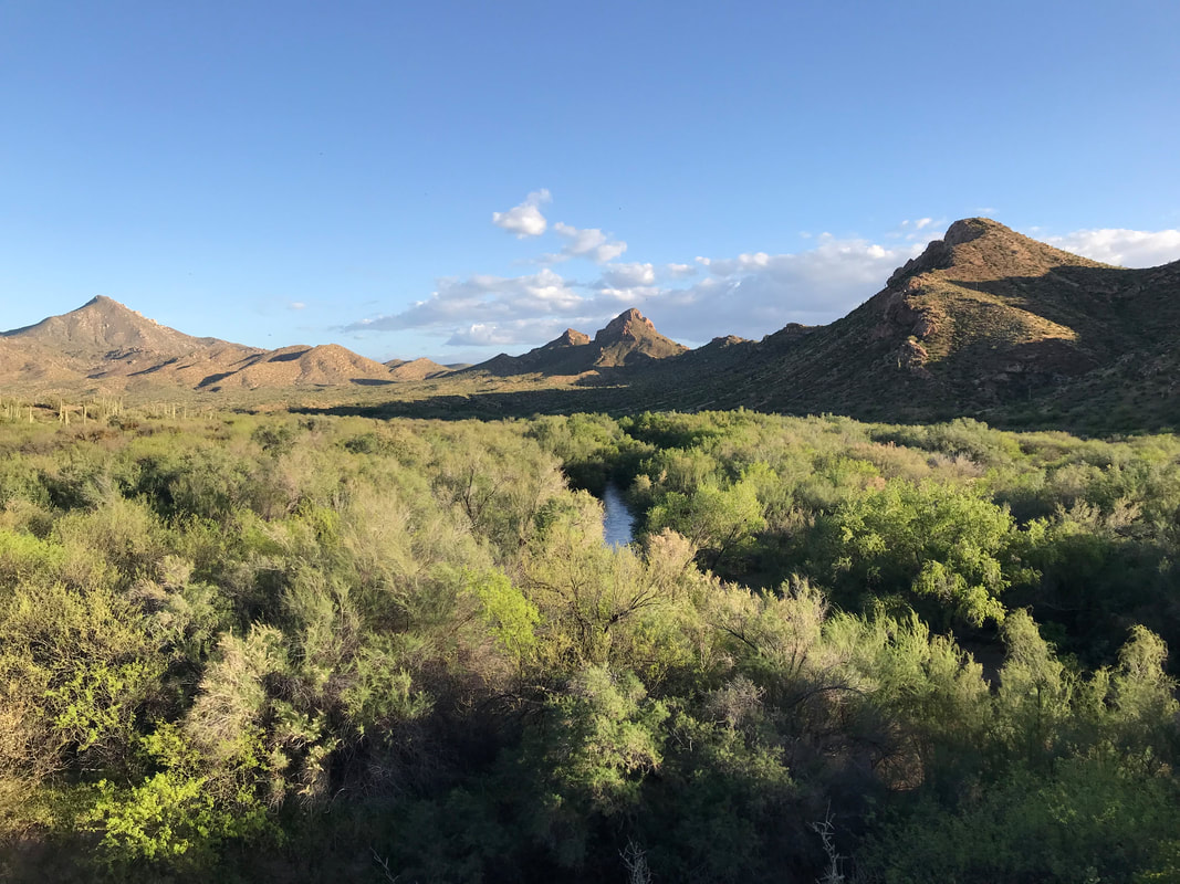   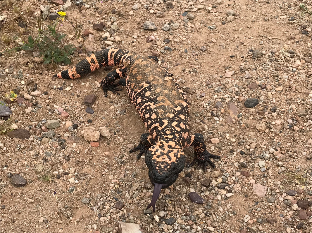 Today was a day of wildlife. With the first crack of light edging the horizon, Janna and I exited our shelter to get a move on. We had no water since around noon yesterday and we wouldn’t have one for several miles still. The morning was cool and overcast. The AZT was lined with miles of yuccas in bloom, providing sweet nectar to Mexican long-nosed bats in the night. After a four mile start to the day, through scrubland and low desert, we hit up some double track that began rolling towards a few distant power line towers. The AZT Water Guide and Guthook mentioned something called a “wildlife tank” near here. It’s apparently a cement rectangular pit with descending steps that’s filled by a rainwater harvesting system; installed by the AZ Fish and Game, wildlife tanks provide a reliable water source during hot and dry months. For AZTers, its role is the same: water in these hot, low, and waterless sections. We approached a hill to our right, but no tank was in site. Using the GPS coordinates provided, we wandered off trail and up the Sonoran scrub for a quarter mile before a rusty metal-tubed fence appeared. Hopping the fence, we collected what looked to be disgusting water from the surface. But a quick submerge of our bottles brought up clear water with a few insect swimmers. Continuing on, the day began to heat up as we crossed through sandy washes and rounded through low thornscrub. Rounding a sharp corner, I heard a massive hiss, stopped in my tracks, and at my feet, fully inflated and swelled, was a massive Gila Monster. Unlike the one from yesterday that took off the moment we approached, this two-foot reptile stood its ground. It raised its head, gaped its mouth, and hissed again. We shuffled around it, watching it rotate to keep its open-mouth directed at us. Now across the path, the Gila Monster seemed to settle. It began moving around, flicking its forked tongue, and investigating a bush. Fearless, it didn’t budge. Instead, it became disinterested. Pictures taken, we continued on, rounded a bend, and were hit with the stench of rotting flesh. To the right of the Arizona Trail, a desiccated and massively decayed cow carcass lay.
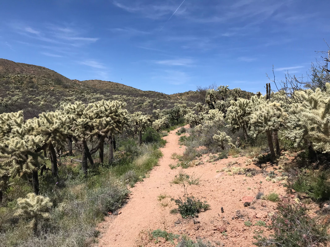
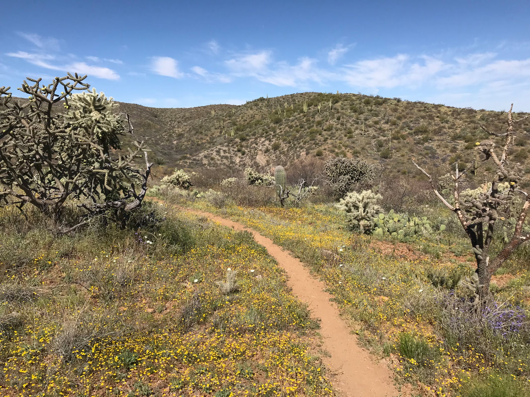
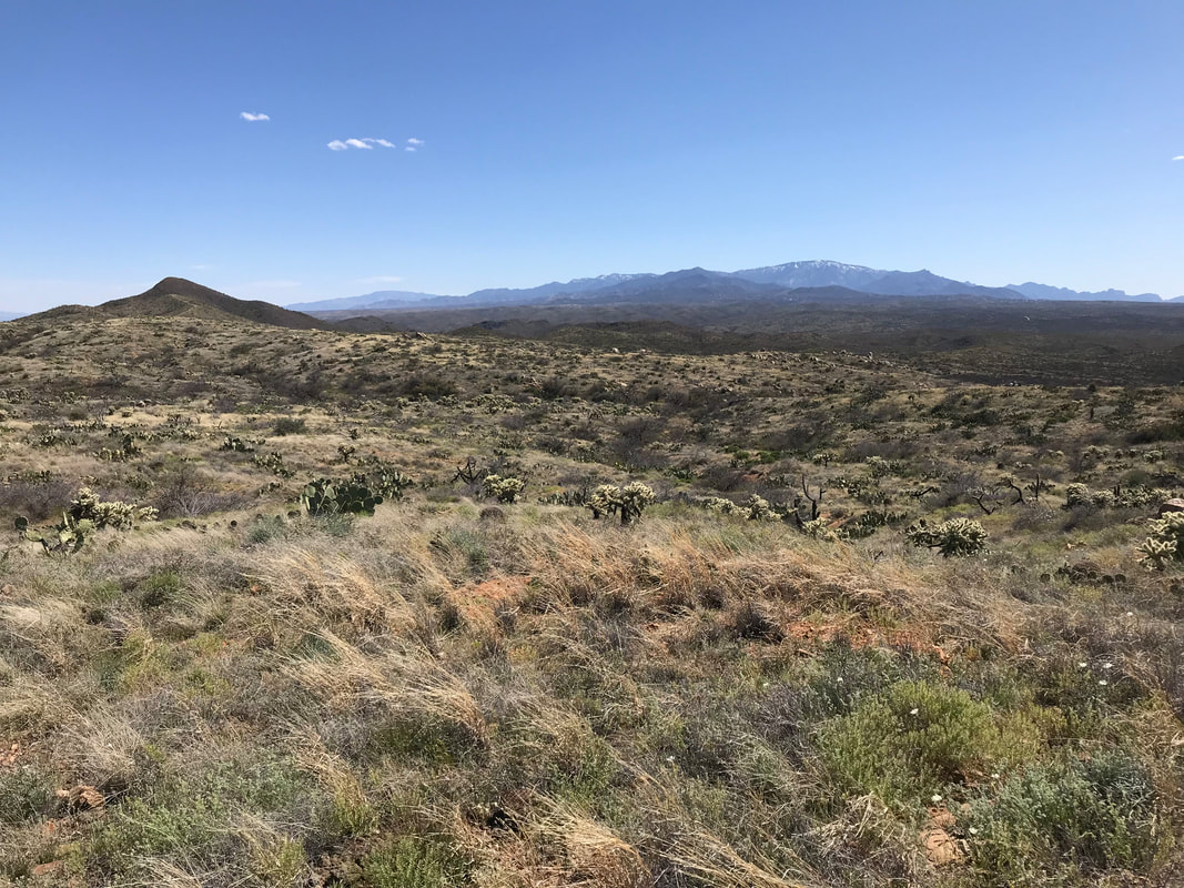
 We passed by the carcass, went through a few AZT official gates, and suddenly, it was as if rattlesnakes came out en masse. Wary, we heard their rattling next to the trail what felt like once a mile. By the end of the day, the wariness would subside into a relative annoyance. Some western diamondbacks would be fully stretched across the trail (at least 5 by my count today) and we would have to hike off-trail to get a wide berth to pass by. Sometimes, when the route was steeply walled by rock, we would have to wait for the rattlesnake to move on after 10 - 15 minutes. Venomous reptiles aside, the blooms were in equal glory today. A few miles later, in this swell of serpents, we crossed a rancher fence and found, amazingly, a good several gallons of water left by trail angels. We each took heavy swigs of clean water before smashing up the bottles and placing them in our packs. The AZT entered a canyon and skirted to the right of a wash. Mexican gold poppies grew in small bunches among the sand of the wash. The heat began to cook in earnest, sweat dripping, rolling down my back. Now, fully in the wash, it was a struggle to walk in the unstable sand. We were distracted by our steps until a roar came piercing up the canyon. We looked ahead for the source of the noise as it got closer and closer. Two military fighter jets came flying overhead, their engine noise roaring in a delayed response; they were using the canyons and peaks in the area for flight maneuver training. The jets gone, we started a long slog up a triangular hill with a base extending from the wash. Heat going strong, brittlebush stalks leafed in the pale green of the desert thickly covered the hillside. And then, we were on top. A ridgeline extended back into the rocky outcrops of the hills to our south. To our north, a massive swag of supervolcanic ancient hearts, sturdy with granite and rhyolite, beckoned with canyons and cols. We walked along a ridgeline for several hours. The heart of the mountain laid bare by a massive open pit mine drew my eyes all day. In the distance, dust from the tailing would make a faint blur in the distant ranges while shelves of mine terraces led into the earth. Again, a loud noise caught us off guard. I turned to my left, half-expecting to see another fighter jet. My eyes widened as I stared at a massive cloud of like 500 Africanized honey bees, a dark cloud of buzzing and swiftness tracing the same ridgeline we were walking. I FUCKING TOOK OFF. Janna sprinted ahead of me, keeping to the AZT as it darted off the ridge and began switchbacking down the side of a cliff slab. I bolted towards that junction, the swarm several yards away from me now. I turned and watched the bees move downward, then twist away from us, descending into a valley. Shocked at how close they got, Janna and I stopped to catch our breath, especially in the drilling heat - easily mid 90s.
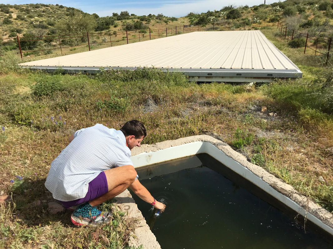
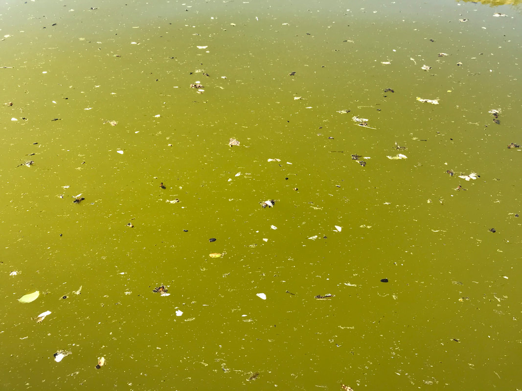
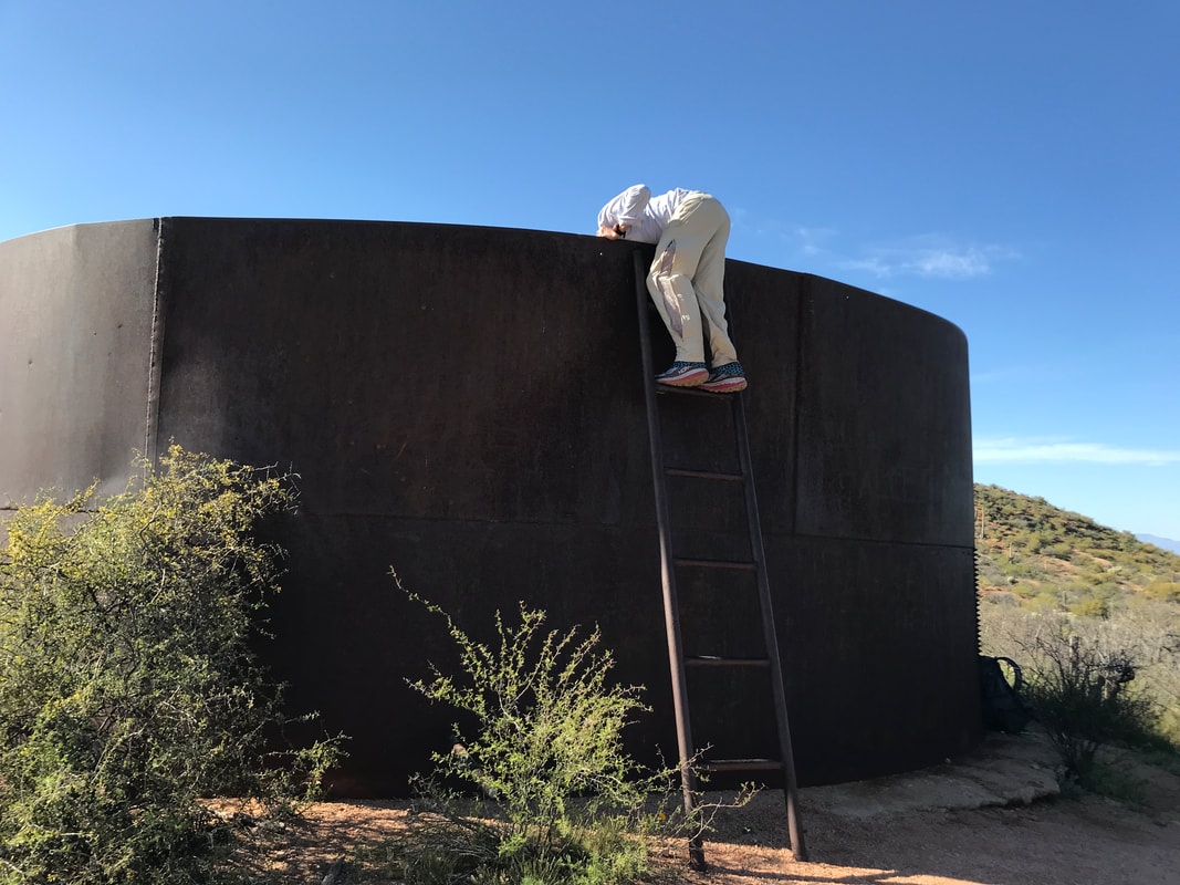
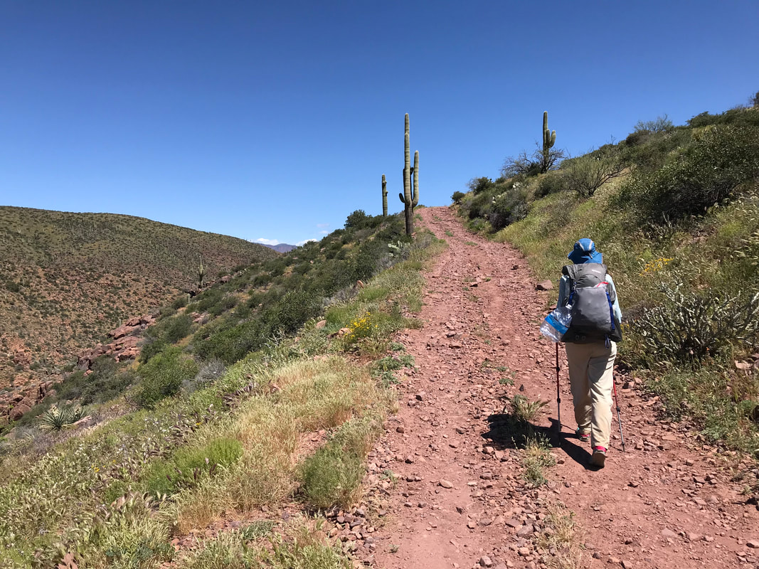
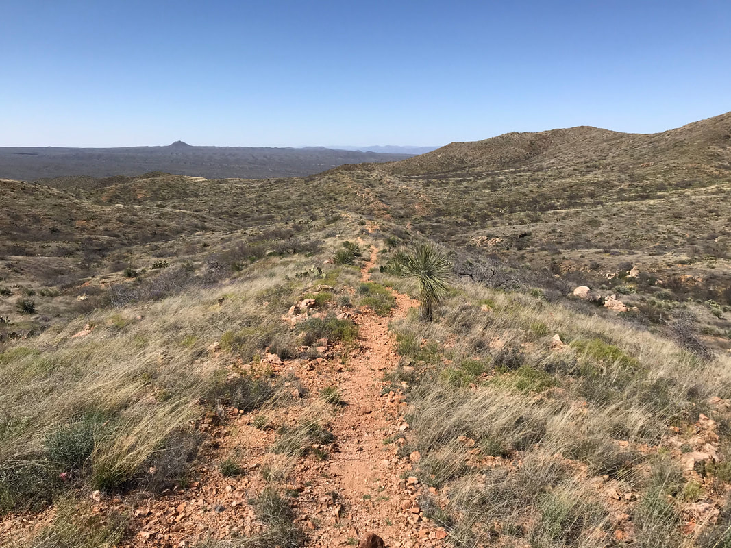
  As the day rolled on, rattlesnakes continued to rattle frequently from the sides of the trail. Coming down that large mountain/hill, we stopped for breaks under any shade provided by small palo verde or the occasional mesquite. Water was being carefully managed. Salt crusted my clothing, my face, everything. The sweat and heat volleyed back and forth. The sun slanted with later afternoon, making the flowers look even more prominent. The MPB (miles per bloom) made me light on my feet; I couldn’t take enough photos. Around 5 pm or so, we entered a series of rolling hills. Each roll descended more than the one before, bringing us closer and closer to the lowest elevation on the entire AZT. We walked through a slanted valley of saguaros. Immediately, I saw one that was the tallest I had ever seen (the picture below). I stood next to it, a mere 6 feet tall - the saguaro probably 50 feet tall. As evening approached, we finally hit a paved road that would lead to Kearny. We stood at a bridge in the still-bright light of evening and crossed into the outskirts of town. Walking over the bridge revealed the first look at the mighty Gila River. Born in the mountains of New Mexico and engorged by tributaries, it rolls through the Gila River Canyon here in central Arizona. Its waters were silty brown but its banks were filled with lush riparian vegetation, soft green in the evening light. We headed up the road to a maintenance facility. Outside of it, a spigot, complete with old plastic chairs and a universal water sign, provided our first cold and sure water since early that morning. We filled up 5 L, looking to enjoy an evening of long and frequent rehydration. Plus, the creek spewing into the Gila River nearby was rumored to be contaminated with heavy metals from the local mines. We walked back to the bridge and started up a small paved road leading out of town. The evening, now well past 6 pm, finally began to cool. At a trailhead for the AZT and the entrance to the Gila River Canyon, was a parking lot. Next to the parking lot was a huge grassy area where we walked back behind some mesquite to put up our tent for the night. Within minutes of finishing the setup, a pair of cars pulled into the parking lot. Out hopped an entire crew of thru-hikers and a dog. They all came over to greet us, including the locals from Kearny who had dropped the hikers off. Everyone encouraged us to catch a ride into town to grab some legendary pizza, but we were set, relaxed, and enjoying the beauty of the evening. All the hikers eventually went off to setup camp, except for a thru-hiker named Numbers. He sat with us in the dark, eating an entire pizza he purchased in town, graciously sharing a slice or two. In his 40s, Numbers had thru-hiked the PCT and AT, with the PCT being his favorite. A former computer programmer in a more prodigious life making tons of money, he gave it all up when he found it empty. He had since turned to backpacking as a salve for his longing. Currently, he was working on creating a competitor app for Guthook. He was carefully gathering GPS coordinates for the length of the AZT, as well as a library of photos to attach to waypoints. Conversation lasted until the stars brilliantly shown in the deep dark desert night sky. We all turned in and slept the cool of darkness away.  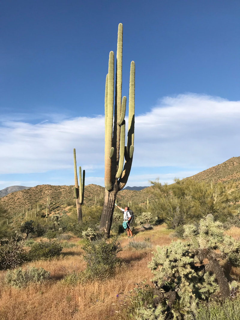 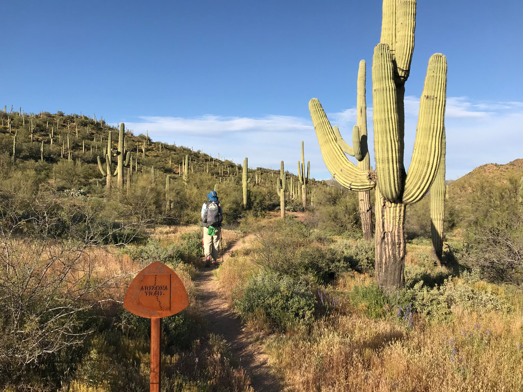 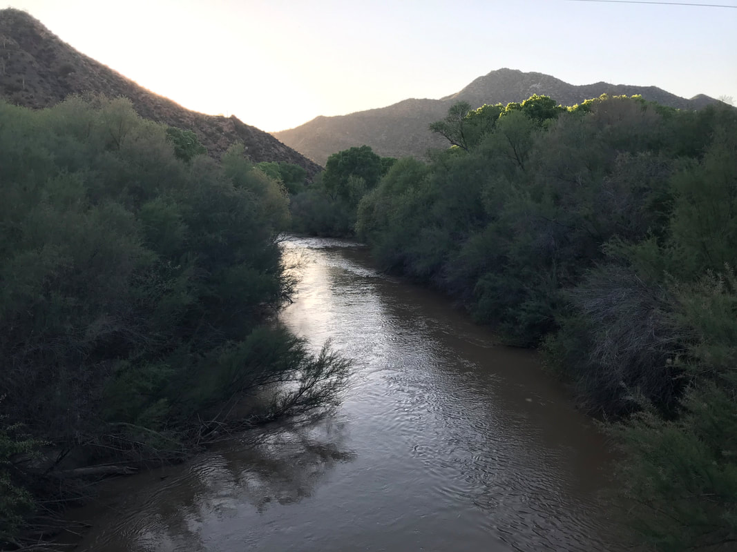 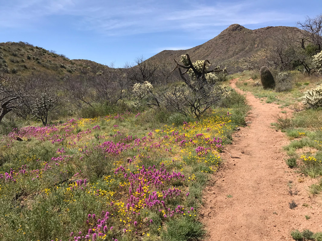 Today, the flower blooms just continued to sweep and rival everything today. As a thru-hiker we would later meet would say: “My hike is measured in MPB….miles per blooms.” After a great night’s sleep, Janna and I woke up in the wash to the slow morning pull of breakfast. Kitska and Rosey were already up, sitting in their bivies dressed in down jackets and eating food in the cold of morning. I wandered up the wash for a while before finding a nice and deep location for digging a cathole for my morning ritualistic poop. I took my time, enjoying the warming sun on my open body. After carefully soaping up and cleaning all said areas, I applied some balm to my chafed butt cheeks. I was feeling pleased with how my body was holding up. We were now doing 20+ miles a day; my feet were solid with the new Hokas (my only wish being that they had toe boxes similar to Altras), the arches of my feet were strong, the anxiety of my knee had receded as my strength and confidence grew, I had secured longer boxer briefs (Saxx Quest 2.0 Long Legs - how had I never used tall boxer briefs before??) in Tucson which cupped my parts solidly, and the weather only provided greater feelings of success for the low Sonoran crossing. Personal needs abated, I headed back to camp to find Rosey and Kitska had moved on out, although both left they cell phone numbers with Janna as we hoped to meetup again. I climbed back up the ladder of the rusted water tank to fill our bottles one more time from the trickling pipe at the top. Heading back down Bloodsucker Wash, we paused to eye a dead rattlesnake lying desiccated in the sand. As we climbed up a hill out of the wash, Antelope Peak (the picture below) rose in the distance. Antelope Peak is a prominent, though not large, ridge that rises from the desert in this area. Its silhouette stands out for the relatively vast low rolling foothills and expansive washes that make up this portion of the open desert. But the AZT steadily hikes towards it, skirting up and around its base. It was here, two years earlier, that I had been dropped at the start of the Oracle Rumble Ultra, and I longly wanted to return, to feel the passage of time by standing in a place only a second time. Today would be that day. Janna and I moved fast as the morning waned. The Arizona Trail was relatively flat and very smooth singletrack, meaning we could cover more miles more quickly. This speed led us to believe that we could cut a planned day out of this section by covering more miles than intended. The challenge was on and the weather perfect again - mid 70s F with a breeze. The trail wound in and out of washes. Hillsides the entire day were covered in gold poppies, yellow small blooms, white daisies, pink starbursts of petals, and just incredibly dense and vibrantly purple swaths of desert lupine. The desert floor was yellow in all directions. Beehive Tank was our first water source of the day. Down abandoned doubletrack past a cutaway cliff shrouded in lupine, we entered an old wooden corral and walked up to the red rust cattle tank. I knew immediately why it was named Beehive Tank: literally hundreds of bees, some definitely Africanized, swarmed its surface and edges, attempting to land on the delicate nicks in the metal siding in order to pause and take a drink. The water was urine neon green and its surface was coated with a think blanket of dead bees, moths, and flies amongst other decay (take a look at the pics below). But water is water and I hadn’t carried much, planning on the water here. I slowly stretched my arms over and out into the pool of green, slowly lowering my bottle to not spook the many bees on the inside rim. I submerged my bottle, only to realize the O-ring from my water filter was hanging off the top opening of the bottle. No sooner had I realized this than I watched it pop out in the water and sink into the deep green. “Shit!” I said out loud realizing I needed it to perform a watertight seal between my water filter and bottle. My Sawyer Squeeze filter wasn’t the most essential. 99% of the time I just use Aquamira drops. However, when faced with cowshit pools and this green bug stew, I liked being able to clear the physical particulates of poop and insect bodies by using a filter first. A bummer, but I’d get by.
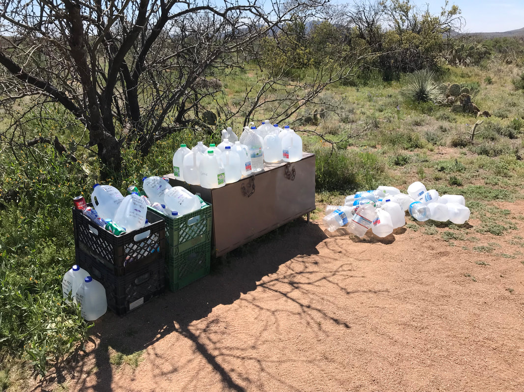
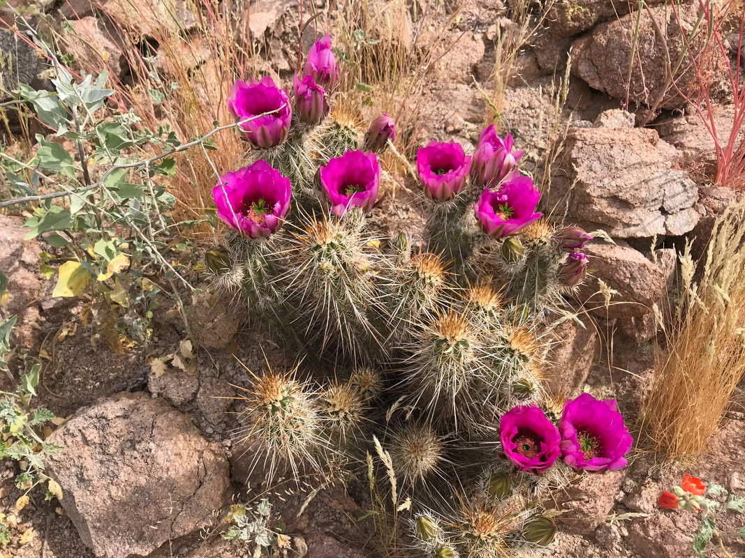
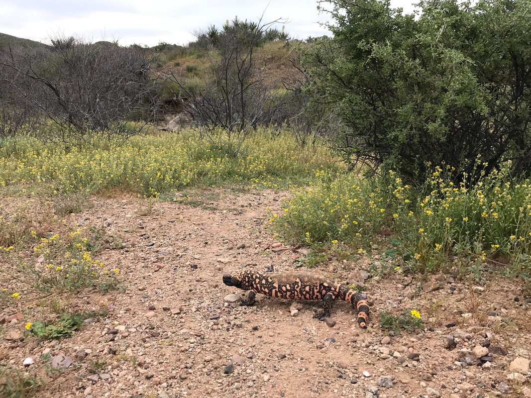
As we got closer to Antelope Peak, we walked through a dense cholla stand proceeded by large tussocks of grass. As I passed by the grass, a sudden movement near my ankle caught my eye and I leapt to the left instinctively as a massive western diamondback rattlesnake struck at me, its mouth open right were my foot was, before it retracted into the characteristic S and rattled VERY loudly. My heart pumping, I looked at it. It was perhaps the largest western diamondback I had ever seen, easily with a midsection as thick as my forearm and well over six feet in length. Its rattle was massive with earned age. I was pumped and tried to take a video of it, but Janna kept yelling at me to get further back (and I promise I was a proper distance away). She would disagree here at my distance, but agreed that the size was enormous. We continued down the trail, eyes and ears alert for more rattlesnakes that I very much hoped I would see (for real, I love reptiles). I looked up the AZT as it meandered up a slight incline, and there(!) in the center of the trail was a massive Gila Monster!!! I froze, carefully walked up the trail towards it. It spied us from 20 feet away and took off up the trail. I walked, doing a slow chase of hikers heading northbound, and a Gila Monster moving northbound on the trail. My pictures were terrible though, and nothing worthy to show. The Gila Monster eventually scooted off the trail and at under a creosote under a jumble of branches, eyeing us. I was really excited to see this one as I have only ever seen a Gila Monster once before. Considering that something like 98% of their lives are spent subterranean, any opportunity to see one is a great one. Protected in Arizona from collectors, Gila Monsters can grow up to 2+ feet in length and weigh over 5 pounds. Their striking orange and black mosaic bodies are famous along with being one of the few lizards in the world with a venomous bite. Their larger cousins, the Mexican Beaded Lizard, come only as far north as 70 miles below the Arizona Border. The Gila Monster is a truly iconic Arizona species, a species I appreciate. We made our way up and around Antelope Peak to a trailhead parking lots. And just like that, I was where I had been aiming to return. Turning slightly east, we followed the AZT to the Freeman Trailhead where we ran into Rosey and Kitska sitting in the shade of a small seated shelter, both kicking back water, beer, and soda. A MASSIVE water cache was here at the hiker box - something like 40 gallons. A combination of trail angel gifts, stock gallons for AZT 300 and 750 mountain bike racers coming through next week, and water drops left by hikers made up the lot. As well, some trail angel had left cookies, candy, soda, and warm beer cans in the hiker box - free calories to enjoy. But first, Janna and I walked out into the desert and using our GPS coordinates, dug up the water we had buried here back in February. 
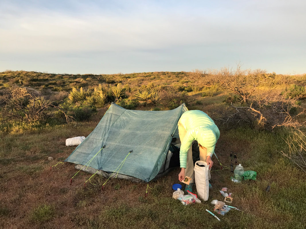
Several weeks before, Darren had taken Janna and I out to do some water drops in the desert. We identified this stretch as a probable concern for water supply and distance, and buried about 2 gallons each. Although a hiker box presented itself, we had heard accounts and witnessed firsthand bottles where a planned water drops (with clearly labeled names, requests for people not to drink it, and ETAs) were half, nearly, or completely emptied by individuals without permission - often AZTers who didn’t plan ahead and thought taking “just a little” of someone else’s water was acceptable. We even ran into hikers who talked about taking the water drops of others, rationalizing it (they were in no way in danger but just uncomfortable) and/or then bragging about not having to carry water weight. We even talked to hikers who proudly relied on trail angels alone to supply all their water needs. That to me is a major concern. Take responsibility. Plan ahead and prepare - it’s not only a Leave No Trace principle, it’s the right thing to do when in the desert. This was all coupled by the fact that the leftover plastic bottles and jugs were either emptied and abandoned, or left for someone else to pick up. Most annoying would be when AZTers would take almost all the water but leave some on the bottom to relieve their minds of the responsibility to have to pack that trash out. After noticing a bunch of 95%-empty-bottles with a swig at the bottom, Janna and I committed to drinking the leftover swigs, crushing the plastic jugs/bottles, and packing as many empty bottles into our packs as possible to dump in the nearest trash can when we ran into one. After hearing warnings from others about leaving water in hiking boxes, we decided to bury ours and retrieve it now. We dug up our gallons in perfect conditions, sat back and drank a ton, and chased all of it with some sodas and candy. Kitska and Rosey moved on shortly after our arrival. After some rest in the shade of that little benched area, Janna and I topped off all our water, signed the Trail Register, and moved out into the sunny desert. The AZT here suddenly cut straight to the horizon. Miles and miles of straight and clear trail that touched nowhere. We walked among the grasses and prickly pears, saw and passed under a series of overhead power lines, and went back and forth between single and doubletrack. As evening crept closer, we passed by a rare jumble of granite out here and I saw a cardboard piece that said “Magic” with an arrow pointing to it. I nearly fell over my feet. Who the heck would put that out here? I followed a spur trail from the AZT back into the rocks. Low and behold, there was a metal storage container, military style, chained to a bolder. I opened it to reveal water, some crackers, and a long note from a someone that lives nearby. The person said that this was their secret beautiful spot out in the desert and encouraged AZTers to take was food/water they needed and pointed out a few pottery shards nearby from historical inhabitants of the region. It was magic indeed. Back on trail and evening quickly advancing, Janna and I crossed a series of washes before hiking off trail into some desert hills. We found a nice flat mound of earth relatively barren of plant life. We setup camp and ate dinner slowly, enjoying the late warmth in the evening, not yet cold enough to dawn our puffy jackets. Reds and purples slurred the sky as night came on, full and enveloping. The lack of geology around us meant that the full hemisphere of the sky was unbroken in every direction, incredible for viewing the stars. I sat out enjoying the view as cold eventually seeped down from on high, chasing us into the Triplex. 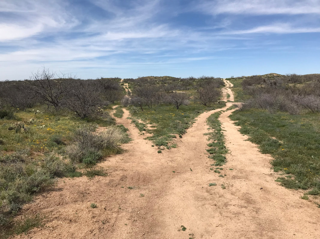 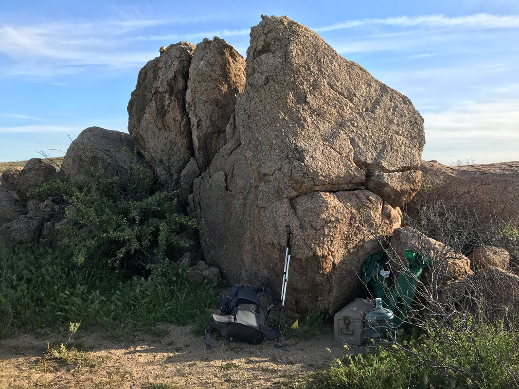 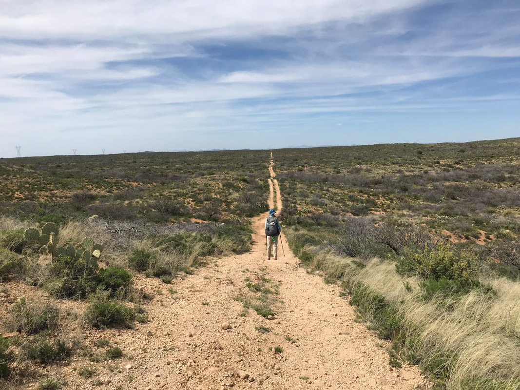
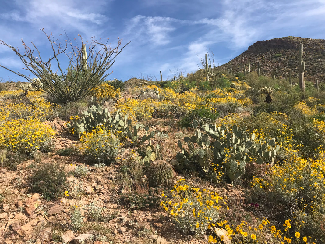
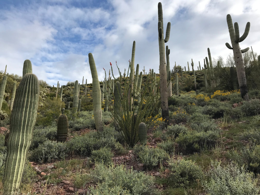
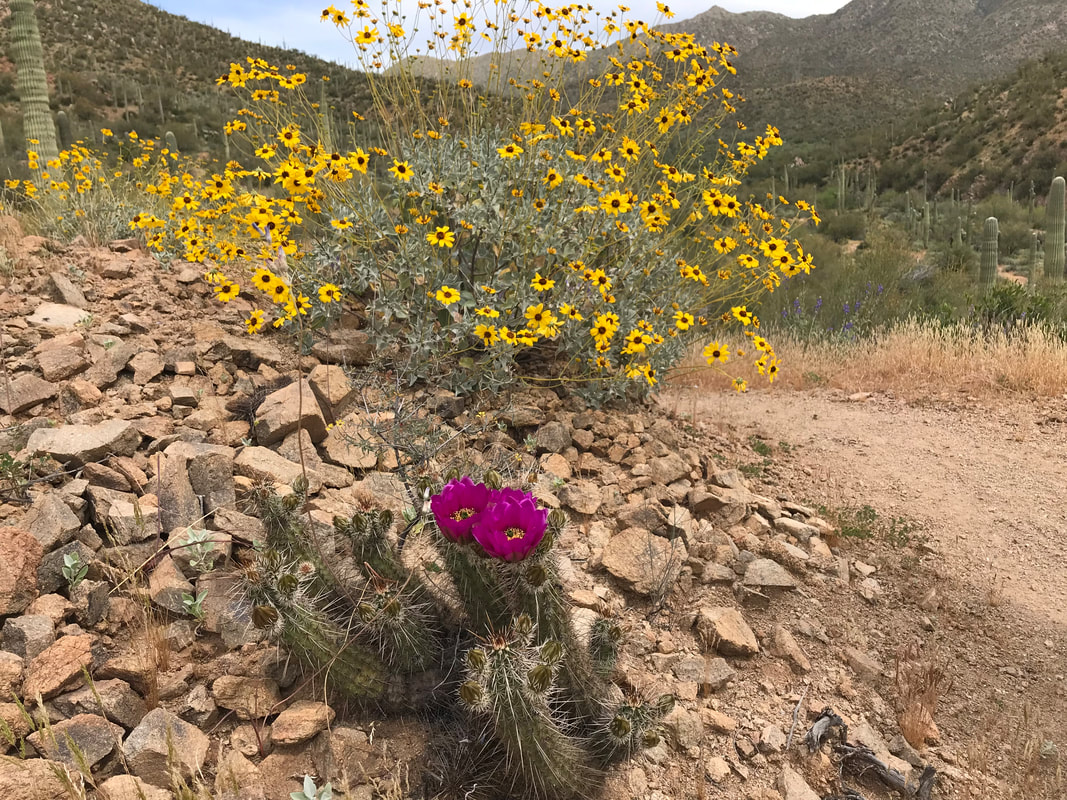
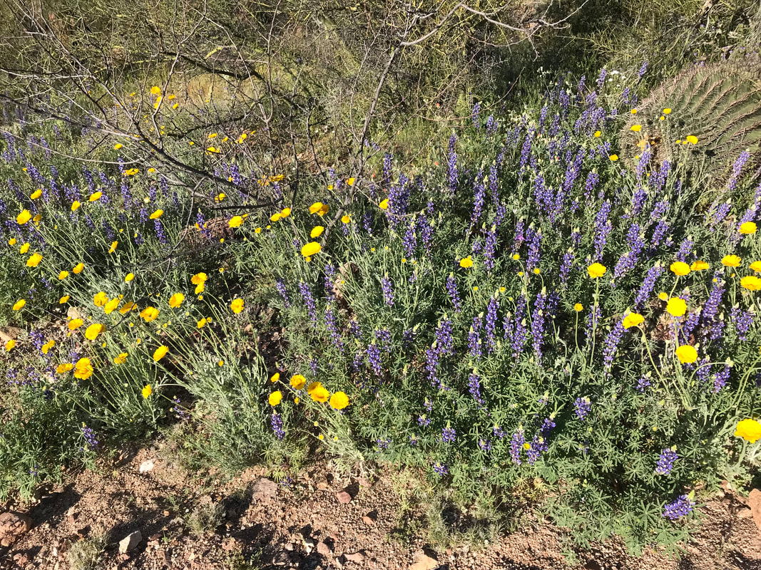
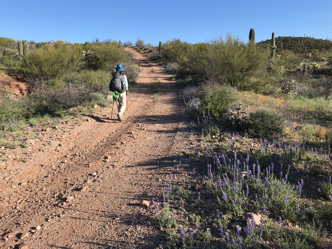
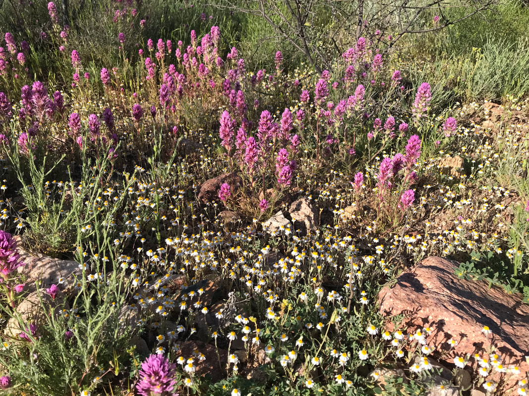
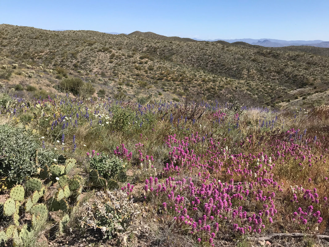
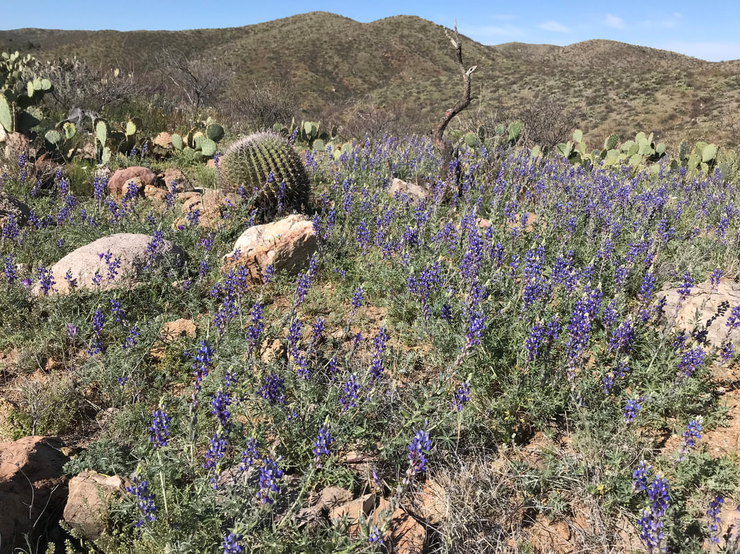
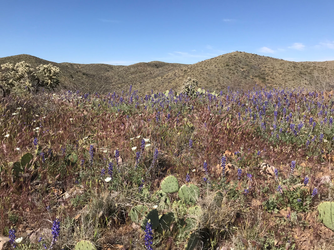
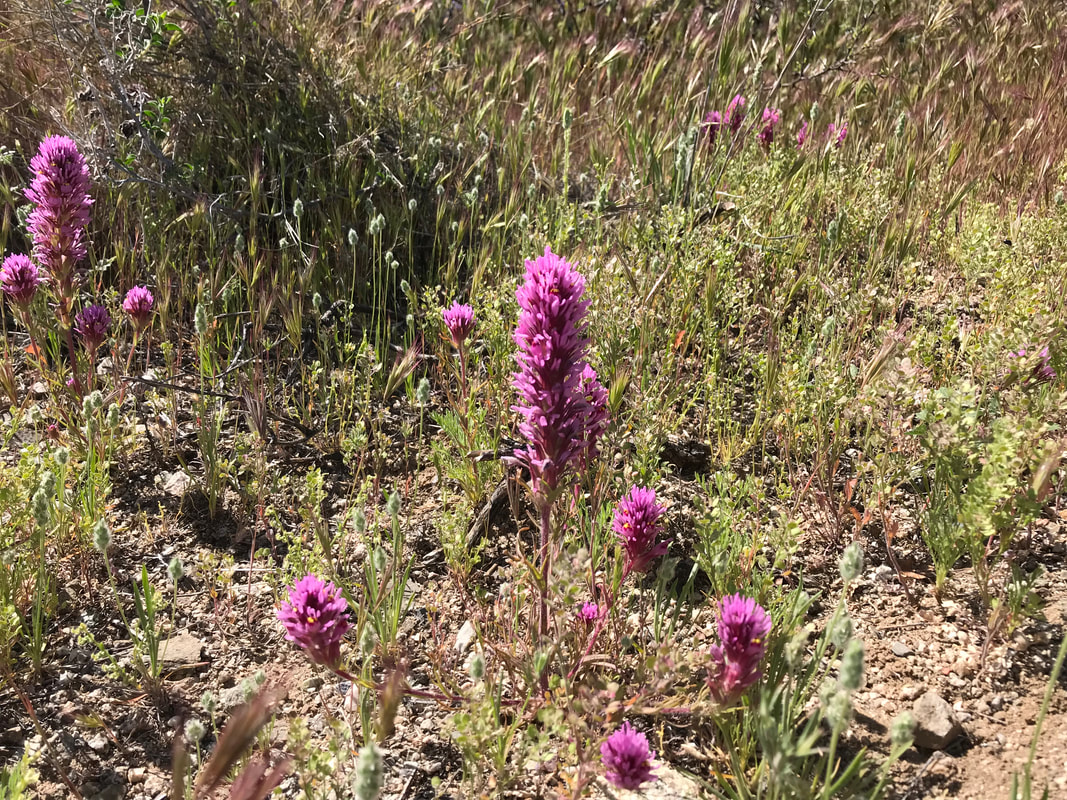
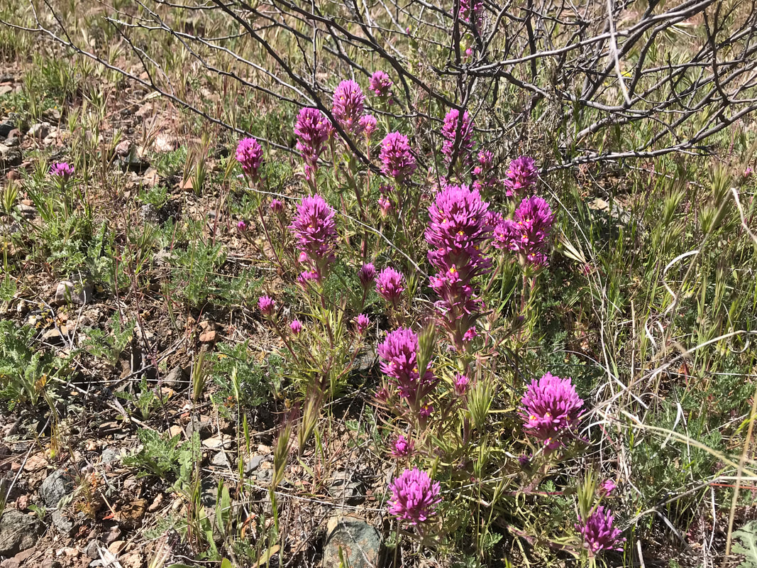
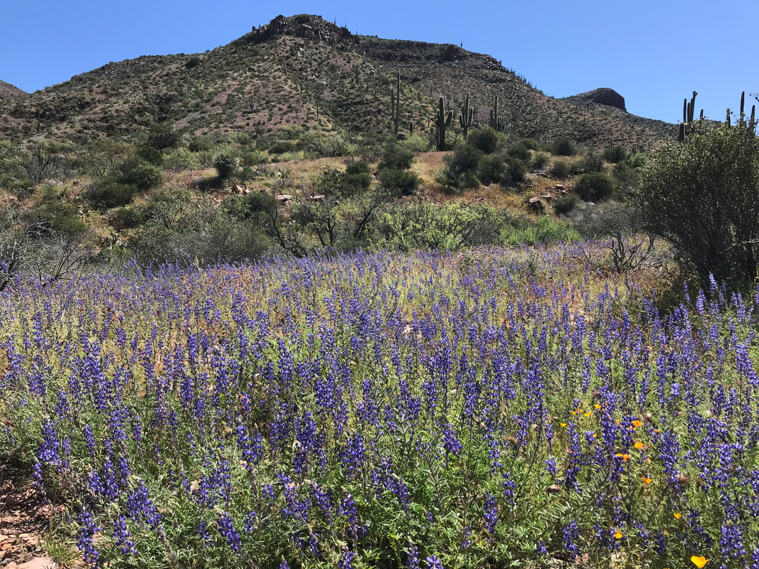
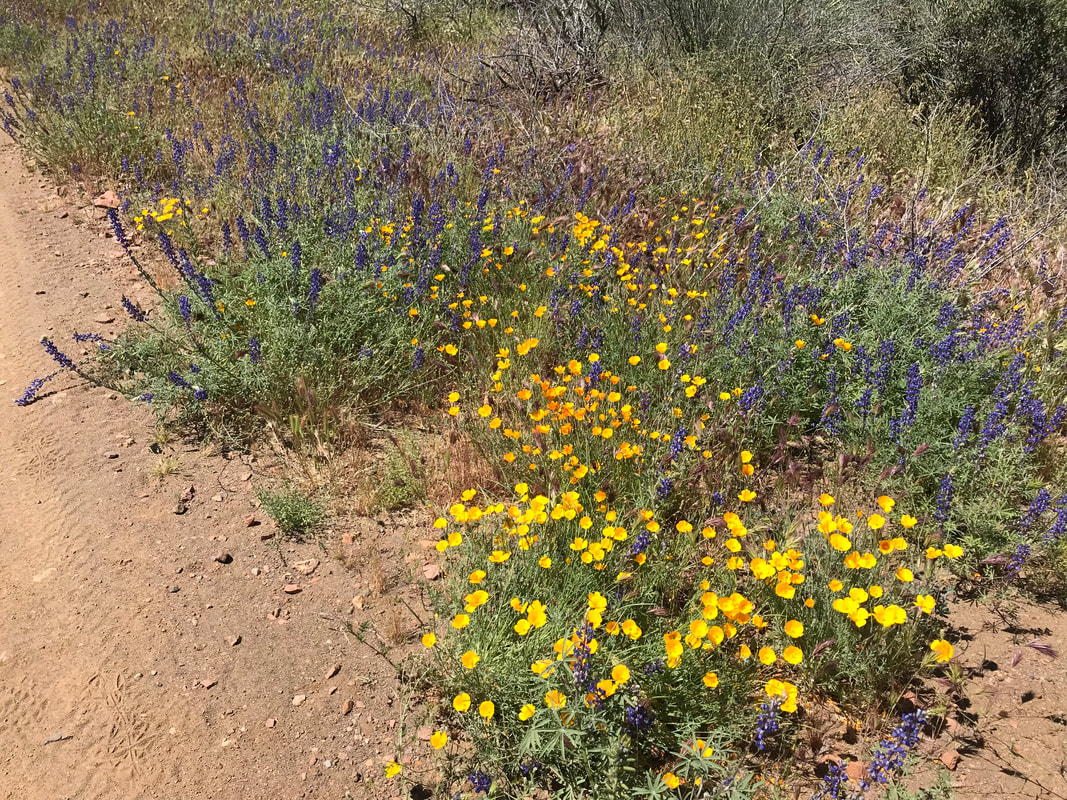
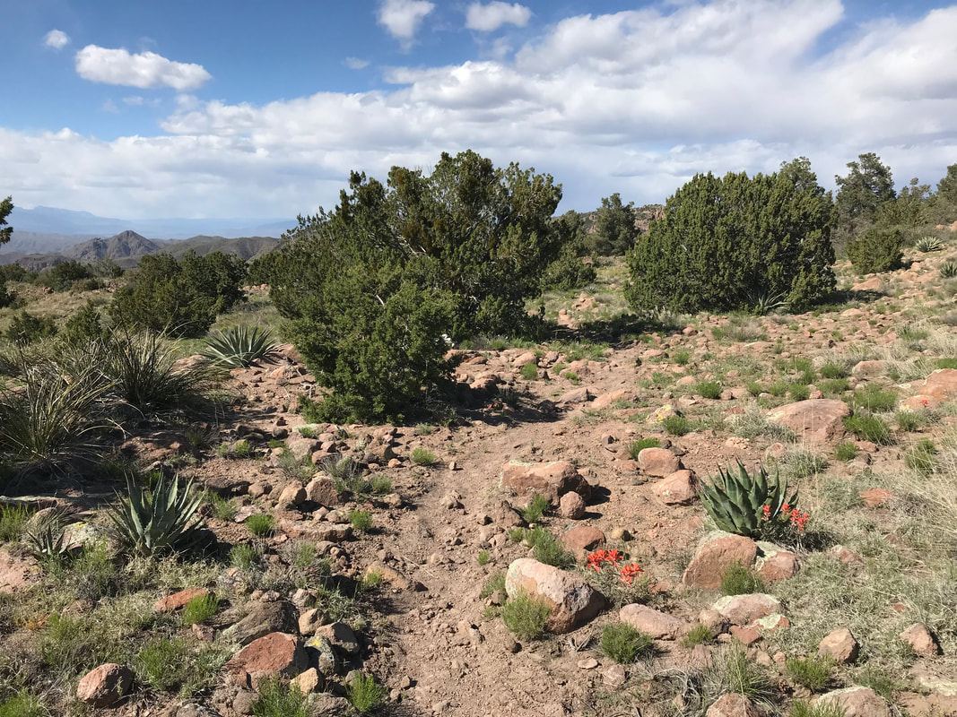
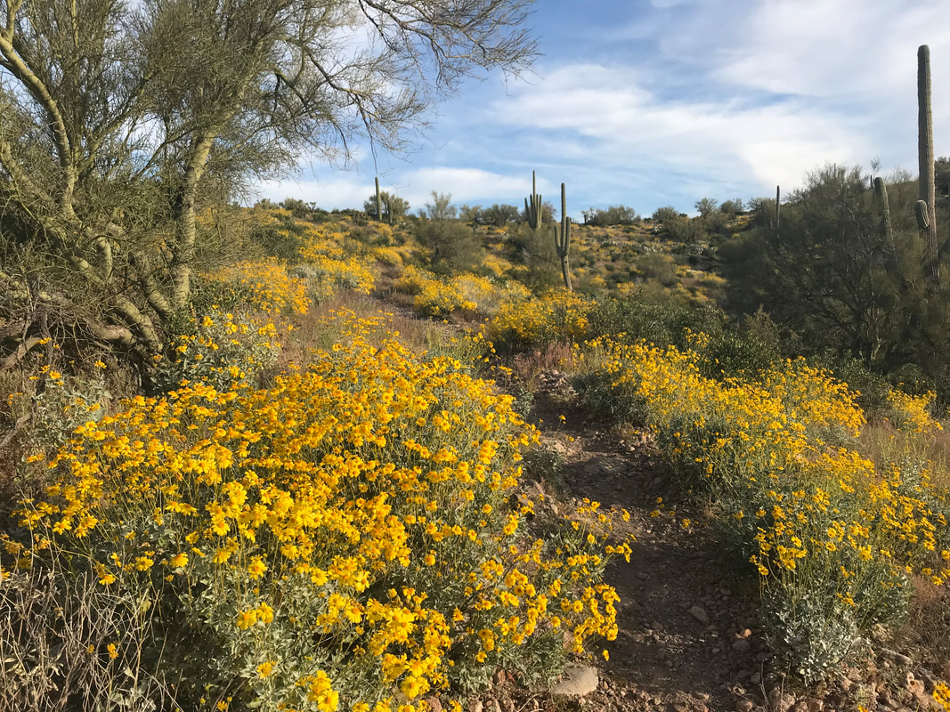
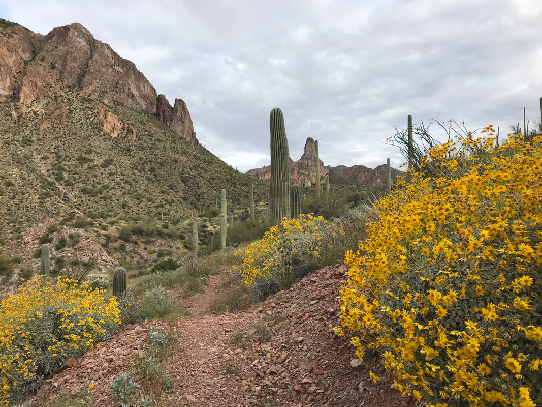
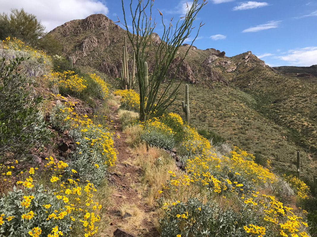
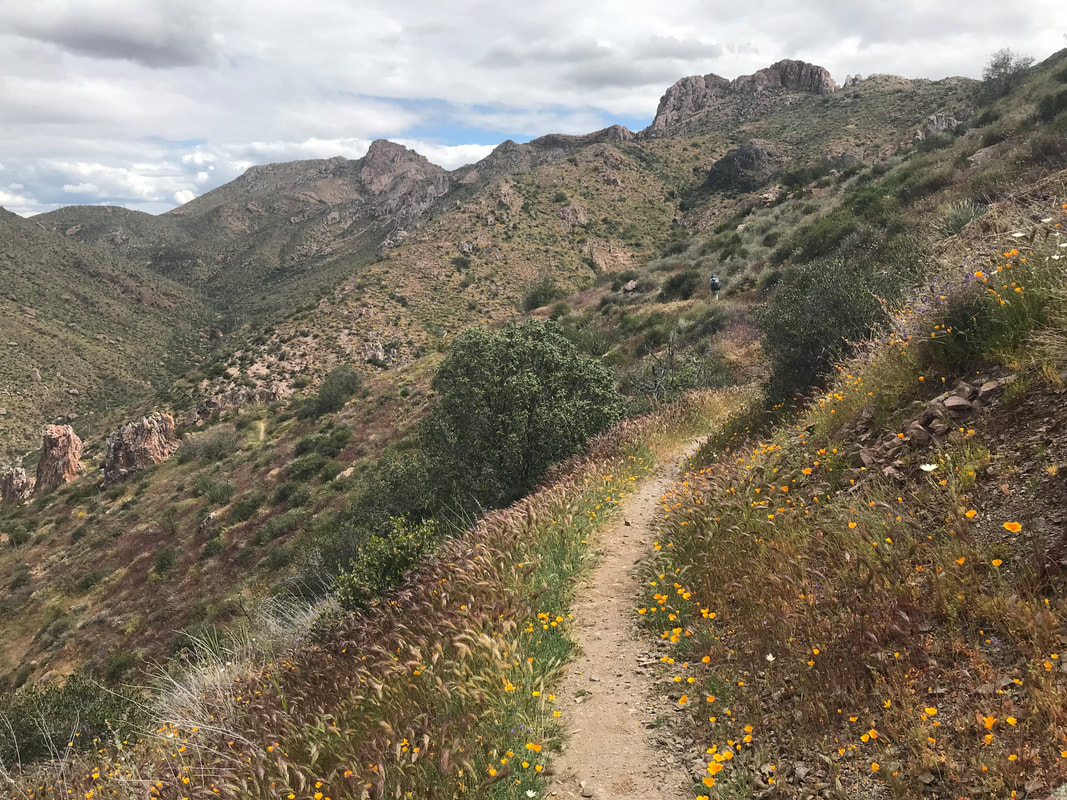
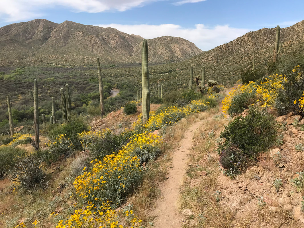
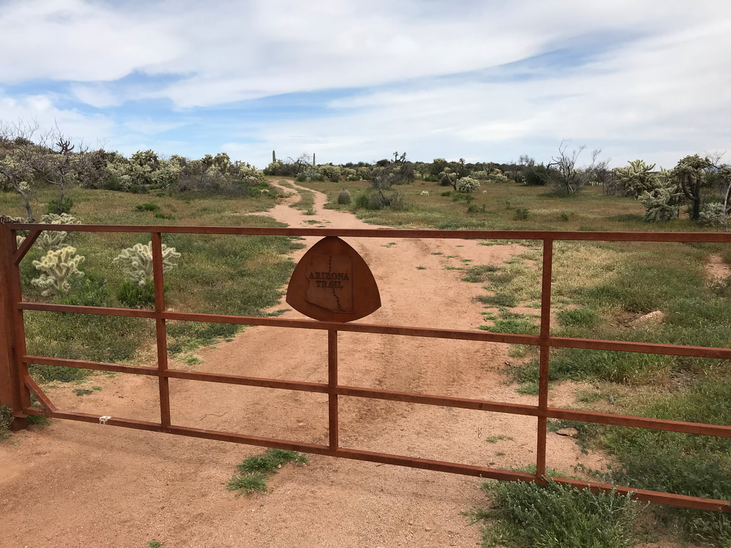
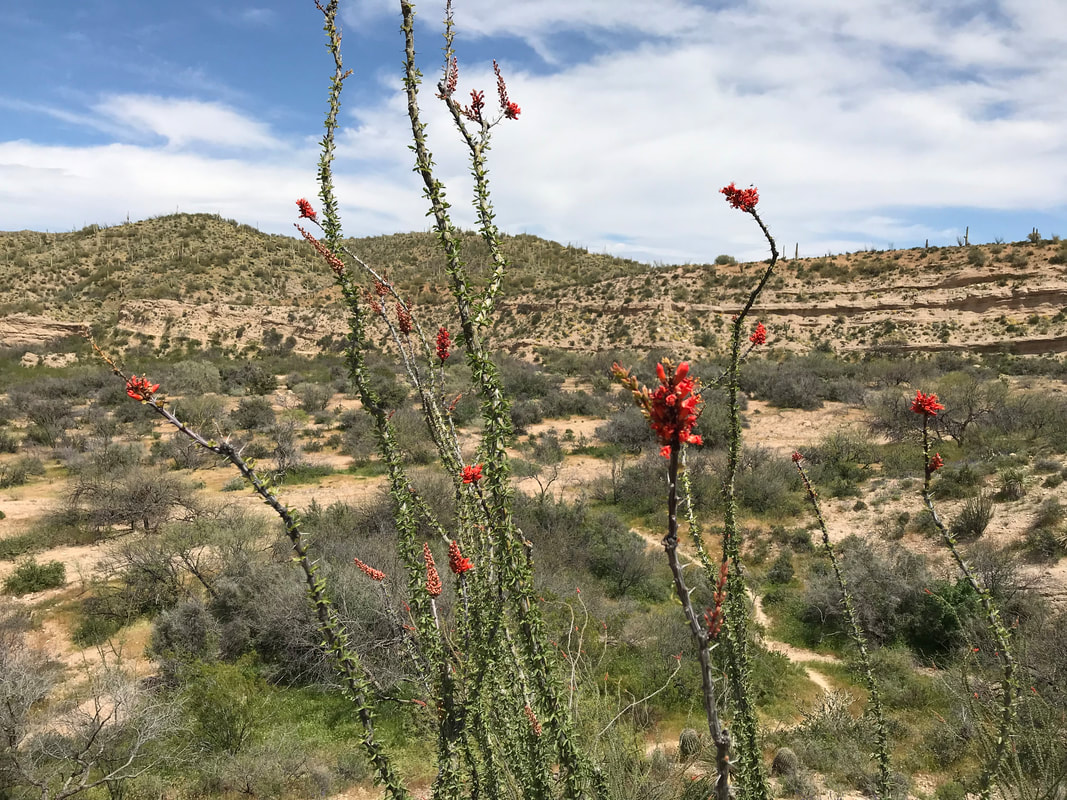
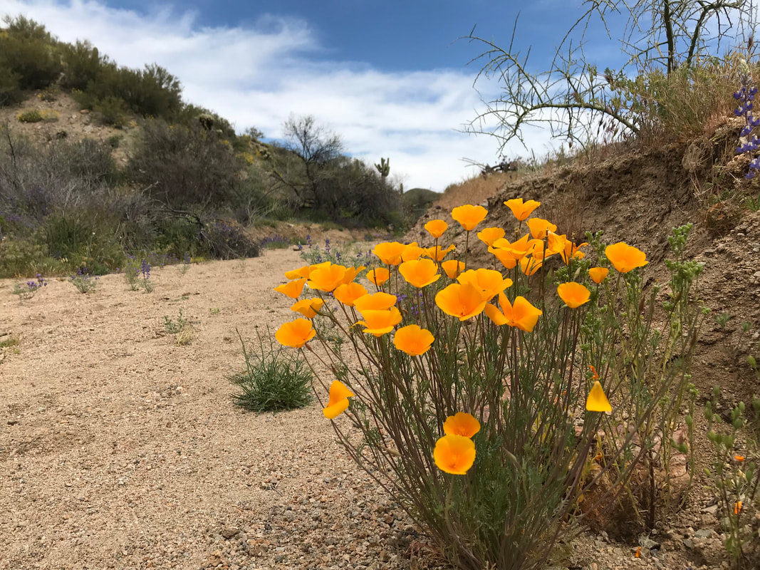
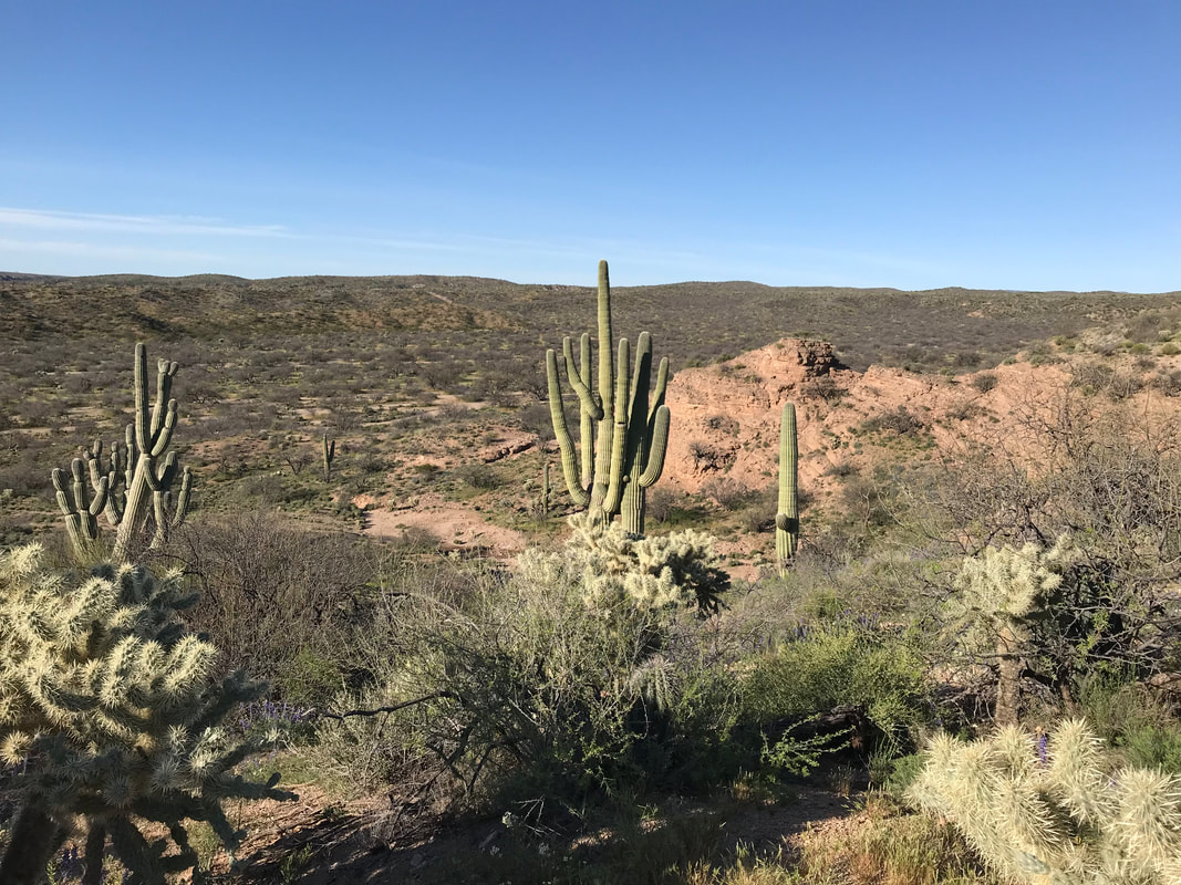
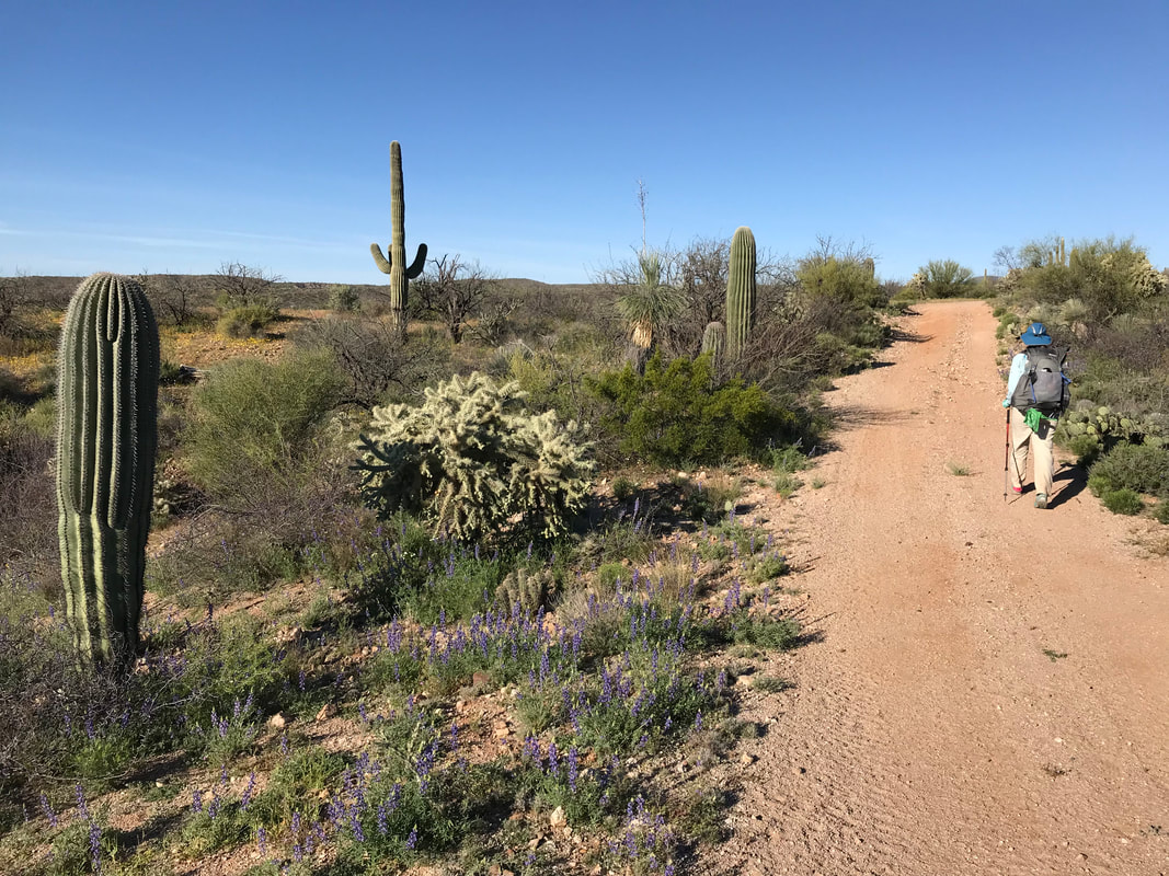
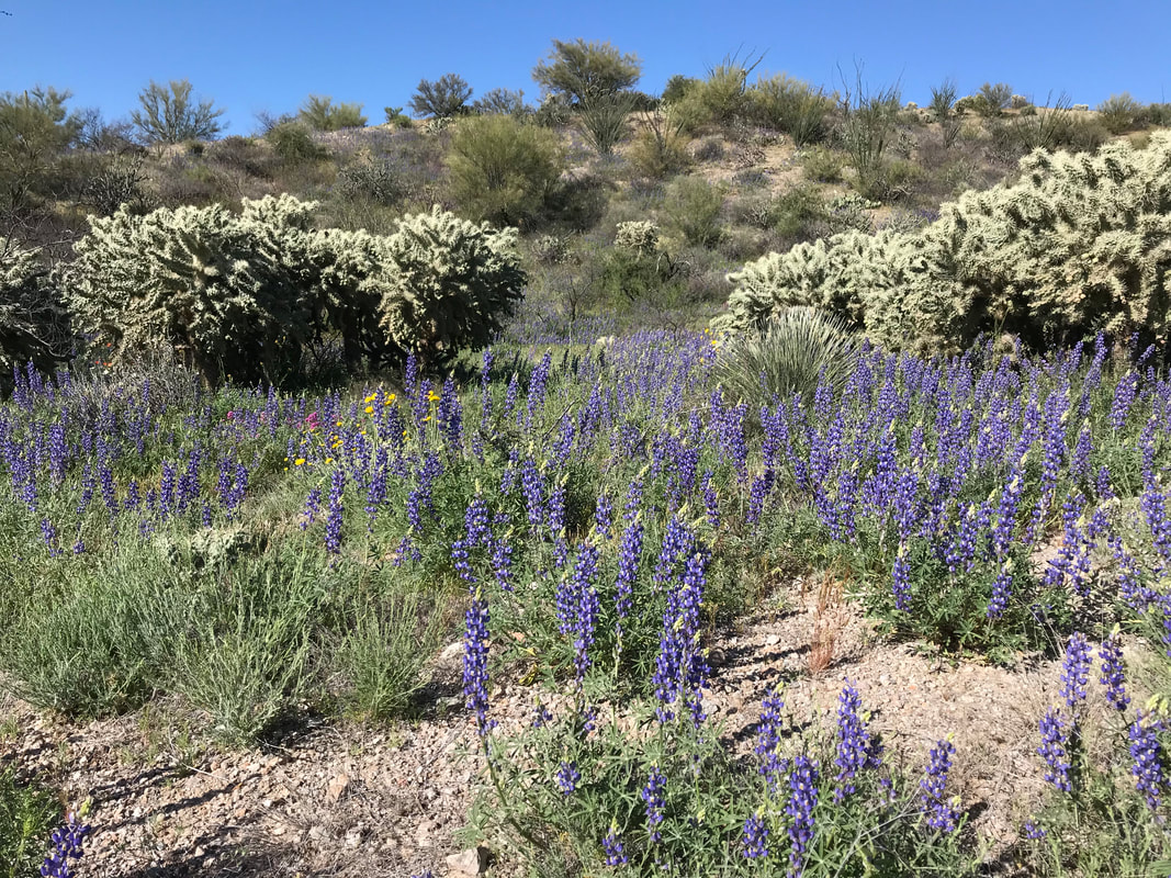
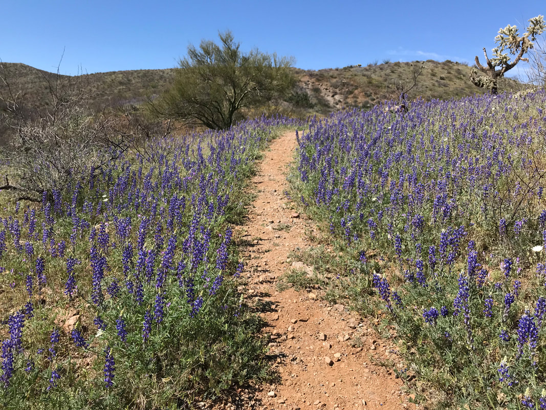
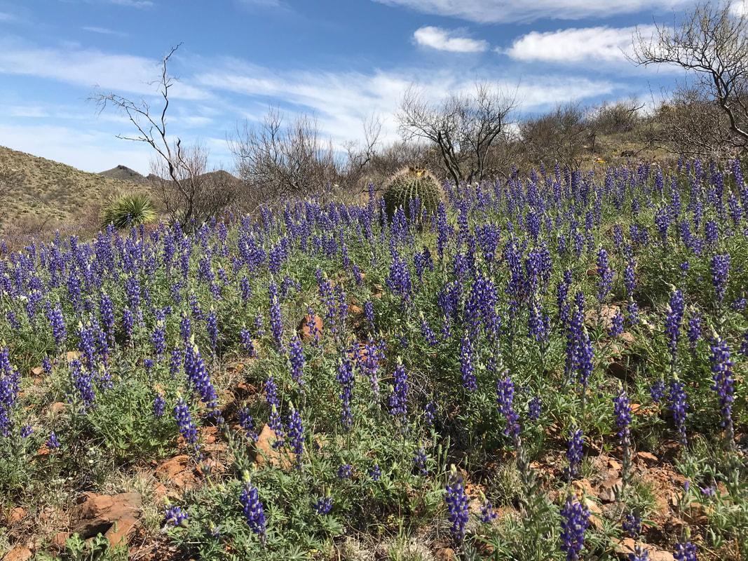
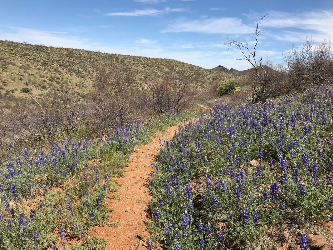
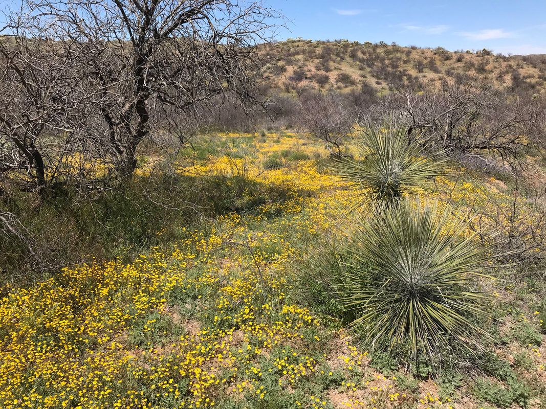
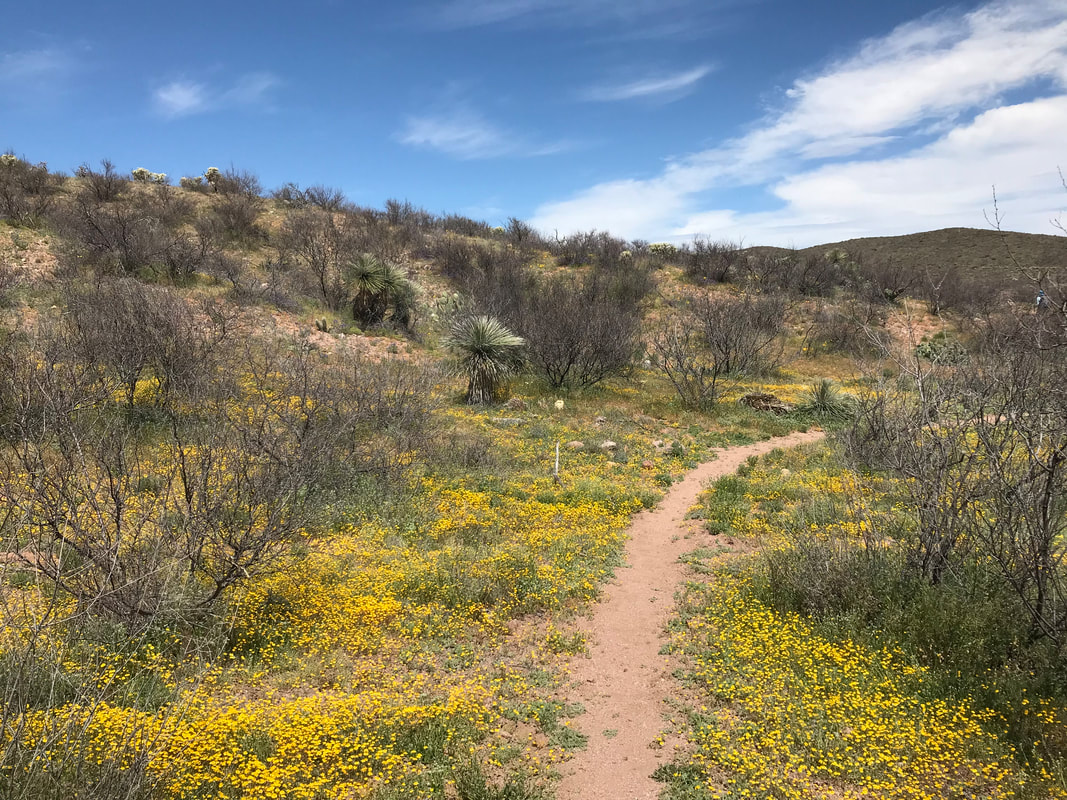
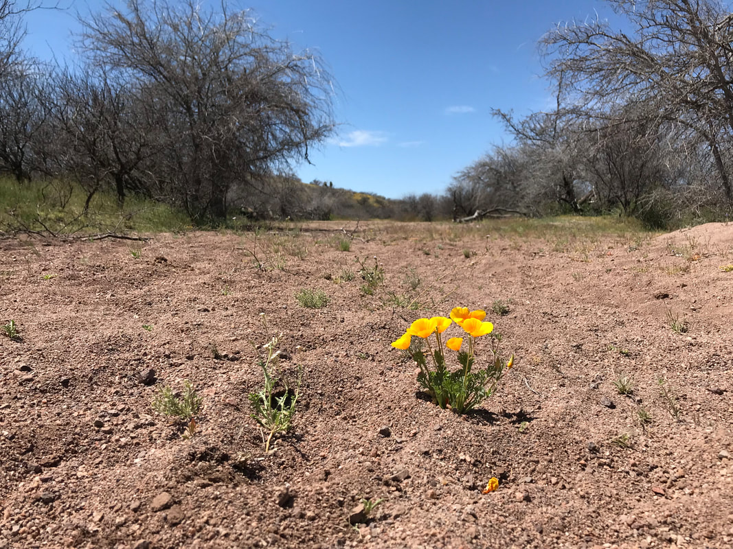
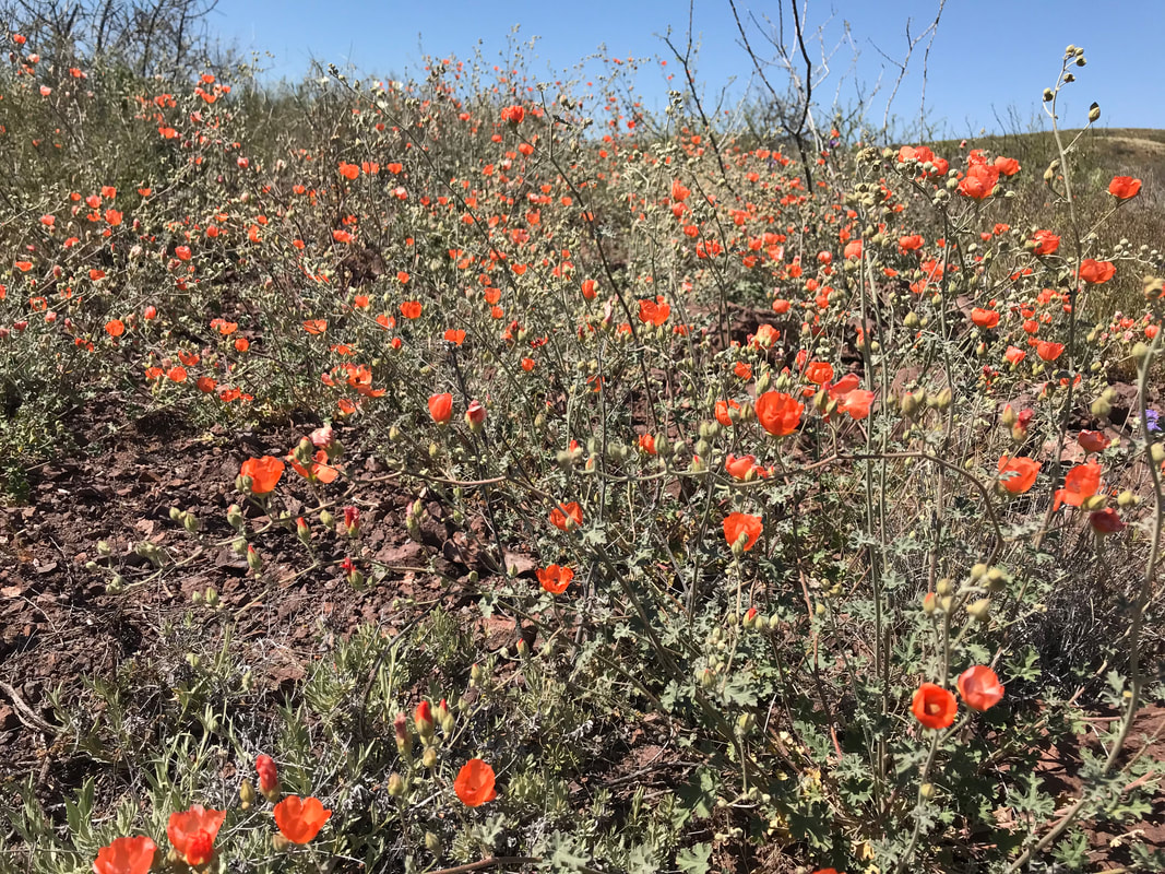
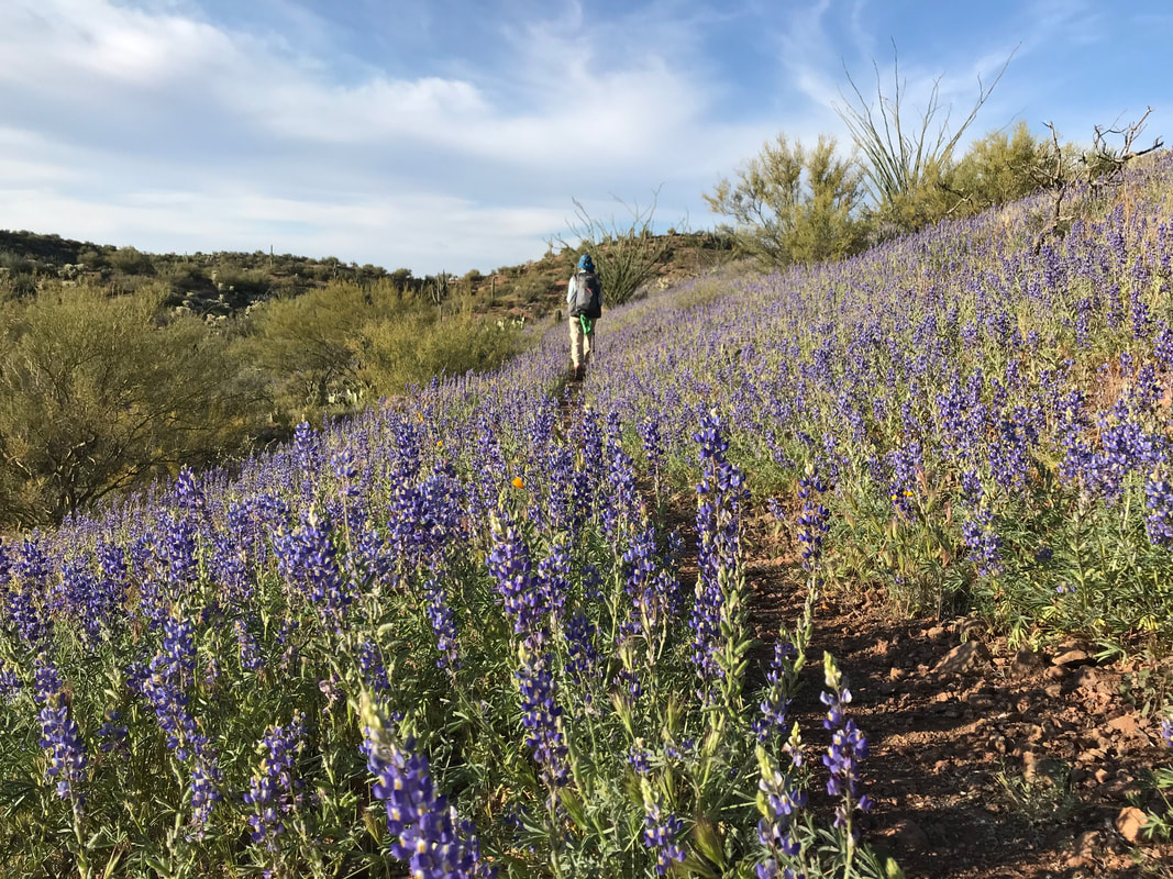 The Sonoran Desert is beautiful to me thanks in no small part to the season of spring. Spend some time around me, and I’m sure you’ll hear me gush about the wildflowers blooms that occur. There are no sweeping, diverse, and starkly brilliant blooms as those in the Sonoran Desert when the wildflowers blaze across the landscape. After our epic El Nino winter and spring, I had been waiting to see a stunning spread of blooms, but so far, everything had been average. In fact, heading into today, I thought we might see some blooms, but didn’t give it much thought. This particular stretch of the Arizona Trail, the one linking Oracle to Superior, had, in my mind, been steadily growing as a stressful challenge as we approached it. No section is lower, more exposed, hotter, and with fewer water sources than this section, all wrapped up here. I was expecting 100+ degree temps, blazing afternoons, tons of rattlesnakes, questionable water availability and sources, and a struggle with head exhaustion. Yet, this whole stretch, when complete, would end up being one of the most stunning, memorable, beautiful, and compelling reasons to hike the Arizona Trail. We got up this morning and a group of us hikers were driven by Jim and Marney to the Oracle Patio Cafe for one last delicious breakfast before heading out. They also stopped at the post office so everyone could bounce resupply boxes to their next upcoming locations. Cold-weather gear was now heading home due to the advancing spring and the 8000+ ft. mountains behind us. I didn’t expect snow again until nearer to Flagstaff and the North Rim of the Grand Canyon. As their vehicle jolted up and down the road to Tiger Mine Trailhead, Jim and Marney relayed that they had driven up washes last in the desert to drop off water for all of us in this next section, which meant our water carries could be reduced. They pulled up to Tiger Mine Trailhead and dropped Frisbee, Stubs, Janna, Kitska, Rosey, and I out. The temperature was perfect, a literal 75 degrees F. A cool breeze kept up all day. These ideal temperatures and conditions would extend through the day. The Arizona Trail sign, standing as a portal to the low Sonoran desert was well-framed with the speck of the tip of Antelope Peak visible in the distance. I knew this section well as this was the route I had taken to run on Oracle Rumble ultramarathon two years ago, with Antelope Peak being the drop point for the start and Oracle the end. I felt like this was a monumental moment, a moment to think how I had fucked up my knee before and now I was back on a bigger journey to realize this same section all over again. Heading down the trail, I began stopping, what seemed to be every 20 steps to exclaim out loud how amazing beautiful the desert looked. Every ocotillo branch was in full deep green leaf. Every patch of normally barren interspersed dirt earth was ripe with golden and yellow flowers of a dozen different species. Every hillside in the distance seemed highlighted in yellow, while brink pink florals would punch the color scheme, drawing my eye to their striking hue. It was insane how good the flowers were. At times, the Arizona Trail was lined with thick Sonoran desert lupine, their purple flowers making a perfect and thick outside of the singletrack in between. I couldn’t stop taking photos of the vast numbers of golds, yellows, whites, creams, purples, pinks, reds, and greens that matted the entire desert. A superbloom of a size I had never seen. FREAKING BEAUTIFUL. 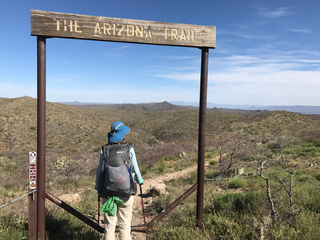
  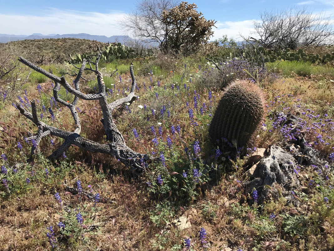
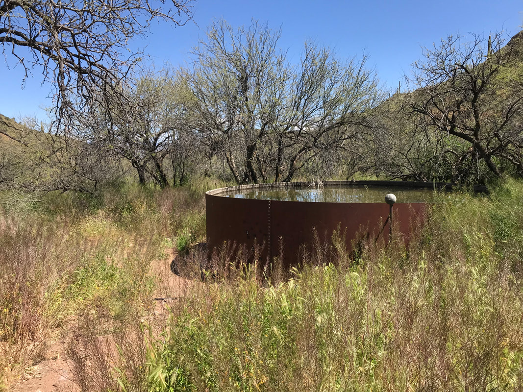
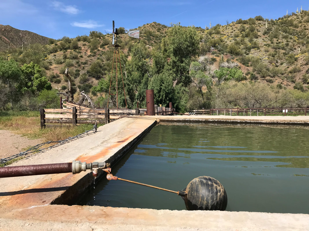
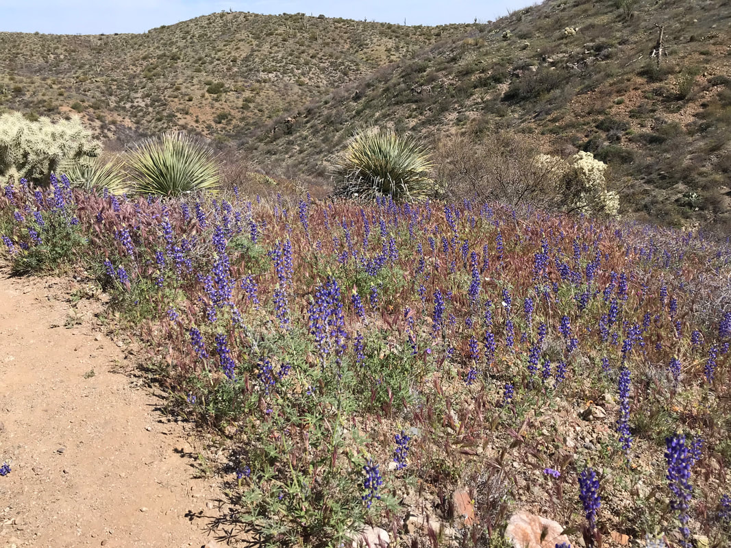
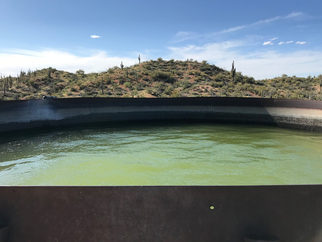
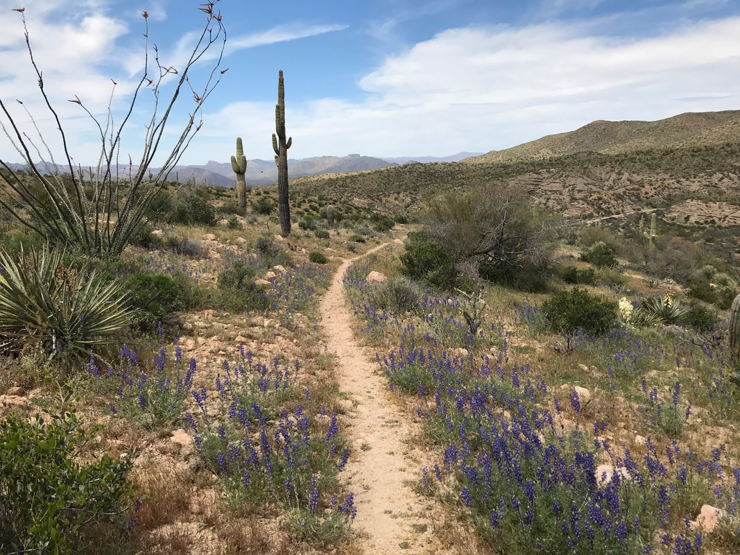
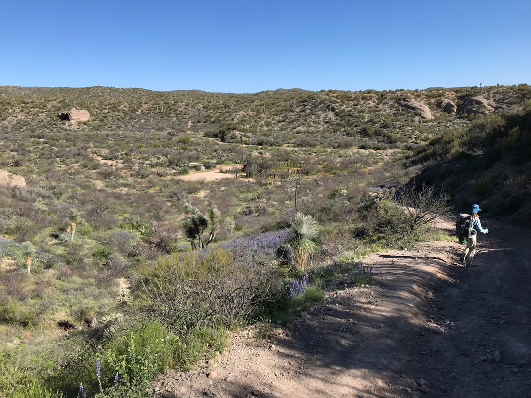
    At some point in all this beauty, we caught up to Frisbee, Stubs, Kitska, and Rosey all chilling in some palo verde shade, filling up water from the bottles left by Jim and Marney. The conservations with fellow hikers just added to the strength of day. Feeling that strength in our bodies, along with the more mellow terrain (no massively steep ascents and descents - just rolling smooth singletrack flow), Janna and I really crushed the miles. Water wasn’t as big of an issue was the water tanks were full. At this point, we hadn’t seen these types of tanks yet. Cattle tanks so far were maybe 4 feet high and filled with water. These new tanks (which would continue throughout the rest of the hike), were 10+ feet tall and only accessible by ladder or careful climbing. The water inside was a brilliant neon green at times, a product of algae growth, bright sun, and blue sky above. However, when bottles were dipped, they always came up relatively clear. At least cows couldn’t physically shit in these ones. As afternoon wore on, we caught up with Rosey and Kitska and ended up hiking with them for the rest of the day. Golden hour hit in early evening, lighting up saguaros to stately gold and making the grass heads stand out. Suddenly, Janna called out as she almost stepped on a young western diamondback rattlesnake. In AZ, I’m always looking where I put my feet and my fingers - there are plenty of organisms here who sting and bite. Thus far, I’ve never had an issue, but it doesn’t mean letting your senses down. I love reptiles and I was excited to check out our first rattler on the trail. It was lounging in the granite, almost a perfect match in color, making us very aware of the need to carefully inspect where we step. The western diamondback eventually scooted off into some lush purple lupine, the snake’s iconic black and white striped tail still on trail. Giving it a wide berth, we hiked down the side of a hill and then back up to meet the AZT well away from it. I kept turning around everywhere to take pictures of the flower mottled hills in front of us and the striking snow-capped peaks of the Santa Catalinas behind us. My feet felt great with the major cushioning provided by the Hokas. Janna and I stopped for several snacks and to just enjoy being out in the beauty. Feeling strong, we pushed past our original stopping point and decided to make it to Bloodsucker Wash. A big evening wind picked up, drying us out, but keep the temperature nice. After refilling water with Kitska and Rosey, we all agreed to camp near Cowhead Tank up Bloodsucker Wash. Kitska was a fast hiker and took off way ahead of us. Rosey talked to us about thru-hiking the PCT last year and how he was just doing a section of the AZT between Tucson and Flagstaff before returning to his job. He said he felt so much freer only section-hiking a long trail. Rosey spoke of the mental pressures within and the external expectation pressures of others when intending to do a thru-hike and how all those felt gone when only doing a section. It was a conversation of great insight. 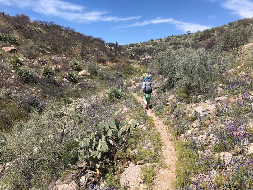
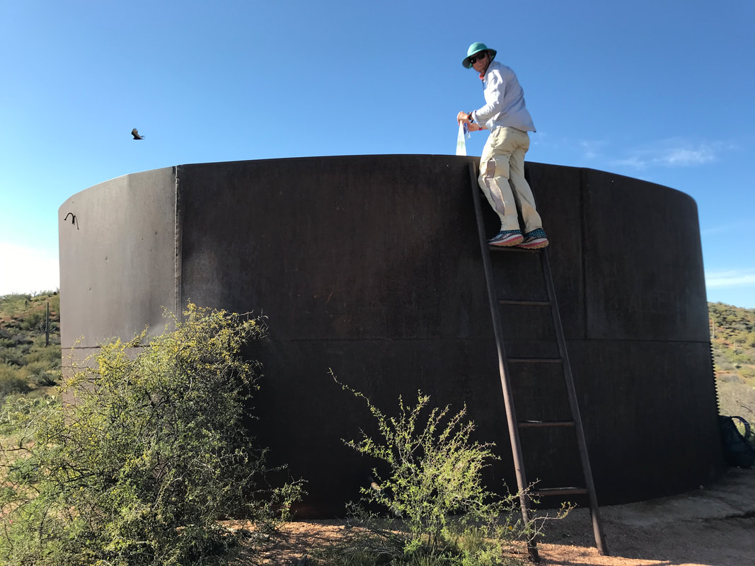
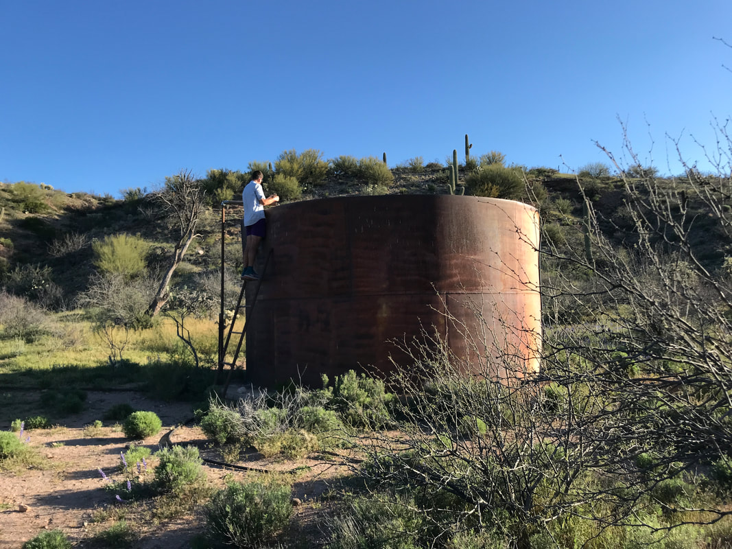
As evening approach, Rosey surged ahead of Janna and I. My butt began chafing a little bit and I stopped to baby that shit. A non-chaffed butt is a happy butt. We spilled out in the gathering darkness into Bloodsucker Wash, a massively wide flow of sand stretching for miles. It was crisscrossed with tire tracks from ATVers; how they got out here, I definitely have no idea. Following directions indicated in the comments of Guthook, we found a side tributary wash and took it upstream. There, we convened on an old wooden and decaying cow corral with a large water tank complete with small pipe drizzling cool water into the container, on top. Rosey was here, standing on the ladder and patiently letting the clean dribble fill his bottle. All three us of us setup camp nearby in another wash, the sand warm and soft, perfect camping substrate for the night. We were all confused why Kitska wasn’t here as she was so far ahead. As evening wore on, we heard a crashing coming down an opposing hill and Kitska was suddenly here. She apparently missed the turnoff and backtracked to a little-used side trail and tumbled down to us. We all sat around in the dark, a clear desert night-sky spilling with stars above us, talking about life. A great end to a great day. 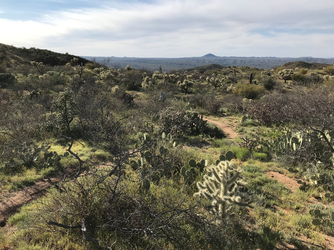 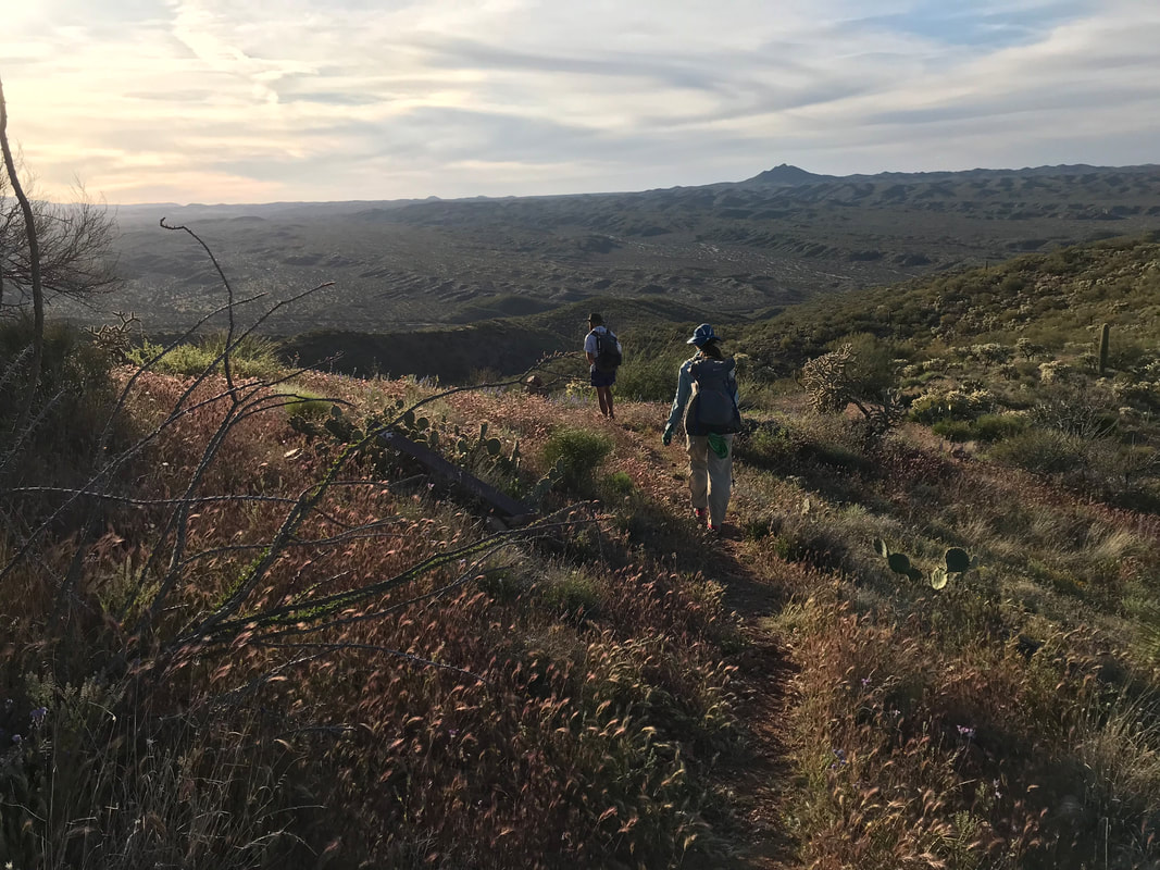 |