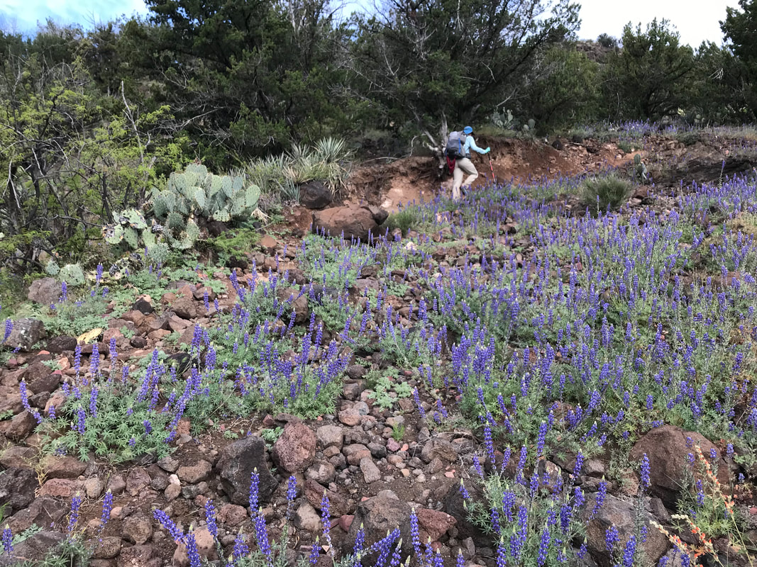
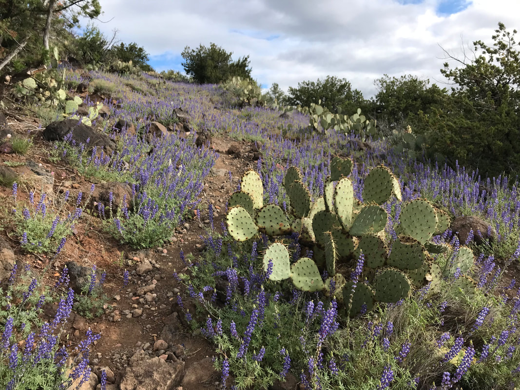
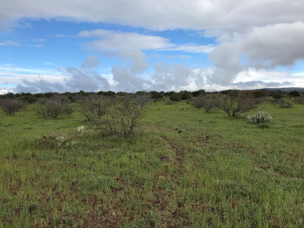
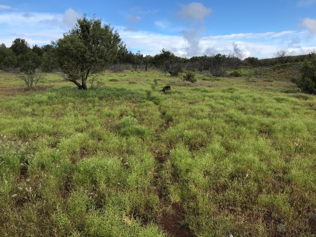
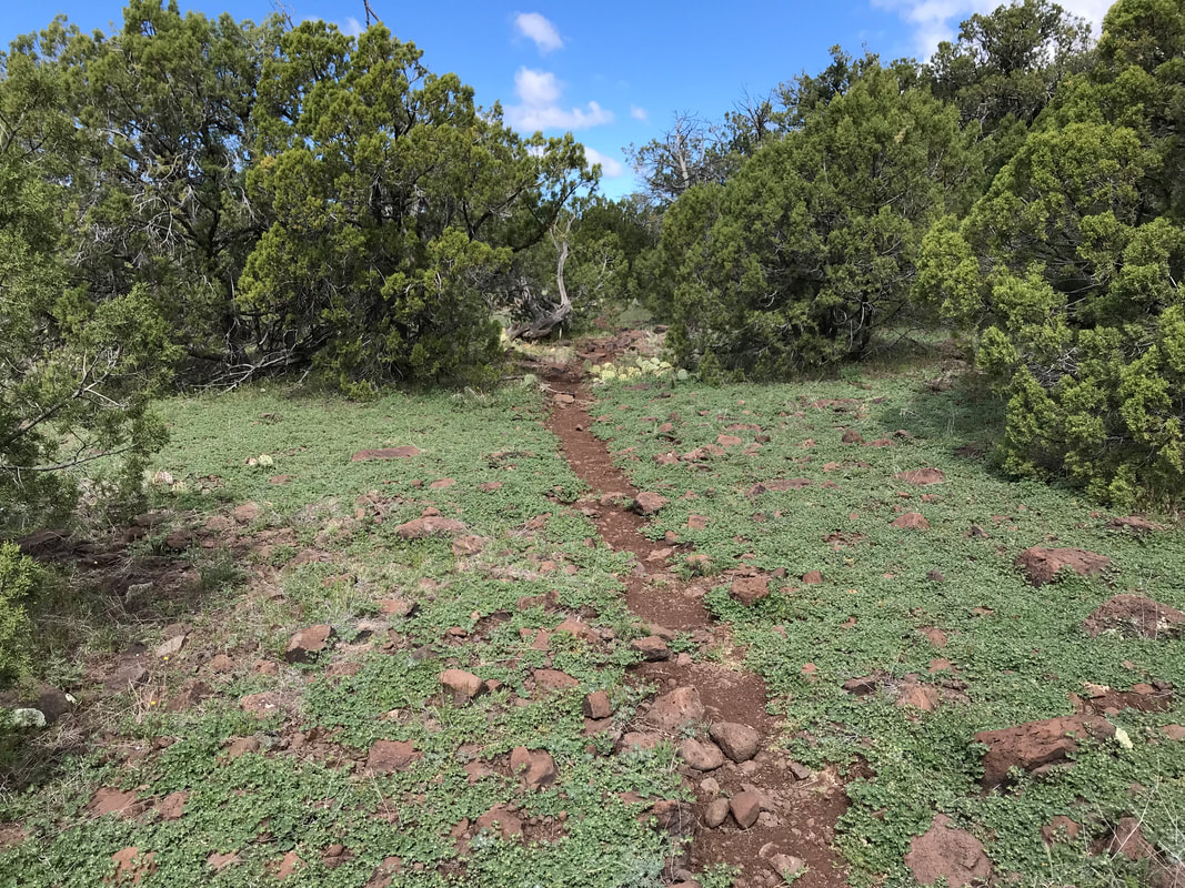
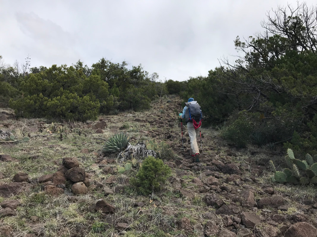
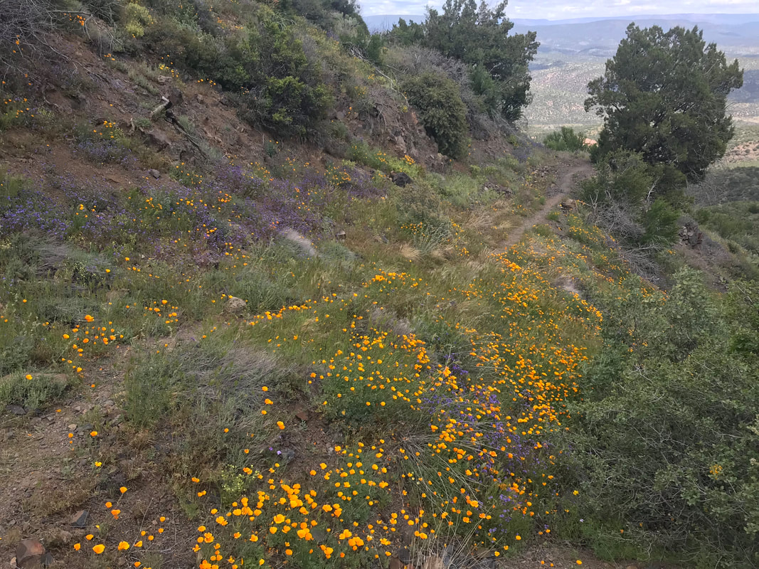
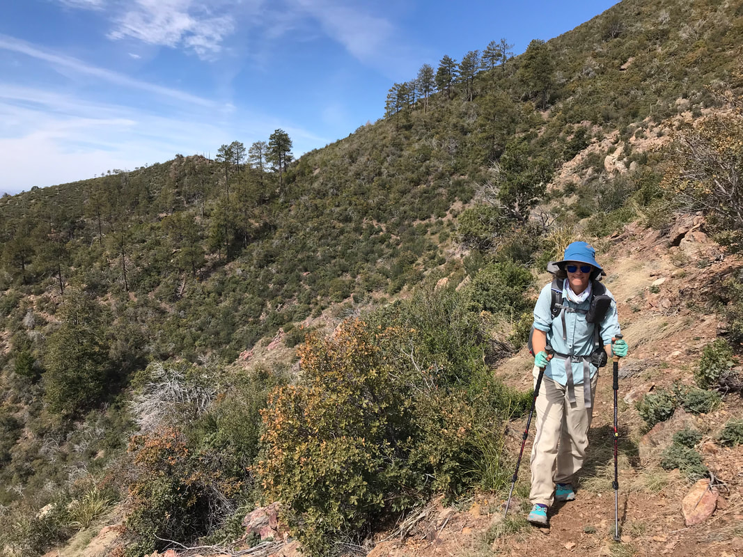
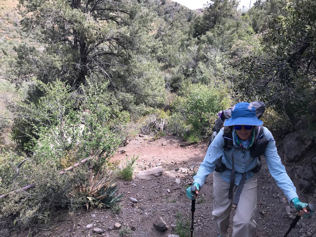
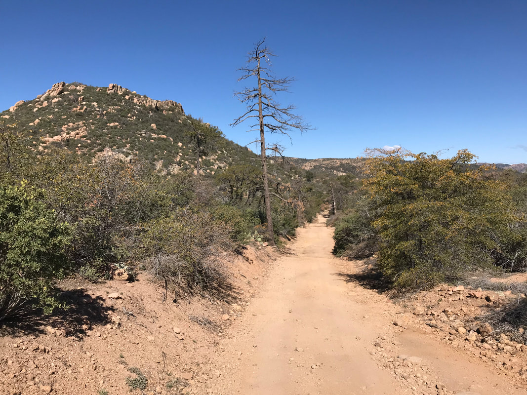
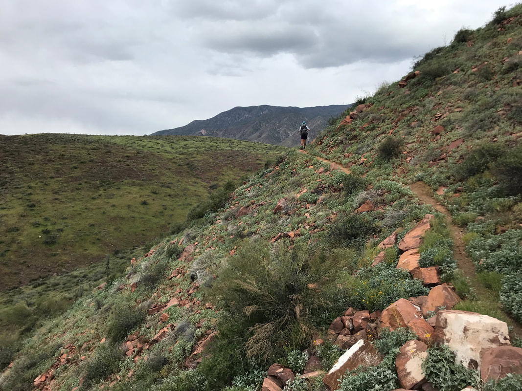
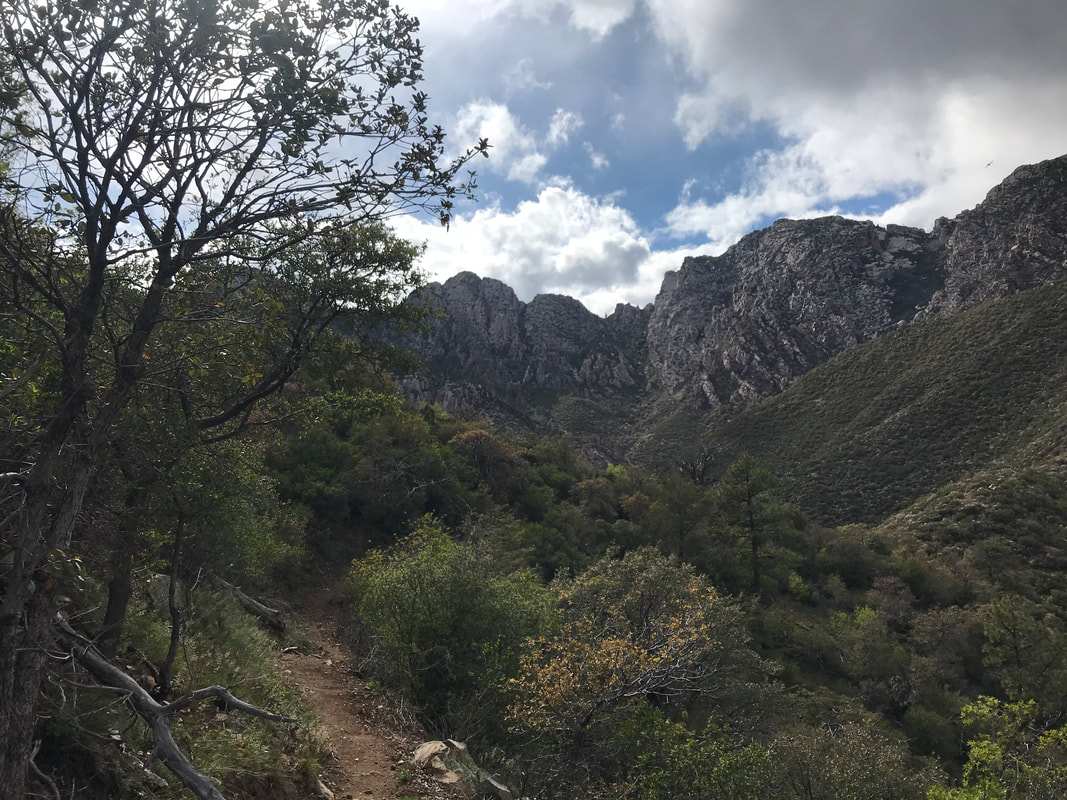
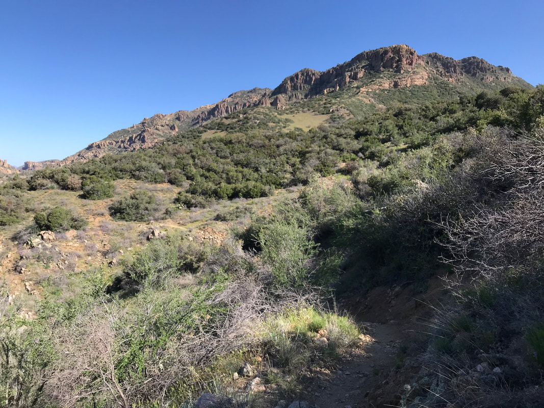
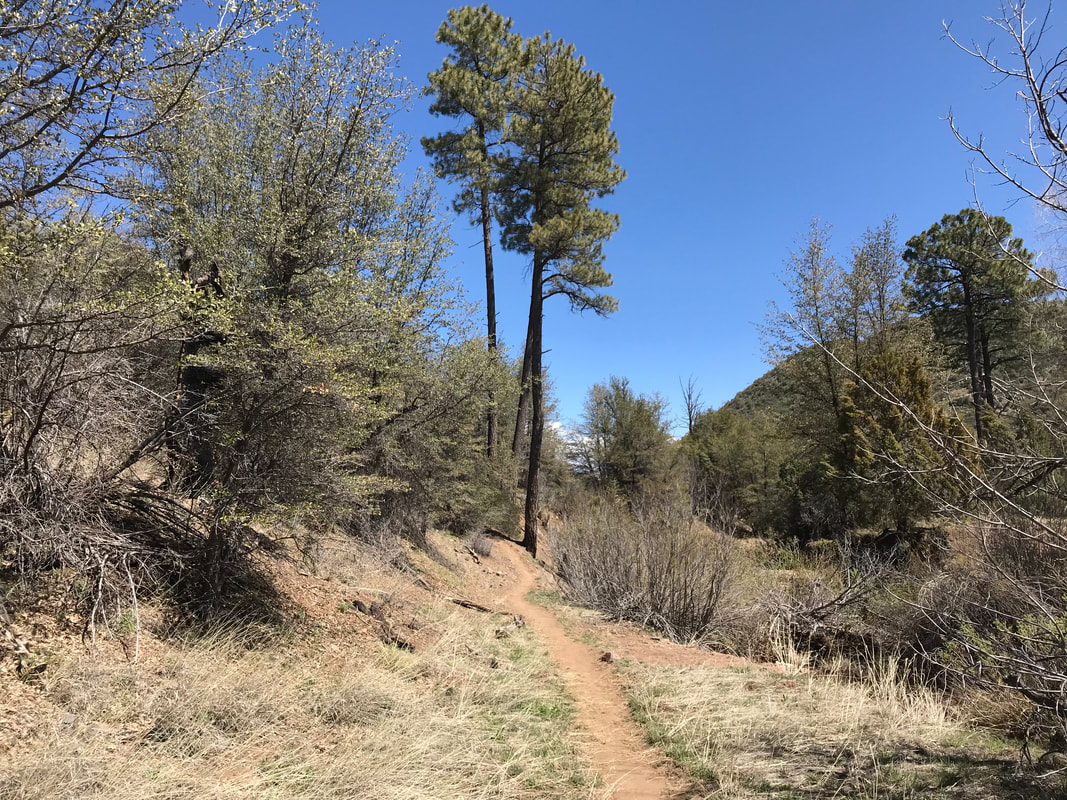
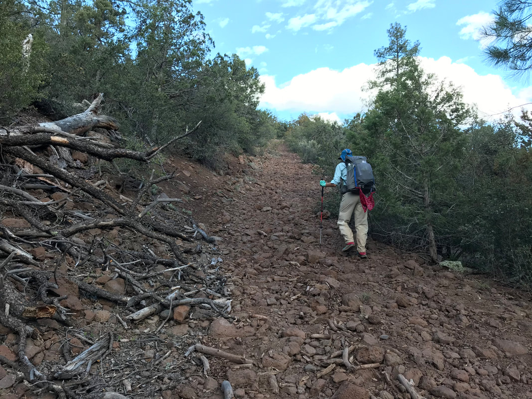
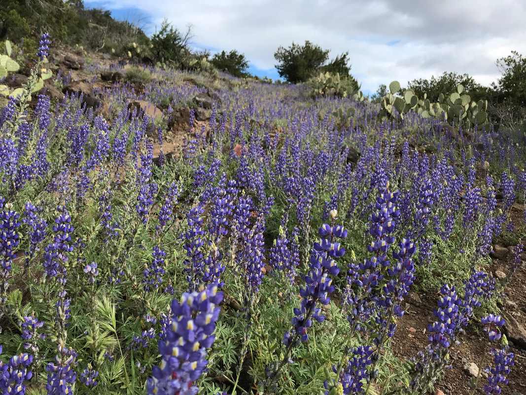
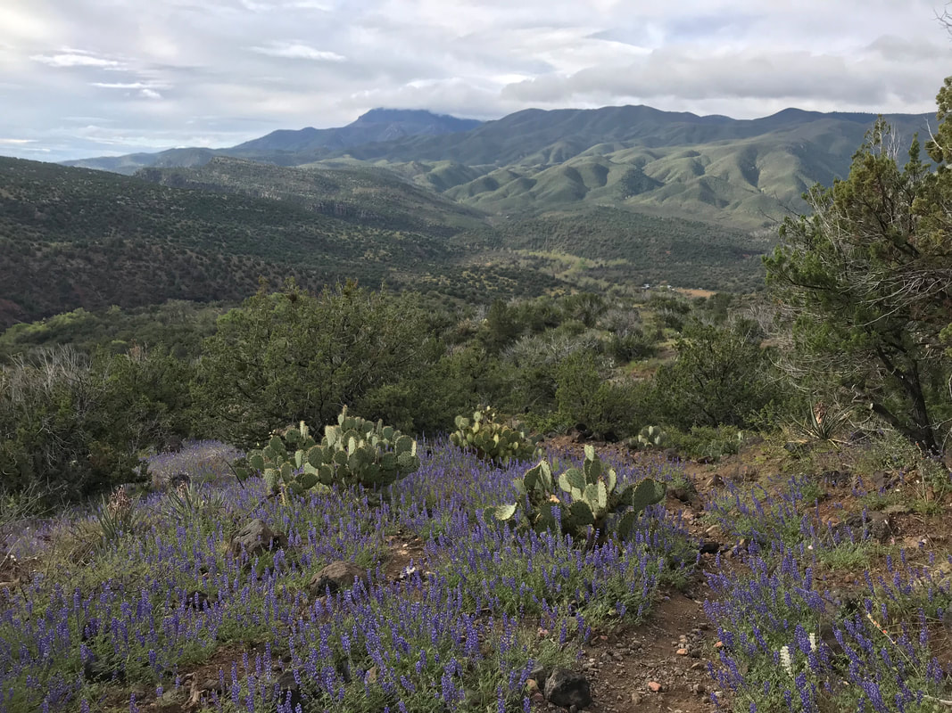
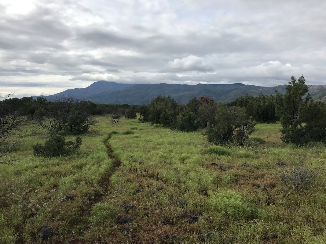
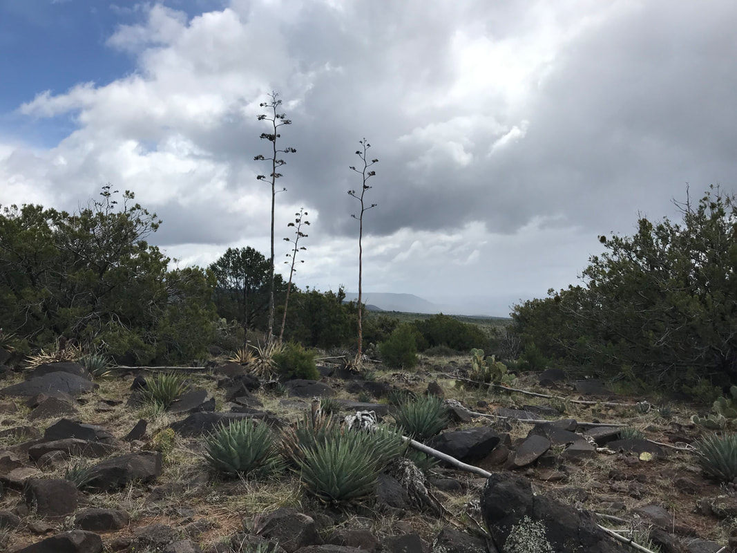
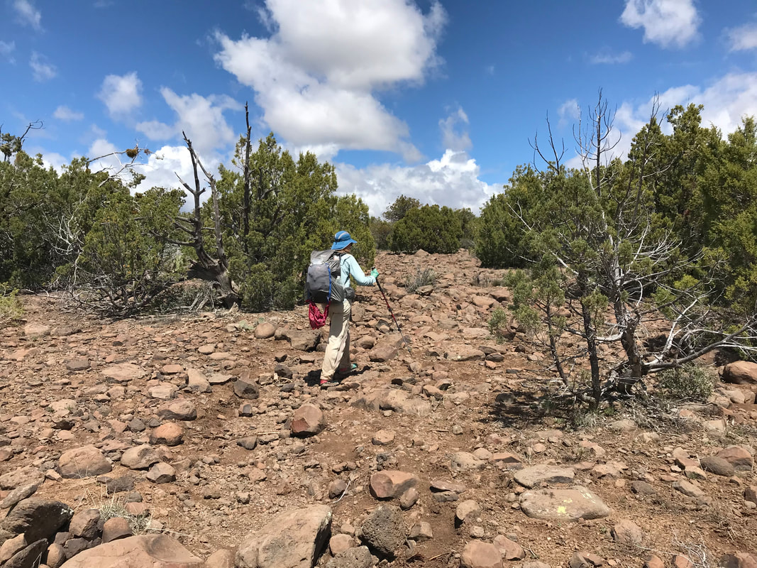
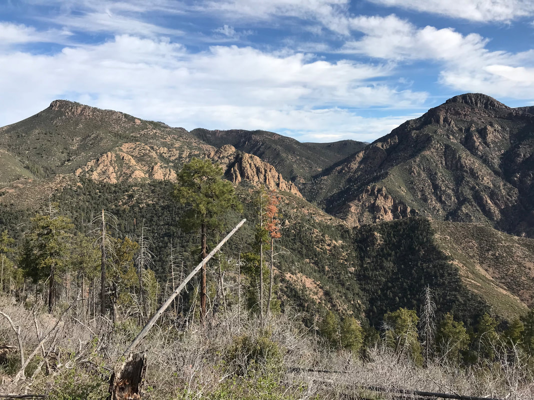
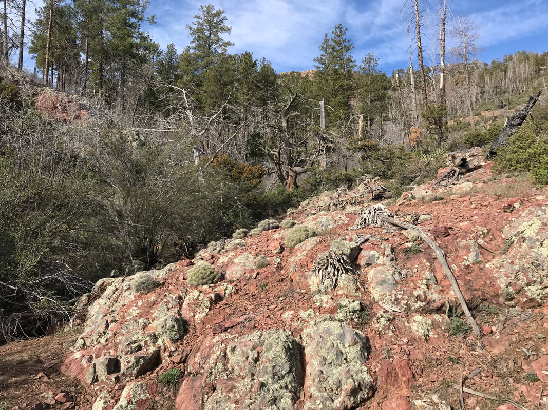
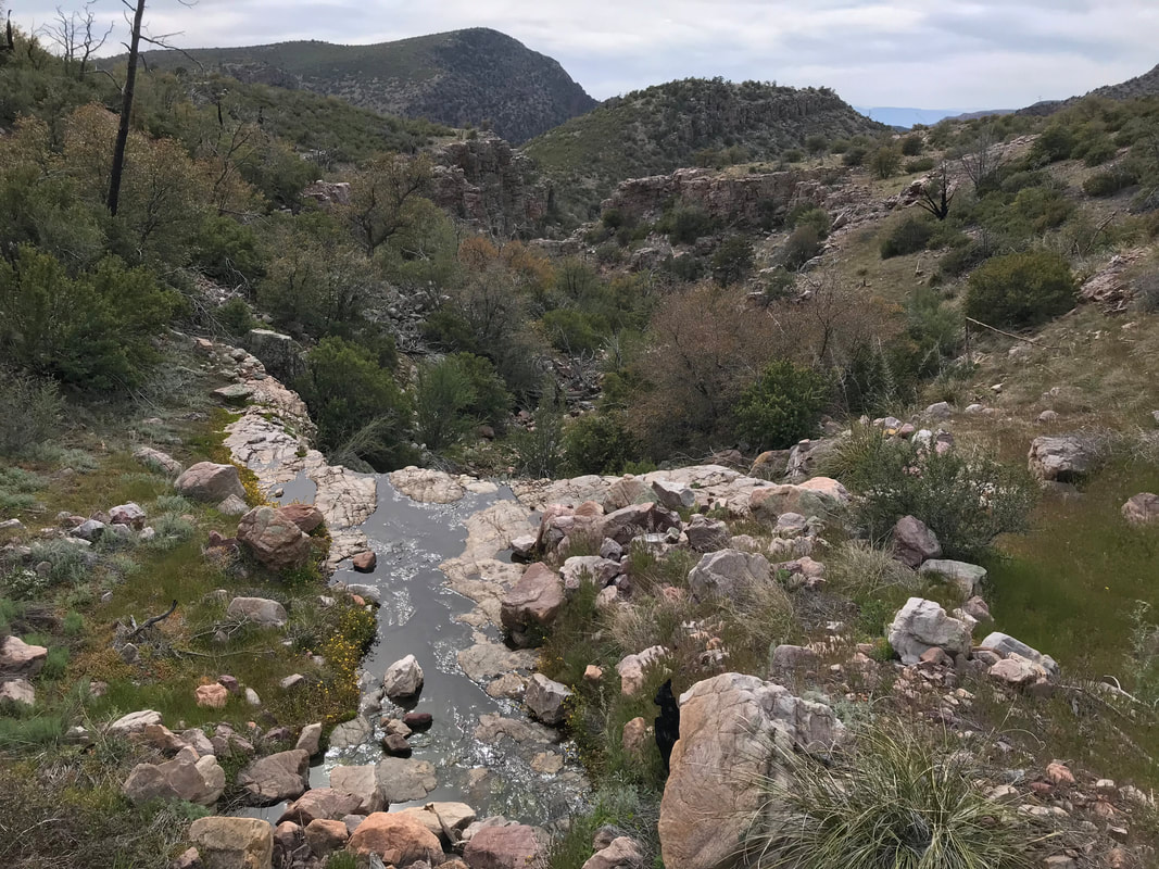
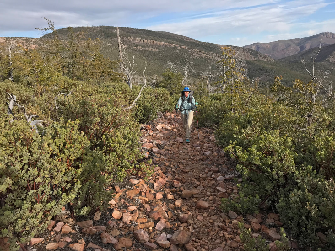
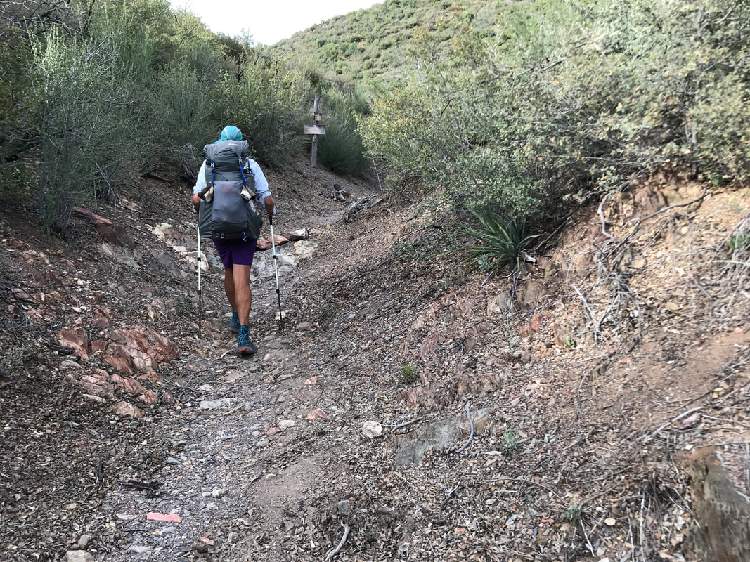
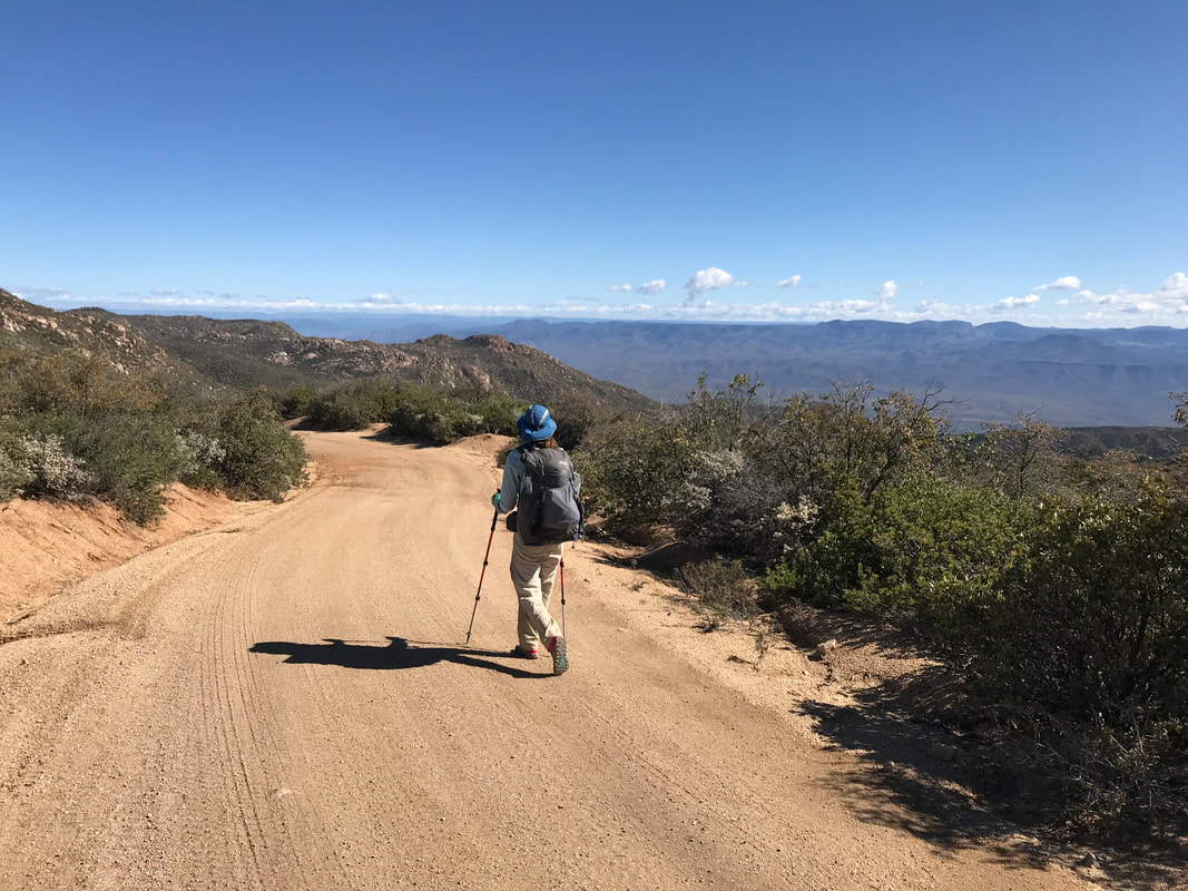
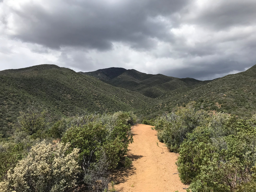
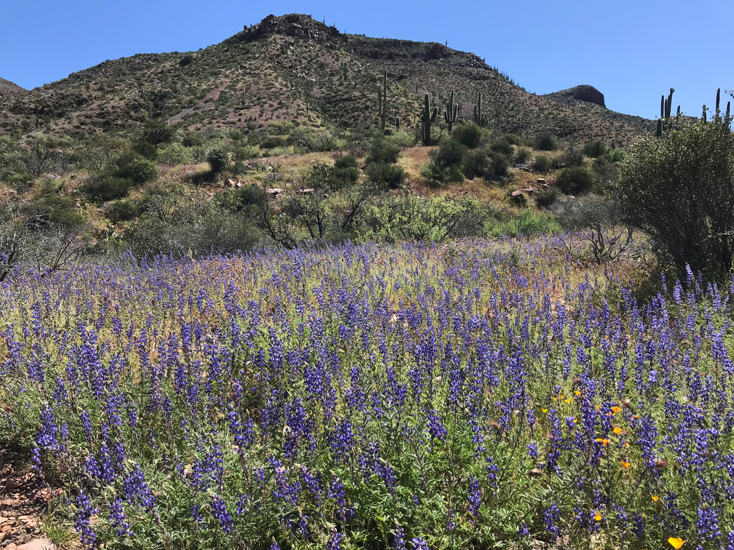
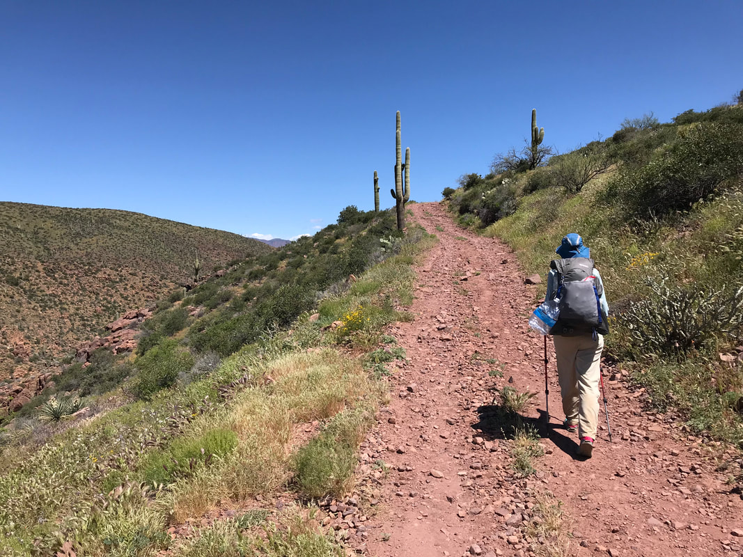
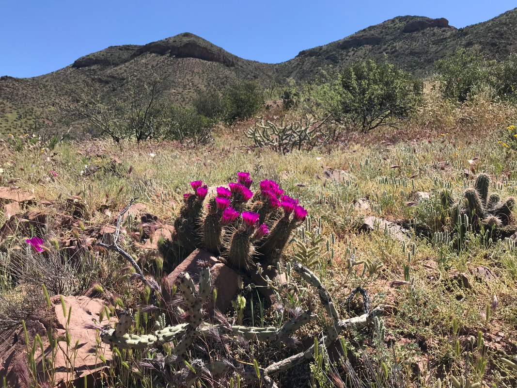
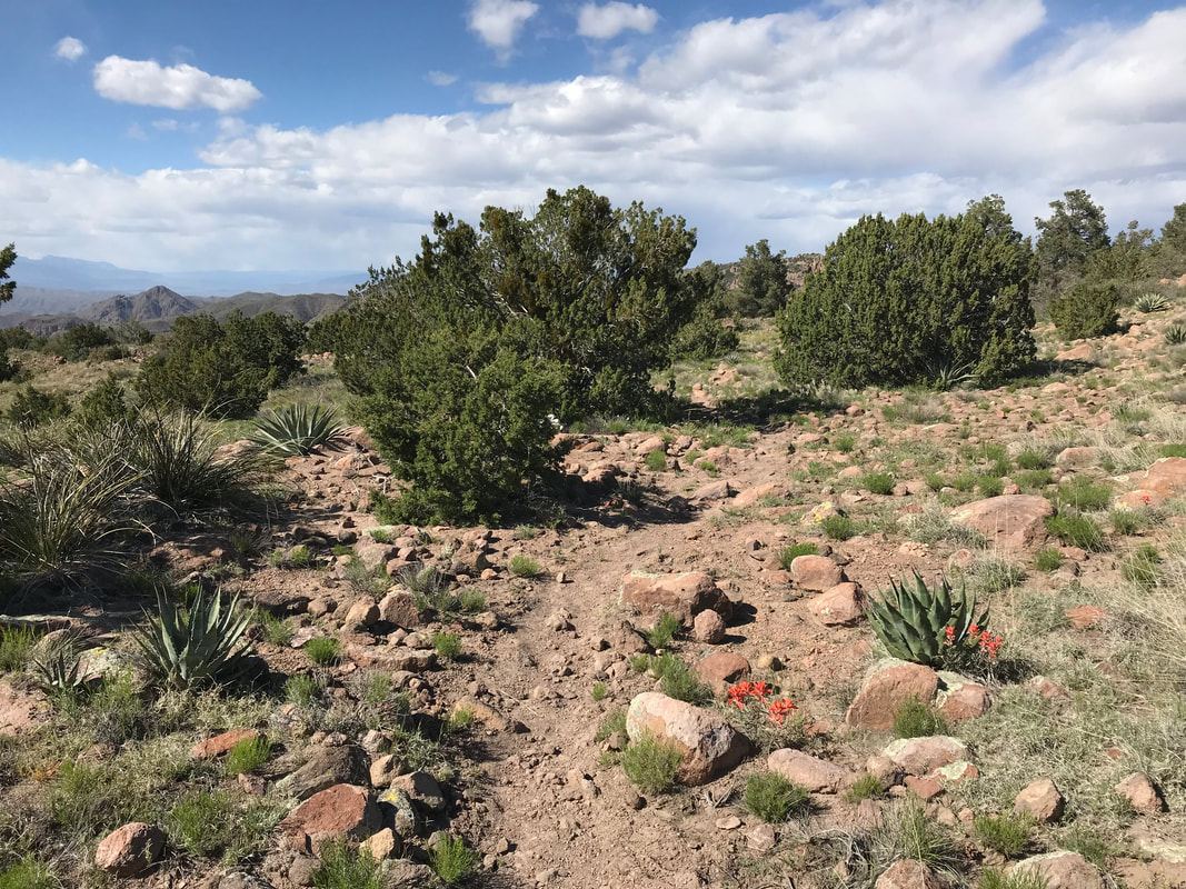
 The photo above is a fitting picture for today: steep and rocky. Today would actually prove to be the rockiest section of the trail. Everything we thought was rocky before held little compared to today. It rained all night and we woke up damp from humidity and condensation, but dry from the rain. The Polk Spring with its warm waters kept the entire area, including our tent, warm all night and morning. Clouds hung low over the surrounding mountains, obscuring any views of the top. Grays and whites hung and ascending tussling over one another. We packed up in the humid field, secured one last collection of water, and prepared to exit the Mazatzals and get to Pine. Rejoining the AZT, it immediately led up a steep ascent. Black rock formed under foot as ankle-rollers abounded. A swathe of lupine grew along and up the trail - absolutely gorgeous. The trail crested a high mesa. Thick green grass grew across the flat high field. Information suggested this next section was relatively unmarked; just a series of rock cairns blending into the ground. We moved slowly across the field, making sure we didn’t stray. The fine silt and clay making up the soil, now saturated, began sticking, clinging, and weighing down our feed. Peanut butter mud. Gumbo, Frankenstein mud. We grew 6 inches each as a solid mound of earth clung to the bottom of our shoes, growing with every step. Now freshly weighed down with 5 pounds of soil on each foot, our pace slowed to a crawl. We would take a few steps and then pound our feet in an attempt to remove the soil. Unsuccessful, it was better to just keep walking. We caught up to Wags and Frenchie who passed our off-trail campsite this morning. They were laying our their gear as sun burned away cloud. Their items were pretty well soaked as they had camped up on this exposed mesa and weathered the storm and with sideways rain. They said they would get to Pine tomorrow and that we would catch up on our Zero Day. Passing them, the trail passed into drier red dirt. The mounds under our feet began to chip away slowly. My mind became focused on that one end: get to Pine. Again, I felt in my mind at the time, getting there would mean I could finish, that my knee would be okay. Time to move. We sped up, both sure of Pine or bust tonight. 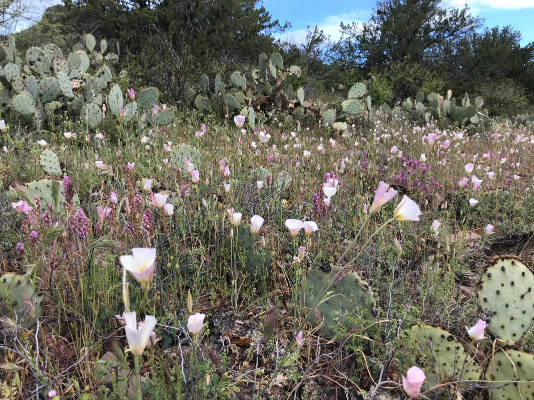
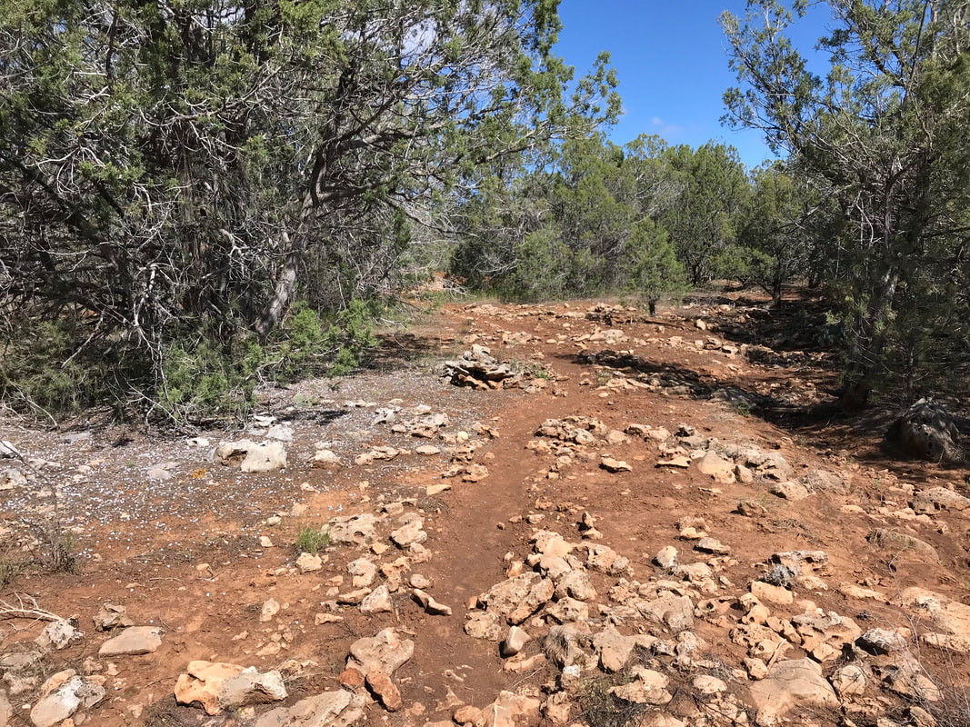
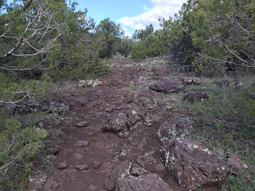
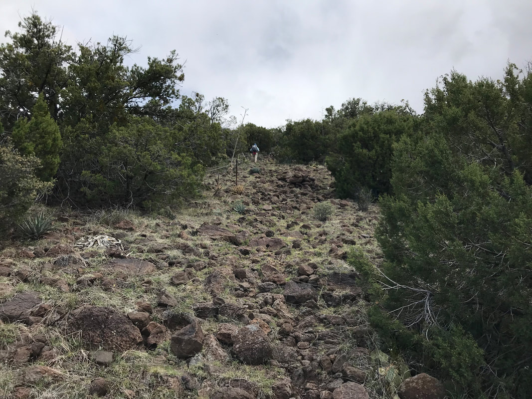
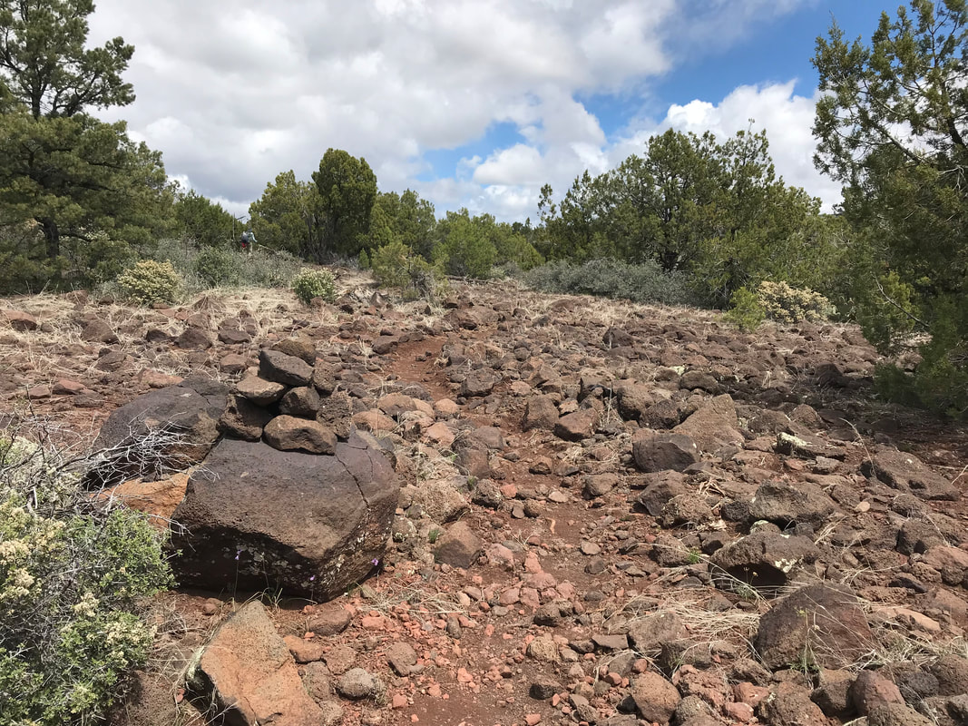
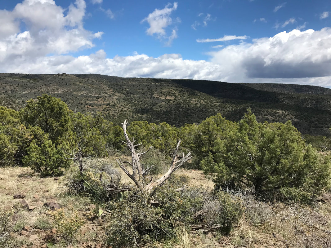
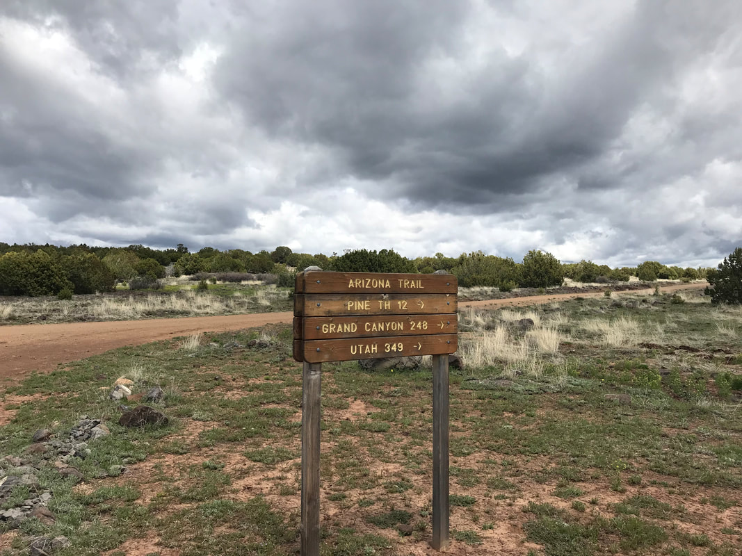
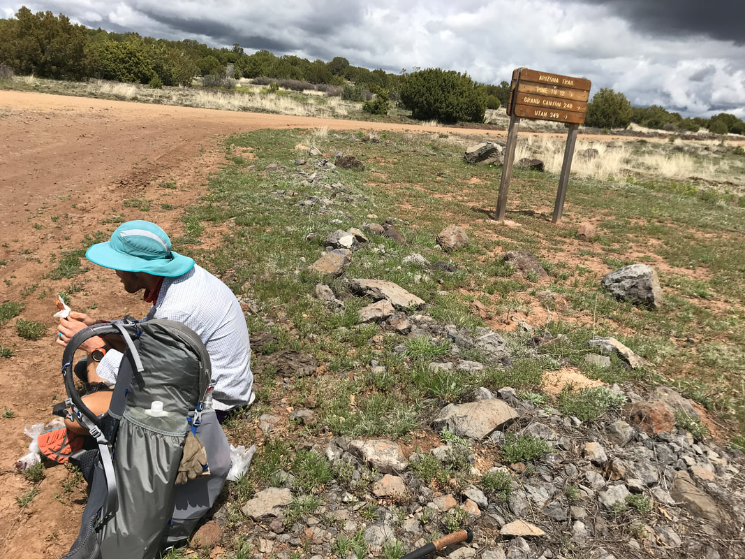
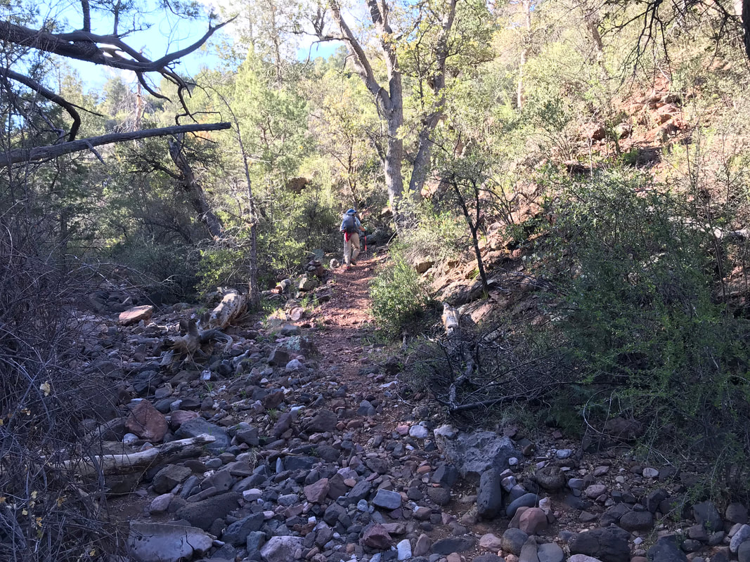
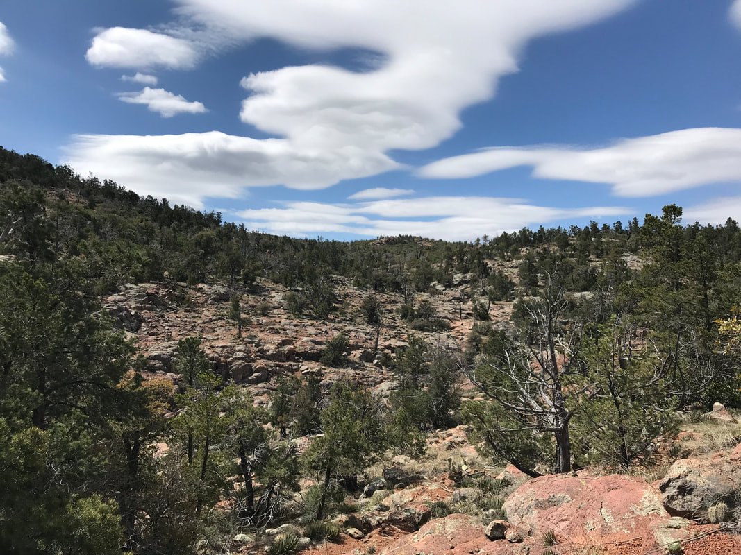
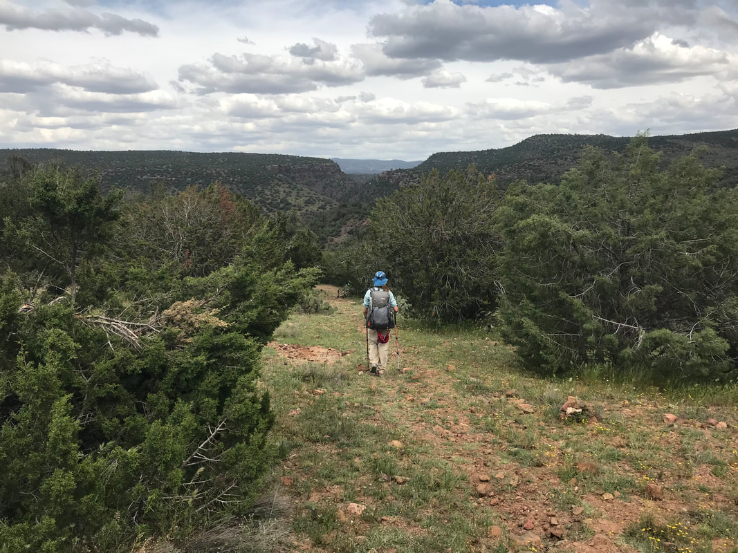
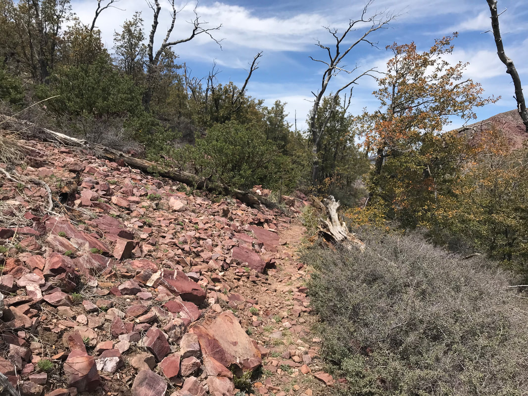
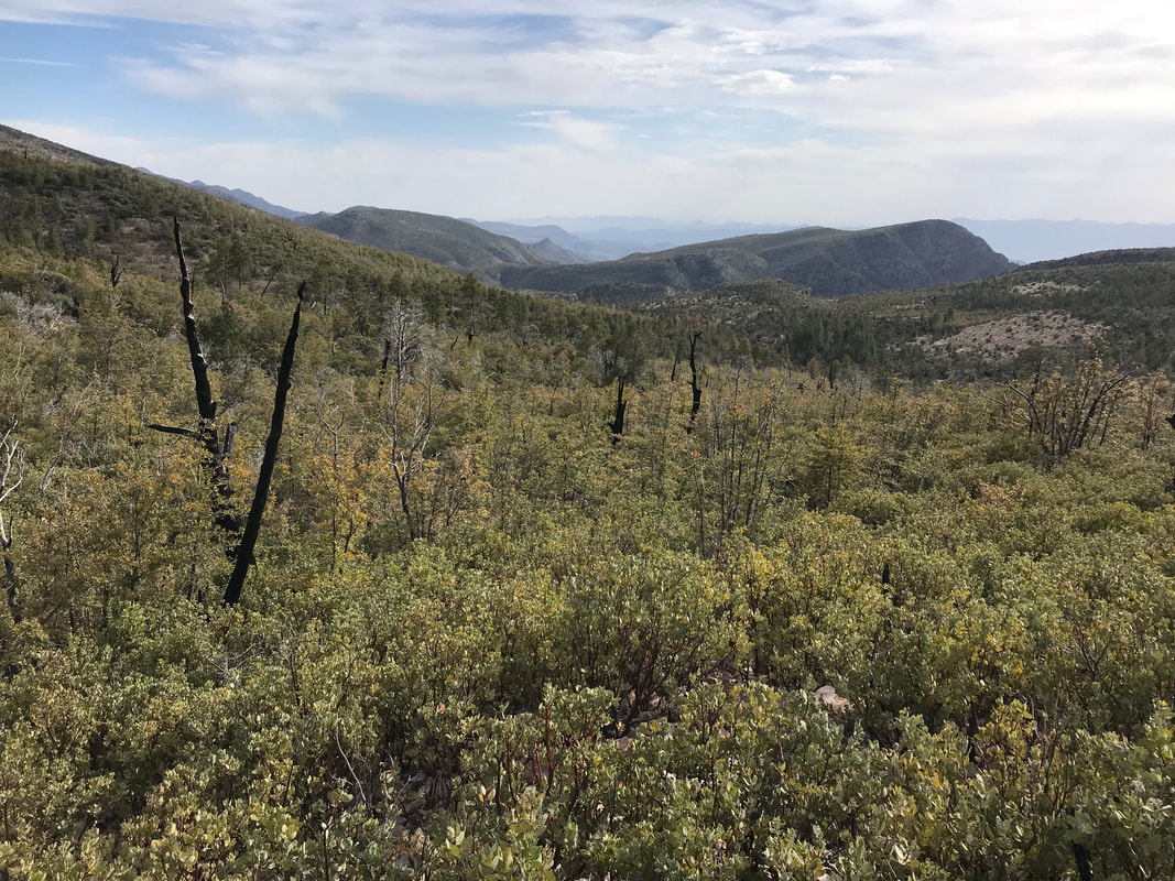
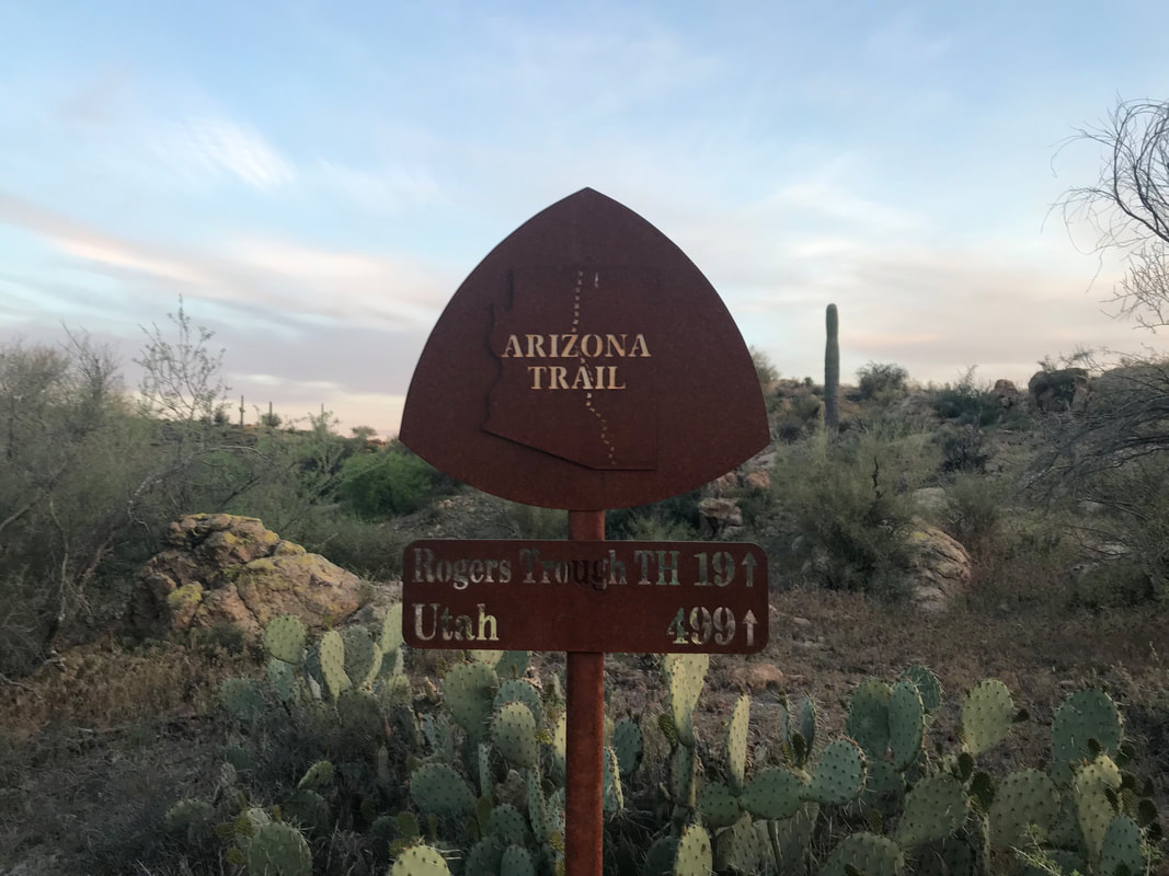
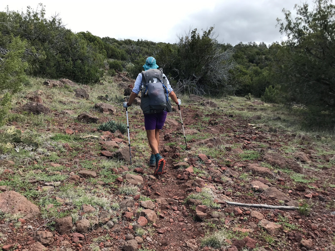
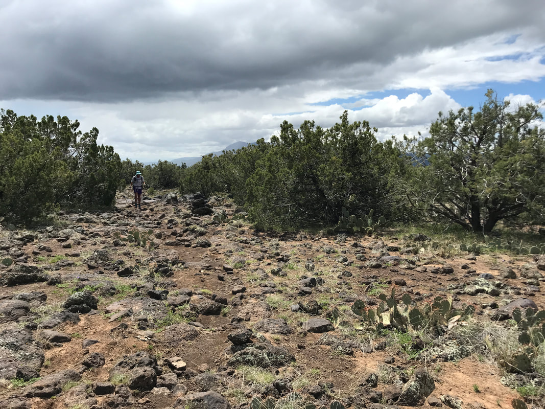
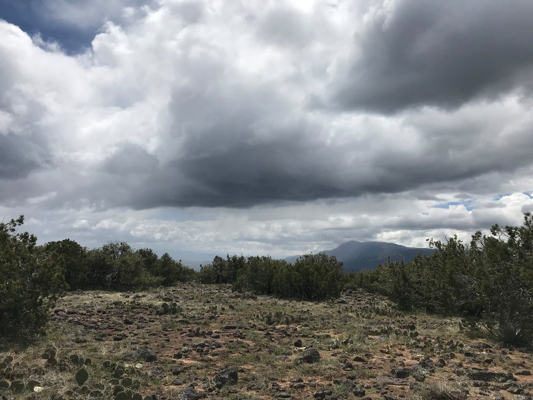
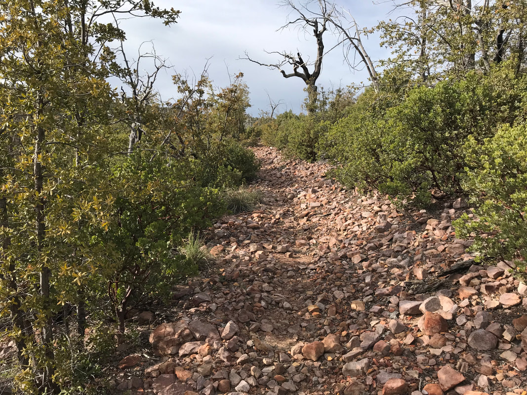
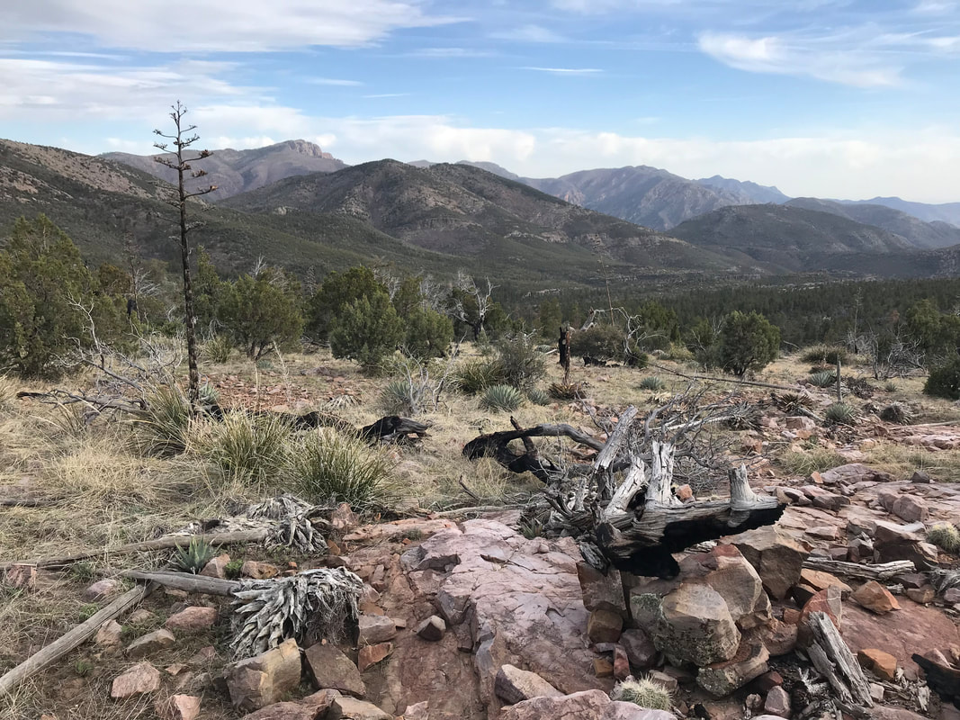
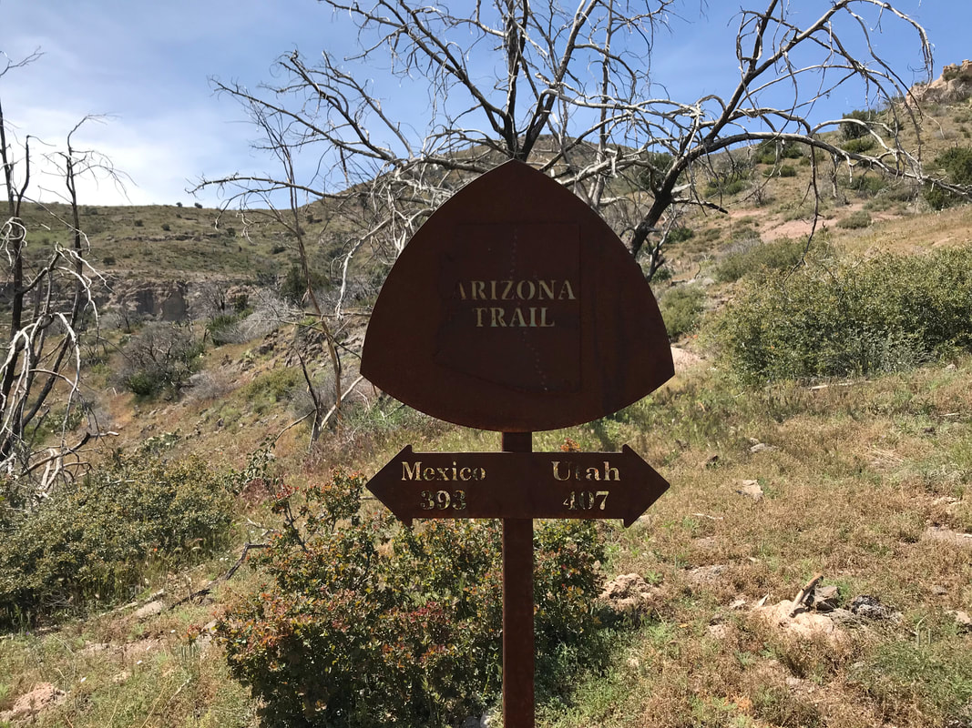
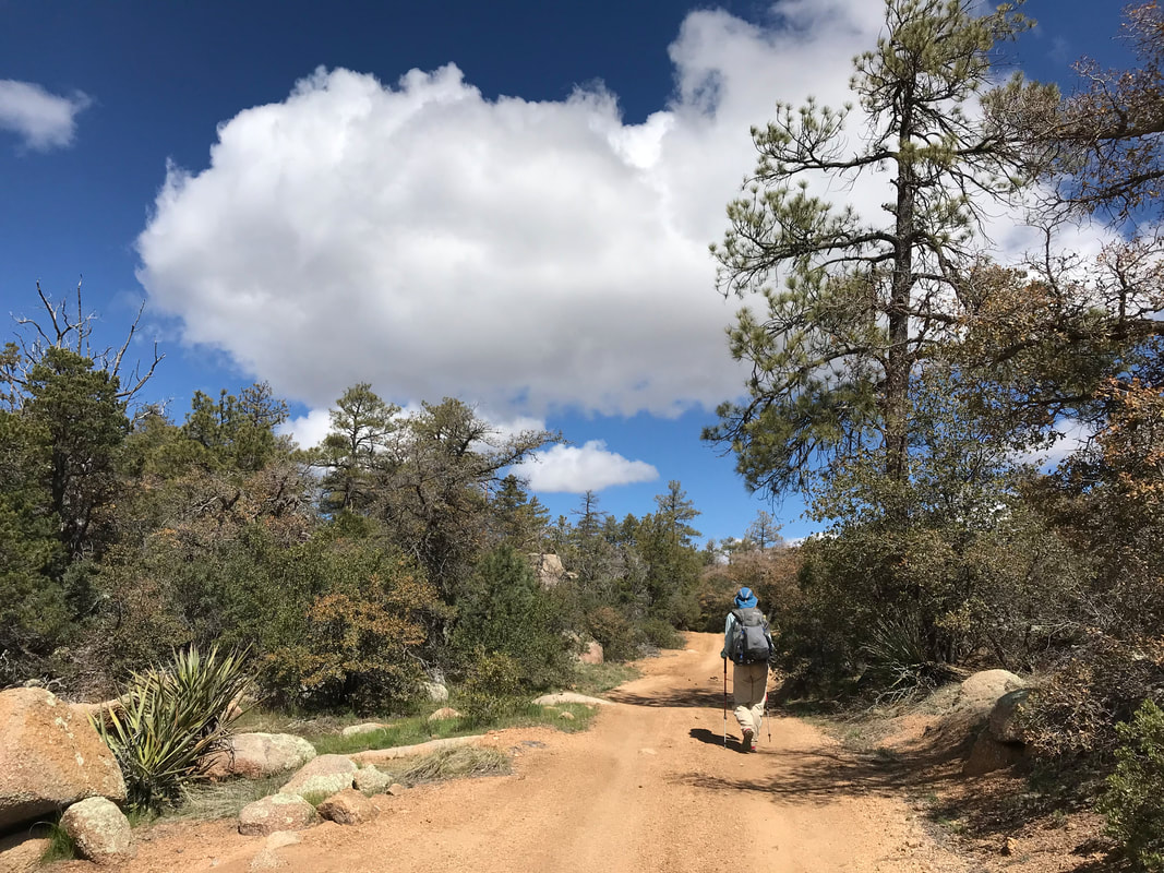
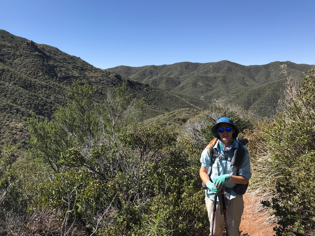
 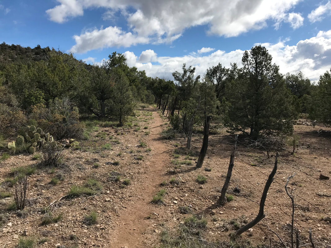 And with that, the ground began to rise. Drastically, the land dominant plant forms of the land went from high desert to Juniper-Pinion woodland as the geology became characterized by more volcanic northern Arizona rock type. Like a curtain rising on stage, we passed from one realm into another, from south/central Arizona into the northern. A whole new trail experience lay ahead. The trail began to absolutely disintegrate. I take back everything I said about the rockiest days before. This was the rockiest the trail had ever been. I tried to capture the absurdity of what we were climbing, but the washed out lighting of the day blended the ground texture. The steepness and stones were lost on camera. Just look at the photos and know what a mess it was. The flanks of the mountains were pure volcanic spill, boulders upon boulders of pumice and pocked rock, all smeared with lichen. Sweat poured off as we pushed upwards. The unforgiving rocks were finally felt on the bottom of my feet. Even as we climbed, the once dissipating storm clouds began to regroup. Eastward, large fast-moving cumulus clouds gathered in heaps of dark gray. Our climb with methodical, almost robotic to get to the top. We reached a high plateau by passing through a barbed wire fence so narrow I could barely squeeze sideways. On a red dirt road, the black boulder slope was gone. The grade became more gentle. The mountainside we were climbing seemed to be easing up - we could almost see the top of the rise in the far distance. A group of thru-hikers heading south on Day 1 of their section hike met us. They asked us if the trail was as easy as the dirt road they had just walked down. Janna and I said no, and secretly thought we had just gone through a battle they had yet to enter. And with that, the trail somewhat evened out in a large open expanse of juniper-pine grasslands. We sat next to a road sign with the first indication of the Grand Canyon written on it. The skies swirled gray but we felt victorious and HUNGRY. Knocking back some jerky and bars, around the corner came Basis Ben. Basis Ben (as we called him) was a thru-hiker we had last seen in Patagonia, AZ. And here he was coming southbound! He said he reached Pine, heard from a friend about a kayaking trip down the Verde River, and was hiking back through the Mazzies to Sunflower to meet the guy by the highway. Damn - what a rockstar.
   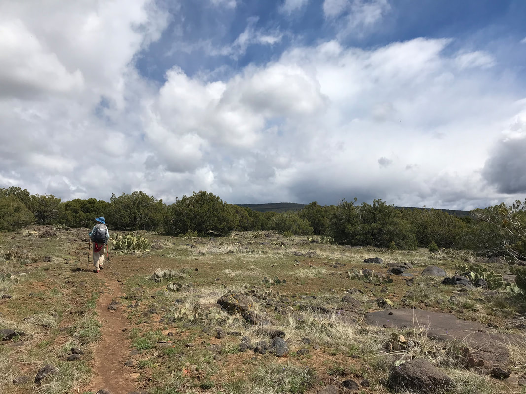
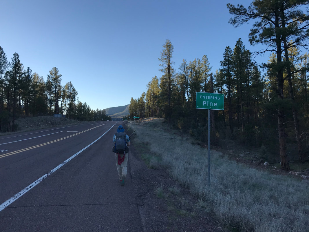
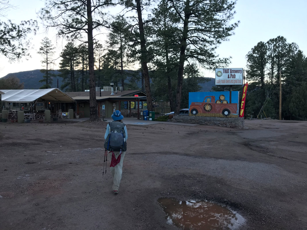
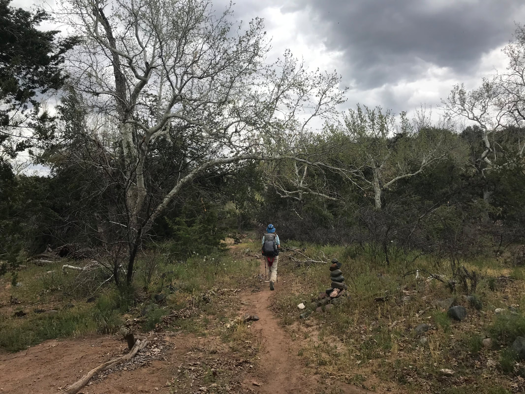
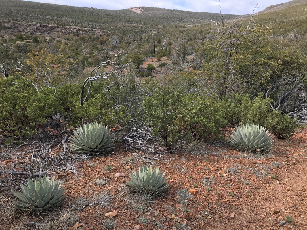
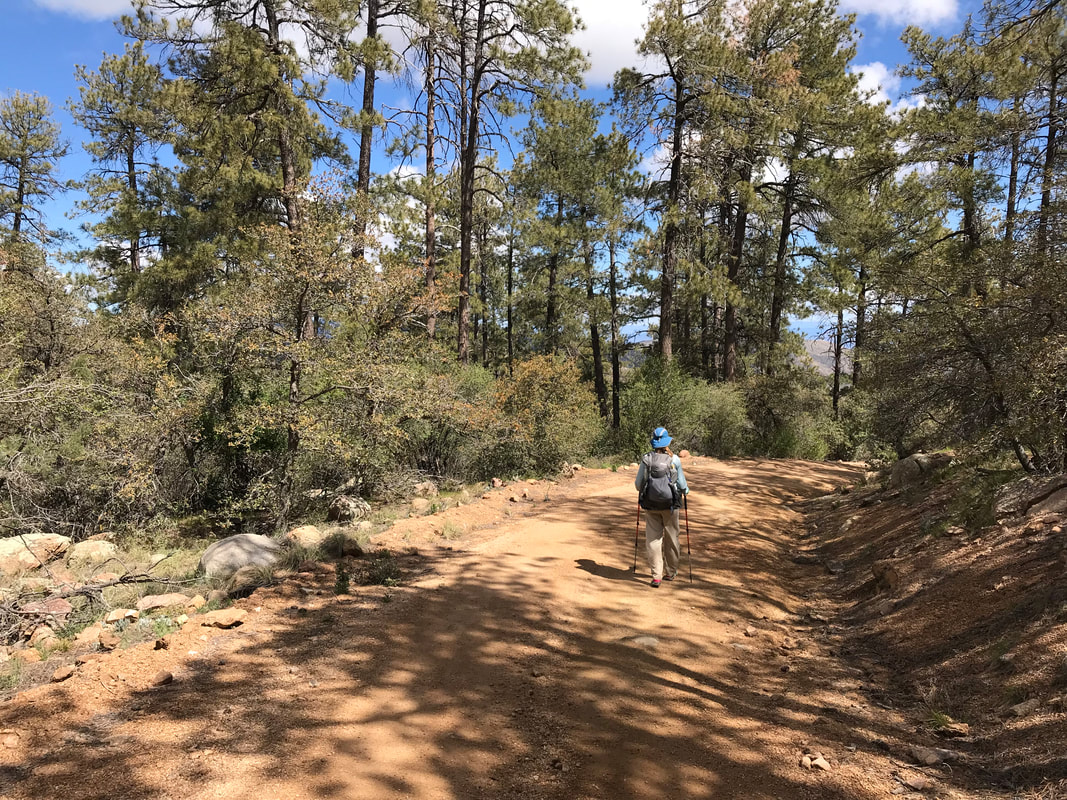
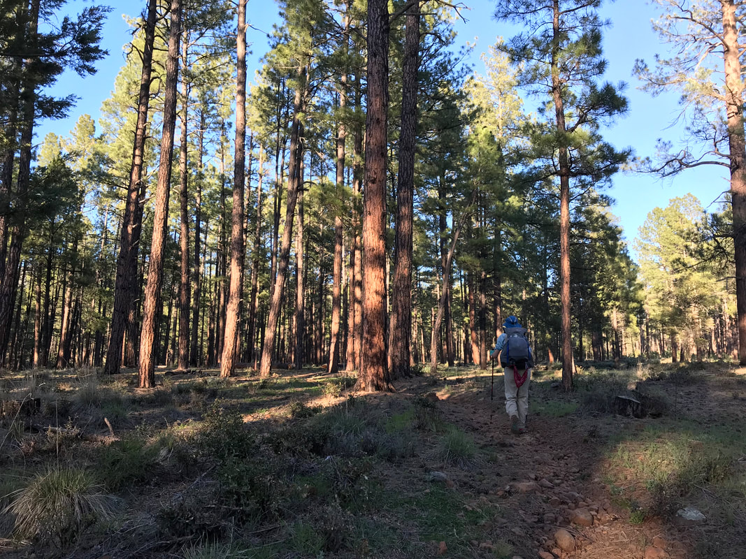
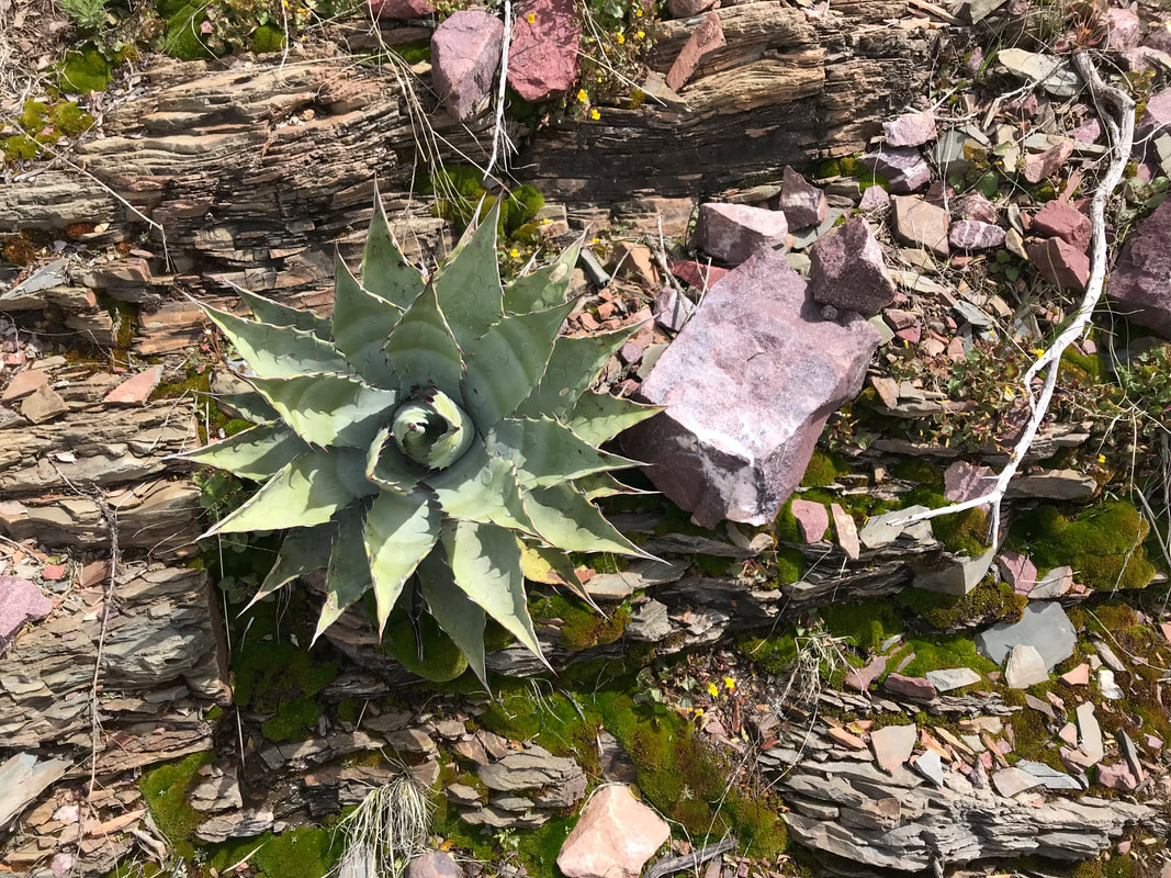
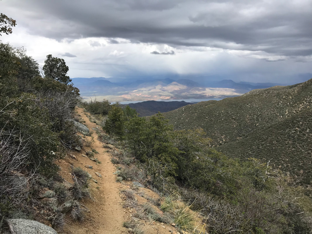
The AZT followed the red dirt roads here as a few ATVs revved past us. It sharply turned onto some rocky/jumble double track that head up into ponderosa studded hills along a telephone wire cut. We were giddy. The worst of the long climbing was behind us for the day we were only like 7 miles from town. The double track was chunky for sure, but the temperature was cool and the cloud cover kept the sun exposure down. Eventually, the AZT split from the double track after several miles and plunged into thicker forest. The trail pumped up and down repeat steep sections check full of rock shards. It came down to a beautiful meadow and swept pass a crystal-clear spring. The water quality was entirely welcome. The AZT took us up an adjoining hill full of agave interspersed with pine. At the top of this last saddle, the mighty Mogollon Rim slopes stood before us, as well as the distant rooftops of Pine. Sloping toward town and the Mogollon Rim, the trail became well graded and smooth. Massive green and flat meadows spread before us including one with a large lake. Ponderosa Pines in full height cast shade and shadow over the trail as late afternoon wore on. We were walking fast to the highway into town. There is a brewery outside of town (THAT Brewery and Pub) and we were DETERMINED to get there at 6 (it closed at 7 on this weekday). The trail sloped through a towering ponderosa pine forest with golden light shafting between the trees. Woodsmoke from a large ranch across a stream cutting across a field added smell and invitation to the area. Curving through the trees, we heard the whir of cars and stepped out into gathering evening, around 6 pm, onto the highway. FUCKING VICTORY. We walked the shoulder of the highway past the “Pine” city sign and within a mile, arrived at THAT Brewery and Pub. I cannot describe the absolute elevation we felt at walking up to that restaurant in the chilling air. The place freaking loves AZT hikers and has a logbook, holds resupply packages (they were holding ours), and provides a massive assortment of food. In the evening shade, we heard voices calling to us from the outside eating area. Katya was here and somehow passed us today! She was sitting with Scruffy, a thru-hiker from Tucson. We all sat together eating loads of food. I ordered a massive salad, an Elk Burger with beer cheese fries, ,and at a bowl of ice cream. The place let us stay past closing and let us take a look through the hiker box. Full of food, and the night now full on around 8:30, we began the extra mile walk into town. In the darkness, we donned our headlamps on the highway shoulder and passed a MASSIVE herd of elk just eating grass in people yards. They just looked up at us as we shined our nights from feet away. We got to the reserved cabin at 9 pm. It was insanely nice. It was more of a mini-house with a jacuzzi in the bathroom and a very modern spread. We stepped inside, and I felt a sense that I might actually be able to finish the trail. 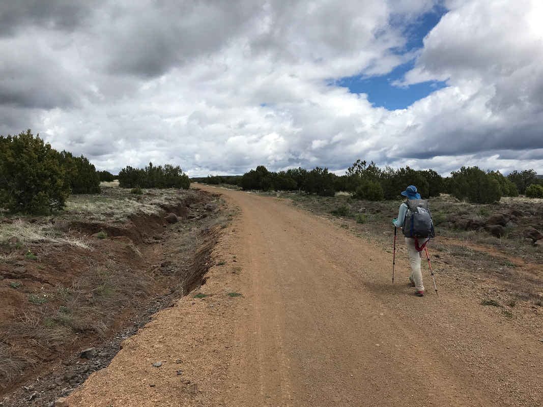 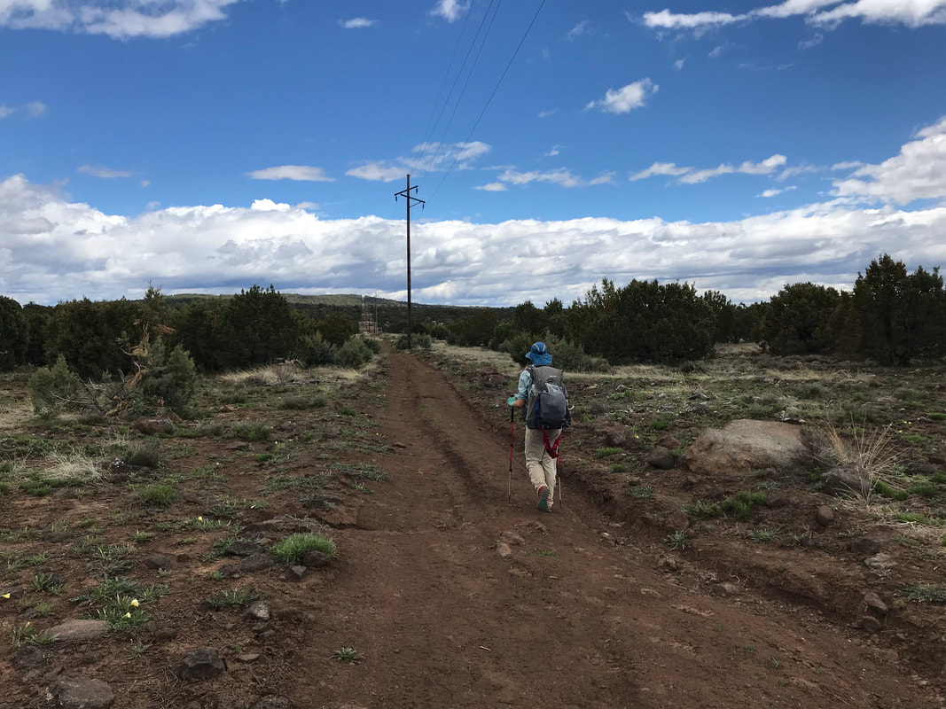 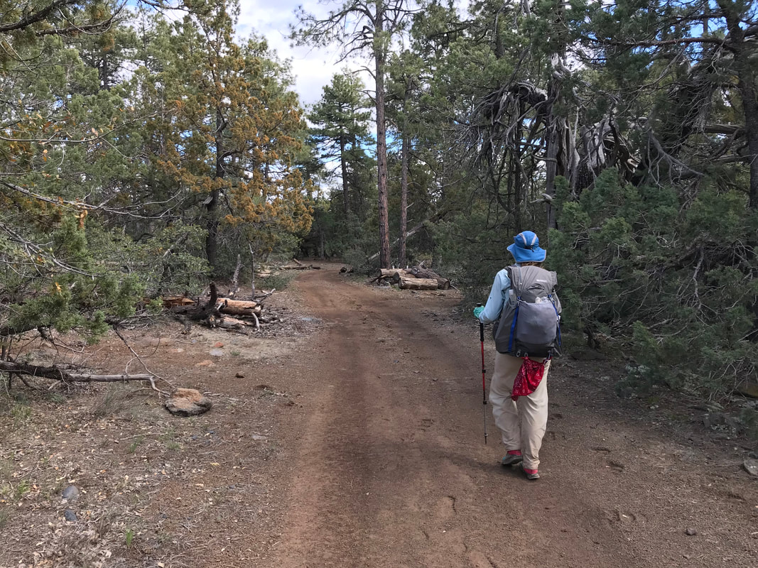 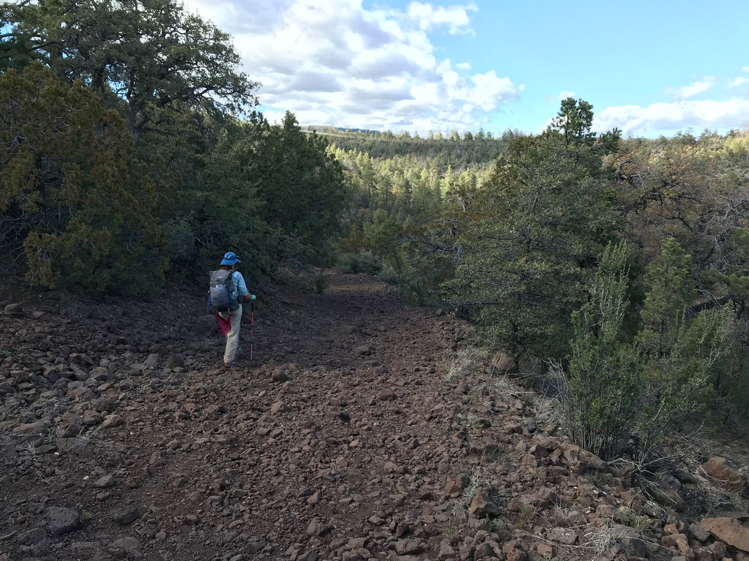
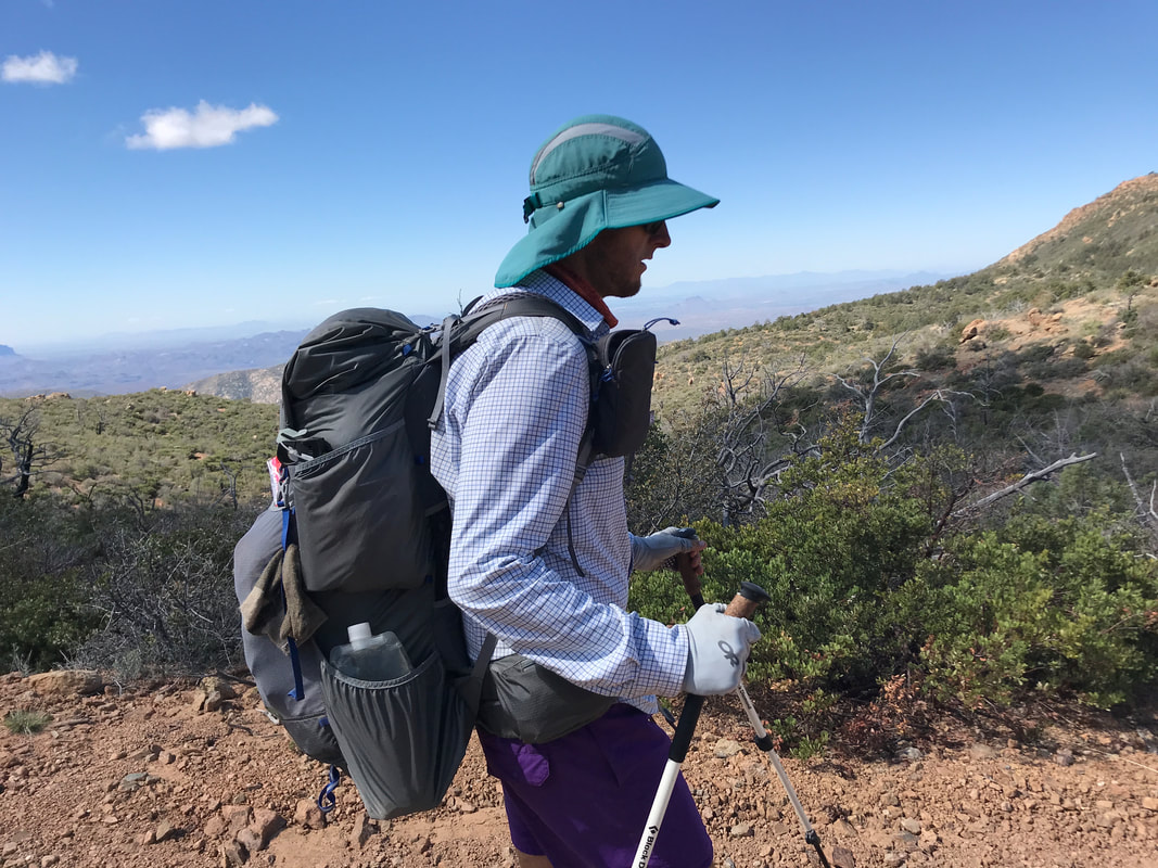
   ——————————————————————————————- 4/18/19 The Zero Day was deeply deserved. In hindsight, the section of AZT stretching between Superior and Pine, Arizona would end up being the most rugged, steep, tough, and mentally challenging. Getting this Zero Day in was well worth it. We woke up later than usual (up at nearly 5:20 am daily with the Sun at this point) and made our way to the Randall House for a full spread breakfast. After that, we picked up our mail and started a long day of laundry at the laundromat next door. We walked our way to the grocery in between, picking up enough food to get us to Mormon Lake and enough to take back and binge eat. We ran into Scruffy and Katya doing the same. Back at the cabin, I thoroughly washed and aired out all gear. I hung the Triplex up from the back porch after a thorough water wash to allow it to dry. I washed out our backpacks in the shower, repaired the hole in my front mesh, and scrubbed our shoes of salt and debris. Around lunch, we made our way to the local deli where Janna had the best sandwich she ever had in her entire life. Hunger is the best seasoning. In the afternoon, we kicked back and watched several movies on TV, relaxing, taking a nap, and just catching up on a load of fluids. As evening approached, we made our way down to the Old Country Inn Woodfire Pizza where we ran into Wags and Frenchie - both jubilant to see us! They saved us both seats with a crew of thru-hikers including Scruffy, Katya, and Blue Skies. Katya let us know this was her last night in town as she had to head back to the Typical world in order to keep her job. She would be back this fall to finish by going southbound. After two large pizzas and a massive woodfired chocolate chip cookie, Janna and I made our way back to the cabin in the dark for one more night’s sleep in a bed. 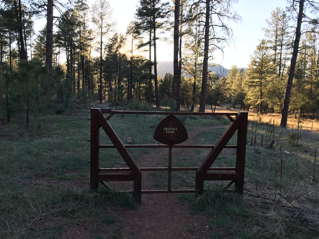
0 Comments
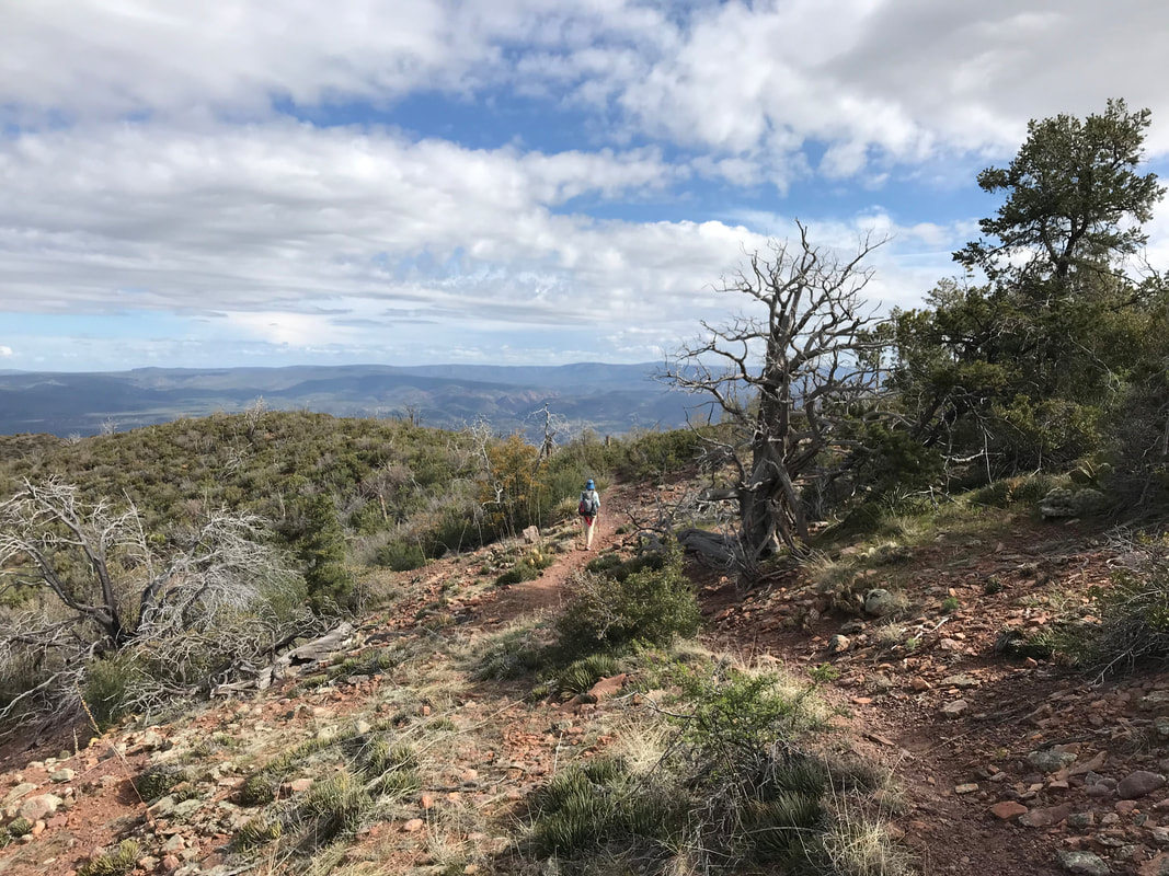
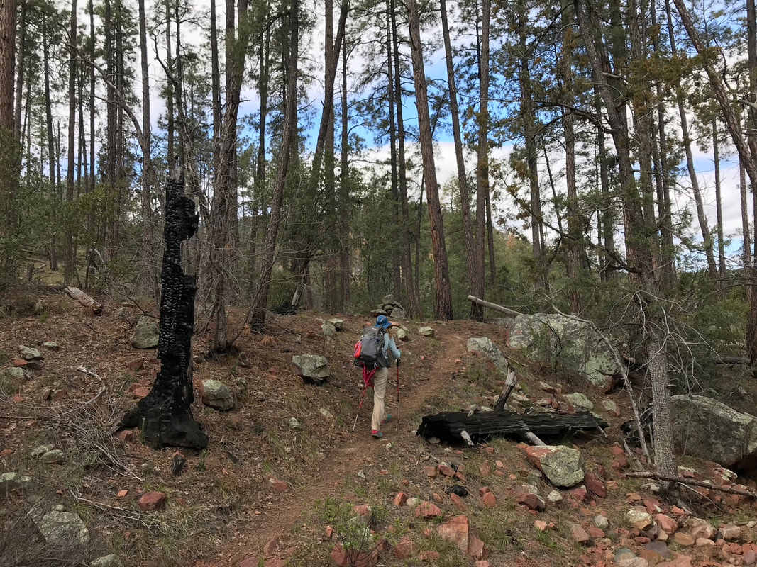
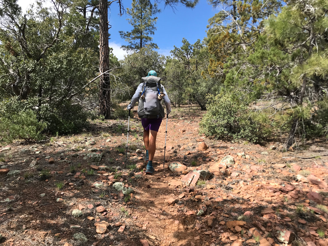
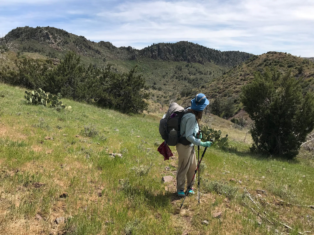
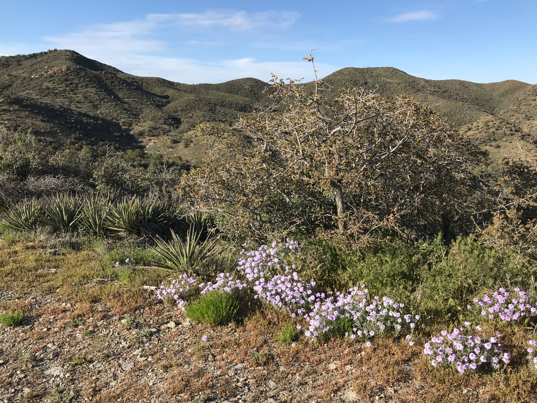
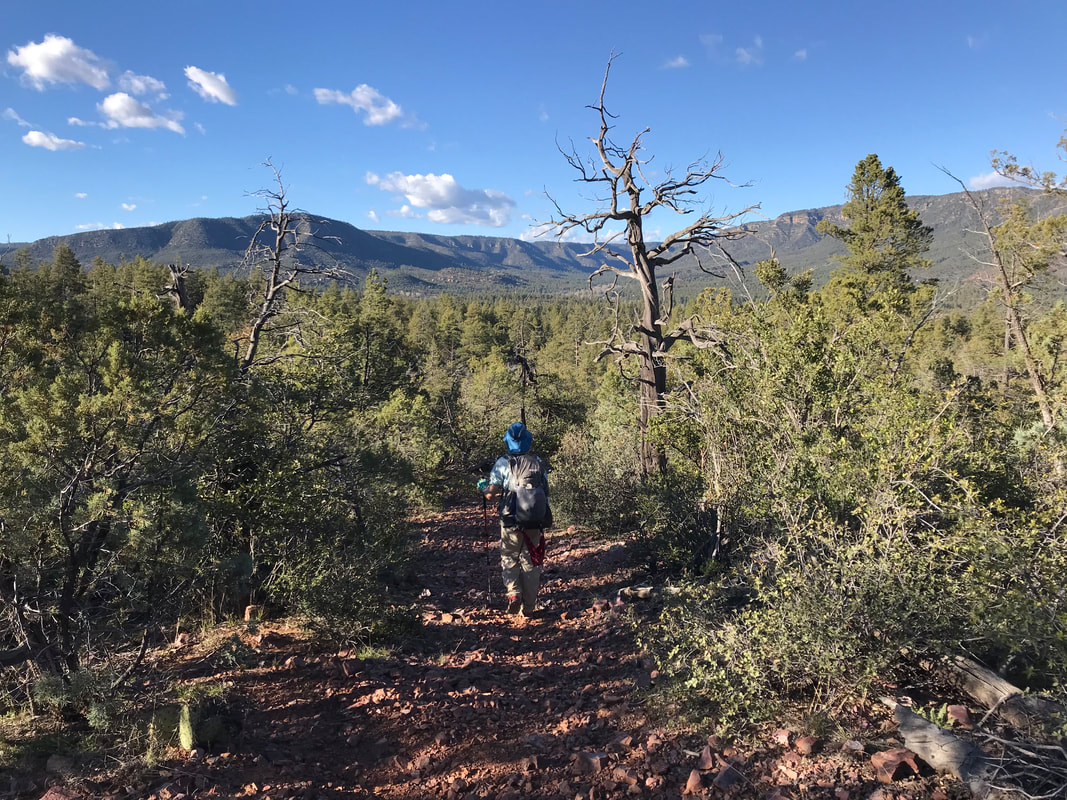
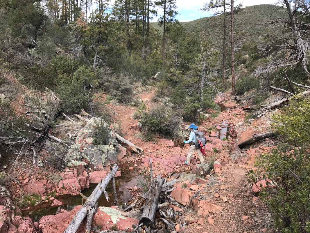
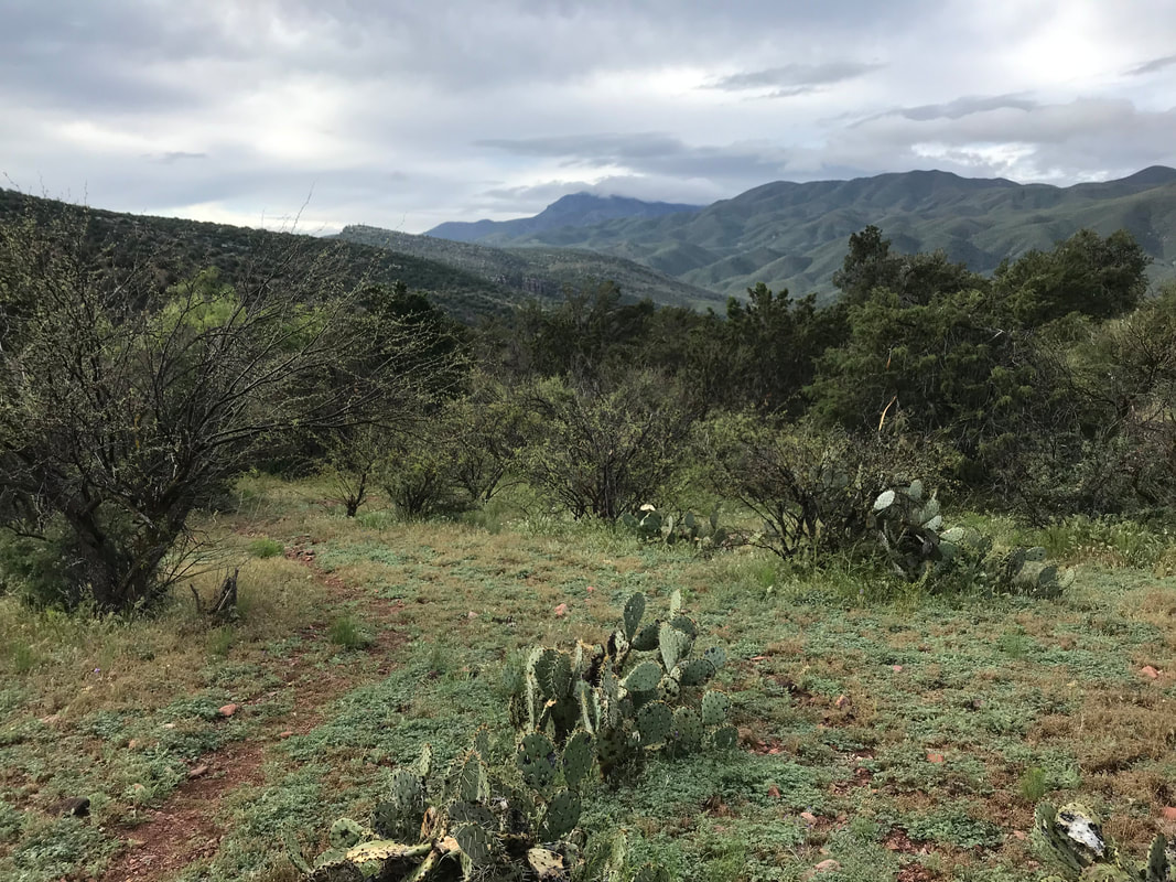
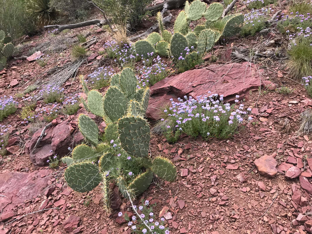
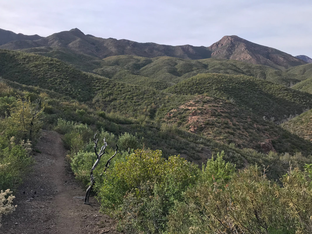
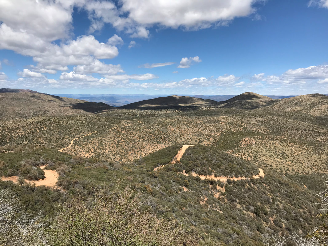
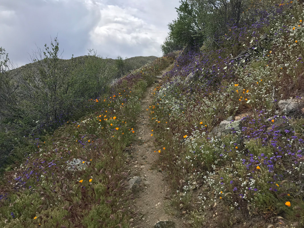
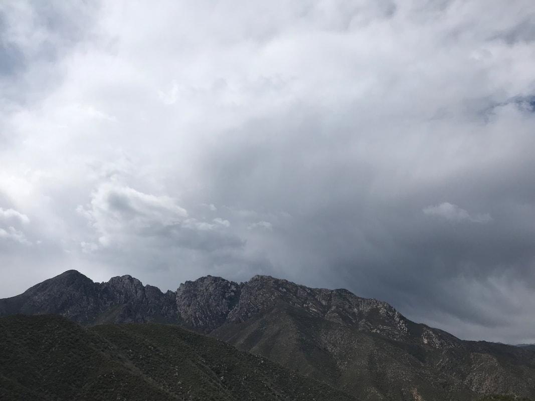
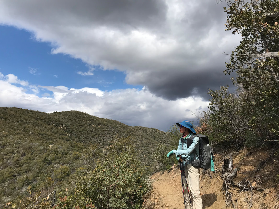
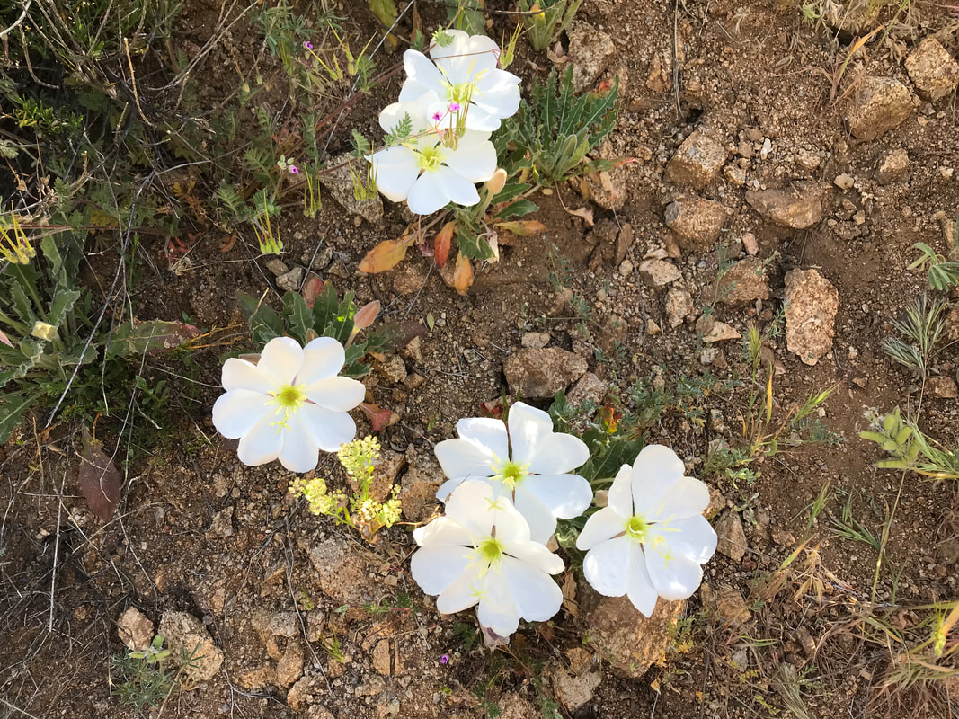
 Backpacking is hard on the body. We woke up and got moving before Katya, bidding her a goodbye and promise to meetup in Pine in a few days. We hiked up from the valley through a juniper-pinion pine forest. The trail became rocky shardy again filled with stone chunks. The hue of the land began to change, began to become more iron-based red. The junipers fell away as the Arizona Trail zig-zagged across multiple rolling hills. The Mogollon Wall was incredibly visible in the distance. That wall that separated us from the high country. On a descending ridge, Janna managed to get just enough reception to call ahead to reserve us a cabin in Pine. We mutually agreed we wanted to take a 0 in Pine. Lodging with a hot shower was strongly desired. With that sliver of bars, she was able to confirm us their last cabin in town. A roof secured, we walked on, pumping out more miles. Small white flowers began blooming trailside in red dirt. The surrounding rock facades increasingly reminded me of northern Arizona - striated with pale whites and sanguines, the true forms of red rock country. The AZT led down to a wash where we climbed over old fallen burned timber and jumped around large boulders. Low growing oak and manzanita continued to crowd up against the trail in places. Water was plentiful so we took what we wanted, when we wanted. We moved in and out of chunky rock-strewn trail before it came through a vegetative thickness. Campsites abounded, but the gently sloping land up here’s only shelter was the body sized shrubs and isolated deadfall. Glad we didn’t camp here last night, we pushed, gaining elevation upwards now. We kept our eyes on the sky. The morning had a mix of blue and white, but a more permanent cloud cover seemed to be moving in now. Thick, draping clouds hung on the highest peaks behind us. The storm didn’t hit last night, but a cold front had definitely arrived. The sky suggested a mid-afternoon storm. 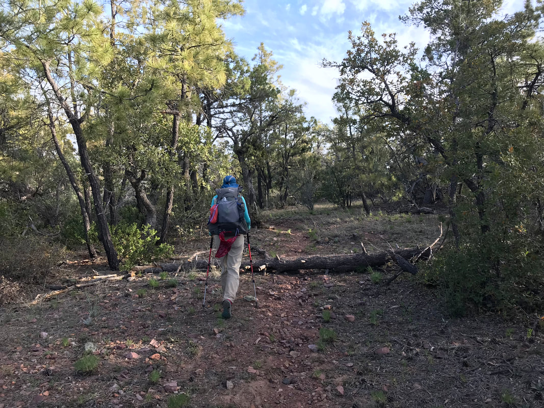 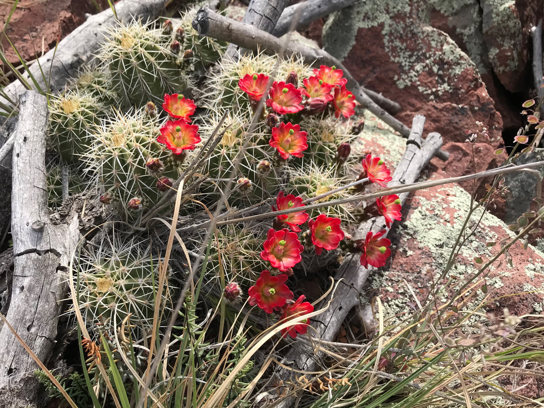 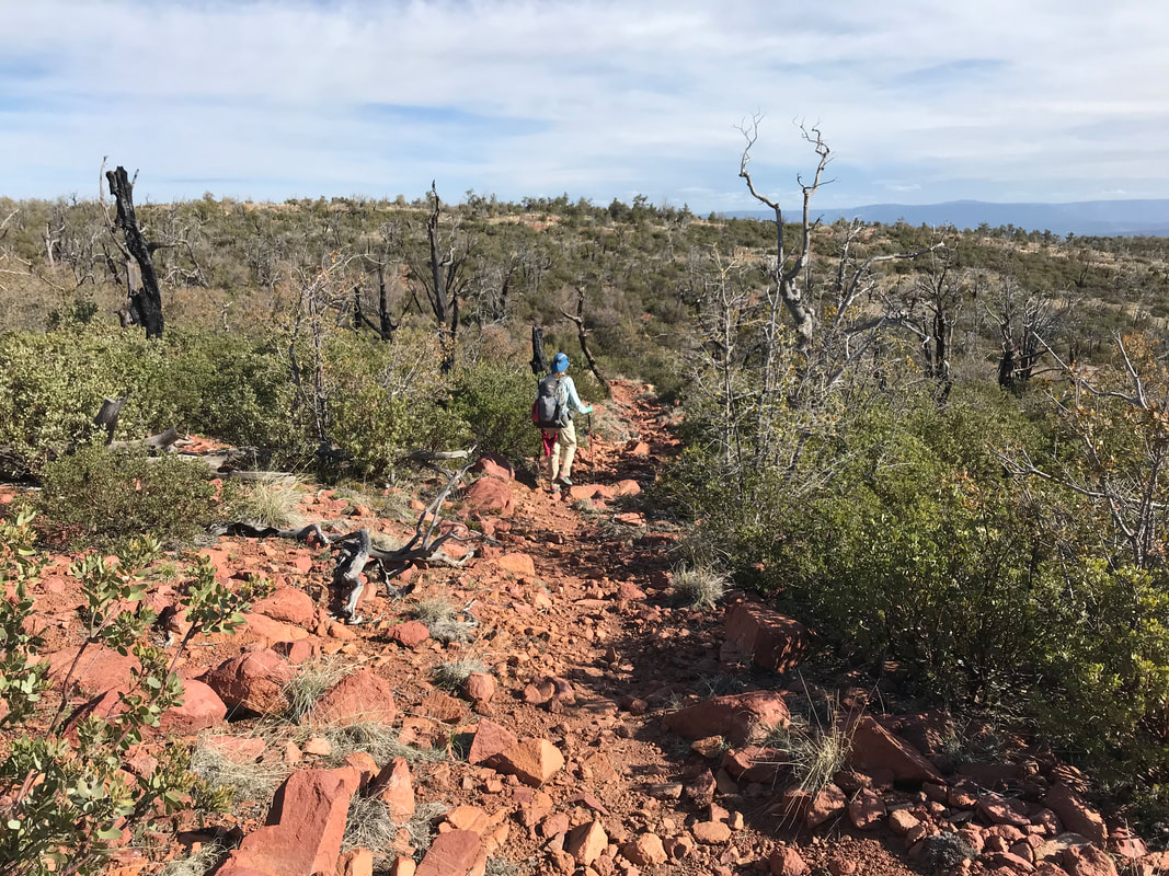 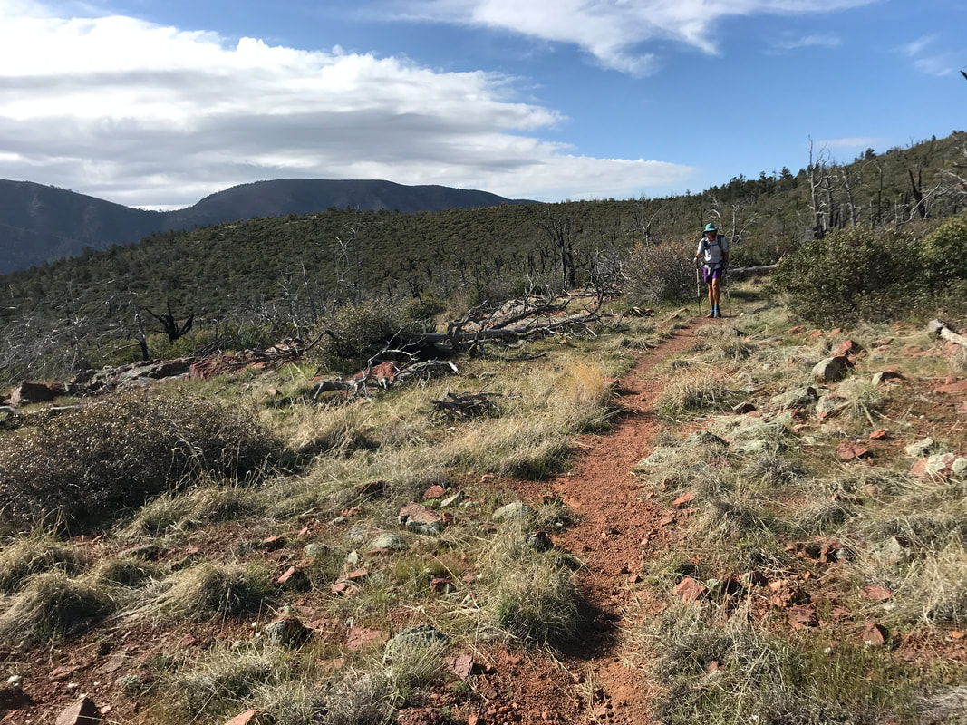
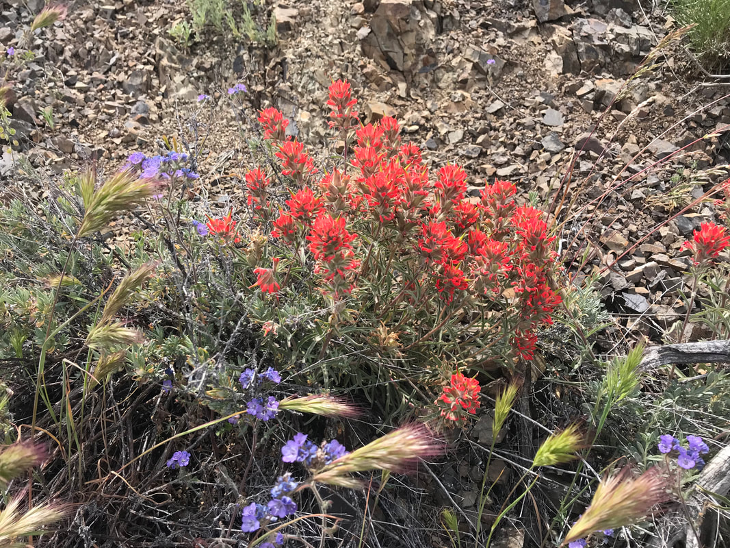
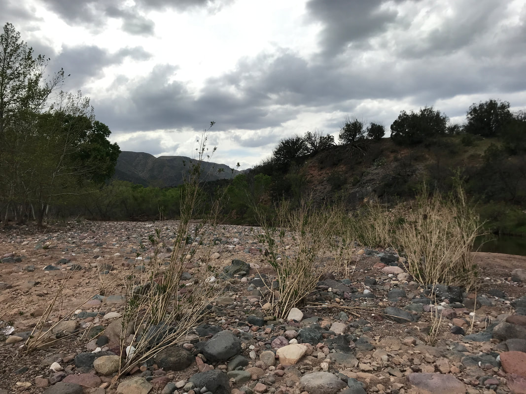
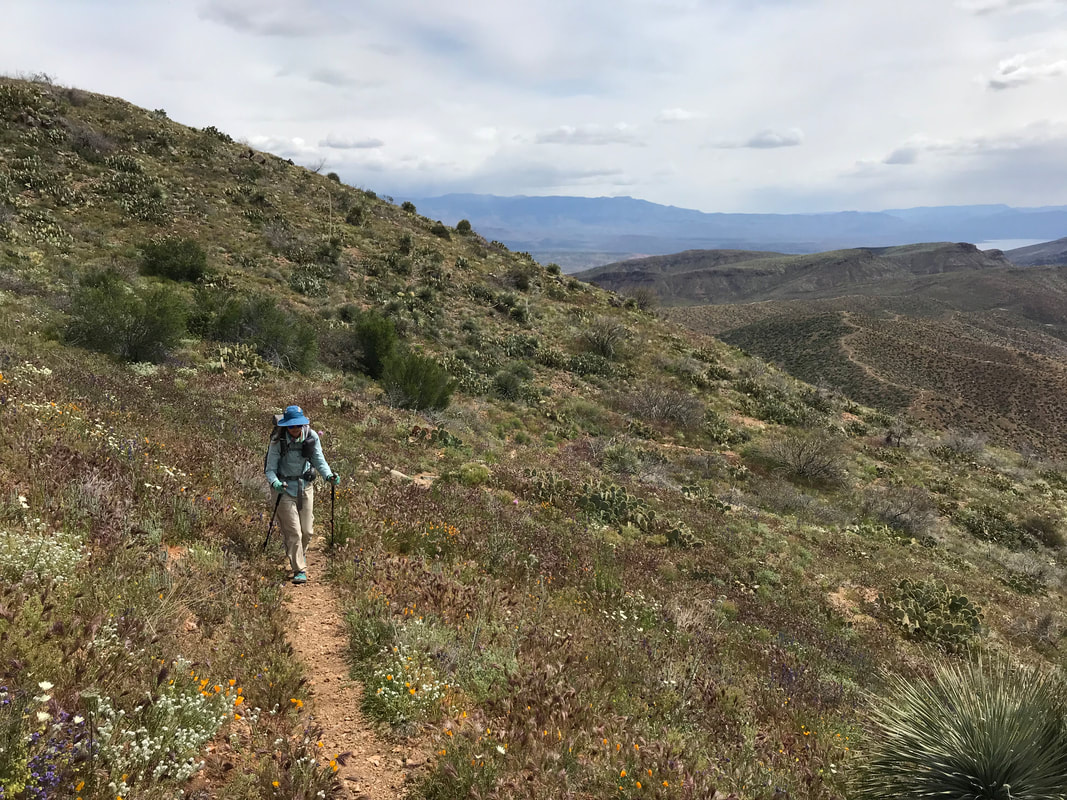
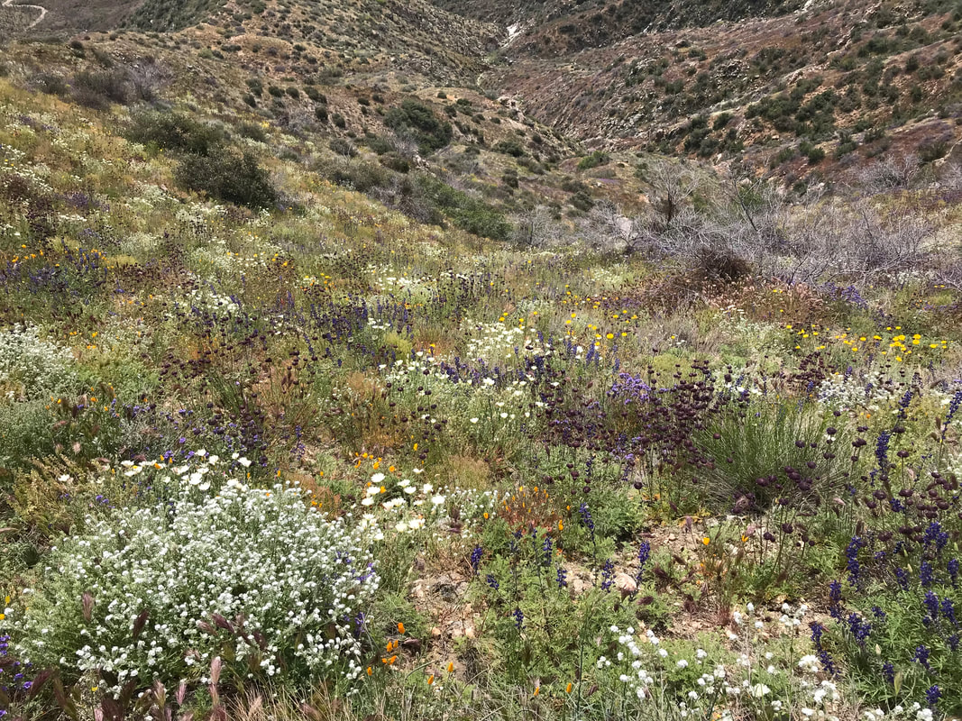
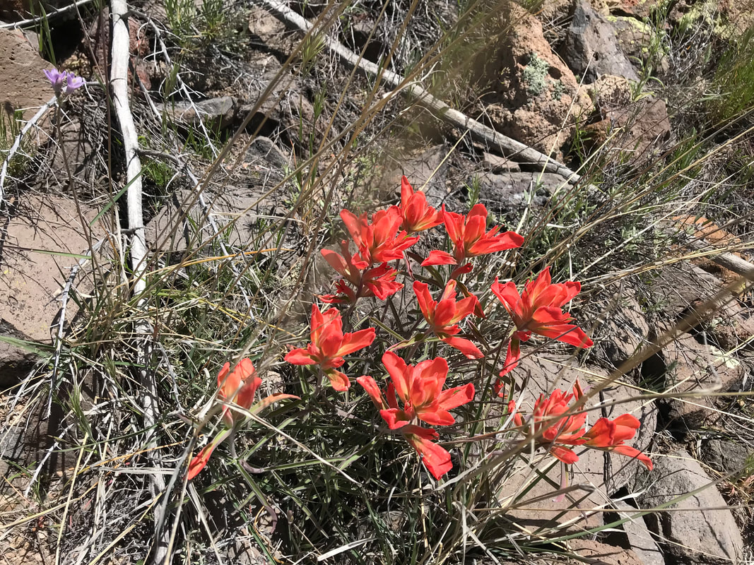
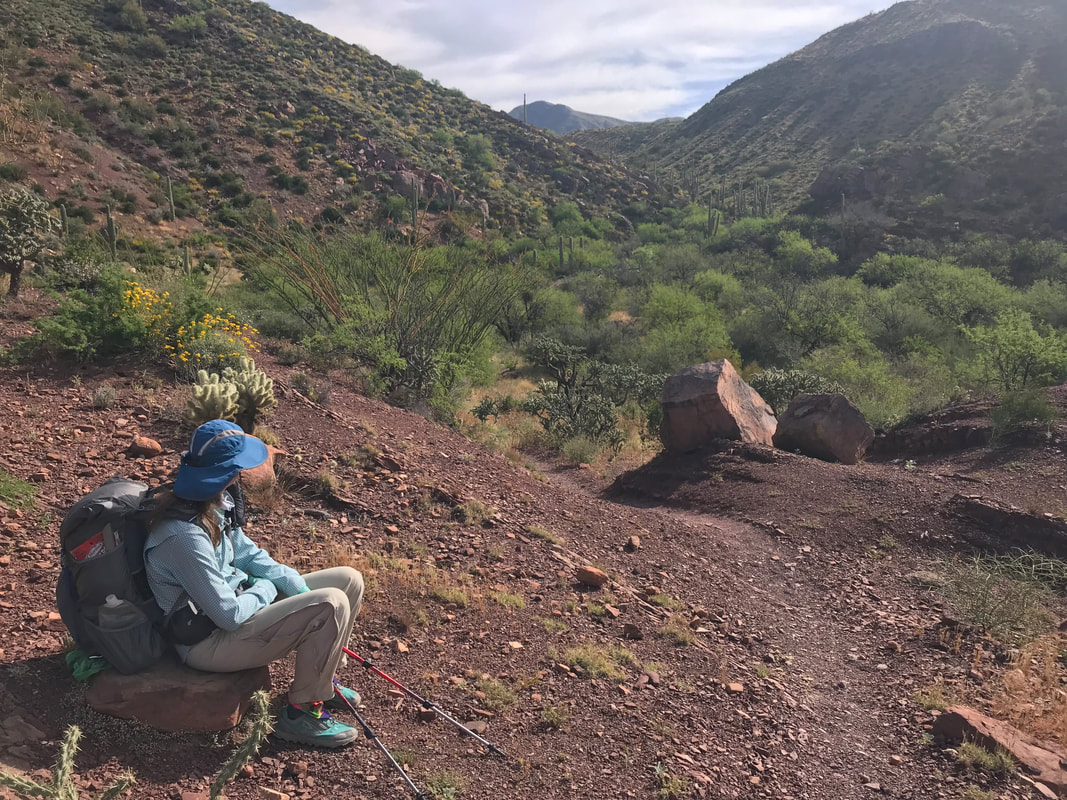
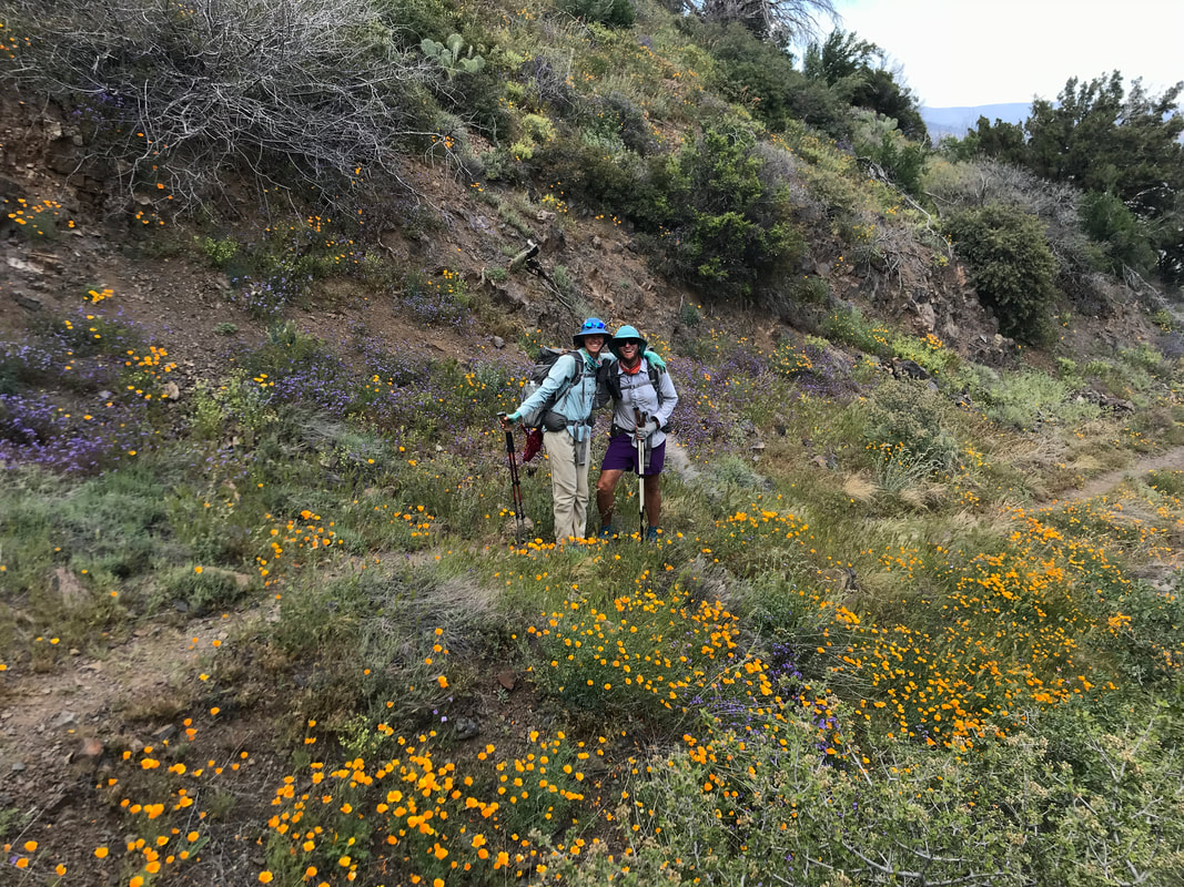
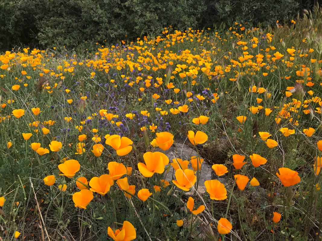
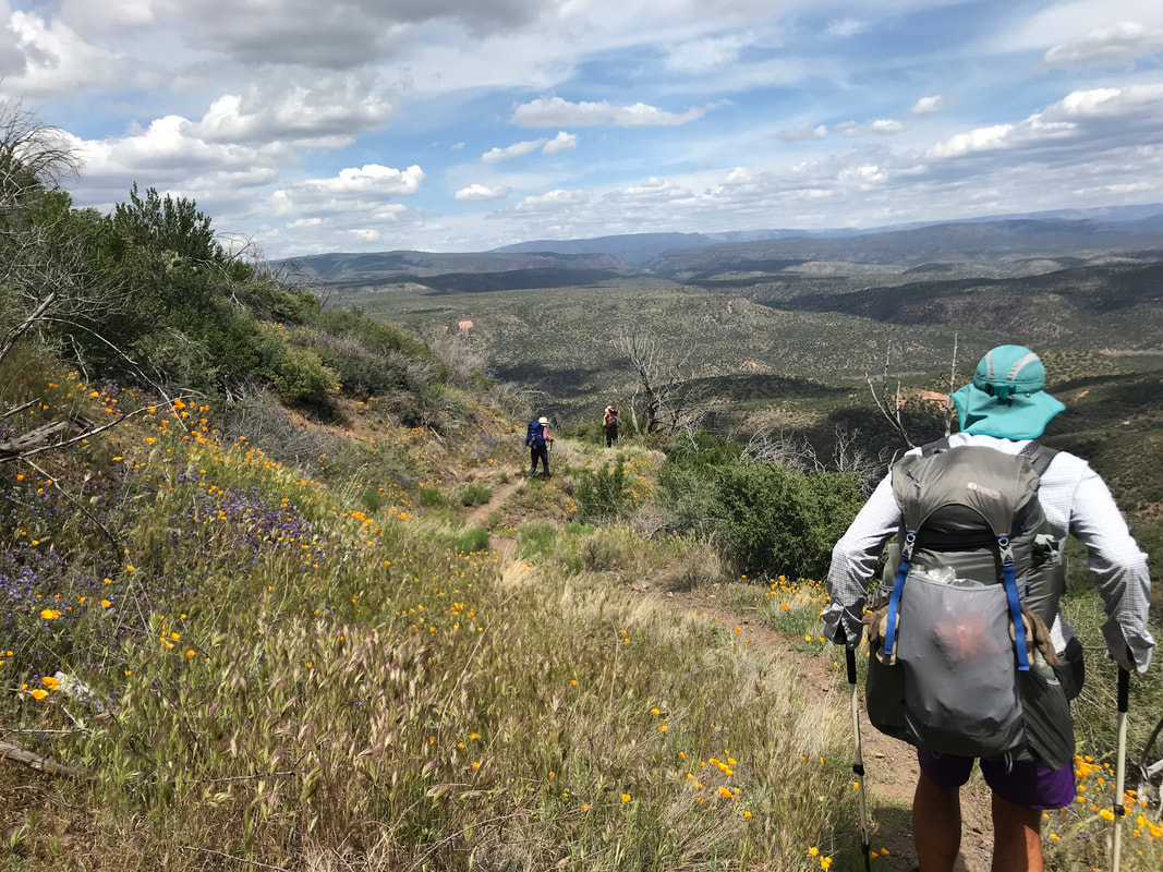
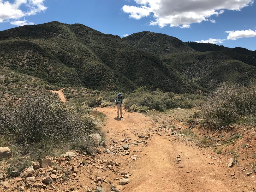
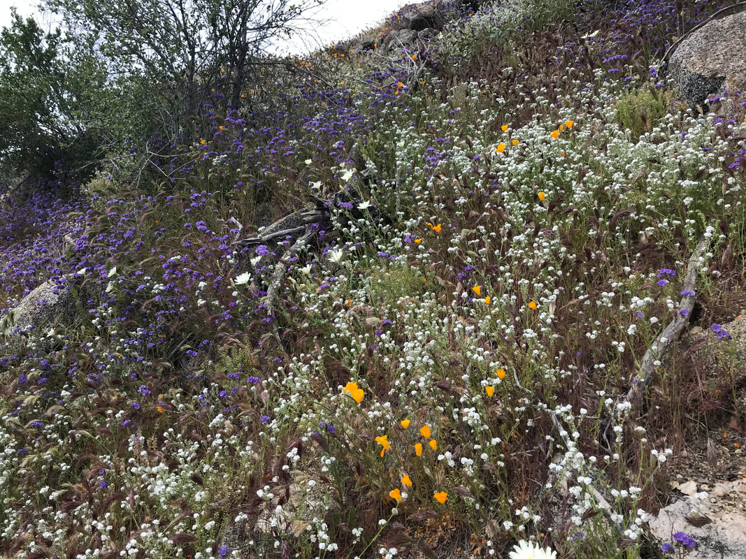
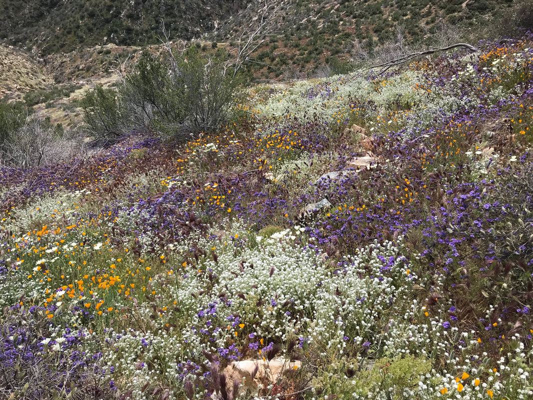
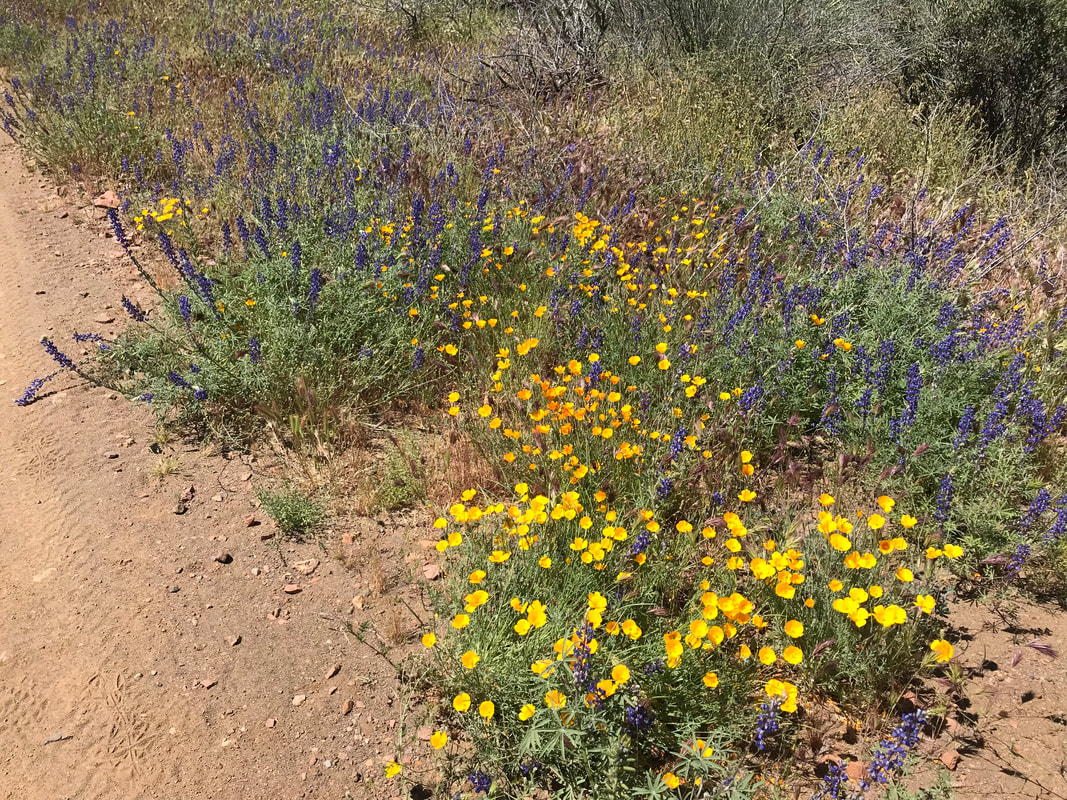
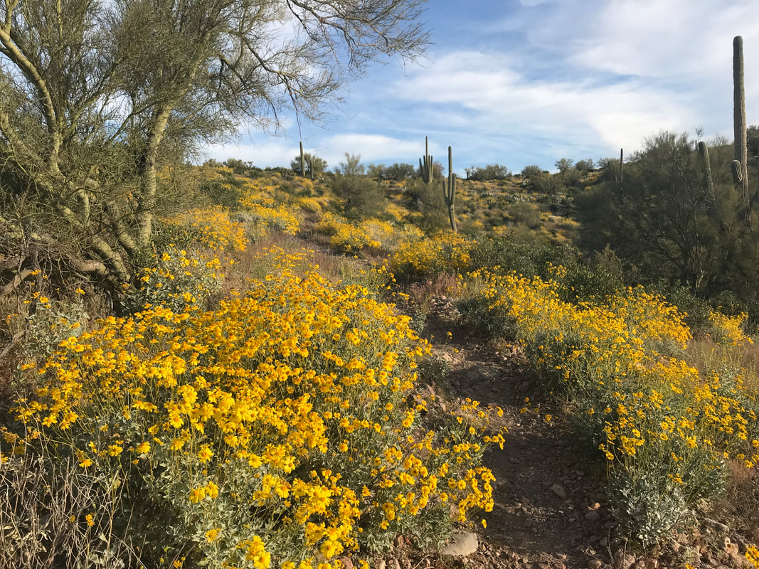
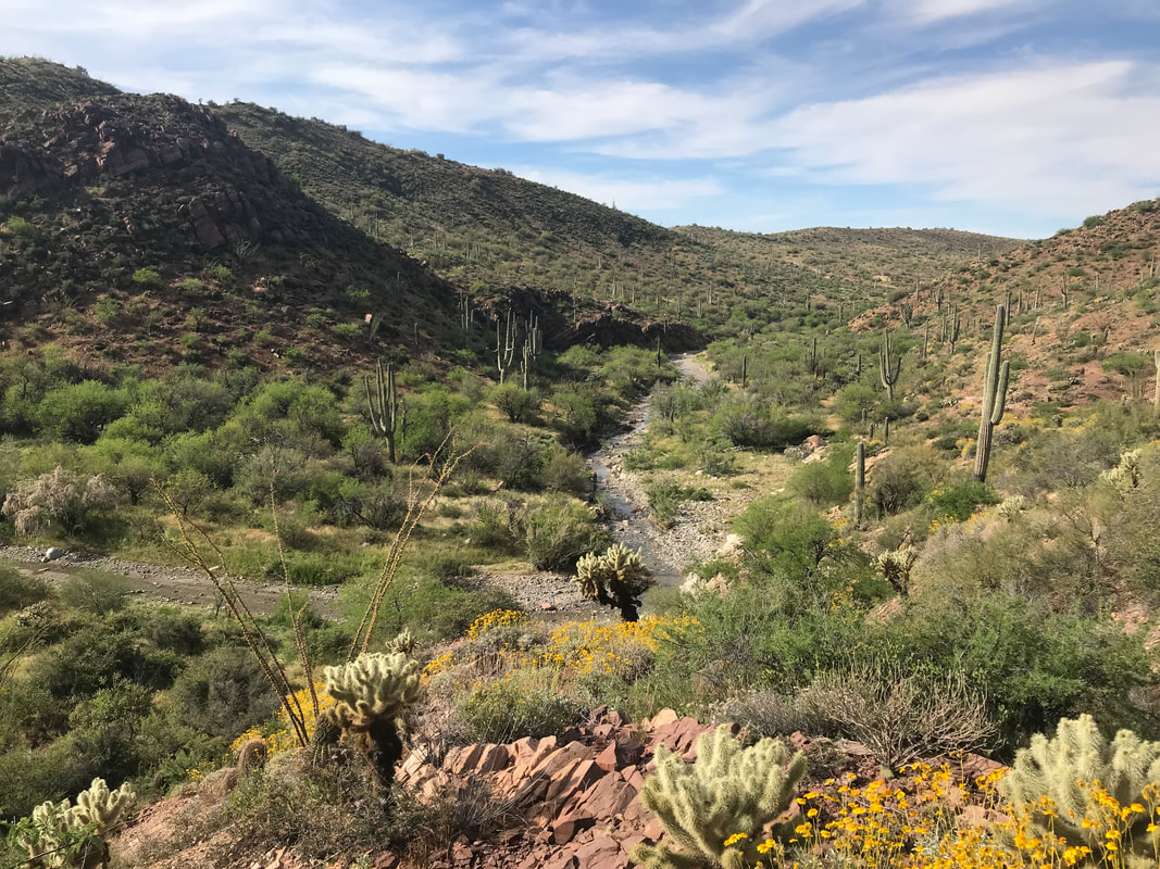
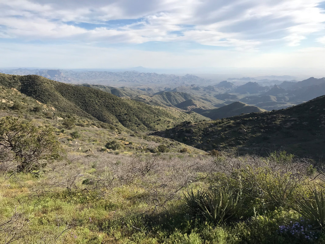
 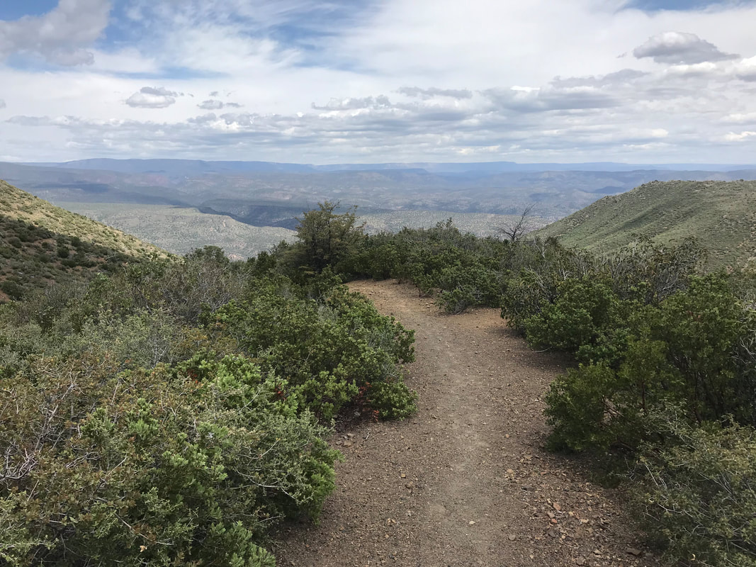 As we moved along, we began to notice a new array of flowers popping up all over the places: multiple cactus flowers, Mexican gold poppies, fireweed, jojoba blooms, and mallows. The profusion made me extremely grateful to be hiking the AZT in such a wet year - beauty born of water. The trail came over a higher ridge and began a steep series of distant switchbacks to the now visible Verde River valley. The trail straight-up plunged down some 5,000 feet to the river valley in only a few miles. We began descending the slanted trail, my knees lock stepping to halt the speed of my descent. Trekking poles were slammed in front in many places. We wound down and down. Above and behind us, large cumulus began building - the storm in wait. As we were walking, I began to feel a certain pain developing in my right knee (my good knee!). Then, the pain became sharp, defined, and felt like clicking. All bad signs. I stopped immediately began going through my ritualistic stretches in an attempt to realign that which wasn’t. Unfortunately, this pain would haunt me for days, causing much alarm about possible damage. By the time we got to the Grand Canyon, it was gone. But in this moment, it served its own dish of worry. We rounded a corner and found a hillside swept with gold poppies. Plus, we caught up to two backpackers ahead of us. We met Wags and Frenchie - two flip-flopping thru-hikers from Pine. They raved about their town and insisted we meet up when we all got there. They were doing the Mazaztals now and then were going to flip down to the border and head north from there. Then, flip back to the northern end of the trail to finish up. We talked about the profusion of flowers, the insane amount of snow/rain this past winter, and our favorite areas in Arizona. They were honestly some of the few other thru-hikers we had run into who were from the state. We pushed ahead, gingerly (my knee was clicking with pain on every step down) ahead of them. A few hours later, the incline of the trail decreased. It began to wave past more flowers, instead undulating through pinion-juniper stands. The heat of the day had risen as our elevation decreased. And suddenly, we spilled out on a dirt road leading to the Verde River past a ranch. As we walked, we heard barking and a pack of dogs from the ranch came out at us. I was like, “Shit!” but the dogs barked and circled us before running back on their property. As we walked on, sunlight began to dip (even though it was only early afternoon) as rain clouds built up. The deepening gray made the entire area seem damp already. The studded rock trail became smooth, then sandy, as the floodplain approached. Large sycamores grew densely along the sandbars and banks of the Verde.
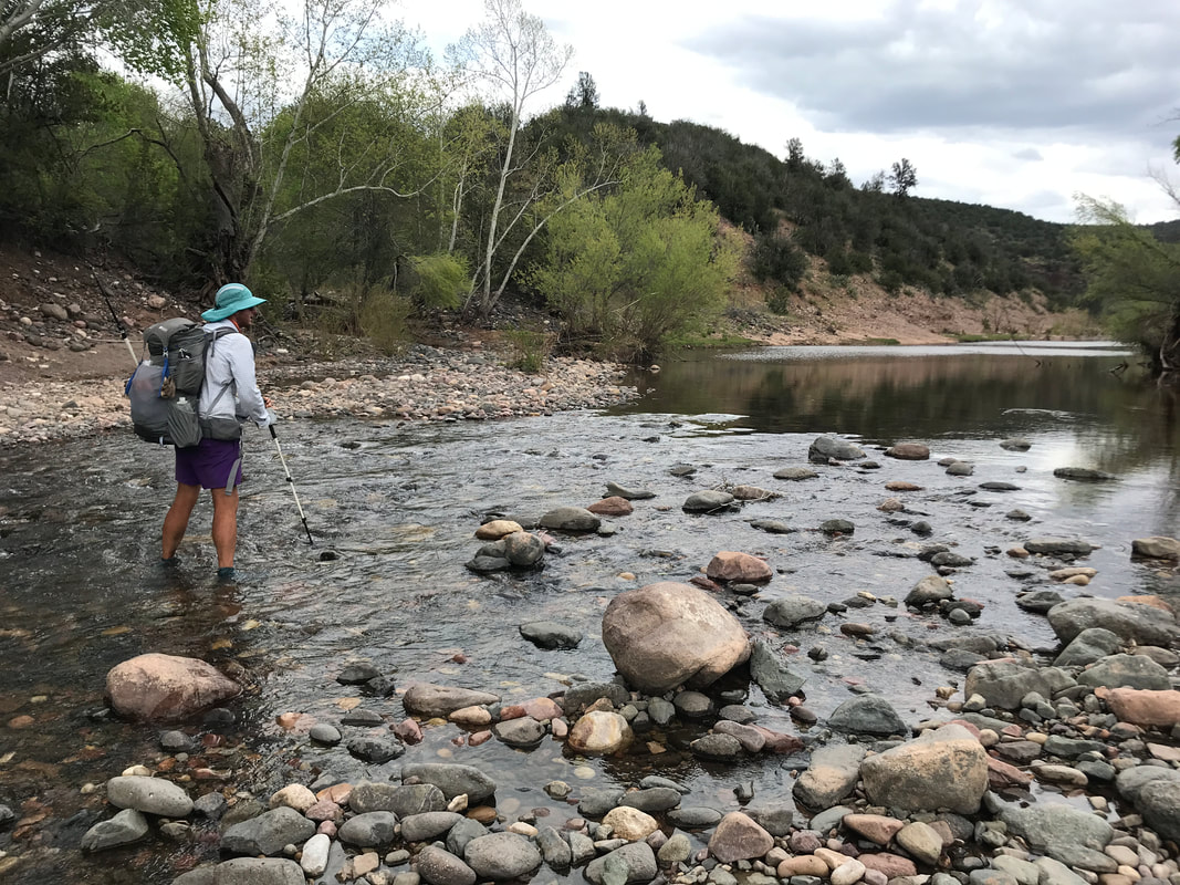
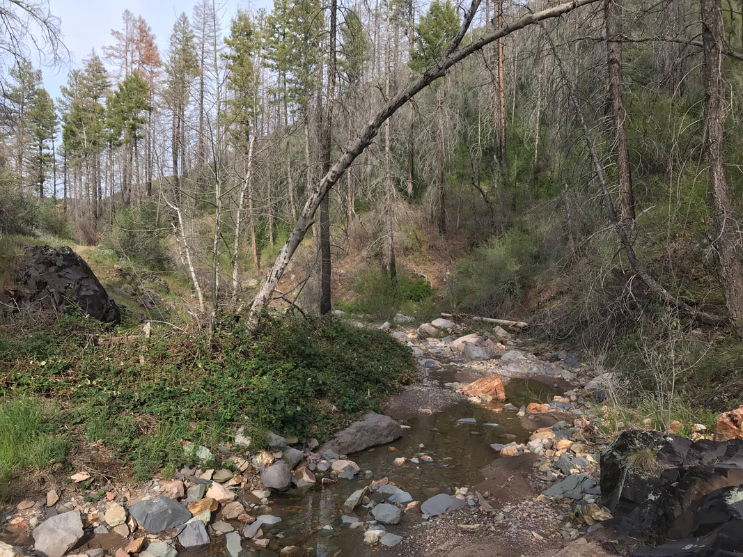
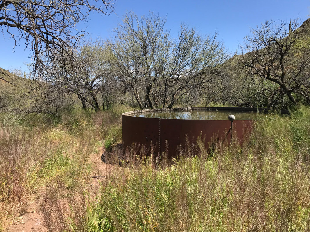
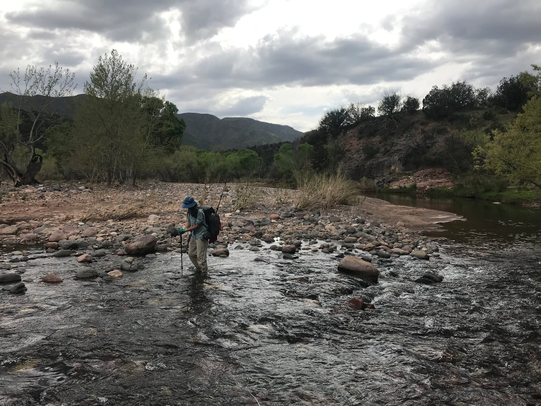
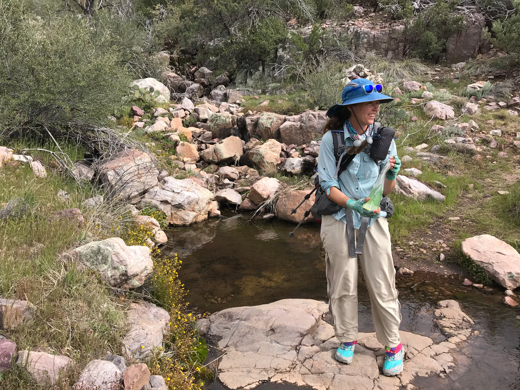
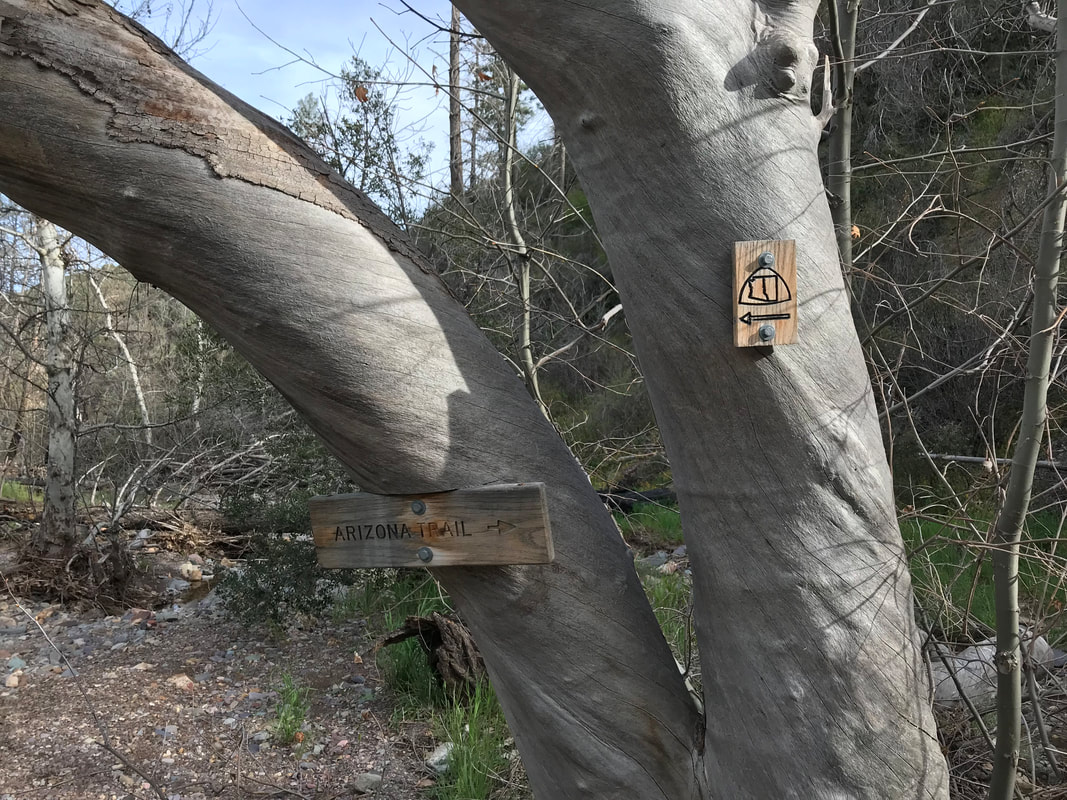
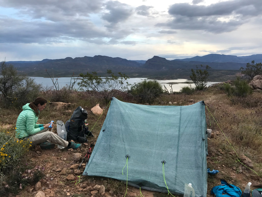
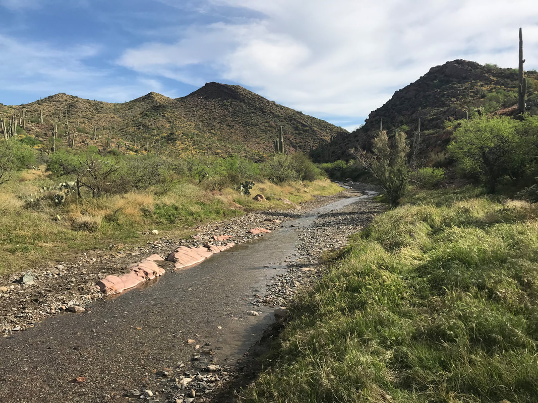
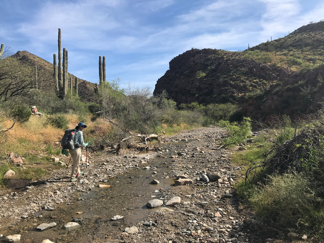
We were curious how deep it would be flowing. Guthook comments from only a couple of weeks ago suggested that the river was flooded with spring melt. Hikers had to actually swim across to get to the other side. We walked through the sand and large river stones and came out into the actual river channel. Deep sections lay before us so we walked upstream and found a perfect crossing spot with an easily manageable depth. We crossed and took some time to enjoy beauty of this undammed river still running wild in Arizona. But the gathering clouds were starting to dim everything more, so we climbed a hill. As we left, loud peacocks from the ranch began calling. We would hear their calls all night long. Pacing up the hill, we entered juniper-pine stands again. A few miles in, we left the AZT to hike into the wood to Polk Spring. Polk Spring ended up being a naturally warm spring that made the resulting field it ran through temperate and comfortable in the gathering chill. We setup camp in the field well away from widowmakers and branches, using a bush as wind-block. The spring fed a stream through the north side of the large field. A layer of watercress and ivy richly covered it, not making any water visible. I walked up towards the source in the woods and found water exposed and running through tree roots. I took off my shoes and soaked my feet in the warm and clear waters. Being here by 3 pm, Janna and I decided to divide tonight’s dinner into two. Early dinner and late dinner. We ate early dinner right away and took some time to reorganize and patch our gear (especially the rip on my backpack where I had fallen in the Superstitions). By 4:30 we decided to eat late dinner as it was obvious that the storm was going to unleash in the next hour. Food consumed, we made sure the Triplex was well battened with all tie-outs and headed in. Not 10 minutes later, a wave of clouds obscured all peaks as a steady rain began to fall. The night would bring an intense lightning storm, thunder, and driving rain for hours. Refuge was our shelter. 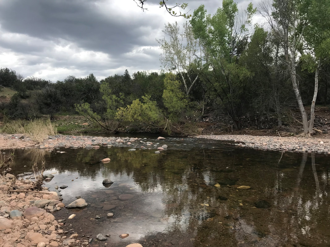
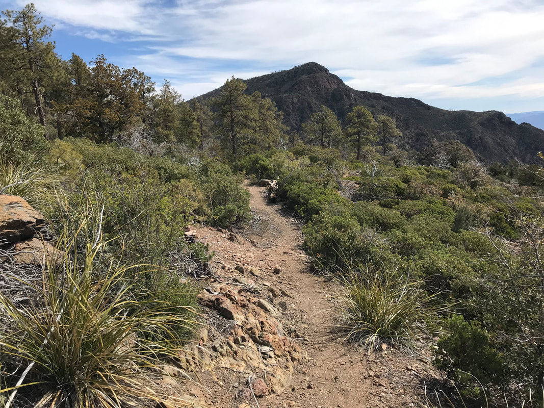
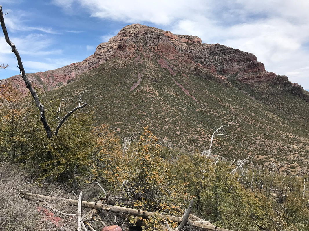
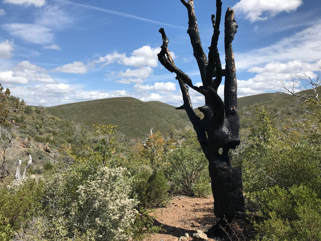
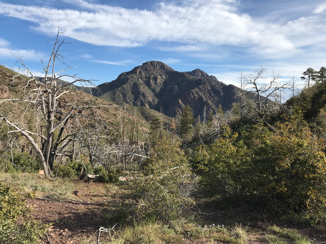
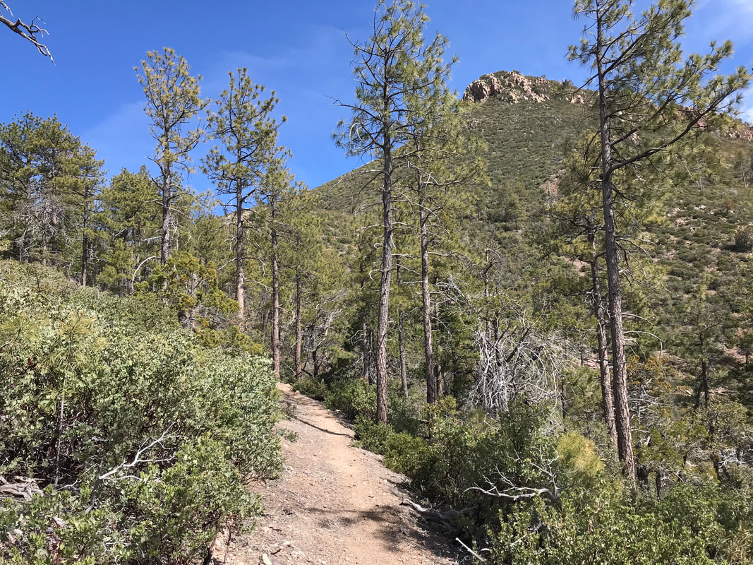
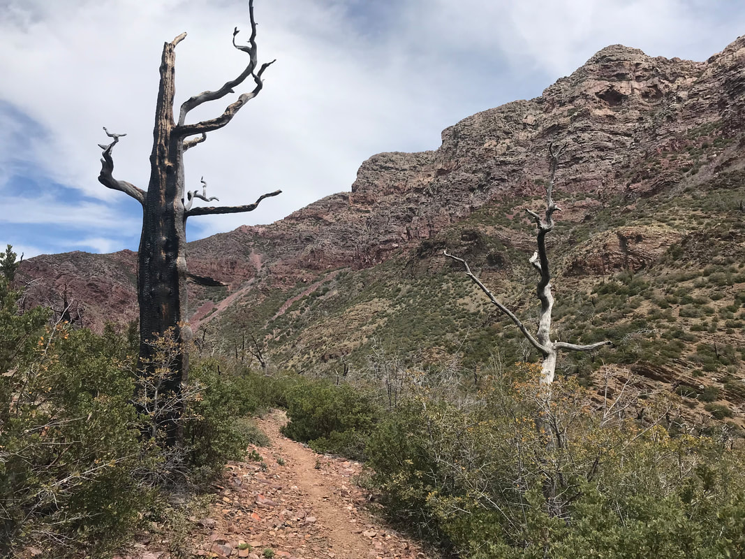
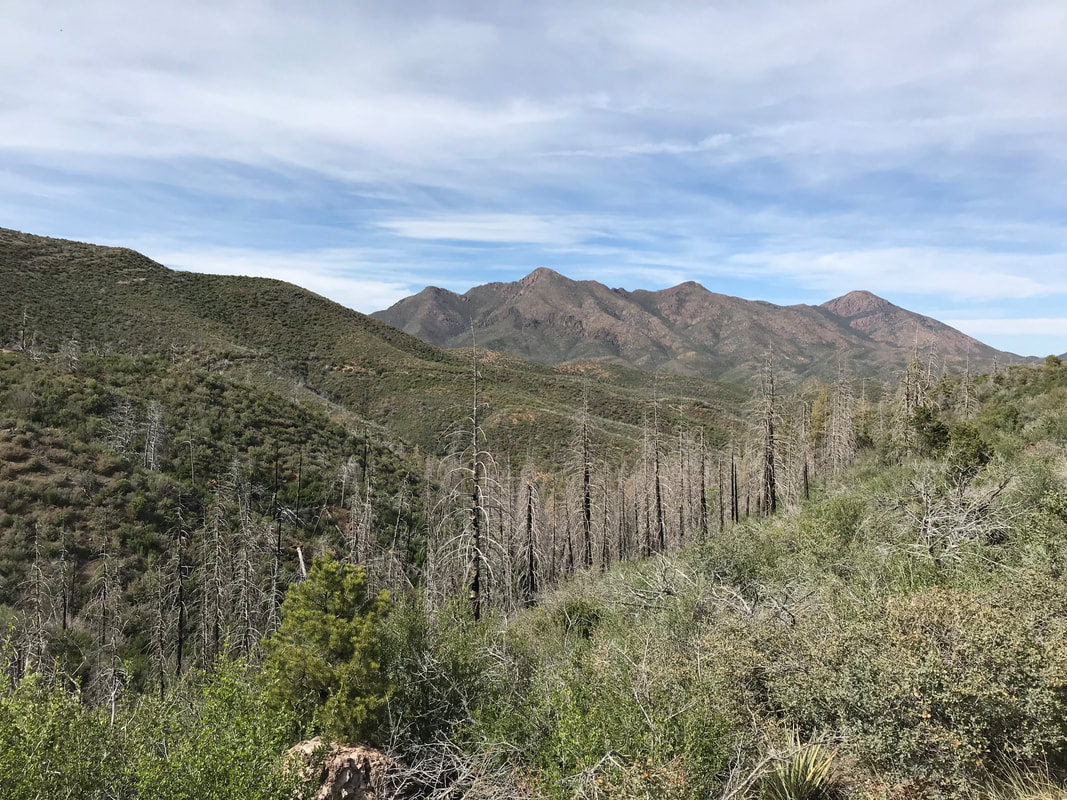
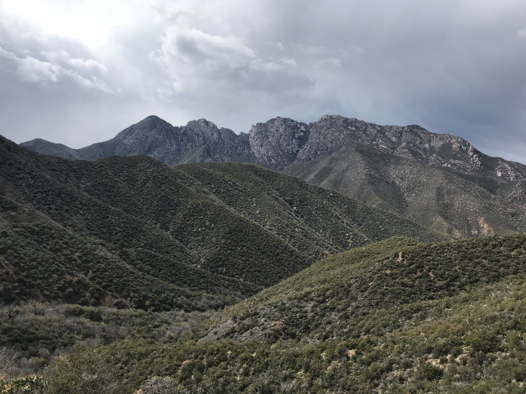
  The night was cold, long, and it felt like we were so far away from humanity. For some reason, it reminded me of sleeping in the Paria Canyon. You stare up into deep stars, the night sky a sliver between rock walls. Nighthawk calls continued until the touch of dawn. We awoke and I felt urgency. Urgency to get through the Mazzies to Pine. In my head, I thought, “If I can get there, my knee will be good, and I can finish the trail…If I get there, the heat will lessen, and water will be plentiful…If I can get there, shade will be more abundant….” The urgency was also born of a weather report suggesting a very large storm and rain system approaching tonight or tomorrow. We wanted to cross the Verde River (a federally designated Wild and Scenic River) and find some good shelter before a veritable deluge hit. Therefore, we had miles to make today. We climbed out of the Triplex into the frigid air. Again, ice caked where condensation had formed. I felt well pleased because the Destin and Preparation H were doing INCREDIBLE things down there. My butthole and cheeks were simply on the up. I had settled into a rhythm with using my derriere creams: (1) sleep with no underwear to air the area. Wipe with baby wipes before bed to remove salt crystals from sweat. (2) Apply Preparation H before bed to keep the itch away while I sleep. (3) Add Destin before and during hiking to prevent the cheek chafe. Golden. The day began with Mazatzal Peak rising all day until we stood across from its 8,000 ft. prominence. The trail switchbacked up an opposing peak on a narrow edge. Scrub oak grew low and bushy and packed right up next to the trail. We felt exposed to the Sun again, but after the trail curved the mountainside, we entered an unburned ponderosa pine forest with a sprinkling of junipers. The evidence of the wildfire impact was just dramatic across the whole range. We’d dip into an unscathed pine forest only to abruptly exit into a hillside of grass/scrub oak/manzanita all knee high with splintered ponderosa skeletons lodged about.
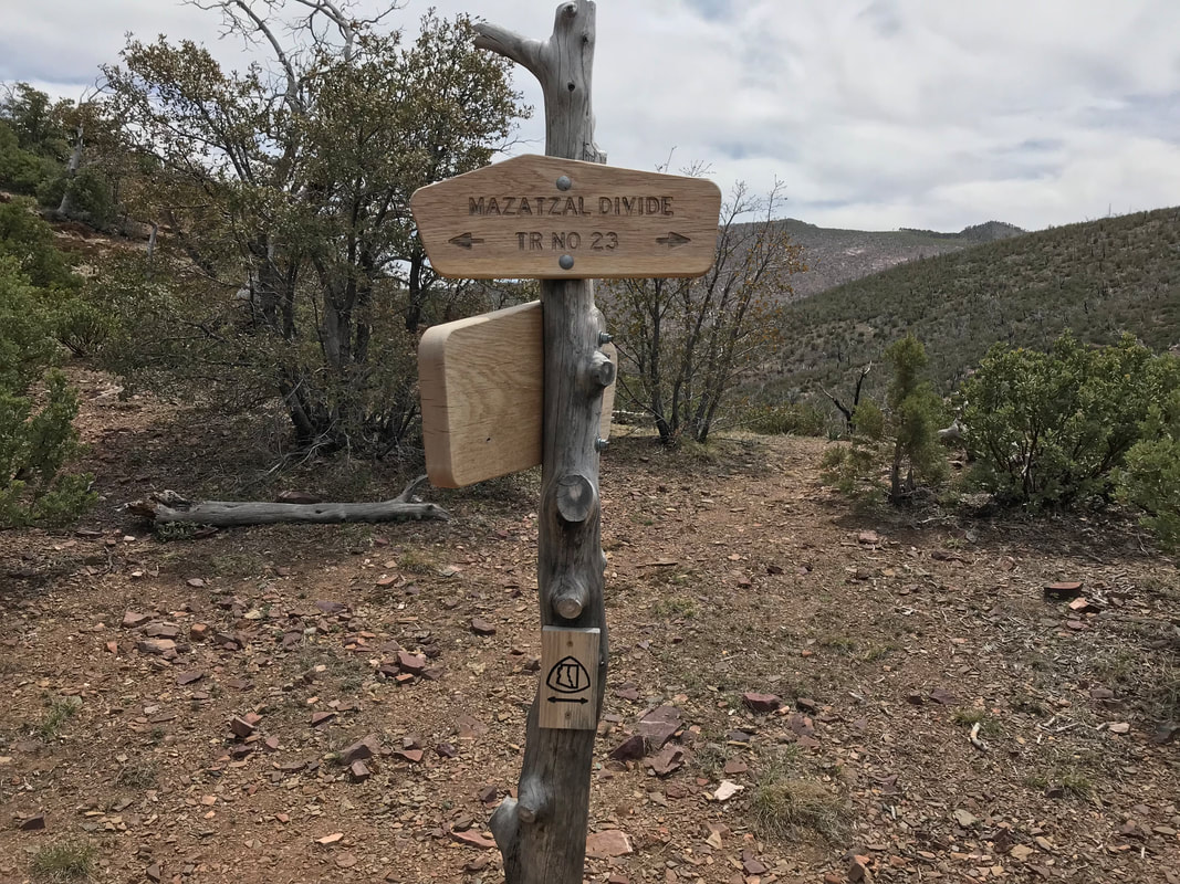
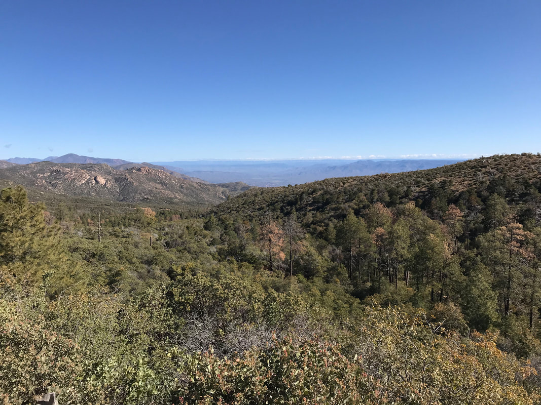
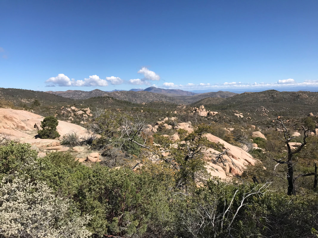
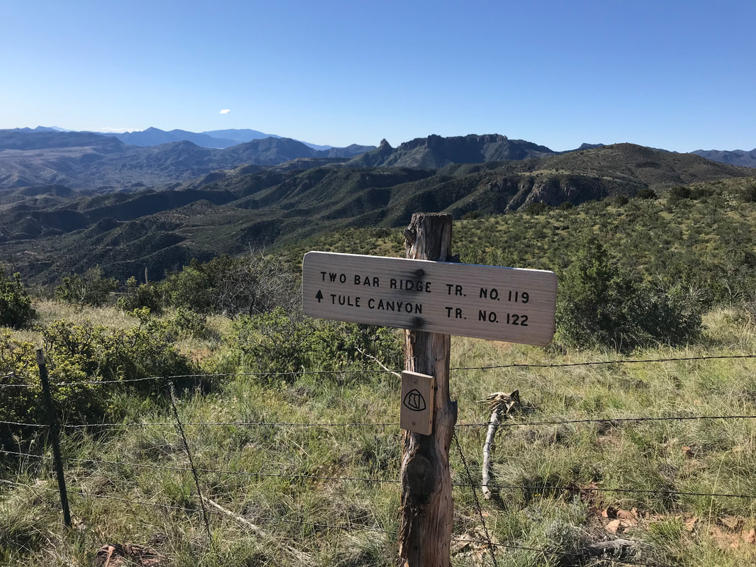
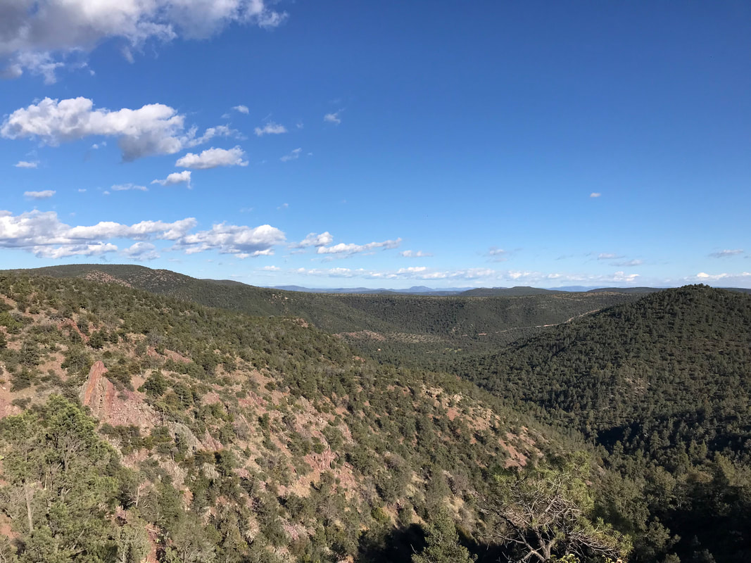
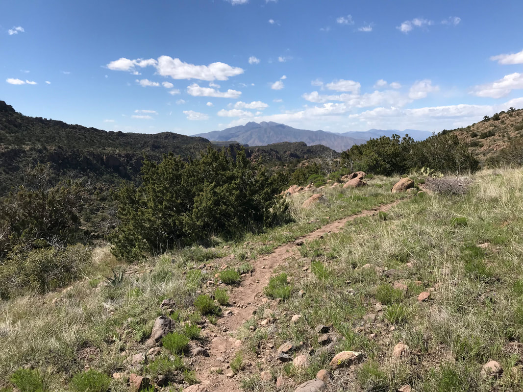
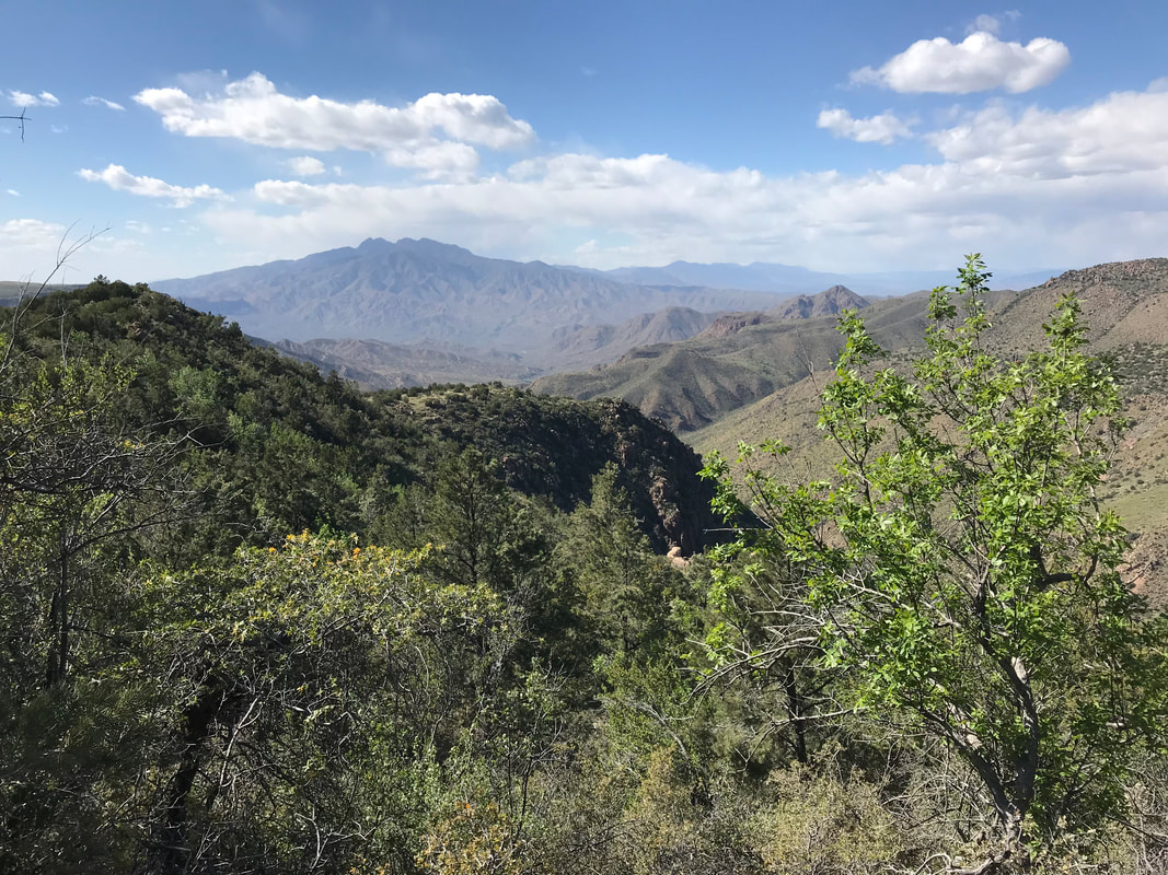
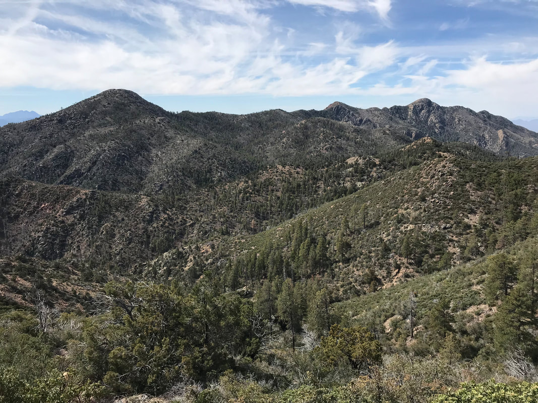  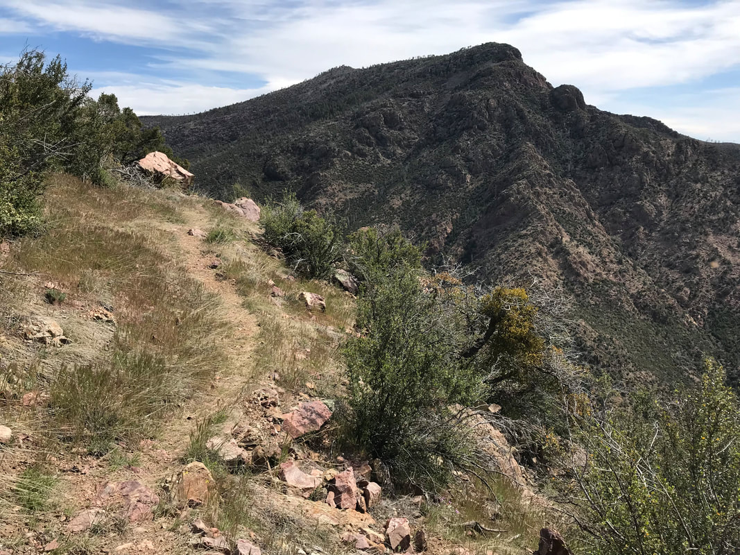 Near 7,000 ft. high again, the botany began to change. Agave and firs intermingled in the high places. The trail scooped out of a turn and we both stopped to gaze at an unbroken expanse into the heart of the Tonto National Forest north of Phoenix. The valley down below contained horseshoe lake and a white building, a spec really, on a distant parallel range proved to be the Humboldt Observatory out at Seven Springs. Looking south, we could just pick a few distant glints of houses from Cave Creek. I was pumped when I looked north and saw the caked-in-snow rise of the San Francisco Peaks small but clearly seen. The wall of the Mogollon Rim cut perpendicularly in the north. Wow. In this one view, we could see it all; from Phoenix to Flagstaff. Just as we started to move again, an older couple rounded the corner. In their 60s, they were finishing this last section of the Arizona Trail. With it would come completion of the whole route. We congratulated them and felt a sort of awe wondering what it would feel like if/when we reached the end. The trail wound through a burned forest of black stumps and splinters with chunky red granite forming the ground. It curved over the top, provided us views into the east, and then came down the side of another mountain at a saddle to a spring. At this point it was nearly noon and we had done nearly 12 miles. Feeling comfortable with the pace being made in this steep terrain, we took a break. I was good on water, and so was Janna, so we decided to keep going after a snack. The views, unbroken by trees (burnt by the fire), revealed hulks of red granite ranges stretching into the distance. The AZT joined the Mazatzal Divide (a trail bisecting the range) and undulated up and down over miles of incredibly rocky trail. Janna and I settled into conservations about school, student behavior, trends in education, and the like. We realized during early afternoon that we were now back on the section we had hiked before when we visited the ice waterfall a few winters ago. It felt good to be someplace we had touched, a sort of confirming progress. 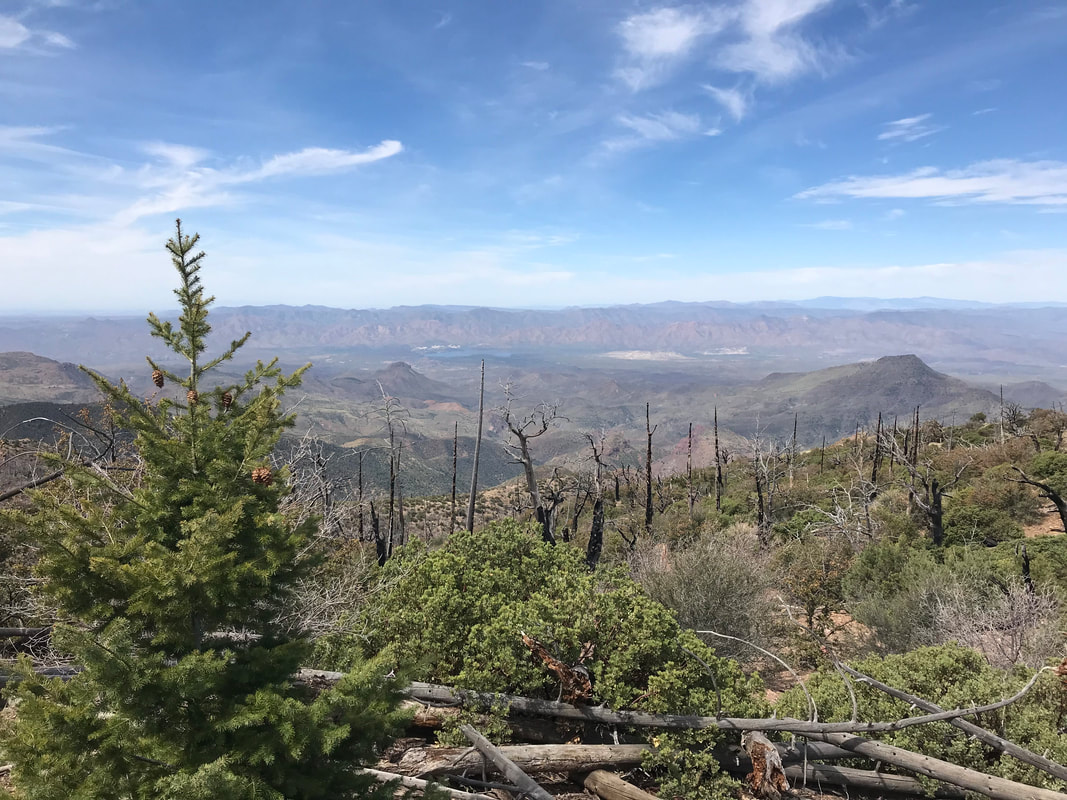  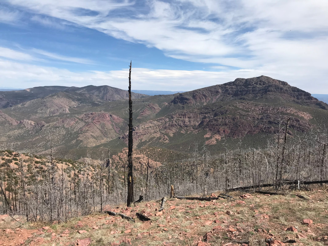 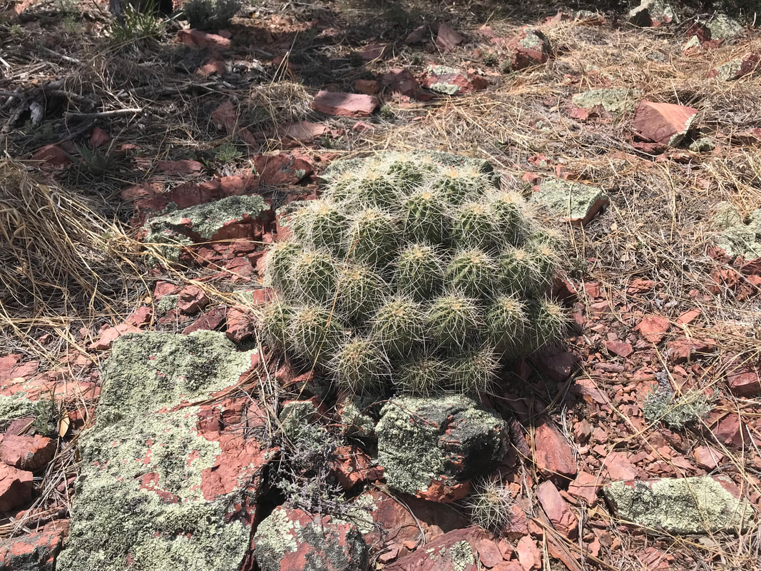
     Moving into another long expanse of manzanita-choked trail, the terrain below us disintegrated into the most insane rock. Shards, babyheads, river stones, chunky granite rounds. Like god punched the mountainside and strew the ankle-bending bits along this section. I was happy with the max soles of my Hokas as the bottom of my feet would have been destroyed. We walked quickly but carefully through the miles of possible broken ankles. Then, someone hollered to us from behind. Surprised to see anyone else, we turned and met Katya. She immediately recognized us (given our sun hats) and said that she was one of the hikers we had seen on Day 1, all the way back in the Huachucas. She had seen us take the alternate down low when she went high into the snow - again reaffirming our decision as good risk management. She said it was terrible up there. Apparently, she had been covering something like 20-30 miles a day but got an injury outside of Superior that forced her off the trail for a week or two. During that time, we had caught and passed her location. And now, despite the month passing since we all left from the Mexico/US border, we happened to intersect again. Janna gave Katya some olives that she was sick us; Katya ate them up for the palate change. She jumped ahead of us but we caught up when we both stopped at the same spring off trail to collect some water. Janna had gone down first and somehow I got lost descending the mountainside and walked through a ton of catclaw that ripped my legs apart. Find the stream flowing over a raw granite outcrop, I dipped by bottles only to bring up small leaches all over. I took some time to scrape them all off before walking downstream and finding Janna and Katya talking. Somehow, there was a clear trail there that I had missed. Janna and I told her we were aiming to make it to “The Park” tonight, a rare flat valley area a few miles ahead. It was supposed to have a small stream nearby and a thicket of wind-protected pine good for camping, and good for weathering the storm should it blow in. We pushed on ahead into early evening. The sun drifted behind some cirrus clouds, which seemed to drop the temperatures suddenly. The trail broke out into a pimplefest of fist-sized rocks and climbed upwards 1,000 feet. Yearning for smooth dirt track, the Mazatzal Divide suddenly summited out on a ledge with an awesome view into crimped peaks and ranges stretching out far. We switchbacked down the trail studded with agaves in the granite. It curved the width of a mountain flank and suddenly, there The Park was. A few acres of healthy pine in a small valley below. With evening in full force, we hit the bottom, crossed a small stream, walked up a large meadow and entered the woods. We hiked off trail a ways and found an absolutely perfect area to camp for the night. Good trees with no big branches overhead, flat, and with a thick bed of soft pine needles to camp on. After setting up camp, I hiked back down to the trickle of a stream to fill water and ran into Katya. I told her our location for camping and invited her to join us. I filled up my water in the dropping temperature and walked back up. The three of us ate dinner in the dark as Katya told us some stories about thru-hiking the PCT. We stayed up well-past dark and climbed into our shelters as the wind began picking up in earnest.
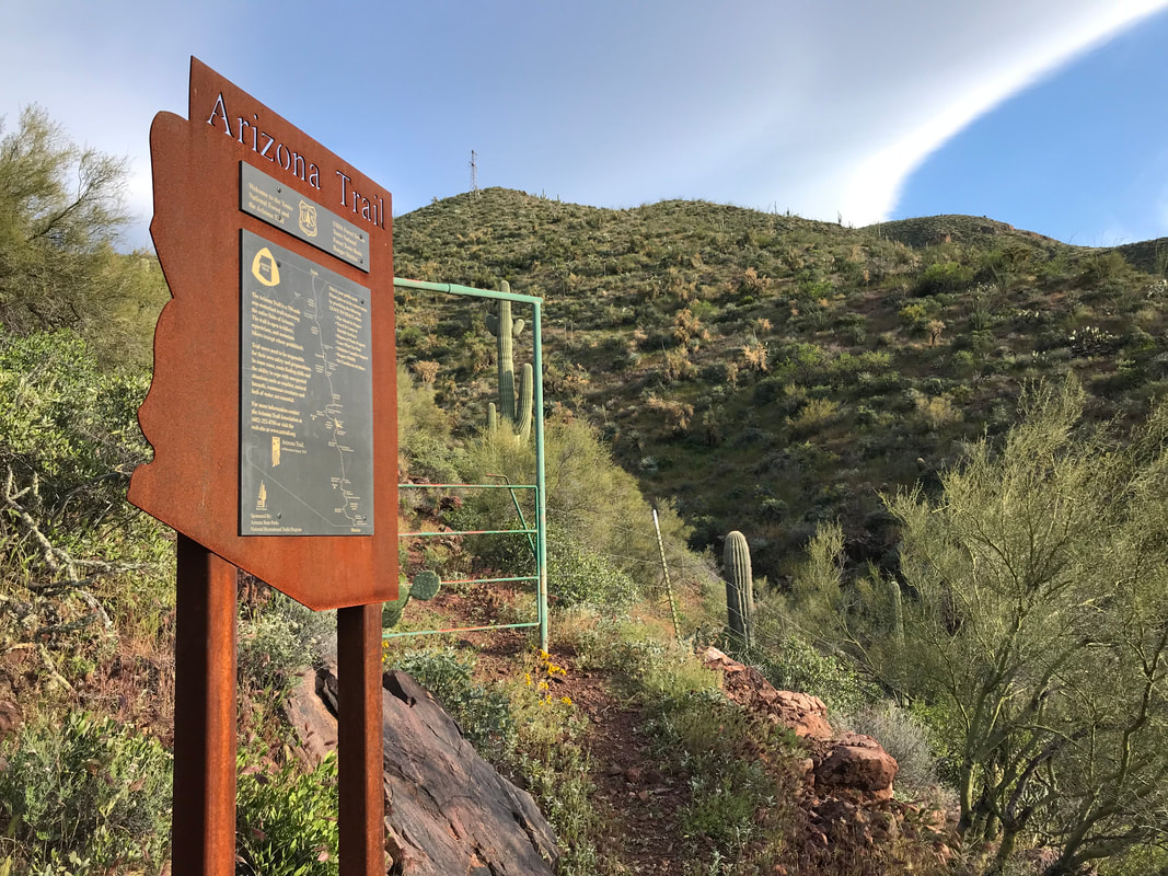
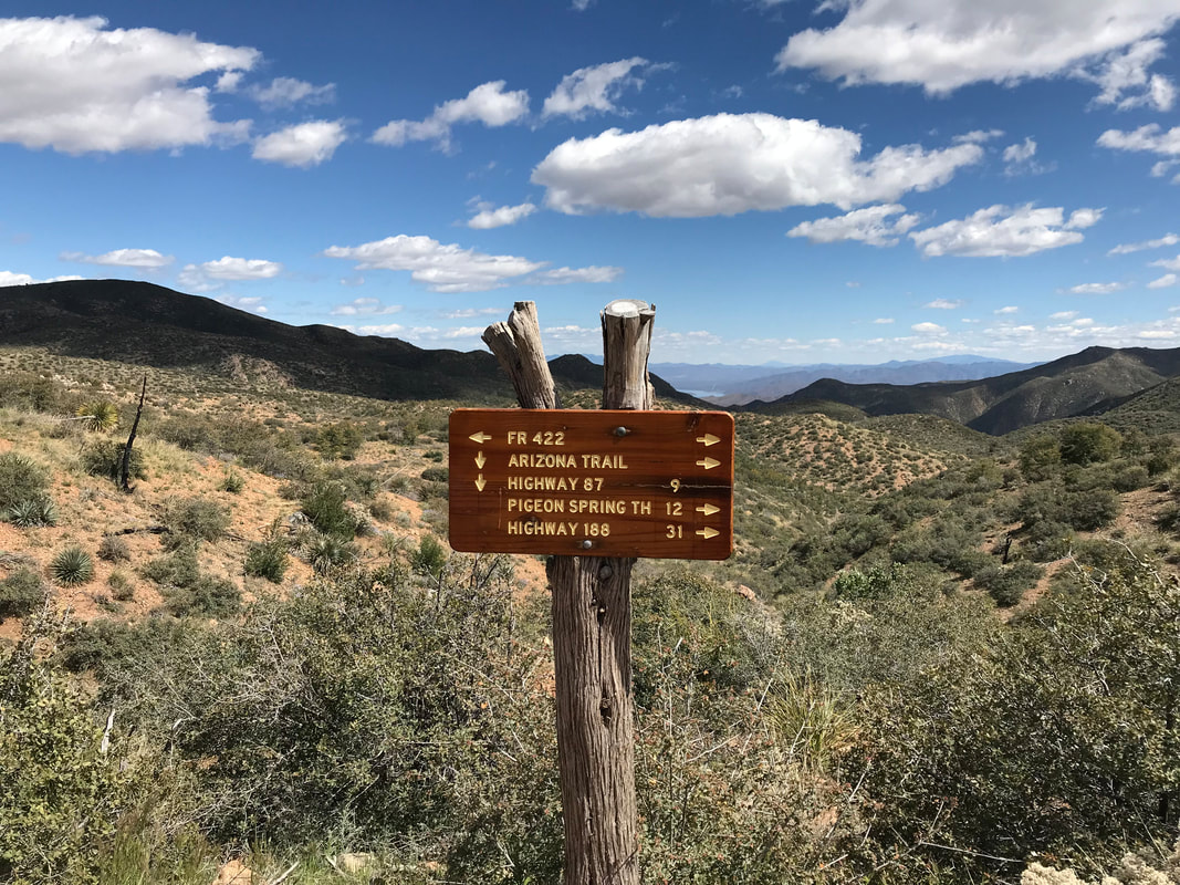
    Both of us were anxious to get moving this morning because we needed to meet Kristin who was bringing a load of fresh fruit and food. We got up early and found that, even up above, a deep cold had descended from the surrounding mountains, leaving us in a sheen of morning ice. We packed up our crispy bags, now soaked with collected condensation and hit the trail. We shivered in the subfreezing temps, even this late in spring in the desert. Eventually, the AZT came up on a rise and provided a long view of leafless cottonwoods lining the entire path of Sycamore Creek, now in the distance. We allowed the Sun to hit us. Sunflower, more a spot on a map then a real stop at all, was a short side-hike from the AZT. Sunflower sits along State Route 87 (The Beeline Highway) and has a tow truck business and a collection of houses. No services. We’ve never stopped there on drives to Rim Country. But there is a pullout just past Sunflower that leads down a lane to a dead-end where the AZT picks up at trail. Now warmed, we made our way to that pullout parking area to meet Kristin. Janna and I arrived at the parking area earlier than the planned meeting of 9 am. We took the time to empty all our gear to air out and dry out in the quickly warming sun. With our pack contents disgorged, a car pulled in and out popped Kristin and Sandra (both teachers from Janna’s school). They brought us our mail to look through, tons of fresh/easy water, MY FUCKING BUTT CREAMS (Prep. H + Desitin + Baby Wipes - I thanked them a million times and apologized for so personal a purchase), our resupply of food to get us to Pine, and a WHOLE TON OF FOOD we had requested, including: • McDonald’s Sausage Biscuits (I ate 2 - the first McDonalds in years) • 2 packages of iced cookies and 1 fresh batch of chocolate chip cookies • Cake • Tortilla Chips + Salsa • A bag of fresh oranges • A whole thing of bananas • Sourpatch Kids • Strawberries Over the next 1.5 hours, we literally ate it all. I don’t know how, but I literally consumed thousands of calories and an unbelievable volume of consumables. It was so much I thought I was going to vomit. It was wonderful. We all sat around laughing, asking each other questions about the typical world and the extraordinary world (as Murilo from NOLS would call them), and ate food endlessly. It was like I could feel the surge of calories being fed to my leg muscles through an IV or something. The recovery effect was huge for my energy, morale, and physical state. We dropped off trash, sent back that which we didn’t want/need anymore, and took a few more cookies for the trail ahead. Now, it was 10:30 and Janna and I need to go because tough terrain lay ahead. They said goodbye and drove away as we hiked back down to Sycamore Creek, crossed it, rejoined the AZT by a country home, passed under the highway via a culvert, and stared at the first peaks of the Mazatzal Mountains. 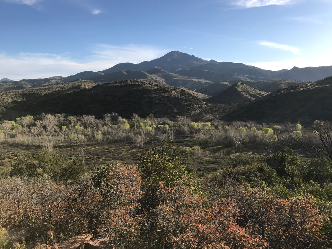
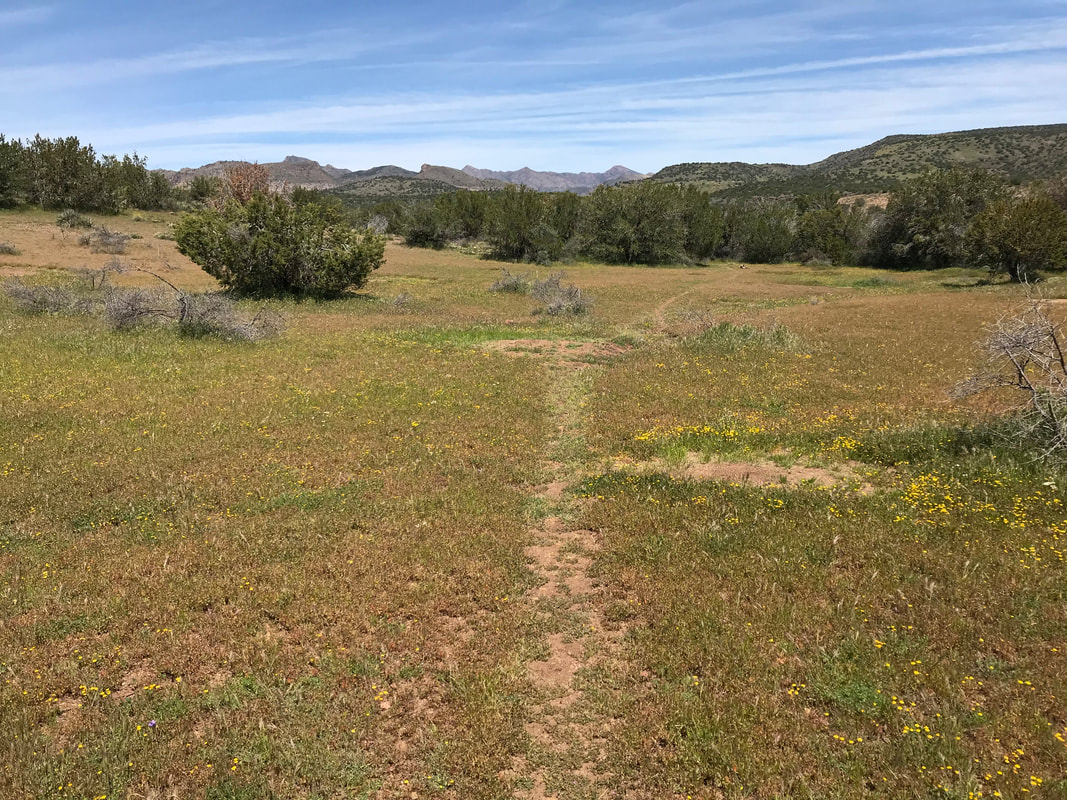
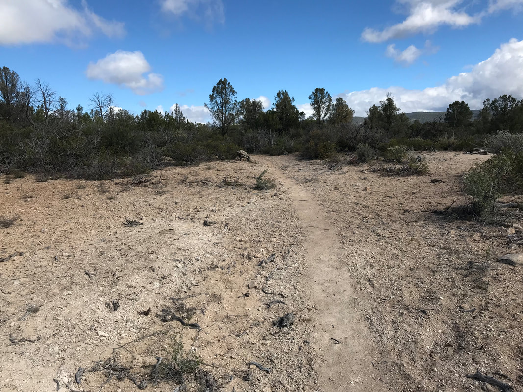
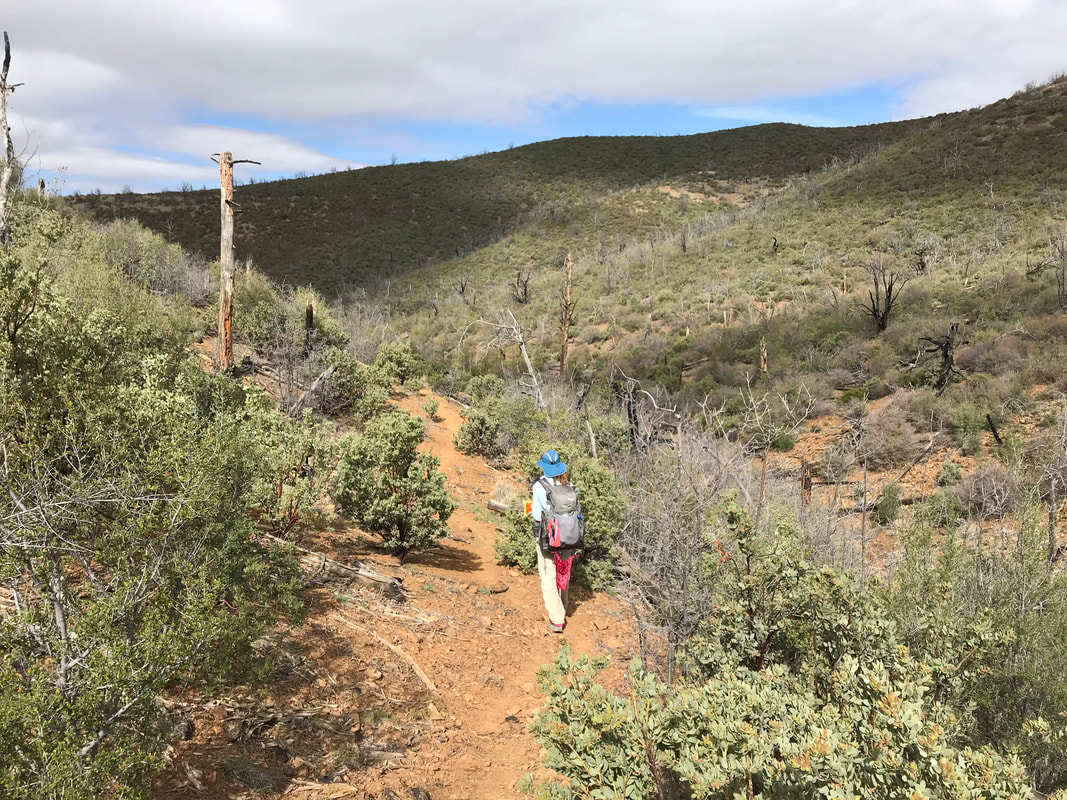
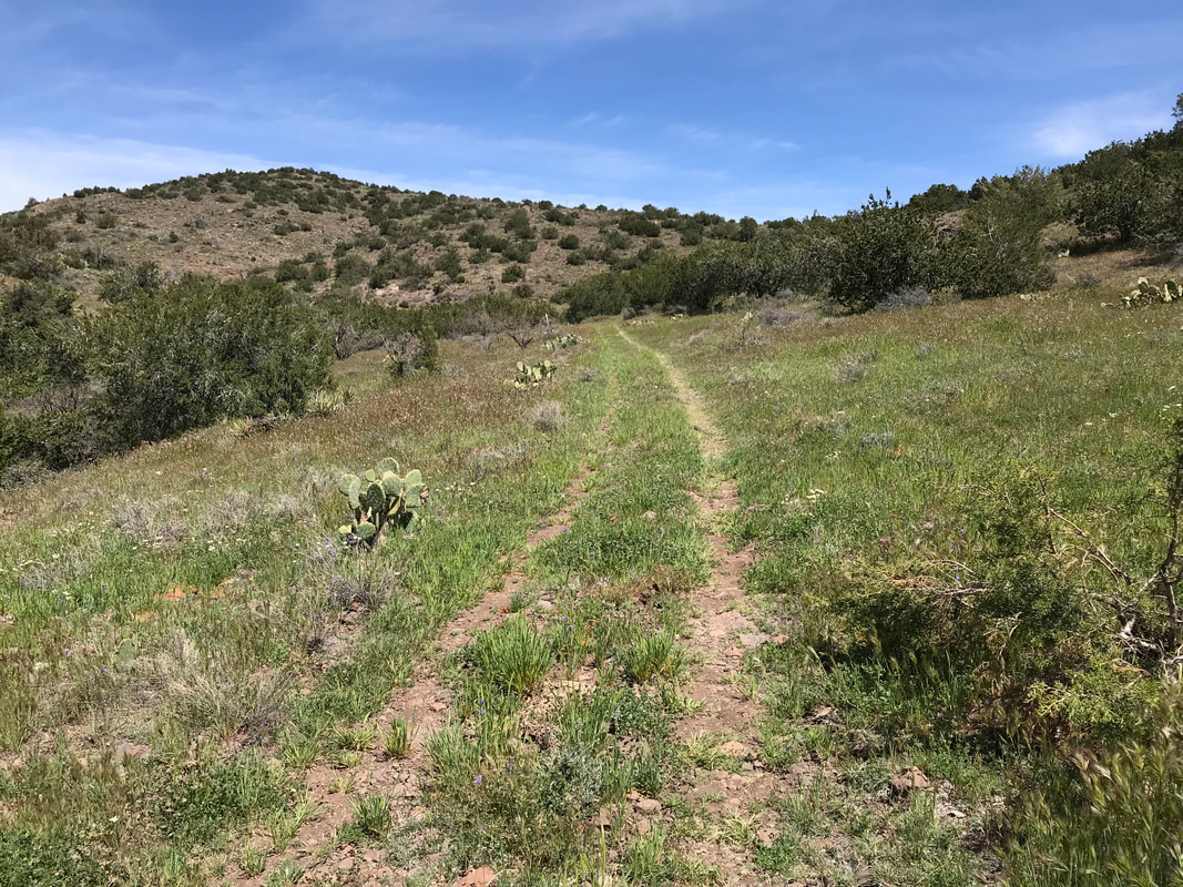
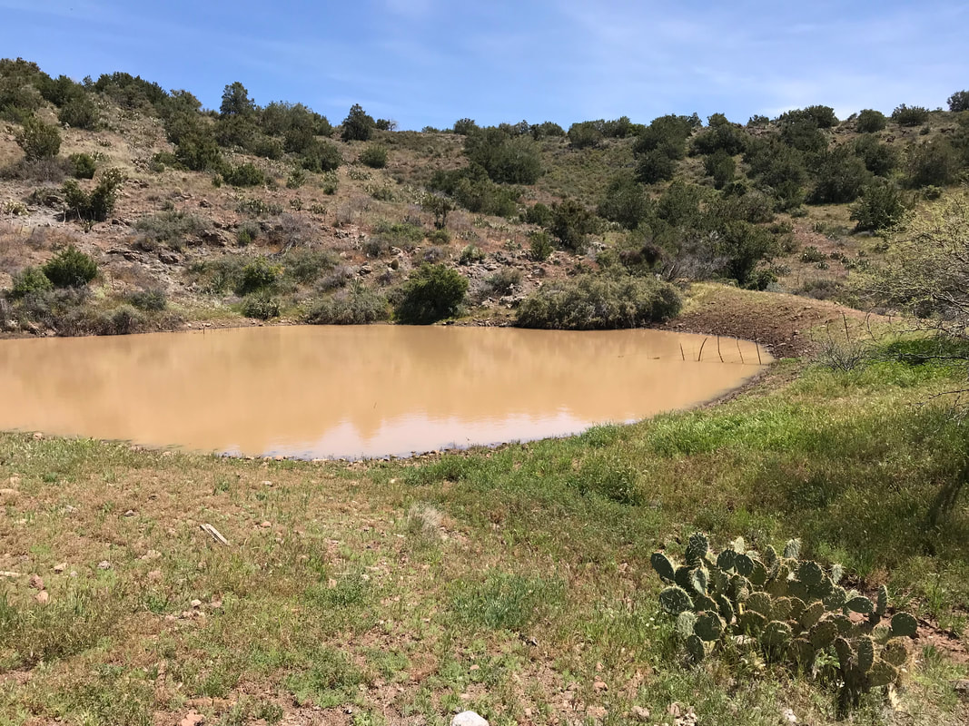
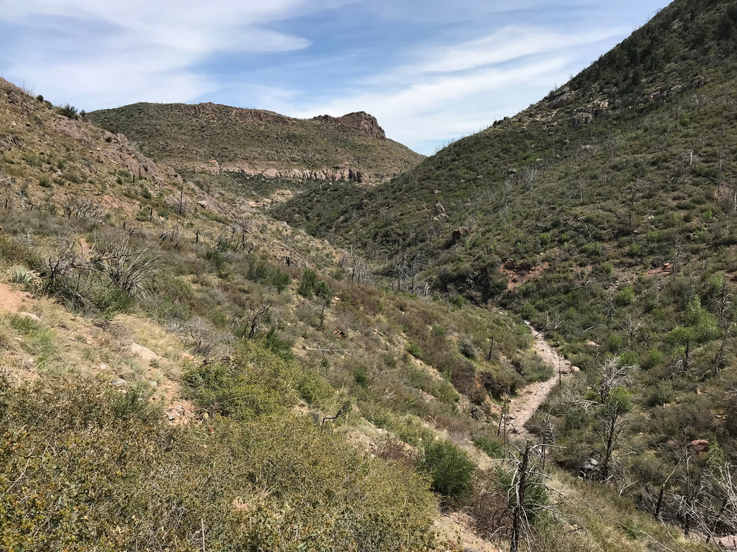
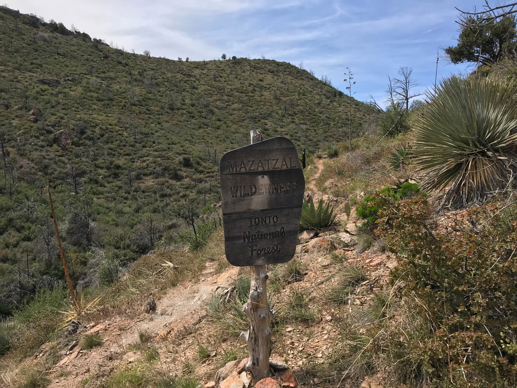
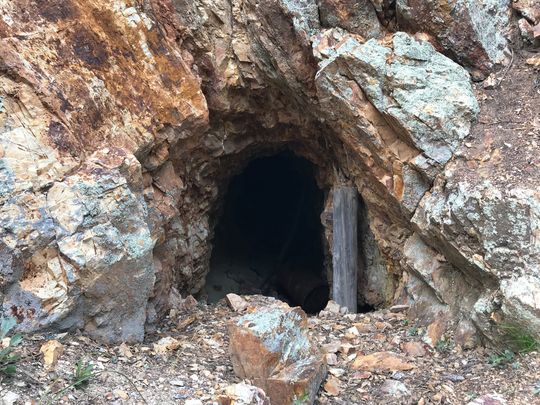
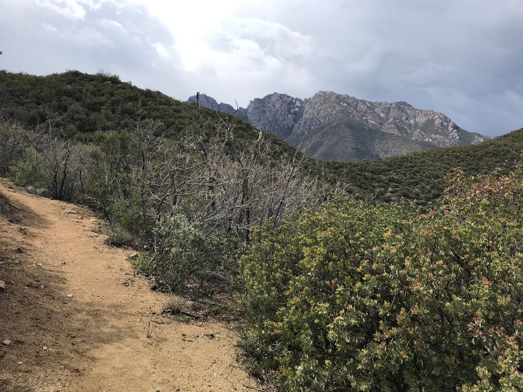
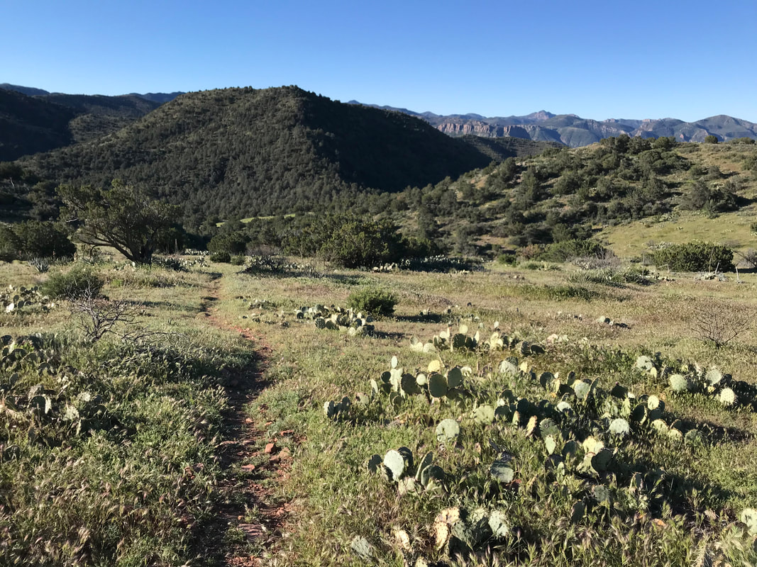
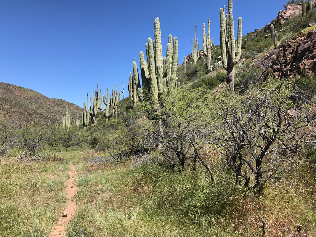
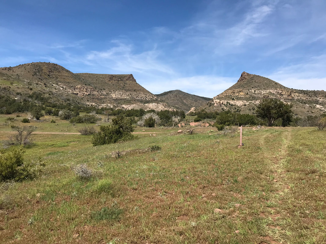
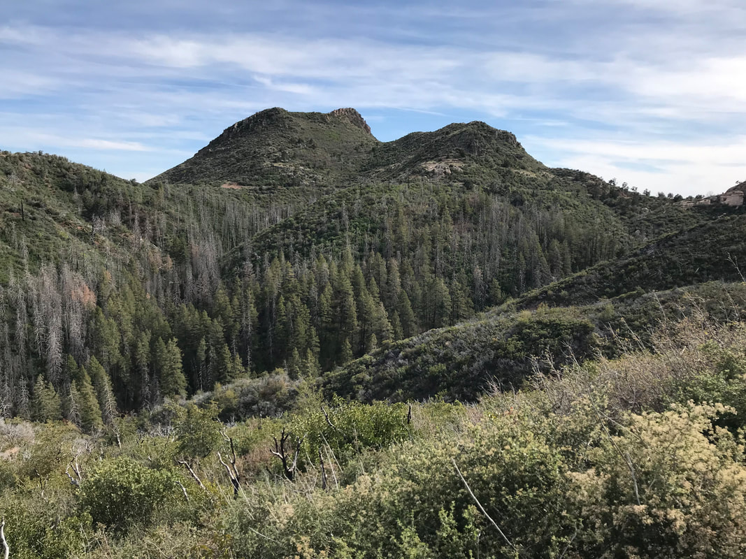
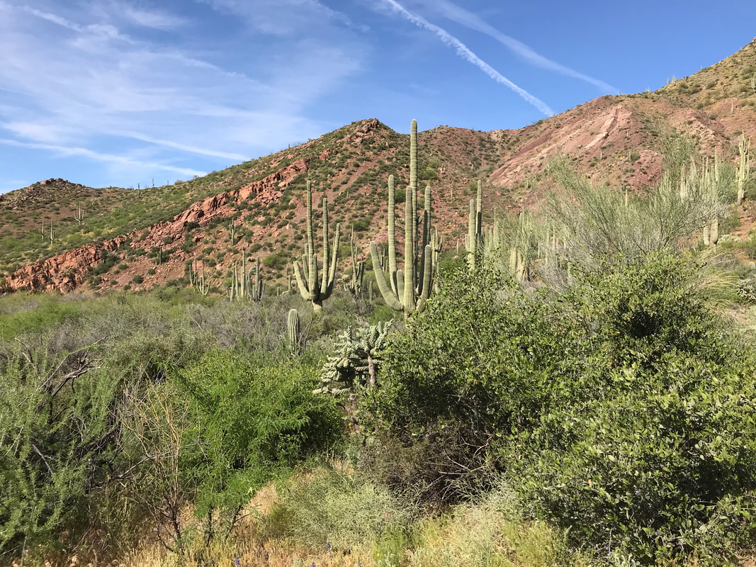
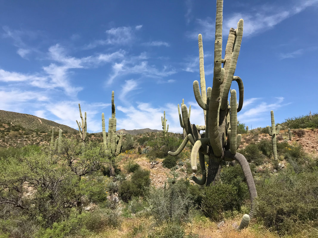
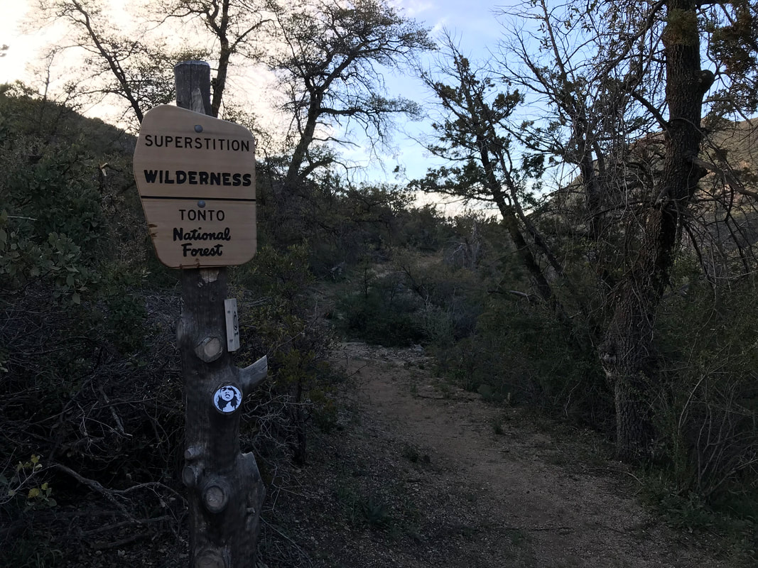
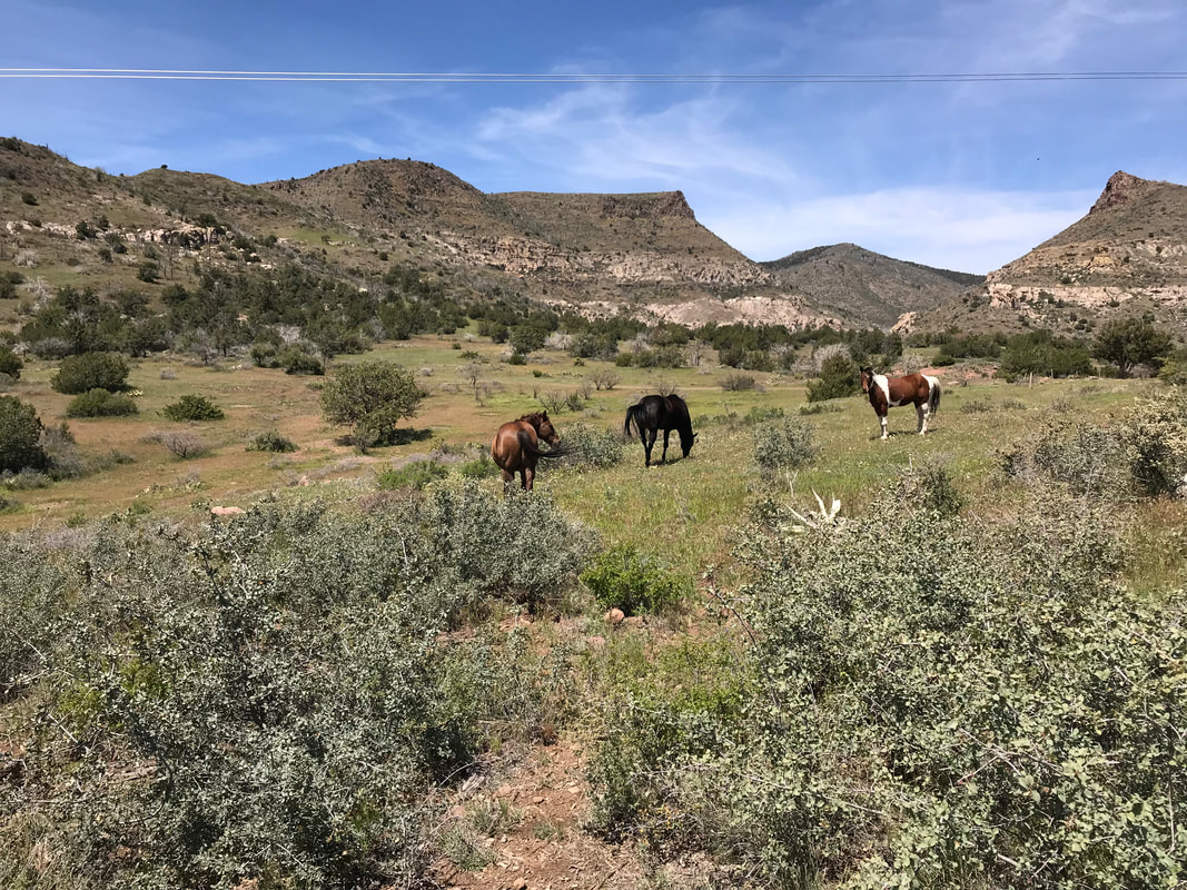   The Mazatzals, or Mazzies (or Mad-as-Hells), are singularly notorious for being the most overgrown, hardest to navigate, very remote, rugged, and hardest section of the entire AZT. The mountains there have experienced multiple burns, the land is almost never flat, the trail is VERY rocky, and frequent manzanita covers the trail requiring scraping and bushwhacking. The range hit its highest point at nearly 8,000 feet at Mazatzal Peak. It was an intimidating section in our minds, but also one we were looking forward to. A couple of years ago we did a winter hike up Barnhardt Trail from Highway 87 to a frozen waterfall. It made our appetites grin to see more. As well, I knew this to be the last of low/hot country. Once we reached the end in Pine, we would enter Arizona’s high country. Grass grew alongside the trail gorgeous and green. The smattering of houses around Sunflower fell away as the trail because overgrown with grass. It was front easily discernible to one needing close attention. We began picking our path by looking for the telltale sing of footsteps in vegetation. Then, it rolled out into muddy and rocky doubletrack. Peaks and unconformities rose in the distance and hillsides bled red rock. We passed by a muddy cattle hole while humidity shot up. The AZT crested a grassy knoll and a herd of wild horses stood before us. They brazenly refused to step aside of the trail and somewhat bristled at our approach, so we gave them a wide berth. We passed the horses, the AZT joined and left a dirt track, it crossed a flowing creek, and turned abruptly up the canyon bearing the creek. With that, we firmly hiked up the foothills of the Mazatzals. The heat cooked up as the day progressed. All that food we ate was fuel running through me. Janna and I moved with speed and strength. A weathered sign welcomed us to the Mazatzal Wilderness. From there, the Mazzies revealed their steep and vertical structure. The trail would skirt up the sides of streams, gaining elevation steadily higher and higher. Unlike other mountain ranges encountered on the AZT which featured large climbs and rounded roofs with broad valleys and meadows, I would describe the Mazzies as sharply rising and falling slabs of mountain that meet in narrow “V” valleys. The walls of opposing flanks are begin and end sharply with elevation - there is no flat, no valley bottom. They are straight rockwall to creekbed to rockwall. This new topography made the Arizona Trail shoot straight up and down climbs. In addition, a massive fire that passed through here over a decade ago had removed much of the large ponderosa pines that would have provided cover from the Sun. The trail itself seemed made of straight-up flaked rock shards. As the day went on, the trail seemed to only get steeper, forcing me to descend sideways in some areas. Here and there, pockets of untouched pine behemoths beckoned shelter in narrow valleys. The trail would leave the manzanita chaparral to plunge into the evergreens. Many gorgeous campsites with supple streams drifted nearby. A few abandoned mine shafts sat trailside. For all of its sharp and rocky harshness, it was exhilarating to be in this legendary range. It also seemed little used, but promised many side backpacking trips from a maze of trails splitting from the AZT.
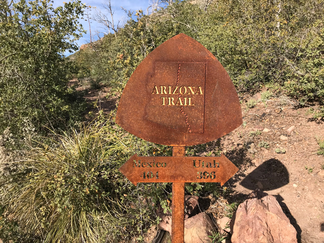
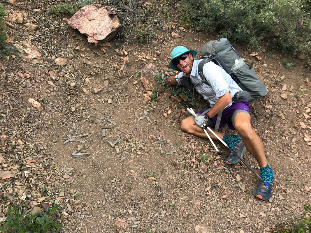
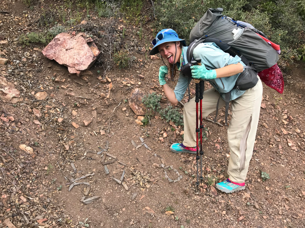
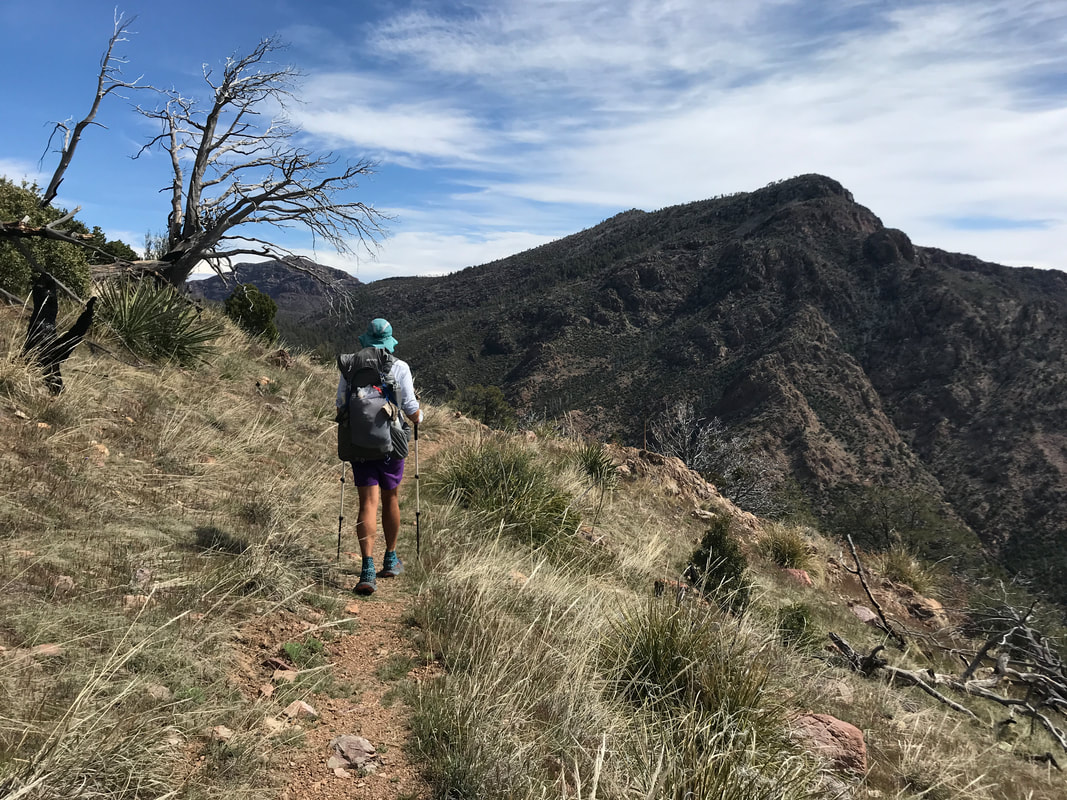
    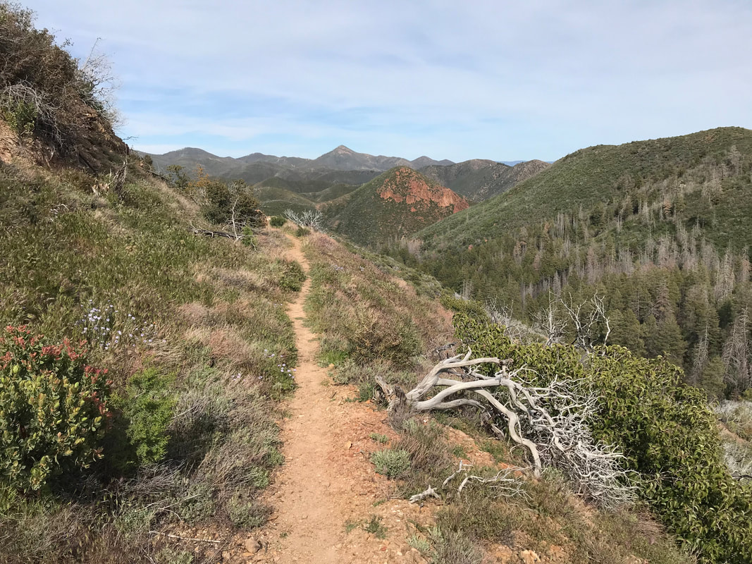 At one point, the AZT climbed a ridge and then cut along a contour line, staying even and steady. We took the opportunity to peer at the distant peaks. It was truly a place of solitude. As late afternoon approached, we officially hit the halfway point of the entire trail, spelled out in rock shards on the shattered ground: 400 Miles, ½ Way. That felt like an accomplishment –> having hike ½ the trail. But dusk in the narrow-valleys made the night only come on faster. The sun drifted behind a tall ridge and shadows cast coldness as chilled air sank. We picked up the pace, sweating profusely from the frequent up and downs. Literally walking up washes in places. I wanted to make sure we had a place to camp out of the wind as it was rushing down the valleys in places. About a quarter mile before Thicket Spring, we found a flatish spot, literally just big enough to pitch our Triplex trailside. The topographic maps and Guthook comments revealed little to no camping off trail as everything was vertical walls. Tonight, we would camp with the trail forming an edge with our shelter walls. We tried to clear the ground of the sharpest of rock shards before setting up. As cold descended, we climbed into the Triplex, feeling truly isolated out in this range. The calls of lesser nighthawks on a high cliff filled the night. Darkness was solitude.
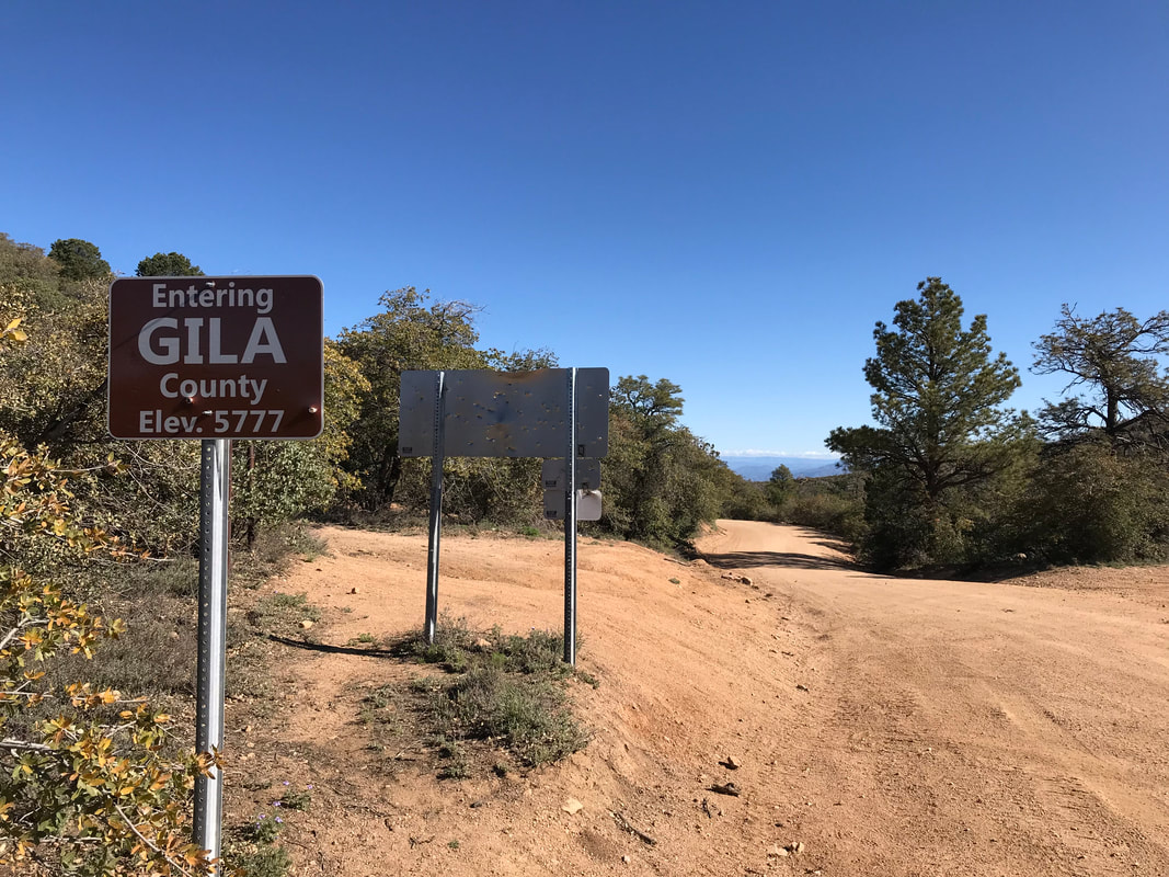
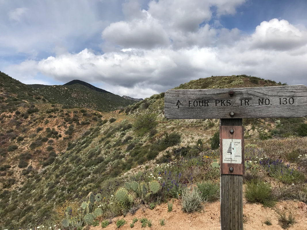
 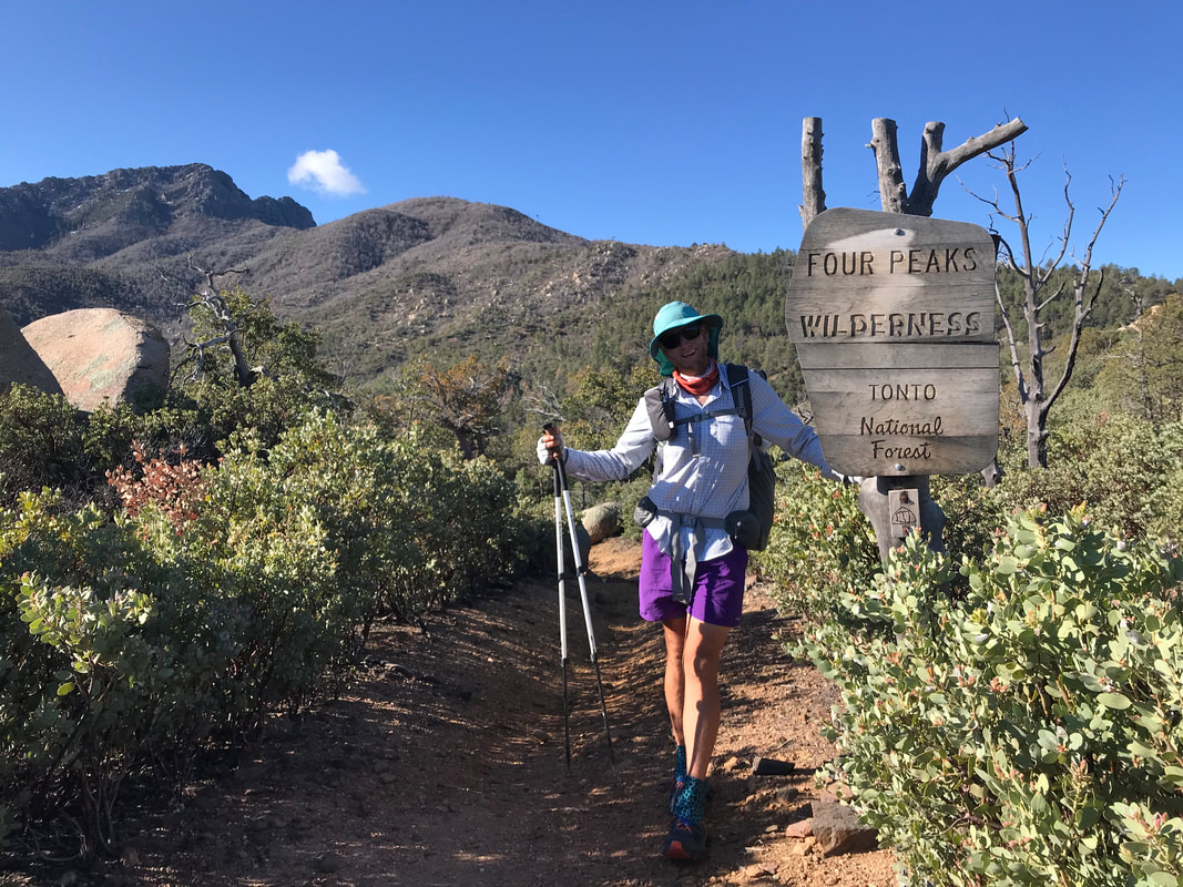 The pattern repeats. All ascents one day. All descents this day. I woke up very grateful for the awesome campsite we had last night. We were dry, sheltered from the wind and rain. Today looked clear weather-wise, but the morning was ridiculously cold. We got up, scraped a layer of frosted ice off our tent, and got moving for warmth. We crossed over Shake Spring and got that frigid water on the toes to help us move along. The trail swept in and out of valleys and we passed many backpackers in various campsites the closer we got to Four Peaks Road. With that, we stumbled past a beautiful site onto the road. That road. I hadn’t been up here in several years - the last time with Reed when we summited. We were up on Four Peaks! Feeling pumped, the AZT followed the road. On either side, we could glimpse far off views of either Roosevelt Lake to the east or the Fountain Hills and the Phoenix metropolitan area to our west. It seemed so crazy to see our city and yet be so very far from it. Eventually, the road split with a spur leading all the way back down to Roosevelt. We took the high fork, left Maricopa Country, and officially entered Gila County. Now, the morning was looking beautiful. With that, we exited the Four Peaks Wilderness and took a picture to commemorate having walked up here. Many AZTers would complain about road walks. They hated walking on forest roads, saw it as drudgery, or perhaps hard on their feet. Maybe it’s the significant gravel grinding we do, or the fact that Arizona is covered in literally thousands of miles of dirt roads, but Janna and I LOVED it. We relished the change in walking terrain, having gone from rocky singletrack to smooth dirt. The road kept high, undulating over small rises. Low clouds passed quickly overhead. After a couple of hours, we turned to see a ball of cloud building into the upper atmosphere over the Four Peaks. Rain - the ever present afternoon threat at elevation. The forest road sauntered through large exposed sections with rocky outcrops reminiscent of Joshua Tree, fell across shallow round valleys with good camping, and then snaked through a large forest of ponderosa pine. A few ATVs and trucks passed us - people out enjoying the weather and views. 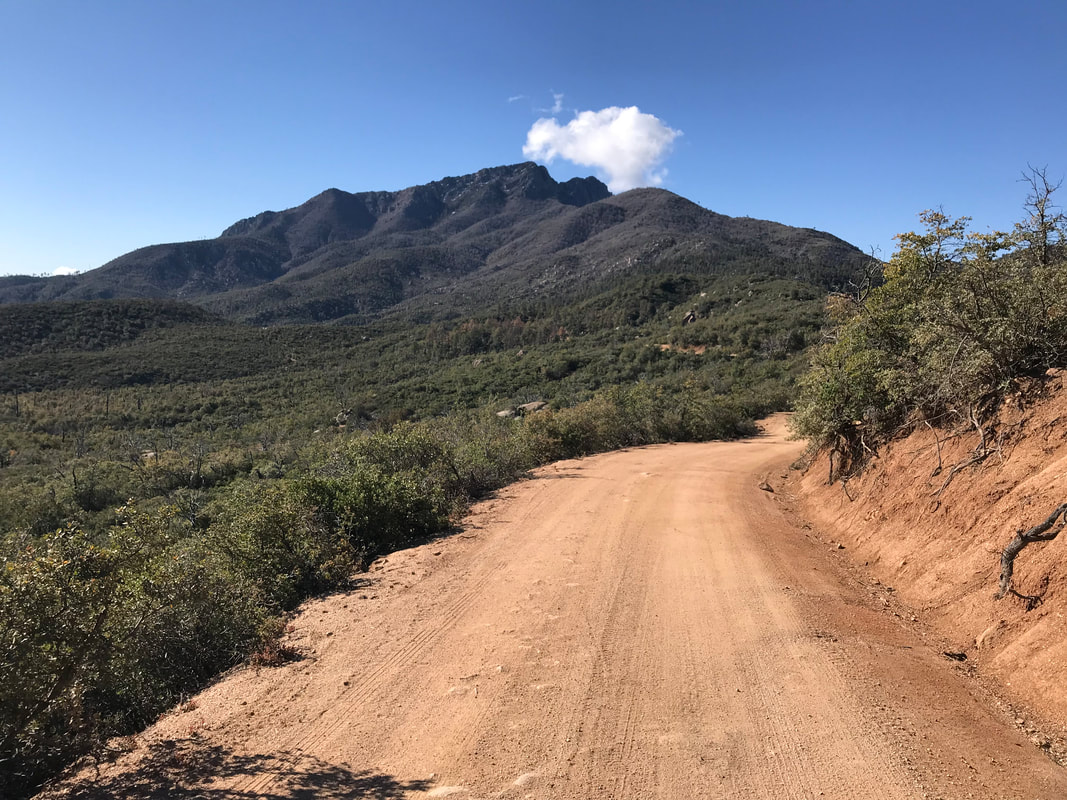
 Clouds come rolling overhead, fast, thick, and low. Blue sky and cloud. The sense of rain. We walked through a ponderosa pine forest for a while before the road made a broad turn and descended. With that, the ridge became a flank and the flank let us see out into the Tonto National Forest again. The hulking mass of Mt. Ord stood before us. We walked down the road, enjoying the shade now as the day heated up. I was sweating profusely, and then suddenly, was in pain. Now here is my disclaimer. If you’re going to read this, you get to read the whole truth about backpacking. That includes the unfortunate things that happen to your body when you’re moving it great distances. Things rub. Blisters happen. And in this case, I got a massively terrible case of butt chafe. Literally, like Satan was rubbing his hot fingers across the tender insides of my cheeks. I had been ignoring it all morning, but now the pain came screaming up my ass. I stopped. “Janna, I can’t walk. Oh my god. My butthole is itchy and BURNING.” Janna, my lovely wife, calmly put up with everything that followed. I dropped my pants in the middle of the road and she looked. “Don’t panic Forrest, but there is blood.” IMMEDIATE PANIC ENSUED. My mind raced to the most logical (at the time) of possibilities. Anal fissures. Why anal fissures? For no other reason than that episode of The Office where Dwight reads off people’s healthcare issues, only to say anal fissures is fake before Kevin says he has them - Dwight’s embarrassment ensues. I am Kevin. I have anal fissures. The whole time I’m freaking out, Janna is like: YOU DO NOT HAVE ANAL FISSURES. I pull out my cell phone and find 1 bar of reception. I immediately Google Image “anal fissures.” Only one photo loads…of a diagram…that plays havoc in my mind. Meanwhile, Janna is like: YOU DO NOT HAVE ANAL FISSURES. I shuffle down the road a bit more. More images load. Dude…insane. And clearly, based on these photos, I do not have anal fissures. Instead, I have a terrible case of salt causing friction causing raw skin and severe butt chafe. I thoroughly wash and rinse the area, let it dry, and apply some balm to keep the friction down. We descend further down and exit the ponderosa woods back into the desert. The high thornscrub-shrub interface forms around us. At a switchback in the road, we stop for a break, and for me to expose my butt for some air and drying. Janna called Kristin to check-in on our resupply for tomorrow in Sunflower. Kristin is tremendous teacher at Janna’s school who has agreed to come out and meet us along Highway 87 to bring us a resupply of food. As Janna’s talking on the tenuous reception, I ask her to ask Kristin, with complete humility with no questions asked, to bring (1) a bottle of Desitin/diaper rash cream, (2) a tube of Preparation H, and (3) baby wipes. I am FOREVER indebted to Kristin for literally bringing the creams of the gods. Honestly, and I mean honestly, the pain was so bad, that I thought it likely that I might need to quit the trail. The diaper rash cream and hemorrhoid cream I would receive tomorrow would be my elixirs until the end of the trail.
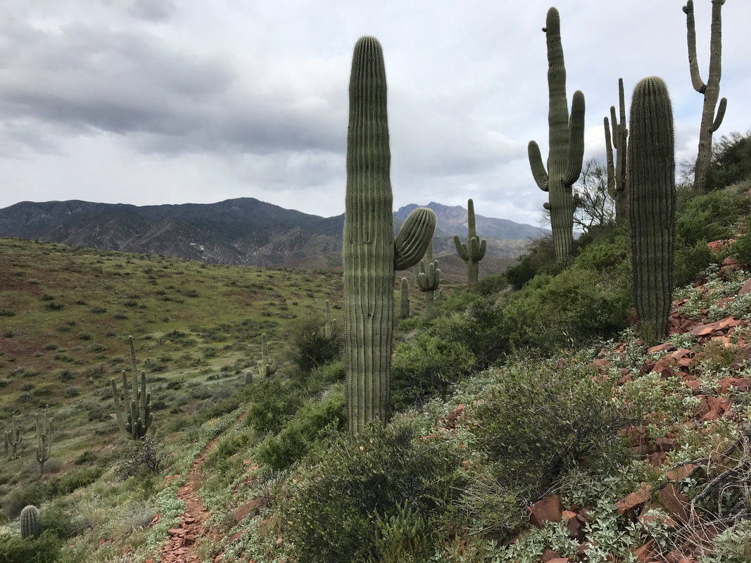
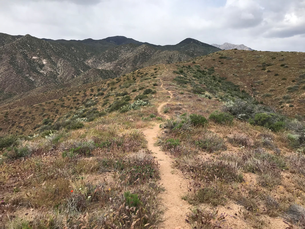
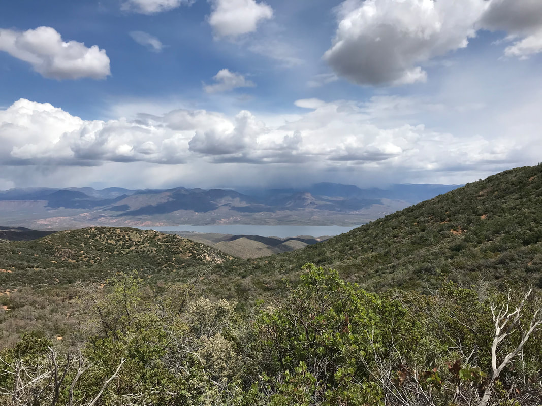
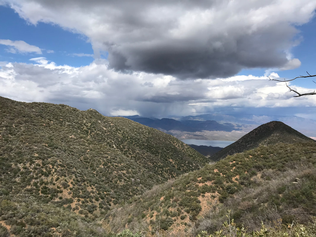
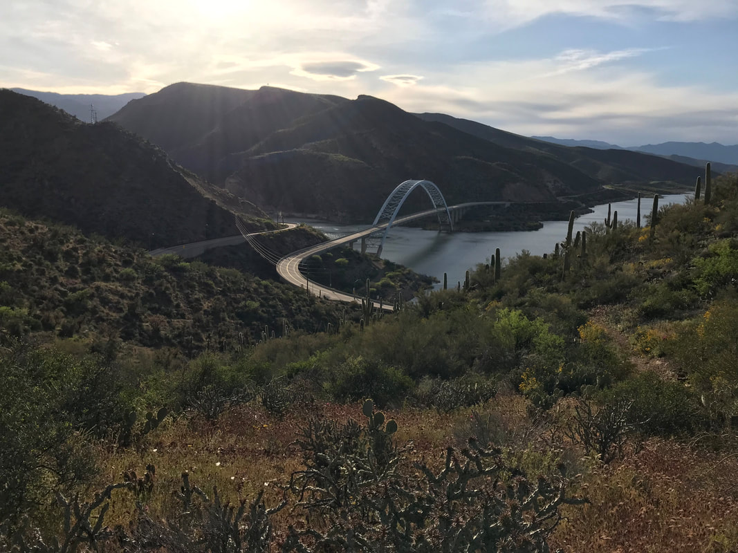
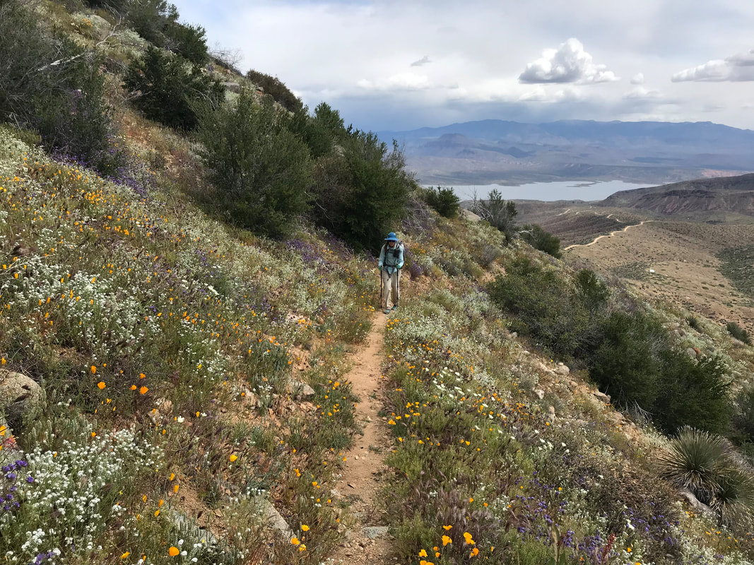
   Mid-day (and slowly now that my butt chafe has led to delicate walking and a careful pace), the AZT split from the forest road and led down into the desert. Switchbacks in the sun and lizards everywhere. The Arizona Trail eventually met a tributary of Sycamore Creek. Water flowed clear and cold through a rocky riparian zone. We stopped several times to rest, soak our feet in the cold water, and KEEP MY BUTT DRY AND CLEAN. Our pace was leisurely as we were close to our stop and we had a preplanned meetup tomorrow. High grasses spread over the land as the sun slanted in the sky. Janna and I were walking along, talking about that thru-hiker named Legend we had met before back in the Santa Catalinas. He had announced via Instagram and FKT.com that he was attempting to do an unsupported FKT on the Arizona Trail. This was a big deal. When we passed him going southbound on Mt. Lemmon, he was merely using a few hundred miles to warm up his legs and body before turning around at the border and heading northbound to set the FKT. I had been following his attempt via Instagram to see where he was. Based on his current pace, we laughed about running into him. With that, we heard an “Excuse me,” only to turn around and there he was! He stopped to talk to us for a minute, I caught a photo of him, and he (with slurred words of exhaustion) told us how beautiful the desert was. With that, he hiked ahead us with his tiny pack and was gone. In a few days, he would indeed set the Fastest Known Time on the Arizona Trail. Unsupported, he hiked all 800 miles from the US/Mexico border to the Utah border in 15 days, 13 hours and 10 minutes at a pace of over 50 miles a day on average. We arrived at Sycamore Creek in the early evening. It had a deep, beautiful, and large flow. More stream than creek, we hiked to a campsite up a hill nearby. There, we hunkered down for the night, looking forward to diaper rash cream, good food, and seeing friends tomorrow morning. 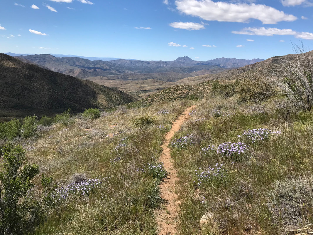   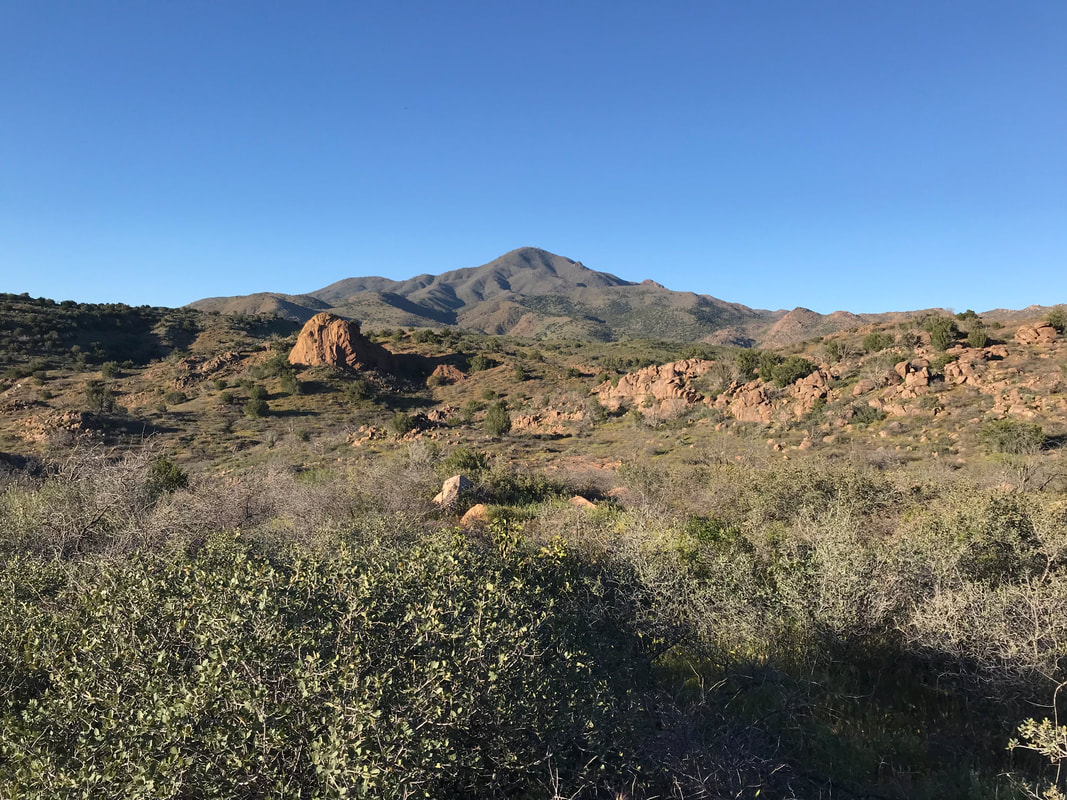 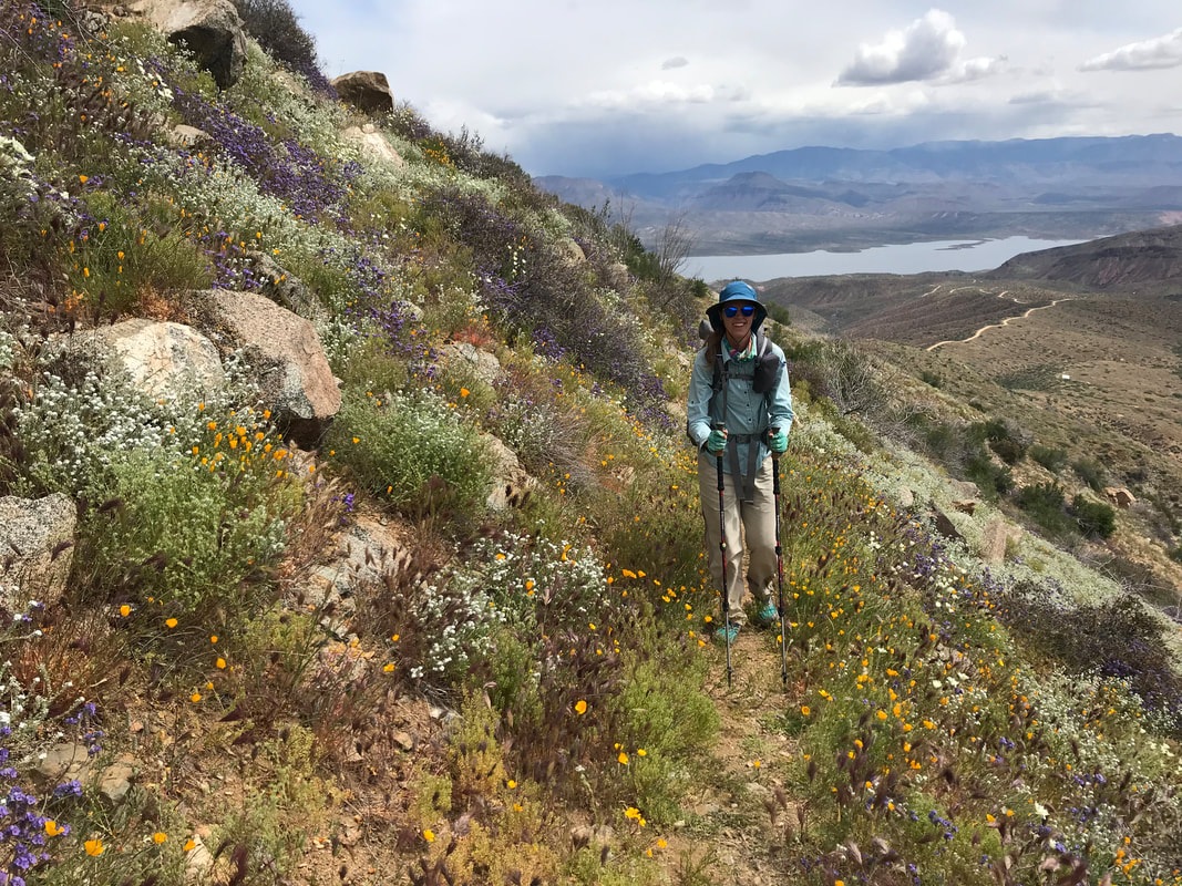 One of those gorgeous days with so many photos I had to divide the day into two posts. This is Part I. ———————————– A drizzling night led to a damp morning with overcast skies. The rest of the day would threaten complete storms, hail, and visible downpours occurring in discrete patches around us. Most of the pictures of distant scenery from today have a large downpour occurring in some frame of the photo. The temperate morning was a welcome relief to the heat of yesterday. This ensured that our nearly continuous day of solely uphill travel from the low desert would be much cooler. We started up from our campsite overlooking Roosevelt Dam. Roosevelt Reservoir and the further Sierra Ancha would serve as a backdrop for the rest of the day. We eventually hit an upper rounded mesa with a small radio tower for town. Skirting it, the four peaks rose monstrous before us - massive rakes dead ahead. The AZT became undulating, moving around the contours of hills and ducking under massive saguaro. Even here, large fields of 4 foot tall vibrant green grass swayed with the rippling wind. Behind us, the Apache Trail, a famous dirt forest road, wound into the confines of canyons quickly building around us as we ascended. The route eventually collided with Four Peaks Trail 130 and joined a different dirt road. Using recent Guthook comments, we had only carried a little water up here (to reduce the strain on the climb). We went off-route and rounded a bend to a dead end with one of those descending stair wildlife tanks. Newly built in the last few weeks, we filled up what we needed to get us high up on the peaks. The Arizona Trail now left the dirt road and went straight up a rounded ridgeline. Valleys sloped off to our lefts and rights, descending to far canyons below. Massive downpours with clearly demarcated edges erupted water from above around. We kept our eyes on those cloudbursts, expecting one to open the heavens above us. Somehow, we kept in a moving and constant gap of non-cloud/sun. The sky above us often was blue, but curtains of water threatened to hit us from even a quarter mile away. 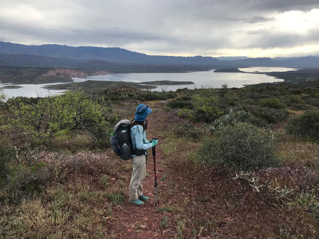 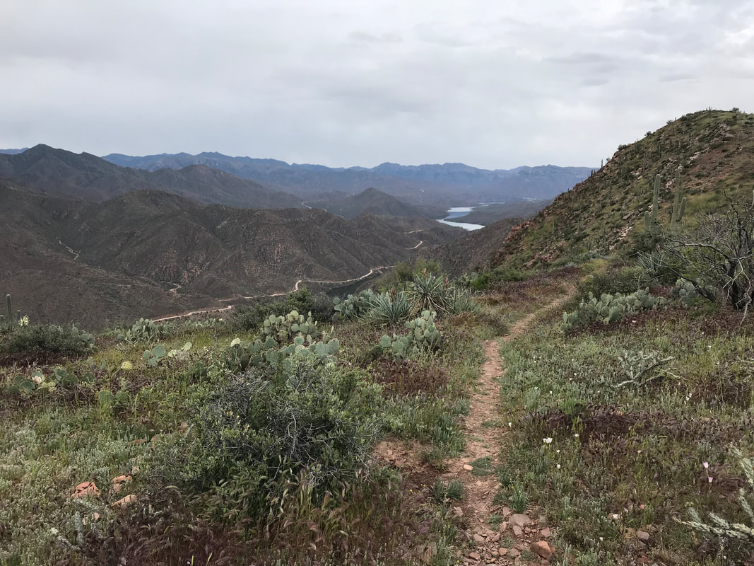 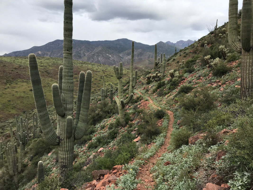 
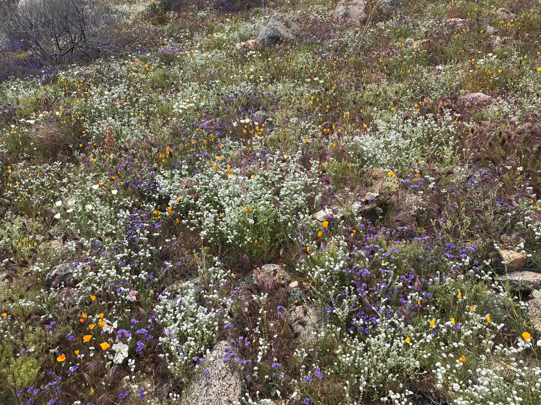
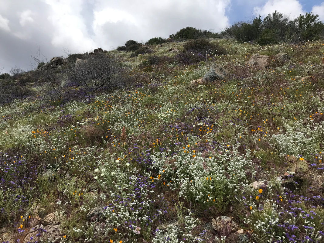
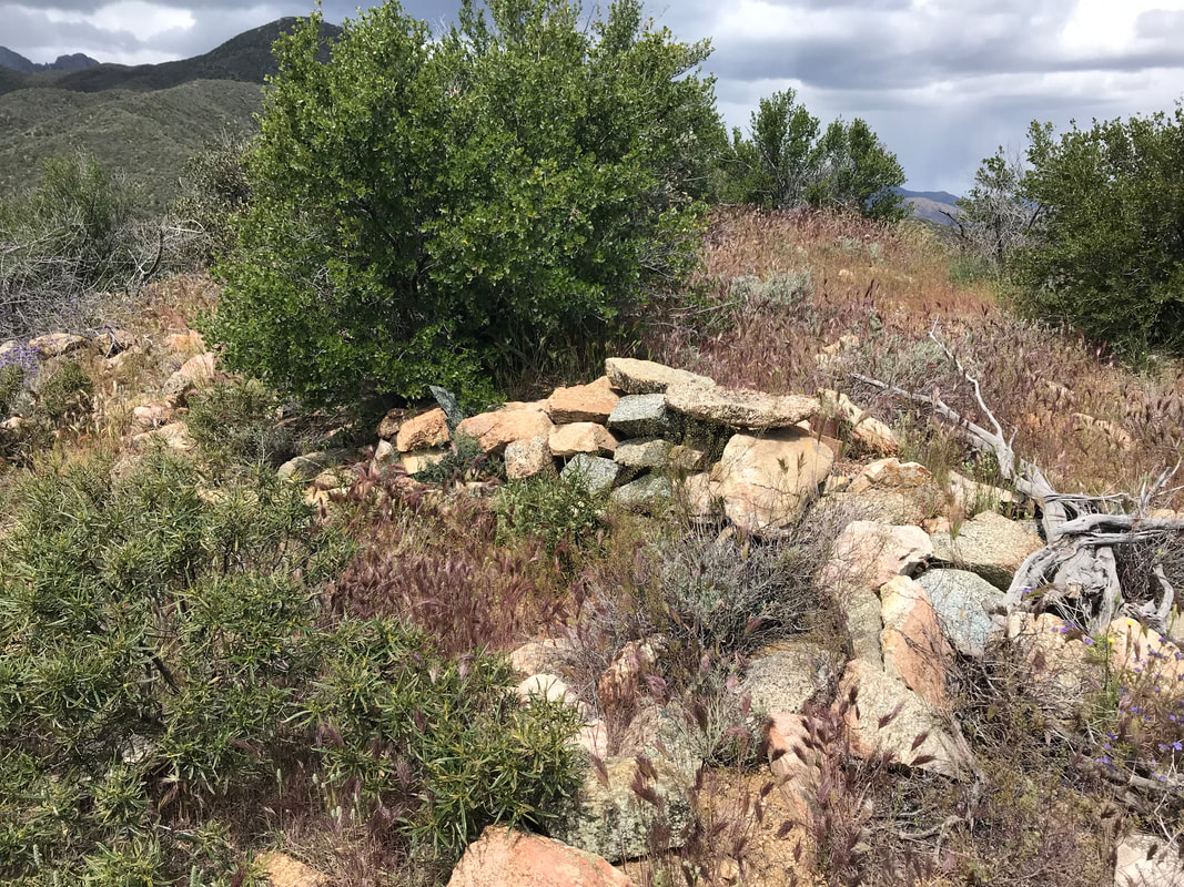
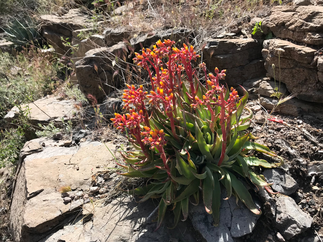
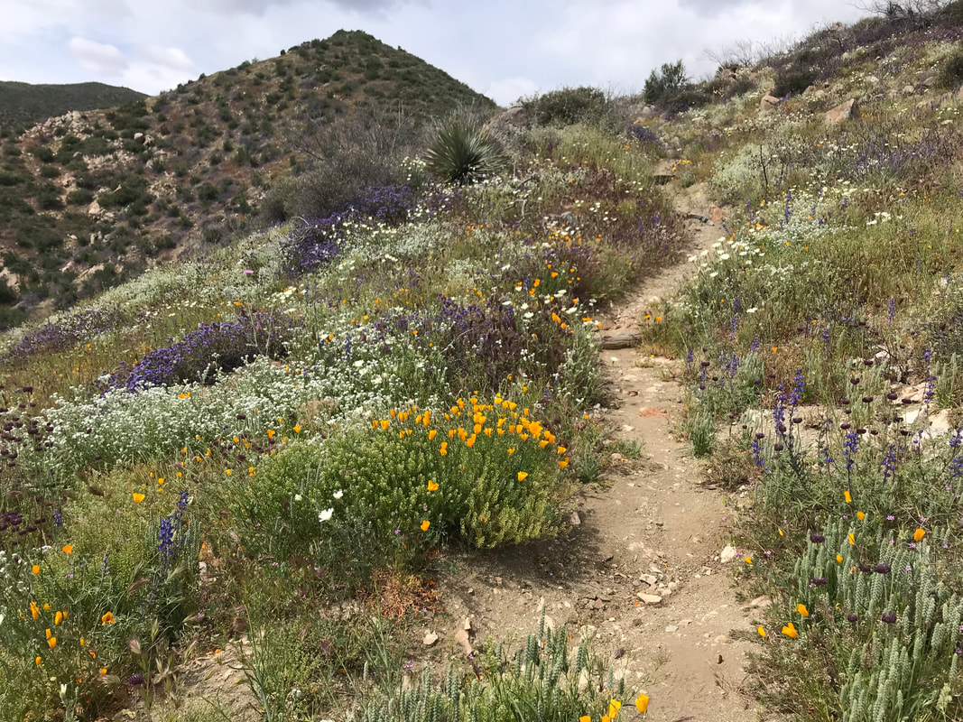
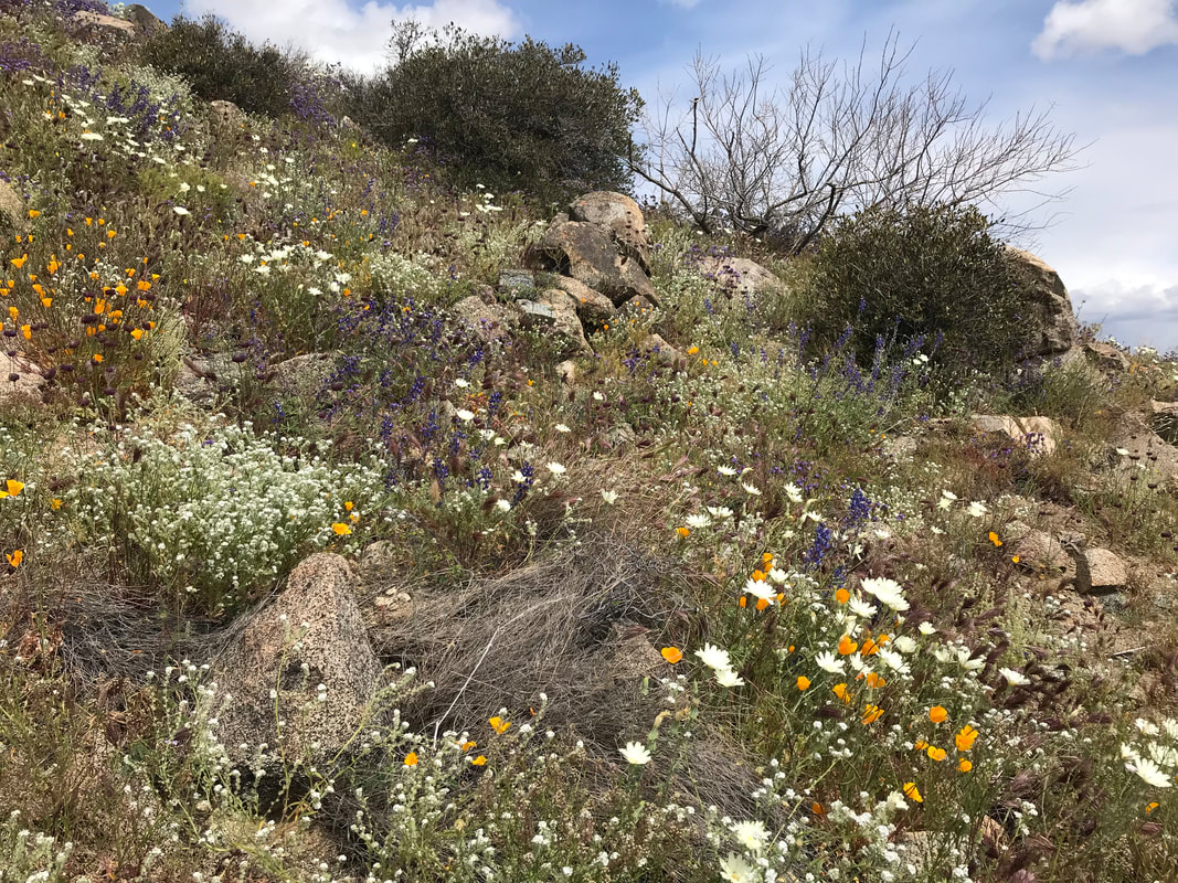
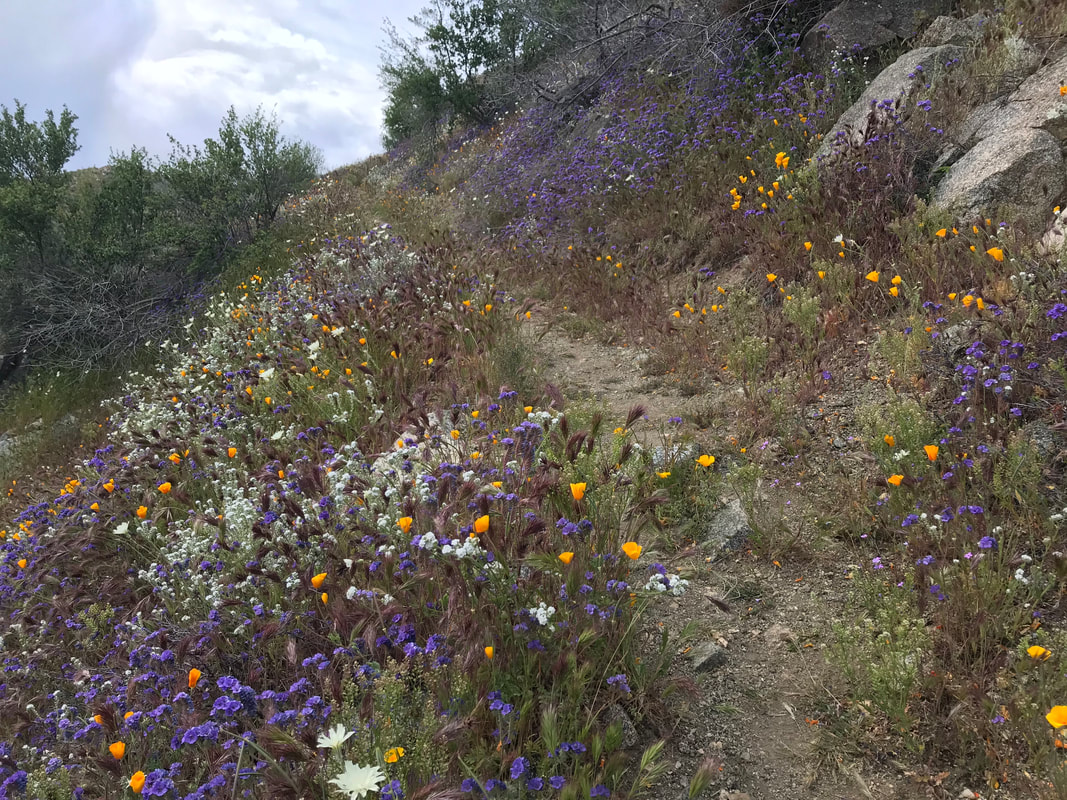
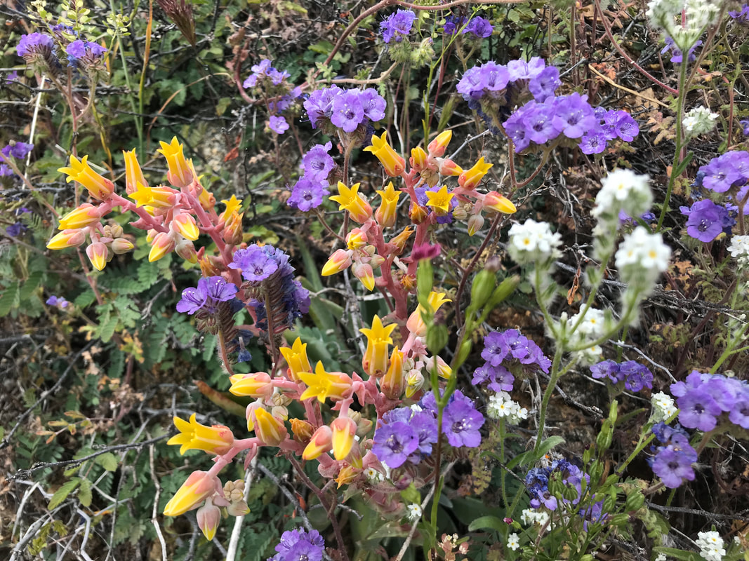
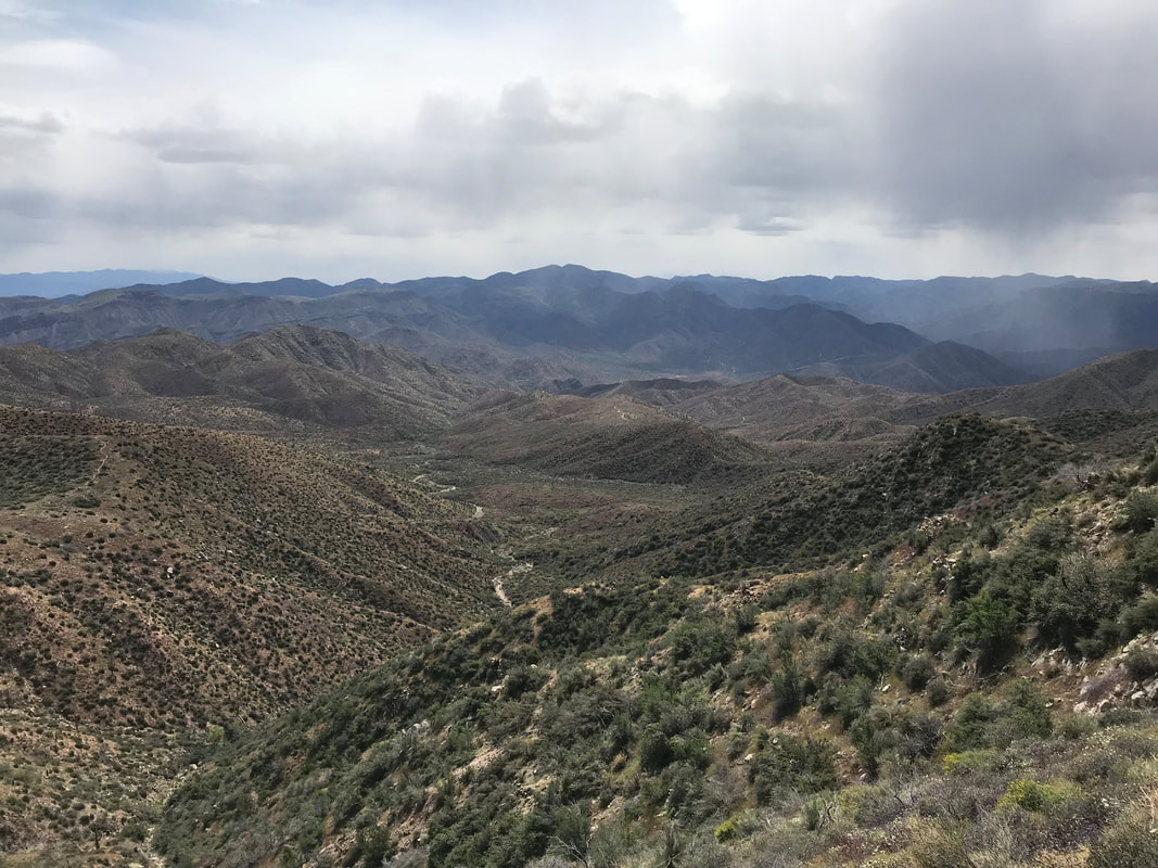 And all that rain brought out a profusion of flowers. What new species we had yet to see were busting out color on every hillside. Succulents swollen with rain put forth rare blooms. The creams, violets, and yellows blanketed hillsides dressed in green growth. Janna and I both commented that the rich, damp plant life along with the overcast day reminded us the pacific northwest. We eventually summited out at a parking lot where the Butt’s car was stationed. We had plenty of water so didn’t grab any - pushing on. Now, the real effort began in earnest as the slope steepness increased and the trail became narrow/rocky singletrack hugging the hillside. But visual sensory overload: mountains, canyons, flower blooms, cloudbursts, the blue swathe of a massive reservoir in the gold desert. After some time, based on conversation with some older locals out on a day hike, we navigated off-trail to an unmarked Native American ruin at a location not to be given. Old structures with original stacked rock walls and pottery pieces everywhere. It was affirming to see a place not pillaged by “art collectors” or “artifact hunters” - namely people taking a piece of someone else’s history as their own personal collection item or to be sold. Leave No Trace Principle 4: Leave What You Find. As the day rolled on and rain continued to roll in waves, we reached higher points in the trail where it began to fill with chaparral. The path came over a small rounded peak and descended into the thick of brush as small streams flowed nearby. We ran into Gummy Bear, a thru-hiker who had done the PCT last year. We talked to him for a bit before continuing our climb upwards. Chaparral became juniper, and juniper became pine. The trail began taking a sandy wash and passed several large and excellent campsites before beginning an outward trek around mountain on the contour line we were walking. As the trail swept around the eastward flank of the mountain, the Four Peaks dramatically came back into view. To be continued in Part 2.
  Click here to read Part 1. Rounding the eastern flank, the grizzled and scored tops of the Four Peaks came into view. Plus a massive storm hitting from the northeast. The sweep around the mountain made us realize how we were really paralleling Lake Roosevelt, almost hiking its length from afar. Jagged burnt trunks of lumbering old growth Ponderosa Pine appeared trailside, victims of prior wildfires. The AZT curved to our left into a massive inward valley. I was more stoked than anything to be so up near the Four Peaks. I knew we would get near them, but not nearly right below their exposed granite summits. We turned back to look at where we had come only to see a swirl of rain and light indicate a storm chasing our direction. We put a move on as the AZT finally entered unbroken ponderosa pines. My knees at this point were feeling pretty cooked. We had thousands of feet of elevation gain and our current elevation put us well over 6,000 feet. Janna wasn’t feeling well and went trailside to deal with her stomach. I sat down and for the first time that day, the chill of the wind and sputtering rain hit me. The constant upward exertion, elevation, and cold temperatures suddenly made me completely bonk. Had I been eating enough? Damn. I was so set on motion and making pace with the storms that I had dipped low with my food consumption. I hustled out some Cliff Builder Bars. Janna rejoined me, feeling much better, and now I was the one feeling terrible. We continued on, dipping into a wash and meeting a trail intersection where we stopped next to a sign. At this point, we both took a long rest and looked at the scattered pottery shards. We refilled water, put on some layers, and prepared to exit the pines as we came through the inner curve of the valley and shot right back out along a new flank of the eastern mountainside. The trail was marked as a straight rip into the slanted slab of land. It was almost dizzying to look at. Right above us, the hulking masses of the Four Peaks stood. 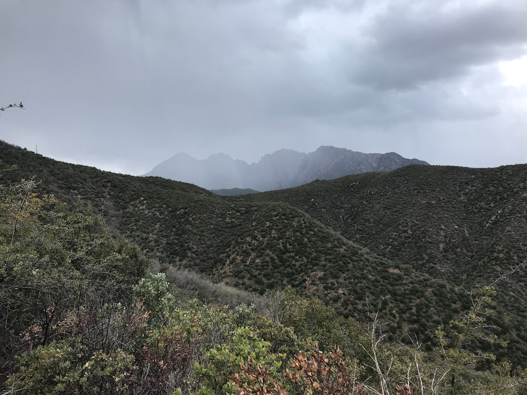 
We moved on as late afternoon/early evening approached. The trees immediately disappeared as we were on the south-facing slope of the eastern flank. The wind hit us, chilling us greatly. We reached the outer edge and found it switchbacking down an INSANELY cornered, steep, and chunky descent; we each went one of the time so that if one fell, the other would not get knocked off the mountain. We stopped again when we could plainly see the Mogollon Rim rising up in the northern distance. It was like a massive sentinel of wall delineating the lower half the state from the northern. Before it stood the rugged and jagged land of the Tonto. Once we ascended it in a few days time, we would be in the high elevation thick forests of northern Arizona. I took some photos of alien-looking succulents sprouting blooms from granite before moving on. As evening approached, we now came around the flank and were suddenly on the north side of the Four Peaks. The north-face of one held chunks of snow and ice still. We walked through burnt logs and standing pines until the sound of a rushing steam caught our ears. We arrived at Shake Spring which was more waterfall and smashing rapids than a spring. Up the hill, we found a series of awesome campsites shielded from the elements by a thick grove of pines and chaparral in the understory, plus some good logs to sit on. We made sure to set our Ursacks well as the northern portions of the Four Peaks contain the largest populations of black bears in the entire southwestern United States. The cold came dramatically and we could see campfire smoke in the distance, someone up near the pass where Four Peaks road is. We climbed into our Triplex not a moment too soon before sleet came down on us, dropping the temperatures. I always sleep well in these conditions though: the sound of a nearby stream, raining pelting my shelter. I always get snuggy and pass out, a feeling of safety from the elements. 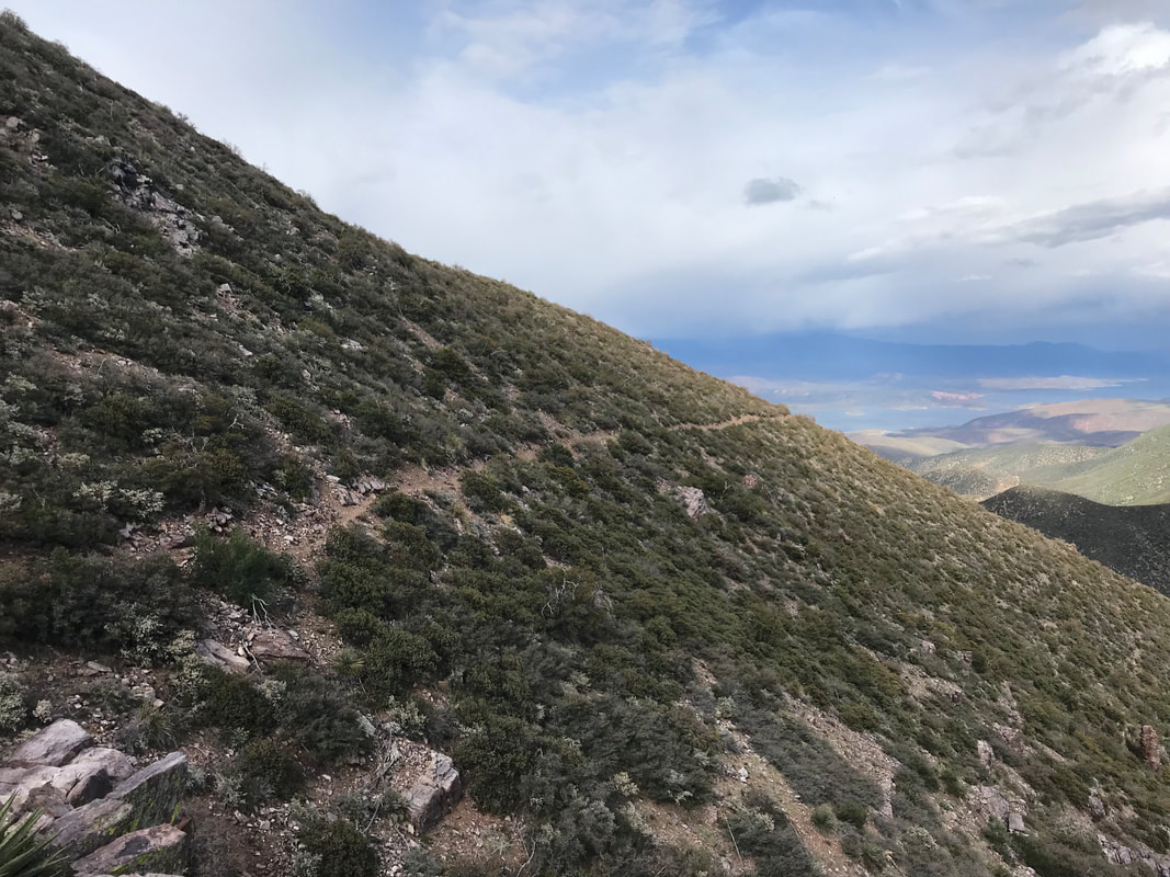  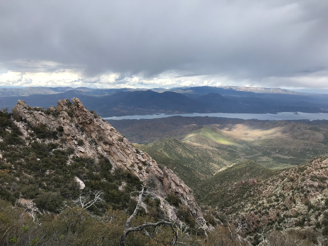 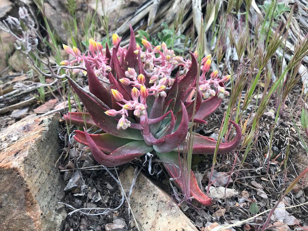 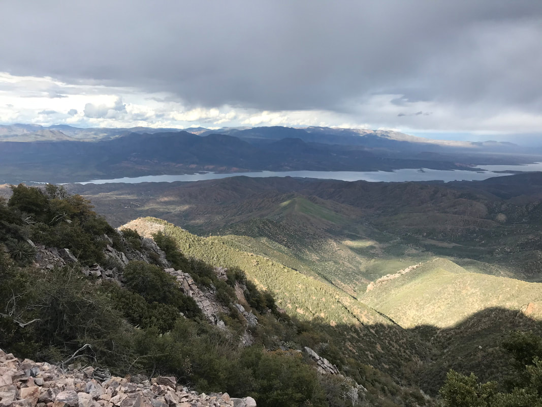 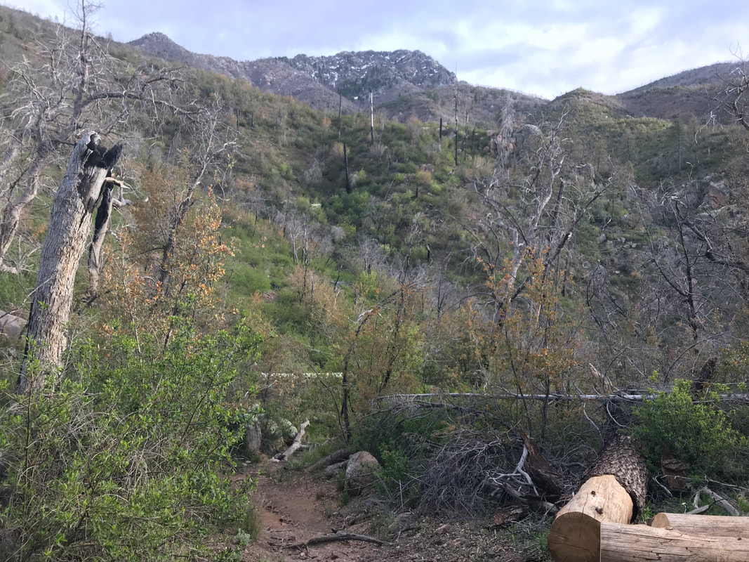 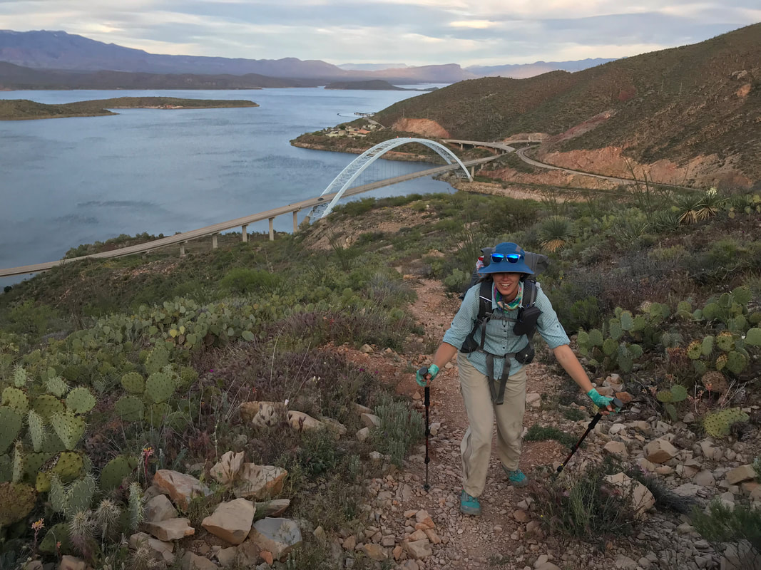 I slept excellent last night due to the well-protected spot. The wind barely made it into the trees where we camped and it was nice and silent. Two days back on and my trail legs are back. We packed up, headed out, rounded a corner, went up a small climb back the ridge again and were afforded awesome views of the descending ranges leading to Roosevelt, a 10 mile and 3000 ft. loss section. Bluebird skies ranged overhead while every plant seemed more vibrant from the sputtering rain. Looking back at where we had walked yesterday, the Superstitions seemed just as rough and rugged. After a few miles, the AZT left the Superstition Wilderness and joined a double track road. Curving round and down, it came to a small hill with a single tree. There was an old plywood bench, empty cattle trough, but some decent campsites had wind not been bad. There was also a large rock sitting on a notebook in a plastic bag. We opened it up to find a trail register from an individual assigned as Section Leader for this part of the AZT. He was looking for feedback from AZTers for blowdowns, crumbling trail, etc. that needed dealt with. Unanimously, all previous AZTers said the Super V was ridiculous, encouraging rampant erosion, and could be remedied with switchbacks or simply a trail that kept to the contour line and circled the valley. The Section Leader wrote a big response to everyone that the USFS, due to the Wilderness Designation, refused to further impact that portion of the ecosystem to move or reroute the trail. We replaced the notebook and continued down a wide dirt road that went by a muddy cow tank. We still had some water so we opted to skip the refill. And just when I thought my mind could relax from snakes, I inadvertently stepped right next to a big western diamondback curled up on the road in the sun, which rattled as I jumped. The AZT led off the forest road and continued down into some thick/overgrown singletrack that weaved in and out of a boulder-strewn sandy wash. Our progress slowed massively. It seemed that game trails split with the AZT here and there; it was not clear which was the true trail. In an urge to avoid the slow slog in the sand, I walked up a hill through some beautiful desert lupine but eventually got caught in a bunch of acacia trees. I retraced my steps, pulled out my maps, and saw that the AZT basically stuck to the wash. Sand it is. We continued down through a increasingly warm canyon as the sun rose further in the sky. Around noon, we arrived at a beautiful spring/seep that filled the wash below with water. Ferns, moss, and water plants grew along the flow while shade was given by unbudded sycamore overhead. We drank some cold and clear water before passing through a burn area. The AZT wound up and over the massive fallen trunks of old cottonwoods and sycamores as the water-fed wash expanded into a true riparian strip.   
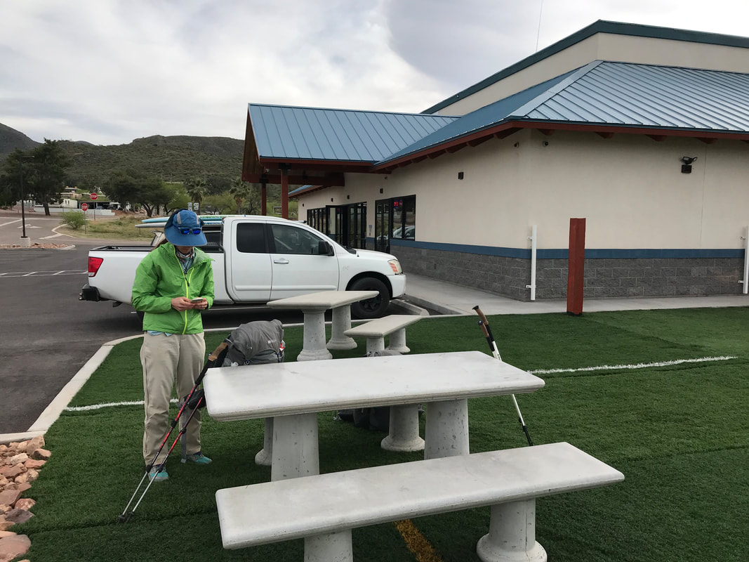
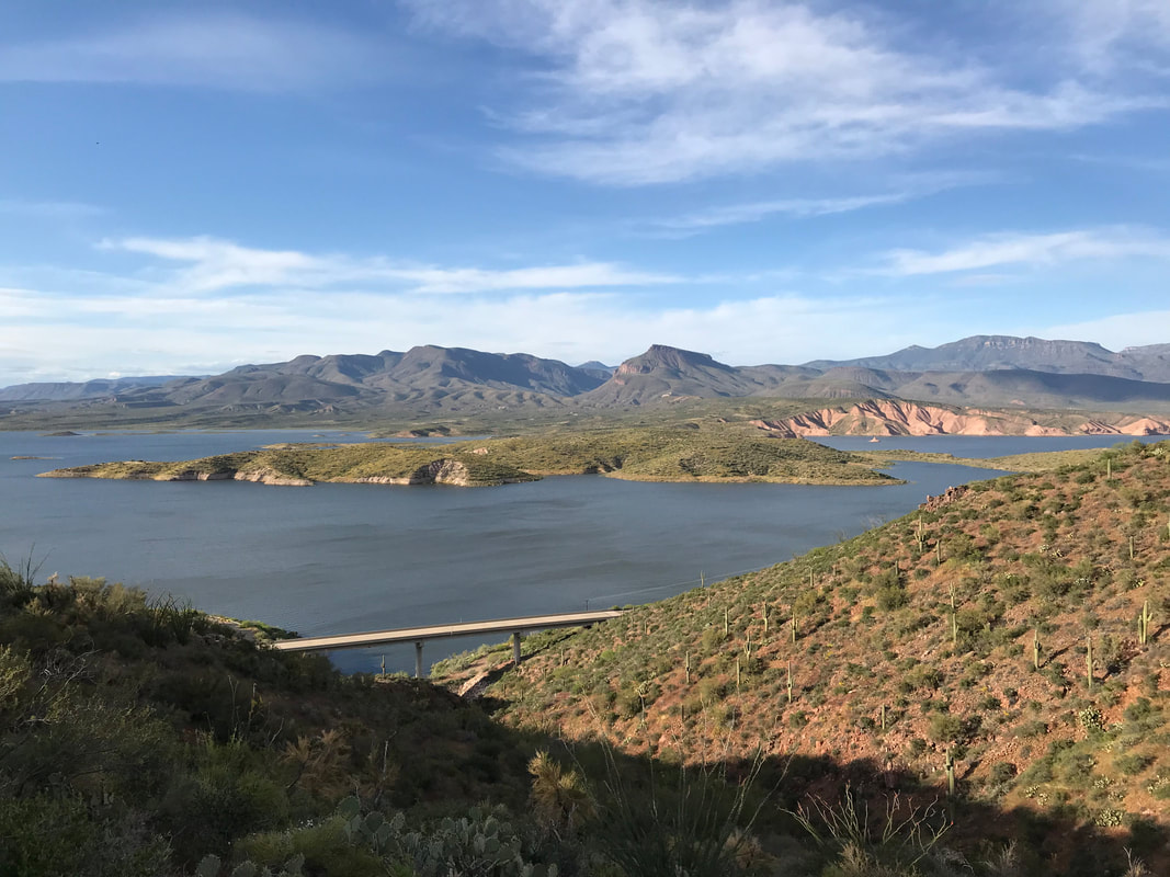
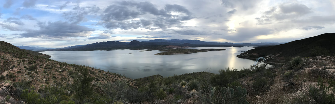
 And then the AZT dumped out again onto another dirt forest road. It continued to descend past two algae-growing metal cattle tanks (we had enough water) and bobbed up and down a series of hills. Nearing town, the massive spread of Roosevelt Lake loomed. Roosevelt Lake is one of the biggest reservoirs in Arizona, a result of early 20th century damming of the Salt River by the Roosevelt Dam. At one point, the dam was the largest in the country until the Hoover Dam replaced it. The resulting flood filled up this large Sonoran valley and sprouted several small towns along its massive length. Boating is now a main recreational attraction, in addition to fishing and the Tonto National Monument cliff dwelling ruins. Descent also brought higher temperatures. As early afternoon came, we came down a ridge and the mobile home park and factory homes of Roosevelt came into view along the edge of the lake. The true AZT continued to the north but we took a spur trail through an old cemetery, crossed the highway, and ended up at the Lake Roosevelt Marina and General Store. We had sent a resupply box here with food all the way through Sunflower as we heard the food choices were slim inside. At a picnic table sat the senior couple we had been trailing for days. And we finally got to talk to them. Their names were No Butt and Yeah But. They were 80 years old and doing the entire Arizona Trail again for the fourth time. They were incredibly fit and I would have thought 60s for age. I WAS FREAKING INSPIRED. This was an 80-year old couple through hiking this remote desert trail for a fourth time…and kicking our asses with their speed. They had done many of the big long-distance trails but lived in Arizona, and had a particular love for the AZT. They had even done a third thru-hike last year. But when they realized the epic El Nino winter rains would mean a stellar water and flower bloom year, they decided to come out and do the whole thing again this year. They had also completed the AZT back before it was even finished! This was a lesson I learned: Moving water don’t freeze. At any age can a person do an epic hike. The Butts had parked their main resupply at a car another day’s journey out, so they said their goodbyes and let us know they’d leave some water for us there. Janna and I got a text from Chris, who we hadn’t seen since Oracle. He said that he had quit the trail the when heading up Montana Mountain. He suffered from bad plantar fasciitis and needed some long rest. I was saddened to hear this as we hoped to catch up to him again. We headed into the store, buying microwave pizzas and ice cream. Taking advantage of trash cans to dump refuse, we then headed over to the ranger station at the lake to charge electronics and clean up in the bathrooms. I took a tour of the inside museum, reading about the history of the lake and area. We relaxed there for several hours. Electronics charged, clouds had begun to move in with late afternoon, bringing a cool breeze that chased away the heat of the day. We went back over to the store and caught one more round of ice cream and food before it closed. A few other thru-hikers we met said to avoid hiking the AZT out of town and just take the highway shoulder instead. Janna and I both knew this would kill my soul so we went back up to the AZT through the cemetery and did the true route. To quote Janna: “We didn’t come here to do easy.” 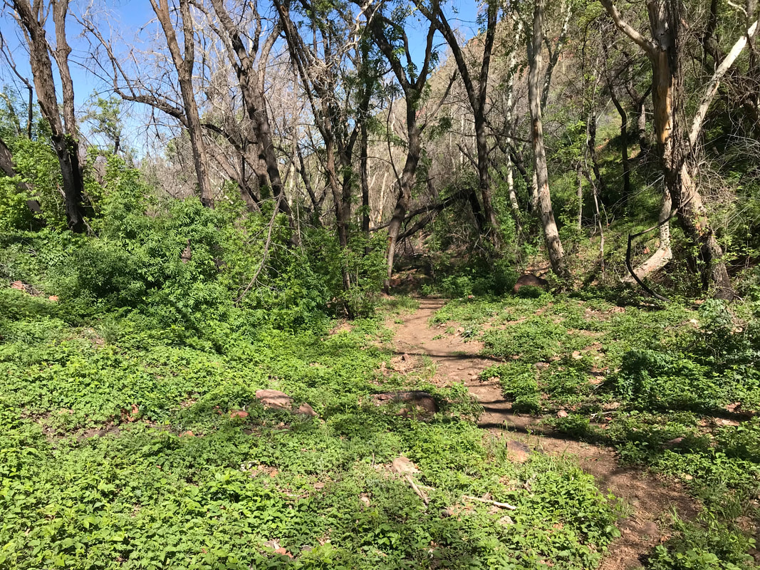
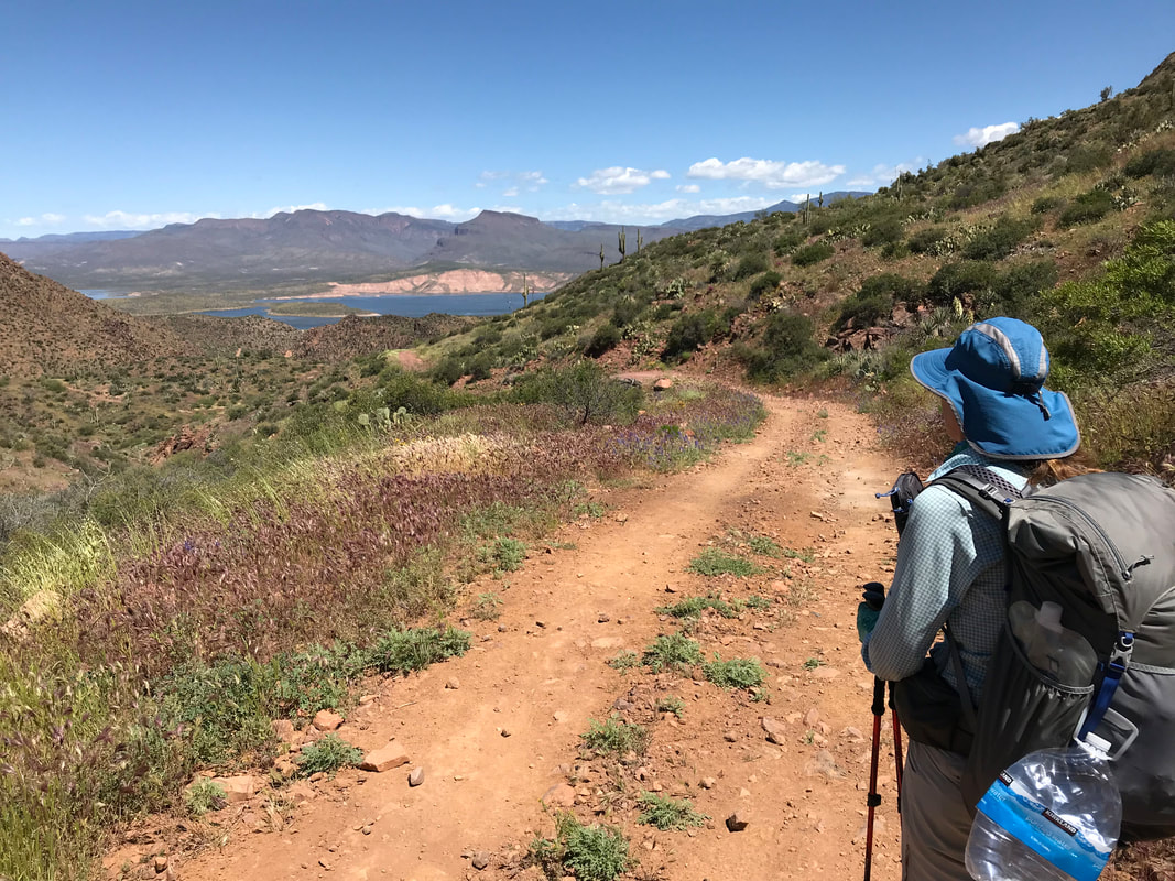
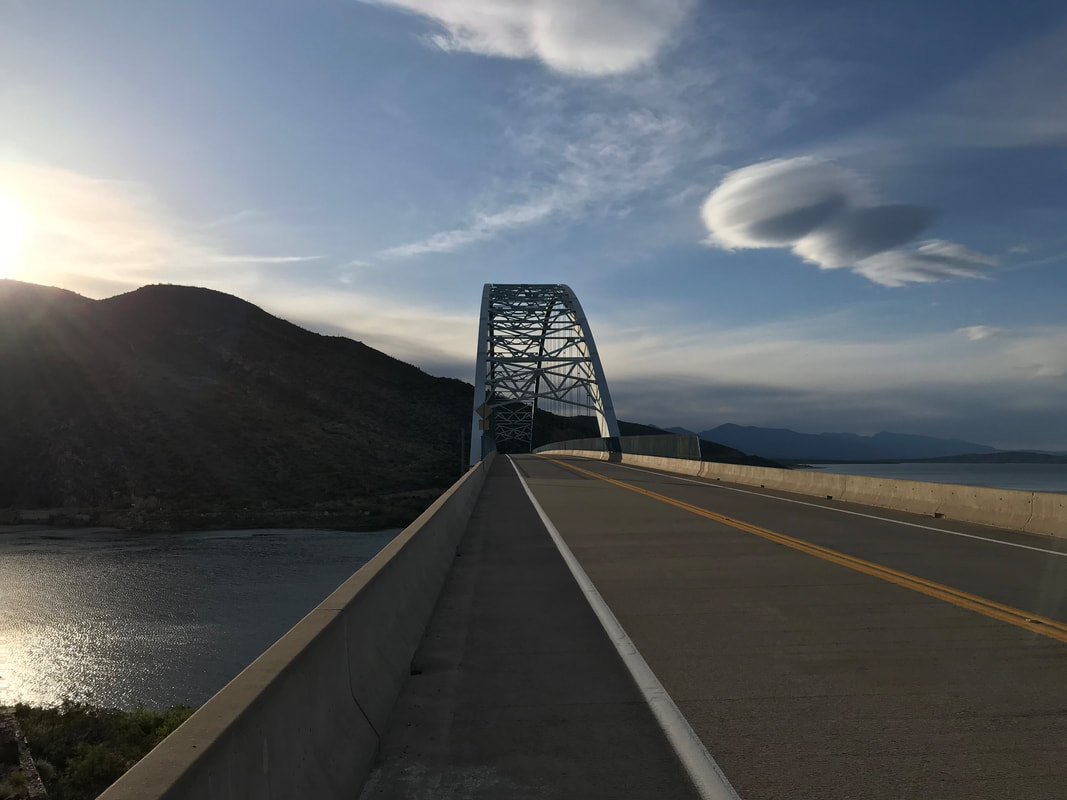
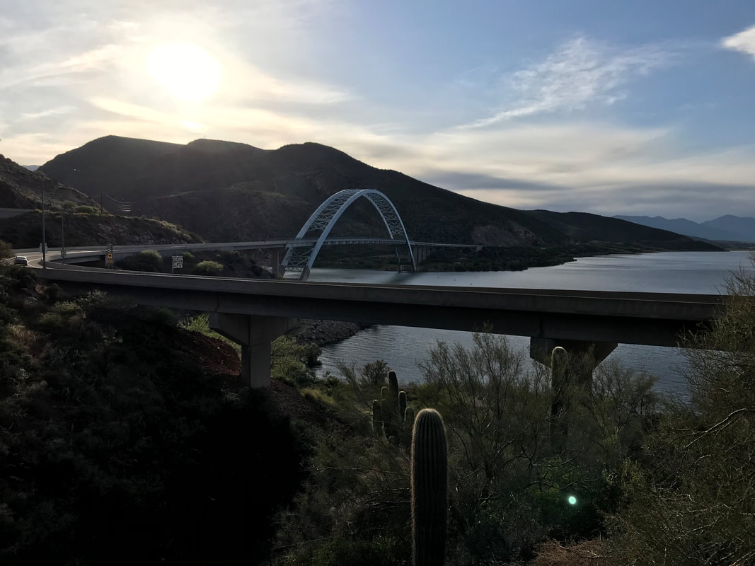
Weather checks revealed another storm system was moving in with evening, so we picked up the pace. The AZT paralleled the highway for several miles, weaving in and out of contours of the land. But the views of the lake were gorgeous from on high. Plus, a massive javelina ran up the trail in front of us - scared the shit out of me before I saw what it was. The trail went through dark and orange sand before descending a ridge overlooking Roosevelt Dam. Again, an epic feeling as we had been to the dam several times before. Now, we had walked here. The trail deposited us onto the highway where all hikers can only cross the dam by walking the road shoulder on the bridge. Small lenticular clouds hung overhead, further indicating atmospheric instability. The AZT trailhead was on the other side of the bridge. Just as we had descended all the way down to Roosevelt, we now had to spend the next two days climbing all the way up to upper reaches of the Four Peaks, our next destination. As overcast skies hung, Janna and I decided not to climb too much higher as we would be exposed on a ridge again. We found a flat spot overlooking the dam and lake to camp for the night. After battening down the Triplex with rocks in the thin/rocky soil, we sat on overlook ledge to enjoy the lake’s reflection in the evening. The night brought a bit of rain but nothing too bad and we slept well. 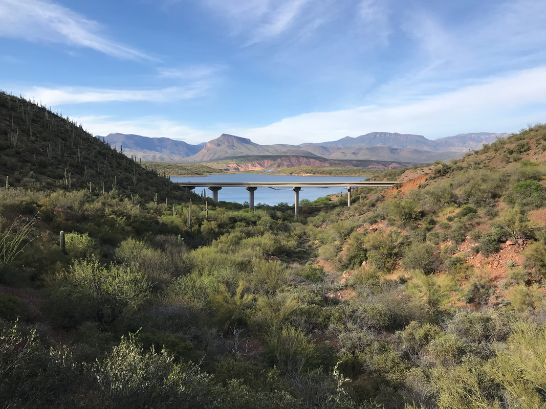 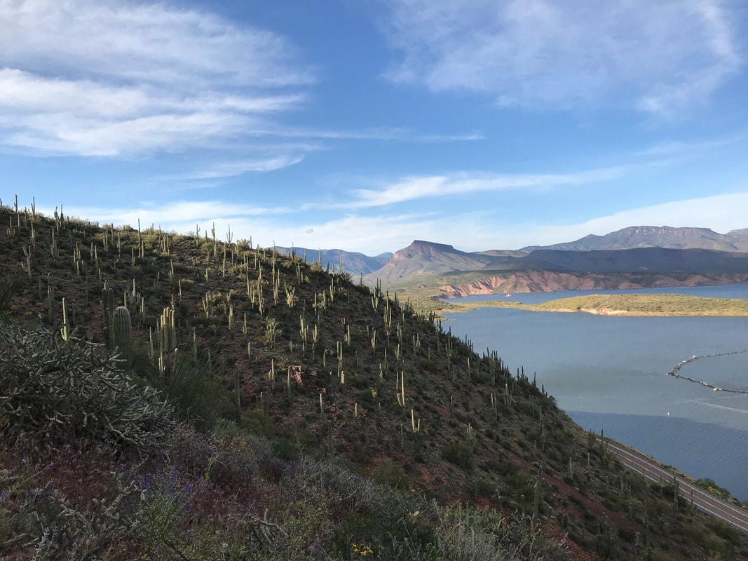
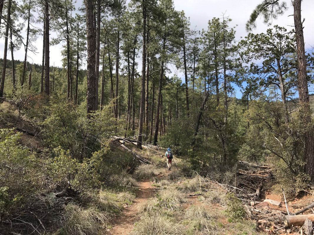
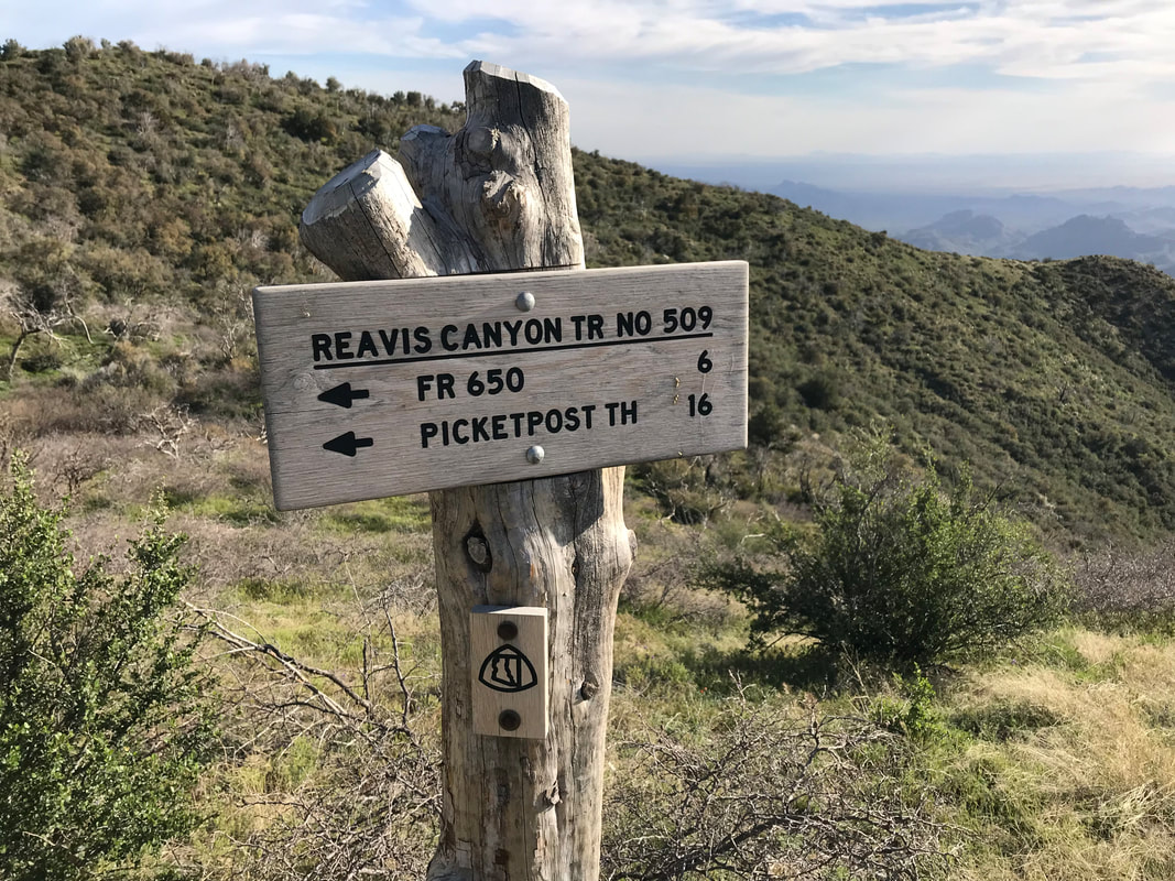
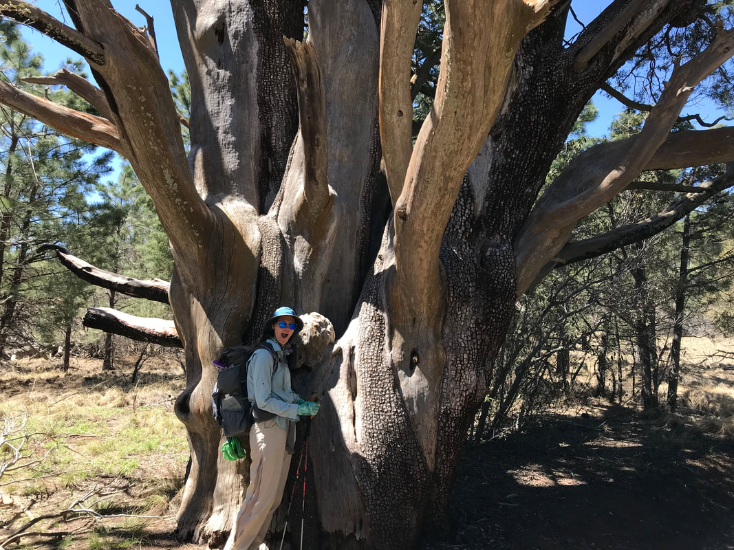
   THE SUPER V! Today would prove to be the hardest day both mentally and physically yet. What a terrible night’s sleep last night was. A windstorm swept over the mountains in the night, pummeling our exposed (my fault) shelter with constant 10 - 20 mph wind and gusts reaching 35 - 40 mph. Those gusts happened about twice a minute all night. The Triplex (being made of Dyneema) would swell at the seams, bend, and bellow this horrible noise that made it seem the sky was falling. Dyneema (cuben fiber) is awesome for its waterproofness, but its bellowing in wind is unmatched. I slammed earplugs in my ears to drown out the explosive shaking. That taken care of, the wind began gusting horizontally bringing a hoard of fine silt dust through the netting. All of it settled on my face and body since I was sleeping on the windward side. I felt like I woke up once an hour, my face and body caked with dust. Again, my fault for campsite selection. That was coupled with an intense cold brought in by the approaching front. At some point in the early hours of the morning, after feeling like we would blow away, the winds died down. Consequently, we could finally sleep. We woke up later than normal, drowsy, drunk on the physical exertion of the day before and the poor sleep. It took us longer to pack up this morning because dust permeated all my clothing, the inside and outside of my quilt, and most of our items. The older couple were gone from their site. It looks like we made a good call sleeping out in the open because massive tree branches had broken off in the night and laid everywhere. Packed up, we crossed the creek nearby and descended into a gorgeous riparian valley. Conifers mingled with deciduous. Plant diversity abounded. It was nice and cold, so no sweating. In fact, I shivered for the first hour. It was beautiful, peaceful, and the trail crisscrossed back and forth across the stream. In the distance, I could just made out the distant edge of the Four Peaks. The AZT left Reavis Ranch Trail at a junction and became steep and overgrown. It crawled under low hanging branches of trees, shimmied up narrow rock washes, and quickly jolted upwards into thickly overgrown manzanita. All of which scraped, scratched, whacked, and stumbled our walking bodies. The easy morning quickly turned to hard work as the trail became a skinny singletrack shooting skywards along steep cliff edges with tangled and sharp manzanita stems to break one’s fall. A couple hours later, the manzanita became pine as the trail reached a saddle and afforded views of the creek valley below. From here, the AZT became more gentle in grade. A surprising thick ponderosa pine forest greeted us. The trail sloped down through this large pine forest for several miles. It swept across large, beautiful grassy meadows (completely shocked by these being up here) and meandered through streams (some dry and some deep with spring water). One portion had us walking in the water and under jumbled secondary growth branches. We passed a large meadow filled with grassy tussocks with some large spruce and the biggest juniper trunk I had ever seen in my life. 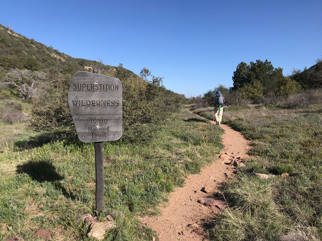
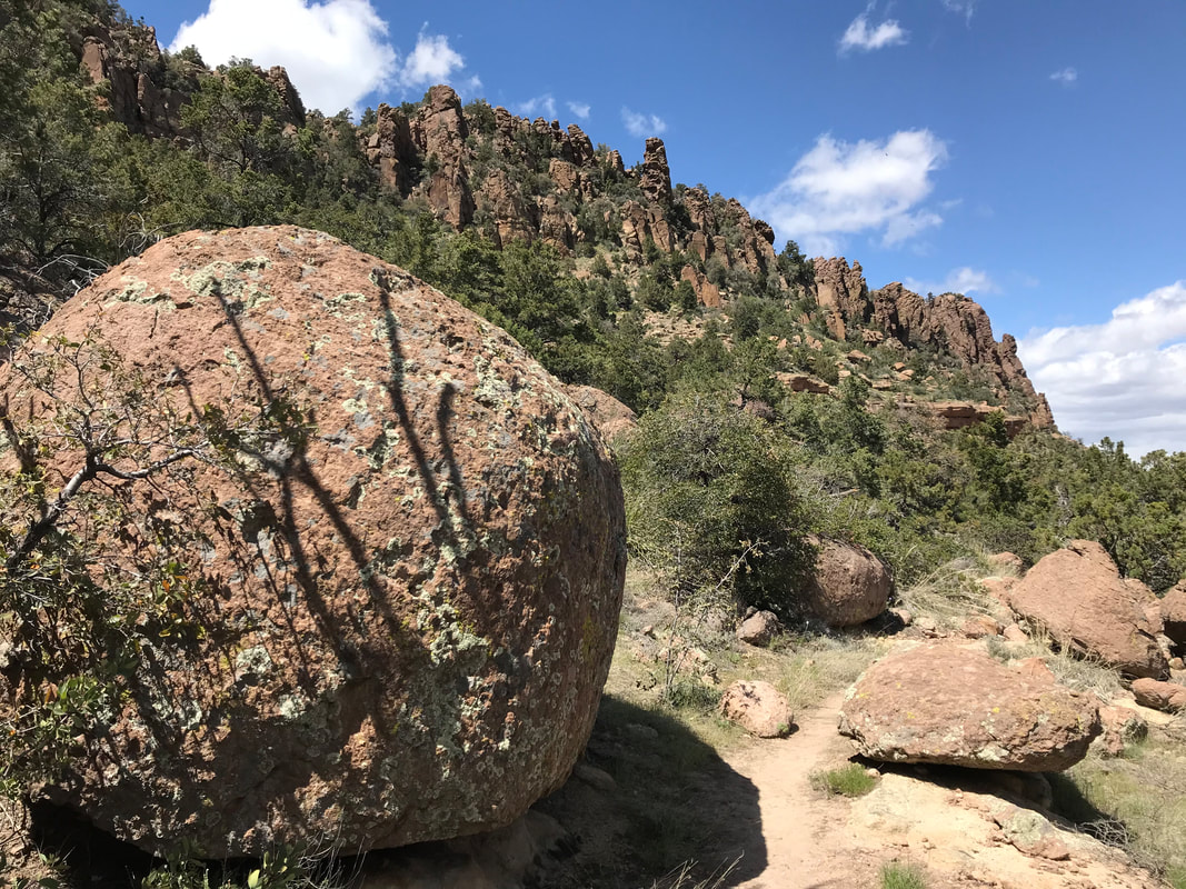
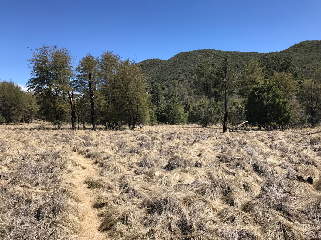  By noon, the AZT crossed out of the thick forest and entered Reavis Ranch. Reavis Ranch is old homestead, now abandoned. What remains is a large flat valley walled in by desert peaks. But this valley is filled with lush green grass, multiple streams, and a huge apple orchard left by the former white settlers. The apple trees were in bloom now for the spring. In the autumn, backpackers come up here to get the free fruit. Deer also loved this area and we passed a herd spread about the meadows, eating grass and resting in the shade of ponderosas and spruce. Janna and I went and looked at the foundation of the old homestead, its abandoned ground cellar, and the old fenced fields nearby. Obviously a popular camping spot, several well-used campfire rings lined different areas of the field. We sat in the shade of a large oak, eating lunch and getting some spring water. By early afternoon, the AZT left the protective valley with its grass and water to head back up over the dry surrounding desert peaks. The trail came rocky with babyheads and small boulders. Fireweed (the first seen this season) grew trailside in places, the red starkly catching my eyes. Large round boulders and geological spires stood out from the land. In the distance, large clouds began building. We kept an eye on these as we knew a cold front had come during the night before. The trail was washed out in several areas, but we successfully got several miles under us before we hit Pine Creek. This was the last reliable water source for the day so we carried 4 L out each. The trail ran up a ridge and hit a high elevation mesa where the gathering clouds to the north now sent an unobstructed wind right at us. Four Peaks was clearly visible. I had climbed Brown’s Peak (the highest of the four) several years ago with Reed and I had been itching to return. 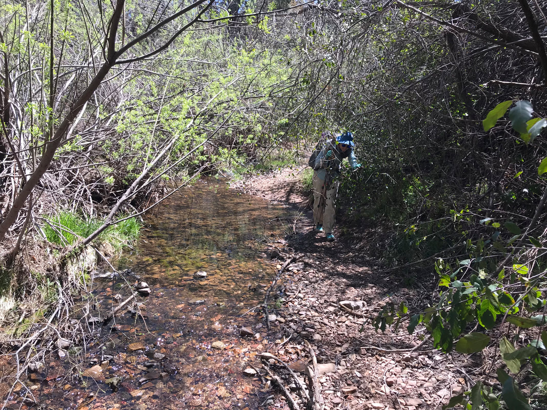 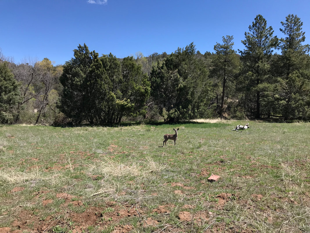
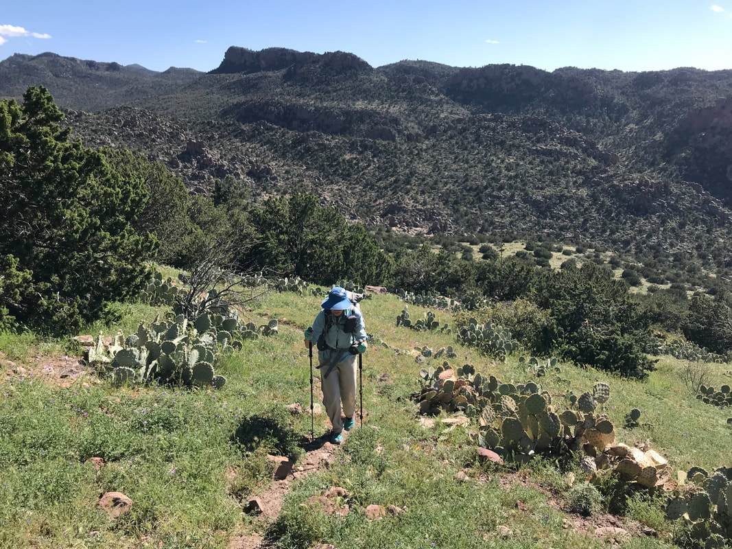
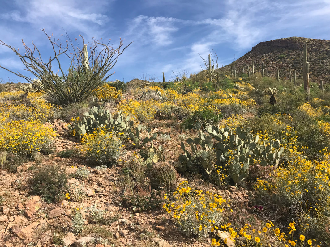
  Now the wind blew at 30 - 40 mph consistently. We leaned into it and felt a sudden chill chase away any heat from the day. I had an urge to poop and ran up a hillside and crouched behind a single windblocking bush to do my business. An unsaid sense of urgency began to settle in both Janna and I’s minds. A storm was gathering and we were well over 5,000 feet in elevation on an exposed high desert mountainside with little vegetation for cover. The name of the game was movement. We switchback higher up a hill and hit a saddle where the most INSANE descent and ascent (literally top 3 in my life) awaited. “WTF is this??” we both thought as we looked at a section we would later call “The Super V.” Just like a V, the trail descended straight down the side of a mountain, no switchbacks at all. The entirety of it was scree that provided ill-secure footing. It was narrow, cliffs were abundant, and the steepness only seemed to get worse when approaching the crook of the V at the bottom where a dry creek-bed lay. We ended up losing 1,000 ft. in a mile to the bottom, all with the accompanying wind blowing sideways on us. I had to carefully place each step because my knee was now screaming. Janna started descending on her butt at one point. Near the bottom, the steepest portion, I stepped on some scree, my legs slipped out from under me, and I fell backwards smashing my back into a pointed boulder right where my spine was. Janna yelled and came to me. I got up, feeling the impact and looked at my pack. The pointed boulder had ripped a massive hold in the outer mesh pocket and taken most of impact. Thankful I could fix it and that my back was sore but okay, we hit the bottom of valley and looked up. Dark, black clouds wisped up along the upper edges of the opposing valley wall. There was nowhere to take shelter down here in case of lightning; it was exposed and probably would flood anyways. Now the rush was on to reach the opposing top of the Super V, get on the saddle, descend the other side, and find some shelter before a lightning storm potentially unleashed. The opposite side of the Super V required gaining 1,200 ft. in 1 mile - also all vertical straight-up with scree as the substrate. Every step up stretched the Achilles acutely and was joined by a backwards sliding motion eliminating a good chunk of my effort. Double work was the sacrifice required to reach the top. The whole time, my eyes kept staring as the black clouds advanced from the north towards us in the south. “Just got to reach that ridgeline before they are on us. Just got to reach that ridgeline,” I thought over and over in my head. Near the top of the ascent, the clouds arrived but moved not just south, but easterly as well. A rush of relief hit Janna and I. We were literally climbing on the edge between blue sky and black walls and the walls were moving away from us. Rain sputtered only lightly on us. We were near the top saddle when we saw a large juniper. Anxious to get out of the unrelenting wind, we huddled and felt afforded an opportunity to eat a snack and drink some water. I mean, we earned it with the storm moving away, right? Fed and watered, we left the wind-block and made it to the saddle. Dear god. The storm was waiting here for us. The AZT didn’t leave the ridgeline. It WAS the ridgeline. A ridgeline right into the massive billowing clouds growing on Four Peaks and streaking across the heavens to here. There was no avoiding it. There was no shelter behind, just shelter ahead…or so we hoped. Nothing blocked the wind. It was so intense that Janna’s bandana immediately flew off into the distance, never to be seen again. Later, the two senior hikers before us would agree that the wind was a constant 40 mph with 50/55 mph gusts. Literally knocking us off our feet. Three miles of this awaited. We stumbled along and I attempted to take 3 photos of the storm that did NOTHING to capture how crazy it looked in real life (see my poor attempts below). Wind rocked us sideways. My hat was cinched to my head. We had our rain-gear on but it only sprinkled. The layers kept us warm. My fingers numbed in the cold and I just kept cranking out speed. Finally, an hour or so later, the AZT crept off the ridge and went to the leeward side of the mountain. It was amazing how we went from being blasted to still in a few footsteps. A small valley appeared with low-growing juniper and pine. As we passed into it, a series of small campsites appeared. I was so thankful. We setup camp in the dying light, the sound of wind on the ridge above us still there. And yet, with evening, the storm blew out as if never there. I walked down the trail a bit and found the senior hiker couple already camping and asleep. I returned to the Triplex and carefully crawled inside. Mentally taxed from the storm. Physically taxed from poor sleep, crazy ascents/descents, cold, heat, and wind. Just so incredibly HAPPY that we found this great campsite. Safe in the Triplex, I knocked out. 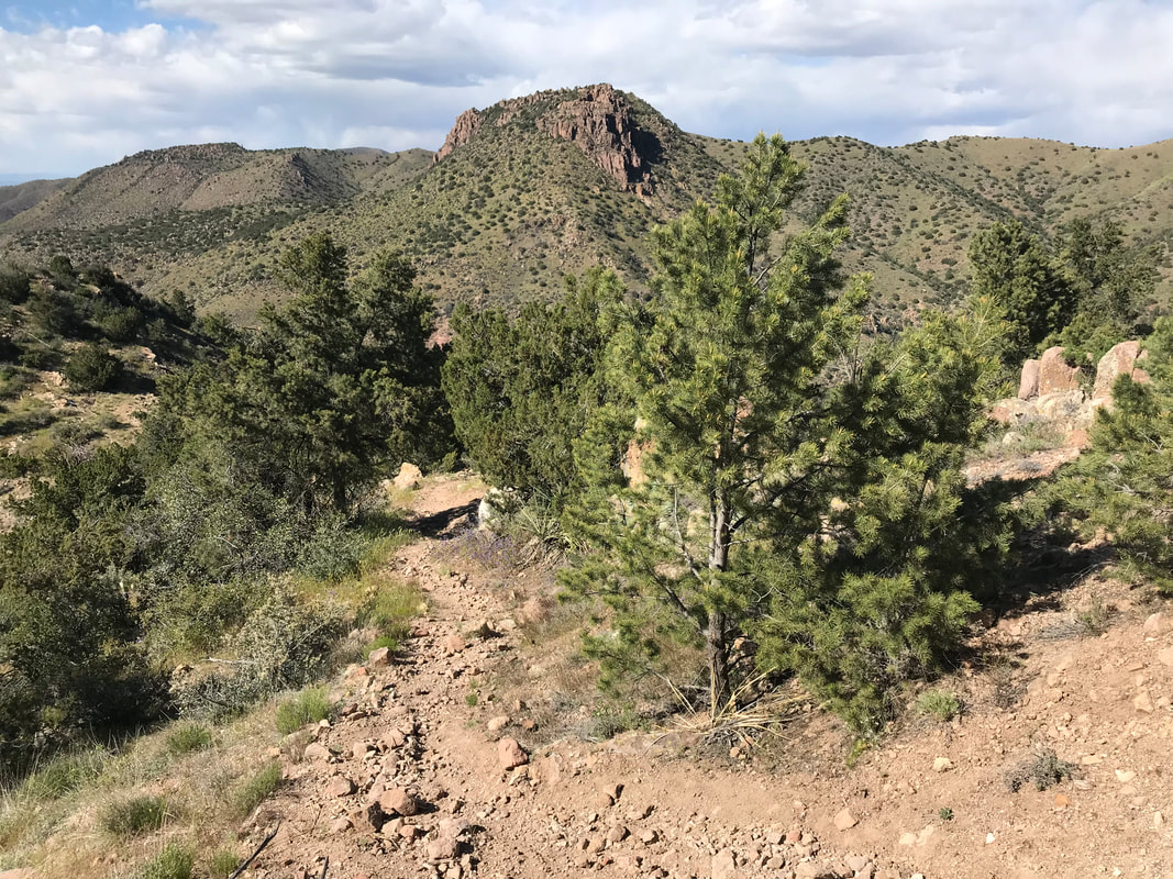 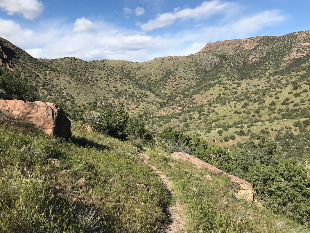 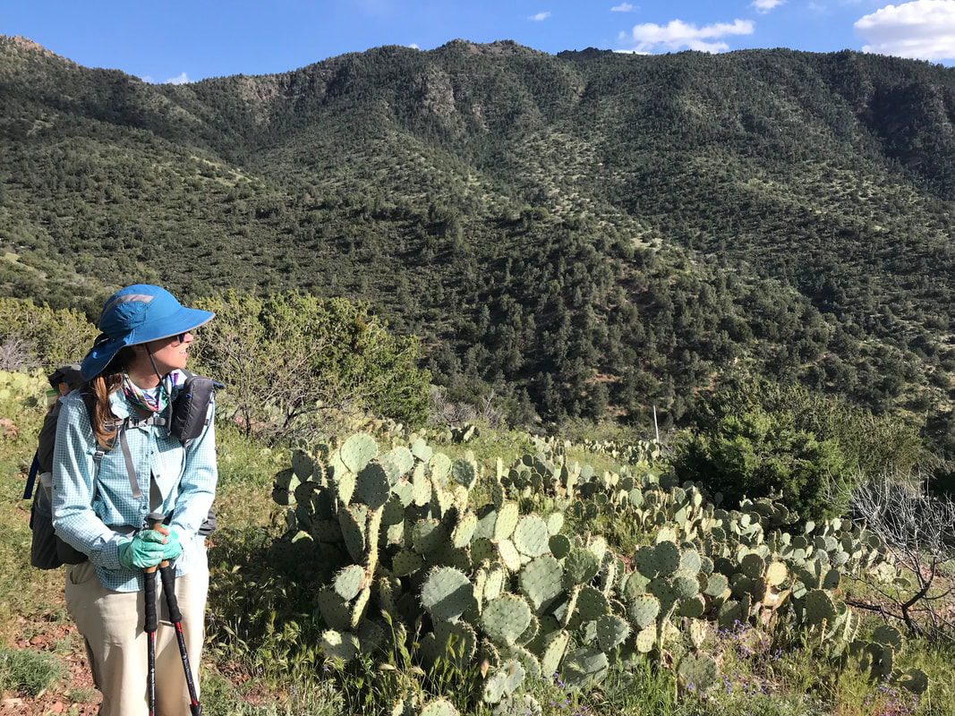 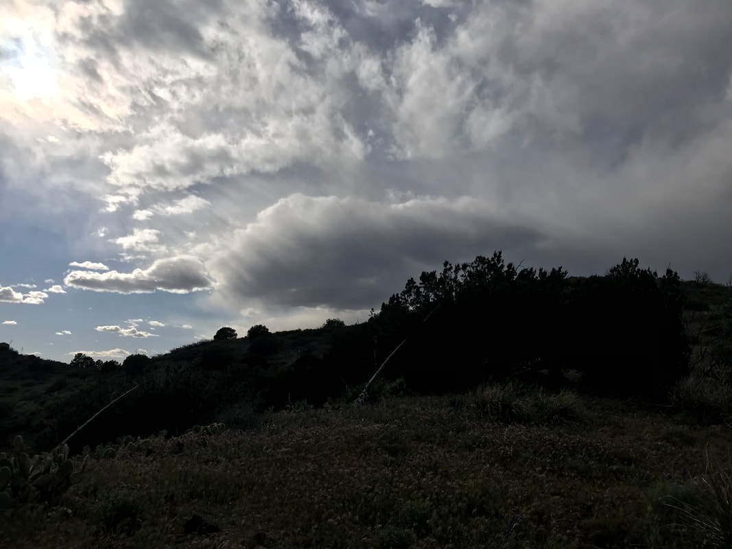 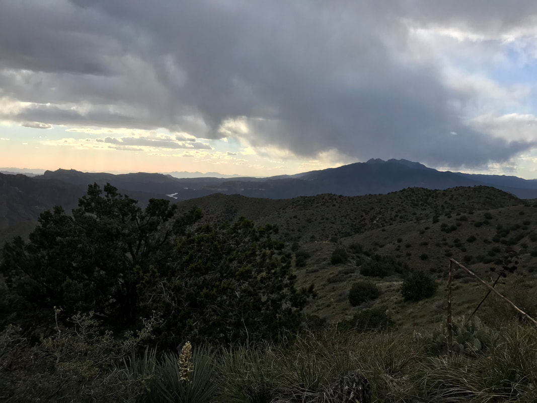 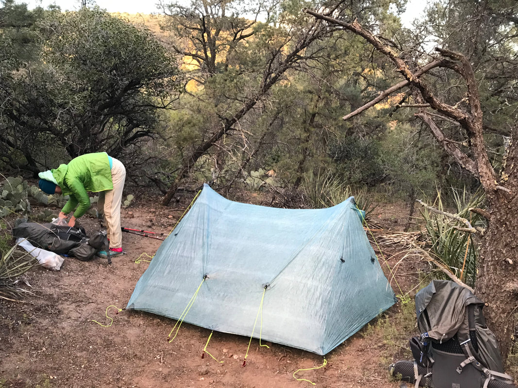  Morning arrived quickly to the tune of 4 am. Janna’s teammate Tony, from her school, was graciously picking us up at 5 am, dropping us back at the Picketpost Mountain Trailhead where we had stopped several days before, before he turned around and made it to school to teach all day. At 6 am, we rolled into the parking lot, just as the cusp of the sun hit the horizon. We were also eager to get going to avoid getting cooked in the low country. A second older couple stood in the parking, also getting ready to embark. They were definitely seniors and the look of their gear indicated high experience. We talked to them briefly before they took off. Faster than us, we wouldn’t see them again until the end of the day. I felt exhausted and slightly off-camber, as if I’d been gone from the trail for months. The morning was warming already and I felt like I had to regrow my trail legs. The Arizona Trail went through a culvert beneath the 60, and moved across this vast basin area with the Superstitions and rugged peaks of the Tonto National Forest rising before us. Brittlebush blooms carpeted the desert floor beneath the spires of saguaros. We moved quickly, hitting a wash with a solid flow of unexpected water that we topped off our supplies with. The trail began to parallel the flowing wash for several miles, banking next to wall of red rock. The small rises around us grew into peaks, us gaining elevation as we followed the flow uphill. The whole time, a thick spread of grasses grew right up to the trail, obscuring the path in front of us at times - I had never seen anything like it in the desert before. There were even some parts where the grass was so thick that a passing equestrian had smashed the stalks across the trail.
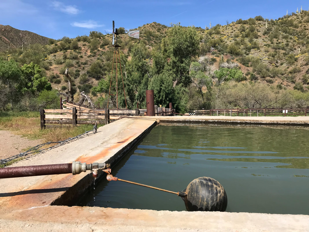
   Carefully I walked in front of Janna, slowly placing my feet where I couldn’t see them into the thick mat below. Every step submerged my legs up to my knees, and I knocked hard with my trekking poles the crisscrossed grass folded in front of my next foot placement. Then, boom! A rattlesnake head darted out next to my pole while it sent its tail shaking. The buzz filled the air and I led us through the brush around it. This dance of rattlesnake buzz, sightings, and wading through deep grass continued for several hours. It was mentally taxing. I spent more time staring straight down than at the views around me. My ears strained for noise. My eyes scanned for the shape of snake heads. Brush of trekking pole tip, BUZZZZZ, rattlesnake coiled, us cautiously moving around it. The dance of precision and care. A few miles later, the grasses receded and we walked along a spent wash. We hit a cattle tank with a float valve outside of a nearly abandoned corral in early morning. We sat in the shade of a building which obviously had been used recently for target practice. We pressed on. Around 1 pm and well into the mid-upper 90s F, we reached Mud Spring, which had a singular large cypress providing shade. We dropped packs and crouched in the shade. Small midges from spring flew about, dying in the heat and desperate for water. They dive-bombed my tear ducts so I threw some head netting one and took a long 2 hour siesta. 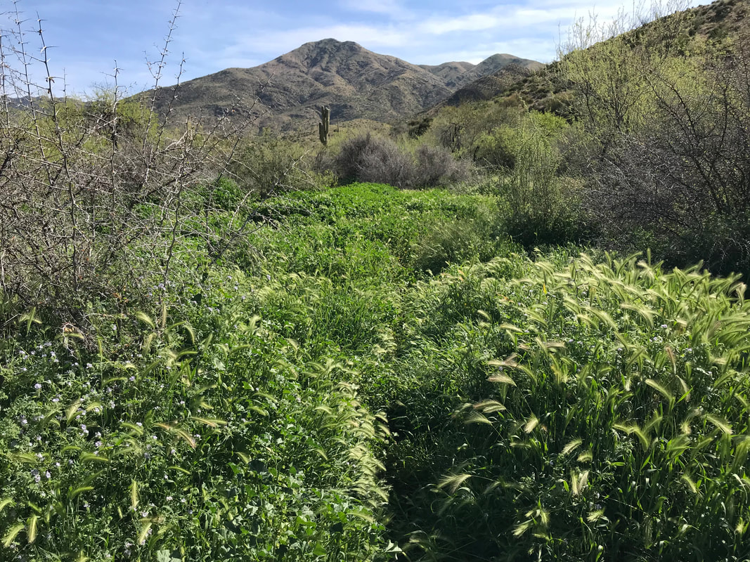 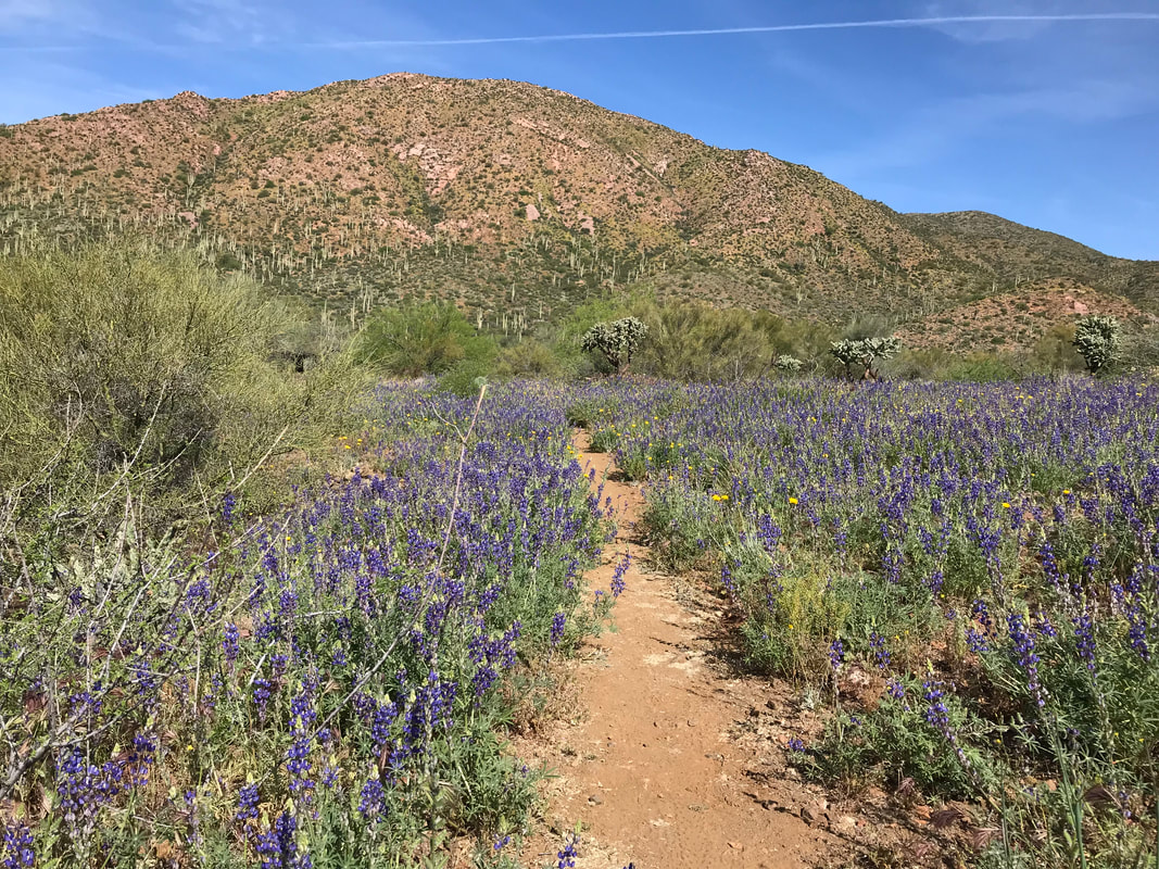
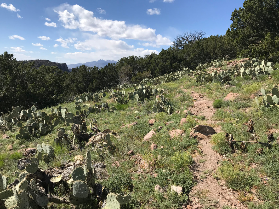
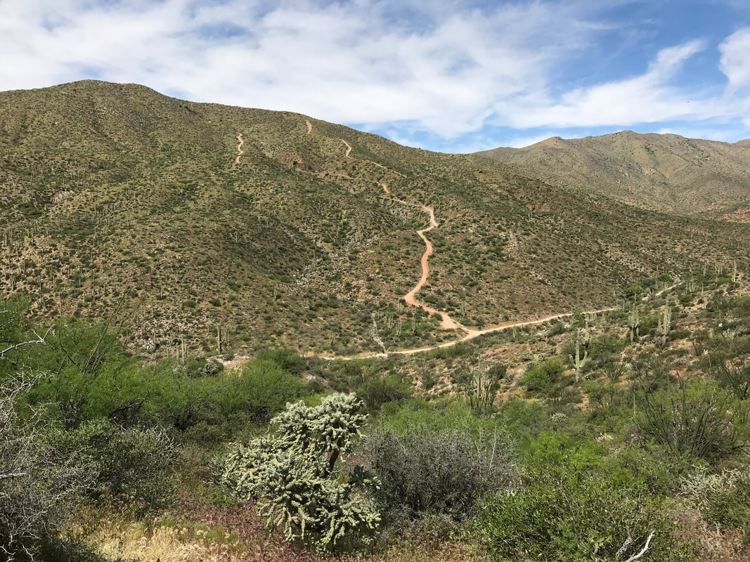
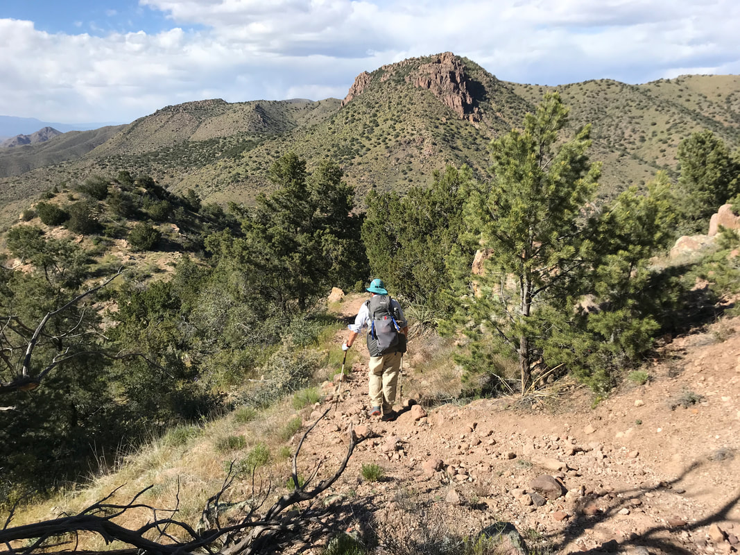
 Around 3 pm, we decided to get a move on as we still had a 3,000 ft. ascent up Montana Mountain before we would arrive near where we hoped to camp that night. Now, the trail wove in and out of the wash as we moved steadily uphill. Saguaros began to fade away with the gain in elevation. We passed the ruins of an old ranch and its crumbling walls. The AZT began to weave away from the wash and starting switchbacking up the south flank of Montana Mountain. Suddenly, a rapid botany change occurred as low desert plants were all replaced with a stunning green grassland. These grasses were 3 - 5 ft. tall, vibrant, and made me feel like I was walking through a savannah in the rainy season. I could barely see the trail weaving through the swaying stems. Some were even as tall as me! The trail wove back and forth and the entire canyon we had walked up fell away below us as we took our first extended glances at the distant ranges from this height. Picketpost Mountain and the entire Gila Canyon range stood at some distance to our south. The grasses wove back and forth until, near the top, and drenched with sweat, we began stumbling through chaparral at 5,000 ft. in elevation. The AZT peaked out at a saddle where we could now look over the other side. There it was! Phoenix in its metropolitan sprawl far out to the west with Mesa homes in view. The Superstition Ridgeline prominently separated city from wilderness. Large cut valleys filled with pines and junipers lay below. A group of 3 thru-hikers just heading out on the Grand Enchantment Trail met us (the GET has a western terminus in Phoenix with the eastern terminus in Albuquerque). They reported seeing a black bear nearby, not surprising as they are relatively common in these desert mountains. Now the AZT traced a ridgeline along the easternmost portion of the Superstition Wilderness. The AZT dumped us onto a dirt forest road outside the wilderness zone where we road walked with awesome views on either side. Violet flowers grew in clumps beneath agave plants. Manzanita, juniper, and pine began to fill up around us. After the significant climbing of the day, both Janna and I had pain in our plantar fasciitis. The dirt road was pleasant and gentle in grade. It slowly entered a pine forest with beautiful creeks and washes filled with water. And then, we were at Roger’s Trough trailhead. We headed over to some good camping but found the area taken by that senior couple. Everything else was slanted or rocky. We settled on camping in the parking lot in the dust. A creek flowed several hundred feet away that gave us a resupply of water. We felt beat by today. It was beautiful but harsh. However, we were up in elevation in the cooler temps now. We only had two other descents to the low Sonoran desert between us and the Mogollon Rim high country - two more times for heat as spring advanced towards summer. After a dinner of pizza tortillas (tortillas, pepperoni, and cheese), we climbed in for the night. 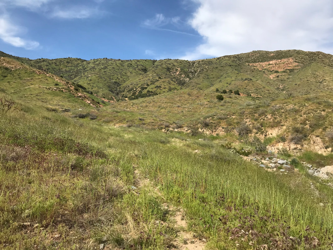 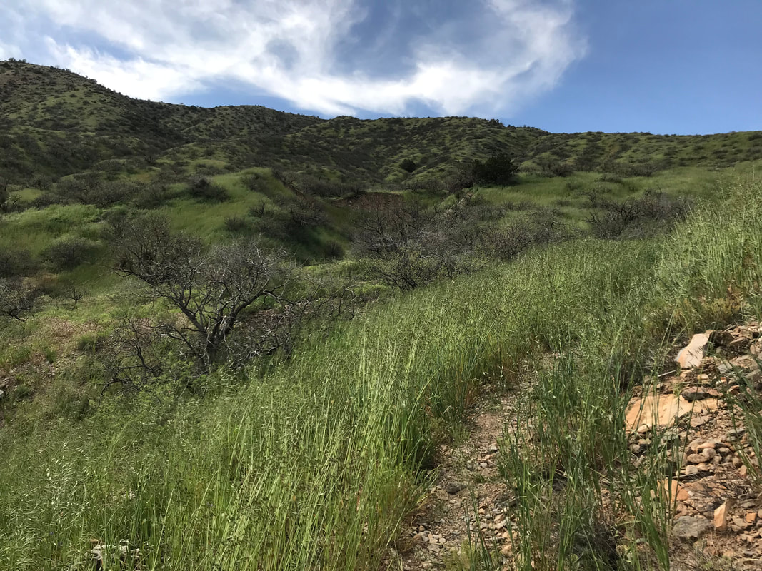 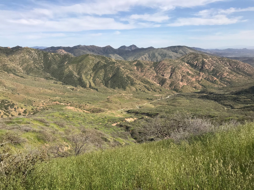 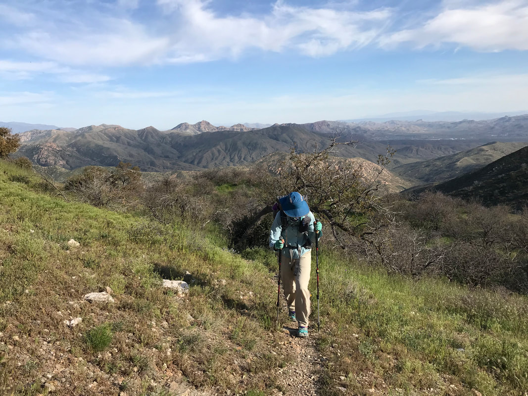 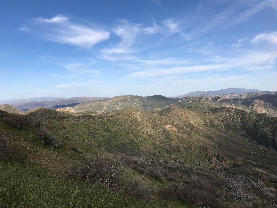 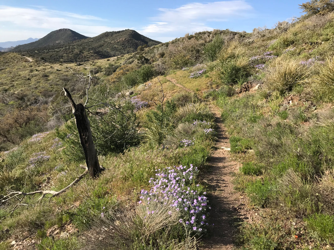
  |